

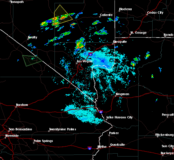
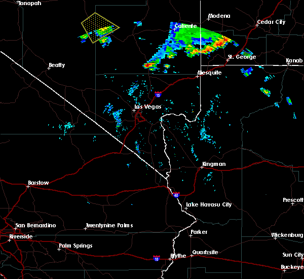
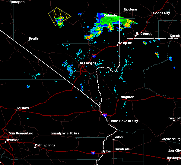
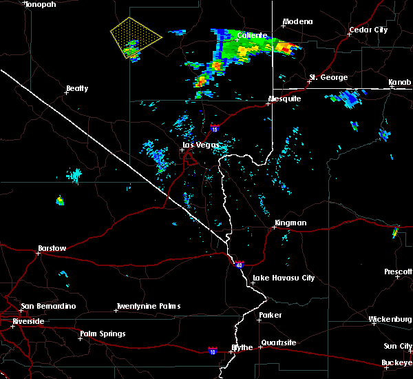
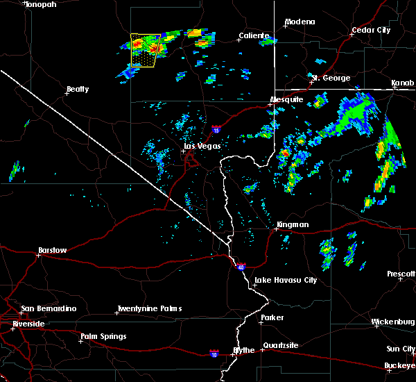
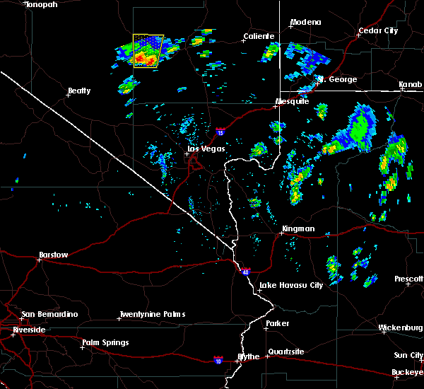
Hail Map for Rachel, NV
The Rachel, NV area has had 0 reports of on-the-ground hail by trained spotters, and has been under severe weather warnings 0 times during the past 12 months. Doppler radar has detected hail at or near Rachel, NV on 2 occasions.
| Name: | Rachel, NV |
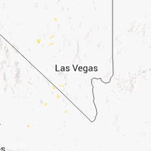
| Where Located: | 107.2 miles NNW of Las Vegas, NV |
| Map: | Google Map for Rachel, NV |
| Population: | 54 |
| Housing Units: | 45 |
| More Info: | Search Google for Rachel, NV |
0
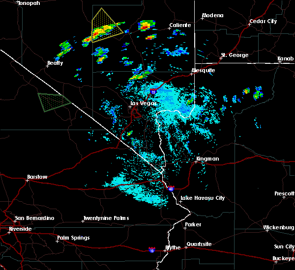
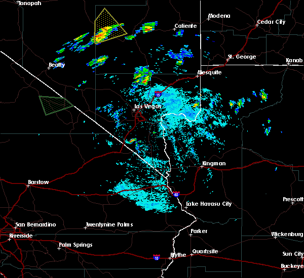
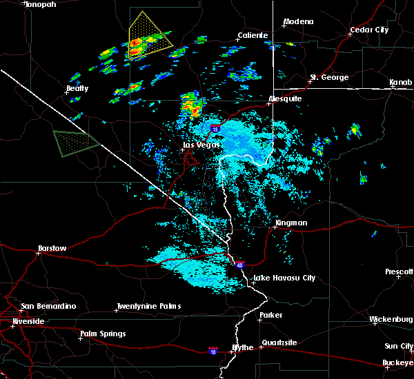
The Top Recent Hail Date for Rachel, NV is Thursday, July 19, 2018 (2nd out of 2)
Hail and Wind Damage Spotted near Rachel, NV
| Date / Time | Report Details |
|---|---|
| 7/13/2021 5:08 PM PDT |
 The severe thunderstorm warning for central lincoln and nye counties will expire at 515 pm pdt, the storm which prompted the warning has weakened below severe limits, and no longer poses an immediate threat to life or property. therefore, the warning will be allowed to expire. however gusty winds up to 50 mph are still possible with this thunderstorm. The severe thunderstorm warning for central lincoln and nye counties will expire at 515 pm pdt, the storm which prompted the warning has weakened below severe limits, and no longer poses an immediate threat to life or property. therefore, the warning will be allowed to expire. however gusty winds up to 50 mph are still possible with this thunderstorm.
|
| 7/13/2021 4:19 PM PDT |
 At 418 pm pdt, a severe thunderstorm was located 20 miles west of pioche, moving east at 40 mph (radar indicated). Hazards include 60 mph wind gusts. expect damage to roofs and trees At 418 pm pdt, a severe thunderstorm was located 20 miles west of pioche, moving east at 40 mph (radar indicated). Hazards include 60 mph wind gusts. expect damage to roofs and trees
|
| 8/10/2018 9:06 PM PDT |
 The severe thunderstorm warning for southwestern lincoln and northeastern nye counties will expire at 915 pm pdt, the storm which prompted the warning has weakened below severe limits, and no longer poses an immediate threat to life or property. therefore, the warning will be allowed to expire. however gusty winds are still possible with this thunderstorm. The severe thunderstorm warning for southwestern lincoln and northeastern nye counties will expire at 915 pm pdt, the storm which prompted the warning has weakened below severe limits, and no longer poses an immediate threat to life or property. therefore, the warning will be allowed to expire. however gusty winds are still possible with this thunderstorm.
|
| 8/10/2018 8:15 PM PDT |
 The national weather service in las vegas has issued a * severe thunderstorm warning for. southwestern lincoln county in south central nevada. northeastern nye county in south central nevada. until 915 pm pdt. At 814 pm pdt, a severe thunderstorm was located 31 miles north of. The national weather service in las vegas has issued a * severe thunderstorm warning for. southwestern lincoln county in south central nevada. northeastern nye county in south central nevada. until 915 pm pdt. At 814 pm pdt, a severe thunderstorm was located 31 miles north of.
|
| 7/26/2017 2:10 PM PDT |
 At 152 pm pdt, a severe thunderstorm was located 7 miles northeast of rachel, and is moving northeast at 20 mph (radar indicated). Hazards include 60 mph wind gusts and quarter size hail. Hail damage to vehicles is expected. Expect wind damage to roofs, siding, and trees. At 152 pm pdt, a severe thunderstorm was located 7 miles northeast of rachel, and is moving northeast at 20 mph (radar indicated). Hazards include 60 mph wind gusts and quarter size hail. Hail damage to vehicles is expected. Expect wind damage to roofs, siding, and trees.
|
| 7/26/2017 1:53 PM PDT |
 At 152 pm pdt, a severe thunderstorm was located 7 miles northeast of rachel, and is moving northeast at 20 mph (radar indicated). Hazards include 60 mph wind gusts and quarter size hail. Hail damage to vehicles is expected. Expect wind damage to roofs, siding, and trees. At 152 pm pdt, a severe thunderstorm was located 7 miles northeast of rachel, and is moving northeast at 20 mph (radar indicated). Hazards include 60 mph wind gusts and quarter size hail. Hail damage to vehicles is expected. Expect wind damage to roofs, siding, and trees.
|
| 7/26/2017 1:40 PM PDT |
 At 139 pm pdt, a severe thunderstorm was located over rachel, moving northeast at 30 mph (radar indicated). Hazards include 60 mph wind gusts and quarter size hail. Hail damage to vehicles is expected. expect wind damage to roofs, siding, and trees. Locations impacted include, rachel and state highway 375/extraterrestrial highway. At 139 pm pdt, a severe thunderstorm was located over rachel, moving northeast at 30 mph (radar indicated). Hazards include 60 mph wind gusts and quarter size hail. Hail damage to vehicles is expected. expect wind damage to roofs, siding, and trees. Locations impacted include, rachel and state highway 375/extraterrestrial highway.
|
| 7/26/2017 1:19 PM PDT |
 At 117 pm pdt, a severe thunderstorm was located 9 miles southwest of rachel, moving northeast at 30 mph (radar indicated). Hazards include 60 mph wind gusts and quarter size hail. Hail damage to vehicles is expected. Expect wind damage to roofs, siding, and trees. At 117 pm pdt, a severe thunderstorm was located 9 miles southwest of rachel, moving northeast at 30 mph (radar indicated). Hazards include 60 mph wind gusts and quarter size hail. Hail damage to vehicles is expected. Expect wind damage to roofs, siding, and trees.
|
| 7/30/2016 7:25 PM PDT |
 The severe thunderstorm warning for west central lincoln and northeastern nye counties will expire at 730 pm pdt, the storm which prompted the warning along highway 375 has weakened below severe limits. therefore the warning will be allowed to expire at 730 pm pdt. The severe thunderstorm warning for west central lincoln and northeastern nye counties will expire at 730 pm pdt, the storm which prompted the warning along highway 375 has weakened below severe limits. therefore the warning will be allowed to expire at 730 pm pdt.
|
| 7/30/2016 7:04 PM PDT |
 At 703 pm pdt, doppler radar indicated a severe thunderstorm capable of producing damaging winds in excess of 60 mph. this storm was located 7 miles west of rachel, moving southeast at 25 mph along highway 375. locations impacted include, rachel. highway 375. At 703 pm pdt, doppler radar indicated a severe thunderstorm capable of producing damaging winds in excess of 60 mph. this storm was located 7 miles west of rachel, moving southeast at 25 mph along highway 375. locations impacted include, rachel. highway 375.
|
| 7/30/2016 6:44 PM PDT |
 At 643 pm pdt, doppler radar indicated a severe thunderstorm capable of producing damaging winds in excess of 60 mph. this storm was located 8 miles west of rachel, and moving southeast at 25 mph along highway 375. At 643 pm pdt, doppler radar indicated a severe thunderstorm capable of producing damaging winds in excess of 60 mph. this storm was located 8 miles west of rachel, and moving southeast at 25 mph along highway 375.
|
| 6/11/2016 5:47 PM PDT |
 At 546 pm pdt, doppler radar indicated a severe thunderstorm capable of producing quarter size hail and damaging winds in excess of 60 mph. this storm was located 11 miles southeast of rachel, moving northeast at 35 mph. locations impacted include, rachel, highway 375. At 546 pm pdt, doppler radar indicated a severe thunderstorm capable of producing quarter size hail and damaging winds in excess of 60 mph. this storm was located 11 miles southeast of rachel, moving northeast at 35 mph. locations impacted include, rachel, highway 375.
|
| 6/11/2016 5:24 PM PDT |
 At 523 pm pdt, doppler radar indicated a severe thunderstorm capable of producing damaging winds in excess of 60 mph. this storm was located 15 miles south of rachel, and moving north at 30 mph. At 523 pm pdt, doppler radar indicated a severe thunderstorm capable of producing damaging winds in excess of 60 mph. this storm was located 15 miles south of rachel, and moving north at 30 mph.
|
| 7/7/2013 11:04 AM PDT | Storm damage reported in lincoln county NV, 2.2 miles ENE of Rachel, NV |
| 7/23/2012 4:20 PM PDT | Storm damage reported in lincoln county NV, 4.2 miles E of Rachel, NV |
| 7/23/2012 4:10 PM PDT | A trained weather spotter reported that his davis weather station recorded a gust to 84 mph as a rolling wall of dust impacted his hous in lincoln county NV, 3 miles ENE of Rachel, NV |
Hail Maps for Rachel, NV

Connect with Interactive Hail Maps