

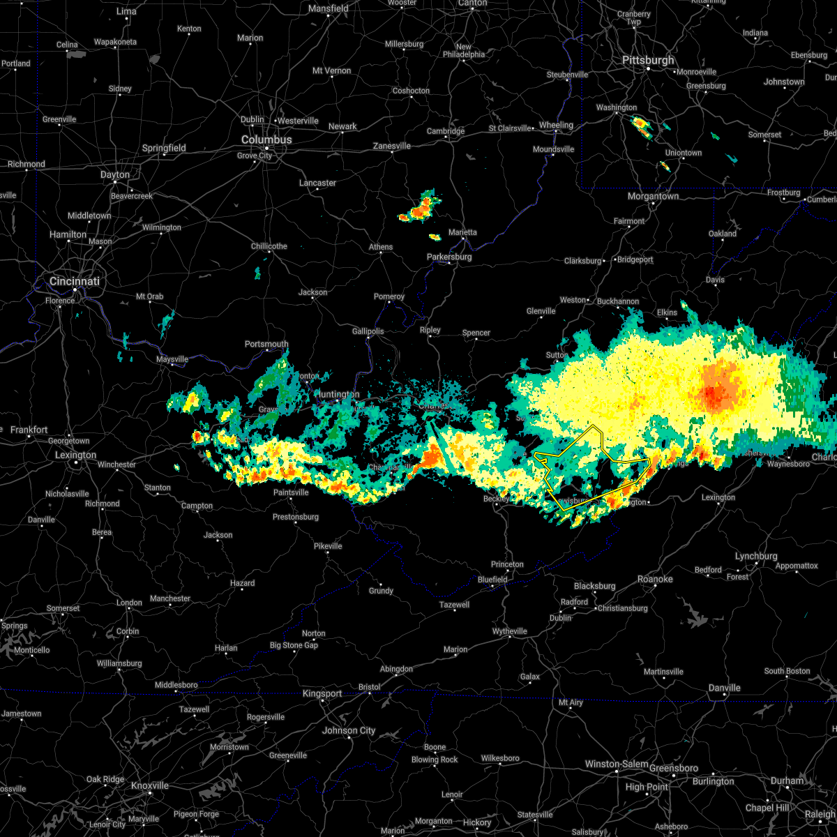
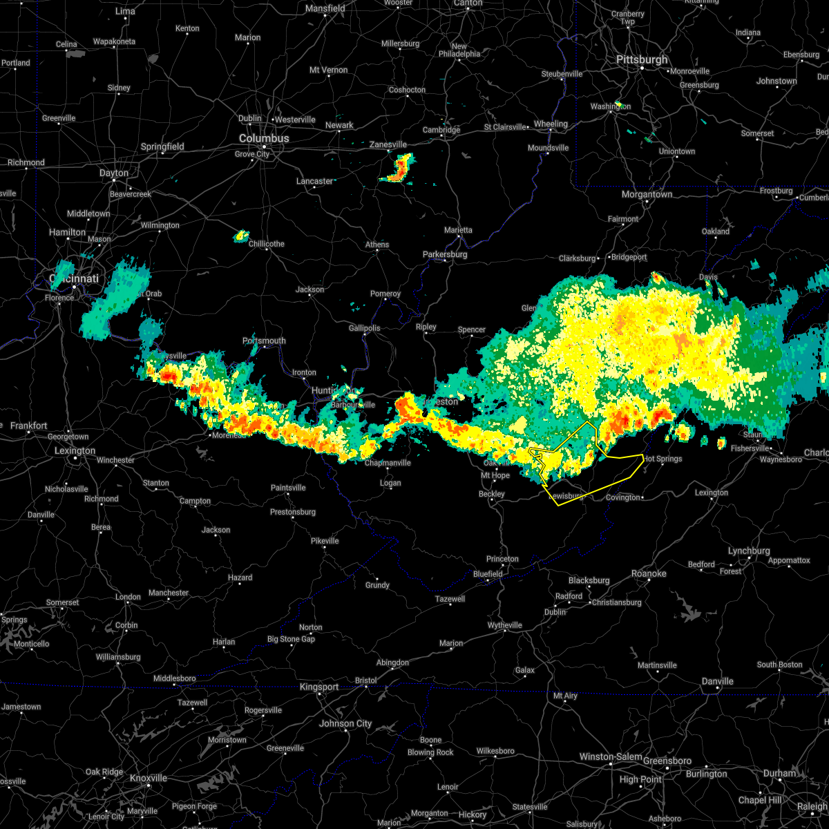
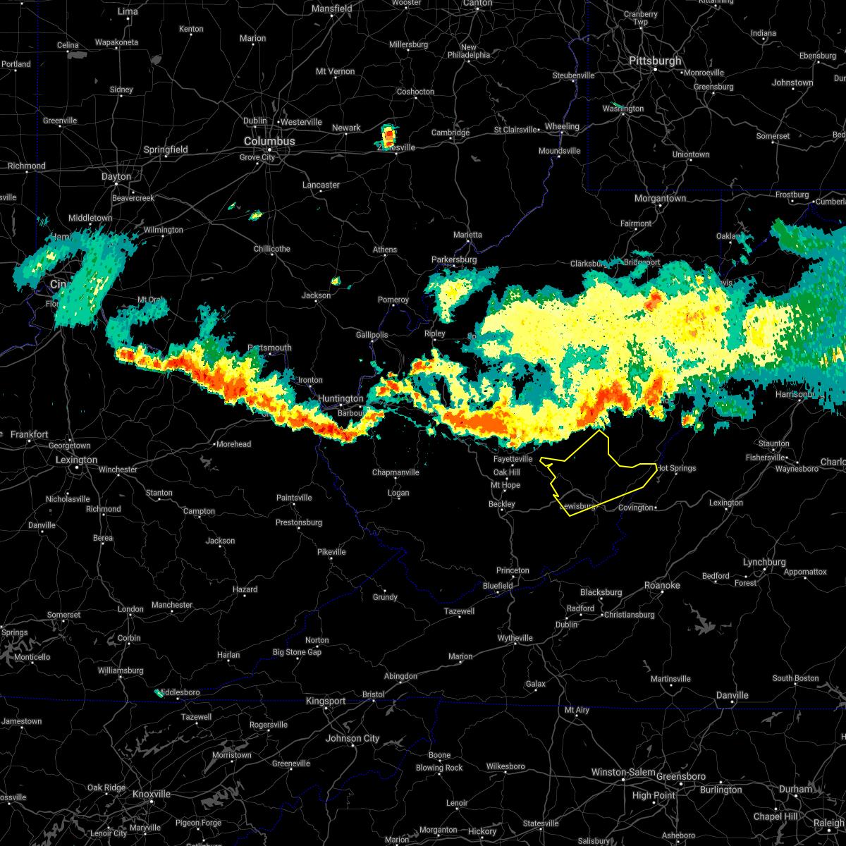
Hail Map for Rainelle, WV
The Rainelle, WV area has had 2 reports of on-the-ground hail by trained spotters, and has been under severe weather warnings 14 times during the past 12 months. Doppler radar has detected hail at or near Rainelle, WV on 17 occasions, including 2 occasions during the past year.
| Name: | Rainelle, WV |
| Where Located: | 54.2 miles ESE of Charleston, WV |
| Map: | Google Map for Rainelle, WV |
| Population: | 1505 |
| Housing Units: | 806 |
| More Info: | Search Google for Rainelle, WV |
0
The Top Recent Hail Date for Rainelle, WV is Friday, July 28, 2023 (8th out of 17)

Hail and Wind Damage Spotted near Rainelle, WV
| Date / Time | Report Details |
|---|---|
| 4/2/2024 11:39 AM EDT |
 Svrrnk the national weather service in blacksburg has issued a * severe thunderstorm warning for, greenbrier county in southeastern west virginia, * until 1230 pm edt. * at 1139 am edt, severe thunderstorms were located along a line extending from 9 miles southeast of clay to near ansted to near mount hope, moving east at 75 mph (radar indicated). Hazards include 70 mph wind gusts. Expect considerable tree damage. Damage is likely to mobile homes, roofs, and outbuildings. Svrrnk the national weather service in blacksburg has issued a * severe thunderstorm warning for, greenbrier county in southeastern west virginia, * until 1230 pm edt. * at 1139 am edt, severe thunderstorms were located along a line extending from 9 miles southeast of clay to near ansted to near mount hope, moving east at 75 mph (radar indicated). Hazards include 70 mph wind gusts. Expect considerable tree damage. Damage is likely to mobile homes, roofs, and outbuildings.
|
| 4/1/2024 8:35 PM EDT |
 Svrrlx the national weather service in charleston west virginia has issued a * severe thunderstorm warning for, northeastern raleigh county in southeastern west virginia, southeastern fayette county in southeastern west virginia, * until 900 pm edt. * at 833 pm edt, a severe thunderstorm was located near mount hope, or 9 miles northeast of beckley, moving east at 30 mph (radar indicated). Hazards include 60 mph wind gusts and quarter size hail. Hail damage to vehicles is expected. Expect wind damage to roofs, siding, and trees. Svrrlx the national weather service in charleston west virginia has issued a * severe thunderstorm warning for, northeastern raleigh county in southeastern west virginia, southeastern fayette county in southeastern west virginia, * until 900 pm edt. * at 833 pm edt, a severe thunderstorm was located near mount hope, or 9 miles northeast of beckley, moving east at 30 mph (radar indicated). Hazards include 60 mph wind gusts and quarter size hail. Hail damage to vehicles is expected. Expect wind damage to roofs, siding, and trees.
|
| 7/28/2023 5:13 PM EDT |
 The severe thunderstorm warning for giles, northwestern smyth, tazewell, bland, greenbrier, summers, mercer and monroe counties will expire at 515 pm edt, the storms which prompted the warning have moved out of the area. therefore, the warning will be allowed to expire. a severe thunderstorm watch remains in effect until 1100 pm edt for southwestern and west central virginia, and southeastern west virginia. The severe thunderstorm warning for giles, northwestern smyth, tazewell, bland, greenbrier, summers, mercer and monroe counties will expire at 515 pm edt, the storms which prompted the warning have moved out of the area. therefore, the warning will be allowed to expire. a severe thunderstorm watch remains in effect until 1100 pm edt for southwestern and west central virginia, and southeastern west virginia.
|
| 7/28/2023 4:45 PM EDT | Tree down on bingham roa in greenbrier county WV, 3.5 miles SSE of Rainelle, WV |
| 7/28/2023 4:32 PM EDT |
 At 432 pm edt, severe thunderstorms were located along a line extending from 8 miles west of holly river state park to 6 miles southwest of rainelle, moving east at 40 mph (radar indicated). Hazards include 60 mph wind gusts and penny size hail. Expect damage to roofs, siding, and trees. locations impacted include, summersville, richwood, babcock state park, webster springs, addison (webster springs), camden-on-gauley, craigsville, holly river state park, camden on gauley, rock cave, cowen, thurmond, alexander, eden, upper glade, cleveland, boggs, hacker valley, kanawha head, and french creek. hail threat, radar indicated max hail size, 0. 75 in wind threat, radar indicated max wind gust, 60 mph. At 432 pm edt, severe thunderstorms were located along a line extending from 8 miles west of holly river state park to 6 miles southwest of rainelle, moving east at 40 mph (radar indicated). Hazards include 60 mph wind gusts and penny size hail. Expect damage to roofs, siding, and trees. locations impacted include, summersville, richwood, babcock state park, webster springs, addison (webster springs), camden-on-gauley, craigsville, holly river state park, camden on gauley, rock cave, cowen, thurmond, alexander, eden, upper glade, cleveland, boggs, hacker valley, kanawha head, and french creek. hail threat, radar indicated max hail size, 0. 75 in wind threat, radar indicated max wind gust, 60 mph.
|
| 7/28/2023 4:31 PM EDT |
 At 431 pm edt, severe thunderstorms were located along a line extending from 6 miles northwest of bingham to near hix to pipestem resort state park to near amonate, moving southeast at 60 mph (radar indicated). Hazards include 60 mph wind gusts. Expect damage to roofs, siding, and trees. locations impacted include, alleghany, bluefield, bland, princeton, richlands, tazewell, and lewisburg. this includes the following locations the west virginia state fairgrounds and mercer county airport. hail threat, radar indicated max hail size, <. 75 in wind threat, radar indicated max wind gust, 60 mph. At 431 pm edt, severe thunderstorms were located along a line extending from 6 miles northwest of bingham to near hix to pipestem resort state park to near amonate, moving southeast at 60 mph (radar indicated). Hazards include 60 mph wind gusts. Expect damage to roofs, siding, and trees. locations impacted include, alleghany, bluefield, bland, princeton, richlands, tazewell, and lewisburg. this includes the following locations the west virginia state fairgrounds and mercer county airport. hail threat, radar indicated max hail size, <. 75 in wind threat, radar indicated max wind gust, 60 mph.
|
| 7/28/2023 4:03 PM EDT |
 At 403 pm edt, severe thunderstorms were located along a line extending from near gassaway to mount hope, moving east at 40 mph (radar indicated). Hazards include 60 mph wind gusts and penny size hail. expect damage to roofs, siding, and trees At 403 pm edt, severe thunderstorms were located along a line extending from near gassaway to mount hope, moving east at 40 mph (radar indicated). Hazards include 60 mph wind gusts and penny size hail. expect damage to roofs, siding, and trees
|
| 7/28/2023 4:03 PM EDT |
 At 402 pm edt, severe thunderstorms were located along a line extending from 6 miles south of burnwell to near sophia to near hanover, moving east at 30 mph (radar indicated). Hazards include 60 mph wind gusts. expect damage to roofs, siding, and trees At 402 pm edt, severe thunderstorms were located along a line extending from 6 miles south of burnwell to near sophia to near hanover, moving east at 30 mph (radar indicated). Hazards include 60 mph wind gusts. expect damage to roofs, siding, and trees
|
| 7/13/2023 7:18 PM EDT |
 At 717 pm edt, severe thunderstorms were located along a line extending from near neola to near hinton, moving southeast at 40 mph (radar indicated). Hazards include 60 mph wind gusts and quarter size hail. Hail damage to vehicles is expected. expect wind damage to roofs, siding, and trees. locations impacted include, lewisburg, hinton, rainelle, alderson, rupert, quinwood, and renick. hail threat, radar indicated max hail size, 1. 00 in wind threat, radar indicated max wind gust, 60 mph. At 717 pm edt, severe thunderstorms were located along a line extending from near neola to near hinton, moving southeast at 40 mph (radar indicated). Hazards include 60 mph wind gusts and quarter size hail. Hail damage to vehicles is expected. expect wind damage to roofs, siding, and trees. locations impacted include, lewisburg, hinton, rainelle, alderson, rupert, quinwood, and renick. hail threat, radar indicated max hail size, 1. 00 in wind threat, radar indicated max wind gust, 60 mph.
|
| 7/13/2023 6:59 PM EDT |
 At 658 pm edt, severe thunderstorms were located along a line extending from 10 miles west of marlinton to near piney view, moving southeast at 40 mph. this storm was producing high amounts of lightning (radar indicated). Hazards include 60 mph wind gusts and quarter size hail. Hail damage to vehicles is expected. Expect wind damage to roofs, siding, and trees. At 658 pm edt, severe thunderstorms were located along a line extending from 10 miles west of marlinton to near piney view, moving southeast at 40 mph. this storm was producing high amounts of lightning (radar indicated). Hazards include 60 mph wind gusts and quarter size hail. Hail damage to vehicles is expected. Expect wind damage to roofs, siding, and trees.
|
| 7/3/2023 12:54 AM EDT |
 At 1253 am edt, a severe thunderstorm was located near glenray, or near alderson, moving northeast at 40 mph (radar indicated). Hazards include 60 mph wind gusts. Expect damage to roofs, siding, and trees. locations impacted include, lewisburg, hinton, white sulphur springs, ronceverte, rainelle, alderson, and rupert. this includes the following location the west virginia state fairgrounds. hail threat, radar indicated max hail size, <. 75 in wind threat, radar indicated max wind gust, 60 mph. At 1253 am edt, a severe thunderstorm was located near glenray, or near alderson, moving northeast at 40 mph (radar indicated). Hazards include 60 mph wind gusts. Expect damage to roofs, siding, and trees. locations impacted include, lewisburg, hinton, white sulphur springs, ronceverte, rainelle, alderson, and rupert. this includes the following location the west virginia state fairgrounds. hail threat, radar indicated max hail size, <. 75 in wind threat, radar indicated max wind gust, 60 mph.
|
| 7/3/2023 12:30 AM EDT |
 At 1230 am edt, a severe thunderstorm was located over flat top, or 7 miles northwest of pipestem, moving northeast at 40 mph (radar indicated). Hazards include 60 mph wind gusts. expect damage to roofs, siding, and trees At 1230 am edt, a severe thunderstorm was located over flat top, or 7 miles northwest of pipestem, moving northeast at 40 mph (radar indicated). Hazards include 60 mph wind gusts. expect damage to roofs, siding, and trees
|
| 7/12/2022 6:03 PM EDT |
 At 602 pm edt, a severe thunderstorm was located over rainelle, moving southeast at 25 mph (radar indicated). Hazards include ping pong ball size hail and 60 mph wind gusts. People and animals outdoors will be injured. expect hail damage to roofs, siding, windows, and vehicles. expect wind damage to roofs, siding, and trees. locations impacted include, lewisburg, hinton, white sulphur springs, ronceverte, rainelle, alderson, and rupert. hail threat, radar indicated max hail size, 1. 50 in wind threat, radar indicated max wind gust, 60 mph. At 602 pm edt, a severe thunderstorm was located over rainelle, moving southeast at 25 mph (radar indicated). Hazards include ping pong ball size hail and 60 mph wind gusts. People and animals outdoors will be injured. expect hail damage to roofs, siding, windows, and vehicles. expect wind damage to roofs, siding, and trees. locations impacted include, lewisburg, hinton, white sulphur springs, ronceverte, rainelle, alderson, and rupert. hail threat, radar indicated max hail size, 1. 50 in wind threat, radar indicated max wind gust, 60 mph.
|
| 7/12/2022 5:35 PM EDT |
 At 534 pm edt, severe thunderstorms were located along a line extending from near summersville to 7 miles northwest of mount hope, moving east-southeast at 50 mph (radar indicated). Hazards include 60 mph wind gusts and quarter size hail. Hail damage to vehicles is expected. Expect wind damage to roofs, siding, and trees. At 534 pm edt, severe thunderstorms were located along a line extending from near summersville to 7 miles northwest of mount hope, moving east-southeast at 50 mph (radar indicated). Hazards include 60 mph wind gusts and quarter size hail. Hail damage to vehicles is expected. Expect wind damage to roofs, siding, and trees.
|
| 7/12/2022 5:20 PM EDT |
 At 520 pm edt, a severe thunderstorm was located near ansted, or 10 miles northeast of fayetteville, moving east at 30 mph (radar indicated). Hazards include 60 mph wind gusts and quarter size hail. Hail damage to vehicles is expected. Expect wind damage to roofs, siding, and trees. At 520 pm edt, a severe thunderstorm was located near ansted, or 10 miles northeast of fayetteville, moving east at 30 mph (radar indicated). Hazards include 60 mph wind gusts and quarter size hail. Hail damage to vehicles is expected. Expect wind damage to roofs, siding, and trees.
|
| 6/22/2022 9:23 PM EDT |
 At 923 pm edt, a severe thunderstorm was located near babcock state park, moving southeast at 40 mph (radar indicated). Hazards include 60 mph wind gusts. expect damage to roofs, siding, and trees At 923 pm edt, a severe thunderstorm was located near babcock state park, moving southeast at 40 mph (radar indicated). Hazards include 60 mph wind gusts. expect damage to roofs, siding, and trees
|
| 6/22/2022 8:41 PM EDT |
 At 840 pm edt, a severe thunderstorm was located over quinwood, moving southeast at 35 mph (radar indicated). Hazards include 60 mph wind gusts and quarter size hail. Hail damage to vehicles is expected. Expect wind damage to roofs, siding, and trees. At 840 pm edt, a severe thunderstorm was located over quinwood, moving southeast at 35 mph (radar indicated). Hazards include 60 mph wind gusts and quarter size hail. Hail damage to vehicles is expected. Expect wind damage to roofs, siding, and trees.
|
| 6/17/2022 3:36 PM EDT |
 At 334 pm edt, severe thunderstorms were located along a line extending from renick to lewisburg to union to bland to broadford, moving southeast at 55 mph (radar indicated). Hazards include 60 mph wind gusts. Expect damage to roofs, siding, and trees. locations impacted include, bluefield, bland, princeton, richlands, tazewell, lewisburg, and pearisburg. this includes the following locations the west virginia state fairgrounds and mercer county airport. hail threat, radar indicated max hail size, <. 75 in wind threat, radar indicated max wind gust, 60 mph. At 334 pm edt, severe thunderstorms were located along a line extending from renick to lewisburg to union to bland to broadford, moving southeast at 55 mph (radar indicated). Hazards include 60 mph wind gusts. Expect damage to roofs, siding, and trees. locations impacted include, bluefield, bland, princeton, richlands, tazewell, lewisburg, and pearisburg. this includes the following locations the west virginia state fairgrounds and mercer county airport. hail threat, radar indicated max hail size, <. 75 in wind threat, radar indicated max wind gust, 60 mph.
|
| 6/17/2022 3:02 PM EDT |
 At 301 pm edt, severe thunderstorms were located along a line extending from near richwood to abingdon, moving southeast at 55 mph (radar indicated). Hazards include 60 mph wind gusts. expect damage to roofs, siding, and trees At 301 pm edt, severe thunderstorms were located along a line extending from near richwood to abingdon, moving southeast at 55 mph (radar indicated). Hazards include 60 mph wind gusts. expect damage to roofs, siding, and trees
|
| 6/16/2022 11:55 PM EDT |
 At 1155 pm edt, a severe thunderstorm was located near meadow bluff, or 8 miles southeast of rupert, moving east at 30 mph (radar indicated). Hazards include 60 mph wind gusts. Expect damage to roofs, siding, and trees. locations impacted include, lewisburg, hinton, white sulphur springs, ronceverte, rainelle, alderson, and rupert. this includes the following location the west virginia state fairgrounds. hail threat, radar indicated max hail size, <. 75 in wind threat, radar indicated max wind gust, 60 mph. At 1155 pm edt, a severe thunderstorm was located near meadow bluff, or 8 miles southeast of rupert, moving east at 30 mph (radar indicated). Hazards include 60 mph wind gusts. Expect damage to roofs, siding, and trees. locations impacted include, lewisburg, hinton, white sulphur springs, ronceverte, rainelle, alderson, and rupert. this includes the following location the west virginia state fairgrounds. hail threat, radar indicated max hail size, <. 75 in wind threat, radar indicated max wind gust, 60 mph.
|
| 6/16/2022 11:24 PM EDT |
 At 1124 pm edt, a severe thunderstorm was located near rainelle, moving southeast at 35 mph (radar indicated). Hazards include 60 mph wind gusts. expect damage to roofs, siding, and trees At 1124 pm edt, a severe thunderstorm was located near rainelle, moving southeast at 35 mph (radar indicated). Hazards include 60 mph wind gusts. expect damage to roofs, siding, and trees
|
| 6/13/2022 11:07 PM EDT |
 The severe thunderstorm warning for north central giles, greenbrier, summers, northeastern mercer and western monroe counties will expire at 1115 pm edt, the storms which prompted the warning have moved out of the area. therefore, the warning will be allowed to expire. however gusty winds are still possible with these thunderstorms. a severe thunderstorm watch remains in effect until 100 am edt for southwestern and west central virginia, and southeastern west virginia. The severe thunderstorm warning for north central giles, greenbrier, summers, northeastern mercer and western monroe counties will expire at 1115 pm edt, the storms which prompted the warning have moved out of the area. therefore, the warning will be allowed to expire. however gusty winds are still possible with these thunderstorms. a severe thunderstorm watch remains in effect until 100 am edt for southwestern and west central virginia, and southeastern west virginia.
|
| 6/13/2022 10:47 PM EDT |
 At 1047 pm edt, severe thunderstorms were located along a line extending from 7 miles west of marlinton to near athens, moving southeast at 35 mph (radar indicated). Hazards include 70 mph wind gusts. Expect considerable tree damage. damage is likely to mobile homes, roofs, and outbuildings. locations impacted include, lewisburg, hinton, white sulphur springs, narrows, ronceverte, rainelle, and alderson. this includes the following location, the west virginia state fairgrounds. thunderstorm damage threat, considerable hail threat, radar indicated max hail size, <. 75 in wind threat, radar indicated max wind gust, 70 mph. At 1047 pm edt, severe thunderstorms were located along a line extending from 7 miles west of marlinton to near athens, moving southeast at 35 mph (radar indicated). Hazards include 70 mph wind gusts. Expect considerable tree damage. damage is likely to mobile homes, roofs, and outbuildings. locations impacted include, lewisburg, hinton, white sulphur springs, narrows, ronceverte, rainelle, and alderson. this includes the following location, the west virginia state fairgrounds. thunderstorm damage threat, considerable hail threat, radar indicated max hail size, <. 75 in wind threat, radar indicated max wind gust, 70 mph.
|
| 6/13/2022 10:45 PM EDT | Tree down on route 20 south of rainell in greenbrier county WV, 1 miles NE of Rainelle, WV |
| 6/13/2022 10:02 PM EDT |
 At 1000 pm edt, severe thunderstorms were located along a line extending from near birch river to 8 miles northeast of oceana, moving east at 35 mph (radar indicated). Hazards include 70 mph wind gusts. Expect considerable tree damage. Damage is likely to mobile homes, roofs, and outbuildings. At 1000 pm edt, severe thunderstorms were located along a line extending from near birch river to 8 miles northeast of oceana, moving east at 35 mph (radar indicated). Hazards include 70 mph wind gusts. Expect considerable tree damage. Damage is likely to mobile homes, roofs, and outbuildings.
|
| 6/13/2022 9:35 PM EDT | Tree dow in fayette county WV, 1.3 miles E of Rainelle, WV |
| 6/13/2021 7:26 PM EDT |
 The severe thunderstorm warning for southwestern pocahontas, southern nicholas, northeastern raleigh, southeastern webster and fayette counties will expire at 730 pm edt, the storms which prompted the warning have moved out of the area. therefore, the warning will be allowed to expire. a severe thunderstorm watch remains in effect until 800 pm edt for central, southeastern and northeastern west virginia. a severe thunderstorm watch also remains in effect until 1000 pm edt for southeastern west virginia. remember, a severe thunderstorm warning still remains in effect for portions of fayette, southern nicholas, southern webster, and southeast pocahontas counties. The severe thunderstorm warning for southwestern pocahontas, southern nicholas, northeastern raleigh, southeastern webster and fayette counties will expire at 730 pm edt, the storms which prompted the warning have moved out of the area. therefore, the warning will be allowed to expire. a severe thunderstorm watch remains in effect until 800 pm edt for central, southeastern and northeastern west virginia. a severe thunderstorm watch also remains in effect until 1000 pm edt for southeastern west virginia. remember, a severe thunderstorm warning still remains in effect for portions of fayette, southern nicholas, southern webster, and southeast pocahontas counties.
|
| 6/13/2021 7:24 PM EDT |
 At 724 pm edt, severe thunderstorms were located along a line extending from 7 miles northeast of beartown state park to near oak hill, moving south at 20 mph (radar indicated). Hazards include 60 mph wind gusts and quarter size hail. Hail damage to vehicles is expected. Expect wind damage to roofs, siding, and trees. At 724 pm edt, severe thunderstorms were located along a line extending from 7 miles northeast of beartown state park to near oak hill, moving south at 20 mph (radar indicated). Hazards include 60 mph wind gusts and quarter size hail. Hail damage to vehicles is expected. Expect wind damage to roofs, siding, and trees.
|
| 6/13/2021 7:12 PM EDT |
 At 711 pm edt, severe thunderstorms were located along a line extending from near marlinton to near richwood to near hawks nest state park, moving east at 25 mph (radar indicated). Hazards include 60 mph wind gusts and quarter size hail. Hail damage to vehicles is expected. expect wind damage to roofs, siding, and trees. Locations impacted include, summersville, fayetteville, richwood, marlinton, babcock state park, oak hill, mount hope, ansted, gauley bridge, bradley, craigsville, hawks nest state park, piney view, prosperity, powellton, hillsboro, thurmond, canvas, cranberry mountain nature center and swiss. At 711 pm edt, severe thunderstorms were located along a line extending from near marlinton to near richwood to near hawks nest state park, moving east at 25 mph (radar indicated). Hazards include 60 mph wind gusts and quarter size hail. Hail damage to vehicles is expected. expect wind damage to roofs, siding, and trees. Locations impacted include, summersville, fayetteville, richwood, marlinton, babcock state park, oak hill, mount hope, ansted, gauley bridge, bradley, craigsville, hawks nest state park, piney view, prosperity, powellton, hillsboro, thurmond, canvas, cranberry mountain nature center and swiss.
|
| 6/13/2021 6:50 PM EDT |
 At 649 pm edt, severe thunderstorms were located along a line extending from 11 miles southeast of addison (webster springs) to near summersville to gauley bridge, moving south at 30 mph (radar indicated). Hazards include 60 mph wind gusts and quarter size hail. Hail damage to vehicles is expected. Expect wind damage to roofs, siding, and trees. At 649 pm edt, severe thunderstorms were located along a line extending from 11 miles southeast of addison (webster springs) to near summersville to gauley bridge, moving south at 30 mph (radar indicated). Hazards include 60 mph wind gusts and quarter size hail. Hail damage to vehicles is expected. Expect wind damage to roofs, siding, and trees.
|
| 6/13/2021 6:49 PM EDT |
 At 649 pm edt, severe thunderstorms were located along a line extending from 11 miles northwest of marlinton to near richwood to near smithers, moving south at 25 mph (radar indicated). Hazards include 60 mph wind gusts and quarter size hail. Hail damage to vehicles is expected. Expect wind damage to roofs, siding, and trees. At 649 pm edt, severe thunderstorms were located along a line extending from 11 miles northwest of marlinton to near richwood to near smithers, moving south at 25 mph (radar indicated). Hazards include 60 mph wind gusts and quarter size hail. Hail damage to vehicles is expected. Expect wind damage to roofs, siding, and trees.
|
| 8/25/2020 8:06 PM EDT |
 The severe thunderstorm warning for greenbrier county will expire at 815 pm edt, the storms which prompted the warning have weakened below severe limits, and have exited the warned area. therefore, the warning will be allowed to expire. a severe thunderstorm watch remains in effect until 1100 pm edt for southwestern and west central virginia, and southeastern west virginia. when it is safe to do so, please send your reports of hail of any size, as well as reports of any wind damage, including downed trees or large limbs, to the national weather service by calling toll free at 1, 8 6 6, 2 1 5, 4 3 2 4. reports and pictures can also be shared on the national weather service blacksburg facebook page and on twitter. The severe thunderstorm warning for greenbrier county will expire at 815 pm edt, the storms which prompted the warning have weakened below severe limits, and have exited the warned area. therefore, the warning will be allowed to expire. a severe thunderstorm watch remains in effect until 1100 pm edt for southwestern and west central virginia, and southeastern west virginia. when it is safe to do so, please send your reports of hail of any size, as well as reports of any wind damage, including downed trees or large limbs, to the national weather service by calling toll free at 1, 8 6 6, 2 1 5, 4 3 2 4. reports and pictures can also be shared on the national weather service blacksburg facebook page and on twitter.
|
| 8/25/2020 7:33 PM EDT | Tree down across simms mountain road near rt. 20 heading toward lilly par in greenbrier county WV, 2.7 miles NE of Rainelle, WV |
| 8/25/2020 7:33 PM EDT |
 At 733 pm edt, severe thunderstorms were located along a line extending from 7 miles northeast of leonard to near duo to near babcock state park, moving southeast at 30 mph (radar indicated). Hazards include 60 mph wind gusts and quarter size hail. Hail damage to vehicles is expected. expect wind damage to roofs, siding, and trees. Locations impacted include, lewisburg, rainelle, rupert, quinwood, renick, neola, and falling spring. At 733 pm edt, severe thunderstorms were located along a line extending from 7 miles northeast of leonard to near duo to near babcock state park, moving southeast at 30 mph (radar indicated). Hazards include 60 mph wind gusts and quarter size hail. Hail damage to vehicles is expected. expect wind damage to roofs, siding, and trees. Locations impacted include, lewisburg, rainelle, rupert, quinwood, renick, neola, and falling spring.
|
| 8/25/2020 7:02 PM EDT |
 At 701 pm edt, severe thunderstorms were located along a line extending from 6 miles northwest of snowshoe to 6 miles north of ansted, moving south at 25 mph (radar indicated). Hazards include 60 mph wind gusts and quarter size hail. Hail damage to vehicles is expected. Expect wind damage to roofs, siding, and trees. At 701 pm edt, severe thunderstorms were located along a line extending from 6 miles northwest of snowshoe to 6 miles north of ansted, moving south at 25 mph (radar indicated). Hazards include 60 mph wind gusts and quarter size hail. Hail damage to vehicles is expected. Expect wind damage to roofs, siding, and trees.
|
| 8/6/2020 5:49 PM EDT |
 At 549 pm edt, a severe thunderstorm was located near williamsburg, or near rupert, moving northeast at 25 mph (radar indicated). Hazards include 60 mph wind gusts. expect damage to roofs, siding, and trees At 549 pm edt, a severe thunderstorm was located near williamsburg, or near rupert, moving northeast at 25 mph (radar indicated). Hazards include 60 mph wind gusts. expect damage to roofs, siding, and trees
|
| 6/6/2020 7:25 PM EDT |
 At 725 pm edt, severe thunderstorms were located along a line extending from near nimrod hall to bingham, moving southeast at 25 mph (radar indicated). Hazards include 60 mph wind gusts and quarter size hail. Hail damage to vehicles is expected. expect wind damage to roofs, siding, and trees. Locations impacted include, clifton forge, lewisburg, white sulphur springs, rainelle, rupert, goshen, and quinwood. At 725 pm edt, severe thunderstorms were located along a line extending from near nimrod hall to bingham, moving southeast at 25 mph (radar indicated). Hazards include 60 mph wind gusts and quarter size hail. Hail damage to vehicles is expected. expect wind damage to roofs, siding, and trees. Locations impacted include, clifton forge, lewisburg, white sulphur springs, rainelle, rupert, goshen, and quinwood.
|
| 6/6/2020 7:11 PM EDT |
 At 710 pm edt, severe thunderstorms were located along a line extending from near warm springs to 6 miles northwest of bingham, moving southeast at 25 mph (radar indicated). Hazards include 60 mph wind gusts and quarter size hail. Hail damage to vehicles is expected. Expect wind damage to roofs, siding, and trees. At 710 pm edt, severe thunderstorms were located along a line extending from near warm springs to 6 miles northwest of bingham, moving southeast at 25 mph (radar indicated). Hazards include 60 mph wind gusts and quarter size hail. Hail damage to vehicles is expected. Expect wind damage to roofs, siding, and trees.
|
| 4/13/2020 3:16 AM EDT |
 At 315 am edt, a line of showers were extending from near birch river to near rainelle, moving east at 35mph (radar indicated). Hazards include 60 mph wind gusts. Expect damage to roofs, siding, and trees. Locations impacted include, summersville, camden-on-gauley, birch river, craigsville, camden on gauley, meadow bridge, canvas, muddlety, nettie, boggs, calvin, mount nebo and erbacon. At 315 am edt, a line of showers were extending from near birch river to near rainelle, moving east at 35mph (radar indicated). Hazards include 60 mph wind gusts. Expect damage to roofs, siding, and trees. Locations impacted include, summersville, camden-on-gauley, birch river, craigsville, camden on gauley, meadow bridge, canvas, muddlety, nettie, boggs, calvin, mount nebo and erbacon.
|
| 4/13/2020 2:47 AM EDT |
 At 247 am edt, a line of heavy showers are extending from 6 miles southeast of big otter to mount hope, moving east at 35 mph (radar indicated). Hazards include 60 mph wind gusts. expect damage to roofs, siding, and trees At 247 am edt, a line of heavy showers are extending from 6 miles southeast of big otter to mount hope, moving east at 35 mph (radar indicated). Hazards include 60 mph wind gusts. expect damage to roofs, siding, and trees
|
| 4/9/2020 2:39 AM EDT |
 At 238 am edt, a severe thunderstorm was located near babcock state park, moving southeast at 35 mph (radar indicated). Hazards include 60 mph wind gusts. Expect considerable tree damage. wind damage is also likely to mobile homes, roofs, and outbuildings. Locations impacted include, shady spring, daniels, coal city, beaver, meadow bridge, ghent and josephine. At 238 am edt, a severe thunderstorm was located near babcock state park, moving southeast at 35 mph (radar indicated). Hazards include 60 mph wind gusts. Expect considerable tree damage. wind damage is also likely to mobile homes, roofs, and outbuildings. Locations impacted include, shady spring, daniels, coal city, beaver, meadow bridge, ghent and josephine.
|
| 4/9/2020 2:11 AM EDT |
 At 210 am edt, a severe thunderstorm was located near oak hill, or near fayetteville, moving southeast at 35 mph (radar indicated). Hazards include 70 mph wind gusts and quarter size hail. Hail damage to vehicles is expected. expect considerable tree damage. Wind damage is also likely to mobile homes, roofs, and outbuildings. At 210 am edt, a severe thunderstorm was located near oak hill, or near fayetteville, moving southeast at 35 mph (radar indicated). Hazards include 70 mph wind gusts and quarter size hail. Hail damage to vehicles is expected. expect considerable tree damage. Wind damage is also likely to mobile homes, roofs, and outbuildings.
|
| 4/9/2020 2:10 AM EDT |
 At 209 am edt, severe thunderstorms were located along a line extending from 7 miles east of sutton to 6 miles southeast of summersville to 8 miles north of bingham to piney view, moving southeast at 55 mph (radar indicated). Hazards include 70 mph wind gusts and quarter size hail. Hail damage to vehicles is expected. expect considerable tree damage. wind damage is also likely to mobile homes, roofs, and outbuildings. Locations impacted include, beckley, summersville, fayetteville, sutton, babcock state park, oak hill, mount hope, mabscott, ansted, sophia, gassaway, gauley bridge, piney view, coal city, birch river, prosperity, crab orchard, dry creek, macarthur and bradley. At 209 am edt, severe thunderstorms were located along a line extending from 7 miles east of sutton to 6 miles southeast of summersville to 8 miles north of bingham to piney view, moving southeast at 55 mph (radar indicated). Hazards include 70 mph wind gusts and quarter size hail. Hail damage to vehicles is expected. expect considerable tree damage. wind damage is also likely to mobile homes, roofs, and outbuildings. Locations impacted include, beckley, summersville, fayetteville, sutton, babcock state park, oak hill, mount hope, mabscott, ansted, sophia, gassaway, gauley bridge, piney view, coal city, birch river, prosperity, crab orchard, dry creek, macarthur and bradley.
|
| 4/9/2020 2:02 AM EDT |
 At 201 am edt, severe thunderstorms were located along a line extending from near gassaway to near summersville to 10 miles northeast of ansted to 7 miles northwest of bradley, moving east at 55 mph (radar indicated). Hazards include 70 mph wind gusts and quarter size hail. Hail damage to vehicles is expected. expect considerable tree damage. wind damage is also likely to mobile homes, roofs, and outbuildings. Locations impacted include, beckley, summersville, fayetteville, sutton, clay, babcock state park, oak hill, montgomery, mount hope, mabscott, ansted, sophia, gassaway, smithers, gauley bridge, piney view, coal city, birch river, prosperity and burnwell. At 201 am edt, severe thunderstorms were located along a line extending from near gassaway to near summersville to 10 miles northeast of ansted to 7 miles northwest of bradley, moving east at 55 mph (radar indicated). Hazards include 70 mph wind gusts and quarter size hail. Hail damage to vehicles is expected. expect considerable tree damage. wind damage is also likely to mobile homes, roofs, and outbuildings. Locations impacted include, beckley, summersville, fayetteville, sutton, clay, babcock state park, oak hill, montgomery, mount hope, mabscott, ansted, sophia, gassaway, smithers, gauley bridge, piney view, coal city, birch river, prosperity and burnwell.
|
| 4/9/2020 1:46 AM EDT |
 At 146 am edt, severe thunderstorms were located along a line extending from near arnoldsburg to near glen to 6 miles north of gauley bridge to 7 miles northeast of bald knob, moving east at 60 mph (radar indicated). Hazards include 70 mph wind gusts and quarter size hail. Hail damage to vehicles is expected. expect considerable tree damage. wind damage is also likely to mobile homes, roofs, and outbuildings. Locations impacted include, beckley, summersville, madison, fayetteville, sutton, clay, babcock state park, oak hill, montgomery, chesapeake, marmet, mount hope, mabscott, ansted, sophia, belle, clendenin, cedar grove, east bank and gassaway. At 146 am edt, severe thunderstorms were located along a line extending from near arnoldsburg to near glen to 6 miles north of gauley bridge to 7 miles northeast of bald knob, moving east at 60 mph (radar indicated). Hazards include 70 mph wind gusts and quarter size hail. Hail damage to vehicles is expected. expect considerable tree damage. wind damage is also likely to mobile homes, roofs, and outbuildings. Locations impacted include, beckley, summersville, madison, fayetteville, sutton, clay, babcock state park, oak hill, montgomery, chesapeake, marmet, mount hope, mabscott, ansted, sophia, belle, clendenin, cedar grove, east bank and gassaway.
|
| 4/9/2020 1:23 AM EDT |
 At 122 am edt, severe thunderstorms were located along a line extending from 6 miles south of spencer to marmet to near chesapeake to near logan, moving southeast at 85 mph (radar indicated). Hazards include 70 mph wind gusts and quarter size hail. Hail damage to vehicles is expected. expect considerable tree damage. Wind damage is also likely to mobile homes, roofs, and outbuildings. At 122 am edt, severe thunderstorms were located along a line extending from 6 miles south of spencer to marmet to near chesapeake to near logan, moving southeast at 85 mph (radar indicated). Hazards include 70 mph wind gusts and quarter size hail. Hail damage to vehicles is expected. expect considerable tree damage. Wind damage is also likely to mobile homes, roofs, and outbuildings.
|
| 1/11/2020 8:57 PM EST |
 The national weather service in charleston west virginia has issued a * severe thunderstorm warning for. southwestern randolph county in northeastern west virginia. nicholas county in southeastern west virginia. webster county in northeastern west virginia. Fayette county in southeastern west virginia. The national weather service in charleston west virginia has issued a * severe thunderstorm warning for. southwestern randolph county in northeastern west virginia. nicholas county in southeastern west virginia. webster county in northeastern west virginia. Fayette county in southeastern west virginia.
|
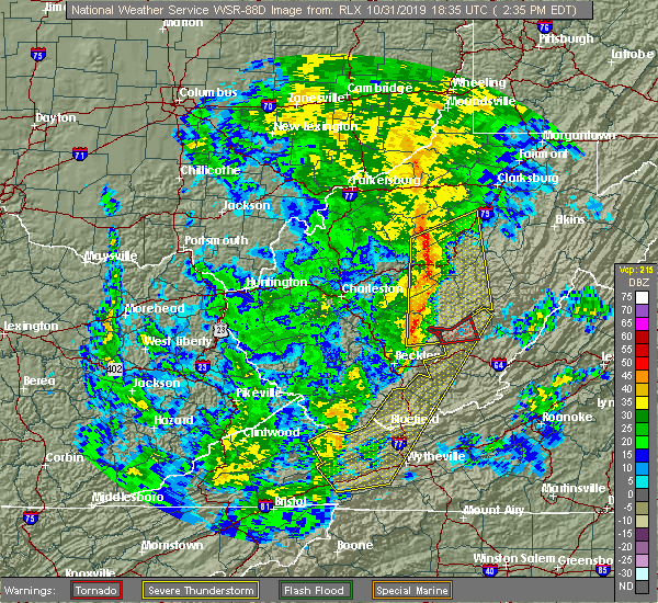
| 10/31/2019 3:31 PM EDT |
 At 330 pm edt, severe thunderstorms were located along a line extending from 6 miles south of mill creek to near pulaski, moving northeast at 70 mph (law enforcement reported trees down in tazewell county). Hazards include 60 mph wind gusts. Expect damage to roofs, siding, and trees. locations impacted include, bluefield, bland, princeton, lewisburg, pearisburg, hinton, and white sulphur springs. this includes the following locations the west virginia state fairgrounds and mercer county airport. a tornado watch remains in effect until 700 pm edt for southwestern virginia, and southeastern west virginia. A tornado watch also remains in effect until 1100 pm edt for southwestern and west central virginia. At 330 pm edt, severe thunderstorms were located along a line extending from 6 miles south of mill creek to near pulaski, moving northeast at 70 mph (law enforcement reported trees down in tazewell county). Hazards include 60 mph wind gusts. Expect damage to roofs, siding, and trees. locations impacted include, bluefield, bland, princeton, lewisburg, pearisburg, hinton, and white sulphur springs. this includes the following locations the west virginia state fairgrounds and mercer county airport. a tornado watch remains in effect until 700 pm edt for southwestern virginia, and southeastern west virginia. A tornado watch also remains in effect until 1100 pm edt for southwestern and west central virginia.
|
| 10/31/2019 3:17 PM EDT |
 At 316 pm edt, severe thunderstorms were located along a line extending from 10 miles east of addison (webster springs) to near wytheville, moving east at 45 mph (law enforcement reported trees down in tazewell county). Hazards include 60 mph wind gusts. Expect damage to roofs, siding, and trees. locations impacted include, bluefield, wytheville, bland, princeton, lewisburg, pearisburg, and hinton. this includes the following locations the west virginia state fairgrounds and mercer county airport. a tornado watch remains in effect until 700 pm edt for northwestern north carolina, southwestern virginia, and southeastern west virginia. A tornado watch also remains in effect until 1100 pm edt for northwestern north carolina, and southwestern and west central virginia. At 316 pm edt, severe thunderstorms were located along a line extending from 10 miles east of addison (webster springs) to near wytheville, moving east at 45 mph (law enforcement reported trees down in tazewell county). Hazards include 60 mph wind gusts. Expect damage to roofs, siding, and trees. locations impacted include, bluefield, wytheville, bland, princeton, lewisburg, pearisburg, and hinton. this includes the following locations the west virginia state fairgrounds and mercer county airport. a tornado watch remains in effect until 700 pm edt for northwestern north carolina, southwestern virginia, and southeastern west virginia. A tornado watch also remains in effect until 1100 pm edt for northwestern north carolina, and southwestern and west central virginia.
|
| 10/31/2019 2:57 PM EDT |
 The tornado warning for northwestern greenbrier county will expire at 300 pm edt, the storm which prompted the tornado warning has weakened, and no longer appears capable of producing a tornado. therefore, the warning will be allowed to expire. however gusty winds are still possible with this thunderstorm and a severe thunderstorm warning remains in effect for all of greenbrier county. a tornado watch remains in effect until 700 pm edt for southeastern west virginia. when it is safe to do so, please send your reports of hail of any size, as well as reports of any wind damage, including downed trees or large limbs, to the national weather service by calling toll free at 1, 8 6 6, 2 1 5, 4 3 2 4. reports and pictures can also be shared on the national weather service blacksburg facebook page and on twitter. The tornado warning for northwestern greenbrier county will expire at 300 pm edt, the storm which prompted the tornado warning has weakened, and no longer appears capable of producing a tornado. therefore, the warning will be allowed to expire. however gusty winds are still possible with this thunderstorm and a severe thunderstorm warning remains in effect for all of greenbrier county. a tornado watch remains in effect until 700 pm edt for southeastern west virginia. when it is safe to do so, please send your reports of hail of any size, as well as reports of any wind damage, including downed trees or large limbs, to the national weather service by calling toll free at 1, 8 6 6, 2 1 5, 4 3 2 4. reports and pictures can also be shared on the national weather service blacksburg facebook page and on twitter.
|
| 10/31/2019 2:45 PM EDT |
 At 242 pm edt, severe thunderstorms were located along a line extending from camden on gauley to near marion, moving northeast at 70 mph (radar indicated). Hazards include 60 mph wind gusts. expect damage to roofs, siding, and trees At 242 pm edt, severe thunderstorms were located along a line extending from camden on gauley to near marion, moving northeast at 70 mph (radar indicated). Hazards include 60 mph wind gusts. expect damage to roofs, siding, and trees
|
| 10/31/2019 2:45 PM EDT |
 The national weather service in blacksburg has issued a * severe thunderstorm warning for. giles county in southwestern virginia. smyth county in southwestern virginia. tazewell county in southwestern virginia. Bland county in southwestern virginia. The national weather service in blacksburg has issued a * severe thunderstorm warning for. giles county in southwestern virginia. smyth county in southwestern virginia. tazewell county in southwestern virginia. Bland county in southwestern virginia.
|
| 10/31/2019 2:42 PM EDT |
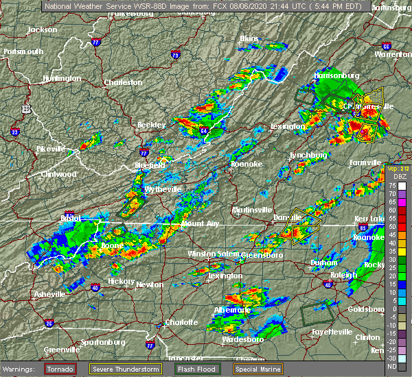
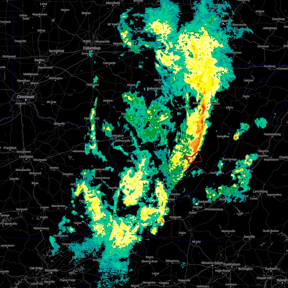
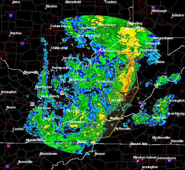 At 242 pm edt, a severe thunderstorm capable of producing a tornado was located near bingham, or near quinwood, moving east at 40 mph (radar indicated rotation). Hazards include tornado. Flying debris will be dangerous to those caught without shelter. mobile homes will be damaged or destroyed. damage to roofs, windows, and vehicles will occur. tree damage is likely. Locations impacted include, rainelle, quinwood, bingham, duo, and anjean. At 242 pm edt, a severe thunderstorm capable of producing a tornado was located near bingham, or near quinwood, moving east at 40 mph (radar indicated rotation). Hazards include tornado. Flying debris will be dangerous to those caught without shelter. mobile homes will be damaged or destroyed. damage to roofs, windows, and vehicles will occur. tree damage is likely. Locations impacted include, rainelle, quinwood, bingham, duo, and anjean.
|
| 10/31/2019 2:34 PM EDT |
 At 234 pm edt, a severe thunderstorm capable of producing a tornado was located near bingham, or 8 miles west of quinwood, moving east at 45 mph (radar indicated rotation). Hazards include tornado. Flying debris will be dangerous to those caught without shelter. mobile homes will be damaged or destroyed. damage to roofs, windows, and vehicles will occur. tree damage is likely. Locations impacted include, rainelle, quinwood, bingham, duo, and anjean. At 234 pm edt, a severe thunderstorm capable of producing a tornado was located near bingham, or 8 miles west of quinwood, moving east at 45 mph (radar indicated rotation). Hazards include tornado. Flying debris will be dangerous to those caught without shelter. mobile homes will be damaged or destroyed. damage to roofs, windows, and vehicles will occur. tree damage is likely. Locations impacted include, rainelle, quinwood, bingham, duo, and anjean.
|
| 10/31/2019 2:26 PM EDT |
 At 225 pm edt, a severe thunderstorm capable of producing a tornado was located near babcock state park, moving northeast at 45 mph (radar indicated rotation). Hazards include tornado. Flying debris will be dangerous to those caught without shelter. mobile homes will be damaged or destroyed. damage to roofs, windows, and vehicles will occur. Tree damage is likely. At 225 pm edt, a severe thunderstorm capable of producing a tornado was located near babcock state park, moving northeast at 45 mph (radar indicated rotation). Hazards include tornado. Flying debris will be dangerous to those caught without shelter. mobile homes will be damaged or destroyed. damage to roofs, windows, and vehicles will occur. Tree damage is likely.
|
| 10/31/2019 2:06 PM EDT |
 At 205 pm edt, severe thunderstorms were located along a line extending from 7 miles southwest of summersville to near quarry, moving east at 60 mph (radar indicated). Hazards include 60 mph wind gusts. Expect damage to roofs, siding, and trees. locations impacted include, bluefield, wytheville, bland, princeton, marion, richlands, and tazewell. this includes the following location mercer county airport. A tornado watch remains in effect until 700 pm edt for northwestern north carolina, southwestern virginia, and southeastern west virginia. At 205 pm edt, severe thunderstorms were located along a line extending from 7 miles southwest of summersville to near quarry, moving east at 60 mph (radar indicated). Hazards include 60 mph wind gusts. Expect damage to roofs, siding, and trees. locations impacted include, bluefield, wytheville, bland, princeton, marion, richlands, and tazewell. this includes the following location mercer county airport. A tornado watch remains in effect until 700 pm edt for northwestern north carolina, southwestern virginia, and southeastern west virginia.
|
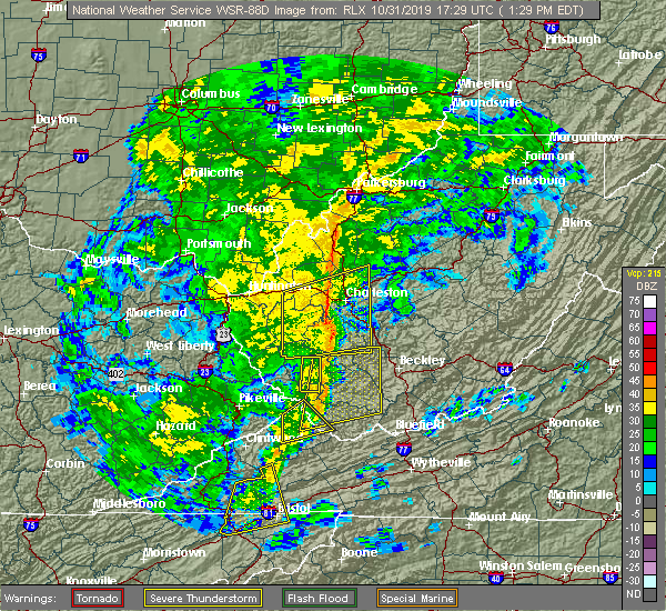
| 10/31/2019 1:51 PM EDT |
 At 150 pm edt, severe thunderstorms were located along a line extending from 8 miles northwest of amma to near burnwell, moving northeast at 65 mph (radar indicated). Hazards include 60 mph wind gusts. expect damage to roofs, siding, and trees At 150 pm edt, severe thunderstorms were located along a line extending from 8 miles northwest of amma to near burnwell, moving northeast at 65 mph (radar indicated). Hazards include 60 mph wind gusts. expect damage to roofs, siding, and trees
|
| 10/31/2019 1:32 PM EDT |
 At 130 pm edt, severe thunderstorms were located along a line extending from near oceana to near bristol va, moving northeast at 55 mph (radar indicated). Hazards include 60 mph wind gusts. expect damage to roofs, siding, and trees At 130 pm edt, severe thunderstorms were located along a line extending from near oceana to near bristol va, moving northeast at 55 mph (radar indicated). Hazards include 60 mph wind gusts. expect damage to roofs, siding, and trees
|
| 8/9/2019 5:08 PM EDT |
 At 508 pm edt, a severe thunderstorm was located near elton, moving southeast at 30 mph (radar indicated). Hazards include 60 mph wind gusts and quarter size hail. Hail damage to vehicles is expected. expect wind damage to roofs, siding, and trees. Locations impacted include, hinton, rainelle, alderson, sandstone, and asbury. At 508 pm edt, a severe thunderstorm was located near elton, moving southeast at 30 mph (radar indicated). Hazards include 60 mph wind gusts and quarter size hail. Hail damage to vehicles is expected. expect wind damage to roofs, siding, and trees. Locations impacted include, hinton, rainelle, alderson, sandstone, and asbury.
|
| 8/9/2019 4:38 PM EDT |
 At 438 pm edt, a severe thunderstorm was located over babcock state park, moving southeast at 25 mph (radar indicated). Hazards include 60 mph wind gusts and quarter size hail. Hail damage to vehicles is expected. Expect wind damage to roofs, siding, and trees. At 438 pm edt, a severe thunderstorm was located over babcock state park, moving southeast at 25 mph (radar indicated). Hazards include 60 mph wind gusts and quarter size hail. Hail damage to vehicles is expected. Expect wind damage to roofs, siding, and trees.
|
| 8/9/2019 3:42 PM EDT |
 The severe thunderstorm warning for southwestern alleghany county in west central virginia, greenbrier, summers and monroe counties in southeastern west virginia will expire at 345 pm edt, the storms which prompted the warning have weakened below severe limits, and no longer pose an immediate threat to life or property. these storms are still strong and capable of producing winds to near 50 mph. when it is safe to do so, please send your reports of hail of any size, as well as reports of any wind damage, including downed trees or large limbs, to the national weather service by calling toll free at 1, 8 6 6, 2 1 5, 4 3 2 4. reports and pictures can also be shared on the national weather service blacksburg facebook page and on twitter. The severe thunderstorm warning for southwestern alleghany county in west central virginia, greenbrier, summers and monroe counties in southeastern west virginia will expire at 345 pm edt, the storms which prompted the warning have weakened below severe limits, and no longer pose an immediate threat to life or property. these storms are still strong and capable of producing winds to near 50 mph. when it is safe to do so, please send your reports of hail of any size, as well as reports of any wind damage, including downed trees or large limbs, to the national weather service by calling toll free at 1, 8 6 6, 2 1 5, 4 3 2 4. reports and pictures can also be shared on the national weather service blacksburg facebook page and on twitter.
|
| 8/9/2019 3:24 PM EDT |
 At 321 pm edt, severe thunderstorms were located near jumping branch and north of quinwood, moving southeast at 30 mph (radar indicated). Hazards include 60 mph wind gusts and quarter size hail. Hail damage to vehicles is expected. expect wind damage to roofs, siding, and trees. Locations impacted include, alleghany, lewisburg, hinton, white sulphur springs, and ronceverte. At 321 pm edt, severe thunderstorms were located near jumping branch and north of quinwood, moving southeast at 30 mph (radar indicated). Hazards include 60 mph wind gusts and quarter size hail. Hail damage to vehicles is expected. expect wind damage to roofs, siding, and trees. Locations impacted include, alleghany, lewisburg, hinton, white sulphur springs, and ronceverte.
|
| 8/9/2019 2:49 PM EDT |
 At 248 pm edt, a severe thunderstorm was located near elton, moving southeast at 35 mph (radar indicated). Hazards include 60 mph wind gusts and quarter size hail. Hail damage to vehicles is expected. Expect wind damage to roofs, siding, and trees. At 248 pm edt, a severe thunderstorm was located near elton, moving southeast at 35 mph (radar indicated). Hazards include 60 mph wind gusts and quarter size hail. Hail damage to vehicles is expected. Expect wind damage to roofs, siding, and trees.
|
| 5/29/2019 4:13 PM EDT |
 At 413 pm edt, severe thunderstorms were located along a line extending from shady spring to near elton to near piney view, moving east at 50 mph (radar indicated). Hazards include 60 mph wind gusts and quarter size hail. Hail damage to vehicles is expected. Expect wind damage to roofs, siding, and trees. At 413 pm edt, severe thunderstorms were located along a line extending from shady spring to near elton to near piney view, moving east at 50 mph (radar indicated). Hazards include 60 mph wind gusts and quarter size hail. Hail damage to vehicles is expected. Expect wind damage to roofs, siding, and trees.
|
| 5/29/2019 3:59 PM EDT |
 At 358 pm edt, severe thunderstorms were located along a line extending from 6 miles south of babcock state park to 8 miles west of prosperity, moving east at 35 mph. storms will be developing and moving in from the southwest (radar indicated). Hazards include 60 mph wind gusts and quarter size hail. Hail damage to vehicles is expected. expect wind damage to roofs, siding, and trees. Locations impacted include, lewisburg, rainelle, alderson, rupert, and quinwood. At 358 pm edt, severe thunderstorms were located along a line extending from 6 miles south of babcock state park to 8 miles west of prosperity, moving east at 35 mph. storms will be developing and moving in from the southwest (radar indicated). Hazards include 60 mph wind gusts and quarter size hail. Hail damage to vehicles is expected. expect wind damage to roofs, siding, and trees. Locations impacted include, lewisburg, rainelle, alderson, rupert, and quinwood.
|
| 5/29/2019 3:18 PM EDT |
 At 317 pm edt, severe thunderstorms were located from 6 miles north of quinwood, through babcock state park, to 8 miles south of burnwell, moving east at 45 mph (radar indicated). Hazards include 60 mph wind gusts and quarter size hail. Hail damage to vehicles is expected. Expect wind damage to roofs, siding, and trees. At 317 pm edt, severe thunderstorms were located from 6 miles north of quinwood, through babcock state park, to 8 miles south of burnwell, moving east at 45 mph (radar indicated). Hazards include 60 mph wind gusts and quarter size hail. Hail damage to vehicles is expected. Expect wind damage to roofs, siding, and trees.
|
| 5/23/2019 9:26 PM EDT |
 The tornado warning for southwestern greenbrier and northeastern summers counties will expire at 930 pm edt, the tornado threat has diminished and the tornado warning has been cancelled. however, large hail and damaging winds remain likely and a severe thunderstorm warning remains in effect for the area. when it is safe to do so, please send your reports of hail of any size, as well as reports of any wind damage, including downed trees or large limbs, to the national weather service by calling toll free at 1, 8 6 6, 2 1 5, 4 3 2 4. reports and pictures can also be shared on the national weather service blacksburg facebook page and on twitter. The tornado warning for southwestern greenbrier and northeastern summers counties will expire at 930 pm edt, the tornado threat has diminished and the tornado warning has been cancelled. however, large hail and damaging winds remain likely and a severe thunderstorm warning remains in effect for the area. when it is safe to do so, please send your reports of hail of any size, as well as reports of any wind damage, including downed trees or large limbs, to the national weather service by calling toll free at 1, 8 6 6, 2 1 5, 4 3 2 4. reports and pictures can also be shared on the national weather service blacksburg facebook page and on twitter.
|
| 5/23/2019 9:22 PM EDT |
 The tornado warning for southeastern fayette county will expire at 930 pm edt, the storm which prompted the warning has moved out of the area. therefore, the warning will be allowed to expire. to report severe weather, contact your nearest law enforcement agency. they will relay your report to the national weather service charleston west virginia. The tornado warning for southeastern fayette county will expire at 930 pm edt, the storm which prompted the warning has moved out of the area. therefore, the warning will be allowed to expire. to report severe weather, contact your nearest law enforcement agency. they will relay your report to the national weather service charleston west virginia.
|
| 5/23/2019 9:16 PM EDT |
 At 916 pm edt, a severe thunderstorm capable of producing a tornado was located near lawn, moving southeast at 30 mph (radar indicated rotation). Hazards include tornado and two inch hail. Flying debris will be dangerous to those caught without shelter. mobile homes will be damaged or destroyed. damage to roofs, windows, and vehicles will occur. tree damage is likely. this dangerous storm will be near, lawn and elton around 925 pm edt. Glenray and asbury around 930 pm edt. At 916 pm edt, a severe thunderstorm capable of producing a tornado was located near lawn, moving southeast at 30 mph (radar indicated rotation). Hazards include tornado and two inch hail. Flying debris will be dangerous to those caught without shelter. mobile homes will be damaged or destroyed. damage to roofs, windows, and vehicles will occur. tree damage is likely. this dangerous storm will be near, lawn and elton around 925 pm edt. Glenray and asbury around 930 pm edt.
|
| 5/23/2019 9:07 PM EDT |
 At 906 pm edt, a severe thunderstorm capable of producing a tornado was located near rainelle, moving southeast at 30 mph (radar indicated rotation). Hazards include tornado and quarter size hail. Flying debris will be dangerous to those caught without shelter. mobile homes will be damaged or destroyed. damage to roofs, windows, and vehicles will occur. tree damage is likely. this dangerous storm will be near, rainelle around 910 pm edt. Other locations impacted by this tornadic thunderstorm include meadow bridge. At 906 pm edt, a severe thunderstorm capable of producing a tornado was located near rainelle, moving southeast at 30 mph (radar indicated rotation). Hazards include tornado and quarter size hail. Flying debris will be dangerous to those caught without shelter. mobile homes will be damaged or destroyed. damage to roofs, windows, and vehicles will occur. tree damage is likely. this dangerous storm will be near, rainelle around 910 pm edt. Other locations impacted by this tornadic thunderstorm include meadow bridge.
|
| 5/23/2019 8:58 PM EDT |
 At 857 pm edt, a severe thunderstorm capable of producing a tornado was located near rainelle, moving southeast at 25 mph (radar indicated rotation). Hazards include tornado and hail up to two inches in diameter. Flying debris will be dangerous to those caught without shelter. mobile homes will be damaged or destroyed. damage to roofs, windows, and vehicles will occur. tree damage is likely. this dangerous storm will be near, sandstone and elton around 920 pm edt. Hix and glenray around 930 pm edt. At 857 pm edt, a severe thunderstorm capable of producing a tornado was located near rainelle, moving southeast at 25 mph (radar indicated rotation). Hazards include tornado and hail up to two inches in diameter. Flying debris will be dangerous to those caught without shelter. mobile homes will be damaged or destroyed. damage to roofs, windows, and vehicles will occur. tree damage is likely. this dangerous storm will be near, sandstone and elton around 920 pm edt. Hix and glenray around 930 pm edt.
|
| 5/23/2019 8:53 PM EDT |
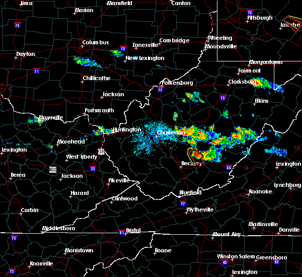 At 852 pm edt, a severe thunderstorm capable of producing a tornado was located over babcock state park, moving southeast at 30 mph (radar indicated rotation). Hazards include tornado and quarter size hail. Flying debris will be dangerous to those caught without shelter. mobile homes will be damaged or destroyed. damage to roofs, windows, and vehicles will occur. tree damage is likely. this dangerous storm will be near, rainelle around 910 pm edt. Other locations impacted by this tornadic thunderstorm include meadow bridge. At 852 pm edt, a severe thunderstorm capable of producing a tornado was located over babcock state park, moving southeast at 30 mph (radar indicated rotation). Hazards include tornado and quarter size hail. Flying debris will be dangerous to those caught without shelter. mobile homes will be damaged or destroyed. damage to roofs, windows, and vehicles will occur. tree damage is likely. this dangerous storm will be near, rainelle around 910 pm edt. Other locations impacted by this tornadic thunderstorm include meadow bridge.
|
| 5/23/2019 8:44 PM EDT |
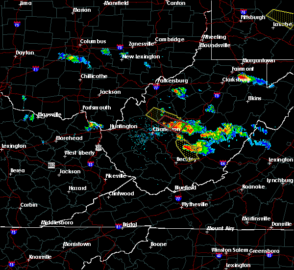 At 824 pm edt, a severe thunderstorm was located over ansted, or 8 miles north of fayetteville, moving southeast at 30 mph (radar indicated). Hazards include ping pong ball size hail and 60 mph wind gusts. People and animals outdoors will be injured. expect hail damage to roofs, siding, windows, and vehicles. Expect wind damage to roofs, siding, and trees. At 824 pm edt, a severe thunderstorm was located over ansted, or 8 miles north of fayetteville, moving southeast at 30 mph (radar indicated). Hazards include ping pong ball size hail and 60 mph wind gusts. People and animals outdoors will be injured. expect hail damage to roofs, siding, windows, and vehicles. Expect wind damage to roofs, siding, and trees.
|
| 5/23/2019 8:25 PM EDT |
 At 824 pm edt, a severe thunderstorm was located over ansted, or 8 miles north of fayetteville, moving southeast at 30 mph (radar indicated). Hazards include ping pong ball size hail and 60 mph wind gusts. People and animals outdoors will be injured. expect hail damage to roofs, siding, windows, and vehicles. Expect wind damage to roofs, siding, and trees. At 824 pm edt, a severe thunderstorm was located over ansted, or 8 miles north of fayetteville, moving southeast at 30 mph (radar indicated). Hazards include ping pong ball size hail and 60 mph wind gusts. People and animals outdoors will be injured. expect hail damage to roofs, siding, windows, and vehicles. Expect wind damage to roofs, siding, and trees.
|
| 5/19/2019 7:26 PM EDT |
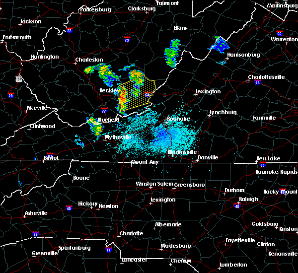 At 725 pm edt, a severe thunderstorm was located near glenray, moving northeast at 30 mph (radar indicated). Hazards include 60 mph wind gusts. expect damage to roofs, siding, and trees At 725 pm edt, a severe thunderstorm was located near glenray, moving northeast at 30 mph (radar indicated). Hazards include 60 mph wind gusts. expect damage to roofs, siding, and trees
|
| 4/14/2019 9:21 PM EDT |
 The severe thunderstorm warning for eastern raleigh and southeastern fayette counties will expire at 930 pm edt, the storms which prompted the warning have moved out of the area. therefore, the warning will be allowed to expire. a severe thunderstorm watch remains in effect until 200 am edt for southeastern west virginia. The severe thunderstorm warning for eastern raleigh and southeastern fayette counties will expire at 930 pm edt, the storms which prompted the warning have moved out of the area. therefore, the warning will be allowed to expire. a severe thunderstorm watch remains in effect until 200 am edt for southeastern west virginia.
|
| 4/14/2019 9:20 PM EDT |
 At 919 pm edt, severe thunderstorms were located along a line extending from richwood to bozoo, moving northeast at 60 mph (radar indicated). Hazards include 60 mph wind gusts. Expect damage to roofs, siding, and trees. locations impacted include, lewisburg, hinton, ronceverte, rainelle, and alderson. This includes the following location the west virginia state fairgrounds. At 919 pm edt, severe thunderstorms were located along a line extending from richwood to bozoo, moving northeast at 60 mph (radar indicated). Hazards include 60 mph wind gusts. Expect damage to roofs, siding, and trees. locations impacted include, lewisburg, hinton, ronceverte, rainelle, and alderson. This includes the following location the west virginia state fairgrounds.
|
| 4/14/2019 9:10 PM EDT | Trees down on route 60. road closed in both direction in fayette county WV, 8 miles ESE of Rainelle, WV |
| 4/14/2019 9:07 PM EDT |
 At 907 pm edt, severe thunderstorms were located along a line extending from near babcock state park to near camp creek state park, moving east at 30 mph (radar indicated). Hazards include 60 mph wind gusts. Expect damage to roofs, siding, and trees. Locations impacted include, beckley, fayetteville, babcock state park, oak hill, mount hope, bradley, shady spring, prosperity, beaver, daniels, piney view, stanaford, macarthur, meadow bridge, thurmond and ghent. At 907 pm edt, severe thunderstorms were located along a line extending from near babcock state park to near camp creek state park, moving east at 30 mph (radar indicated). Hazards include 60 mph wind gusts. Expect damage to roofs, siding, and trees. Locations impacted include, beckley, fayetteville, babcock state park, oak hill, mount hope, bradley, shady spring, prosperity, beaver, daniels, piney view, stanaford, macarthur, meadow bridge, thurmond and ghent.
|
| 4/14/2019 9:03 PM EDT |
 At 902 pm edt, severe thunderstorms were located along a line extending from near quinwood to near ceres, moving northeast at 55 mph (radar indicated). Hazards include 60 mph wind gusts. Expect damage to roofs, siding, and trees. locations impacted include, bluefield, princeton, lewisburg, hinton, and ronceverte. This includes the following locations the west virginia state fairgrounds and mercer county airport. At 902 pm edt, severe thunderstorms were located along a line extending from near quinwood to near ceres, moving northeast at 55 mph (radar indicated). Hazards include 60 mph wind gusts. Expect damage to roofs, siding, and trees. locations impacted include, bluefield, princeton, lewisburg, hinton, and ronceverte. This includes the following locations the west virginia state fairgrounds and mercer county airport.
|
| 4/14/2019 9:00 PM EDT | Electrical pole snapped at corner of fifth main stree in greenbrier county WV, 0.4 miles W of Rainelle, WV |
| 4/14/2019 8:40 PM EDT |
 At 840 pm edt, severe thunderstorms were located along a line extending from near fayetteville to near mullens, moving east at 30 mph (radar indicated). Hazards include 60 mph wind gusts. expect damage to roofs, siding, and trees At 840 pm edt, severe thunderstorms were located along a line extending from near fayetteville to near mullens, moving east at 30 mph (radar indicated). Hazards include 60 mph wind gusts. expect damage to roofs, siding, and trees
|
| 4/14/2019 8:32 PM EDT |
 At 831 pm edt, severe thunderstorms were located along a line extending from near stanaford to near ceres, moving northeast at 60 mph (radar indicated). Hazards include 60 mph wind gusts. expect damage to roofs, siding, and trees At 831 pm edt, severe thunderstorms were located along a line extending from near stanaford to near ceres, moving northeast at 60 mph (radar indicated). Hazards include 60 mph wind gusts. expect damage to roofs, siding, and trees
|
| 4/14/2019 8:17 PM EDT |
 At 817 pm edt, severe thunderstorms were located along a line extending from near fayetteville to 6 miles west of sophia, moving east at 20 mph (radar indicated). Hazards include 60 mph wind gusts and penny size hail. Expect damage to roofs, siding, and trees. Locations impacted include, beckley, fayetteville, babcock state park, oak hill, mount hope, mabscott, oceana, sophia, crab orchard, dry creek, macarthur, bradley, shady spring, powellton, beaver, piney view, stanaford, coal city, prosperity and burnwell. At 817 pm edt, severe thunderstorms were located along a line extending from near fayetteville to 6 miles west of sophia, moving east at 20 mph (radar indicated). Hazards include 60 mph wind gusts and penny size hail. Expect damage to roofs, siding, and trees. Locations impacted include, beckley, fayetteville, babcock state park, oak hill, mount hope, mabscott, oceana, sophia, crab orchard, dry creek, macarthur, bradley, shady spring, powellton, beaver, piney view, stanaford, coal city, prosperity and burnwell.
|
| 4/14/2019 7:47 PM EDT |
 At 746 pm edt, severe thunderstorms were located along a line extending from near burnwell to 6 miles northeast of oceana, moving east at 30 mph (radar indicated). Hazards include 60 mph wind gusts and penny size hail. expect damage to roofs, siding, and trees At 746 pm edt, severe thunderstorms were located along a line extending from near burnwell to 6 miles northeast of oceana, moving east at 30 mph (radar indicated). Hazards include 60 mph wind gusts and penny size hail. expect damage to roofs, siding, and trees
|
| 5/15/2018 5:51 PM EDT |
 The severe thunderstorm warning for southwestern greenbrier and northern summers counties will expire at 600 pm edt, the storm which prompted the warning has weakened below severe limits, and no longer poses an immediate threat to life or property. therefore, the warning will be allowed to expire. however heavy rain is still possible with this thunderstorm. when it is safe to do so, please send your reports of hail of any size, as well as reports of any wind damage, including downed trees or large limbs, to the national weather service by calling toll free at 1, 8 6 6, 2 1 5, 4 3 2 4. reports and pictures can also be shared on the national weather service blacksburg facebook page and on twitter. The severe thunderstorm warning for southwestern greenbrier and northern summers counties will expire at 600 pm edt, the storm which prompted the warning has weakened below severe limits, and no longer poses an immediate threat to life or property. therefore, the warning will be allowed to expire. however heavy rain is still possible with this thunderstorm. when it is safe to do so, please send your reports of hail of any size, as well as reports of any wind damage, including downed trees or large limbs, to the national weather service by calling toll free at 1, 8 6 6, 2 1 5, 4 3 2 4. reports and pictures can also be shared on the national weather service blacksburg facebook page and on twitter.
|
| 5/15/2018 5:24 PM EDT |
 At 500 pm edt, a severe thunderstorm was located over sandstone, moving northeast at 25 mph (radar indicated). Hazards include 60 mph wind gusts and quarter size hail. Hail damage to vehicles is expected. Expect wind damage to roofs, siding, and trees. At 500 pm edt, a severe thunderstorm was located over sandstone, moving northeast at 25 mph (radar indicated). Hazards include 60 mph wind gusts and quarter size hail. Hail damage to vehicles is expected. Expect wind damage to roofs, siding, and trees.
|
| 5/15/2018 5:00 PM EDT |
 At 500 pm edt, a severe thunderstorm was located over sandstone, moving northeast at 25 mph (radar indicated). Hazards include 60 mph wind gusts and quarter size hail. Hail damage to vehicles is expected. Expect wind damage to roofs, siding, and trees. At 500 pm edt, a severe thunderstorm was located over sandstone, moving northeast at 25 mph (radar indicated). Hazards include 60 mph wind gusts and quarter size hail. Hail damage to vehicles is expected. Expect wind damage to roofs, siding, and trees.
|
| 5/31/2017 12:40 PM EDT |
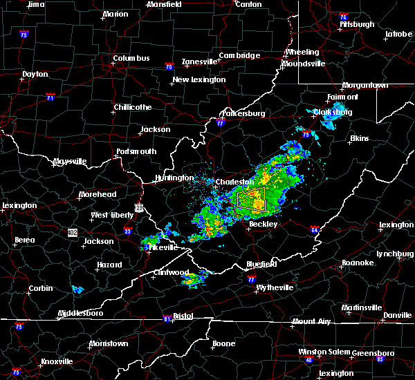 At 1240 pm edt, a severe thunderstorm was located 7 miles north of babcock state park, moving east at 40 mph (radar indicated). Hazards include 60 mph wind gusts. expect damage to roofs, siding, and trees At 1240 pm edt, a severe thunderstorm was located 7 miles north of babcock state park, moving east at 40 mph (radar indicated). Hazards include 60 mph wind gusts. expect damage to roofs, siding, and trees
|
| 3/27/2017 5:27 PM EDT |
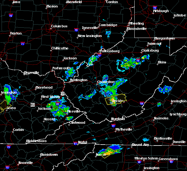 At 526 pm edt, a severe thunderstorm was located near mount hope, or 8 miles northeast of beckley, moving east at 30 mph. this storm produced quarter-sized hail as it crossed i-77 north of beckley near 515 pm (radar indicated). Hazards include 60 mph wind gusts and quarter size hail. Hail damage to vehicles is expected. expect wind damage to roofs, siding, and trees. locations impacted include, beckley, rainelle, babcock state park, oak hill, mount hope, bradley, prosperity, piney view, stanaford, meadow bridge and thurmond. this includes the following highways, west virginia turnpike near mile marker 57. Interstate 64 in west virginia between mile markers 124 and 128. At 526 pm edt, a severe thunderstorm was located near mount hope, or 8 miles northeast of beckley, moving east at 30 mph. this storm produced quarter-sized hail as it crossed i-77 north of beckley near 515 pm (radar indicated). Hazards include 60 mph wind gusts and quarter size hail. Hail damage to vehicles is expected. expect wind damage to roofs, siding, and trees. locations impacted include, beckley, rainelle, babcock state park, oak hill, mount hope, bradley, prosperity, piney view, stanaford, meadow bridge and thurmond. this includes the following highways, west virginia turnpike near mile marker 57. Interstate 64 in west virginia between mile markers 124 and 128.
|
| 3/27/2017 5:14 PM EDT |
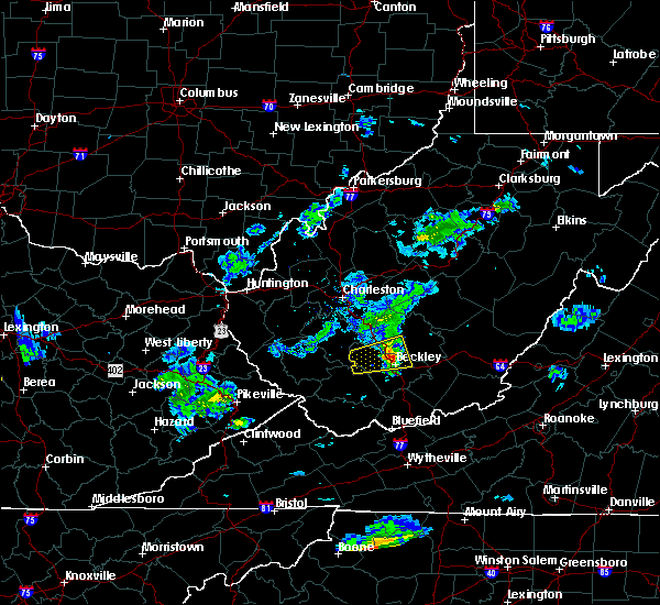 At 513 pm edt, a severe thunderstorm was located over bradley, or near beckley, moving east at 30 mph (radar indicated). Hazards include 60 mph wind gusts and quarter size hail. Hail damage to vehicles is expected. Expect wind damage to roofs, siding, and trees. At 513 pm edt, a severe thunderstorm was located over bradley, or near beckley, moving east at 30 mph (radar indicated). Hazards include 60 mph wind gusts and quarter size hail. Hail damage to vehicles is expected. Expect wind damage to roofs, siding, and trees.
|
| 3/1/2017 10:50 AM EST | Tree down in rainelle in greenbrier county WV, 0.7 miles E of Rainelle, WV |
| 3/1/2017 10:44 AM EST |
 At 1043 am est, severe thunderstorms were located along a line extending from 6 miles west of holly river state to near pineville, moving east at 65 mph (radar indicated). Hazards include 70 mph wind gusts. Expect considerable tree damage. Damage is likely to mobile homes, roofs, and outbuildings. At 1043 am est, severe thunderstorms were located along a line extending from 6 miles west of holly river state to near pineville, moving east at 65 mph (radar indicated). Hazards include 70 mph wind gusts. Expect considerable tree damage. Damage is likely to mobile homes, roofs, and outbuildings.
|
| 3/1/2017 10:35 AM EST |
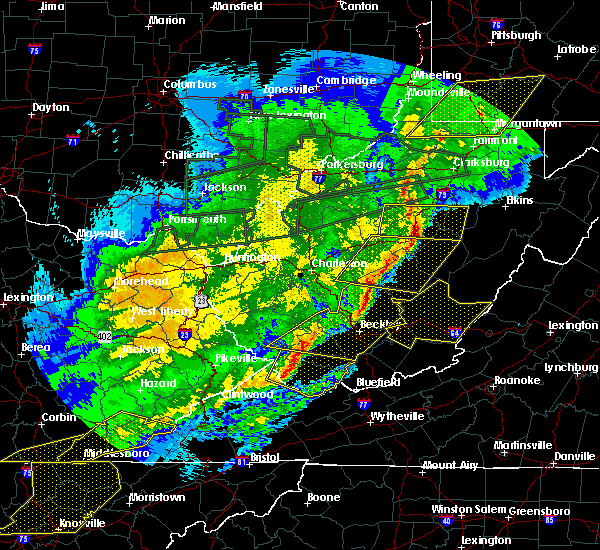 At 1033 am est, severe thunderstorms were located along a line extending from near birch river to northeast of ansted to near oak hill, moving east at 60 mph (radar indicated). Hazards include 60 mph wind gusts and quarter size hail. Hail damage to vehicles is expected. Expect wind damage to roofs, siding, and trees. At 1033 am est, severe thunderstorms were located along a line extending from near birch river to northeast of ansted to near oak hill, moving east at 60 mph (radar indicated). Hazards include 60 mph wind gusts and quarter size hail. Hail damage to vehicles is expected. Expect wind damage to roofs, siding, and trees.
|
| 3/1/2017 10:18 AM EST |
 At 1017 am est, severe thunderstorms were located along a line extending from near pratt to near hinch, moving east at 70 mph (radar indicated). Hazards include 70 mph wind gusts. Expect considerable tree damage. Damage is likely to mobile homes, roofs, and outbuildings. At 1017 am est, severe thunderstorms were located along a line extending from near pratt to near hinch, moving east at 70 mph (radar indicated). Hazards include 70 mph wind gusts. Expect considerable tree damage. Damage is likely to mobile homes, roofs, and outbuildings.
|
| 6/23/2016 4:57 PM EDT |
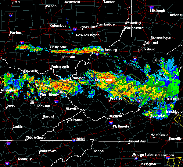 At 457 pm edt, a severe thunderstorm was located over anjean, moving southeast at 35 mph (radar indicated). Hazards include golf ball size hail and 60 mph wind gusts. People and animals outdoors will be injured. expect hail damage to roofs, siding, windows, and vehicles. expect wind damage to roofs, siding, and trees. Locations impacted include, rainelle, rupert, quinwood, meadow bluff, and bingham. At 457 pm edt, a severe thunderstorm was located over anjean, moving southeast at 35 mph (radar indicated). Hazards include golf ball size hail and 60 mph wind gusts. People and animals outdoors will be injured. expect hail damage to roofs, siding, windows, and vehicles. expect wind damage to roofs, siding, and trees. Locations impacted include, rainelle, rupert, quinwood, meadow bluff, and bingham.
|
| 6/23/2016 4:42 PM EDT |
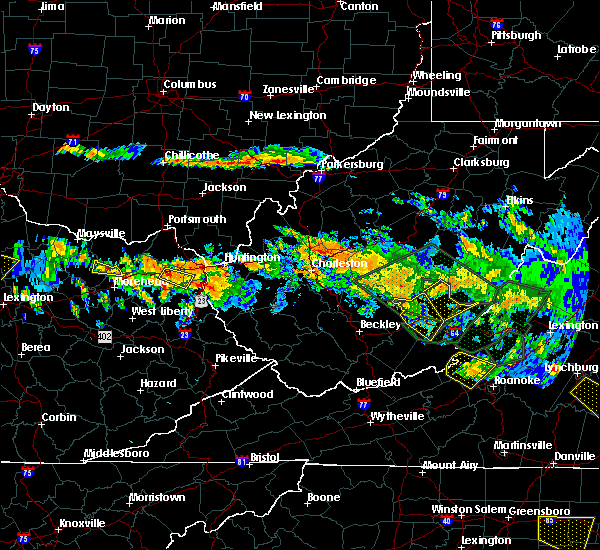 At 442 pm edt, severe thunderstorms were located along a line extending from 7 miles northwest of quinwood to near bingham, moving southeast at 35 mph (radar indicated). Hazards include 60 mph wind gusts and quarter size hail. Hail damage to vehicles is expected. Expect wind damage to roofs, siding, and trees. At 442 pm edt, severe thunderstorms were located along a line extending from 7 miles northwest of quinwood to near bingham, moving southeast at 35 mph (radar indicated). Hazards include 60 mph wind gusts and quarter size hail. Hail damage to vehicles is expected. Expect wind damage to roofs, siding, and trees.
|
| 6/23/2016 8:58 AM EDT |
 The severe thunderstorm warning for summers, greenbrier and monroe counties will expire at 900 am edt, the storms which prompted the warning have moved out of the area. therefore the warning will be allowed to expire. when it is safe to do so, please send your reports of hail of any size, as well as any reports of wind damage, including downed trees or large limbs, to the national weather service by calling toll free at 1, 8 6 6, 2 1 5, 4 3 2 4. reports and pictures can also be shared on the national weather service blacksburg facebook page and on twitter. The severe thunderstorm warning for summers, greenbrier and monroe counties will expire at 900 am edt, the storms which prompted the warning have moved out of the area. therefore the warning will be allowed to expire. when it is safe to do so, please send your reports of hail of any size, as well as any reports of wind damage, including downed trees or large limbs, to the national weather service by calling toll free at 1, 8 6 6, 2 1 5, 4 3 2 4. reports and pictures can also be shared on the national weather service blacksburg facebook page and on twitter.
|
| 6/23/2016 8:25 AM EDT |
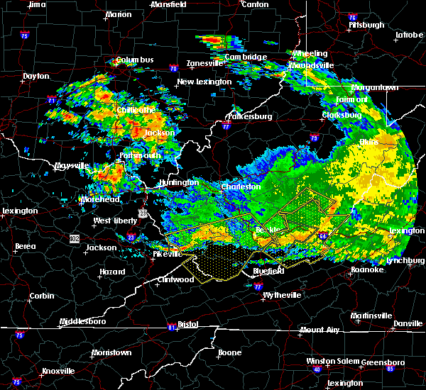 The severe thunderstorm warning for east central raleigh, southwestern pocahontas, southeastern nicholas, southeastern fayette and southwestern webster counties will expire at 830 am edt, the storms which prompted the warning have moved out of the area. therefore, the warning will be allowed to expire. The severe thunderstorm warning for east central raleigh, southwestern pocahontas, southeastern nicholas, southeastern fayette and southwestern webster counties will expire at 830 am edt, the storms which prompted the warning have moved out of the area. therefore, the warning will be allowed to expire.
|
| 6/23/2016 8:24 AM EDT |
 At 823 am edt, severe thunderstorms were located along a line extending from near beartown state park to near fairlea to near bluestone dam, moving southeast at 70 mph (radar indicated). Hazards include 70 mph wind gusts. Expect considerable tree damage. damage is likely to mobile homes, roofs, and outbuildings. locations impacted include, alleghany, lewisburg, hinton, white sulphur springs, and ronceverte. This includes the west virginia state fairgrounds. At 823 am edt, severe thunderstorms were located along a line extending from near beartown state park to near fairlea to near bluestone dam, moving southeast at 70 mph (radar indicated). Hazards include 70 mph wind gusts. Expect considerable tree damage. damage is likely to mobile homes, roofs, and outbuildings. locations impacted include, alleghany, lewisburg, hinton, white sulphur springs, and ronceverte. This includes the west virginia state fairgrounds.
|
| 6/23/2016 8:14 AM EDT |
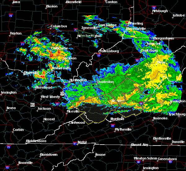 At 813 am edt, severe thunderstorms were located along a line extending from 7 miles southwest of marlinton to glenray, moving southeast at 45 mph (radar indicated). Hazards include 60 mph wind gusts. Expect damage to roofs. siding. and trees. Locations impacted include, richwood, rainelle, babcock state park, craigsville, meadow bridge, nettie and cranberry mountain nature center. At 813 am edt, severe thunderstorms were located along a line extending from 7 miles southwest of marlinton to glenray, moving southeast at 45 mph (radar indicated). Hazards include 60 mph wind gusts. Expect damage to roofs. siding. and trees. Locations impacted include, richwood, rainelle, babcock state park, craigsville, meadow bridge, nettie and cranberry mountain nature center.
|
| 6/23/2016 8:10 AM EDT |
 At 810 am edt, severe thunderstorms were located along a line extending from near leonard to near pipestem, moving southeast at 70 mph (radar indicated). Hazards include 60 mph wind gusts. Expect damage to roofs. siding. And trees. At 810 am edt, severe thunderstorms were located along a line extending from near leonard to near pipestem, moving southeast at 70 mph (radar indicated). Hazards include 60 mph wind gusts. Expect damage to roofs. siding. And trees.
|
| 6/23/2016 8:07 AM EDT |
 At 806 am edt, severe thunderstorms were located along a line extending from 6 miles northeast of richwood to 8 miles south of babcock state park, moving southeast at 65 mph (radar indicated). Hazards include 60 mph wind gusts. Expect damage to roofs. siding. And trees. At 806 am edt, severe thunderstorms were located along a line extending from 6 miles northeast of richwood to 8 miles south of babcock state park, moving southeast at 65 mph (radar indicated). Hazards include 60 mph wind gusts. Expect damage to roofs. siding. And trees.
|
| 6/23/2016 6:55 AM EDT |
 At 653 am edt, severe thunderstorms were located along a line extending from near natural well to babcock state park, moving southwest at 40 mph (radar indicated). Hazards include 60 mph wind gusts. Expect damage to roofs. siding. and trees. locations impacted include, lewisburg, hinton, white sulphur springs, ronceverte, and rainelle. This includes the west virginia state fairgrounds. At 653 am edt, severe thunderstorms were located along a line extending from near natural well to babcock state park, moving southwest at 40 mph (radar indicated). Hazards include 60 mph wind gusts. Expect damage to roofs. siding. and trees. locations impacted include, lewisburg, hinton, white sulphur springs, ronceverte, and rainelle. This includes the west virginia state fairgrounds.
|
| 6/23/2016 6:30 AM EDT |
 At 628 am edt, severe thunderstorms were located along a line extending from near mountain grove to near beartown state park to near duo to near gauley bridge, moving southeast at 45 mph (radar indicated). Hazards include 60 mph wind gusts. Expect damage to roofs. siding. and trees. locations impacted include, lewisburg, hinton, white sulphur springs, ronceverte, and rainelle. This includes the west virginia state fairgrounds. At 628 am edt, severe thunderstorms were located along a line extending from near mountain grove to near beartown state park to near duo to near gauley bridge, moving southeast at 45 mph (radar indicated). Hazards include 60 mph wind gusts. Expect damage to roofs. siding. and trees. locations impacted include, lewisburg, hinton, white sulphur springs, ronceverte, and rainelle. This includes the west virginia state fairgrounds.
|
| 6/23/2016 5:53 AM EDT |
 At 551 am edt, severe thunderstorms were located along a line extending from 8 miles west of webster springs to 6 miles north of summersville to near glen to alum creek, moving southeast at 45 mph (radar indicated). Hazards include 60 mph wind gusts. Expect damage to roofs. siding. And trees. At 551 am edt, severe thunderstorms were located along a line extending from 8 miles west of webster springs to 6 miles north of summersville to near glen to alum creek, moving southeast at 45 mph (radar indicated). Hazards include 60 mph wind gusts. Expect damage to roofs. siding. And trees.
|
| 5/1/2016 7:35 PM EDT |
 At 735 pm edt, a severe thunderstorm was located near babcock state park, moving east at 30 mph (radar indicated). Hazards include 60 mph wind gusts and quarter size hail. Hail damage to vehicles is expected. expect wind damage to roofs, siding, and trees. Locations impacted include, rainelle, babcock state park and meadow bridge. At 735 pm edt, a severe thunderstorm was located near babcock state park, moving east at 30 mph (radar indicated). Hazards include 60 mph wind gusts and quarter size hail. Hail damage to vehicles is expected. expect wind damage to roofs, siding, and trees. Locations impacted include, rainelle, babcock state park and meadow bridge.
|
| 5/1/2016 7:34 PM EDT |
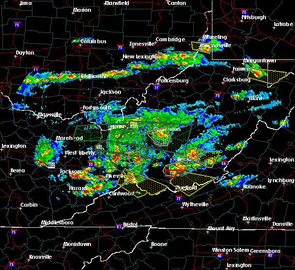 At 734 pm edt, a severe thunderstorm was located near rainelle, moving east at 25 mph (radar indicated). Hazards include 60 mph wind gusts and half dollar size hail. Hail damage to vehicles is expected. Expect wind damage to roofs, siding, and trees. At 734 pm edt, a severe thunderstorm was located near rainelle, moving east at 25 mph (radar indicated). Hazards include 60 mph wind gusts and half dollar size hail. Hail damage to vehicles is expected. Expect wind damage to roofs, siding, and trees.
|
| 5/1/2016 7:30 PM EDT | Quarter sized hail reported 6.3 miles ENE of Rainelle, WV |
| 5/1/2016 7:11 PM EDT |
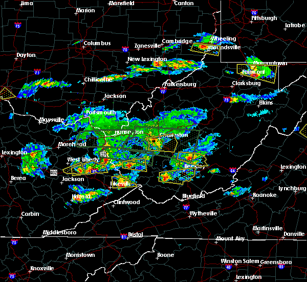 At 711 pm edt, a severe thunderstorm was located near fayetteville, moving east at 30 mph (radar indicated). Hazards include ping pong ball size hail and 60 mph wind gusts. People and animals outdoors will be injured. expect hail damage to roofs, siding, windows, and vehicles. expect wind damage to roofs, siding, and trees. Locations impacted include, fayetteville, rainelle, babcock state park, oak hill, meadow bridge and thurmond. At 711 pm edt, a severe thunderstorm was located near fayetteville, moving east at 30 mph (radar indicated). Hazards include ping pong ball size hail and 60 mph wind gusts. People and animals outdoors will be injured. expect hail damage to roofs, siding, windows, and vehicles. expect wind damage to roofs, siding, and trees. Locations impacted include, fayetteville, rainelle, babcock state park, oak hill, meadow bridge and thurmond.
|
| 5/1/2016 6:55 PM EDT |
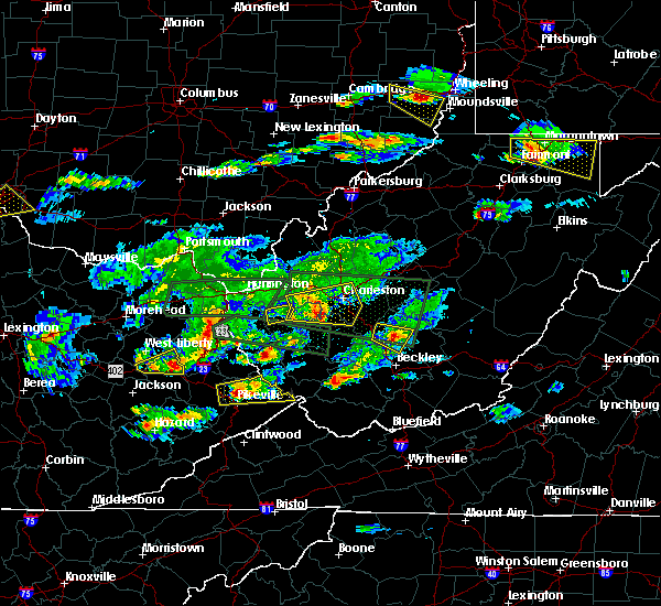 At 655 pm edt, a severe thunderstorm was located near oak hill, or near fayetteville, moving east at 25 mph (radar indicated). Hazards include ping pong ball size hail and 60 mph wind gusts. People and animals outdoors will be injured. expect hail damage to roofs, siding, windows, and vehicles. Expect wind damage to roofs, siding, and trees. At 655 pm edt, a severe thunderstorm was located near oak hill, or near fayetteville, moving east at 25 mph (radar indicated). Hazards include ping pong ball size hail and 60 mph wind gusts. People and animals outdoors will be injured. expect hail damage to roofs, siding, windows, and vehicles. Expect wind damage to roofs, siding, and trees.
|
| 7/14/2015 7:14 PM EDT |
 At 712 pm edt, doppler radar indicated a line of severe thunderstorms capable of producing damaging winds in excess of 60 mph. these storms were located along a line extending from near oak hill to bald knob to odds, moving south at 65 mph. locations impacted include, beckley, williamson, fayetteville, logan, rainelle, babcock state park, oak hill, mount hope, mabscott, oceana, chapmanville, man, delbarton, prosperity, wharton, bald knob, holden, south williamson, aflex and dry creek. At 712 pm edt, doppler radar indicated a line of severe thunderstorms capable of producing damaging winds in excess of 60 mph. these storms were located along a line extending from near oak hill to bald knob to odds, moving south at 65 mph. locations impacted include, beckley, williamson, fayetteville, logan, rainelle, babcock state park, oak hill, mount hope, mabscott, oceana, chapmanville, man, delbarton, prosperity, wharton, bald knob, holden, south williamson, aflex and dry creek.
|
| 7/14/2015 7:02 PM EDT |
 At 659 pm edt, severe thunderstorms were located along a line extending from 10 miles southeast of holly river state to 11 miles northwest of marlinton to quinwood to near madison, moving east at 45 mph. scattered showers and thunderstorms are forming ahead of line and moving east around 30 mph (radar indicated). Hazards include 60 mph wind gusts and quarter size hail. Hail damage to vehicles is expected. expect wind damage to roofs, siding and trees. locations impacted include, alleghany, bluefield, princeton, covington, and lewisburg. This includes the west virginia state fairgrounds and mercer county airport. At 659 pm edt, severe thunderstorms were located along a line extending from 10 miles southeast of holly river state to 11 miles northwest of marlinton to quinwood to near madison, moving east at 45 mph. scattered showers and thunderstorms are forming ahead of line and moving east around 30 mph (radar indicated). Hazards include 60 mph wind gusts and quarter size hail. Hail damage to vehicles is expected. expect wind damage to roofs, siding and trees. locations impacted include, alleghany, bluefield, princeton, covington, and lewisburg. This includes the west virginia state fairgrounds and mercer county airport.
|
| 7/14/2015 6:38 PM EDT |
 At 637 pm edt, severe thunderstorms were located along a line extending from 7 miles south of addison (webster springs) to 6 miles southeast of burnwell to near whitepost, moving southeast at 50 mph (radar indicated). Hazards include 60 mph wind gusts and quarter size hail. Hail damage to vehicles is expected. Expect wind damage to roofs, siding and trees. At 637 pm edt, severe thunderstorms were located along a line extending from 7 miles south of addison (webster springs) to 6 miles southeast of burnwell to near whitepost, moving southeast at 50 mph (radar indicated). Hazards include 60 mph wind gusts and quarter size hail. Hail damage to vehicles is expected. Expect wind damage to roofs, siding and trees.
|
| 7/14/2015 6:35 PM EDT |
 At 634 pm edt, doppler radar indicated a line of severe thunderstorms capable of producing damaging winds in excess of 60 mph. these storms were located along a line extending from near gauley bridge to near madison to blaine, and moving southeast at 30 mph. At 634 pm edt, doppler radar indicated a line of severe thunderstorms capable of producing damaging winds in excess of 60 mph. these storms were located along a line extending from near gauley bridge to near madison to blaine, and moving southeast at 30 mph.
|
| 7/13/2015 6:26 PM EDT | At 601 pm edt, doppler radar indicated a line of severe thunderstorms capable of producing damaging winds in excess of 60 mph. these storms were located along a line extending from 8 miles southeast of clay to near oak hill, moving east at 35 mph. these severe storms will be near, summersville around 610 pm edt. bingham around 625 pm edt. rainelle around 630 pm edt. other locations impacted by these severe thunderstorms include kesslers cross lanes, drennan, calvin, canvas, muddlety and mount nebo. |
| 7/13/2015 6:25 PM EDT |
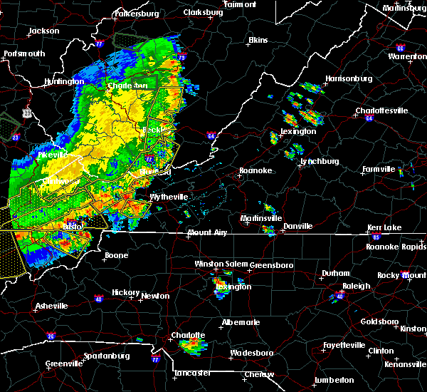 The national weather service in blacksburg has issued a * severe thunderstorm warning for. northern summers county in southeastern west virginia. greenbrier county in southeastern west virginia. northern monroe county in southeastern west virginia. Until 730 pm edt. The national weather service in blacksburg has issued a * severe thunderstorm warning for. northern summers county in southeastern west virginia. greenbrier county in southeastern west virginia. northern monroe county in southeastern west virginia. Until 730 pm edt.
|
| 7/13/2015 6:01 PM EDT |
 A severe thunderstorm warning remains in effect until 630 pm edt for south central nicholas and northeastern fayette counties. at 601 pm edt. doppler radar indicated a line of severe thunderstorms capable of producing damaging winds in excess of 60 mph. these storms were located along a line extending from 8 miles southeast of clay to near oak hill. Moving east at 35 mph. A severe thunderstorm warning remains in effect until 630 pm edt for south central nicholas and northeastern fayette counties. at 601 pm edt. doppler radar indicated a line of severe thunderstorms capable of producing damaging winds in excess of 60 mph. these storms were located along a line extending from 8 miles southeast of clay to near oak hill. Moving east at 35 mph.
|
| 7/13/2015 5:23 PM EDT |
 At 523 pm edt, doppler radar indicated a line of severe thunderstorms capable of producing damaging winds in excess of 60 mph. these storms were located along a line extending from 6 miles southwest of glen to 10 miles east of bald knob, and moving east at 35 mph. * severe thunderstorms will be near, summersville around 605 pm edt. babcock state park around 610 pm edt. rainelle and bingham around 625 pm edt. other locations impacted by these severe thunderstorms include kesslers cross lanes, bickmore, calvin, indore, handley, pond gap, bentree, mount nebo, drennan and canvas. At 523 pm edt, doppler radar indicated a line of severe thunderstorms capable of producing damaging winds in excess of 60 mph. these storms were located along a line extending from 6 miles southwest of glen to 10 miles east of bald knob, and moving east at 35 mph. * severe thunderstorms will be near, summersville around 605 pm edt. babcock state park around 610 pm edt. rainelle and bingham around 625 pm edt. other locations impacted by these severe thunderstorms include kesslers cross lanes, bickmore, calvin, indore, handley, pond gap, bentree, mount nebo, drennan and canvas.
|
| 7/23/2014 10:20 PM EDT | Broadcast media relayed a report from the public of multiple trees blown down in the community of rainell in greenbrier county WV, 0.7 miles E of Rainelle, WV |
| 10/18/2012 5:17 PM EDT | Quarter sized hail reported 2.5 miles SW of Rainelle, WV, up to quarter size hail in the town of charmco |
| 7/24/2012 2:55 PM EDT | Tree down on wv rt 60 near ponderos in fayette county WV, 5.3 miles ESE of Rainelle, WV |
| 6/29/2012 8:12 PM EDT | Multiple trees down on houses in rainelle...local fire department on the scene in greenbrier county WV, 0.7 miles E of Rainelle, WV |
| 6/29/2012 8:00 PM EDT | Trees down on rt 20 in greenbrier county WV, 0.7 miles E of Rainelle, WV |
| 1/1/0001 12:00 AM | Thunderstorm winds tore a large portion of a roof off a trailer on route 6 in greenbrier county WV, 2.4 miles SW of Rainelle, WV |
| 1/1/0001 12:00 AM | Tree down on highway 60 approximately halfway between the town of charmco and hines in greenbrier county WV, 2.4 miles SW of Rainelle, WV |
| 1/1/0001 12:00 AM | Tree down on locust street in the town of rainelle in greenbrier county WV, 0.2 miles E of Rainelle, WV |
| 1/1/0001 12:00 AM | Several 4 to 6 inch diameter tree limbs down in the charmco area in greenbrier county WV, 2.5 miles SW of Rainelle, WV |
| 1/1/0001 12:00 AM | Several trees blown down on route 20 in lilly par in greenbrier county WV, 2.3 miles NE of Rainelle, WV |
| 1/1/0001 12:00 AM | Several trees blown down on route 20 in lilly par in greenbrier county WV, 2.3 miles NE of Rainelle, WV |
Hail Maps for Rainelle, WV


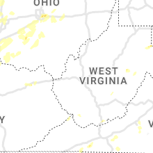


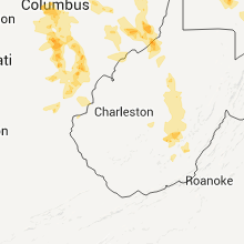

Connect with Interactive Hail Maps