

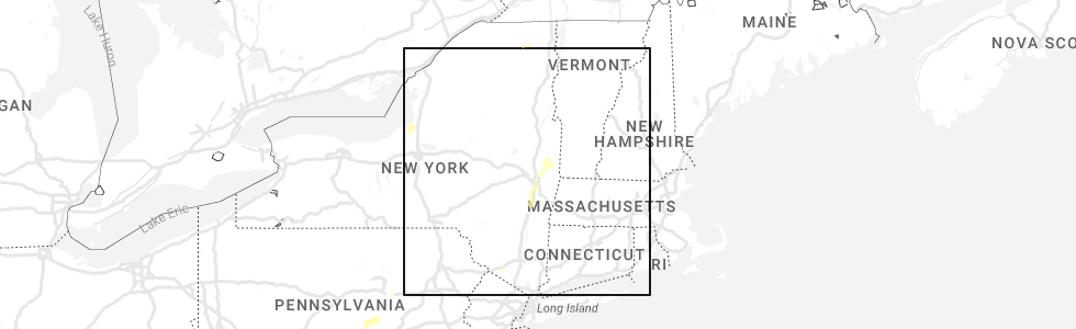
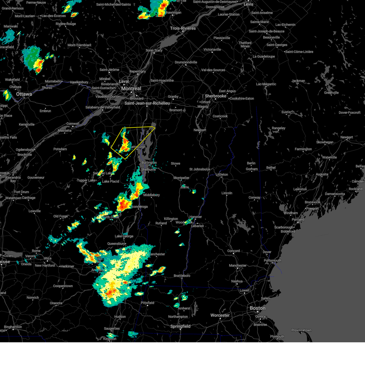
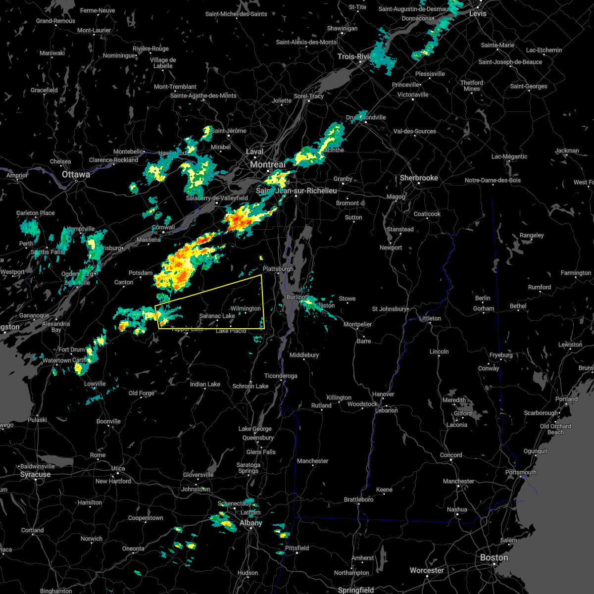
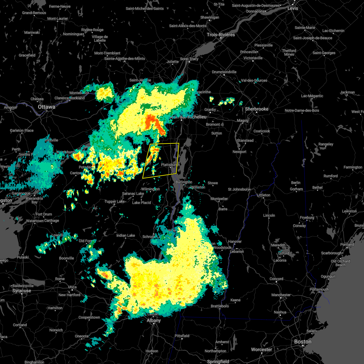
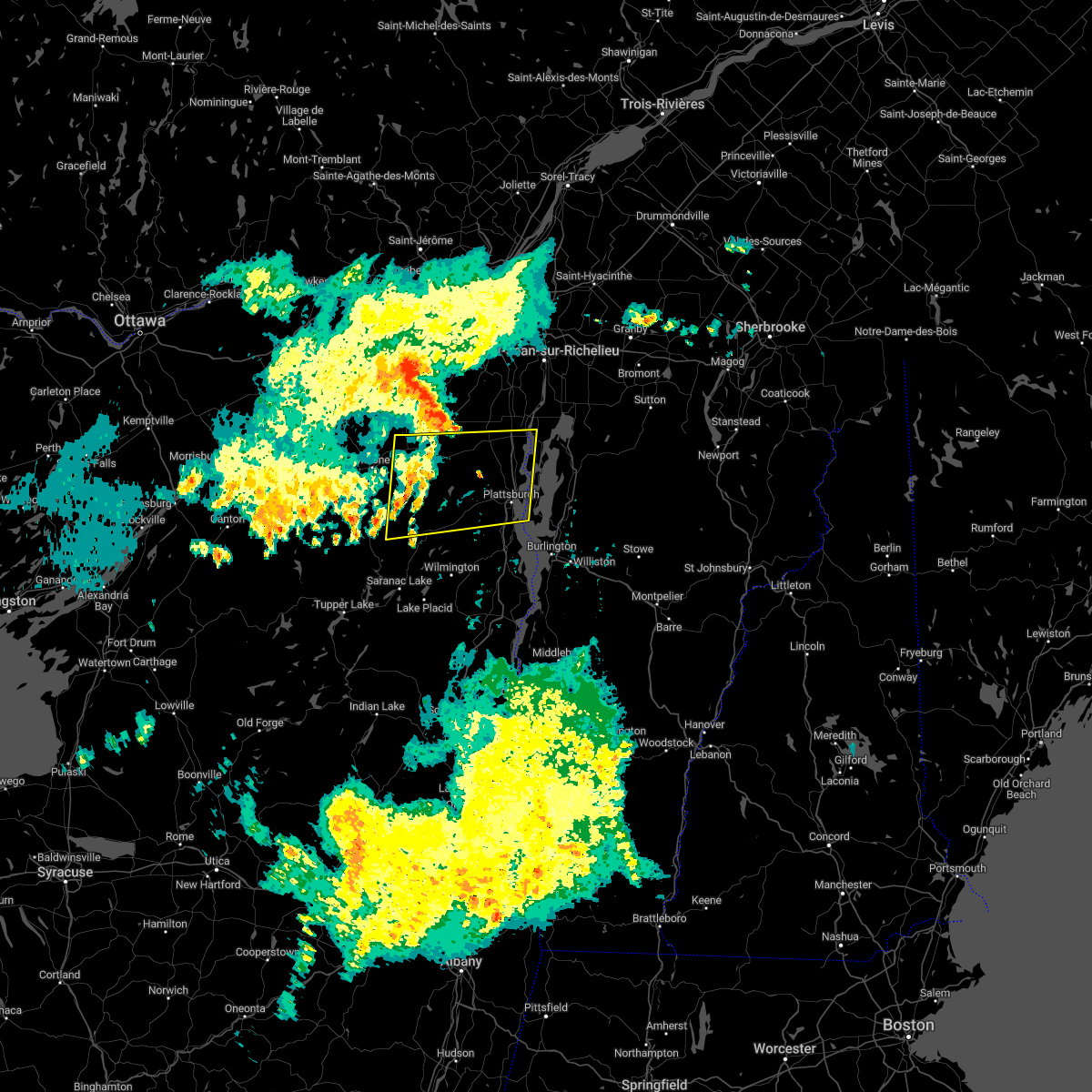
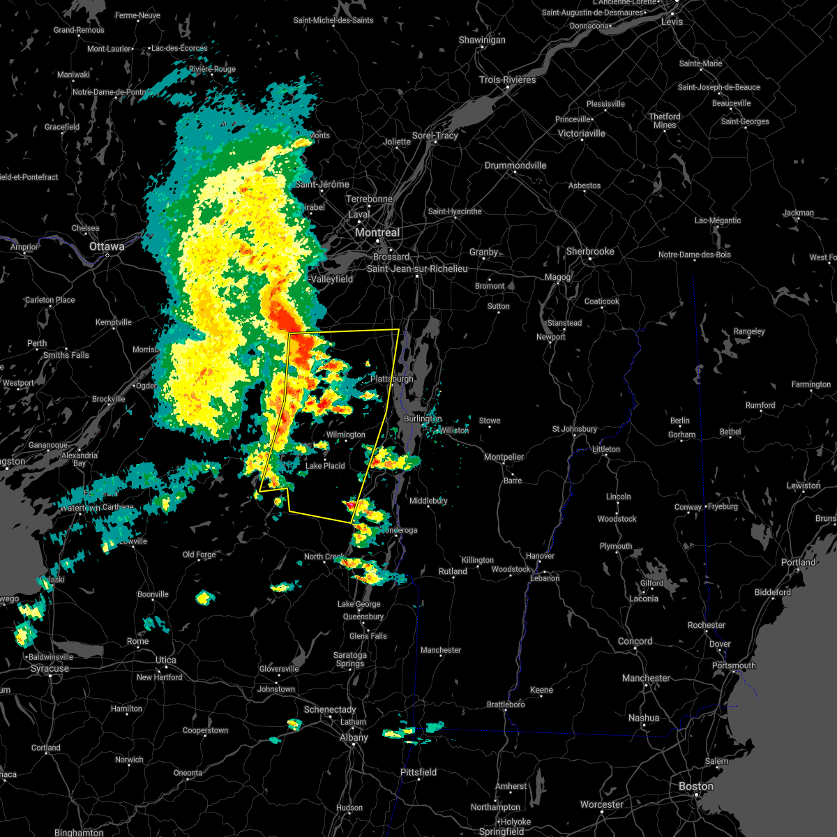
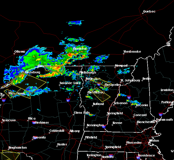
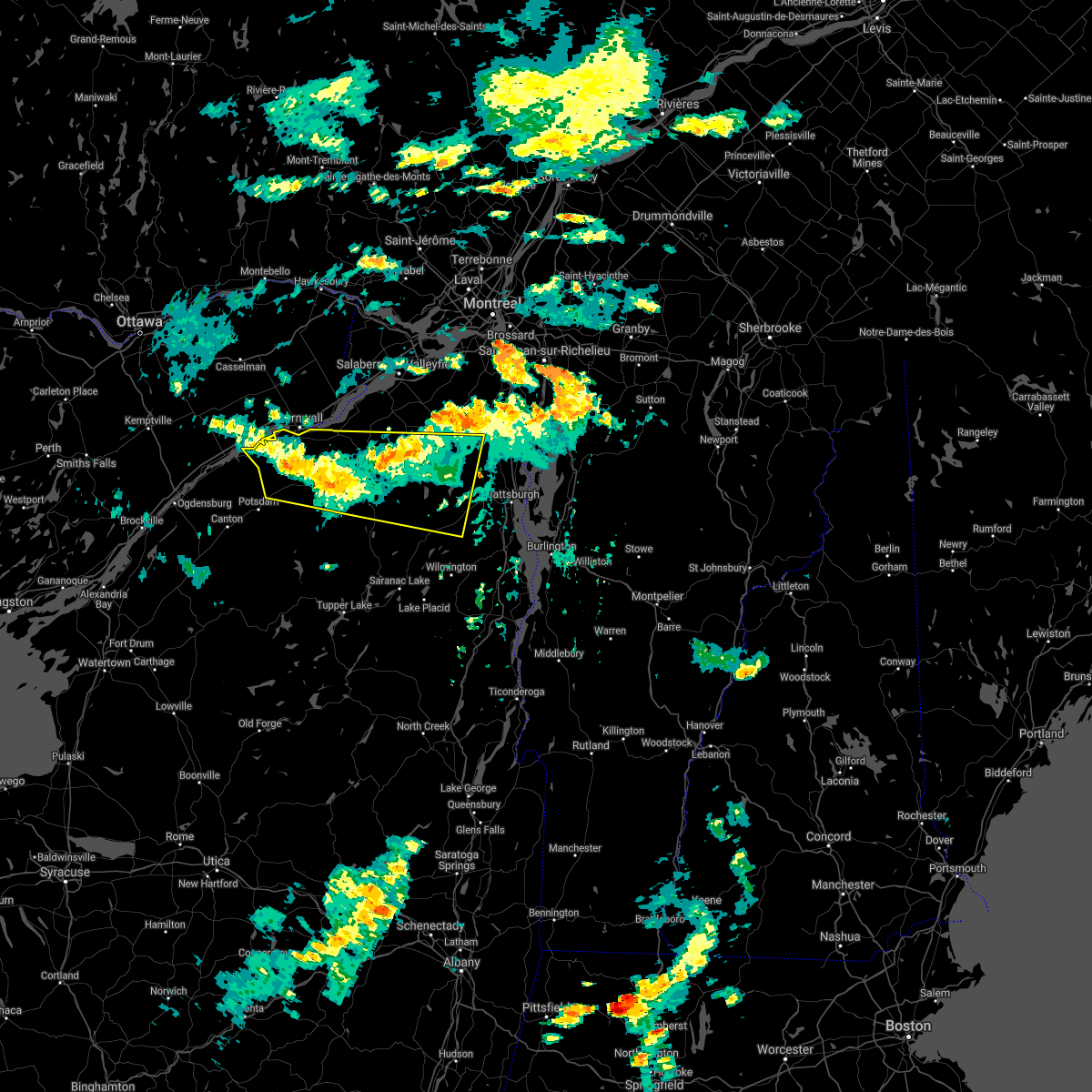
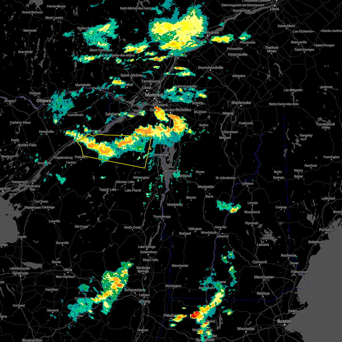
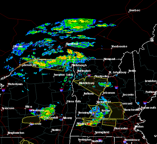
Hail Map for Redford, NY
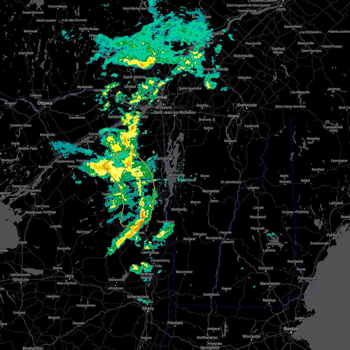
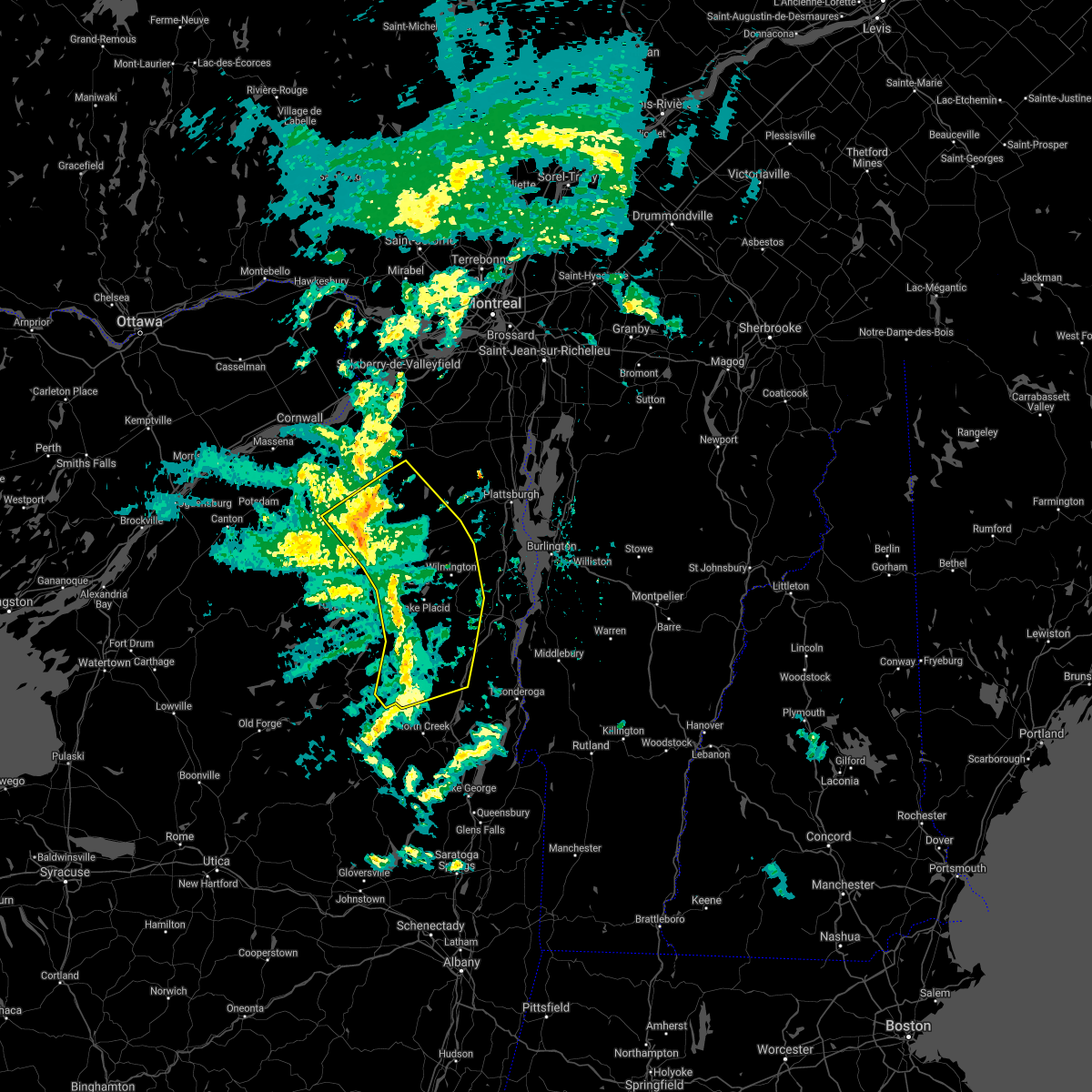
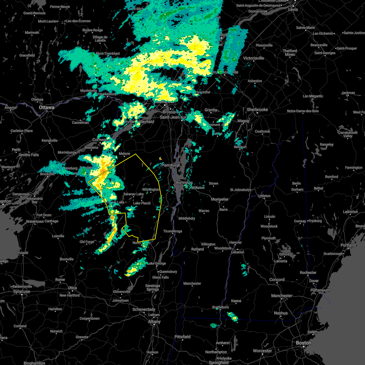
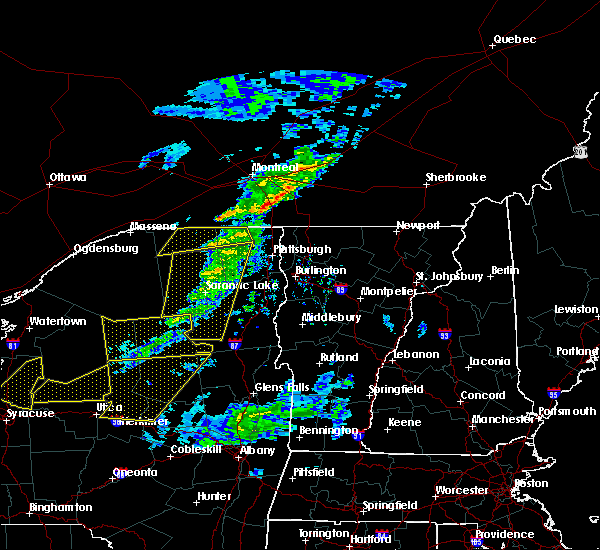
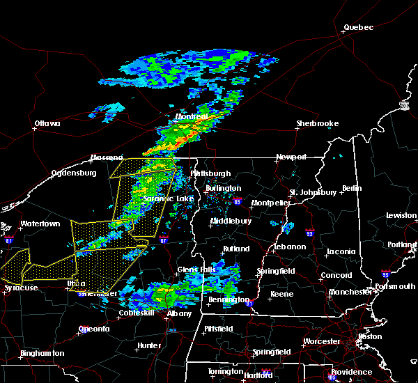
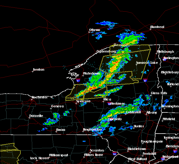
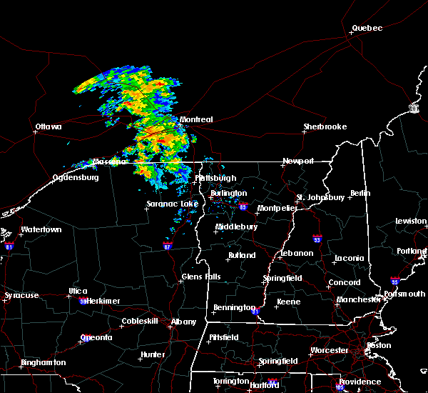
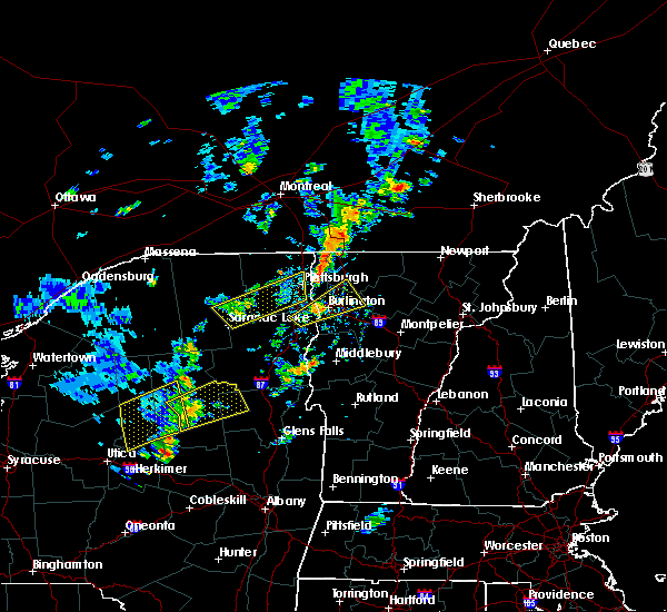
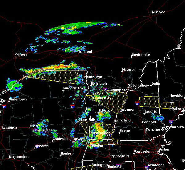
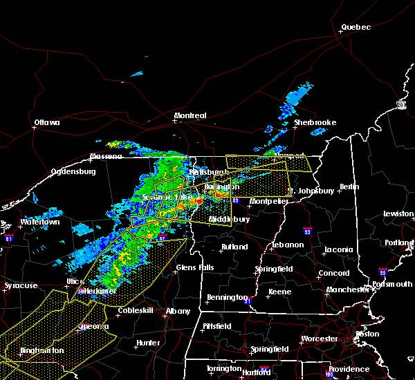
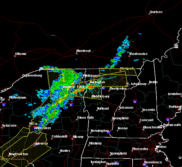
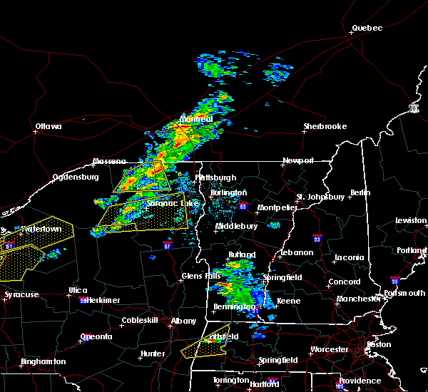
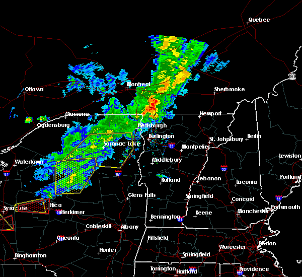
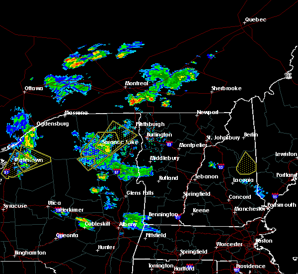
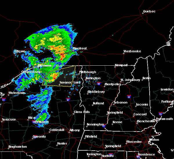
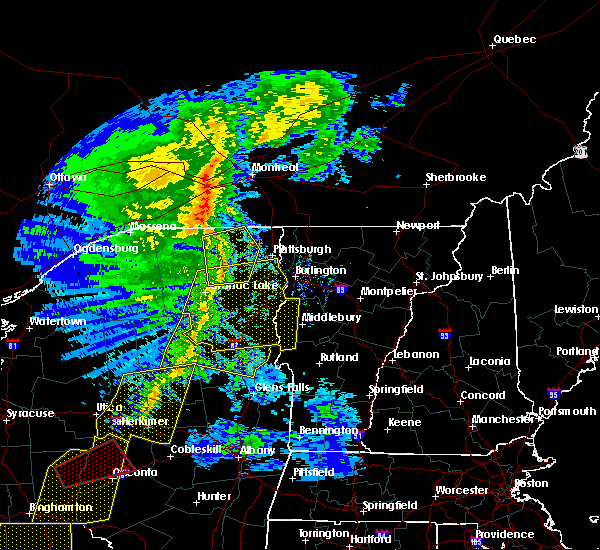
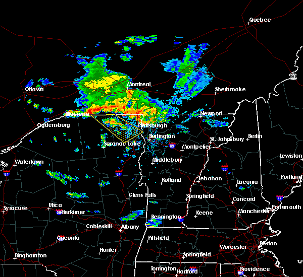
The Redford, NY area has had 2 reports of on-the-ground hail by trained spotters, and has been under severe weather warnings 2 times during the past 12 months. Doppler radar has detected hail at or near Redford, NY on 8 occasions, including 1 occasion during the past year.
| Name: | Redford, NY |
| Where Located: | 30.7 miles WNW of Burlington, VT |
| Map: | Google Map for Redford, NY |
| Population: | 477 |
| Housing Units: | 188 |
| More Info: | Search Google for Redford, NY |
0
The Top Recent Hail Date for Redford, NY is Sunday, July 9, 2023 (5th out of 8)
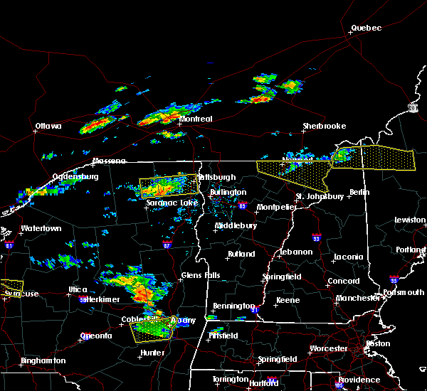
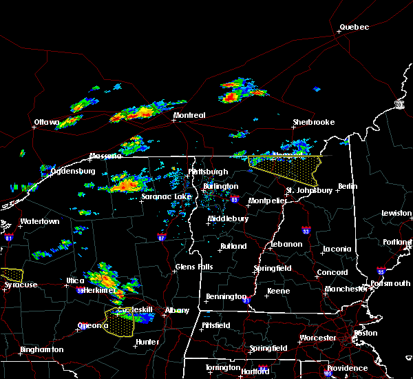
Hail and Wind Damage Spotted near Redford, NY
| Date / Time | Report Details |
|---|---|
| 7/24/2023 2:19 PM EDT |
 At 218 pm edt, a severe thunderstorm was located over jericho, moving northeast at 35 mph (radar indicated). Hazards include 60 mph wind gusts and quarter size hail. Minor hail damage to vehicles is possible. Expect wind damage to trees and powerlines. At 218 pm edt, a severe thunderstorm was located over jericho, moving northeast at 35 mph (radar indicated). Hazards include 60 mph wind gusts and quarter size hail. Minor hail damage to vehicles is possible. Expect wind damage to trees and powerlines.
|
| 9/22/2022 1:42 AM EDT |
 At 142 am edt, a severe thunderstorm was located near carry falls reservoir, moving east at 60 mph (radar indicated). Hazards include 60 mph wind gusts and quarter size hail. Minor hail damage to vehicles is possible. Expect wind damage to trees and powerlines. At 142 am edt, a severe thunderstorm was located near carry falls reservoir, moving east at 60 mph (radar indicated). Hazards include 60 mph wind gusts and quarter size hail. Minor hail damage to vehicles is possible. Expect wind damage to trees and powerlines.
|
| 7/25/2022 1:00 AM EDT |
 At 100 am edt, severe thunderstorms were located along a line extending from near mooers forks to moffitsville, moving east at 40 mph (radar indicated). Hazards include 60 mph wind gusts. Expect damage to trees and powerlines. locations impacted include, plattsburgh international airport, plattsburgh, beekmantown, schuyler falls, chazy, saranac, mooers, altona, ellenburg depot, champlain, isle la motte, lyon mountain, clayburg, jericho, dannemora, peasleeville, rouses point, alburgh village, alburgh and south hero. hail threat, radar indicated max hail size, <. 75 in wind threat, radar indicated max wind gust, 60 mph. At 100 am edt, severe thunderstorms were located along a line extending from near mooers forks to moffitsville, moving east at 40 mph (radar indicated). Hazards include 60 mph wind gusts. Expect damage to trees and powerlines. locations impacted include, plattsburgh international airport, plattsburgh, beekmantown, schuyler falls, chazy, saranac, mooers, altona, ellenburg depot, champlain, isle la motte, lyon mountain, clayburg, jericho, dannemora, peasleeville, rouses point, alburgh village, alburgh and south hero. hail threat, radar indicated max hail size, <. 75 in wind threat, radar indicated max wind gust, 60 mph.
|
| 7/25/2022 12:38 AM EDT |
 At 1237 am edt, severe thunderstorms were located along a line extending from 8 miles north of earlville to near wolf pond, moving east at 45 mph (radar indicated). Hazards include 60 mph wind gusts. Expect damage to trees and powerlines. locations impacted include, plattsburgh international airport, plattsburgh, beekmantown, schuyler falls, chazy, saranac, mooers, altona, ellenburg depot, champlain, bryants mill, churubusco, isle la motte, lyon mountain, merrill, clayburg, jericho, chateaugay, dannemora and peasleeville. hail threat, radar indicated max hail size, <. 75 in wind threat, radar indicated max wind gust, 60 mph. At 1237 am edt, severe thunderstorms were located along a line extending from 8 miles north of earlville to near wolf pond, moving east at 45 mph (radar indicated). Hazards include 60 mph wind gusts. Expect damage to trees and powerlines. locations impacted include, plattsburgh international airport, plattsburgh, beekmantown, schuyler falls, chazy, saranac, mooers, altona, ellenburg depot, champlain, bryants mill, churubusco, isle la motte, lyon mountain, merrill, clayburg, jericho, chateaugay, dannemora and peasleeville. hail threat, radar indicated max hail size, <. 75 in wind threat, radar indicated max wind gust, 60 mph.
|
| 7/25/2022 12:08 AM EDT |
 At 1208 am edt, severe thunderstorms were located along a line extending from near fort covington to madawaska, moving east at 45 mph (radar indicated). Hazards include 60 mph wind gusts. expect damage to trees and powerlines At 1208 am edt, severe thunderstorms were located along a line extending from near fort covington to madawaska, moving east at 45 mph (radar indicated). Hazards include 60 mph wind gusts. expect damage to trees and powerlines
|
| 6/16/2022 6:04 PM EDT |
 At 603 pm edt, severe thunderstorms were located along a line extending from near chasm falls to near bryants mill to 6 miles southeast of axton landing, moving east at 50 mph (law enforcement and utilities report numerous powerlines down in southern and central saint lawrence county). Hazards include 70 mph wind gusts and quarter size hail. Minor hail damage to vehicles is possible. expect considerable tree damage. wind damage is also likely to mobile homes, roofs, and outbuildings. locations impacted include, tupper lake, adirondack regional airport, saranac lake, lake placid, saranac, parishville, wilmington, keene, piercefield, bryants mill, wawbeek, lyon mountain, merrill, clayburg, carry falls reservoir, keene valley, cranberry lake, lawrenceville, au sable forks and debar mountain. thunderstorm damage threat, considerable hail threat, radar indicated max hail size, 1. 00 in wind threat, observed max wind gust, 70 mph. At 603 pm edt, severe thunderstorms were located along a line extending from near chasm falls to near bryants mill to 6 miles southeast of axton landing, moving east at 50 mph (law enforcement and utilities report numerous powerlines down in southern and central saint lawrence county). Hazards include 70 mph wind gusts and quarter size hail. Minor hail damage to vehicles is possible. expect considerable tree damage. wind damage is also likely to mobile homes, roofs, and outbuildings. locations impacted include, tupper lake, adirondack regional airport, saranac lake, lake placid, saranac, parishville, wilmington, keene, piercefield, bryants mill, wawbeek, lyon mountain, merrill, clayburg, carry falls reservoir, keene valley, cranberry lake, lawrenceville, au sable forks and debar mountain. thunderstorm damage threat, considerable hail threat, radar indicated max hail size, 1. 00 in wind threat, observed max wind gust, 70 mph.
|
| 6/16/2022 5:41 PM EDT |
 At 538 pm edt, severe thunderstorms were located along a line extending from nicholville to near lake ozonia to near horseshoe lake, moving east at 50 mph (law enforcement and utilities report numerous powerlines down in southern and central saint lawrence county). Hazards include 70 mph wind gusts and quarter size hail. Minor hail damage to vehicles is possible. expect considerable tree damage. Wind damage is also likely to mobile homes, roofs, and outbuildings. At 538 pm edt, severe thunderstorms were located along a line extending from nicholville to near lake ozonia to near horseshoe lake, moving east at 50 mph (law enforcement and utilities report numerous powerlines down in southern and central saint lawrence county). Hazards include 70 mph wind gusts and quarter size hail. Minor hail damage to vehicles is possible. expect considerable tree damage. Wind damage is also likely to mobile homes, roofs, and outbuildings.
|
| 10/16/2021 2:13 PM EDT | Trees down on east hill rd near burnt hill rd in clinton county NY, 5 miles WSW of Redford, NY |
| 10/16/2021 1:32 PM EDT |
 At 132 pm edt, severe thunderstorms were located along a line extending from near onchiota to 6 miles south of ray brook to 8 miles southwest of newcomb, moving northeast at 65 mph (radar indicated). Hazards include 60 mph wind gusts. expect damage to trees and powerlines At 132 pm edt, severe thunderstorms were located along a line extending from near onchiota to 6 miles south of ray brook to 8 miles southwest of newcomb, moving northeast at 65 mph (radar indicated). Hazards include 60 mph wind gusts. expect damage to trees and powerlines
|
| 7/20/2021 6:17 PM EDT |
 At 616 pm edt, a line of severe thunderstorms over northern new york was located along a line extending from near cannon corners to clayburg to near newcomb, moving east at 45 mph (radar indicated). Hazards include 60 mph wind gusts and quarter size hail. Expect wind damage to trees and powerlines. there have been numerous reports of downed trees and power outages across northern new york with this line of storms. minor hail damage to vehicles is possible. Locations impacted include, saranac lake, lake placid, plattsburgh, peru, beekmantown, schuyler falls, chazy, saranac, mooers, altona, wilmington, keene, ellenburg depot, champlain, lyon mountain, clayburg, merrill, keene valley, churubusco and au sable forks. At 616 pm edt, a line of severe thunderstorms over northern new york was located along a line extending from near cannon corners to clayburg to near newcomb, moving east at 45 mph (radar indicated). Hazards include 60 mph wind gusts and quarter size hail. Expect wind damage to trees and powerlines. there have been numerous reports of downed trees and power outages across northern new york with this line of storms. minor hail damage to vehicles is possible. Locations impacted include, saranac lake, lake placid, plattsburgh, peru, beekmantown, schuyler falls, chazy, saranac, mooers, altona, wilmington, keene, ellenburg depot, champlain, lyon mountain, clayburg, merrill, keene valley, churubusco and au sable forks.
|
| 7/20/2021 5:50 PM EDT |
 At 548 pm edt, a line of severe thunderstorms over northern new york was located along a line extending from north burke to debar mountain to 8 miles southwest of axton landing, moving east at 45 mph (radar indicated). Hazards include 60 mph wind gusts and quarter size hail. Expect wind damage to trees and powerlines as there have been numerous reports or trees and powerlines down along with power outages. Minor hail damage to vehicles is possible. At 548 pm edt, a line of severe thunderstorms over northern new york was located along a line extending from north burke to debar mountain to 8 miles southwest of axton landing, moving east at 45 mph (radar indicated). Hazards include 60 mph wind gusts and quarter size hail. Expect wind damage to trees and powerlines as there have been numerous reports or trees and powerlines down along with power outages. Minor hail damage to vehicles is possible.
|
| 6/21/2021 4:09 PM EDT |
 At 409 pm edt, a severe thunderstorm was located over moffitsville, moving northeast at 50 mph (radar indicated). Hazards include 60 mph wind gusts and quarter size hail. Minor hail damage to vehicles is possible. expect wind damage to trees and powerlines. Locations impacted include, peru, schuyler falls, saranac, altona, jericho, dannemora, peasleeville, clayburg, keeseville, port kent, black brook, south plattsburgh, west beekmantown, chazy lake, union falls, morrisonville, moffittsville, cadyville, ausable point and moffitsville. At 409 pm edt, a severe thunderstorm was located over moffitsville, moving northeast at 50 mph (radar indicated). Hazards include 60 mph wind gusts and quarter size hail. Minor hail damage to vehicles is possible. expect wind damage to trees and powerlines. Locations impacted include, peru, schuyler falls, saranac, altona, jericho, dannemora, peasleeville, clayburg, keeseville, port kent, black brook, south plattsburgh, west beekmantown, chazy lake, union falls, morrisonville, moffittsville, cadyville, ausable point and moffitsville.
|
| 6/21/2021 3:49 PM EDT |
 At 349 pm edt, a severe thunderstorm was located over loon lake, moving northeast at 50 mph (radar indicated). Hazards include 60 mph wind gusts and quarter size hail. Minor hail damage to vehicles is possible. expect wind damage to trees and powerlines. Locations impacted include, adirondack regional airport, saranac lake, peru, schuyler falls, saranac, altona, bryants mill, lyon mountain, clayburg, merrill, port kent, debar mountain, jericho, dannemora, peasleeville, keeseville, harrietstown, black brook, paul smiths and west beekmantown. At 349 pm edt, a severe thunderstorm was located over loon lake, moving northeast at 50 mph (radar indicated). Hazards include 60 mph wind gusts and quarter size hail. Minor hail damage to vehicles is possible. expect wind damage to trees and powerlines. Locations impacted include, adirondack regional airport, saranac lake, peru, schuyler falls, saranac, altona, bryants mill, lyon mountain, clayburg, merrill, port kent, debar mountain, jericho, dannemora, peasleeville, keeseville, harrietstown, black brook, paul smiths and west beekmantown.
|
| 6/21/2021 3:25 PM EDT |
 At 324 pm edt, a severe thunderstorm was located near st. regis mountain, moving northeast at 50 mph (radar indicated). Hazards include 60 mph wind gusts and quarter size hail. Minor hail damage to vehicles is possible. Expect wind damage to trees and powerlines. At 324 pm edt, a severe thunderstorm was located near st. regis mountain, moving northeast at 50 mph (radar indicated). Hazards include 60 mph wind gusts and quarter size hail. Minor hail damage to vehicles is possible. Expect wind damage to trees and powerlines.
|
| 3/26/2021 12:57 PM EDT |
 The severe thunderstorm warning for southwestern clinton, central franklin, northeastern st. lawrence and central essex counties will expire at 100 pm edt, the storms which prompted the warning have weakened below severe limits, and no longer pose an immediate threat to life or property. therefore, the warning will be allowed to expire. a severe thunderstorm watch remains in effect until 400 pm edt for northern new york. The severe thunderstorm warning for southwestern clinton, central franklin, northeastern st. lawrence and central essex counties will expire at 100 pm edt, the storms which prompted the warning have weakened below severe limits, and no longer pose an immediate threat to life or property. therefore, the warning will be allowed to expire. a severe thunderstorm watch remains in effect until 400 pm edt for northern new york.
|
| 3/26/2021 12:38 PM EDT |
 At 1237 pm edt, severe thunderstorms were located along a line extending from near santa clara to near paul smiths to lake clear to 7 miles northwest of tahawus to 6 miles west of vanderwhacker mountain, moving northeast at 50 mph (radar indicated). Hazards include 60 mph wind gusts. Expect damage to trees and powerlines. Locations impacted include, adirondack regional airport, saranac lake, lake placid, wilmington, keene, newcomb, bryants mill, lyon mountain, clayburg, merrill, keene valley, au sable forks, debar mountain, mount marcy, jay in essex county, madawaska, north elba, harrietstown, black brook and santa clara. At 1237 pm edt, severe thunderstorms were located along a line extending from near santa clara to near paul smiths to lake clear to 7 miles northwest of tahawus to 6 miles west of vanderwhacker mountain, moving northeast at 50 mph (radar indicated). Hazards include 60 mph wind gusts. Expect damage to trees and powerlines. Locations impacted include, adirondack regional airport, saranac lake, lake placid, wilmington, keene, newcomb, bryants mill, lyon mountain, clayburg, merrill, keene valley, au sable forks, debar mountain, mount marcy, jay in essex county, madawaska, north elba, harrietstown, black brook and santa clara.
|
| 3/26/2021 12:13 PM EDT |
 At 1213 pm edt, severe thunderstorms were located along a line extending from near stark to near childwold to piercefield to 11 miles southeast of horseshoe lake to 24 miles west of vanderwhacker mountain, moving northeast at 50 mph (radar indicated). Hazards include 60 mph wind gusts. expect damage to trees and powerlines At 1213 pm edt, severe thunderstorms were located along a line extending from near stark to near childwold to piercefield to 11 miles southeast of horseshoe lake to 24 miles west of vanderwhacker mountain, moving northeast at 50 mph (radar indicated). Hazards include 60 mph wind gusts. expect damage to trees and powerlines
|
| 3/20/2020 3:30 PM EDT | Trees down in clinton county NY, 6.8 miles W of Redford, NY |
| 3/20/2020 3:18 PM EDT | About a dozen trees blown down in clinton county NY, 4.9 miles ENE of Redford, NY |
| 3/20/2020 3:15 PM EDT |
 At 314 pm edt, severe thunderstorms were located along a line extending from standish to near ray brook, moving northeast at 70 mph (radar indicated. this line has a history of producing wind damage). Hazards include 60 mph wind gusts. expect damage to trees and powerlines At 314 pm edt, severe thunderstorms were located along a line extending from standish to near ray brook, moving northeast at 70 mph (radar indicated. this line has a history of producing wind damage). Hazards include 60 mph wind gusts. expect damage to trees and powerlines
|
| 3/20/2020 3:07 PM EDT |
 At 307 pm edt, severe thunderstorms were located along a line extending from duane center to near tupper lake, moving northeast at 60 mph (law enforcement. multiple damage reports in edwards, cranberry lake, and star lake, new york). Hazards include 60 mph wind gusts and penny size hail. Expect damage to trees and powerlines. Locations impacted include, tupper lake, adirondack regional airport, saranac lake, lake placid, saranac, wilmington, newcomb, bryants mill, wawbeek, lyon mountain, clayburg, merrill, debar mountain, mount marcy, dannemora, madawaska, north elba, harrietstown, santa clara and paul smiths. At 307 pm edt, severe thunderstorms were located along a line extending from duane center to near tupper lake, moving northeast at 60 mph (law enforcement. multiple damage reports in edwards, cranberry lake, and star lake, new york). Hazards include 60 mph wind gusts and penny size hail. Expect damage to trees and powerlines. Locations impacted include, tupper lake, adirondack regional airport, saranac lake, lake placid, saranac, wilmington, newcomb, bryants mill, wawbeek, lyon mountain, clayburg, merrill, debar mountain, mount marcy, dannemora, madawaska, north elba, harrietstown, santa clara and paul smiths.
|
| 3/20/2020 2:45 PM EDT |
 At 244 pm edt, severe thunderstorms were located along a line extending from higley flow state park to 6 miles south of aldrich, moving northeast at 75 mph (radar indicated). Hazards include 60 mph wind gusts and penny size hail. Expect damage to trees and powerlines. Locations impacted include, tupper lake, adirondack regional airport, saranac lake, lake placid, oswegatchie, saranac, parishville, colton, wilmington, newcomb, piercefield, bryants mill, wawbeek, lyon mountain, clayburg, merrill, carry falls reservoir, cranberry lake, debar mountain and mount marcy. At 244 pm edt, severe thunderstorms were located along a line extending from higley flow state park to 6 miles south of aldrich, moving northeast at 75 mph (radar indicated). Hazards include 60 mph wind gusts and penny size hail. Expect damage to trees and powerlines. Locations impacted include, tupper lake, adirondack regional airport, saranac lake, lake placid, oswegatchie, saranac, parishville, colton, wilmington, newcomb, piercefield, bryants mill, wawbeek, lyon mountain, clayburg, merrill, carry falls reservoir, cranberry lake, debar mountain and mount marcy.
|
| 3/20/2020 2:28 PM EDT |
 At 227 pm edt, severe thunderstorms were located along a line extending from near edwards to 19 miles southwest of pitcairn, moving northeast at 75 mph (radar indicated. fort drum reported 64 mph gust associated with this line). Hazards include 60 mph wind gusts and penny size hail. expect damage to trees and powerlines At 227 pm edt, severe thunderstorms were located along a line extending from near edwards to 19 miles southwest of pitcairn, moving northeast at 75 mph (radar indicated. fort drum reported 64 mph gust associated with this line). Hazards include 60 mph wind gusts and penny size hail. expect damage to trees and powerlines
|
| 10/1/2019 2:48 PM EDT |
 At 247 pm edt, a severe thunderstorm was located near brainardsville, moving east at 45 mph (radar indicated). Hazards include 60 mph wind gusts and quarter size hail. Minor hail damage to vehicles is possible. Expect wind damage to trees and powerlines. At 247 pm edt, a severe thunderstorm was located near brainardsville, moving east at 45 mph (radar indicated). Hazards include 60 mph wind gusts and quarter size hail. Minor hail damage to vehicles is possible. Expect wind damage to trees and powerlines.
|
| 7/30/2019 3:40 PM EDT |
 At 338 pm edt, a severe thunderstorm was located over vermontville, new york, moving northeast at 40 mph (radar indicated. at 328 pm, a gust of 60 mph was reported at saranac lake airport). Hazards include 60 mph wind gusts and penny size hail. expect damage to trees and powerlines At 338 pm edt, a severe thunderstorm was located over vermontville, new york, moving northeast at 40 mph (radar indicated. at 328 pm, a gust of 60 mph was reported at saranac lake airport). Hazards include 60 mph wind gusts and penny size hail. expect damage to trees and powerlines
|
| 6/29/2019 9:10 PM EDT |
 The severe thunderstorm warning for southern clinton, central franklin, east central st. lawrence and northwestern essex counties will expire at 915 pm edt, the storm which prompted the warning has exited franklin county and was weakening across essex county. therefore, the warning will be allowed to expire. however gusty winds are still possible with this thunderstorm. The severe thunderstorm warning for southern clinton, central franklin, east central st. lawrence and northwestern essex counties will expire at 915 pm edt, the storm which prompted the warning has exited franklin county and was weakening across essex county. therefore, the warning will be allowed to expire. however gusty winds are still possible with this thunderstorm.
|
| 6/29/2019 8:42 PM EDT |
 At 842 pm edt, a severe thunderstorm was located over wolf pond, moving southeast at 35 mph (radar indicated). Hazards include 60 mph wind gusts and penny size hail. Expect damage to trees and powerlines. Locations impacted include, adirondack regional airport, plattsburgh international airport, saranac lake, plattsburgh, schuyler falls, saranac, debar mountain, bryants mill, lyon mountain, peasleeville, clayburg, lake ozonia, madawaska, dannemora, harrietstown, santa clara, south plattsburgh, paul smiths, chazy lake and union falls. At 842 pm edt, a severe thunderstorm was located over wolf pond, moving southeast at 35 mph (radar indicated). Hazards include 60 mph wind gusts and penny size hail. Expect damage to trees and powerlines. Locations impacted include, adirondack regional airport, plattsburgh international airport, saranac lake, plattsburgh, schuyler falls, saranac, debar mountain, bryants mill, lyon mountain, peasleeville, clayburg, lake ozonia, madawaska, dannemora, harrietstown, santa clara, south plattsburgh, paul smiths, chazy lake and union falls.
|
| 6/29/2019 8:11 PM EDT |
 At 811 pm edt, a severe thunderstorm was located near bangor, moving southeast at 35 mph (radar indicated). Hazards include 60 mph wind gusts and quarter size hail. Minor hail damage to vehicles is possible. Expect wind damage to trees and powerlines. At 811 pm edt, a severe thunderstorm was located near bangor, moving southeast at 35 mph (radar indicated). Hazards include 60 mph wind gusts and quarter size hail. Minor hail damage to vehicles is possible. Expect wind damage to trees and powerlines.
|
| 6/18/2018 5:28 PM EDT |
 The severe thunderstorm warning for western clinton, northern franklin and northeastern st. lawrence counties will expire at 530 pm edt, the storm which prompted the warning has weakened below severe limits, and no longer poses an immediate threat to life or property. therefore, the warning will be allowed to expire. however gusty winds and heavy rain are still possible with this thunderstorm. a severe thunderstorm watch remains in effect until 1000 pm edt for northern new york. The severe thunderstorm warning for western clinton, northern franklin and northeastern st. lawrence counties will expire at 530 pm edt, the storm which prompted the warning has weakened below severe limits, and no longer poses an immediate threat to life or property. therefore, the warning will be allowed to expire. however gusty winds and heavy rain are still possible with this thunderstorm. a severe thunderstorm watch remains in effect until 1000 pm edt for northern new york.
|
| 6/18/2018 5:23 PM EDT |
 At 523 pm edt, a severe thunderstorm was located over ironton, moving east at 35 mph (radar indicated). Hazards include 60 mph wind gusts and penny size hail. Expect damage to trees and powerlines. Locations impacted include, massena, saranac, louisville, moira, altona, bangor, fort covington, bombay, ellenburg depot, bryants mill, massena international airport - richards field, helena, lyon mountain, burke, clayburg, merrill, brushton, lawrenceville, malone and churubusco. At 523 pm edt, a severe thunderstorm was located over ironton, moving east at 35 mph (radar indicated). Hazards include 60 mph wind gusts and penny size hail. Expect damage to trees and powerlines. Locations impacted include, massena, saranac, louisville, moira, altona, bangor, fort covington, bombay, ellenburg depot, bryants mill, massena international airport - richards field, helena, lyon mountain, burke, clayburg, merrill, brushton, lawrenceville, malone and churubusco.
|
| 6/18/2018 4:37 PM EDT |
 At 436 pm edt, a severe thunderstorm was located 7 miles northwest of coles creek state park, moving east at 35 mph (radar indicated). Hazards include 60 mph wind gusts and penny size hail. expect damage to trees and powerlines At 436 pm edt, a severe thunderstorm was located 7 miles northwest of coles creek state park, moving east at 35 mph (radar indicated). Hazards include 60 mph wind gusts and penny size hail. expect damage to trees and powerlines
|
| 5/4/2018 7:22 PM EDT |
 At 721 pm edt, severe thunderstorms were located along a line extending from near schuyler falls to near harkness to near st. huberts, moving east at 70 mph (radar indicated). Hazards include 60 mph wind gusts and quarter size hail. Minor hail damage to vehicles is possible. expect wind damage to trees and powerlines. locations impacted include, lake placid, schuyler falls, saranac, wilmington, keene, au sable forks, mount marcy, peasleeville, clayburg, jay in essex county, keene valley, north elba, black brook, upper jay, union falls, morrisonville, moffittsville, cadyville, clintonville and mount van hoevenberg. A tornado watch remains in effect until 1000 pm edt for northern new york. At 721 pm edt, severe thunderstorms were located along a line extending from near schuyler falls to near harkness to near st. huberts, moving east at 70 mph (radar indicated). Hazards include 60 mph wind gusts and quarter size hail. Minor hail damage to vehicles is possible. expect wind damage to trees and powerlines. locations impacted include, lake placid, schuyler falls, saranac, wilmington, keene, au sable forks, mount marcy, peasleeville, clayburg, jay in essex county, keene valley, north elba, black brook, upper jay, union falls, morrisonville, moffittsville, cadyville, clintonville and mount van hoevenberg. A tornado watch remains in effect until 1000 pm edt for northern new york.
|
| 5/4/2018 7:10 PM EDT |
 At 709 pm edt, severe thunderstorms were located along a line extending from fort covington center to near alder brook to near tahawus, moving east at 65 mph (radar indicated). Hazards include 60 mph wind gusts and quarter size hail. Minor hail damage to vehicles is possible. expect wind damage to trees and powerlines. locations impacted include, saranac lake, tupper lake, adirondack regional airport, lake placid, schuyler falls, saranac, moira, bangor, fort covington, bombay, wilmington, keene, ellenburg depot, bryants mill, wawbeek, burke, brushton, churubusco, au sable forks and mount marcy. A tornado watch remains in effect until 1000 pm edt for northern new york. At 709 pm edt, severe thunderstorms were located along a line extending from fort covington center to near alder brook to near tahawus, moving east at 65 mph (radar indicated). Hazards include 60 mph wind gusts and quarter size hail. Minor hail damage to vehicles is possible. expect wind damage to trees and powerlines. locations impacted include, saranac lake, tupper lake, adirondack regional airport, lake placid, schuyler falls, saranac, moira, bangor, fort covington, bombay, wilmington, keene, ellenburg depot, bryants mill, wawbeek, burke, brushton, churubusco, au sable forks and mount marcy. A tornado watch remains in effect until 1000 pm edt for northern new york.
|
| 5/4/2018 6:51 PM EDT |
 At 651 pm edt, severe thunderstorms were located along a line extending from norfolk to debar mountain to tahawus, moving northeast at 70 mph (radar indicated). Hazards include 60 mph wind gusts and quarter size hail. Minor hail damage to vehicles is possible. Expect wind damage to trees and powerlines. At 651 pm edt, severe thunderstorms were located along a line extending from norfolk to debar mountain to tahawus, moving northeast at 70 mph (radar indicated). Hazards include 60 mph wind gusts and quarter size hail. Minor hail damage to vehicles is possible. Expect wind damage to trees and powerlines.
|
| 5/4/2018 5:38 PM EDT |
 At 537 pm edt, a severe thunderstorm was located near santa clara, moving east at 60 mph (radar indicated). Hazards include 60 mph wind gusts and quarter size hail. Minor hail damage to vehicles is possible. expect wind damage to trees and powerlines. locations impacted include, bangor, malone, burke, churubusco, debar mountain, clayburg, merrill, bryants mill, chateaugay, lyon mountain, earlville, santa clara, chazy lake, redford, whippleville, duane center, burke center, harrigan, ellenburg center and owls head. A tornado watch remains in effect until 1000 pm edt for northern new york. At 537 pm edt, a severe thunderstorm was located near santa clara, moving east at 60 mph (radar indicated). Hazards include 60 mph wind gusts and quarter size hail. Minor hail damage to vehicles is possible. expect wind damage to trees and powerlines. locations impacted include, bangor, malone, burke, churubusco, debar mountain, clayburg, merrill, bryants mill, chateaugay, lyon mountain, earlville, santa clara, chazy lake, redford, whippleville, duane center, burke center, harrigan, ellenburg center and owls head. A tornado watch remains in effect until 1000 pm edt for northern new york.
|
| 5/4/2018 4:49 PM EDT |
 At 448 pm edt, a severe thunderstorm was located over converse, moving northeast at 40 mph (radar indicated). Hazards include 60 mph wind gusts and quarter size hail. Minor hail damage to vehicles is possible. Expect wind damage to trees and powerlines. At 448 pm edt, a severe thunderstorm was located over converse, moving northeast at 40 mph (radar indicated). Hazards include 60 mph wind gusts and quarter size hail. Minor hail damage to vehicles is possible. Expect wind damage to trees and powerlines.
|
| 8/22/2017 4:14 PM EDT |
 At 413 pm edt, severe thunderstorms were located along a line extending from loon lake to saranac inn, moving northeast at 45 mph (radar indicated). Hazards include 70 mph wind gusts. Expect considerable tree damage. damage is likely to mobile homes, roofs, and outbuildings. locations impacted include, tupper lake, adirondack regional airport, saranac lake, lake placid, schuyler falls, wilmington, elizabethtown, keene, newcomb, piercefield, wawbeek, clayburg, keene valley, au sable forks, debar mountain, mount marcy, peasleeville, horseshoe lake, jay in essex county and madawaska. A tornado watch remains in effect until 900 pm edt for northern new york. At 413 pm edt, severe thunderstorms were located along a line extending from loon lake to saranac inn, moving northeast at 45 mph (radar indicated). Hazards include 70 mph wind gusts. Expect considerable tree damage. damage is likely to mobile homes, roofs, and outbuildings. locations impacted include, tupper lake, adirondack regional airport, saranac lake, lake placid, schuyler falls, wilmington, elizabethtown, keene, newcomb, piercefield, wawbeek, clayburg, keene valley, au sable forks, debar mountain, mount marcy, peasleeville, horseshoe lake, jay in essex county and madawaska. A tornado watch remains in effect until 900 pm edt for northern new york.
|
| 8/22/2017 3:42 PM EDT |
 At 341 pm edt, severe thunderstorms were located along a line extending from near madawaska to near tupper lake to 7 miles south of wanakena, moving east at 35 mph (radar indicated). Hazards include 60 mph wind gusts and quarter size hail. Minor hail damage to vehicles is possible. Expect wind damage to trees and powerlines. At 341 pm edt, severe thunderstorms were located along a line extending from near madawaska to near tupper lake to 7 miles south of wanakena, moving east at 35 mph (radar indicated). Hazards include 60 mph wind gusts and quarter size hail. Minor hail damage to vehicles is possible. Expect wind damage to trees and powerlines.
|
| 8/4/2017 7:37 PM EDT |
 The severe thunderstorm warning for southern clinton county will expire at 745 pm edt, the storm which prompted the warning has weakened below severe limits, and no longer pose an immediate threat to life or property. therefore the warning will be allowed to expire. however heavy rain is still possible with this thunderstorm. The severe thunderstorm warning for southern clinton county will expire at 745 pm edt, the storm which prompted the warning has weakened below severe limits, and no longer pose an immediate threat to life or property. therefore the warning will be allowed to expire. however heavy rain is still possible with this thunderstorm.
|
| 8/4/2017 7:19 PM EDT |
 At 719 pm edt, a severe thunderstorm was located over peasleeville, moving northeast at 40 mph (radar indicated). Hazards include 60 mph wind gusts and nickel size hail. Expect damage to trees and powerlines. Locations impacted include, peru, schuyler falls, saranac, peasleeville, au sable forks, clayburg, dannemora, keeseville, black brook, hawkeye, redford, ausable chasm, moffittsville, riverview, laphams mills, clintonville, moffitsville and harkness. At 719 pm edt, a severe thunderstorm was located over peasleeville, moving northeast at 40 mph (radar indicated). Hazards include 60 mph wind gusts and nickel size hail. Expect damage to trees and powerlines. Locations impacted include, peru, schuyler falls, saranac, peasleeville, au sable forks, clayburg, dannemora, keeseville, black brook, hawkeye, redford, ausable chasm, moffittsville, riverview, laphams mills, clintonville, moffitsville and harkness.
|
| 8/4/2017 6:40 PM EDT |
 At 639 pm edt, a severe thunderstorm was located near lake placid, moving northeast at 35 mph (radar indicated). Hazards include 60 mph wind gusts and nickel size hail. expect damage to trees and powerlines At 639 pm edt, a severe thunderstorm was located near lake placid, moving northeast at 35 mph (radar indicated). Hazards include 60 mph wind gusts and nickel size hail. expect damage to trees and powerlines
|
| 7/8/2017 7:15 AM EDT |
 At 715 am edt, severe thunderstorms were located along a line extending from beekmantown to laphams mills to north jay, moving east at 45 mph (radar indicated). Hazards include 60 mph wind gusts. Expect damage to trees and powerlines. locations impacted include, essex junction, burlington international airport, plattsburgh, plattsburgh international airport, south burlington, burlington, peru, beekmantown, schuyler falls, saranac, willsboro, colchester, essex junction village, georgia, au sable forks, grand isle, st. Albans town, jay in essex county, north hero and milton. At 715 am edt, severe thunderstorms were located along a line extending from beekmantown to laphams mills to north jay, moving east at 45 mph (radar indicated). Hazards include 60 mph wind gusts. Expect damage to trees and powerlines. locations impacted include, essex junction, burlington international airport, plattsburgh, plattsburgh international airport, south burlington, burlington, peru, beekmantown, schuyler falls, saranac, willsboro, colchester, essex junction village, georgia, au sable forks, grand isle, st. Albans town, jay in essex county, north hero and milton.
|
| 7/8/2017 7:04 AM EDT |
 At 703 am edt, severe thunderstorms were located along a line extending from jericho to near peasleeville to near wilmington, moving east at 30 mph (radar indicated). Hazards include 60 mph wind gusts. Expect damage to trees and powerlines. locations impacted include, essex junction, burlington international airport, adirondack regional airport, plattsburgh, plattsburgh international airport, south burlington, burlington, saranac lake, peru, beekmantown, schuyler falls, saranac, willsboro, wilmington, colchester, essex junction village, georgia, au sable forks, grand isle and st. Albans town. At 703 am edt, severe thunderstorms were located along a line extending from jericho to near peasleeville to near wilmington, moving east at 30 mph (radar indicated). Hazards include 60 mph wind gusts. Expect damage to trees and powerlines. locations impacted include, essex junction, burlington international airport, adirondack regional airport, plattsburgh, plattsburgh international airport, south burlington, burlington, saranac lake, peru, beekmantown, schuyler falls, saranac, willsboro, wilmington, colchester, essex junction village, georgia, au sable forks, grand isle and st. Albans town.
|
| 7/8/2017 6:29 AM EDT |
 At 628 am edt, severe thunderstorms were located along a line extending from merrill to near loon lake to adirondack regional airport, moving east at 30 mph (radar indicated). Hazards include 60 mph wind gusts and quarter size hail. Minor hail damage to vehicles is possible. Expect wind damage to trees and powerlines. At 628 am edt, severe thunderstorms were located along a line extending from merrill to near loon lake to adirondack regional airport, moving east at 30 mph (radar indicated). Hazards include 60 mph wind gusts and quarter size hail. Minor hail damage to vehicles is possible. Expect wind damage to trees and powerlines.
|
| 7/8/2017 6:17 AM EDT |
 At 617 am edt, severe thunderstorms were located along a line extending from bryants mill to near debar mountain to st. regis mountain, moving east at 45 mph (radar indicated). Hazards include 60 mph wind gusts and quarter size hail. Minor hail damage to vehicles is possible. expect wind damage to trees and powerlines. Locations impacted include, adirondack regional airport, saranac lake, lake placid, saranac, mooers, altona, wilmington, ellenburg depot, bryants mill, lyon mountain, clayburg, merrill, debar mountain, jericho, dannemora, peasleeville, jay in essex county, madawaska, au sable forks and harrietstown. At 617 am edt, severe thunderstorms were located along a line extending from bryants mill to near debar mountain to st. regis mountain, moving east at 45 mph (radar indicated). Hazards include 60 mph wind gusts and quarter size hail. Minor hail damage to vehicles is possible. expect wind damage to trees and powerlines. Locations impacted include, adirondack regional airport, saranac lake, lake placid, saranac, mooers, altona, wilmington, ellenburg depot, bryants mill, lyon mountain, clayburg, merrill, debar mountain, jericho, dannemora, peasleeville, jay in essex county, madawaska, au sable forks and harrietstown.
|
| 7/8/2017 6:04 AM EDT |
 At 604 am edt, severe thunderstorms were located along a line extending from near duane center to near debar mountain to 6 miles west of st. regis mountain, moving east at 45 mph (radar indicated). Hazards include 60 mph wind gusts and quarter size hail. Minor hail damage to vehicles is possible. expect wind damage to trees and powerlines. Locations impacted include, adirondack regional airport, saranac lake, lake placid, saranac, mooers, altona, bangor, wilmington, ellenburg depot, bryants mill, lyon mountain, clayburg, merrill, debar mountain, jericho, dannemora, peasleeville, jay in essex county, lake ozonia and madawaska. At 604 am edt, severe thunderstorms were located along a line extending from near duane center to near debar mountain to 6 miles west of st. regis mountain, moving east at 45 mph (radar indicated). Hazards include 60 mph wind gusts and quarter size hail. Minor hail damage to vehicles is possible. expect wind damage to trees and powerlines. Locations impacted include, adirondack regional airport, saranac lake, lake placid, saranac, mooers, altona, bangor, wilmington, ellenburg depot, bryants mill, lyon mountain, clayburg, merrill, debar mountain, jericho, dannemora, peasleeville, jay in essex county, lake ozonia and madawaska.
|
| 7/8/2017 5:55 AM EDT |
 At 555 am edt, severe thunderstorms were located along a line extending from near duane center to near madawaska to 9 miles west of st. regis mountain, moving east at 45 mph (radar indicated). Hazards include 60 mph wind gusts and quarter size hail. Minor hail damage to vehicles is possible. expect wind damage to trees and powerlines. Locations impacted include, adirondack regional airport, saranac lake, lake placid, saranac, mooers, altona, wilmington, ellenburg depot, bryants mill, lyon mountain, clayburg, merrill, carry falls reservoir, debar mountain, jericho, dannemora, peasleeville, jay in essex county, lake ozonia and madawaska. At 555 am edt, severe thunderstorms were located along a line extending from near duane center to near madawaska to 9 miles west of st. regis mountain, moving east at 45 mph (radar indicated). Hazards include 60 mph wind gusts and quarter size hail. Minor hail damage to vehicles is possible. expect wind damage to trees and powerlines. Locations impacted include, adirondack regional airport, saranac lake, lake placid, saranac, mooers, altona, wilmington, ellenburg depot, bryants mill, lyon mountain, clayburg, merrill, carry falls reservoir, debar mountain, jericho, dannemora, peasleeville, jay in essex county, lake ozonia and madawaska.
|
| 7/8/2017 5:31 AM EDT |
 At 531 am edt, severe thunderstorms were located along a line extending from near hopkinton to 6 miles north of carry falls reservoir to near stark, moving east at 45 mph (radar indicated). Hazards include 60 mph wind gusts and quarter size hail. Minor hail damage to vehicles is possible. Expect wind damage to trees and powerlines. At 531 am edt, severe thunderstorms were located along a line extending from near hopkinton to 6 miles north of carry falls reservoir to near stark, moving east at 45 mph (radar indicated). Hazards include 60 mph wind gusts and quarter size hail. Minor hail damage to vehicles is possible. Expect wind damage to trees and powerlines.
|
| 5/1/2017 8:49 PM EDT |
 At 848 pm edt, severe thunderstorms were located along a line extending from near harkness to st. huberts to near south schroon, moving east at 50 mph (radar indicated). Hazards include 60 mph wind gusts. Expect damage to roofs, siding, and trees. Locations impacted include, plattsburgh international airport, essex, peru, willsboro, crown point, westport, wilmington, elizabethtown, minerva, schroon lake, au sable forks, mount marcy, jay in essex county, ferrisburg, clayburg, keene valley, port kent, kingsland bay state park, d a r state park and crown point center. At 848 pm edt, severe thunderstorms were located along a line extending from near harkness to st. huberts to near south schroon, moving east at 50 mph (radar indicated). Hazards include 60 mph wind gusts. Expect damage to roofs, siding, and trees. Locations impacted include, plattsburgh international airport, essex, peru, willsboro, crown point, westport, wilmington, elizabethtown, minerva, schroon lake, au sable forks, mount marcy, jay in essex county, ferrisburg, clayburg, keene valley, port kent, kingsland bay state park, d a r state park and crown point center.
|
| 5/1/2017 8:36 PM EDT | Trees and powerlines down in clinton county NY, 4.6 miles SW of Redford, NY |
| 5/1/2017 8:31 PM EDT | Trees and powerlines down in clinton county NY, 0.5 miles SW of Redford, NY |
| 5/1/2017 8:27 PM EDT |
 At 826 pm edt, severe thunderstorms were located along a line extending from near whippleville to bryants mill to vermontville, moving northeast at 45 mph (radar indicated). Hazards include 60 mph wind gusts. Expect damage to roofs, siding, and trees. Locations impacted include, altona, ellenburg depot, bryants mill, jericho, lyon mountain, peasleeville, merrill, clayburg, saranac, ellenburg, black brook, irona, chazy lake, union falls, moffittsville, cadyville, cannon corners, ellenburg center, moffitsville and standish. At 826 pm edt, severe thunderstorms were located along a line extending from near whippleville to bryants mill to vermontville, moving northeast at 45 mph (radar indicated). Hazards include 60 mph wind gusts. Expect damage to roofs, siding, and trees. Locations impacted include, altona, ellenburg depot, bryants mill, jericho, lyon mountain, peasleeville, merrill, clayburg, saranac, ellenburg, black brook, irona, chazy lake, union falls, moffittsville, cadyville, cannon corners, ellenburg center, moffitsville and standish.
|
| 5/1/2017 8:22 PM EDT |
 At 821 pm edt, severe thunderstorms were located along a line extending from near loon lake to near coreys to near long lake, moving east at 50 mph (radar indicated). Hazards include 60 mph wind gusts. expect damage to roofs, siding, and trees At 821 pm edt, severe thunderstorms were located along a line extending from near loon lake to near coreys to near long lake, moving east at 50 mph (radar indicated). Hazards include 60 mph wind gusts. expect damage to roofs, siding, and trees
|
| 5/1/2017 8:05 PM EDT |
 At 804 pm edt, severe thunderstorms were located along a line extending from near nicholville to near st. regis falls to near madawaska to 7 miles west of saranac inn, moving northeast at 55 mph. this storm has a history of producing wind damage with reports of damage in fine and russell new york (radar indicated). Hazards include 60 mph wind gusts. Expect damage to roofs, siding, and trees. Locations impacted include, adirondack regional airport, altona, bangor, ellenburg depot, bryants mill, lyon mountain, merrill, clayburg, churubusco, debar mountain, jericho, peasleeville, madawaska, harrietstown, dickinson, saranac, moira, ellenburg, constable and black brook. At 804 pm edt, severe thunderstorms were located along a line extending from near nicholville to near st. regis falls to near madawaska to 7 miles west of saranac inn, moving northeast at 55 mph. this storm has a history of producing wind damage with reports of damage in fine and russell new york (radar indicated). Hazards include 60 mph wind gusts. Expect damage to roofs, siding, and trees. Locations impacted include, adirondack regional airport, altona, bangor, ellenburg depot, bryants mill, lyon mountain, merrill, clayburg, churubusco, debar mountain, jericho, peasleeville, madawaska, harrietstown, dickinson, saranac, moira, ellenburg, constable and black brook.
|
| 5/1/2017 7:43 PM EDT |
 At 742 pm edt, severe thunderstorms were located along a line extending from near west parishville to near parishville to near carry falls reservoir to childwold, moving northeast at 60 mph. this storm has a history of producing wind damage with reports of damage in fine and russell new york (radar indicated). Hazards include 60 mph wind gusts. expect damage to roofs, siding, and trees At 742 pm edt, severe thunderstorms were located along a line extending from near west parishville to near parishville to near carry falls reservoir to childwold, moving northeast at 60 mph. this storm has a history of producing wind damage with reports of damage in fine and russell new york (radar indicated). Hazards include 60 mph wind gusts. expect damage to roofs, siding, and trees
|
| 7/23/2016 3:08 PM EDT |
 At 308 pm edt, a severe thunderstorm was located over chazy lake, moving southeast at 55 mph (radar indicated). Hazards include 60 mph wind gusts and quarter size hail. Hail damage to vehicles is expected. expect wind damage to roofs, siding, and trees. Locations impacted include, plattsburgh international airport, peru, dannemora, chateaugay, burke, jericho, merrill, peasleeville, lyon mountain, ellenburg depot, clayburg, churubusco, schuyler falls, saranac, russia, ellenburg, black brook, moffittsville, moffitsville and ellenburg center. At 308 pm edt, a severe thunderstorm was located over chazy lake, moving southeast at 55 mph (radar indicated). Hazards include 60 mph wind gusts and quarter size hail. Hail damage to vehicles is expected. expect wind damage to roofs, siding, and trees. Locations impacted include, plattsburgh international airport, peru, dannemora, chateaugay, burke, jericho, merrill, peasleeville, lyon mountain, ellenburg depot, clayburg, churubusco, schuyler falls, saranac, russia, ellenburg, black brook, moffittsville, moffitsville and ellenburg center.
|
| 7/23/2016 2:36 PM EDT |
 At 235 pm edt, a severe thunderstorm was located near north burke, moving southeast at 50 mph (radar indicated). Hazards include 60 mph wind gusts and quarter size hail. Hail damage to vehicles is expected. Expect wind damage to roofs, siding, and trees. At 235 pm edt, a severe thunderstorm was located near north burke, moving southeast at 50 mph (radar indicated). Hazards include 60 mph wind gusts and quarter size hail. Hail damage to vehicles is expected. Expect wind damage to roofs, siding, and trees.
|
| 7/22/2016 10:58 PM EDT |
 The severe thunderstorm warning for southern clinton, southeastern st. lawrence, southern franklin, essex, central chittenden and northwestern addison counties will expire at 1100 pm edt, the storms which prompted the warning will move out of the area. therefore the warning will be allowed to expire but a new severe thunderstorm warning has been issued for portions of eastern essex county new york eastward across vermont. The severe thunderstorm warning for southern clinton, southeastern st. lawrence, southern franklin, essex, central chittenden and northwestern addison counties will expire at 1100 pm edt, the storms which prompted the warning will move out of the area. therefore the warning will be allowed to expire but a new severe thunderstorm warning has been issued for portions of eastern essex county new york eastward across vermont.
|
| 7/22/2016 10:06 PM EDT |
 At 1004 pm edt, severe thunderstorms were located along a line extending from saranac to near gale, moving southeast at 35 mph (radar indicated). Hazards include 60 mph wind gusts and quarter size hail. Hail damage to vehicles is expected. Expect wind damage to roofs, siding, and trees. At 1004 pm edt, severe thunderstorms were located along a line extending from saranac to near gale, moving southeast at 35 mph (radar indicated). Hazards include 60 mph wind gusts and quarter size hail. Hail damage to vehicles is expected. Expect wind damage to roofs, siding, and trees.
|
| 7/18/2016 3:22 PM EDT |
 The severe thunderstorm warning for southern clinton, northeastern essex, southwestern grand isle and west central chittenden counties will expire at 330 pm edt, the storm which prompted the warning has weakened below severe limits, and have exited the warned area. therefore the warning will be allowed to expire. however small hail, gusty winds and heavy rain are still possible with this thunderstorm. a severe thunderstorm watch remains in effect until 800 pm edt for northern new york, and northwestern vermont. The severe thunderstorm warning for southern clinton, northeastern essex, southwestern grand isle and west central chittenden counties will expire at 330 pm edt, the storm which prompted the warning has weakened below severe limits, and have exited the warned area. therefore the warning will be allowed to expire. however small hail, gusty winds and heavy rain are still possible with this thunderstorm. a severe thunderstorm watch remains in effect until 800 pm edt for northern new york, and northwestern vermont.
|
| 7/18/2016 2:51 PM EDT |
 At 250 pm edt, a severe thunderstorm was located near wilmington, moving east at 35 mph (radar indicated). Hazards include 60 mph wind gusts and half dollar size hail. Hail damage to vehicles is expected. expect wind damage to roofs, siding, and trees. locations impacted include, plattsburgh international airport, peru, south hero, wilmington, clayburg, au sable forks, peasleeville, jay in essex county, port kent, schuyler falls, saranac, keeseville, black brook, clintonville, ausable chasm, stave island, hatch point, south plattsburgh, corlaer bay and grand isle state park. At 250 pm edt, a severe thunderstorm was located near wilmington, moving east at 35 mph (radar indicated). Hazards include 60 mph wind gusts and half dollar size hail. Hail damage to vehicles is expected. expect wind damage to roofs, siding, and trees. locations impacted include, plattsburgh international airport, peru, south hero, wilmington, clayburg, au sable forks, peasleeville, jay in essex county, port kent, schuyler falls, saranac, keeseville, black brook, clintonville, ausable chasm, stave island, hatch point, south plattsburgh, corlaer bay and grand isle state park.
|
| 7/18/2016 2:26 PM EDT |
 At 226 pm edt, a severe thunderstorm was located over rainbow lake in new york, moving east at 40 mph (radar indicated). Hazards include 60 mph wind gusts and quarter size hail. Hail damage to vehicles is expected. Expect wind damage to roofs, siding, and trees. At 226 pm edt, a severe thunderstorm was located over rainbow lake in new york, moving east at 40 mph (radar indicated). Hazards include 60 mph wind gusts and quarter size hail. Hail damage to vehicles is expected. Expect wind damage to roofs, siding, and trees.
|
| 7/18/2016 1:10 PM EDT |
 The severe thunderstorm warning for central clinton and east central franklin counties will expire at 115 pm edt, the storm which prompted the warning has moved out of the area. therefore the warning will be allowed to expire. a severe thunderstorm warning still remains in effect for eastern clinton county as this storm nears the ny border of lake champlain. a severe thunderstorm watch remains in effect until 800 pm edt for northern new york. The severe thunderstorm warning for central clinton and east central franklin counties will expire at 115 pm edt, the storm which prompted the warning has moved out of the area. therefore the warning will be allowed to expire. a severe thunderstorm warning still remains in effect for eastern clinton county as this storm nears the ny border of lake champlain. a severe thunderstorm watch remains in effect until 800 pm edt for northern new york.
|
| 7/18/2016 12:43 PM EDT |
 At 1242 pm edt, a severe thunderstorm was located over riverview, moving east at 45 mph (radar indicated). Hazards include 60 mph wind gusts and quarter size hail. Hail damage to vehicles is expected. expect wind damage to roofs, siding, and trees. locations impacted include, plattsburgh international airport, peru, beekmantown, dannemora, jericho, merrill, peasleeville, bryants mill, lyon mountain, clayburg, schuyler falls, saranac, russia, riverview, moffittsville, owls head, moffitsville, ausable point, wolf pond and cumberland bay. At 1242 pm edt, a severe thunderstorm was located over riverview, moving east at 45 mph (radar indicated). Hazards include 60 mph wind gusts and quarter size hail. Hail damage to vehicles is expected. expect wind damage to roofs, siding, and trees. locations impacted include, plattsburgh international airport, peru, beekmantown, dannemora, jericho, merrill, peasleeville, bryants mill, lyon mountain, clayburg, schuyler falls, saranac, russia, riverview, moffittsville, owls head, moffitsville, ausable point, wolf pond and cumberland bay.
|
| 7/18/2016 12:16 PM EDT |
 At 1216 pm edt, a severe thunderstorm was located near debar mountain, moving east at 45 mph (radar indicated). Hazards include 60 mph wind gusts and quarter size hail. Hail damage to vehicles is expected. Expect wind damage to roofs, siding, and trees. At 1216 pm edt, a severe thunderstorm was located near debar mountain, moving east at 45 mph (radar indicated). Hazards include 60 mph wind gusts and quarter size hail. Hail damage to vehicles is expected. Expect wind damage to roofs, siding, and trees.
|
| 6/9/2015 3:27 PM EDT | The severe thunderstorm warning for southern clinton, east central franklin, northeastern essex, southern grand isle, western chittenden and northwestern addison counties will expire at 330 pm edt, the storm which prompted the warning has weakened below severe limits, and no longer poses an immediate threat to life or property. therefore the warning will be allowed to expire. however gusty winds and heavy rain are still possible with this thunderstorm. |
| 6/9/2015 3:27 PM EDT | The severe thunderstorm warning for southern clinton, east central franklin, northeastern essex, southern grand isle, western chittenden and northwestern addison counties will expire at 330 pm edt, the storm which prompted the warning has weakened below severe limits, and no longer poses an immediate threat to life or property. therefore the warning will be allowed to expire. however gusty winds and heavy rain are still possible with this thunderstorm. |
| 6/9/2015 2:58 PM EDT |
 A severe thunderstorm warning remains in effect until 330 pm edt for southern clinton. east central franklin. northeastern essex. southern grand isle. western chittenden and northwestern addison counties. at 258 pm edt. Doppler radar indicated a severe thunderstorm capable of producing quarter size hail and damaging winds in excess of 60. A severe thunderstorm warning remains in effect until 330 pm edt for southern clinton. east central franklin. northeastern essex. southern grand isle. western chittenden and northwestern addison counties. at 258 pm edt. Doppler radar indicated a severe thunderstorm capable of producing quarter size hail and damaging winds in excess of 60.
|
| 6/9/2015 2:43 PM EDT |
 At 242 pm edt, doppler radar indicated a severe thunderstorm capable of producing quarter size hail and damaging winds in excess of 60 mph. this storm was located near wilmington, moving northeast at 35 mph. locations impacted include, plattsburgh international airport, adirondack regional airport, essex, shelburne, peru, grand isle, beekmantown, charlotte, willsboro, monkton, south hero, wilmington, north hero, au sable forks, mt. philo state park, kingsland bay state park, clayburg, jay in essex county, port kent and monkton boro. At 242 pm edt, doppler radar indicated a severe thunderstorm capable of producing quarter size hail and damaging winds in excess of 60 mph. this storm was located near wilmington, moving northeast at 35 mph. locations impacted include, plattsburgh international airport, adirondack regional airport, essex, shelburne, peru, grand isle, beekmantown, charlotte, willsboro, monkton, south hero, wilmington, north hero, au sable forks, mt. philo state park, kingsland bay state park, clayburg, jay in essex county, port kent and monkton boro.
|
| 6/9/2015 2:27 PM EDT |
 At 227 pm edt, doppler radar indicated a severe thunderstorm capable of producing damaging winds in excess of 60 mph. this storm was located near adirondack regional airport, and moving northeast at 35 mph. * locations to be impacted include, plattsburgh international airport, adirondack regional airport, essex, shelburne, peru, grand isle, beekmantown, charlotte, willsboro, monkton, south hero, wilmington, north hero, au sable forks, mt. philo state park, kingsland bay state park, clayburg, jay in essex county, port kent and monkton boro. At 227 pm edt, doppler radar indicated a severe thunderstorm capable of producing damaging winds in excess of 60 mph. this storm was located near adirondack regional airport, and moving northeast at 35 mph. * locations to be impacted include, plattsburgh international airport, adirondack regional airport, essex, shelburne, peru, grand isle, beekmantown, charlotte, willsboro, monkton, south hero, wilmington, north hero, au sable forks, mt. philo state park, kingsland bay state park, clayburg, jay in essex county, port kent and monkton boro.
|
| 7/17/2012 3:50 PM EDT | Trees down in clinton county NY, 4.6 miles SW of Redford, NY |
| 7/17/2012 3:49 PM EDT | Uprooted trees and siding damage to houses in clinton county NY, 0.5 miles SW of Redford, NY |
| 7/4/2012 7:13 PM EDT | Tennis Ball sized hail reported 6.8 miles W of Redford, NY, many windows smashed from hail and multiple trees down |
| 7/4/2012 7:13 PM EDT | Many windows smashed from hail and multiple trees down in clinton county NY, 6.8 miles W of Redford, NY |
| 7/4/2012 7:10 PM EDT | Quarter sized hail reported 6.8 miles W of Redford, NY |
| 1/1/0001 12:00 AM | Tree down on downs road in clinton county NY, 4.6 miles SW of Redford, NY |
| 1/1/0001 12:00 AM | Tree limbs down and dime size hail in clinton county NY, 4.6 miles SW of Redford, NY |
| 1/1/0001 12:00 AM | Tree limbs down and sime size hail in clinton county NY, 4.6 miles SW of Redford, NY |
Hail Maps for Redford, NY


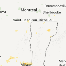


Connect with Interactive Hail Maps