

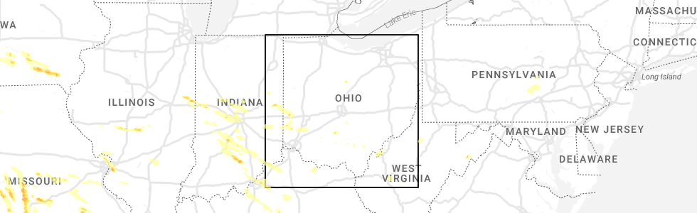
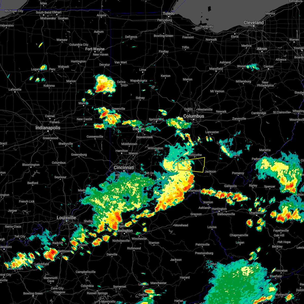
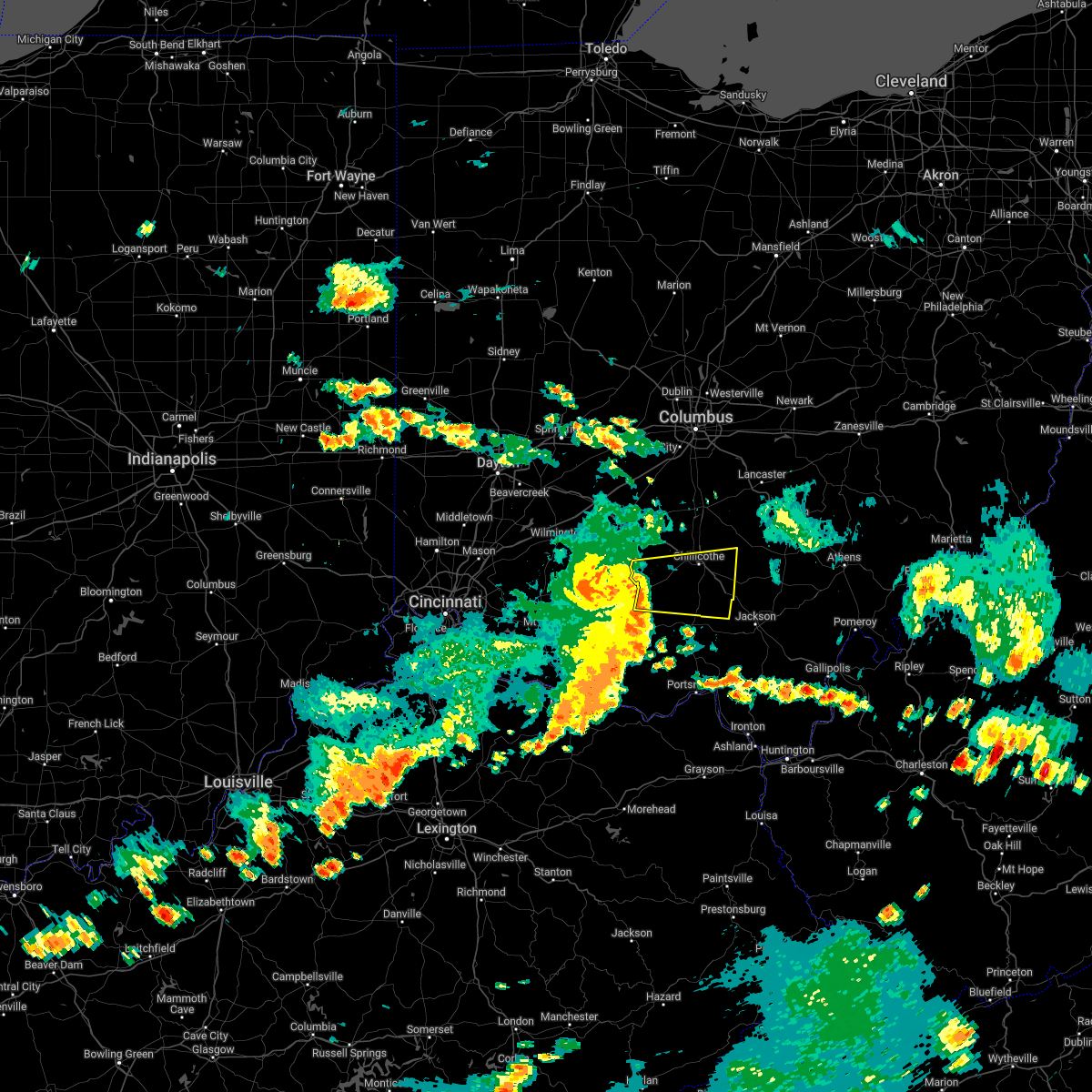
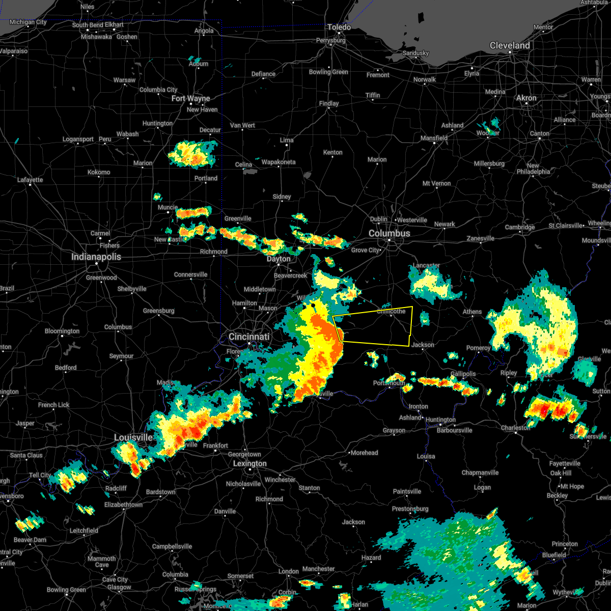
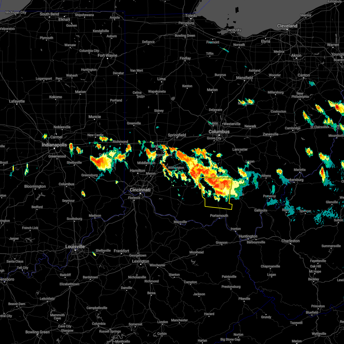
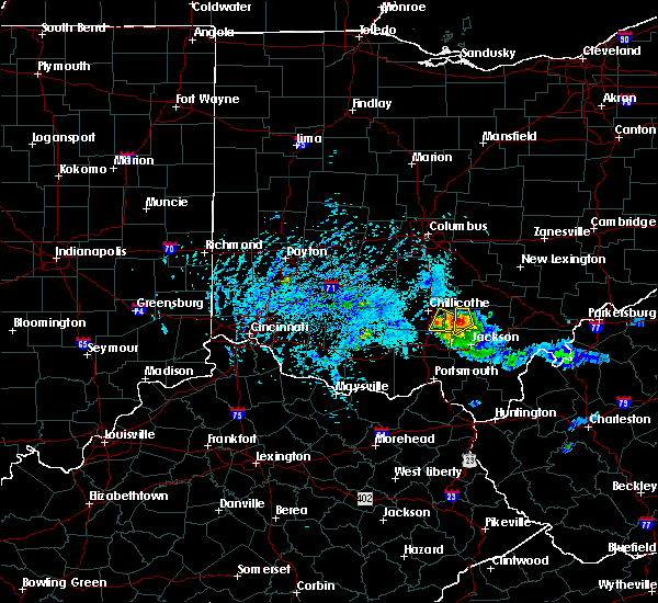
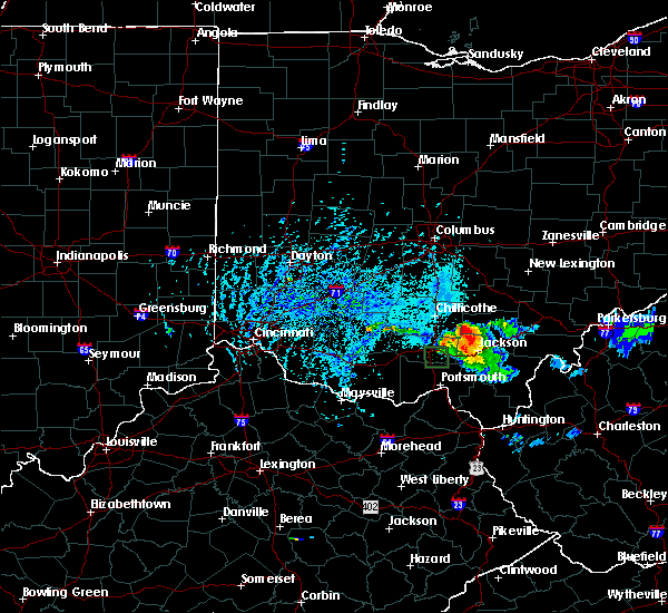
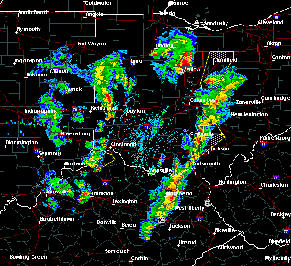
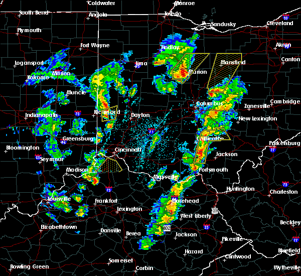
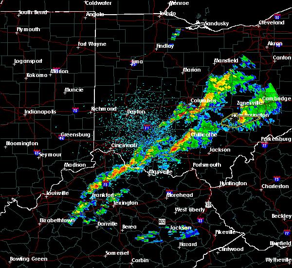
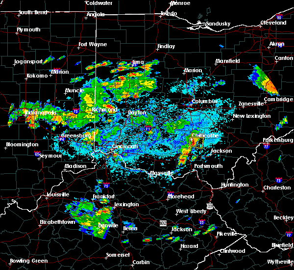
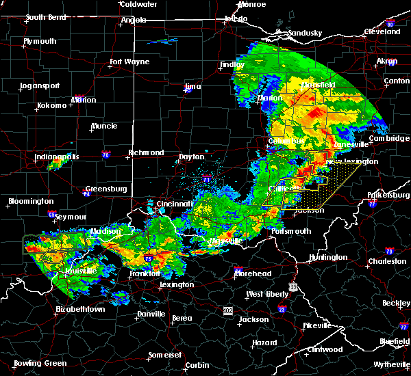
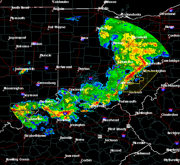
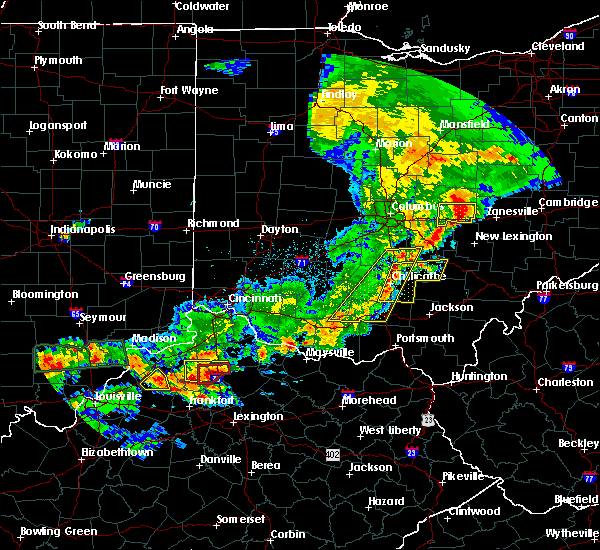
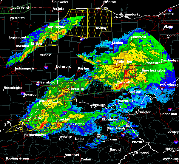
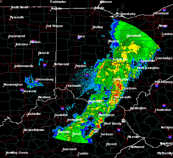
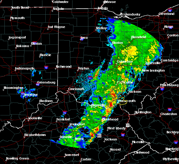
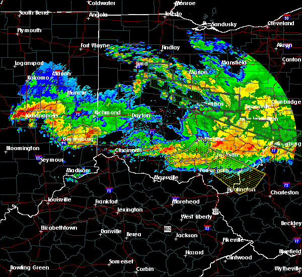
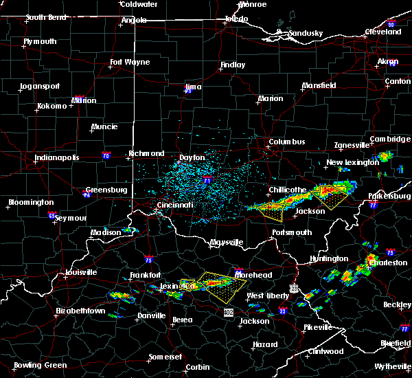
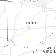
Hail Map for Richmond Dale, OH
The Richmond Dale, OH area has had 3 reports of on-the-ground hail by trained spotters, and has been under severe weather warnings 3 times during the past 12 months. Doppler radar has detected hail at or near Richmond Dale, OH on 31 occasions, including 1 occasion during the past year.
| Name: | Richmond Dale, OH |
| Where Located: | 53.4 miles S of Columbus, OH |
| Map: | Google Map for Richmond Dale, OH |
| Population: | 377 |
| Housing Units: | 175 |
| More Info: | Search Google for Richmond Dale, OH |
2
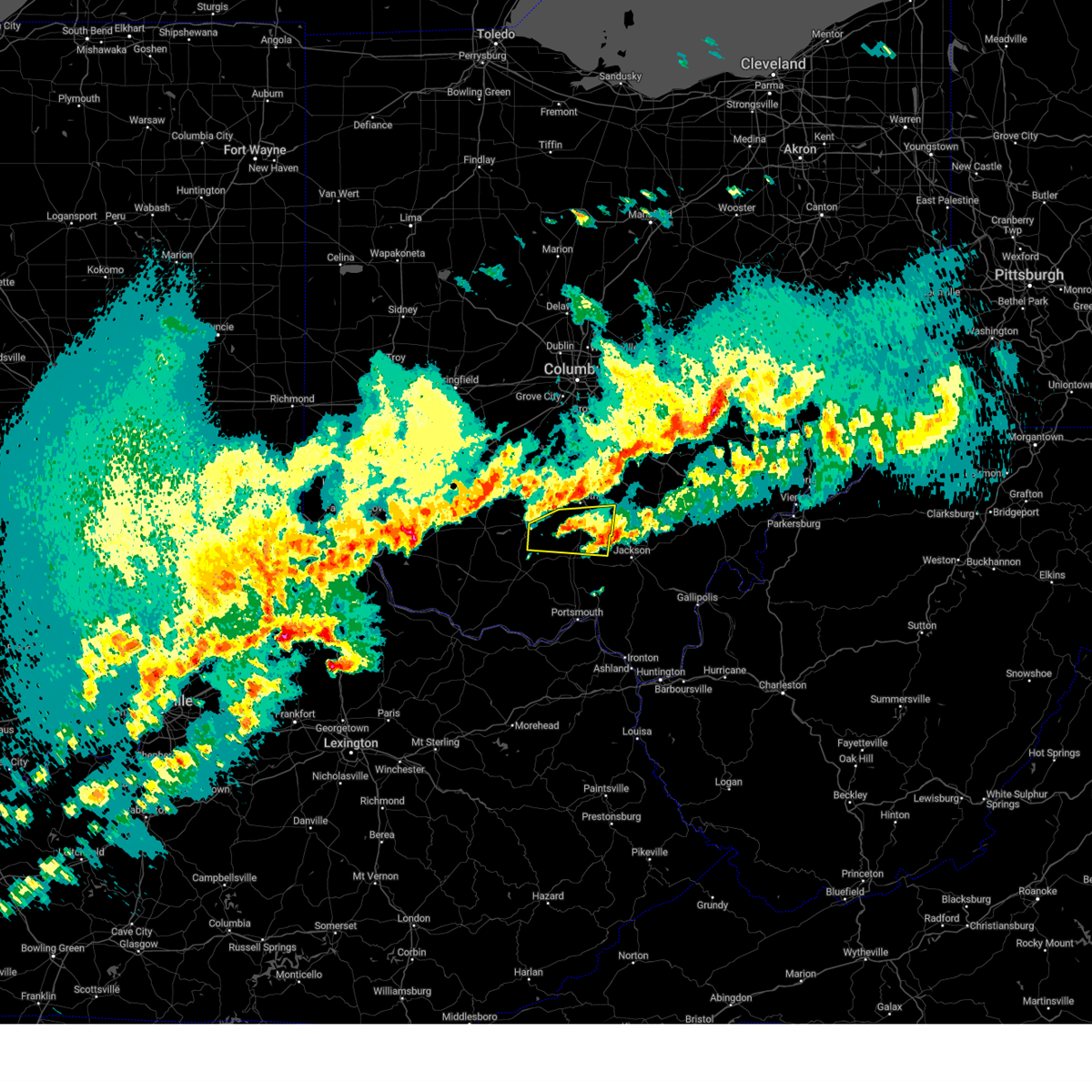
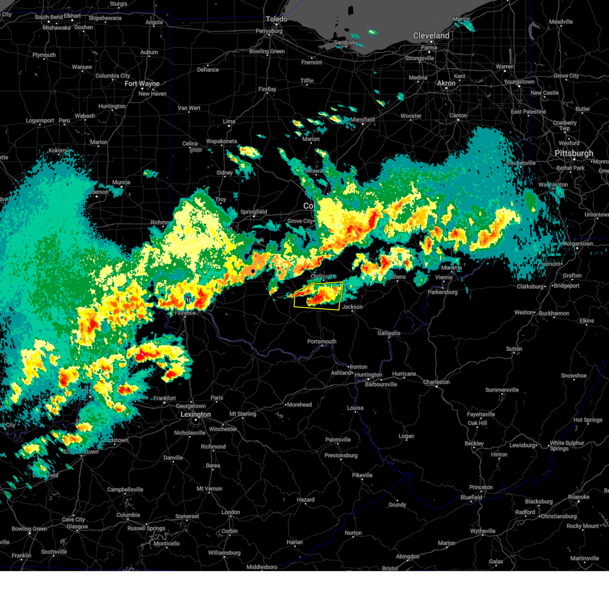
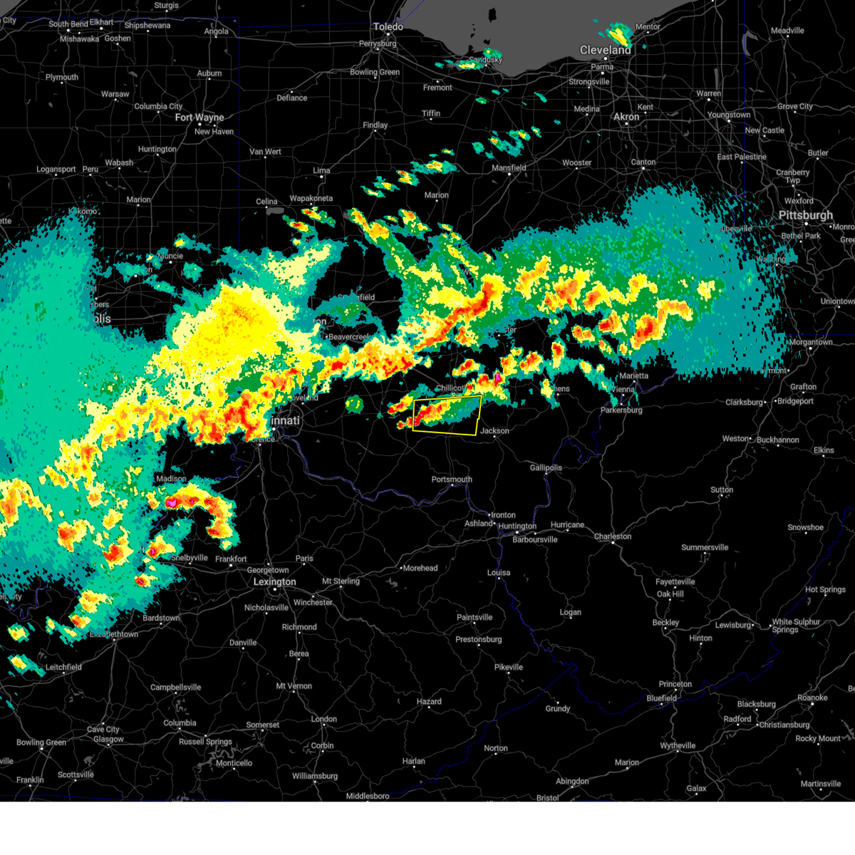
The Top Recent Hail Date for Richmond Dale, OH is Monday, July 17, 2023 (8th out of 31)
Hail and Wind Damage Spotted near Richmond Dale, OH
| Date / Time | Report Details |
|---|---|
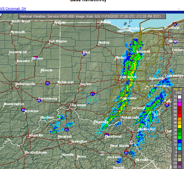
| 3/14/2024 11:26 PM EDT |
 The storm which prompted the warning has moved out of the area. therefore, the warning will be allowed to expire. a tornado watch remains in effect until midnight edt for south central ohio. a tornado watch also remains in effect until 400 am edt for south central ohio. please report previous wind damage or hail to the national weather service by going to our website at weather.gov/iln and submitting your report via social media. The storm which prompted the warning has moved out of the area. therefore, the warning will be allowed to expire. a tornado watch remains in effect until midnight edt for south central ohio. a tornado watch also remains in effect until 400 am edt for south central ohio. please report previous wind damage or hail to the national weather service by going to our website at weather.gov/iln and submitting your report via social media.
|
| 3/14/2024 11:08 PM EDT |
 At 1108 pm edt, a severe thunderstorm was located near waverly, moving east at 45 mph (radar indicated). Hazards include 60 mph wind gusts and quarter size hail. Minor hail damage to vehicles is possible. expect wind damage to trees and power lines. Locations impacted include, waverly, piketon, bainbridge, pike lake, kincaid springs, londonderry, bourneville, pike county airport, omega, buchanan, summithill, knockemstiff, richmond dale, massieville, linn, lake white, scioto trail state park, and idaho. At 1108 pm edt, a severe thunderstorm was located near waverly, moving east at 45 mph (radar indicated). Hazards include 60 mph wind gusts and quarter size hail. Minor hail damage to vehicles is possible. expect wind damage to trees and power lines. Locations impacted include, waverly, piketon, bainbridge, pike lake, kincaid springs, londonderry, bourneville, pike county airport, omega, buchanan, summithill, knockemstiff, richmond dale, massieville, linn, lake white, scioto trail state park, and idaho.
|
| 3/14/2024 10:51 PM EDT |
 Svriln the national weather service in wilmington has issued a * severe thunderstorm warning for, northern pike county in south central ohio, southern ross county in south central ohio, * until 1130 pm edt. * at 1051 pm edt, a severe thunderstorm was located near pike lake, moving east at 35 mph (radar indicated). Hazards include 60 mph wind gusts and quarter size hail. Minor hail damage to vehicles is possible. Expect wind damage to trees and power lines. Svriln the national weather service in wilmington has issued a * severe thunderstorm warning for, northern pike county in south central ohio, southern ross county in south central ohio, * until 1130 pm edt. * at 1051 pm edt, a severe thunderstorm was located near pike lake, moving east at 35 mph (radar indicated). Hazards include 60 mph wind gusts and quarter size hail. Minor hail damage to vehicles is possible. Expect wind damage to trees and power lines.
|
| 7/6/2022 4:34 PM EDT |
 At 434 pm edt, a severe thunderstorm was located near waverly, moving east at 40 mph (radar indicated). Hazards include 60 mph wind gusts. Expect damage to trees and power lines. locations impacted include, waverly, bainbridge, pike lake, londonderry, pike county airport, omega, buchanan, summithill, knockemstiff, richmond dale, massieville, linn, lake white, scioto trail state park and bourneville. hail threat, radar indicated max hail size, <. 75 in wind threat, radar indicated max wind gust, 60 mph. At 434 pm edt, a severe thunderstorm was located near waverly, moving east at 40 mph (radar indicated). Hazards include 60 mph wind gusts. Expect damage to trees and power lines. locations impacted include, waverly, bainbridge, pike lake, londonderry, pike county airport, omega, buchanan, summithill, knockemstiff, richmond dale, massieville, linn, lake white, scioto trail state park and bourneville. hail threat, radar indicated max hail size, <. 75 in wind threat, radar indicated max wind gust, 60 mph.
|
| 7/6/2022 4:17 PM EDT |
 At 417 pm edt, a severe thunderstorm was located over bainbridge, moving east at 45 mph (radar indicated). Hazards include 60 mph wind gusts. Expect damage to trees and power lines. locations impacted include, chillicothe, greenfield, waverly, bainbridge, pike lake, cynthiana, north folk village, londonderry, south salem, bourneville, pike county airport, mooresville, lattaville, omega, buchanan, summithill, knockemstiff, richmond dale, massieville and linn. hail threat, radar indicated max hail size, <. 75 in wind threat, radar indicated max wind gust, 60 mph. At 417 pm edt, a severe thunderstorm was located over bainbridge, moving east at 45 mph (radar indicated). Hazards include 60 mph wind gusts. Expect damage to trees and power lines. locations impacted include, chillicothe, greenfield, waverly, bainbridge, pike lake, cynthiana, north folk village, londonderry, south salem, bourneville, pike county airport, mooresville, lattaville, omega, buchanan, summithill, knockemstiff, richmond dale, massieville and linn. hail threat, radar indicated max hail size, <. 75 in wind threat, radar indicated max wind gust, 60 mph.
|
| 7/6/2022 3:59 PM EDT |
 At 358 pm edt, a severe thunderstorm was located over highland holiday, moving east at 45 mph (radar indicated). Hazards include 70 mph wind gusts. Expect considerable tree damage. Damage is likely to mobile homes, roofs, and outbuildings. At 358 pm edt, a severe thunderstorm was located over highland holiday, moving east at 45 mph (radar indicated). Hazards include 70 mph wind gusts. Expect considerable tree damage. Damage is likely to mobile homes, roofs, and outbuildings.
|
| 7/6/2022 1:34 PM EDT | Quarter sized hail reported 10.2 miles SW of Richmond Dale, OH, large limbs also observed down. time estimated from radar. |
| 6/8/2022 8:12 PM EDT |
 The severe thunderstorm warning for southwestern hocking and eastern ross counties will expire at 815 pm edt, the storm which prompted the warning has moved out of the area. therefore, the warning will be allowed to expire. a tornado watch remains in effect until 1000 pm edt for central and southwestern ohio. please report previous wind damage or hail to the national weather service by going to our website at weather.gov/iln and submitting your report via social media. The severe thunderstorm warning for southwestern hocking and eastern ross counties will expire at 815 pm edt, the storm which prompted the warning has moved out of the area. therefore, the warning will be allowed to expire. a tornado watch remains in effect until 1000 pm edt for central and southwestern ohio. please report previous wind damage or hail to the national weather service by going to our website at weather.gov/iln and submitting your report via social media.
|
| 6/8/2022 7:53 PM EDT |
 At 752 pm edt, a severe thunderstorm was located over chillicothe, moving east at 45 mph (radar indicated). Hazards include 60 mph wind gusts and penny size hail. Expect damage to trees and power lines. locations impacted include, chillicothe, kingston, north folk village, londonderry, laurelville, adelphi, andersonville, mooresville, south bloomingville, summithill, knockemstiff, richmond dale, massieville, hallsville, scioto trail state park and bourneville. hail threat, radar indicated max hail size, 0. 75 in wind threat, radar indicated max wind gust, 60 mph. At 752 pm edt, a severe thunderstorm was located over chillicothe, moving east at 45 mph (radar indicated). Hazards include 60 mph wind gusts and penny size hail. Expect damage to trees and power lines. locations impacted include, chillicothe, kingston, north folk village, londonderry, laurelville, adelphi, andersonville, mooresville, south bloomingville, summithill, knockemstiff, richmond dale, massieville, hallsville, scioto trail state park and bourneville. hail threat, radar indicated max hail size, 0. 75 in wind threat, radar indicated max wind gust, 60 mph.
|
| 6/8/2022 7:36 PM EDT |
 At 735 pm edt, a severe thunderstorm was located 8 miles north of bainbridge, moving east at 45 mph (radar indicated). Hazards include 60 mph wind gusts and quarter size hail. Minor hail damage to vehicles is possible. Expect wind damage to trees and power lines. At 735 pm edt, a severe thunderstorm was located 8 miles north of bainbridge, moving east at 45 mph (radar indicated). Hazards include 60 mph wind gusts and quarter size hail. Minor hail damage to vehicles is possible. Expect wind damage to trees and power lines.
|
| 5/3/2022 5:16 PM EDT |
 At 516 pm edt, a severe thunderstorm was located 9 miles west of hocking hills state park, moving east at 45 mph (radar indicated). Hazards include 60 mph wind gusts and penny size hail. Expect damage to trees and power lines. locations impacted include, chillicothe, londonderry, stoutsville, laurelville, adelphi, tarlton, buena vista in hocking county, gibisonville, mooresville, whisler, south bloomingville, summithill, clearport, richmond dale, massieville, hallsville and scioto trail state park. hail threat, radar indicated max hail size, 0. 75 in wind threat, radar indicated max wind gust, 60 mph. At 516 pm edt, a severe thunderstorm was located 9 miles west of hocking hills state park, moving east at 45 mph (radar indicated). Hazards include 60 mph wind gusts and penny size hail. Expect damage to trees and power lines. locations impacted include, chillicothe, londonderry, stoutsville, laurelville, adelphi, tarlton, buena vista in hocking county, gibisonville, mooresville, whisler, south bloomingville, summithill, clearport, richmond dale, massieville, hallsville and scioto trail state park. hail threat, radar indicated max hail size, 0. 75 in wind threat, radar indicated max wind gust, 60 mph.
|
| 5/3/2022 4:59 PM EDT |
 At 459 pm edt, a severe thunderstorm was located near chillicothe, moving northeast at 45 mph (radar indicated). Hazards include 60 mph wind gusts and penny size hail. expect damage to trees and power lines At 459 pm edt, a severe thunderstorm was located near chillicothe, moving northeast at 45 mph (radar indicated). Hazards include 60 mph wind gusts and penny size hail. expect damage to trees and power lines
|
| 7/29/2021 6:11 PM EDT |
 At 611 pm edt, a severe thunderstorm was located over waverly, moving southeast at 35 mph (radar indicated). Hazards include 60 mph wind gusts and quarter size hail. Minor hail damage to vehicles is possible. expect wind damage to trees and power lines. Locations impacted include, chillicothe, waverly, piketon, bainbridge, pike lake, kincaid springs, lucasville, londonderry, beaver, south salem, rarden, wakefield, pike county airport, mooresville, omega, givens, knockemstiff, mount joy, bear creek and massieville. At 611 pm edt, a severe thunderstorm was located over waverly, moving southeast at 35 mph (radar indicated). Hazards include 60 mph wind gusts and quarter size hail. Minor hail damage to vehicles is possible. expect wind damage to trees and power lines. Locations impacted include, chillicothe, waverly, piketon, bainbridge, pike lake, kincaid springs, lucasville, londonderry, beaver, south salem, rarden, wakefield, pike county airport, mooresville, omega, givens, knockemstiff, mount joy, bear creek and massieville.
|
| 7/29/2021 5:58 PM EDT |
 At 557 pm edt, a severe thunderstorm was located near chillicothe, moving southeast at 35 mph (radar indicated). Hazards include 70 mph wind gusts and quarter size hail. Minor hail damage to vehicles is possible. expect considerable tree damage. Wind damage is also likely to mobile homes, roofs, and outbuildings. At 557 pm edt, a severe thunderstorm was located near chillicothe, moving southeast at 35 mph (radar indicated). Hazards include 70 mph wind gusts and quarter size hail. Minor hail damage to vehicles is possible. expect considerable tree damage. Wind damage is also likely to mobile homes, roofs, and outbuildings.
|
| 11/15/2020 12:32 PM EST |
 At 1232 pm est, severe thunderstorms were located along a line extending from 8 miles southwest of hocking hills state park to near piketon, moving east at 60 mph (radar indicated). Hazards include 60 mph wind gusts. Expect damage to trees and power lines. Locations impacted include, chillicothe, waverly, piketon, londonderry, beaver, adelphi, rarden, wakefield, pike county airport, mooresville, omega, givens, mount joy, bear creek, massieville, lake white, stockdale, elm grove, buchanan and state route 335 at state route 776. At 1232 pm est, severe thunderstorms were located along a line extending from 8 miles southwest of hocking hills state park to near piketon, moving east at 60 mph (radar indicated). Hazards include 60 mph wind gusts. Expect damage to trees and power lines. Locations impacted include, chillicothe, waverly, piketon, londonderry, beaver, adelphi, rarden, wakefield, pike county airport, mooresville, omega, givens, mount joy, bear creek, massieville, lake white, stockdale, elm grove, buchanan and state route 335 at state route 776.
|
| 11/15/2020 12:12 PM EST |
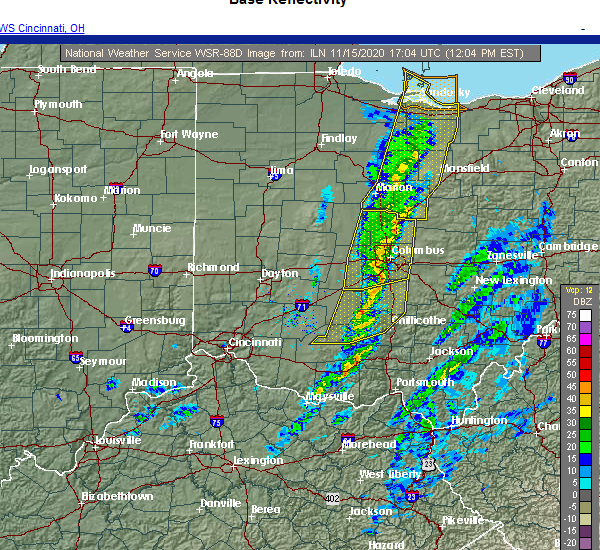 At 1211 pm est, severe thunderstorms were located along a line extending from near north folk village to near peebles, moving east at 60 mph (radar indicated). Hazards include 60 mph wind gusts. expect damage to trees and power lines At 1211 pm est, severe thunderstorms were located along a line extending from near north folk village to near peebles, moving east at 60 mph (radar indicated). Hazards include 60 mph wind gusts. expect damage to trees and power lines
|
| 8/16/2020 4:18 PM EDT | Trees dow in vinton county OH, 7 miles SSW of Richmond Dale, OH |
| 6/10/2020 7:15 PM EDT |
 At 714 pm edt, severe thunderstorms were located along a line extending from near thornport to near bremen to 6 miles northwest of wellston, moving northeast at 30 mph (radar indicated). Hazards include 60 mph wind gusts. Expect damage to trees and power lines. Locations impacted include, logan, nelsonville, piketon, hocking hills state park, hide-a-way hills, starr, amanda, londonderry, laurelville, murray city, beaver, sugar grove, adelphi, tarlton, us route 22 at state route 159, ilesboro, haydenville, omega, givens and south bloomingville. At 714 pm edt, severe thunderstorms were located along a line extending from near thornport to near bremen to 6 miles northwest of wellston, moving northeast at 30 mph (radar indicated). Hazards include 60 mph wind gusts. Expect damage to trees and power lines. Locations impacted include, logan, nelsonville, piketon, hocking hills state park, hide-a-way hills, starr, amanda, londonderry, laurelville, murray city, beaver, sugar grove, adelphi, tarlton, us route 22 at state route 159, ilesboro, haydenville, omega, givens and south bloomingville.
|
| 6/10/2020 7:06 PM EDT |
 At 706 pm edt, severe thunderstorms were located along a line extending from pleasantville to near shawnee to 9 miles northwest of wellston, moving east at 60 mph (trained weather spotters). Hazards include 70 mph wind gusts. Expect considerable tree damage. damage is likely to mobile homes, roofs, and outbuildings. Locations impacted include, chillicothe, logan, waverly, nelsonville, piketon, kingston, hide-a-way hills, hocking hills state park, starr, amanda, londonderry, stoutsville, laurelville, murray city, beaver, sugar grove, adelphi, tarlton, east ringgold and us route 22 at state route 159. At 706 pm edt, severe thunderstorms were located along a line extending from pleasantville to near shawnee to 9 miles northwest of wellston, moving east at 60 mph (trained weather spotters). Hazards include 70 mph wind gusts. Expect considerable tree damage. damage is likely to mobile homes, roofs, and outbuildings. Locations impacted include, chillicothe, logan, waverly, nelsonville, piketon, kingston, hide-a-way hills, hocking hills state park, starr, amanda, londonderry, stoutsville, laurelville, murray city, beaver, sugar grove, adelphi, tarlton, east ringgold and us route 22 at state route 159.
|
| 6/10/2020 6:52 PM EDT |
 At 651 pm edt, severe thunderstorms were located along a line extending from 7 miles south of canal winchester to 8 miles north of hocking hills state park to near waverly, moving east at 60 mph (radar indicated). Hazards include 70 mph wind gusts. Expect considerable tree damage. damage is likely to mobile homes, roofs, and outbuildings. Locations impacted include, chillicothe, circleville, logan, waverly, nelsonville, piketon, south bloomfield, kingston, hide-a-way hills, logan elm village, hocking hills state park, pike lake, north folk village, starr, fox, amanda, londonderry, stoutsville, laurelville and murray city. At 651 pm edt, severe thunderstorms were located along a line extending from 7 miles south of canal winchester to 8 miles north of hocking hills state park to near waverly, moving east at 60 mph (radar indicated). Hazards include 70 mph wind gusts. Expect considerable tree damage. damage is likely to mobile homes, roofs, and outbuildings. Locations impacted include, chillicothe, circleville, logan, waverly, nelsonville, piketon, south bloomfield, kingston, hide-a-way hills, logan elm village, hocking hills state park, pike lake, north folk village, starr, fox, amanda, londonderry, stoutsville, laurelville and murray city.
|
| 6/10/2020 6:35 PM EDT |
 At 635 pm edt, severe thunderstorms were located along a line extending from near south bloomfield to near kingston to 6 miles south of kincaid springs, moving east at 60 mph (radar indicated). Hazards include 70 mph wind gusts. Expect considerable tree damage. Damage is likely to mobile homes, roofs, and outbuildings. At 635 pm edt, severe thunderstorms were located along a line extending from near south bloomfield to near kingston to 6 miles south of kincaid springs, moving east at 60 mph (radar indicated). Hazards include 70 mph wind gusts. Expect considerable tree damage. Damage is likely to mobile homes, roofs, and outbuildings.
|
| 4/9/2020 12:07 AM EDT |
 The severe thunderstorm warning for northern pike and ross counties will expire at 1215 am edt, the storm which prompted the warning has moved out of the area. therefore, the warning will be allowed to expire. however gusty winds are still possible with this thunderstorm. a tornado watch remains in effect until 200 am edt for central and southwestern ohio. please report previous wind damage or hail to the national weather service by going to our website at weather.gov/iln and submitting your report via social media. The severe thunderstorm warning for northern pike and ross counties will expire at 1215 am edt, the storm which prompted the warning has moved out of the area. therefore, the warning will be allowed to expire. however gusty winds are still possible with this thunderstorm. a tornado watch remains in effect until 200 am edt for central and southwestern ohio. please report previous wind damage or hail to the national weather service by going to our website at weather.gov/iln and submitting your report via social media.
|
| 4/8/2020 11:39 PM EDT |
 At 1139 pm edt, a severe thunderstorm was located over pike lake, moving northeast at 30 mph (radar indicated). Hazards include 60 mph wind gusts and quarter size hail. Minor hail damage to vehicles is possible. expect wind damage to trees and power lines. locations impacted include, chillicothe, greenfield, waverly, piketon, kingston, bainbridge, pike lake, kincaid springs, cynthiana, north folk village, frankfort, londonderry, laurelville, clarksburg, adelphi, south salem, pike county airport, mooresville, austin and omega. A tornado watch remains in effect until 200 am edt for central and southwestern ohio. At 1139 pm edt, a severe thunderstorm was located over pike lake, moving northeast at 30 mph (radar indicated). Hazards include 60 mph wind gusts and quarter size hail. Minor hail damage to vehicles is possible. expect wind damage to trees and power lines. locations impacted include, chillicothe, greenfield, waverly, piketon, kingston, bainbridge, pike lake, kincaid springs, cynthiana, north folk village, frankfort, londonderry, laurelville, clarksburg, adelphi, south salem, pike county airport, mooresville, austin and omega. A tornado watch remains in effect until 200 am edt for central and southwestern ohio.
|
| 4/8/2020 11:13 PM EDT |
 At 1113 pm edt, a severe thunderstorm was located near cynthiana, moving east at 25 mph (radar indicated). Hazards include 60 mph wind gusts and quarter size hail. Minor hail damage to vehicles is possible. Expect wind damage to trees and power lines. At 1113 pm edt, a severe thunderstorm was located near cynthiana, moving east at 25 mph (radar indicated). Hazards include 60 mph wind gusts and quarter size hail. Minor hail damage to vehicles is possible. Expect wind damage to trees and power lines.
|
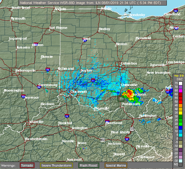
| 8/1/2019 6:20 PM EDT | Multiple trees down on along us highway 5 in vinton county OH, 5.7 miles WSW of Richmond Dale, OH |
| 8/1/2019 6:20 PM EDT |
 The severe thunderstorm warning for southeastern ross county will expire at 630 pm edt, the storm which prompted the warning has weakened below severe limits, and no longer poses an immediate threat to life or property. therefore, the warning will be allowed to expire. however gusty winds and heavy rain are still possible with this thunderstorm. please report previous wind damage or hail to the national weather service by going to our website at weather.gov/iln and submitting your report via social media. The severe thunderstorm warning for southeastern ross county will expire at 630 pm edt, the storm which prompted the warning has weakened below severe limits, and no longer poses an immediate threat to life or property. therefore, the warning will be allowed to expire. however gusty winds and heavy rain are still possible with this thunderstorm. please report previous wind damage or hail to the national weather service by going to our website at weather.gov/iln and submitting your report via social media.
|
| 8/1/2019 6:02 PM EDT |
 At 602 pm edt, a severe thunderstorm was located 11 miles southeast of chillicothe, and is nearly stationary (radar indicated). Hazards include 70 mph wind gusts and ping pong ball size hail. People and animals outdoors will be injured. expect hail damage to roofs, siding, windows, and vehicles. expect considerable tree damage. wind damage is also likely to mobile homes, roofs, and outbuildings. Locations impacted include, londonderry, mooresville, scioto trail state park and richmond dale. At 602 pm edt, a severe thunderstorm was located 11 miles southeast of chillicothe, and is nearly stationary (radar indicated). Hazards include 70 mph wind gusts and ping pong ball size hail. People and animals outdoors will be injured. expect hail damage to roofs, siding, windows, and vehicles. expect considerable tree damage. wind damage is also likely to mobile homes, roofs, and outbuildings. Locations impacted include, londonderry, mooresville, scioto trail state park and richmond dale.
|
| 8/1/2019 5:55 PM EDT | Trees down on bluelick road. time estimated from rada in ross county OH, 6.1 miles S of Richmond Dale, OH |
| 8/1/2019 5:45 PM EDT |
 At 545 pm edt, a severe thunderstorm was located 12 miles southeast of chillicothe, moving northwest at 10 mph (radar indicated). Hazards include 70 mph wind gusts and ping pong ball size hail. People and animals outdoors will be injured. expect hail damage to roofs, siding, windows, and vehicles. expect considerable tree damage. wind damage is also likely to mobile homes, roofs, and outbuildings. Locations impacted include, londonderry, mooresville, scioto trail state park and richmond dale. At 545 pm edt, a severe thunderstorm was located 12 miles southeast of chillicothe, moving northwest at 10 mph (radar indicated). Hazards include 70 mph wind gusts and ping pong ball size hail. People and animals outdoors will be injured. expect hail damage to roofs, siding, windows, and vehicles. expect considerable tree damage. wind damage is also likely to mobile homes, roofs, and outbuildings. Locations impacted include, londonderry, mooresville, scioto trail state park and richmond dale.
|
| 8/1/2019 5:41 PM EDT |
 At 541 pm edt, a severe thunderstorm was located 13 miles southeast of chillicothe, moving northwest at 10 mph (radar indicated). Hazards include 60 mph wind gusts and quarter size hail. Minor hail damage to vehicles is possible. expect wind damage to trees and power lines. Locations impacted include, londonderry, mooresville, scioto trail state park and richmond dale. At 541 pm edt, a severe thunderstorm was located 13 miles southeast of chillicothe, moving northwest at 10 mph (radar indicated). Hazards include 60 mph wind gusts and quarter size hail. Minor hail damage to vehicles is possible. expect wind damage to trees and power lines. Locations impacted include, londonderry, mooresville, scioto trail state park and richmond dale.
|
| 8/1/2019 5:38 PM EDT |
 At 538 pm edt, a severe thunderstorm was located 13 miles northeast of waverly, moving northwest at 10 mph (radar indicated). Hazards include 60 mph wind gusts and penny size hail. expect damage to trees and power lines At 538 pm edt, a severe thunderstorm was located 13 miles northeast of waverly, moving northwest at 10 mph (radar indicated). Hazards include 60 mph wind gusts and penny size hail. expect damage to trees and power lines
|
| 8/1/2019 5:13 PM EDT | Quarter sized hail reported 4.9 miles SSW of Richmond Dale, OH |
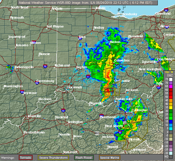
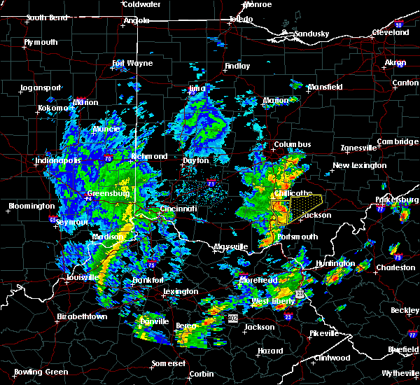
| 6/24/2019 6:50 PM EDT |
 The severe thunderstorm warning for northeastern pike and southeastern ross counties will expire at 700 pm edt, the storm which prompted the warning has moved out of the area. therefore, the warning will be allowed to expire. a severe thunderstorm watch remains in effect until 900 pm edt for southwestern ohio. please report previous wind damage or hail to the national weather service by going to our website at weather.gov/iln and submitting your report via social media. The severe thunderstorm warning for northeastern pike and southeastern ross counties will expire at 700 pm edt, the storm which prompted the warning has moved out of the area. therefore, the warning will be allowed to expire. a severe thunderstorm watch remains in effect until 900 pm edt for southwestern ohio. please report previous wind damage or hail to the national weather service by going to our website at weather.gov/iln and submitting your report via social media.
|
| 6/24/2019 6:39 PM EDT |
 At 639 pm edt, a severe thunderstorm was located 8 miles southeast of chillicothe, moving northeast at 40 mph (radar indicated). Hazards include 60 mph wind gusts. Expect damage to trees and power lines. Locations impacted include, chillicothe, londonderry, beaver, richmond dale, linn, mooresville and massieville. At 639 pm edt, a severe thunderstorm was located 8 miles southeast of chillicothe, moving northeast at 40 mph (radar indicated). Hazards include 60 mph wind gusts. Expect damage to trees and power lines. Locations impacted include, chillicothe, londonderry, beaver, richmond dale, linn, mooresville and massieville.
|
| 6/24/2019 6:17 PM EDT |
 At 617 pm edt, a severe thunderstorm was located near pike lake, moving northeast at 40 mph (radar indicated). Hazards include 60 mph wind gusts. expect damage to trees and power lines At 617 pm edt, a severe thunderstorm was located near pike lake, moving northeast at 40 mph (radar indicated). Hazards include 60 mph wind gusts. expect damage to trees and power lines
|
| 6/24/2019 3:20 PM EDT |
 At 319 pm edt, a severe thunderstorm was located 9 miles northeast of waverly, moving northeast at 45 mph (radar indicated). Hazards include 60 mph wind gusts. Expect damage to trees and power lines. Locations impacted include, chillicothe, waverly, londonderry, beaver, givens, pike county airport, richmond dale, massieville, linn, omega, scioto trail state park and germany. At 319 pm edt, a severe thunderstorm was located 9 miles northeast of waverly, moving northeast at 45 mph (radar indicated). Hazards include 60 mph wind gusts. Expect damage to trees and power lines. Locations impacted include, chillicothe, waverly, londonderry, beaver, givens, pike county airport, richmond dale, massieville, linn, omega, scioto trail state park and germany.
|
| 6/24/2019 3:12 PM EDT |
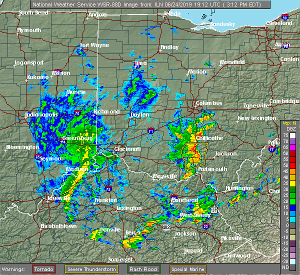 At 312 pm edt, a severe thunderstorm was located near waverly, moving northeast at 45 mph (radar indicated). Hazards include 60 mph wind gusts. Expect damage to trees and power lines. Locations impacted include, chillicothe, waverly, piketon, londonderry, beaver, wakefield, stockdale, pike county airport, omega, givens, richmond dale, massieville, linn, lake white, scioto trail state park and germany. At 312 pm edt, a severe thunderstorm was located near waverly, moving northeast at 45 mph (radar indicated). Hazards include 60 mph wind gusts. Expect damage to trees and power lines. Locations impacted include, chillicothe, waverly, piketon, londonderry, beaver, wakefield, stockdale, pike county airport, omega, givens, richmond dale, massieville, linn, lake white, scioto trail state park and germany.
|
| 6/24/2019 3:02 PM EDT |
 At 301 pm edt, a severe thunderstorm was located near lake white, moving northeast at 45 mph (radar indicated). Hazards include 60 mph wind gusts. Expect damage to trees and power lines. Locations impacted include, waverly, piketon, pike lake, omega, lucasville, londonderry, beaver, wakefield, pike county airport, chillicothe, givens, knockemstiff, bear creek, massieville, lake white, bourneville, stockdale, elm grove and buchanan. At 301 pm edt, a severe thunderstorm was located near lake white, moving northeast at 45 mph (radar indicated). Hazards include 60 mph wind gusts. Expect damage to trees and power lines. Locations impacted include, waverly, piketon, pike lake, omega, lucasville, londonderry, beaver, wakefield, pike county airport, chillicothe, givens, knockemstiff, bear creek, massieville, lake white, bourneville, stockdale, elm grove and buchanan.
|
| 6/24/2019 2:51 PM EDT |
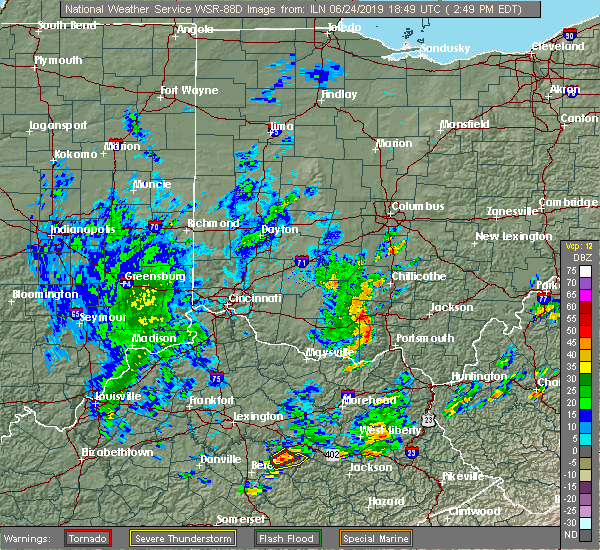 At 251 pm edt, a severe thunderstorm was located near kincaid springs, moving northeast at 45 mph (radar indicated). Hazards include 60 mph wind gusts. expect damage to trees and power lines At 251 pm edt, a severe thunderstorm was located near kincaid springs, moving northeast at 45 mph (radar indicated). Hazards include 60 mph wind gusts. expect damage to trees and power lines
|
| 6/17/2019 9:50 PM EDT |
 At 950 pm edt, a severe thunderstorm was located over north folk village, moving east at 35 mph (radar indicated). Hazards include 60 mph wind gusts. Expect damage to trees and power lines. Locations impacted include, chillicothe, north folk village, frankfort, londonderry, laurelville, adelphi, bourneville, andersonville, mooresville, summithill, knockemstiff, richmond dale, massieville, hallsville and scioto trail state park. At 950 pm edt, a severe thunderstorm was located over north folk village, moving east at 35 mph (radar indicated). Hazards include 60 mph wind gusts. Expect damage to trees and power lines. Locations impacted include, chillicothe, north folk village, frankfort, londonderry, laurelville, adelphi, bourneville, andersonville, mooresville, summithill, knockemstiff, richmond dale, massieville, hallsville and scioto trail state park.
|
| 6/17/2019 9:35 PM EDT |
 At 935 pm edt, a severe thunderstorm was located near bainbridge, moving east at 35 mph (radar indicated). Hazards include 60 mph wind gusts. expect damage to trees and power lines At 935 pm edt, a severe thunderstorm was located near bainbridge, moving east at 35 mph (radar indicated). Hazards include 60 mph wind gusts. expect damage to trees and power lines
|
| 5/23/2019 6:57 PM EDT |
 The severe thunderstorm warning for southeastern pickaway and eastern ross counties will expire at 700 pm edt, the storm which prompted the warning has weakened below severe limits, and no longer poses an immediate threat to life or property. therefore, the warning will be allowed to expire. a severe thunderstorm watch remains in effect until midnight edt for central and southwestern ohio. please report previous wind damage or hail to the national weather service by going to our website at weather.gov/iln and submitting your report via social media. The severe thunderstorm warning for southeastern pickaway and eastern ross counties will expire at 700 pm edt, the storm which prompted the warning has weakened below severe limits, and no longer poses an immediate threat to life or property. therefore, the warning will be allowed to expire. a severe thunderstorm watch remains in effect until midnight edt for central and southwestern ohio. please report previous wind damage or hail to the national weather service by going to our website at weather.gov/iln and submitting your report via social media.
|
| 5/23/2019 6:41 PM EDT |
 At 641 pm edt, a severe thunderstorm was located over chillicothe, moving east at 40 mph (radar indicated). Hazards include 60 mph wind gusts. Expect damage to trees and power lines. Locations impacted include, chillicothe, kingston, north folk village, londonderry, pickaway county airport, richmond dale, andersonville, massieville, mooresville, hallsville, whisler and scioto trail state park. At 641 pm edt, a severe thunderstorm was located over chillicothe, moving east at 40 mph (radar indicated). Hazards include 60 mph wind gusts. Expect damage to trees and power lines. Locations impacted include, chillicothe, kingston, north folk village, londonderry, pickaway county airport, richmond dale, andersonville, massieville, mooresville, hallsville, whisler and scioto trail state park.
|
| 5/23/2019 6:31 PM EDT |
 At 631 pm edt, a severe thunderstorm was located near north folk village, moving east at 45 mph (radar indicated). Hazards include 60 mph wind gusts and quarter size hail. Minor hail damage to vehicles is possible. expect wind damage to trees and power lines. Locations impacted include, chillicothe, kingston, north folk village, frankfort, londonderry, clarksburg, bourneville, andersonville, mooresville, lattaville, austin, whisler, summithill, knockemstiff, pickaway county airport, richmond dale, massieville, hallsville and scioto trail state park. At 631 pm edt, a severe thunderstorm was located near north folk village, moving east at 45 mph (radar indicated). Hazards include 60 mph wind gusts and quarter size hail. Minor hail damage to vehicles is possible. expect wind damage to trees and power lines. Locations impacted include, chillicothe, kingston, north folk village, frankfort, londonderry, clarksburg, bourneville, andersonville, mooresville, lattaville, austin, whisler, summithill, knockemstiff, pickaway county airport, richmond dale, massieville, hallsville and scioto trail state park.
|
| 5/23/2019 6:21 PM EDT |
 At 621 pm edt, a severe thunderstorm was located near bainbridge, moving east at 40 mph (radar indicated). Hazards include 60 mph wind gusts and quarter size hail. Minor hail damage to vehicles is possible. Expect wind damage to trees and power lines. At 621 pm edt, a severe thunderstorm was located near bainbridge, moving east at 40 mph (radar indicated). Hazards include 60 mph wind gusts and quarter size hail. Minor hail damage to vehicles is possible. Expect wind damage to trees and power lines.
|
| 4/14/2019 4:23 PM EDT |
 At 422 pm edt, severe thunderstorms were located along a line extending from laurelville to 8 miles east of piketon, moving northeast at 50 mph (radar indicated). Hazards include 60 mph wind gusts and penny size hail. Expect damage to trees and power lines. locations impacted include, logan, hocking hills state park, starr, londonderry, laurelville, beaver, adelphi, tarlton, stockdale, buena vista in hocking county, gibisonville, ilesboro, mooresville, lake logan state park, south bloomingville, richmond dale, enterprise, linn, rockbridge and hallsville. A tornado watch remains in effect until 900 pm edt for central and southwestern ohio. At 422 pm edt, severe thunderstorms were located along a line extending from laurelville to 8 miles east of piketon, moving northeast at 50 mph (radar indicated). Hazards include 60 mph wind gusts and penny size hail. Expect damage to trees and power lines. locations impacted include, logan, hocking hills state park, starr, londonderry, laurelville, beaver, adelphi, tarlton, stockdale, buena vista in hocking county, gibisonville, ilesboro, mooresville, lake logan state park, south bloomingville, richmond dale, enterprise, linn, rockbridge and hallsville. A tornado watch remains in effect until 900 pm edt for central and southwestern ohio.
|
| 4/14/2019 4:13 PM EDT |
 At 413 pm edt, severe thunderstorms were located along a line extending from laurelville to piketon, moving northeast at 40 mph (radar indicated). Hazards include 60 mph wind gusts and penny size hail. expect damage to trees and power lines At 413 pm edt, severe thunderstorms were located along a line extending from laurelville to piketon, moving northeast at 40 mph (radar indicated). Hazards include 60 mph wind gusts and penny size hail. expect damage to trees and power lines
|
| 3/14/2019 9:40 PM EDT |
 At 940 pm edt, a severe thunderstorm was located over kincaid springs, moving northeast at 65 mph (radar indicated). Hazards include 60 mph wind gusts and penny size hail. expect damage to trees and power lines At 940 pm edt, a severe thunderstorm was located over kincaid springs, moving northeast at 65 mph (radar indicated). Hazards include 60 mph wind gusts and penny size hail. expect damage to trees and power lines
|
| 9/6/2018 4:10 PM EDT |
 At 409 pm edt, a severe thunderstorm was located 7 miles southeast of chillicothe, moving east at 20 mph (radar indicated). Hazards include 60 mph wind gusts and quarter size hail. Minor hail damage to vehicles is possible. expect wind damage to trees and power lines. Locations impacted include, chillicothe, londonderry, massieville, mooresville, scioto trail state park and richmond dale. At 409 pm edt, a severe thunderstorm was located 7 miles southeast of chillicothe, moving east at 20 mph (radar indicated). Hazards include 60 mph wind gusts and quarter size hail. Minor hail damage to vehicles is possible. expect wind damage to trees and power lines. Locations impacted include, chillicothe, londonderry, massieville, mooresville, scioto trail state park and richmond dale.
|
| 9/6/2018 3:59 PM EDT |
 At 358 pm edt, a severe thunderstorm was located near chillicothe, moving east at 20 mph (radar indicated). Hazards include 60 mph wind gusts and quarter size hail. Minor hail damage to vehicles is possible. Expect wind damage to trees and power lines. At 358 pm edt, a severe thunderstorm was located near chillicothe, moving east at 20 mph (radar indicated). Hazards include 60 mph wind gusts and quarter size hail. Minor hail damage to vehicles is possible. Expect wind damage to trees and power lines.
|
| 7/7/2017 7:28 PM EDT |
 At 727 pm edt, severe thunderstorms were located along a line extending from 8 miles southeast of chillicothe to 6 miles west of lucasville to 8 miles east of west union, moving east at 45 mph (radar indicated). Hazards include 60 mph wind gusts and penny size hail. Expect damage to trees and power lines. Locations impacted include, portsmouth, waverly, new boston, piketon, peebles, winchester, seaman, rosemount, clarktown, pike lake, lucasville, blue creek, londonderry, beaver, rarden, otway, wakefield, pike county airport, minford and dunkinsville. At 727 pm edt, severe thunderstorms were located along a line extending from 8 miles southeast of chillicothe to 6 miles west of lucasville to 8 miles east of west union, moving east at 45 mph (radar indicated). Hazards include 60 mph wind gusts and penny size hail. Expect damage to trees and power lines. Locations impacted include, portsmouth, waverly, new boston, piketon, peebles, winchester, seaman, rosemount, clarktown, pike lake, lucasville, blue creek, londonderry, beaver, rarden, otway, wakefield, pike county airport, minford and dunkinsville.
|
| 7/7/2017 7:11 PM EDT |
 At 710 pm edt, severe thunderstorms were located along a line extending from near north folk village to near peebles to near seaman, moving east at 45 mph (radar indicated). Hazards include 70 mph wind gusts and nickel size hail. Expect considerable tree damage. Damage is likely to mobile homes, roofs, and outbuildings. At 710 pm edt, severe thunderstorms were located along a line extending from near north folk village to near peebles to near seaman, moving east at 45 mph (radar indicated). Hazards include 70 mph wind gusts and nickel size hail. Expect considerable tree damage. Damage is likely to mobile homes, roofs, and outbuildings.
|
| 5/19/2017 6:40 PM EDT |
 The severe thunderstorm warning for southwestern hocking, southeastern pickaway and eastern ross counties will expire at 645 pm edt, the storm which prompted the warning has weakened below severe limits, and no longer poses an immediate threat to life or property. therefore, the warning will be allowed to expire. a severe thunderstorm watch remains in effect until 1100 pm edt for central and southwestern ohio. please report previous wind damage or hail to the national weather service by going to our website at weather.gov/iln and submitting your report via social media. The severe thunderstorm warning for southwestern hocking, southeastern pickaway and eastern ross counties will expire at 645 pm edt, the storm which prompted the warning has weakened below severe limits, and no longer poses an immediate threat to life or property. therefore, the warning will be allowed to expire. a severe thunderstorm watch remains in effect until 1100 pm edt for central and southwestern ohio. please report previous wind damage or hail to the national weather service by going to our website at weather.gov/iln and submitting your report via social media.
|
| 5/19/2017 6:32 PM EDT |
 At 632 pm edt, a severe thunderstorm was located 11 miles southeast of kingston, moving east at 35 mph (radar indicated). Hazards include 60 mph wind gusts. Expect damage to roofs, siding, and trees. Locations impacted include, logan, hocking hills state park, londonderry, laurelville, adelphi, buena vista in hocking county, gibisonville, mooresville, whisler, south bloomingville, richmond dale, enterprise, massieville, hallsville and scioto trail state park. At 632 pm edt, a severe thunderstorm was located 11 miles southeast of kingston, moving east at 35 mph (radar indicated). Hazards include 60 mph wind gusts. Expect damage to roofs, siding, and trees. Locations impacted include, logan, hocking hills state park, londonderry, laurelville, adelphi, buena vista in hocking county, gibisonville, mooresville, whisler, south bloomingville, richmond dale, enterprise, massieville, hallsville and scioto trail state park.
|
| 5/19/2017 6:11 PM EDT |
 At 611 pm edt, a severe thunderstorm was located over chillicothe, moving east at 35 mph (radar indicated). Hazards include 60 mph wind gusts. expect damage to roofs, siding, and trees At 611 pm edt, a severe thunderstorm was located over chillicothe, moving east at 35 mph (radar indicated). Hazards include 60 mph wind gusts. expect damage to roofs, siding, and trees
|
| 4/5/2017 8:42 PM EDT |
 The severe thunderstorm warning for northeastern adams. pike. southeastern highland. northwestern scioto and southeastern ross counties will expire at 845 pm edt. the storm which prompted the warning has weakened below severe limits, and no longer poses an immediate threat to life or property. therefore, the warning will be allowed to expire. However gusty. The severe thunderstorm warning for northeastern adams. pike. southeastern highland. northwestern scioto and southeastern ross counties will expire at 845 pm edt. the storm which prompted the warning has weakened below severe limits, and no longer poses an immediate threat to life or property. therefore, the warning will be allowed to expire. However gusty.
|
| 4/5/2017 8:17 PM EDT |
 At 816 pm edt, a severe thunderstorm was located near kincaid springs, moving northeast at 45 mph (radar indicated). Hazards include 60 mph wind gusts and quarter size hail. Hail damage to vehicles is expected. expect wind damage to roofs, siding, and trees. Locations impacted include, waverly, piketon, peebles, pike lake, kincaid springs, cynthiana, beaver, rarden, sinking spring, wakefield, pike county airport, dunkinsville, mooresville, omega, locust grove, givens, mount joy, bear creek, massieville and lake white. At 816 pm edt, a severe thunderstorm was located near kincaid springs, moving northeast at 45 mph (radar indicated). Hazards include 60 mph wind gusts and quarter size hail. Hail damage to vehicles is expected. expect wind damage to roofs, siding, and trees. Locations impacted include, waverly, piketon, peebles, pike lake, kincaid springs, cynthiana, beaver, rarden, sinking spring, wakefield, pike county airport, dunkinsville, mooresville, omega, locust grove, givens, mount joy, bear creek, massieville and lake white.
|
| 4/5/2017 7:55 PM EDT |
 At 755 pm edt, a severe thunderstorm was located over seaman, moving northeast at 45 mph (radar indicated). Hazards include 60 mph wind gusts and quarter size hail. Hail damage to vehicles is expected. Expect wind damage to roofs, siding, and trees. At 755 pm edt, a severe thunderstorm was located over seaman, moving northeast at 45 mph (radar indicated). Hazards include 60 mph wind gusts and quarter size hail. Hail damage to vehicles is expected. Expect wind damage to roofs, siding, and trees.
|
| 3/1/2017 8:22 AM EST | Power pole and wires down. time estimated from rada in ross county OH, 4.2 miles SSW of Richmond Dale, OH |
| 3/1/2017 8:18 AM EST |
 At 818 am est, severe thunderstorms were located along a line extending from near kingston to near piketon, moving east at 65 mph (radar indicated). Hazards include 70 mph wind gusts. Expect considerable tree damage. damage is likely to mobile homes, roofs, and outbuildings. locations impacted include, chillicothe, waverly, piketon, north folk village, londonderry, beaver, pike county airport, elm grove, mooresville, omega, buchanan, givens, summithill, richmond dale, massieville, linn, hallsville, lake white, scioto trail state park and idaho. A tornado watch remains in effect until 1100 am est for central and southwestern ohio. At 818 am est, severe thunderstorms were located along a line extending from near kingston to near piketon, moving east at 65 mph (radar indicated). Hazards include 70 mph wind gusts. Expect considerable tree damage. damage is likely to mobile homes, roofs, and outbuildings. locations impacted include, chillicothe, waverly, piketon, north folk village, londonderry, beaver, pike county airport, elm grove, mooresville, omega, buchanan, givens, summithill, richmond dale, massieville, linn, hallsville, lake white, scioto trail state park and idaho. A tornado watch remains in effect until 1100 am est for central and southwestern ohio.
|
| 3/1/2017 8:09 AM EST |
 At 808 am est, severe thunderstorms were located along a line extending from near chillicothe to near kincaid springs, moving east at 65 mph (radar indicated). Hazards include 70 mph wind gusts. Expect considerable tree damage. damage is likely to mobile homes, roofs, and outbuildings. locations impacted include, chillicothe, waverly, piketon, pike lake, kincaid springs, north folk village, londonderry, beaver, pike county airport, mooresville, omega, givens, knockemstiff, massieville, lake white, bourneville, poplar grove, elm grove, buchanan and summithill. A tornado watch remains in effect until 1100 am est for central and southwestern ohio. At 808 am est, severe thunderstorms were located along a line extending from near chillicothe to near kincaid springs, moving east at 65 mph (radar indicated). Hazards include 70 mph wind gusts. Expect considerable tree damage. damage is likely to mobile homes, roofs, and outbuildings. locations impacted include, chillicothe, waverly, piketon, pike lake, kincaid springs, north folk village, londonderry, beaver, pike county airport, mooresville, omega, givens, knockemstiff, massieville, lake white, bourneville, poplar grove, elm grove, buchanan and summithill. A tornado watch remains in effect until 1100 am est for central and southwestern ohio.
|
| 3/1/2017 7:56 AM EST |
 At 756 am est, severe thunderstorms were located along a line extending from 9 miles west of north folk village to 7 miles southeast of marshall, moving east at 75 mph (radar indicated). Hazards include 70 mph wind gusts. Expect considerable tree damage. damage is likely to mobile homes, roofs, and outbuildings. locations impacted include, chillicothe, waverly, piketon, marshall, bainbridge, pike lake, kincaid springs, cynthiana, north folk village, frankfort, londonderry, beaver, south salem, sinking spring, pike county airport, mooresville, omega, givens, knockemstiff and massieville. A tornado watch remains in effect until 1100 am est for central and southwestern ohio. At 756 am est, severe thunderstorms were located along a line extending from 9 miles west of north folk village to 7 miles southeast of marshall, moving east at 75 mph (radar indicated). Hazards include 70 mph wind gusts. Expect considerable tree damage. damage is likely to mobile homes, roofs, and outbuildings. locations impacted include, chillicothe, waverly, piketon, marshall, bainbridge, pike lake, kincaid springs, cynthiana, north folk village, frankfort, londonderry, beaver, south salem, sinking spring, pike county airport, mooresville, omega, givens, knockemstiff and massieville. A tornado watch remains in effect until 1100 am est for central and southwestern ohio.
|
| 3/1/2017 7:43 AM EST |
 At 743 am est, severe thunderstorms were located along a line extending from near lynchburg to near mount orab, moving east at 70 mph (radar indicated). Hazards include 60 mph wind gusts. expect damage to roofs, siding, and trees At 743 am est, severe thunderstorms were located along a line extending from near lynchburg to near mount orab, moving east at 70 mph (radar indicated). Hazards include 60 mph wind gusts. expect damage to roofs, siding, and trees
|
| 3/1/2017 3:20 AM EST |
 At 320 am est, severe thunderstorms were located along a line extending from near lancaster to 11 miles northwest of wellston, moving east at 55 mph (radar indicated). Hazards include 60 mph wind gusts. Expect damage to roofs, siding, and trees. locations impacted include, lancaster, logan, nelsonville, bremen, pleasantville, hocking hills state park, hide-a-way hills, starr, amanda, londonderry, thurston, laurelville, carroll, murray city, sugar grove, adelphi, rushville, tarlton, west rushville and fairfield county airport. A tornado watch remains in effect until 700 am est for central and southwestern ohio. At 320 am est, severe thunderstorms were located along a line extending from near lancaster to 11 miles northwest of wellston, moving east at 55 mph (radar indicated). Hazards include 60 mph wind gusts. Expect damage to roofs, siding, and trees. locations impacted include, lancaster, logan, nelsonville, bremen, pleasantville, hocking hills state park, hide-a-way hills, starr, amanda, londonderry, thurston, laurelville, carroll, murray city, sugar grove, adelphi, rushville, tarlton, west rushville and fairfield county airport. A tornado watch remains in effect until 700 am est for central and southwestern ohio.
|
| 3/1/2017 3:04 AM EST |
 At 304 am est, severe thunderstorms were located along a line extending from near ashville to 6 miles northeast of pike lake, moving east at 50 mph (radar indicated). Hazards include 60 mph wind gusts and penny size hail. expect damage to roofs, siding, and trees At 304 am est, severe thunderstorms were located along a line extending from near ashville to 6 miles northeast of pike lake, moving east at 50 mph (radar indicated). Hazards include 60 mph wind gusts and penny size hail. expect damage to roofs, siding, and trees
|
| 2/25/2017 12:07 AM EST |
 The severe thunderstorm warning for northeastern pike and southeastern ross counties will expire at 1215 am est, the storm which prompted the warning has weakened below severe limits, and has exited the warned area. therefore, the warning will be allowed to expire. a severe thunderstorm watch remains in effect until 200 am est for southwestern ohio. please report previous wind damage or hail to the national weather service by going to our website at weather.gov/iln and submitting your report via social media. The severe thunderstorm warning for northeastern pike and southeastern ross counties will expire at 1215 am est, the storm which prompted the warning has weakened below severe limits, and has exited the warned area. therefore, the warning will be allowed to expire. a severe thunderstorm watch remains in effect until 200 am est for southwestern ohio. please report previous wind damage or hail to the national weather service by going to our website at weather.gov/iln and submitting your report via social media.
|
| 2/24/2017 11:58 PM EST |
 At 1158 pm est, a severe thunderstorm was located near waverly, moving northeast at 60 mph (radar indicated). Hazards include 60 mph wind gusts. Expect damage to roofs, siding, and trees. Locations impacted include, waverly, londonderry, pike county airport, richmond dale, linn, mooresville, omega and scioto trail state park. At 1158 pm est, a severe thunderstorm was located near waverly, moving northeast at 60 mph (radar indicated). Hazards include 60 mph wind gusts. Expect damage to roofs, siding, and trees. Locations impacted include, waverly, londonderry, pike county airport, richmond dale, linn, mooresville, omega and scioto trail state park.
|
| 2/24/2017 11:45 PM EST |
 At 1145 pm est, a severe thunderstorm was located near piketon, moving northeast at 65 mph (radar indicated). Hazards include 60 mph wind gusts. expect damage to roofs, siding, and trees At 1145 pm est, a severe thunderstorm was located near piketon, moving northeast at 65 mph (radar indicated). Hazards include 60 mph wind gusts. expect damage to roofs, siding, and trees
|
| 8/28/2016 7:30 PM EDT | 2 ft diameter tree uprooted. another 2 ft diameter tree snapped and fell on house. widespread cornfield damag in ross county OH, 4.9 miles SSW of Richmond Dale, OH |
| 6/23/2016 4:09 AM EDT |
 The severe thunderstorm warning for southeastern ross, pike, northeastern adams and southeastern highland counties will expire at 415 am edt, the storms which prompted the warning have weakened below severe limits, and no longer pose an immediate threat to life or property. therefore the warning will be allowed to expire. however gusty winds are still possible with these thunderstorms. a tornado watch remains in effect until 500 am edt for southwestern ohio. please report previous wind damage or hail to the national weather service by going to our website at weather.gov/iln and submitting your report via social media. The severe thunderstorm warning for southeastern ross, pike, northeastern adams and southeastern highland counties will expire at 415 am edt, the storms which prompted the warning have weakened below severe limits, and no longer pose an immediate threat to life or property. therefore the warning will be allowed to expire. however gusty winds are still possible with these thunderstorms. a tornado watch remains in effect until 500 am edt for southwestern ohio. please report previous wind damage or hail to the national weather service by going to our website at weather.gov/iln and submitting your report via social media.
|
| 6/23/2016 3:58 AM EDT |
 At 358 am edt, severe thunderstorms were located along a line extending from 9 miles southeast of kingston to waverly city to near peebles, moving southeast at 75 mph (radar indicated). Hazards include 60 mph wind gusts. Expect damage to roofs. siding. and trees. locations impacted include, chillicothe, waverly, waverly city, piketon, north fork village, belfast, kincaid springs, north folk village, pike lake, londonderry, sinking spring, knockemstiff, scioto trail state park, mooresville, richmond dale, lake white, massieville, pike county airport, may hill and idaho. A tornado watch remains in effect until 500 am edt for southwestern ohio. At 358 am edt, severe thunderstorms were located along a line extending from 9 miles southeast of kingston to waverly city to near peebles, moving southeast at 75 mph (radar indicated). Hazards include 60 mph wind gusts. Expect damage to roofs. siding. and trees. locations impacted include, chillicothe, waverly, waverly city, piketon, north fork village, belfast, kincaid springs, north folk village, pike lake, londonderry, sinking spring, knockemstiff, scioto trail state park, mooresville, richmond dale, lake white, massieville, pike county airport, may hill and idaho. A tornado watch remains in effect until 500 am edt for southwestern ohio.
|
| 6/23/2016 3:49 AM EDT |
 At 349 am edt, severe thunderstorms were located along a line extending from near kingston to near bainbridge to belfast, moving east at 85 mph (radar indicated). Hazards include 70 mph wind gusts. Expect considerable tree damage. damage is likely to mobile homes, roofs, and outbuildings. locations impacted include, chillicothe, hillsboro, waverly, waverly city, piketon, marshall, bainbridge, north fork village, belfast, kincaid springs, north folk village, cynthiana, pike lake, new market, frankfort, londonderry, sinking spring, danville in highland county, andersonville and knockemstiff. A tornado watch remains in effect until 500 am edt for southwestern ohio. At 349 am edt, severe thunderstorms were located along a line extending from near kingston to near bainbridge to belfast, moving east at 85 mph (radar indicated). Hazards include 70 mph wind gusts. Expect considerable tree damage. damage is likely to mobile homes, roofs, and outbuildings. locations impacted include, chillicothe, hillsboro, waverly, waverly city, piketon, marshall, bainbridge, north fork village, belfast, kincaid springs, north folk village, cynthiana, pike lake, new market, frankfort, londonderry, sinking spring, danville in highland county, andersonville and knockemstiff. A tornado watch remains in effect until 500 am edt for southwestern ohio.
|
| 6/23/2016 3:39 AM EDT |
 At 339 am edt, severe thunderstorms were located along a line extending from 9 miles northwest of north folk village to 6 miles north of marshall to near lynchburg, moving southeast at 75 mph (radar indicated). Hazards include 70 mph wind gusts. Expect considerable tree damage. damage is likely to mobile homes, roofs, and outbuildings. locations impacted include, chillicothe, hillsboro, greenfield, waverly, waverly city, piketon, lynchburg, leesburg, marshall, bainbridge, north fork village, pike lake, belfast, kincaid springs, north folk village, cynthiana, russell, new market, frankfort and londonderry. A tornado watch remains in effect until 500 am edt for central and southwestern ohio. At 339 am edt, severe thunderstorms were located along a line extending from 9 miles northwest of north folk village to 6 miles north of marshall to near lynchburg, moving southeast at 75 mph (radar indicated). Hazards include 70 mph wind gusts. Expect considerable tree damage. damage is likely to mobile homes, roofs, and outbuildings. locations impacted include, chillicothe, hillsboro, greenfield, waverly, waverly city, piketon, lynchburg, leesburg, marshall, bainbridge, north fork village, pike lake, belfast, kincaid springs, north folk village, cynthiana, russell, new market, frankfort and londonderry. A tornado watch remains in effect until 500 am edt for central and southwestern ohio.
|
| 6/23/2016 3:25 AM EDT |
 At 324 am edt, severe thunderstorms were located along a line extending from near washington court house to near new vienna to near morrow, moving southeast at 75 mph (radar indicated). Hazards include 70 mph wind gusts. Expect considerable tree damage. Damage is likely to mobile homes, roofs, and outbuildings. At 324 am edt, severe thunderstorms were located along a line extending from near washington court house to near new vienna to near morrow, moving southeast at 75 mph (radar indicated). Hazards include 70 mph wind gusts. Expect considerable tree damage. Damage is likely to mobile homes, roofs, and outbuildings.
|
| 7/14/2015 3:47 PM EDT |
 At 346 pm edt, radar indicated severe thunderstorms located along a line extending from near chillicothe to near greenfield, moving southeast at 60 mph. storm hazards include, winds to 60 mph, quarter size hail,. At 346 pm edt, radar indicated severe thunderstorms located along a line extending from near chillicothe to near greenfield, moving southeast at 60 mph. storm hazards include, winds to 60 mph, quarter size hail,.
|
| 7/14/2015 1:25 AM EDT |
 At 124 am edt, radar indicated a severe thunderstorm located near chillicothe, moving east at 40 mph. storm hazards include, winds to 60 mph, locations impacted include, chillicothe, north fork village, londonderry, mooresville, richmond dale, omega, massieville, pike county airport and scioto trail state park. At 124 am edt, radar indicated a severe thunderstorm located near chillicothe, moving east at 40 mph. storm hazards include, winds to 60 mph, locations impacted include, chillicothe, north fork village, londonderry, mooresville, richmond dale, omega, massieville, pike county airport and scioto trail state park.
|
| 7/14/2015 1:12 AM EDT |
 At 112 am edt, radar indicated a severe thunderstorm located 7 miles northwest of north fork village, moving east at 25 mph. storm hazards include, winds to 60 mph, quarter size hail,. At 112 am edt, radar indicated a severe thunderstorm located 7 miles northwest of north fork village, moving east at 25 mph. storm hazards include, winds to 60 mph, quarter size hail,.
|
| 6/26/2015 4:35 PM EDT | At 431 pm edt, radar continued to indicate a severe thunderstorm located near lake white, moving east at 30 mph. numerous reports of down trees in highland county. storm hazards include, winds to 60 mph, quarter size hail, frequent cloud to ground lightning, very heavy rain which may cause minor flooding, locations impacted include, waverly and piketon. in addition, scioto trail state park, wakefield, pike county airport, mooresville, omega, givens, londonderry and germany are near the path of this storm. |
| 6/26/2015 4:15 PM EDT | At 412 pm edt, radar indicated a severe thunderstorm located near pike lake, moving east at 30 mph. storm hazards include, damaging winds to 70 mph, half dollar size hail,. |
| 6/23/2015 3:16 PM EDT |
 At 314 pm edt, radar indicated a severe thunderstorm located near pike county airport, moving southeast at 30 mph. storm hazards include, winds to 60 mph, quarter size hail, * the severe thunderstorm will affect mainly rural areas of northeastern pike and southeastern ross counties, including omega, givens, richmond dale, linn and beaver. At 314 pm edt, radar indicated a severe thunderstorm located near pike county airport, moving southeast at 30 mph. storm hazards include, winds to 60 mph, quarter size hail, * the severe thunderstorm will affect mainly rural areas of northeastern pike and southeastern ross counties, including omega, givens, richmond dale, linn and beaver.
|
| 5/26/2015 9:02 PM EDT | At 901 pm edt, radar continued to indicate a severe thunderstorm located near waverly, moving northeast at 40 mph. storm hazards include, winds to 60 mph, quarter size hail, this storm will affect mainly rural areas of eastern ross and northeastern pike counties, including omega, linn, pike county airport, scioto trail state park, massieville, richmond dale, londonderry and mooresville. |
| 5/26/2015 8:46 PM EDT | At 845 pm edt, radar indicated a severe thunderstorm located near wakefield, moving northeast at 40 mph. storm hazards include, winds to 60 mph, quarter size hail,. |
| 5/11/2015 5:48 PM EDT | At 546 pm edt, radar continued to indicate severe thunderstorms located along a line extending from thurston to rockbridge to linn, moving east at 30 mph. storm hazards include, winds to 60 mph, quarter size hail, frequent cloud to ground lightning, locations impacted include, hocking hills state park, bremen and logan. in addition, fairfield beach, north berne, hideaway hills, enterprise, lake logan state park, west rushville, rushville and ilesboro are near the path of these storms. , 1.00in. |
| 5/11/2015 5:25 PM EDT | At 522 pm edt, radar indicated severe thunderstorms located along a line extending from pickerington to tarlton to omega, moving east at 25 mph. storm hazards include, winds to 60 mph, quarter size hail,. |
| 5/11/2015 5:12 PM EDT | At 510 pm edt, radar continued to indicate severe thunderstorms located along a line extending from royalton to tarlton to omega, moving east at 40 mph. storm hazards include, winds to 60 mph, quarter size hail, frequent cloud to ground lightning, locations impacted include, baltimore, lancaster and hocking hills state park. in addition, amanda, linn, laurelville, adelphi, carroll, us route 22 at state route 159, clearport and buena vista are near the path of these storms. , 1.00in. |
| 5/11/2015 5:01 PM EDT | At 458 pm edt, radar indicated that the severe thunderstorms had strengthened. these storms were located along a line extending from ashville to kingston to pike county airport, moving east at 40 mph. storm hazards include, winds to 60 mph, quarter size hail, frequent cloud to ground lightning, locations impacted include, baltimore, lancaster and hocking hills state park. in addition, scioto trail state park, aw marion state park, slate run metro park, omega, pike county airport, east ringgold, state route 674 at state route 188 and lithopolis are near the path of these storms. , 1.00in. |
| 5/11/2015 4:51 PM EDT | At 448 pm edt, radar indicated severe thunderstorms located along a line extending from darbyville to pickaway county airport to buchanan, moving east at 40 mph. storm hazards include, winds to 60 mph, penny size hail, frequent cloud to ground lightning,. |
| 4/9/2015 3:57 PM EDT | The severe thunderstorm warning for southeastern ross and pike counties will expire at 400 pm edt. the storm has weakened below severe limits. therefore the severe thunderstorm warning will be allowed to expire. small hail and gusty winds are still possible with this storm. Please report previous wind damage or hail to the national weather. |
| 4/9/2015 3:42 PM EDT | A severe thunderstorm warning remains in effect until 400 pm edt for southeastern ross and pike counties. at 339 pm edt. radar continued to indicate a severe thunderstorm located near idaho. and another severe thunderstorm 3 miles northeast of waverly. These storms are moving to the northeast at 50 mph. |
| 4/9/2015 3:32 PM EDT | A severe thunderstorm warning remains in effect until 400 pm edt for southeastern ross and pike counties. at 329 pm edt. radar continued to indicate a severe thunderstorm located near kincaid springs. and another severe thunderstorm near lake white. these storms are moving northeast at 50 mph. Storm hazards include. |
| 4/9/2015 3:27 PM EDT | The national weather service in wilmington has issued a * severe thunderstorm warning for. northwestern scioto county in southwest ohio. southeastern ross county in southwest ohio. pike county in southwest ohio. Northeastern adams county in southwest ohio. |
| 4/8/2015 12:31 PM EDT | A severe thunderstorm warning remains in effect until 1245 pm edt for scioto. southeastern ross. eastern pike. southern hocking. southeastern adams and northeastern lewis counties. at 1229 pm edt. radar continued to indicate severe thunderstorms located along a line extending from union furnace to 18 miles east of linn to firebrick. Moving east at 55 mph. |
| 4/8/2015 12:31 PM EDT | A severe thunderstorm warning remains in effect until 1245 pm edt for scioto. southeastern ross. eastern pike. southern hocking. southeastern adams and northeastern lewis counties. at 1229 pm edt. radar continued to indicate severe thunderstorms located along a line extending from union furnace to 18 miles east of linn to firebrick. Moving east at 55 mph. |
| 4/8/2015 12:06 PM EDT | The national weather service in wilmington has issued a * severe thunderstorm warning for. scioto county in southwest ohio. eastern ross county in southwest ohio. eastern pike county in southwest ohio. Southeastern pickaway county in central ohio. |
| 4/8/2015 12:06 PM EDT | The national weather service in wilmington has issued a * severe thunderstorm warning for. scioto county in southwest ohio. eastern ross county in southwest ohio. eastern pike county in southwest ohio. Southeastern pickaway county in central ohio. |
| 7/26/2012 5:33 PM EDT | Several trees dow in ross county OH, 4.9 miles SSW of Richmond Dale, OH |
| 1/1/0001 12:00 AM | Quarter sized hail reported 4.9 miles SSW of Richmond Dale, OH |
Hail Maps for Richmond Dale, OH


Connect with Interactive Hail Maps