

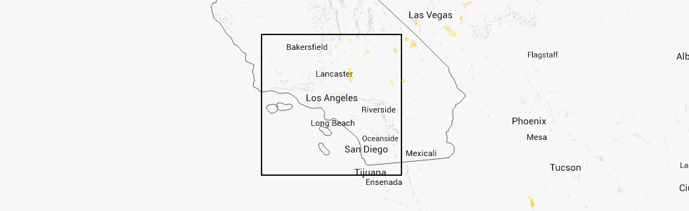
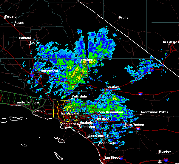
Hail Map for Ridgecrest, CA
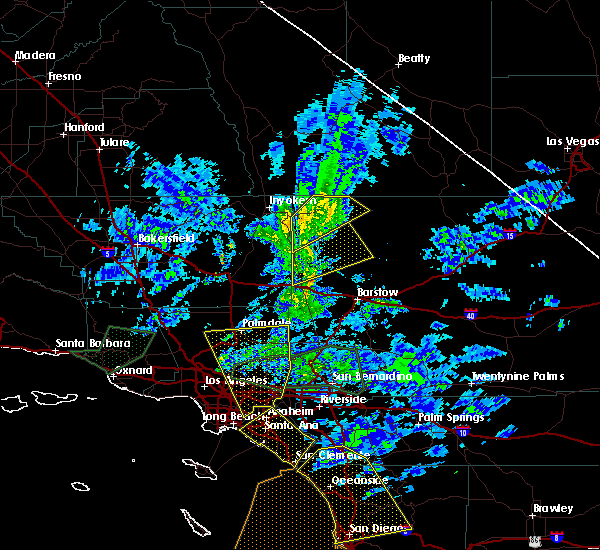
The Ridgecrest, CA area has had 0 reports of on-the-ground hail by trained spotters, and has been under severe weather warnings 0 times during the past 12 months. Doppler radar has detected hail at or near Ridgecrest, CA on 1 occasion.
| Name: | Ridgecrest, CA |
| Where Located: | 78.2 miles ENE of Bakersfield, CA |
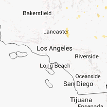
| Map: | Google Map for Ridgecrest, CA |
| Population: | 27616 |
| Housing Units: | 11915 |
| More Info: | Search Google for Ridgecrest, CA |
0
The Top Recent Hail Date for Ridgecrest, CA is Sunday, August 18, 2013 (1st out of 1)
Hail and Wind Damage Spotted near Ridgecrest, CA
| Date / Time | Report Details |
|---|---|
| 5/21/2023 6:56 PM PDT | Asos station knid china lake aso in kern county CA, 3.3 miles S of Ridgecrest, CA |
| 1/31/2016 2:10 PM PST |
 The severe thunderstorm warning for northwestern san bernardino county will expire at 215 pm pst, the storm which prompted the warning has weakened below severe limits, and no longer poses an immediate threat to life or property. therefore the warning will be allowed to expire. remember, a severe thunderstorm warning still remains in effect for western san bernardino county south of the previously warned area, including us 395. The severe thunderstorm warning for northwestern san bernardino county will expire at 215 pm pst, the storm which prompted the warning has weakened below severe limits, and no longer poses an immediate threat to life or property. therefore the warning will be allowed to expire. remember, a severe thunderstorm warning still remains in effect for western san bernardino county south of the previously warned area, including us 395.
|
| 1/31/2016 1:56 PM PST |
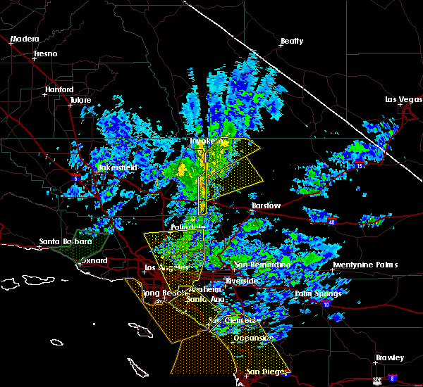 At 156 pm pst, doppler radar continued to indicate a severe thunderstorm capable of producing destructive winds in excess of 70 mph. this storm was located 10 miles east of ridgecrest, moving northeast at 45 mph. locations impacted include, trona, homewood canyon-valley wells and searles valley. At 156 pm pst, doppler radar continued to indicate a severe thunderstorm capable of producing destructive winds in excess of 70 mph. this storm was located 10 miles east of ridgecrest, moving northeast at 45 mph. locations impacted include, trona, homewood canyon-valley wells and searles valley.
|
| 1/31/2016 1:36 PM PST |
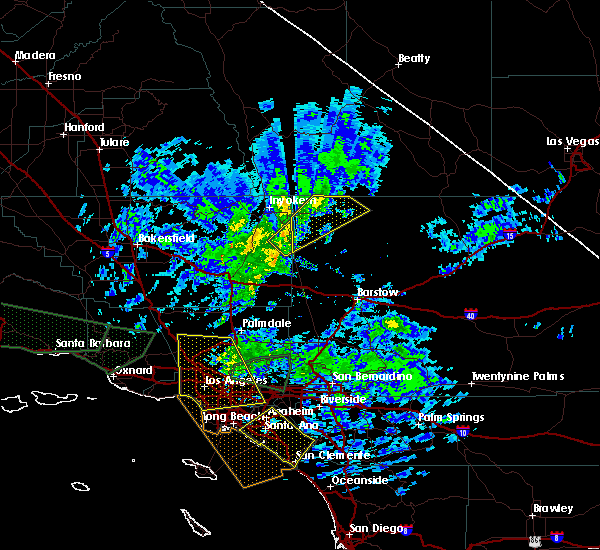 At 135 pm pst, doppler radar indicated a severe thunderstorm capable of producing destructive winds in excess of 70 mph. this storm was located near randsburg, or 13 miles south of ridgecrest, and moving northeast at 45 mph. At 135 pm pst, doppler radar indicated a severe thunderstorm capable of producing destructive winds in excess of 70 mph. this storm was located near randsburg, or 13 miles south of ridgecrest, and moving northeast at 45 mph.
|
| 1/31/2016 1:33 PM PST |
 At 132 pm pst, doppler radar indicated a severe thunderstorm capable of producing damaging winds in excess of 60 mph. this storm was located near randsburg, or 14 miles south of ridgecrest, and moving northeast at 45 mph. At 132 pm pst, doppler radar indicated a severe thunderstorm capable of producing damaging winds in excess of 60 mph. this storm was located near randsburg, or 14 miles south of ridgecrest, and moving northeast at 45 mph.
|
| 7/1/2015 5:26 AM PDT | Laurel mountain raws; also 58 mph report at 4:26 am pd in kern county CA, 10 miles N of Ridgecrest, CA |
| 7/2/2013 9:00 AM PDT | Numerous reports of wind damage from thunderstorm outflow winds in ridgecrest between about 900 and 920 am. winds estimated up to 75 mph. power poles knocked down with in kern county CA, 0.7 miles SW of Ridgecrest, CA |
| 1/1/0001 12:00 AM | Gust to 48 mph due to outflow boundary in kern county CA, 0.7 miles SW of Ridgecrest, CA |
Hail Maps for Ridgecrest, CA
Connect with Interactive Hail Maps