

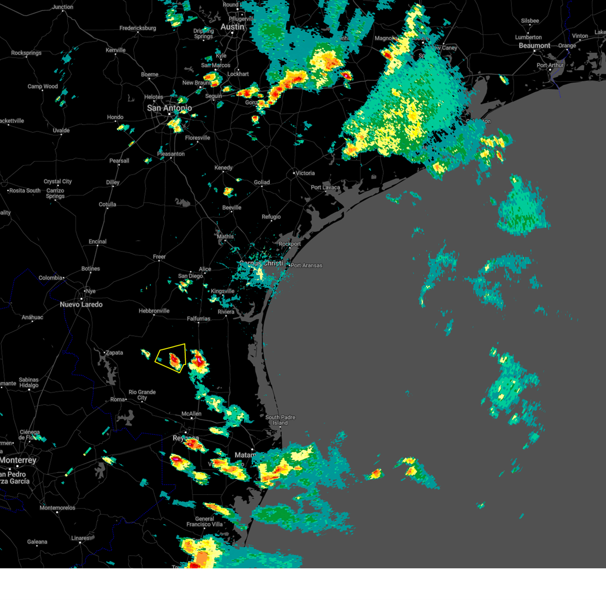
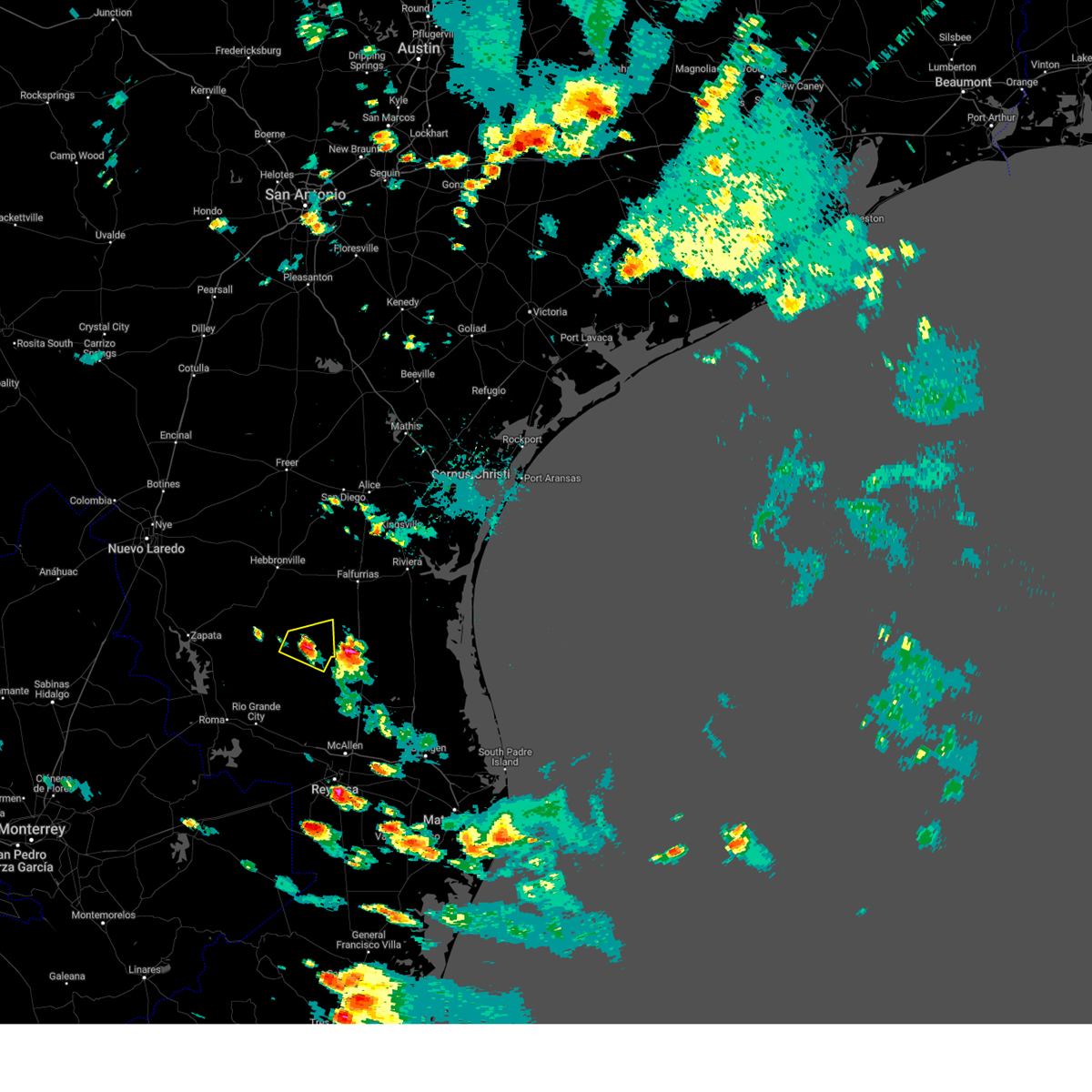
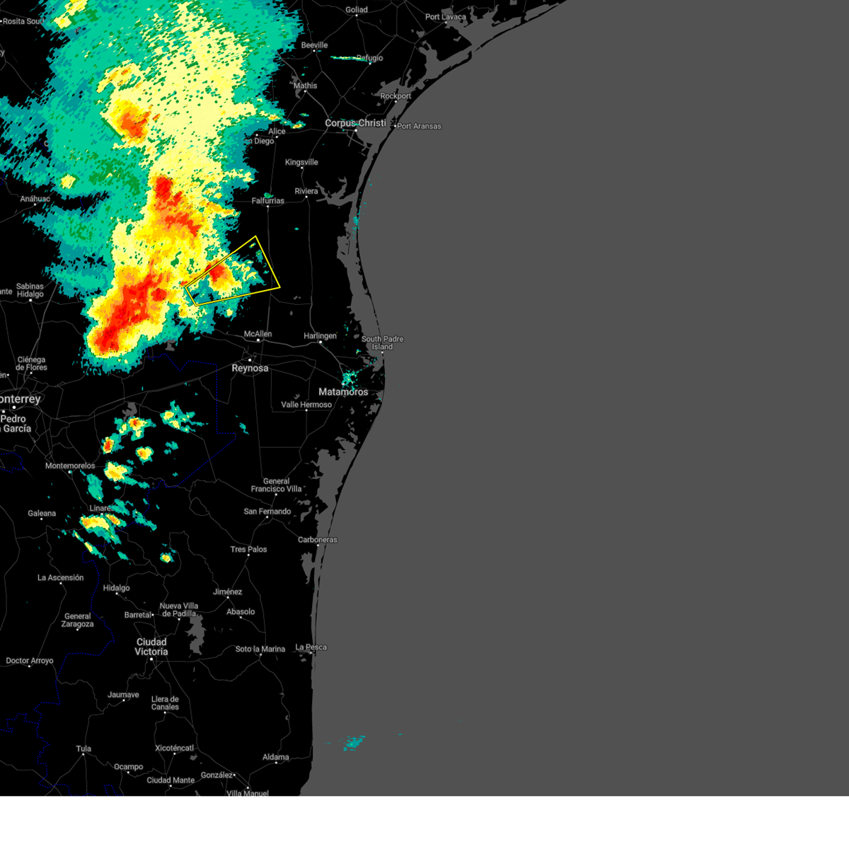
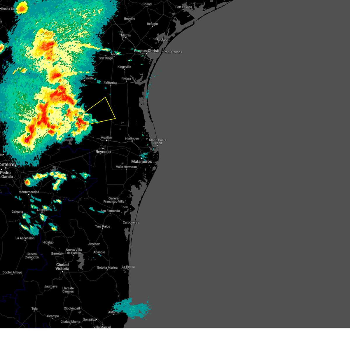
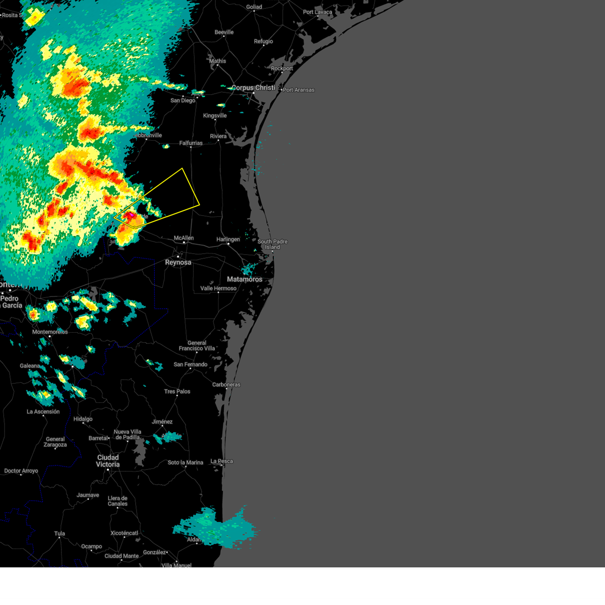
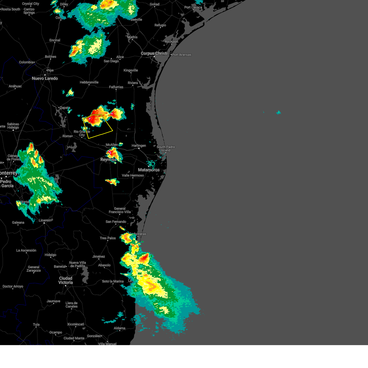
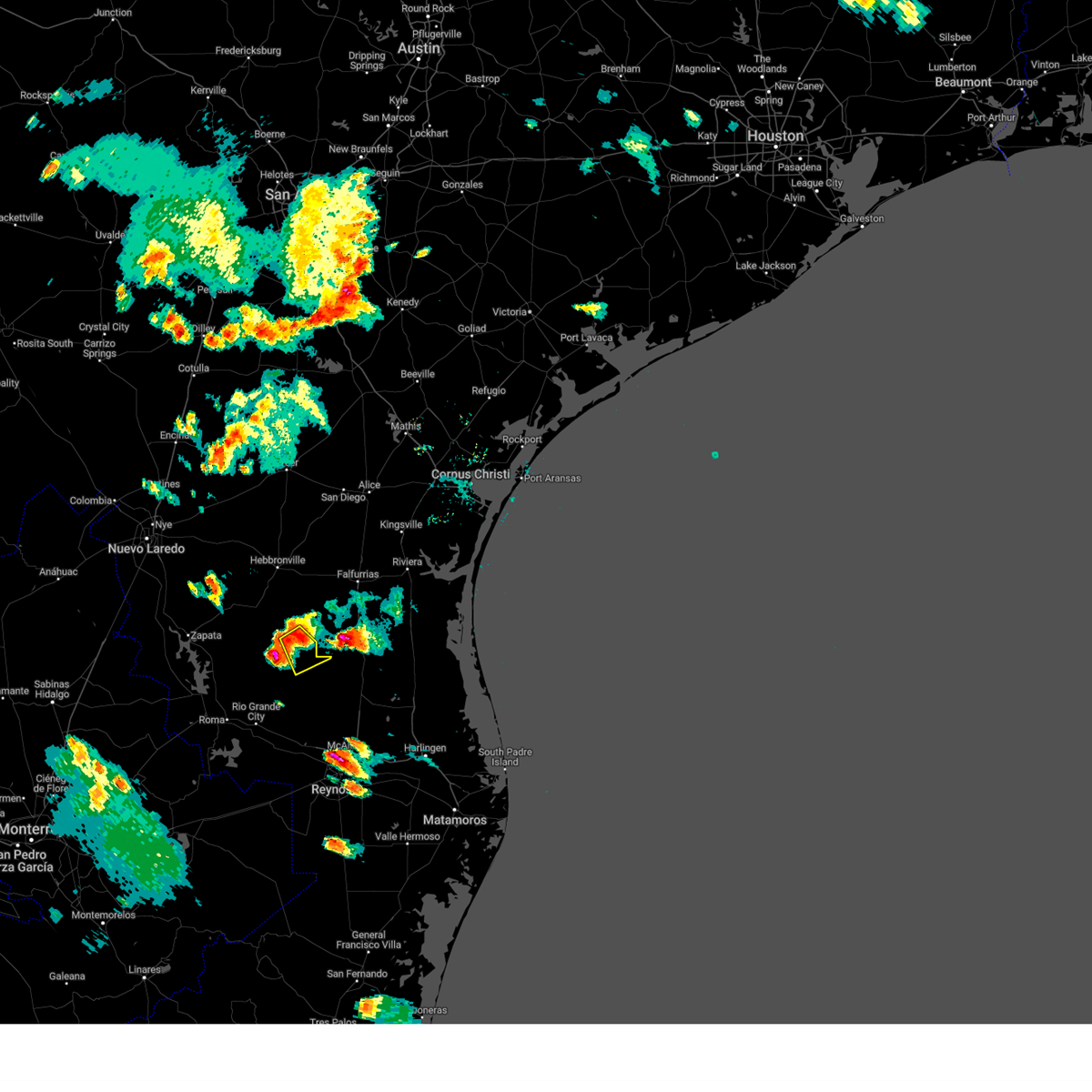
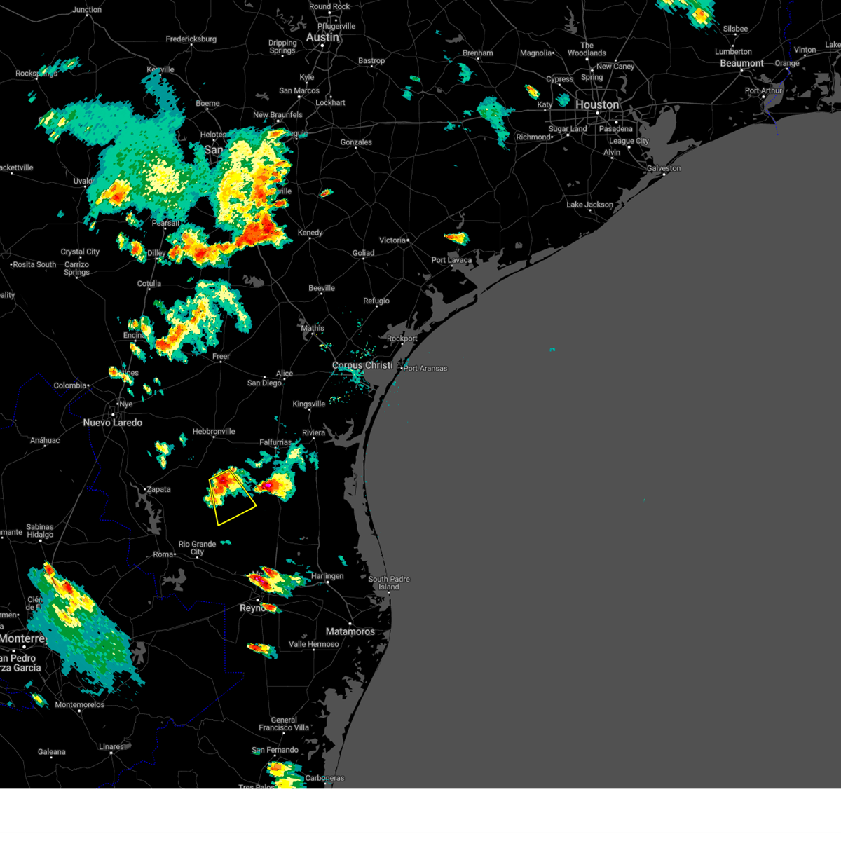
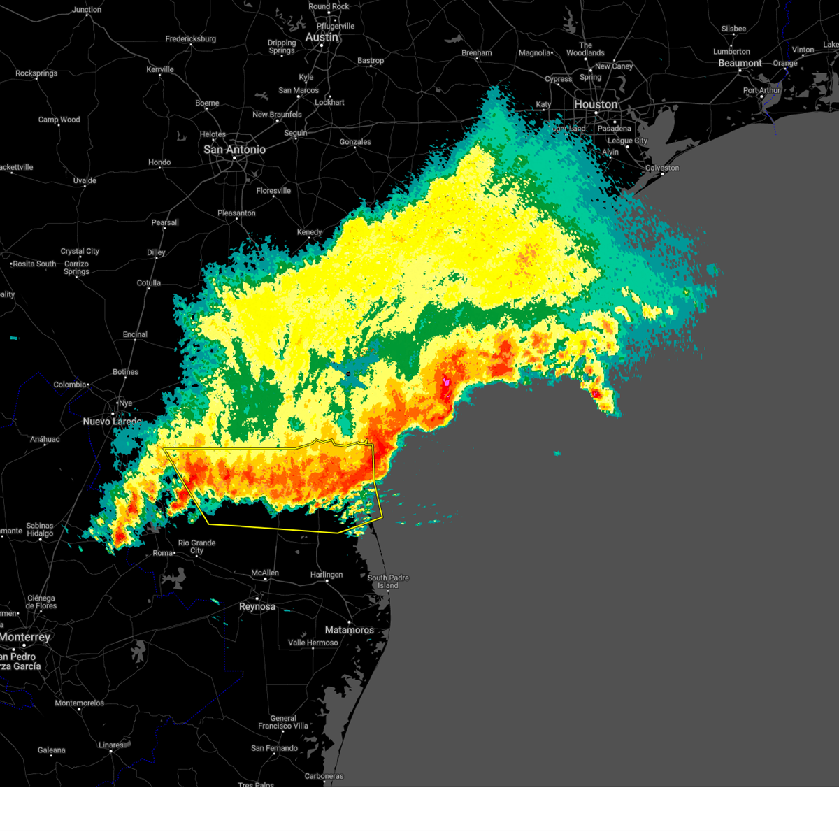
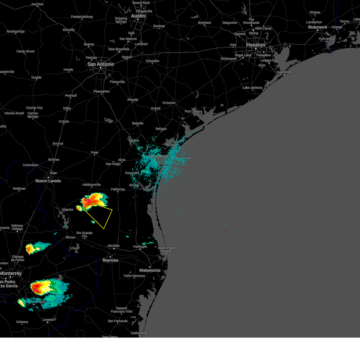
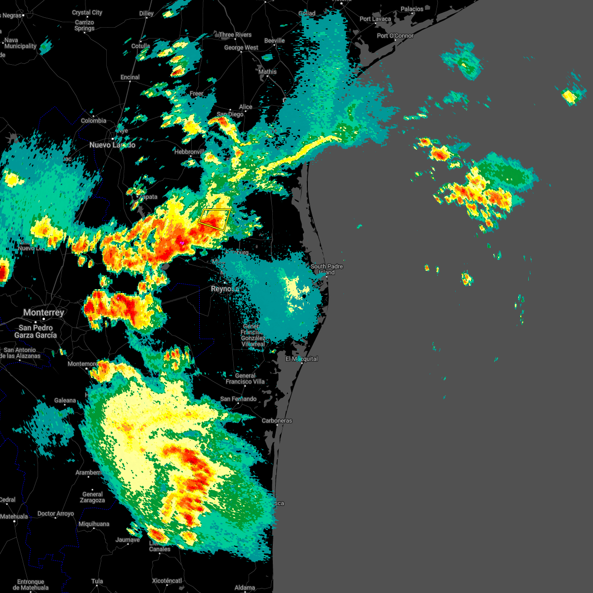
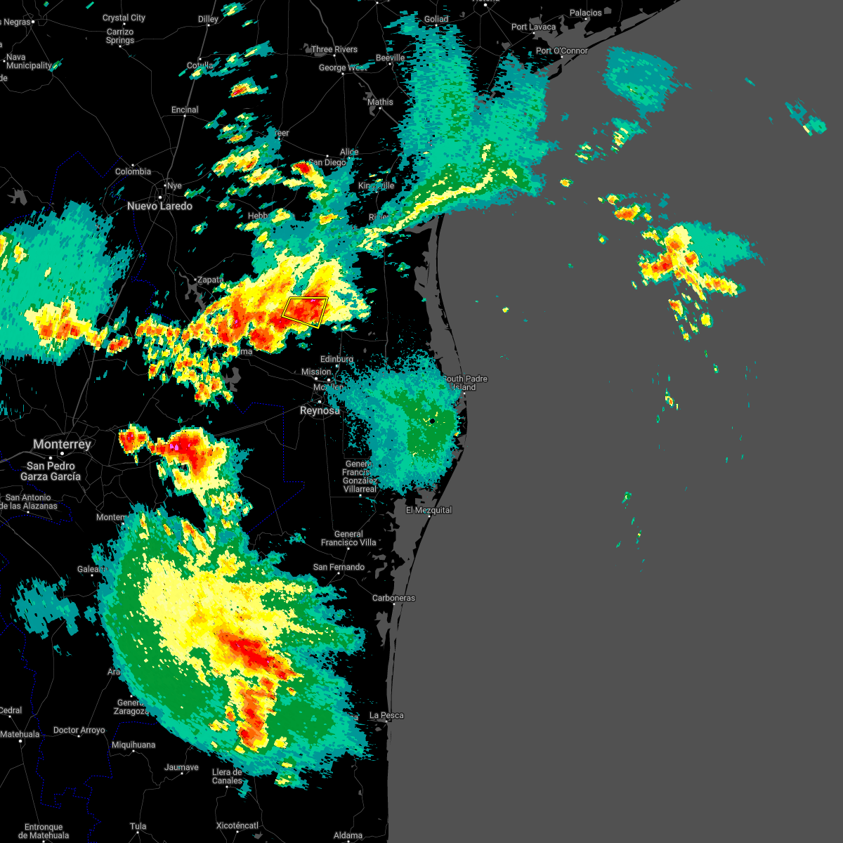
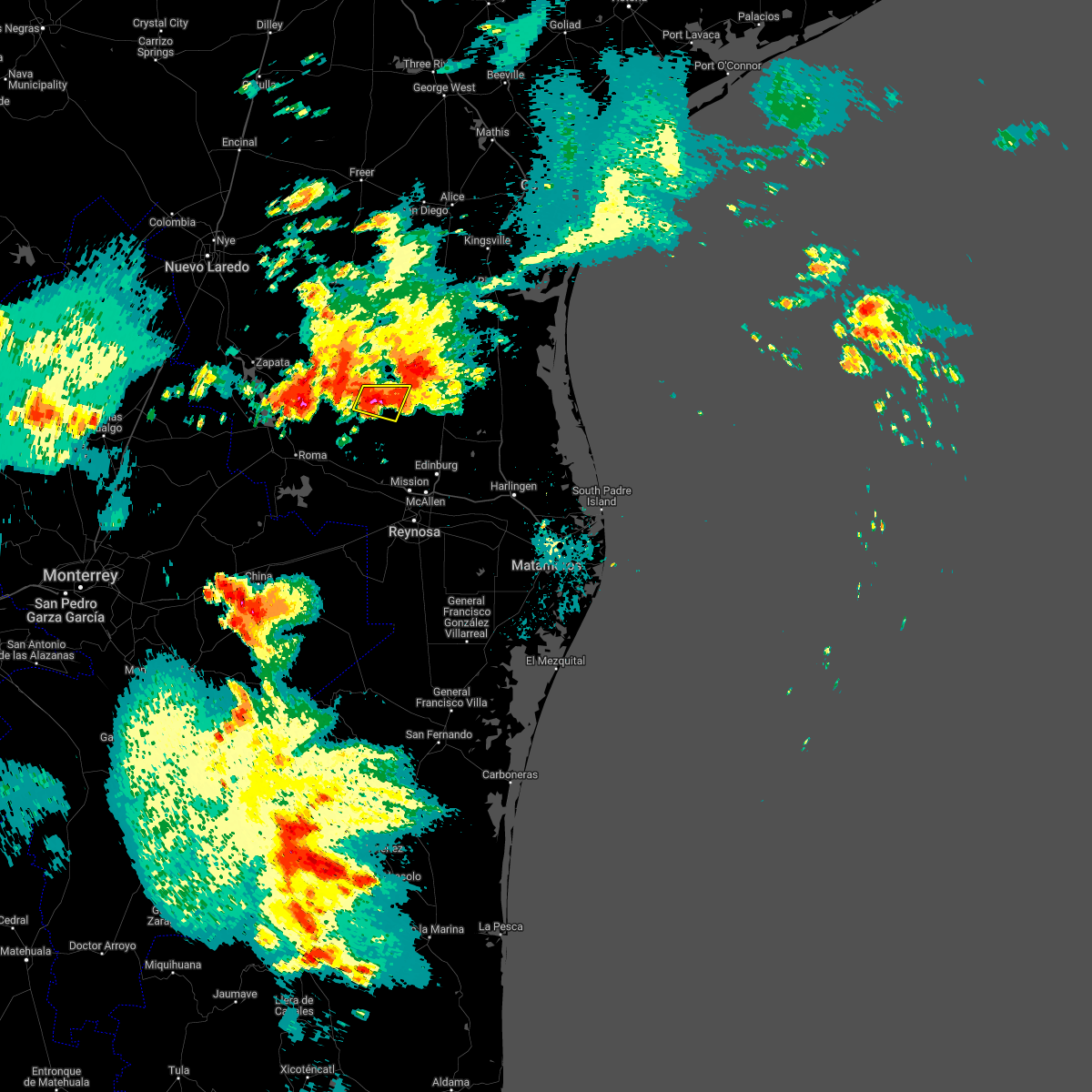
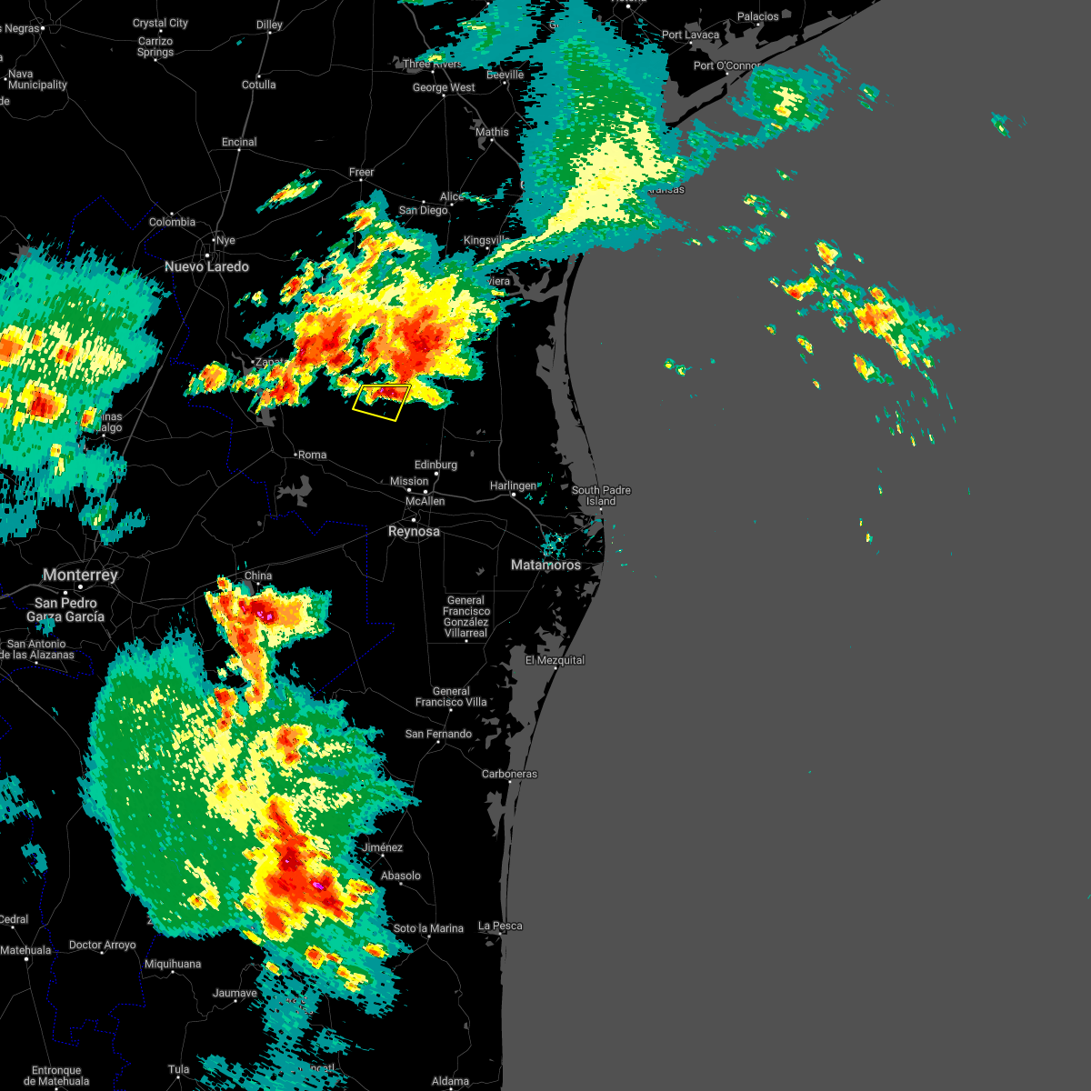
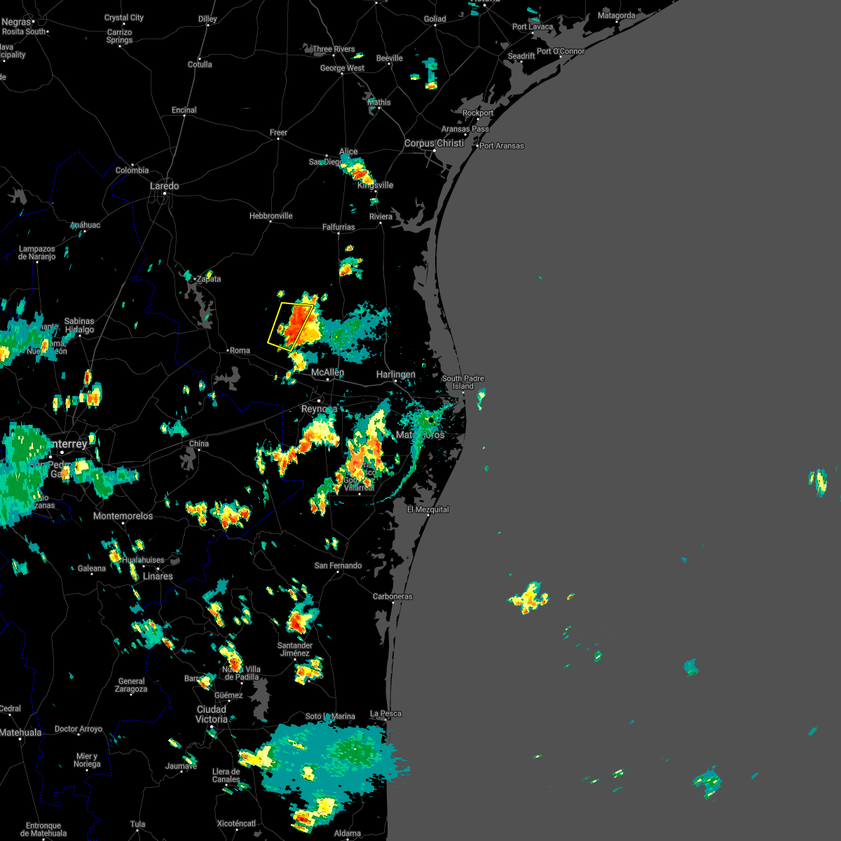
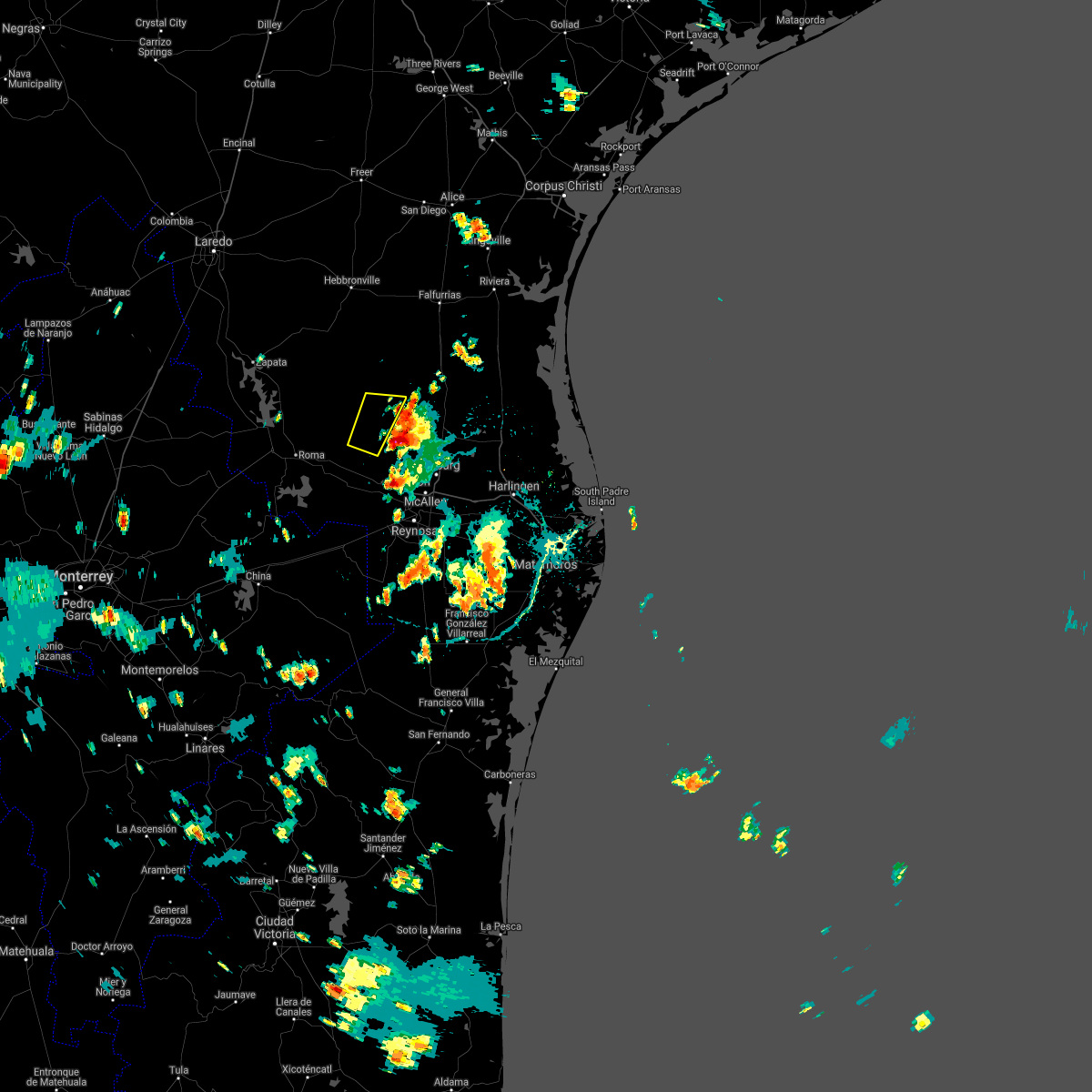
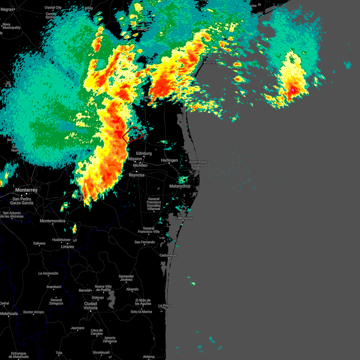
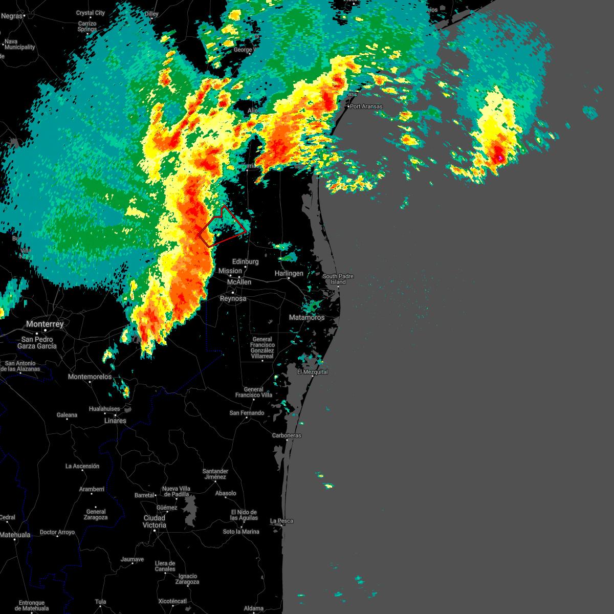
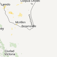
Hail Map for San Isidro, TX
The San Isidro, TX area has had 2 reports of on-the-ground hail by trained spotters, and has been under severe weather warnings 20 times during the past 12 months. Doppler radar has detected hail at or near San Isidro, TX on 24 occasions, including 4 occasions during the past year.
| Name: | San Isidro, TX |
| Where Located: | 81.6 miles NW of Brownsville, TX |
| Map: | Google Map for San Isidro, TX |
| Population: | 240 |
| Housing Units: | 112 |
| More Info: | Search Google for San Isidro, TX |
1
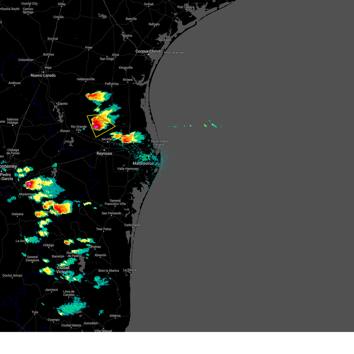
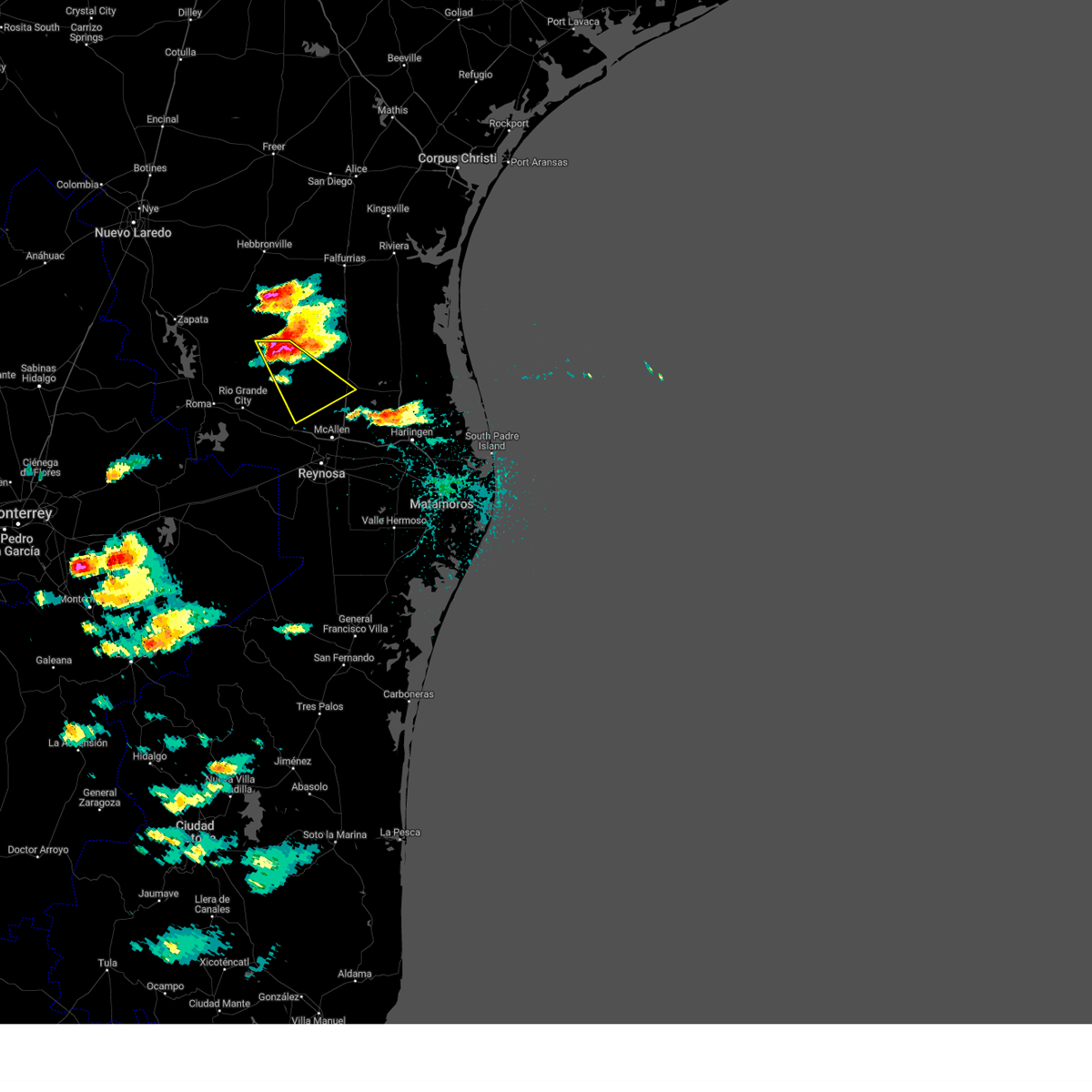
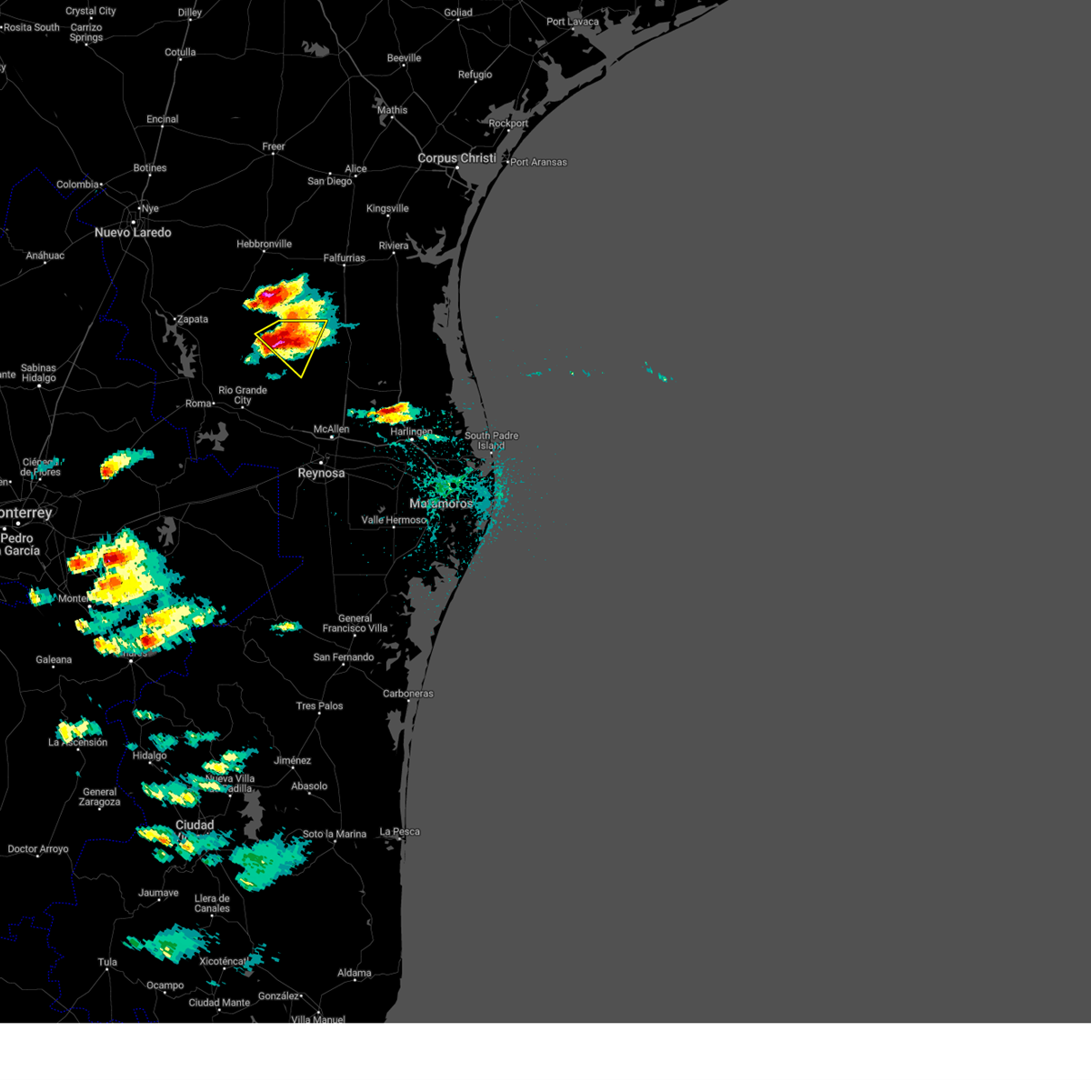
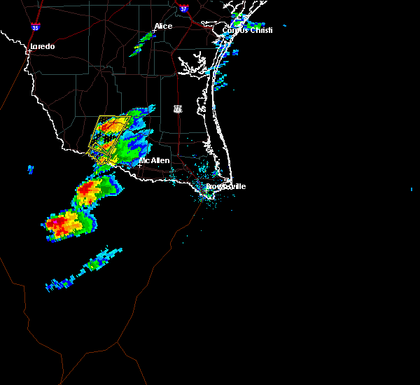
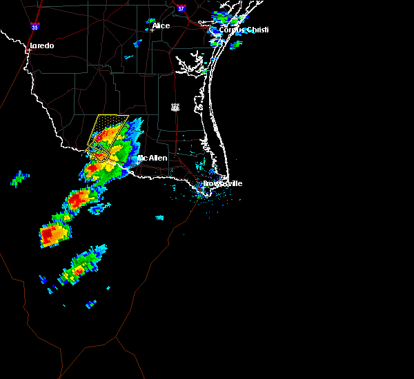
The Top Recent Hail Date for San Isidro, TX is Friday, April 21, 2023 (5th out of 24)

Hail and Wind Damage Spotted near San Isidro, TX
| Date / Time | Report Details |
|---|---|
| 6/5/2023 5:06 PM CDT |
 The severe thunderstorm warning for southeastern jim hogg, northeastern starr and southwestern brooks counties will expire at 515 pm cdt, the storm which prompted the warning has weakened below severe limits, and no longer poses an immediate threat to life or property. therefore, the warning will be allowed to expire. however small hail is still possible with this thunderstorm. a severe thunderstorm watch remains in effect until 600 pm cdt for deep south texas. The severe thunderstorm warning for southeastern jim hogg, northeastern starr and southwestern brooks counties will expire at 515 pm cdt, the storm which prompted the warning has weakened below severe limits, and no longer poses an immediate threat to life or property. therefore, the warning will be allowed to expire. however small hail is still possible with this thunderstorm. a severe thunderstorm watch remains in effect until 600 pm cdt for deep south texas.
|
| 6/5/2023 4:51 PM CDT |
 At 451 pm cdt, a severe thunderstorm was located over san rafael ranch airport, or 10 miles southeast of agua nueva, moving east at 30 mph (radar indicated). Hazards include quarter size hail. damage to vehicles is expected At 451 pm cdt, a severe thunderstorm was located over san rafael ranch airport, or 10 miles southeast of agua nueva, moving east at 30 mph (radar indicated). Hazards include quarter size hail. damage to vehicles is expected
|
| 6/3/2023 8:54 PM CDT |
 At 853 pm cdt, a severe thunderstorm was located over las lomas, or near rio grande city, moving east at 55 mph (radar indicated). Hazards include 60 mph wind gusts and quarter size hail. Hail damage to vehicles is expected. Expect wind damage to roofs, siding, and trees. At 853 pm cdt, a severe thunderstorm was located over las lomas, or near rio grande city, moving east at 55 mph (radar indicated). Hazards include 60 mph wind gusts and quarter size hail. Hail damage to vehicles is expected. Expect wind damage to roofs, siding, and trees.
|
| 6/3/2023 8:26 PM CDT |
 The severe thunderstorm warning for southeastern jim hogg, northwestern hidalgo, northeastern starr and southwestern brooks counties will expire at 830 pm cdt, the storm which prompted the warning has weakened below severe limits, and no longer poses an immediate threat to life or property. therefore, the warning will be allowed to expire. however small hail is still possible with this thunderstorm. a severe thunderstorm watch remains in effect until 100 am cdt for deep south texas. The severe thunderstorm warning for southeastern jim hogg, northwestern hidalgo, northeastern starr and southwestern brooks counties will expire at 830 pm cdt, the storm which prompted the warning has weakened below severe limits, and no longer poses an immediate threat to life or property. therefore, the warning will be allowed to expire. however small hail is still possible with this thunderstorm. a severe thunderstorm watch remains in effect until 100 am cdt for deep south texas.
|
| 6/3/2023 7:59 PM CDT |
 At 758 pm cdt, a severe thunderstorm was located over santa catarina, or 14 miles northwest of mccook, moving northeast at 50 mph (radar indicated). Hazards include ping pong ball size hail. People and animals outdoors will be injured. expect damage to roofs, siding, windows, and vehicles. Locations impacted include, puerto rico, la gloria, la reforma, santa catarina, el coyote ranch airport, san isidro, san rafael ranch airport, santa elena, delmita and diamond o ranch airport. At 758 pm cdt, a severe thunderstorm was located over santa catarina, or 14 miles northwest of mccook, moving northeast at 50 mph (radar indicated). Hazards include ping pong ball size hail. People and animals outdoors will be injured. expect damage to roofs, siding, windows, and vehicles. Locations impacted include, puerto rico, la gloria, la reforma, santa catarina, el coyote ranch airport, san isidro, san rafael ranch airport, santa elena, delmita and diamond o ranch airport.
|
| 6/3/2023 7:46 PM CDT |
 At 746 pm cdt, a severe thunderstorm was located 9 miles southwest of santa catarina, or 10 miles east of el sauz, moving northeast at 50 mph (radar indicated). Hazards include ping pong ball size hail. People and animals outdoors will be injured. expect damage to roofs, siding, windows, and vehicles. Locations impacted include, rio grande city, el sauz, puerto rico, starr county memorial hospital, ringgold middle school, santa catarina, fort ringgold county park, starr county sheriffs office, la gloria and la reforma. At 746 pm cdt, a severe thunderstorm was located 9 miles southwest of santa catarina, or 10 miles east of el sauz, moving northeast at 50 mph (radar indicated). Hazards include ping pong ball size hail. People and animals outdoors will be injured. expect damage to roofs, siding, windows, and vehicles. Locations impacted include, rio grande city, el sauz, puerto rico, starr county memorial hospital, ringgold middle school, santa catarina, fort ringgold county park, starr county sheriffs office, la gloria and la reforma.
|
| 6/3/2023 7:39 PM CDT |
 At 738 pm cdt, a severe thunderstorm was located near el sauz, moving northeast at 50 mph (radar indicated). Hazards include ping pong ball size hail. People and animals outdoors will be injured. Expect damage to roofs, siding, windows, and vehicles. At 738 pm cdt, a severe thunderstorm was located near el sauz, moving northeast at 50 mph (radar indicated). Hazards include ping pong ball size hail. People and animals outdoors will be injured. Expect damage to roofs, siding, windows, and vehicles.
|
| 5/29/2023 8:57 PM CDT |
 At 856 pm cdt, severe thunderstorms were located along a line extending from near la reforma to near mccook to 8 miles northeast of sullivan city to near las lomas to near el sauz, moving southeast at 15 mph (radar indicated). Hazards include 60 mph wind gusts and nickel size hail. expect damage to roofs, siding, and trees At 856 pm cdt, severe thunderstorms were located along a line extending from near la reforma to near mccook to 8 miles northeast of sullivan city to near las lomas to near el sauz, moving southeast at 15 mph (radar indicated). Hazards include 60 mph wind gusts and nickel size hail. expect damage to roofs, siding, and trees
|
| 5/29/2023 8:30 PM CDT |
 At 830 pm cdt, a severe thunderstorm was located over santa catarina, or 15 miles south of agua nueva, moving southeast at 20 mph (radar indicated). Hazards include 60 mph wind gusts and nickel size hail. expect damage to roofs, siding, and trees At 830 pm cdt, a severe thunderstorm was located over santa catarina, or 15 miles south of agua nueva, moving southeast at 20 mph (radar indicated). Hazards include 60 mph wind gusts and nickel size hail. expect damage to roofs, siding, and trees
|
| 5/29/2023 8:01 PM CDT |
 At 801 pm cdt, a severe thunderstorm was located over agua nueva, moving southeast at 15 mph (radar indicated). Hazards include 60 mph wind gusts and quarter size hail. Hail damage to vehicles is expected. expect wind damage to roofs, siding, and trees. locations impacted include, agua nueva, la gloria, san rafael ranch airport, santa elena, diamond o ranch airport and puesta del sol airport. hail threat, radar indicated max hail size, 1. 00 in wind threat, radar indicated max wind gust, 60 mph. At 801 pm cdt, a severe thunderstorm was located over agua nueva, moving southeast at 15 mph (radar indicated). Hazards include 60 mph wind gusts and quarter size hail. Hail damage to vehicles is expected. expect wind damage to roofs, siding, and trees. locations impacted include, agua nueva, la gloria, san rafael ranch airport, santa elena, diamond o ranch airport and puesta del sol airport. hail threat, radar indicated max hail size, 1. 00 in wind threat, radar indicated max wind gust, 60 mph.
|
| 5/29/2023 7:44 PM CDT |
 At 744 pm cdt, a severe thunderstorm was located near agua nueva, moving southeast at 15 mph (radar indicated). Hazards include 60 mph wind gusts and quarter size hail. Hail damage to vehicles is expected. Expect wind damage to roofs, siding, and trees. At 744 pm cdt, a severe thunderstorm was located near agua nueva, moving southeast at 15 mph (radar indicated). Hazards include 60 mph wind gusts and quarter size hail. Hail damage to vehicles is expected. Expect wind damage to roofs, siding, and trees.
|
| 5/13/2023 12:50 AM CDT |
 At 1249 am cdt, severe thunderstorms were located along a line extending from near starr county memorial hospital to near los ebanos to 16 miles southwest of granjero, moving northeast at 35 mph (radar indicated). Hazards include 60 mph wind gusts and nickel size hail. expect damage to roofs, siding, and trees At 1249 am cdt, severe thunderstorms were located along a line extending from near starr county memorial hospital to near los ebanos to 16 miles southwest of granjero, moving northeast at 35 mph (radar indicated). Hazards include 60 mph wind gusts and nickel size hail. expect damage to roofs, siding, and trees
|
| 4/23/2023 12:46 PM CDT |
 At 1246 pm cdt, severe thunderstorms were located along a line extending from 45 miles northeast of beach access six to porfirio to 7 miles west of mccook to near fronton, moving southeast at 45 mph (radar indicated). Hazards include 70 mph wind gusts and penny size hail. Expect considerable tree damage. damage is likely to mobile homes, roofs, and outbuildings. locations impacted include, edinburg, harlingen, rio grande city, raymondville, roma, elsa, edcouch, santa rosa, lyford and la villa. thunderstorm damage threat, considerable hail threat, radar indicated max hail size, 0. 75 in wind threat, radar indicated max wind gust, 70 mph. At 1246 pm cdt, severe thunderstorms were located along a line extending from 45 miles northeast of beach access six to porfirio to 7 miles west of mccook to near fronton, moving southeast at 45 mph (radar indicated). Hazards include 70 mph wind gusts and penny size hail. Expect considerable tree damage. damage is likely to mobile homes, roofs, and outbuildings. locations impacted include, edinburg, harlingen, rio grande city, raymondville, roma, elsa, edcouch, santa rosa, lyford and la villa. thunderstorm damage threat, considerable hail threat, radar indicated max hail size, 0. 75 in wind threat, radar indicated max wind gust, 70 mph.
|
| 4/23/2023 12:17 PM CDT |
 At 1216 pm cdt, severe thunderstorms were located along a line extending from 38 miles east of kenedy county wind farms to near rudolph to 7 miles west of santa catarina to 7 miles west of falcon dam, moving southeast at 45 mph (radar indicated). Hazards include 70 mph wind gusts and penny size hail. Expect considerable tree damage. Damage is likely to mobile homes, roofs, and outbuildings. At 1216 pm cdt, severe thunderstorms were located along a line extending from 38 miles east of kenedy county wind farms to near rudolph to 7 miles west of santa catarina to 7 miles west of falcon dam, moving southeast at 45 mph (radar indicated). Hazards include 70 mph wind gusts and penny size hail. Expect considerable tree damage. Damage is likely to mobile homes, roofs, and outbuildings.
|
| 4/23/2023 12:06 PM CDT |
 At 1206 pm cdt, severe thunderstorms were located along a line extending from 30 miles southeast of malaquite beach to 9 miles west of norias to near guerra, moving southeast at 55 mph (radar indicated). Hazards include 70 mph wind gusts and penny size hail. Expect considerable tree damage. damage is likely to mobile homes, roofs, and outbuildings. locations impacted include, falfurrias, armstrong, agua nueva, encino, rachal, sarita, puerto rico, randado, la gloria and la reforma. thunderstorm damage threat, considerable hail threat, radar indicated max hail size, 0. 75 in wind threat, radar indicated max wind gust, 70 mph. At 1206 pm cdt, severe thunderstorms were located along a line extending from 30 miles southeast of malaquite beach to 9 miles west of norias to near guerra, moving southeast at 55 mph (radar indicated). Hazards include 70 mph wind gusts and penny size hail. Expect considerable tree damage. damage is likely to mobile homes, roofs, and outbuildings. locations impacted include, falfurrias, armstrong, agua nueva, encino, rachal, sarita, puerto rico, randado, la gloria and la reforma. thunderstorm damage threat, considerable hail threat, radar indicated max hail size, 0. 75 in wind threat, radar indicated max wind gust, 70 mph.
|
| 4/23/2023 11:42 AM CDT |
 At 1141 am cdt, severe thunderstorms were located along a line extending from 21 miles southeast of malaquite beach to 6 miles east of rachal to near bustamante, moving southeast at 50 mph (radar indicated). Hazards include 70 mph wind gusts and penny size hail. Expect considerable tree damage. Damage is likely to mobile homes, roofs, and outbuildings. At 1141 am cdt, severe thunderstorms were located along a line extending from 21 miles southeast of malaquite beach to 6 miles east of rachal to near bustamante, moving southeast at 50 mph (radar indicated). Hazards include 70 mph wind gusts and penny size hail. Expect considerable tree damage. Damage is likely to mobile homes, roofs, and outbuildings.
|
| 4/21/2023 4:02 PM CDT |
 At 401 pm cdt, a severe thunderstorm was located over mccook, moving southeast at 35 mph (radar indicated). Hazards include golf ball size hail and 60 mph wind gusts. People and animals outdoors will be injured. expect hail damage to roofs, siding, windows, and vehicles. expect wind damage to roofs, siding, and trees. locations impacted include, mccook, red gate, santa catarina, juan n. seguin elementary school and delmita. thunderstorm damage threat, considerable hail threat, radar indicated max hail size, 1. 75 in wind threat, radar indicated max wind gust, 60 mph. At 401 pm cdt, a severe thunderstorm was located over mccook, moving southeast at 35 mph (radar indicated). Hazards include golf ball size hail and 60 mph wind gusts. People and animals outdoors will be injured. expect hail damage to roofs, siding, windows, and vehicles. expect wind damage to roofs, siding, and trees. locations impacted include, mccook, red gate, santa catarina, juan n. seguin elementary school and delmita. thunderstorm damage threat, considerable hail threat, radar indicated max hail size, 1. 75 in wind threat, radar indicated max wind gust, 60 mph.
|
| 4/21/2023 3:41 PM CDT |
 At 340 pm cdt, a severe thunderstorm was located near santa catarina, or 13 miles northwest of mccook, moving southeast at 35 mph (radar indicated). Hazards include golf ball size hail and 60 mph wind gusts. People and animals outdoors will be injured. expect hail damage to roofs, siding, windows, and vehicles. Expect wind damage to roofs, siding, and trees. At 340 pm cdt, a severe thunderstorm was located near santa catarina, or 13 miles northwest of mccook, moving southeast at 35 mph (radar indicated). Hazards include golf ball size hail and 60 mph wind gusts. People and animals outdoors will be injured. expect hail damage to roofs, siding, windows, and vehicles. Expect wind damage to roofs, siding, and trees.
|
| 4/21/2023 3:30 PM CDT |
 At 329 pm cdt, a severe thunderstorm was located over san rafael ranch airport, or 11 miles southeast of agua nueva, moving southeast at 35 mph (radar indicated). Hazards include golf ball size hail and 60 mph wind gusts. People and animals outdoors will be injured. expect hail damage to roofs, siding, windows, and vehicles. expect wind damage to roofs, siding, and trees. locations impacted include, la gloria, la reforma, san isidro, san rafael ranch airport, santa elena, delmita, diamond o ranch airport and puesta del sol airport. thunderstorm damage threat, considerable hail threat, radar indicated max hail size, 1. 75 in wind threat, radar indicated max wind gust, 60 mph. At 329 pm cdt, a severe thunderstorm was located over san rafael ranch airport, or 11 miles southeast of agua nueva, moving southeast at 35 mph (radar indicated). Hazards include golf ball size hail and 60 mph wind gusts. People and animals outdoors will be injured. expect hail damage to roofs, siding, windows, and vehicles. expect wind damage to roofs, siding, and trees. locations impacted include, la gloria, la reforma, san isidro, san rafael ranch airport, santa elena, delmita, diamond o ranch airport and puesta del sol airport. thunderstorm damage threat, considerable hail threat, radar indicated max hail size, 1. 75 in wind threat, radar indicated max wind gust, 60 mph.
|
| 4/21/2023 3:05 PM CDT |
 At 304 pm cdt, a severe thunderstorm was located near agua nueva, moving southeast at 30 mph (radar indicated). Hazards include 60 mph wind gusts and half dollar size hail. Hail damage to vehicles is expected. Expect wind damage to roofs, siding, and trees. At 304 pm cdt, a severe thunderstorm was located near agua nueva, moving southeast at 30 mph (radar indicated). Hazards include 60 mph wind gusts and half dollar size hail. Hail damage to vehicles is expected. Expect wind damage to roofs, siding, and trees.
|
| 5/23/2022 10:49 PM CDT |
 At 1049 pm cdt, a severe thunderstorm was located near mccook, moving east at 35 mph (radar indicated). Hazards include tennis ball size hail and 70 mph wind gusts. People and animals outdoors will be injured. expect hail damage to roofs, siding, windows, and vehicles. expect considerable tree damage. wind damage is also likely to mobile homes, roofs, and outbuildings. Locations impacted include, san manuel, mccook, linn, faysville, puerto rico, red gate, la gloria, monte cristo elementary school, la reforma and doolittle. At 1049 pm cdt, a severe thunderstorm was located near mccook, moving east at 35 mph (radar indicated). Hazards include tennis ball size hail and 70 mph wind gusts. People and animals outdoors will be injured. expect hail damage to roofs, siding, windows, and vehicles. expect considerable tree damage. wind damage is also likely to mobile homes, roofs, and outbuildings. Locations impacted include, san manuel, mccook, linn, faysville, puerto rico, red gate, la gloria, monte cristo elementary school, la reforma and doolittle.
|
| 5/23/2022 10:38 PM CDT |
 At 1037 pm cdt, a severe thunderstorm was located near mccook, moving east at 30 mph (radar indicated). Hazards include tennis ball size hail and 70 mph wind gusts. People and animals outdoors will be injured. expect hail damage to roofs, siding, windows, and vehicles. expect considerable tree damage. wind damage is also likely to mobile homes, roofs, and outbuildings. Locations impacted include, encino, rachal, san manuel, mccook, linn, faysville, puerto rico, red gate, santa catarina and la gloria. At 1037 pm cdt, a severe thunderstorm was located near mccook, moving east at 30 mph (radar indicated). Hazards include tennis ball size hail and 70 mph wind gusts. People and animals outdoors will be injured. expect hail damage to roofs, siding, windows, and vehicles. expect considerable tree damage. wind damage is also likely to mobile homes, roofs, and outbuildings. Locations impacted include, encino, rachal, san manuel, mccook, linn, faysville, puerto rico, red gate, santa catarina and la gloria.
|
| 5/23/2022 10:28 PM CDT |
 The severe thunderstorm warning for southeastern jim hogg and starr counties will expire at 1030 pm cdt, the severe thunderstorm which prompted the warning continues to move east and has been replaced by new warnings. this warning will be allowed to expire. a severe thunderstorm watch remains in effect until midnight cdt for deep south texas. remember, a severe thunderstorm warning still remains in effect for eastern starr county and southeastern jim hogg county until 11:15 pm. The severe thunderstorm warning for southeastern jim hogg and starr counties will expire at 1030 pm cdt, the severe thunderstorm which prompted the warning continues to move east and has been replaced by new warnings. this warning will be allowed to expire. a severe thunderstorm watch remains in effect until midnight cdt for deep south texas. remember, a severe thunderstorm warning still remains in effect for eastern starr county and southeastern jim hogg county until 11:15 pm.
|
| 5/23/2022 10:24 PM CDT |
 At 1023 pm cdt, a severe thunderstorm was located near santa catarina, or 13 miles northwest of mccook, moving east at 30 mph (radar indicated). Hazards include tennis ball size hail and 60 mph wind gusts. People and animals outdoors will be injured. expect hail damage to roofs, siding, windows, and vehicles. Expect wind damage to roofs, siding, and trees. At 1023 pm cdt, a severe thunderstorm was located near santa catarina, or 13 miles northwest of mccook, moving east at 30 mph (radar indicated). Hazards include tennis ball size hail and 60 mph wind gusts. People and animals outdoors will be injured. expect hail damage to roofs, siding, windows, and vehicles. Expect wind damage to roofs, siding, and trees.
|
| 5/23/2022 10:15 PM CDT |
 At 1015 pm cdt, a severe thunderstorm was located 7 miles northwest of mccook, moving southeast at 30 mph (radar indicated). Hazards include ping pong ball size hail and 60 mph wind gusts. People and animals outdoors will be injured. expect hail damage to roofs, siding, windows, and vehicles. expect wind damage to roofs, siding, and trees. locations impacted include, rio grande city, roma, escobares, agua nueva, el sauz, viboras, garciasville, la rosita, los alvarez and fort ringgold county park. hail threat, radar indicated max hail size, 1. 50 in wind threat, radar indicated max wind gust, 60 mph. At 1015 pm cdt, a severe thunderstorm was located 7 miles northwest of mccook, moving southeast at 30 mph (radar indicated). Hazards include ping pong ball size hail and 60 mph wind gusts. People and animals outdoors will be injured. expect hail damage to roofs, siding, windows, and vehicles. expect wind damage to roofs, siding, and trees. locations impacted include, rio grande city, roma, escobares, agua nueva, el sauz, viboras, garciasville, la rosita, los alvarez and fort ringgold county park. hail threat, radar indicated max hail size, 1. 50 in wind threat, radar indicated max wind gust, 60 mph.
|
| 5/23/2022 9:56 PM CDT |
 At 955 pm cdt, a severe thunderstorm was located near santa catarina, or 14 miles southeast of viboras, moving southeast at 25 mph (radar indicated). Hazards include 60 mph wind gusts and half dollar size hail. Hail damage to vehicles is expected. expect wind damage to roofs, siding, and trees. locations impacted include, rio grande city, roma, escobares, agua nueva, el sauz, viboras, garciasville, la rosita, los alvarez and fort ringgold county park. hail threat, radar indicated max hail size, 1. 25 in wind threat, radar indicated max wind gust, 60 mph. At 955 pm cdt, a severe thunderstorm was located near santa catarina, or 14 miles southeast of viboras, moving southeast at 25 mph (radar indicated). Hazards include 60 mph wind gusts and half dollar size hail. Hail damage to vehicles is expected. expect wind damage to roofs, siding, and trees. locations impacted include, rio grande city, roma, escobares, agua nueva, el sauz, viboras, garciasville, la rosita, los alvarez and fort ringgold county park. hail threat, radar indicated max hail size, 1. 25 in wind threat, radar indicated max wind gust, 60 mph.
|
| 5/23/2022 9:39 PM CDT |
 At 939 pm cdt, a severe thunderstorm was located near viboras, moving southeast at 30 mph (radar indicated). Hazards include 60 mph wind gusts and half dollar size hail. Hail damage to vehicles is expected. Expect wind damage to roofs, siding, and trees. At 939 pm cdt, a severe thunderstorm was located near viboras, moving southeast at 30 mph (radar indicated). Hazards include 60 mph wind gusts and half dollar size hail. Hail damage to vehicles is expected. Expect wind damage to roofs, siding, and trees.
|
| 4/25/2022 9:11 PM CDT |
 The severe thunderstorm warning for north central hidalgo and northeastern starr counties will expire at 915 pm cdt, the severe thunderstorm which prompted the warning has weakened. therefore, the warning will be allowed to expire. The severe thunderstorm warning for north central hidalgo and northeastern starr counties will expire at 915 pm cdt, the severe thunderstorm which prompted the warning has weakened. therefore, the warning will be allowed to expire.
|
| 4/25/2022 8:46 PM CDT |
 At 845 pm cdt, a severe thunderstorm was located near la reforma, or 16 miles southwest of rachal, moving south at 10 mph (radar indicated). Hazards include 60 mph wind gusts and nickel size hail. expect damage to roofs, siding, and trees At 845 pm cdt, a severe thunderstorm was located near la reforma, or 16 miles southwest of rachal, moving south at 10 mph (radar indicated). Hazards include 60 mph wind gusts and nickel size hail. expect damage to roofs, siding, and trees
|
| 4/25/2022 8:22 PM CDT |
 At 821 pm cdt, a severe thunderstorm was located over la gloria, or 13 miles south of agua nueva, and is nearly stationary (radar indicated). Hazards include 60 mph wind gusts and quarter size hail. Hail damage to vehicles is expected. expect wind damage to roofs, siding, and trees. locations impacted include, la gloria, la reforma, santa catarina, san isidro, santa elena, delmita and diamond o ranch airport. hail threat, radar indicated max hail size, 1. 00 in wind threat, radar indicated max wind gust, 60 mph. At 821 pm cdt, a severe thunderstorm was located over la gloria, or 13 miles south of agua nueva, and is nearly stationary (radar indicated). Hazards include 60 mph wind gusts and quarter size hail. Hail damage to vehicles is expected. expect wind damage to roofs, siding, and trees. locations impacted include, la gloria, la reforma, santa catarina, san isidro, santa elena, delmita and diamond o ranch airport. hail threat, radar indicated max hail size, 1. 00 in wind threat, radar indicated max wind gust, 60 mph.
|
| 4/25/2022 8:00 PM CDT |
 At 759 pm cdt, a severe thunderstorm was located over santa elena, or 12 miles southeast of agua nueva, moving south or southwest at 5 mph (radar indicated). Hazards include 60 mph wind gusts and half dollar size hail. Hail damage to vehicles is expected. Expect wind damage to roofs, siding, and trees. At 759 pm cdt, a severe thunderstorm was located over santa elena, or 12 miles southeast of agua nueva, moving south or southwest at 5 mph (radar indicated). Hazards include 60 mph wind gusts and half dollar size hail. Hail damage to vehicles is expected. Expect wind damage to roofs, siding, and trees.
|
| 7/28/2021 4:14 PM CDT |
 At 410 pm cdt, severe thunderstorms were located along a line extending from near la reforma to the starr hidalgo county line west of mccook, moving west at 20 mph (nws cooperative observer in mccook reported 61 mph gusts and pea sized hail at 349 pm). Hazards include 60 mph wind gusts and penny size hail. Expect damage to poorly constructed roofs, siding, and sheds as well as unanchored mobile homes or trailers. these severe storms will be near, san isidro around 420 pm cdt. la gloria through 430 pm cdt. santa catarina between 430 and 440 pm cdt. other locations impacted by these severe thunderstorms include diamond o ranch airport and delmita. the wind core is beginning to weaken, but the threat continues. Mcallen/miller airport had a 54 mph gust on the backside of similar storms at 334 pm. At 410 pm cdt, severe thunderstorms were located along a line extending from near la reforma to the starr hidalgo county line west of mccook, moving west at 20 mph (nws cooperative observer in mccook reported 61 mph gusts and pea sized hail at 349 pm). Hazards include 60 mph wind gusts and penny size hail. Expect damage to poorly constructed roofs, siding, and sheds as well as unanchored mobile homes or trailers. these severe storms will be near, san isidro around 420 pm cdt. la gloria through 430 pm cdt. santa catarina between 430 and 440 pm cdt. other locations impacted by these severe thunderstorms include diamond o ranch airport and delmita. the wind core is beginning to weaken, but the threat continues. Mcallen/miller airport had a 54 mph gust on the backside of similar storms at 334 pm.
|
| 7/28/2021 3:57 PM CDT |
 At 355 pm cdt, severe thunderstorms were located along a line extending from puerto rico to near mccook, moving west at 20 mph (cooperative nws observer. report of 61 mph wind and pea sized hail at 349 pm). Hazards include 60 mph wind gusts and quarter size hail. Expect wind damage to poorly constructured or anchored roofs and siding as well as mobile homes. some trees will also fall. severe thunderstorms will be near, la reforma around 405 pm cdt. san isidro around 420 pm cdt. la gloria and santa catarina around 430 pm cdt. Other locations impacted by these severe thunderstorms include diamond o ranch airport and delmita as addition cells move toward la gloria. At 355 pm cdt, severe thunderstorms were located along a line extending from puerto rico to near mccook, moving west at 20 mph (cooperative nws observer. report of 61 mph wind and pea sized hail at 349 pm). Hazards include 60 mph wind gusts and quarter size hail. Expect wind damage to poorly constructured or anchored roofs and siding as well as mobile homes. some trees will also fall. severe thunderstorms will be near, la reforma around 405 pm cdt. san isidro around 420 pm cdt. la gloria and santa catarina around 430 pm cdt. Other locations impacted by these severe thunderstorms include diamond o ranch airport and delmita as addition cells move toward la gloria.
|
| 6/3/2021 8:19 PM CDT |
 At 819 pm cdt, severe thunderstorms were located along a line extending from 7 miles east of viboras to starr county memorial hospital, moving east at 10 to 15 mph (radar indicated). Hazards include 60 mph wind gusts and penny size hail. Expect damage to roofs, siding, and trees. Locations impacted include, rio grande city, roma, escobares, el sauz, viboras, garciasville, la rosita, la victoria, los alvarez and fort ringgold county park. At 819 pm cdt, severe thunderstorms were located along a line extending from 7 miles east of viboras to starr county memorial hospital, moving east at 10 to 15 mph (radar indicated). Hazards include 60 mph wind gusts and penny size hail. Expect damage to roofs, siding, and trees. Locations impacted include, rio grande city, roma, escobares, el sauz, viboras, garciasville, la rosita, la victoria, los alvarez and fort ringgold county park.
|
| 6/3/2021 8:03 PM CDT |
 At 803 pm cdt, national weather service doppler radar indicated severe thunderstorms located along a line extending from near viboras to la rosita, moving southeast at 10 mph (radar indicated). Hazards include 60 mph wind gusts and penny size hail. expect damage to roofs, siding, and trees At 803 pm cdt, national weather service doppler radar indicated severe thunderstorms located along a line extending from near viboras to la rosita, moving southeast at 10 mph (radar indicated). Hazards include 60 mph wind gusts and penny size hail. expect damage to roofs, siding, and trees
|
| 5/19/2021 8:21 AM CDT |
 The national weather service in brownsville has issued a * severe thunderstorm warning for. western kenedy county in deep south texas. central jim hogg county in deep south texas. hidalgo county in deep south texas. Eastern starr county in deep south texas. The national weather service in brownsville has issued a * severe thunderstorm warning for. western kenedy county in deep south texas. central jim hogg county in deep south texas. hidalgo county in deep south texas. Eastern starr county in deep south texas.
|
| 5/19/2021 8:00 AM CDT |
 At 800 am cdt, a severe thunderstorm capable of producing a tornado was located near san isidro, or 12 miles north of mccook, moving northeast at 40 mph (radar indicated rotation). Hazards include tornado. Flying debris will be dangerous to those caught without shelter. mobile homes will be damaged or destroyed. damage to roofs, windows, and vehicles will occur. tree damage is likely. this dangerous storm will be near, la reforma and puerto rico around 805 am cdt. Other locations impacted by this tornadic thunderstorm include delmita. At 800 am cdt, a severe thunderstorm capable of producing a tornado was located near san isidro, or 12 miles north of mccook, moving northeast at 40 mph (radar indicated rotation). Hazards include tornado. Flying debris will be dangerous to those caught without shelter. mobile homes will be damaged or destroyed. damage to roofs, windows, and vehicles will occur. tree damage is likely. this dangerous storm will be near, la reforma and puerto rico around 805 am cdt. Other locations impacted by this tornadic thunderstorm include delmita.
|
| 5/19/2021 7:51 AM CDT |
 At 750 am cdt, a severe thunderstorm capable of producing a tornado was located near santa catarina, or 12 miles northwest of mccook, moving northeast at 40 mph (radar indicated rotation). Hazards include tornado. Flying debris will be dangerous to those caught without shelter. mobile homes will be damaged or destroyed. damage to roofs, windows, and vehicles will occur. tree damage is likely. this dangerous storm will be near, santa elena around 800 am cdt. la reforma, san isidro and puerto rico around 805 am cdt. Other locations impacted by this tornadic thunderstorm include delmita and diamond o ranch airport. At 750 am cdt, a severe thunderstorm capable of producing a tornado was located near santa catarina, or 12 miles northwest of mccook, moving northeast at 40 mph (radar indicated rotation). Hazards include tornado. Flying debris will be dangerous to those caught without shelter. mobile homes will be damaged or destroyed. damage to roofs, windows, and vehicles will occur. tree damage is likely. this dangerous storm will be near, santa elena around 800 am cdt. la reforma, san isidro and puerto rico around 805 am cdt. Other locations impacted by this tornadic thunderstorm include delmita and diamond o ranch airport.
|
| 5/19/2021 7:47 AM CDT |
 At 747 am cdt, severe thunderstorms were located along a line extending from 12 miles southeast of south fork estates to near los ebanos, moving southeast at 35 mph (radar indicated). Hazards include 60 mph wind gusts. expect damage to roofs, siding, and trees At 747 am cdt, severe thunderstorms were located along a line extending from 12 miles southeast of south fork estates to near los ebanos, moving southeast at 35 mph (radar indicated). Hazards include 60 mph wind gusts. expect damage to roofs, siding, and trees
|
| 5/26/2020 2:05 AM CDT |
 At 205 am cdt, severe thunderstorms were located along a line extending from 9 miles southwest of agua nueva to 8 miles southeast of el sauz to 6 miles south of roma park, moving east at 35 mph (radar indicated). Hazards include golf ball size hail and 70 mph wind gusts. People and animals outdoors will be injured. expect hail damage to roofs, siding, windows, and vehicles. expect considerable tree damage. wind damage is also likely to mobile homes, roofs, and outbuildings. Locations impacted include, rio grande city, roma, escobares, el sauz, viboras, garciasville, la rosita, la grulla, puerto rico and la victoria. At 205 am cdt, severe thunderstorms were located along a line extending from 9 miles southwest of agua nueva to 8 miles southeast of el sauz to 6 miles south of roma park, moving east at 35 mph (radar indicated). Hazards include golf ball size hail and 70 mph wind gusts. People and animals outdoors will be injured. expect hail damage to roofs, siding, windows, and vehicles. expect considerable tree damage. wind damage is also likely to mobile homes, roofs, and outbuildings. Locations impacted include, rio grande city, roma, escobares, el sauz, viboras, garciasville, la rosita, la grulla, puerto rico and la victoria.
|
| 5/26/2020 1:27 AM CDT |
 At 126 am cdt, severe thunderstorms were located along a line extending from near mirando city to near viboras to 16 miles southwest of falcon dam, moving east at 40 mph. these are very dangerous storms (radar indicated). Hazards include 80 mph wind gusts and golf ball size hail. Flying debris will be dangerous to those caught without shelter. mobile homes will be heavily damaged. expect considerable damage to roofs, windows, and vehicles. Extensive tree damage and power outages are likely. At 126 am cdt, severe thunderstorms were located along a line extending from near mirando city to near viboras to 16 miles southwest of falcon dam, moving east at 40 mph. these are very dangerous storms (radar indicated). Hazards include 80 mph wind gusts and golf ball size hail. Flying debris will be dangerous to those caught without shelter. mobile homes will be heavily damaged. expect considerable damage to roofs, windows, and vehicles. Extensive tree damage and power outages are likely.
|
| 5/8/2020 9:53 PM CDT | Tree blocking roadway to the north of la gloria near highway 755. time estimated via rada in starr county TX, 3.6 miles ESE of San Isidro, TX |
| 4/4/2020 6:37 AM CDT |
 The severe thunderstorm warning for southeastern jim hogg, northeastern starr and southwestern brooks counties will expire at 645 am cdt, the storm which prompted the warning has moved out of the area. therefore, the warning will be allowed to expire. The severe thunderstorm warning for southeastern jim hogg, northeastern starr and southwestern brooks counties will expire at 645 am cdt, the storm which prompted the warning has moved out of the area. therefore, the warning will be allowed to expire.
|
| 4/4/2020 6:26 AM CDT |
 At 625 am cdt, a severe thunderstorm was located near san isidro, or 16 miles southwest of rachal, moving southeast at 30 mph (radar indicated). Hazards include tennis ball size hail and 60 mph wind gusts. People and animals outdoors will be injured. expect hail damage to roofs, siding, windows, and vehicles. Expect wind damage to roofs, siding, and trees. At 625 am cdt, a severe thunderstorm was located near san isidro, or 16 miles southwest of rachal, moving southeast at 30 mph (radar indicated). Hazards include tennis ball size hail and 60 mph wind gusts. People and animals outdoors will be injured. expect hail damage to roofs, siding, windows, and vehicles. Expect wind damage to roofs, siding, and trees.
|
| 4/4/2020 6:23 AM CDT |
 At 623 am cdt, a severe thunderstorm was located near san rafael ranch airport, or 13 miles east of agua nueva, moving east at 20 mph (radar indicated). Hazards include tennis ball size hail and 60 mph wind gusts. People and animals outdoors will be injured. expect hail damage to roofs, siding, windows, and vehicles. expect wind damage to roofs, siding, and trees. Locations impacted include, la reforma, san isidro, san rafael ranch airport and santa elena. At 623 am cdt, a severe thunderstorm was located near san rafael ranch airport, or 13 miles east of agua nueva, moving east at 20 mph (radar indicated). Hazards include tennis ball size hail and 60 mph wind gusts. People and animals outdoors will be injured. expect hail damage to roofs, siding, windows, and vehicles. expect wind damage to roofs, siding, and trees. Locations impacted include, la reforma, san isidro, san rafael ranch airport and santa elena.
|
| 4/4/2020 6:08 AM CDT |
 At 607 am cdt, a severe thunderstorm was located over san rafael ranch airport, or 7 miles southeast of agua nueva, moving east at 20 mph (radar indicated). Hazards include two inch hail and 60 mph wind gusts. People and animals outdoors will be injured. expect hail damage to roofs, siding, windows, and vehicles. Expect wind damage to roofs, siding, and trees. At 607 am cdt, a severe thunderstorm was located over san rafael ranch airport, or 7 miles southeast of agua nueva, moving east at 20 mph (radar indicated). Hazards include two inch hail and 60 mph wind gusts. People and animals outdoors will be injured. expect hail damage to roofs, siding, windows, and vehicles. Expect wind damage to roofs, siding, and trees.
|
| 4/7/2019 8:07 AM CDT |
 The severe thunderstorm warning for northeastern hidalgo, northeastern starr and brooks counties will expire at 815 am cdt, the storms which prompted the warning have weakened below severe limits, and no longer pose an immediate threat to life or property. therefore, the warning will be allowed to expire. however heavy rain and frequent lightning are still possible with these thunderstorms. a severe thunderstorm watch remains in effect until 900 am cdt for deep south texas. The severe thunderstorm warning for northeastern hidalgo, northeastern starr and brooks counties will expire at 815 am cdt, the storms which prompted the warning have weakened below severe limits, and no longer pose an immediate threat to life or property. therefore, the warning will be allowed to expire. however heavy rain and frequent lightning are still possible with these thunderstorms. a severe thunderstorm watch remains in effect until 900 am cdt for deep south texas.
|
| 4/7/2019 8:01 AM CDT |
 At 800 am cdt, severe thunderstorms were located along a line extending from near falfurrias to la gloria, moving east at 25 mph (radar indicated). Hazards include 60 mph wind gusts and penny size hail. Expect damage to roofs, siding, and trees. Locations impacted include, falfurrias, encino, rachal, san manuel, linn, puerto rico, la colonia park, airport road addition, falfurrias junior high school and la gloria. At 800 am cdt, severe thunderstorms were located along a line extending from near falfurrias to la gloria, moving east at 25 mph (radar indicated). Hazards include 60 mph wind gusts and penny size hail. Expect damage to roofs, siding, and trees. Locations impacted include, falfurrias, encino, rachal, san manuel, linn, puerto rico, la colonia park, airport road addition, falfurrias junior high school and la gloria.
|
| 4/7/2019 7:17 AM CDT |
 At 716 am cdt, severe thunderstorms were located along a line extending from 8 miles southeast of ramirez to near santa elena, moving east at 25 mph (radar indicated). Hazards include 60 mph wind gusts and quarter size hail. Hail damage to vehicles is expected. Expect wind damage to roofs, siding, and trees. At 716 am cdt, severe thunderstorms were located along a line extending from 8 miles southeast of ramirez to near santa elena, moving east at 25 mph (radar indicated). Hazards include 60 mph wind gusts and quarter size hail. Hail damage to vehicles is expected. Expect wind damage to roofs, siding, and trees.
|
| 3/28/2018 8:00 PM CDT |
 At 800 pm cdt, a severe thunderstorm was located over santa catarina, or 13 miles east of viboras, moving north at 30 mph (radar indicated). Hazards include ping pong ball size hail and 60 mph wind gusts. People and animals outdoors will be injured. expect hail damage to roofs, siding, windows, and vehicles. expect wind damage to roofs, siding, and trees. Locations impacted include, la gloria, san isidro, santa elena, santa catarina, diamond o ranch airport and delmita. At 800 pm cdt, a severe thunderstorm was located over santa catarina, or 13 miles east of viboras, moving north at 30 mph (radar indicated). Hazards include ping pong ball size hail and 60 mph wind gusts. People and animals outdoors will be injured. expect hail damage to roofs, siding, windows, and vehicles. expect wind damage to roofs, siding, and trees. Locations impacted include, la gloria, san isidro, santa elena, santa catarina, diamond o ranch airport and delmita.
|
| 3/28/2018 7:39 PM CDT |
 At 738 pm cdt, a severe thunderstorm was located 11 miles north of la victoria, or 11 miles north of garciasville, moving northeast at 40 mph (radar indicated). Hazards include golf ball size hail and 60 mph wind gusts. People and animals outdoors will be injured. expect hail damage to roofs, siding, windows, and vehicles. Expect wind damage to roofs, siding, and trees. At 738 pm cdt, a severe thunderstorm was located 11 miles north of la victoria, or 11 miles north of garciasville, moving northeast at 40 mph (radar indicated). Hazards include golf ball size hail and 60 mph wind gusts. People and animals outdoors will be injured. expect hail damage to roofs, siding, windows, and vehicles. Expect wind damage to roofs, siding, and trees.
|
| 5/29/2017 12:51 AM CDT |
 At 1251 am cdt, severe thunderstorms were located along a line extending from near san rafael ranch airport to near san isidro to 9 miles southwest of mccook to alto bonito, moving east at 40 mph (radar indicated). Hazards include 60 mph wind gusts and quarter size hail. Hail damage to vehicles. including cracked windshields and minor exterior dents can expected. some damage to crops and trees is expected. expect minor wind damage to mobile homes, some roofs, siding and some fences. tree limbs will blow down and small trees will be uprooted. damage to power lines and some power poles is expected. Locations impacted include, rio grande city, penitas, sullivan city, la joya, escobares, el sauz, garciasville, la rosita, mccook and los ebanos. At 1251 am cdt, severe thunderstorms were located along a line extending from near san rafael ranch airport to near san isidro to 9 miles southwest of mccook to alto bonito, moving east at 40 mph (radar indicated). Hazards include 60 mph wind gusts and quarter size hail. Hail damage to vehicles. including cracked windshields and minor exterior dents can expected. some damage to crops and trees is expected. expect minor wind damage to mobile homes, some roofs, siding and some fences. tree limbs will blow down and small trees will be uprooted. damage to power lines and some power poles is expected. Locations impacted include, rio grande city, penitas, sullivan city, la joya, escobares, el sauz, garciasville, la rosita, mccook and los ebanos.
|
| 5/29/2017 12:23 AM CDT |
 At 1221 am cdt, severe thunderstorms were located along a line extending from 7 miles southwest of aqua nuevo to 7 miles southeast of viboras to el saul to 7 miles southwest of , moving east at 45 mph (radar indicated). Hazards include 60 mph wind gusts and quarter size hail. Hail damage to vehicles. including cracked windshields and minor exterior dents can expected. some damage to crops and trees is expected. expect minor wind damage to mobile homes, some roofs, siding and some fences. tree limbs will blow down and small trees will be uprooted. Damage to power lines and some power poles is expected. At 1221 am cdt, severe thunderstorms were located along a line extending from 7 miles southwest of aqua nuevo to 7 miles southeast of viboras to el saul to 7 miles southwest of , moving east at 45 mph (radar indicated). Hazards include 60 mph wind gusts and quarter size hail. Hail damage to vehicles. including cracked windshields and minor exterior dents can expected. some damage to crops and trees is expected. expect minor wind damage to mobile homes, some roofs, siding and some fences. tree limbs will blow down and small trees will be uprooted. Damage to power lines and some power poles is expected.
|
| 5/18/2016 2:44 PM CDT |
 At 244 pm cdt, severe thunderstorms were located along a line extending from 12 miles northwest of encino to near la reforma to 8 miles northeast of la victoria, moving east at 25 mph (radar indicated). Hazards include 60 mph wind gusts and quarter size hail. Hail damage to vehicles. including cracked windshields and minor exterior dents can expected. some damage to crops and trees is expected. expect minor wind damage to mobile homes, some roofs, siding and some fences. tree limbs will blow down and small trees will be uprooted. Damage to power lines and some power poles is expected. At 244 pm cdt, severe thunderstorms were located along a line extending from 12 miles northwest of encino to near la reforma to 8 miles northeast of la victoria, moving east at 25 mph (radar indicated). Hazards include 60 mph wind gusts and quarter size hail. Hail damage to vehicles. including cracked windshields and minor exterior dents can expected. some damage to crops and trees is expected. expect minor wind damage to mobile homes, some roofs, siding and some fences. tree limbs will blow down and small trees will be uprooted. Damage to power lines and some power poles is expected.
|
| 5/18/2016 2:26 PM CDT |
 At 225 pm cdt, severe thunderstorms were located along a line extending from 11 miles northeast of agua nueva to near san rafael ranch airport to santa catarina, moving east at 35 mph (radar indicated). Hazards include ping pong ball size hail and 60 mph wind gusts. People and animals outdoors will be injured. expect hail damage to roofs, siding, windows and property. vehicle damage will include cracked or shattered windshields and major dents requiring significant repairs. expect minor wind damage to mobile homes, some roofs, siding and some fences. tree limbs will blow down and small trees will be uprooted. damage to power lines and some power poles is expected. Locations impacted include, agua nueva, san rafael ranch airport, san isidro, la reforma, santa catarina, santa elena, la gloria, delmita, puesta del sol airport and diamond o ranch airport. At 225 pm cdt, severe thunderstorms were located along a line extending from 11 miles northeast of agua nueva to near san rafael ranch airport to santa catarina, moving east at 35 mph (radar indicated). Hazards include ping pong ball size hail and 60 mph wind gusts. People and animals outdoors will be injured. expect hail damage to roofs, siding, windows and property. vehicle damage will include cracked or shattered windshields and major dents requiring significant repairs. expect minor wind damage to mobile homes, some roofs, siding and some fences. tree limbs will blow down and small trees will be uprooted. damage to power lines and some power poles is expected. Locations impacted include, agua nueva, san rafael ranch airport, san isidro, la reforma, santa catarina, santa elena, la gloria, delmita, puesta del sol airport and diamond o ranch airport.
|
| 5/18/2016 2:07 PM CDT |
 At 206 pm cdt, severe thunderstorms were located along a line extending from 13 miles east of randado to near agua nueva to 8 miles southeast of viboras, moving east at 35 mph (radar indicated). Hazards include 60 mph wind gusts and quarter size hail. Hail damage to vehicles. including cracked windshields and minor exterior dents can expected. some damage to crops and trees is expected. expect minor wind damage to mobile homes, some roofs, siding and some fences. tree limbs will blow down and small trees will be uprooted. Damage to power lines and some power poles is expected. At 206 pm cdt, severe thunderstorms were located along a line extending from 13 miles east of randado to near agua nueva to 8 miles southeast of viboras, moving east at 35 mph (radar indicated). Hazards include 60 mph wind gusts and quarter size hail. Hail damage to vehicles. including cracked windshields and minor exterior dents can expected. some damage to crops and trees is expected. expect minor wind damage to mobile homes, some roofs, siding and some fences. tree limbs will blow down and small trees will be uprooted. Damage to power lines and some power poles is expected.
|
| 4/18/2016 6:25 PM CDT |
 At 624 pm cdt, national weather service meteorologists detected severe thunderstorms located along a line extending from near santa catarina to 11 miles east of el sauz, moving east at 10 to 15 mph (radar indicated). Hazards include tennis ball size hail and 60 mph wind gusts. People and animals outdoors will be injured. expect hail damage to roofs, siding, windows and property. vehicle damage will include cracked or shattered windshields and major dents requiring significant repairs. expect minor wind damage to mobile homes, some roofs, siding and some fences. tree limbs will blow down and small trees will be uprooted. damage to power lines and some power poles is expected. Locations impacted include, santa catarina, santa elena, san isidro, la gloria and diamond o ranch airport. At 624 pm cdt, national weather service meteorologists detected severe thunderstorms located along a line extending from near santa catarina to 11 miles east of el sauz, moving east at 10 to 15 mph (radar indicated). Hazards include tennis ball size hail and 60 mph wind gusts. People and animals outdoors will be injured. expect hail damage to roofs, siding, windows and property. vehicle damage will include cracked or shattered windshields and major dents requiring significant repairs. expect minor wind damage to mobile homes, some roofs, siding and some fences. tree limbs will blow down and small trees will be uprooted. damage to power lines and some power poles is expected. Locations impacted include, santa catarina, santa elena, san isidro, la gloria and diamond o ranch airport.
|
| 4/18/2016 6:09 PM CDT |
 At 608 pm cdt, national weather service meteorologists detected a severe thunderstorm located 8 miles west of santa catarina, or 10 miles southeast of viboras, moving east at 10 mph (radar indicated). Hazards include tennis ball size hail and 60 mph wind gusts. People and animals outdoors will be injured. expect hail damage to roofs, siding, windows and property. vehicle damage will include cracked or shattered windshields and major dents requiring significant repairs. expect minor wind damage to mobile homes, some roofs, siding and some fences. tree limbs will blow down and small trees will be uprooted. damage to power lines and some power poles is expected. Locations impacted include, santa catarina, santa elena, san isidro, la gloria and diamond o ranch airport. At 608 pm cdt, national weather service meteorologists detected a severe thunderstorm located 8 miles west of santa catarina, or 10 miles southeast of viboras, moving east at 10 mph (radar indicated). Hazards include tennis ball size hail and 60 mph wind gusts. People and animals outdoors will be injured. expect hail damage to roofs, siding, windows and property. vehicle damage will include cracked or shattered windshields and major dents requiring significant repairs. expect minor wind damage to mobile homes, some roofs, siding and some fences. tree limbs will blow down and small trees will be uprooted. damage to power lines and some power poles is expected. Locations impacted include, santa catarina, santa elena, san isidro, la gloria and diamond o ranch airport.
|
| 4/18/2016 5:51 PM CDT |
 At 550 pm cdt, national weather service meteorologists indicated a severe thunderstorm located 7 miles southeast of viboras, moving east at 10 mph (radar indicated). Hazards include ping pong ball size hail and 60 mph wind gusts. People and animals outdoors will be injured. expect hail damage to roofs, siding, windows and property. vehicle damage will include cracked or shattered windshields and major dents requiring significant repairs. expect minor wind damage to mobile homes, some roofs, siding and some fences. tree limbs will blow down and small trees will be uprooted. Damage to power lines and some power poles is expected. At 550 pm cdt, national weather service meteorologists indicated a severe thunderstorm located 7 miles southeast of viboras, moving east at 10 mph (radar indicated). Hazards include ping pong ball size hail and 60 mph wind gusts. People and animals outdoors will be injured. expect hail damage to roofs, siding, windows and property. vehicle damage will include cracked or shattered windshields and major dents requiring significant repairs. expect minor wind damage to mobile homes, some roofs, siding and some fences. tree limbs will blow down and small trees will be uprooted. Damage to power lines and some power poles is expected.
|
| 5/23/2015 11:39 PM CDT | At 1138 pm cdt, doppler radar indicated a line of severe thunderstorms capable of producing damaging winds in excess of 60 mph. these storms were located along a line extending from near concepcion to 11 miles northwest of encino to 7 miles northeast of la reforma to 9 miles south of santa catarina, moving east at 45 mph. locations impacted include, mcallen, rio grande city, falfurrias..sullivan city, la joya and la grulla. |
| 5/23/2015 11:12 PM CDT | At 1110 pm cdt, doppler radar indicated a line of severe thunderstorms capable of producing damaging winds in excess of 60 mph. these storms were located along a line extending from hebbronville to near agua nueva to santa catarina to near rio grande city, moving east at 45 mph. |
| 5/11/2015 8:07 PM CDT | At 806 pm cdt, doppler radar indicated a severe thunderstorm capable of producing quarter size hail and damaging winds in excess of 60 mph. this storm was located over la reforma, or 14 miles north of mccook, and moving northeast at 15 mph. |
| 4/17/2015 10:50 PM CDT | At 1048 pm cdt, doppler radar indicated a severe thunderstorm capable of producing quarter size hail and damaging winds in excess of 60 mph. this storm was located near el coyote ranch airport, moving east at 45 mph. locations impacted include, el coyote ranch airport, san isidro, la reforma and delmita. a tornado watch remains in effect until 200 am cdt for portions of deep south texas. |
| 4/17/2015 10:37 PM CDT | At 1036 pm cdt, doppler radar indicated a severe thunderstorm capable of producing quarter size hail and damaging winds in excess of 60 mph. this storm was located near san rafael ranch airport, or 12 miles west of el coyote ranch airport, and moving east at 45 mph. |
| 4/12/2015 10:52 PM CDT | A severe thunderstorm warning remains in effect until 1130 pm cdt for hidalgo. kenedy. northwestern cameron. brooks. eastern starr and willacy counties. at 1048 pm cdt. doppler radar indicated a line of severe thunderstorms capable of producing quarter size hail and damaging winds in excess of 60 mph. These storms were located along a line. |
| 4/12/2015 10:28 PM CDT | The national weather service in brownsville has issued a * severe thunderstorm warning for. hidalgo county in deep south texas. eastern jim hogg county in deep south texas. kenedy county in deep south texas. Northwestern cameron county in deep south texas. |
| 4/12/2015 10:15 PM CDT | A severe thunderstorm warning remains in effect until 1030 pm cdt for jim hogg. western brooks and starr counties. at 1013 pm cdt. doppler radar indicated a line of severe thunderstorms capable of producing quarter size hail and destructive winds in excess of 70 mph. These storms were located along a line extending from 7 miles southwest of ramirez to near santa elena to. |
| 4/12/2015 10:04 PM CDT | A severe thunderstorm warning remains in effect until 1030 pm cdt for jim hogg. zapata. western brooks and starr counties. at 1001 pm cdt. doppler radar indicated a line of severe thunderstorms capable of producing quarter size hail and destructive winds in excess of 80 mph. These storms were located along a line extending from near hebbronville high school to 7 miles southwest of. |
| 4/12/2015 9:46 PM CDT | A severe thunderstorm warning remains in effect until 1030 pm cdt for jim hogg. zapata. western brooks and starr counties. at 942 pm cdt. doppler radar indicated a line of severe thunderstorms capable of producing quarter size hail and destructive winds in excess of 80 mph. These storms were located along a line extending from 6 miles west of south fork estates to near guerra to. |
| 4/12/2015 9:32 PM CDT | The national weather service in brownsville has issued a * severe thunderstorm warning for. jim hogg county in deep south texas. zapata county in deep south texas. western brooks county in deep south texas. Starr county in deep south texas. |
| 4/20/2012 4:36 PM CDT | Quarter sized hail reported 0.8 miles ESE of San Isidro, TX, nws co-op observer reports quarter size hail and wind gust to 50 to 60 mph near san isidro |
| 4/20/2012 4:20 PM CDT | Quarter sized hail reported 4.2 miles SSE of San Isidro, TX, us postal service in santa elena reported quarter sized hail. |
Hail Maps for San Isidro, TX


Connect with Interactive Hail Maps