

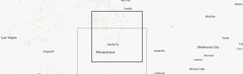
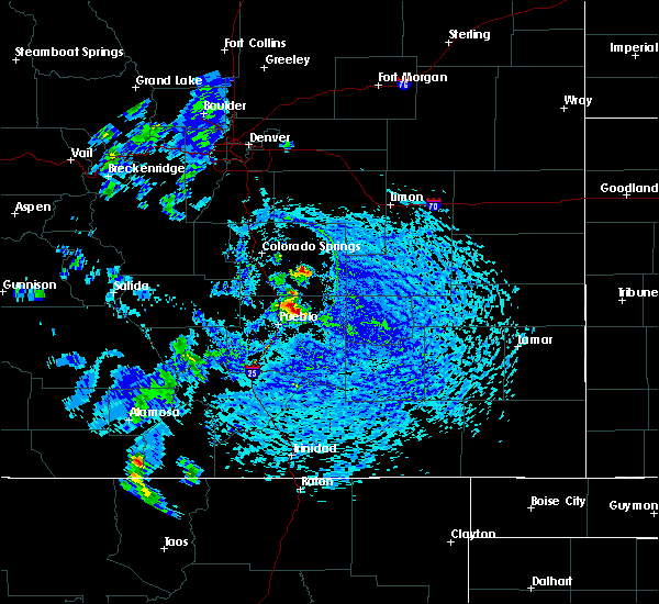
Hail Map for Sanford, CO
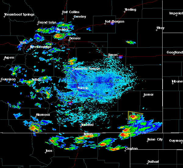
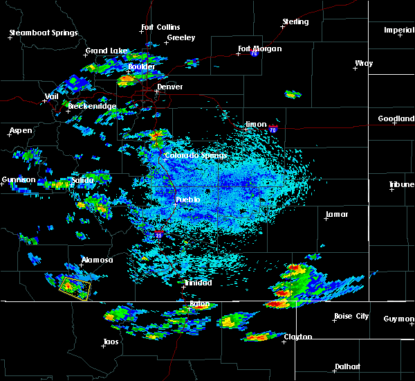
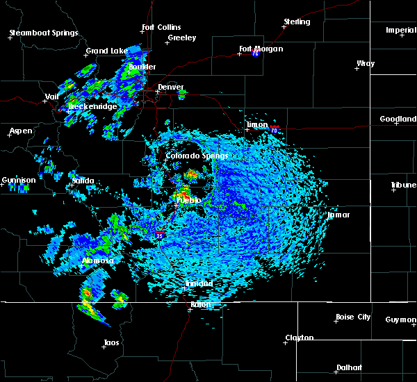
The Sanford, CO area has had 0 reports of on-the-ground hail by trained spotters, and has been under severe weather warnings 0 times during the past 12 months. Doppler radar has detected hail at or near Sanford, CO on 1 occasion.
| Name: | Sanford, CO |
| Where Located: | 61 miles NNW of Taos, NM |
| Map: | Google Map for Sanford, CO |
| Population: | 879 |
| Housing Units: | 350 |
| More Info: | Search Google for Sanford, CO |
0
The Top Recent Hail Date for Sanford, CO is Tuesday, July 15, 2014 (1st out of 1)
Hail and Wind Damage Spotted near Sanford, CO
| Date / Time | Report Details |
|---|---|
| 8/13/2017 2:29 PM MDT |
 At 227 pm mdt, a severe thunderstorm was located over manassa, or 21 miles south of alamosa, moving southeast at 25 mph (radar indicated). Hazards include 60 mph wind gusts and quarter size hail. Hail damage to vehicles is expected. expect wind damage to roofs, siding, and trees. Locations impacted include, manassa, antonito, and romeo. At 227 pm mdt, a severe thunderstorm was located over manassa, or 21 miles south of alamosa, moving southeast at 25 mph (radar indicated). Hazards include 60 mph wind gusts and quarter size hail. Hail damage to vehicles is expected. expect wind damage to roofs, siding, and trees. Locations impacted include, manassa, antonito, and romeo.
|
| 8/13/2017 2:16 PM MDT |
 At 215 pm mdt, a severe thunderstorm was located over romeo, or 20 miles southwest of alamosa, moving east at 25 mph (radar indicated). Hazards include 60 mph wind gusts and quarter size hail. Hail damage to vehicles is expected. Expect wind damage to roofs, siding, and trees. At 215 pm mdt, a severe thunderstorm was located over romeo, or 20 miles southwest of alamosa, moving east at 25 mph (radar indicated). Hazards include 60 mph wind gusts and quarter size hail. Hail damage to vehicles is expected. Expect wind damage to roofs, siding, and trees.
|
| 6/28/2015 3:37 PM MDT |
 The severe thunderstorm warning for northeastern conejos, southeastern rio grande, west central costilla and alamosa counties will expire at 345 pm mdt, the storm which prompted the warning has weakened below severe limits, and no longer pose an immediate threat to life or property. therefore the warning will be allowed to expire. however gusty winds to 45 mph will still be possible with this storm. The severe thunderstorm warning for northeastern conejos, southeastern rio grande, west central costilla and alamosa counties will expire at 345 pm mdt, the storm which prompted the warning has weakened below severe limits, and no longer pose an immediate threat to life or property. therefore the warning will be allowed to expire. however gusty winds to 45 mph will still be possible with this storm.
|
| 6/28/2015 3:32 PM MDT |
 At 332 pm mdt, a severe thunderstorm was located over alamosa east, or near alamosa, moving southwest at 20 mph (radar indicated). Hazards include 60 mph wind gusts. Expect damage to roofs. siding and trees. Locations impacted include, alamosa, sanford and alamosa east. At 332 pm mdt, a severe thunderstorm was located over alamosa east, or near alamosa, moving southwest at 20 mph (radar indicated). Hazards include 60 mph wind gusts. Expect damage to roofs. siding and trees. Locations impacted include, alamosa, sanford and alamosa east.
|
| 6/28/2015 3:15 PM MDT |
 At 315 pm mdt, a severe thunderstorm was located near alamosa east, or near alamosa, moving southwest at 20 mph (radar indicated). Hazards include 60 mph wind gusts and quarter size hail. Hail damage to vehicles is expected. expect wind damage to roofs, siding and trees. Locations impacted include, alamosa, sanford, la jara, blanca, san luis lake, mosca, alamosa east, san acacio and great sand dunes. At 315 pm mdt, a severe thunderstorm was located near alamosa east, or near alamosa, moving southwest at 20 mph (radar indicated). Hazards include 60 mph wind gusts and quarter size hail. Hail damage to vehicles is expected. expect wind damage to roofs, siding and trees. Locations impacted include, alamosa, sanford, la jara, blanca, san luis lake, mosca, alamosa east, san acacio and great sand dunes.
|
| 6/28/2015 3:03 PM MDT |
 At 302 pm mdt, a severe thunderstorm was located near san luis lake, or 9 miles northeast of alamosa, moving southwest at 20 mph (radar indicated). Hazards include 60 mph wind gusts and quarter size hail. Hail damage to vehicles is expected. Expect wind damage to roofs, siding and trees. At 302 pm mdt, a severe thunderstorm was located near san luis lake, or 9 miles northeast of alamosa, moving southwest at 20 mph (radar indicated). Hazards include 60 mph wind gusts and quarter size hail. Hail damage to vehicles is expected. Expect wind damage to roofs, siding and trees.
|
Hail Maps for Sanford, CO

Connect with Interactive Hail Maps