

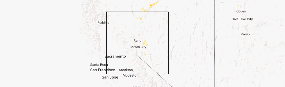
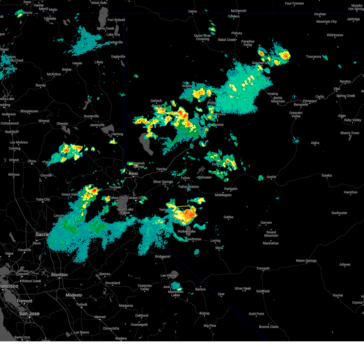
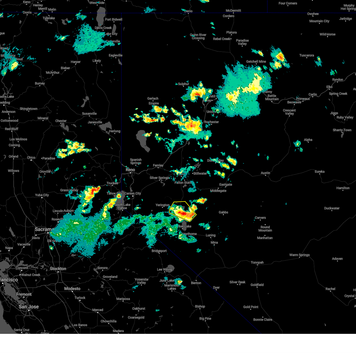
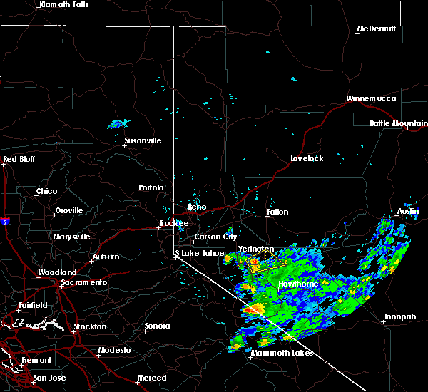
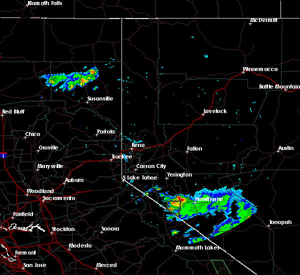
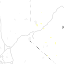
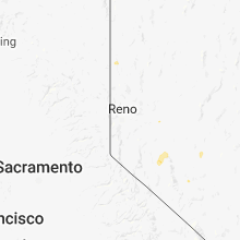
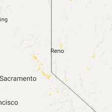
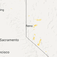
Hail Map for Schurz, NV
The Schurz, NV area has had 0 reports of on-the-ground hail by trained spotters, and has been under severe weather warnings 2 times during the past 12 months. Doppler radar has detected hail at or near Schurz, NV on 6 occasions.
| Name: | Schurz, NV |
| Where Located: | 66 miles SE of Reno, NV |
| Map: | Google Map for Schurz, NV |
| Population: | 658 |
| Housing Units: | 322 |
| More Info: | Search Google for Schurz, NV |
5
The Top Recent Hail Date for Schurz, NV is Thursday, July 4, 2013 (1st out of 6)
Hail and Wind Damage Spotted near Schurz, NV
| Date / Time | Report Details |
|---|---|
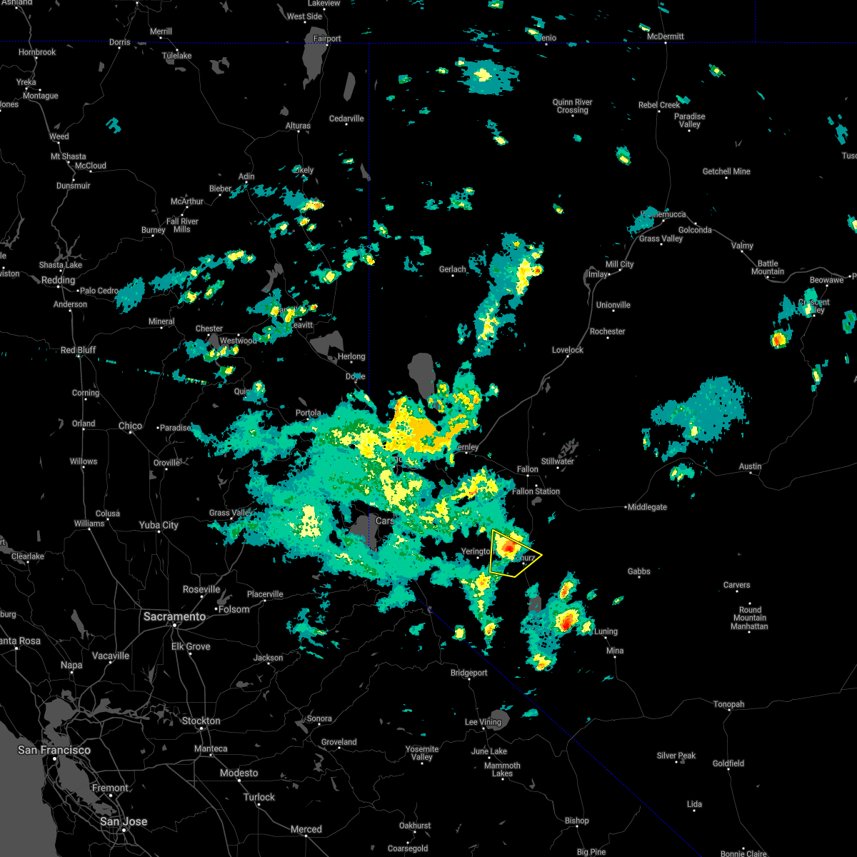
| 6/6/2023 3:45 PM PDT |
 At 345 pm pdt, a severe thunderstorm was located near schurz, moving northwest at 30 mph (radar indicated). Hazards include 60 mph wind gusts and quarter size hail. Hail damage to vehicles is expected. expect wind damage to roofs, siding, fencing and trees. locations impacted include, schurz and alt u. s 95. hail threat, radar indicated max hail size, 1. 00 in wind threat, radar indicated max wind gust, 60 mph. At 345 pm pdt, a severe thunderstorm was located near schurz, moving northwest at 30 mph (radar indicated). Hazards include 60 mph wind gusts and quarter size hail. Hail damage to vehicles is expected. expect wind damage to roofs, siding, fencing and trees. locations impacted include, schurz and alt u. s 95. hail threat, radar indicated max hail size, 1. 00 in wind threat, radar indicated max wind gust, 60 mph.
|
| 6/6/2023 3:28 PM PDT |
 At 327 pm pdt, a severe thunderstorm was located near schurz, moving northwest at 30 mph (radar indicated). Hazards include 60 mph wind gusts and quarter size hail. Hail damage to vehicles is expected. Expect wind damage to roofs, siding, fencing and trees. At 327 pm pdt, a severe thunderstorm was located near schurz, moving northwest at 30 mph (radar indicated). Hazards include 60 mph wind gusts and quarter size hail. Hail damage to vehicles is expected. Expect wind damage to roofs, siding, fencing and trees.
|
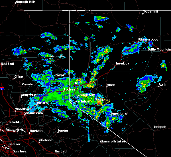
| 7/31/2018 4:04 PM PDT |
 At 404 pm pdt, a severe thunderstorm was located 15 miles southeast of yerington, or 36 miles east of topaz lake, moving northeast at 20 mph (radar indicated). Hazards include 60 mph wind gusts and penny size hail. expect damage to roofs, siding, fencing and trees At 404 pm pdt, a severe thunderstorm was located 15 miles southeast of yerington, or 36 miles east of topaz lake, moving northeast at 20 mph (radar indicated). Hazards include 60 mph wind gusts and penny size hail. expect damage to roofs, siding, fencing and trees
|
| 5/16/2018 12:56 PM PDT |
 The severe thunderstorm warning for northwestern mineral and east central lyon counties will expire at 100 pm pdt, the storm which prompted the warning has weakened below severe limits, and no longer poses an immediate threat to life or property. therefore the warning will be allowed to expire. however small hail, gusty winds and heavy rain are still possible with this thunderstorm. to report severe weather, contact your nearest law enforcement agency. they will relay your report to the national weather service reno nevada. The severe thunderstorm warning for northwestern mineral and east central lyon counties will expire at 100 pm pdt, the storm which prompted the warning has weakened below severe limits, and no longer poses an immediate threat to life or property. therefore the warning will be allowed to expire. however small hail, gusty winds and heavy rain are still possible with this thunderstorm. to report severe weather, contact your nearest law enforcement agency. they will relay your report to the national weather service reno nevada.
|
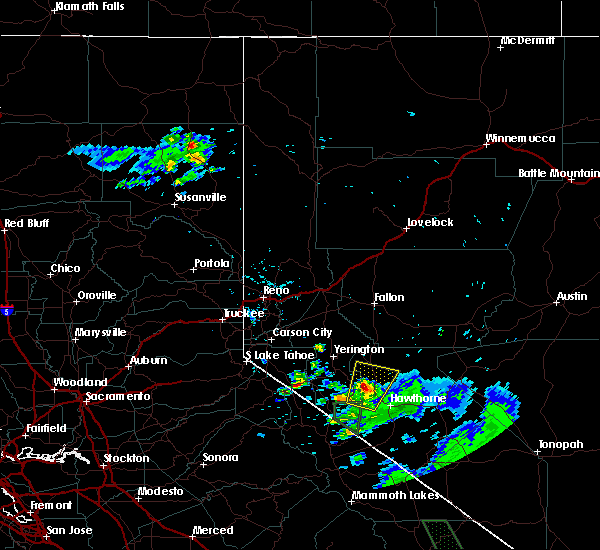
| 5/16/2018 12:16 PM PDT |
 At 1215 pm pdt, doppler radar indicated a severe thunderstorm capable of producing quarter size hail and damaging winds in excess of 60 mph. this storm was located 9 miles southeast of yerington, or 33 miles northeast of topaz lake, moving north at 15 mph. locations impacted include, schurz and alt u.s 95 at lyon-mineral co line. At 1215 pm pdt, doppler radar indicated a severe thunderstorm capable of producing quarter size hail and damaging winds in excess of 60 mph. this storm was located 9 miles southeast of yerington, or 33 miles northeast of topaz lake, moving north at 15 mph. locations impacted include, schurz and alt u.s 95 at lyon-mineral co line.
|
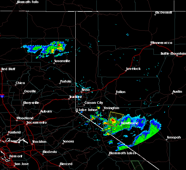
| 5/16/2018 11:55 AM PDT |
 The national weather service in reno nevada has issued a * severe thunderstorm warning for. northwestern mineral county in western nevada. east central lyon county in west central nevada. Until 100 pm pdt * at 1155 am pdt, doppler radar indicated a severe thunderstorm. The national weather service in reno nevada has issued a * severe thunderstorm warning for. northwestern mineral county in western nevada. east central lyon county in west central nevada. Until 100 pm pdt * at 1155 am pdt, doppler radar indicated a severe thunderstorm.
|
| 7/5/2015 4:59 PM PDT |
 At 457 pm pdt, doppler radar indicated a severe thunderstorm capable of producing quarter size hail and damaging winds in excess of 60 mph. this storm was located 8 miles northwest of walker lake, and moving northeast at 20 mph. At 457 pm pdt, doppler radar indicated a severe thunderstorm capable of producing quarter size hail and damaging winds in excess of 60 mph. this storm was located 8 miles northwest of walker lake, and moving northeast at 20 mph.
|
| 7/5/2015 4:49 PM PDT |
 At 446 pm pdt, doppler radar indicated a severe thunderstorm capable of producing quarter size hail and damaging winds in excess of 60 mph. this storm is about to cross highway 95 near the northern end of walker lake. the storm is moving north at 20 mph. locations impacted include, walker lake, mount grant, bald mountain and schurz. At 446 pm pdt, doppler radar indicated a severe thunderstorm capable of producing quarter size hail and damaging winds in excess of 60 mph. this storm is about to cross highway 95 near the northern end of walker lake. the storm is moving north at 20 mph. locations impacted include, walker lake, mount grant, bald mountain and schurz.
|
| 7/5/2015 4:36 PM PDT |
 At 433 pm pdt, doppler radar indicated a severe thunderstorm capable of producing quarter size or larger hail and damaging winds in excess of 60 mph. this storm was located 7 miles northwest of walker lake, moving north at 20 mph. locations impacted include, walker lake, mount grant, bald mountain and schurz. At 433 pm pdt, doppler radar indicated a severe thunderstorm capable of producing quarter size or larger hail and damaging winds in excess of 60 mph. this storm was located 7 miles northwest of walker lake, moving north at 20 mph. locations impacted include, walker lake, mount grant, bald mountain and schurz.
|
| 7/5/2015 4:17 PM PDT |
 At 416 pm pdt, doppler radar indicated a severe thunderstorm capable of producing quarter size hail and damaging winds in excess of 60 mph. this storm was located 9 miles southwest of walker lake, moving north at 20 mph. At 416 pm pdt, doppler radar indicated a severe thunderstorm capable of producing quarter size hail and damaging winds in excess of 60 mph. this storm was located 9 miles southwest of walker lake, moving north at 20 mph.
|
Hail Maps for Schurz, NV


Connect with Interactive Hail Maps