

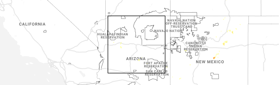
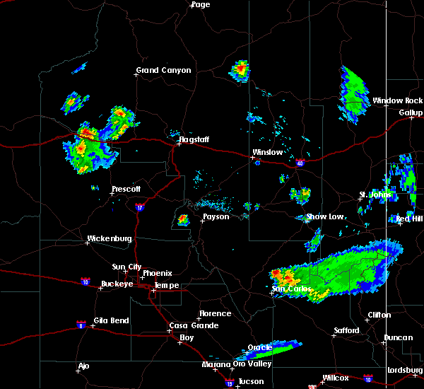
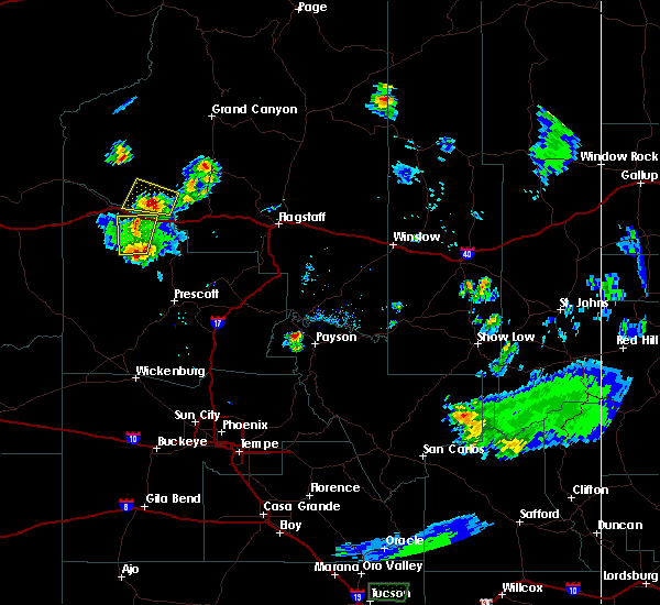
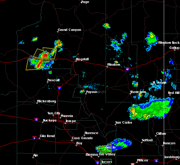
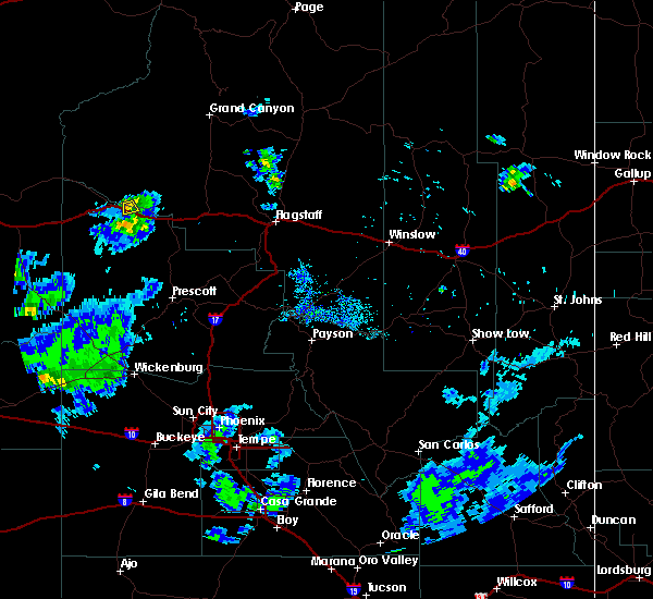
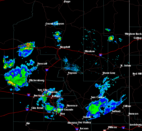
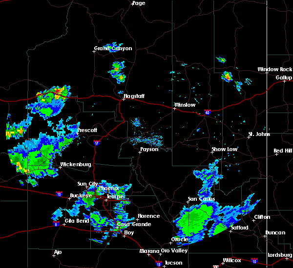
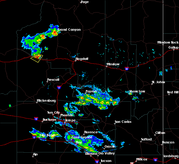
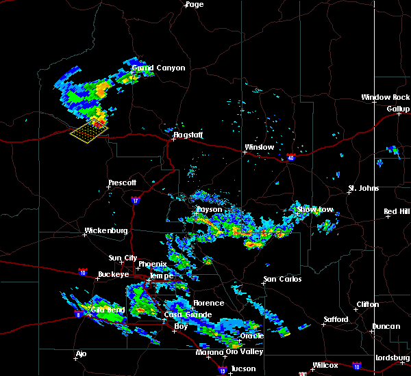
Hail Map for Seligman, AZ
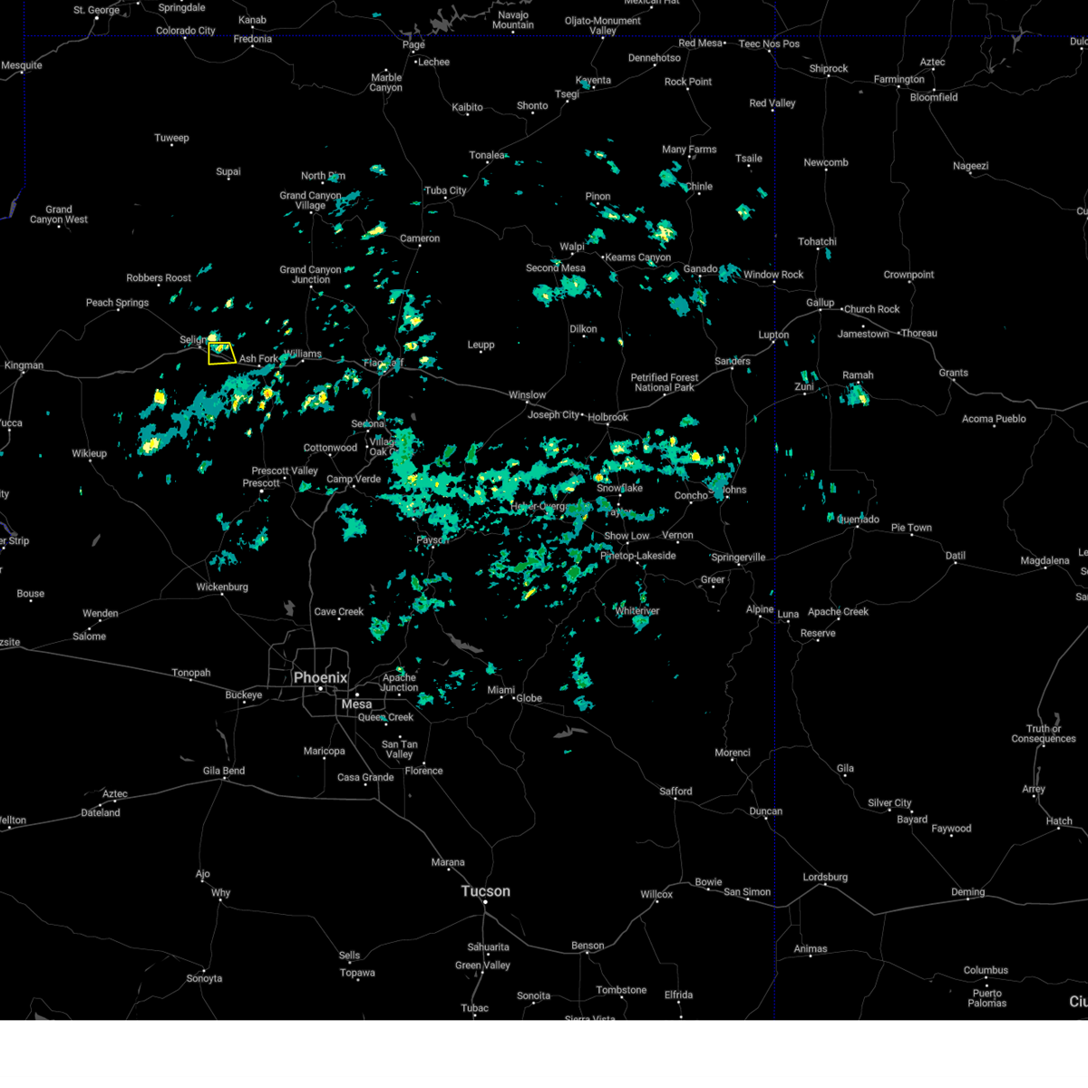
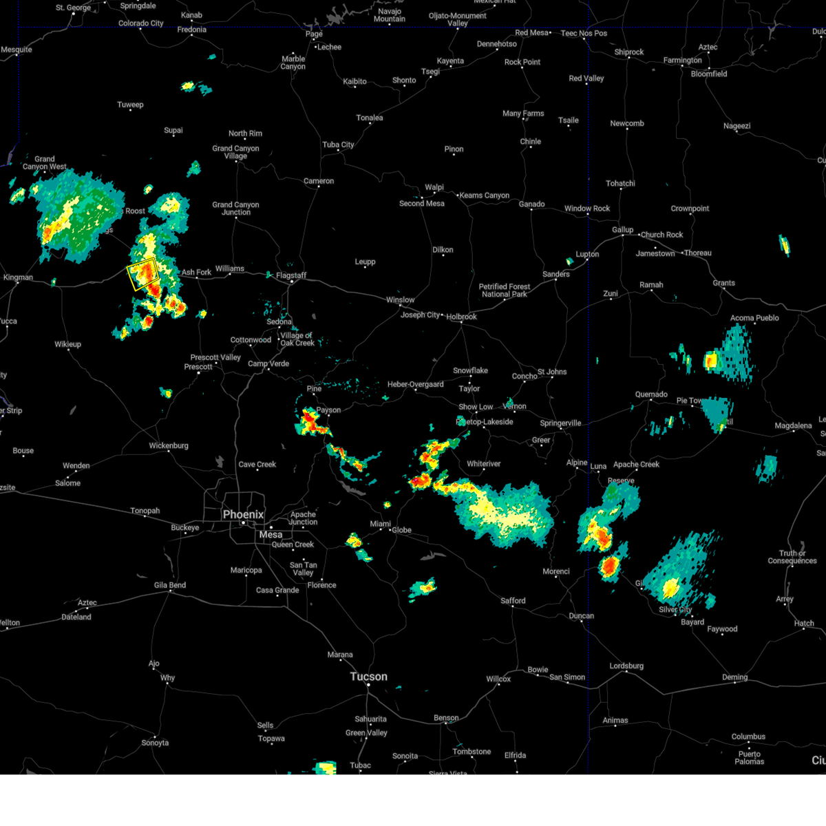
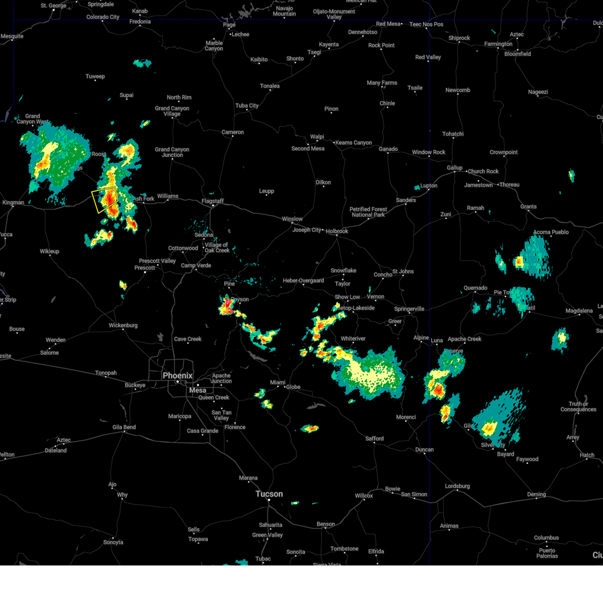
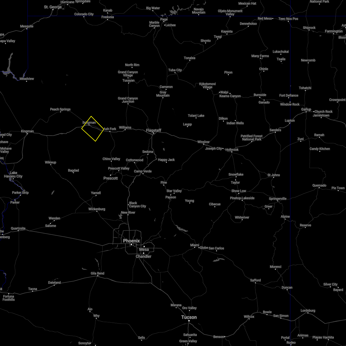
The Seligman, AZ area has had 1 report of on-the-ground hail by trained spotters, and has been under severe weather warnings 6 times during the past 12 months. Doppler radar has detected hail at or near Seligman, AZ on 28 occasions, including 2 occasions during the past year.
| Name: | Seligman, AZ |
| Where Located: | 69.8 miles W of Flagstaff, AZ |
| Map: | Google Map for Seligman, AZ |
| Population: | 445 |
| Housing Units: | 292 |
| More Info: | Search Google for Seligman, AZ |
1
The Top Recent Hail Date for Seligman, AZ is Saturday, July 22, 2023 (4th out of 28)
Hail and Wind Damage Spotted near Seligman, AZ
| Date / Time | Report Details |
|---|---|
| 4/1/2024 1:10 PM MST |
 the severe thunderstorm warning has been cancelled and is no longer in effect the severe thunderstorm warning has been cancelled and is no longer in effect
|
| 4/1/2024 1:09 PM MST |
 Svrfgz the national weather service in flagstaff has issued a * severe thunderstorm warning for, coconino county in north central arizona, yavapai county in west central arizona, * until 130 pm mst. * at 107 pm mst, a severe thunderstorm was located near picacho butte, or 6 miles east of seligman, moving south at 10 mph (radar indicated). Hazards include enough graupel and small hail to cover interstate-40. hazardous driving conditions Svrfgz the national weather service in flagstaff has issued a * severe thunderstorm warning for, coconino county in north central arizona, yavapai county in west central arizona, * until 130 pm mst. * at 107 pm mst, a severe thunderstorm was located near picacho butte, or 6 miles east of seligman, moving south at 10 mph (radar indicated). Hazards include enough graupel and small hail to cover interstate-40. hazardous driving conditions
|
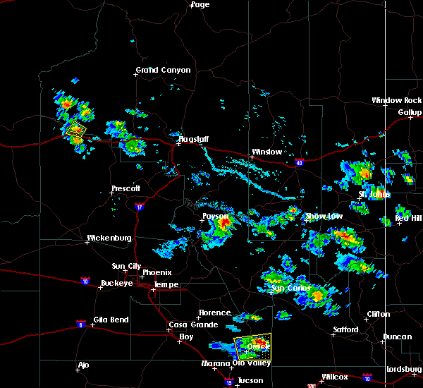
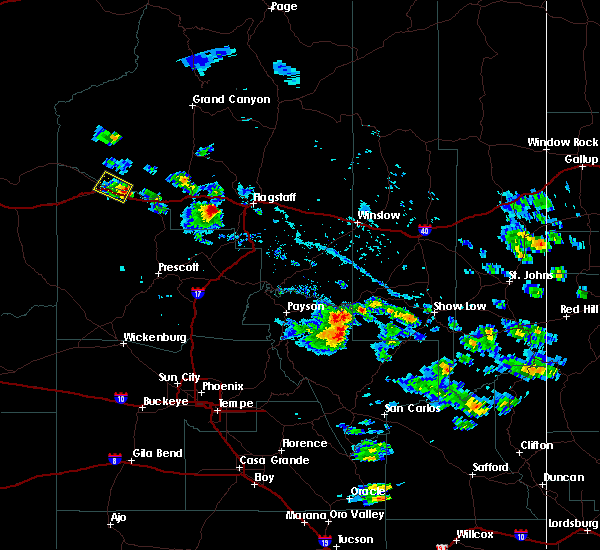
| 7/22/2023 4:23 PM MST |
 The severe thunderstorm warning for coconino and yavapai counties will expire at 430 pm mst, the storm which prompted the warning has weakened below severe limits, and no longer poses an immediate threat to life or property. therefore, the warning will be allowed to expire. however, gusty winds are still possible with this thunderstorm. The severe thunderstorm warning for coconino and yavapai counties will expire at 430 pm mst, the storm which prompted the warning has weakened below severe limits, and no longer poses an immediate threat to life or property. therefore, the warning will be allowed to expire. however, gusty winds are still possible with this thunderstorm.
|
| 7/22/2023 4:18 PM MST |
 At 417 pm mst, a severe thunderstorm was located near seligman, or 41 miles northwest of chino valley, moving southwest at 10 mph (radar indicated). Hazards include 60 mph wind gusts and penny size hail. Expect damage to roofs, siding, and trees. locations impacted include, seligman. this includes the following highways, business interstate 40 between mile markers 140 and 141. route 66 between mile markers 137 and 139. interstate 40 between mile markers 110 and 124. hail threat, radar indicated max hail size, 0. 75 in wind threat, radar indicated max wind gust, 60 mph. At 417 pm mst, a severe thunderstorm was located near seligman, or 41 miles northwest of chino valley, moving southwest at 10 mph (radar indicated). Hazards include 60 mph wind gusts and penny size hail. Expect damage to roofs, siding, and trees. locations impacted include, seligman. this includes the following highways, business interstate 40 between mile markers 140 and 141. route 66 between mile markers 137 and 139. interstate 40 between mile markers 110 and 124. hail threat, radar indicated max hail size, 0. 75 in wind threat, radar indicated max wind gust, 60 mph.
|
| 7/22/2023 4:07 PM MST |
 At 406 pm mst, a severe thunderstorm was located near seligman, or 41 miles northwest of chino valley, moving west at 15 mph (radar indicated). Hazards include 60 mph wind gusts and penny size hail. Expect damage to roofs, siding, and trees. locations impacted include, seligman. this includes the following highways, business interstate 40 between mile markers 140 and 141. route 66 between mile markers 135 and 139. interstate 40 between mile markers 110 and 126. hail threat, radar indicated max hail size, 0. 75 in wind threat, radar indicated max wind gust, 60 mph. At 406 pm mst, a severe thunderstorm was located near seligman, or 41 miles northwest of chino valley, moving west at 15 mph (radar indicated). Hazards include 60 mph wind gusts and penny size hail. Expect damage to roofs, siding, and trees. locations impacted include, seligman. this includes the following highways, business interstate 40 between mile markers 140 and 141. route 66 between mile markers 135 and 139. interstate 40 between mile markers 110 and 126. hail threat, radar indicated max hail size, 0. 75 in wind threat, radar indicated max wind gust, 60 mph.
|
| 7/22/2023 3:50 PM MST |
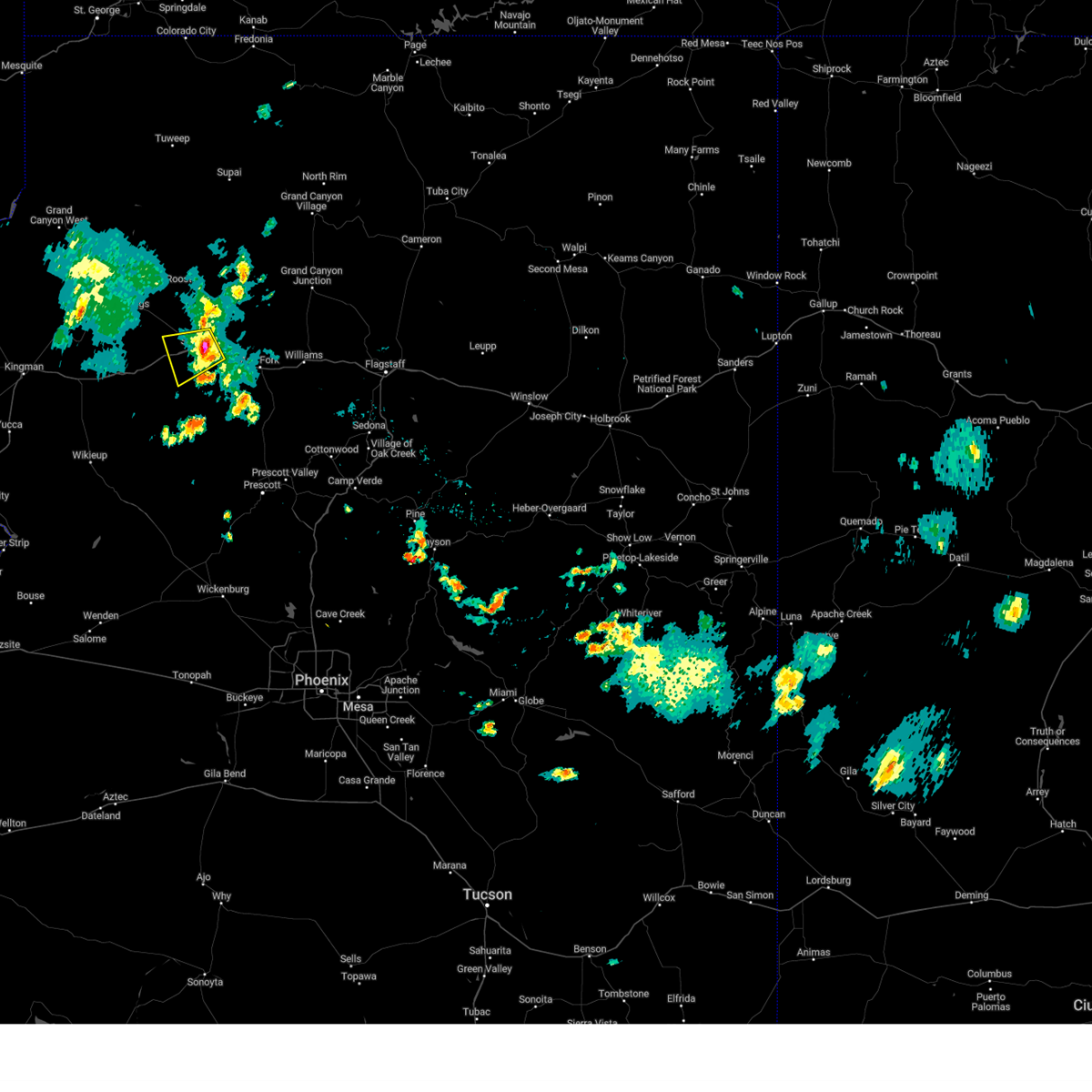 At 350 pm mst, a severe thunderstorm was located over seligman, or 44 miles northwest of chino valley, moving southwest at 10 mph (radar indicated). Hazards include 60 mph wind gusts and penny size hail. expect damage to roofs, siding, and trees At 350 pm mst, a severe thunderstorm was located over seligman, or 44 miles northwest of chino valley, moving southwest at 10 mph (radar indicated). Hazards include 60 mph wind gusts and penny size hail. expect damage to roofs, siding, and trees
|
| 8/10/2021 3:21 PM MST |
 The severe thunderstorm warning for yavapai and coconino counties will expire at 330 pm mst, the storm which prompted the warning has weakened below severe limits, and no longer poses an immediate threat to life or property. therefore, the warning will be allowed to expire. however heavy rain is still possible with this thunderstorm. The severe thunderstorm warning for yavapai and coconino counties will expire at 330 pm mst, the storm which prompted the warning has weakened below severe limits, and no longer poses an immediate threat to life or property. therefore, the warning will be allowed to expire. however heavy rain is still possible with this thunderstorm.
|
| 8/10/2021 2:52 PM MST |
 At 250 pm mst, a severe thunderstorm was located near seligman, or 41 miles northwest of chino valley, and is nearly stationary (radar indicated). Hazards include 60 mph wind gusts and quarter size hail. Hail damage to vehicles is expected. Expect wind damage to roofs, siding, and trees. At 250 pm mst, a severe thunderstorm was located near seligman, or 41 miles northwest of chino valley, and is nearly stationary (radar indicated). Hazards include 60 mph wind gusts and quarter size hail. Hail damage to vehicles is expected. Expect wind damage to roofs, siding, and trees.
|
| 8/10/2018 7:43 PM MST |
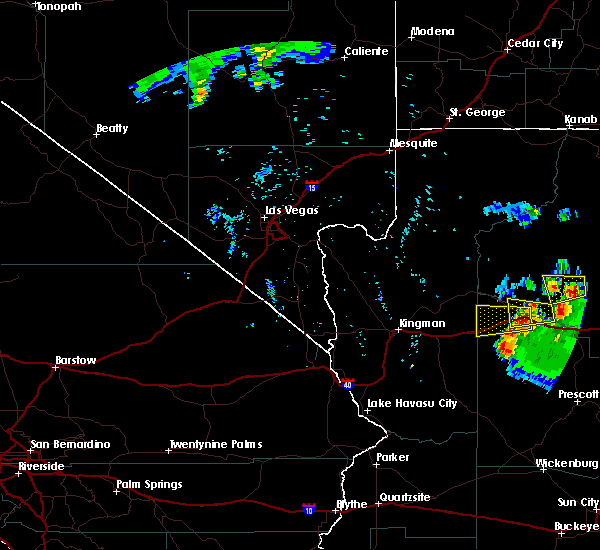 The national weather service in flagstaff has issued a * severe thunderstorm warning for. yavapai county in west central arizona. coconino county in north central arizona. Until 845 pm mst * at 742 pm mst, a severe thunderstorm was located near seligman, or. The national weather service in flagstaff has issued a * severe thunderstorm warning for. yavapai county in west central arizona. coconino county in north central arizona. Until 845 pm mst * at 742 pm mst, a severe thunderstorm was located near seligman, or.
|
| 8/10/2018 7:30 PM MST | Golf Ball sized hail reported 3.2 miles ESE of Seligman, AZ |
| 8/10/2018 7:25 PM MST |
 At 724 pm mst, a severe thunderstorm was located over seligman, or 48 miles northwest of chino valley, moving west at 15 mph (radar indicated). Hazards include ping pong ball size hail and 60 mph wind gusts. People and animals outdoors will be injured. expect hail damage to roofs, siding, windows, and vehicles. expect wind damage to roofs, siding, and trees. locations impacted include, seligman. this includes the following highways, business interstate 40 between mile markers 140 and 141. route 66 between mile markers 129 and 139. Interstate 40 between mile markers 113 and 129. At 724 pm mst, a severe thunderstorm was located over seligman, or 48 miles northwest of chino valley, moving west at 15 mph (radar indicated). Hazards include ping pong ball size hail and 60 mph wind gusts. People and animals outdoors will be injured. expect hail damage to roofs, siding, windows, and vehicles. expect wind damage to roofs, siding, and trees. locations impacted include, seligman. this includes the following highways, business interstate 40 between mile markers 140 and 141. route 66 between mile markers 129 and 139. Interstate 40 between mile markers 113 and 129.
|
| 8/10/2018 7:02 PM MST |
 At 702 pm mst, a severe thunderstorm was located near seligman, or 45 miles northwest of chino valley, moving west at 15 mph (radar indicated). Hazards include 60 mph wind gusts and quarter size hail. Hail damage to vehicles is expected. Expect wind damage to roofs, siding, and trees. At 702 pm mst, a severe thunderstorm was located near seligman, or 45 miles northwest of chino valley, moving west at 15 mph (radar indicated). Hazards include 60 mph wind gusts and quarter size hail. Hail damage to vehicles is expected. Expect wind damage to roofs, siding, and trees.
|
| 8/10/2018 6:37 PM MST |
 At 637 pm mst, a severe thunderstorm was located 13 miles east of seligman, or 43 miles north of chino valley, moving west at 10 mph (radar indicated). Hazards include 60 mph wind gusts and half dollar size hail. Hail damage to vehicles is expected. expect wind damage to roofs, siding, and trees. This severe thunderstorm will remain over mainly rural areas of yavapai and coconino counties. At 637 pm mst, a severe thunderstorm was located 13 miles east of seligman, or 43 miles north of chino valley, moving west at 10 mph (radar indicated). Hazards include 60 mph wind gusts and half dollar size hail. Hail damage to vehicles is expected. expect wind damage to roofs, siding, and trees. This severe thunderstorm will remain over mainly rural areas of yavapai and coconino counties.
|
| 8/10/2018 6:14 PM MST |
 At 614 pm mst, a severe thunderstorm was located 11 miles northwest of ash fork, or 42 miles north of chino valley, moving west at 10 mph (radar indicated). Hazards include ping pong ball size hail and 60 mph wind gusts. People and animals outdoors will be injured. expect hail damage to roofs, siding, windows, and vehicles. expect wind damage to roofs, siding, and trees. This severe thunderstorm will remain over mainly rural areas of yavapai and coconino counties. At 614 pm mst, a severe thunderstorm was located 11 miles northwest of ash fork, or 42 miles north of chino valley, moving west at 10 mph (radar indicated). Hazards include ping pong ball size hail and 60 mph wind gusts. People and animals outdoors will be injured. expect hail damage to roofs, siding, windows, and vehicles. expect wind damage to roofs, siding, and trees. This severe thunderstorm will remain over mainly rural areas of yavapai and coconino counties.
|
| 8/9/2018 4:08 PM MST |
 At 408 pm mst, severe thunderstorms were located along a line extending from 14 miles northwest of williams to 12 miles southwest of seligman, moving south at 20 mph (radar indicated). Hazards include 60 mph wind gusts and half dollar size hail. Hail damage to vehicles is expected. Expect wind damage to roofs, siding, and trees. At 408 pm mst, severe thunderstorms were located along a line extending from 14 miles northwest of williams to 12 miles southwest of seligman, moving south at 20 mph (radar indicated). Hazards include 60 mph wind gusts and half dollar size hail. Hail damage to vehicles is expected. Expect wind damage to roofs, siding, and trees.
|
| 8/27/2015 7:08 PM MST |
 The severe thunderstorm warning for west central coconino and northwestern yavapai counties will expire at 715 pm mst, the storm near seligman which prompted the warning has weakened below severe limits, and no longer poses an immediate threat to life or property. therefore the warning will be allowed to expire. The severe thunderstorm warning for west central coconino and northwestern yavapai counties will expire at 715 pm mst, the storm near seligman which prompted the warning has weakened below severe limits, and no longer poses an immediate threat to life or property. therefore the warning will be allowed to expire.
|
| 8/27/2015 6:57 PM MST |
 At 653 pm mst, doppler radar indicated a severe thunderstorm capable of producing quarter size hail and damaging winds in excess of 60 mph. this storm was located near seligman moving southeast at 10 mph. this severe thunderstorm is located just north of interstate 40 near milepost marker 128 and route 66. At 653 pm mst, doppler radar indicated a severe thunderstorm capable of producing quarter size hail and damaging winds in excess of 60 mph. this storm was located near seligman moving southeast at 10 mph. this severe thunderstorm is located just north of interstate 40 near milepost marker 128 and route 66.
|
| 8/27/2015 6:44 PM MST |
 At 643 pm mst, doppler radar indicated a severe thunderstorm capable of producing damaging winds in excess of 60 mph. this storm was located near seligman, and moving south at 10 mph. penny size hail may also accompany the damaging winds. * this severe thunderstorm will remain over mainly rural areas of west central coconino and northwestern yavapai counties. this includes interstate 40 between mile markers 126 and 128. At 643 pm mst, doppler radar indicated a severe thunderstorm capable of producing damaging winds in excess of 60 mph. this storm was located near seligman, and moving south at 10 mph. penny size hail may also accompany the damaging winds. * this severe thunderstorm will remain over mainly rural areas of west central coconino and northwestern yavapai counties. this includes interstate 40 between mile markers 126 and 128.
|
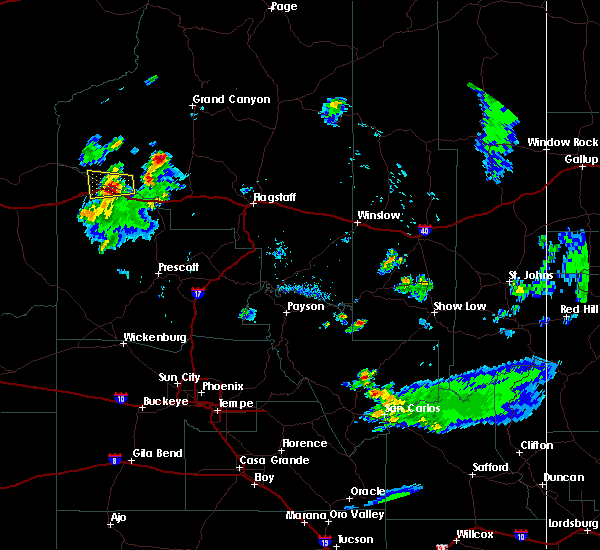
| 6/30/2015 7:57 PM MST | The severe thunderstorm warning for southwestern coconino and north central yavapai counties will expire at 800 pm mst, the storm southeast of seligman has weakened as it crossed i-40 near milemarker 129. small hail and briefly heavy rain are still possible with this storm just east and southeast of seligman. |
| 6/30/2015 7:45 PM MST |
 At 743 pm mst, doppler radar indicated a severe thunderstorm capable of producing quarter size hail and damaging winds in excess of 60 mph. this storm was located 7 miles southeast of seligman and was moving southwest at 30 mph. locations impacted include, interstate 40 between mile markers 127 and 132. At 743 pm mst, doppler radar indicated a severe thunderstorm capable of producing quarter size hail and damaging winds in excess of 60 mph. this storm was located 7 miles southeast of seligman and was moving southwest at 30 mph. locations impacted include, interstate 40 between mile markers 127 and 132.
|
| 6/30/2015 7:28 PM MST |
 At 725 pm mst, doppler radar indicated a severe thunderstorm capable of producing half dollar size hail and damaging winds in excess of 60 mph. this storm was located 11 miles northwest of ash fork and was moving southwest toward i-40 at 30 mph. this includes interstate 40 between mile markers 124 and 139. At 725 pm mst, doppler radar indicated a severe thunderstorm capable of producing half dollar size hail and damaging winds in excess of 60 mph. this storm was located 11 miles northwest of ash fork and was moving southwest toward i-40 at 30 mph. this includes interstate 40 between mile markers 124 and 139.
|
| 6/30/2015 4:45 PM MST |
 At 443 pm mst, doppler radar indicated a severe thunderstorm capable of producing damaging winds in excess of 60 mph. this storm was located near seligman, moving west at 15 mph. penny size hail may also accompany the damaging winds. locations impacted include, seligman. this includes the following highways, route 66 between mile markers 135 and 139. interstate 40 between mile markers 117 and 132. At 443 pm mst, doppler radar indicated a severe thunderstorm capable of producing damaging winds in excess of 60 mph. this storm was located near seligman, moving west at 15 mph. penny size hail may also accompany the damaging winds. locations impacted include, seligman. this includes the following highways, route 66 between mile markers 135 and 139. interstate 40 between mile markers 117 and 132.
|
| 6/30/2015 4:29 PM MST |
 At 427 pm mst, doppler radar indicated a severe thunderstorm capable of producing quarter size hail and damaging winds in excess of 60 mph. this storm was located just east of seligman and moving west at 15 mph. At 427 pm mst, doppler radar indicated a severe thunderstorm capable of producing quarter size hail and damaging winds in excess of 60 mph. this storm was located just east of seligman and moving west at 15 mph.
|
Hail Maps for Seligman, AZ


Connect with Interactive Hail Maps