

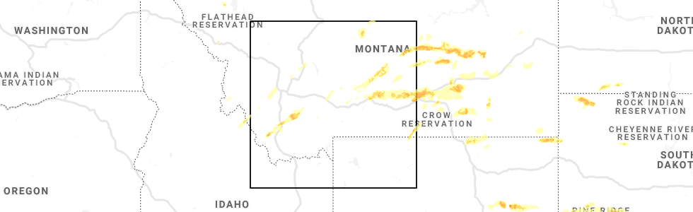
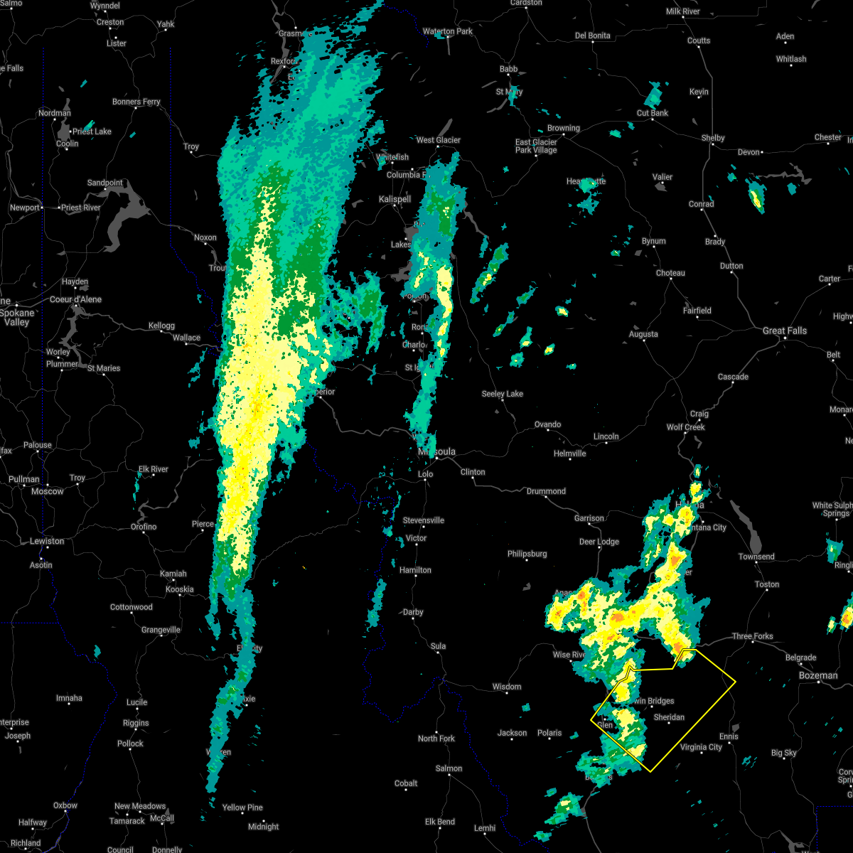
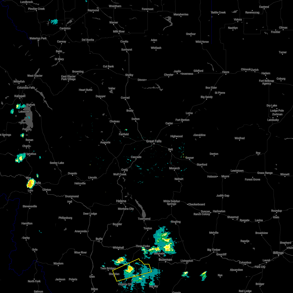
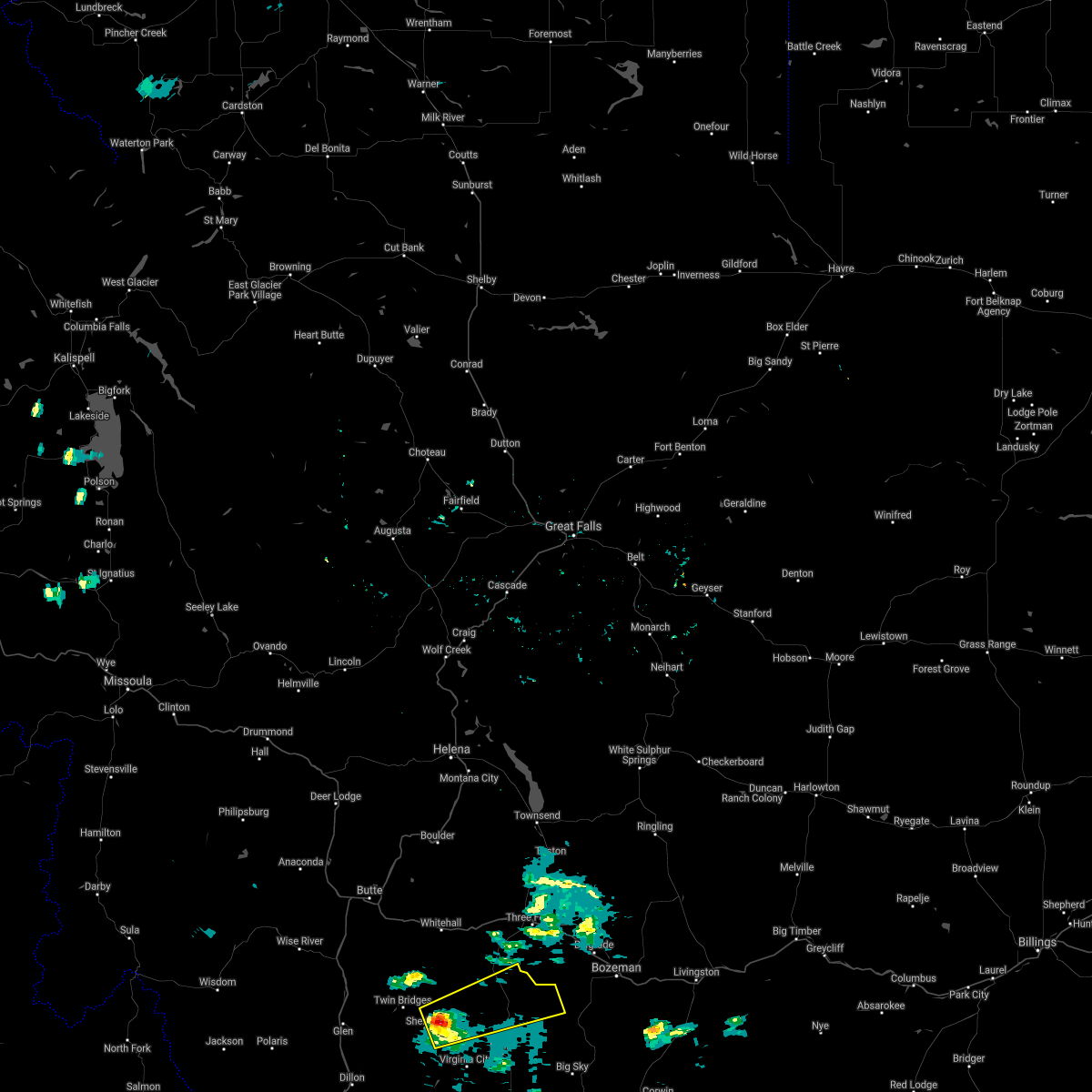
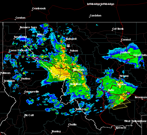
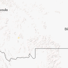
Hail Map for Sheridan, MT
The Sheridan, MT area has had 3 reports of on-the-ground hail by trained spotters, and has been under severe weather warnings 0 times during the past 12 months. Doppler radar has detected hail at or near Sheridan, MT on 3 occasions.
| Name: | Sheridan, MT |
| Where Located: | 58.3 miles WSW of Bozeman, MT |
| Map: | Google Map for Sheridan, MT |
| Population: | 642 |
| Housing Units: | 376 |
| More Info: | Search Google for Sheridan, MT |
5
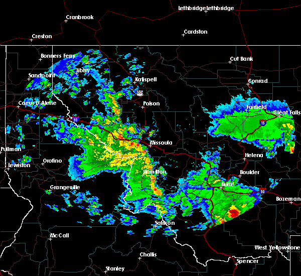
The Top Recent Hail Date for Sheridan, MT is Sunday, August 11, 2019 (1st out of 3)
Hail and Wind Damage Spotted near Sheridan, MT
| Date / Time | Report Details |
|---|---|
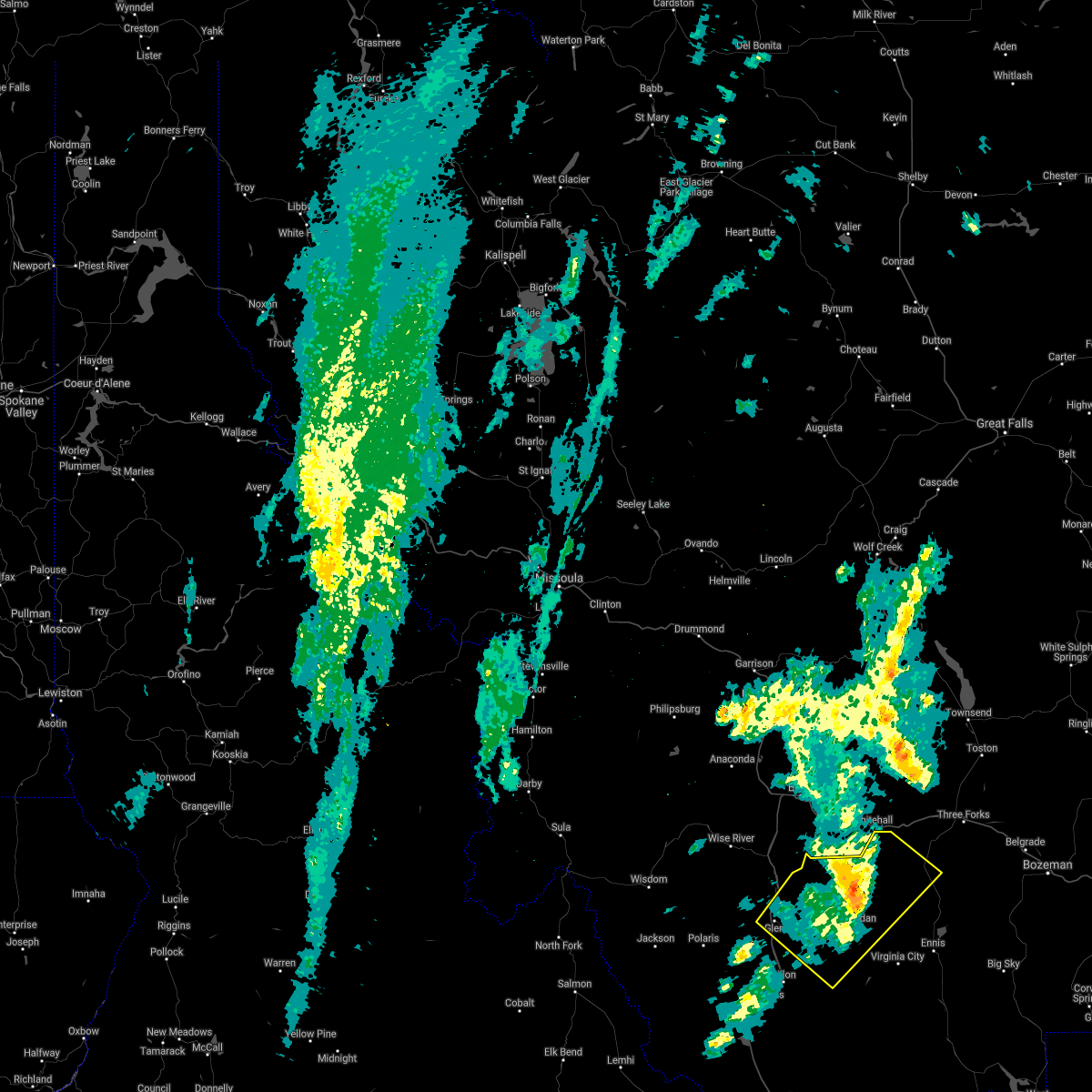
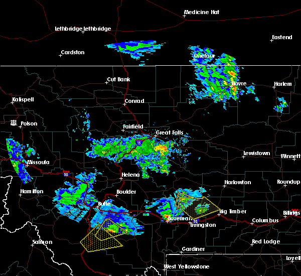
| 6/28/2022 2:23 PM MDT |
 The severe thunderstorm warning for northwestern madison and north central beaverhead counties will expire at 230 pm mdt, the storm which prompted the warning has weakened below severe limits, and no longer poses an immediate threat to life or property. therefore, the warning will be allowed to expire. however gusty winds are still possible with this thunderstorm. The severe thunderstorm warning for northwestern madison and north central beaverhead counties will expire at 230 pm mdt, the storm which prompted the warning has weakened below severe limits, and no longer poses an immediate threat to life or property. therefore, the warning will be allowed to expire. however gusty winds are still possible with this thunderstorm.
|
| 6/28/2022 1:58 PM MDT |
 At 158 pm mdt, a severe thunderstorm was located 13 miles south of twin bridges, or 13 miles southwest of sheridan, moving northeast at 40 mph (radar indicated). Hazards include 60 mph wind gusts. expect damage to roofs, siding, and trees At 158 pm mdt, a severe thunderstorm was located 13 miles south of twin bridges, or 13 miles southwest of sheridan, moving northeast at 40 mph (radar indicated). Hazards include 60 mph wind gusts. expect damage to roofs, siding, and trees
|
| 9/10/2021 6:58 PM MDT |
 The severe thunderstorm warning for madison, central beaverhead and south central gallatin counties will expire at 700 pm mdt, the storms which prompted the warning have weakened below severe limits, and have exited the warned area. therefore, the warning will be allowed to expire. however gusty winds are still possible with these thunderstorms. to report severe weather, contact your nearest law enforcement agency. they will relay your report to the national weather service great falls. The severe thunderstorm warning for madison, central beaverhead and south central gallatin counties will expire at 700 pm mdt, the storms which prompted the warning have weakened below severe limits, and have exited the warned area. therefore, the warning will be allowed to expire. however gusty winds are still possible with these thunderstorms. to report severe weather, contact your nearest law enforcement agency. they will relay your report to the national weather service great falls.
|
| 9/10/2021 6:38 PM MDT |
 At 636 pm mdt, severe thunderstorms were located along a line extending from 24 miles north of wisdom to near harlequin lake, moving northeast at 50 mph (radar indicated. at 611 pm mdt, a 63 mph wind gust was reported at the dillon airport). Hazards include 70 mph wind gusts. Expect considerable tree damage. damage is likely to mobile homes, roofs, and outbuildings. blowing dust and smoke will also reduce visibility. locations impacted include, dillon, west yellowstone, sheridan, virginia city, ennis, twin bridges, pony, wisdom, alder, divide lake, silver star, west entrance, big sky, melrose, wise river, dewey, targhee pass, cameron, waterloo and glen. thunderstorm damage threat, considerable hail threat, radar indicated max hail size, <. 75 in wind threat, observed max wind gust, 70 mph. At 636 pm mdt, severe thunderstorms were located along a line extending from 24 miles north of wisdom to near harlequin lake, moving northeast at 50 mph (radar indicated. at 611 pm mdt, a 63 mph wind gust was reported at the dillon airport). Hazards include 70 mph wind gusts. Expect considerable tree damage. damage is likely to mobile homes, roofs, and outbuildings. blowing dust and smoke will also reduce visibility. locations impacted include, dillon, west yellowstone, sheridan, virginia city, ennis, twin bridges, pony, wisdom, alder, divide lake, silver star, west entrance, big sky, melrose, wise river, dewey, targhee pass, cameron, waterloo and glen. thunderstorm damage threat, considerable hail threat, radar indicated max hail size, <. 75 in wind threat, observed max wind gust, 70 mph.
|
| 9/10/2021 6:12 PM MDT |
 At 612 pm mdt, severe thunderstorms were located along a line extending from 16 miles southeast of conner to near island park village, moving northeast at 50 mph (radar indicated). Hazards include 70 mph wind gusts. Expect considerable tree damage. Damage is likely to mobile homes, roofs, and outbuildings. At 612 pm mdt, severe thunderstorms were located along a line extending from 16 miles southeast of conner to near island park village, moving northeast at 50 mph (radar indicated). Hazards include 70 mph wind gusts. Expect considerable tree damage. Damage is likely to mobile homes, roofs, and outbuildings.
|
| 8/17/2021 3:25 PM MDT |
 The severe thunderstorm warning for northwestern madison and central beaverhead counties will expire at 330 pm mdt, the storm which prompted the warning has weakened below severe limits, and has exited the warned area. therefore, the warning will be allowed to expire. however gusty winds and heavy rain are still possible with multiple thunderstorms moving through the region. The severe thunderstorm warning for northwestern madison and central beaverhead counties will expire at 330 pm mdt, the storm which prompted the warning has weakened below severe limits, and has exited the warned area. therefore, the warning will be allowed to expire. however gusty winds and heavy rain are still possible with multiple thunderstorms moving through the region.
|
| 8/17/2021 3:00 PM MDT |
 At 258 pm mdt, a severe thunderstorm was located near twin bridges, or 12 miles northwest of sheridan, moving northeast at 45 mph (radar indicated. additionally, 60 mph wind gust reported at dillon airport). Hazards include 60 mph wind gusts. expect damage to roofs, siding, and trees At 258 pm mdt, a severe thunderstorm was located near twin bridges, or 12 miles northwest of sheridan, moving northeast at 45 mph (radar indicated. additionally, 60 mph wind gust reported at dillon airport). Hazards include 60 mph wind gusts. expect damage to roofs, siding, and trees
|
| 8/8/2021 5:04 PM MDT |
 At 501 pm mdt, sporadic areas of severe wind gusts continue across the warned area. many locations within the warned area have reported wind gusts of 50 to 55 mph over the last 30 minutes. a few gusts to around 60 mph are likely (trained weather spotters). Hazards include 60 mph wind gusts. Expect damage to roofs, siding, and trees. locations impacted include, bozeman, dillon, sheridan, virginia city, belgrade, three forks, manhattan, ennis, lima, pony, alder, harrison, dell, bannack pass, cameron, missouri headwaters state park, snowline, maudlow, four corners and amsterdam. hail threat, radar indicated max hail size, <. 75 in wind threat, radar indicated max wind gust, 60 mph. At 501 pm mdt, sporadic areas of severe wind gusts continue across the warned area. many locations within the warned area have reported wind gusts of 50 to 55 mph over the last 30 minutes. a few gusts to around 60 mph are likely (trained weather spotters). Hazards include 60 mph wind gusts. Expect damage to roofs, siding, and trees. locations impacted include, bozeman, dillon, sheridan, virginia city, belgrade, three forks, manhattan, ennis, lima, pony, alder, harrison, dell, bannack pass, cameron, missouri headwaters state park, snowline, maudlow, four corners and amsterdam. hail threat, radar indicated max hail size, <. 75 in wind threat, radar indicated max wind gust, 60 mph.
|
| 8/8/2021 4:29 PM MDT |
 At 429 pm mdt, areas of severe wind gusts were located along a line extending from 11 miles southeast of toston to 6 miles north of leadore, moving northeast at 45 mph (radar indicated). Hazards include 60 mph wind gusts. expect damage to roofs, siding, and trees At 429 pm mdt, areas of severe wind gusts were located along a line extending from 11 miles southeast of toston to 6 miles north of leadore, moving northeast at 45 mph (radar indicated). Hazards include 60 mph wind gusts. expect damage to roofs, siding, and trees
|
| 8/19/2020 6:38 PM MDT |
 The severe thunderstorm warning for northeastern madison county will expire at 645 pm mdt, the storm which prompted the warning has weakened below severe limits, and no longer poses an immediate threat to life or property. therefore, the warning will be allowed to expire. however small hail, gusty winds and heavy rain are still possible with this thunderstorm. The severe thunderstorm warning for northeastern madison county will expire at 645 pm mdt, the storm which prompted the warning has weakened below severe limits, and no longer poses an immediate threat to life or property. therefore, the warning will be allowed to expire. however small hail, gusty winds and heavy rain are still possible with this thunderstorm.
|
| 8/19/2020 6:16 PM MDT |
 At 615 pm mdt, a severe thunderstorm was located near sheridan, moving east at 30 mph (radar indicated). Hazards include 60 mph wind gusts and half dollar size hail. Hail damage to vehicles is expected. Expect wind damage to roofs, siding, and trees. At 615 pm mdt, a severe thunderstorm was located near sheridan, moving east at 30 mph (radar indicated). Hazards include 60 mph wind gusts and half dollar size hail. Hail damage to vehicles is expected. Expect wind damage to roofs, siding, and trees.
|
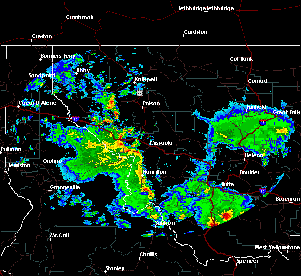
| 8/11/2019 3:06 PM MDT |
 The severe thunderstorm warning for central madison county will expire at 315 pm mdt, the storm which prompted the warning has weakened below severe limits, and has exited the warned area. therefore, the warning will be allowed to expire. a severe thunderstorm watch remains in effect until 700 pm mdt for southwestern montana. The severe thunderstorm warning for central madison county will expire at 315 pm mdt, the storm which prompted the warning has weakened below severe limits, and has exited the warned area. therefore, the warning will be allowed to expire. a severe thunderstorm watch remains in effect until 700 pm mdt for southwestern montana.
|
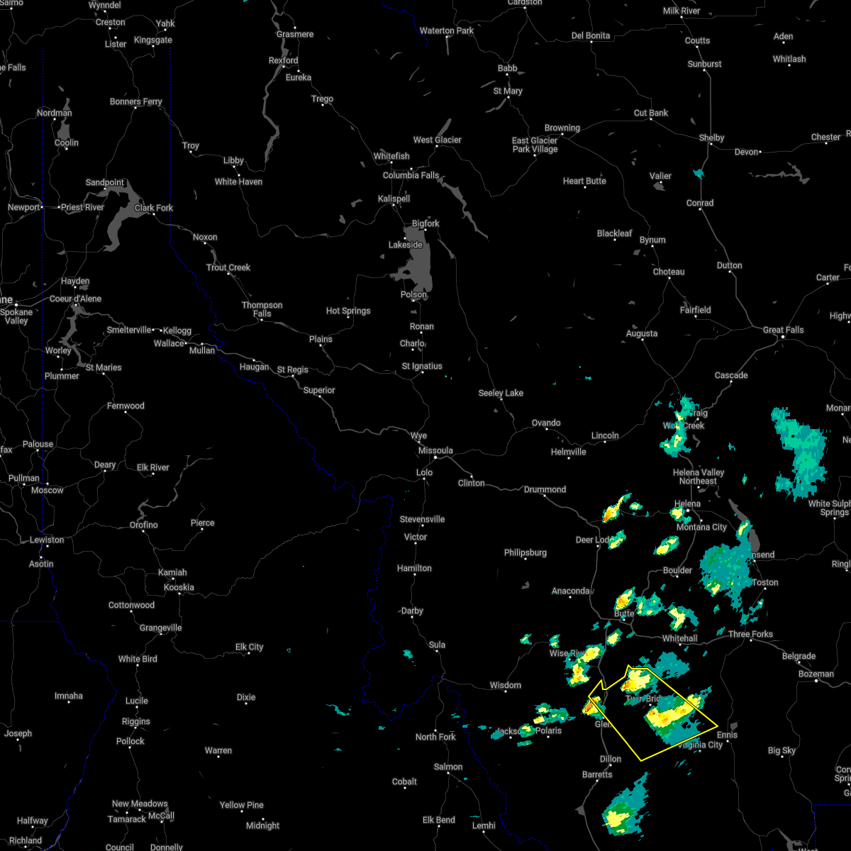
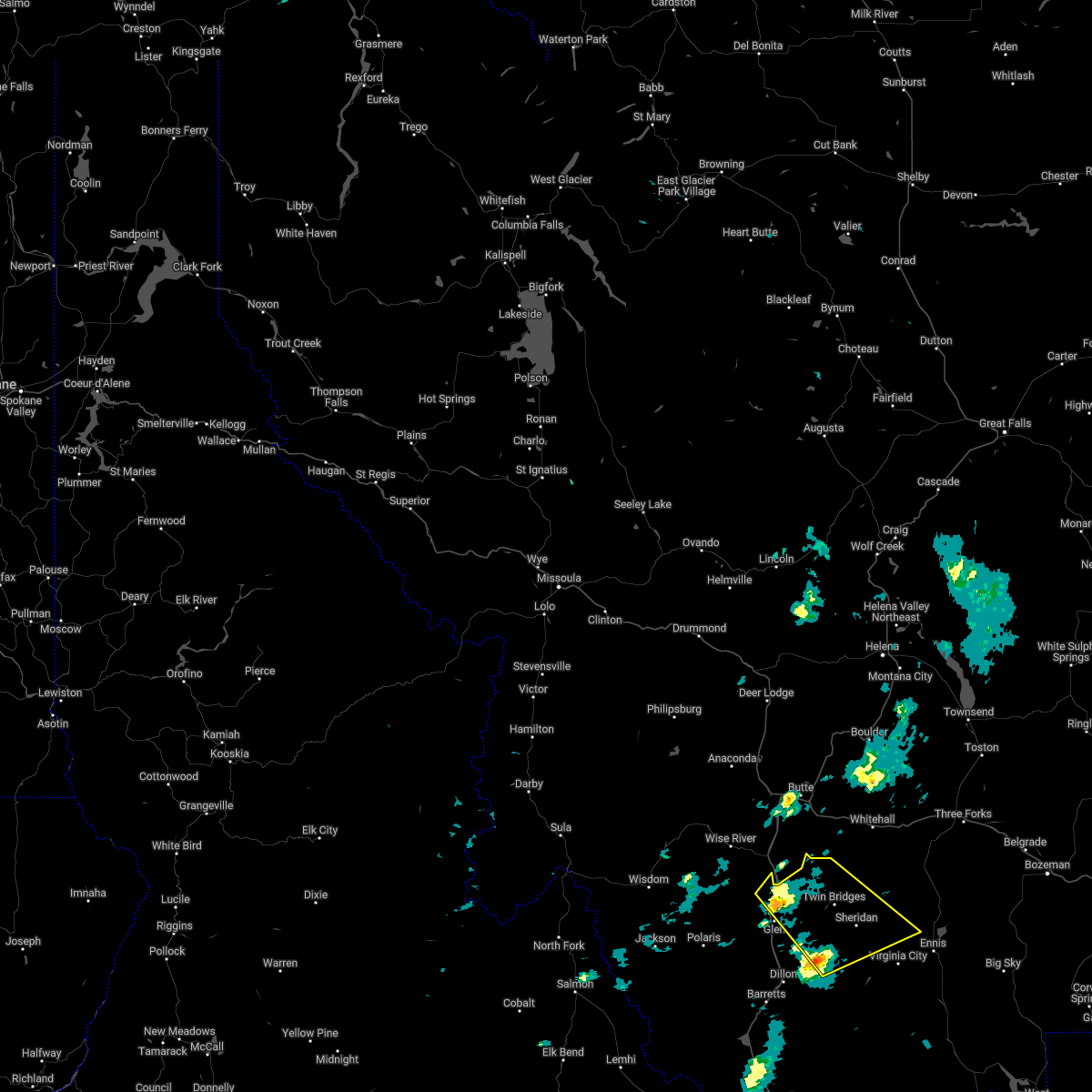
| 8/11/2019 2:50 PM MDT | Quarter sized hail reported 7.5 miles NW of Sheridan, MT, largest hail stones around an inch. time estimated from radar. |
| 8/11/2019 2:50 PM MDT |
 At 249 pm mdt, a severe thunderstorm was located near alder, or near sheridan, moving northeast at 40 mph (radar indicated). Hazards include 60 mph wind gusts and quarter size hail. Hail damage to vehicles is expected. expect wind damage to roofs, siding, and trees. Locations impacted include, sheridan, ennis, alder and laurin. At 249 pm mdt, a severe thunderstorm was located near alder, or near sheridan, moving northeast at 40 mph (radar indicated). Hazards include 60 mph wind gusts and quarter size hail. Hail damage to vehicles is expected. expect wind damage to roofs, siding, and trees. Locations impacted include, sheridan, ennis, alder and laurin.
|
| 8/11/2019 2:41 PM MDT |
 At 240 pm mdt, a severe thunderstorm was located 9 miles southwest of pony, or 10 miles northeast of sheridan, moving northeast at 35 mph (trained weather spotters). Hazards include 60 mph wind gusts and half dollar size hail. Hail damage to vehicles is expected. expect wind damage to roofs, siding, and trees. Locations impacted include, sheridan, harrison, pony, norris and cardwell. At 240 pm mdt, a severe thunderstorm was located 9 miles southwest of pony, or 10 miles northeast of sheridan, moving northeast at 35 mph (trained weather spotters). Hazards include 60 mph wind gusts and half dollar size hail. Hail damage to vehicles is expected. expect wind damage to roofs, siding, and trees. Locations impacted include, sheridan, harrison, pony, norris and cardwell.
|
| 8/11/2019 2:37 PM MDT |
 At 237 pm mdt, a severe thunderstorm was located 12 miles west of alder, or 14 miles southwest of sheridan, moving northeast at 40 mph (radar indicated). Hazards include 60 mph wind gusts and quarter size hail. Hail damage to vehicles is expected. Expect wind damage to roofs, siding, and trees. At 237 pm mdt, a severe thunderstorm was located 12 miles west of alder, or 14 miles southwest of sheridan, moving northeast at 40 mph (radar indicated). Hazards include 60 mph wind gusts and quarter size hail. Hail damage to vehicles is expected. Expect wind damage to roofs, siding, and trees.
|
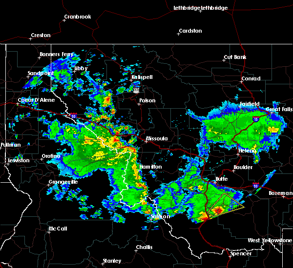
| 8/11/2019 2:35 PM MDT | Quarter sized hail reported 2 miles W of Sheridan, MT, garage window blown out. |
| 8/11/2019 2:28 PM MDT | Golf Ball sized hail reported 0.5 miles N of Sheridan, MT, photo shared on facebook - largest stone appears to be about golf ball size. |
| 8/11/2019 2:28 PM MDT |
 At 228 pm mdt, a severe thunderstorm was located over sheridan, moving northeast at 35 mph (radar indicated). Hazards include ping pong ball size hail and 60 mph wind gusts. People and animals outdoors will be injured. expect hail damage to roofs, siding, windows, and vehicles. expect wind damage to roofs, siding, and trees. Locations impacted include, sheridan, twin bridges, harrison, pony, norris and cardwell. At 228 pm mdt, a severe thunderstorm was located over sheridan, moving northeast at 35 mph (radar indicated). Hazards include ping pong ball size hail and 60 mph wind gusts. People and animals outdoors will be injured. expect hail damage to roofs, siding, windows, and vehicles. expect wind damage to roofs, siding, and trees. Locations impacted include, sheridan, twin bridges, harrison, pony, norris and cardwell.
|
| 8/11/2019 2:25 PM MDT |
 The severe thunderstorm warning for northwestern madison and northeastern beaverhead counties will expire at 230 pm mdt, the storm which prompted the warning has moved out of the area. a severe thunderstorm warning still remains in effect for northwestern madison county. The severe thunderstorm warning for northwestern madison and northeastern beaverhead counties will expire at 230 pm mdt, the storm which prompted the warning has moved out of the area. a severe thunderstorm warning still remains in effect for northwestern madison county.
|
| 8/11/2019 2:23 PM MDT |
 At 223 pm mdt, a severe thunderstorm was located over sheridan, moving northeast at 35 mph (radar indicated). Hazards include 60 mph wind gusts and quarter size hail. Hail damage to vehicles is expected. Expect wind damage to roofs, siding, and trees. At 223 pm mdt, a severe thunderstorm was located over sheridan, moving northeast at 35 mph (radar indicated). Hazards include 60 mph wind gusts and quarter size hail. Hail damage to vehicles is expected. Expect wind damage to roofs, siding, and trees.
|
| 8/11/2019 2:12 PM MDT |
 At 211 pm mdt, a severe thunderstorm was located 8 miles west of sheridan, moving northeast at 40 mph (doppler radar indicated). Hazards include 60 mph wind gusts and quarter size hail. Hail damage to vehicles is expected. expect wind damage to roofs, siding, and trees. Locations impacted include, sheridan, twin bridges and silver star. At 211 pm mdt, a severe thunderstorm was located 8 miles west of sheridan, moving northeast at 40 mph (doppler radar indicated). Hazards include 60 mph wind gusts and quarter size hail. Hail damage to vehicles is expected. expect wind damage to roofs, siding, and trees. Locations impacted include, sheridan, twin bridges and silver star.
|
| 8/11/2019 2:00 PM MDT |
 At 159 pm mdt, a severe thunderstorm was located 13 miles northeast of dillon, moving east at 45 mph (trained weather spotters). Hazards include 60 mph wind gusts and half dollar size hail. Hail damage to vehicles is expected. expect wind damage to roofs, siding, and trees. Locations impacted include, sheridan, twin bridges and silver star. At 159 pm mdt, a severe thunderstorm was located 13 miles northeast of dillon, moving east at 45 mph (trained weather spotters). Hazards include 60 mph wind gusts and half dollar size hail. Hail damage to vehicles is expected. expect wind damage to roofs, siding, and trees. Locations impacted include, sheridan, twin bridges and silver star.
|
| 8/11/2019 1:53 PM MDT |
 At 152 pm mdt, a severe thunderstorm was located 8 miles north of dillon, moving northeast at 45 mph (trained weather spotters). Hazards include golf ball size hail and 60 mph wind gusts. People and animals outdoors will be injured. expect hail damage to roofs, siding, windows, and vehicles. expect wind damage to roofs, siding, and trees. This storm is also producing accumulating hail on roadways, be prepared for hazardous driving conditions. At 152 pm mdt, a severe thunderstorm was located 8 miles north of dillon, moving northeast at 45 mph (trained weather spotters). Hazards include golf ball size hail and 60 mph wind gusts. People and animals outdoors will be injured. expect hail damage to roofs, siding, windows, and vehicles. expect wind damage to roofs, siding, and trees. This storm is also producing accumulating hail on roadways, be prepared for hazardous driving conditions.
|
| 7/7/2019 3:13 PM MDT |
 At 312 pm mdt, severe thunderstorms were located along a line extending from 21 miles south of alder to near lima, moving northeast at 25 mph (spotter reported quarter-size hail in lima recently). Hazards include 60 mph wind gusts and quarter size hail. Hail damage to vehicles is expected. Expect wind damage to roofs, siding, and trees. At 312 pm mdt, severe thunderstorms were located along a line extending from 21 miles south of alder to near lima, moving northeast at 25 mph (spotter reported quarter-size hail in lima recently). Hazards include 60 mph wind gusts and quarter size hail. Hail damage to vehicles is expected. Expect wind damage to roofs, siding, and trees.
|
| 6/27/2017 7:00 AM MDT | Storm damage reported in madison county MT, 7.6 miles NNW of Sheridan, MT |
Hail Maps for Sheridan, MT


Connect with Interactive Hail Maps