

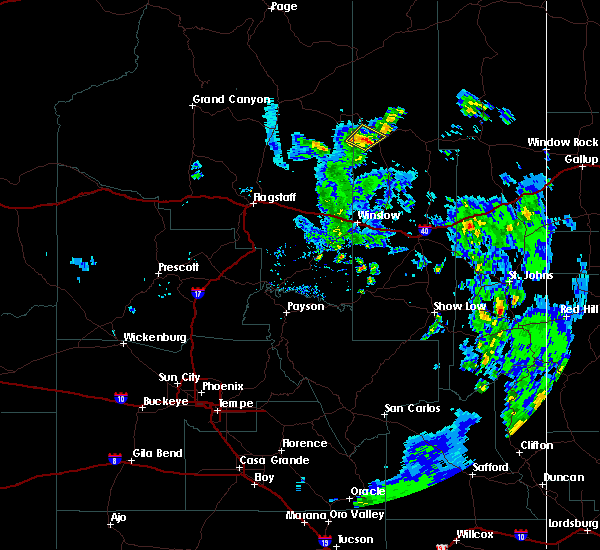
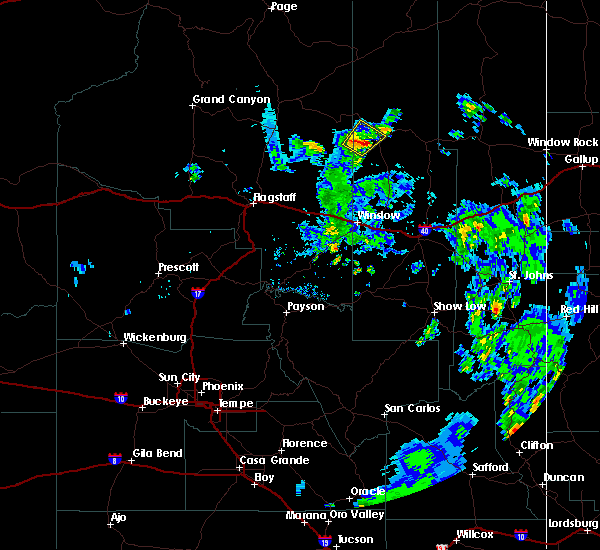
Hail Map for Shongopovi, AZ
The Shongopovi, AZ area has had 0 reports of on-the-ground hail by trained spotters, and has been under severe weather warnings 2 times during the past 12 months. Doppler radar has detected hail at or near Shongopovi, AZ on 4 occasions, including 1 occasion during the past year.
| Name: | Shongopovi, AZ |
| Where Located: | 76.3 miles NE of Flagstaff, AZ |
| Map: | Google Map for Shongopovi, AZ |
| Population: | 831 |
| Housing Units: | 240 |
| More Info: | Search Google for Shongopovi, AZ |
0
The Top Recent Hail Date for Shongopovi, AZ is Wednesday, August 2, 2023 (4th out of 4)

Hail and Wind Damage Spotted near Shongopovi, AZ
| Date / Time | Report Details |
|---|---|
| 8/2/2023 6:19 PM MST |
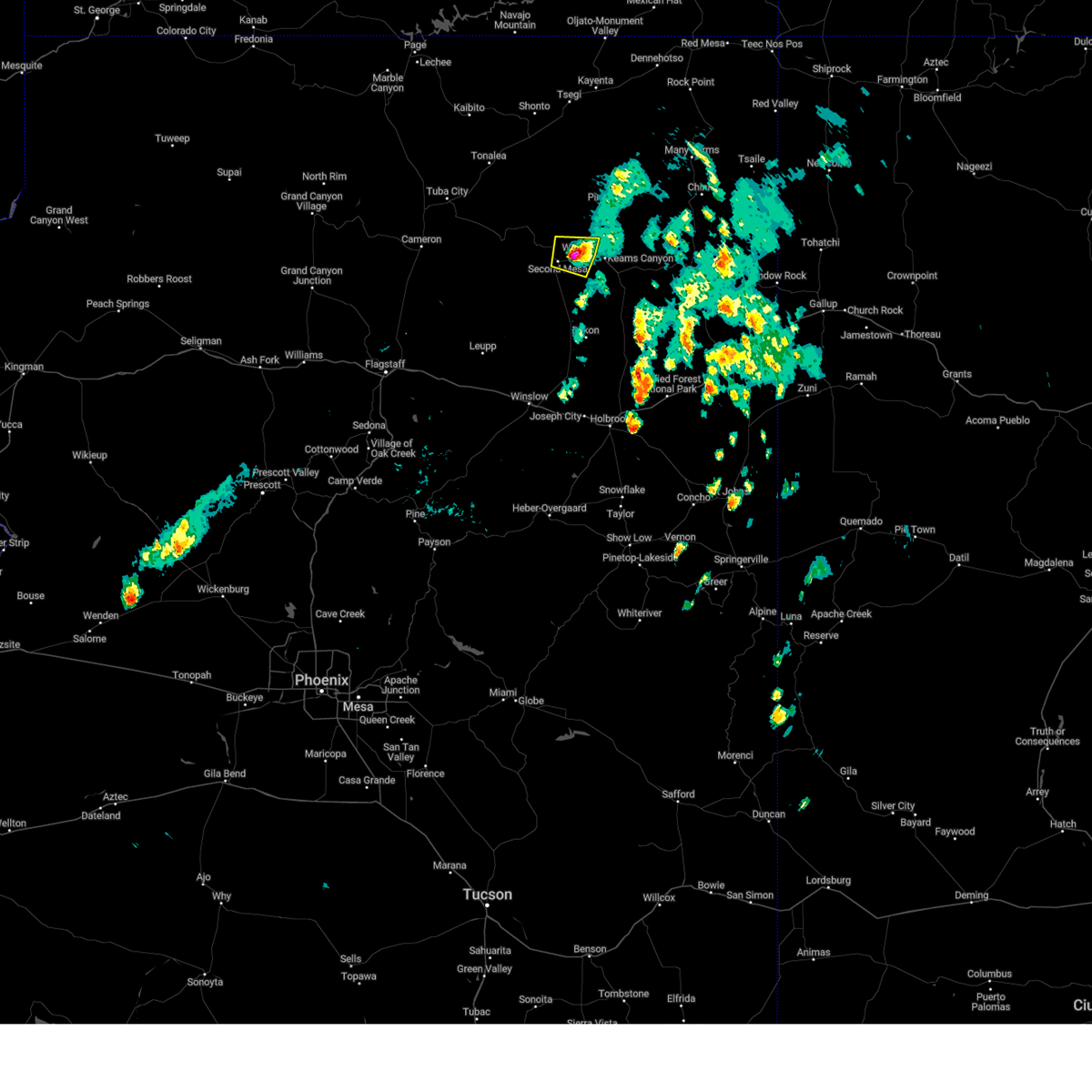 At 616 pm mst, a severe thunderstorm was located over polacca, or east of second mesa, moving north at 20 mph (radar indicated). Hazards include 60 mph wind gusts and quarter size hail. Hail damage to vehicles is expected. expect wind damage to roofs, siding, and trees. locations impacted include, first mesa, second mesa, shongopovi, polacca, and hopi reservation. this includes the following highways, state route 264 between mile markers 379 and 399. state route 87 between mile markers 404 and 406. hail threat, radar indicated max hail size, 1. 00 in wind threat, radar indicated max wind gust, 60 mph. At 616 pm mst, a severe thunderstorm was located over polacca, or east of second mesa, moving north at 20 mph (radar indicated). Hazards include 60 mph wind gusts and quarter size hail. Hail damage to vehicles is expected. expect wind damage to roofs, siding, and trees. locations impacted include, first mesa, second mesa, shongopovi, polacca, and hopi reservation. this includes the following highways, state route 264 between mile markers 379 and 399. state route 87 between mile markers 404 and 406. hail threat, radar indicated max hail size, 1. 00 in wind threat, radar indicated max wind gust, 60 mph.
|
| 8/2/2023 6:02 PM MST |
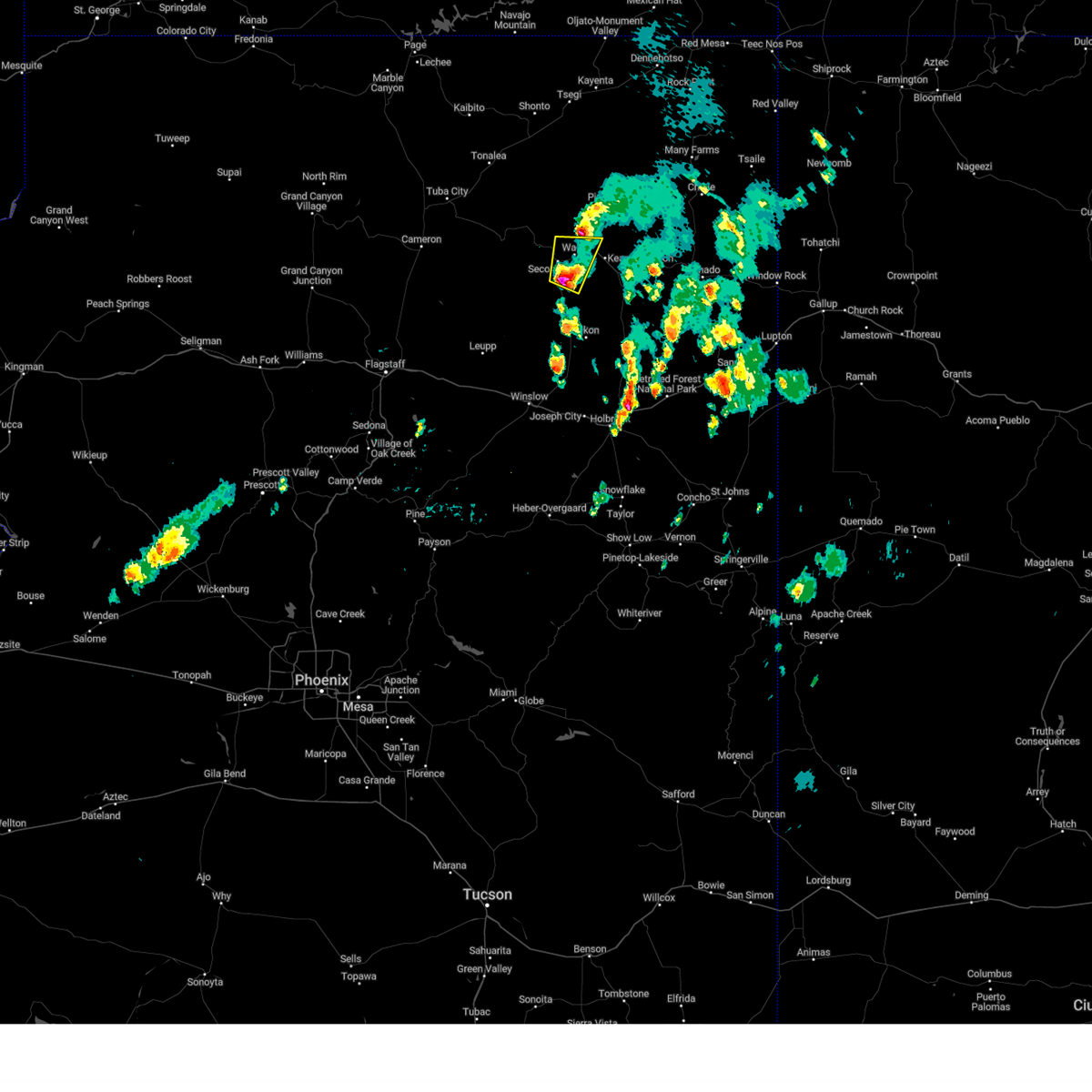 At 601 pm mst, a severe thunderstorm was located 7 miles southwest of first mesa, or 14 miles west of keams canyon, moving north at 20 mph (radar indicated). Hazards include 60 mph wind gusts and quarter size hail. Hail damage to vehicles is expected. Expect wind damage to roofs, siding, and trees. At 601 pm mst, a severe thunderstorm was located 7 miles southwest of first mesa, or 14 miles west of keams canyon, moving north at 20 mph (radar indicated). Hazards include 60 mph wind gusts and quarter size hail. Hail damage to vehicles is expected. Expect wind damage to roofs, siding, and trees.
|
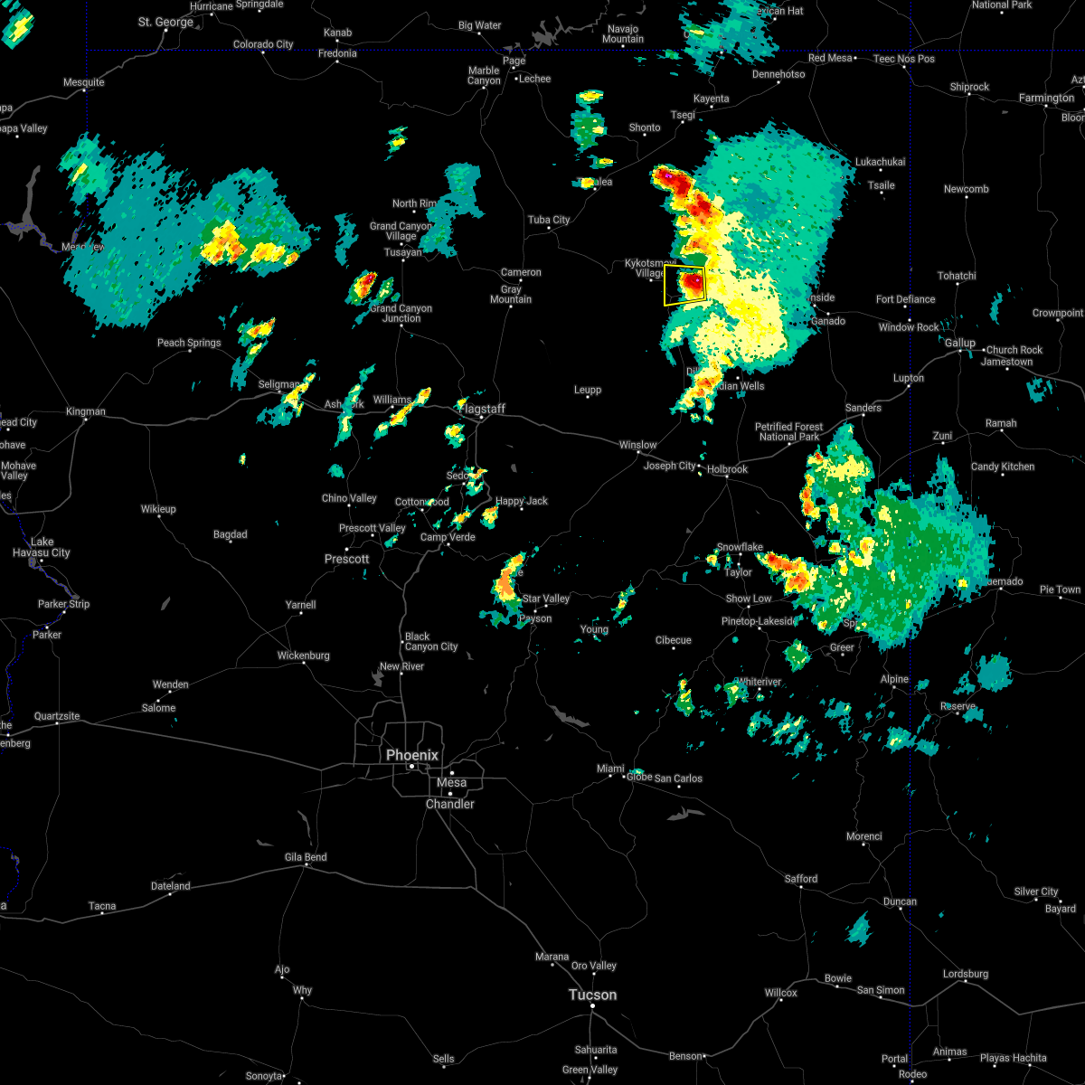
| 7/24/2021 5:23 PM MST |
 The severe thunderstorm warning for navajo county will expire at 530 pm mst, the storm between polacca and second mesa which prompted the warning has weakened below severe limits, and no longer poses an immediate threat to life or property. therefore, the warning will be allowed to expire. The severe thunderstorm warning for navajo county will expire at 530 pm mst, the storm between polacca and second mesa which prompted the warning has weakened below severe limits, and no longer poses an immediate threat to life or property. therefore, the warning will be allowed to expire.
|
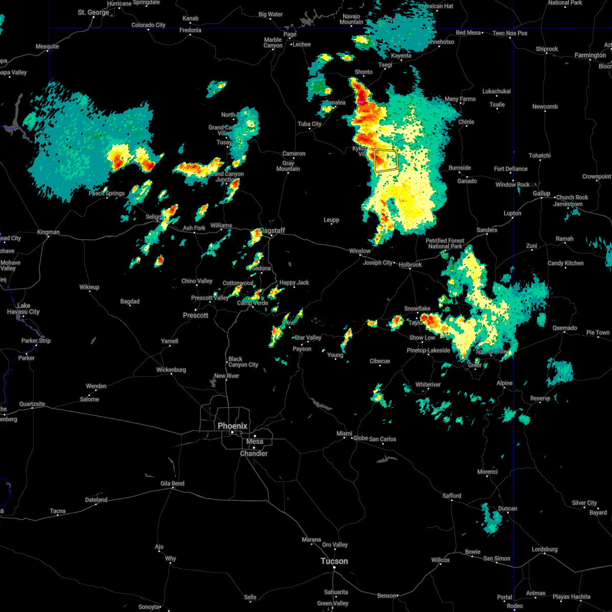
| 7/24/2021 4:51 PM MST |
 At 450 pm mst, a severe thunderstorm was located over first mesa, or 8 miles west of keams canyon, moving west at 10 mph (radar indicated). Hazards include half dollar size hail. wind gusts to 50 mph. damage to vehicles is expected At 450 pm mst, a severe thunderstorm was located over first mesa, or 8 miles west of keams canyon, moving west at 10 mph (radar indicated). Hazards include half dollar size hail. wind gusts to 50 mph. damage to vehicles is expected
|
| 9/2/2015 3:04 PM MST |
 At 303 pm mst, doppler radar indicated a severe thunderstorm capable of producing damaging winds in excess of 60 mph. this storm was located 5 miles west of second mesa, or 23 miles west of keams canyon, moving northeast at 20 mph. nickel size hail may also accompany the damaging winds. locations impacted include, hopi reservation and shongopovi. At 303 pm mst, doppler radar indicated a severe thunderstorm capable of producing damaging winds in excess of 60 mph. this storm was located 5 miles west of second mesa, or 23 miles west of keams canyon, moving northeast at 20 mph. nickel size hail may also accompany the damaging winds. locations impacted include, hopi reservation and shongopovi.
|
| 9/2/2015 2:52 PM MST |
 At 251 pm mst, doppler radar indicated a severe thunderstorm capable of producing quarter size hail and damaging winds in excess of 60 mph. this storm was located 11 miles southwest of second mesa, or 27 miles west of keams canyon, and moving northeast at 20 mph. At 251 pm mst, doppler radar indicated a severe thunderstorm capable of producing quarter size hail and damaging winds in excess of 60 mph. this storm was located 11 miles southwest of second mesa, or 27 miles west of keams canyon, and moving northeast at 20 mph.
|
Hail Maps for Shongopovi, AZ


Connect with Interactive Hail Maps