

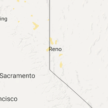
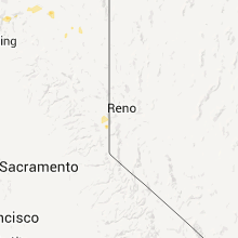
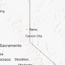
Hail Map for Sierra Brooks, CA
The Sierra Brooks, CA area has had 0 reports of on-the-ground hail by trained spotters, and has been under severe weather warnings 0 times during the past 12 months. Doppler radar has detected hail at or near Sierra Brooks, CA on 10 occasions.
| Name: | Sierra Brooks, CA |
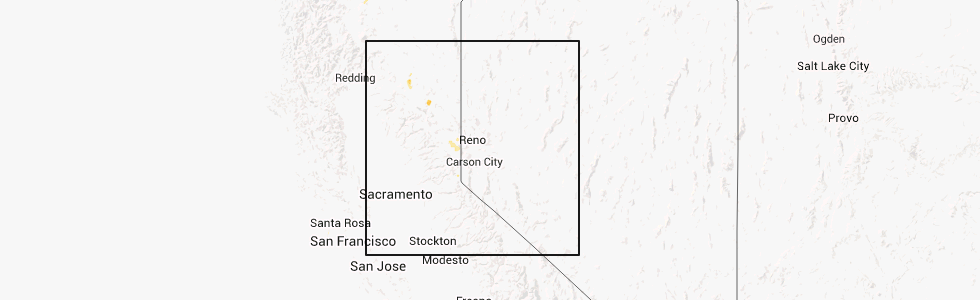
| Where Located: | 22.8 miles WNW of Reno, NV |
| Map: | Google Map for Sierra Brooks, CA |
| Population: | 478 |
| Housing Units: | 211 |
| More Info: | Search Google for Sierra Brooks, CA |
5
The Top Recent Hail Date for Sierra Brooks, CA is Thursday, July 25, 2013 (1st out of 10)
Hail and Wind Damage Spotted near Sierra Brooks, CA
| Date / Time | Report Details |
|---|---|
| 9/4/2019 4:15 PM PDT |
 At 415 pm pdt, a severe thunderstorm was located near independence lake, or 7 miles west of stampede reservoir, moving north at 25 mph (radar indicated). Hazards include quarter size hail. damage to vehicles is expected At 415 pm pdt, a severe thunderstorm was located near independence lake, or 7 miles west of stampede reservoir, moving north at 25 mph (radar indicated). Hazards include quarter size hail. damage to vehicles is expected
|
| 8/17/2016 6:46 PM PDT |
 At 646 pm pdt, doppler radar indicated a severe thunderstorm capable of producing damaging winds in excess of 60 mph. this storm was located near vinton, or near chilcoot. this storm was nearly stationary. penny size hail may also accompany the damaging winds. locations impacted include, beckwourth, chilcoot, vinton, chilcoot-vinton, hallelujah junction, frenchman lake, loyalton, frenchman campground, spring creek campground, ca 49 at sierra-plumas co line, ca 70 at plumas-lassen co line, beckwourth-nervino airport, big cove campground and chilcoot campground. At 646 pm pdt, doppler radar indicated a severe thunderstorm capable of producing damaging winds in excess of 60 mph. this storm was located near vinton, or near chilcoot. this storm was nearly stationary. penny size hail may also accompany the damaging winds. locations impacted include, beckwourth, chilcoot, vinton, chilcoot-vinton, hallelujah junction, frenchman lake, loyalton, frenchman campground, spring creek campground, ca 49 at sierra-plumas co line, ca 70 at plumas-lassen co line, beckwourth-nervino airport, big cove campground and chilcoot campground.
|
| 8/17/2016 6:19 PM PDT |
 At 617 pm pdt, doppler radar indicated a severe thunderstorm capable of producing damaging winds in excess of 60 mph. this storm was located near vinton, or near beckwourth, and moving southeast at 5 mph. penny size hail may also accompany the damaging winds. At 617 pm pdt, doppler radar indicated a severe thunderstorm capable of producing damaging winds in excess of 60 mph. this storm was located near vinton, or near beckwourth, and moving southeast at 5 mph. penny size hail may also accompany the damaging winds.
|
Hail Maps for Sierra Brooks, CA


Connect with Interactive Hail Maps