

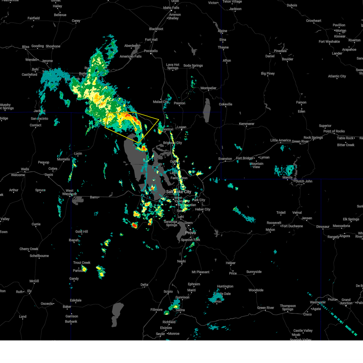
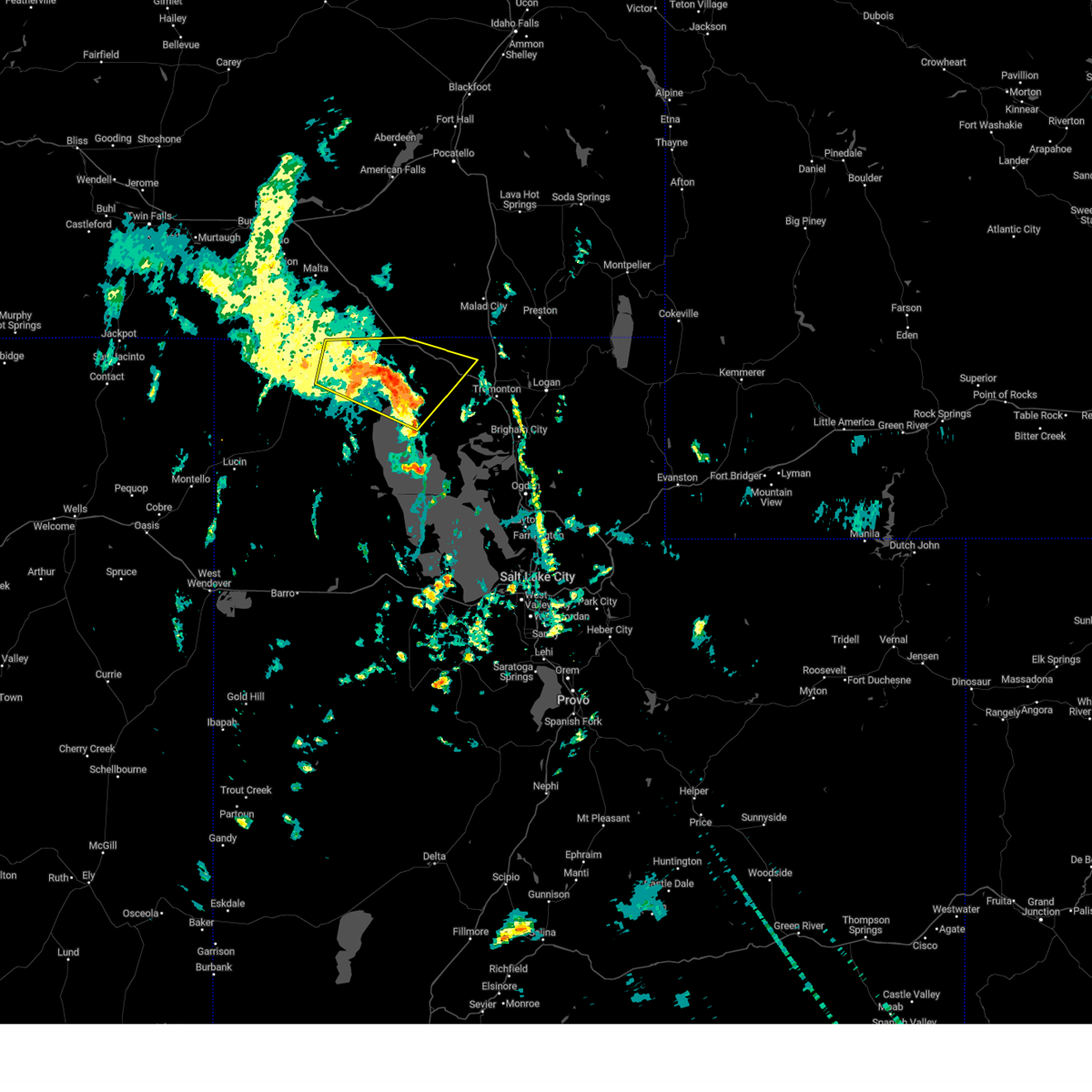
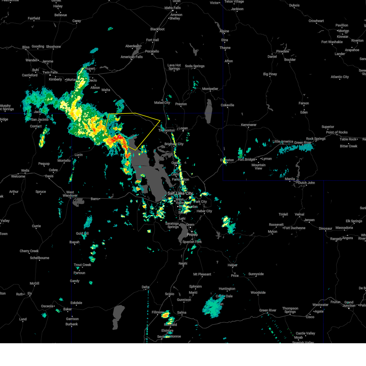
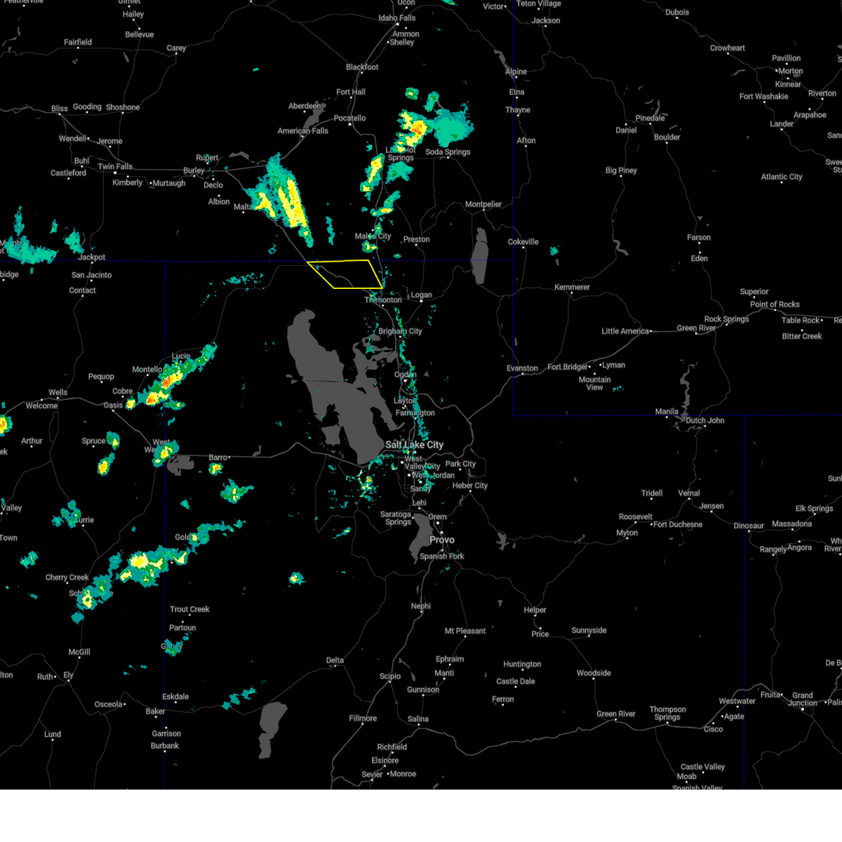
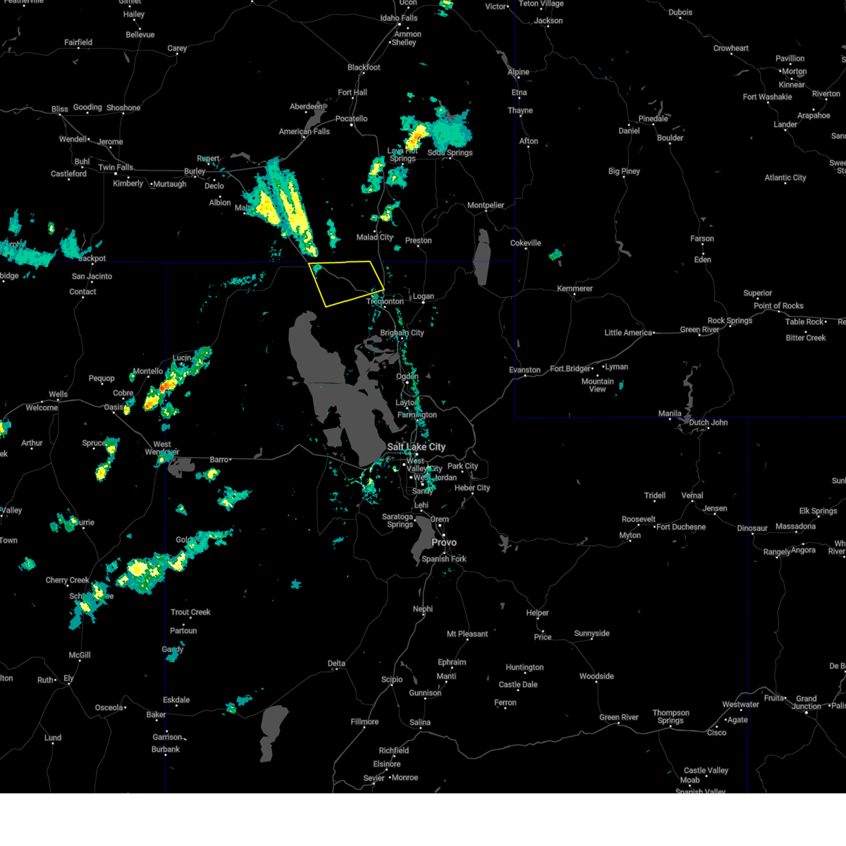
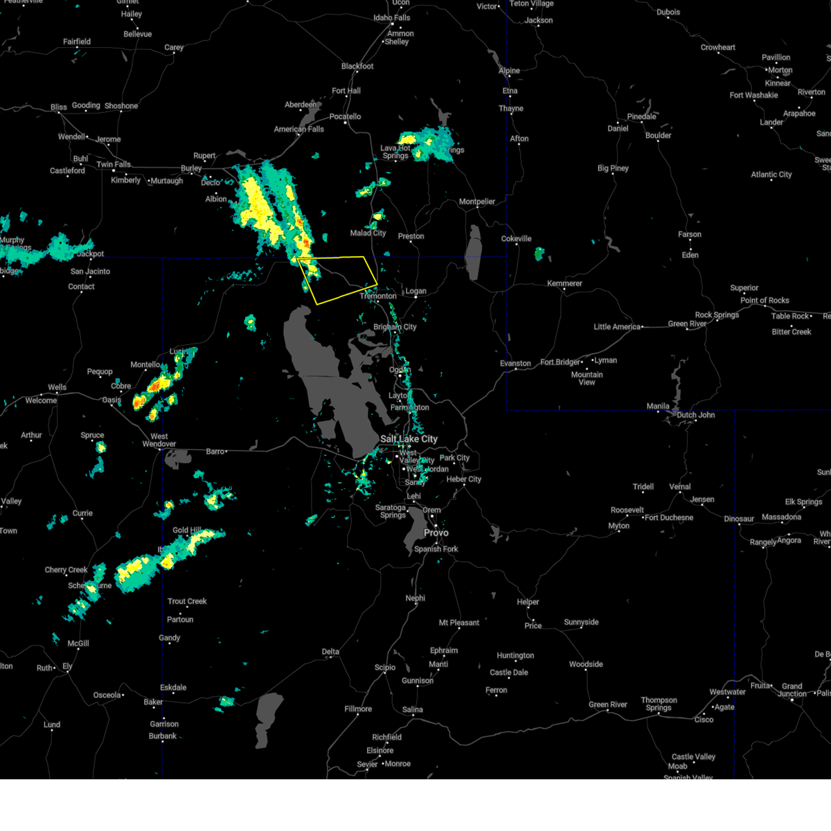
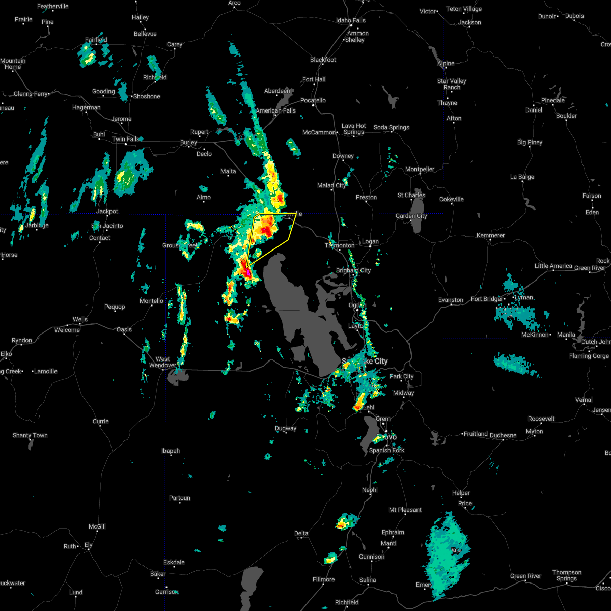
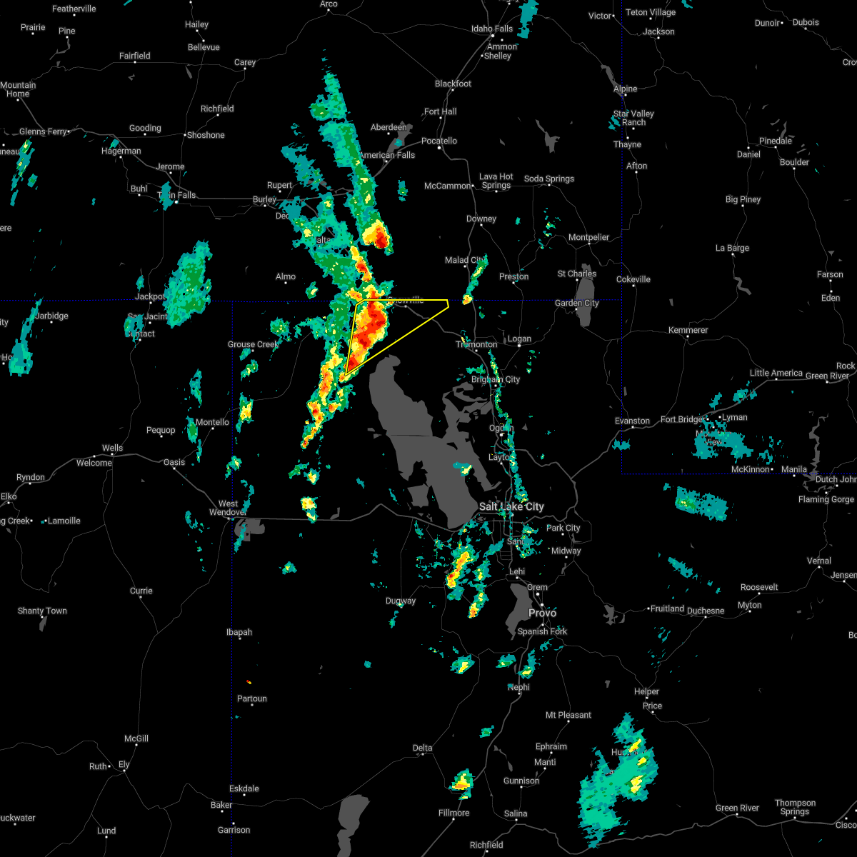
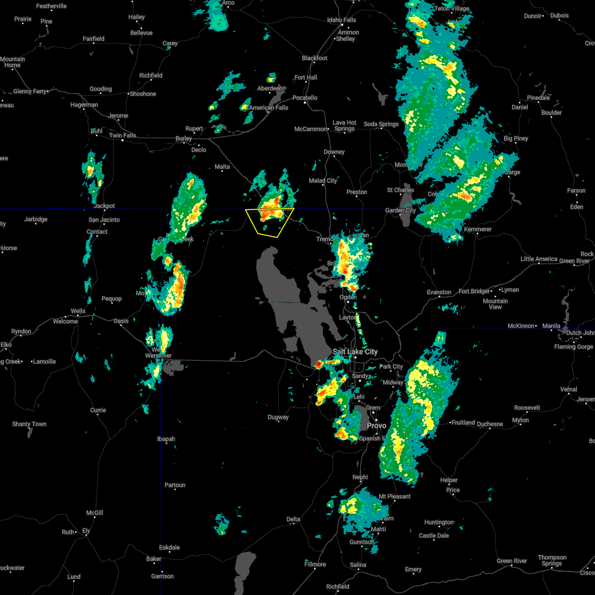
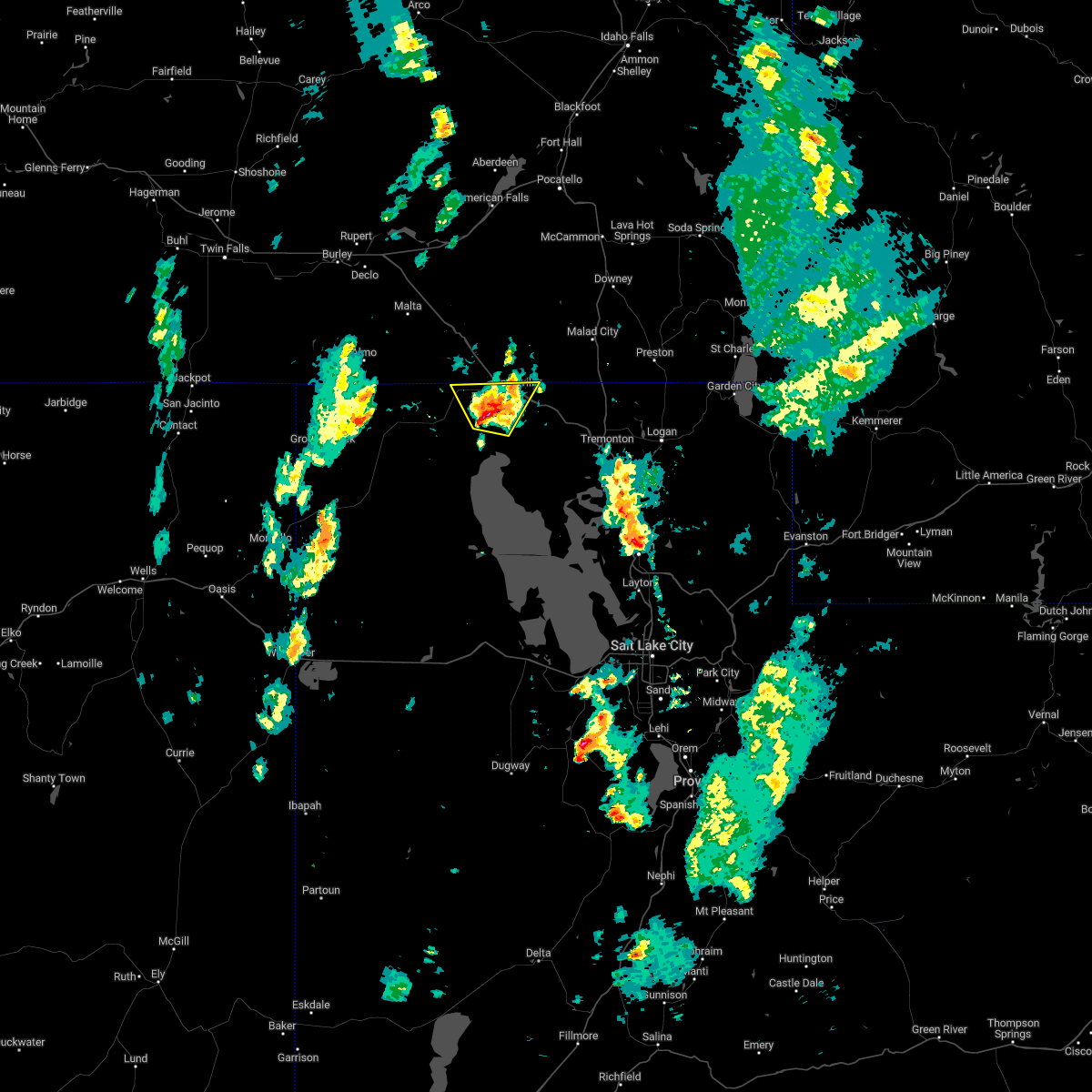
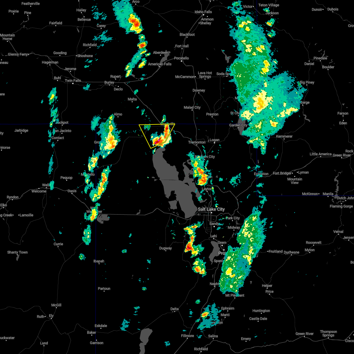
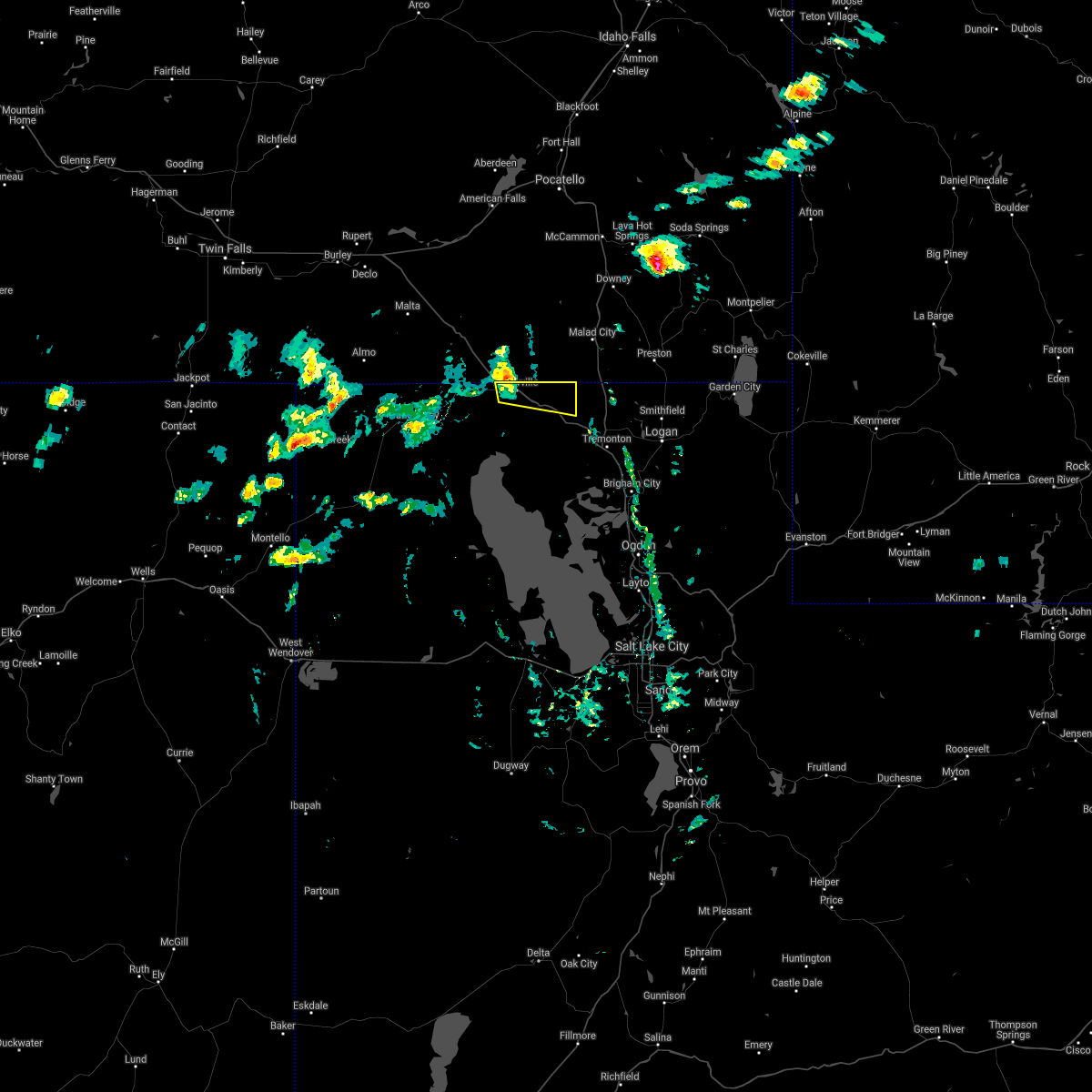
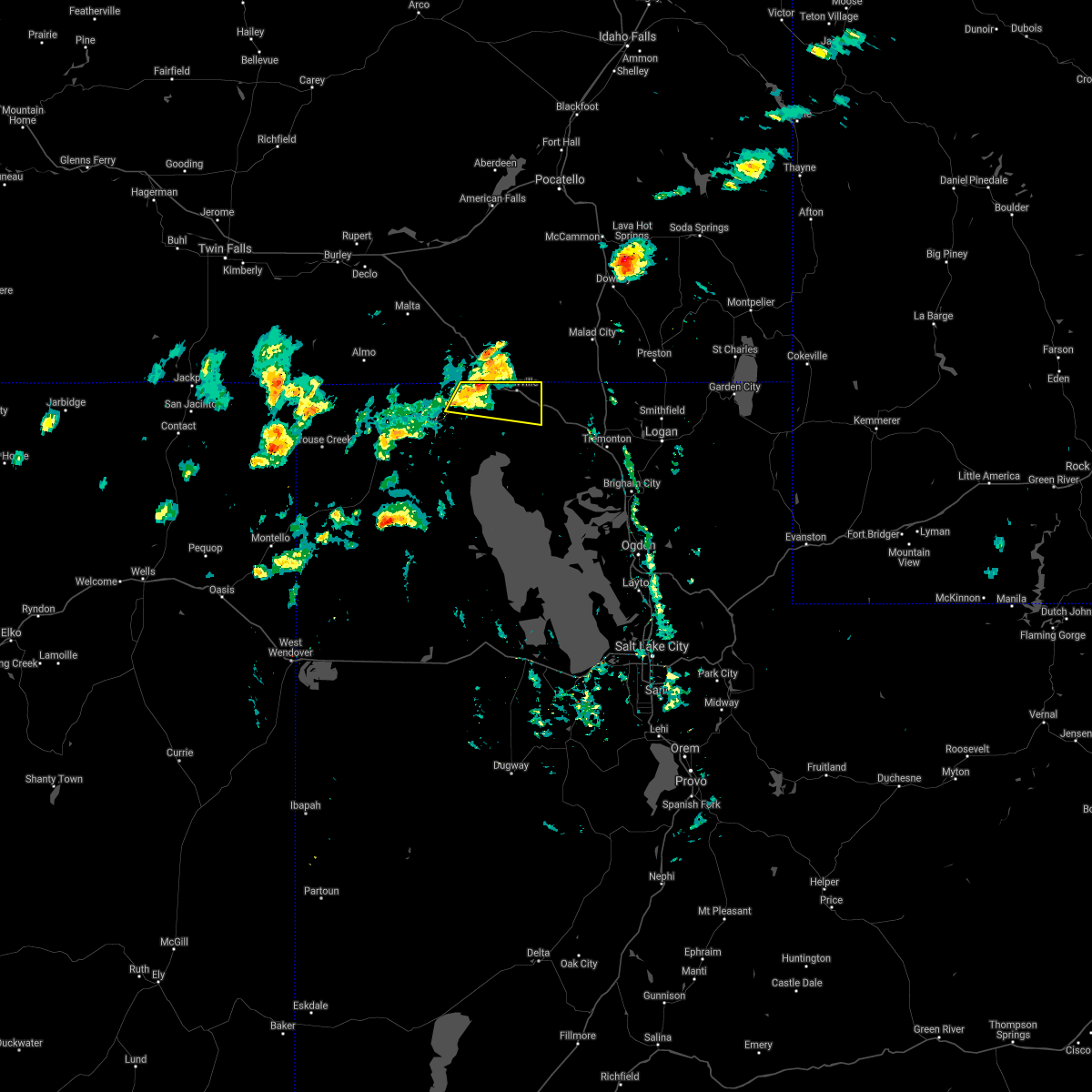
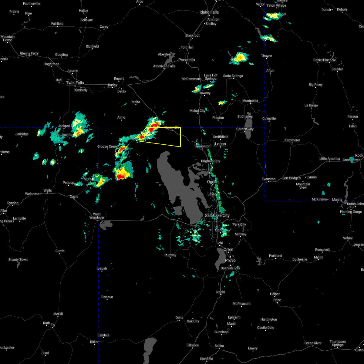
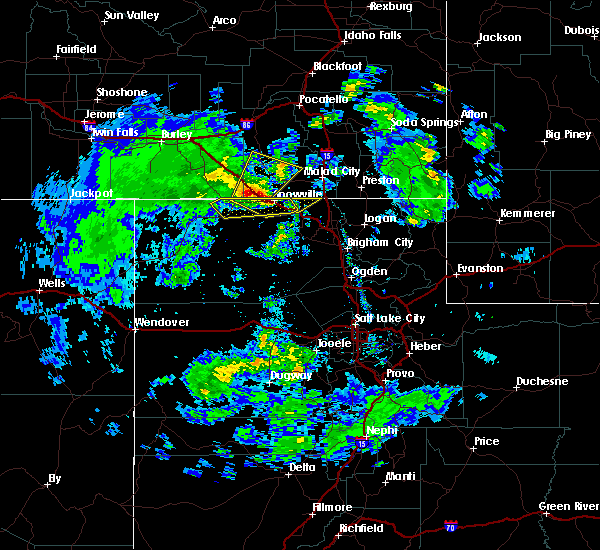
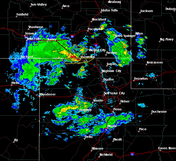
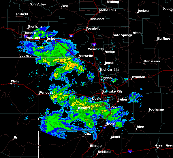
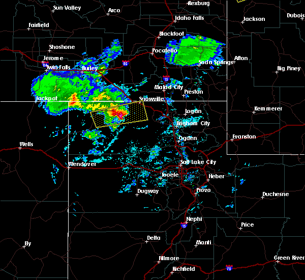
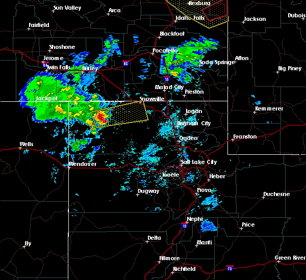
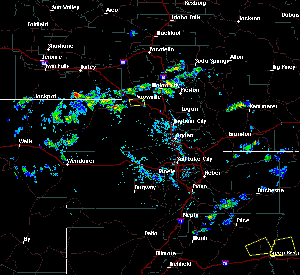
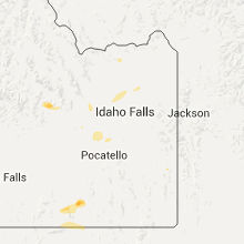
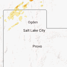
Hail Map for Snowville, UT
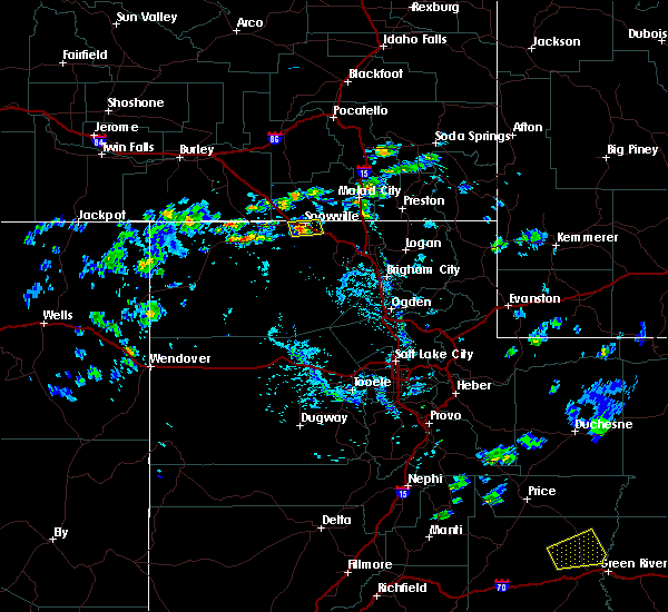
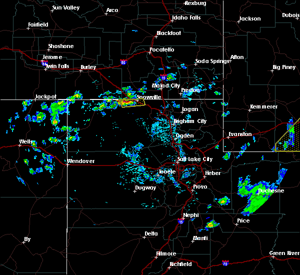
The Snowville, UT area has had 0 reports of on-the-ground hail by trained spotters, and has been under severe weather warnings 7 times during the past 12 months. Doppler radar has detected hail at or near Snowville, UT on 5 occasions.
| Name: | Snowville, UT |
| Where Located: | 94.2 miles NNW of Salt Lake City, UT |
| Map: | Google Map for Snowville, UT |
| Population: | 167 |
| Housing Units: | 67 |
| More Info: | Search Google for Snowville, UT |
5
The Top Recent Hail Date for Snowville, UT is Wednesday, August 22, 2018 (1st out of 5)

Hail and Wind Damage Spotted near Snowville, UT
| Date / Time | Report Details |
|---|---|
| 8/17/2023 7:45 PM MDT | Mesonet station ucc01 snowville (west in box elder county UT, 10 miles E of Snowville, UT |
| 7/24/2023 7:00 PM MDT | Measured at the hansel valley upr mesonet site. site id pc35 in box elder county UT, 8.8 miles NNW of Snowville, UT |
| 7/24/2023 6:58 PM MDT |
 The severe thunderstorm warning for north central box elder county will expire at 700 pm mdt, the storm which prompted the warning has weakened below severe limits, and has exited the warned area. therefore, the warning will be allowed to expire. The severe thunderstorm warning for north central box elder county will expire at 700 pm mdt, the storm which prompted the warning has weakened below severe limits, and has exited the warned area. therefore, the warning will be allowed to expire.
|
| 7/24/2023 6:42 PM MDT |
 At 642 pm mdt, a severe thunderstorm was located near snowville, moving northeast at 45 mph (radar indicated). Hazards include 60 mph wind gusts. Expect damage to roofs, siding, and trees. locations impacted include, snowville, howell, park valley, curlew junction and locomotive springs. this includes the following highways, interstate 84 between mile markers 1 and 28. utah route 30 between mile markers 54 and 90. hail threat, radar indicated max hail size, <. 75 in wind threat, radar indicated max wind gust, 60 mph. At 642 pm mdt, a severe thunderstorm was located near snowville, moving northeast at 45 mph (radar indicated). Hazards include 60 mph wind gusts. Expect damage to roofs, siding, and trees. locations impacted include, snowville, howell, park valley, curlew junction and locomotive springs. this includes the following highways, interstate 84 between mile markers 1 and 28. utah route 30 between mile markers 54 and 90. hail threat, radar indicated max hail size, <. 75 in wind threat, radar indicated max wind gust, 60 mph.
|
| 7/24/2023 6:21 PM MDT |
 At 619 pm mdt, a severe thunderstorm was located 19 miles southeast of park valley, or 24 miles southwest of snowville, moving northeast at 45 mph (radar and observation indicated. wind gusts exceeding 70 mph have been observed, but peak gusts are expected to be near 60 mph as it approaches the state border). Hazards include 60 mph wind gusts. expect damage to roofs, siding, and trees At 619 pm mdt, a severe thunderstorm was located 19 miles southeast of park valley, or 24 miles southwest of snowville, moving northeast at 45 mph (radar and observation indicated. wind gusts exceeding 70 mph have been observed, but peak gusts are expected to be near 60 mph as it approaches the state border). Hazards include 60 mph wind gusts. expect damage to roofs, siding, and trees
|
| 7/18/2023 3:50 PM MDT | Mesonet station utckh chaulk hil in box elder county UT, 7 miles NW of Snowville, UT |
| 7/18/2023 3:40 PM MDT | Mesonet station pc358 hansel valle in box elder county UT, 8.8 miles NNW of Snowville, UT |
| 6/27/2023 5:52 PM MDT |
 The severe thunderstorm warning for northeastern box elder county will expire at 600 pm mdt, the storms which prompted the warning have weakened below severe limits, and have exited the warned area. therefore, the warning will be allowed to expire. The severe thunderstorm warning for northeastern box elder county will expire at 600 pm mdt, the storms which prompted the warning have weakened below severe limits, and have exited the warned area. therefore, the warning will be allowed to expire.
|
| 6/27/2023 5:48 PM MDT |
 At 548 pm mdt, severe thunderstorms were located along a line extending from 6 miles west of holbrook summit to 9 miles east of snowville, moving northeast at 30 mph (multiple mesonet sensors reported wind gusts in excess of 60 mph southeast of snowville). Hazards include 60 mph wind gusts. Expect damage to roofs, siding, and trees. locations impacted include, snowville and howell. this includes the following highways, interstate 15 near mile marker 388. interstate 84 between mile markers 2 and 26. utah route 30 between mile markers 89 and 90. hail threat, radar indicated max hail size, <. 75 in wind threat, observed max wind gust, 60 mph. At 548 pm mdt, severe thunderstorms were located along a line extending from 6 miles west of holbrook summit to 9 miles east of snowville, moving northeast at 30 mph (multiple mesonet sensors reported wind gusts in excess of 60 mph southeast of snowville). Hazards include 60 mph wind gusts. Expect damage to roofs, siding, and trees. locations impacted include, snowville and howell. this includes the following highways, interstate 15 near mile marker 388. interstate 84 between mile markers 2 and 26. utah route 30 between mile markers 89 and 90. hail threat, radar indicated max hail size, <. 75 in wind threat, observed max wind gust, 60 mph.
|
| 6/27/2023 5:44 PM MDT |
 At 543 pm mdt, severe thunderstorms were located along a line extending from 9 miles west of holbrook summit to 9 miles southeast of snowville, moving northeast at 30 mph (multiple mesonet sensors reported wind gusts in excess of 60 mph southeast of snowville). Hazards include 60 mph wind gusts. Expect damage to roofs, siding, and trees. locations impacted include, snowville and howell. this includes the following highways, interstate 15 near mile marker 388. interstate 84 between mile markers 2 and 33. utah route 30 between mile markers 88 and 90. hail threat, radar indicated max hail size, <. 75 in wind threat, observed max wind gust, 60 mph. At 543 pm mdt, severe thunderstorms were located along a line extending from 9 miles west of holbrook summit to 9 miles southeast of snowville, moving northeast at 30 mph (multiple mesonet sensors reported wind gusts in excess of 60 mph southeast of snowville). Hazards include 60 mph wind gusts. Expect damage to roofs, siding, and trees. locations impacted include, snowville and howell. this includes the following highways, interstate 15 near mile marker 388. interstate 84 between mile markers 2 and 33. utah route 30 between mile markers 88 and 90. hail threat, radar indicated max hail size, <. 75 in wind threat, observed max wind gust, 60 mph.
|
| 6/27/2023 5:29 PM MDT |
 At 528 pm mdt, severe thunderstorms were located along a line extending from 7 miles northwest of snowville to 11 miles west of howell, moving northeast at 30 mph (mesonet sensors reported wind gusts to 60 mph). Hazards include 60 mph wind gusts. expect damage to roofs, siding, and trees At 528 pm mdt, severe thunderstorms were located along a line extending from 7 miles northwest of snowville to 11 miles west of howell, moving northeast at 30 mph (mesonet sensors reported wind gusts to 60 mph). Hazards include 60 mph wind gusts. expect damage to roofs, siding, and trees
|
| 6/27/2023 5:20 PM MDT | Storm damage reported in box elder county UT, 7 miles NW of Snowville, UT |
| 6/27/2023 5:10 PM MDT | Storm damage reported in box elder county UT, 8.8 miles NNW of Snowville, UT |
| 6/6/2023 6:30 PM MDT | Mesonet station pc358 hansel valle in box elder county UT, 8.8 miles NNW of Snowville, UT |
| 4/24/2023 2:30 PM MDT | Chaulk hill sensor utckh in box elder county UT, 7 miles NW of Snowville, UT |
| 9/21/2022 7:19 PM MDT |
 At 719 pm mdt, a severe thunderstorm was located 7 miles northeast of snowville, moving northeast at 30 mph (radar indicated). Hazards include 60 mph wind gusts. Expect damage to roofs, siding, and trees. locations impacted include, snowville, curlew junction and locomotive springs. this includes the following highways, interstate 84 between mile markers 0 and 10. utah route 30 between mile markers 71 and 90. hail threat, radar indicated max hail size, <. 75 in wind threat, radar indicated max wind gust, 60 mph. At 719 pm mdt, a severe thunderstorm was located 7 miles northeast of snowville, moving northeast at 30 mph (radar indicated). Hazards include 60 mph wind gusts. Expect damage to roofs, siding, and trees. locations impacted include, snowville, curlew junction and locomotive springs. this includes the following highways, interstate 84 between mile markers 0 and 10. utah route 30 between mile markers 71 and 90. hail threat, radar indicated max hail size, <. 75 in wind threat, radar indicated max wind gust, 60 mph.
|
| 9/21/2022 6:53 PM MDT |
 At 652 pm mdt, a severe thunderstorm was located 8 miles southwest of snowville, moving northeast at 30 mph (radar indicated). Hazards include 60 mph wind gusts. expect damage to roofs, siding, and trees At 652 pm mdt, a severe thunderstorm was located 8 miles southwest of snowville, moving northeast at 30 mph (radar indicated). Hazards include 60 mph wind gusts. expect damage to roofs, siding, and trees
|
| 9/21/2022 4:08 PM MDT |
 The severe thunderstorm warning for north central box elder county will expire at 415 pm mdt, the storm which prompted the warning has moved out of the area. therefore, the warning will be allowed to expire. a severe thunderstorm watch remains in effect until 800 pm mdt for northern utah. The severe thunderstorm warning for north central box elder county will expire at 415 pm mdt, the storm which prompted the warning has moved out of the area. therefore, the warning will be allowed to expire. a severe thunderstorm watch remains in effect until 800 pm mdt for northern utah.
|
| 9/21/2022 4:00 PM MDT |
 At 400 pm mdt, a severe thunderstorm was located 8 miles west of snowville, moving north at 40 mph (radar indicated). Hazards include 60 mph wind gusts and quarter size hail. Hail damage to vehicles is expected. expect wind damage to roofs, siding, and trees. locations impacted include, snowville and curlew junction. this includes the following highways, interstate 84 between mile markers 1 and 12. utah route 30 between mile markers 74 and 90. hail threat, radar indicated max hail size, 1. 00 in wind threat, radar indicated max wind gust, 60 mph. At 400 pm mdt, a severe thunderstorm was located 8 miles west of snowville, moving north at 40 mph (radar indicated). Hazards include 60 mph wind gusts and quarter size hail. Hail damage to vehicles is expected. expect wind damage to roofs, siding, and trees. locations impacted include, snowville and curlew junction. this includes the following highways, interstate 84 between mile markers 1 and 12. utah route 30 between mile markers 74 and 90. hail threat, radar indicated max hail size, 1. 00 in wind threat, radar indicated max wind gust, 60 mph.
|
| 9/21/2022 3:47 PM MDT |
 At 347 pm mdt, a severe thunderstorm was located 16 miles southwest of snowville, moving northwest at 65 mph (radar indicated). Hazards include 70 mph wind gusts and ping pong ball size hail. People and animals outdoors will be injured. expect hail damage to roofs, siding, windows, and vehicles. expect considerable tree damage. Wind damage is also likely to mobile homes, roofs, and outbuildings. At 347 pm mdt, a severe thunderstorm was located 16 miles southwest of snowville, moving northwest at 65 mph (radar indicated). Hazards include 70 mph wind gusts and ping pong ball size hail. People and animals outdoors will be injured. expect hail damage to roofs, siding, windows, and vehicles. expect considerable tree damage. Wind damage is also likely to mobile homes, roofs, and outbuildings.
|
| 9/12/2021 5:08 PM MDT |
 At 508 pm mdt, a severe thunderstorm was located near snowville, moving east at 30 mph (radar indicated). Hazards include 60 mph wind gusts and quarter size hail. Hail damage to vehicles is expected. Expect wind damage to roofs, siding, and trees. At 508 pm mdt, a severe thunderstorm was located near snowville, moving east at 30 mph (radar indicated). Hazards include 60 mph wind gusts and quarter size hail. Hail damage to vehicles is expected. Expect wind damage to roofs, siding, and trees.
|
| 9/12/2021 4:55 PM MDT |
 At 455 pm mdt, a severe thunderstorm was located near juniper, or 9 miles west of snowville, moving east at 20 mph (radar indicated). Hazards include 60 mph wind gusts and penny size hail. Expect damage to roofs, siding, and trees. locations impacted include, snowville and curlew junction. this includes the following highways, interstate 84 between mile markers 0 and 16. utah route 30 between mile markers 68 and 90. hail threat, radar indicated max hail size, 0. 75 in wind threat, radar indicated max wind gust, 60 mph. At 455 pm mdt, a severe thunderstorm was located near juniper, or 9 miles west of snowville, moving east at 20 mph (radar indicated). Hazards include 60 mph wind gusts and penny size hail. Expect damage to roofs, siding, and trees. locations impacted include, snowville and curlew junction. this includes the following highways, interstate 84 between mile markers 0 and 16. utah route 30 between mile markers 68 and 90. hail threat, radar indicated max hail size, 0. 75 in wind threat, radar indicated max wind gust, 60 mph.
|
| 9/12/2021 4:31 PM MDT |
 At 430 pm mdt, a severe thunderstorm was located near juniper, or 19 miles west of snowville, moving east at 25 mph. an additional severe thunderstorm is located northeast of park valley, moving east at 25 mph (radar indicated). Hazards include 60 mph wind gusts and quarter size hail. Hail damage to vehicles is expected. Expect wind damage to roofs, siding, and trees. At 430 pm mdt, a severe thunderstorm was located near juniper, or 19 miles west of snowville, moving east at 25 mph. an additional severe thunderstorm is located northeast of park valley, moving east at 25 mph (radar indicated). Hazards include 60 mph wind gusts and quarter size hail. Hail damage to vehicles is expected. Expect wind damage to roofs, siding, and trees.
|
| 7/12/2021 4:00 PM MDT | Udot mesonet sensor sr-30 at curlew junction in box elder county UT, 19.4 miles E of Snowville, UT |
| 6/6/2020 4:08 PM MDT |
 The severe thunderstorm warning for north central box elder county will expire at 415 pm mdt, the storm which prompted the warning has moved out of the area. therefore, the warning will be allowed to expire. The severe thunderstorm warning for north central box elder county will expire at 415 pm mdt, the storm which prompted the warning has moved out of the area. therefore, the warning will be allowed to expire.
|
| 6/6/2020 3:59 PM MDT | Chaulk hill - udot mesonet in box elder county UT, 7 miles NW of Snowville, UT |
| 6/6/2020 3:56 PM MDT |
 At 356 pm mdt, a severe thunderstorm was located over snowville, moving northeast at 35 mph (radar indicated). Hazards include 70 mph wind gusts and ping pong ball size hail. People and animals outdoors will be injured. expect hail damage to roofs, siding, windows, and vehicles. expect considerable tree damage. wind damage is also likely to mobile homes, roofs, and outbuildings. locations impacted include, snowville and curlew junction. this includes the following highways, interstate 84 between mile markers 0 and 22. Utah route 30 between mile markers 75 and 90. At 356 pm mdt, a severe thunderstorm was located over snowville, moving northeast at 35 mph (radar indicated). Hazards include 70 mph wind gusts and ping pong ball size hail. People and animals outdoors will be injured. expect hail damage to roofs, siding, windows, and vehicles. expect considerable tree damage. wind damage is also likely to mobile homes, roofs, and outbuildings. locations impacted include, snowville and curlew junction. this includes the following highways, interstate 84 between mile markers 0 and 22. Utah route 30 between mile markers 75 and 90.
|
| 6/6/2020 3:54 PM MDT | Public estimated gust to 60 mph. numerous downed tree limbs and some shingles blown off of house. time estimated from rada in box elder county UT, 0.3 miles NE of Snowville, UT |
| 6/6/2020 3:51 PM MDT |
 At 351 pm mdt, a severe thunderstorm was located over snowville, moving northeast at 35 mph (radar indicated). Hazards include 60 mph wind gusts and half dollar size hail. Hail damage to vehicles is expected. Expect wind damage to roofs, siding, and trees. At 351 pm mdt, a severe thunderstorm was located over snowville, moving northeast at 35 mph (radar indicated). Hazards include 60 mph wind gusts and half dollar size hail. Hail damage to vehicles is expected. Expect wind damage to roofs, siding, and trees.
|
| 6/6/2020 3:47 PM MDT |
 At 346 pm mdt, a severe thunderstorm was located near juniper, or 9 miles west of snowville, moving northeast at 35 mph (radar indicated). Hazards include ping pong ball size hail and 60 mph wind gusts. People and animals outdoors will be injured. expect hail damage to roofs, siding, windows, and vehicles. expect wind damage to roofs, siding, and trees. locations impacted include, snowville and curlew junction. this includes the following highways, interstate 84 between mile markers 0 and 20. Utah route 30 between mile markers 63 and 90. At 346 pm mdt, a severe thunderstorm was located near juniper, or 9 miles west of snowville, moving northeast at 35 mph (radar indicated). Hazards include ping pong ball size hail and 60 mph wind gusts. People and animals outdoors will be injured. expect hail damage to roofs, siding, windows, and vehicles. expect wind damage to roofs, siding, and trees. locations impacted include, snowville and curlew junction. this includes the following highways, interstate 84 between mile markers 0 and 20. Utah route 30 between mile markers 63 and 90.
|
| 6/6/2020 3:31 PM MDT |
 At 331 pm mdt, a severe thunderstorm was located near juniper, or 16 miles west of snowville, moving northeast at 35 mph (radar indicated). Hazards include 60 mph wind gusts and quarter size hail. Hail damage to vehicles is expected. Expect wind damage to roofs, siding, and trees. At 331 pm mdt, a severe thunderstorm was located near juniper, or 16 miles west of snowville, moving northeast at 35 mph (radar indicated). Hazards include 60 mph wind gusts and quarter size hail. Hail damage to vehicles is expected. Expect wind damage to roofs, siding, and trees.
|
| 5/30/2020 6:05 PM MDT |
 At 605 pm mdt, a severe thunderstorm was located 17 miles northwest of great salt lake north of the causeway, or 27 miles southwest of snowville, moving north at 40 mph (radar indicated). Hazards include 70 mph wind gusts. Expect considerable tree damage. damage is likely to mobile homes, roofs, and outbuildings. locations impacted include, snowville, howell, park valley, great salt lake north of the causeway, promontory, standrod, gunnison island, locomotive springs, curlew junction, rosette, yost, golden spike historic site and lakeside. this includes the following highways, interstate 84 between mile markers 1 and 29. Utah route 30 between mile markers 45 and 90. At 605 pm mdt, a severe thunderstorm was located 17 miles northwest of great salt lake north of the causeway, or 27 miles southwest of snowville, moving north at 40 mph (radar indicated). Hazards include 70 mph wind gusts. Expect considerable tree damage. damage is likely to mobile homes, roofs, and outbuildings. locations impacted include, snowville, howell, park valley, great salt lake north of the causeway, promontory, standrod, gunnison island, locomotive springs, curlew junction, rosette, yost, golden spike historic site and lakeside. this includes the following highways, interstate 84 between mile markers 1 and 29. Utah route 30 between mile markers 45 and 90.
|
| 5/30/2020 5:43 PM MDT |
 At 542 pm mdt, a severe thunderstorm was located 10 miles west of great salt lake north of the causeway, or 42 miles south of snowville, moving north at 40 mph (radar indicated). Hazards include 70 mph wind gusts. Expect considerable tree damage. Damage is likely to mobile homes, roofs, and outbuildings. At 542 pm mdt, a severe thunderstorm was located 10 miles west of great salt lake north of the causeway, or 42 miles south of snowville, moving north at 40 mph (radar indicated). Hazards include 70 mph wind gusts. Expect considerable tree damage. Damage is likely to mobile homes, roofs, and outbuildings.
|
| 7/8/2019 2:52 PM MDT |
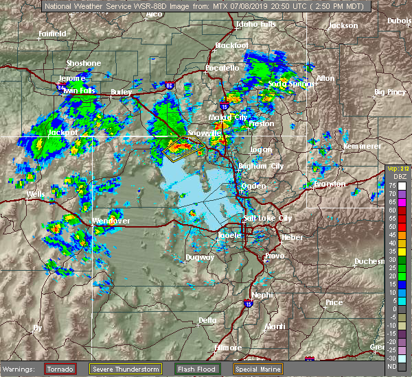 At 252 pm mdt, a severe thunderstorm was located 7 miles south of snowville, moving northeast at 25 mph (radar indicated). Hazards include 60 mph wind gusts and quarter size hail. Hail damage to vehicles is expected. expect wind damage to roofs, siding, and trees. Locations impacted include, snowville. At 252 pm mdt, a severe thunderstorm was located 7 miles south of snowville, moving northeast at 25 mph (radar indicated). Hazards include 60 mph wind gusts and quarter size hail. Hail damage to vehicles is expected. expect wind damage to roofs, siding, and trees. Locations impacted include, snowville.
|
| 7/8/2019 2:39 PM MDT |
 At 239 pm mdt, a severe thunderstorm was located 14 miles southwest of snowville, moving northeast at 25 mph (radar indicated). Hazards include 60 mph wind gusts and quarter size hail. Hail damage to vehicles is expected. Expect wind damage to roofs, siding, and trees. At 239 pm mdt, a severe thunderstorm was located 14 miles southwest of snowville, moving northeast at 25 mph (radar indicated). Hazards include 60 mph wind gusts and quarter size hail. Hail damage to vehicles is expected. Expect wind damage to roofs, siding, and trees.
|
| 8/22/2018 9:09 AM MDT |
 At 852 am mdt, a severe thunderstorm was located 15 miles south of snowville, moving northeast at 40 mph (radar indicated). Hazards include 60 mph wind gusts and quarter size hail. Hail damage to vehicles is expected. Expect wind damage to roofs, siding, and trees. At 852 am mdt, a severe thunderstorm was located 15 miles south of snowville, moving northeast at 40 mph (radar indicated). Hazards include 60 mph wind gusts and quarter size hail. Hail damage to vehicles is expected. Expect wind damage to roofs, siding, and trees.
|
| 8/22/2018 8:52 AM MDT |
 At 852 am mdt, a severe thunderstorm was located 15 miles south of snowville, moving northeast at 40 mph (radar indicated). Hazards include 60 mph wind gusts and quarter size hail. Hail damage to vehicles is expected. Expect wind damage to roofs, siding, and trees. At 852 am mdt, a severe thunderstorm was located 15 miles south of snowville, moving northeast at 40 mph (radar indicated). Hazards include 60 mph wind gusts and quarter size hail. Hail damage to vehicles is expected. Expect wind damage to roofs, siding, and trees.
|
| 8/22/2018 8:34 AM MDT |
 At 834 am mdt, a severe thunderstorm was located 16 miles east of park valley, or 22 miles southwest of snowville, moving northeast at 40 mph (radar indicated). Hazards include 60 mph wind gusts and quarter size hail. Hail damage to vehicles is expected. expect wind damage to roofs, siding, and trees. Locations impacted include, snowville, howell and locomotive springs. At 834 am mdt, a severe thunderstorm was located 16 miles east of park valley, or 22 miles southwest of snowville, moving northeast at 40 mph (radar indicated). Hazards include 60 mph wind gusts and quarter size hail. Hail damage to vehicles is expected. expect wind damage to roofs, siding, and trees. Locations impacted include, snowville, howell and locomotive springs.
|
| 8/22/2018 8:17 AM MDT |
 At 817 am mdt, a severe thunderstorm was located 12 miles southeast of park valley, or 31 miles southwest of snowville, moving northeast at 40 mph (radar indicated). Hazards include 60 mph wind gusts and quarter size hail. Hail damage to vehicles is expected. Expect wind damage to roofs, siding, and trees. At 817 am mdt, a severe thunderstorm was located 12 miles southeast of park valley, or 31 miles southwest of snowville, moving northeast at 40 mph (radar indicated). Hazards include 60 mph wind gusts and quarter size hail. Hail damage to vehicles is expected. Expect wind damage to roofs, siding, and trees.
|
| 6/20/2017 5:00 PM MDT | Chaulk hill sensor... utck in box elder county UT, 7 miles NW of Snowville, UT |
| 5/6/2016 5:16 PM MDT |
 At 516 pm mdt, doppler radar indicated a line of severe thunderstorms capable of producing damaging winds in excess of 60 mph. these storms stretched from 5 miles south of snowville to near plymouth and were moving north at 35 mph. this line of storms has a history of producing winds in excess of 60 mph. locations impacted include, snowville, plymouth, howell, riverside, fielding, portage and washakie. At 516 pm mdt, doppler radar indicated a line of severe thunderstorms capable of producing damaging winds in excess of 60 mph. these storms stretched from 5 miles south of snowville to near plymouth and were moving north at 35 mph. this line of storms has a history of producing winds in excess of 60 mph. locations impacted include, snowville, plymouth, howell, riverside, fielding, portage and washakie.
|
| 5/6/2016 4:59 PM MDT |
 At 459 pm mdt, doppler radar indicated a line of severe thunderstorms capable of producing damaging winds in excess of 60 mph. these storms stretched from near howell to near garland and were moving north at 35 mph. this line of storms has a history of producing damaging winds!. At 459 pm mdt, doppler radar indicated a line of severe thunderstorms capable of producing damaging winds in excess of 60 mph. these storms stretched from near howell to near garland and were moving north at 35 mph. this line of storms has a history of producing damaging winds!.
|
| 3/6/2016 3:30 PM MST | Sr-30 at curlew utcur 4766 ft in box elder county UT, 19.4 miles E of Snowville, UT |
| 10/18/2015 6:41 PM MDT | The severe thunderstorm warning for north central box elder county will expire at 645 pm mdt, the storm which prompted the warning has moved out of the area. therefore the warning will be allowed to expire. however gusty winds are still possible across far northern box elder county with this thunderstorm. |
| 10/18/2015 6:25 PM MDT |
 At 624 pm mdt, doppler radar indicated a severe thunderstorm capable of producing damaging winds in excess of 60 mph. this storm was located just north of the great salt lake, moving north at 35 mph. locations impacted include, snowville, howell, locomotive springs, curlew junction and standrod. At 624 pm mdt, doppler radar indicated a severe thunderstorm capable of producing damaging winds in excess of 60 mph. this storm was located just north of the great salt lake, moving north at 35 mph. locations impacted include, snowville, howell, locomotive springs, curlew junction and standrod.
|
| 10/18/2015 6:06 PM MDT |
 At 605 pm mdt, doppler radar indicated a severe thunderstorm capable of producing damaging winds in excess of 60 mph. this storm was located near locomotive springs on the north end of the great salt lake, and moving north at 35 mph. At 605 pm mdt, doppler radar indicated a severe thunderstorm capable of producing damaging winds in excess of 60 mph. this storm was located near locomotive springs on the north end of the great salt lake, and moving north at 35 mph.
|
| 8/5/2015 4:25 PM MDT |
 At 423 pm mdt, doppler radar indicated a severe thunderstorm capable of producing quarter size hail and damaging winds in excess of 60 mph. this storm was located 15 miles southeast of park valley, or 24 miles southwest of snowville, moving east at 40 mph. this storm has also consistently exhibited rotation through its lifetime. locations impacted include, snowville and locomotive springs. At 423 pm mdt, doppler radar indicated a severe thunderstorm capable of producing quarter size hail and damaging winds in excess of 60 mph. this storm was located 15 miles southeast of park valley, or 24 miles southwest of snowville, moving east at 40 mph. this storm has also consistently exhibited rotation through its lifetime. locations impacted include, snowville and locomotive springs.
|
| 8/5/2015 3:58 PM MDT |
 At 355 pm mdt, doppler radar indicated a severe thunderstorm capable of producing quarter size hail and damaging winds in excess of 60 mph. this storm was located 11 miles south of park valley, or 40 miles southwest of snowville, and moving east at 35 mph. this storm is exhibiting rotation, and will produce large hail and strong winds along its path. At 355 pm mdt, doppler radar indicated a severe thunderstorm capable of producing quarter size hail and damaging winds in excess of 60 mph. this storm was located 11 miles south of park valley, or 40 miles southwest of snowville, and moving east at 35 mph. this storm is exhibiting rotation, and will produce large hail and strong winds along its path.
|
| 7/15/2015 3:52 PM MDT |
 The severe thunderstorm warning for northeastern box elder county will expire at 400 pm mdt, the storm which prompted the severe thunderstorm warning in box elder county has weakened below severe limits, and no longer poses an immediate threat to life or property. therefore the warning will be allowed to expire. The severe thunderstorm warning for northeastern box elder county will expire at 400 pm mdt, the storm which prompted the severe thunderstorm warning in box elder county has weakened below severe limits, and no longer poses an immediate threat to life or property. therefore the warning will be allowed to expire.
|
| 7/15/2015 3:44 PM MDT |
 At 343 pm mdt, doppler radar indicated a severe thunderstorm capable of producing quarter size hail and damaging winds in excess of 60 mph. this storm was located near snowville, moving east at 25 mph. this storm will impact interstate 84 south of snowville around 345 pm mdt. locations impacted include, snowville. At 343 pm mdt, doppler radar indicated a severe thunderstorm capable of producing quarter size hail and damaging winds in excess of 60 mph. this storm was located near snowville, moving east at 25 mph. this storm will impact interstate 84 south of snowville around 345 pm mdt. locations impacted include, snowville.
|
| 7/15/2015 3:09 PM MDT |
 At 308 pm mdt, doppler radar indicated a severe thunderstorm capable of producing quarter size hail and damaging winds in excess of 60 mph. this storm was located near juniper, or 9 miles west of snowville, and moving east at 15 mph. At 308 pm mdt, doppler radar indicated a severe thunderstorm capable of producing quarter size hail and damaging winds in excess of 60 mph. this storm was located near juniper, or 9 miles west of snowville, and moving east at 15 mph.
|
| 6/3/2015 8:11 PM MDT | At 811 pm mdt, doppler radar indicated a line of severe thunderstorms capable of producing damaging winds in excess of 60 mph. these storms were located along a line extending from 8 miles southeast of juniper to 6 miles west of bear river city, and moving north at 25 mph. penny size hail may also accompany the damaging winds. |
| 6/3/2015 7:54 PM MDT | At 754 pm mdt, doppler radar indicated a line of severe thunderstorms capable of producing quarter size hail and damaging winds in excess of 60 mph. these storms were located along a line extending from 8 miles southeast of juniper to 11 miles south of howell, moving northeast at 30 mph. locations impacted include, tremonton, snowville, howell, riverside, garland, fielding, thatcher, golden spike historic site, bothwell, penrose, promontory and curlew junction. |
| 6/3/2015 7:45 PM MDT | Report came from the itd site at the juniper interchang in oneida county ID, 17.9 miles SE of Snowville, UT |
| 6/3/2015 7:43 PM MDT | At 743 pm mdt, doppler radar indicated a line of severe thunderstorms capable of producing quarter size hail and damaging winds in excess of 60 mph. these storms were located along a line extending from 9 miles south of juniper to 15 miles southwest of howell, and moving northeast at 40 mph. |
| 6/3/2015 7:26 PM MDT | At 725 pm mdt, doppler radar indicated a line of severe thunderstorms capable of producing quarter size hail and damaging winds in excess of 60 mph. these storms were located along a line extending from 10 miles northeast of park valley to 24 miles southwest of howell, moving northeast at 25 mph. locations impacted include, snowville, howell, promontory, locomotive springs, golden spike historic site and curlew junction. |
| 6/3/2015 7:20 PM MDT | Curlew junction sensor utcur in box elder county UT, 19.4 miles E of Snowville, UT |
| 6/3/2015 7:11 PM MDT | At 710 pm mdt, doppler radar indicated a line of severe thunderstorms capable of producing quarter size hail and damaging winds in excess of 60 mph. these storms were located along a line extending from 12 miles west of juniper to 27 miles southeast of park valley, and moving northeast at 35 mph. |
| 6/3/2015 7:10 PM MDT | Curlew junction sensor utcur in box elder county UT, 19.4 miles E of Snowville, UT |
| 7/7/2013 5:35 PM MDT | Chaulk hill sensor...utck in box elder county UT, 7 miles NW of Snowville, UT |
Hail Maps for Snowville, UT


Connect with Interactive Hail Maps