

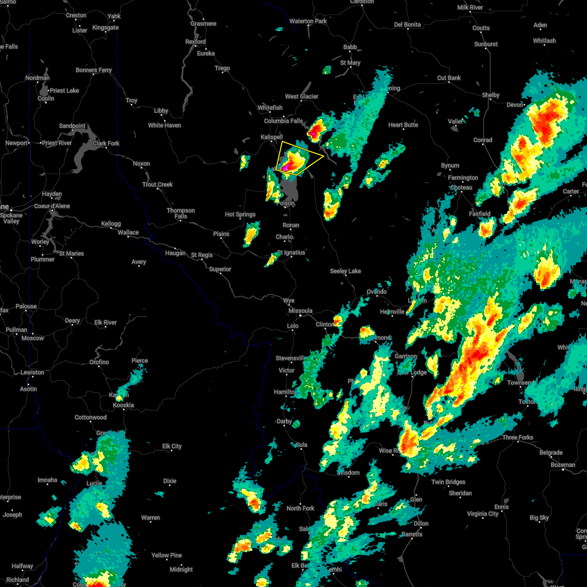
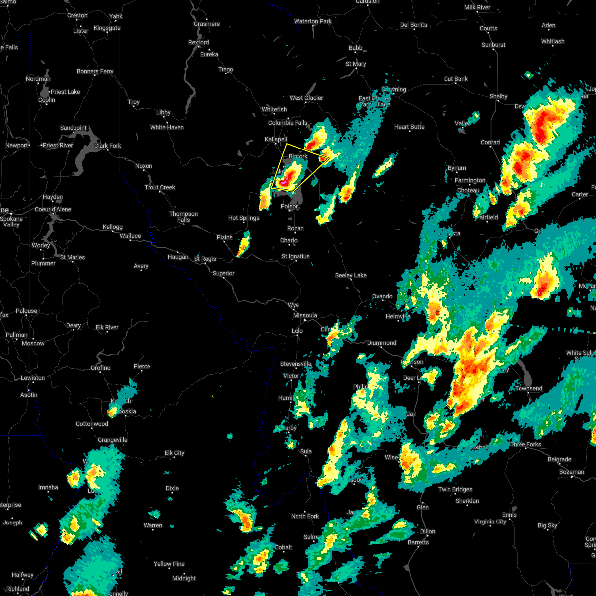
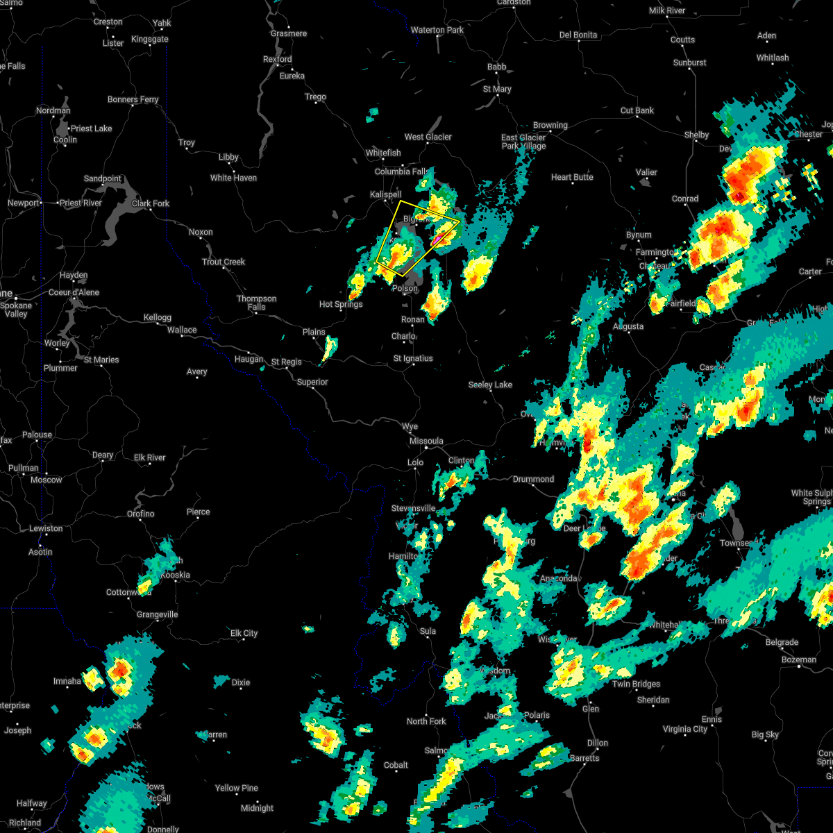
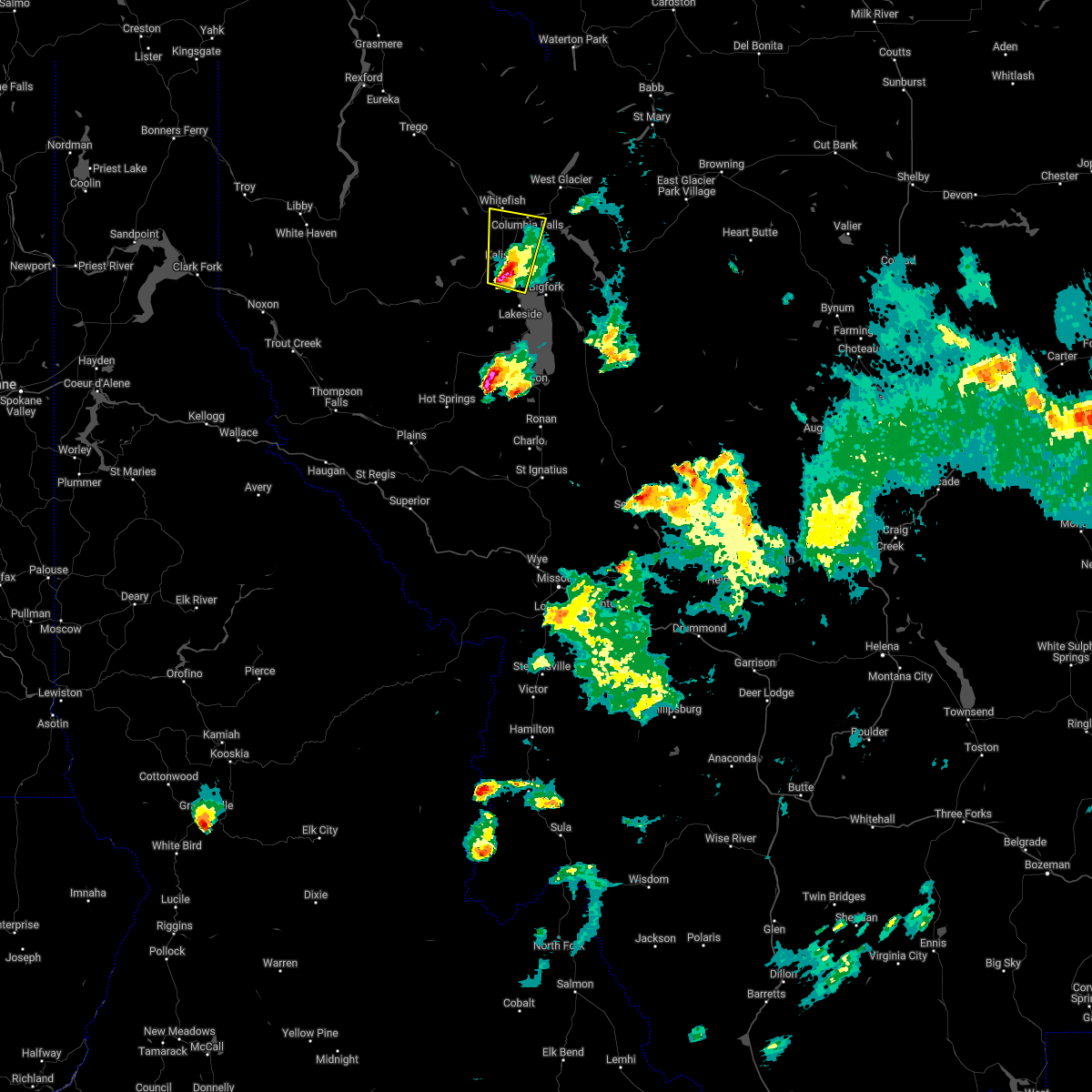
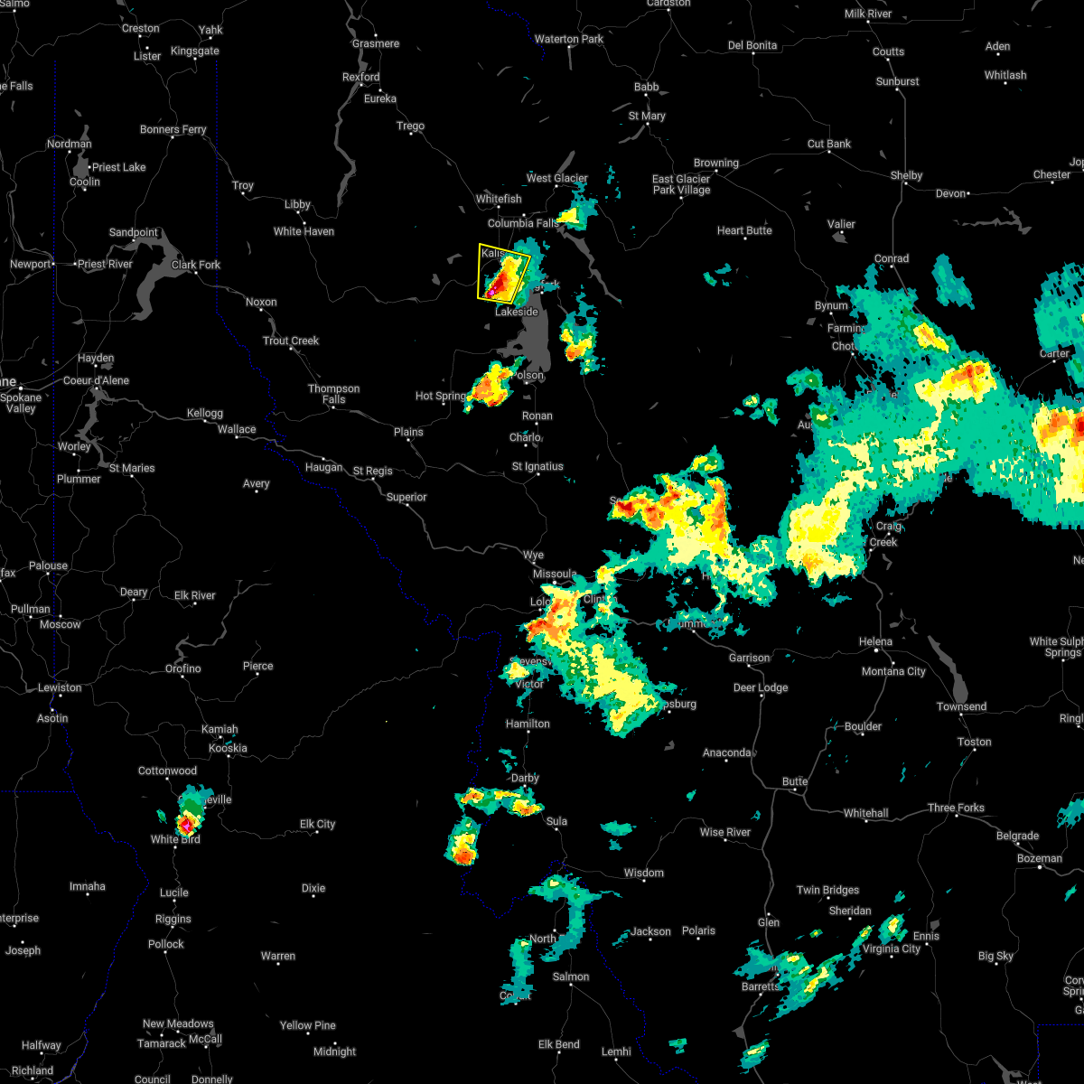
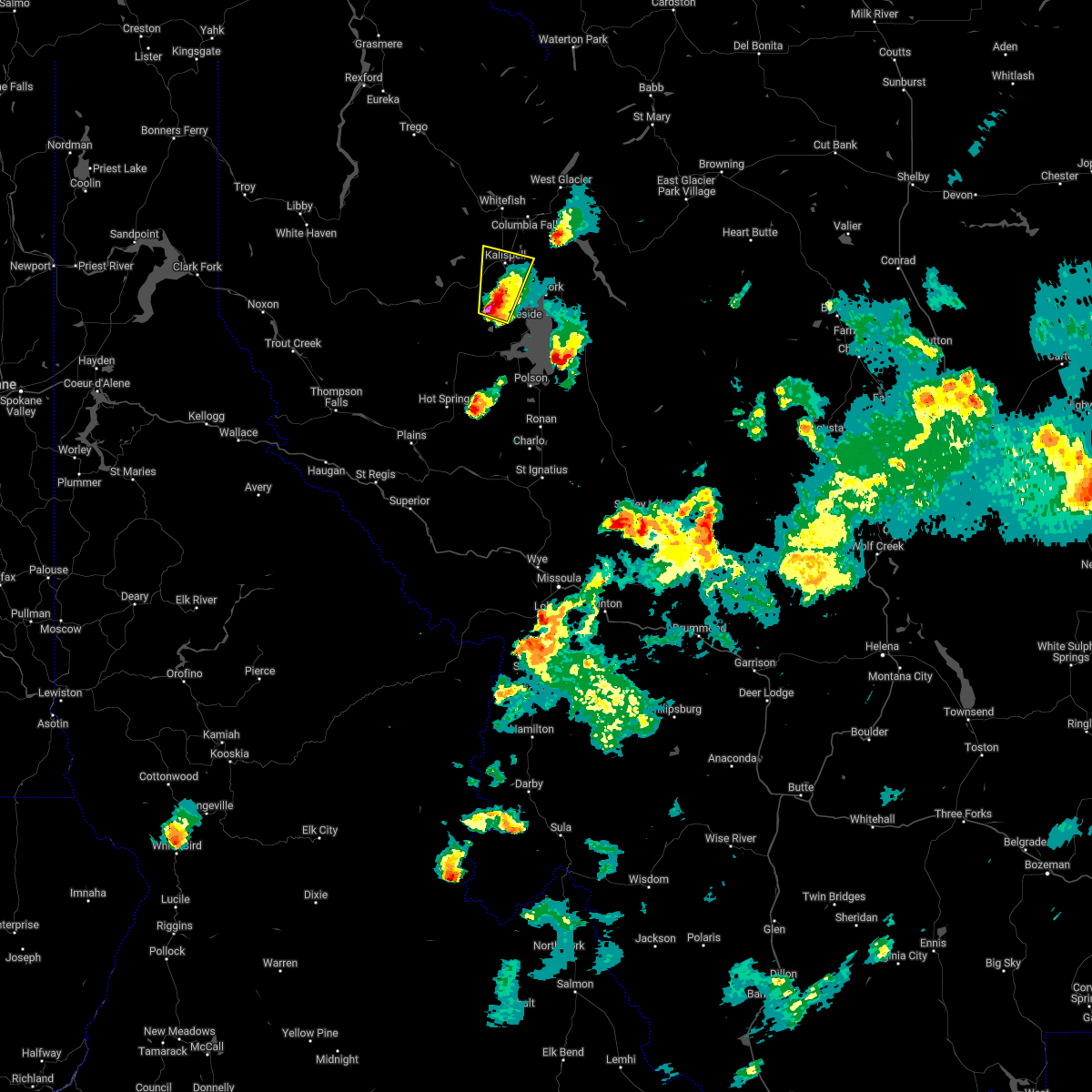
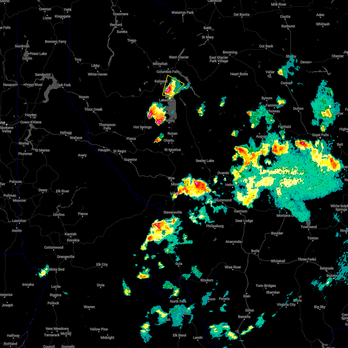
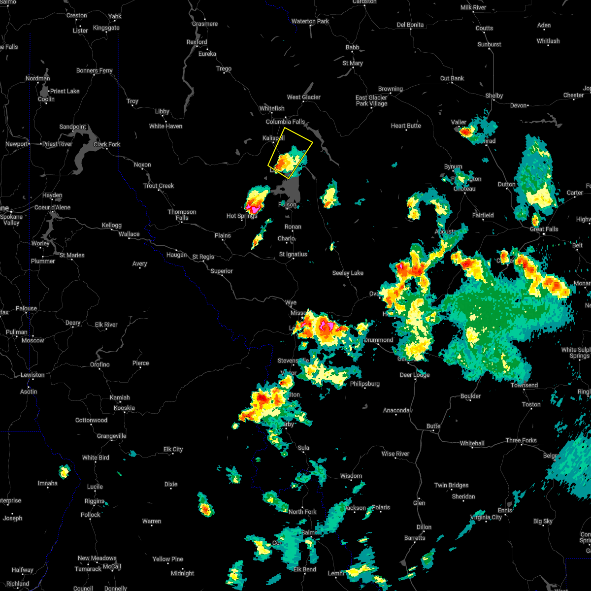
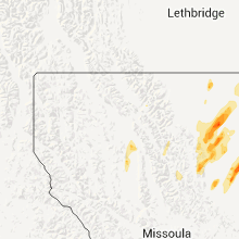
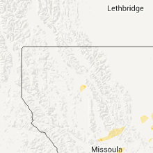
Hail Map for Somers, MT
The Somers, MT area has had 1 report of on-the-ground hail by trained spotters, and has been under severe weather warnings 0 times during the past 12 months. Doppler radar has detected hail at or near Somers, MT on 9 occasions.
| Name: | Somers, MT |
| Where Located: | 23.6 miles SSE of Whitefish, MT |
| Map: | Google Map for Somers, MT |
| Population: | 1109 |
| Housing Units: | 609 |
| More Info: | Search Google for Somers, MT |
5
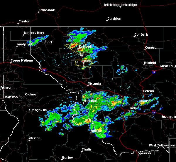
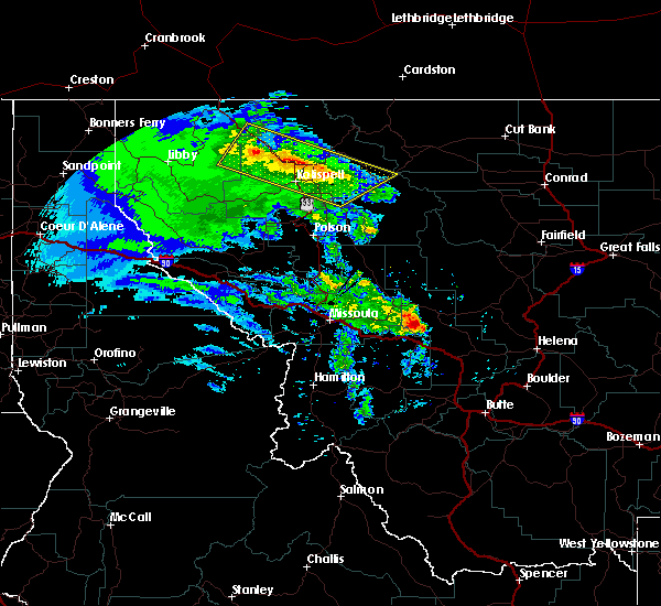
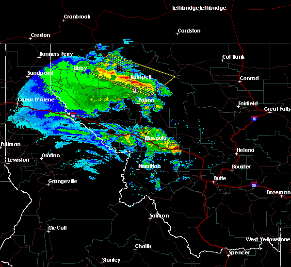
The Top Recent Hail Date for Somers, MT is Thursday, July 7, 2022 (1st out of 9)

Hail and Wind Damage Spotted near Somers, MT
| Date / Time | Report Details |
|---|---|
| 7/9/2022 5:21 PM MDT |
 At 521 pm mdt, a severe thunderstorm was located over woods bay, or 18 miles southeast of kalispell, moving northeast at 30 mph (radar indicated). Hazards include two inch hail and 60 mph wind gusts. People and animals outdoors will be injured. expect hail damage to roofs, siding, windows, and vehicles. expect wind damage to roofs, siding, and trees. locations impacted include, woods bay, bigfork, somers and lakeside. thunderstorm damage threat, considerable hail threat, radar indicated max hail size, 2. 00 in wind threat, radar indicated max wind gust, 60 mph. At 521 pm mdt, a severe thunderstorm was located over woods bay, or 18 miles southeast of kalispell, moving northeast at 30 mph (radar indicated). Hazards include two inch hail and 60 mph wind gusts. People and animals outdoors will be injured. expect hail damage to roofs, siding, windows, and vehicles. expect wind damage to roofs, siding, and trees. locations impacted include, woods bay, bigfork, somers and lakeside. thunderstorm damage threat, considerable hail threat, radar indicated max hail size, 2. 00 in wind threat, radar indicated max wind gust, 60 mph.
|
| 7/9/2022 5:20 PM MDT |
 At 520 pm mdt, a severe thunderstorm was located over woods bay, or 19 miles southeast of kalispell, moving northeast at 30 mph (radar indicated). Hazards include two inch hail and 60 mph wind gusts. People and animals outdoors will be injured. expect hail damage to roofs, siding, windows, and vehicles. expect wind damage to roofs, siding, and trees. locations impacted include, woods bay, bigfork, somers and lakeside. thunderstorm damage threat, considerable hail threat, radar indicated max hail size, 2. 00 in wind threat, radar indicated max wind gust, 60 mph. At 520 pm mdt, a severe thunderstorm was located over woods bay, or 19 miles southeast of kalispell, moving northeast at 30 mph (radar indicated). Hazards include two inch hail and 60 mph wind gusts. People and animals outdoors will be injured. expect hail damage to roofs, siding, windows, and vehicles. expect wind damage to roofs, siding, and trees. locations impacted include, woods bay, bigfork, somers and lakeside. thunderstorm damage threat, considerable hail threat, radar indicated max hail size, 2. 00 in wind threat, radar indicated max wind gust, 60 mph.
|
| 7/9/2022 5:14 PM MDT |
 At 514 pm mdt, a severe thunderstorm was located near woods bay, or 19 miles north of polson, moving northeast at 30 mph (radar indicated). Hazards include golf ball size hail and 60 mph wind gusts. People and animals outdoors will be injured. expect hail damage to roofs, siding, windows, and vehicles. expect wind damage to roofs, siding, and trees. locations impacted include, woods bay, bigfork, somers and lakeside. thunderstorm damage threat, considerable hail threat, radar indicated max hail size, 1. 75 in wind threat, radar indicated max wind gust, 60 mph. At 514 pm mdt, a severe thunderstorm was located near woods bay, or 19 miles north of polson, moving northeast at 30 mph (radar indicated). Hazards include golf ball size hail and 60 mph wind gusts. People and animals outdoors will be injured. expect hail damage to roofs, siding, windows, and vehicles. expect wind damage to roofs, siding, and trees. locations impacted include, woods bay, bigfork, somers and lakeside. thunderstorm damage threat, considerable hail threat, radar indicated max hail size, 1. 75 in wind threat, radar indicated max wind gust, 60 mph.
|
| 7/9/2022 5:14 PM MDT |
 At 513 pm mdt, a severe thunderstorm was located near woods bay, or 18 miles north of polson, moving northeast at 30 mph (radar indicated). Hazards include golf ball size hail and 60 mph wind gusts. People and animals outdoors will be injured. expect hail damage to roofs, siding, windows, and vehicles. expect wind damage to roofs, siding, and trees. locations impacted include, woods bay, bigfork, somers and lakeside. thunderstorm damage threat, considerable hail threat, radar indicated max hail size, 1. 75 in wind threat, radar indicated max wind gust, 60 mph. At 513 pm mdt, a severe thunderstorm was located near woods bay, or 18 miles north of polson, moving northeast at 30 mph (radar indicated). Hazards include golf ball size hail and 60 mph wind gusts. People and animals outdoors will be injured. expect hail damage to roofs, siding, windows, and vehicles. expect wind damage to roofs, siding, and trees. locations impacted include, woods bay, bigfork, somers and lakeside. thunderstorm damage threat, considerable hail threat, radar indicated max hail size, 1. 75 in wind threat, radar indicated max wind gust, 60 mph.
|
| 7/9/2022 5:05 PM MDT |
 At 505 pm mdt, a severe thunderstorm was located 7 miles southwest of woods bay, or 15 miles north of polson, moving northeast at 25 mph (radar indicated). Hazards include golf ball size hail and 60 mph wind gusts. People and animals outdoors will be injured. expect hail damage to roofs, siding, windows, and vehicles. Expect wind damage to roofs, siding, and trees. At 505 pm mdt, a severe thunderstorm was located 7 miles southwest of woods bay, or 15 miles north of polson, moving northeast at 25 mph (radar indicated). Hazards include golf ball size hail and 60 mph wind gusts. People and animals outdoors will be injured. expect hail damage to roofs, siding, windows, and vehicles. Expect wind damage to roofs, siding, and trees.
|
| 7/9/2022 5:01 PM MDT |
 At 501 pm mdt, a severe thunderstorm was located 8 miles northeast of big arm, or 14 miles north of polson, moving northeast at 25 mph (radar indicated). Hazards include ping pong ball size hail and 60 mph wind gusts. People and animals outdoors will be injured. expect hail damage to roofs, siding, windows, and vehicles. Expect wind damage to roofs, siding, and trees. At 501 pm mdt, a severe thunderstorm was located 8 miles northeast of big arm, or 14 miles north of polson, moving northeast at 25 mph (radar indicated). Hazards include ping pong ball size hail and 60 mph wind gusts. People and animals outdoors will be injured. expect hail damage to roofs, siding, windows, and vehicles. Expect wind damage to roofs, siding, and trees.
|
| 7/7/2022 9:13 PM MDT |
 The severe thunderstorm warning for central flathead county will expire at 915 pm mdt. the storm which prompted the warning has moved out of the area. Therefore, the warning will be allowed to expire. The severe thunderstorm warning for central flathead county will expire at 915 pm mdt. the storm which prompted the warning has moved out of the area. Therefore, the warning will be allowed to expire.
|
| 7/7/2022 9:12 PM MDT |
 At 912 pm mdt, a severe thunderstorm was located over kalispell, moving north at 25 mph (radar indicated). Hazards include ping pong ball size hail and 60 mph wind gusts. People and animals outdoors will be injured. expect hail damage to roofs, siding, windows, and vehicles. Expect wind damage to roofs, siding, and trees. At 912 pm mdt, a severe thunderstorm was located over kalispell, moving north at 25 mph (radar indicated). Hazards include ping pong ball size hail and 60 mph wind gusts. People and animals outdoors will be injured. expect hail damage to roofs, siding, windows, and vehicles. Expect wind damage to roofs, siding, and trees.
|
| 7/7/2022 9:00 PM MDT |
 At 900 pm mdt, a severe thunderstorm was located 8 miles south of kalispell, moving north at 25 mph (radar indicated). Hazards include golf ball size hail and 60 mph wind gusts. People and animals outdoors will be injured. expect hail damage to roofs, siding, windows, and vehicles. expect wind damage to roofs, siding, and trees. locations impacted include, kalispell, evergreen, kila and somers. thunderstorm damage threat, considerable hail threat, radar indicated max hail size, 1. 75 in wind threat, radar indicated max wind gust, 60 mph. At 900 pm mdt, a severe thunderstorm was located 8 miles south of kalispell, moving north at 25 mph (radar indicated). Hazards include golf ball size hail and 60 mph wind gusts. People and animals outdoors will be injured. expect hail damage to roofs, siding, windows, and vehicles. expect wind damage to roofs, siding, and trees. locations impacted include, kalispell, evergreen, kila and somers. thunderstorm damage threat, considerable hail threat, radar indicated max hail size, 1. 75 in wind threat, radar indicated max wind gust, 60 mph.
|
| 7/7/2022 8:53 PM MDT |
 At 853 pm mdt, a severe thunderstorm was located 12 miles south of kalispell, moving north at 25 mph (radar indicated). Hazards include ping pong ball size hail and 60 mph wind gusts. People and animals outdoors will be injured. expect hail damage to roofs, siding, windows, and vehicles. expect wind damage to roofs, siding, and trees. locations impacted include, kalispell, evergreen, kila and somers. hail threat, radar indicated max hail size, 1. 50 in wind threat, radar indicated max wind gust, 60 mph. At 853 pm mdt, a severe thunderstorm was located 12 miles south of kalispell, moving north at 25 mph (radar indicated). Hazards include ping pong ball size hail and 60 mph wind gusts. People and animals outdoors will be injured. expect hail damage to roofs, siding, windows, and vehicles. expect wind damage to roofs, siding, and trees. locations impacted include, kalispell, evergreen, kila and somers. hail threat, radar indicated max hail size, 1. 50 in wind threat, radar indicated max wind gust, 60 mph.
|
| 7/7/2022 8:51 PM MDT |
 At 851 pm mdt, a severe thunderstorm was located 12 miles south of kalispell, moving north at 25 mph (radar indicated). Hazards include 60 mph wind gusts and quarter size hail. Hail damage to vehicles is expected. Expect wind damage to roofs, siding, and trees. At 851 pm mdt, a severe thunderstorm was located 12 miles south of kalispell, moving north at 25 mph (radar indicated). Hazards include 60 mph wind gusts and quarter size hail. Hail damage to vehicles is expected. Expect wind damage to roofs, siding, and trees.
|
| 7/7/2022 8:09 PM MDT |
 At 809 pm mdt, a severe thunderstorm was located near bigfork, or 9 miles southeast of kalispell, moving northeast at 20 mph (radar indicated). Hazards include 60 mph wind gusts and half dollar size hail. Hail damage to vehicles is expected. expect wind damage to roofs, siding, and trees. locations impacted include, bigfork, creston, somers and lakeside. hail threat, radar indicated max hail size, 1. 25 in wind threat, radar indicated max wind gust, 60 mph. At 809 pm mdt, a severe thunderstorm was located near bigfork, or 9 miles southeast of kalispell, moving northeast at 20 mph (radar indicated). Hazards include 60 mph wind gusts and half dollar size hail. Hail damage to vehicles is expected. expect wind damage to roofs, siding, and trees. locations impacted include, bigfork, creston, somers and lakeside. hail threat, radar indicated max hail size, 1. 25 in wind threat, radar indicated max wind gust, 60 mph.
|
| 7/7/2022 8:05 PM MDT | Quarter sized hail reported 0.3 miles S of Somers, MT |
| 7/7/2022 8:02 PM MDT |
 At 802 pm mdt, a severe thunderstorm was located near bigfork, or 11 miles southeast of kalispell, moving northeast at 20 mph (radar indicated). Hazards include ping pong ball size hail and 60 mph wind gusts. People and animals outdoors will be injured. expect hail damage to roofs, siding, windows, and vehicles. expect wind damage to roofs, siding, and trees. locations impacted include, bigfork, creston, somers and lakeside. hail threat, radar indicated max hail size, 1. 50 in wind threat, radar indicated max wind gust, 60 mph. At 802 pm mdt, a severe thunderstorm was located near bigfork, or 11 miles southeast of kalispell, moving northeast at 20 mph (radar indicated). Hazards include ping pong ball size hail and 60 mph wind gusts. People and animals outdoors will be injured. expect hail damage to roofs, siding, windows, and vehicles. expect wind damage to roofs, siding, and trees. locations impacted include, bigfork, creston, somers and lakeside. hail threat, radar indicated max hail size, 1. 50 in wind threat, radar indicated max wind gust, 60 mph.
|
| 7/7/2022 7:55 PM MDT |
 At 755 pm mdt, a severe thunderstorm was located 7 miles southwest of bigfork, or 12 miles south of kalispell, moving northeast at 20 mph (radar indicated). Hazards include ping pong ball size hail and 60 mph wind gusts. People and animals outdoors will be injured. expect hail damage to roofs, siding, windows, and vehicles. Expect wind damage to roofs, siding, and trees. At 755 pm mdt, a severe thunderstorm was located 7 miles southwest of bigfork, or 12 miles south of kalispell, moving northeast at 20 mph (radar indicated). Hazards include ping pong ball size hail and 60 mph wind gusts. People and animals outdoors will be injured. expect hail damage to roofs, siding, windows, and vehicles. Expect wind damage to roofs, siding, and trees.
|
| 6/24/2020 4:29 PM MDT |
 At 428 pm mdt, severe thunderstorms were located along a line extending from 9 miles southwest of whitefish to 7 miles southeast of kalispell, moving northeast at 30 mph (public). Hazards include golf ball size hail and 70 mph wind gusts. People and animals outdoors will be injured. expect hail damage to roofs, siding, windows, and vehicles. expect considerable tree damage. wind damage is also likely to mobile homes, roofs, and outbuildings. Locations impacted include, kalispell, evergreen, whitefish, columbia falls, bigfork, kila, somers, creston, la salle and lakeside. At 428 pm mdt, severe thunderstorms were located along a line extending from 9 miles southwest of whitefish to 7 miles southeast of kalispell, moving northeast at 30 mph (public). Hazards include golf ball size hail and 70 mph wind gusts. People and animals outdoors will be injured. expect hail damage to roofs, siding, windows, and vehicles. expect considerable tree damage. wind damage is also likely to mobile homes, roofs, and outbuildings. Locations impacted include, kalispell, evergreen, whitefish, columbia falls, bigfork, kila, somers, creston, la salle and lakeside.
|
| 6/24/2020 4:12 PM MDT |
 At 411 pm mdt, severe thunderstorms were located along a line extending from 17 miles southwest of whitefish to 7 miles south of kalispell, moving east at 30 mph (radar indicated). Hazards include 70 mph wind gusts and quarter size hail. Hail damage to vehicles is expected. expect considerable tree damage. Wind damage is also likely to mobile homes, roofs, and outbuildings. At 411 pm mdt, severe thunderstorms were located along a line extending from 17 miles southwest of whitefish to 7 miles south of kalispell, moving east at 30 mph (radar indicated). Hazards include 70 mph wind gusts and quarter size hail. Hail damage to vehicles is expected. expect considerable tree damage. Wind damage is also likely to mobile homes, roofs, and outbuildings.
|
| 5/31/2020 8:42 AM MDT |
 The severe thunderstorm warning for north central lake and west central flathead counties will expire at 845 am mdt, the storms which prompted the warning have moved out of the area. therefore, the warning will be allowed to expire. The severe thunderstorm warning for north central lake and west central flathead counties will expire at 845 am mdt, the storms which prompted the warning have moved out of the area. therefore, the warning will be allowed to expire.
|
| 5/31/2020 8:25 AM MDT |
 At 822 am mdt, severe thunderstorms were located along a line extending from 26 miles west of whitefish to 6 miles north of swan lake, moving northeast at 55 mph (widespread reports of tree damage and poweroutages have been recieved). Hazards include 60 mph wind gusts. Expect damage to roofs, siding, and trees. These severe thunderstorms will remain over mainly rural areas of north central lake and west central flathead counties, including the following locations, blacktail, stryker, olney, pinnacle, radnor, martin city, coram, creston, lupfer and essex. At 822 am mdt, severe thunderstorms were located along a line extending from 26 miles west of whitefish to 6 miles north of swan lake, moving northeast at 55 mph (widespread reports of tree damage and poweroutages have been recieved). Hazards include 60 mph wind gusts. Expect damage to roofs, siding, and trees. These severe thunderstorms will remain over mainly rural areas of north central lake and west central flathead counties, including the following locations, blacktail, stryker, olney, pinnacle, radnor, martin city, coram, creston, lupfer and essex.
|
| 5/31/2020 8:14 AM MDT |
 At 813 am mdt, severe thunderstorms were located along a line extending from 25 miles east of libby to near swan lake, moving northeast at 55 mph (radar indicated). Hazards include 60 mph wind gusts. expect damage to roofs, siding, and trees At 813 am mdt, severe thunderstorms were located along a line extending from 25 miles east of libby to near swan lake, moving northeast at 55 mph (radar indicated). Hazards include 60 mph wind gusts. expect damage to roofs, siding, and trees
|
Hail Maps for Somers, MT


Connect with Interactive Hail Maps