

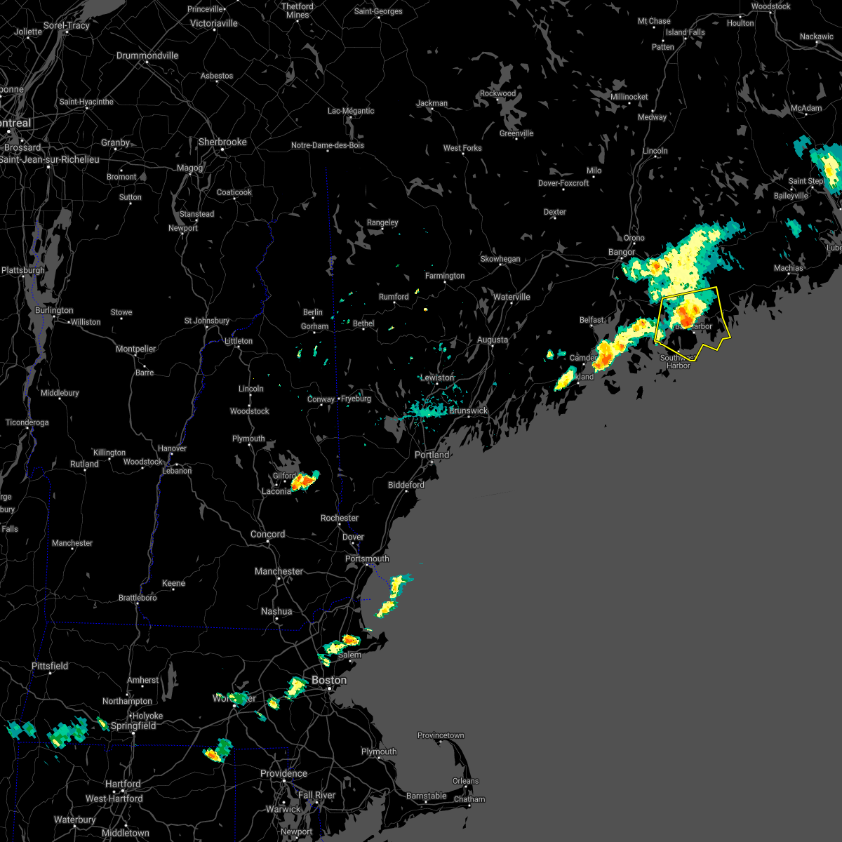
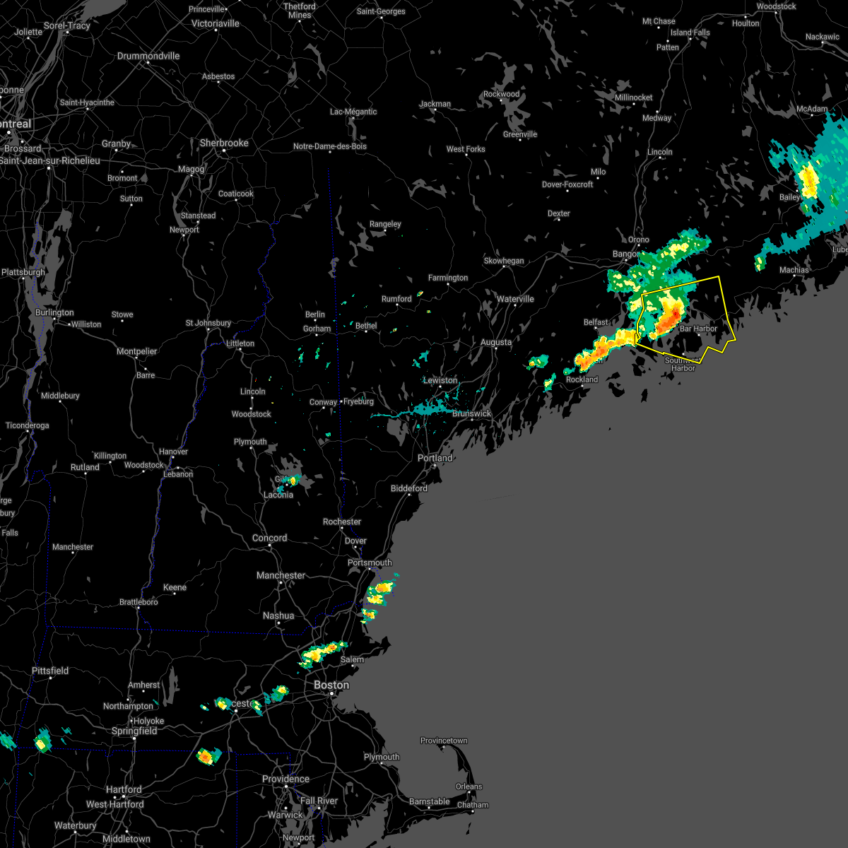
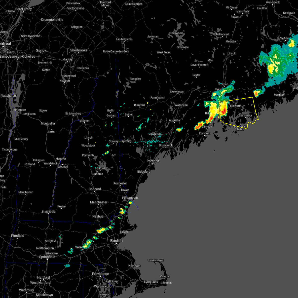
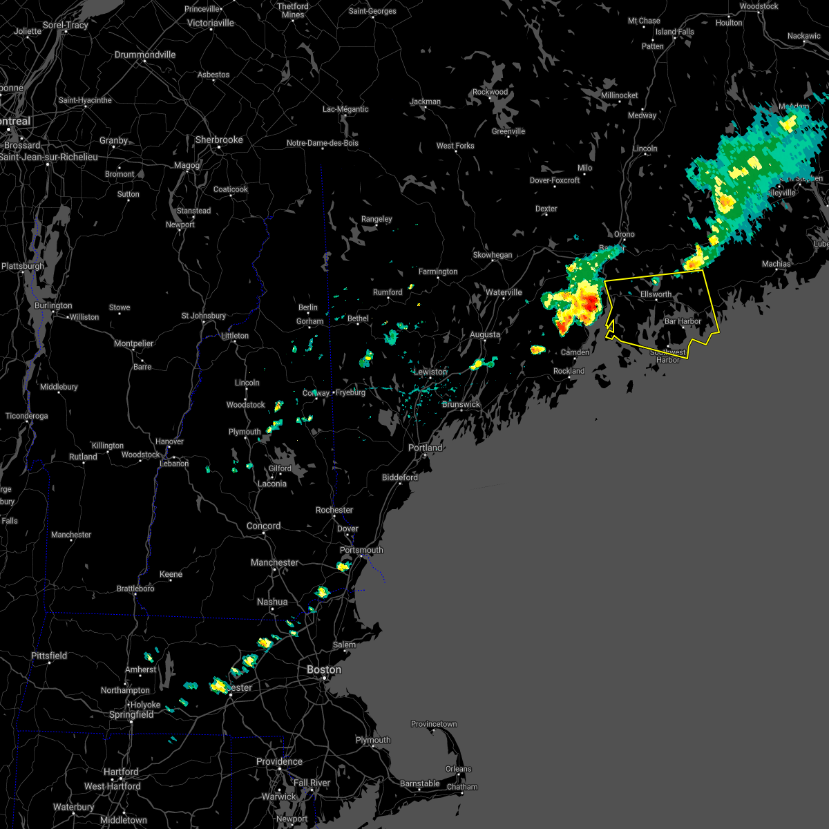
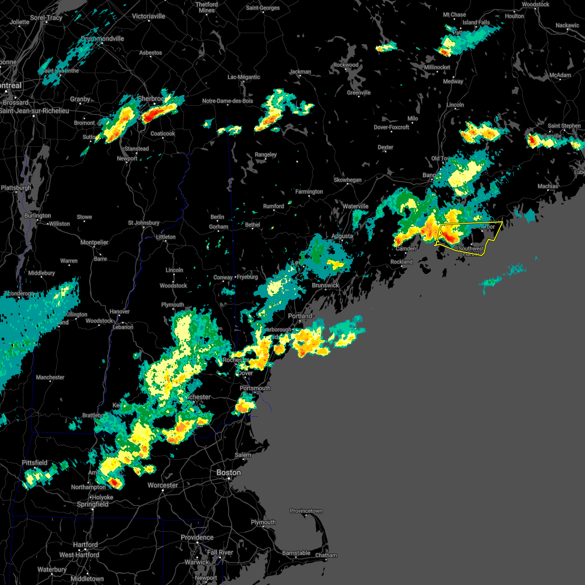
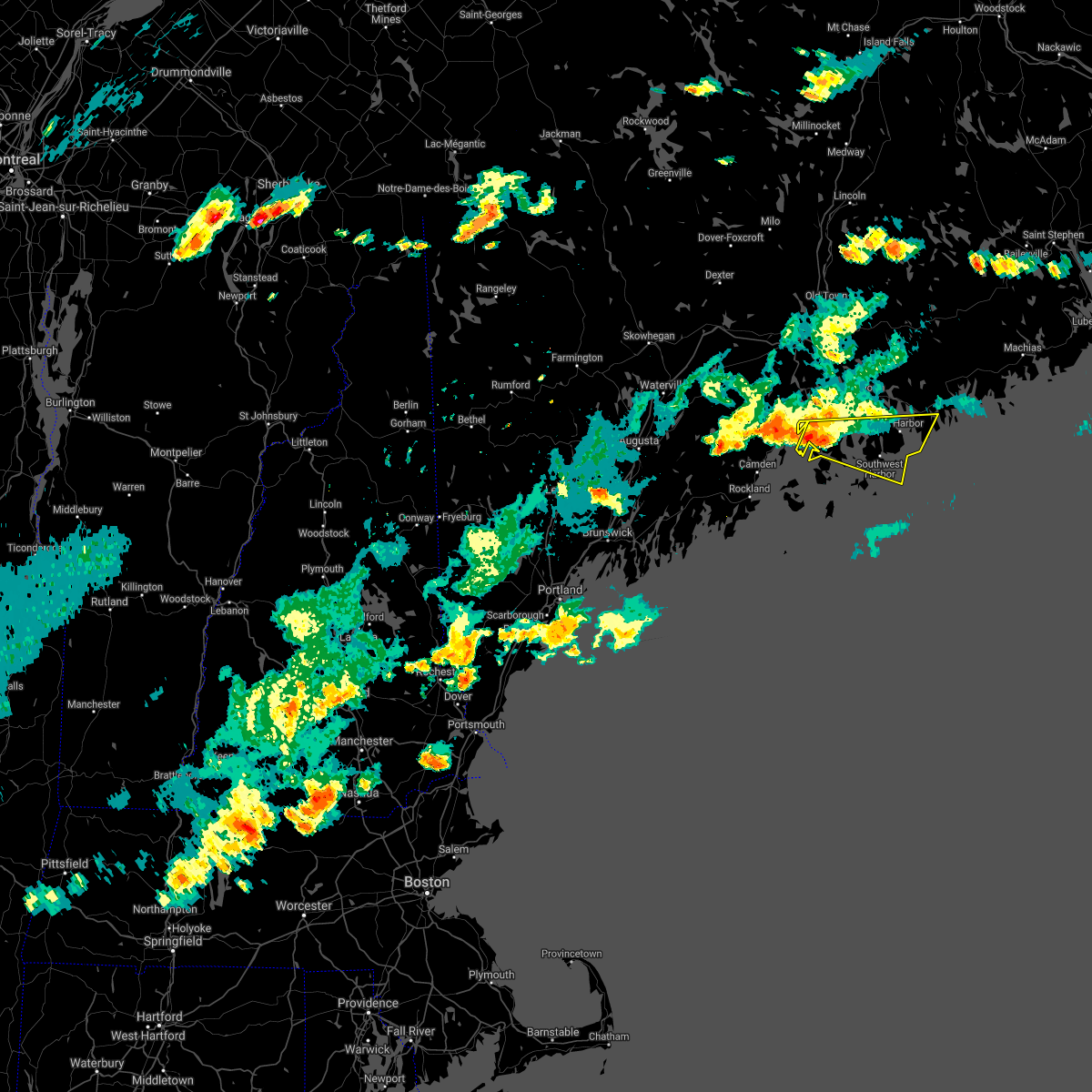
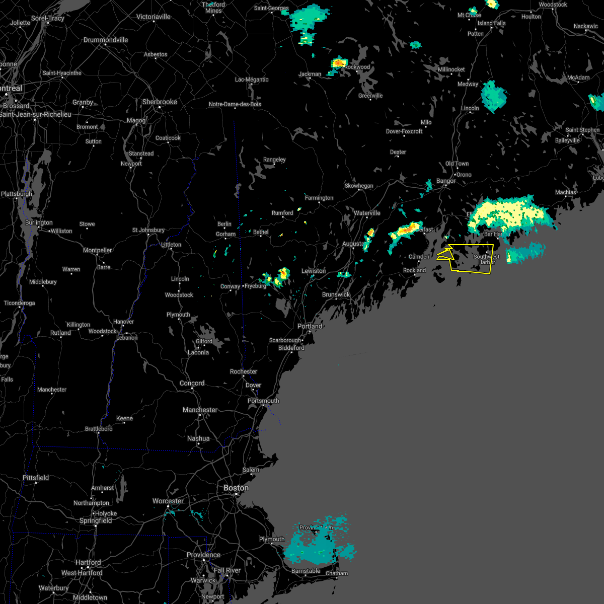
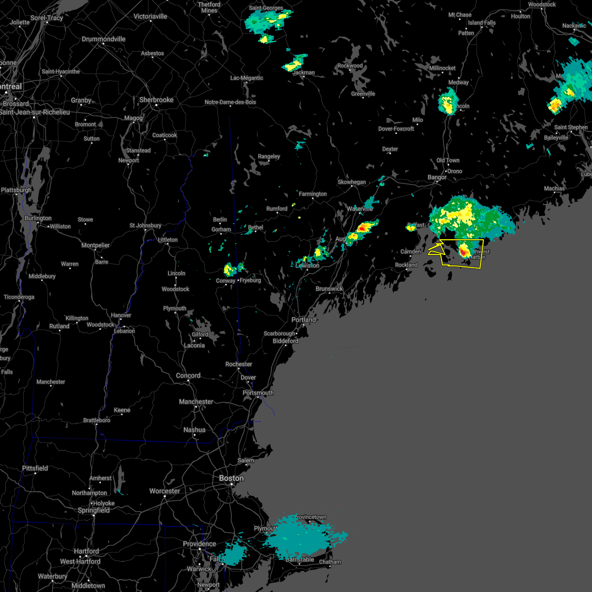
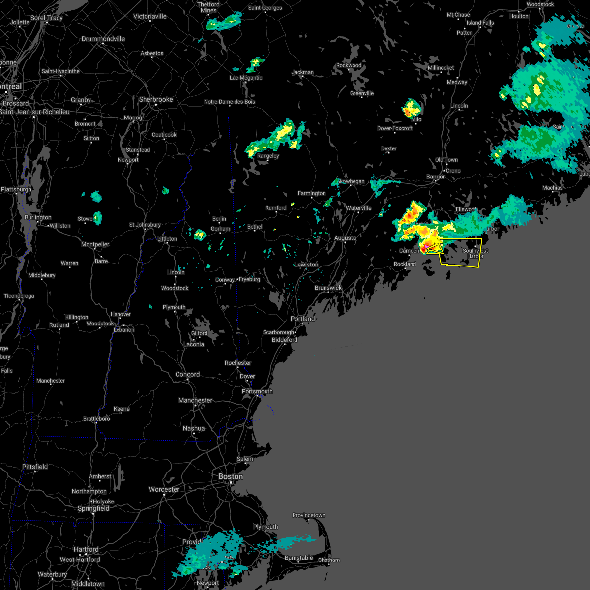
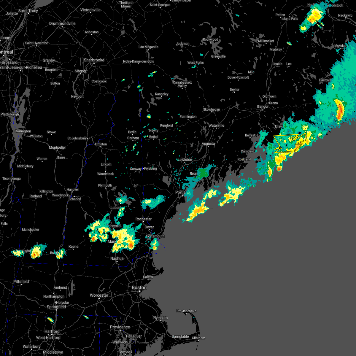
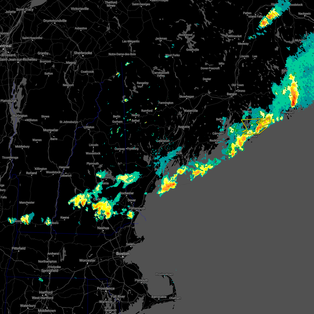
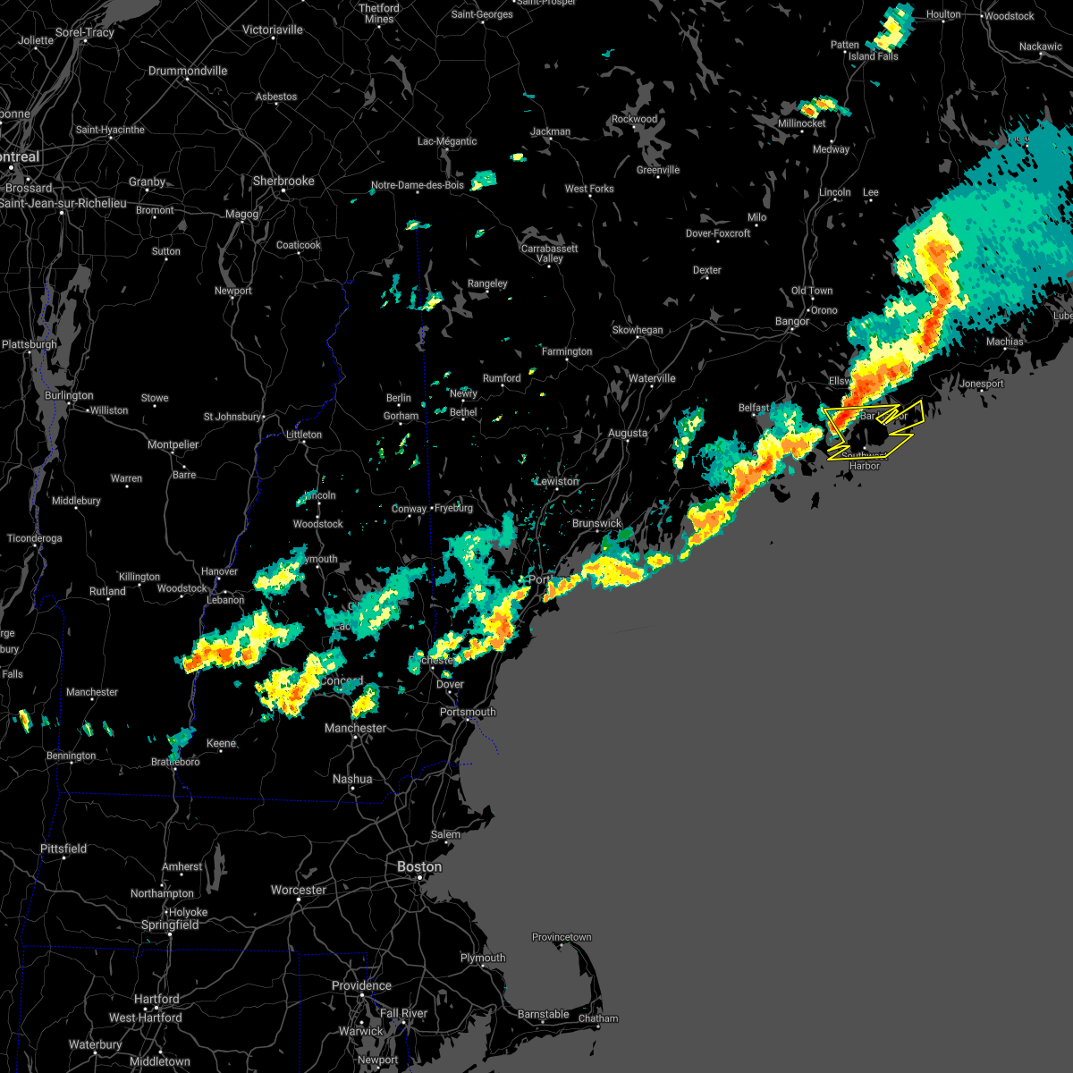
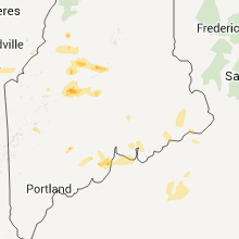
Hail Map for Southwest Harbor, ME
The Southwest Harbor, ME area has had 0 reports of on-the-ground hail by trained spotters, and has been under severe weather warnings 0 times during the past 12 months. Doppler radar has detected hail at or near Southwest Harbor, ME on 3 occasions.
| Name: | Southwest Harbor, ME |
| Where Located: | 42.3 miles SSE of Bangor, ME |
| Map: | Google Map for Southwest Harbor, ME |
| Population: | 720 |
| Housing Units: | 705 |
| More Info: | Search Google for Southwest Harbor, ME |
5
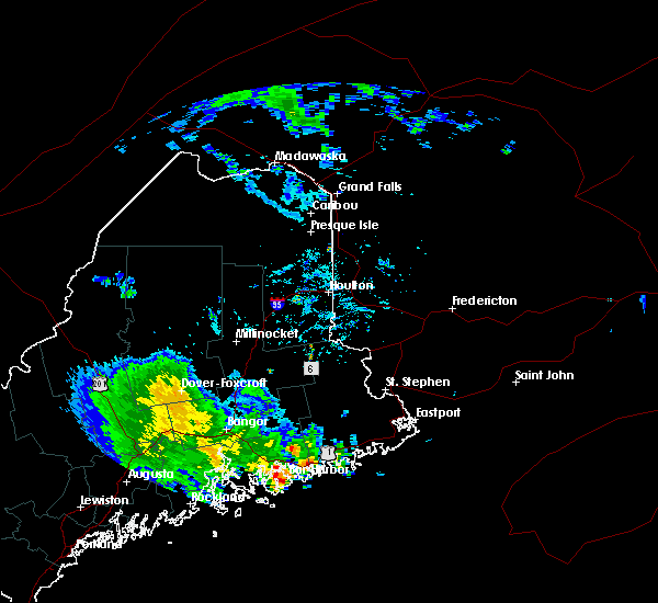
The Top Recent Hail Date for Southwest Harbor, ME is Wednesday, June 30, 2021 (1st out of 3)

Hail and Wind Damage Spotted near Southwest Harbor, ME
| Date / Time | Report Details |
|---|---|
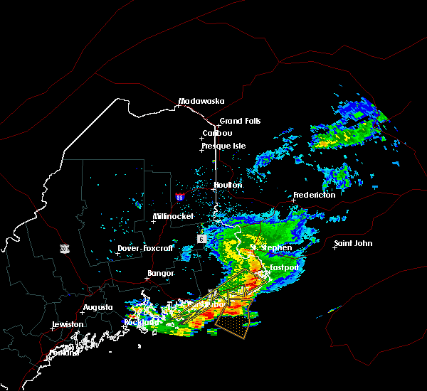
| 7/16/2021 3:18 PM EDT |
 At 317 pm edt, a severe thunderstorm was located near bar harbor, moving east at 35 mph (radar indicated). Hazards include 70 mph wind gusts and quarter size hail. Minor hail damage to vehicles is possible. expect considerable tree damage. wind damage is also likely to mobile homes, roofs, and outbuildings. Locations impacted include, ellsworth, bar harbor, steuben, hancock, franklin, gouldsboro, lamoine, trenton, surry, sullivan, winter harbor, sorrento, cranberry isles and somesville. At 317 pm edt, a severe thunderstorm was located near bar harbor, moving east at 35 mph (radar indicated). Hazards include 70 mph wind gusts and quarter size hail. Minor hail damage to vehicles is possible. expect considerable tree damage. wind damage is also likely to mobile homes, roofs, and outbuildings. Locations impacted include, ellsworth, bar harbor, steuben, hancock, franklin, gouldsboro, lamoine, trenton, surry, sullivan, winter harbor, sorrento, cranberry isles and somesville.
|
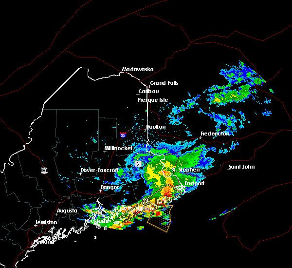
| 7/16/2021 3:01 PM EDT |
 At 300 pm edt, a severe thunderstorm was located near ellsworth, moving east at 40 mph (radar indicated). Hazards include 70 mph wind gusts and quarter size hail. Minor hail damage to vehicles is possible. expect considerable tree damage. wind damage is also likely to mobile homes, roofs, and outbuildings. Locations impacted include, ellsworth, bar harbor, blue hill, steuben, penobscot township, hancock, franklin, orland, gouldsboro, lamoine, trenton, surry, sullivan, sedgwick, brooksville, brooklin, winter harbor, mariaville, eastbrook and waltham. At 300 pm edt, a severe thunderstorm was located near ellsworth, moving east at 40 mph (radar indicated). Hazards include 70 mph wind gusts and quarter size hail. Minor hail damage to vehicles is possible. expect considerable tree damage. wind damage is also likely to mobile homes, roofs, and outbuildings. Locations impacted include, ellsworth, bar harbor, blue hill, steuben, penobscot township, hancock, franklin, orland, gouldsboro, lamoine, trenton, surry, sullivan, sedgwick, brooksville, brooklin, winter harbor, mariaville, eastbrook and waltham.
|
| 7/16/2021 2:40 PM EDT |
 At 240 pm edt, a severe thunderstorm was located near penobscot township, or near blue hill, moving east at 50 mph (radar indicated). Hazards include 60 mph wind gusts and quarter size hail. Minor hail damage to vehicles is possible. expect wind damage to trees and power lines. Locations impacted include, ellsworth, bar harbor, bucksport, blue hill, dedham, castine, steuben, verona island, penobscot township, hancock, franklin, orland, gouldsboro, lamoine, tremont, trenton, surry, penobscot, sullivan and sedgwick. At 240 pm edt, a severe thunderstorm was located near penobscot township, or near blue hill, moving east at 50 mph (radar indicated). Hazards include 60 mph wind gusts and quarter size hail. Minor hail damage to vehicles is possible. expect wind damage to trees and power lines. Locations impacted include, ellsworth, bar harbor, bucksport, blue hill, dedham, castine, steuben, verona island, penobscot township, hancock, franklin, orland, gouldsboro, lamoine, tremont, trenton, surry, penobscot, sullivan and sedgwick.
|
| 7/16/2021 2:23 PM EDT |
 At 223 pm edt, a severe thunderstorm was located near searsport, moving east at 50 mph (radar indicated). Hazards include 60 mph wind gusts and quarter size hail. Minor hail damage to vehicles is possible. Expect wind damage to trees and power lines. At 223 pm edt, a severe thunderstorm was located near searsport, moving east at 50 mph (radar indicated). Hazards include 60 mph wind gusts and quarter size hail. Minor hail damage to vehicles is possible. Expect wind damage to trees and power lines.
|
| 6/30/2021 5:35 PM EDT |
 At 535 pm edt, a severe thunderstorm was located 8 miles south of bar harbor, moving east at 30 mph (radar indicated). Hazards include 60 mph wind gusts and quarter size hail. Minor hail damage to vehicles is possible. expect wind damage to trees and power lines. Locations impacted include, tremont and cranberry isles. At 535 pm edt, a severe thunderstorm was located 8 miles south of bar harbor, moving east at 30 mph (radar indicated). Hazards include 60 mph wind gusts and quarter size hail. Minor hail damage to vehicles is possible. expect wind damage to trees and power lines. Locations impacted include, tremont and cranberry isles.
|
| 6/30/2021 5:06 PM EDT |
 At 506 pm edt, a severe thunderstorm was located near blue hill, moving east at 40 mph (radar indicated). Hazards include 60 mph wind gusts and quarter size hail. Minor hail damage to vehicles is possible. expect wind damage to trees and power lines. Locations impacted include, bar harbor, blue hill, lamoine, tremont, trenton, surry, sedgwick, brooksville, brooklin, winter harbor, cranberry isles and somesville. At 506 pm edt, a severe thunderstorm was located near blue hill, moving east at 40 mph (radar indicated). Hazards include 60 mph wind gusts and quarter size hail. Minor hail damage to vehicles is possible. expect wind damage to trees and power lines. Locations impacted include, bar harbor, blue hill, lamoine, tremont, trenton, surry, sedgwick, brooksville, brooklin, winter harbor, cranberry isles and somesville.
|
| 6/30/2021 4:53 PM EDT |
 At 453 pm edt, a severe thunderstorm was located near castine, or near blue hill, moving east at 40 mph (radar indicated). Hazards include 60 mph wind gusts and penny size hail. expect damage to trees and power lines At 453 pm edt, a severe thunderstorm was located near castine, or near blue hill, moving east at 40 mph (radar indicated). Hazards include 60 mph wind gusts and penny size hail. expect damage to trees and power lines
|
| 6/19/2021 6:25 PM EDT |
 The severe thunderstorm warning for southwestern hancock county will expire at 630 pm edt, the storm which prompted the warning has weakened below severe limits, and has exited the warned area. therefore, the warning will be allowed to expire. The severe thunderstorm warning for southwestern hancock county will expire at 630 pm edt, the storm which prompted the warning has weakened below severe limits, and has exited the warned area. therefore, the warning will be allowed to expire.
|
| 6/19/2021 6:00 PM EDT |
 At 558 pm edt, a severe thunderstorm was located 8 miles east of stonington, or 16 miles south of blue hill, moving east at 35 mph (radar indicated). Hazards include 60 mph wind gusts and quarter size hail. Minor hail damage to vehicles is possible. expect wind damage to trees and power lines. Locations impacted include, deer isle, stonington, tremont, sedgwick, brooksville, brooklin, swans island and frenchboro. At 558 pm edt, a severe thunderstorm was located 8 miles east of stonington, or 16 miles south of blue hill, moving east at 35 mph (radar indicated). Hazards include 60 mph wind gusts and quarter size hail. Minor hail damage to vehicles is possible. expect wind damage to trees and power lines. Locations impacted include, deer isle, stonington, tremont, sedgwick, brooksville, brooklin, swans island and frenchboro.
|
| 6/19/2021 5:26 PM EDT |
 At 524 pm edt, a severe thunderstorm was located near islesboro, or 8 miles east of lincolnville, moving east at 40 mph (radar indicated). Hazards include 60 mph wind gusts and quarter size hail. Minor hail damage to vehicles is possible. Expect wind damage to trees and power lines. At 524 pm edt, a severe thunderstorm was located near islesboro, or 8 miles east of lincolnville, moving east at 40 mph (radar indicated). Hazards include 60 mph wind gusts and quarter size hail. Minor hail damage to vehicles is possible. Expect wind damage to trees and power lines.
|
| 8/25/2020 5:12 PM EDT |
 The severe thunderstorm warning for southeastern hancock county will expire at 515 pm edt, the storm which prompted the warning is exiting the area. therefore, the warning will be allowed to expire. however gusty winds and heavy rain are still possible with this thunderstorm. a severe thunderstorm watch remains in effect until 1000 pm edt for southeastern maine. The severe thunderstorm warning for southeastern hancock county will expire at 515 pm edt, the storm which prompted the warning is exiting the area. therefore, the warning will be allowed to expire. however gusty winds and heavy rain are still possible with this thunderstorm. a severe thunderstorm watch remains in effect until 1000 pm edt for southeastern maine.
|
| 8/25/2020 5:05 PM EDT |
 At 502 pm edt, a severe thunderstorm was located 12 miles southeast of steuben, or 18 miles southwest of cherryfield, moving east at 50 mph (radar indicated). Hazards include 60 mph wind gusts and quarter size hail. Minor hail damage to vehicles is possible. expect wind damage to trees and power lines. Locations impacted include, bar harbor, blue hill, lamoine, tremont, trenton, surry, brooklin, winter harbor, cranberry isles and somesville. At 502 pm edt, a severe thunderstorm was located 12 miles southeast of steuben, or 18 miles southwest of cherryfield, moving east at 50 mph (radar indicated). Hazards include 60 mph wind gusts and quarter size hail. Minor hail damage to vehicles is possible. expect wind damage to trees and power lines. Locations impacted include, bar harbor, blue hill, lamoine, tremont, trenton, surry, brooklin, winter harbor, cranberry isles and somesville.
|
| 8/25/2020 4:30 PM EDT |
 At 428 pm edt, a severe thunderstorm was located 8 miles southeast of blue hill, moving east at 50 mph (radar indicated). Hazards include 60 mph wind gusts and quarter size hail. Minor hail damage to vehicles is possible. Expect wind damage to trees and power lines. At 428 pm edt, a severe thunderstorm was located 8 miles southeast of blue hill, moving east at 50 mph (radar indicated). Hazards include 60 mph wind gusts and quarter size hail. Minor hail damage to vehicles is possible. Expect wind damage to trees and power lines.
|
| 9/24/2019 5:21 PM EDT |
 At 520 pm edt, a severe thunderstorm was located near bar harbor, moving northeast at 20 mph (radar indicated). Hazards include 60 mph wind gusts and quarter size hail. Minor hail damage to vehicles is possible. Expect wind damage to trees and power lines. At 520 pm edt, a severe thunderstorm was located near bar harbor, moving northeast at 20 mph (radar indicated). Hazards include 60 mph wind gusts and quarter size hail. Minor hail damage to vehicles is possible. Expect wind damage to trees and power lines.
|
| 2/25/2016 5:26 AM EST |
 The severe thunderstorm warning for southwestern washington, hancock, southern aroostook and southeastern penobscot counties will expire at 530 am est, the storms which prompted the warning have moved out of the warned area. therefore the warning will be allowed to expire. The severe thunderstorm warning for southwestern washington, hancock, southern aroostook and southeastern penobscot counties will expire at 530 am est, the storms which prompted the warning have moved out of the warned area. therefore the warning will be allowed to expire.
|
| 2/25/2016 4:37 AM EST |
 At 436 am est, severe thunderstorms were located along a line extending from 6 miles north of lincoln to near bar harbor, moving east at 30 mph (radar indicated). Hazards include 60 mph wind gusts. Expect damage to roofs. siding and trees. locations impacted include, lincoln, ellsworth, howland, cherryfield, steuben, columbia, springfield, lakeville, deblois, millbridge, grand falls, licoln township, reed plantation, hancock, franklin, milford, gouldsboro, enfield, lamoine and tremont. This includes interstate 95 between mile markers 222 and 236. At 436 am est, severe thunderstorms were located along a line extending from 6 miles north of lincoln to near bar harbor, moving east at 30 mph (radar indicated). Hazards include 60 mph wind gusts. Expect damage to roofs. siding and trees. locations impacted include, lincoln, ellsworth, howland, cherryfield, steuben, columbia, springfield, lakeville, deblois, millbridge, grand falls, licoln township, reed plantation, hancock, franklin, milford, gouldsboro, enfield, lamoine and tremont. This includes interstate 95 between mile markers 222 and 236.
|
| 2/25/2016 4:03 AM EST |
 At 402 am est, severe thunderstorms were located along a line extending from near milo to near stonington, moving northeast at 45 mph (radar indicated). Hazards include 60 mph wind gusts. Expect damage to roofs. Siding and trees. At 402 am est, severe thunderstorms were located along a line extending from near milo to near stonington, moving northeast at 45 mph (radar indicated). Hazards include 60 mph wind gusts. Expect damage to roofs. Siding and trees.
|
| 7/28/2015 7:00 AM EDT |
 At 700 am edt, a severe thunderstorm was located over jonesport, or 15 miles east of cherryfield, and is nearly stationary (radar indicated). Hazards include 60 mph wind gusts and quarter size hail. Hail damage to vehicles is expected. expect wind damage to roofs, siding and trees. Locations impacted include, machias, lubec, cherryfield, jonesport, steuben, harrington, jonesboro, columbia falls, cutler, columbia, millbridge, centerville, gouldsboro, east machias, machiasport, marshfield, winter harbor, beals, whiting and dennysville. At 700 am edt, a severe thunderstorm was located over jonesport, or 15 miles east of cherryfield, and is nearly stationary (radar indicated). Hazards include 60 mph wind gusts and quarter size hail. Hail damage to vehicles is expected. expect wind damage to roofs, siding and trees. Locations impacted include, machias, lubec, cherryfield, jonesport, steuben, harrington, jonesboro, columbia falls, cutler, columbia, millbridge, centerville, gouldsboro, east machias, machiasport, marshfield, winter harbor, beals, whiting and dennysville.
|
| 7/28/2015 6:46 AM EDT |
 At 646 am edt, a severe thunderstorm was located near harrington, or 7 miles southeast of cherryfield, moving east at 25 mph (radar indicated). Hazards include 60 mph wind gusts and quarter size hail. Hail damage to vehicles is expected. Expect wind damage to roofs, siding and trees. At 646 am edt, a severe thunderstorm was located near harrington, or 7 miles southeast of cherryfield, moving east at 25 mph (radar indicated). Hazards include 60 mph wind gusts and quarter size hail. Hail damage to vehicles is expected. Expect wind damage to roofs, siding and trees.
|
Hail Maps for Southwest Harbor, ME

Connect with Interactive Hail Maps