

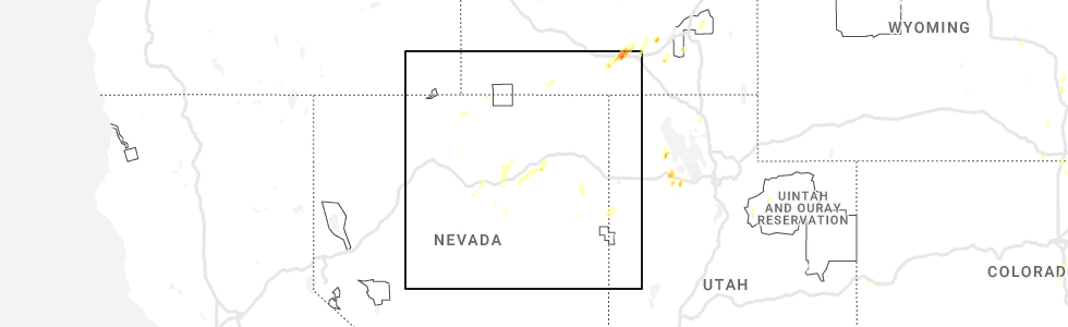
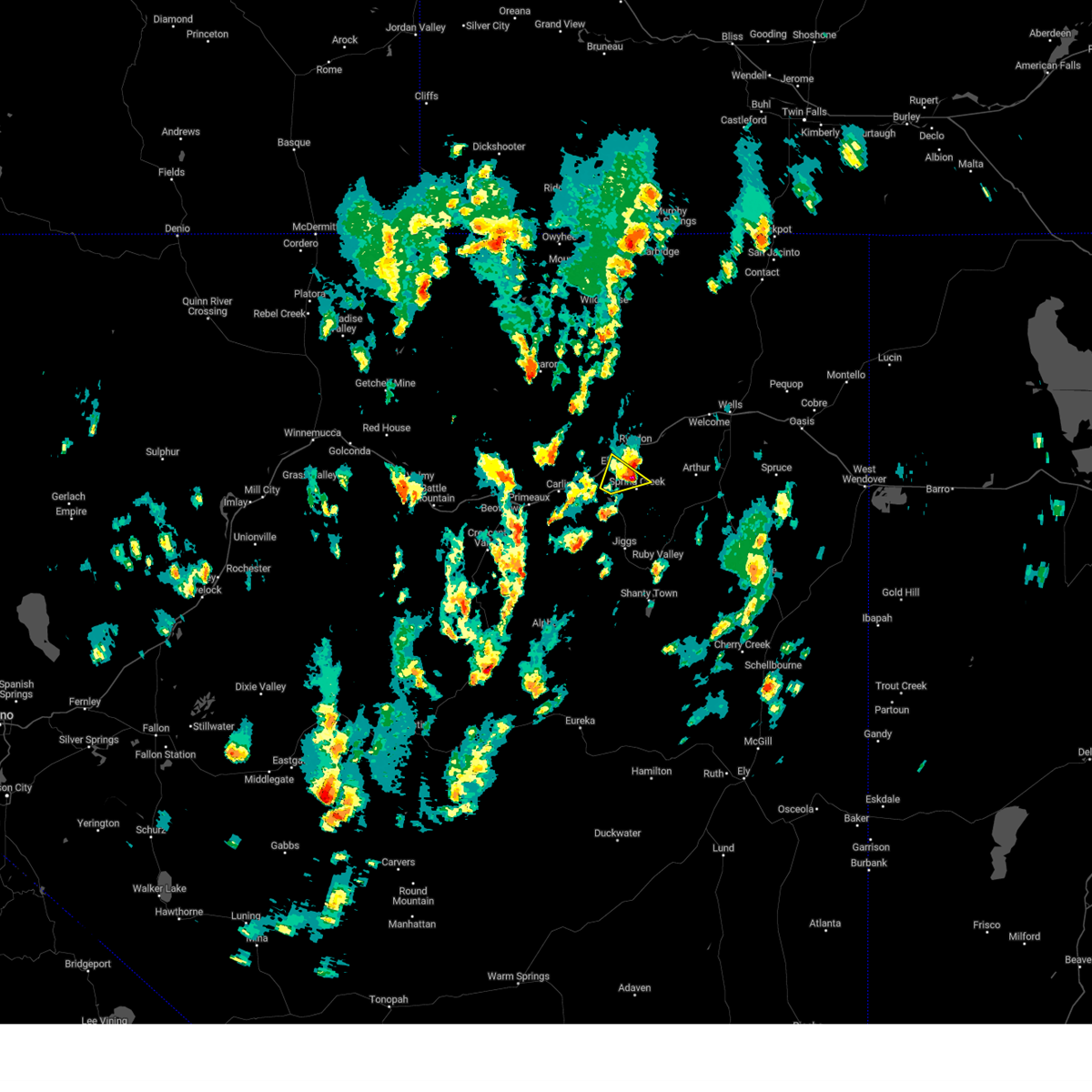
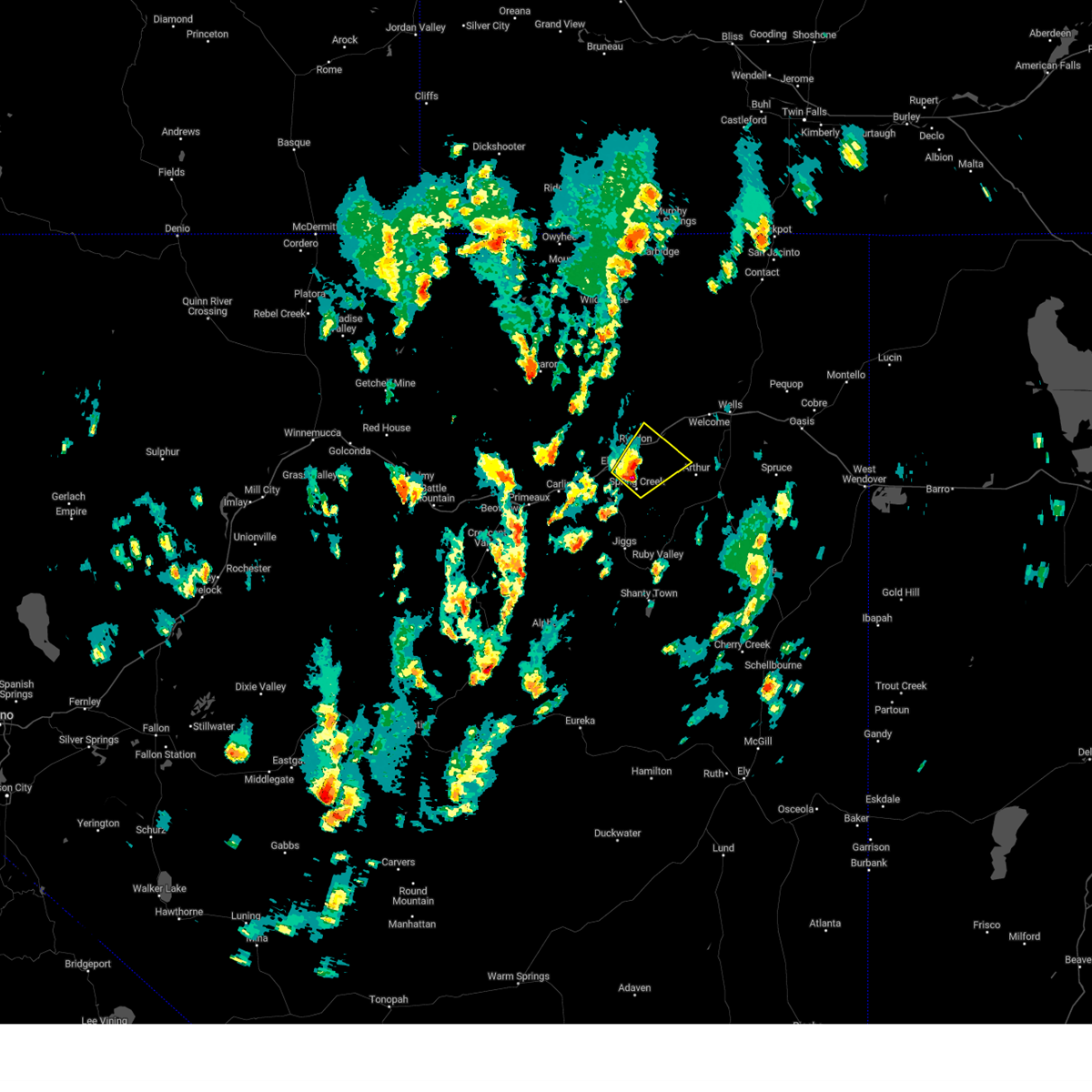
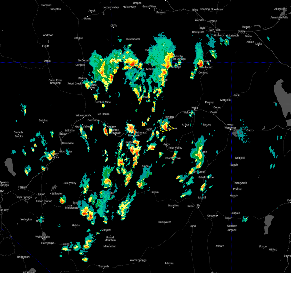
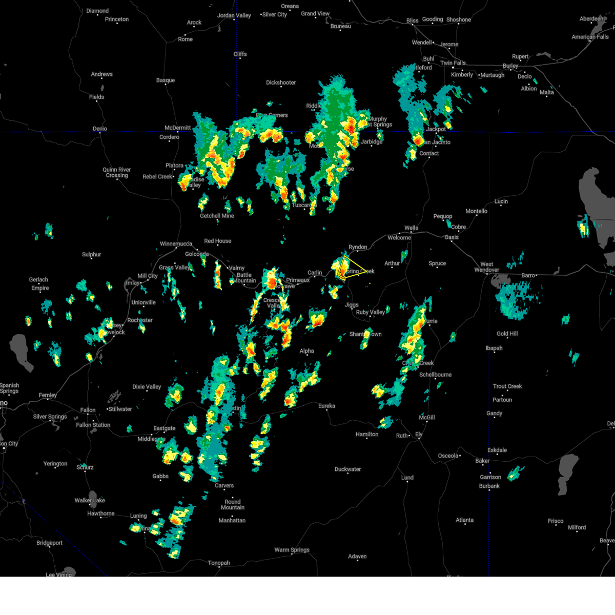
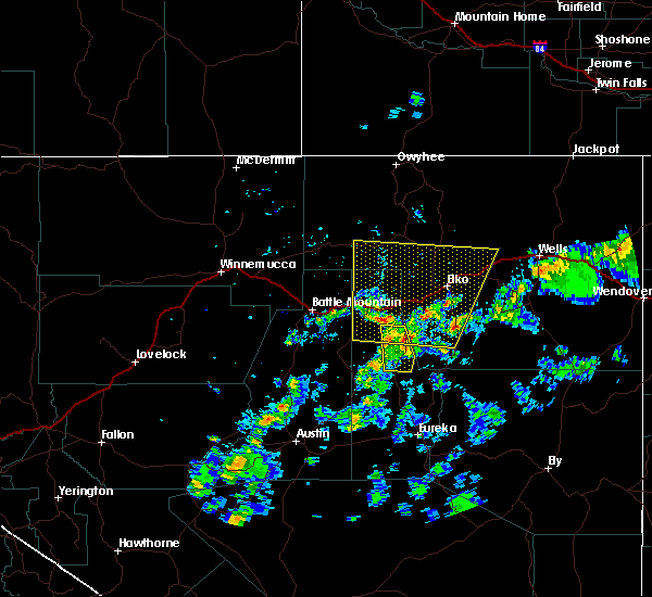
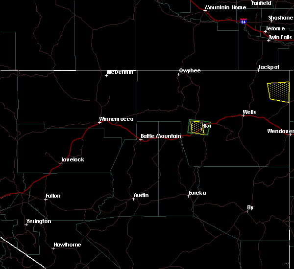
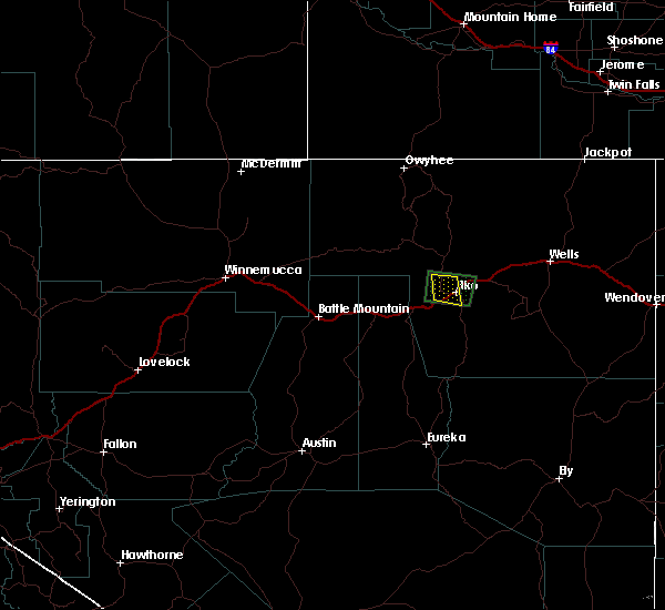
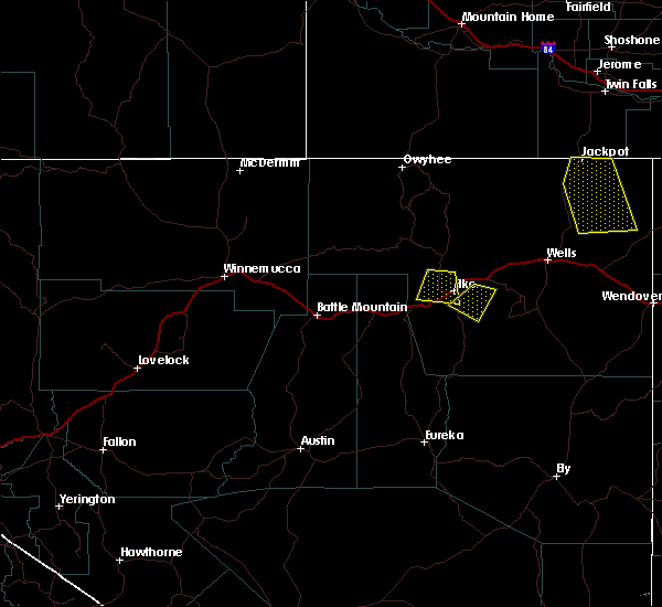
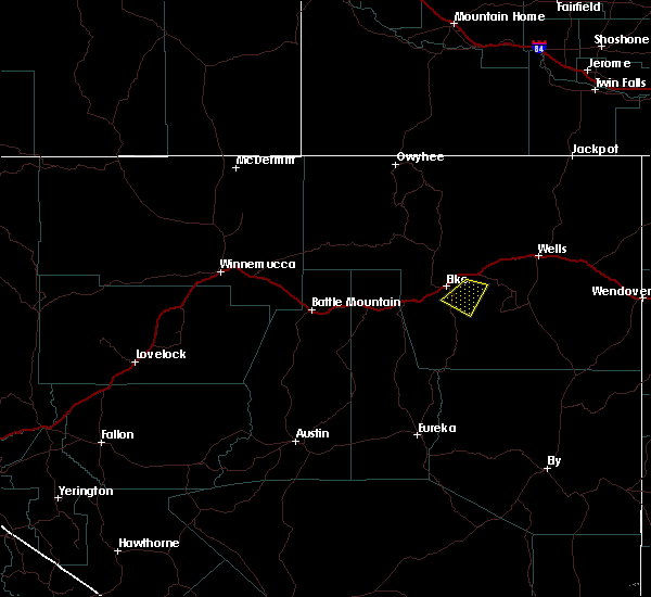
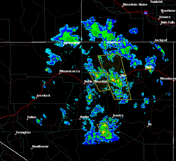
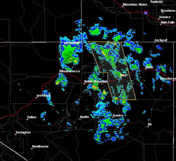
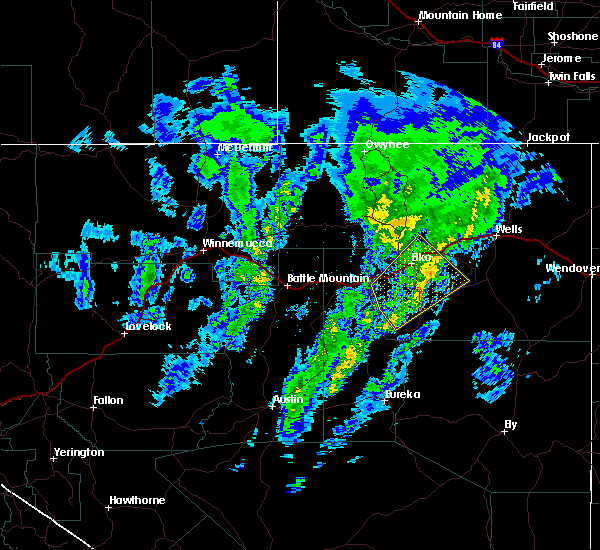
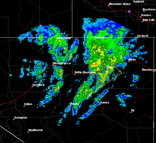
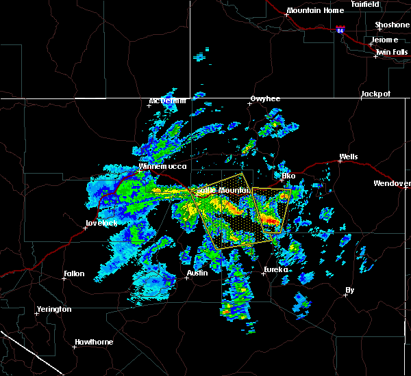
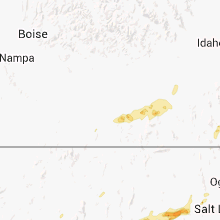
Hail Map for Spring Creek, NV
The Spring Creek, NV area has had 8 reports of on-the-ground hail by trained spotters, and has been under severe weather warnings 7 times during the past 12 months. Doppler radar has detected hail at or near Spring Creek, NV on 2 occasions, including 1 occasion during the past year.
| Name: | Spring Creek, NV |
| Where Located: | 9.6 miles SE of Elko, NV |
| Map: | Google Map for Spring Creek, NV |
| Population: | 12361 |
| Housing Units: | 4394 |
| More Info: | Search Google for Spring Creek, NV |
5
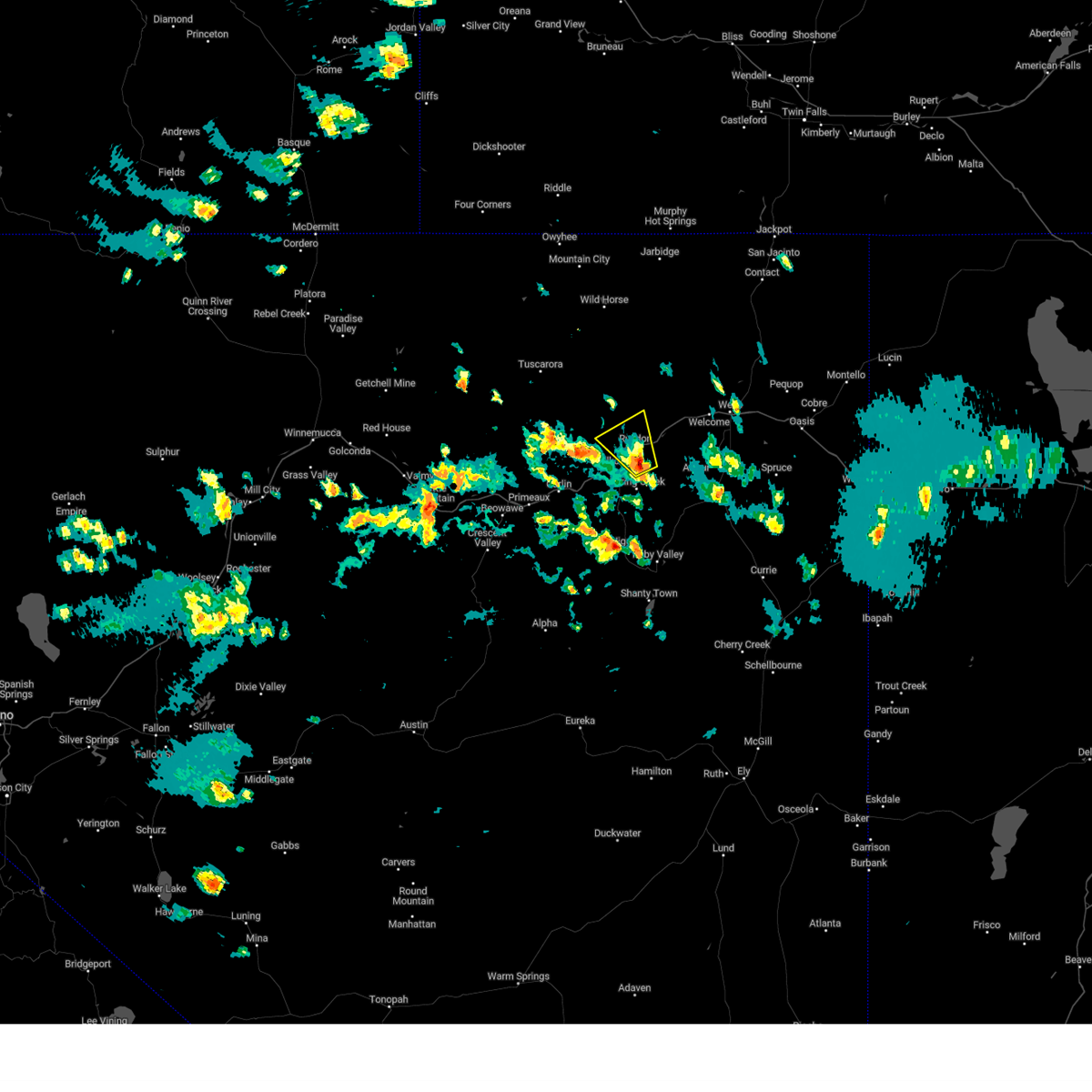
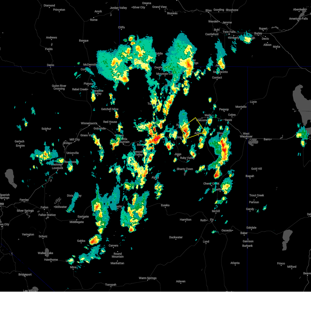
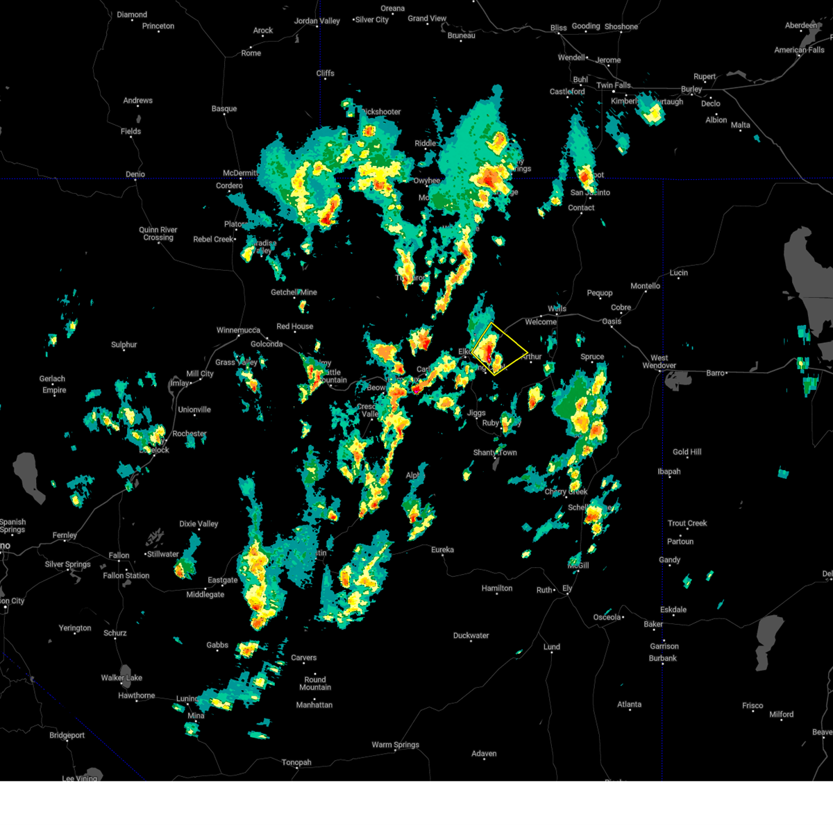
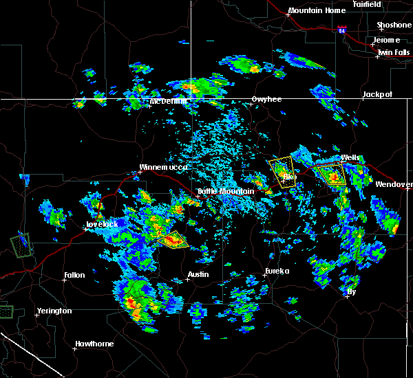
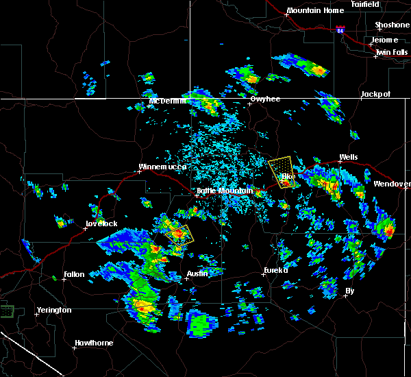
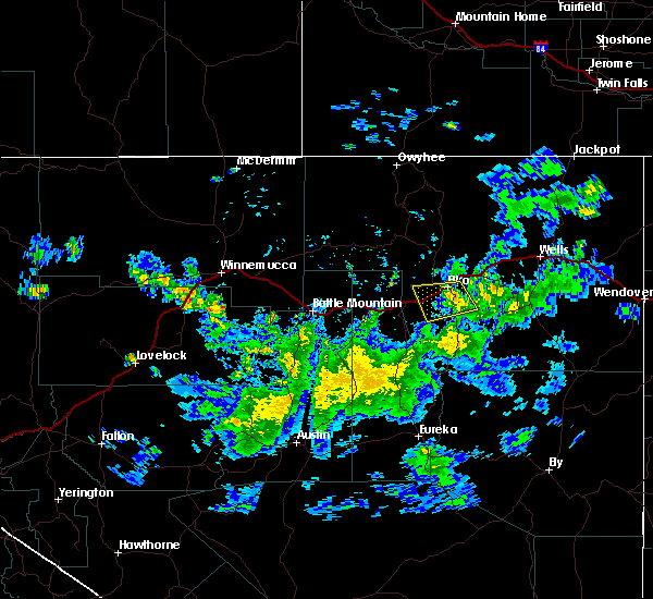
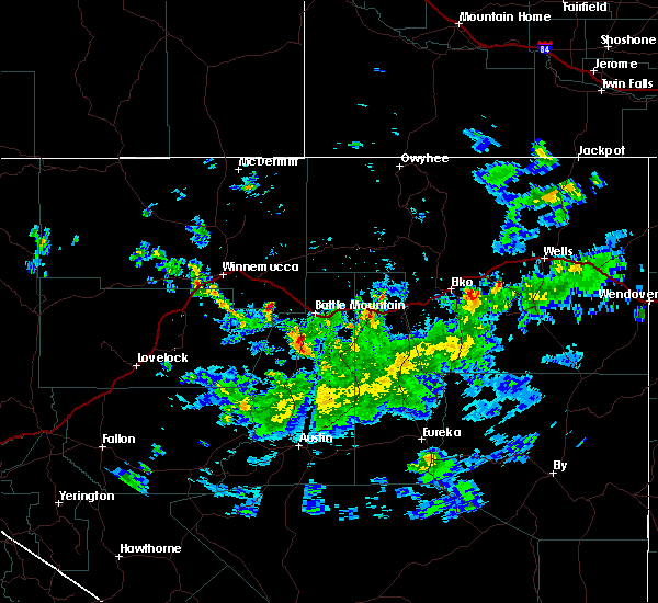
The Top Recent Hail Date for Spring Creek, NV is Wednesday, May 24, 2023 (1st out of 2)
Hail and Wind Damage Spotted near Spring Creek, NV
| Date / Time | Report Details |
|---|---|
| 9/1/2023 4:28 PM PDT | Mesonet station spknv sr-227 sp crk roundabout mm11.5 station elevation: 5452 f in elko county NV, 0.6 miles NNW of Spring Creek, NV |
| 6/6/2023 3:26 PM PDT | Mesonet station crsn2 crane springs raws station elevation: 6414 f in elko county NV, 23.2 miles NNE of Spring Creek, NV |
| 6/6/2023 2:43 PM PDT |
 At 242 pm pdt, a severe thunderstorm was located near ryndon, moving northwest at 15 mph (radar indicated). Hazards include 60 mph wind gusts and quarter size hail. Hail damage to vehicles is expected. Expect wind damage to roofs, siding, and trees. At 242 pm pdt, a severe thunderstorm was located near ryndon, moving northwest at 15 mph (radar indicated). Hazards include 60 mph wind gusts and quarter size hail. Hail damage to vehicles is expected. Expect wind damage to roofs, siding, and trees.
|
| 5/24/2023 1:51 PM PDT |
 At 151 pm pdt, a severe thunderstorm was located 9 miles north of lamoille, moving northeast at 15 mph (radar indicated). Hazards include 60 mph wind gusts and quarter size hail. Hail damage to vehicles is expected. Expect wind damage to roofs, siding, and trees. At 151 pm pdt, a severe thunderstorm was located 9 miles north of lamoille, moving northeast at 15 mph (radar indicated). Hazards include 60 mph wind gusts and quarter size hail. Hail damage to vehicles is expected. Expect wind damage to roofs, siding, and trees.
|
| 5/24/2023 1:46 PM PDT | Ping Pong Ball sized hail reported 6.9 miles ENE of Spring Creek, NV, public photos of 1.25 to 1.5 inch hail. |
| 5/24/2023 1:40 PM PDT | Ping Pong Ball sized hail reported 7.8 miles ENE of Spring Creek, NV, photo of 1.25 to 1.5 inch hail against ruler. |
| 5/24/2023 1:35 PM PDT |
 At 135 pm pdt, a severe thunderstorm was located 8 miles southeast of ryndon, moving northeast at 20 mph (radar indicated). Hazards include 60 mph wind gusts and quarter size hail. Hail damage to vehicles is expected. expect wind damage to roofs, siding, and trees. locations impacted include, lamoille, ryndon, spring creek and halleck. hail threat, radar indicated max hail size, 1. 00 in wind threat, radar indicated max wind gust, 60 mph. At 135 pm pdt, a severe thunderstorm was located 8 miles southeast of ryndon, moving northeast at 20 mph (radar indicated). Hazards include 60 mph wind gusts and quarter size hail. Hail damage to vehicles is expected. expect wind damage to roofs, siding, and trees. locations impacted include, lamoille, ryndon, spring creek and halleck. hail threat, radar indicated max hail size, 1. 00 in wind threat, radar indicated max wind gust, 60 mph.
|
| 5/24/2023 1:24 PM PDT |
 The severe thunderstorm warning for central elko county will expire at 130 pm pdt, the storm which prompted the warning has moved out of the area. therefore, the warning will be allowed to expire with a new warning set to take its place. The severe thunderstorm warning for central elko county will expire at 130 pm pdt, the storm which prompted the warning has moved out of the area. therefore, the warning will be allowed to expire with a new warning set to take its place.
|
| 5/24/2023 1:22 PM PDT |
 At 122 pm pdt, a severe thunderstorm was located near spring creek, moving northeast at 20 mph (radar indicated). Hazards include 60 mph wind gusts and quarter size hail. Hail damage to vehicles is expected. Expect wind damage to roofs, siding, and trees. At 122 pm pdt, a severe thunderstorm was located near spring creek, moving northeast at 20 mph (radar indicated). Hazards include 60 mph wind gusts and quarter size hail. Hail damage to vehicles is expected. Expect wind damage to roofs, siding, and trees.
|
| 5/24/2023 1:14 PM PDT |
 At 113 pm pdt, a severe thunderstorm was located near elko, moving northeast at 15 mph (radar indicated). Hazards include 60 mph wind gusts and quarter size hail. Hail damage to vehicles is expected. expect wind damage to roofs, siding, and trees. locations impacted include, elko, spring creek and lamoille summit. hail threat, radar indicated max hail size, 1. 00 in wind threat, radar indicated max wind gust, 60 mph. At 113 pm pdt, a severe thunderstorm was located near elko, moving northeast at 15 mph (radar indicated). Hazards include 60 mph wind gusts and quarter size hail. Hail damage to vehicles is expected. expect wind damage to roofs, siding, and trees. locations impacted include, elko, spring creek and lamoille summit. hail threat, radar indicated max hail size, 1. 00 in wind threat, radar indicated max wind gust, 60 mph.
|
| 5/24/2023 1:00 PM PDT | Ping Pong Ball sized hail reported 1.6 miles ESE of Spring Creek, NV, public report of 1.25 to 1.5 inch hail. |
| 5/24/2023 12:55 PM PDT |
 At 1255 pm pdt, a severe thunderstorm was located near elko, moving northeast at 20 mph (radar indicated). Hazards include 60 mph wind gusts and quarter size hail. Hail damage to vehicles is expected. Expect wind damage to roofs, siding, and trees. At 1255 pm pdt, a severe thunderstorm was located near elko, moving northeast at 20 mph (radar indicated). Hazards include 60 mph wind gusts and quarter size hail. Hail damage to vehicles is expected. Expect wind damage to roofs, siding, and trees.
|
| 5/26/2022 5:26 PM PDT | Mesonet station crsn2 crane springs raws. 68 mph wind gust was reporte in elko county NV, 23.2 miles NNE of Spring Creek, NV |
| 5/26/2022 5:26 PM PDT | Mesonet station crsn2 crane springs raw in elko county NV, 23.2 miles NNE of Spring Creek, NV |
| 5/26/2022 4:08 PM PDT | At 4:08 pm pdt... the observation at the spring creek roundabout on sr-227 measure a wind gust of 62 mph. radar and satellite indicated this was the result of a downbur in elko county NV, 0.6 miles NNW of Spring Creek, NV |
| 7/31/2021 4:09 PM PDT |
 The severe thunderstorm warning for south central elko county will expire at 415 pm pdt, the storm which prompted the warning has weakened below severe limits, and no longer poses an immediate threat to life or property. therefore, the warning will be allowed to expire. however gusty winds and heavy rain are still possible with this thunderstorm. The severe thunderstorm warning for south central elko county will expire at 415 pm pdt, the storm which prompted the warning has weakened below severe limits, and no longer poses an immediate threat to life or property. therefore, the warning will be allowed to expire. however gusty winds and heavy rain are still possible with this thunderstorm.
|
| 7/31/2021 3:24 PM PDT |
 At 324 pm pdt, a severe thunderstorm was located near south fork, moving north at 35 mph (radar indicated). Hazards include 60 mph wind gusts and quarter size hail. Hail damage to vehicles is expected. Expect wind damage to roofs, siding, and trees. At 324 pm pdt, a severe thunderstorm was located near south fork, moving north at 35 mph (radar indicated). Hazards include 60 mph wind gusts and quarter size hail. Hail damage to vehicles is expected. Expect wind damage to roofs, siding, and trees.
|
| 7/23/2020 4:55 PM PDT | Mesonet station lmrnv 3.4 se elko (nv dot in elko county NV, 6.1 miles SE of Spring Creek, NV |
| 5/30/2018 2:34 PM PDT |
 At 233 pm pdt, an area of several thunderstorms over northern eureka county and southwest elko county was moring northeast at around 30 mph (radar indicated). Hazards include 60 mph wind gusts and nickel size hail. expect damage to roofs, siding, and trees At 233 pm pdt, an area of several thunderstorms over northern eureka county and southwest elko county was moring northeast at around 30 mph (radar indicated). Hazards include 60 mph wind gusts and nickel size hail. expect damage to roofs, siding, and trees
|
| 5/17/2018 3:35 PM PDT |
 The severe thunderstorm warning for southwestern elko county will expire at 345 pm pdt, the storm which prompted the warning has weakened below severe limits, and no longer poses an immediate threat to life or property. therefore the warning will be allowed to expire. however small hail, gusty winds and heavy rain are still possible with this thunderstorm. to report severe weather, contact your nearest law enforcement agency. they will relay your report to the national weather service elko nevada. The severe thunderstorm warning for southwestern elko county will expire at 345 pm pdt, the storm which prompted the warning has weakened below severe limits, and no longer poses an immediate threat to life or property. therefore the warning will be allowed to expire. however small hail, gusty winds and heavy rain are still possible with this thunderstorm. to report severe weather, contact your nearest law enforcement agency. they will relay your report to the national weather service elko nevada.
|
| 5/17/2018 3:15 PM PDT | Quarter sized hail reported 4.4 miles NW of Spring Creek, NV, nws employee reported hail around dime size... with some stones the size of quarters. |
| 5/17/2018 3:13 PM PDT |
 At 313 pm pdt, a severe thunderstorm was located 8 miles northwest of elko, and is nearly stationary (radar indicated). Hazards include 60 mph wind gusts. Expect damage to roofs, siding, and trees. Locations impacted include, elko, adobe summit and lamoille summit. At 313 pm pdt, a severe thunderstorm was located 8 miles northwest of elko, and is nearly stationary (radar indicated). Hazards include 60 mph wind gusts. Expect damage to roofs, siding, and trees. Locations impacted include, elko, adobe summit and lamoille summit.
|
| 5/17/2018 2:50 PM PDT |
 The severe thunderstorm warning for central elko county will expire at 300 pm pdt, the storm which prompted the warning has weakened below severe limits, and no longer poses an immediate threat to life or property. therefore the warning will be allowed to expire. however gusty winds and heavy rain are still possible with this thunderstorm. to report severe weather, contact your nearest law enforcement agency. they will relay your report to the national weather service elko nevada. The severe thunderstorm warning for central elko county will expire at 300 pm pdt, the storm which prompted the warning has weakened below severe limits, and no longer poses an immediate threat to life or property. therefore the warning will be allowed to expire. however gusty winds and heavy rain are still possible with this thunderstorm. to report severe weather, contact your nearest law enforcement agency. they will relay your report to the national weather service elko nevada.
|
| 5/17/2018 2:44 PM PDT |
 At 243 pm pdt, a severe thunderstorm was located 9 miles northwest of elko, and is nearly stationary (radar indicated). Hazards include 60 mph wind gusts and quarter size hail. Hail damage to vehicles is expected. Expect wind damage to roofs, siding, and trees. At 243 pm pdt, a severe thunderstorm was located 9 miles northwest of elko, and is nearly stationary (radar indicated). Hazards include 60 mph wind gusts and quarter size hail. Hail damage to vehicles is expected. Expect wind damage to roofs, siding, and trees.
|
| 5/17/2018 2:02 PM PDT |
 At 200 pm pdt, a severe thunderstorm was located over spring creek, and is nearly stationary (trained weather spotters). Hazards include 60 mph wind gusts and quarter size hail. significant accumulating hail is occurring with this storm. hail will cover roads and make conditions slick. slow down when encountering hail. Hail damage to vehicles is expected. expect wind damage to roofs, siding, and trees. Locations impacted include, lamoille and spring creek. At 200 pm pdt, a severe thunderstorm was located over spring creek, and is nearly stationary (trained weather spotters). Hazards include 60 mph wind gusts and quarter size hail. significant accumulating hail is occurring with this storm. hail will cover roads and make conditions slick. slow down when encountering hail. Hail damage to vehicles is expected. expect wind damage to roofs, siding, and trees. Locations impacted include, lamoille and spring creek.
|
| 5/17/2018 1:59 PM PDT | Quarter sized hail reported 1.4 miles WNW of Spring Creek, NV, half inch to 1" size hail. hail covered the ground to at least 2-3" inches deep. significant hail accumulation on the road. |
| 5/17/2018 1:57 PM PDT |
 At 157 pm pdt, a severe thunderstorm was located over spring creek, and is nearly stationary (radar indicated). Hazards include 60 mph wind gusts and quarter size hail. Hail damage to vehicles is expected. Expect wind damage to roofs, siding, and trees. At 157 pm pdt, a severe thunderstorm was located over spring creek, and is nearly stationary (radar indicated). Hazards include 60 mph wind gusts and quarter size hail. Hail damage to vehicles is expected. Expect wind damage to roofs, siding, and trees.
|
| 5/17/2018 1:55 PM PDT | Quarter sized hail reported 4.4 miles NW of Spring Creek, NV, corrects previous hail report from 3 sse spring creek. nws employee reported hail around dime size... with some stones the size of quarters. time corrected. |
| 5/6/2017 4:42 PM PDT |
 At 440 pm pdt, a severe thunderstorm was located near south fork, moving north at 30 mph (radar indicated). Hazards include 60 mph wind gusts and penny size hail. these storms have already produced winds over 50 mph at automated sites. expect damage to roofs, siding, and trees At 440 pm pdt, a severe thunderstorm was located near south fork, moving north at 30 mph (radar indicated). Hazards include 60 mph wind gusts and penny size hail. these storms have already produced winds over 50 mph at automated sites. expect damage to roofs, siding, and trees
|
| 5/6/2017 3:44 PM PDT |
 At 343 pm pdt, a severe thunderstorm was located 9 miles west of ryndon, moving north at 45 mph. this storm has produced winds of 57 mph at elko (radar indicated). Hazards include 60 mph wind gusts and penny size hail. Expect damage to roofs, siding, and trees. Winds could blow vehicles off roads. At 343 pm pdt, a severe thunderstorm was located 9 miles west of ryndon, moving north at 45 mph. this storm has produced winds of 57 mph at elko (radar indicated). Hazards include 60 mph wind gusts and penny size hail. Expect damage to roofs, siding, and trees. Winds could blow vehicles off roads.
|
| 10/30/2016 5:02 PM PDT |
 At 502 pm pdt, doppler radar indicated a severe thunderstorm capable of producing damaging winds in excess of 60 mph. this storm was located near spring creek, moving northeast at 45 mph. penny size hail may also accompany the damaging winds. locations impacted include, lamoille, lee, south fork, spring creek, jiggs and lamoille canyon. At 502 pm pdt, doppler radar indicated a severe thunderstorm capable of producing damaging winds in excess of 60 mph. this storm was located near spring creek, moving northeast at 45 mph. penny size hail may also accompany the damaging winds. locations impacted include, lamoille, lee, south fork, spring creek, jiggs and lamoille canyon.
|
| 10/30/2016 4:39 PM PDT |
 At 439 pm pdt, doppler radar indicated a severe thunderstorm capable of producing damaging winds in excess of 60 mph. this storm was located 12 miles west of jiggs, and moving northeast at 45 mph. penny size hail may also accompany the damaging winds. At 439 pm pdt, doppler radar indicated a severe thunderstorm capable of producing damaging winds in excess of 60 mph. this storm was located 12 miles west of jiggs, and moving northeast at 45 mph. penny size hail may also accompany the damaging winds.
|
| 10/30/2016 4:30 PM PDT | Spotter estimated wind gusts of around 70 mp in elko county NV, 7.1 miles W of Spring Creek, NV |
| 10/30/2016 4:26 PM PDT | Mesonet station crane springs raws /crsn2 in elko county NV, 23.2 miles NNE of Spring Creek, NV |
| 9/13/2016 1:38 PM PDT |
 At 136 pm pdt, doppler radar indicated a severe thunderstorm capable of producing quarter size hail and destructive winds in excess of 70 mph. this storm was located 16 miles southeast of pine valley, or about 16 miles southwest of jiggs, and moving north at 30 mph. this storm has some rotation in it and is life threatening. At 136 pm pdt, doppler radar indicated a severe thunderstorm capable of producing quarter size hail and destructive winds in excess of 70 mph. this storm was located 16 miles southeast of pine valley, or about 16 miles southwest of jiggs, and moving north at 30 mph. this storm has some rotation in it and is life threatening.
|
| 7/22/2015 2:15 PM PDT | A shed was destroyed by the wind. shed had been there for 11 years and was thrown 130 ft...before being wrapped around a tre in elko county NV, 3.6 miles NNW of Spring Creek, NV |
| 7/9/2015 2:11 PM PDT | The severe thunderstorm warning for central elko county will expire at 215 pm pdt, the storm which prompted the warning has weakened below severe limits, and no longer poses an immediate threat to life or property. therefore the warning will be allowed to expire. |
| 7/9/2015 2:09 PM PDT |
 At 207 pm pdt, doppler radar indicated a severe thunderstorm capable of producing quarter size hail and damaging winds in excess of 60 mph. this storm was located 8 miles northwest of ryndon, moving north at 20 mph. dime sized hail (1/2 inch) reported at elko nws office. locations impacted include, elko, ryndon, spring creek and lamoille summit. this includes mile marker 312 osino. At 207 pm pdt, doppler radar indicated a severe thunderstorm capable of producing quarter size hail and damaging winds in excess of 60 mph. this storm was located 8 miles northwest of ryndon, moving north at 20 mph. dime sized hail (1/2 inch) reported at elko nws office. locations impacted include, elko, ryndon, spring creek and lamoille summit. this includes mile marker 312 osino.
|
| 7/9/2015 1:36 PM PDT |
 At 135 pm pdt, doppler radar indicated a severe thunderstorm capable of producing quarter size hail and damaging winds in excess of 60 mph. this storm was located near elko, and moving north at 20 mph. At 135 pm pdt, doppler radar indicated a severe thunderstorm capable of producing quarter size hail and damaging winds in excess of 60 mph. this storm was located near elko, and moving north at 20 mph.
|
| 6/29/2015 3:45 PM PDT | Thunderstorm winds snapped top part of tree. from pictures estimated tree was 3-4 inches in diameter where it snappe in elko county NV, 0.3 miles WSW of Spring Creek, NV |
| 6/10/2015 5:29 PM PDT |
 At 527 pm pdt, the public and an off duty nws employee reported extremely heavy rains and localized flooding in spring creek. also, small hail was reported in the vicinity of the high school. gusty winds were also reported. please use caution when out driving. take cover until the storm passes if possible. locations impacted include, elko, spring creek, south fork and lamoille summit. this includes mile marker 293 hunter. At 527 pm pdt, the public and an off duty nws employee reported extremely heavy rains and localized flooding in spring creek. also, small hail was reported in the vicinity of the high school. gusty winds were also reported. please use caution when out driving. take cover until the storm passes if possible. locations impacted include, elko, spring creek, south fork and lamoille summit. this includes mile marker 293 hunter.
|
| 6/10/2015 4:53 PM PDT |
 At 451 pm pdt, doppler radar indicated a severe thunderstorm capable of producing quarter size hail and damaging winds in excess of 60 mph. this storm was located near spring creek, and moving west at 10 mph. this is a dangerous situation. take cover now. this storm will also produce torrential rain producing flooding. At 451 pm pdt, doppler radar indicated a severe thunderstorm capable of producing quarter size hail and damaging winds in excess of 60 mph. this storm was located near spring creek, and moving west at 10 mph. this is a dangerous situation. take cover now. this storm will also produce torrential rain producing flooding.
|
| 8/25/2014 5:45 PM PDT | Quarter sized hail reported 5.9 miles ENE of Spring Creek, NV, quarter size hail was reported and covered the ground. |
| 8/25/2014 5:38 PM PDT | Quarter sized hail reported 5.7 miles ENE of Spring Creek, NV, quarter size hail that damaged trees. |
| 8/21/2013 5:02 PM PDT | Storm damage reported in elko county NV, 1.4 miles WNW of Spring Creek, NV |
| 5/16/2012 2:50 PM PDT | Very strong wind gust ripped several shingles off roof. 4x4 piece of wood holding bird houses up was snapped off completely at the bas in elko county NV, 1.4 miles WNW of Spring Creek, NV |
Hail Maps for Spring Creek, NV

Connect with Interactive Hail Maps