

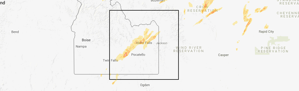
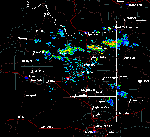
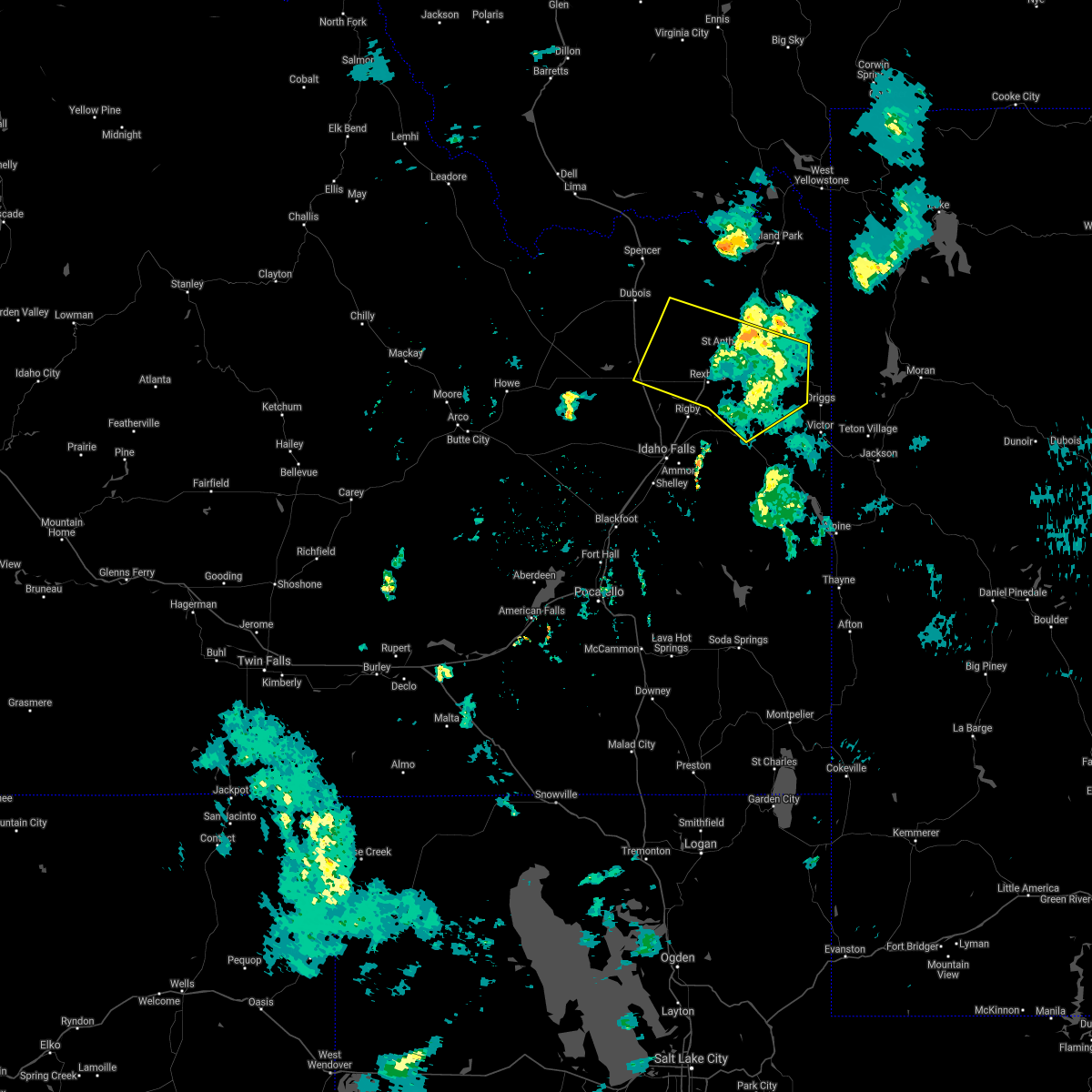
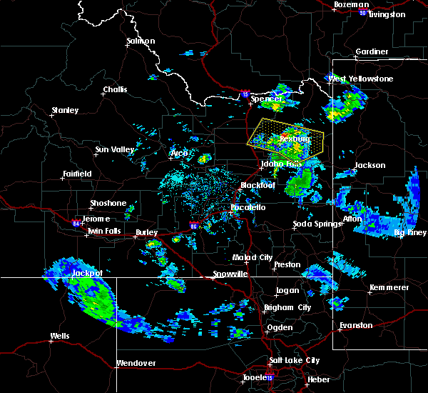
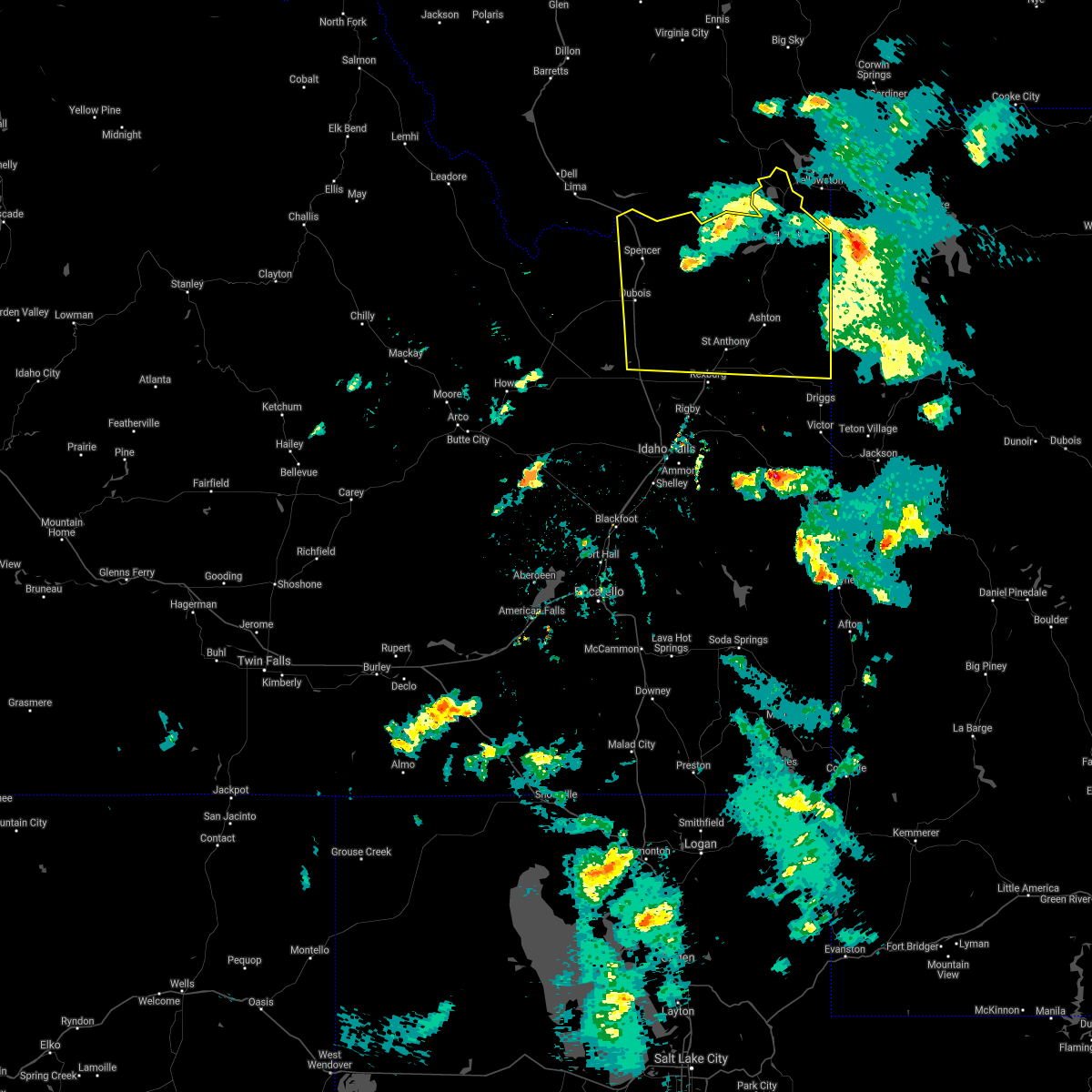
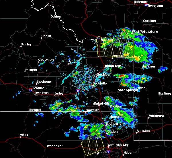
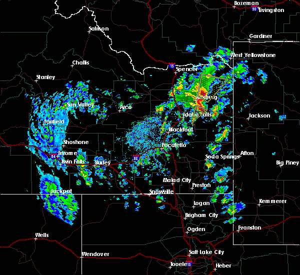
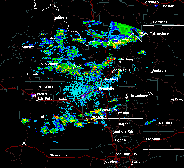
Hail Map for St. Anthony, ID
The St. Anthony, ID area has had 6 reports of on-the-ground hail by trained spotters, and has been under severe weather warnings 0 times during the past 12 months. Doppler radar has detected hail at or near St. Anthony, ID on 7 occasions.
| Name: | St. Anthony, ID |
| Where Located: | 37.2 miles NNE of Idaho Falls, ID |
| Map: | Google Map for St. Anthony, ID |
| Population: | 3542 |
| Housing Units: | 1252 |
| More Info: | Search Google for St. Anthony, ID |
5
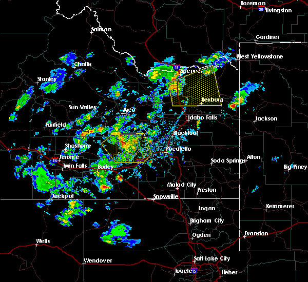
The Top Recent Hail Date for St. Anthony, ID is Thursday, May 31, 2018 (1st out of 7)
Hail and Wind Damage Spotted near St. Anthony, ID
| Date / Time | Report Details |
|---|---|
| 3/2/2024 10:23 AM MST | Mesonet station gasi1 gas cave in fremont county ID, 15 miles SSE of St. Anthony, ID |
| 2/29/2024 11:23 PM MST | Mesonet station gasi1 gas cave in fremont county ID, 15 miles SSE of St. Anthony, ID |
| 8/19/2022 5:59 PM MDT |
 At 559 pm mdt, a severe thunderstorm was located over chester, or 9 miles southwest of ashton, moving northwest at 15 mph (radar indicated). Hazards include quarter size hail. damage to vehicles is expected At 559 pm mdt, a severe thunderstorm was located over chester, or 9 miles southwest of ashton, moving northwest at 15 mph (radar indicated). Hazards include quarter size hail. damage to vehicles is expected
|
| 7/2/2022 6:05 PM MDT |
 At 604 pm mdt, severe thunderstorms were located along a line extending from 14 miles northeast of mackay to 13 miles northwest of dubois to near chester, moving north at 50 mph (radar indicated). Hazards include 70 mph wind gusts and penny size hail. Expect considerable tree damage. damage is likely to mobile homes, roofs, and outbuildings. locations impacted include, northern idaho falls, rexburg, rigby, ashton, dubois, ririe reservoir, terreton, marysville, lorenzo, ammon, iona, sugar city, ucon, menan, teton, ririe, roberts, lewisville, mud lake and parker. thunderstorm damage threat, considerable hail threat, observed max hail size, 0. 75 in wind threat, observed max wind gust, 70 mph. At 604 pm mdt, severe thunderstorms were located along a line extending from 14 miles northeast of mackay to 13 miles northwest of dubois to near chester, moving north at 50 mph (radar indicated). Hazards include 70 mph wind gusts and penny size hail. Expect considerable tree damage. damage is likely to mobile homes, roofs, and outbuildings. locations impacted include, northern idaho falls, rexburg, rigby, ashton, dubois, ririe reservoir, terreton, marysville, lorenzo, ammon, iona, sugar city, ucon, menan, teton, ririe, roberts, lewisville, mud lake and parker. thunderstorm damage threat, considerable hail threat, observed max hail size, 0. 75 in wind threat, observed max wind gust, 70 mph.
|
| 7/2/2022 5:29 PM MDT |
 At 529 pm mdt, severe thunderstorms were located along a line extending from near arco to mud lake to 8 miles east of ririe, moving north at 50 mph (radar indicated). Hazards include 70 mph wind gusts and penny size hail. Expect considerable tree damage. Damage is likely to mobile homes, roofs, and outbuildings. At 529 pm mdt, severe thunderstorms were located along a line extending from near arco to mud lake to 8 miles east of ririe, moving north at 50 mph (radar indicated). Hazards include 70 mph wind gusts and penny size hail. Expect considerable tree damage. Damage is likely to mobile homes, roofs, and outbuildings.
|
| 7/15/2021 7:10 PM MDT |
 At 709 pm mdt, severe thunderstorms were located along a line extending from 8 miles south of island park reservoir to sugar city to near terreton, moving southeast at 35 mph (radar indicated). Hazards include 60 mph wind gusts. Expect damage to roofs, siding, and trees. locations impacted include, rexburg, rigby, ashton, terreton, marysville, lorenzo, sugar city, menan, teton, roberts, lewisville, mud lake, parker, hamer, archer, egin, st anthony, monteview, plano and chester. hail threat, radar indicated max hail size, <. 75 in wind threat, radar indicated max wind gust, 60 mph. At 709 pm mdt, severe thunderstorms were located along a line extending from 8 miles south of island park reservoir to sugar city to near terreton, moving southeast at 35 mph (radar indicated). Hazards include 60 mph wind gusts. Expect damage to roofs, siding, and trees. locations impacted include, rexburg, rigby, ashton, terreton, marysville, lorenzo, sugar city, menan, teton, roberts, lewisville, mud lake, parker, hamer, archer, egin, st anthony, monteview, plano and chester. hail threat, radar indicated max hail size, <. 75 in wind threat, radar indicated max wind gust, 60 mph.
|
| 7/15/2021 6:44 PM MDT |
 At 642 pm mdt, severe thunderstorms were located along a line extending from near kilgore to 10 miles northeast of hamer to 7 miles northwest of monteview, moving southeast at 40 mph (mesonet. at 630 pm, 64mph winds were reported at the china point mesonet station). Hazards include 70 mph wind gusts. Expect considerable tree damage. Damage is likely to mobile homes, roofs, and outbuildings. At 642 pm mdt, severe thunderstorms were located along a line extending from near kilgore to 10 miles northeast of hamer to 7 miles northwest of monteview, moving southeast at 40 mph (mesonet. at 630 pm, 64mph winds were reported at the china point mesonet station). Hazards include 70 mph wind gusts. Expect considerable tree damage. Damage is likely to mobile homes, roofs, and outbuildings.
|
| 9/19/2020 6:12 PM MDT |
 The severe thunderstorm warning for western teton, southeastern fremont, southeastern jefferson, north central bonneville and madison counties will expire at 615 pm mdt, the storms which prompted the warning have weakened below severe limits, and no longer pose an immediate threat to life or property. therefore, the warning will be allowed to expire. however gusty winds are still possible with these thunderstorms. The severe thunderstorm warning for western teton, southeastern fremont, southeastern jefferson, north central bonneville and madison counties will expire at 615 pm mdt, the storms which prompted the warning have weakened below severe limits, and no longer pose an immediate threat to life or property. therefore, the warning will be allowed to expire. however gusty winds are still possible with these thunderstorms.
|
| 9/19/2020 5:38 PM MDT |
 At 531 pm mdt, severe thunderstorms were located along a line extending from near parker to goshen, moving northeast at 20 mph. there have been reports of downed trees and powerline as a result of this line of thunderstorms. frequent lightning is also occuring. move indoors now! (radar indicated). Hazards include 60 mph wind gusts and quarter size hail. Hail damage to vehicles is expected. Expect wind damage to roofs, siding, and trees. At 531 pm mdt, severe thunderstorms were located along a line extending from near parker to goshen, moving northeast at 20 mph. there have been reports of downed trees and powerline as a result of this line of thunderstorms. frequent lightning is also occuring. move indoors now! (radar indicated). Hazards include 60 mph wind gusts and quarter size hail. Hail damage to vehicles is expected. Expect wind damage to roofs, siding, and trees.
|
| 9/19/2020 5:34 PM MDT |
 At 531 pm mdt, severe thunderstorms were located along a line extending from near parker to goshen, moving northeast at 20 mph. there have been reports of downed trees and powerline as a result of this line of thunderstorms. frequent lightning is also occuring. move indoors now! (radar indicated). Hazards include 60 mph wind gusts and quarter size hail. Hail damage to vehicles is expected. Expect wind damage to roofs, siding, and trees. At 531 pm mdt, severe thunderstorms were located along a line extending from near parker to goshen, moving northeast at 20 mph. there have been reports of downed trees and powerline as a result of this line of thunderstorms. frequent lightning is also occuring. move indoors now! (radar indicated). Hazards include 60 mph wind gusts and quarter size hail. Hail damage to vehicles is expected. Expect wind damage to roofs, siding, and trees.
|
| 8/25/2020 5:54 PM MDT |
 At 552 pm mdt, severe thunderstorms were located along a line extending from 7 miles west of hamer to 12 miles northwest of shelley to near rose, moving east at 50 mph (mesonet observations and radar indicated. these storms have a history of producing wind gusts up to 70 mph!). Hazards include 60 to 70 mph wind gusts. Expect considerable tree damage. Damage is likely to mobile homes, roofs, and outbuildings. At 552 pm mdt, severe thunderstorms were located along a line extending from 7 miles west of hamer to 12 miles northwest of shelley to near rose, moving east at 50 mph (mesonet observations and radar indicated. these storms have a history of producing wind gusts up to 70 mph!). Hazards include 60 to 70 mph wind gusts. Expect considerable tree damage. Damage is likely to mobile homes, roofs, and outbuildings.
|
| 6/18/2019 5:04 PM MDT |
 At 504 pm mdt, a severe thunderstorm was located over egin or 8 miles northwest of rexburg, moving southeast at 10 mph (radar indicated). Hazards include quarter size hail. damage to vehicles is expected At 504 pm mdt, a severe thunderstorm was located over egin or 8 miles northwest of rexburg, moving southeast at 10 mph (radar indicated). Hazards include quarter size hail. damage to vehicles is expected
|
| 6/6/2019 9:13 PM MDT |
 The severe thunderstorm warning for northwestern teton, southern fremont, central jefferson, north central bonneville, madison and southeastern clark counties will expire at 915 pm mdt, the storms which prompted the warning have weakened below severe limits, and have exited the warned area. therefore, the warning will be allowed to expire. however gusty winds are still possible with these thunderstorms. a severe thunderstorm watch remains in effect until 1100 pm mdt for eastern and southeastern idaho. The severe thunderstorm warning for northwestern teton, southern fremont, central jefferson, north central bonneville, madison and southeastern clark counties will expire at 915 pm mdt, the storms which prompted the warning have weakened below severe limits, and have exited the warned area. therefore, the warning will be allowed to expire. however gusty winds are still possible with these thunderstorms. a severe thunderstorm watch remains in effect until 1100 pm mdt for eastern and southeastern idaho.
|
| 6/6/2019 8:56 PM MDT |
 At 855 pm mdt, severe thunderstorms and associated outflow winds were located along a line extending from near hamer to 6 miles southeast of teton to 14 miles northwest of swan valley, moving northeast at 50 mph (radar indicated). Hazards include 60 mph wind gusts. Expect damage to roofs, siding, and trees. Locations impacted include, rexburg, sugar city, teton, parker, drummond, archer, egin, st anthony, chester, plano, tetonia research station, green canyon hot springs, sage junction, newdale, thornton, saint anthony sand dunes and heise. At 855 pm mdt, severe thunderstorms and associated outflow winds were located along a line extending from near hamer to 6 miles southeast of teton to 14 miles northwest of swan valley, moving northeast at 50 mph (radar indicated). Hazards include 60 mph wind gusts. Expect damage to roofs, siding, and trees. Locations impacted include, rexburg, sugar city, teton, parker, drummond, archer, egin, st anthony, chester, plano, tetonia research station, green canyon hot springs, sage junction, newdale, thornton, saint anthony sand dunes and heise.
|
| 6/6/2019 8:41 PM MDT |
 At 841 pm mdt, severe thunderstorms were located along a line extending from 6 miles east of terreton to archer to near ririe reservoir, moving northeast at 50 mph (radar indicated. 57 mph winds were reported at the idaho falls airport). Hazards include 60 mph wind gusts. Expect damage to roofs, siding, and trees. Locations impacted include, northern idaho falls, rexburg, rigby, ririe reservoir, lorenzo, ammon, iona, sugar city, ucon, menan, teton, ririe, roberts, lewisville, parker, hamer, drummond, archer, egin and st anthony. At 841 pm mdt, severe thunderstorms were located along a line extending from 6 miles east of terreton to archer to near ririe reservoir, moving northeast at 50 mph (radar indicated. 57 mph winds were reported at the idaho falls airport). Hazards include 60 mph wind gusts. Expect damage to roofs, siding, and trees. Locations impacted include, northern idaho falls, rexburg, rigby, ririe reservoir, lorenzo, ammon, iona, sugar city, ucon, menan, teton, ririe, roberts, lewisville, parker, hamer, drummond, archer, egin and st anthony.
|
| 6/6/2019 8:26 PM MDT |
 At 825 pm mdt, severe thunderstorms and associated outflow winds were located along a line extending from 7 miles south of terreton to near ucon to 7 miles southeast of ammon, moving northeast at 50 mph (radar indicated). Hazards include 60 mph wind gusts. expect damage to roofs, siding, and trees At 825 pm mdt, severe thunderstorms and associated outflow winds were located along a line extending from 7 miles south of terreton to near ucon to 7 miles southeast of ammon, moving northeast at 50 mph (radar indicated). Hazards include 60 mph wind gusts. expect damage to roofs, siding, and trees
|
| 6/6/2019 6:27 PM MDT |
 The severe thunderstorm warning for northern teton, fremont, north central jefferson, northern madison and eastern clark counties will expire at 630 pm mdt, the storms which prompted the warning has weakened below severe limits, and has exited the warned area. therefore, the warning will be allowed to expire. however gusty winds are still possible with this thunderstorm. a severe thunderstorm watch remains in effect until 1100 pm mdt for eastern and southeastern idaho. The severe thunderstorm warning for northern teton, fremont, north central jefferson, northern madison and eastern clark counties will expire at 630 pm mdt, the storms which prompted the warning has weakened below severe limits, and has exited the warned area. therefore, the warning will be allowed to expire. however gusty winds are still possible with this thunderstorm. a severe thunderstorm watch remains in effect until 1100 pm mdt for eastern and southeastern idaho.
|
| 6/6/2019 6:07 PM MDT |
 At 605 pm mdt, severe thunderstorms were located 12 miles southwest of henrys lake, moving generally north and east. severe wind gusts have been observed along highway 20 (radar indicated). Hazards include 60 mph wind gusts and penny size hail. Expect damage to roofs, siding, and trees. Locations impacted include, ashton, dubois, idmon, felt, henrys lake, marysville, sugar city, teton, parker, hamer, spencer, drummond, shotgun village, egin, ponds lodge, kilgore, st anthony, plano, island park village and macks inn. At 605 pm mdt, severe thunderstorms were located 12 miles southwest of henrys lake, moving generally north and east. severe wind gusts have been observed along highway 20 (radar indicated). Hazards include 60 mph wind gusts and penny size hail. Expect damage to roofs, siding, and trees. Locations impacted include, ashton, dubois, idmon, felt, henrys lake, marysville, sugar city, teton, parker, hamer, spencer, drummond, shotgun village, egin, ponds lodge, kilgore, st anthony, plano, island park village and macks inn.
|
| 6/6/2019 5:46 PM MDT |
 At 544 pm mdt, thunderstorms were located 11 miles northwest of ashton reservoir or 14 miles northwest of ashton, moving generally to the north and east. these storms are produced strong outflow boundaries (radar indicated). Hazards include 60 mph wind gusts and penny size hail. expect damage to roofs, siding, and trees At 544 pm mdt, thunderstorms were located 11 miles northwest of ashton reservoir or 14 miles northwest of ashton, moving generally to the north and east. these storms are produced strong outflow boundaries (radar indicated). Hazards include 60 mph wind gusts and penny size hail. expect damage to roofs, siding, and trees
|
| 6/6/2019 5:40 PM MDT | Multiple trees reported down across st. anthony. one tree reported as across a powerline and rocky mountain power has been advised. time estimated based on rada in fremont county ID, 1.3 miles WSW of St. Anthony, ID |
| 8/22/2018 4:50 PM MDT |
 At 450 pm mdt, severe thunderstorms were located along a line extending from 12 miles south of idmon to 7 miles northwest of parker to near plano, moving east at 30 mph (radar indicated). Hazards include 60 mph wind gusts and quarter size hail. Hail damage to vehicles is expected. expect wind damage to roofs, siding, and trees. Locations impacted include, sugar city, teton, parker, egin, st anthony, plano and saint anthony sand dunes. At 450 pm mdt, severe thunderstorms were located along a line extending from 12 miles south of idmon to 7 miles northwest of parker to near plano, moving east at 30 mph (radar indicated). Hazards include 60 mph wind gusts and quarter size hail. Hail damage to vehicles is expected. expect wind damage to roofs, siding, and trees. Locations impacted include, sugar city, teton, parker, egin, st anthony, plano and saint anthony sand dunes.
|
| 8/22/2018 4:28 PM MDT |
 At 424 pm mdt, severe thunderstorms were located along a line extending from near dubois to 12 miles northwest of plano to 6 miles south of hamer, moving east at 35 mph. a wind gust to 56 mph was recorded around 4:20 pm mdt in camas with these storms. a trained spotter also reported power outages in camas (radar indicated). Hazards include 60 mph wind gusts and quarter size hail. Hail damage to vehicles is expected. Expect wind damage to roofs, siding, and trees. At 424 pm mdt, severe thunderstorms were located along a line extending from near dubois to 12 miles northwest of plano to 6 miles south of hamer, moving east at 35 mph. a wind gust to 56 mph was recorded around 4:20 pm mdt in camas with these storms. a trained spotter also reported power outages in camas (radar indicated). Hazards include 60 mph wind gusts and quarter size hail. Hail damage to vehicles is expected. Expect wind damage to roofs, siding, and trees.
|
| 6/17/2018 1:26 PM MDT | Half Dollar sized hail reported 3 miles N of St. Anthony, ID, quarter to half dollar size hail in wilford covering the ground. reported to east idaho news via facebook. |
| 6/17/2018 1:25 PM MDT |
 At 124 pm mdt, a severe thunderstorm was located near chester or 11 miles southwest of ashton, moving north-northeast at 25 mph (radar indicated). Hazards include golf ball size hail and 50 mph wind gusts. People and animals outdoors will be injured. expect hail damage to roofs, siding, windows, and vehicles. Expect wind damage to roofs, siding, and trees. At 124 pm mdt, a severe thunderstorm was located near chester or 11 miles southwest of ashton, moving north-northeast at 25 mph (radar indicated). Hazards include golf ball size hail and 50 mph wind gusts. People and animals outdoors will be injured. expect hail damage to roofs, siding, windows, and vehicles. Expect wind damage to roofs, siding, and trees.
|
| 5/31/2018 6:01 PM MDT | Quarter sized hail reported 0.5 miles SSW of St. Anthony, ID |
| 5/31/2018 5:58 PM MDT |
 At 556 pm mdt, a line of severe thunderstorms extended from east o idmon to saint anthony, moving northeast at 40 mph (radar indicated). Hazards include 60 mph wind gusts and half dollar size hail. this storm has a history of producing to near quarter size, winds to near 50 mph and brief funnel clouds. Hail damage to vehicles is expected. expect wind damage to roofs, siding, and trees. Locations impacted include, ashton, marysville, parker, chester, egin, ashton reservoir, st anthony, plano, warm river, saint anthony sand dunes and ashton hill. At 556 pm mdt, a line of severe thunderstorms extended from east o idmon to saint anthony, moving northeast at 40 mph (radar indicated). Hazards include 60 mph wind gusts and half dollar size hail. this storm has a history of producing to near quarter size, winds to near 50 mph and brief funnel clouds. Hail damage to vehicles is expected. expect wind damage to roofs, siding, and trees. Locations impacted include, ashton, marysville, parker, chester, egin, ashton reservoir, st anthony, plano, warm river, saint anthony sand dunes and ashton hill.
|
| 5/31/2018 5:54 PM MDT | Quarter sized hail reported 0.5 miles SSW of St. Anthony, ID, time estimated. |
| 5/31/2018 5:45 PM MDT |
 At 544 pm mdt, a line of severe thunderstorm was from idmon to egin, moving northeast at 40 mph (radar indicated). Hazards include 60 mph wind gusts and half dollar size hail. Hail damage to vehicles is expected. expect wind damage to roofs, siding, and trees. Locations impacted include, ashton, idmon, marysville, parker, egin, kilgore, st anthony, chester, ashton reservoir, plano, warm river, saint anthony sand dunes and ashton hill. At 544 pm mdt, a line of severe thunderstorm was from idmon to egin, moving northeast at 40 mph (radar indicated). Hazards include 60 mph wind gusts and half dollar size hail. Hail damage to vehicles is expected. expect wind damage to roofs, siding, and trees. Locations impacted include, ashton, idmon, marysville, parker, egin, kilgore, st anthony, chester, ashton reservoir, plano, warm river, saint anthony sand dunes and ashton hill.
|
| 5/31/2018 5:40 PM MDT | Quarter sized hail reported 2.3 miles N of St. Anthony, ID, via social media. time estimated. |
| 5/31/2018 5:24 PM MDT |
 At 523 pm mdt, a line of severe thunderstorms was located 10 miles northwest of plano to just east of camas, moving northeast at 40 mph (radar indicated). Hazards include 60 mph wind gusts and half dollar size hail. Hail damage to vehicles is expected. Expect wind damage to roofs, siding, and trees. At 523 pm mdt, a line of severe thunderstorms was located 10 miles northwest of plano to just east of camas, moving northeast at 40 mph (radar indicated). Hazards include 60 mph wind gusts and half dollar size hail. Hail damage to vehicles is expected. Expect wind damage to roofs, siding, and trees.
|
| 5/31/2018 5:15 PM MDT |
 At 514 pm mdt, a line of severe thunderstorms was located from north of roberts to just south of idaho falls, moving east at 35 mph (trained weather spotters. this storm has a history of producing large hail and winds to 50 mph or higher). Hazards include ping pong ball size hail and 60 mph wind gusts. People and animals outdoors will be injured. expect hail damage to roofs, siding, windows, and vehicles. Expect wind damage to roofs, siding, and trees. At 514 pm mdt, a line of severe thunderstorms was located from north of roberts to just south of idaho falls, moving east at 35 mph (trained weather spotters. this storm has a history of producing large hail and winds to 50 mph or higher). Hazards include ping pong ball size hail and 60 mph wind gusts. People and animals outdoors will be injured. expect hail damage to roofs, siding, windows, and vehicles. Expect wind damage to roofs, siding, and trees.
|
| 5/31/2018 2:10 PM MDT |
 At 210 pm mdt, a severe thunderstorm was located near archer or near rexburg, moving northeast at 45 mph (radar indicated). Hazards include 60 mph wind gusts and quarter size hail. Hail damage to vehicles is expected. expect wind damage to roofs, siding, and trees. Locations impacted include, rexburg, rigby, lorenzo, sugar city, ucon, menan, teton, ririe, lewisville, parker, archer, egin, st anthony, chester, plano, newdale, thornton and saint anthony sand dunes. At 210 pm mdt, a severe thunderstorm was located near archer or near rexburg, moving northeast at 45 mph (radar indicated). Hazards include 60 mph wind gusts and quarter size hail. Hail damage to vehicles is expected. expect wind damage to roofs, siding, and trees. Locations impacted include, rexburg, rigby, lorenzo, sugar city, ucon, menan, teton, ririe, lewisville, parker, archer, egin, st anthony, chester, plano, newdale, thornton and saint anthony sand dunes.
|
| 5/31/2018 1:55 PM MDT |
 At 155 pm mdt, a severe thunderstorm was located over rigby, moving northeast at 60 mph (radar indicated). Hazards include 60 mph wind gusts and quarter size hail. Hail damage to vehicles is expected. expect wind damage to roofs, siding, and trees. Locations impacted include, rexburg, rigby, lorenzo, sugar city, ucon, menan, teton, ririe, lewisville, parker, archer, egin, st anthony, chester, plano, newdale, thornton and saint anthony sand dunes. At 155 pm mdt, a severe thunderstorm was located over rigby, moving northeast at 60 mph (radar indicated). Hazards include 60 mph wind gusts and quarter size hail. Hail damage to vehicles is expected. expect wind damage to roofs, siding, and trees. Locations impacted include, rexburg, rigby, lorenzo, sugar city, ucon, menan, teton, ririe, lewisville, parker, archer, egin, st anthony, chester, plano, newdale, thornton and saint anthony sand dunes.
|
| 5/31/2018 1:44 PM MDT |
 At 143 pm mdt, a severe thunderstorm was located near idaho falls, moving northeast at 60 mph (radar indicated). Hazards include 60 mph wind gusts and half dollar size hail. Hail damage to vehicles is expected. Expect wind damage to roofs, siding, and trees. At 143 pm mdt, a severe thunderstorm was located near idaho falls, moving northeast at 60 mph (radar indicated). Hazards include 60 mph wind gusts and half dollar size hail. Hail damage to vehicles is expected. Expect wind damage to roofs, siding, and trees.
|
| 5/16/2018 6:25 PM MDT | Reports of trees down on roadways in egin... teton and st anthon in fremont county ID, 0.5 miles SSE of St. Anthony, ID |
| 6/27/2017 9:53 AM MDT |
 The severe thunderstorm warning for south central fremont and northeastern madison counties will expire at 400 pm mdt, the severe thunderstorm which prompted the warning has weakened and moved out of the warned area. therefore, the warning will be allowed to expire. The severe thunderstorm warning for south central fremont and northeastern madison counties will expire at 400 pm mdt, the severe thunderstorm which prompted the warning has weakened and moved out of the warned area. therefore, the warning will be allowed to expire.
|
| 6/27/2017 9:46 AM MDT |
 At 344 pm mdt, a severe thunderstorm was located near teton or 12 miles southwest of ashton, moving east at 10 mph. marble size hailcovering the ground was reported just southeast of parker (radar indicated). Hazards include quarter size hail. Damage to vehicles is expected. Locations impacted include, teton, st anthony and newdale. At 344 pm mdt, a severe thunderstorm was located near teton or 12 miles southwest of ashton, moving east at 10 mph. marble size hailcovering the ground was reported just southeast of parker (radar indicated). Hazards include quarter size hail. Damage to vehicles is expected. Locations impacted include, teton, st anthony and newdale.
|
| 6/27/2017 9:20 AM MDT |
 At 320 pm mdt, a severe thunderstorm was located over teton or 9 miles northeast of rexburg, moving east at 10 mph (radar indicated). Hazards include quarter size hail. damage to vehicles is expected At 320 pm mdt, a severe thunderstorm was located over teton or 9 miles northeast of rexburg, moving east at 10 mph (radar indicated). Hazards include quarter size hail. damage to vehicles is expected
|
| 10/30/2016 9:41 PM MDT |
 The severe thunderstorm warning for northwestern bonneville, south central fremont, southeastern bingham, western madison, southeastern jefferson, north central bannock and northwestern caribou counties will expire at 945 pm mdt, the storms which prompted the warning have weakened below severe limits and exited the warned area. therefore the warning will be allowed to expire. The severe thunderstorm warning for northwestern bonneville, south central fremont, southeastern bingham, western madison, southeastern jefferson, north central bannock and northwestern caribou counties will expire at 945 pm mdt, the storms which prompted the warning have weakened below severe limits and exited the warned area. therefore the warning will be allowed to expire.
|
| 10/30/2016 9:20 PM MDT |
 At 919 pm mdt, doppler radar indicated severe thunderstorms capable of producing damaging winds in excess of 60 mph. these storms were located along a line extending from lorenzo to 11 miles southwest of bone, moving northeast at 35 mph. locations impacted include, idaho falls, rexburg, rigby, ririe reservoir, goshen, lorenzo, ammon, shelley, iona, sugar city, ucon, menan, teton, ririe, roberts, firth, lewisville, parker, egin and fort hall lincoln creek lodge. At 919 pm mdt, doppler radar indicated severe thunderstorms capable of producing damaging winds in excess of 60 mph. these storms were located along a line extending from lorenzo to 11 miles southwest of bone, moving northeast at 35 mph. locations impacted include, idaho falls, rexburg, rigby, ririe reservoir, goshen, lorenzo, ammon, shelley, iona, sugar city, ucon, menan, teton, ririe, roberts, firth, lewisville, parker, egin and fort hall lincoln creek lodge.
|
| 10/30/2016 8:58 PM MDT |
 At 858 pm mdt, doppler radar indicated a line of severe thunderstorms capable of producing damaging winds in excess of 60 mph. these storms were located along a line extending from 8 miles south of roberts to near fort hall putnam lodge, and moving northeast at 25 mph. At 858 pm mdt, doppler radar indicated a line of severe thunderstorms capable of producing damaging winds in excess of 60 mph. these storms were located along a line extending from 8 miles south of roberts to near fort hall putnam lodge, and moving northeast at 25 mph.
|
| 10/2/2016 8:45 AM MDT |
 At 845 am mdt, doppler radar indicated a severe thunderstorm capable of producing damaging winds in excess of 60 mph. this storm was located 10 miles north of st anthony, or 15 miles west of ashton, and moving northeast at 50 mph. At 845 am mdt, doppler radar indicated a severe thunderstorm capable of producing damaging winds in excess of 60 mph. this storm was located 10 miles north of st anthony, or 15 miles west of ashton, and moving northeast at 50 mph.
|
| 7/9/2016 11:43 PM MDT | The severe thunderstorm warning for north central jefferson, northwestern madison, south central clark and southwestern fremont counties will expire at 1145 pm mdt, the storm which prompted the warning has moved out of the area. therefore the warning will be allowed to expire. however gusty winds are still possible with this thunderstorm. |
| 7/9/2016 11:31 PM MDT |
 At 1129 pm mdt, doppler radar indicated a severe thunderstorm capable of producing quarter size hail and damaging winds in excess of 60 mph. this storm was located 9 miles north of parker, or 18 miles north of rexburg, moving northeast at 50 mph. these storms have a history of very strong wind gusts, and have produced wind gusts to 74 mph at kettle butte and 72 mph at roberts. locations impacted include, rexburg, sugar city, teton, parker, hamer, st anthony, egin, plano, saint anthony sand dunes, newdale and thornton. At 1129 pm mdt, doppler radar indicated a severe thunderstorm capable of producing quarter size hail and damaging winds in excess of 60 mph. this storm was located 9 miles north of parker, or 18 miles north of rexburg, moving northeast at 50 mph. these storms have a history of very strong wind gusts, and have produced wind gusts to 74 mph at kettle butte and 72 mph at roberts. locations impacted include, rexburg, sugar city, teton, parker, hamer, st anthony, egin, plano, saint anthony sand dunes, newdale and thornton.
|
| 7/9/2016 11:09 PM MDT |
 At 1109 pm mdt, doppler radar indicated a severe thunderstorm capable of producing quarter size hail and damaging winds in excess of 60 mph. this storm was located near plano, or 11 miles northwest of lorenzo, and moving northeast at 50 mph. At 1109 pm mdt, doppler radar indicated a severe thunderstorm capable of producing quarter size hail and damaging winds in excess of 60 mph. this storm was located near plano, or 11 miles northwest of lorenzo, and moving northeast at 50 mph.
|
| 5/20/2016 7:10 PM MDT | Quarter sized hail reported 0.5 miles SSW of St. Anthony, ID, hail accumulated 1-2 inches on us 20. |
| 5/8/2016 7:13 PM MDT | The severe thunderstorm warning for southeastern fremont county will expire at 715 pm mdt, the storms which prompted the warning have weakened below severe limits, and no longer pose an immediate threat to life or property. therefore the warning will be allowed to expire. however small hail is still possible with these thunderstorms. |
| 5/8/2016 6:23 PM MDT |
 At 622 pm mdt, emergency management reported a line of severe thunderstorms producing quarter size hail near ashton. these storms were located along a line extending from 14 miles northwest of gibson meadows to near marysville to egin, and moving southeast at 15 mph. At 622 pm mdt, emergency management reported a line of severe thunderstorms producing quarter size hail near ashton. these storms were located along a line extending from 14 miles northwest of gibson meadows to near marysville to egin, and moving southeast at 15 mph.
|
| 8/14/2015 7:58 PM MDT | The severe thunderstorm warning for east central bingham, central jefferson, northeastern caribou, eastern clark, fremont, bonneville, madison and teton counties will expire at 800 pm mdt, the storms which prompted the warning have weakened below severe limits and exited the warned area. therefore the warning will be allowed to expire. however small hail, gusty winds and heavy rain are still possible with these thunderstorms. |
| 8/14/2015 7:42 PM MDT |
 At 739 pm mdt, doppler radar indicated a line of severe thunderstorms capable of producing damaging winds in excess of 60 mph. these storms were located along a line extending from 10 miles northeast of kilgore to 6 miles southwest of island park reservoir to near felt to 6 miles west of alpine, moving northeast at 55 mph. locations impacted include, rexburg, rigby, driggs, ashton, dubois, swan valley, felt, marysville, lorenzo, henrys lake, ririe reservoir, wayan, idmon, palisades reservoir, blackfoot reservoir, victor, sugar city, teton, ririe and parker. At 739 pm mdt, doppler radar indicated a line of severe thunderstorms capable of producing damaging winds in excess of 60 mph. these storms were located along a line extending from 10 miles northeast of kilgore to 6 miles southwest of island park reservoir to near felt to 6 miles west of alpine, moving northeast at 55 mph. locations impacted include, rexburg, rigby, driggs, ashton, dubois, swan valley, felt, marysville, lorenzo, henrys lake, ririe reservoir, wayan, idmon, palisades reservoir, blackfoot reservoir, victor, sugar city, teton, ririe and parker.
|
| 8/14/2015 7:28 PM MDT |
 At 727 pm mdt, doppler radar indicated a line of severe thunderstorms capable of producing damaging winds in excess of 60 mph. these storms were located along a line extending from 6 miles northwest of kilgore to 11 miles southeast of idmon to 12 miles southeast of teton to near wayan, moving northeast at 55 mph. in addition, multiple reports of 55 to 60 mph winds reported earlier near interstate 15. also, tree limbs were reported down along the salem highway a few minutes ago. locations impacted include, rexburg, rigby, driggs, ashton, dubois, swan valley, felt, marysville, lorenzo, henrys lake, ririe reservoir, wayan, idmon, palisades reservoir, blackfoot reservoir, ammon, victor, iona, sugar city and ucon. At 727 pm mdt, doppler radar indicated a line of severe thunderstorms capable of producing damaging winds in excess of 60 mph. these storms were located along a line extending from 6 miles northwest of kilgore to 11 miles southeast of idmon to 12 miles southeast of teton to near wayan, moving northeast at 55 mph. in addition, multiple reports of 55 to 60 mph winds reported earlier near interstate 15. also, tree limbs were reported down along the salem highway a few minutes ago. locations impacted include, rexburg, rigby, driggs, ashton, dubois, swan valley, felt, marysville, lorenzo, henrys lake, ririe reservoir, wayan, idmon, palisades reservoir, blackfoot reservoir, ammon, victor, iona, sugar city and ucon.
|
| 8/14/2015 7:11 PM MDT |
 At 711 pm mdt, doppler radar indicated a line of severe thunderstorms capable of producing damaging winds in excess of 60 mph. these storms were located along a line extending from spencer to 12 miles east of dubois to near archer to near blackfoot reservoir, and moving northeast at 55 mph. 60 mph winds were recently reported at sage junction. At 711 pm mdt, doppler radar indicated a line of severe thunderstorms capable of producing damaging winds in excess of 60 mph. these storms were located along a line extending from spencer to 12 miles east of dubois to near archer to near blackfoot reservoir, and moving northeast at 55 mph. 60 mph winds were recently reported at sage junction.
|
| 8/14/2015 5:53 PM MDT |
 At 553 pm mdt, doppler radar indicated a line of severe thunderstorms capable of producing damaging winds in excess of 60 mph. these storms were located along a line extending from 9 miles south of idmon to near rexburg, moving east at 45 mph. locations impacted include, rexburg, ashton, dubois, idmon, sugar city, teton, parker, hamer, st anthony, egin, kilgore, plano, chester, ashton reservoir, southern island park reservoir, green canyon hot springs, saint anthony sand dunes, sheridan reservoir and newdale. At 553 pm mdt, doppler radar indicated a line of severe thunderstorms capable of producing damaging winds in excess of 60 mph. these storms were located along a line extending from 9 miles south of idmon to near rexburg, moving east at 45 mph. locations impacted include, rexburg, ashton, dubois, idmon, sugar city, teton, parker, hamer, st anthony, egin, kilgore, plano, chester, ashton reservoir, southern island park reservoir, green canyon hot springs, saint anthony sand dunes, sheridan reservoir and newdale.
|
| 8/14/2015 5:37 PM MDT |
 At 536 pm mdt, doppler radar indicated a line of severe thunderstorms capable of producing damaging winds in excess of 60 mph. these storms were located along a line extending from near dubois to 6 miles southwest of plano, and moving east at 35 mph. At 536 pm mdt, doppler radar indicated a line of severe thunderstorms capable of producing damaging winds in excess of 60 mph. these storms were located along a line extending from near dubois to 6 miles southwest of plano, and moving east at 35 mph.
|
| 8/5/2015 4:11 PM MDT |
 The severe thunderstorm warning for eastern jefferson, southeastern clark, southern fremont, northeastern bonneville, madison and teton counties will expire at 415 pm mdt, the storms which prompted the warning have weakened below severe limits, and no longer poses an immediate threat to life or property. therefore the warning will be allowed to expire. however small. The severe thunderstorm warning for eastern jefferson, southeastern clark, southern fremont, northeastern bonneville, madison and teton counties will expire at 415 pm mdt, the storms which prompted the warning have weakened below severe limits, and no longer poses an immediate threat to life or property. therefore the warning will be allowed to expire. however small.
|
| 8/5/2015 3:49 PM MDT |
 At 348 pm mdt, doppler radar indicated a line of severe thunderstorms capable of producing damaging winds in excess of 60 mph. these storms were located along a line extending from 8 miles northwest of egin to 7 miles east of teton to near swan valley, moving northeast at 45 mph. locations impacted include, rexburg, rigby, driggs, ashton, swan valley, felt, marysville, lorenzo, ririe reservoir, victor, sugar city, menan, teton, ririe, parker, tetonia, irwin, hamer, drummond and egin. At 348 pm mdt, doppler radar indicated a line of severe thunderstorms capable of producing damaging winds in excess of 60 mph. these storms were located along a line extending from 8 miles northwest of egin to 7 miles east of teton to near swan valley, moving northeast at 45 mph. locations impacted include, rexburg, rigby, driggs, ashton, swan valley, felt, marysville, lorenzo, ririe reservoir, victor, sugar city, menan, teton, ririe, parker, tetonia, irwin, hamer, drummond and egin.
|
| 8/5/2015 3:24 PM MDT |
 At 324 pm mdt, doppler radar indicated a line of severe thunderstorms capable of producing quarter size hail and damaging winds in excess of 60 mph. these storms were located along a line extending from 6 miles southwest of hamer to archer to 12 miles west of swan valley, and moving northeast at 45 mph. At 324 pm mdt, doppler radar indicated a line of severe thunderstorms capable of producing quarter size hail and damaging winds in excess of 60 mph. these storms were located along a line extending from 6 miles southwest of hamer to archer to 12 miles west of swan valley, and moving northeast at 45 mph.
|
| 8/4/2015 4:44 PM MDT |
 At 443 pm mdt, doppler radar indicated a line of severe thunderstorms capable of producing damaging winds in excess of 60 mph. these storms were located along a line extending from near teton to near archer to ririe, moving east at 40 mph. locations impacted include, rexburg, rigby, driggs, lorenzo, felt, ririe reservoir, sugar city, menan, ririe, lewisville, tetonia, egin, plano, archer, green canyon hot springs, heise, newdale, tetonia research station and thornton. At 443 pm mdt, doppler radar indicated a line of severe thunderstorms capable of producing damaging winds in excess of 60 mph. these storms were located along a line extending from near teton to near archer to ririe, moving east at 40 mph. locations impacted include, rexburg, rigby, driggs, lorenzo, felt, ririe reservoir, sugar city, menan, ririe, lewisville, tetonia, egin, plano, archer, green canyon hot springs, heise, newdale, tetonia research station and thornton.
|
| 8/4/2015 4:29 PM MDT |
 At 428 pm mdt, doppler radar indicated a line of severe thunderstorms capable of producing damaging winds in excess of 60 mph. these storms were located along a line extending from plano to near lorenzo to near rigby, and moving east at 40 mph. At 428 pm mdt, doppler radar indicated a line of severe thunderstorms capable of producing damaging winds in excess of 60 mph. these storms were located along a line extending from plano to near lorenzo to near rigby, and moving east at 40 mph.
|
| 7/15/2015 4:50 PM MDT | Quarter sized hail reported 0.5 miles SSW of St. Anthony, ID, channel 8 viewer submitted video via social media of hail between 0.25 and 0.50 inches. time estimated. |
| 7/15/2015 4:42 PM MDT | The tornado warning for northeastern jefferson, south central fremont and northwestern madison counties will expire at 445 pm mdt, the tornadic thunderstorm which prompted the warning has weakened. therefore the warning will be allowed to expire. gusty winds, small hail and heavy rain is likely!. |
| 7/15/2015 4:31 PM MDT |
 At 430 pm mdt, doppler radar indicated a severe thunderstorm capable of producing a tornado. this dangerous storm was located over egin, moving east northeast at 25 mph. locations impacted include, sugar city, teton, parker, st anthony, egin, plano and southern saint anthony sand dunes. At 430 pm mdt, doppler radar indicated a severe thunderstorm capable of producing a tornado. this dangerous storm was located over egin, moving east northeast at 25 mph. locations impacted include, sugar city, teton, parker, st anthony, egin, plano and southern saint anthony sand dunes.
|
| 7/15/2015 4:23 PM MDT |
 At 423 pm mdt, doppler radar indicated a severe thunderstorm capable of producing a tornado. this dangerous storm was located over plano, or near rexburg, moving east at 25 mph. locations impacted include, rexburg, sugar city, teton, parker, st anthony, egin, plano, newdale and southern saint anthony sand dunes. At 423 pm mdt, doppler radar indicated a severe thunderstorm capable of producing a tornado. this dangerous storm was located over plano, or near rexburg, moving east at 25 mph. locations impacted include, rexburg, sugar city, teton, parker, st anthony, egin, plano, newdale and southern saint anthony sand dunes.
|
| 7/15/2015 4:12 PM MDT |
 At 411 pm mdt, trained weather spotters reported a funnel cloud 10 miles west of plano. a tornado may develop at any time! this dangerous storm was located near plano, or 10 miles west of rexburg, moving east northeast at 30 mph. locations impacted include, rexburg, sugar city, teton, parker, st anthony, egin, plano, newdale and southern saint anthony sand dunes. At 411 pm mdt, trained weather spotters reported a funnel cloud 10 miles west of plano. a tornado may develop at any time! this dangerous storm was located near plano, or 10 miles west of rexburg, moving east northeast at 30 mph. locations impacted include, rexburg, sugar city, teton, parker, st anthony, egin, plano, newdale and southern saint anthony sand dunes.
|
| 7/15/2015 4:07 PM MDT |
 At 406 pm mdt, doppler radar indicated a severe thunderstorm capable of producing a tornado. this dangerous storm was located 8 miles west of plano, or 11 miles northwest of lorenzo, moving east at 30 mph. strong low level rotation was noted on radar. locations impacted include, rexburg, sugar city, teton, parker, st anthony, egin, plano, newdale and southern saint anthony sand dunes. At 406 pm mdt, doppler radar indicated a severe thunderstorm capable of producing a tornado. this dangerous storm was located 8 miles west of plano, or 11 miles northwest of lorenzo, moving east at 30 mph. strong low level rotation was noted on radar. locations impacted include, rexburg, sugar city, teton, parker, st anthony, egin, plano, newdale and southern saint anthony sand dunes.
|
| 7/15/2015 3:54 PM MDT |
 At 354 pm mdt, doppler radar indicated a severe thunderstorm capable of producing a tornado. this dangerous storm was located 7 miles southeast of hamer, or 14 miles east of terreton, and moving east at 30 mph. At 354 pm mdt, doppler radar indicated a severe thunderstorm capable of producing a tornado. this dangerous storm was located 7 miles southeast of hamer, or 14 miles east of terreton, and moving east at 30 mph.
|
| 5/31/2015 10:12 PM MDT | The severe thunderstorm warning for eastern jefferson, southern fremont, northeastern bonneville, madison and teton counties will expire at 1015 pm mdt, this warning has been replaced with a new severe thunderstorm warning in effect until 1045 pm. |
| 5/31/2015 10:11 PM MDT | At 1010 pm mdt, doppler radar indicated outflow from thunderstorms capable of producing damaging winds in excess of 60 mph. these storms were located along a line extending from near marysville to near felt to 7 miles south of victor, and moving east at 35 mph. |
| 5/31/2015 9:58 PM MDT | At 956 pm mdt, doppler radar indicated the leading edge of outflow winds in excess of 60 mph, extending from 12 miles west of ashton reservoir to 6 miles southeast of chester to 8 miles north of swan valley, moving northeast at 50 mph. up to half inch hail may also be falling from near swan valley to south of newdale. locations impacted include, rexburg, rigby, driggs, ashton, swan valley, felt, ririe reservoir, marysville, lorenzo, victor, sugar city, ucon, menan, teton, ririe, roberts, lewisville, parker, tetonia and drummond. |
| 5/31/2015 9:39 PM MDT | At 937 pm mdt, doppler radar indicated outflow winds from thunderstorms capable of producing damaging winds in excess of 60 mph. these storms were located along a line extending from 7 miles north of roberts to near archer to 7 miles west of swan valley, and moving northeast at 45 mph. quarter size hail may also be falling with this just west of swan valley. |
| 5/27/2015 3:02 PM MDT | At 301 pm mdt, doppler radar indicated a line of severe thunderstorms capable of producing quarter size hail and damaging winds in excess of 60 mph. these storms were located along a line extending from near hamer to near plano to menan, and moving northeast at 30 mph. |
| 4/22/2014 2:33 PM MDT | Reports of multiple downed or damaged power poles in tow in fremont county ID, 0.5 miles SSW of St. Anthony, ID |
Hail Maps for St. Anthony, ID


Connect with Interactive Hail Maps