

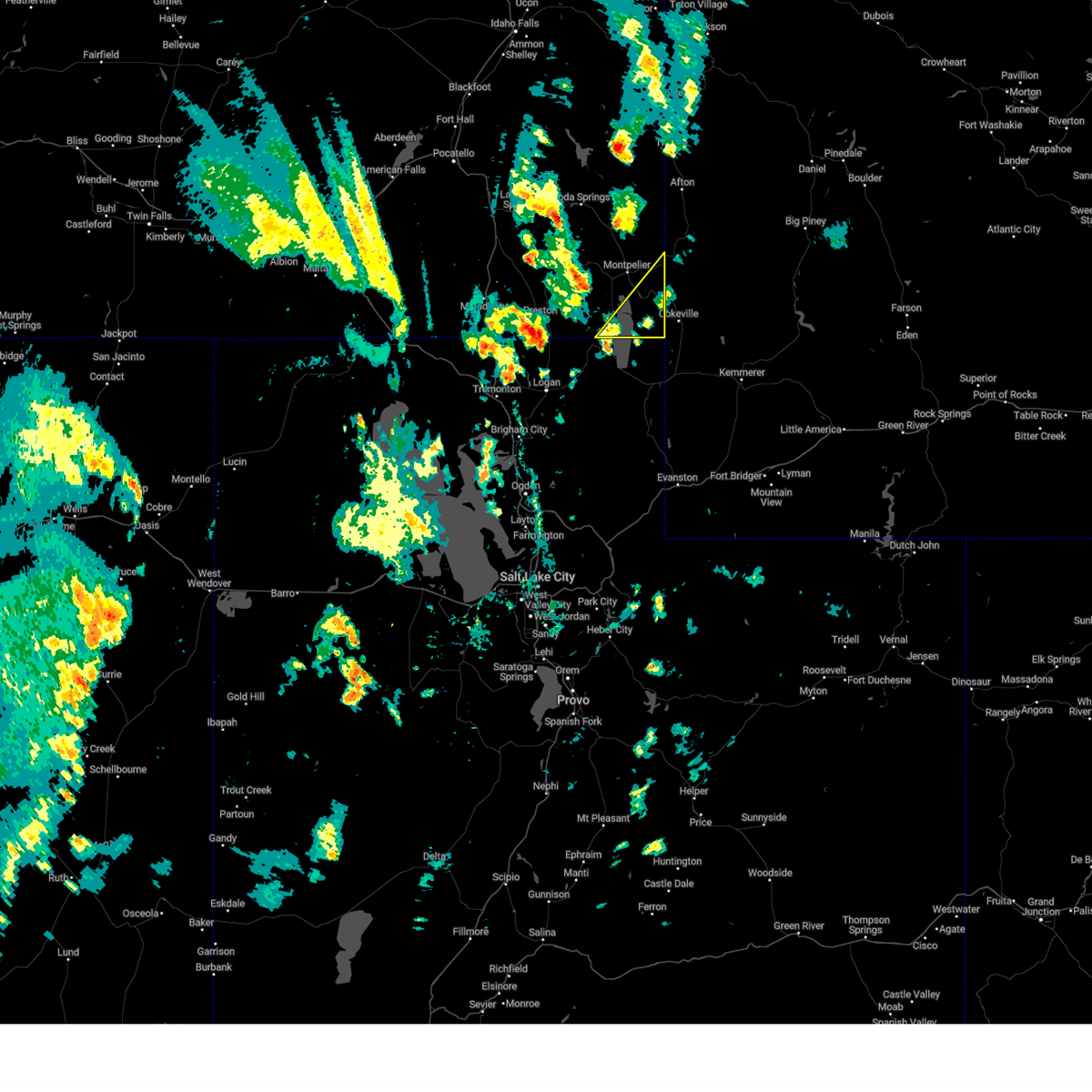
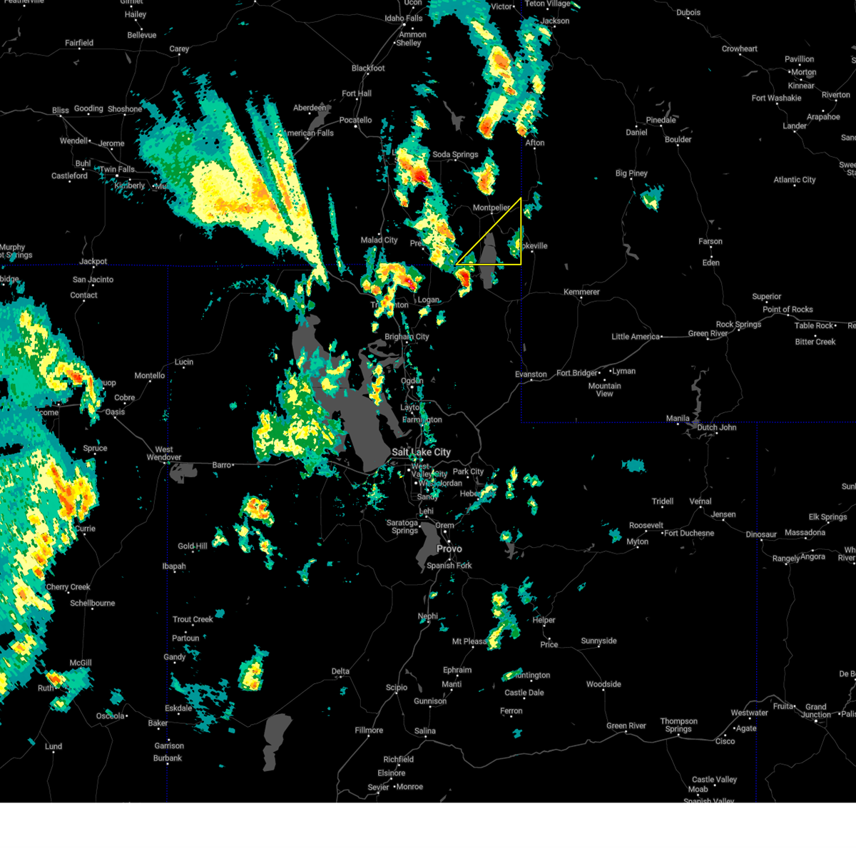
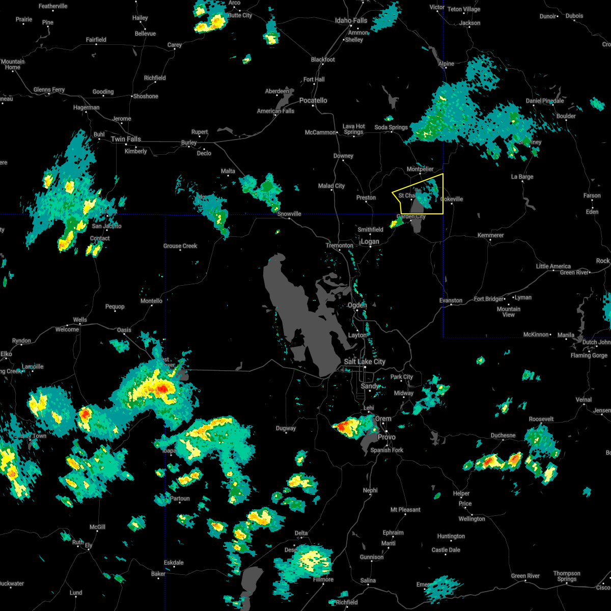
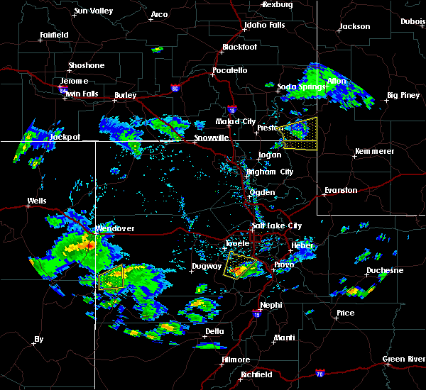
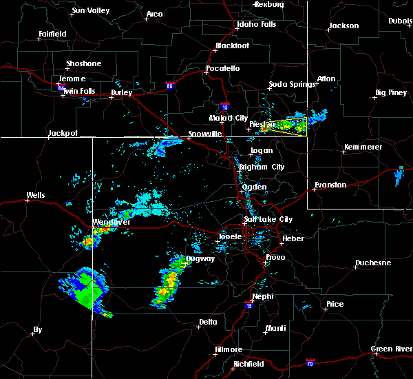
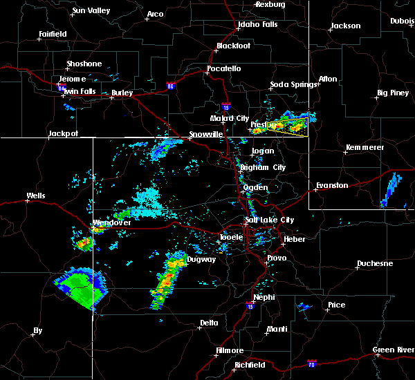
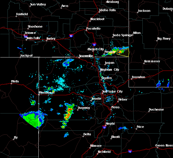
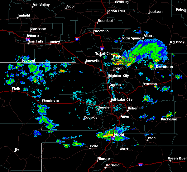
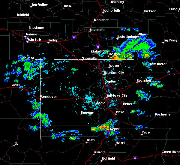
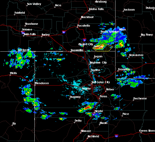
Hail Map for St. Charles, ID
The St. Charles, ID area has had 0 reports of on-the-ground hail by trained spotters, and has been under severe weather warnings 2 times during the past 12 months. Doppler radar has detected hail at or near St. Charles, ID on 3 occasions.
| Name: | St. Charles, ID |
| Where Located: | 97 miles NNE of Salt Lake City, UT |
| Map: | Google Map for St. Charles, ID |
| Population: | 131 |
| Housing Units: | 138 |
| More Info: | Search Google for St. Charles, ID |
0
The Top Recent Hail Date for St. Charles, ID is Wednesday, August 22, 2018 (1st out of 3)

Hail and Wind Damage Spotted near St. Charles, ID
| Date / Time | Report Details |
|---|---|
| 9/3/2023 6:09 PM MDT |
 At 608 pm mdt, a severe thunderstorm was located over bear lake, moving northeast at 30 mph (radar indicated). Hazards include 60 mph wind gusts and quarter size hail. Hail damage to vehicles is expected. expect wind damage to roofs, siding, and trees. locations impacted include, bear lake idaho portion, saint charles, dingle, border summit, geneva, fish haven, geneva summit, and pegram. hail threat, radar indicated max hail size, 1. 00 in wind threat, radar indicated max wind gust, 60 mph. At 608 pm mdt, a severe thunderstorm was located over bear lake, moving northeast at 30 mph (radar indicated). Hazards include 60 mph wind gusts and quarter size hail. Hail damage to vehicles is expected. expect wind damage to roofs, siding, and trees. locations impacted include, bear lake idaho portion, saint charles, dingle, border summit, geneva, fish haven, geneva summit, and pegram. hail threat, radar indicated max hail size, 1. 00 in wind threat, radar indicated max wind gust, 60 mph.
|
| 9/3/2023 5:54 PM MDT |
 At 554 pm mdt, a severe thunderstorm was located over garden city, utah, moving northeast at 35 mph (radar indicated). Hazards include 60 mph wind gusts and half dollar size hail. Hail damage to vehicles is expected. Expect wind damage to roofs, siding, and trees. At 554 pm mdt, a severe thunderstorm was located over garden city, utah, moving northeast at 35 mph (radar indicated). Hazards include 60 mph wind gusts and half dollar size hail. Hail damage to vehicles is expected. Expect wind damage to roofs, siding, and trees.
|
| 7/13/2022 6:53 PM MDT |
 At 653 pm mdt, severe thunderstorms were located along a line extending from near soda springs to near saint charles, moving east at 30 mph (trained weather spotters). Hazards include 60 mph wind gusts. expect damage to roofs, siding, and trees At 653 pm mdt, severe thunderstorms were located along a line extending from near soda springs to near saint charles, moving east at 30 mph (trained weather spotters). Hazards include 60 mph wind gusts. expect damage to roofs, siding, and trees
|
| 6/27/2020 10:10 PM MDT |
 At 1010 pm mdt, a severe thunderstorm was located near cherry creek rest area, or 11 miles southeast of malad, moving northeast at 45 mph (radar indicated). Hazards include 70 mph wind gusts. Expect considerable tree damage. Damage is likely to mobile homes, roofs, and outbuildings. At 1010 pm mdt, a severe thunderstorm was located near cherry creek rest area, or 11 miles southeast of malad, moving northeast at 45 mph (radar indicated). Hazards include 70 mph wind gusts. Expect considerable tree damage. Damage is likely to mobile homes, roofs, and outbuildings.
|
| 6/13/2019 4:43 PM MDT |
 The severe thunderstorm warning for southern bear lake county will expire at 445 pm mdt, the storm which prompted the warning has weakened below severe limits, and no longer poses an immediate threat to life or property. therefore, the warning will be allowed to expire. however small hail, gusty winds and heavy rain are still possible with this thunderstorm. The severe thunderstorm warning for southern bear lake county will expire at 445 pm mdt, the storm which prompted the warning has weakened below severe limits, and no longer poses an immediate threat to life or property. therefore, the warning will be allowed to expire. however small hail, gusty winds and heavy rain are still possible with this thunderstorm.
|
| 6/13/2019 4:36 PM MDT |
 At 435 pm mdt, a severe thunderstorm was located near bear lake, moving east at 35 mph (radar indicated). Hazards include 60 mph wind gusts. Expect damage to roofs, siding, and trees. Locations impacted include, bear lake idaho portion, saint charles, dingle, paris, bloomington, border summit, fish haven and pegram. At 435 pm mdt, a severe thunderstorm was located near bear lake, moving east at 35 mph (radar indicated). Hazards include 60 mph wind gusts. Expect damage to roofs, siding, and trees. Locations impacted include, bear lake idaho portion, saint charles, dingle, paris, bloomington, border summit, fish haven and pegram.
|
| 6/13/2019 4:22 PM MDT |
 At 422 pm mdt, a severe thunderstorm was located over saint charles, moving east at 40 mph (radar indicated). Hazards include 60 mph wind gusts and quarter size hail. Hail damage to vehicles is expected. expect wind damage to roofs, siding, and trees. Locations impacted include, bear lake, saint charles, dingle, paris, bloomington, minnetonka cave, border summit, fish haven and pegram. At 422 pm mdt, a severe thunderstorm was located over saint charles, moving east at 40 mph (radar indicated). Hazards include 60 mph wind gusts and quarter size hail. Hail damage to vehicles is expected. expect wind damage to roofs, siding, and trees. Locations impacted include, bear lake, saint charles, dingle, paris, bloomington, minnetonka cave, border summit, fish haven and pegram.
|
| 6/13/2019 4:07 PM MDT |
 At 407 pm mdt, a severe thunderstorm was located 10 miles east of franklin or 14 miles west of bear lake, moving east at 35 mph (radar indicated). Hazards include 60 mph wind gusts and quarter size hail. Hail damage to vehicles is expected. Expect wind damage to roofs, siding, and trees. At 407 pm mdt, a severe thunderstorm was located 10 miles east of franklin or 14 miles west of bear lake, moving east at 35 mph (radar indicated). Hazards include 60 mph wind gusts and quarter size hail. Hail damage to vehicles is expected. Expect wind damage to roofs, siding, and trees.
|
| 6/6/2019 7:07 PM MDT |
 The severe thunderstorm warning for southeastern caribou and bear lake counties will expire at 715 pm mdt, the storm which prompted the warning has moved out of the area. therefore, the warning will be allowed to expire. a severe thunderstorm watch remains in effect until 1100 pm mdt for southeastern idaho. The severe thunderstorm warning for southeastern caribou and bear lake counties will expire at 715 pm mdt, the storm which prompted the warning has moved out of the area. therefore, the warning will be allowed to expire. a severe thunderstorm watch remains in effect until 1100 pm mdt for southeastern idaho.
|
| 6/6/2019 6:59 PM MDT |
 At 658 pm mdt, severe thunderstorms extend from georgetown to 12 miles south of salt river pass or 17 miles north of cokeville utah, moving east at 40 mph (trained weather spotters). Hazards include 60 mph wind gusts. Expect damage to roofs, siding, and trees. Locations impacted include, montpelier, bear lake idaho portion, georgetown, saint charles, dingle, paris, bloomington, bern, ovid, border summit, geneva, fish haven, clear creek ranger station, pegram, geneva summit and bennington. At 658 pm mdt, severe thunderstorms extend from georgetown to 12 miles south of salt river pass or 17 miles north of cokeville utah, moving east at 40 mph (trained weather spotters). Hazards include 60 mph wind gusts. Expect damage to roofs, siding, and trees. Locations impacted include, montpelier, bear lake idaho portion, georgetown, saint charles, dingle, paris, bloomington, bern, ovid, border summit, geneva, fish haven, clear creek ranger station, pegram, geneva summit and bennington.
|
| 6/6/2019 6:42 PM MDT |
 At 641 pm mdt, severe thunderstorms were located from near georgetown summit to bear lake, moving east at 40 mph (trained weather spotters. at 640 pm, 64 mph winds were reported in bern). Hazards include 60-70 mph wind gusts. expect damage to roofs, siding, and trees At 641 pm mdt, severe thunderstorms were located from near georgetown summit to bear lake, moving east at 40 mph (trained weather spotters. at 640 pm, 64 mph winds were reported in bern). Hazards include 60-70 mph wind gusts. expect damage to roofs, siding, and trees
|
| 8/1/2018 9:21 PM MDT |
 The severe thunderstorm warning for central bear lake county will expire at 930 pm mdt, the storms which prompted the warning have weakened below severe limits, and have exited the warned area. therefore, the warning will be allowed to expire. however gusty winds are still possible with these thunderstorms. The severe thunderstorm warning for central bear lake county will expire at 930 pm mdt, the storms which prompted the warning have weakened below severe limits, and have exited the warned area. therefore, the warning will be allowed to expire. however gusty winds are still possible with these thunderstorms.
|
| 8/1/2018 8:48 PM MDT |
 At 847 pm mdt, severe thunderstorms were located along a line extending from 7 miles west of salt river pass to 8 miles west of montpelier, moving southeast at 20 mph (trained weather spotters in bern reported 60 mph winds). Hazards include 60 mph wind gusts. expect damage to roofs, siding, and trees At 847 pm mdt, severe thunderstorms were located along a line extending from 7 miles west of salt river pass to 8 miles west of montpelier, moving southeast at 20 mph (trained weather spotters in bern reported 60 mph winds). Hazards include 60 mph wind gusts. expect damage to roofs, siding, and trees
|
| 8/1/2018 7:40 PM MDT |
 The severe thunderstorm warning for southern bear lake county will expire at 745 pm mdt, the storm which prompted the warning has weakened below severe limits, and has exited the warned area. therefore, the warning will be allowed to expire. however gusty winds and heavy rain are still possible with this thunderstorm. The severe thunderstorm warning for southern bear lake county will expire at 745 pm mdt, the storm which prompted the warning has weakened below severe limits, and has exited the warned area. therefore, the warning will be allowed to expire. however gusty winds and heavy rain are still possible with this thunderstorm.
|
| 8/1/2018 7:15 PM MDT |
 At 714 pm mdt, a severe thunderstorm was located near dingle or 8 miles south of montpelier, moving southeast at 30 mph (radar indicated. at 710 pm a storm spotter reported 40 to 50 mph winds in montpelier). Hazards include 60 mph wind gusts. Expect damage to roofs, siding, and trees. Locations impacted include, montpelier, bear lake idaho portion, saint charles, dingle, paris, bloomington, bern, ovid, border summit, fish haven, liberty and pegram. At 714 pm mdt, a severe thunderstorm was located near dingle or 8 miles south of montpelier, moving southeast at 30 mph (radar indicated. at 710 pm a storm spotter reported 40 to 50 mph winds in montpelier). Hazards include 60 mph wind gusts. Expect damage to roofs, siding, and trees. Locations impacted include, montpelier, bear lake idaho portion, saint charles, dingle, paris, bloomington, bern, ovid, border summit, fish haven, liberty and pegram.
|
| 8/1/2018 6:56 PM MDT |
 At 656 pm mdt, a severe thunderstorm was located near montpelier, moving southeast at 35 mph (radar indicated). Hazards include 60 mph wind gusts. expect damage to roofs, siding, and trees At 656 pm mdt, a severe thunderstorm was located near montpelier, moving southeast at 35 mph (radar indicated). Hazards include 60 mph wind gusts. expect damage to roofs, siding, and trees
|
| 7/16/2018 5:38 PM MDT |
 At 538 pm mdt, a severe thunderstorm was located 9 miles east of oneida narrows reservoir or 12 miles west of montpelier, moving east at 15 mph (trained weather spotters). Hazards include 60 mph wind gusts. expect damage to roofs, siding, and trees At 538 pm mdt, a severe thunderstorm was located 9 miles east of oneida narrows reservoir or 12 miles west of montpelier, moving east at 15 mph (trained weather spotters). Hazards include 60 mph wind gusts. expect damage to roofs, siding, and trees
|
| 7/20/2017 10:22 PM MDT |
 At 1021 pm mdt, a severe thunderstorm was located over fish haven, moving east at 15 mph (radar indicated). Hazards include quarter size hail. Damage to vehicles is expected. Locations impacted include, bear lake idaho portion, saint charles, fish haven, pegram and minnetonka cave. At 1021 pm mdt, a severe thunderstorm was located over fish haven, moving east at 15 mph (radar indicated). Hazards include quarter size hail. Damage to vehicles is expected. Locations impacted include, bear lake idaho portion, saint charles, fish haven, pegram and minnetonka cave.
|
| 7/20/2017 10:00 PM MDT |
 At 1000 pm mdt, a severe thunderstorm was located near saint charles or near bear lake idaho portion, moving east at 15 mph (radar indicated). Hazards include quarter size hail. damage to vehicles is expected At 1000 pm mdt, a severe thunderstorm was located near saint charles or near bear lake idaho portion, moving east at 15 mph (radar indicated). Hazards include quarter size hail. damage to vehicles is expected
|
| 7/20/2017 9:09 PM MDT |
 At 907 pm mdt, a severe thunderstorm was located near saint charles or near bear lake idaho portion, moving east at 25 mph (radar indicated). Hazards include quarter size hail. Damage to vehicles is expected. slick road conditions are expected with accumulating hail on roadways. Locations impacted include, bear lake idaho portion, saint charles, dingle, paris, bloomington, minnetonka cave, border summit and pegram. At 907 pm mdt, a severe thunderstorm was located near saint charles or near bear lake idaho portion, moving east at 25 mph (radar indicated). Hazards include quarter size hail. Damage to vehicles is expected. slick road conditions are expected with accumulating hail on roadways. Locations impacted include, bear lake idaho portion, saint charles, dingle, paris, bloomington, minnetonka cave, border summit and pegram.
|
| 7/20/2017 8:49 PM MDT |
 At 847 pm mdt, a severe thunderstorm was located near saint charles or 10 miles northwest of bear lake idaho portion, moving east at 25 mph (radar indicated). Hazards include quarter size hail. previous storm of similar magnitude had quarter size hail as well. damage to vehicles is expected At 847 pm mdt, a severe thunderstorm was located near saint charles or 10 miles northwest of bear lake idaho portion, moving east at 25 mph (radar indicated). Hazards include quarter size hail. previous storm of similar magnitude had quarter size hail as well. damage to vehicles is expected
|
| 7/20/2017 8:32 PM MDT |
 At 831 pm mdt, a severe thunderstorm was located near saint charles or 7 miles north of bear lake idaho portion, moving east at 15 mph (trained weather spotters). Hazards include quarter size hail. damage to vehicles is expected At 831 pm mdt, a severe thunderstorm was located near saint charles or 7 miles north of bear lake idaho portion, moving east at 15 mph (trained weather spotters). Hazards include quarter size hail. damage to vehicles is expected
|
| 8/27/2015 4:55 PM MDT |
 The severe thunderstorm warning for southeastern franklin and southern bear lake counties will expire at 500 pm mdt, the storm which prompted the warning has moved out of the area. therefore the warning will be allowed to expire. The severe thunderstorm warning for southeastern franklin and southern bear lake counties will expire at 500 pm mdt, the storm which prompted the warning has moved out of the area. therefore the warning will be allowed to expire.
|
| 8/27/2015 4:39 PM MDT |
 At 438 pm mdt, doppler radar indicated a severe thunderstorm capable of producing quarter size hail and damaging winds in excess of 60 mph. this storm was located near franklin, or 8 miles southeast of preston, moving southeast at 25 mph. locations impacted include, bear lake idaho portion, saint charles, minnetonka cave and fish haven. At 438 pm mdt, doppler radar indicated a severe thunderstorm capable of producing quarter size hail and damaging winds in excess of 60 mph. this storm was located near franklin, or 8 miles southeast of preston, moving southeast at 25 mph. locations impacted include, bear lake idaho portion, saint charles, minnetonka cave and fish haven.
|
| 8/27/2015 4:11 PM MDT |
 At 410 pm mdt, doppler radar indicated a line of severe thunderstorms capable of producing large damaging hail up to golf ball size and damaging winds in excess of 60 mph. these storms were located along a line extending from 10 miles west of montpelier to 11 miles west of saint charles to preston, and moving southeast at 25 mph. At 410 pm mdt, doppler radar indicated a line of severe thunderstorms capable of producing large damaging hail up to golf ball size and damaging winds in excess of 60 mph. these storms were located along a line extending from 10 miles west of montpelier to 11 miles west of saint charles to preston, and moving southeast at 25 mph.
|
| 1/1/0001 12:00 AM | Big trre blown down in bear lake county ID, 1.2 miles NNW of St. Charles, ID |
| 1/1/0001 12:00 AM | Storm damage reported in bear lake county ID, 1.2 miles NNW of St. Charles, ID |
Hail Maps for St. Charles, ID


Connect with Interactive Hail Maps