

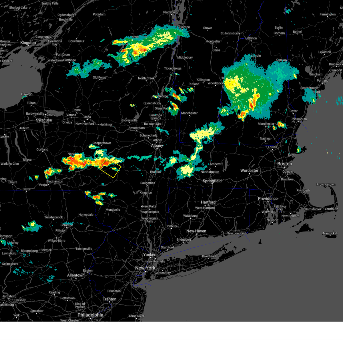
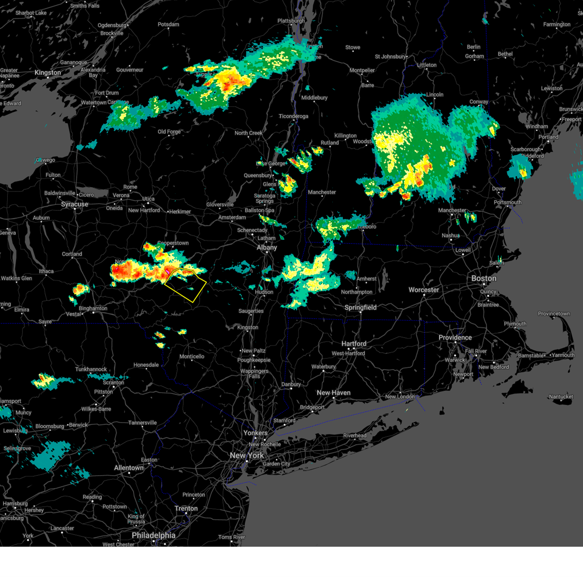
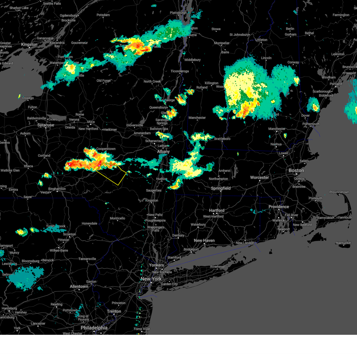
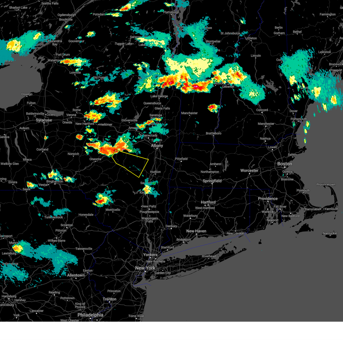
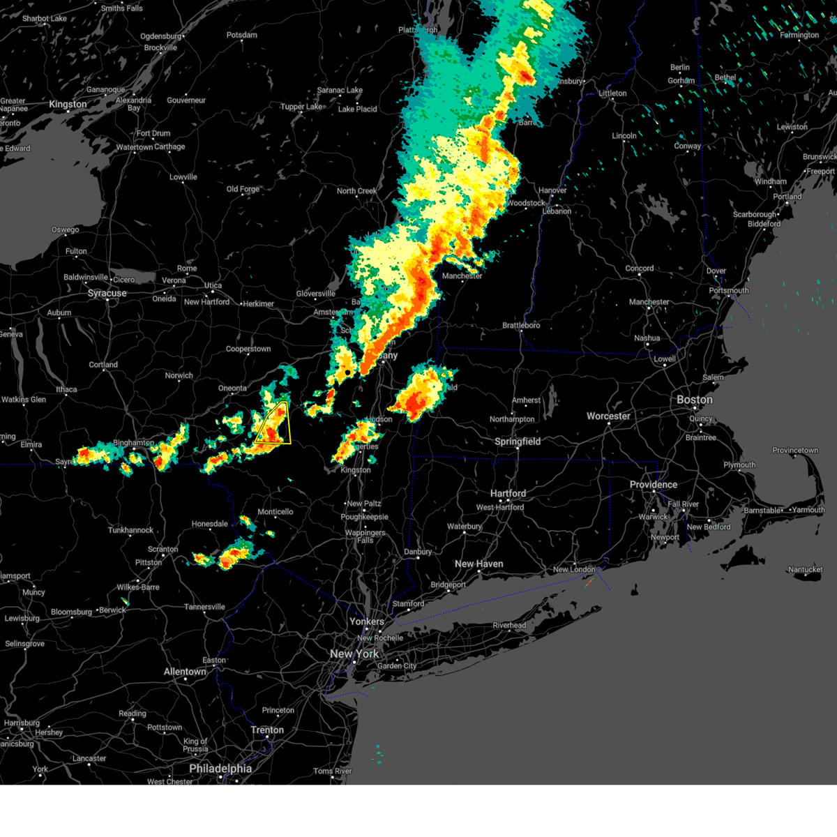
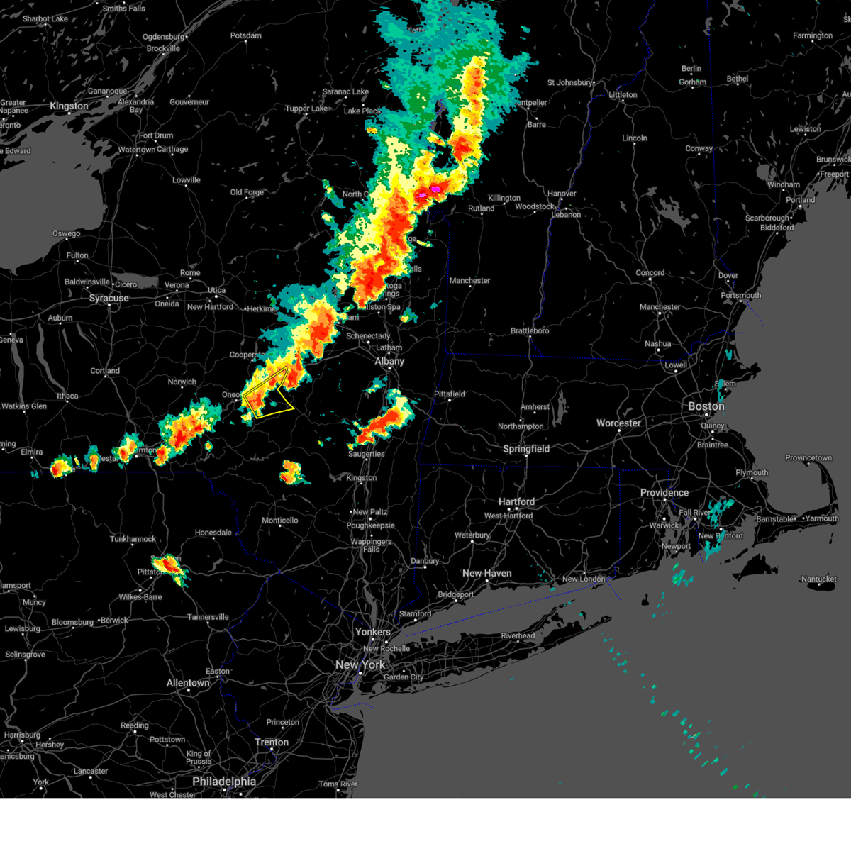
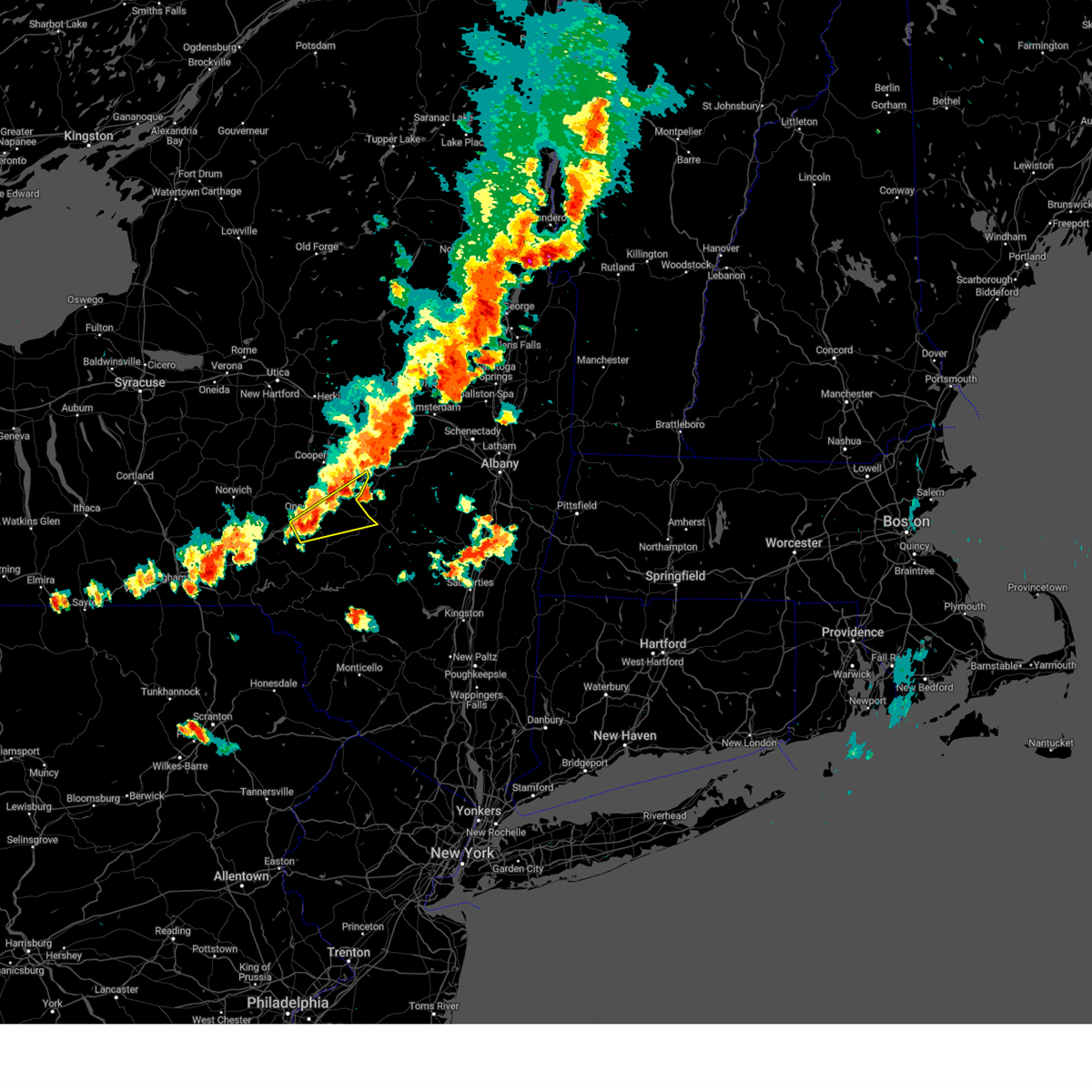
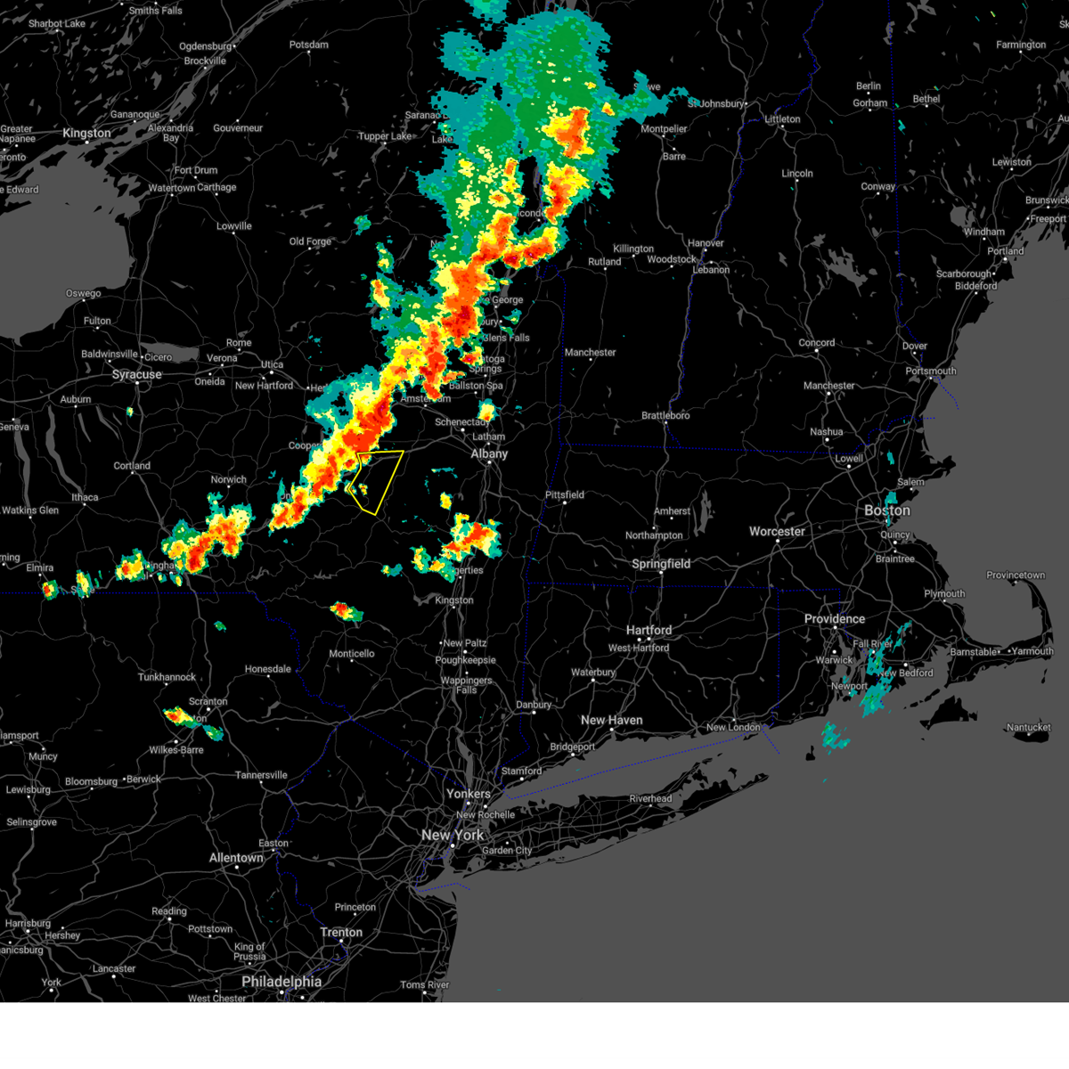
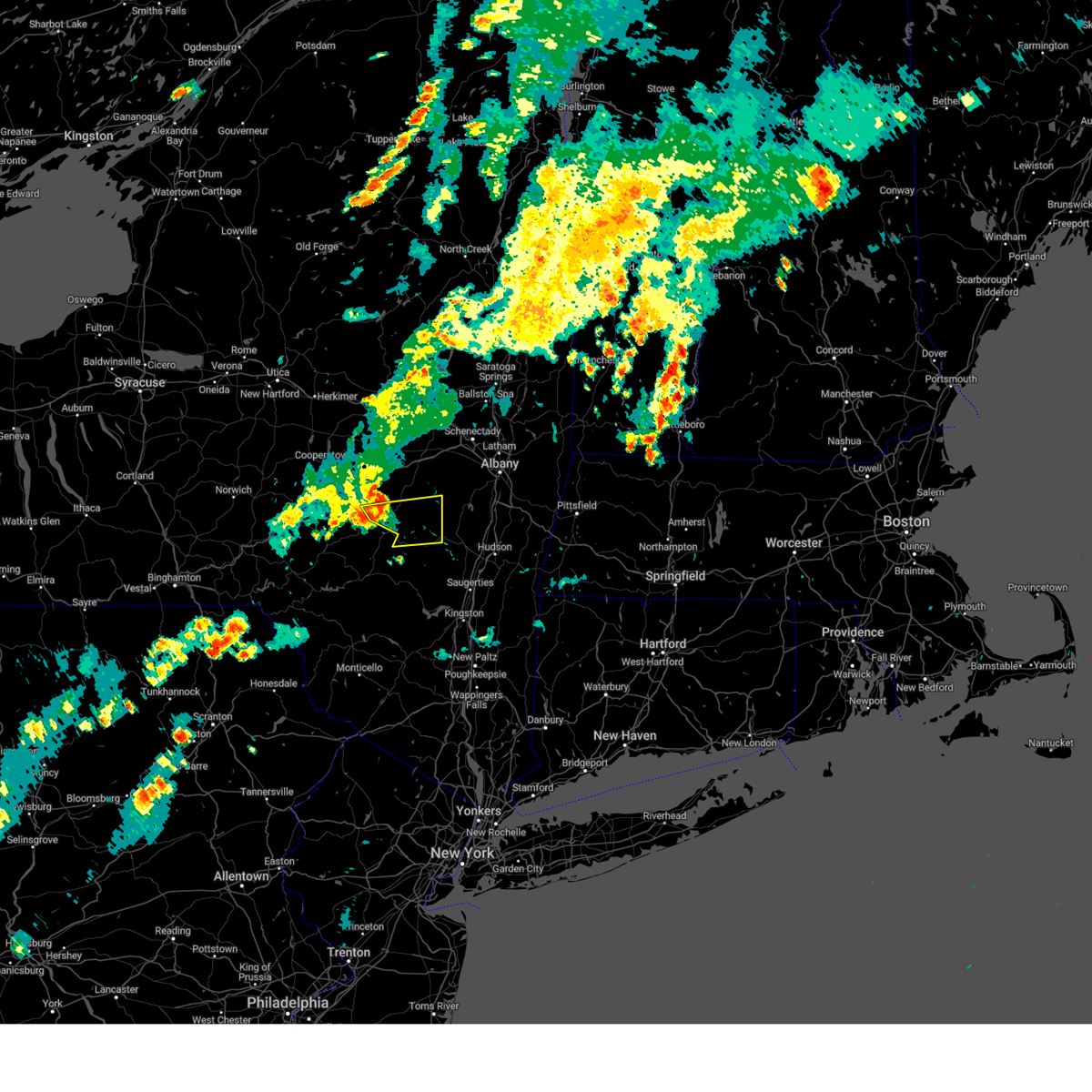
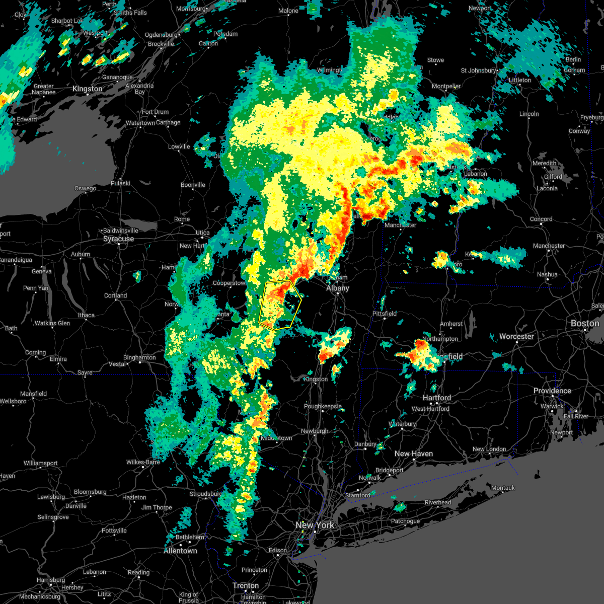
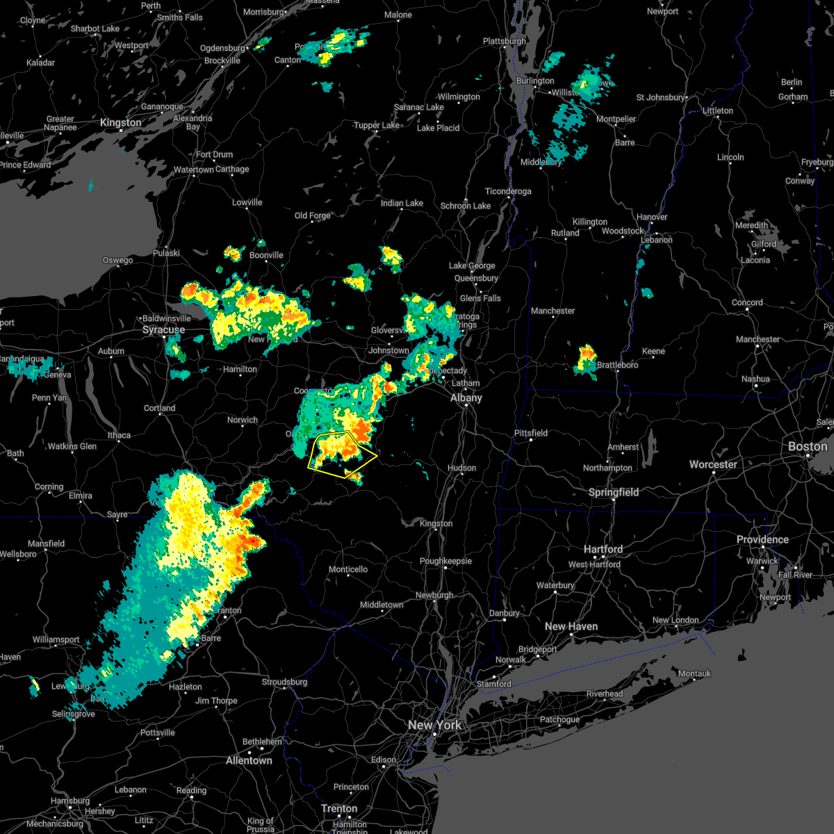
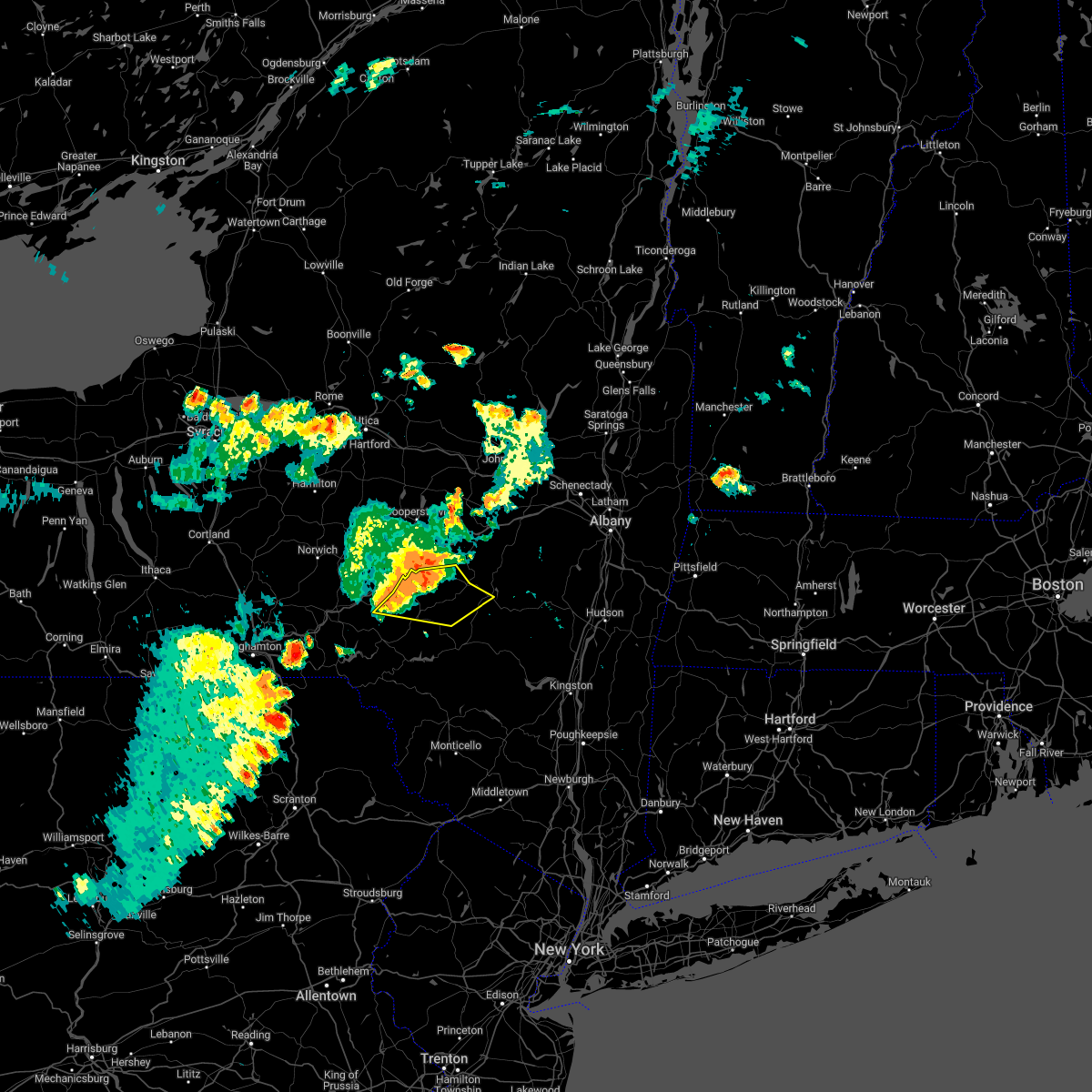
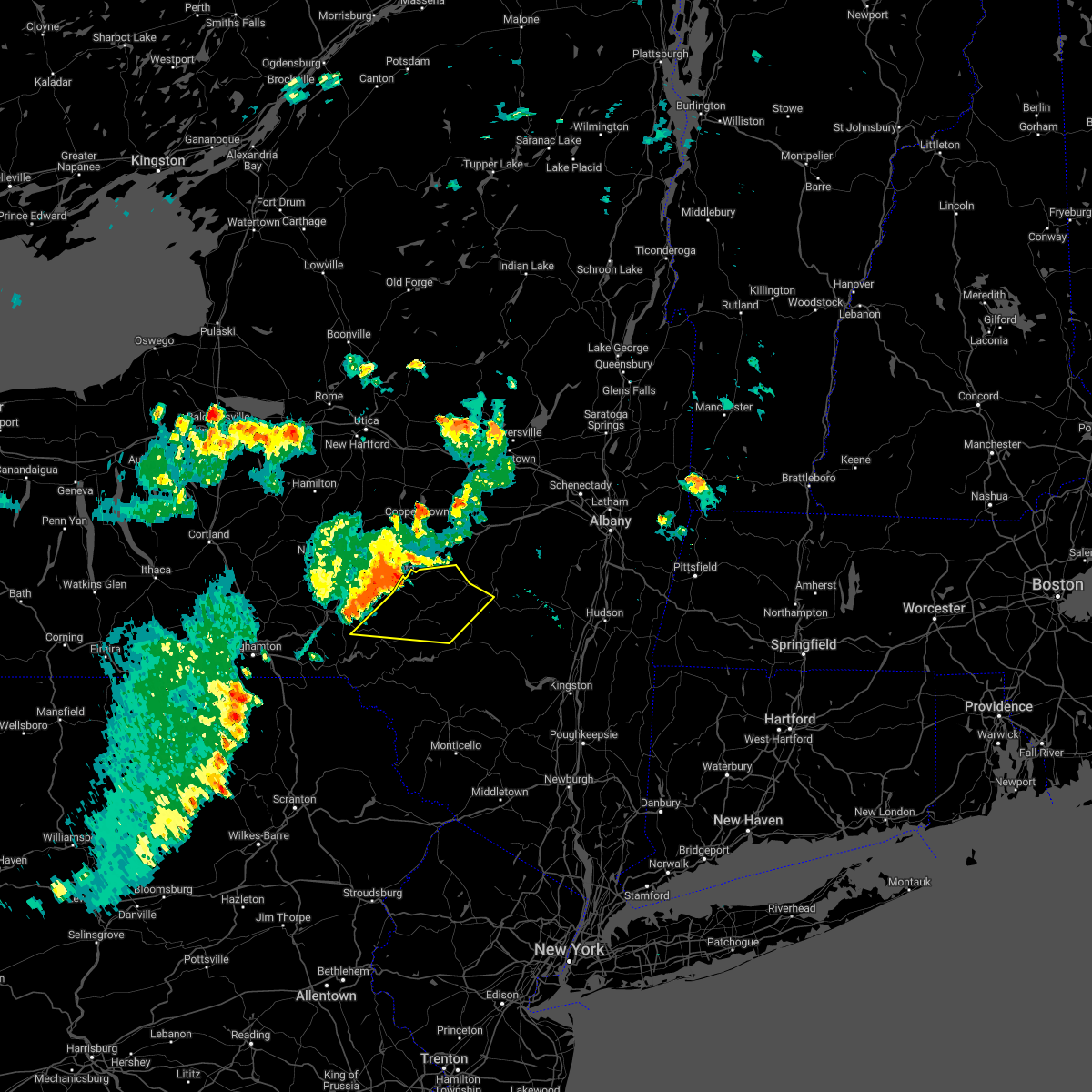
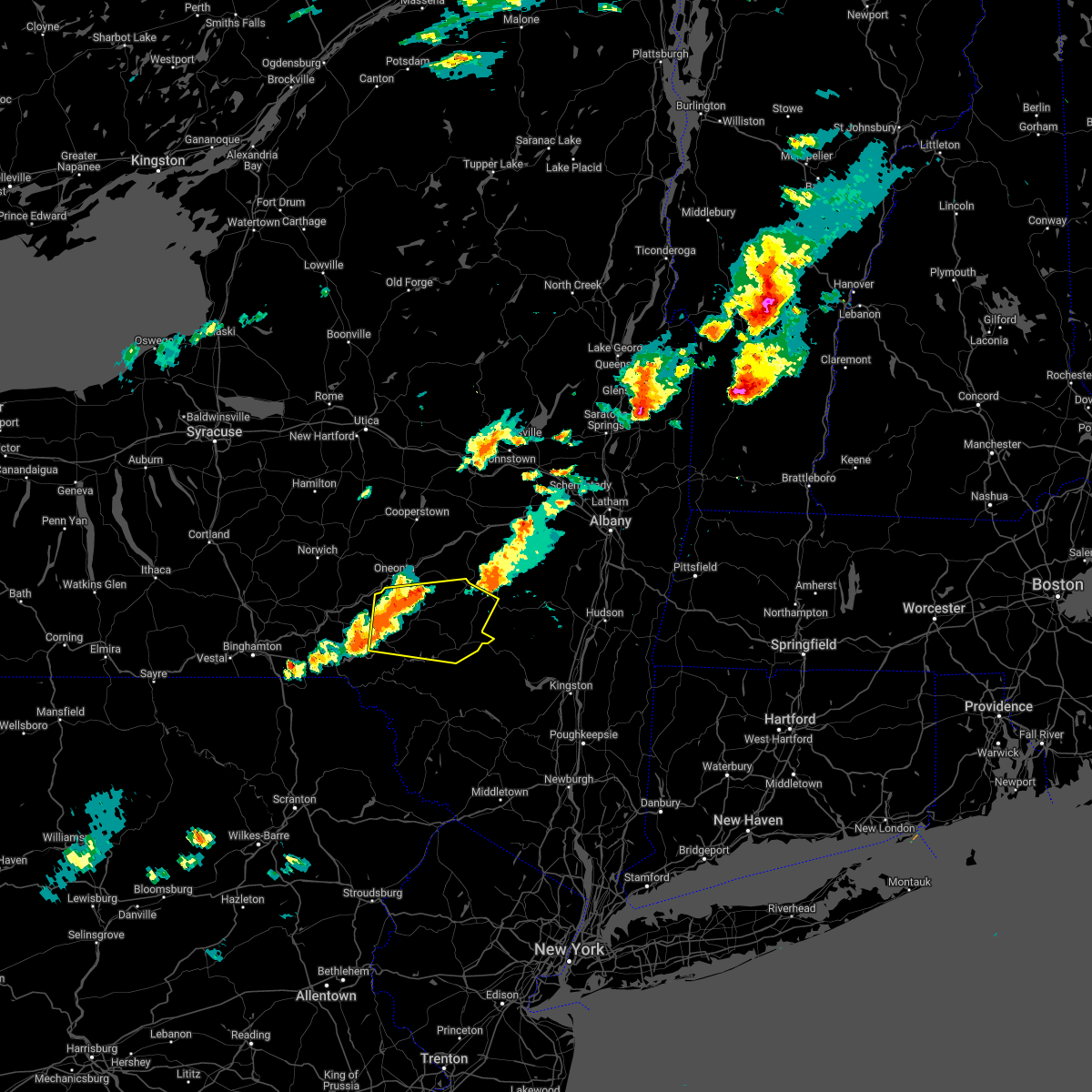
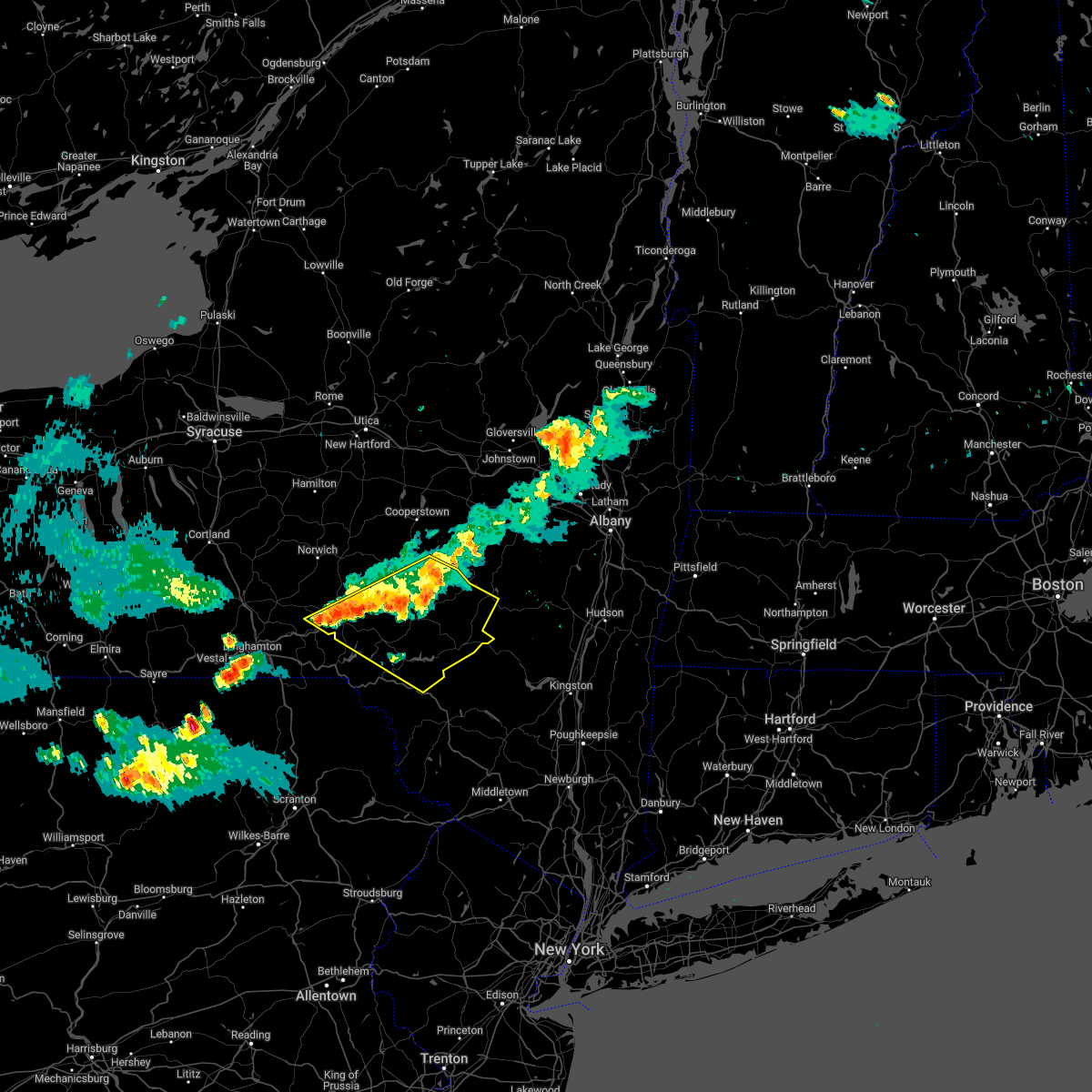
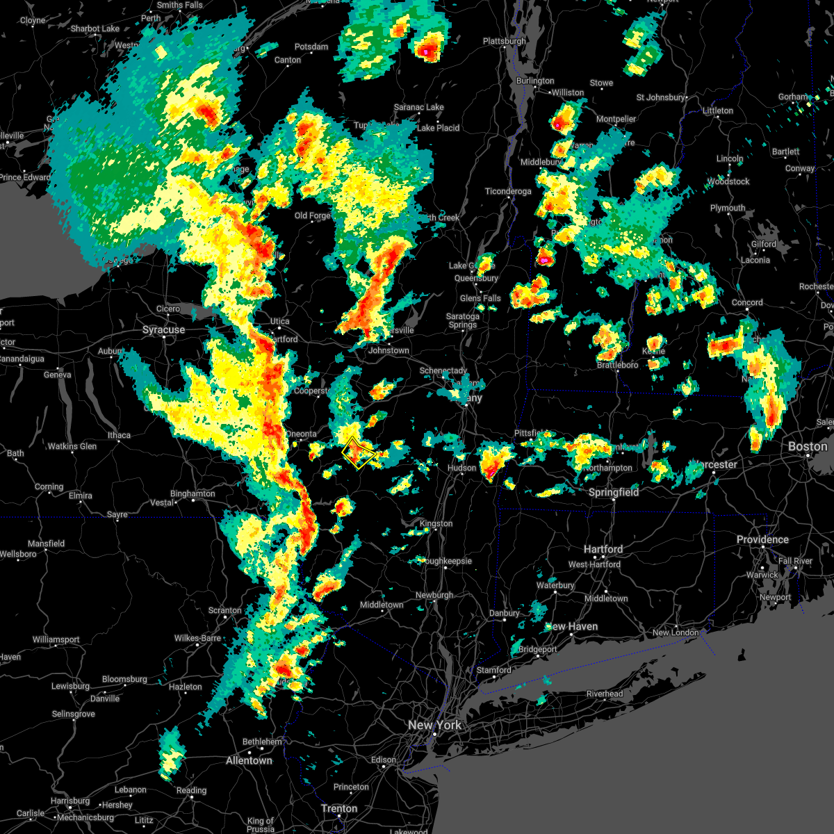
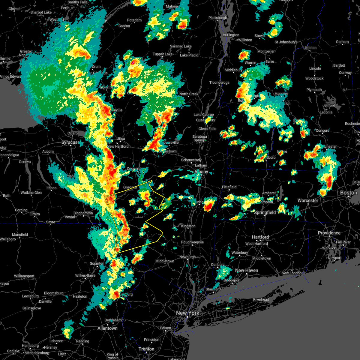
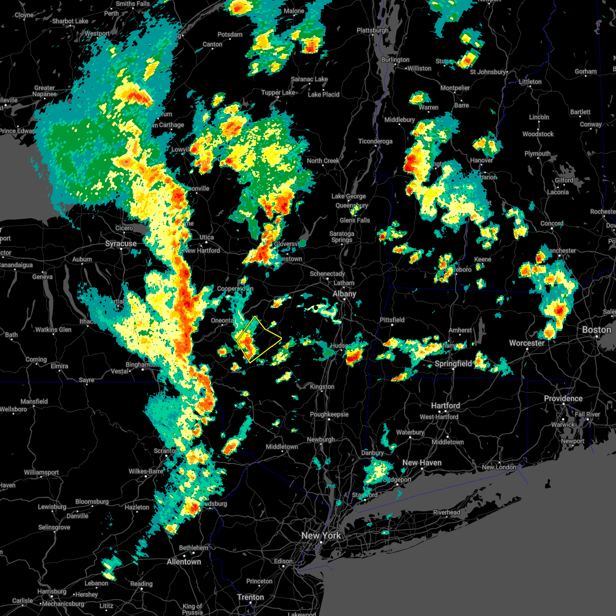
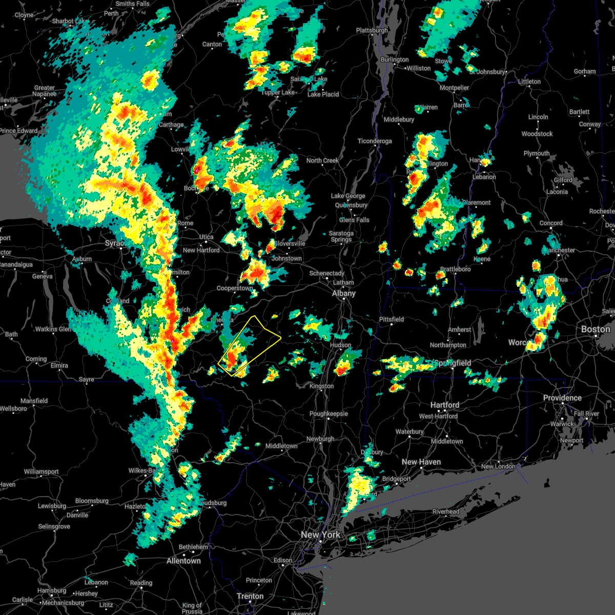
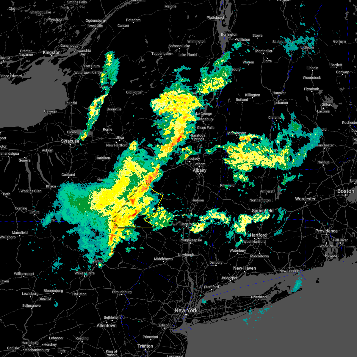
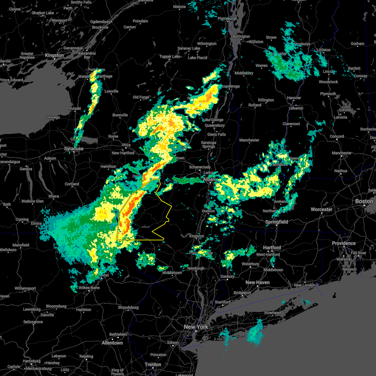
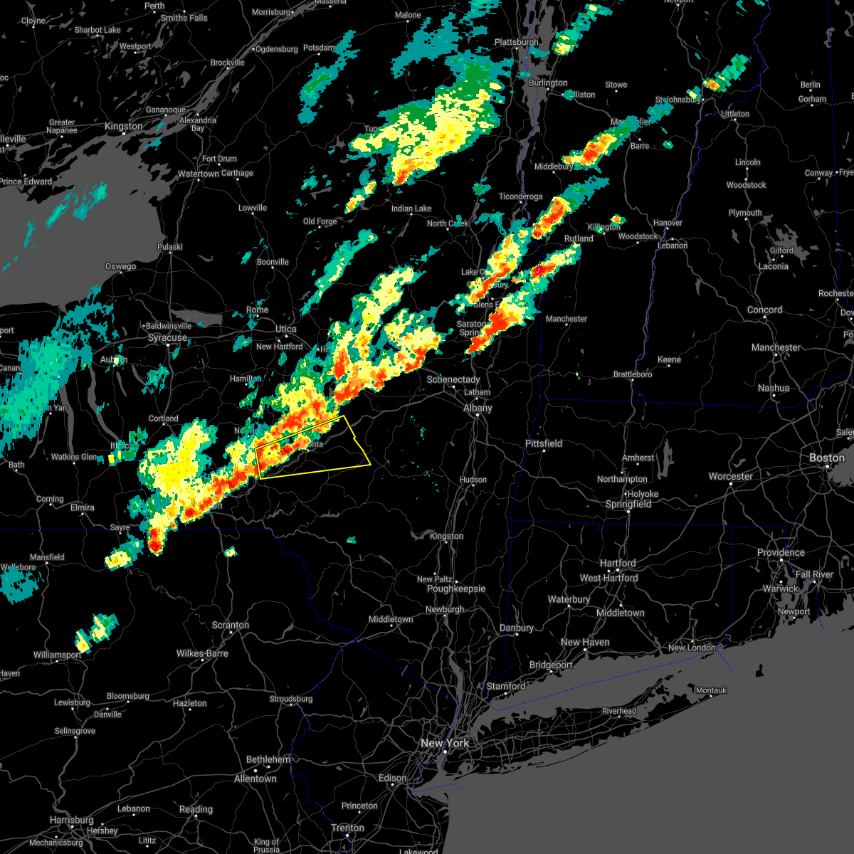
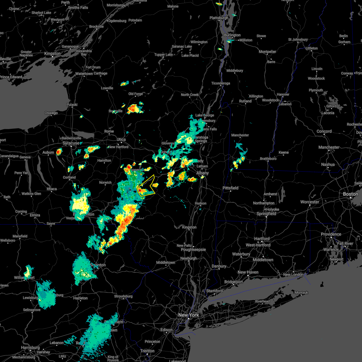
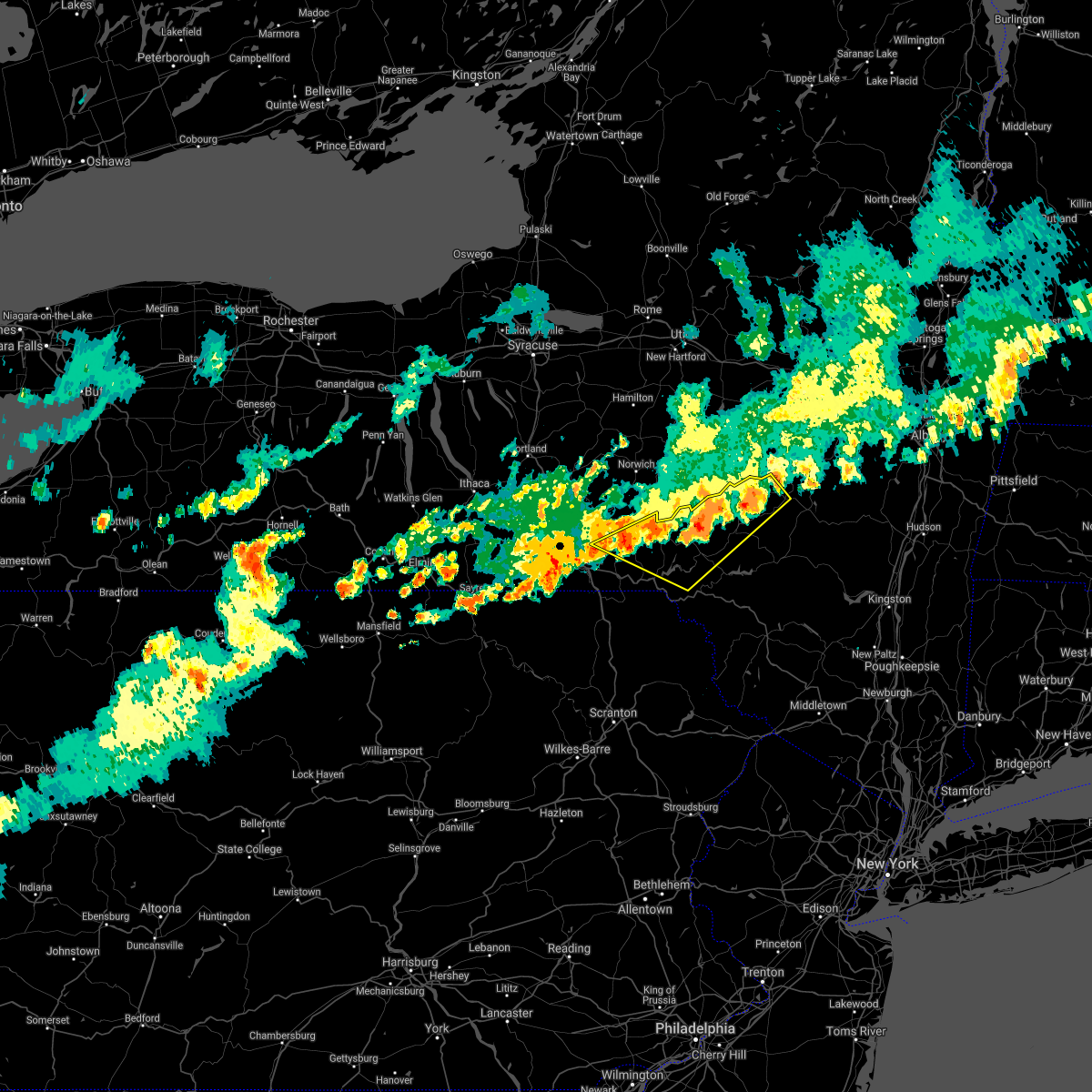
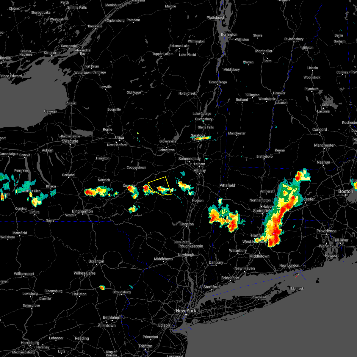
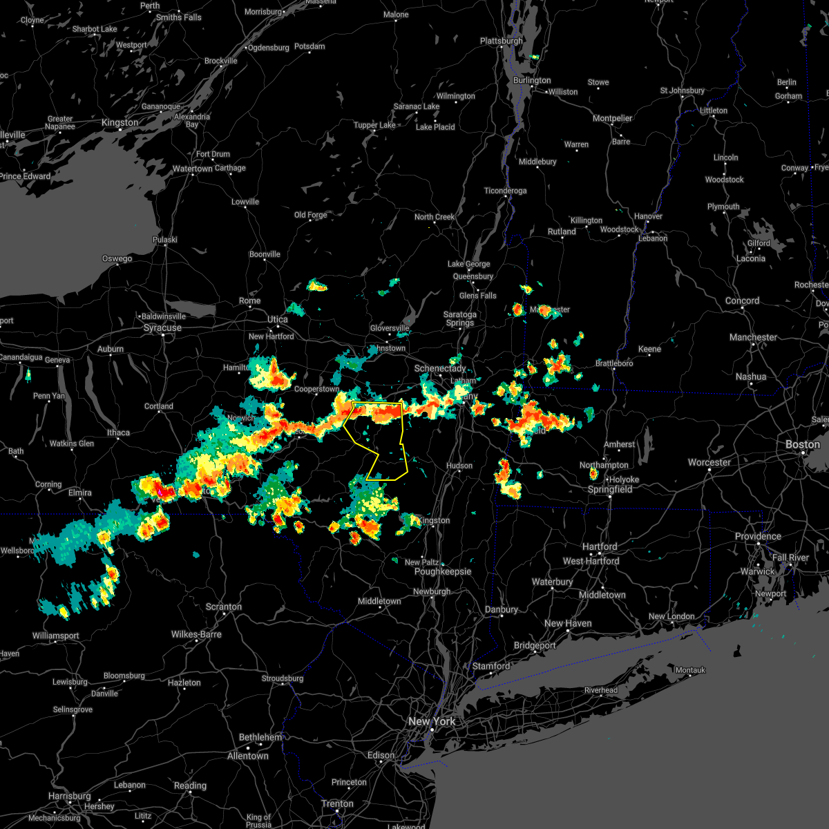
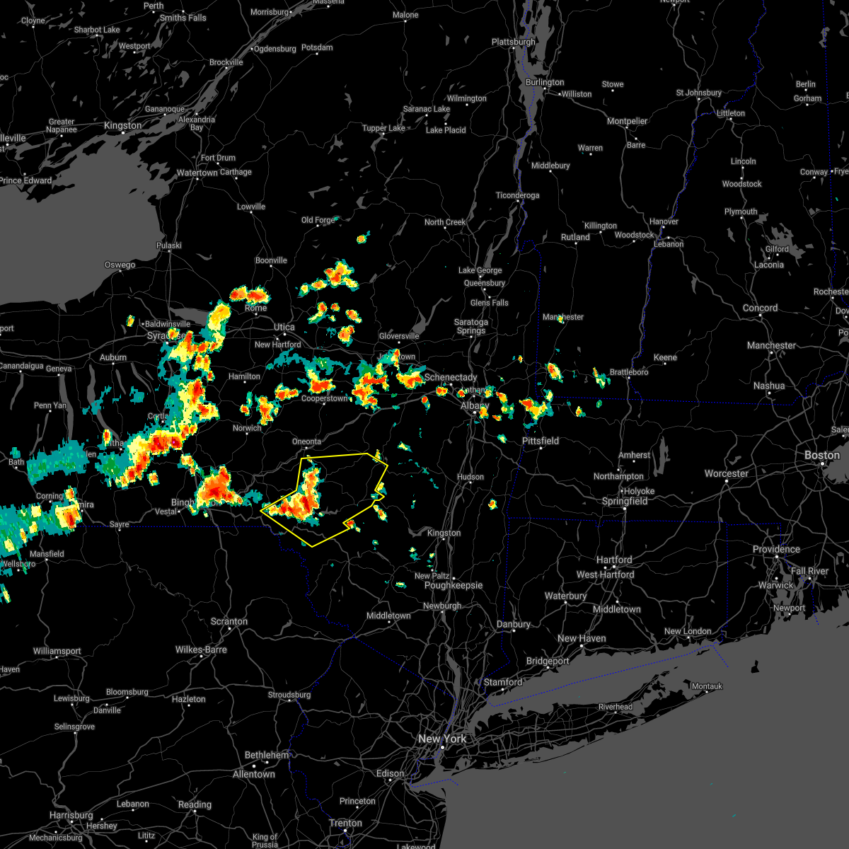
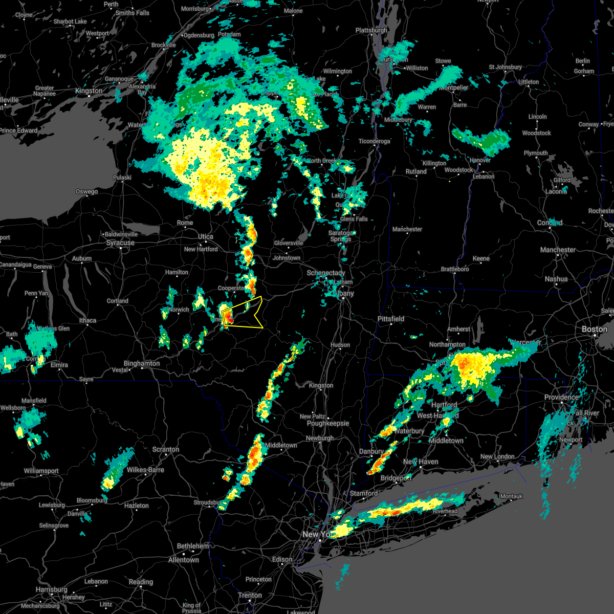
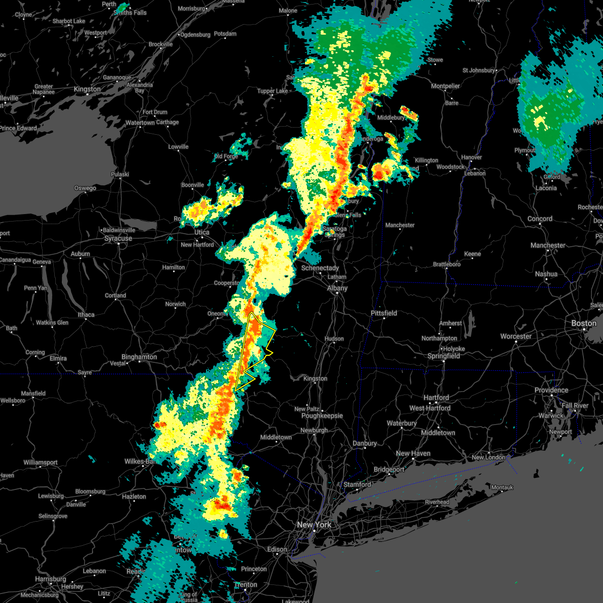
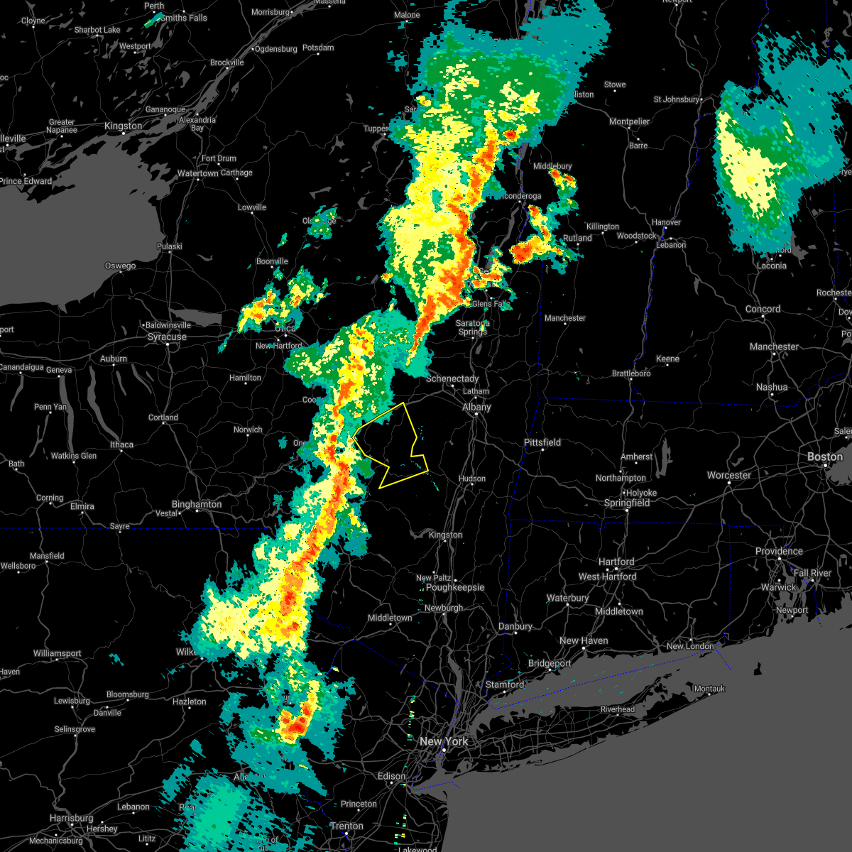
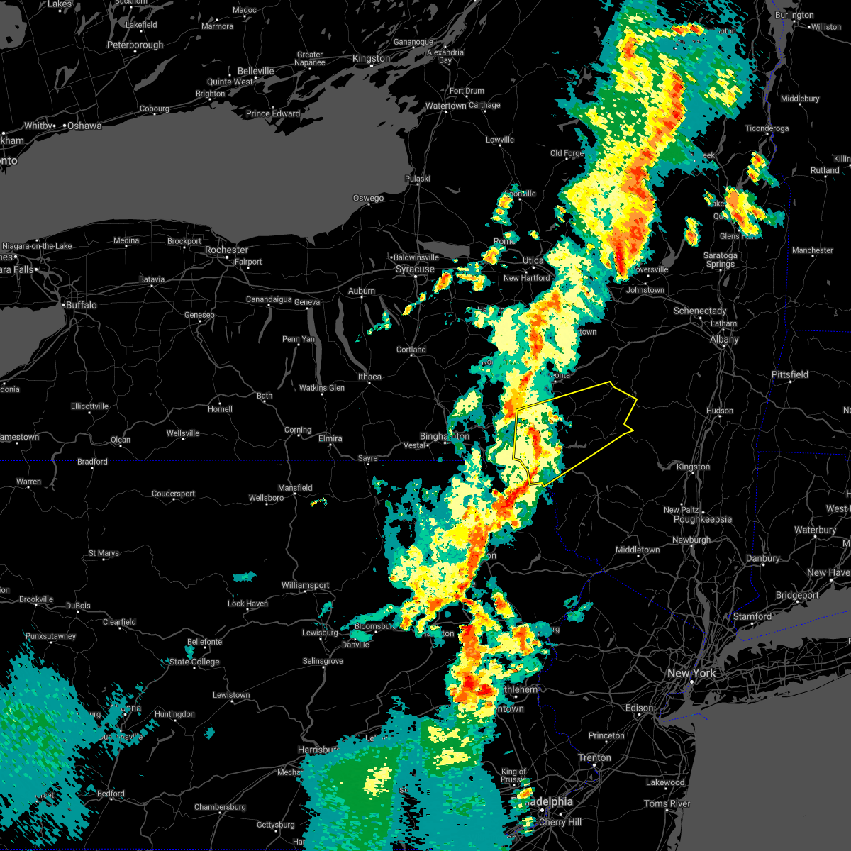
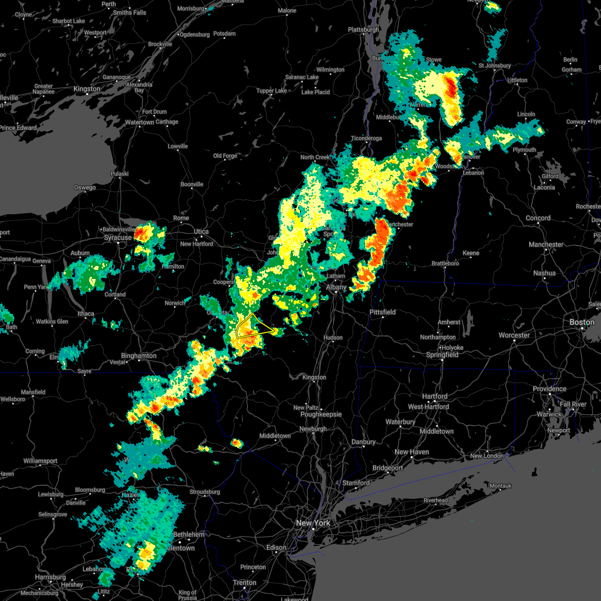
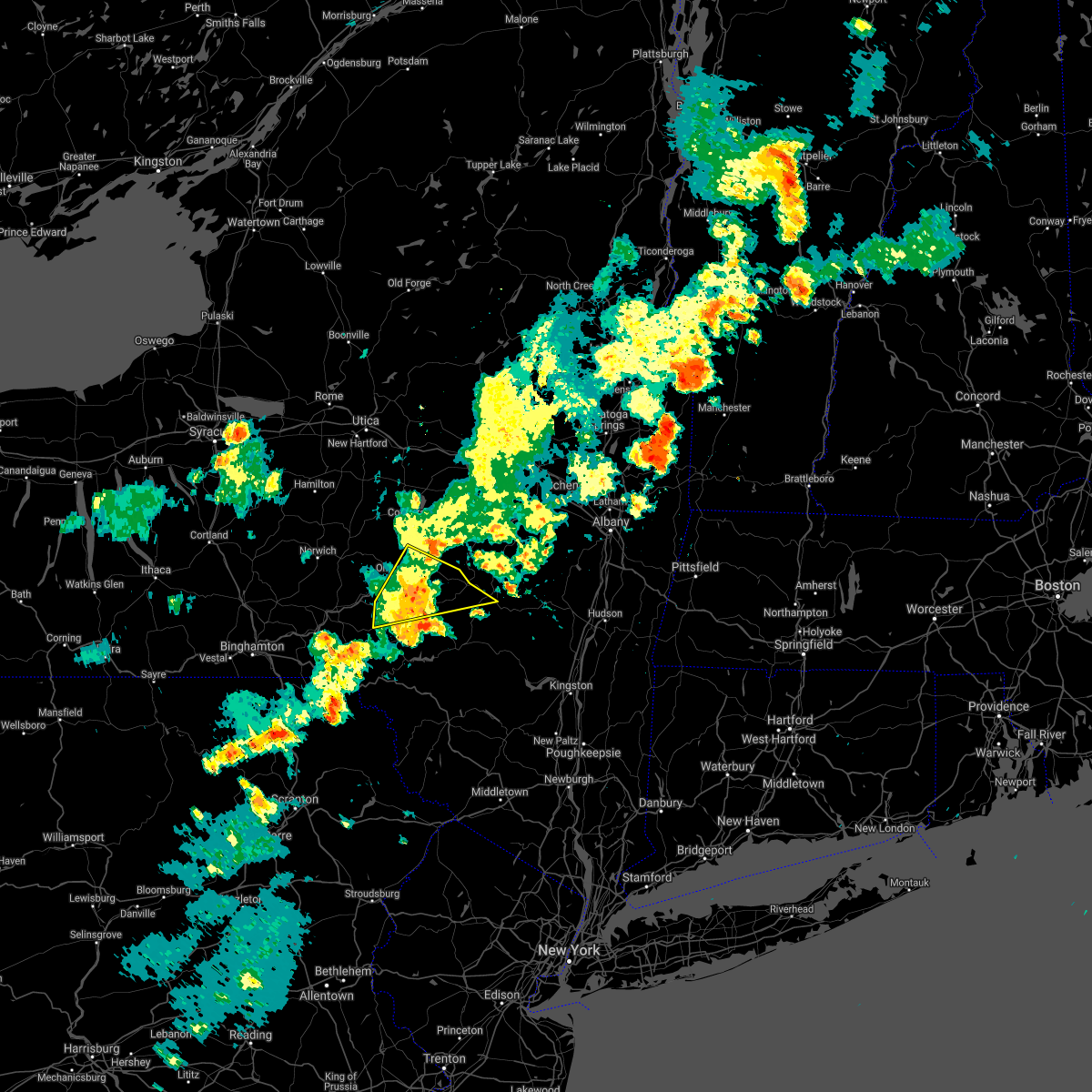
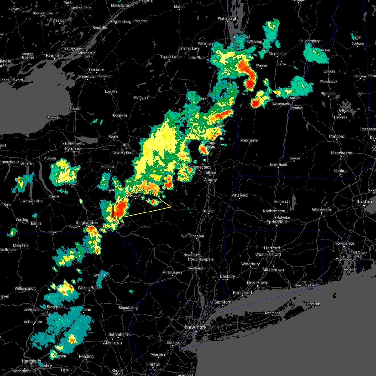
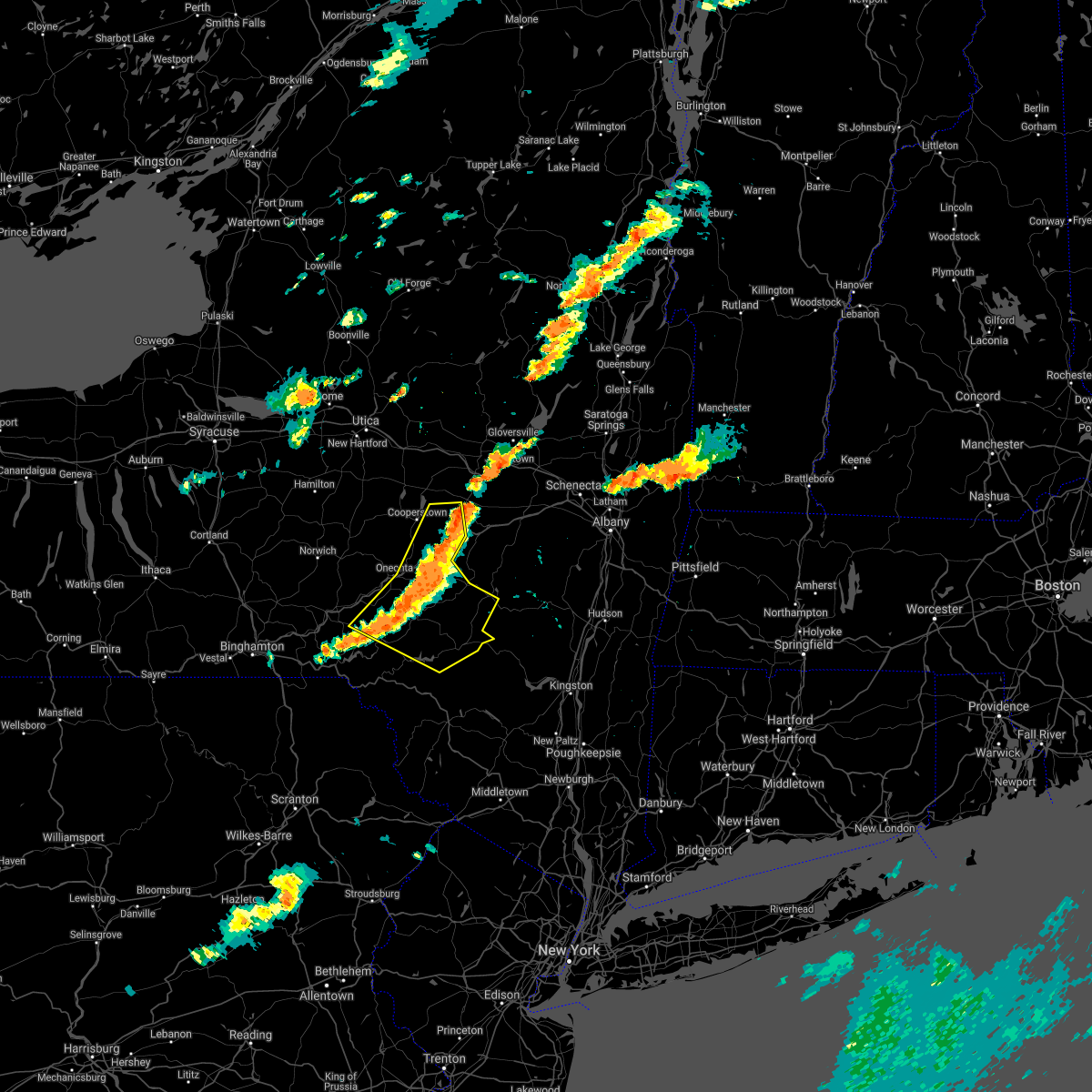
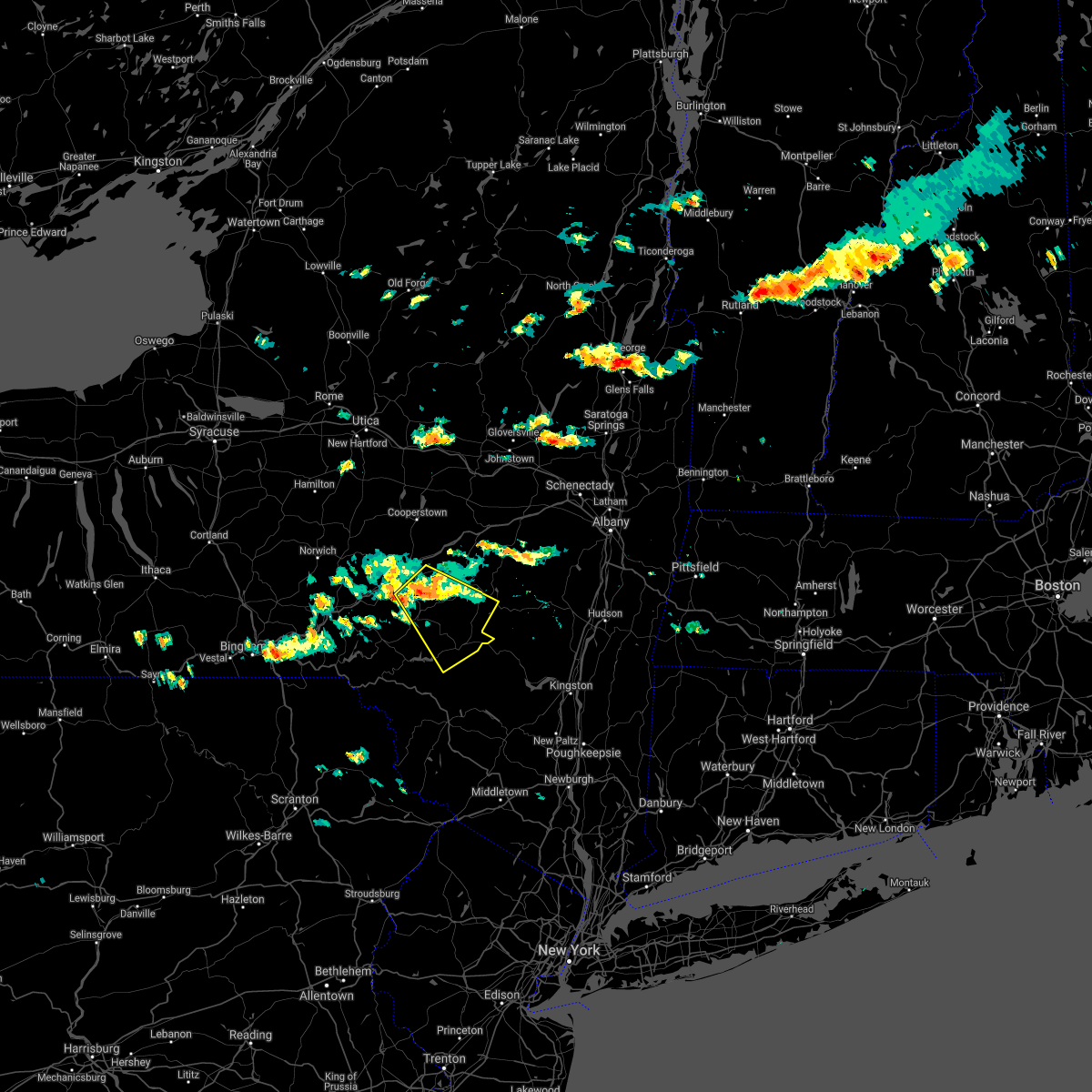
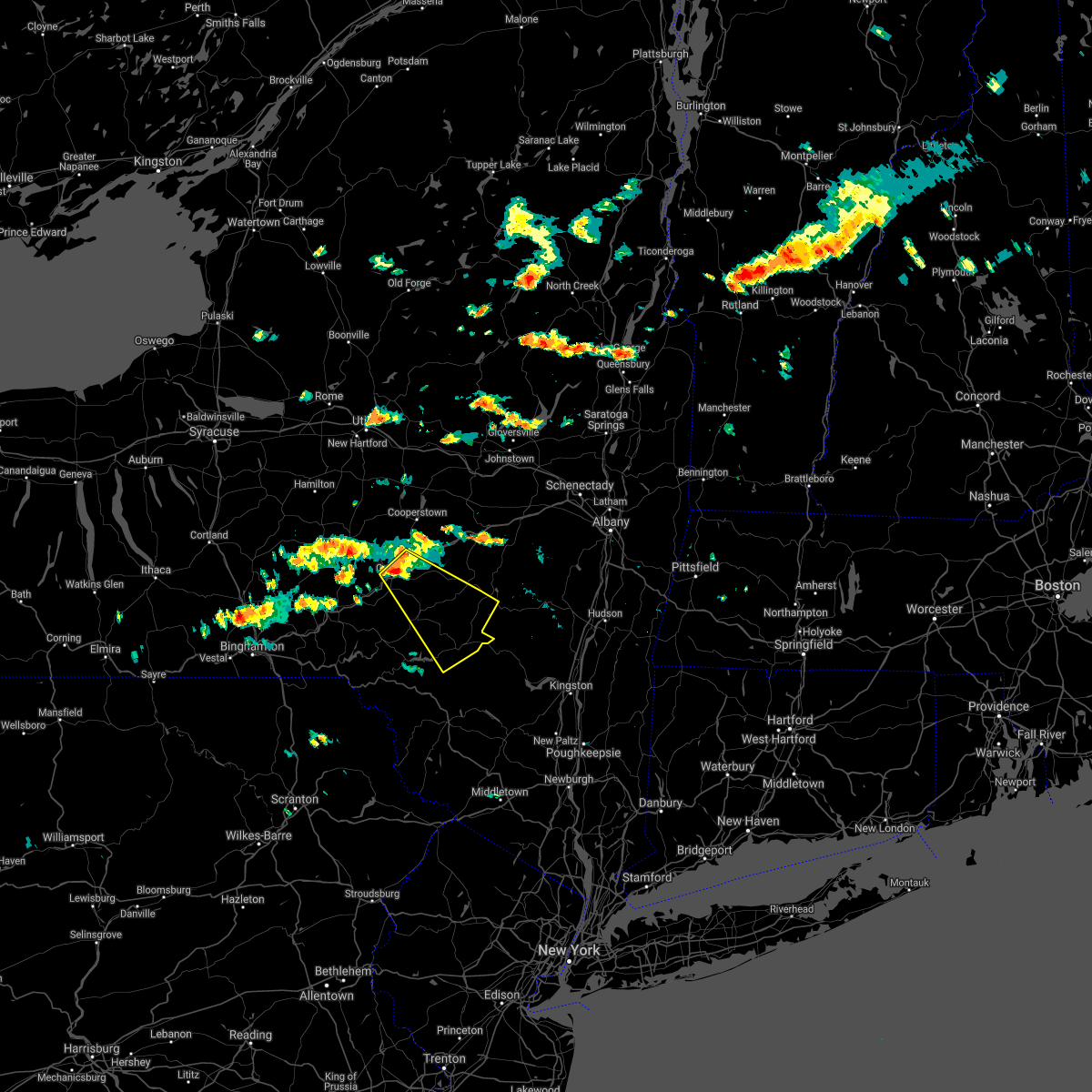
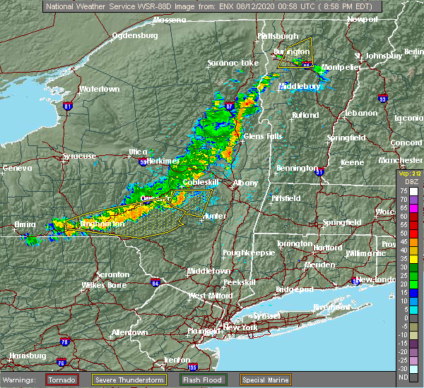
Hail Map for Stamford, NY
The Stamford, NY area has had 0 reports of on-the-ground hail by trained spotters, and has been under severe weather warnings 13 times during the past 12 months. Doppler radar has detected hail at or near Stamford, NY on 15 occasions, including 2 occasions during the past year.
| Name: | Stamford, NY |
| Where Located: | 44.4 miles SW of Schenectady, NY |
| Map: | Google Map for Stamford, NY |
| Population: | 1119 |
| Housing Units: | 660 |
| More Info: | Search Google for Stamford, NY |
0
The Top Recent Hail Date for Stamford, NY is Friday, August 4, 2023 (12th out of 15)

Hail and Wind Damage Spotted near Stamford, NY
| Date / Time | Report Details |
|---|---|
| 8/4/2023 6:49 PM EDT |
 At 649 pm edt, a severe thunderstorm was located over east meredith, or 8 miles northeast of delhi, moving southeast at 20 mph (radar indicated). Hazards include golf ball size hail and 70 mph wind gusts. People and animals outdoors will be injured. expect hail damage to roofs, siding, windows, and vehicles. expect considerable tree damage. wind damage is also likely to mobile homes, roofs, and outbuildings. locations impacted include, kortright, stamford, hobart, bovina center, east meredith, east delhi, new kingston and butts corner. thunderstorm damage threat, considerable hail threat, radar indicated max hail size, 1. 75 in wind threat, radar indicated max wind gust, 70 mph. At 649 pm edt, a severe thunderstorm was located over east meredith, or 8 miles northeast of delhi, moving southeast at 20 mph (radar indicated). Hazards include golf ball size hail and 70 mph wind gusts. People and animals outdoors will be injured. expect hail damage to roofs, siding, windows, and vehicles. expect considerable tree damage. wind damage is also likely to mobile homes, roofs, and outbuildings. locations impacted include, kortright, stamford, hobart, bovina center, east meredith, east delhi, new kingston and butts corner. thunderstorm damage threat, considerable hail threat, radar indicated max hail size, 1. 75 in wind threat, radar indicated max wind gust, 70 mph.
|
| 8/4/2023 6:40 PM EDT |
 At 640 pm edt, a severe thunderstorm was located over east meredith, or 9 miles north of delhi, moving southeast at 20 mph (radar indicated). Hazards include 60 mph wind gusts and quarter size hail. Hail damage to vehicles is expected. expect wind damage to roofs, siding, and trees. locations impacted include, davenport, kortright, meredith, stamford, hobart, meridale, east meredith, bovina center, butts corner and fergusonville. hail threat, radar indicated max hail size, 1. 00 in wind threat, radar indicated max wind gust, 60 mph. At 640 pm edt, a severe thunderstorm was located over east meredith, or 9 miles north of delhi, moving southeast at 20 mph (radar indicated). Hazards include 60 mph wind gusts and quarter size hail. Hail damage to vehicles is expected. expect wind damage to roofs, siding, and trees. locations impacted include, davenport, kortright, meredith, stamford, hobart, meridale, east meredith, bovina center, butts corner and fergusonville. hail threat, radar indicated max hail size, 1. 00 in wind threat, radar indicated max wind gust, 60 mph.
|
| 8/4/2023 6:23 PM EDT |
 At 623 pm edt, a severe thunderstorm was located over emmons, or near oneonta, moving southeast at 20 mph (radar indicated). Hazards include 60 mph wind gusts and quarter size hail. Hail damage to vehicles is expected. Expect wind damage to roofs, siding, and trees. At 623 pm edt, a severe thunderstorm was located over emmons, or near oneonta, moving southeast at 20 mph (radar indicated). Hazards include 60 mph wind gusts and quarter size hail. Hail damage to vehicles is expected. Expect wind damage to roofs, siding, and trees.
|
| 8/4/2023 3:57 PM EDT |
 At 357 pm edt, a severe thunderstorm was located over summit, or 10 miles southwest of cobleskill, moving southeast at 35 mph (radar indicated). Hazards include 60 mph wind gusts and quarter size hail. Hail damage to vehicles is expected. Expect wind damage to roofs, siding, and trees. At 357 pm edt, a severe thunderstorm was located over summit, or 10 miles southwest of cobleskill, moving southeast at 35 mph (radar indicated). Hazards include 60 mph wind gusts and quarter size hail. Hail damage to vehicles is expected. Expect wind damage to roofs, siding, and trees.
|
| 7/13/2023 7:11 PM EDT |
 At 711 pm edt, a severe thunderstorm was located over bovina center, or 8 miles east of delhi, moving east at 25 mph (radar indicated). Hazards include 60 mph wind gusts and quarter size hail. Hail damage to vehicles is expected. expect wind damage to roofs, siding, and trees. locations impacted include, andes, stamford, margaretville, hobart, arkville, bovina center, wolf hollow, halcottsville and new kingston. hail threat, radar indicated max hail size, 1. 00 in wind threat, radar indicated max wind gust, 60 mph. At 711 pm edt, a severe thunderstorm was located over bovina center, or 8 miles east of delhi, moving east at 25 mph (radar indicated). Hazards include 60 mph wind gusts and quarter size hail. Hail damage to vehicles is expected. expect wind damage to roofs, siding, and trees. locations impacted include, andes, stamford, margaretville, hobart, arkville, bovina center, wolf hollow, halcottsville and new kingston. hail threat, radar indicated max hail size, 1. 00 in wind threat, radar indicated max wind gust, 60 mph.
|
| 7/13/2023 6:47 PM EDT |
 At 647 pm edt, a severe thunderstorm was located over delhi, moving east at 25 mph (radar indicated). Hazards include 60 mph wind gusts and quarter size hail. Hail damage to vehicles is expected. expect wind damage to roofs, siding, and trees. locations impacted include, delhi, kortright, meredith, hamden, andes, stamford, margaretville, hobart, arkville and meridale. hail threat, radar indicated max hail size, 1. 00 in wind threat, radar indicated max wind gust, 60 mph. At 647 pm edt, a severe thunderstorm was located over delhi, moving east at 25 mph (radar indicated). Hazards include 60 mph wind gusts and quarter size hail. Hail damage to vehicles is expected. expect wind damage to roofs, siding, and trees. locations impacted include, delhi, kortright, meredith, hamden, andes, stamford, margaretville, hobart, arkville and meridale. hail threat, radar indicated max hail size, 1. 00 in wind threat, radar indicated max wind gust, 60 mph.
|
| 7/13/2023 6:31 PM EDT |
 At 631 pm edt, a severe thunderstorm was located near colchester, or near walton, moving east at 25 mph (radar indicated). Hazards include 60 mph wind gusts and half dollar size hail. Hail damage to vehicles is expected. Expect wind damage to roofs, siding, and trees. At 631 pm edt, a severe thunderstorm was located near colchester, or near walton, moving east at 25 mph (radar indicated). Hazards include 60 mph wind gusts and half dollar size hail. Hail damage to vehicles is expected. Expect wind damage to roofs, siding, and trees.
|
| 7/13/2023 6:21 PM EDT |
 At 621 pm edt, a severe thunderstorm was located near jefferson, or 14 miles southwest of cobleskill, moving northeast at 40 mph (radar indicated). Hazards include 60 mph wind gusts and quarter size hail. Hail damage to vehicles is expected. expect wind damage to roofs, siding, and trees. locations impacted include, stamford. hail threat, radar indicated max hail size, 1. 00 in wind threat, radar indicated max wind gust, 60 mph. At 621 pm edt, a severe thunderstorm was located near jefferson, or 14 miles southwest of cobleskill, moving northeast at 40 mph (radar indicated). Hazards include 60 mph wind gusts and quarter size hail. Hail damage to vehicles is expected. expect wind damage to roofs, siding, and trees. locations impacted include, stamford. hail threat, radar indicated max hail size, 1. 00 in wind threat, radar indicated max wind gust, 60 mph.
|
| 7/13/2023 6:14 PM EDT |
 At 613 pm edt, severe thunderstorms were located along a line extending from near hagaman to near jefferson, moving east at 35 mph (radar indicated). Hazards include 60 mph wind gusts and penny size hail. expect damage to roofs, siding, and trees At 613 pm edt, severe thunderstorms were located along a line extending from near hagaman to near jefferson, moving east at 35 mph (radar indicated). Hazards include 60 mph wind gusts and penny size hail. expect damage to roofs, siding, and trees
|
| 7/13/2023 6:09 PM EDT |
 At 609 pm edt, a severe thunderstorm was located over davenport, or 13 miles east of oneonta, moving northeast at 35 mph (radar indicated). Hazards include 60 mph wind gusts and quarter size hail. Hail damage to vehicles is expected. expect wind damage to roofs, siding, and trees. locations impacted include, davenport, worcester, maryland, kortright, stamford, colliersville, east meredith, schenevus, cooperstown junction and butts corner. hail threat, radar indicated max hail size, 1. 00 in wind threat, radar indicated max wind gust, 60 mph. At 609 pm edt, a severe thunderstorm was located over davenport, or 13 miles east of oneonta, moving northeast at 35 mph (radar indicated). Hazards include 60 mph wind gusts and quarter size hail. Hail damage to vehicles is expected. expect wind damage to roofs, siding, and trees. locations impacted include, davenport, worcester, maryland, kortright, stamford, colliersville, east meredith, schenevus, cooperstown junction and butts corner. hail threat, radar indicated max hail size, 1. 00 in wind threat, radar indicated max wind gust, 60 mph.
|
| 7/13/2023 5:57 PM EDT |
 At 557 pm edt, a severe thunderstorm was located over east meredith, or 7 miles east of oneonta, moving northeast at 40 mph (radar indicated). Hazards include 60 mph wind gusts and quarter size hail. Hail damage to vehicles is expected. Expect wind damage to roofs, siding, and trees. At 557 pm edt, a severe thunderstorm was located over east meredith, or 7 miles east of oneonta, moving northeast at 40 mph (radar indicated). Hazards include 60 mph wind gusts and quarter size hail. Hail damage to vehicles is expected. Expect wind damage to roofs, siding, and trees.
|
| 7/13/2023 5:52 PM EDT |
 At 552 pm edt, severe thunderstorms were located along a line extending from near richmondville to near meridale, moving east at 35 mph (radar indicated). Hazards include 60 mph wind gusts and penny size hail. expect damage to roofs, siding, and trees At 552 pm edt, severe thunderstorms were located along a line extending from near richmondville to near meridale, moving east at 35 mph (radar indicated). Hazards include 60 mph wind gusts and penny size hail. expect damage to roofs, siding, and trees
|
| 7/7/2023 5:20 PM EDT |
 At 519 pm edt, a severe thunderstorm was located near stamford, or 17 miles south of cobleskill, moving east at 25 mph (radar indicated). Hazards include 60 mph wind gusts and quarter size hail. Hail damage to vehicles is expected. expect wind damage to roofs, siding, and trees. this severe thunderstorm will be near, gilboa and north blenheim around 535 pm edt. livingstonville around 555 pm edt. preston-potter hollow and preston hollow around 600 pm edt. other locations impacted by this severe thunderstorm include west settlement, manorkill, broome center, rensselaerville, five corners, four corners, north settlement, west conesville, red falls and oak hill. please report hail size, damaging winds and reports of trees down to the national weather service by email at alb. stormreport@noaa. gov, on facebook at www. facebook. com/nwsalbany or twitter @nwsalbany hail threat, radar indicated max hail size, 1. 00 in wind threat, radar indicated max wind gust, 60 mph. At 519 pm edt, a severe thunderstorm was located near stamford, or 17 miles south of cobleskill, moving east at 25 mph (radar indicated). Hazards include 60 mph wind gusts and quarter size hail. Hail damage to vehicles is expected. expect wind damage to roofs, siding, and trees. this severe thunderstorm will be near, gilboa and north blenheim around 535 pm edt. livingstonville around 555 pm edt. preston-potter hollow and preston hollow around 600 pm edt. other locations impacted by this severe thunderstorm include west settlement, manorkill, broome center, rensselaerville, five corners, four corners, north settlement, west conesville, red falls and oak hill. please report hail size, damaging winds and reports of trees down to the national weather service by email at alb. stormreport@noaa. gov, on facebook at www. facebook. com/nwsalbany or twitter @nwsalbany hail threat, radar indicated max hail size, 1. 00 in wind threat, radar indicated max wind gust, 60 mph.
|
| 9/19/2022 4:13 PM EDT |
 At 412 pm edt, severe thunderstorms were located along a line extending from 6 miles northwest of delanson to near schoharie to near livingstonville, moving east at 65 mph (radar indicated). Hazards include 60 mph wind gusts. Expect damage to roofs, siding, and trees. locations impacted include, cobleskill, middleburgh, gilboa, schoharie, richmondville, livingstonville, north blenheim, breakabeen, central bridge, preston-potter hollow, conesville, west berne, huntersland, warnerville, broome center, becker corners, west fulton, shutts corners, barnerville and eminence. hail threat, radar indicated max hail size, <. 75 in wind threat, radar indicated max wind gust, 60 mph. At 412 pm edt, severe thunderstorms were located along a line extending from 6 miles northwest of delanson to near schoharie to near livingstonville, moving east at 65 mph (radar indicated). Hazards include 60 mph wind gusts. Expect damage to roofs, siding, and trees. locations impacted include, cobleskill, middleburgh, gilboa, schoharie, richmondville, livingstonville, north blenheim, breakabeen, central bridge, preston-potter hollow, conesville, west berne, huntersland, warnerville, broome center, becker corners, west fulton, shutts corners, barnerville and eminence. hail threat, radar indicated max hail size, <. 75 in wind threat, radar indicated max wind gust, 60 mph.
|
| 9/19/2022 3:59 PM EDT |
 At 358 pm edt, severe thunderstorms were located along a line extending from near sharon springs to near summit to stamford, moving east at 50 mph (radar indicated). Hazards include 60 mph wind gusts. expect damage to roofs, siding, and trees At 358 pm edt, severe thunderstorms were located along a line extending from near sharon springs to near summit to stamford, moving east at 50 mph (radar indicated). Hazards include 60 mph wind gusts. expect damage to roofs, siding, and trees
|
| 8/4/2022 4:16 PM EDT | Trees and wires down in the town of jefferson including west kill road. time estimate in schoharie county NY, 4.8 miles S of Stamford, NY |
| 7/24/2022 6:18 PM EDT |
 At 618 pm edt, severe thunderstorms were located along a line extending from near north blenheim to gilboa to near bovina center, moving east at 55 mph (radar indicated). Hazards include 60 mph wind gusts. Expect damage to roofs, siding, and trees. locations impacted include, delhi, davenport, kortright, meredith, stamford, hobart, bovina center, meridale, east meredith and butts corner. hail threat, radar indicated max hail size, <. 75 in wind threat, radar indicated max wind gust, 60 mph. At 618 pm edt, severe thunderstorms were located along a line extending from near north blenheim to gilboa to near bovina center, moving east at 55 mph (radar indicated). Hazards include 60 mph wind gusts. Expect damage to roofs, siding, and trees. locations impacted include, delhi, davenport, kortright, meredith, stamford, hobart, bovina center, meridale, east meredith and butts corner. hail threat, radar indicated max hail size, <. 75 in wind threat, radar indicated max wind gust, 60 mph.
|
| 7/24/2022 6:10 PM EDT | Trees and wires dow in delaware county NY, 0.5 miles E of Stamford, NY |
| 7/24/2022 6:00 PM EDT |
 At 600 pm edt, a severe thunderstorm was located near jefferson, or 17 miles northeast of delhi, moving east at 40 mph (radar indicated). Hazards include 60 mph wind gusts. expect damage to roofs, siding, and trees At 600 pm edt, a severe thunderstorm was located near jefferson, or 17 miles northeast of delhi, moving east at 40 mph (radar indicated). Hazards include 60 mph wind gusts. expect damage to roofs, siding, and trees
|
| 7/24/2022 5:59 PM EDT | Tree and wires down hwy 23. time estimated from rada in delaware county NY, 6.6 miles SE of Stamford, NY |
| 7/24/2022 5:58 PM EDT |
 At 557 pm edt, severe thunderstorms were located along a line extending from near davenport to near east meredith to near colchester, moving east at 55 mph (radar indicated). Hazards include 60 mph wind gusts. expect damage to roofs, siding, and trees At 557 pm edt, severe thunderstorms were located along a line extending from near davenport to near east meredith to near colchester, moving east at 55 mph (radar indicated). Hazards include 60 mph wind gusts. expect damage to roofs, siding, and trees
|
| 7/24/2022 5:45 PM EDT |
 At 545 pm edt, severe thunderstorms were located along a line extending from colliersville to near meridale to near sidney center, moving east at 55 mph (radar indicated). Hazards include 60 mph wind gusts. expect damage to roofs, siding, and trees At 545 pm edt, severe thunderstorms were located along a line extending from colliersville to near meridale to near sidney center, moving east at 55 mph (radar indicated). Hazards include 60 mph wind gusts. expect damage to roofs, siding, and trees
|
| 7/12/2022 3:15 PM EDT |
 At 315 pm edt, a severe thunderstorm was located near colchester, or near walton, moving east at 45 mph (radar indicated). Hazards include 60 mph wind gusts and penny size hail. expect damage to roofs, siding, and trees At 315 pm edt, a severe thunderstorm was located near colchester, or near walton, moving east at 45 mph (radar indicated). Hazards include 60 mph wind gusts and penny size hail. expect damage to roofs, siding, and trees
|
| 7/12/2022 2:46 PM EDT |
 At 246 pm edt, a severe thunderstorm was located over jefferson, or 16 miles southwest of cobleskill, moving east at 45 mph (radar indicated). Hazards include 60 mph wind gusts and quarter size hail. Hail damage to vehicles is expected. expect wind damage to roofs, siding, and trees. locations impacted include, kortright, stamford, hobart and butts corner. hail threat, radar indicated max hail size, 1. 00 in wind threat, radar indicated max wind gust, 60 mph. At 246 pm edt, a severe thunderstorm was located over jefferson, or 16 miles southwest of cobleskill, moving east at 45 mph (radar indicated). Hazards include 60 mph wind gusts and quarter size hail. Hail damage to vehicles is expected. expect wind damage to roofs, siding, and trees. locations impacted include, kortright, stamford, hobart and butts corner. hail threat, radar indicated max hail size, 1. 00 in wind threat, radar indicated max wind gust, 60 mph.
|
| 7/12/2022 2:30 PM EDT |
 At 230 pm edt, a severe thunderstorm was located over davenport, or 9 miles east of oneonta, moving east at 45 mph (radar indicated). Hazards include golf ball size hail and 70 mph wind gusts. People and animals outdoors will be injured. expect hail damage to roofs, siding, windows, and vehicles. expect considerable tree damage. Wind damage is also likely to mobile homes, roofs, and outbuildings. At 230 pm edt, a severe thunderstorm was located over davenport, or 9 miles east of oneonta, moving east at 45 mph (radar indicated). Hazards include golf ball size hail and 70 mph wind gusts. People and animals outdoors will be injured. expect hail damage to roofs, siding, windows, and vehicles. expect considerable tree damage. Wind damage is also likely to mobile homes, roofs, and outbuildings.
|
| 7/1/2022 9:51 PM EDT |
 The severe thunderstorm warning for southern otsego, delaware, southeastern chenango and northern sullivan counties will expire at 1000 pm edt, the storms which prompted the warning have weakened below severe limits, and no longer pose an immediate threat to life or property. therefore, the warning will be allowed to expire. The severe thunderstorm warning for southern otsego, delaware, southeastern chenango and northern sullivan counties will expire at 1000 pm edt, the storms which prompted the warning have weakened below severe limits, and no longer pose an immediate threat to life or property. therefore, the warning will be allowed to expire.
|
| 7/1/2022 9:35 PM EDT |
 At 934 pm edt, severe thunderstorms were located along a line extending from near stamford to near afton, moving east at 30 mph (radar indicated). Hazards include 60 mph wind gusts and quarter size hail. Hail damage to vehicles is expected. expect wind damage to roofs, siding, and trees. locations impacted include, rockland, oneonta, sidney, walton, delhi, davenport, roxbury, colchester, kortright and meredith. hail threat, radar indicated max hail size, 1. 00 in wind threat, radar indicated max wind gust, 60 mph. At 934 pm edt, severe thunderstorms were located along a line extending from near stamford to near afton, moving east at 30 mph (radar indicated). Hazards include 60 mph wind gusts and quarter size hail. Hail damage to vehicles is expected. expect wind damage to roofs, siding, and trees. locations impacted include, rockland, oneonta, sidney, walton, delhi, davenport, roxbury, colchester, kortright and meredith. hail threat, radar indicated max hail size, 1. 00 in wind threat, radar indicated max wind gust, 60 mph.
|
| 7/1/2022 9:20 PM EDT |
 At 919 pm edt, severe thunderstorms were located along a line extending from stamford to near sanford, moving southeast at 30 mph (radar indicated). Hazards include 60 mph wind gusts and quarter size hail. Hail damage to vehicles is expected. Expect wind damage to roofs, siding, and trees. At 919 pm edt, severe thunderstorms were located along a line extending from stamford to near sanford, moving southeast at 30 mph (radar indicated). Hazards include 60 mph wind gusts and quarter size hail. Hail damage to vehicles is expected. Expect wind damage to roofs, siding, and trees.
|
| 7/1/2022 9:14 PM EDT |
 At 913 pm edt, severe thunderstorms were located along a line extending from near davenport to near sidney center, moving southeast at 25 mph (dispatch centers and public have reported many trees down across chenango county). Hazards include 60 mph wind gusts and quarter size hail. Hail damage to vehicles is expected. expect wind damage to roofs, siding, and trees. locations impacted include, oneonta, sidney, walton, delhi, davenport, sanford, colchester, maryland, kortright and deposit. hail threat, radar indicated max hail size, 1. 00 in wind threat, radar indicated max wind gust, 60 mph. At 913 pm edt, severe thunderstorms were located along a line extending from near davenport to near sidney center, moving southeast at 25 mph (dispatch centers and public have reported many trees down across chenango county). Hazards include 60 mph wind gusts and quarter size hail. Hail damage to vehicles is expected. expect wind damage to roofs, siding, and trees. locations impacted include, oneonta, sidney, walton, delhi, davenport, sanford, colchester, maryland, kortright and deposit. hail threat, radar indicated max hail size, 1. 00 in wind threat, radar indicated max wind gust, 60 mph.
|
| 7/1/2022 8:50 PM EDT |
 At 849 pm edt, severe thunderstorms were located along a line extending from colliersville to near bainbridge, moving southeast at 25 mph (radar indicated). Hazards include 60 mph wind gusts and quarter size hail. Hail damage to vehicles is expected. Expect wind damage to roofs, siding, and trees. At 849 pm edt, severe thunderstorms were located along a line extending from colliersville to near bainbridge, moving southeast at 25 mph (radar indicated). Hazards include 60 mph wind gusts and quarter size hail. Hail damage to vehicles is expected. Expect wind damage to roofs, siding, and trees.
|
| 5/16/2022 3:36 PM EDT |
 The severe thunderstorm warning for southeastern otsego, eastern delaware, northern sullivan and eastern wayne counties will expire at 345 pm edt, the storms which prompted the warning have moved out of the area. therefore, the warning will be allowed to expire. a severe thunderstorm watch remains in effect until 400 pm edt for central new york, and northeastern pennsylvania. to report severe weather, contact your nearest law enforcement agency. they will relay your report to the national weather service binghamton. The severe thunderstorm warning for southeastern otsego, eastern delaware, northern sullivan and eastern wayne counties will expire at 345 pm edt, the storms which prompted the warning have moved out of the area. therefore, the warning will be allowed to expire. a severe thunderstorm watch remains in effect until 400 pm edt for central new york, and northeastern pennsylvania. to report severe weather, contact your nearest law enforcement agency. they will relay your report to the national weather service binghamton.
|
| 5/16/2022 3:15 PM EDT |
 At 315 pm edt, severe thunderstorms were located along a line extending from near meridale to near hobart to margaretville to livingston manor, moving northeast at 35 mph (radar indicated). Hazards include 60 mph wind gusts. Expect damage to roofs, siding, and trees. locations impacted include, rockland, oneonta, liberty, bethel, damascus, neversink, south fallsburg, delhi, callicoon and davenport. hail threat, radar indicated max hail size, <. 75 in wind threat, radar indicated max wind gust, 60 mph. At 315 pm edt, severe thunderstorms were located along a line extending from near meridale to near hobart to margaretville to livingston manor, moving northeast at 35 mph (radar indicated). Hazards include 60 mph wind gusts. Expect damage to roofs, siding, and trees. locations impacted include, rockland, oneonta, liberty, bethel, damascus, neversink, south fallsburg, delhi, callicoon and davenport. hail threat, radar indicated max hail size, <. 75 in wind threat, radar indicated max wind gust, 60 mph.
|
| 5/16/2022 3:13 PM EDT |
 At 313 pm edt, severe thunderstorms were located along a line extending from near east meredith to near arkville to swan lake, moving northeast at 50 mph (radar indicated). Hazards include 60 mph wind gusts and quarter size hail. Hail damage to vehicles is expected. Expect wind damage to roofs, siding, and trees. At 313 pm edt, severe thunderstorms were located along a line extending from near east meredith to near arkville to swan lake, moving northeast at 50 mph (radar indicated). Hazards include 60 mph wind gusts and quarter size hail. Hail damage to vehicles is expected. Expect wind damage to roofs, siding, and trees.
|
| 5/16/2022 3:10 PM EDT |
 At 309 pm edt, severe thunderstorms were located along a line extending from near exeter center to near milford to near east meredith, moving east at 40 mph (radar indicated). Hazards include 60 mph wind gusts and quarter size hail. Hail damage to vehicles is expected. Expect wind damage to roofs, siding, and trees. At 309 pm edt, severe thunderstorms were located along a line extending from near exeter center to near milford to near east meredith, moving east at 40 mph (radar indicated). Hazards include 60 mph wind gusts and quarter size hail. Hail damage to vehicles is expected. Expect wind damage to roofs, siding, and trees.
|
| 5/16/2022 2:53 PM EDT |
 At 253 pm edt, severe thunderstorms were located along a line extending from near franklin to near delhi to 6 miles northeast of roscoe to near hortonville, moving northeast at 45 mph (radar indicated). Hazards include 60 mph wind gusts. Expect damage to roofs, siding, and trees. locations impacted include, rockland, oneonta, liberty, bethel, damascus, neversink, south fallsburg, walton, delhi and callicoon. hail threat, radar indicated max hail size, <. 75 in wind threat, radar indicated max wind gust, 60 mph. At 253 pm edt, severe thunderstorms were located along a line extending from near franklin to near delhi to 6 miles northeast of roscoe to near hortonville, moving northeast at 45 mph (radar indicated). Hazards include 60 mph wind gusts. Expect damage to roofs, siding, and trees. locations impacted include, rockland, oneonta, liberty, bethel, damascus, neversink, south fallsburg, walton, delhi and callicoon. hail threat, radar indicated max hail size, <. 75 in wind threat, radar indicated max wind gust, 60 mph.
|
| 5/16/2022 2:49 PM EDT |
 At 249 pm edt, a severe thunderstorm was located over stamford, or 16 miles east of delhi, moving northeast at 40 mph (radar indicated). Hazards include 60 mph wind gusts. Expect damage to roofs, siding, and trees. locations impacted include, stamford and hobart. hail threat, radar indicated max hail size, <. 75 in wind threat, radar indicated max wind gust, 60 mph. At 249 pm edt, a severe thunderstorm was located over stamford, or 16 miles east of delhi, moving northeast at 40 mph (radar indicated). Hazards include 60 mph wind gusts. Expect damage to roofs, siding, and trees. locations impacted include, stamford and hobart. hail threat, radar indicated max hail size, <. 75 in wind threat, radar indicated max wind gust, 60 mph.
|
| 5/16/2022 2:39 PM EDT |
 At 238 pm edt, severe thunderstorms were located along a line extending from near otego to 6 miles southwest of sidney center to near walton to near east branch to near rutledgedale, moving northeast at 45 mph (radar indicated). Hazards include 60 mph wind gusts. Expect damage to roofs, siding, and trees. locations impacted include, rockland, oneonta, liberty, bethel, sidney, damascus, neversink, south fallsburg, walton and delhi. hail threat, radar indicated max hail size, <. 75 in wind threat, radar indicated max wind gust, 60 mph. At 238 pm edt, severe thunderstorms were located along a line extending from near otego to 6 miles southwest of sidney center to near walton to near east branch to near rutledgedale, moving northeast at 45 mph (radar indicated). Hazards include 60 mph wind gusts. Expect damage to roofs, siding, and trees. locations impacted include, rockland, oneonta, liberty, bethel, sidney, damascus, neversink, south fallsburg, walton and delhi. hail threat, radar indicated max hail size, <. 75 in wind threat, radar indicated max wind gust, 60 mph.
|
| 5/16/2022 2:29 PM EDT |
 At 228 pm edt, a severe thunderstorm was located over bovina center, or 7 miles east of delhi, moving northeast at 40 mph (radar indicated). Hazards include 60 mph wind gusts. Expect damage to roofs, siding, and trees. locations impacted include, roxbury, kortright, andes, stamford, hobart, bovina center, east delhi and new kingston. hail threat, radar indicated max hail size, <. 75 in wind threat, radar indicated max wind gust, 60 mph. At 228 pm edt, a severe thunderstorm was located over bovina center, or 7 miles east of delhi, moving northeast at 40 mph (radar indicated). Hazards include 60 mph wind gusts. Expect damage to roofs, siding, and trees. locations impacted include, roxbury, kortright, andes, stamford, hobart, bovina center, east delhi and new kingston. hail threat, radar indicated max hail size, <. 75 in wind threat, radar indicated max wind gust, 60 mph.
|
| 5/16/2022 2:24 PM EDT |
 At 224 pm edt, severe thunderstorms were located along a line extending from near sidney to near deposit to near stalker to prompton, moving northeast at 35 mph (radar indicated). Hazards include 60 mph wind gusts. expect damage to roofs, siding, and trees At 224 pm edt, severe thunderstorms were located along a line extending from near sidney to near deposit to near stalker to prompton, moving northeast at 35 mph (radar indicated). Hazards include 60 mph wind gusts. expect damage to roofs, siding, and trees
|
| 5/16/2022 2:09 PM EDT |
 At 209 pm edt, a severe thunderstorm was located near downsville, or 8 miles east of walton, moving northeast at 20 mph (radar indicated). Hazards include 60 mph wind gusts and penny size hail. expect damage to roofs, siding, and trees At 209 pm edt, a severe thunderstorm was located near downsville, or 8 miles east of walton, moving northeast at 20 mph (radar indicated). Hazards include 60 mph wind gusts and penny size hail. expect damage to roofs, siding, and trees
|
| 3/31/2022 6:13 PM EDT |
 At 612 pm edt, severe thunderstorms were located along a line extending from near jefferson to near meredith to near andes to hancock, moving northeast at 40 mph (radar indicated). Hazards include 60 mph wind gusts and penny size hail. Expect damage to roofs, siding, and trees. Locations impacted include, rockland, walton, delhi, davenport, roxbury, colchester, kortright, meredith, hamden and andes. At 612 pm edt, severe thunderstorms were located along a line extending from near jefferson to near meredith to near andes to hancock, moving northeast at 40 mph (radar indicated). Hazards include 60 mph wind gusts and penny size hail. Expect damage to roofs, siding, and trees. Locations impacted include, rockland, walton, delhi, davenport, roxbury, colchester, kortright, meredith, hamden and andes.
|
| 3/31/2022 5:39 PM EDT |
 At 538 pm edt, severe thunderstorms were located along a line extending from cooperstown junction to franklin to walton to hancock, moving northeast at 65 mph (radar indicated). Hazards include 60 mph wind gusts and penny size hail. expect damage to roofs, siding, and trees At 538 pm edt, severe thunderstorms were located along a line extending from cooperstown junction to franklin to walton to hancock, moving northeast at 65 mph (radar indicated). Hazards include 60 mph wind gusts and penny size hail. expect damage to roofs, siding, and trees
|
| 3/7/2022 8:01 PM EST | Law enforcement reports tree down near the intersection of blenheim hill rd and north rd in schoharie county NY, 7 miles SW of Stamford, NY |
| 3/7/2022 7:55 PM EST | Trees and wires dow in delaware county NY, 0.1 miles NW of Stamford, NY |
| 3/7/2022 7:51 PM EST | Law enforcement reports large tree down near the intersection of route 10 and route 43 in schoharie county NY, 4.8 miles S of Stamford, NY |
| 3/7/2022 7:39 PM EST |
 At 739 pm est, severe thunderstorms were located along a line extending from sharon springs to 7 miles northwest of richmondville to near emmons, moving east at 55 mph (radar indicated). Hazards include 60 mph wind gusts. Expect damage to roofs, siding, and trees. these severe storms will be near, summit, richmondville, sharon springs and ames around 745 pm est. cobleskill around 750 pm est. central bridge around 755 pm est. jefferson, middleburgh and schoharie around 800 pm est. duanesburg and delanson around 805 pm est. gilboa and north blenheim around 810 pm est. preston-potter hollow around 820 pm est. other locations impacted by these severe thunderstorms include zeh corners, beekman corners, west richmondville, baird corners, seward, rockwell corners, huntersland, warnerville, flat creek and carlisle. hail threat, radar indicated max hail size, <. 75 in wind threat, radar indicated max wind gust, 60 mph. At 739 pm est, severe thunderstorms were located along a line extending from sharon springs to 7 miles northwest of richmondville to near emmons, moving east at 55 mph (radar indicated). Hazards include 60 mph wind gusts. Expect damage to roofs, siding, and trees. these severe storms will be near, summit, richmondville, sharon springs and ames around 745 pm est. cobleskill around 750 pm est. central bridge around 755 pm est. jefferson, middleburgh and schoharie around 800 pm est. duanesburg and delanson around 805 pm est. gilboa and north blenheim around 810 pm est. preston-potter hollow around 820 pm est. other locations impacted by these severe thunderstorms include zeh corners, beekman corners, west richmondville, baird corners, seward, rockwell corners, huntersland, warnerville, flat creek and carlisle. hail threat, radar indicated max hail size, <. 75 in wind threat, radar indicated max wind gust, 60 mph.
|
| 3/7/2022 7:31 PM EST |
 At 731 pm est, severe thunderstorms were located along a line extending from franklin to conyngham, moving east at 60 mph (radar indicated). Hazards include 60 mph wind gusts. expect damage to roofs, siding, and trees At 731 pm est, severe thunderstorms were located along a line extending from franklin to conyngham, moving east at 60 mph (radar indicated). Hazards include 60 mph wind gusts. expect damage to roofs, siding, and trees
|
| 3/7/2022 7:22 PM EST |
 At 721 pm est, severe thunderstorms were located along a line extending from near caroga lake to near gilbertsville, moving east at 55 mph (radar indicated). Hazards include 60 mph wind gusts. Expect damage to roofs, siding, and trees. severe thunderstorms will be near, jefferson around 755 pm est. north blenheim around 805 pm est. gilboa around 810 pm est. other locations impacted by these severe thunderstorms include beekman corners, west richmondville, rockwell corners, huntersland, engleville, gardnersville, quaker street, broome center, west fulton and eminence. please report hail size, damaging winds and reports of trees down to the national weather service by email at alb. stormreport@noaa. gov, on facebook at www. facebook. com/nwsalbany or twitter @nwsalbany hail threat, radar indicated max hail size, <. 75 in wind threat, radar indicated max wind gust, 60 mph. At 721 pm est, severe thunderstorms were located along a line extending from near caroga lake to near gilbertsville, moving east at 55 mph (radar indicated). Hazards include 60 mph wind gusts. Expect damage to roofs, siding, and trees. severe thunderstorms will be near, jefferson around 755 pm est. north blenheim around 805 pm est. gilboa around 810 pm est. other locations impacted by these severe thunderstorms include beekman corners, west richmondville, rockwell corners, huntersland, engleville, gardnersville, quaker street, broome center, west fulton and eminence. please report hail size, damaging winds and reports of trees down to the national weather service by email at alb. stormreport@noaa. gov, on facebook at www. facebook. com/nwsalbany or twitter @nwsalbany hail threat, radar indicated max hail size, <. 75 in wind threat, radar indicated max wind gust, 60 mph.
|
| 9/15/2021 1:09 PM EDT |
 At 109 pm edt, a severe thunderstorm was located near otego, or 7 miles west of oneonta, moving east at 30 mph (radar indicated). Hazards include 60 mph wind gusts and quarter size hail. Hail damage to vehicles is expected. Expect wind damage to roofs, siding, and trees. At 109 pm edt, a severe thunderstorm was located near otego, or 7 miles west of oneonta, moving east at 30 mph (radar indicated). Hazards include 60 mph wind gusts and quarter size hail. Hail damage to vehicles is expected. Expect wind damage to roofs, siding, and trees.
|
| 8/13/2021 6:38 PM EDT |
 At 638 pm edt, a severe thunderstorm was located over davenport, or 10 miles east of oneonta, moving northeast at 25 mph (radar indicated). Hazards include 60 mph wind gusts and penny size hail. expect damage to roofs, siding, and trees At 638 pm edt, a severe thunderstorm was located over davenport, or 10 miles east of oneonta, moving northeast at 25 mph (radar indicated). Hazards include 60 mph wind gusts and penny size hail. expect damage to roofs, siding, and trees
|
| 7/20/2021 9:32 PM EDT |
 At 932 pm edt, severe thunderstorms were located along a line extending from near worcester to near sanford, moving east at 30 mph (radar indicated). Hazards include 60 mph wind gusts. Expect damage to roofs, siding, and trees. Locations impacted include, sidney, walton, delhi, davenport, sanford, colchester, kortright, meredith, bainbridge and hamden. At 932 pm edt, severe thunderstorms were located along a line extending from near worcester to near sanford, moving east at 30 mph (radar indicated). Hazards include 60 mph wind gusts. Expect damage to roofs, siding, and trees. Locations impacted include, sidney, walton, delhi, davenport, sanford, colchester, kortright, meredith, bainbridge and hamden.
|
| 7/20/2021 9:25 PM EDT |
 The severe thunderstorm warning for southwestern schenectady, schoharie and southwestern montgomery counties will expire at 930 pm edt, the storms which prompted the warning have weakened below severe limits, and no longer pose an immediate threat to life or property. therefore, the warning will be allowed to expire. a severe thunderstorm watch remains in effect until 1100 pm edt for eastern and east central new york. The severe thunderstorm warning for southwestern schenectady, schoharie and southwestern montgomery counties will expire at 930 pm edt, the storms which prompted the warning have weakened below severe limits, and no longer pose an immediate threat to life or property. therefore, the warning will be allowed to expire. a severe thunderstorm watch remains in effect until 1100 pm edt for eastern and east central new york.
|
| 7/20/2021 8:58 PM EDT |
 At 856 pm edt, severe thunderstorms were located along a line extending from near hartwick to near sanitaria springs, moving east at 30 mph (radar indicated). Hazards include 60 mph wind gusts and quarter size hail. Hail damage to vehicles is expected. Expect wind damage to roofs, siding, and trees. At 856 pm edt, severe thunderstorms were located along a line extending from near hartwick to near sanitaria springs, moving east at 30 mph (radar indicated). Hazards include 60 mph wind gusts and quarter size hail. Hail damage to vehicles is expected. Expect wind damage to roofs, siding, and trees.
|
| 7/20/2021 8:40 PM EDT |
 At 839 pm edt, severe thunderstorms were located along a line extending from sharon springs to richmondville to near schenevus, moving east at 25 mph (radar indicated). Hazards include 60 mph wind gusts. expect damage to roofs, siding, and trees At 839 pm edt, severe thunderstorms were located along a line extending from sharon springs to richmondville to near schenevus, moving east at 25 mph (radar indicated). Hazards include 60 mph wind gusts. expect damage to roofs, siding, and trees
|
| 7/20/2021 8:36 PM EDT |
 At 835 pm edt, severe thunderstorms were located along a line extending from near hartwick to near whitney point, moving east at 25 mph (radar indicated). Hazards include 60 mph wind gusts and quarter size hail. Hail damage to vehicles is expected. expect wind damage to roofs, siding, and trees. Locations impacted include, oneonta, norwich, sidney, walton, delhi, davenport, guilford, roxbury, worcester and middlefield. At 835 pm edt, severe thunderstorms were located along a line extending from near hartwick to near whitney point, moving east at 25 mph (radar indicated). Hazards include 60 mph wind gusts and quarter size hail. Hail damage to vehicles is expected. expect wind damage to roofs, siding, and trees. Locations impacted include, oneonta, norwich, sidney, walton, delhi, davenport, guilford, roxbury, worcester and middlefield.
|
| 7/20/2021 8:05 PM EDT |
 At 805 pm edt, severe thunderstorms were located along a line extending from leonardsville to near marathon, moving east at 70 mph (radar indicated). Hazards include 60 mph wind gusts and quarter size hail. Hail damage to vehicles is expected. Expect wind damage to roofs, siding, and trees. At 805 pm edt, severe thunderstorms were located along a line extending from leonardsville to near marathon, moving east at 70 mph (radar indicated). Hazards include 60 mph wind gusts and quarter size hail. Hail damage to vehicles is expected. Expect wind damage to roofs, siding, and trees.
|
| 7/13/2021 10:57 PM EDT |
 At 1056 pm edt, severe thunderstorms were located along a line extending from near georgetown to 6 miles south of sidney, moving east at 35 mph (radar indicated). Hazards include 70 mph wind gusts. Expect considerable tree damage. Damage is likely to mobile homes, roofs, and outbuildings. At 1056 pm edt, severe thunderstorms were located along a line extending from near georgetown to 6 miles south of sidney, moving east at 35 mph (radar indicated). Hazards include 70 mph wind gusts. Expect considerable tree damage. Damage is likely to mobile homes, roofs, and outbuildings.
|
| 7/7/2021 11:42 PM EDT |
 At 1142 pm edt, severe thunderstorms were located along a line extending from near jordanville to near richmondville to roxbury, moving northeast at 45 mph (radar indicated). Hazards include 60 mph wind gusts. Expect damage to roofs, siding, and trees. locations impacted include, johnstown, ilion, herkimer, little falls, cobleskill, canajoharie, fonda, jefferson, mohawk, frankfort, fort plain, dolgeville, st. Johnsville, ephratah, middleburgh, gilboa, summit, schoharie, richmondville and west winfield. At 1142 pm edt, severe thunderstorms were located along a line extending from near jordanville to near richmondville to roxbury, moving northeast at 45 mph (radar indicated). Hazards include 60 mph wind gusts. Expect damage to roofs, siding, and trees. locations impacted include, johnstown, ilion, herkimer, little falls, cobleskill, canajoharie, fonda, jefferson, mohawk, frankfort, fort plain, dolgeville, st. Johnsville, ephratah, middleburgh, gilboa, summit, schoharie, richmondville and west winfield.
|
| 7/7/2021 11:26 PM EDT |
 At 1125 pm edt, severe thuhnderstorms were located along a line extending from hartwick to arkville, moving east at 45 mph (reports of downed trees and wires with these storms). Hazards include 60 mph wind gusts and quarter size hail. Hail damage to vehicles is expected. expect wind damage to roofs, siding, and trees. Locations impacted include, oneonta, delhi, davenport, roxbury, worcester, middlefield, hartwick, maryland, cooperstown and westville. At 1125 pm edt, severe thuhnderstorms were located along a line extending from hartwick to arkville, moving east at 45 mph (reports of downed trees and wires with these storms). Hazards include 60 mph wind gusts and quarter size hail. Hail damage to vehicles is expected. expect wind damage to roofs, siding, and trees. Locations impacted include, oneonta, delhi, davenport, roxbury, worcester, middlefield, hartwick, maryland, cooperstown and westville.
|
| 7/7/2021 11:20 PM EDT |
 At 1119 pm edt, severe thunderstorms were located along a line extending from near exeter center to davenport to near andes, moving northeast at 45 mph (radar indicated). Hazards include 60 mph wind gusts and penny size hail. expect damage to roofs, siding, and trees At 1119 pm edt, severe thunderstorms were located along a line extending from near exeter center to davenport to near andes, moving northeast at 45 mph (radar indicated). Hazards include 60 mph wind gusts and penny size hail. expect damage to roofs, siding, and trees
|
| 7/7/2021 10:41 PM EDT |
 At 1041 pm edt, severe thunderstorms were located along a line extending from near plymouth to near harvard, moving east at 45 mph (these storms have produced widespread downed trees and wires with widespread power outages). Hazards include 60 mph wind gusts and quarter size hail. Hail damage to vehicles is expected. Expect wind damage to roofs, siding, and trees. At 1041 pm edt, severe thunderstorms were located along a line extending from near plymouth to near harvard, moving east at 45 mph (these storms have produced widespread downed trees and wires with widespread power outages). Hazards include 60 mph wind gusts and quarter size hail. Hail damage to vehicles is expected. Expect wind damage to roofs, siding, and trees.
|
| 7/7/2021 5:42 PM EDT |
 At 541 pm edt, a severe thunderstorm was located near davenport, or 14 miles northeast of delhi, moving east at 30 mph (radar indicated). Hazards include 60 mph wind gusts and quarter size hail. Hail damage to vehicles is expected. Expect wind damage to roofs, siding, and trees. At 541 pm edt, a severe thunderstorm was located near davenport, or 14 miles northeast of delhi, moving east at 30 mph (radar indicated). Hazards include 60 mph wind gusts and quarter size hail. Hail damage to vehicles is expected. Expect wind damage to roofs, siding, and trees.
|
| 7/7/2021 5:40 PM EDT |
 At 540 pm edt, a severe thunderstorm was located near davenport, or 14 miles northeast of delhi, moving east at 25 mph (radar indicated). Hazards include 60 mph wind gusts and nickel size hail. expect damage to roofs, siding, and trees At 540 pm edt, a severe thunderstorm was located near davenport, or 14 miles northeast of delhi, moving east at 25 mph (radar indicated). Hazards include 60 mph wind gusts and nickel size hail. expect damage to roofs, siding, and trees
|
| 7/6/2021 3:33 PM EDT |
 At 333 pm edt, severe thunderstorms were located along a line extending from jefferson to near delhi to near new milford, moving east at 60 mph (radar indicated). Hazards include 60 mph wind gusts and quarter size hail. Hail damage to vehicles is expected. expect wind damage to roofs, siding, and trees. Locations impacted include, binghamton, oneonta, kirkwood, conklin, sidney, walton, delhi, davenport, sanford and colchester. At 333 pm edt, severe thunderstorms were located along a line extending from jefferson to near delhi to near new milford, moving east at 60 mph (radar indicated). Hazards include 60 mph wind gusts and quarter size hail. Hail damage to vehicles is expected. expect wind damage to roofs, siding, and trees. Locations impacted include, binghamton, oneonta, kirkwood, conklin, sidney, walton, delhi, davenport, sanford and colchester.
|
| 7/6/2021 3:08 PM EDT |
 At 308 pm edt, severe thunderstorms were located along a line extending from laurens to bainbridge to near warren center, moving east at 60 mph (radar indicated). Hazards include 60 mph wind gusts and quarter size hail. Hail damage to vehicles is expected. Expect wind damage to roofs, siding, and trees. At 308 pm edt, severe thunderstorms were located along a line extending from laurens to bainbridge to near warren center, moving east at 60 mph (radar indicated). Hazards include 60 mph wind gusts and quarter size hail. Hail damage to vehicles is expected. Expect wind damage to roofs, siding, and trees.
|
| 7/6/2021 3:06 PM EDT |
 At 306 pm edt, severe thunderstorms were located along a line extending from near breakabeen to near worcester to near schenevus, moving southeast at 35 mph (radar indicated). Hazards include 60 mph wind gusts and penny size hail. expect damage to roofs, siding, and trees At 306 pm edt, severe thunderstorms were located along a line extending from near breakabeen to near worcester to near schenevus, moving southeast at 35 mph (radar indicated). Hazards include 60 mph wind gusts and penny size hail. expect damage to roofs, siding, and trees
|
| 7/6/2021 2:15 PM EDT |
 At 215 pm edt, severe thunderstorms were located along a line extending from near delhi to near downsville to near harvard, moving east at 40 mph (radar indicated). Hazards include 60 mph wind gusts and penny size hail. Expect damage to roofs, siding, and trees. Locations impacted include, rockland, walton, delhi, roxbury, colchester, kortright, meredith, hamden, andes and stamford. At 215 pm edt, severe thunderstorms were located along a line extending from near delhi to near downsville to near harvard, moving east at 40 mph (radar indicated). Hazards include 60 mph wind gusts and penny size hail. Expect damage to roofs, siding, and trees. Locations impacted include, rockland, walton, delhi, roxbury, colchester, kortright, meredith, hamden, andes and stamford.
|
| 7/6/2021 1:49 PM EDT |
 At 148 pm edt, severe thunderstorms were located along a line extending from near franklin to 6 miles south of sidney center to sanford, moving east at 40 mph (radar indicated). Hazards include 60 mph wind gusts and penny size hail. expect damage to roofs, siding, and trees At 148 pm edt, severe thunderstorms were located along a line extending from near franklin to 6 miles south of sidney center to sanford, moving east at 40 mph (radar indicated). Hazards include 60 mph wind gusts and penny size hail. expect damage to roofs, siding, and trees
|
| 7/2/2021 3:47 PM EDT |
 At 346 pm edt, a severe thunderstorm was located over cooperstown junction, or near oneonta, moving east at 20 mph (radar indicated). Hazards include 60 mph wind gusts and quarter size hail. Hail damage to vehicles is expected. Expect wind damage to roofs, siding, and trees. At 346 pm edt, a severe thunderstorm was located over cooperstown junction, or near oneonta, moving east at 20 mph (radar indicated). Hazards include 60 mph wind gusts and quarter size hail. Hail damage to vehicles is expected. Expect wind damage to roofs, siding, and trees.
|
| 6/21/2021 8:59 PM EDT |
 At 858 pm edt, a severe thunderstorm was located over berne, or 16 miles southwest of rotterdam, moving northeast at 35 mph (radar indicated). Hazards include 60 mph wind gusts. Expect damage to roofs, siding, and trees. Locations impacted include, jefferson, windham, middleburgh, gilboa, summit, schoharie, prattsville, livingstonville, breakabeen, central bridge, durham, ashland, conesville, north lexington, and huntersland. At 858 pm edt, a severe thunderstorm was located over berne, or 16 miles southwest of rotterdam, moving northeast at 35 mph (radar indicated). Hazards include 60 mph wind gusts. Expect damage to roofs, siding, and trees. Locations impacted include, jefferson, windham, middleburgh, gilboa, summit, schoharie, prattsville, livingstonville, breakabeen, central bridge, durham, ashland, conesville, north lexington, and huntersland.
|
| 6/21/2021 8:22 PM EDT |
 At 822 pm edt, severe thunderstorms were located along a line extending from near hobart to near hazel, moving northeast at 35 mph (radar indicated). Hazards include 60 mph wind gusts. expect damage to roofs, siding, and trees At 822 pm edt, severe thunderstorms were located along a line extending from near hobart to near hazel, moving northeast at 35 mph (radar indicated). Hazards include 60 mph wind gusts. expect damage to roofs, siding, and trees
|
| 6/21/2021 8:12 PM EDT |
 At 810 pm edt, a severe thunderstorm was located near hobart, or 8 miles northeast of delhi, moving northeast at 45 mph (radar indicated). Hazards include 60 mph wind gusts. expect damage to roofs, siding, and trees At 810 pm edt, a severe thunderstorm was located near hobart, or 8 miles northeast of delhi, moving northeast at 45 mph (radar indicated). Hazards include 60 mph wind gusts. expect damage to roofs, siding, and trees
|
| 6/21/2021 7:35 PM EDT |
 At 735 pm edt, severe thunderstorms were located along a line extending from near forest city to near equinunk, moving northeast at 50 mph (radar indicated). Hazards include 60 mph wind gusts. expect damage to roofs, siding, and trees At 735 pm edt, severe thunderstorms were located along a line extending from near forest city to near equinunk, moving northeast at 50 mph (radar indicated). Hazards include 60 mph wind gusts. expect damage to roofs, siding, and trees
|
| 5/26/2021 4:33 PM EDT |
 At 432 pm edt, a severe thunderstorm was located near davenport, or 13 miles northeast of delhi, moving east at 45 mph (radar indicated). Hazards include 60 mph wind gusts and penny size hail. Expect damage to roofs, siding, and trees. Locations impacted include, kortright, stamford and hobart. At 432 pm edt, a severe thunderstorm was located near davenport, or 13 miles northeast of delhi, moving east at 45 mph (radar indicated). Hazards include 60 mph wind gusts and penny size hail. Expect damage to roofs, siding, and trees. Locations impacted include, kortright, stamford and hobart.
|
| 5/26/2021 4:19 PM EDT |
 At 418 pm edt, a severe thunderstorm was located near meridale, or near oneonta, moving east at 45 mph (radar indicated). Hazards include 60 mph wind gusts and penny size hail. Expect damage to roofs, siding, and trees. Locations impacted include, oneonta, delhi, davenport, maryland, kortright, meredith, stamford, hobart, franklin and meridale. At 418 pm edt, a severe thunderstorm was located near meridale, or near oneonta, moving east at 45 mph (radar indicated). Hazards include 60 mph wind gusts and penny size hail. Expect damage to roofs, siding, and trees. Locations impacted include, oneonta, delhi, davenport, maryland, kortright, meredith, stamford, hobart, franklin and meridale.
|
| 5/26/2021 3:58 PM EDT |
 At 358 pm edt, a severe thunderstorm was located over unadilla, or 12 miles northwest of walton, moving east at 45 mph (radar indicated). Hazards include 60 mph wind gusts and penny size hail. Expect damage to roofs, siding, and trees. Locations impacted include, oneonta, sidney, delhi, davenport, maryland, kortright, meredith, masonville, unadilla and stamford. At 358 pm edt, a severe thunderstorm was located over unadilla, or 12 miles northwest of walton, moving east at 45 mph (radar indicated). Hazards include 60 mph wind gusts and penny size hail. Expect damage to roofs, siding, and trees. Locations impacted include, oneonta, sidney, delhi, davenport, maryland, kortright, meredith, masonville, unadilla and stamford.
|
| 5/26/2021 3:42 PM EDT |
 At 341 pm edt, a severe thunderstorm was located over afton, or 13 miles northwest of deposit, moving east at 45 mph (radar indicated). Hazards include 60 mph wind gusts and penny size hail. expect damage to roofs, siding, and trees At 341 pm edt, a severe thunderstorm was located over afton, or 13 miles northwest of deposit, moving east at 45 mph (radar indicated). Hazards include 60 mph wind gusts and penny size hail. expect damage to roofs, siding, and trees
|
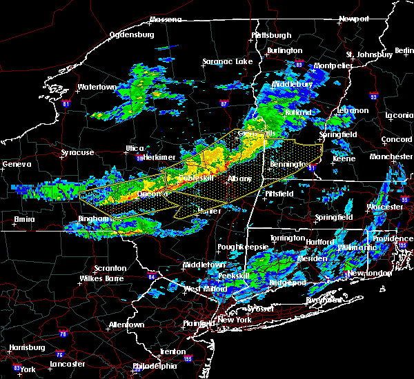
| 10/7/2020 4:22 PM EDT | Trees on powerlines along railroad av in delaware county NY, 0.1 miles NW of Stamford, NY |
| 10/7/2020 4:03 PM EDT | Trees and powerlines down on terry roa in delaware county NY, 0.8 miles SE of Stamford, NY |
| 10/7/2020 4:03 PM EDT |
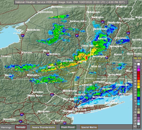 At 403 pm edt, severe thunderstorms were located along a line extending from near berne to near bainbridge, moving southeast at 45 mph (law enforcement). Hazards include 60 mph wind gusts. Expect damage to roofs, siding, and trees. Locations impacted include, sidney, delhi, davenport, kortright, meredith, bainbridge, masonville, unadilla, stamford and otego. At 403 pm edt, severe thunderstorms were located along a line extending from near berne to near bainbridge, moving southeast at 45 mph (law enforcement). Hazards include 60 mph wind gusts. Expect damage to roofs, siding, and trees. Locations impacted include, sidney, delhi, davenport, kortright, meredith, bainbridge, masonville, unadilla, stamford and otego.
|
| 10/7/2020 3:43 PM EDT |
 At 343 pm edt, severe thunderstorms were located along a line extending from near central bridge to near smithville flats, moving southeast at 45 mph (law enforcement has reported multiple trees and powerlines down across the warned area). Hazards include 60 mph wind gusts. Expect damage to roofs, siding, and trees. Locations impacted include, oneonta, sidney, delhi, davenport, guilford, worcester, maryland, westville, kortright and meredith. At 343 pm edt, severe thunderstorms were located along a line extending from near central bridge to near smithville flats, moving southeast at 45 mph (law enforcement has reported multiple trees and powerlines down across the warned area). Hazards include 60 mph wind gusts. Expect damage to roofs, siding, and trees. Locations impacted include, oneonta, sidney, delhi, davenport, guilford, worcester, maryland, westville, kortright and meredith.
|
| 10/7/2020 3:40 PM EDT |
 At 340 pm edt, severe thunderstorms were located along a line extending from richmondville to near milford, moving southeast at 50 mph (radar indicated). Hazards include 60 mph wind gusts. expect damage to roofs, siding, and trees At 340 pm edt, severe thunderstorms were located along a line extending from richmondville to near milford, moving southeast at 50 mph (radar indicated). Hazards include 60 mph wind gusts. expect damage to roofs, siding, and trees
|
| 10/7/2020 3:28 PM EDT |
 At 327 pm edt, severe thunderstorms were located along a line extending from near ames to willet, moving southeast at 45 mph (radar indicated). Hazards include 60 mph wind gusts. expect damage to roofs, siding, and trees At 327 pm edt, severe thunderstorms were located along a line extending from near ames to willet, moving southeast at 45 mph (radar indicated). Hazards include 60 mph wind gusts. expect damage to roofs, siding, and trees
|
| 8/29/2020 6:56 PM EDT | Trees across highway 10 in delaware county NY, 0.1 miles NW of Stamford, NY |
| 8/29/2020 6:47 PM EDT |
 At 646 pm edt, severe thunderstorms were located along a line extending from north blenheim to near margaretville to near fishs eddy, moving east at 35 mph (radar indicated). Hazards include 60 mph wind gusts and quarter size hail. Hail damage to vehicles is expected. expect wind damage to roofs, siding, and trees. Locations impacted include, rockland, fallsburg, liberty, neversink, south fallsburg, roxbury, hamden, andes, stamford and woodridge. At 646 pm edt, severe thunderstorms were located along a line extending from north blenheim to near margaretville to near fishs eddy, moving east at 35 mph (radar indicated). Hazards include 60 mph wind gusts and quarter size hail. Hail damage to vehicles is expected. expect wind damage to roofs, siding, and trees. Locations impacted include, rockland, fallsburg, liberty, neversink, south fallsburg, roxbury, hamden, andes, stamford and woodridge.
|
| 8/29/2020 6:30 PM EDT | Tree down on route 10 in jefferso in schoharie county NY, 4.8 miles S of Stamford, NY |
| 8/29/2020 6:29 PM EDT |
 At 628 pm edt, severe thunderstorms were located along a line extending from near summit to near bovina center to near deposit, moving east at 35 mph (radar indicated). Hazards include 60 mph wind gusts and quarter size hail. Hail damage to vehicles is expected. Expect wind damage to roofs, siding, and trees. At 628 pm edt, severe thunderstorms were located along a line extending from near summit to near bovina center to near deposit, moving east at 35 mph (radar indicated). Hazards include 60 mph wind gusts and quarter size hail. Hail damage to vehicles is expected. Expect wind damage to roofs, siding, and trees.
|
| 8/29/2020 6:13 PM EDT |
 At 613 pm edt, severe thunderstorms were located along a line extending from 6 miles southwest of sharon springs to east meredith to near walton, moving east at 45 mph (radar indicated). Hazards include 60 mph wind gusts and quarter size hail. Hail damage to vehicles is expected. expect wind damage to roofs, siding, and trees. Locations impacted include, oneonta, walton, delhi, davenport, roxbury, worcester, middlefield, colchester, maryland and westville. At 613 pm edt, severe thunderstorms were located along a line extending from 6 miles southwest of sharon springs to east meredith to near walton, moving east at 45 mph (radar indicated). Hazards include 60 mph wind gusts and quarter size hail. Hail damage to vehicles is expected. expect wind damage to roofs, siding, and trees. Locations impacted include, oneonta, walton, delhi, davenport, roxbury, worcester, middlefield, colchester, maryland and westville.
|
| 8/29/2020 6:12 PM EDT |
 At 612 pm edt, a severe thunderstorm was located over davenport, or 12 miles east of oneonta, moving east at 40 mph (radar indicated). Hazards include 60 mph wind gusts. expect damage to roofs, siding, and trees At 612 pm edt, a severe thunderstorm was located over davenport, or 12 miles east of oneonta, moving east at 40 mph (radar indicated). Hazards include 60 mph wind gusts. expect damage to roofs, siding, and trees
|
| 8/29/2020 5:59 PM EDT |
 At 558 pm edt, severe thunderstorms were located along a line extending from near middlefield to near emmons to near sidney center, moving east at 45 mph (radar indicated). Hazards include 60 mph wind gusts and quarter size hail. Hail damage to vehicles is expected. Expect wind damage to roofs, siding, and trees. At 558 pm edt, severe thunderstorms were located along a line extending from near middlefield to near emmons to near sidney center, moving east at 45 mph (radar indicated). Hazards include 60 mph wind gusts and quarter size hail. Hail damage to vehicles is expected. Expect wind damage to roofs, siding, and trees.
|
| 8/27/2020 1:50 PM EDT |
 At 149 pm edt, severe thunderstorms were located along a line extending from 6 miles northeast of windham to east meredith, moving southeast at 45 mph (radar indicated). Hazards include 60 mph wind gusts and quarter size hail. Hail damage to vehicles is expected. Expect wind damage to roofs, siding, and trees. At 149 pm edt, severe thunderstorms were located along a line extending from 6 miles northeast of windham to east meredith, moving southeast at 45 mph (radar indicated). Hazards include 60 mph wind gusts and quarter size hail. Hail damage to vehicles is expected. Expect wind damage to roofs, siding, and trees.
|
| 8/25/2020 2:38 PM EDT |
 At 238 pm edt, a severe thunderstorm was located near bovina center, or near delhi, moving southeast at 50 mph (radar indicated). Hazards include 60 mph wind gusts and quarter size hail. Hail damage to vehicles is expected. expect wind damage to roofs, siding, and trees. Locations impacted include, delhi, davenport, roxbury, kortright, meredith, andes, stamford, margaretville, hobart and fleischmanns. At 238 pm edt, a severe thunderstorm was located near bovina center, or near delhi, moving southeast at 50 mph (radar indicated). Hazards include 60 mph wind gusts and quarter size hail. Hail damage to vehicles is expected. expect wind damage to roofs, siding, and trees. Locations impacted include, delhi, davenport, roxbury, kortright, meredith, andes, stamford, margaretville, hobart and fleischmanns.
|
| 8/25/2020 2:15 PM EDT |
 At 215 pm edt, a severe thunderstorm was located over emmons, or over oneonta, moving southeast at 55 mph (radar indicated). Hazards include 60 mph wind gusts and quarter size hail. Hail damage to vehicles is expected. Expect wind damage to roofs, siding, and trees. At 215 pm edt, a severe thunderstorm was located over emmons, or over oneonta, moving southeast at 55 mph (radar indicated). Hazards include 60 mph wind gusts and quarter size hail. Hail damage to vehicles is expected. Expect wind damage to roofs, siding, and trees.
|
| 8/11/2020 9:15 PM EDT |
 At 914 pm edt, severe thunderstorms were located along a line extending from near hobart to near colchester to binghamton, moving east at 25 mph (radar indicated). Hazards include 60 mph wind gusts and penny size hail. Expect damage to roofs, siding, and trees. Locations impacted include, binghamton, johnson city, endicott, maine, sidney, walton, delhi, davenport, roxbury and sanford. At 914 pm edt, severe thunderstorms were located along a line extending from near hobart to near colchester to binghamton, moving east at 25 mph (radar indicated). Hazards include 60 mph wind gusts and penny size hail. Expect damage to roofs, siding, and trees. Locations impacted include, binghamton, johnson city, endicott, maine, sidney, walton, delhi, davenport, roxbury and sanford.
|
| 8/11/2020 8:57 PM EDT |
 The national weather service in albany has issued a * severe thunderstorm warning for. southwestern albany county in east central new york. northwestern greene county in east central new york. southern schoharie county in east central new york. Until 930 pm edt. The national weather service in albany has issued a * severe thunderstorm warning for. southwestern albany county in east central new york. northwestern greene county in east central new york. southern schoharie county in east central new york. Until 930 pm edt.
|
| 8/11/2020 8:28 PM EDT |
 At 827 pm edt, severe thunderstorms were located along a line extending from near east meredith to near sidney to near sanitaria springs and union center, moving east at 40 mph (radar indicated). Hazards include 60 mph wind gusts and penny size hail. expect damage to roofs, siding, and trees At 827 pm edt, severe thunderstorms were located along a line extending from near east meredith to near sidney to near sanitaria springs and union center, moving east at 40 mph (radar indicated). Hazards include 60 mph wind gusts and penny size hail. expect damage to roofs, siding, and trees
|
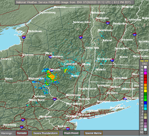
| 7/27/2020 10:25 PM EDT |
 The severe thunderstorm warning for southwestern albany, northwestern greene and southern schoharie counties will expire at 1030 pm edt, the storm which prompted the warning has moved out of the area. therefore, the warning will be allowed to expire. The severe thunderstorm warning for southwestern albany, northwestern greene and southern schoharie counties will expire at 1030 pm edt, the storm which prompted the warning has moved out of the area. therefore, the warning will be allowed to expire.
|
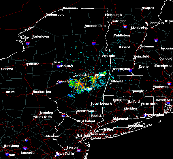
| 7/27/2020 9:42 PM EDT |
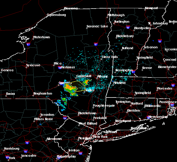 At 940 pm edt, severe thunderstorms were located along a line extending from near schenevus to near fleischmanns, moving east at 40 mph (radar indicated). Hazards include 60 mph wind gusts. Expect damage to roofs, siding, and trees. Locations impacted include, davenport, roxbury, kortright, stamford, hobart, butts corner, fergusonville, halcottsville and new kingston. At 940 pm edt, severe thunderstorms were located along a line extending from near schenevus to near fleischmanns, moving east at 40 mph (radar indicated). Hazards include 60 mph wind gusts. Expect damage to roofs, siding, and trees. Locations impacted include, davenport, roxbury, kortright, stamford, hobart, butts corner, fergusonville, halcottsville and new kingston.
|
| 7/27/2020 9:38 PM EDT |
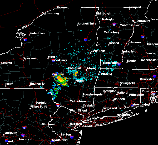 At 937 pm edt, a severe thunderstorm was located over hobart, or 14 miles east of delhi, moving east at 30 mph (radar indicated). Hazards include 60 mph wind gusts. expect damage to roofs, siding, and trees At 937 pm edt, a severe thunderstorm was located over hobart, or 14 miles east of delhi, moving east at 30 mph (radar indicated). Hazards include 60 mph wind gusts. expect damage to roofs, siding, and trees
|
| 7/27/2020 9:20 PM EDT |
 At 918 pm edt, severe thunderstorms were located along a line extending from near east meredith to near margaretville, moving east at 40 mph (radar indicated). Hazards include 60 mph wind gusts. expect damage to roofs, siding, and trees At 918 pm edt, severe thunderstorms were located along a line extending from near east meredith to near margaretville, moving east at 40 mph (radar indicated). Hazards include 60 mph wind gusts. expect damage to roofs, siding, and trees
|
| 7/8/2020 3:57 PM EDT |
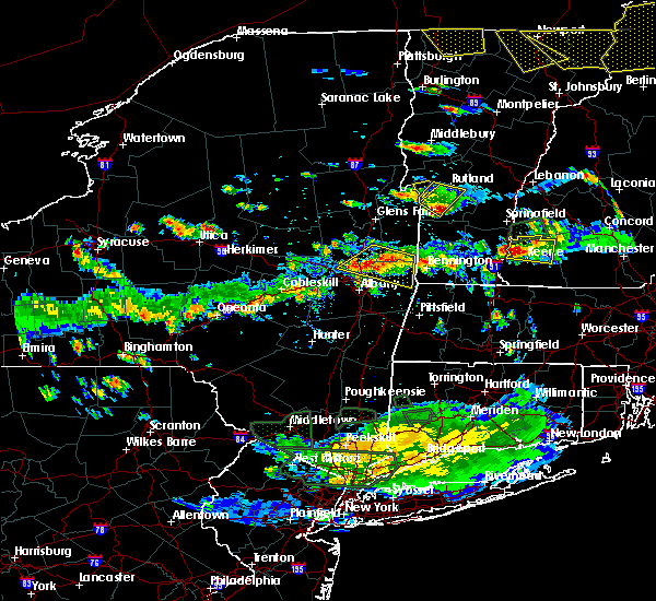 At 357 pm edt, a severe thunderstorm was located over davenport, or 10 miles east of oneonta, moving southeast at 25 mph (radar indicated). Hazards include 60 mph wind gusts and quarter size hail. Hail damage to vehicles is expected. Expect wind damage to roofs, siding, and trees. At 357 pm edt, a severe thunderstorm was located over davenport, or 10 miles east of oneonta, moving southeast at 25 mph (radar indicated). Hazards include 60 mph wind gusts and quarter size hail. Hail damage to vehicles is expected. Expect wind damage to roofs, siding, and trees.
|
| 6/28/2020 2:24 PM EDT |
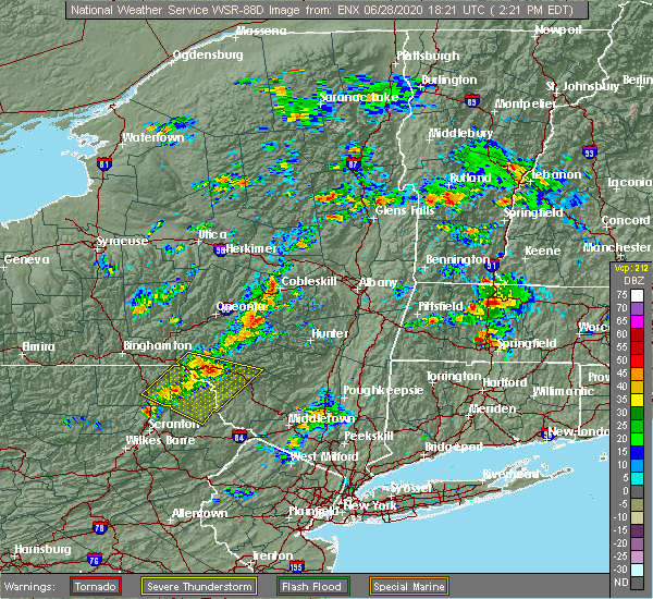 At 224 pm edt, a severe thunderstorm was located over stamford, or 17 miles northeast of delhi, moving east at 35 mph (radar indicated). Hazards include 60 mph wind gusts and penny size hail. expect damage to roofs, siding, and trees At 224 pm edt, a severe thunderstorm was located over stamford, or 17 miles northeast of delhi, moving east at 35 mph (radar indicated). Hazards include 60 mph wind gusts and penny size hail. expect damage to roofs, siding, and trees
|
| 5/29/2020 4:33 PM EDT |
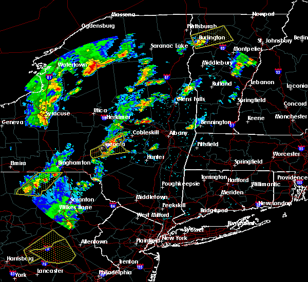 At 433 pm edt, severe thunderstorms were located along a line extending from near elk creek to near schenevus to near east meredith, moving northeast at 50 mph (radar indicated). Hazards include 60 mph wind gusts and nickel size hail. Expect damage to roofs, siding, and trees. Locations impacted include, davenport, worcester, maryland, kortright, stamford, westford, schenevus, elk creek, east meredith and butts corner. At 433 pm edt, severe thunderstorms were located along a line extending from near elk creek to near schenevus to near east meredith, moving northeast at 50 mph (radar indicated). Hazards include 60 mph wind gusts and nickel size hail. Expect damage to roofs, siding, and trees. Locations impacted include, davenport, worcester, maryland, kortright, stamford, westford, schenevus, elk creek, east meredith and butts corner.
|
| 5/29/2020 4:16 PM EDT |
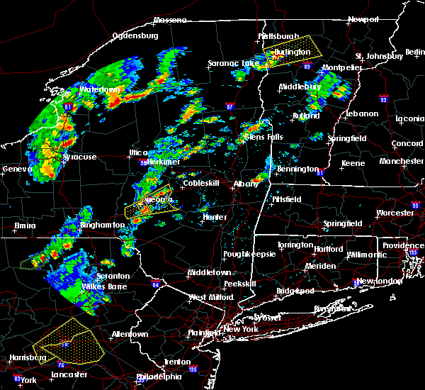 At 415 pm edt, severe thunderstorms were located along a line extending from near colliersville to meridale, moving northeast at 45 mph (radar indicated). Hazards include 60 mph wind gusts and quarter size hail. Hail damage to vehicles is expected. Expect wind damage to roofs, siding, and trees. At 415 pm edt, severe thunderstorms were located along a line extending from near colliersville to meridale, moving northeast at 45 mph (radar indicated). Hazards include 60 mph wind gusts and quarter size hail. Hail damage to vehicles is expected. Expect wind damage to roofs, siding, and trees.
|
| 5/15/2020 6:07 PM EDT |
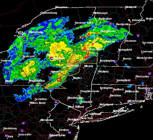 At 607 pm edt, severe thunderstorms were located along a line extending from near stamford to near andes to fishs eddy, moving east at 55 mph (radar indicated). Hazards include 60 mph wind gusts. Expect damage to roofs, siding, and trees. Locations impacted include, rockland, roxbury, andes, stamford, hancock, margaretville, hobart, fleischmanns, hazel and harvard. At 607 pm edt, severe thunderstorms were located along a line extending from near stamford to near andes to fishs eddy, moving east at 55 mph (radar indicated). Hazards include 60 mph wind gusts. Expect damage to roofs, siding, and trees. Locations impacted include, rockland, roxbury, andes, stamford, hancock, margaretville, hobart, fleischmanns, hazel and harvard.
|
| 5/15/2020 5:52 PM EDT |
 At 552 pm edt, severe thunderstorms were located along a line extending from east meredith to near colchester to near hiawatha, moving east at 55 mph (radar indicated). Hazards include 60 mph wind gusts. expect damage to roofs, siding, and trees At 552 pm edt, severe thunderstorms were located along a line extending from east meredith to near colchester to near hiawatha, moving east at 55 mph (radar indicated). Hazards include 60 mph wind gusts. expect damage to roofs, siding, and trees
|
| 5/15/2020 5:52 PM EDT |
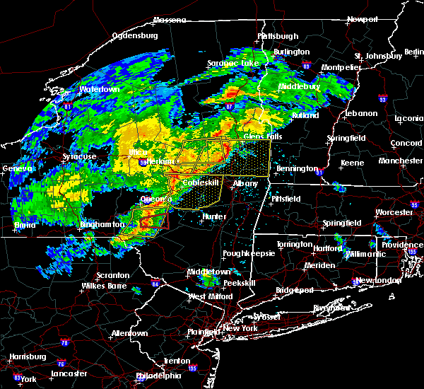 At 552 pm edt, severe thunderstorms were located along a line extending from east meredith to near colchester to near hiawatha, moving east at 55 mph (radar indicated). Hazards include 60 mph wind gusts. expect damage to roofs, siding, and trees At 552 pm edt, severe thunderstorms were located along a line extending from east meredith to near colchester to near hiawatha, moving east at 55 mph (radar indicated). Hazards include 60 mph wind gusts. expect damage to roofs, siding, and trees
|
| 4/13/2020 5:00 PM EDT | Downed tree on the roa in schoharie county NY, 6.2 miles S of Stamford, NY |
| 4/13/2020 4:45 PM EDT |
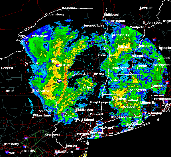 At 445 pm edt, severe thunderstorms were located along a line extending from near springfield to near andes, moving east at 45 mph (radar indicated). Hazards include 60 mph wind gusts. expect damage to roofs, siding, and trees At 445 pm edt, severe thunderstorms were located along a line extending from near springfield to near andes, moving east at 45 mph (radar indicated). Hazards include 60 mph wind gusts. expect damage to roofs, siding, and trees
|
| 10/31/2019 9:56 PM EDT |
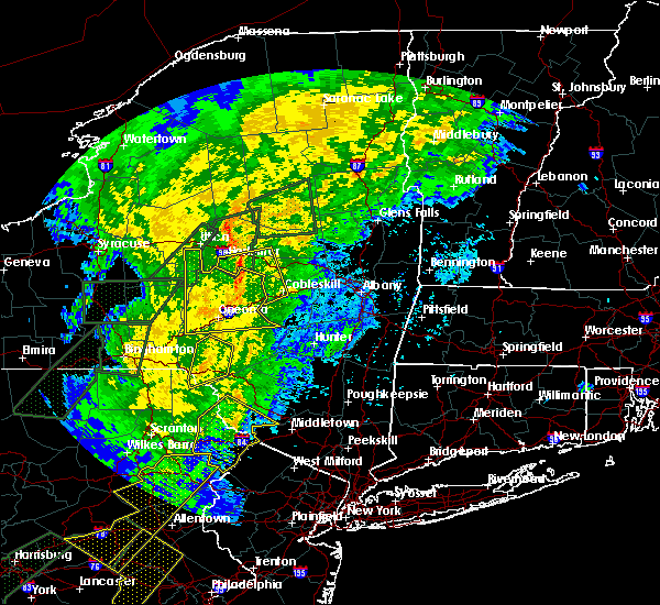 At 955 pm edt, severe thunderstorms were located along a line extending from near little falls to near east meredith, moving east at 50 mph (radar indicated). Hazards include 60 mph wind gusts. Expect damage to roofs, siding, and trees. Locations impacted include, oneonta, davenport, worcester, middlefield, maryland, cooperstown, westville, kortright, meredith and springfield. At 955 pm edt, severe thunderstorms were located along a line extending from near little falls to near east meredith, moving east at 50 mph (radar indicated). Hazards include 60 mph wind gusts. Expect damage to roofs, siding, and trees. Locations impacted include, oneonta, davenport, worcester, middlefield, maryland, cooperstown, westville, kortright, meredith and springfield.
|
| 10/31/2019 9:29 PM EDT |
 At 928 pm edt, gusty showers were located along a line extending from clayville to near east sidney, moving east at 50 mph. these showers have downed trees and wires throughout the evening so far (radar indicated). Hazards include 60 mph wind gusts. expect damage to roofs, siding, and trees At 928 pm edt, gusty showers were located along a line extending from clayville to near east sidney, moving east at 50 mph. these showers have downed trees and wires throughout the evening so far (radar indicated). Hazards include 60 mph wind gusts. expect damage to roofs, siding, and trees
|
| 8/18/2019 5:57 PM EDT |
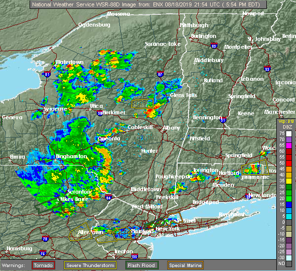 At 556 pm edt, severe thunderstorms were located along a line extending from near davenport to near liberty, moving east at 35 mph (emergency management). Hazards include 60 mph wind gusts. expect damage to roofs, siding, and trees At 556 pm edt, severe thunderstorms were located along a line extending from near davenport to near liberty, moving east at 35 mph (emergency management). Hazards include 60 mph wind gusts. expect damage to roofs, siding, and trees
|
| 8/8/2019 4:19 PM EDT |
 At 418 pm edt, a severe thunderstorm was located near worcester, or 10 miles west of cobleskill, moving east at 40 mph (law enforcement reported multiple trees down in the hartwick area). Hazards include 60 mph wind gusts and penny size hail. Expect damage to roofs, siding, and trees. Locations impacted include, davenport, worcester, middlefield, maryland, cooperstown, westville, kortright, springfield, stamford and westford. At 418 pm edt, a severe thunderstorm was located near worcester, or 10 miles west of cobleskill, moving east at 40 mph (law enforcement reported multiple trees down in the hartwick area). Hazards include 60 mph wind gusts and penny size hail. Expect damage to roofs, siding, and trees. Locations impacted include, davenport, worcester, middlefield, maryland, cooperstown, westville, kortright, springfield, stamford and westford.
|
| 8/8/2019 4:09 PM EDT |
 At 408 pm edt, severe thunderstorms were located along a line extending from near jordanville to near worcester to near delhi, moving east at 45 mph (radar indicated). Hazards include 60 mph wind gusts. Expect damage to roofs, siding, and trees. severe thunderstorms will be near, summit around 420 pm edt. fort plain, st. johnsville and richmondville around 425 pm edt. cobleskill, canajoharie and ames around 430 pm edt. ephratah and breakabeen around 435 pm edt. middleburgh, schoharie and central bridge around 440 pm edt. gloversville, johnstown and fonda around 445 pm edt. tribes hill around 450 pm edt. amsterdam, berne and fort johnson around 455 pm edt. Other locations impacted by these severe thunderstorms include meco, charleston, east berne, west berne, huntersland, engleville, quaker street, broome center, west fulton and mindenville. At 408 pm edt, severe thunderstorms were located along a line extending from near jordanville to near worcester to near delhi, moving east at 45 mph (radar indicated). Hazards include 60 mph wind gusts. Expect damage to roofs, siding, and trees. severe thunderstorms will be near, summit around 420 pm edt. fort plain, st. johnsville and richmondville around 425 pm edt. cobleskill, canajoharie and ames around 430 pm edt. ephratah and breakabeen around 435 pm edt. middleburgh, schoharie and central bridge around 440 pm edt. gloversville, johnstown and fonda around 445 pm edt. tribes hill around 450 pm edt. amsterdam, berne and fort johnson around 455 pm edt. Other locations impacted by these severe thunderstorms include meco, charleston, east berne, west berne, huntersland, engleville, quaker street, broome center, west fulton and mindenville.
|
| 8/8/2019 3:51 PM EDT |
 At 351 pm edt, a severe thunderstorm was located over hartwick, or 7 miles west of cooperstown, moving east at 40 mph (radar indicated). Hazards include 60 mph wind gusts and penny size hail. expect damage to roofs, siding, and trees At 351 pm edt, a severe thunderstorm was located over hartwick, or 7 miles west of cooperstown, moving east at 40 mph (radar indicated). Hazards include 60 mph wind gusts and penny size hail. expect damage to roofs, siding, and trees
|
| 7/30/2019 7:49 PM EDT |
 At 749 pm edt, severe thunderstorms were located along a line extending from elk creek to near east meredith, moving northeast at 45 mph (radar indicated). Hazards include quarter size hail. Damage to vehicles is expected. Locations impacted include, oneonta, delhi, davenport, worcester, maryland, kortright, meredith, hamden, stamford and westford. At 749 pm edt, severe thunderstorms were located along a line extending from elk creek to near east meredith, moving northeast at 45 mph (radar indicated). Hazards include quarter size hail. Damage to vehicles is expected. Locations impacted include, oneonta, delhi, davenport, worcester, maryland, kortright, meredith, hamden, stamford and westford.
|
| 7/30/2019 7:30 PM EDT |
 At 730 pm edt, severe thunderstorms were located along a line extending from emmons to near delhi, moving northeast at 45 mph (radar indicated). Hazards include quarter size hail. damage to vehicles is expected At 730 pm edt, severe thunderstorms were located along a line extending from emmons to near delhi, moving northeast at 45 mph (radar indicated). Hazards include quarter size hail. damage to vehicles is expected
|
| 7/30/2019 5:51 PM EDT |
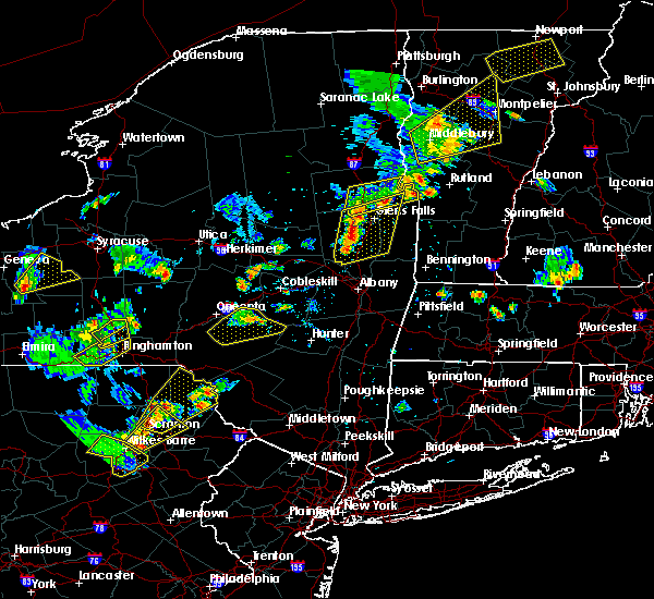 The severe thunderstorm warning for northeastern delaware county will expire at 600 pm edt, the storm which prompted the warning has weakened below severe limits, and no longer poses an immediate threat to life or property. therefore, the warning will be allowed to expire. a severe thunderstorm watch remains in effect until 900 pm edt for central new york. to report severe weather, contact your nearest law enforcement agency. they will relay your report to the national weather service binghamton. The severe thunderstorm warning for northeastern delaware county will expire at 600 pm edt, the storm which prompted the warning has weakened below severe limits, and no longer poses an immediate threat to life or property. therefore, the warning will be allowed to expire. a severe thunderstorm watch remains in effect until 900 pm edt for central new york. to report severe weather, contact your nearest law enforcement agency. they will relay your report to the national weather service binghamton.
|
| 7/30/2019 5:21 PM EDT |
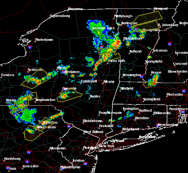 At 521 pm edt, a severe thunderstorm was located over delhi, moving northeast at 30 mph (radar indicated). Hazards include 60 mph wind gusts. Expect damage to roofs, siding, and trees. Locations impacted include, delhi, davenport, roxbury, kortright, meredith, hamden, stamford, hobart, meridale and east meredith. At 521 pm edt, a severe thunderstorm was located over delhi, moving northeast at 30 mph (radar indicated). Hazards include 60 mph wind gusts. Expect damage to roofs, siding, and trees. Locations impacted include, delhi, davenport, roxbury, kortright, meredith, hamden, stamford, hobart, meridale and east meredith.
|
| 7/30/2019 5:05 PM EDT |
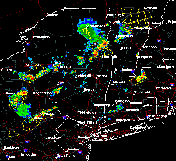 At 505 pm edt, a severe thunderstorm was located near colchester, or near walton, moving northeast at 30 mph (radar indicated). Hazards include 60 mph wind gusts and penny size hail. expect damage to roofs, siding, and trees At 505 pm edt, a severe thunderstorm was located near colchester, or near walton, moving northeast at 30 mph (radar indicated). Hazards include 60 mph wind gusts and penny size hail. expect damage to roofs, siding, and trees
|
| 6/26/2019 5:33 PM EDT |
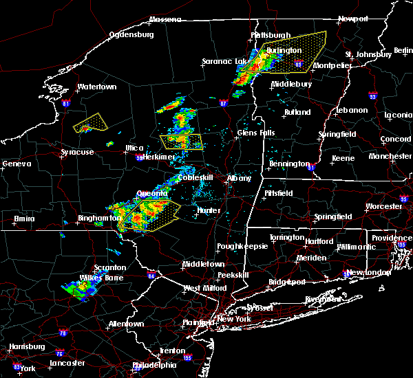 At 532 pm edt, severe thunderstorms were located along a line extending from hobart to near colchester to near harvard, moving east at 25 mph (radar indicated). Hazards include 60 mph wind gusts and penny size hail. Expect damage to roofs, siding, and trees. Locations impacted include, walton, delhi, roxbury, colchester, hamden, andes, stamford, margaretville, hobart and fleischmanns. At 532 pm edt, severe thunderstorms were located along a line extending from hobart to near colchester to near harvard, moving east at 25 mph (radar indicated). Hazards include 60 mph wind gusts and penny size hail. Expect damage to roofs, siding, and trees. Locations impacted include, walton, delhi, roxbury, colchester, hamden, andes, stamford, margaretville, hobart and fleischmanns.
|
| 6/26/2019 5:09 PM EDT |
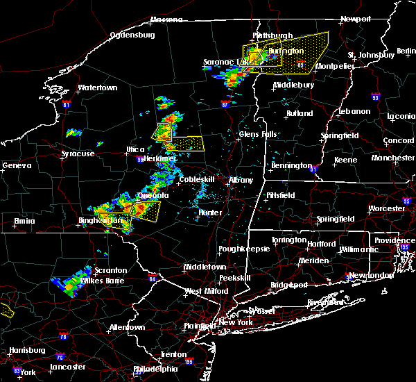 At 508 pm edt, severe thunderstorms were located along a line extending from meridale to near walton, moving east at 30 mph (law enforcement. at 440 pm, downed trees and wires were reported from these thunderstorms near sidney center and in unadilla). Hazards include 60 mph wind gusts and penny size hail. expect damage to roofs, siding, and trees At 508 pm edt, severe thunderstorms were located along a line extending from meridale to near walton, moving east at 30 mph (law enforcement. at 440 pm, downed trees and wires were reported from these thunderstorms near sidney center and in unadilla). Hazards include 60 mph wind gusts and penny size hail. expect damage to roofs, siding, and trees
|
| 4/15/2019 2:54 AM EDT |
 The severe thunderstorm warning for central delaware and northern sullivan counties will expire at 300 am edt, the storms which prompted the warning have weakened below severe limits. therefore, the warning will be allowed to expire. however gusty winds and heavy rain are still possible with these thunderstorms. a tornado watch remains in effect until 500 am edt for central new york, and northeastern pennsylvania. to report severe weather, contact your nearest law enforcement agency. they will relay your report to the national weather service binghamton. The severe thunderstorm warning for central delaware and northern sullivan counties will expire at 300 am edt, the storms which prompted the warning have weakened below severe limits. therefore, the warning will be allowed to expire. however gusty winds and heavy rain are still possible with these thunderstorms. a tornado watch remains in effect until 500 am edt for central new york, and northeastern pennsylvania. to report severe weather, contact your nearest law enforcement agency. they will relay your report to the national weather service binghamton.
|
| 4/15/2019 2:34 AM EDT |
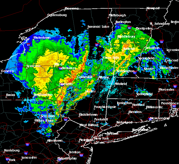 At 233 am edt, severe thunderstorms were located along a line extending from near east meredith to 6 miles west of andes to downsville to near hankins to near fosterdale, moving east at 40 mph (radar indicated). Hazards include 60 mph wind gusts. Expect damage to roofs, siding, and trees. Locations impacted include, rockland, fallsburg, liberty, bethel, neversink, south fallsburg, delhi, callicoon, roxbury and kortright. At 233 am edt, severe thunderstorms were located along a line extending from near east meredith to 6 miles west of andes to downsville to near hankins to near fosterdale, moving east at 40 mph (radar indicated). Hazards include 60 mph wind gusts. Expect damage to roofs, siding, and trees. Locations impacted include, rockland, fallsburg, liberty, bethel, neversink, south fallsburg, delhi, callicoon, roxbury and kortright.
|
| 4/15/2019 2:17 AM EDT |
 At 216 am edt, severe thunderstorms were located along a line extending from near franklin to starlight to near pleasant mount, moving east at 50 mph (radar indicated). Hazards include 60 mph wind gusts. Expect damage to roofs, siding, and trees. Locations impacted include, rockland, fallsburg, liberty, bethel, damascus, neversink, south fallsburg, walton, delhi and callicoon. At 216 am edt, severe thunderstorms were located along a line extending from near franklin to starlight to near pleasant mount, moving east at 50 mph (radar indicated). Hazards include 60 mph wind gusts. Expect damage to roofs, siding, and trees. Locations impacted include, rockland, fallsburg, liberty, bethel, damascus, neversink, south fallsburg, walton, delhi and callicoon.
|
| 4/15/2019 1:59 AM EDT |
 At 158 am edt, severe thunderstorms were located along a line extending from 7 miles east of afton to near gibson to royal, moving east at 45 mph (radar indicated). Hazards include 60 mph wind gusts. expect damage to roofs, siding, and trees At 158 am edt, severe thunderstorms were located along a line extending from 7 miles east of afton to near gibson to royal, moving east at 45 mph (radar indicated). Hazards include 60 mph wind gusts. expect damage to roofs, siding, and trees
|
| 8/17/2018 5:41 PM EDT | Wires down; time estimated by radar in schoharie county NY, 6.5 miles SSW of Stamford, NY |
| 8/17/2018 5:40 PM EDT |
 At 539 pm edt, severe thunderstorms were located along a line extending from richmondville to near stamford to near roxbury, moving northeast at 35 mph (radar indicated). Hazards include 60 mph wind gusts and quarter size hail. Hail damage to vehicles is expected. expect wind damage to roofs, siding, and trees. severe thunderstorms will be near, summit and richmondville around 545 pm edt. cobleskill around 550 pm edt. north blenheim around 555 pm edt. schoharie, prattsville, central bridge and breakabeen around 600 pm edt. gilboa and livingstonville around 605 pm edt. middleburgh around 610 pm edt. windham and delanson around 615 pm edt. Duanesburg and preston hollow around 620 pm edt. At 539 pm edt, severe thunderstorms were located along a line extending from richmondville to near stamford to near roxbury, moving northeast at 35 mph (radar indicated). Hazards include 60 mph wind gusts and quarter size hail. Hail damage to vehicles is expected. expect wind damage to roofs, siding, and trees. severe thunderstorms will be near, summit and richmondville around 545 pm edt. cobleskill around 550 pm edt. north blenheim around 555 pm edt. schoharie, prattsville, central bridge and breakabeen around 600 pm edt. gilboa and livingstonville around 605 pm edt. middleburgh around 610 pm edt. windham and delanson around 615 pm edt. Duanesburg and preston hollow around 620 pm edt.
|
| 7/28/2018 9:03 PM EDT |
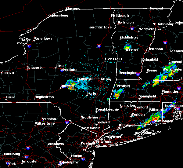 At 901 pm edt, a severe thunderstorm was located near davenport, or 15 miles northeast of delhi, moving east at 25 mph (radar indicated). Hazards include 60 mph wind gusts. Expect damage to roofs, siding, and trees. Locations impacted include, stamford. At 901 pm edt, a severe thunderstorm was located near davenport, or 15 miles northeast of delhi, moving east at 25 mph (radar indicated). Hazards include 60 mph wind gusts. Expect damage to roofs, siding, and trees. Locations impacted include, stamford.
|
| 7/28/2018 8:45 PM EDT |
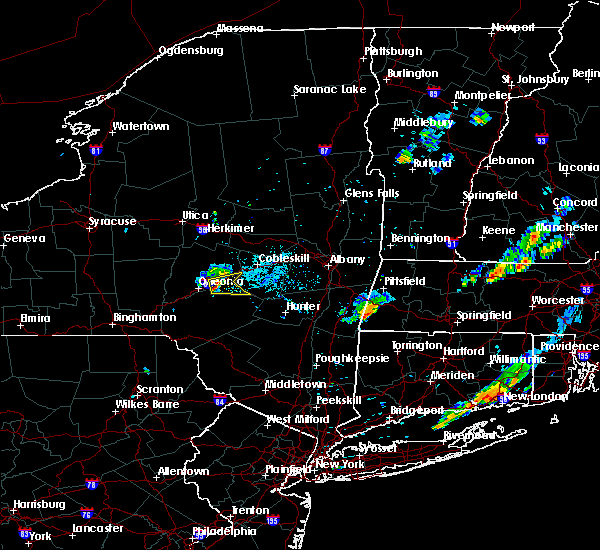 The national weather service in binghamton has issued a * severe thunderstorm warning for. east central otsego county in central new york. northeastern delaware county in central new york. until 915 pm edt. At 844 pm edt, a severe thunderstorm was located over davenport, or. The national weather service in binghamton has issued a * severe thunderstorm warning for. east central otsego county in central new york. northeastern delaware county in central new york. until 915 pm edt. At 844 pm edt, a severe thunderstorm was located over davenport, or.
|
| 6/13/2018 9:58 PM EDT |
 At 958 pm edt, severe thunderstorms were located along a line extending from 7 miles west of athens to white sulphur springs, moving east at 65 mph (radar indicated). Hazards include 60 mph wind gusts. Expect damage to roofs, siding, and trees. These severe thunderstorms will remain over mainly rural areas of central delaware and northern sullivan counties. At 958 pm edt, severe thunderstorms were located along a line extending from 7 miles west of athens to white sulphur springs, moving east at 65 mph (radar indicated). Hazards include 60 mph wind gusts. Expect damage to roofs, siding, and trees. These severe thunderstorms will remain over mainly rural areas of central delaware and northern sullivan counties.
|
| 6/13/2018 9:10 PM EDT |
 At 909 pm edt, severe thunderstorms were located along a line extending from near maryland to conklin, moving east at 65 mph (radar indicated). Hazards include 60 mph wind gusts. Expect damage to roofs, siding, and trees. severe thunderstorms will be near, davenport, worcester and maryland around 915 pm edt. deposit and stamford around 925 pm edt. hancock around 935 pm edt. fishs eddy and east branch around 940 pm edt. hazel and livingston manor around 955 pm edt. parksville around 1000 pm edt. Liberty around 1005 pm edt. At 909 pm edt, severe thunderstorms were located along a line extending from near maryland to conklin, moving east at 65 mph (radar indicated). Hazards include 60 mph wind gusts. Expect damage to roofs, siding, and trees. severe thunderstorms will be near, davenport, worcester and maryland around 915 pm edt. deposit and stamford around 925 pm edt. hancock around 935 pm edt. fishs eddy and east branch around 940 pm edt. hazel and livingston manor around 955 pm edt. parksville around 1000 pm edt. Liberty around 1005 pm edt.
|
| 5/4/2018 7:59 PM EDT |
 At 759 pm edt, severe thunderstorms were located along a line extending from near cobleskill to near summit to near east meredith to gibson, moving southeast at 40 mph (radar indicated). Hazards include 60 mph wind gusts. Expect damage to trees, and power lines. severe thunderstorms will be near, delhi around 805 pm edt. stamford and bovina center around 810 pm edt. forest city and hobart around 815 pm edt. roxbury and waymart around 825 pm edt. fleischmanns, prompton and bethany around 830 pm edt. honesdale and rutledgedale around 835 pm edt. damascus around 840 pm edt. Cochecton and narrowsburg around 845 pm edt. At 759 pm edt, severe thunderstorms were located along a line extending from near cobleskill to near summit to near east meredith to gibson, moving southeast at 40 mph (radar indicated). Hazards include 60 mph wind gusts. Expect damage to trees, and power lines. severe thunderstorms will be near, delhi around 805 pm edt. stamford and bovina center around 810 pm edt. forest city and hobart around 815 pm edt. roxbury and waymart around 825 pm edt. fleischmanns, prompton and bethany around 830 pm edt. honesdale and rutledgedale around 835 pm edt. damascus around 840 pm edt. Cochecton and narrowsburg around 845 pm edt.
|
| 5/4/2018 7:34 PM EDT |
 At 733 pm edt, severe thunderstorms were located along a line extending from ephratah to middlefield to emmons, moving east at 55 mph (radar indicated). Hazards include 60 mph wind gusts. Expect damage to roofs, siding, and trees. severe thunderstorms will be near, sharon springs around 745 pm edt. amsterdam, cobleskill and ames around 750 pm edt. jefferson and hagaman around 755 pm edt. summit, richmondville and central bridge around 800 pm edt. breakabeen and north blenheim around 805 pm edt. duanesburg, middleburgh and delanson around 810 pm edt. schoharie, pattersonville-rotterdam junction and livingstonville around 815 pm edt. berne around 825 pm edt. Other locations impacted by these severe thunderstorms include charleston, east berne, beekman corners, west richmondville, shoefelt corners, hoffmans, rockwell corners, west berne, huntersland and engleville. At 733 pm edt, severe thunderstorms were located along a line extending from ephratah to middlefield to emmons, moving east at 55 mph (radar indicated). Hazards include 60 mph wind gusts. Expect damage to roofs, siding, and trees. severe thunderstorms will be near, sharon springs around 745 pm edt. amsterdam, cobleskill and ames around 750 pm edt. jefferson and hagaman around 755 pm edt. summit, richmondville and central bridge around 800 pm edt. breakabeen and north blenheim around 805 pm edt. duanesburg, middleburgh and delanson around 810 pm edt. schoharie, pattersonville-rotterdam junction and livingstonville around 815 pm edt. berne around 825 pm edt. Other locations impacted by these severe thunderstorms include charleston, east berne, beekman corners, west richmondville, shoefelt corners, hoffmans, rockwell corners, west berne, huntersland and engleville.
|
| 5/4/2018 7:32 PM EDT |
 At 731 pm edt, severe thunderstorms were located along a line extending from near springfield to near bowerstown to near west end to near montrose, moving east at 45 mph (radar indicated). Hazards include 70 mph wind gusts. Expect considerable tree damage. damage is likely to mobile homes, roofs, and outbuildings. these severe storms will be near, cooperstown, otego and cherry valley around 735 pm edt. oneonta, middlefield and maryland around 740 pm edt. worcester, colliersville and cooperstown junction around 745 pm edt. davenport, susquehanna and susquehanna depot around 750 pm edt. gibson around 755 pm edt. Stamford, hobart and thompson around 800 pm edt. At 731 pm edt, severe thunderstorms were located along a line extending from near springfield to near bowerstown to near west end to near montrose, moving east at 45 mph (radar indicated). Hazards include 70 mph wind gusts. Expect considerable tree damage. damage is likely to mobile homes, roofs, and outbuildings. these severe storms will be near, cooperstown, otego and cherry valley around 735 pm edt. oneonta, middlefield and maryland around 740 pm edt. worcester, colliersville and cooperstown junction around 745 pm edt. davenport, susquehanna and susquehanna depot around 750 pm edt. gibson around 755 pm edt. Stamford, hobart and thompson around 800 pm edt.
|
| 5/4/2018 7:06 PM EDT |
 At 703 pm edt, severe thunderstorms were located along a line extending from bridgewater to columbus to near oxford to near apalachin, moving southeast at 40 mph (radar indicated). Hazards include 70 mph wind gusts. Expect considerable tree damage. damage is likely to mobile homes, roofs, and outbuildings. severe thunderstorms will be near, norwich, oxford and new berlin around 710 pm edt. guilford, edmeston and pittsfield around 715 pm edt. richfield springs, morris and exeter center around 720 pm edt. sidney, gilbertsville and brackney around 725 pm edt. cooperstown, conklin and hartwick around 730 pm edt. oneonta, kirkwood and otego around 735 pm edt. middlefield, hallstead and great bend around 740 pm edt. maryland, new milford and elk creek around 745 pm edt. A severe thunderstorm watch remains in effect until 900 pm edt for central new york. At 703 pm edt, severe thunderstorms were located along a line extending from bridgewater to columbus to near oxford to near apalachin, moving southeast at 40 mph (radar indicated). Hazards include 70 mph wind gusts. Expect considerable tree damage. damage is likely to mobile homes, roofs, and outbuildings. severe thunderstorms will be near, norwich, oxford and new berlin around 710 pm edt. guilford, edmeston and pittsfield around 715 pm edt. richfield springs, morris and exeter center around 720 pm edt. sidney, gilbertsville and brackney around 725 pm edt. cooperstown, conklin and hartwick around 730 pm edt. oneonta, kirkwood and otego around 735 pm edt. middlefield, hallstead and great bend around 740 pm edt. maryland, new milford and elk creek around 745 pm edt. A severe thunderstorm watch remains in effect until 900 pm edt for central new york.
|
| 8/12/2017 6:04 PM EDT |
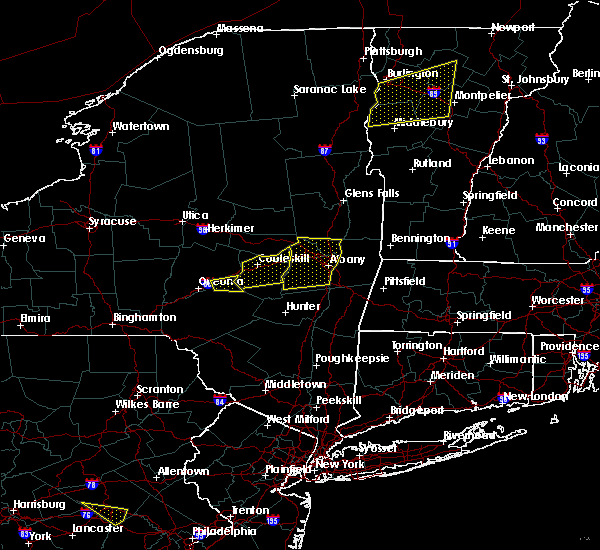 At 603 pm edt, a severe thunderstorm was located near davenport, or 15 miles east of oneonta, moving east at 30 mph (radar indicated). Hazards include 60 mph wind gusts and quarter size hail. Minor hail damage to vehicles is possible. Expect wind to cause damage to trees, and power lines. At 603 pm edt, a severe thunderstorm was located near davenport, or 15 miles east of oneonta, moving east at 30 mph (radar indicated). Hazards include 60 mph wind gusts and quarter size hail. Minor hail damage to vehicles is possible. Expect wind to cause damage to trees, and power lines.
|
| 6/30/2017 5:43 PM EDT |
 At 543 pm edt, a severe thunderstorm was located over meredith, or near delhi, moving east at 35 mph (radar indicated). Hazards include 60 mph wind gusts. Expect damage to trees, and power lines. this severe thunderstorm will be near, east meredith around 550 pm edt. bovina center around 600 pm edt. andes around 605 pm edt. hobart around 610 pm edt. Roxbury around 620 pm edt. At 543 pm edt, a severe thunderstorm was located over meredith, or near delhi, moving east at 35 mph (radar indicated). Hazards include 60 mph wind gusts. Expect damage to trees, and power lines. this severe thunderstorm will be near, east meredith around 550 pm edt. bovina center around 600 pm edt. andes around 605 pm edt. hobart around 610 pm edt. Roxbury around 620 pm edt.
|
| 6/5/2017 2:55 PM EDT |
 At 253 pm edt, a severe thunderstorm was located over north blenheim, or 13 miles south of cobleskill, moving east at 30 mph (trained weather spotters). Hazards include 60 mph wind gusts and quarter size hail. Minor damage to vehicles is possible. expect wind damage to trees, and power lines. this severe storm will be near, livingstonville around 310 pm edt. preston-potter hollow around 315 pm edt. Other locations impacted by this severe thunderstorm include zeh corners, beekman corners, west richmondville, baird corners, seward, rockwell corners, huntersland, warnerville, carlisle and engleville. At 253 pm edt, a severe thunderstorm was located over north blenheim, or 13 miles south of cobleskill, moving east at 30 mph (trained weather spotters). Hazards include 60 mph wind gusts and quarter size hail. Minor damage to vehicles is possible. expect wind damage to trees, and power lines. this severe storm will be near, livingstonville around 310 pm edt. preston-potter hollow around 315 pm edt. Other locations impacted by this severe thunderstorm include zeh corners, beekman corners, west richmondville, baird corners, seward, rockwell corners, huntersland, warnerville, carlisle and engleville.
|
| 6/5/2017 2:41 PM EDT | Large tree down in schoharie county NY, 4.8 miles S of Stamford, NY |
| 6/5/2017 2:27 PM EDT |
 At 226 pm edt, a severe thunderstorm was located near worcester, or 13 miles southwest of cobleskill, moving east at 35 mph (trained weather spotters). Hazards include 60 mph wind gusts and quarter size hail. Minor damage to vehicles is possible. expect wind damage to trees, and power lines. this severe thunderstorm will be near, jefferson, summit and richmondville around 235 pm edt. north blenheim and breakabeen around 250 pm edt. gilboa around 255 pm edt. livingstonville around 305 pm edt. preston-potter hollow around 310 pm edt. Other locations impacted by this severe thunderstorm include zeh corners, beekman corners, west richmondville, baird corners, seward, rockwell corners, huntersland, warnerville, carlisle and engleville. At 226 pm edt, a severe thunderstorm was located near worcester, or 13 miles southwest of cobleskill, moving east at 35 mph (trained weather spotters). Hazards include 60 mph wind gusts and quarter size hail. Minor damage to vehicles is possible. expect wind damage to trees, and power lines. this severe thunderstorm will be near, jefferson, summit and richmondville around 235 pm edt. north blenheim and breakabeen around 250 pm edt. gilboa around 255 pm edt. livingstonville around 305 pm edt. preston-potter hollow around 310 pm edt. Other locations impacted by this severe thunderstorm include zeh corners, beekman corners, west richmondville, baird corners, seward, rockwell corners, huntersland, warnerville, carlisle and engleville.
|
| 6/5/2017 2:19 PM EDT |
 At 219 pm edt, a severe thunderstorm was located near summit, or 10 miles southwest of cobleskill, moving east at 45 mph (radar indicated). Hazards include 60 mph wind gusts. Expect damage to roofs, siding, and trees. This severe thunderstorm will remain over mainly rural areas of southeastern otsego and northeastern delaware counties. At 219 pm edt, a severe thunderstorm was located near summit, or 10 miles southwest of cobleskill, moving east at 45 mph (radar indicated). Hazards include 60 mph wind gusts. Expect damage to roofs, siding, and trees. This severe thunderstorm will remain over mainly rural areas of southeastern otsego and northeastern delaware counties.
|
| 6/5/2017 1:52 PM EDT |
 At 152 pm edt, a severe thunderstorm was located over hartwick, or 7 miles southwest of cooperstown, moving east at 40 mph (radar indicated). Hazards include 60 mph wind gusts. Expect damage to roofs, siding, and trees. this severe thunderstorm will be near, cooperstown, hyde park and milford around 200 pm edt. middlefield and maryland around 205 pm edt. elk creek and schenevus around 210 pm edt. Worcester around 215 pm edt. At 152 pm edt, a severe thunderstorm was located over hartwick, or 7 miles southwest of cooperstown, moving east at 40 mph (radar indicated). Hazards include 60 mph wind gusts. Expect damage to roofs, siding, and trees. this severe thunderstorm will be near, cooperstown, hyde park and milford around 200 pm edt. middlefield and maryland around 205 pm edt. elk creek and schenevus around 210 pm edt. Worcester around 215 pm edt.
|
| 5/1/2017 9:02 PM EDT | Trees and wires down in schoharie county NY, 4.8 miles S of Stamford, NY |
| 5/1/2017 8:39 PM EDT |
 At 839 pm edt, severe thunderstorms were located along a line extending from near little falls to walton, moving east at 60 mph (radar indicated). Hazards include 70 mph wind gusts. Expect considerable tree damage. damage is likely to mobile homes, roofs, and outbuildings. severe thunderstorms will be near, andes and bovina center around 855 pm edt. margaretville and arkville around 905 pm edt. Fleischmanns around 910 pm edt. At 839 pm edt, severe thunderstorms were located along a line extending from near little falls to walton, moving east at 60 mph (radar indicated). Hazards include 70 mph wind gusts. Expect considerable tree damage. damage is likely to mobile homes, roofs, and outbuildings. severe thunderstorms will be near, andes and bovina center around 855 pm edt. margaretville and arkville around 905 pm edt. Fleischmanns around 910 pm edt.
|
| 4/16/2017 5:33 PM EDT |
 At 533 pm edt, severe thunderstorms were located along a line extending from near stamford to near andes to fishs eddy, moving east at 50 mph (radar indicated). Hazards include 60 mph wind gusts. Expect damage to trees. these severe storms will be near, margaretville and arkville around 545 pm edt. Fleischmanns around 550 pm edt. At 533 pm edt, severe thunderstorms were located along a line extending from near stamford to near andes to fishs eddy, moving east at 50 mph (radar indicated). Hazards include 60 mph wind gusts. Expect damage to trees. these severe storms will be near, margaretville and arkville around 545 pm edt. Fleischmanns around 550 pm edt.
|
| 4/16/2017 5:14 PM EDT |
 At 514 pm edt, severe thunderstorms were located along a line extending from near schenevus to colchester to near sherman, moving east at 45 mph (radar indicated). Hazards include 60 mph wind gusts. Expect damage to trees. severe thunderstorms will be near, downsville around 520 pm edt. stamford around 525 pm edt. andes, fishs eddy and east branch around 535 pm edt. margaretville around 540 pm edt. arkville around 545 pm edt. Fleischmanns and roscoe around 550 pm edt. At 514 pm edt, severe thunderstorms were located along a line extending from near schenevus to colchester to near sherman, moving east at 45 mph (radar indicated). Hazards include 60 mph wind gusts. Expect damage to trees. severe thunderstorms will be near, downsville around 520 pm edt. stamford around 525 pm edt. andes, fishs eddy and east branch around 535 pm edt. margaretville around 540 pm edt. arkville around 545 pm edt. Fleischmanns and roscoe around 550 pm edt.
|
| 2/25/2017 4:35 PM EST |
 At 435 pm est, severe thunderstorms were located along a line extending from jefferson to near downsville to near rutledgedale, moving east at 15 mph (radar indicated). Hazards include 60 mph wind gusts. Expect damage to roofs, siding, and trees. severe thunderstorms will be near, stamford and hobart around 440 pm est. fosterdale around 515 pm est. Bethel, margaretville and arkville around 530 pm est. At 435 pm est, severe thunderstorms were located along a line extending from jefferson to near downsville to near rutledgedale, moving east at 15 mph (radar indicated). Hazards include 60 mph wind gusts. Expect damage to roofs, siding, and trees. severe thunderstorms will be near, stamford and hobart around 440 pm est. fosterdale around 515 pm est. Bethel, margaretville and arkville around 530 pm est.
|
| 2/25/2017 4:20 PM EST |
 At 419 pm est, a severe thunderstorm was located near davenport, or 14 miles northeast of delhi, moving northeast at 45 mph (radar indicated). Hazards include 60 mph wind gusts. Expect damage to roofs, siding, and trees. This severe thunderstorm will remain over mainly rural areas of northeastern delaware county. At 419 pm est, a severe thunderstorm was located near davenport, or 14 miles northeast of delhi, moving northeast at 45 mph (radar indicated). Hazards include 60 mph wind gusts. Expect damage to roofs, siding, and trees. This severe thunderstorm will remain over mainly rural areas of northeastern delaware county.
|
| 2/25/2017 4:01 PM EST |
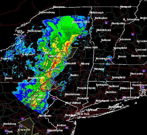 At 401 pm est, a severe thunderstorm was located over meredith, or near delhi, moving northeast at 45 mph (radar indicated). Hazards include 60 mph wind gusts. Expect damage to roofs, siding, and trees. this severe thunderstorm will be near, east meredith around 410 pm est. Davenport around 415 pm est. At 401 pm est, a severe thunderstorm was located over meredith, or near delhi, moving northeast at 45 mph (radar indicated). Hazards include 60 mph wind gusts. Expect damage to roofs, siding, and trees. this severe thunderstorm will be near, east meredith around 410 pm est. Davenport around 415 pm est.
|
| 9/8/2016 6:41 PM EDT |
 The severe thunderstorm warning for schoharie county will expire at 645 pm edt, the storms which prompted the warning have weakened below severe limits, and no longer pose an immediate threat to life or property. therefore, the warning will be allowed to expire. however heavy rain is still possible with these thunderstorms. please report hail size, damaging winds and reports of trees down to the national weather service by email at [email protected], on facebook at www.facebook.com/nwsalbany or twitter @nwsalbany. The severe thunderstorm warning for schoharie county will expire at 645 pm edt, the storms which prompted the warning have weakened below severe limits, and no longer pose an immediate threat to life or property. therefore, the warning will be allowed to expire. however heavy rain is still possible with these thunderstorms. please report hail size, damaging winds and reports of trees down to the national weather service by email at [email protected], on facebook at www.facebook.com/nwsalbany or twitter @nwsalbany.
|
| 9/8/2016 6:22 PM EDT |
 At 621 pm edt, severe thunderstorms were located along a line extending from central bridge to near livingstonville to gilboa, moving east at 30 mph (radar indicated). Hazards include 60 mph wind gusts. Expect damage to roofs. siding. and trees. these severe storms will be near, livingstonville around 625 pm edt. Preston-potter hollow around 630 pm edt. At 621 pm edt, severe thunderstorms were located along a line extending from central bridge to near livingstonville to gilboa, moving east at 30 mph (radar indicated). Hazards include 60 mph wind gusts. Expect damage to roofs. siding. and trees. these severe storms will be near, livingstonville around 625 pm edt. Preston-potter hollow around 630 pm edt.
|
| 9/8/2016 5:42 PM EDT |
 The national weather service in albany has issued a * severe thunderstorm warning for. schoharie county in east central new york. until 645 pm edt * at 541 pm edt. Severe thunderstorms were located along a line extending from near sharon springs to 6 miles northwest of. The national weather service in albany has issued a * severe thunderstorm warning for. schoharie county in east central new york. until 645 pm edt * at 541 pm edt. Severe thunderstorms were located along a line extending from near sharon springs to 6 miles northwest of.
|
| 7/1/2016 3:38 PM EDT |
 At 337 pm edt, severe thunderstorms were located along a line extending from near springfield to bowerstown to otego, moving east at 45 mph (radar indicated). Hazards include 60 mph wind gusts. Expect damage to roofs. siding. and trees. severe thunderstorms will be near, canajoharie, fort plain, sharon springs and ames around 350 pm edt. summit and richmondville around 400 pm edt. cobleskill around 405 pm edt. tribes hill around 410 pm edt. middleburgh, schoharie and central bridge around 415 pm edt. amsterdam and jefferson around 420 pm edt. delanson around 425 pm edt. duanesburg and north blenheim around 430 pm edt. other locations impacted by these severe thunderstorms include glen, ripple corners, miller corners, east jefferson, scotch bush, kilmartin corners, auriesville, braman corners, zeh corners and mckinley. this includes interstate 88 between mile markers 19 and 23. A tornado watch remains in effect until 1000 pm edt for eastern and east central new york. At 337 pm edt, severe thunderstorms were located along a line extending from near springfield to bowerstown to otego, moving east at 45 mph (radar indicated). Hazards include 60 mph wind gusts. Expect damage to roofs. siding. and trees. severe thunderstorms will be near, canajoharie, fort plain, sharon springs and ames around 350 pm edt. summit and richmondville around 400 pm edt. cobleskill around 405 pm edt. tribes hill around 410 pm edt. middleburgh, schoharie and central bridge around 415 pm edt. amsterdam and jefferson around 420 pm edt. delanson around 425 pm edt. duanesburg and north blenheim around 430 pm edt. other locations impacted by these severe thunderstorms include glen, ripple corners, miller corners, east jefferson, scotch bush, kilmartin corners, auriesville, braman corners, zeh corners and mckinley. this includes interstate 88 between mile markers 19 and 23. A tornado watch remains in effect until 1000 pm edt for eastern and east central new york.
|
| 7/1/2016 3:33 PM EDT | Trees and wires down in schoharie county NY, 4.8 miles S of Stamford, NY |
| 7/1/2016 2:42 PM EDT | Trees and wires down in schoharie county NY, 4.8 miles S of Stamford, NY |
| 6/21/2016 2:22 AM EDT |
 At 221 am edt, a severe thunderstorm was located near north blenheim, or 14 miles south of cobleskill, moving east at 45 mph (radar indicated). Hazards include 60 mph wind gusts and quarter size hail. Hail damage to vehicles is expected. Expect wind damage to roofs, siding, and trees. At 221 am edt, a severe thunderstorm was located near north blenheim, or 14 miles south of cobleskill, moving east at 45 mph (radar indicated). Hazards include 60 mph wind gusts and quarter size hail. Hail damage to vehicles is expected. Expect wind damage to roofs, siding, and trees.
|
| 7/14/2015 5:56 PM EDT |
 At 555 pm edt, severe thunderstorms were located along a line extending from davenport to near east meredith to meridale to near meredith, moving east at 25 mph (radar indicated). Hazards include 60 mph wind gusts. Expect damage to roofs. siding and trees. these severe storms will be near, davenport around 600 pm edt. east meredith around 605 pm edt. Hobart around 615 pm edt. At 555 pm edt, severe thunderstorms were located along a line extending from davenport to near east meredith to meridale to near meredith, moving east at 25 mph (radar indicated). Hazards include 60 mph wind gusts. Expect damage to roofs. siding and trees. these severe storms will be near, davenport around 600 pm edt. east meredith around 605 pm edt. Hobart around 615 pm edt.
|
| 7/14/2015 5:20 PM EDT |
 At 520 pm edt, severe thunderstorms were located along a line extending from hartwick to near laurens to near franklin to near sidney, moving east at 25 mph (radar indicated). Hazards include 60 mph wind gusts and quarter size hail. Hail damage to vehicles is expected. expect wind damage to roofs, siding and trees. severe thunderstorms will be near, oneonta, hartwick and laurens around 525 pm edt. cooperstown junction and colliersville around 530 pm edt. hyde park and milford around 535 pm edt. cooperstown and maryland around 540 pm edt. davenport and bowerstown around 545 pm edt. middlefield, meredith and schenevus around 550 pm edt. walton around 555 pm edt. Worcester and east meredith around 600 pm edt. At 520 pm edt, severe thunderstorms were located along a line extending from hartwick to near laurens to near franklin to near sidney, moving east at 25 mph (radar indicated). Hazards include 60 mph wind gusts and quarter size hail. Hail damage to vehicles is expected. expect wind damage to roofs, siding and trees. severe thunderstorms will be near, oneonta, hartwick and laurens around 525 pm edt. cooperstown junction and colliersville around 530 pm edt. hyde park and milford around 535 pm edt. cooperstown and maryland around 540 pm edt. davenport and bowerstown around 545 pm edt. middlefield, meredith and schenevus around 550 pm edt. walton around 555 pm edt. Worcester and east meredith around 600 pm edt.
|
| 6/12/2015 8:41 PM EDT |
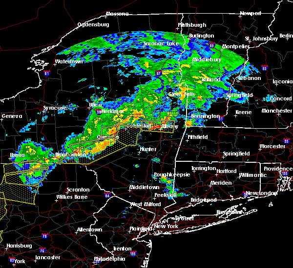 At 841 pm edt, severe thunderstorms were located along a line extending from stamford to near colchester, moving southeast at 45 mph (radar indicated). Hazards include 60 mph wind gusts. Expect damage to roofs. siding and trees. severe thunderstorms will be near, stamford and hobart around 845 pm edt. Roxbury and andes around 850 pm edt. At 841 pm edt, severe thunderstorms were located along a line extending from stamford to near colchester, moving southeast at 45 mph (radar indicated). Hazards include 60 mph wind gusts. Expect damage to roofs. siding and trees. severe thunderstorms will be near, stamford and hobart around 845 pm edt. Roxbury and andes around 850 pm edt.
|
| 6/12/2015 8:38 PM EDT | Trees and wires dow in schoharie county NY, 4.8 miles S of Stamford, NY |
| 6/12/2015 8:27 PM EDT |
 At 826 pm edt, a severe thunderstorm was located near worcester, or 10 miles east of cooperstown, moving east at 45 mph (radar indicated). Hazards include 60 mph wind gusts and penny size hail. Expect damage to roofs. siding and trees. this severe thunderstorm will be near, summit around 835 pm edt. richmondville around 840 pm edt. cobleskill around 845 pm edt. breakabeen and central bridge around 850 pm edt. middleburgh and schoharie around 855 pm edt. other locations impacted by this severe thunderstorm include west richmondville, gallupville, east jefferson, huntersland, zeh corners, west conesville, schoharie junction, bramanville, carlisle center and ruth. A tornado watch remains in effect until 1100 pm edt for east central new york. At 826 pm edt, a severe thunderstorm was located near worcester, or 10 miles east of cooperstown, moving east at 45 mph (radar indicated). Hazards include 60 mph wind gusts and penny size hail. Expect damage to roofs. siding and trees. this severe thunderstorm will be near, summit around 835 pm edt. richmondville around 840 pm edt. cobleskill around 845 pm edt. breakabeen and central bridge around 850 pm edt. middleburgh and schoharie around 855 pm edt. other locations impacted by this severe thunderstorm include west richmondville, gallupville, east jefferson, huntersland, zeh corners, west conesville, schoharie junction, bramanville, carlisle center and ruth. A tornado watch remains in effect until 1100 pm edt for east central new york.
|
| 6/12/2015 7:57 PM EDT |
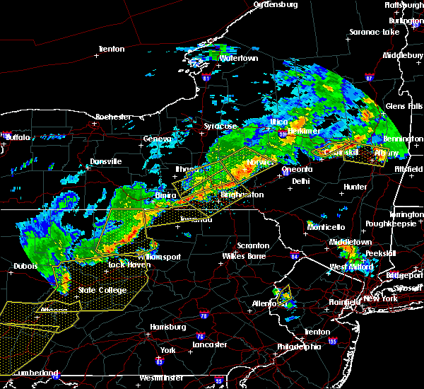 At 757 pm edt, severe thunderstorms were located along a line extending from near laurens to near bainbridge, moving southeast at 55 mph (radar indicated). Hazards include 60 mph wind gusts. Expect damage to roofs. siding and trees. severe thunderstorms will be near, oneonta, emmons and west end around 805 pm edt. davenport, east sidney and east meredith around 810 pm edt. walton around 820 pm edt. Colchester, stamford and hobart around 825 pm edt. At 757 pm edt, severe thunderstorms were located along a line extending from near laurens to near bainbridge, moving southeast at 55 mph (radar indicated). Hazards include 60 mph wind gusts. Expect damage to roofs. siding and trees. severe thunderstorms will be near, oneonta, emmons and west end around 805 pm edt. davenport, east sidney and east meredith around 810 pm edt. walton around 820 pm edt. Colchester, stamford and hobart around 825 pm edt.
|
| 10/7/2013 2:15 PM EDT | Trees and wires down. time estimated by rada in schoharie county NY, 4.3 miles WSW of Stamford, NY |
| 5/29/2013 7:28 PM EDT | Trees and wires dow in schoharie county NY, 4.8 miles S of Stamford, NY |
Hail Maps for Stamford, NY


Connect with Interactive Hail Maps