

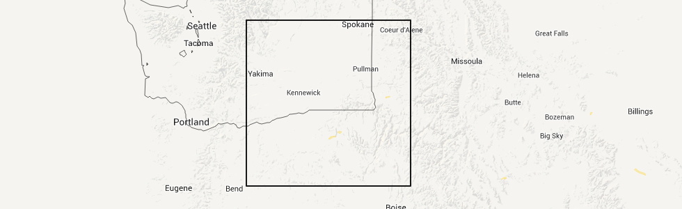
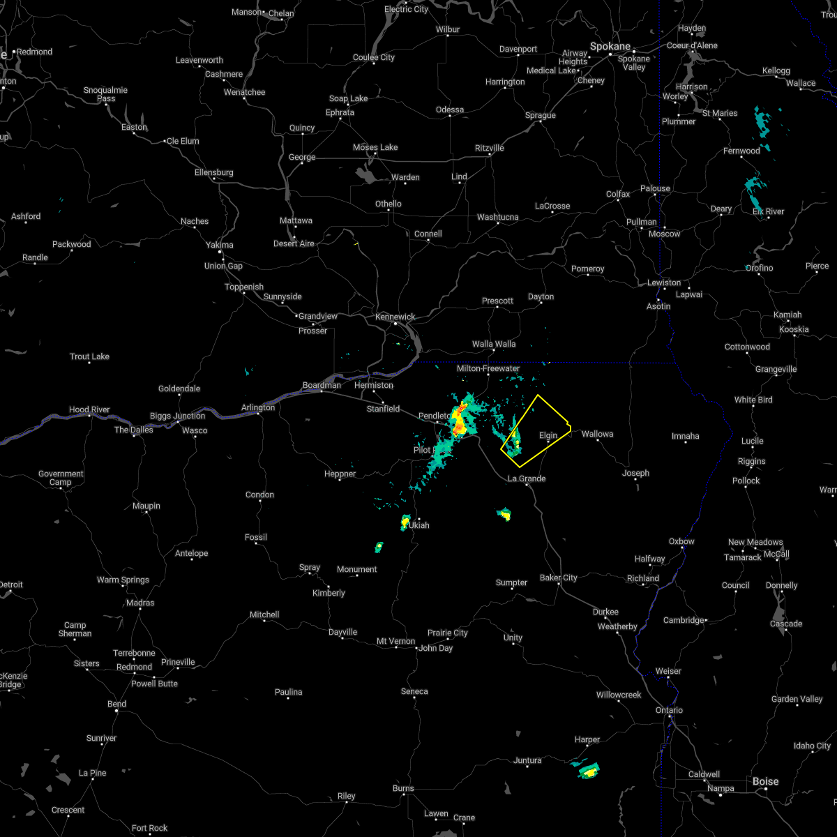
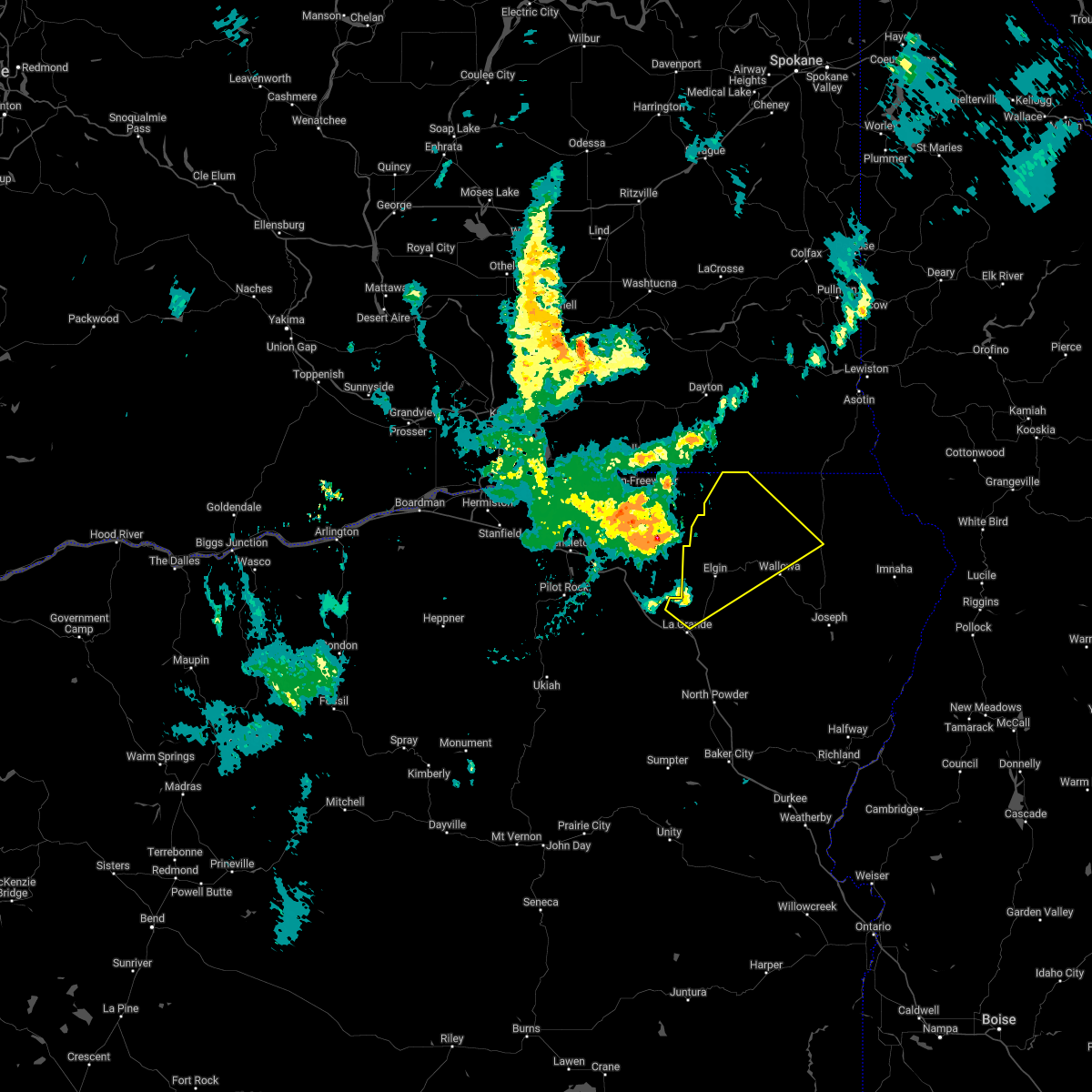
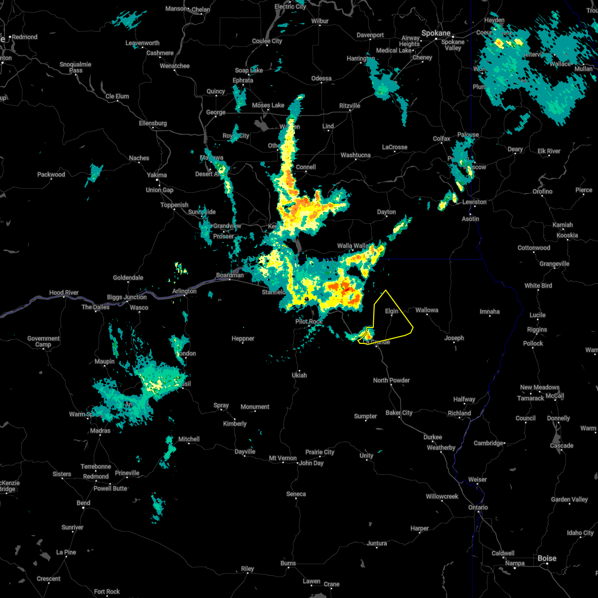
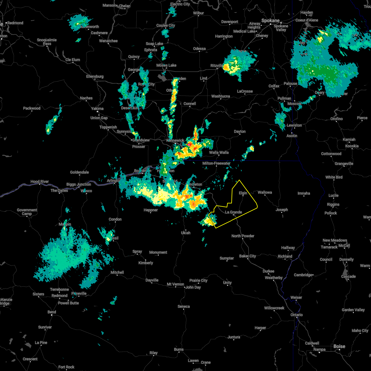
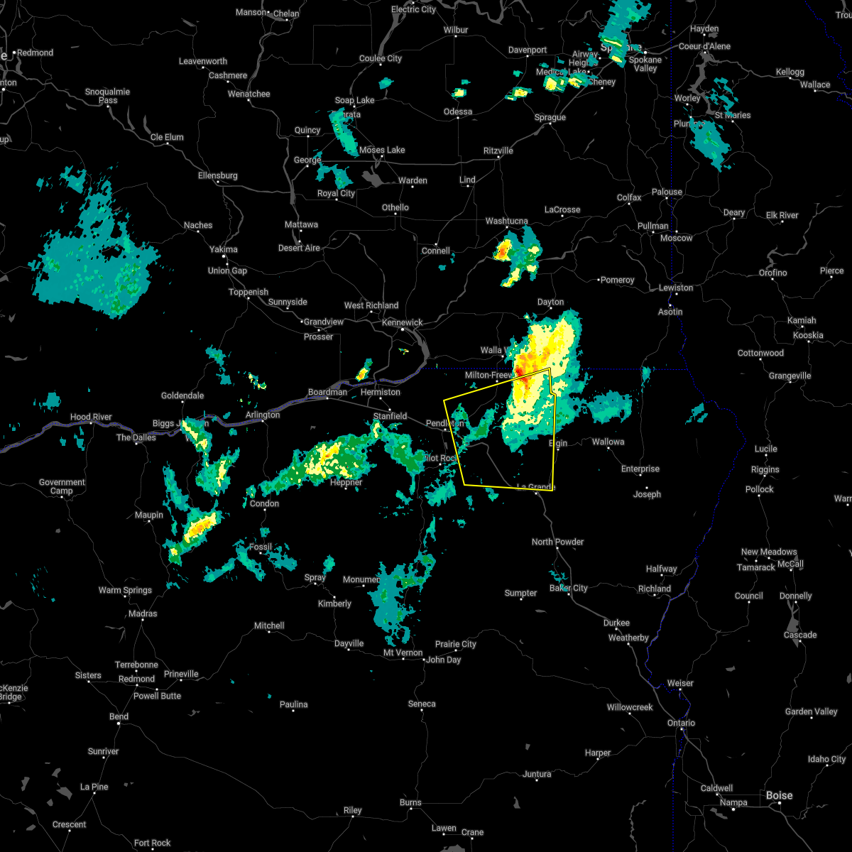
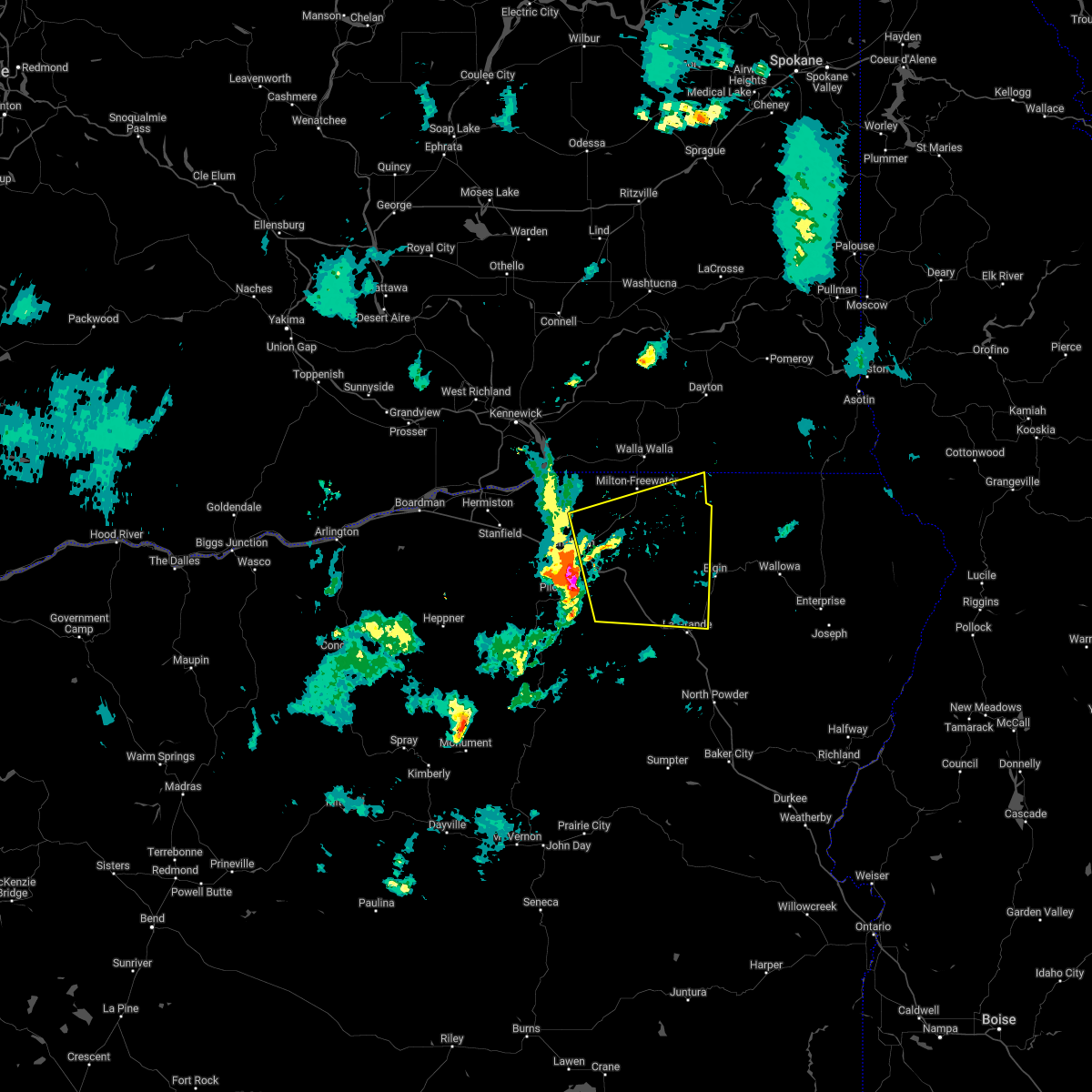
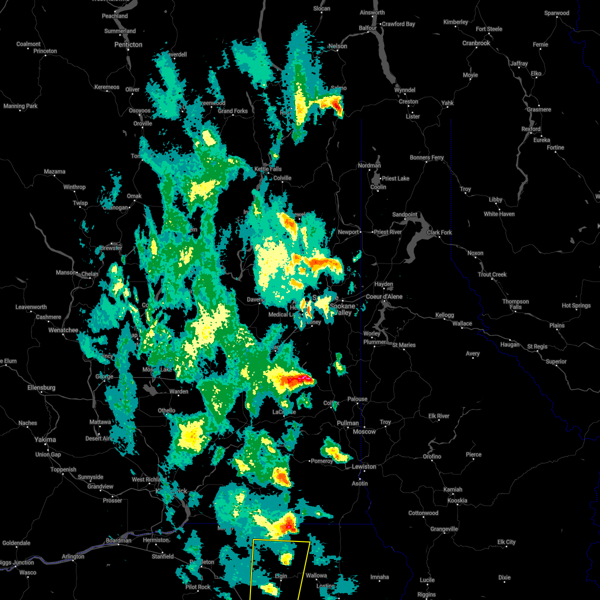
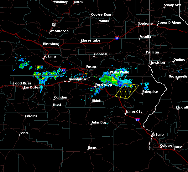
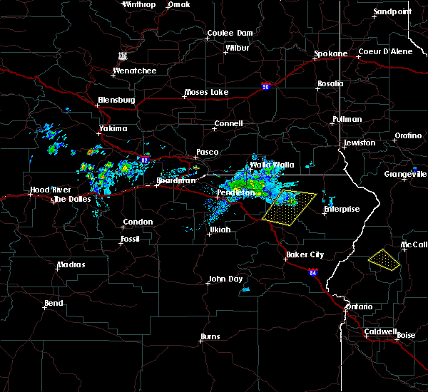
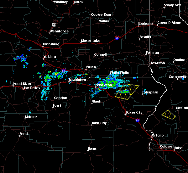
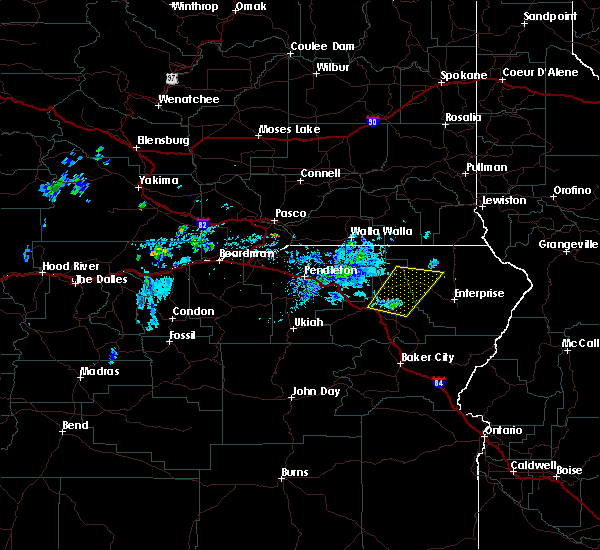
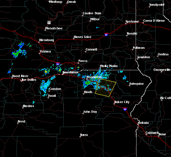
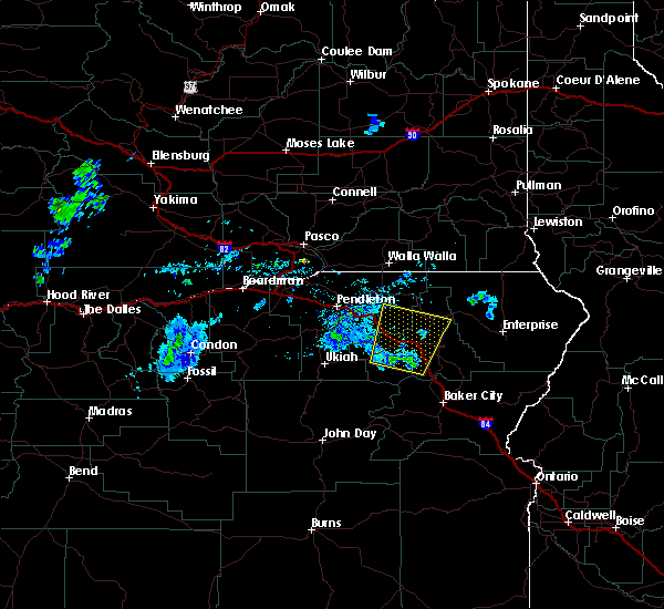
Hail Map for Summerville, OR
The Summerville, OR area has had 5 reports of on-the-ground hail by trained spotters, and has been under severe weather warnings 0 times during the past 12 months. Doppler radar has detected hail at or near Summerville, OR on 4 occasions.
| Name: | Summerville, OR |
| Where Located: | 43.3 miles SSE of Walla Walla, WA |
| Map: | Google Map for Summerville, OR |
| Population: | 135 |
| Housing Units: | 50 |
| More Info: | Search Google for Summerville, OR |
5
The Top Recent Hail Date for Summerville, OR is Sunday, May 31, 2015 (1st out of 4)
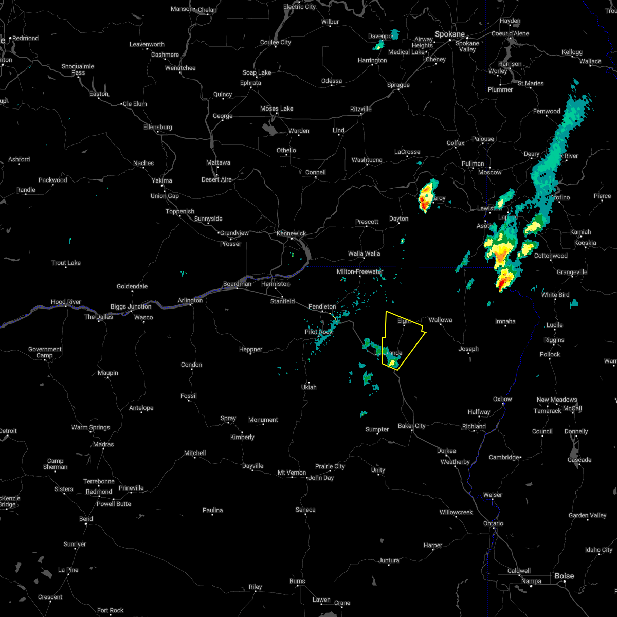
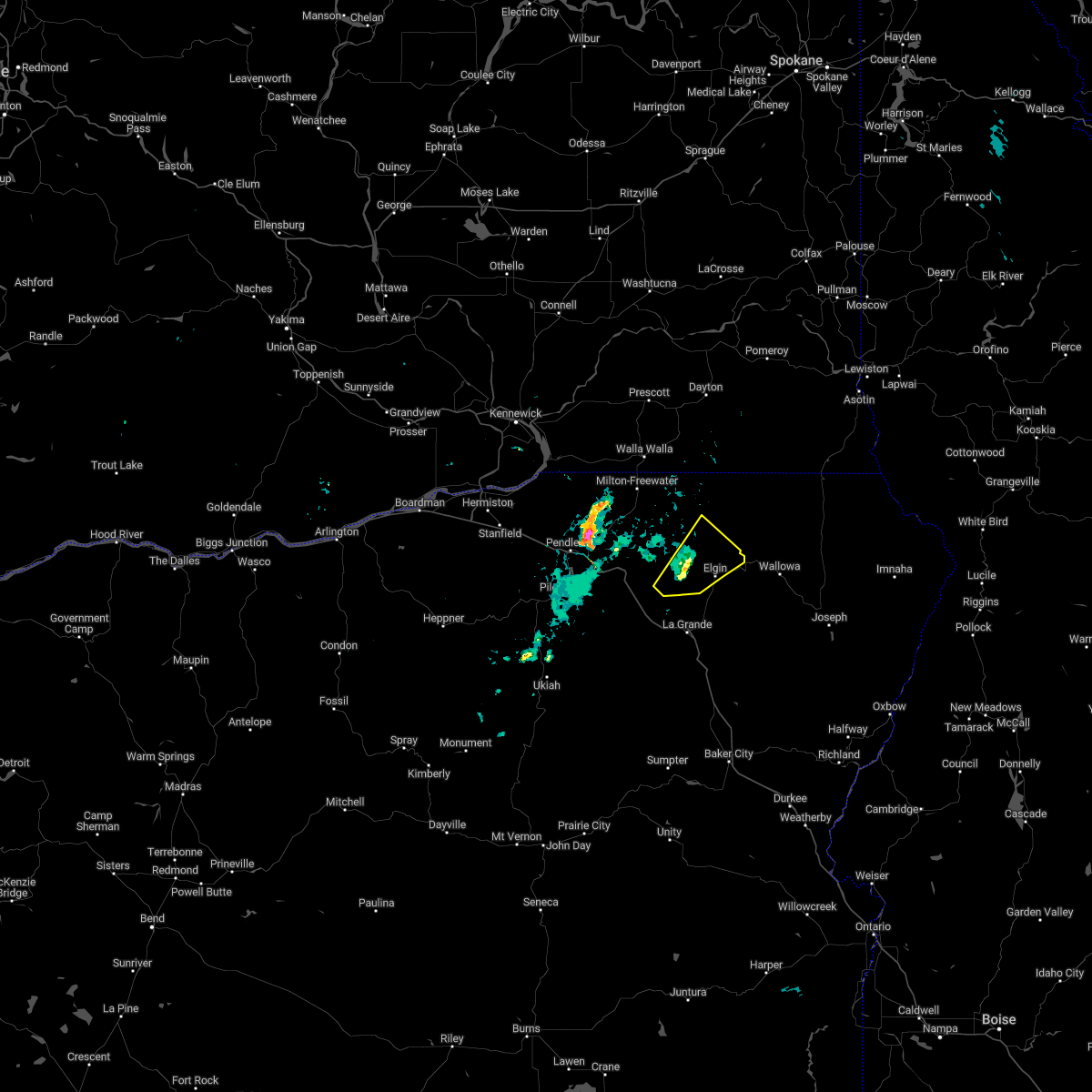
Hail and Wind Damage Spotted near Summerville, OR
| Date / Time | Report Details |
|---|---|
| 8/11/2022 3:02 PM PDT |
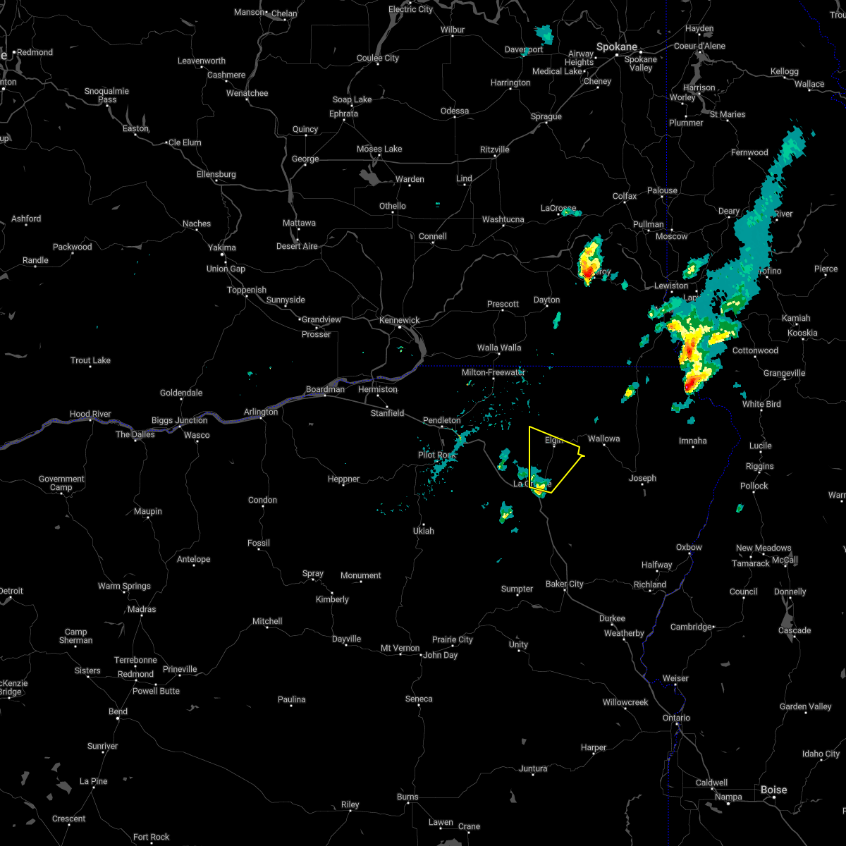 At 302 pm pdt, a severe thunderstorm was located near imbler, or 7 miles northeast of la grande, moving north at 30 mph (radar indicated). Hazards include 60 mph wind gusts and half dollar size hail. Hail damage to vehicles is expected. expect wind damage to roofs, siding, and trees. locations impacted include, la grande, elgin, island city, imbler and summerville. hail threat, radar indicated max hail size, 1. 25 in wind threat, radar indicated max wind gust, 60 mph. At 302 pm pdt, a severe thunderstorm was located near imbler, or 7 miles northeast of la grande, moving north at 30 mph (radar indicated). Hazards include 60 mph wind gusts and half dollar size hail. Hail damage to vehicles is expected. expect wind damage to roofs, siding, and trees. locations impacted include, la grande, elgin, island city, imbler and summerville. hail threat, radar indicated max hail size, 1. 25 in wind threat, radar indicated max wind gust, 60 mph.
|
| 8/11/2022 2:52 PM PDT |
 At 252 pm pdt, a severe thunderstorm was located over island city, or over la grande, moving north at 30 mph (radar indicated). Hazards include 60 mph wind gusts and half dollar size hail. Hail damage to vehicles is expected. Expect wind damage to roofs, siding, and trees. At 252 pm pdt, a severe thunderstorm was located over island city, or over la grande, moving north at 30 mph (radar indicated). Hazards include 60 mph wind gusts and half dollar size hail. Hail damage to vehicles is expected. Expect wind damage to roofs, siding, and trees.
|
| 8/10/2022 2:41 PM PDT |
 At 241 pm pdt, a severe thunderstorm was located 7 miles west of elgin, or 18 miles east of meacham, moving northeast at 25 mph (radar indicated). Hazards include 60 mph wind gusts and quarter size hail. Hail damage to vehicles is expected. expect wind damage to roofs, siding, and trees. locations impacted include, elgin and spout springs. hail threat, radar indicated max hail size, 1. 00 in wind threat, radar indicated max wind gust, 60 mph. At 241 pm pdt, a severe thunderstorm was located 7 miles west of elgin, or 18 miles east of meacham, moving northeast at 25 mph (radar indicated). Hazards include 60 mph wind gusts and quarter size hail. Hail damage to vehicles is expected. expect wind damage to roofs, siding, and trees. locations impacted include, elgin and spout springs. hail threat, radar indicated max hail size, 1. 00 in wind threat, radar indicated max wind gust, 60 mph.
|
| 8/10/2022 2:27 PM PDT |
 At 227 pm pdt, a severe thunderstorm was located near summerville, or 14 miles north of la grande, moving northeast at 25 mph (radar indicated). Hazards include 60 mph wind gusts and quarter size hail. Hail damage to vehicles is expected. Expect wind damage to roofs, siding, and trees. At 227 pm pdt, a severe thunderstorm was located near summerville, or 14 miles north of la grande, moving northeast at 25 mph (radar indicated). Hazards include 60 mph wind gusts and quarter size hail. Hail damage to vehicles is expected. Expect wind damage to roofs, siding, and trees.
|
| 7/2/2022 8:41 PM PDT | Ping Pong Ball sized hail reported 0.2 miles W of Summerville, OR, destroyed garden. dents in car. time estimated from radar. social media report. |
| 7/2/2022 8:40 PM PDT | Golf Ball sized hail reported 0.2 miles W of Summerville, OR |
| 7/2/2022 8:36 PM PDT |
 At 834 pm pdt, a severe thunderstorm was located near summerville, or 9 miles north of la grande, moving northeast at 30 mph (radar indicated). Hazards include two inch hail and 70 mph wind gusts. People and animals outdoors will be injured. expect hail damage to roofs, siding, windows, and vehicles. expect considerable tree damage. Wind damage is also likely to mobile homes, roofs, and outbuildings. At 834 pm pdt, a severe thunderstorm was located near summerville, or 9 miles north of la grande, moving northeast at 30 mph (radar indicated). Hazards include two inch hail and 70 mph wind gusts. People and animals outdoors will be injured. expect hail damage to roofs, siding, windows, and vehicles. expect considerable tree damage. Wind damage is also likely to mobile homes, roofs, and outbuildings.
|
| 7/2/2022 8:26 PM PDT |
 At 825 pm pdt, a severe thunderstorm was located near summerville, or 12 miles north of la grande, moving northeast at 30 mph (radar indicated). Hazards include 60 mph wind gusts and half dollar size hail. Hail damage to vehicles is expected. expect wind damage to roofs, siding, and trees. locations impacted include, elgin, imbler, summerville and hilgard. hail threat, radar indicated max hail size, 1. 25 in wind threat, radar indicated max wind gust, 60 mph. At 825 pm pdt, a severe thunderstorm was located near summerville, or 12 miles north of la grande, moving northeast at 30 mph (radar indicated). Hazards include 60 mph wind gusts and half dollar size hail. Hail damage to vehicles is expected. expect wind damage to roofs, siding, and trees. locations impacted include, elgin, imbler, summerville and hilgard. hail threat, radar indicated max hail size, 1. 25 in wind threat, radar indicated max wind gust, 60 mph.
|
| 7/2/2022 7:49 PM PDT |
 At 748 pm pdt, a severe thunderstorm was located near hilgard, or 12 miles west of la grande, moving northeast at 30 mph (radar indicated). Hazards include 60 mph wind gusts and quarter size hail. Hail damage to vehicles is expected. Expect wind damage to roofs, siding, and trees. At 748 pm pdt, a severe thunderstorm was located near hilgard, or 12 miles west of la grande, moving northeast at 30 mph (radar indicated). Hazards include 60 mph wind gusts and quarter size hail. Hail damage to vehicles is expected. Expect wind damage to roofs, siding, and trees.
|
| 5/6/2022 7:26 PM PDT |
 The severe thunderstorm warning for northeastern umatilla and central union counties will expire at 730 pm pdt, the storm which prompted the warning has weakened below severe limits, and no longer poses an immediate threat to life or property. therefore, the warning will be allowed to expire. The severe thunderstorm warning for northeastern umatilla and central union counties will expire at 730 pm pdt, the storm which prompted the warning has weakened below severe limits, and no longer poses an immediate threat to life or property. therefore, the warning will be allowed to expire.
|
| 5/6/2022 6:31 PM PDT |
 At 630 pm pdt, a severe thunderstorm was located over northwestern umatilla reservation, or 9 miles northwest of meacham, moving east at 40 mph (radar indicated). Hazards include 60 mph wind gusts and quarter size hail. Hail damage to vehicles is expected. Expect wind damage to roofs, siding, and trees. At 630 pm pdt, a severe thunderstorm was located over northwestern umatilla reservation, or 9 miles northwest of meacham, moving east at 40 mph (radar indicated). Hazards include 60 mph wind gusts and quarter size hail. Hail damage to vehicles is expected. Expect wind damage to roofs, siding, and trees.
|
| 6/15/2021 2:10 AM PDT |
 At 209 am pdt, a severe thunderstorm was located 9 miles northeast of spout springs, or 26 miles southeast of walla walla, moving north at 40 mph (radar indicated). Hazards include 60 mph wind gusts and quarter size hail. Hail damage to vehicles is expected. Expect wind damage to roofs, siding, and trees. At 209 am pdt, a severe thunderstorm was located 9 miles northeast of spout springs, or 26 miles southeast of walla walla, moving north at 40 mph (radar indicated). Hazards include 60 mph wind gusts and quarter size hail. Hail damage to vehicles is expected. Expect wind damage to roofs, siding, and trees.
|
| 7/18/2016 5:45 PM PDT | Half Dollar sized hail reported 0.2 miles W of Summerville, OR |
| 5/5/2016 7:16 PM PDT |
 At 714 pm pdt, doppler radar indicated a severe thunderstorm capable of producing quarter size hail and damaging winds in excess of 60 mph. this storm was located near minam, or 25 miles northwest of enterprise, moving northeast at 20 mph. in addition, at 705 pm the public reported quarter size hail, 13 miles east of elgin along highway 82. locations impacted include, la grande, elgin, island city, wallowa, cove, imbler, summerville and minam. At 714 pm pdt, doppler radar indicated a severe thunderstorm capable of producing quarter size hail and damaging winds in excess of 60 mph. this storm was located near minam, or 25 miles northwest of enterprise, moving northeast at 20 mph. in addition, at 705 pm the public reported quarter size hail, 13 miles east of elgin along highway 82. locations impacted include, la grande, elgin, island city, wallowa, cove, imbler, summerville and minam.
|
| 5/5/2016 6:55 PM PDT |
 At 652 pm pdt, doppler radar indicated a severe thunderstorm capable of producing quarter size hail and damaging winds in excess of 60 mph. this storm was located near elgin, or 21 miles northeast of la grande, moving north at 20 mph. in addition, at 605 pm a trained weather spotter reported quarter size hail, three miles southeast of la grande. locations impacted include, la grande, elgin, island city, wallowa, cove, imbler, summerville and minam. At 652 pm pdt, doppler radar indicated a severe thunderstorm capable of producing quarter size hail and damaging winds in excess of 60 mph. this storm was located near elgin, or 21 miles northeast of la grande, moving north at 20 mph. in addition, at 605 pm a trained weather spotter reported quarter size hail, three miles southeast of la grande. locations impacted include, la grande, elgin, island city, wallowa, cove, imbler, summerville and minam.
|
| 5/5/2016 6:44 PM PDT |
 At 644 pm pdt, doppler radar indicated a severe thunderstorm capable of producing quarter size hail and damaging winds in excess of 60 mph. this storm was located 7 miles southeast of elgin, or 17 miles northeast of la grande. this storm was nearly stationary. At 644 pm pdt, doppler radar indicated a severe thunderstorm capable of producing quarter size hail and damaging winds in excess of 60 mph. this storm was located 7 miles southeast of elgin, or 17 miles northeast of la grande. this storm was nearly stationary.
|
| 5/5/2016 6:19 PM PDT |
 At 619 pm pdt, doppler radar indicated a severe thunderstorm capable of producing quarter size hail and damaging winds in excess of 60 mph. this storm was located near imbler, or 8 miles northeast of la grande, and moving northeast at 30 mph. At 619 pm pdt, doppler radar indicated a severe thunderstorm capable of producing quarter size hail and damaging winds in excess of 60 mph. this storm was located near imbler, or 8 miles northeast of la grande, and moving northeast at 30 mph.
|
| 5/5/2016 6:00 PM PDT |
 At 600 pm pdt, doppler radar indicated a severe thunderstorm capable of producing damaging winds in excess of 60 mph. this storm was located over island city, or near la grande, moving northeast at 20 mph. nickel size hail may also accompany the damaging winds. locations impacted include, la grande, elgin, island city, imbler, summerville, hilgard, kamela, gibbon, starkey and eastern umatilla reservation. At 600 pm pdt, doppler radar indicated a severe thunderstorm capable of producing damaging winds in excess of 60 mph. this storm was located over island city, or near la grande, moving northeast at 20 mph. nickel size hail may also accompany the damaging winds. locations impacted include, la grande, elgin, island city, imbler, summerville, hilgard, kamela, gibbon, starkey and eastern umatilla reservation.
|
| 5/5/2016 5:28 PM PDT |
 At 528 pm pdt, doppler radar indicated a severe thunderstorm capable of producing damaging winds in excess of 60 mph. this storm was located near hilgard, or near la grande, and moving north at 20 mph. nickel size hail may also accompany the damaging winds. At 528 pm pdt, doppler radar indicated a severe thunderstorm capable of producing damaging winds in excess of 60 mph. this storm was located near hilgard, or near la grande, and moving north at 20 mph. nickel size hail may also accompany the damaging winds.
|
| 6/1/2015 1:41 PM PDT | At 140 pm pdt, doppler radar indicated a severe thunderstorm capable of producing large hail up to ping pong ball size and damaging winds in excess of 60 mph. this storm was located near meacham, moving northeast at 20 mph. this severe thunderstorm will remain over mainly rural areas of east central umatilla and west central union counties. |
| 6/1/2015 1:24 PM PDT | At 124 pm pdt, doppler radar indicated a severe thunderstorm capable of producing large damaging hail up to golf ball size and damaging winds in excess of 60 mph. this storm was located over kamela, or near meacham, and moving northeast at 15 mph. this dangerous storm will be crossing interstate 84 in the next 5 to 10 minutes. |
| 5/31/2015 8:27 PM PDT | The severe thunderstorm warning for east central umatilla, northwestern wallowa and north central union counties will expire at 830 pm pdt, the storms which prompted the warning have weakened below severe limits, and no longer poses an immediate threat to life or property. therefore the warning will be allowed to expire. however hail up to three quarters of an inch and winds up to 45 mph are still possible with these thunderstorms. |
| 5/31/2015 8:02 PM PDT | At 801 pm pdt, doppler radar indicated a line of severe thunderstorms capable of producing quarter size hail and damaging winds in excess of 60 mph. these storms were located along a line extending from umatilla reservation to 10 miles south of bingham springs to near summerville, moving northeast at 45 mph. locations impacted include, meacham, elgin, summerville, minam and southern umatilla reservation. |
| 5/31/2015 7:36 PM PDT | At 736 pm pdt, doppler radar indicated a line of severe thunderstorms capable of producing quarter size hail and damaging winds in excess of 60 mph. these storms were located along a line extending from 9 miles southwest of meacham to kamela to near hilgard, and moving northeast at 45 mph. |
| 5/31/2015 7:36 PM PDT | At 736 pm pdt, doppler radar indicated a line of severe thunderstorms capable of producing quarter size hail and damaging winds in excess of 60 mph. these storms were located along a line extending from 9 miles southwest of meacham to kamela to near hilgard, and moving northeast at 45 mph. |
| 5/31/2015 7:06 PM PDT | The severe thunderstorm warning for northwestern wallowa and north central union counties will expire at 715 pm pdt, the storm which prompted the warning has weakened below severe limits, and no longer poses an immediate threat to life or property. therefore the warning will be allowed to expire. however hail up to a quarter inch is still possible with this thunderstorm. |
| 5/31/2015 6:46 PM PDT | At 645 pm pdt, trained weather spotters and law enforcement reported a severe thunderstorm producing large damaging hail up to golf ball size. this storm was located over minam, or 24 miles northeast of la grande, moving northeast at 35 mph. locations impacted include, elgin, summerville and minam. |
| 5/31/2015 6:22 PM PDT | At 621 pm pdt, storm spotters reported a severe thunderstorm producing golf ball size hail. this storm was located over imbler, or 12 miles northeast of la grande, and moving northeast at 25 mph. |
| 5/31/2015 5:47 PM PDT | At 545 pm pdt, local law enforcement reported severe thunderstorms producing quarter size hail. these storms were located 8 miles northwest to 5 miles northeast of la grande, moving northeast at 15 mph. locations impacted include, la grande, elgin, island city, imbler, summerville and hilgard. |
| 5/31/2015 5:24 PM PDT | At 523 pm pdt, doppler radar indicated severe thunderstorms capable of producing quarter size hail. these storms were located from 9 miles west of and over la grande, and moving northeast at 15 mph. |
| 5/31/2015 4:25 PM PDT | Golf Ball sized hail reported 0.2 miles W of Summerville, OR, observer reported golbal sized hail for 10 minutes. |
| 8/16/2013 6:35 PM PDT | Quarter sized hail reported 4.3 miles SSE of Summerville, OR, 1 inch hail and very heavy rain. |
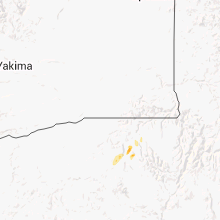
Hail Maps for Summerville, OR


Connect with Interactive Hail Maps