

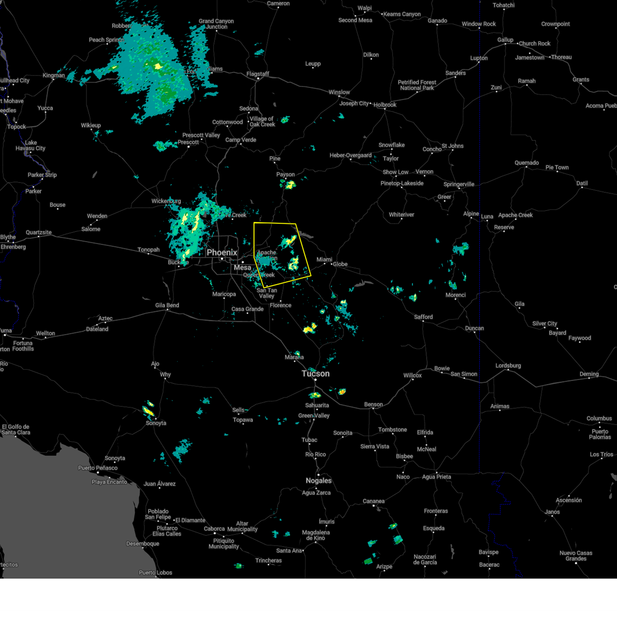
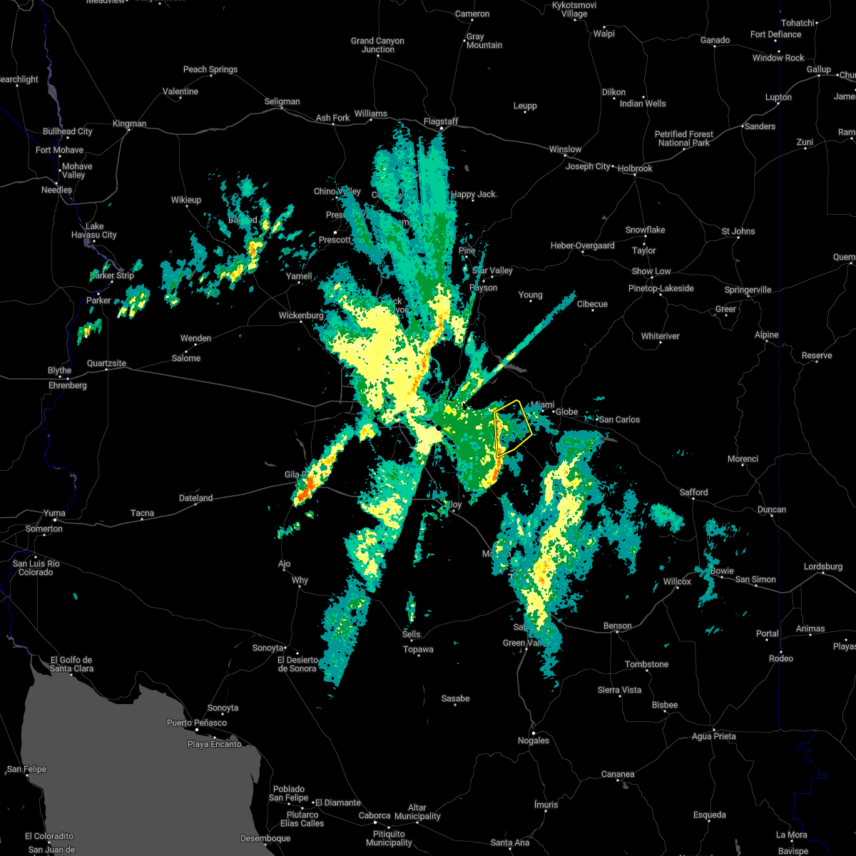
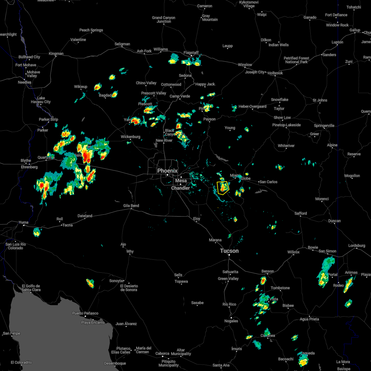
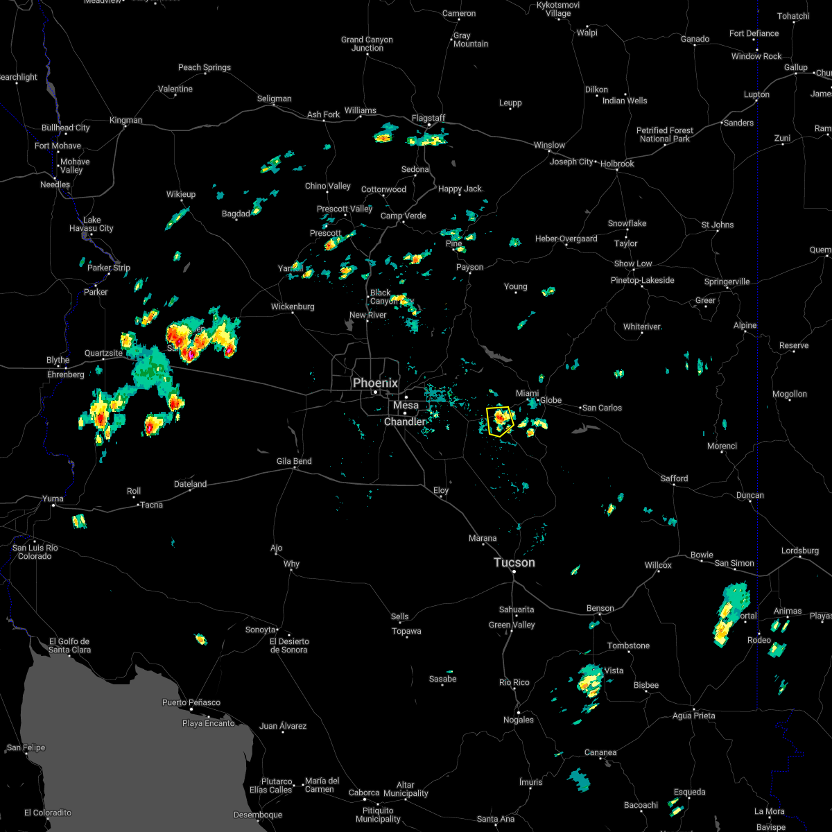
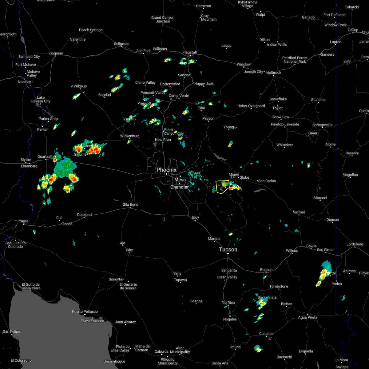
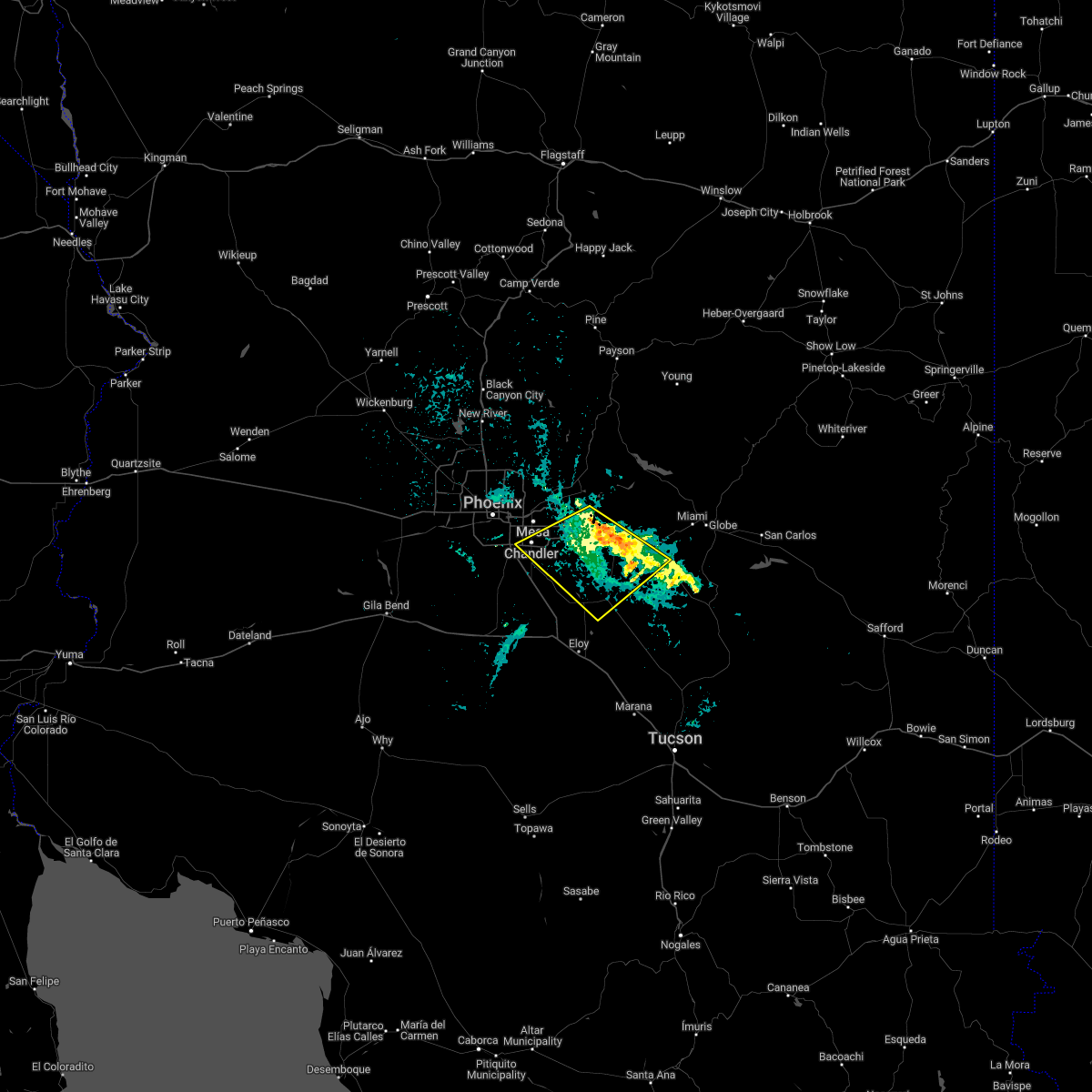
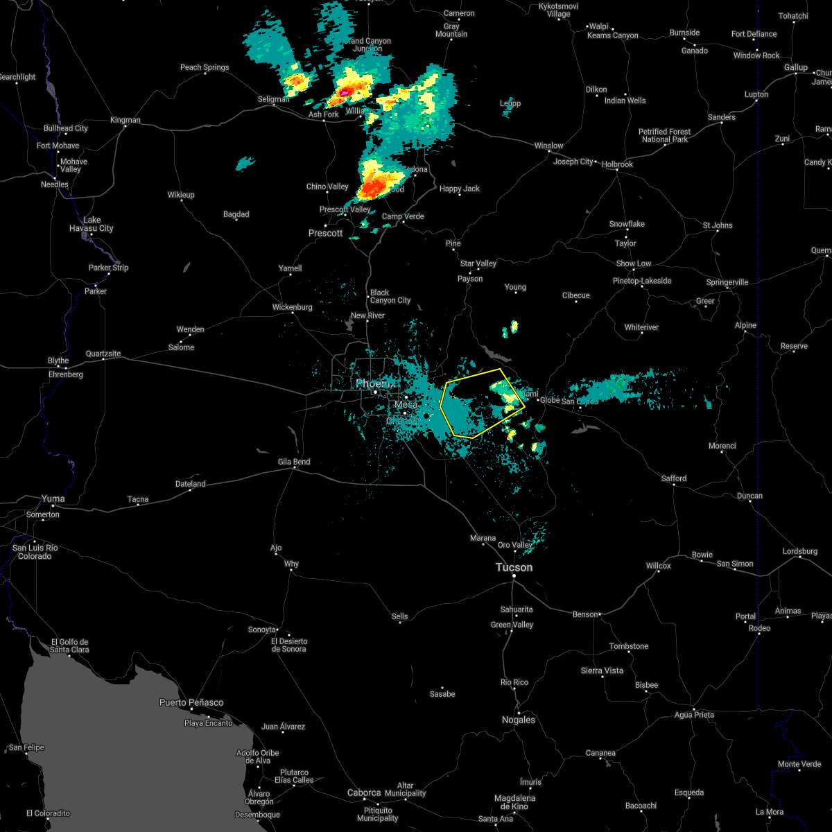
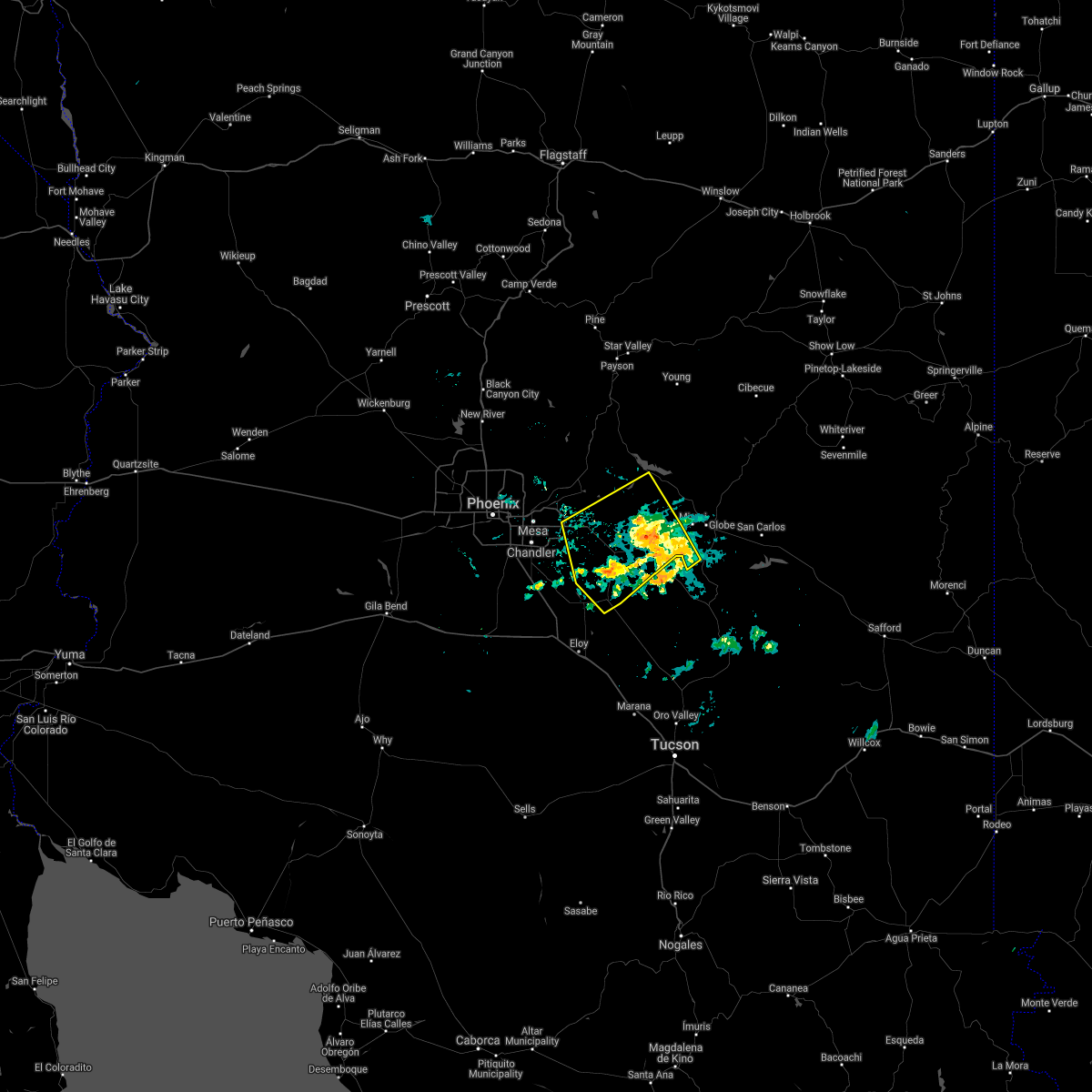
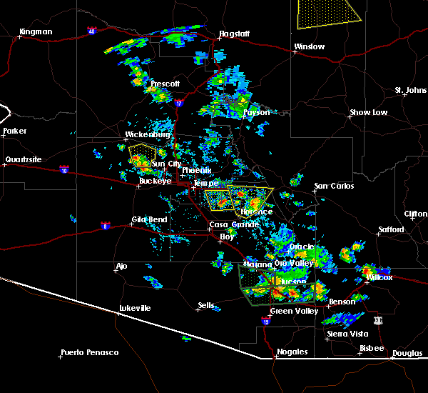
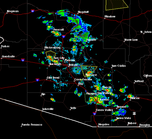
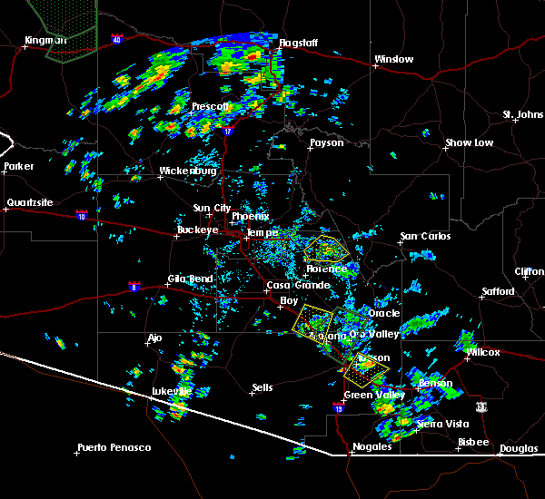
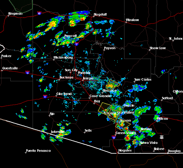
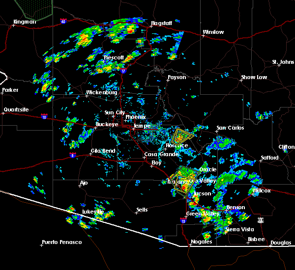
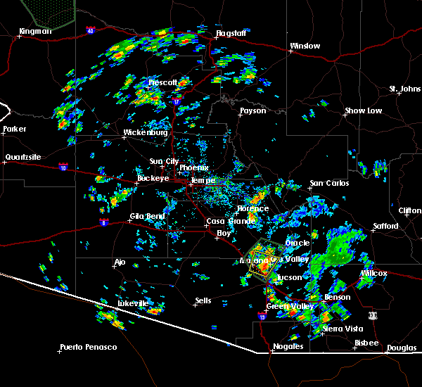
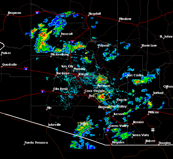
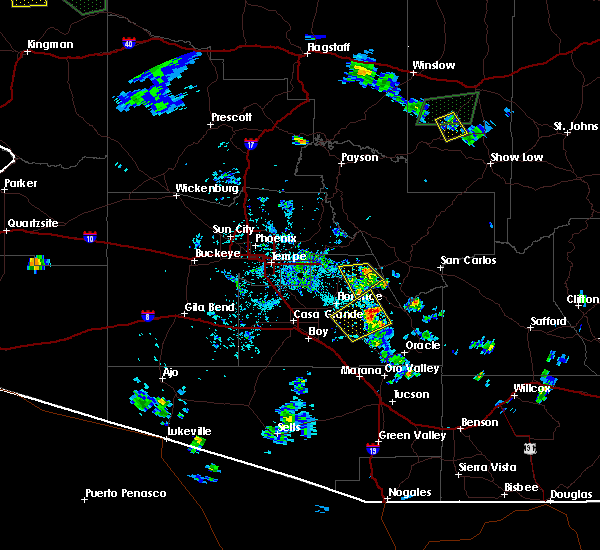
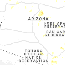
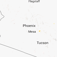
Hail Map for Superior, AZ
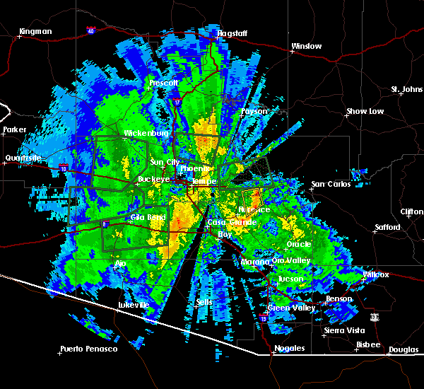
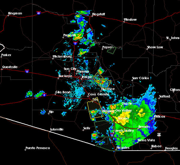
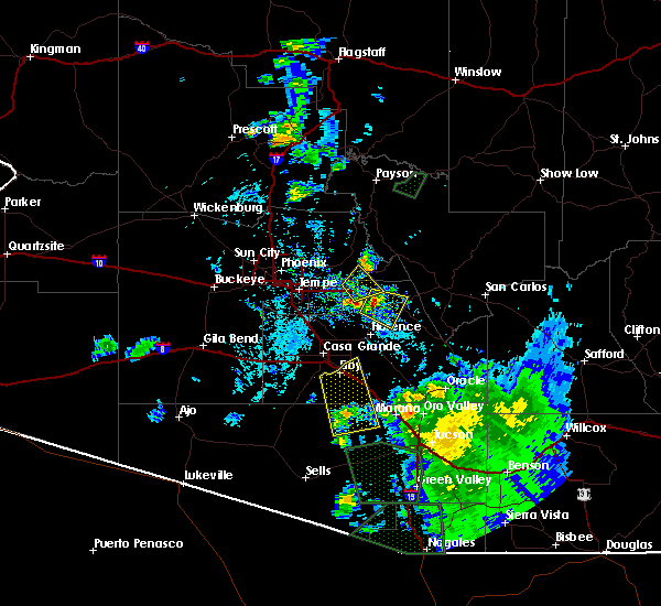
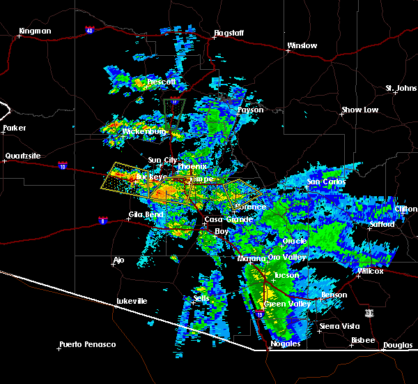
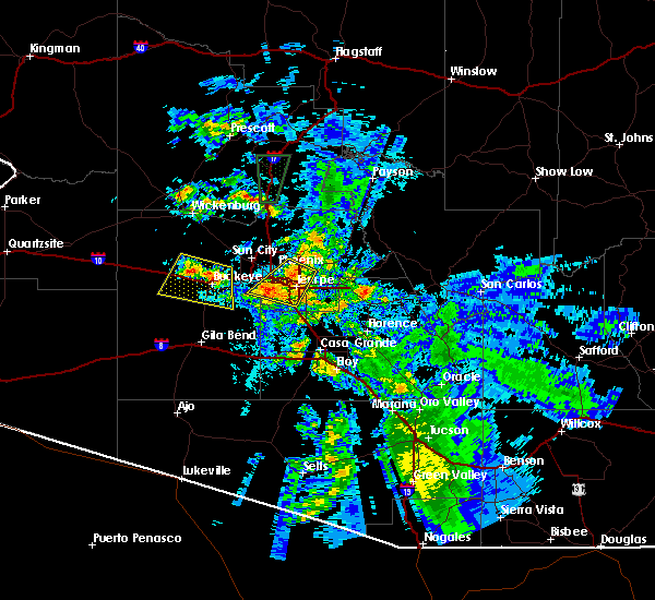
The Superior, AZ area has had 0 reports of on-the-ground hail by trained spotters, and has been under severe weather warnings 1 time during the past 12 months. Doppler radar has detected hail at or near Superior, AZ on 16 occasions.
| Name: | Superior, AZ |
| Where Located: | 56.9 miles ESE of Phoenix, AZ |
| Map: | Google Map for Superior, AZ |
| Population: | 2837 |
| Housing Units: | 1465 |
| More Info: | Search Google for Superior, AZ |
5
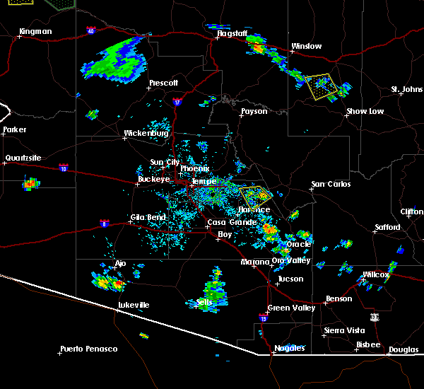
The Top Recent Hail Date for Superior, AZ is Tuesday, October 5, 2010 (1st out of 16)

Hail and Wind Damage Spotted near Superior, AZ
| Date / Time | Report Details |
|---|---|
| 7/30/2023 5:11 PM MST |
 At 511 pm mst, severe thunderstorms were located along a line extending from near four peaks to near boyce thompson arboretum, moving west at 15 mph (radar indicated). Hazards include 60 mph wind gusts and quarter size hail. Hail damage to vehicles is expected. Expect wind damage to roofs, siding, and trees. At 511 pm mst, severe thunderstorms were located along a line extending from near four peaks to near boyce thompson arboretum, moving west at 15 mph (radar indicated). Hazards include 60 mph wind gusts and quarter size hail. Hail damage to vehicles is expected. Expect wind damage to roofs, siding, and trees.
|
| 1/1/2023 4:00 PM MST |
 At 359 pm mst, a severe thunderstorm was located over boyce thompson arboretum, or over superior, moving northeast at 40 mph (radar indicated). Hazards include 60 mph wind gusts. Expect damage to roofs, siding, and trees. locations impacted include, superior, top of the world, boyce thompson arboretum and top-of-the-world. this includes the following highways, us highway 60 between mile markers 219 and 235. Az route 177 between mile markers 159 and 167. At 359 pm mst, a severe thunderstorm was located over boyce thompson arboretum, or over superior, moving northeast at 40 mph (radar indicated). Hazards include 60 mph wind gusts. Expect damage to roofs, siding, and trees. locations impacted include, superior, top of the world, boyce thompson arboretum and top-of-the-world. this includes the following highways, us highway 60 between mile markers 219 and 235. Az route 177 between mile markers 159 and 167.
|
| 1/1/2023 3:47 PM MST |
 At 346 pm mst, a severe thunderstorm was located near queen valley, or 9 miles west of superior, moving northeast at 40 mph (radar indicated). Hazards include 60 mph wind gusts. Expect damage to roofs, siding, and trees. locations impacted include, superior, top of the world, florence junction, queen valley, boyce thompson arboretum and top-of-the-world. this includes the following highways, us highway 60 between mile markers 211 and 235. az route 79 between mile markers 146 and 150. Az route 177 between mile markers 159 and 167. At 346 pm mst, a severe thunderstorm was located near queen valley, or 9 miles west of superior, moving northeast at 40 mph (radar indicated). Hazards include 60 mph wind gusts. Expect damage to roofs, siding, and trees. locations impacted include, superior, top of the world, florence junction, queen valley, boyce thompson arboretum and top-of-the-world. this includes the following highways, us highway 60 between mile markers 211 and 235. az route 79 between mile markers 146 and 150. Az route 177 between mile markers 159 and 167.
|
| 1/1/2023 3:39 PM MST |
 At 339 pm mst, a severe thunderstorm was located near florence junction, or 9 miles north of florence, moving northeast at 30 mph (radar indicated). Hazards include 60 mph wind gusts. expect damage to roofs, siding, and trees At 339 pm mst, a severe thunderstorm was located near florence junction, or 9 miles north of florence, moving northeast at 30 mph (radar indicated). Hazards include 60 mph wind gusts. expect damage to roofs, siding, and trees
|
| 9/23/2022 1:39 PM MST |
 The severe thunderstorm warning for pinal county will expire at 145 pm mst, the storm which prompted the warning has weakened below severe limits, and no longer poses an immediate threat to life or property. therefore, the warning will be allowed to expire. however gusty winds and heavy rain are still possible with this thunderstorm. to report severe weather, contact your nearest law enforcement agency. they will relay your report to the national weather service phoenix. The severe thunderstorm warning for pinal county will expire at 145 pm mst, the storm which prompted the warning has weakened below severe limits, and no longer poses an immediate threat to life or property. therefore, the warning will be allowed to expire. however gusty winds and heavy rain are still possible with this thunderstorm. to report severe weather, contact your nearest law enforcement agency. they will relay your report to the national weather service phoenix.
|
| 9/23/2022 1:20 PM MST |
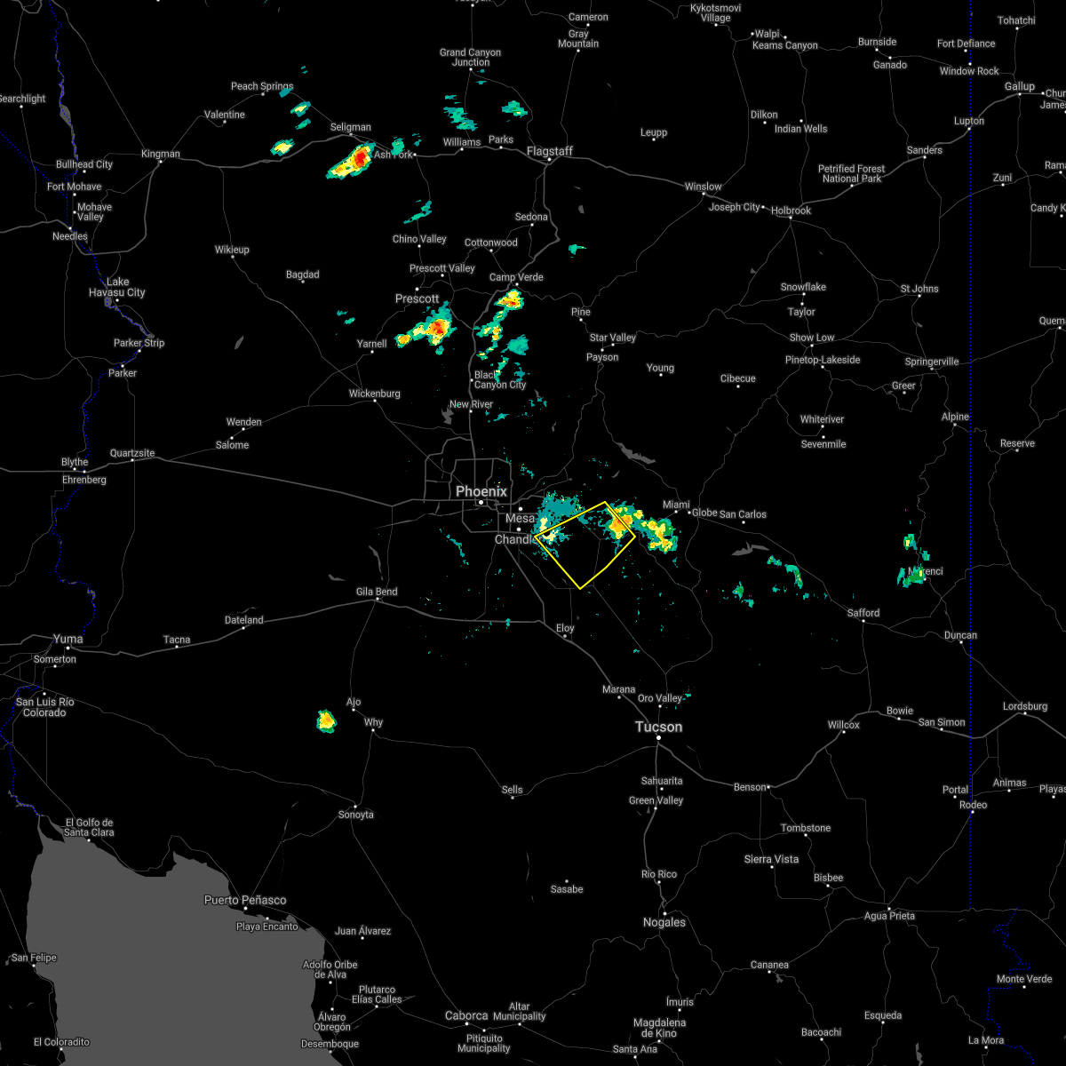
 At 120 pm mst, a severe thunderstorm was located over superior, and is nearly stationary (radar indicated). Hazards include 60 mph wind gusts and penny size hail. Expect damage to roofs, siding, and trees. locations impacted include, superior, boyce thompson arboretum and top-of-the-world. this includes the following highways, us highway 60 between mile markers 222 and 233. az route 177 between mile markers 159 and 167. hail threat, radar indicated max hail size, 0. 75 in wind threat, radar indicated max wind gust, 60 mph. At 120 pm mst, a severe thunderstorm was located over superior, and is nearly stationary (radar indicated). Hazards include 60 mph wind gusts and penny size hail. Expect damage to roofs, siding, and trees. locations impacted include, superior, boyce thompson arboretum and top-of-the-world. this includes the following highways, us highway 60 between mile markers 222 and 233. az route 177 between mile markers 159 and 167. hail threat, radar indicated max hail size, 0. 75 in wind threat, radar indicated max wind gust, 60 mph.
|
| 9/23/2022 12:56 PM MST |
 At 1256 pm mst, a severe thunderstorm was located near superior, and is nearly stationary (radar indicated). Hazards include 60 mph wind gusts and nickel size hail. expect damage to roofs, siding, and trees At 1256 pm mst, a severe thunderstorm was located near superior, and is nearly stationary (radar indicated). Hazards include 60 mph wind gusts and nickel size hail. expect damage to roofs, siding, and trees
|
| 9/1/2022 10:01 PM MST |
 At 1000 pm mst, severe thunderstorms were located along a line extending from near apache junction to 12 miles east of florence, moving southwest at 25 mph (radar indicated). Hazards include 70 mph wind gusts. Expect considerable tree damage. damage is likely to mobile homes, roofs, and outbuildings. locations impacted include, mesa, chandler, gilbert, apache junction, florence, coolidge, superior, gold canyon, queen creek, gold camp, lost dutchman state park, goldfield, san tan village mall, san tan valley and seville. this includes the following highways, us highway 60 between mile markers 186 and 225. az route 87 between mile markers 133 and 136, and between mile markers 161 and 168. az route 202 between mile markers 28 and 52. thunderstorm damage threat, considerable hail threat, radar indicated max hail size, <. 75 in wind threat, radar indicated max wind gust, 70 mph. At 1000 pm mst, severe thunderstorms were located along a line extending from near apache junction to 12 miles east of florence, moving southwest at 25 mph (radar indicated). Hazards include 70 mph wind gusts. Expect considerable tree damage. damage is likely to mobile homes, roofs, and outbuildings. locations impacted include, mesa, chandler, gilbert, apache junction, florence, coolidge, superior, gold canyon, queen creek, gold camp, lost dutchman state park, goldfield, san tan village mall, san tan valley and seville. this includes the following highways, us highway 60 between mile markers 186 and 225. az route 87 between mile markers 133 and 136, and between mile markers 161 and 168. az route 202 between mile markers 28 and 52. thunderstorm damage threat, considerable hail threat, radar indicated max hail size, <. 75 in wind threat, radar indicated max wind gust, 70 mph.
|
| 9/1/2022 9:43 PM MST |
 At 943 pm mst, severe thunderstorms were located along a line extending from gold camp to 10 miles south of superior, moving southwest at 25 mph (radar indicated). Hazards include 60 mph wind gusts. expect damage to roofs, siding, and trees At 943 pm mst, severe thunderstorms were located along a line extending from gold camp to 10 miles south of superior, moving southwest at 25 mph (radar indicated). Hazards include 60 mph wind gusts. expect damage to roofs, siding, and trees
|
| 8/27/2022 4:52 PM MST | At 452 pm mst, a severe thunderstorm was located near kings ranch, or near gold canyon, moving southeast at 20 mph (radar indicated). Hazards include 60 mph wind gusts. expect damage to roofs, siding, and trees |
| 8/23/2022 3:47 PM MST | At 346 pm mst, severe thunderstorms were located along a line extending from near superstition mountains to near queen valley to superior, moving southwest at 5 mph (radar indicated). Hazards include 60 mph wind gusts and quarter size hail. Hail damage to vehicles is expected. expect wind damage to roofs, siding, and trees. locations impacted include, mesa, apache junction, superior, gold canyon, top of the world, gold camp, lost dutchman state park, goldfield, usery mountain park, top-of-the-world, florence junction, queen valley, canyon lake, superstition mountains and kings ranch. this includes the following highways, us highway 60 between mile markers 194 and 235. az route 202 between mile markers 24 and 28. az route 79 between mile markers 147 and 150. hail threat, radar indicated max hail size, 1. 00 in wind threat, radar indicated max wind gust, 60 mph. |
| 8/23/2022 3:28 PM MST | At 328 pm mst, severe thunderstorms were located along a line extending from near superstition mountains to 7 miles north of queen valley to near superior, moving southwest at 5 mph (radar indicated). Hazards include 60 mph wind gusts and quarter size hail. Hail damage to vehicles is expected. Expect wind damage to roofs, siding, and trees. |
| 8/22/2022 4:45 PM MST | At 444 pm mst, a severe thunderstorm was located near top-of-the-world, or 9 miles west of globe, moving west at 10 mph (radar indicated). Hazards include 60 mph wind gusts and quarter size hail. Hail damage to vehicles is expected. Expect wind damage to roofs, siding, and trees. |
| 10/5/2021 1:55 PM MST |
 At 155 pm mst, severe thunderstorms were located along a line extending from near superstition mountains to 7 miles north of queen valley to superior, moving northeast at 35 mph (radar indicated). Hazards include 60 mph wind gusts and quarter size hail. Hail damage to vehicles is expected. expect wind damage to roofs, siding, and trees. locations impacted include, superior, superstition mountains, lost dutchman state park, goldfield, apache lake, boyce thompson arboretum, top-of-the-world, queen valley and gold camp. this includes the following highways, us highway 60 between mile markers 219 and 242. az route 177 between mile markers 165 and 167. hail threat, radar indicated max hail size, 1. 00 in wind threat, radar indicated max wind gust, 60 mph. At 155 pm mst, severe thunderstorms were located along a line extending from near superstition mountains to 7 miles north of queen valley to superior, moving northeast at 35 mph (radar indicated). Hazards include 60 mph wind gusts and quarter size hail. Hail damage to vehicles is expected. expect wind damage to roofs, siding, and trees. locations impacted include, superior, superstition mountains, lost dutchman state park, goldfield, apache lake, boyce thompson arboretum, top-of-the-world, queen valley and gold camp. this includes the following highways, us highway 60 between mile markers 219 and 242. az route 177 between mile markers 165 and 167. hail threat, radar indicated max hail size, 1. 00 in wind threat, radar indicated max wind gust, 60 mph.
|
| 10/5/2021 1:35 PM MST |
 At 135 pm mst, severe thunderstorms were located along a line extending from near gold canyon to florence junction to 9 miles south of queen valley, moving east at 35 mph (radar indicated). Hazards include 60 mph wind gusts and quarter size hail. Hail damage to vehicles is expected. Expect wind damage to roofs, siding, and trees. At 135 pm mst, severe thunderstorms were located along a line extending from near gold canyon to florence junction to 9 miles south of queen valley, moving east at 35 mph (radar indicated). Hazards include 60 mph wind gusts and quarter size hail. Hail damage to vehicles is expected. Expect wind damage to roofs, siding, and trees.
|
| 8/16/2021 10:14 PM MST |
 At 1014 pm mst, severe thunderstorms were located along a line extending from near camp creek to near rio verde to near apache junction to near gold canyon to near superior, moving southwest at 30 mph (radar indicated). Hazards include 70 mph wind gusts and quarter size hail. Hail damage to vehicles is expected. expect considerable tree damage. Wind damage is also likely to mobile homes, roofs, and outbuildings. At 1014 pm mst, severe thunderstorms were located along a line extending from near camp creek to near rio verde to near apache junction to near gold canyon to near superior, moving southwest at 30 mph (radar indicated). Hazards include 70 mph wind gusts and quarter size hail. Hail damage to vehicles is expected. expect considerable tree damage. Wind damage is also likely to mobile homes, roofs, and outbuildings.
|
| 8/16/2021 9:41 PM MST |
 At 941 pm mst, severe thunderstorms were located along a line extending from near four peaks to near apache lake to miami, moving south at 15 mph (radar indicated). Hazards include 60 mph wind gusts and penny size hail. expect damage to roofs, siding, and trees At 941 pm mst, severe thunderstorms were located along a line extending from near four peaks to near apache lake to miami, moving south at 15 mph (radar indicated). Hazards include 60 mph wind gusts and penny size hail. expect damage to roofs, siding, and trees
|
| 8/15/2021 10:19 PM MST |
 At 1019 pm mst, a severe thunderstorm was located near queen valley, or near gold canyon, moving southwest at 40 mph (radar indicated). Hazards include 60 mph wind gusts and penny size hail. Expect damage to roofs, siding, and trees. locations impacted include, apache junction, superior, gold canyon, florence junction, queen valley, superstition mountains, gold camp, kings ranch, lost dutchman state park, goldfield and boyce thompson arboretum. this includes the following highways, us highway 60 between mile markers 197 and 229. az route 79 between mile markers 143 and 150. az route 177 near mile marker 167. hail threat, radar indicated max hail size, 0. 75 in wind threat, radar indicated max wind gust, 60 mph. At 1019 pm mst, a severe thunderstorm was located near queen valley, or near gold canyon, moving southwest at 40 mph (radar indicated). Hazards include 60 mph wind gusts and penny size hail. Expect damage to roofs, siding, and trees. locations impacted include, apache junction, superior, gold canyon, florence junction, queen valley, superstition mountains, gold camp, kings ranch, lost dutchman state park, goldfield and boyce thompson arboretum. this includes the following highways, us highway 60 between mile markers 197 and 229. az route 79 between mile markers 143 and 150. az route 177 near mile marker 167. hail threat, radar indicated max hail size, 0. 75 in wind threat, radar indicated max wind gust, 60 mph.
|
| 8/15/2021 9:58 PM MST |
 At 957 pm mst, a severe thunderstorm was located 9 miles southeast of apache lake, or 12 miles north of superior, moving southwest at 30 mph (radar indicated). Hazards include 70 mph wind gusts and quarter size hail. Hail damage to vehicles is expected. expect considerable tree damage. Wind damage is also likely to mobile homes, roofs, and outbuildings. At 957 pm mst, a severe thunderstorm was located 9 miles southeast of apache lake, or 12 miles north of superior, moving southwest at 30 mph (radar indicated). Hazards include 70 mph wind gusts and quarter size hail. Hail damage to vehicles is expected. expect considerable tree damage. Wind damage is also likely to mobile homes, roofs, and outbuildings.
|
| 8/13/2021 10:44 PM MST |
 At 1043 pm mst, severe thunderstorms were located along a line extending from saguaro lake to goldfield to near gold canyon, moving southwest at 45 mph (radar indicated). Hazards include 70 mph wind gusts and nickel size hail. Expect considerable tree damage. Damage is likely to mobile homes, roofs, and outbuildings. At 1043 pm mst, severe thunderstorms were located along a line extending from saguaro lake to goldfield to near gold canyon, moving southwest at 45 mph (radar indicated). Hazards include 70 mph wind gusts and nickel size hail. Expect considerable tree damage. Damage is likely to mobile homes, roofs, and outbuildings.
|
| 8/13/2021 4:55 PM MST |
 At 455 pm mst, a severe thunderstorm was located near miami, or 9 miles northwest of globe, moving west at 20 mph (radar indicated). Hazards include ping pong ball size hail and 60 mph wind gusts. People and animals outdoors will be injured. expect hail damage to roofs, siding, windows, and vehicles. expect wind damage to roofs, siding, and trees. locations impacted include, globe, superior, miami, central heights-midland city, top-of-the-world, claypool and inspiration. this includes the following highways, us highway 60 between mile markers 227 and 253. az route 70 near mile marker 253. az route 177 near mile marker 167. hail threat, radar indicated max hail size, 1. 50 in wind threat, radar indicated max wind gust, 60 mph. At 455 pm mst, a severe thunderstorm was located near miami, or 9 miles northwest of globe, moving west at 20 mph (radar indicated). Hazards include ping pong ball size hail and 60 mph wind gusts. People and animals outdoors will be injured. expect hail damage to roofs, siding, windows, and vehicles. expect wind damage to roofs, siding, and trees. locations impacted include, globe, superior, miami, central heights-midland city, top-of-the-world, claypool and inspiration. this includes the following highways, us highway 60 between mile markers 227 and 253. az route 70 near mile marker 253. az route 177 near mile marker 167. hail threat, radar indicated max hail size, 1. 50 in wind threat, radar indicated max wind gust, 60 mph.
|
| 8/13/2021 4:34 PM MST |
 At 433 pm mst, a severe thunderstorm was located over claypool, or near globe, moving west at 15 mph (radar indicated). Hazards include 60 mph wind gusts and quarter size hail. Hail damage to vehicles is expected. Expect wind damage to roofs, siding, and trees. At 433 pm mst, a severe thunderstorm was located over claypool, or near globe, moving west at 15 mph (radar indicated). Hazards include 60 mph wind gusts and quarter size hail. Hail damage to vehicles is expected. Expect wind damage to roofs, siding, and trees.
|
| 7/10/2021 7:00 PM MST |
 At 659 pm mst, severe thunderstorms were located along a line extending from 7 miles southeast of apache lake to near superior to 9 miles south of globe, moving southwest at 40 mph (radar indicated). Hazards include 70 mph wind gusts and quarter size hail. Hail damage to vehicles is expected. expect considerable tree damage. Wind damage is also likely to mobile homes, roofs, and outbuildings. At 659 pm mst, severe thunderstorms were located along a line extending from 7 miles southeast of apache lake to near superior to 9 miles south of globe, moving southwest at 40 mph (radar indicated). Hazards include 70 mph wind gusts and quarter size hail. Hail damage to vehicles is expected. expect considerable tree damage. Wind damage is also likely to mobile homes, roofs, and outbuildings.
|
| 7/9/2021 9:48 PM MST |
 At 948 pm mst, severe thunderstorms were located along a line extending from near superstition mountains to queen valley to near superior, moving southwest at 45 mph (radar indicated). Hazards include 70 mph wind gusts and nickel size hail. Expect considerable tree damage. damage is likely to mobile homes, roofs, and outbuildings. locations impacted include, mesa, apache junction, florence, superior, gold canyon, queen creek, gold camp, lost dutchman state park, goldfield, magma, san tan valley, top-of-the-world, florence junction, queen valley and superstition mountains. this includes the following highways, us highway 60 between mile markers 191 and 240. az route 202 between mile markers 29 and 32. Az route 79 between mile markers 130 and 150. At 948 pm mst, severe thunderstorms were located along a line extending from near superstition mountains to queen valley to near superior, moving southwest at 45 mph (radar indicated). Hazards include 70 mph wind gusts and nickel size hail. Expect considerable tree damage. damage is likely to mobile homes, roofs, and outbuildings. locations impacted include, mesa, apache junction, florence, superior, gold canyon, queen creek, gold camp, lost dutchman state park, goldfield, magma, san tan valley, top-of-the-world, florence junction, queen valley and superstition mountains. this includes the following highways, us highway 60 between mile markers 191 and 240. az route 202 between mile markers 29 and 32. Az route 79 between mile markers 130 and 150.
|
| 7/9/2021 9:39 PM MST |
 At 939 pm mst, severe thunderstorms were located along a line extending from near apache lake to near boyce thompson arboretum to 8 miles southeast of superior, moving southwest at 35 mph (radar indicated). Hazards include 60 mph wind gusts and nickel size hail. expect damage to roofs, siding, and trees At 939 pm mst, severe thunderstorms were located along a line extending from near apache lake to near boyce thompson arboretum to 8 miles southeast of superior, moving southwest at 35 mph (radar indicated). Hazards include 60 mph wind gusts and nickel size hail. expect damage to roofs, siding, and trees
|
| 7/8/2021 6:04 PM MST |
 At 604 pm mst, a severe thunderstorm was located over queen valley, or 8 miles southeast of gold canyon, moving southwest at 35 mph (radar indicated). Hazards include 60 mph wind gusts and penny size hail. expect damage to roofs, siding, and trees At 604 pm mst, a severe thunderstorm was located over queen valley, or 8 miles southeast of gold canyon, moving southwest at 35 mph (radar indicated). Hazards include 60 mph wind gusts and penny size hail. expect damage to roofs, siding, and trees
|
| 8/16/2020 3:52 PM MST |
 At 351 pm mst, a severe thunderstorm was located near top-of-the-world, or 9 miles southwest of globe, moving southwest at 20 mph (radar indicated). Hazards include 60 mph wind gusts and quarter size hail. Hail damage to vehicles is expected. expect wind damage to roofs, siding, and trees. locations impacted include, globe, superior, miami, cutter, central heights-midland city, top-of-the-world, claypool and inspiration. this includes the following highways, us highway 60 between mile markers 227 and 255. az route 70 between mile markers 253 and 260. Az route 77 between mile markers 152 and 170. At 351 pm mst, a severe thunderstorm was located near top-of-the-world, or 9 miles southwest of globe, moving southwest at 20 mph (radar indicated). Hazards include 60 mph wind gusts and quarter size hail. Hail damage to vehicles is expected. expect wind damage to roofs, siding, and trees. locations impacted include, globe, superior, miami, cutter, central heights-midland city, top-of-the-world, claypool and inspiration. this includes the following highways, us highway 60 between mile markers 227 and 255. az route 70 between mile markers 253 and 260. Az route 77 between mile markers 152 and 170.
|
| 8/16/2020 3:30 PM MST |
 At 330 pm mst, a severe thunderstorm was located near miami, or near globe, moving southwest at 15 mph (radar indicated). Hazards include 60 mph wind gusts and quarter size hail. Hail damage to vehicles is expected. Expect wind damage to roofs, siding, and trees. At 330 pm mst, a severe thunderstorm was located near miami, or near globe, moving southwest at 15 mph (radar indicated). Hazards include 60 mph wind gusts and quarter size hail. Hail damage to vehicles is expected. Expect wind damage to roofs, siding, and trees.
|
| 11/29/2019 5:40 AM MST |
 The severe thunderstorm warning for pinal county will expire at 545 am mst, the storm which prompted the warning has moved out of the area. therefore, the warning will be allowed to expire. however heavy rain is still possible with this thunderstorm. The severe thunderstorm warning for pinal county will expire at 545 am mst, the storm which prompted the warning has moved out of the area. therefore, the warning will be allowed to expire. however heavy rain is still possible with this thunderstorm.
|
| 11/29/2019 5:29 AM MST |
 At 529 am mst, a severe thunderstorm was located near boyce thompson arboretum, or near superior, moving northeast at 60 mph (radar indicated). Hazards include 60 mph wind gusts. Expect damage to roofs, siding, and trees. locations impacted include, superior, boyce thompson arboretum and queen valley. this includes the following highways, us highway 60 between mile markers 215 and 228. Az route 177 between mile markers 162 and 167. At 529 am mst, a severe thunderstorm was located near boyce thompson arboretum, or near superior, moving northeast at 60 mph (radar indicated). Hazards include 60 mph wind gusts. Expect damage to roofs, siding, and trees. locations impacted include, superior, boyce thompson arboretum and queen valley. this includes the following highways, us highway 60 between mile markers 215 and 228. Az route 177 between mile markers 162 and 167.
|
| 11/29/2019 5:24 AM MST |
 At 523 am mst, a severe thunderstorm was located near florence junction, or 10 miles northeast of florence, moving northeast at 45 mph (radar indicated). Hazards include 60 mph wind gusts. Expect damage to roofs, siding, and trees. locations impacted include, florence, superior, queen valley, boyce thompson arboretum and florence junction. this includes the following highways, us highway 60 between mile markers 213 and 228. az route 79 between mile markers 129 and 130. Az route 177 between mile markers 162 and 167. At 523 am mst, a severe thunderstorm was located near florence junction, or 10 miles northeast of florence, moving northeast at 45 mph (radar indicated). Hazards include 60 mph wind gusts. Expect damage to roofs, siding, and trees. locations impacted include, florence, superior, queen valley, boyce thompson arboretum and florence junction. this includes the following highways, us highway 60 between mile markers 213 and 228. az route 79 between mile markers 129 and 130. Az route 177 between mile markers 162 and 167.
|
| 11/29/2019 5:18 AM MST |
 At 518 am mst, a severe thunderstorm was located 7 miles south of florence junction, or 7 miles north of florence, moving east at 45 mph (radar indicated). Hazards include 60 mph wind gusts. expect damage to roofs, siding, and trees At 518 am mst, a severe thunderstorm was located 7 miles south of florence junction, or 7 miles north of florence, moving east at 45 mph (radar indicated). Hazards include 60 mph wind gusts. expect damage to roofs, siding, and trees
|
| 7/23/2019 6:06 PM MST |
 The severe thunderstorm warning for gila and pinal counties will expire at 615 pm mst, the storm which prompted the warning has weakened below severe limits, and no longer poses an immediate threat to life or property. therefore, the warning will be allowed to expire. however gusty winds are still possible with this thunderstorm. The severe thunderstorm warning for gila and pinal counties will expire at 615 pm mst, the storm which prompted the warning has weakened below severe limits, and no longer poses an immediate threat to life or property. therefore, the warning will be allowed to expire. however gusty winds are still possible with this thunderstorm.
|
| 7/23/2019 5:44 PM MST |
 At 543 pm mst, a severe thunderstorm was located 7 miles southeast of top of the world, or 9 miles southwest of globe, moving southwest at 15 mph (radar indicated). Hazards include 60 mph wind gusts and penny size hail. expect damage to roofs, siding, and trees At 543 pm mst, a severe thunderstorm was located 7 miles southeast of top of the world, or 9 miles southwest of globe, moving southwest at 15 mph (radar indicated). Hazards include 60 mph wind gusts and penny size hail. expect damage to roofs, siding, and trees
|
| 10/23/2018 2:08 PM MST |
 At 208 pm mst, a severe thunderstorm was located over queen valley, or 11 miles west of superior, moving southeast at 5 mph (radar indicated). Hazards include 60 mph wind gusts and quarter size hail. Hail damage to vehicles is expected. expect wind damage to roofs, siding, and trees. locations impacted include, superior, florence junction, queen valley and boyce thompson arboretum. this includes the following highways, us highway 60 between mile markers 208 and 228. az route 79 between mile markers 145 and 150. Az route 177 near mile marker 167. At 208 pm mst, a severe thunderstorm was located over queen valley, or 11 miles west of superior, moving southeast at 5 mph (radar indicated). Hazards include 60 mph wind gusts and quarter size hail. Hail damage to vehicles is expected. expect wind damage to roofs, siding, and trees. locations impacted include, superior, florence junction, queen valley and boyce thompson arboretum. this includes the following highways, us highway 60 between mile markers 208 and 228. az route 79 between mile markers 145 and 150. Az route 177 near mile marker 167.
|
| 10/23/2018 2:01 PM MST |
 At 200 pm mst, a severe thunderstorm was located over queen valley, or 12 miles west of superior, moving southeast at 5 mph (radar indicated). Hazards include 60 mph wind gusts and quarter size hail. Hail damage to vehicles is expected. Expect wind damage to roofs, siding, and trees. At 200 pm mst, a severe thunderstorm was located over queen valley, or 12 miles west of superior, moving southeast at 5 mph (radar indicated). Hazards include 60 mph wind gusts and quarter size hail. Hail damage to vehicles is expected. Expect wind damage to roofs, siding, and trees.
|
| 9/2/2018 6:03 PM MST |
 At 602 pm mst, a severe thunderstorm was located near queen valley, or 10 miles west of superior, moving north at 25 mph (radar indicated). Hazards include 60 mph wind gusts and quarter size hail. Hail damage to vehicles is expected. expect wind damage to roofs, siding, and trees. locations impacted include, apache junction, florence, superior, top of the world, florence junction, queen valley, gold camp, kings ranch, boyce thompson arboretum and top-of-the-world. this includes the following highways, us highway 60 between mile markers 200 and 237. az route 79 between mile markers 137 and 150. Az route 177 between mile markers 162 and 167. At 602 pm mst, a severe thunderstorm was located near queen valley, or 10 miles west of superior, moving north at 25 mph (radar indicated). Hazards include 60 mph wind gusts and quarter size hail. Hail damage to vehicles is expected. expect wind damage to roofs, siding, and trees. locations impacted include, apache junction, florence, superior, top of the world, florence junction, queen valley, gold camp, kings ranch, boyce thompson arboretum and top-of-the-world. this includes the following highways, us highway 60 between mile markers 200 and 237. az route 79 between mile markers 137 and 150. Az route 177 between mile markers 162 and 167.
|
| 9/2/2018 5:42 PM MST |
 At 542 pm mst, a severe thunderstorm was located 8 miles northeast of florence, moving north at 25 mph (radar indicated). Hazards include 60 mph wind gusts and quarter size hail. Hail damage to vehicles is expected. Expect wind damage to roofs, siding, and trees. At 542 pm mst, a severe thunderstorm was located 8 miles northeast of florence, moving north at 25 mph (radar indicated). Hazards include 60 mph wind gusts and quarter size hail. Hail damage to vehicles is expected. Expect wind damage to roofs, siding, and trees.
|
| 8/22/2018 4:08 PM MST |
 At 407 pm mst, a severe thunderstorm was located over florence junction, or 13 miles west of superior, moving north at 7 mph (radar indicated). Hazards include 60 mph wind gusts and nickel size hail. Expect damage to roofs, siding, and trees. locations impacted include, superior, florence junction, queen valley and boyce thompson arboretum. this includes the following highways, us highway 60 between mile markers 210 and 233. az route 79 between mile markers 149 and 150. Az route 177 between mile markers 159 and 167. At 407 pm mst, a severe thunderstorm was located over florence junction, or 13 miles west of superior, moving north at 7 mph (radar indicated). Hazards include 60 mph wind gusts and nickel size hail. Expect damage to roofs, siding, and trees. locations impacted include, superior, florence junction, queen valley and boyce thompson arboretum. this includes the following highways, us highway 60 between mile markers 210 and 233. az route 79 between mile markers 149 and 150. Az route 177 between mile markers 159 and 167.
|
| 8/22/2018 3:47 PM MST |
 At 346 pm mst, a severe thunderstorm was located near boyce thompson arboretum, or near superior, moving north at 7 mph (radar indicated). Hazards include 60 mph wind gusts and nickel size hail. expect damage to roofs, siding, and trees At 346 pm mst, a severe thunderstorm was located near boyce thompson arboretum, or near superior, moving north at 7 mph (radar indicated). Hazards include 60 mph wind gusts and nickel size hail. expect damage to roofs, siding, and trees
|
| 8/22/2018 3:38 PM MST |
 At 338 pm mst, a severe thunderstorm was located near boyce thompson arboretum, or near superior, and is nearly stationary (radar indicated). Hazards include 60 mph wind gusts and penny size hail. Expect damage to roofs, siding, and trees. locations impacted include, superior, boyce thompson arboretum and top-of-the-world. this includes the following highways, us highway 60 between mile markers 221 and 234. Az route 177 between mile markers 159 and 167. At 338 pm mst, a severe thunderstorm was located near boyce thompson arboretum, or near superior, and is nearly stationary (radar indicated). Hazards include 60 mph wind gusts and penny size hail. Expect damage to roofs, siding, and trees. locations impacted include, superior, boyce thompson arboretum and top-of-the-world. this includes the following highways, us highway 60 between mile markers 221 and 234. Az route 177 between mile markers 159 and 167.
|
| 8/22/2018 3:22 PM MST |
 At 322 pm mst, a severe thunderstorm was located near boyce thompson arboretum, or near superior, and is nearly stationary (radar indicated). Hazards include 60 mph wind gusts and penny size hail. expect damage to roofs, siding, and trees At 322 pm mst, a severe thunderstorm was located near boyce thompson arboretum, or near superior, and is nearly stationary (radar indicated). Hazards include 60 mph wind gusts and penny size hail. expect damage to roofs, siding, and trees
|
| 8/22/2018 3:08 PM MST |
 At 259 pm mst, a severe thunderstorm was located near superior, moving northeast at 5 mph (radar indicated). Hazards include 60 mph wind gusts and penny size hail. expect damage to roofs, siding, and trees At 259 pm mst, a severe thunderstorm was located near superior, moving northeast at 5 mph (radar indicated). Hazards include 60 mph wind gusts and penny size hail. expect damage to roofs, siding, and trees
|
| 8/22/2018 2:59 PM MST |
 At 259 pm mst, a severe thunderstorm was located near superior, moving northeast at 5 mph (radar indicated). Hazards include 60 mph wind gusts and penny size hail. expect damage to roofs, siding, and trees At 259 pm mst, a severe thunderstorm was located near superior, moving northeast at 5 mph (radar indicated). Hazards include 60 mph wind gusts and penny size hail. expect damage to roofs, siding, and trees
|
| 7/9/2018 2:35 PM MST |
 At 234 pm mst, a severe thunderstorm was located over boyce thompson arboretum, or near superior, and is nearly stationary (radar indicated). Hazards include 60 mph wind gusts. Expect damage to roofs, siding, and trees. locations impacted include, superior, florence junction, queen valley and boyce thompson arboretum. this includes the following highways, us highway 60 between mile markers 213 and 228. az route 79 between mile markers 145 and 150. Az route 177 near mile marker 167. At 234 pm mst, a severe thunderstorm was located over boyce thompson arboretum, or near superior, and is nearly stationary (radar indicated). Hazards include 60 mph wind gusts. Expect damage to roofs, siding, and trees. locations impacted include, superior, florence junction, queen valley and boyce thompson arboretum. this includes the following highways, us highway 60 between mile markers 213 and 228. az route 79 between mile markers 145 and 150. Az route 177 near mile marker 167.
|
| 7/9/2018 2:21 PM MST |
 At 220 pm mst, a severe thunderstorm was located over boyce thompson arboretum, or near superior, and is nearly stationary (radar indicated). Hazards include 60 mph wind gusts. heavy rain. expect damage to roofs, siding, and trees At 220 pm mst, a severe thunderstorm was located over boyce thompson arboretum, or near superior, and is nearly stationary (radar indicated). Hazards include 60 mph wind gusts. heavy rain. expect damage to roofs, siding, and trees
|
| 8/27/2017 5:22 PM MST |
 At 522 pm mst, a severe thunderstorm was located near queen valley, or 9 miles northwest of superior, moving west at 5 mph (radar indicated). Hazards include 70 mph wind gusts and penny size hail. Expect considerable tree damage. damage is likely to mobile homes, roofs, and outbuildings. Locations impacted include, superior, florence junction, kings ranch, queen valley, boyce thompson arboretum and gold camp. At 522 pm mst, a severe thunderstorm was located near queen valley, or 9 miles northwest of superior, moving west at 5 mph (radar indicated). Hazards include 70 mph wind gusts and penny size hail. Expect considerable tree damage. damage is likely to mobile homes, roofs, and outbuildings. Locations impacted include, superior, florence junction, kings ranch, queen valley, boyce thompson arboretum and gold camp.
|
| 8/27/2017 5:13 PM MST |
 At 513 pm mst, a severe thunderstorm was located over queen valley, or 9 miles west of superior, moving west at 15 mph (radar indicated). Hazards include 60 mph wind gusts. expect damage to roofs, siding, and trees At 513 pm mst, a severe thunderstorm was located over queen valley, or 9 miles west of superior, moving west at 15 mph (radar indicated). Hazards include 60 mph wind gusts. expect damage to roofs, siding, and trees
|
| 7/16/2017 6:07 PM MST |
 At 607 pm mst, a severe thunderstorm was located over superior, moving southwest at 10 mph (radar indicated). Hazards include 60 mph wind gusts and quarter size hail. Hail damage to vehicles is expected. expect wind damage to roofs, siding, and trees. Locations impacted include, superior, boyce thompson arboretum and queen valley. At 607 pm mst, a severe thunderstorm was located over superior, moving southwest at 10 mph (radar indicated). Hazards include 60 mph wind gusts and quarter size hail. Hail damage to vehicles is expected. expect wind damage to roofs, siding, and trees. Locations impacted include, superior, boyce thompson arboretum and queen valley.
|
| 7/16/2017 5:48 PM MST |
 At 548 pm mst, a severe thunderstorm was located over superior, moving southwest at 15 mph (radar indicated). Hazards include 60 mph wind gusts and quarter size hail. Hail damage to vehicles is expected. Expect wind damage to roofs, siding, and trees. At 548 pm mst, a severe thunderstorm was located over superior, moving southwest at 15 mph (radar indicated). Hazards include 60 mph wind gusts and quarter size hail. Hail damage to vehicles is expected. Expect wind damage to roofs, siding, and trees.
|
| 7/14/2017 4:27 PM MST |
 At 426 pm mst, radar detected severe thunderstorms near miami and claypool moving slowly southwest. Hazards include 60 mph wind gusts and nickel size hail. Expect damage to roofs, siding, and trees. Locations impacted include, globe, superior, miami, top of the world, central heights-midland city, top-of-the-world, claypool and inspiration. At 426 pm mst, radar detected severe thunderstorms near miami and claypool moving slowly southwest. Hazards include 60 mph wind gusts and nickel size hail. Expect damage to roofs, siding, and trees. Locations impacted include, globe, superior, miami, top of the world, central heights-midland city, top-of-the-world, claypool and inspiration.
|
| 7/14/2017 4:09 PM MST |
 At 408 pm mst, a few severe thunderstorms were located 9 miles northeast of globe, moving south at 15 mph. Hazards include 60 mph wind gusts and nickel size hail. torrential rainfall is possible. expect damage to roofs, siding, and trees At 408 pm mst, a few severe thunderstorms were located 9 miles northeast of globe, moving south at 15 mph. Hazards include 60 mph wind gusts and nickel size hail. torrential rainfall is possible. expect damage to roofs, siding, and trees
|
| 7/29/2016 8:53 PM MST |
 The severe thunderstorm warning for northeastern pinal county will expire at 900 pm mst, the storm which prompted the warning has weakened below severe limits, and no longer poses an immediate threat to life or property. therefore the warning will be allowed to expire. however gusty winds and heavy rain are still possible with this thunderstorm. The severe thunderstorm warning for northeastern pinal county will expire at 900 pm mst, the storm which prompted the warning has weakened below severe limits, and no longer poses an immediate threat to life or property. therefore the warning will be allowed to expire. however gusty winds and heavy rain are still possible with this thunderstorm.
|
| 7/29/2016 8:41 PM MST |
 At 840 pm mst, doppler radar indicated a severe thunderstorm capable of producing damaging winds in excess of 60 mph. this storm was located over queen valley, or 11 miles west of superior, moving southeast at 20 mph. penny size hail and periodic heavy rainfall may also accompany the damaging winds. locations impacted include, apache junction, superior, queen valley, gold camp, boyce thompson arboretum, florence junction and kings ranch. At 840 pm mst, doppler radar indicated a severe thunderstorm capable of producing damaging winds in excess of 60 mph. this storm was located over queen valley, or 11 miles west of superior, moving southeast at 20 mph. penny size hail and periodic heavy rainfall may also accompany the damaging winds. locations impacted include, apache junction, superior, queen valley, gold camp, boyce thompson arboretum, florence junction and kings ranch.
|
| 7/29/2016 8:24 PM MST |
 At 824 pm mst, doppler radar indicated a severe thunderstorm capable of producing damaging winds in excess of 60 mph. this storm was located near kings ranch, or 11 miles east of apache junction, and moving southeast at 20 mph. penny size hail may also accompany the damaging winds. At 824 pm mst, doppler radar indicated a severe thunderstorm capable of producing damaging winds in excess of 60 mph. this storm was located near kings ranch, or 11 miles east of apache junction, and moving southeast at 20 mph. penny size hail may also accompany the damaging winds.
|
| 6/5/2015 3:55 PM MST | At 354 pm mst, doppler radar indicated a severe thunderstorm capable of producing damaging winds in excess of 60 mph. this storm was located 9 miles northwest of top-of-the-world, or 10 miles north of superior, moving northeast at 50 mph. locations impacted include, superior, roosevelt, lake roosevelt, tonto national monument, boyce thompson arboretum and top-of-the-world. |
| 6/5/2015 3:46 PM MST | At 345 pm mst, doppler radar indicated a severe thunderstorm capable of producing damaging winds in excess of 60 mph. this storm was located near boyce thompson arboretum, or near superior, and moving northeast at 50 mph. |
Hail Maps for Superior, AZ


Connect with Interactive Hail Maps