

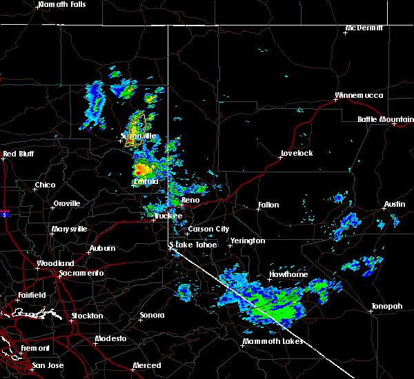
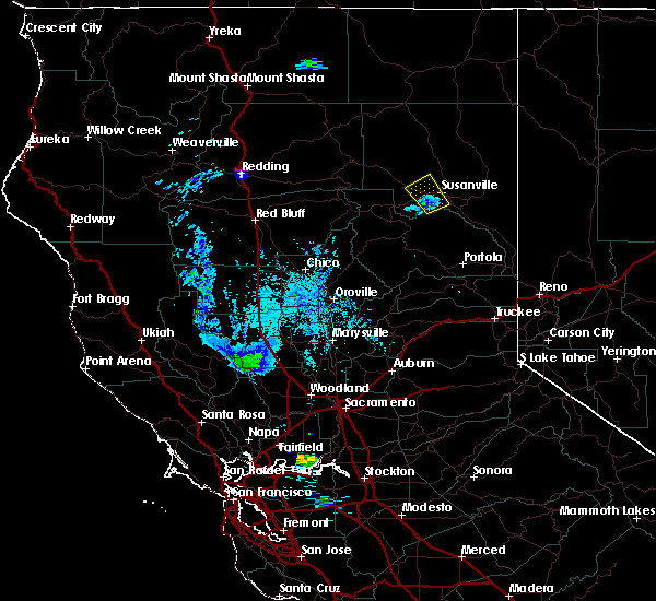
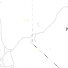
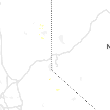
Hail Map for Susanville, CA
The Susanville, CA area has had 1 report of on-the-ground hail by trained spotters, and has been under severe weather warnings 0 times during the past 12 months. Doppler radar has detected hail at or near Susanville, CA on 9 occasions.
| Name: | Susanville, CA |
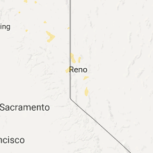
| Where Located: | 74.8 miles NW of Reno, NV |
| Map: | Google Map for Susanville, CA |
| Population: | 17947 |
| Housing Units: | 4256 |
| More Info: | Search Google for Susanville, CA |
5
The Top Recent Hail Date for Susanville, CA is Wednesday, August 9, 2017 (1st out of 9)
Hail and Wind Damage Spotted near Susanville, CA
| Date / Time | Report Details |
|---|---|
| 7/31/2022 4:42 PM PDT | Half Dollar sized hail reported 5.2 miles ESE of Susanville, CA, trained weather spotter reported half dollar sized hail and very heavy rainfall. |
| 6/23/2021 4:27 PM PDT |
 At 426 pm pdt, a severe thunderstorm was located near lake davis, or 14 miles northwest of beckwourth, moving northwest at 30 mph (radar indicated). Hazards include 60 mph wind gusts and quarter size hail. Hail damage to vehicles is expected. Expect wind damage to roofs, siding, fencing and trees. At 426 pm pdt, a severe thunderstorm was located near lake davis, or 14 miles northwest of beckwourth, moving northwest at 30 mph (radar indicated). Hazards include 60 mph wind gusts and quarter size hail. Hail damage to vehicles is expected. Expect wind damage to roofs, siding, fencing and trees.
|
| 7/26/2020 6:32 PM PDT |
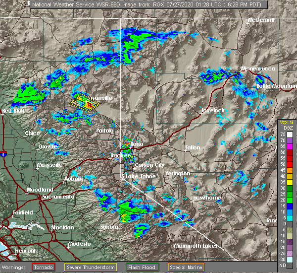 At 631 pm pdt, a severe thunderstorm was located over janesville, or 23 miles south of eagle lake, moving west at 5 mph (radar indicated). Hazards include 60 mph wind gusts and quarter size hail. Hail damage to vehicles is expected. Expect wind damage to roofs, siding, fencing and trees. At 631 pm pdt, a severe thunderstorm was located over janesville, or 23 miles south of eagle lake, moving west at 5 mph (radar indicated). Hazards include 60 mph wind gusts and quarter size hail. Hail damage to vehicles is expected. Expect wind damage to roofs, siding, fencing and trees.
|
| 7/21/2020 4:39 PM PDT |
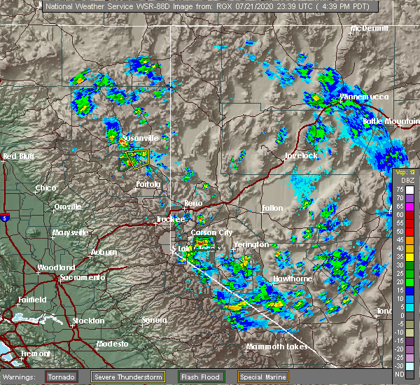 The national weather service in reno has issued a * severe thunderstorm warning for. central lassen county in northern california. until 530 pm pdt. At 436 pm pdt, a severe thunderstorm was located over susanville, or 4 miles east of the hog fire, and is nearly stationary. The national weather service in reno has issued a * severe thunderstorm warning for. central lassen county in northern california. until 530 pm pdt. At 436 pm pdt, a severe thunderstorm was located over susanville, or 4 miles east of the hog fire, and is nearly stationary.
|
| 6/23/2020 6:55 PM PDT |
 The severe thunderstorm warning for east central lassen county will expire at 700 pm pdt, the storm which prompted the warning has weakened below severe limits, and no longer poses an immediate threat to life or property. therefore, the warning will be allowed to expire. The severe thunderstorm warning for east central lassen county will expire at 700 pm pdt, the storm which prompted the warning has weakened below severe limits, and no longer poses an immediate threat to life or property. therefore, the warning will be allowed to expire.
|
| 6/23/2020 6:41 PM PDT |
 At 640 pm pdt, a severe thunderstorm was located near standish, or 21 miles southeast of eagle lake, moving east at 10 mph (radar indicated). Hazards include 60 mph wind gusts and quarter size hail. Hail damage to vehicles is expected. expect wind damage to roofs, siding, fencing and trees. Locations impacted include, susanville and standish. At 640 pm pdt, a severe thunderstorm was located near standish, or 21 miles southeast of eagle lake, moving east at 10 mph (radar indicated). Hazards include 60 mph wind gusts and quarter size hail. Hail damage to vehicles is expected. expect wind damage to roofs, siding, fencing and trees. Locations impacted include, susanville and standish.
|
| 6/23/2020 6:27 PM PDT |
 At 626 pm pdt, severe thunderstorms were located along a line extending from 14 miles south of termo to 11 miles north of standish to near susanville, moving northeast at 15 mph (radar indicated). Hazards include 60 mph wind gusts and quarter size hail. Hail damage to vehicles is expected. Expect wind damage to roofs, siding, fencing and trees. At 626 pm pdt, severe thunderstorms were located along a line extending from 14 miles south of termo to 11 miles north of standish to near susanville, moving northeast at 15 mph (radar indicated). Hazards include 60 mph wind gusts and quarter size hail. Hail damage to vehicles is expected. Expect wind damage to roofs, siding, fencing and trees.
|
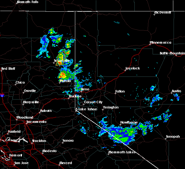
| 8/9/2017 5:50 PM PDT |
 At 549 pm pdt, a severe thunderstorm was located over susanville and is nearly stationary (radar indicated). Hazards include 60 mph wind gusts and quarter size hail. Hail damage to vehicles is expected. Expect wind damage to roofs, siding, fencing, and trees. At 549 pm pdt, a severe thunderstorm was located over susanville and is nearly stationary (radar indicated). Hazards include 60 mph wind gusts and quarter size hail. Hail damage to vehicles is expected. Expect wind damage to roofs, siding, fencing, and trees.
|
| 7/24/2017 4:47 PM PDT |
 At 446 pm pdt, a severe thunderstorm was located 10 miles north of herlong, moving north at 30 mph (radar indicated). Hazards include 60 mph wind gusts and quarter size hail. Hail damage to vehicles is expected. expect wind damage to roofs, siding, fencing, and trees. dust storms resulting in serious accidents. Locations impacted include, herlong, susanville, standish, wendel, honey lake and amedee army airfield. At 446 pm pdt, a severe thunderstorm was located 10 miles north of herlong, moving north at 30 mph (radar indicated). Hazards include 60 mph wind gusts and quarter size hail. Hail damage to vehicles is expected. expect wind damage to roofs, siding, fencing, and trees. dust storms resulting in serious accidents. Locations impacted include, herlong, susanville, standish, wendel, honey lake and amedee army airfield.
|
| 7/24/2017 4:23 PM PDT |
 At 423 pm pdt, a severe thunderstorm was located near herlong, moving north at 30 mph (radar indicated). Hazards include 60 mph wind gusts and quarter size hail. Hail damage to vehicles is expected. expect wind damage to roofs, siding, fencing, and trees. Dust storms resulting in serious accidents. At 423 pm pdt, a severe thunderstorm was located near herlong, moving north at 30 mph (radar indicated). Hazards include 60 mph wind gusts and quarter size hail. Hail damage to vehicles is expected. expect wind damage to roofs, siding, fencing, and trees. Dust storms resulting in serious accidents.
|
| 8/1/2015 8:02 PM PDT |
 At 802 pm pdt, doppler radar indicated a severe thunderstorm capable of producing quarter size hail and damaging winds in excess of 60 mph. this storm was located 9 miles southwest of susanville, or 23 miles south of eagle lake, moving northwest at 10 mph. locations impacted include, susanville, aspen grove campground, eagle campground, junction ca 36 and ca 44, fredonyer pass and merrill campground. At 802 pm pdt, doppler radar indicated a severe thunderstorm capable of producing quarter size hail and damaging winds in excess of 60 mph. this storm was located 9 miles southwest of susanville, or 23 miles south of eagle lake, moving northwest at 10 mph. locations impacted include, susanville, aspen grove campground, eagle campground, junction ca 36 and ca 44, fredonyer pass and merrill campground.
|
| 8/1/2015 7:45 PM PDT |
 At 744 pm pdt, doppler radar indicated a severe thunderstorm capable of producing quarter size hail and damaging winds in excess of 60 mph. this storm was located near susanville, or 17 miles south of eagle lake, and moving northwest at 5 mph. At 744 pm pdt, doppler radar indicated a severe thunderstorm capable of producing quarter size hail and damaging winds in excess of 60 mph. this storm was located near susanville, or 17 miles south of eagle lake, and moving northwest at 5 mph.
|
| 8/1/2015 7:34 PM PDT |
 At 733 pm pdt, doppler radar indicated a severe thunderstorm capable of producing quarter size hail and damaging winds in excess of 60 mph. this storm was located 7 miles southwest of susanville, or 22 miles south of eagle lake, moving northwest at 10 mph. locations impacted include, susanville, janesville, junction ca 36 and ca 44, susanville municipal airport, lone rock campground and boulder creek campground. At 733 pm pdt, doppler radar indicated a severe thunderstorm capable of producing quarter size hail and damaging winds in excess of 60 mph. this storm was located 7 miles southwest of susanville, or 22 miles south of eagle lake, moving northwest at 10 mph. locations impacted include, susanville, janesville, junction ca 36 and ca 44, susanville municipal airport, lone rock campground and boulder creek campground.
|
| 8/1/2015 7:06 PM PDT |
 At 704 pm pdt, doppler radar indicated a severe thunderstorm capable of producing quarter size hail and damaging winds in excess of 60 mph. this storm was located near antelope lake, or 25 miles west of herlong, and moving north at 15 mph. At 704 pm pdt, doppler radar indicated a severe thunderstorm capable of producing quarter size hail and damaging winds in excess of 60 mph. this storm was located near antelope lake, or 25 miles west of herlong, and moving north at 15 mph.
|
Hail Maps for Susanville, CA


Connect with Interactive Hail Maps