

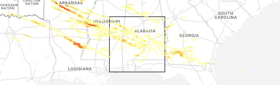
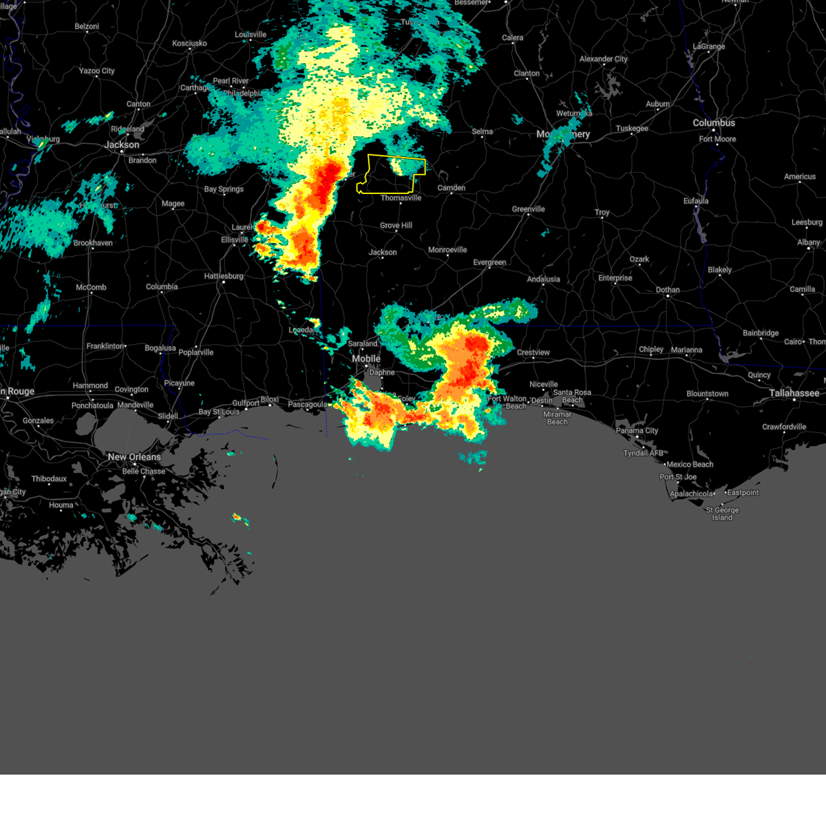
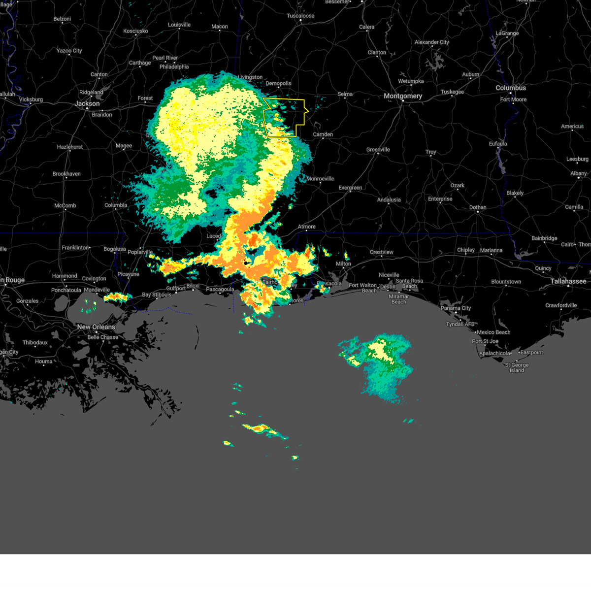
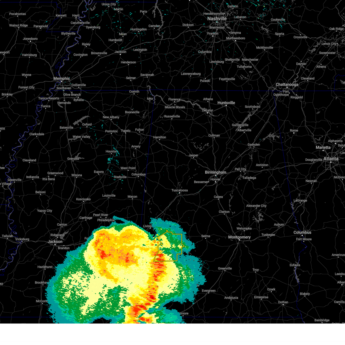
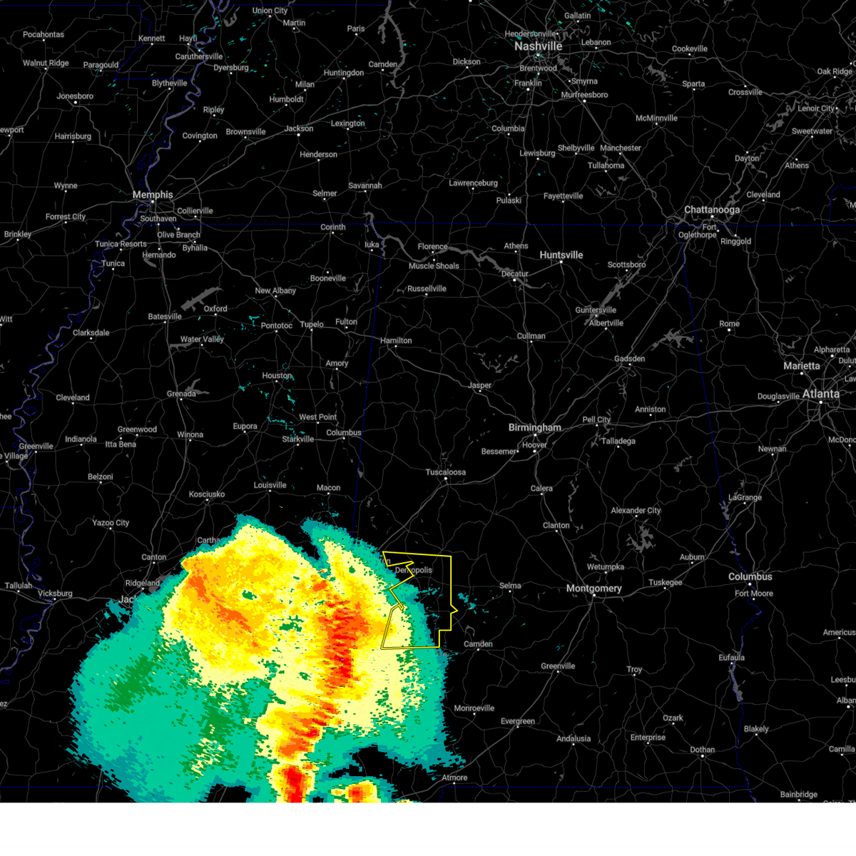
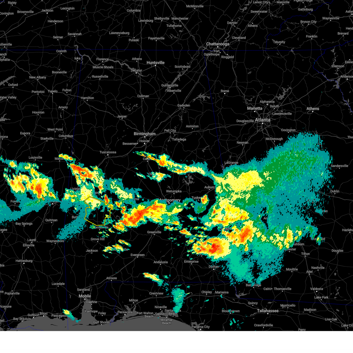
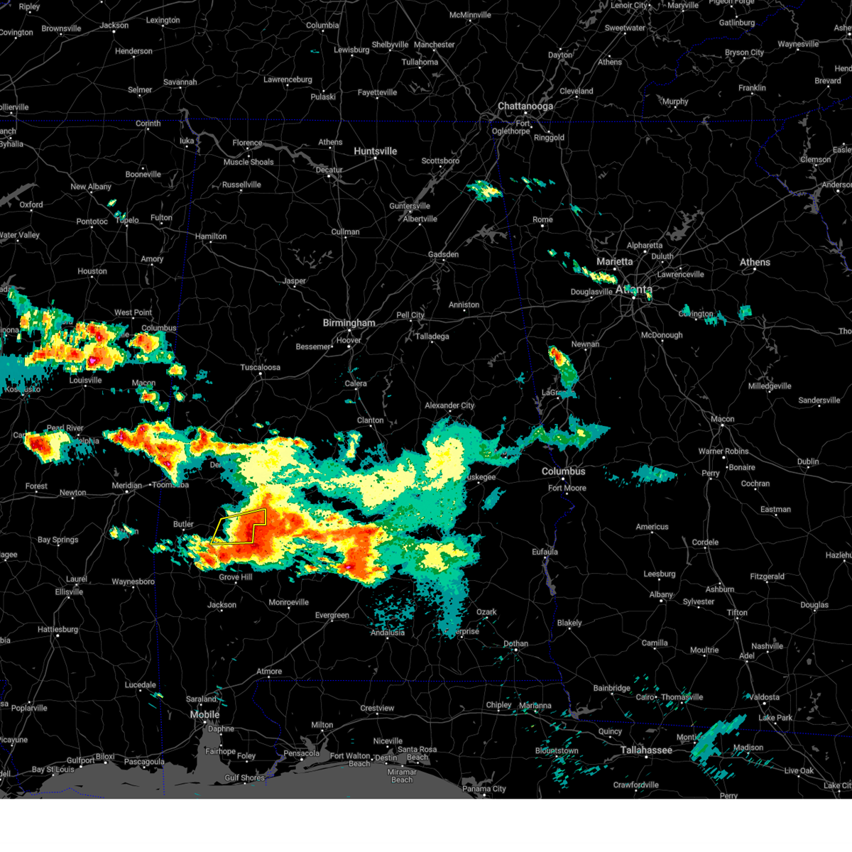
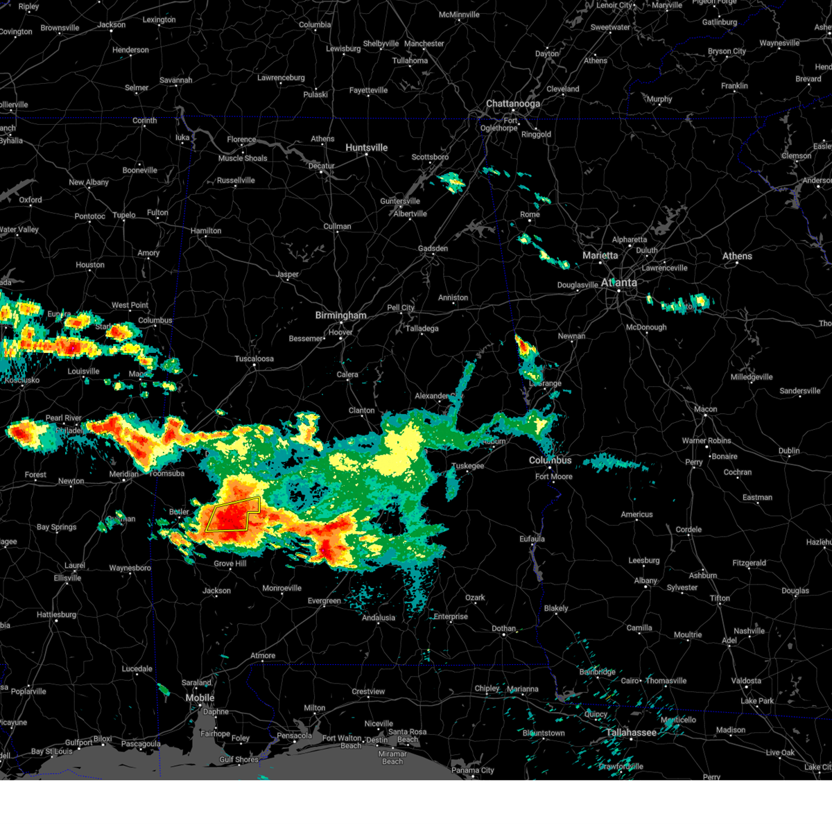
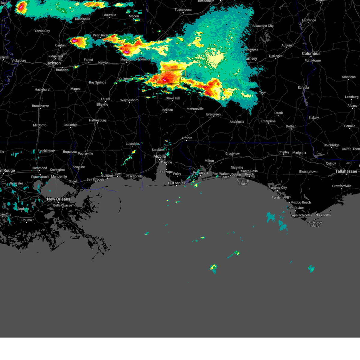
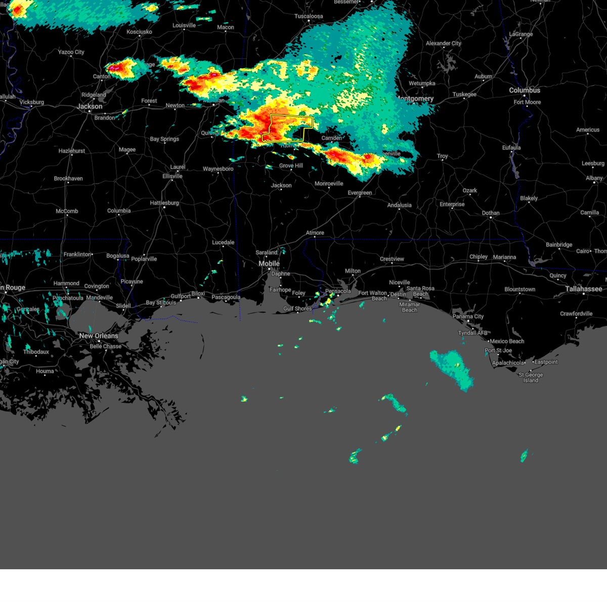
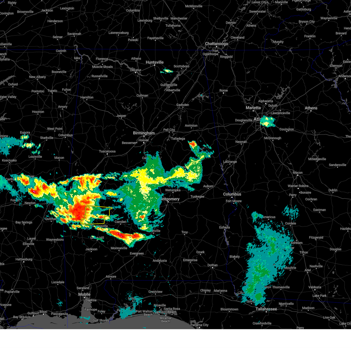
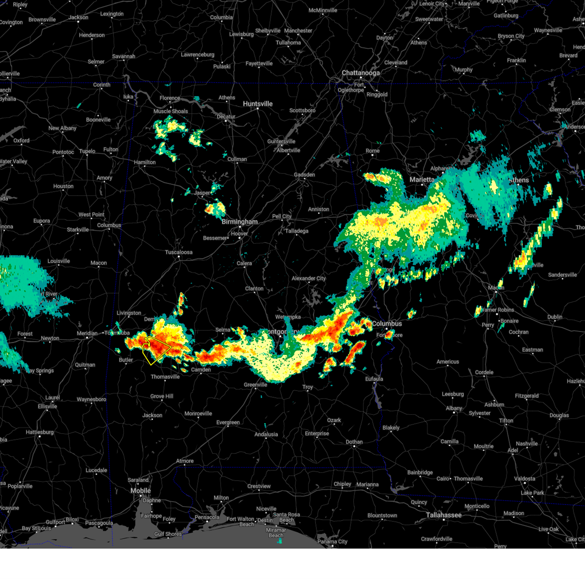
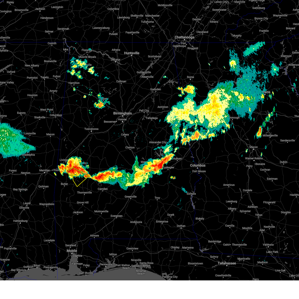
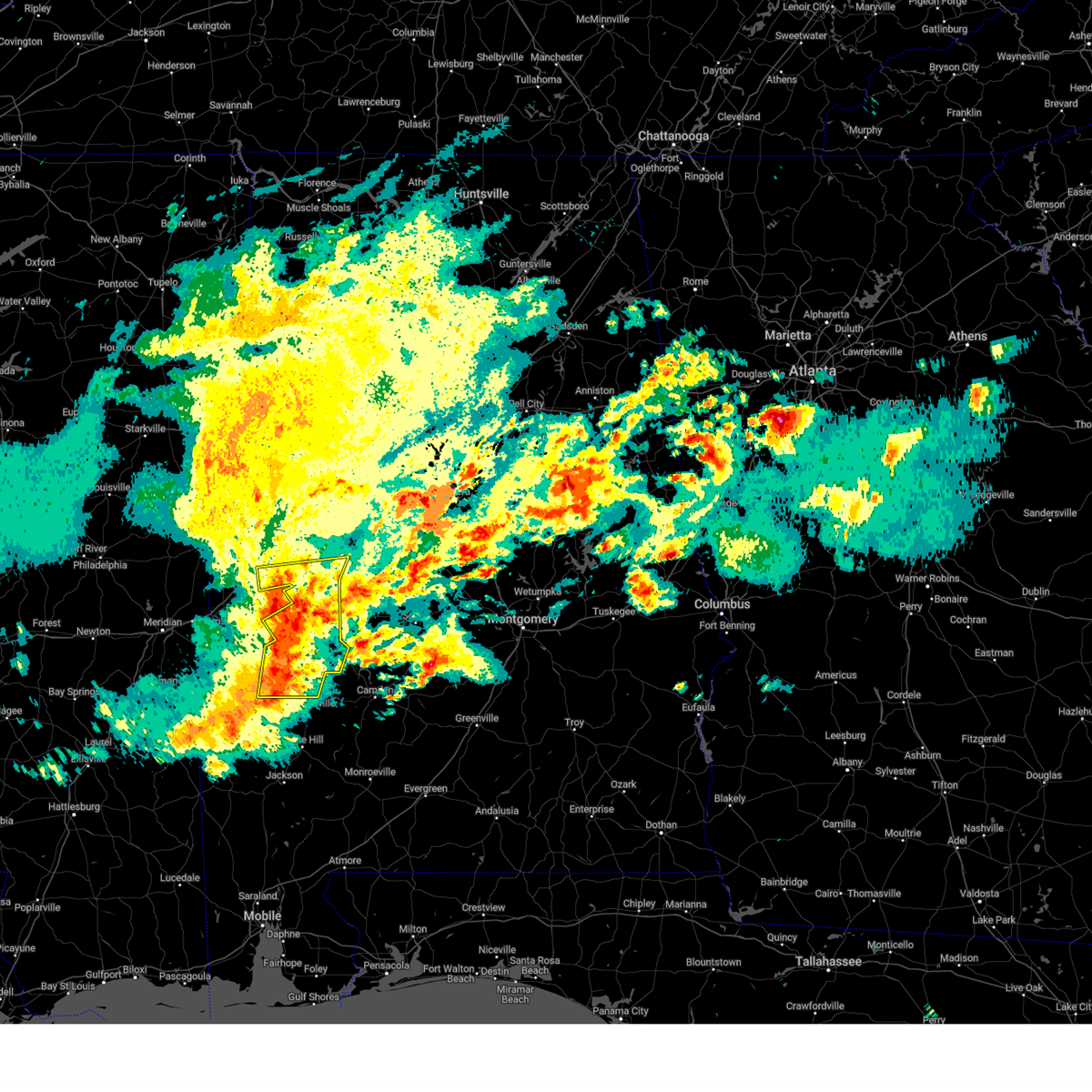
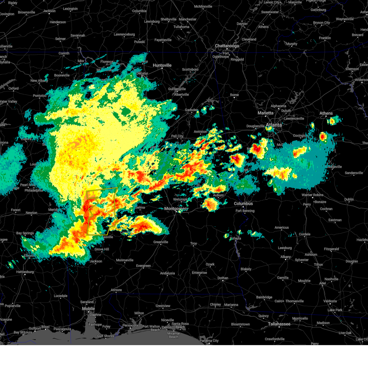
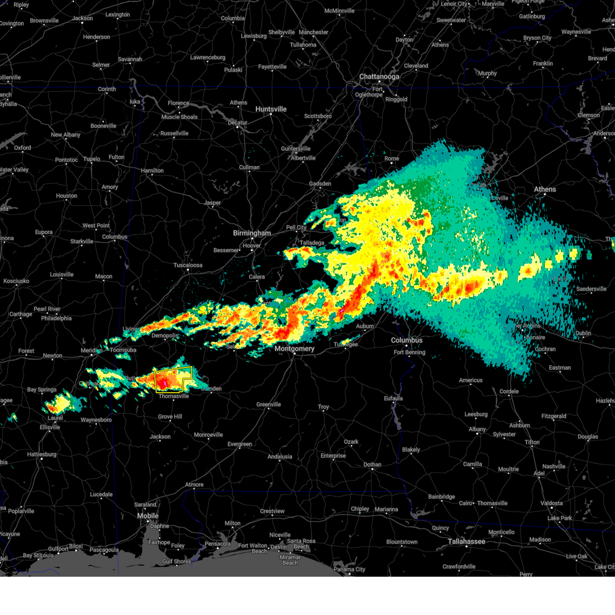
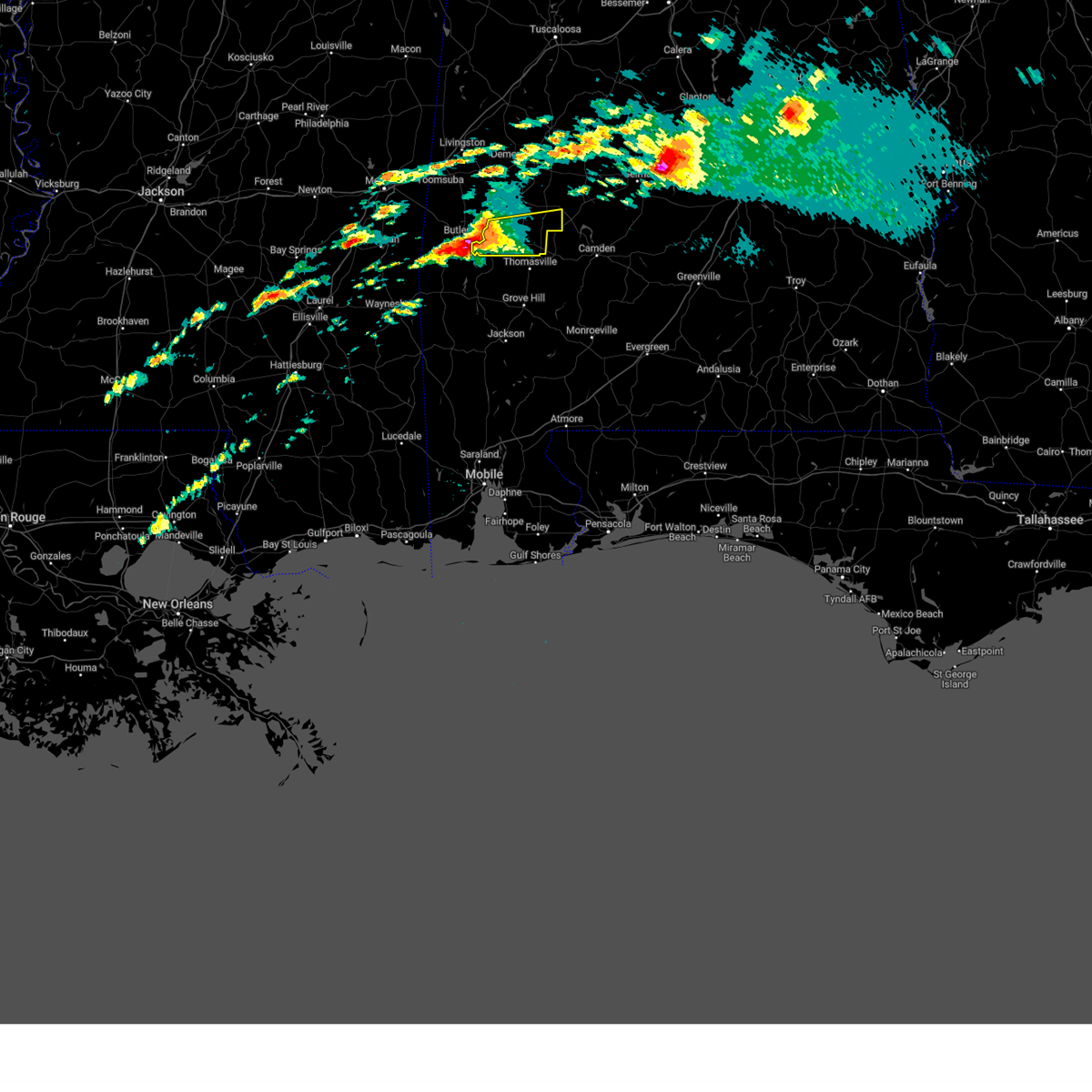
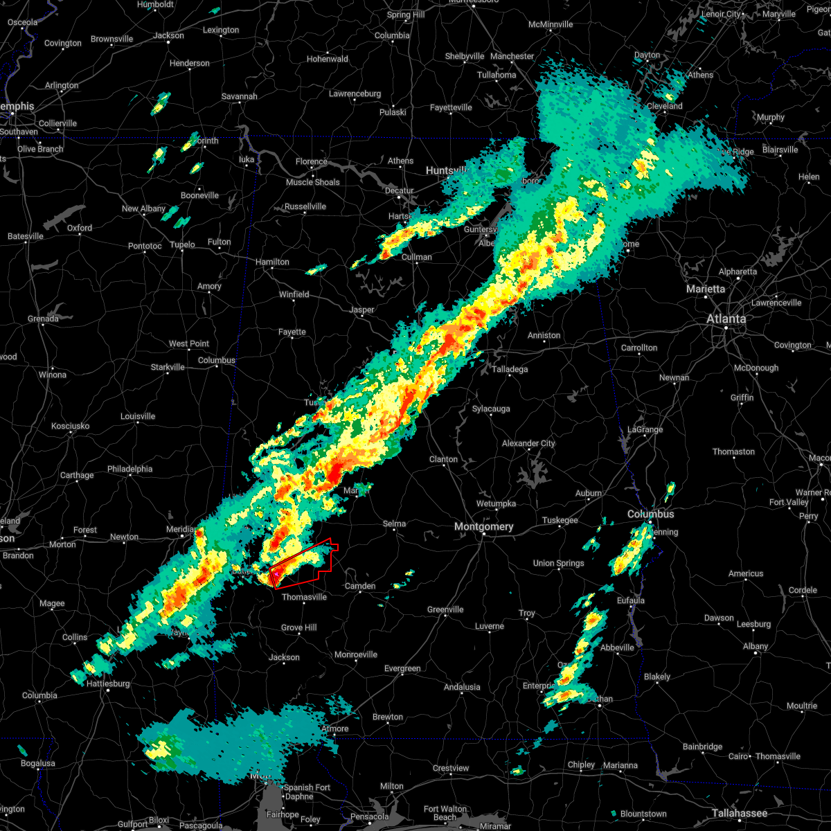
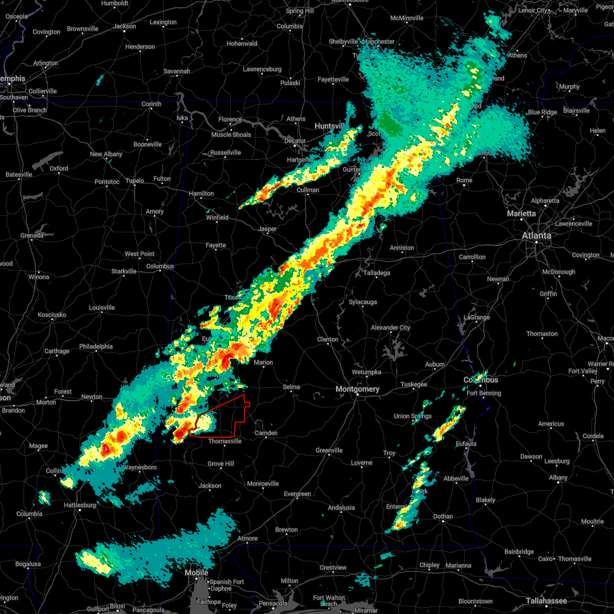
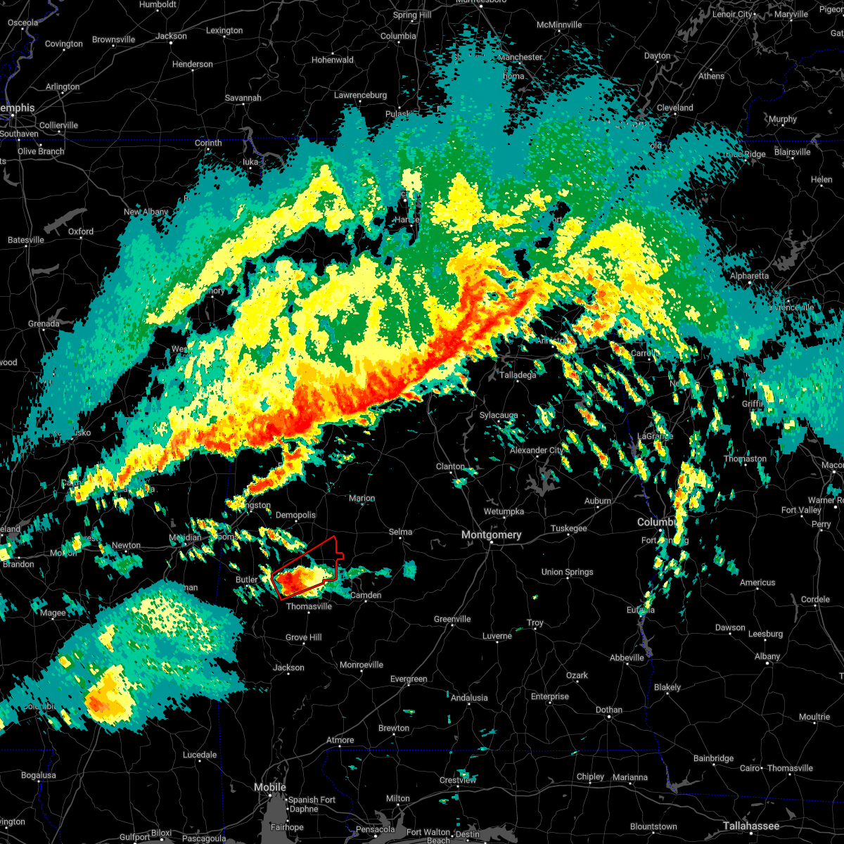
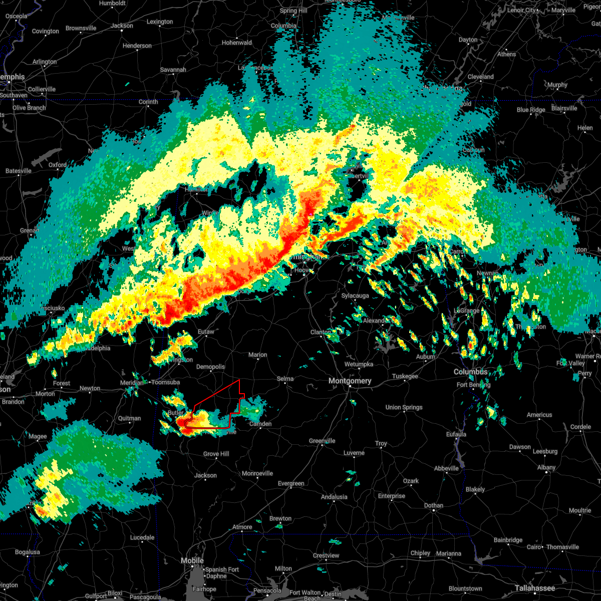
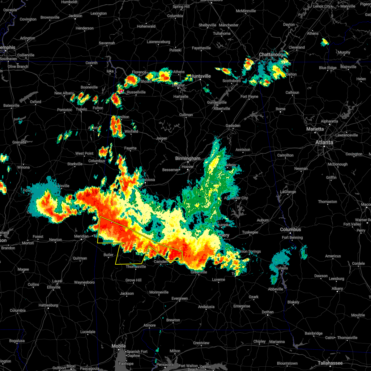
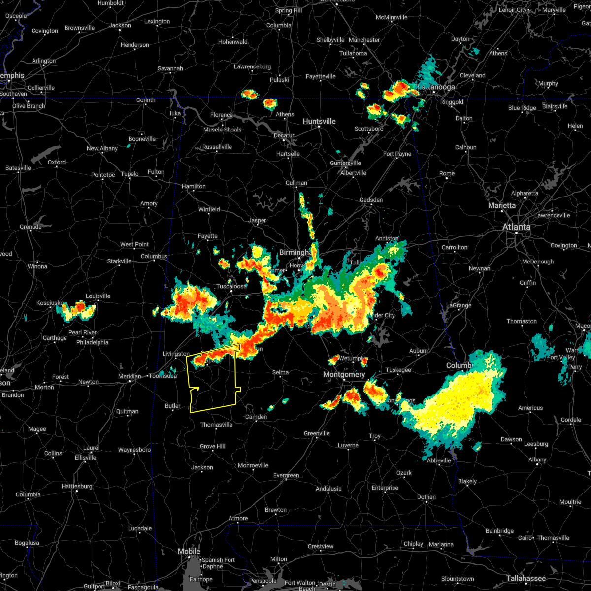
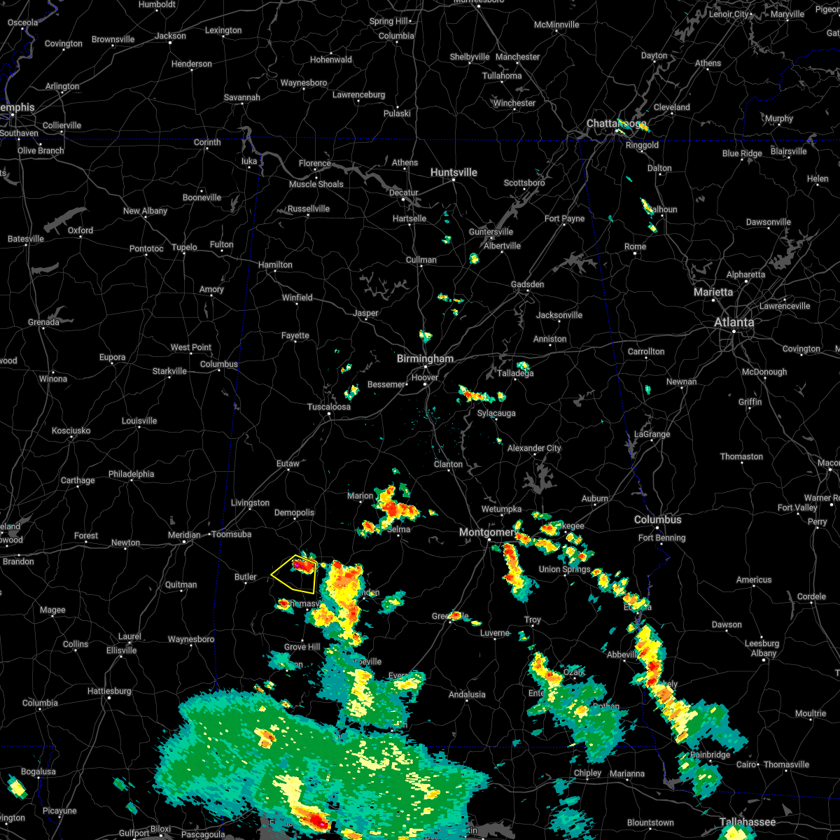
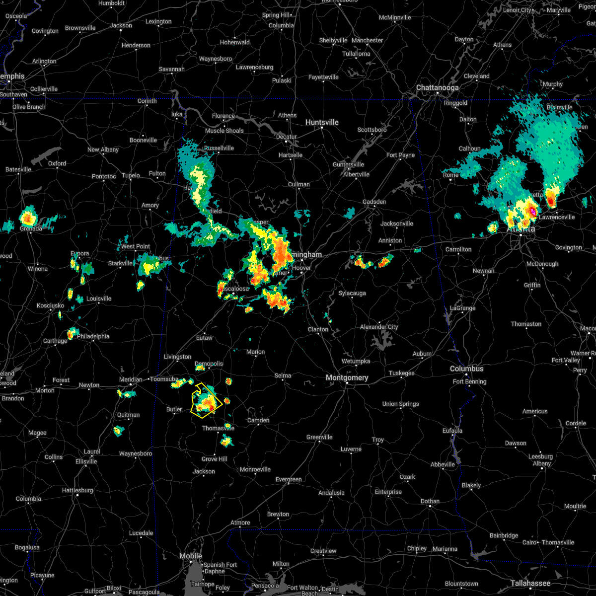
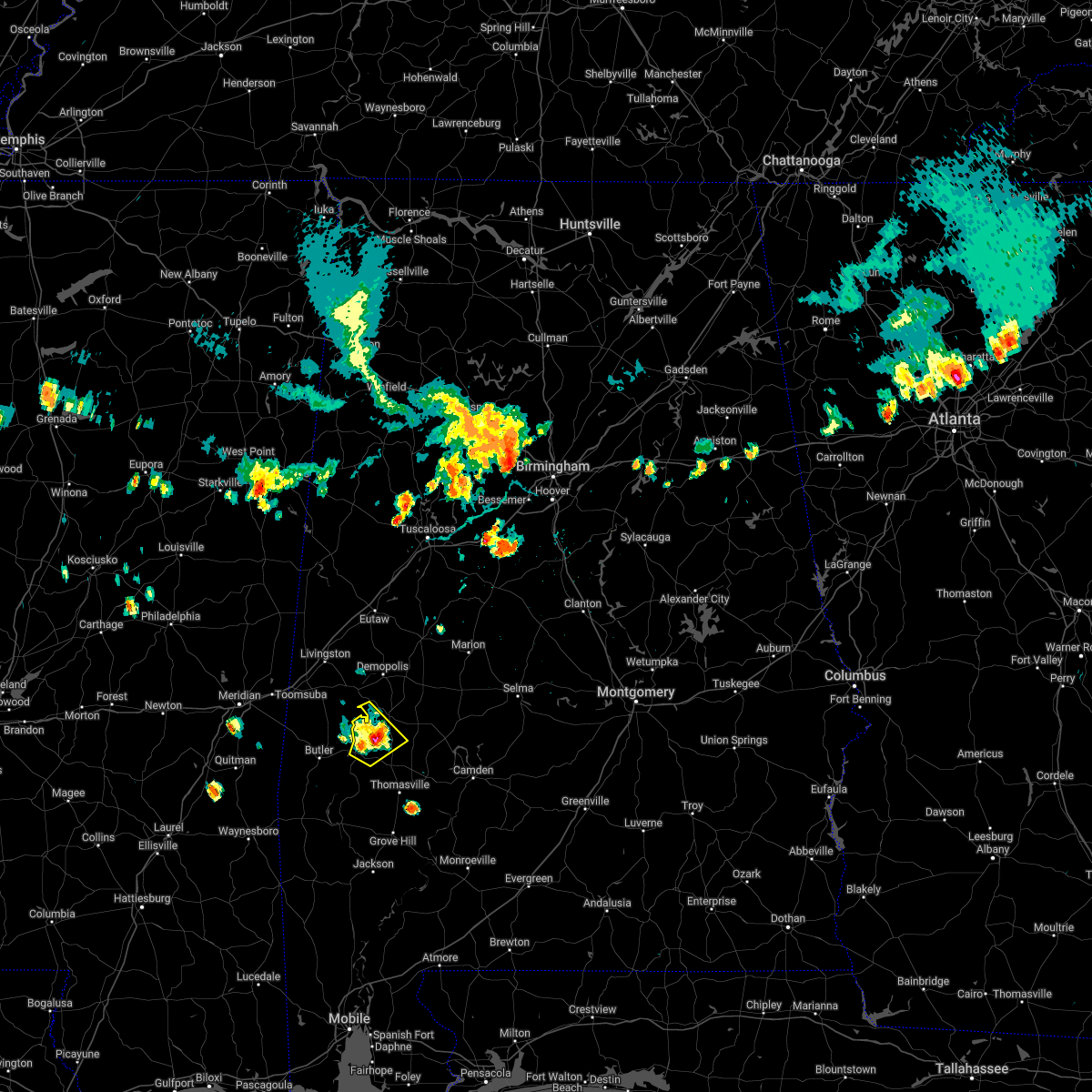
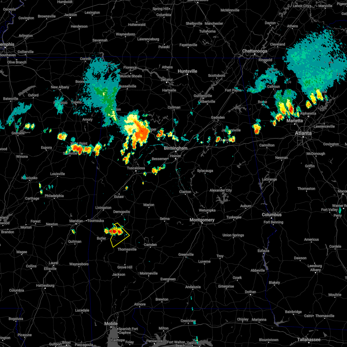
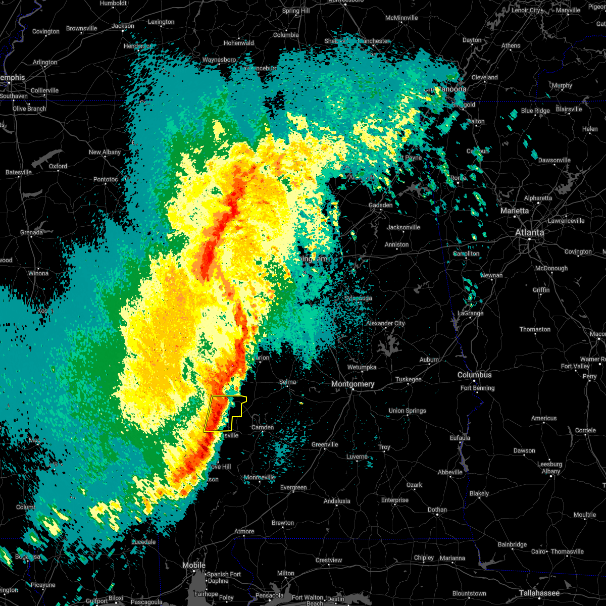
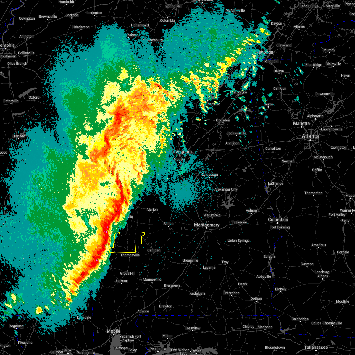
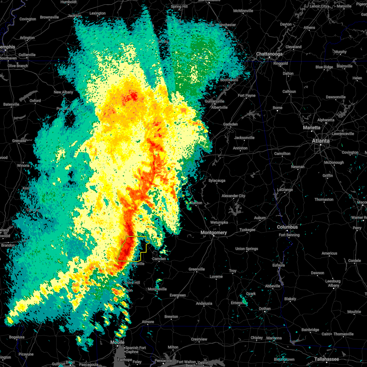
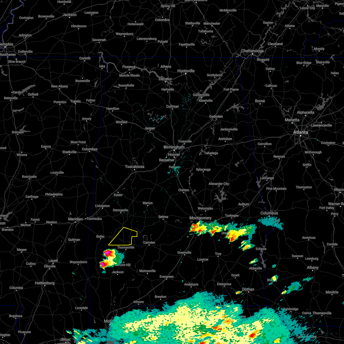
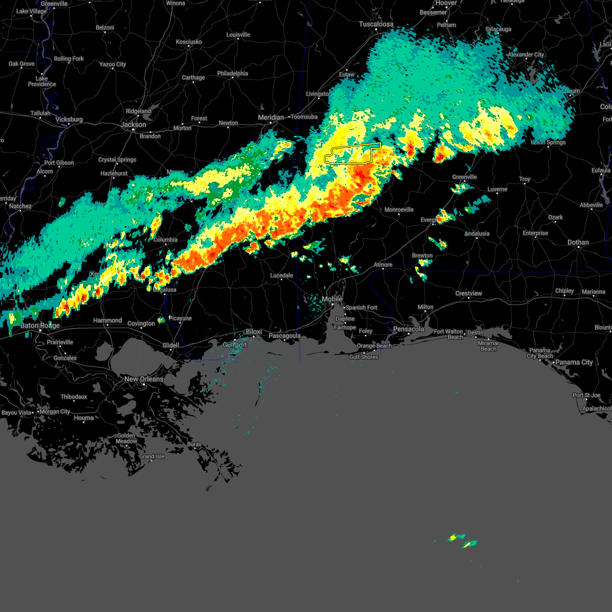
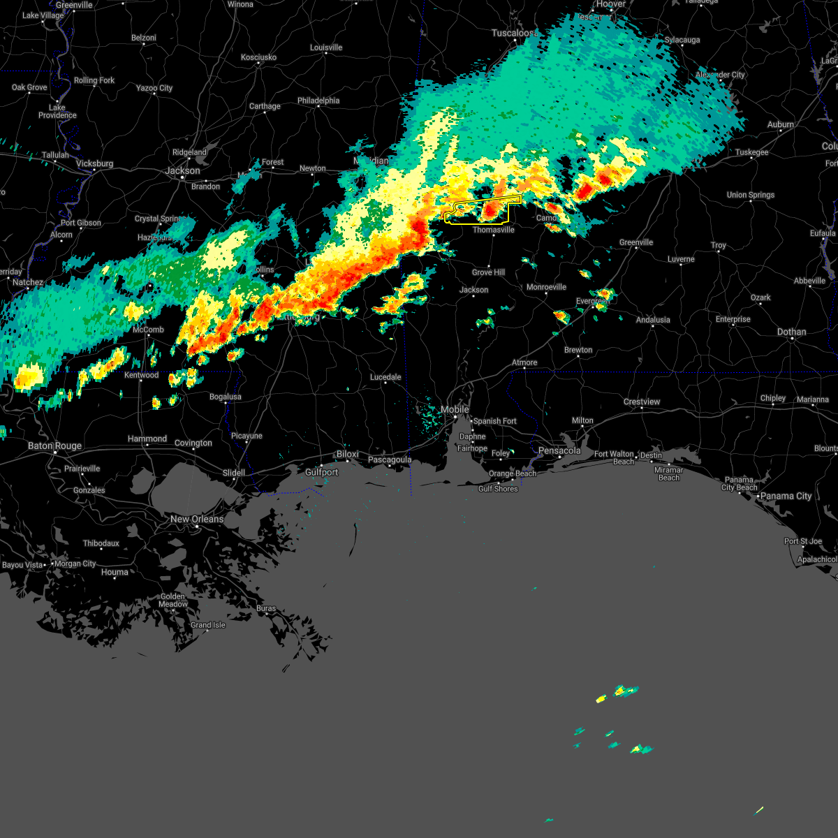
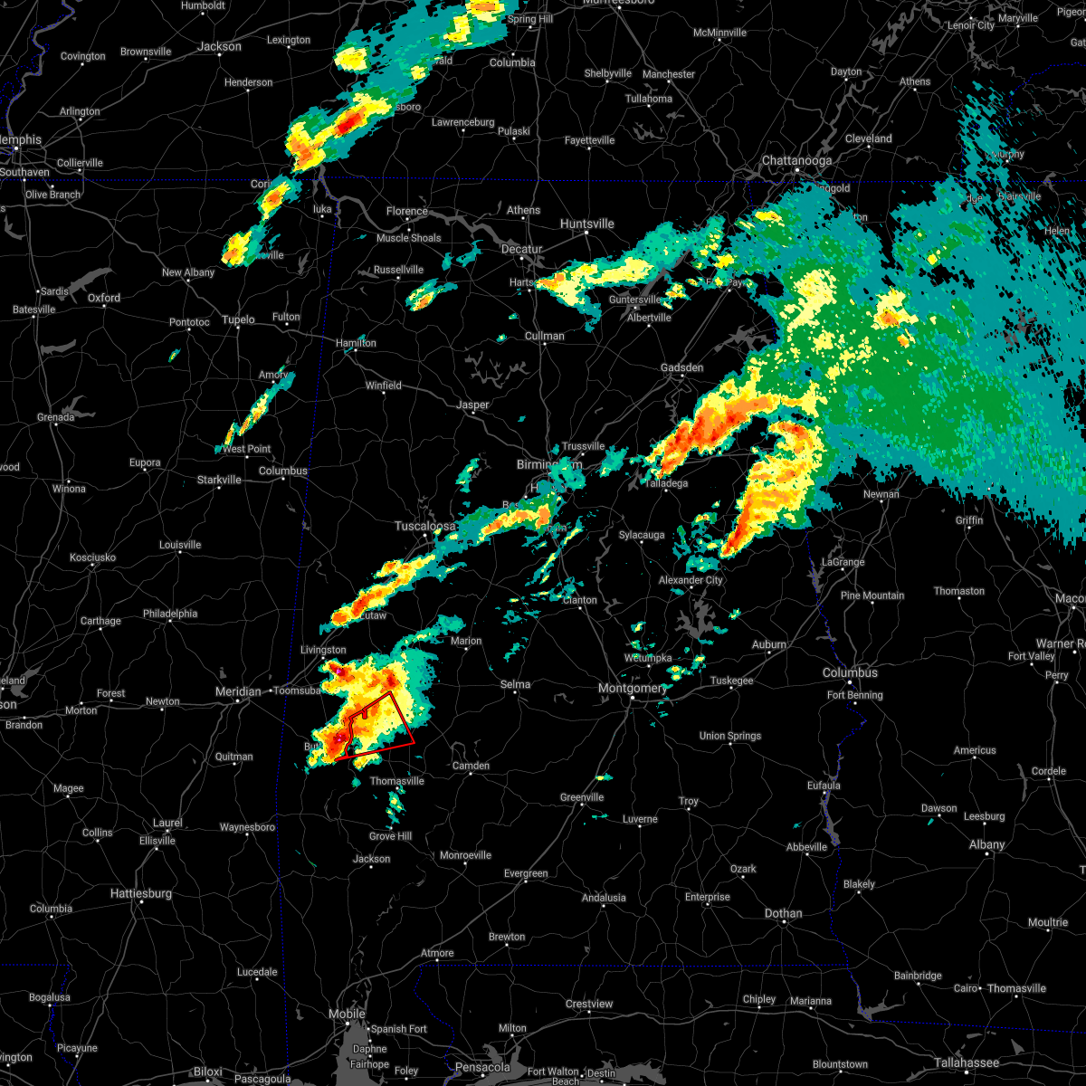
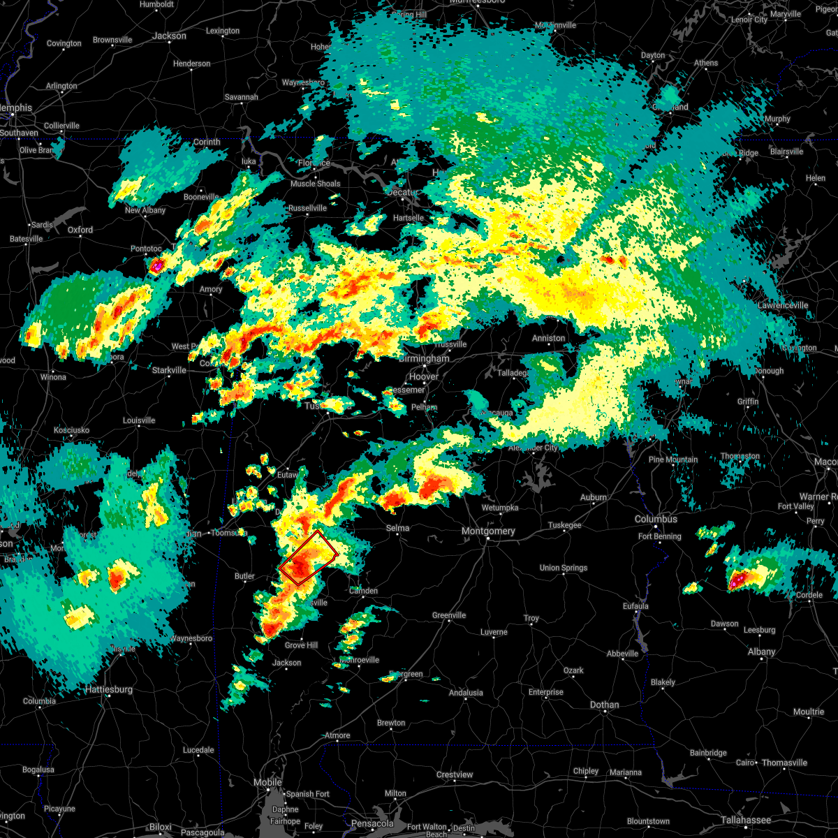
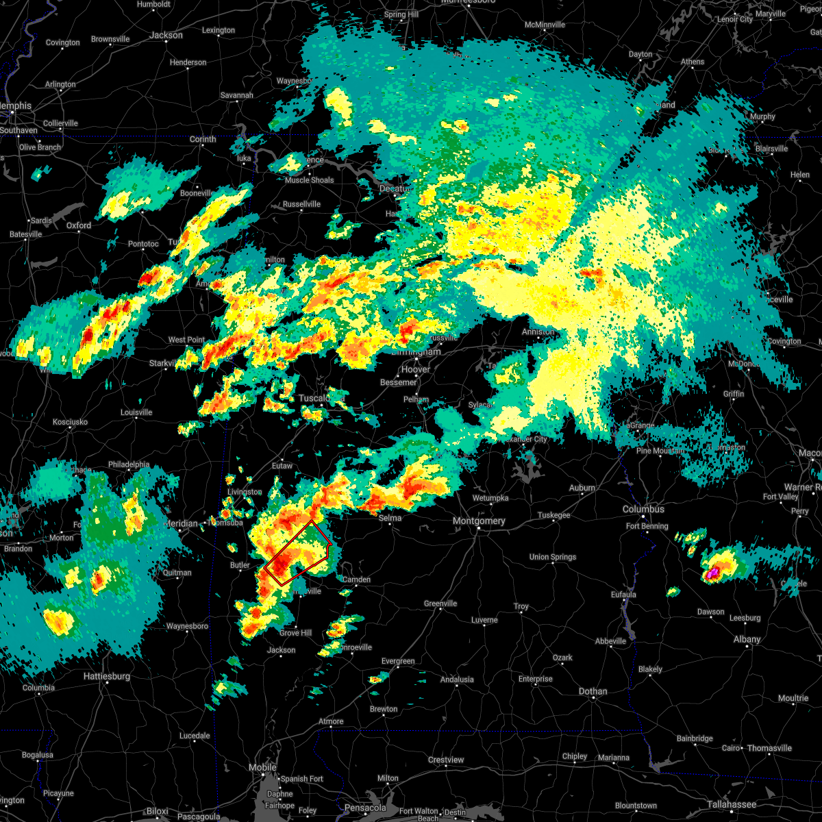
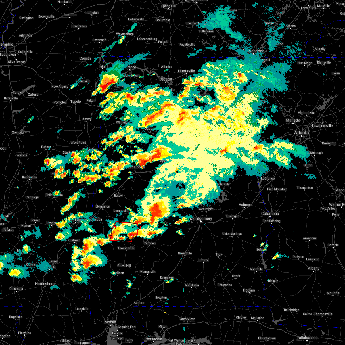
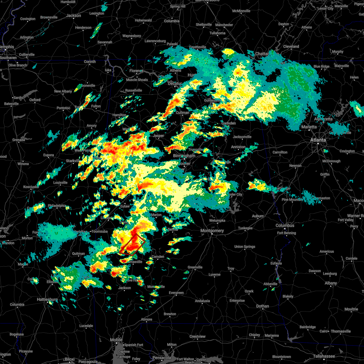
Hail Map for Sweet Water, AL
The Sweet Water, AL area has had 3 reports of on-the-ground hail by trained spotters, and has been under severe weather warnings 27 times during the past 12 months. Doppler radar has detected hail at or near Sweet Water, AL on 52 occasions, including 9 occasions during the past year.
| Name: | Sweet Water, AL |
| Where Located: | 34.5 miles WNW of Camden, AL |
| Map: | Google Map for Sweet Water, AL |
| Population: | 258 |
| Housing Units: | 111 |
| More Info: | Search Google for Sweet Water, AL |
3
The Top Recent Hail Date for Sweet Water, AL is Wednesday, June 14, 2023 (6th out of 52)
Hail and Wind Damage Spotted near Sweet Water, AL
| Date / Time | Report Details |
|---|---|
| 6/19/2023 3:37 AM CDT |
 At 337 am cdt, a severe thunderstorm was located over surginer, or 9 miles north of thomasville, moving east at 50 mph (radar indicated). Hazards include 60 mph wind gusts and penny size hail. Expect damage to roofs, siding, and trees. locations impacted include, linden, thomaston, sweet water, putnam, freddie jones field, shawnee, nanafalia, consul, magnolia, wayne, surginer, miller, dixons mill, vineland, half acre, octagon, clayhill, nicholsville and calvary. hail threat, radar indicated max hail size, 0. 75 in wind threat, radar indicated max wind gust, 60 mph. At 337 am cdt, a severe thunderstorm was located over surginer, or 9 miles north of thomasville, moving east at 50 mph (radar indicated). Hazards include 60 mph wind gusts and penny size hail. Expect damage to roofs, siding, and trees. locations impacted include, linden, thomaston, sweet water, putnam, freddie jones field, shawnee, nanafalia, consul, magnolia, wayne, surginer, miller, dixons mill, vineland, half acre, octagon, clayhill, nicholsville and calvary. hail threat, radar indicated max hail size, 0. 75 in wind threat, radar indicated max wind gust, 60 mph.
|
| 6/19/2023 3:21 AM CDT |
 At 320 am cdt, a severe thunderstorm was located near butler, moving southeast at 40 mph (radar indicated). Hazards include 60 mph wind gusts and quarter size hail. Hail damage to vehicles is expected. Expect wind damage to roofs, siding, and trees. At 320 am cdt, a severe thunderstorm was located near butler, moving southeast at 40 mph (radar indicated). Hazards include 60 mph wind gusts and quarter size hail. Hail damage to vehicles is expected. Expect wind damage to roofs, siding, and trees.
|
| 6/18/2023 11:54 AM CDT |
 At 1154 am cdt, a severe thunderstorm was located over wayne, or 12 miles south of linden, moving east at 50 mph (radar indicated). Hazards include 60 mph wind gusts and quarter size hail. Hail damage to vehicles is expected. expect wind damage to roofs, siding, and trees. locations impacted include, sweet water, myrtlewood, putnam, shawnee, nanafalia, magnolia, wayne, surginer, miller, dixons mill, vineland, half acre, octagon, clayhill, nicholsville, calvary and slater. hail threat, radar indicated max hail size, 1. 00 in wind threat, radar indicated max wind gust, 60 mph. At 1154 am cdt, a severe thunderstorm was located over wayne, or 12 miles south of linden, moving east at 50 mph (radar indicated). Hazards include 60 mph wind gusts and quarter size hail. Hail damage to vehicles is expected. expect wind damage to roofs, siding, and trees. locations impacted include, sweet water, myrtlewood, putnam, shawnee, nanafalia, magnolia, wayne, surginer, miller, dixons mill, vineland, half acre, octagon, clayhill, nicholsville, calvary and slater. hail threat, radar indicated max hail size, 1. 00 in wind threat, radar indicated max wind gust, 60 mph.
|
| 6/18/2023 11:23 AM CDT |
 At 1123 am cdt, a severe thunderstorm was located near butler, moving east at 50 mph (radar indicated). Hazards include 60 mph wind gusts and quarter size hail. Hail damage to vehicles is expected. Expect wind damage to roofs, siding, and trees. At 1123 am cdt, a severe thunderstorm was located near butler, moving east at 50 mph (radar indicated). Hazards include 60 mph wind gusts and quarter size hail. Hail damage to vehicles is expected. Expect wind damage to roofs, siding, and trees.
|
| 6/16/2023 8:52 PM CDT |
 At 852 pm cdt, severe thunderstorms were located along a line extending from dallas county horse arena to 7 miles northeast of vineland to near butler, moving southeast at 30 mph (radar indicated). Hazards include 60 mph wind gusts and quarter size hail. Hail damage to vehicles is expected. expect wind damage to roofs, siding, and trees. locations impacted include, selma, selmont-west selmont, sweet water, orrville, nanafalia, consul, central mills, old cahaba park, surginer, dannelly reservoir, dallas county horse arena, putnam, belknap, magnolia, dallas lake, wayne, memorial stadium, miller, dixons mill and potter station. hail threat, radar indicated max hail size, 1. 00 in wind threat, radar indicated max wind gust, 60 mph. At 852 pm cdt, severe thunderstorms were located along a line extending from dallas county horse arena to 7 miles northeast of vineland to near butler, moving southeast at 30 mph (radar indicated). Hazards include 60 mph wind gusts and quarter size hail. Hail damage to vehicles is expected. expect wind damage to roofs, siding, and trees. locations impacted include, selma, selmont-west selmont, sweet water, orrville, nanafalia, consul, central mills, old cahaba park, surginer, dannelly reservoir, dallas county horse arena, putnam, belknap, magnolia, dallas lake, wayne, memorial stadium, miller, dixons mill and potter station. hail threat, radar indicated max hail size, 1. 00 in wind threat, radar indicated max wind gust, 60 mph.
|
| 6/16/2023 8:35 PM CDT |
 At 835 pm cdt, severe thunderstorms were located along a line extending from near potter station to near magnolia to near lisman, moving southeast at 50 mph (radar indicated). Hazards include 60 mph wind gusts and quarter size hail. Hail damage to vehicles is expected. expect wind damage to roofs, siding, and trees. locations impacted include, selma, selmont-west selmont, thomaston, sweet water, orrville, bogue chitto, nanafalia, consul, central mills, old cahaba park, surginer, dannelly reservoir, dallas county horse arena, putnam, belknap, magnolia, dallas lake, wayne, memorial stadium and miller. hail threat, radar indicated max hail size, 1. 00 in wind threat, radar indicated max wind gust, 60 mph. At 835 pm cdt, severe thunderstorms were located along a line extending from near potter station to near magnolia to near lisman, moving southeast at 50 mph (radar indicated). Hazards include 60 mph wind gusts and quarter size hail. Hail damage to vehicles is expected. expect wind damage to roofs, siding, and trees. locations impacted include, selma, selmont-west selmont, thomaston, sweet water, orrville, bogue chitto, nanafalia, consul, central mills, old cahaba park, surginer, dannelly reservoir, dallas county horse arena, putnam, belknap, magnolia, dallas lake, wayne, memorial stadium and miller. hail threat, radar indicated max hail size, 1. 00 in wind threat, radar indicated max wind gust, 60 mph.
|
| 6/16/2023 8:30 PM CDT | Trees were blown down around dixons mil in marengo county AL, 5.3 miles NW of Sweet Water, AL |
| 6/16/2023 8:25 PM CDT |
 At 825 pm cdt, severe thunderstorms were located along a line extending from near marion junction to freddie jones field to near increase, moving southeast at 35 mph (radar indicated). Hazards include 60 mph wind gusts and quarter size hail. Hail damage to vehicles is expected. expect wind damage to roofs, siding, and trees. locations impacted include, selma, selmont-west selmont, thomaston, sweet water, orrville, bogue chitto, nanafalia, consul, central mills, old cahaba park, surginer, dannelly reservoir, dallas county horse arena, putnam, belknap, magnolia, dallas lake, wayne, memorial stadium and miller. hail threat, radar indicated max hail size, 1. 00 in wind threat, radar indicated max wind gust, 60 mph. At 825 pm cdt, severe thunderstorms were located along a line extending from near marion junction to freddie jones field to near increase, moving southeast at 35 mph (radar indicated). Hazards include 60 mph wind gusts and quarter size hail. Hail damage to vehicles is expected. expect wind damage to roofs, siding, and trees. locations impacted include, selma, selmont-west selmont, thomaston, sweet water, orrville, bogue chitto, nanafalia, consul, central mills, old cahaba park, surginer, dannelly reservoir, dallas county horse arena, putnam, belknap, magnolia, dallas lake, wayne, memorial stadium and miller. hail threat, radar indicated max hail size, 1. 00 in wind threat, radar indicated max wind gust, 60 mph.
|
| 6/16/2023 8:09 PM CDT |
 At 808 pm cdt, severe thunderstorms were located along a line extending from near vaiden to near chickasaw state park to near marion, moving southeast at 30 mph (radar indicated). Hazards include 60 mph wind gusts and quarter size hail. Hail damage to vehicles is expected. Expect wind damage to roofs, siding, and trees. At 808 pm cdt, severe thunderstorms were located along a line extending from near vaiden to near chickasaw state park to near marion, moving southeast at 30 mph (radar indicated). Hazards include 60 mph wind gusts and quarter size hail. Hail damage to vehicles is expected. Expect wind damage to roofs, siding, and trees.
|
| 6/16/2023 7:56 AM CDT |
 At 756 am cdt, severe thunderstorms were located along a line extending from chickasaw state park to near pine hill to 7 miles south of whatley to 6 miles east of mcintosh, moving east at 60 mph (radar indicated). Hazards include 60 mph wind gusts. Expect damage to roofs, siding, and trees. locations impacted include, linden, thomaston, sweet water, freddie jones field, consul, magnolia, wayne, surginer, miller, dixons mill, vineland, carleys, octagon, clayhill and calvary. hail threat, radar indicated max hail size, <. 75 in wind threat, radar indicated max wind gust, 60 mph. At 756 am cdt, severe thunderstorms were located along a line extending from chickasaw state park to near pine hill to 7 miles south of whatley to 6 miles east of mcintosh, moving east at 60 mph (radar indicated). Hazards include 60 mph wind gusts. Expect damage to roofs, siding, and trees. locations impacted include, linden, thomaston, sweet water, freddie jones field, consul, magnolia, wayne, surginer, miller, dixons mill, vineland, carleys, octagon, clayhill and calvary. hail threat, radar indicated max hail size, <. 75 in wind threat, radar indicated max wind gust, 60 mph.
|
| 6/16/2023 7:51 AM CDT |
 At 751 am cdt, severe thunderstorms were located along a line extending from pin hook to near vineland to 7 miles east of jackson to near mcintosh, moving east at 60 mph (radar indicated). Hazards include 60 mph wind gusts and penny size hail. Expect damage to roofs, siding, and trees. locations impacted include, linden, jefferson, thomaston, sweet water, myrtlewood, dayton, freddie jones field, pin hook, nanafalia, consul, magnolia, wayne, surginer, miller, chickasaw state park, dixons mill, vineland, half acre, carleys and octagon. hail threat, radar indicated max hail size, 0. 75 in wind threat, radar indicated max wind gust, 60 mph. At 751 am cdt, severe thunderstorms were located along a line extending from pin hook to near vineland to 7 miles east of jackson to near mcintosh, moving east at 60 mph (radar indicated). Hazards include 60 mph wind gusts and penny size hail. Expect damage to roofs, siding, and trees. locations impacted include, linden, jefferson, thomaston, sweet water, myrtlewood, dayton, freddie jones field, pin hook, nanafalia, consul, magnolia, wayne, surginer, miller, chickasaw state park, dixons mill, vineland, half acre, carleys and octagon. hail threat, radar indicated max hail size, 0. 75 in wind threat, radar indicated max wind gust, 60 mph.
|
| 6/16/2023 7:41 AM CDT |
 At 741 am cdt, severe thunderstorms were located along a line extending from near jefferson to near dixons mill to near jackson to near mcintosh, moving east at 55 mph (radar indicated). Hazards include 60 mph wind gusts and penny size hail. Expect damage to roofs, siding, and trees. locations impacted include, demopolis, linden, uniontown, jefferson, thomaston, sweet water, myrtlewood, faunsdale, dayton, nanafalia, consul, surginer, putnam, freddie jones field, pin hook, magnolia, wayne, miller, chickasaw state park and dixons mill. hail threat, radar indicated max hail size, 0. 75 in wind threat, radar indicated max wind gust, 60 mph. At 741 am cdt, severe thunderstorms were located along a line extending from near jefferson to near dixons mill to near jackson to near mcintosh, moving east at 55 mph (radar indicated). Hazards include 60 mph wind gusts and penny size hail. Expect damage to roofs, siding, and trees. locations impacted include, demopolis, linden, uniontown, jefferson, thomaston, sweet water, myrtlewood, faunsdale, dayton, nanafalia, consul, surginer, putnam, freddie jones field, pin hook, magnolia, wayne, miller, chickasaw state park and dixons mill. hail threat, radar indicated max hail size, 0. 75 in wind threat, radar indicated max wind gust, 60 mph.
|
| 6/16/2023 7:30 AM CDT |
 At 730 am cdt, severe thunderstorms were located along a line extending from near myrtlewood to near sweet water to near saint stephens to 6 miles south of tibbie, moving east at 60 mph (radar indicated). Hazards include 60 mph wind gusts and penny size hail. Expect damage to roofs, siding, and trees. locations impacted include, demopolis, linden, uniontown, jefferson, forkland, thomaston, sweet water, newbern, myrtlewood, faunsdale, dayton, nanafalia, consul, arcola, surginer, tishabee, putnam, freddie jones field, pin hook and magnolia. hail threat, radar indicated max hail size, 0. 75 in wind threat, radar indicated max wind gust, 60 mph. At 730 am cdt, severe thunderstorms were located along a line extending from near myrtlewood to near sweet water to near saint stephens to 6 miles south of tibbie, moving east at 60 mph (radar indicated). Hazards include 60 mph wind gusts and penny size hail. Expect damage to roofs, siding, and trees. locations impacted include, demopolis, linden, uniontown, jefferson, forkland, thomaston, sweet water, newbern, myrtlewood, faunsdale, dayton, nanafalia, consul, arcola, surginer, tishabee, putnam, freddie jones field, pin hook and magnolia. hail threat, radar indicated max hail size, 0. 75 in wind threat, radar indicated max wind gust, 60 mph.
|
| 6/16/2023 7:09 AM CDT |
 At 708 am cdt, severe thunderstorms were located along a line extending from near kinterbish to near lisman to near millry to 10 miles southwest of state line, moving east at 60 mph (radar indicated). Hazards include 60 mph wind gusts and penny size hail. expect damage to roofs, siding, and trees At 708 am cdt, severe thunderstorms were located along a line extending from near kinterbish to near lisman to near millry to 10 miles southwest of state line, moving east at 60 mph (radar indicated). Hazards include 60 mph wind gusts and penny size hail. expect damage to roofs, siding, and trees
|
| 6/15/2023 11:23 AM CDT |
 At 1123 am cdt, a severe thunderstorm was located near magnolia, or 11 miles southeast of linden, moving east at 35 mph (radar indicated). Hazards include 70 mph wind gusts and quarter size hail. Hail damage to vehicles is expected. expect considerable tree damage. wind damage is also likely to mobile homes, roofs, and outbuildings. locations impacted include, linden, thomaston, sweet water, myrtlewood, dayton, freddie jones field, nanafalia, consul, magnolia, wayne, surginer, miller, chickasaw state park, dixons mill, vineland, half acre, octagon, clayhill and calvary. thunderstorm damage threat, considerable hail threat, radar indicated max hail size, 1. 00 in wind threat, radar indicated max wind gust, 70 mph. At 1123 am cdt, a severe thunderstorm was located near magnolia, or 11 miles southeast of linden, moving east at 35 mph (radar indicated). Hazards include 70 mph wind gusts and quarter size hail. Hail damage to vehicles is expected. expect considerable tree damage. wind damage is also likely to mobile homes, roofs, and outbuildings. locations impacted include, linden, thomaston, sweet water, myrtlewood, dayton, freddie jones field, nanafalia, consul, magnolia, wayne, surginer, miller, chickasaw state park, dixons mill, vineland, half acre, octagon, clayhill and calvary. thunderstorm damage threat, considerable hail threat, radar indicated max hail size, 1. 00 in wind threat, radar indicated max wind gust, 70 mph.
|
| 6/15/2023 11:01 AM CDT |
 At 1101 am cdt, a severe thunderstorm was located near myrtlewood, or near linden, moving east at 35 mph (radar indicated). Hazards include 70 mph wind gusts and quarter size hail. Hail damage to vehicles is expected. expect considerable tree damage. wind damage is also likely to mobile homes, roofs, and outbuildings. locations impacted include, linden, jefferson, thomaston, sweet water, myrtlewood, dayton, freddie jones field, pin hook, nanafalia, consul, magnolia, wayne, surginer, miller, chickasaw state park, dixons mill, vineland, half acre, u. s. 80 and al 28 and octagon. thunderstorm damage threat, considerable hail threat, radar indicated max hail size, 1. 00 in wind threat, radar indicated max wind gust, 70 mph. At 1101 am cdt, a severe thunderstorm was located near myrtlewood, or near linden, moving east at 35 mph (radar indicated). Hazards include 70 mph wind gusts and quarter size hail. Hail damage to vehicles is expected. expect considerable tree damage. wind damage is also likely to mobile homes, roofs, and outbuildings. locations impacted include, linden, jefferson, thomaston, sweet water, myrtlewood, dayton, freddie jones field, pin hook, nanafalia, consul, magnolia, wayne, surginer, miller, chickasaw state park, dixons mill, vineland, half acre, u. s. 80 and al 28 and octagon. thunderstorm damage threat, considerable hail threat, radar indicated max hail size, 1. 00 in wind threat, radar indicated max wind gust, 70 mph.
|
| 6/15/2023 10:41 AM CDT |
 At 1041 am cdt, a severe thunderstorm was located 7 miles north of pennington, or 16 miles west of linden, moving east at 35 mph (radar indicated). Hazards include 60 mph wind gusts and quarter size hail. Hail damage to vehicles is expected. expect wind damage to roofs, siding, and trees. locations impacted include, linden, jefferson, thomaston, sweet water, myrtlewood, dayton, freddie jones field, pin hook, nanafalia, consul, magnolia, wayne, surginer, miller, chickasaw state park, dixons mill, vineland, half acre, u. s. 80 and al 28 and octagon. hail threat, radar indicated max hail size, 1. 00 in wind threat, radar indicated max wind gust, 60 mph. At 1041 am cdt, a severe thunderstorm was located 7 miles north of pennington, or 16 miles west of linden, moving east at 35 mph (radar indicated). Hazards include 60 mph wind gusts and quarter size hail. Hail damage to vehicles is expected. expect wind damage to roofs, siding, and trees. locations impacted include, linden, jefferson, thomaston, sweet water, myrtlewood, dayton, freddie jones field, pin hook, nanafalia, consul, magnolia, wayne, surginer, miller, chickasaw state park, dixons mill, vineland, half acre, u. s. 80 and al 28 and octagon. hail threat, radar indicated max hail size, 1. 00 in wind threat, radar indicated max wind gust, 60 mph.
|
| 6/15/2023 10:39 AM CDT |
 At 1038 am cdt, a severe thunderstorm was located 8 miles north of pennington, or 16 miles southeast of york, moving east at 35 mph (radar indicated). Hazards include 60 mph wind gusts. expect damage to roofs, siding, and trees At 1038 am cdt, a severe thunderstorm was located 8 miles north of pennington, or 16 miles southeast of york, moving east at 35 mph (radar indicated). Hazards include 60 mph wind gusts. expect damage to roofs, siding, and trees
|
| 6/15/2023 1:50 AM CDT |
 The severe thunderstorm warning for southeastern marengo county will expire at 200 am cdt, the storm which prompted the warning has moved out of the area. therefore, the warning will be allowed to expire. to report severe weather, contact your nearest law enforcement agency. they will relay your report to the national weather service birmingham. The severe thunderstorm warning for southeastern marengo county will expire at 200 am cdt, the storm which prompted the warning has moved out of the area. therefore, the warning will be allowed to expire. to report severe weather, contact your nearest law enforcement agency. they will relay your report to the national weather service birmingham.
|
| 6/15/2023 1:35 AM CDT |
 At 135 am cdt, a severe thunderstorm was located over vineland, or 11 miles northeast of thomasville, moving east at 40 mph (radar indicated). Hazards include golf ball size hail and 60 mph wind gusts. People and animals outdoors will be injured. expect hail damage to roofs, siding, windows, and vehicles. expect wind damage to roofs, siding, and trees. locations impacted include, sweet water, wayne, surginer, miller, dixons mill, magnolia, vineland, clayhill and nicholsville. thunderstorm damage threat, considerable hail threat, radar indicated max hail size, 1. 75 in wind threat, radar indicated max wind gust, 60 mph. At 135 am cdt, a severe thunderstorm was located over vineland, or 11 miles northeast of thomasville, moving east at 40 mph (radar indicated). Hazards include golf ball size hail and 60 mph wind gusts. People and animals outdoors will be injured. expect hail damage to roofs, siding, windows, and vehicles. expect wind damage to roofs, siding, and trees. locations impacted include, sweet water, wayne, surginer, miller, dixons mill, magnolia, vineland, clayhill and nicholsville. thunderstorm damage threat, considerable hail threat, radar indicated max hail size, 1. 75 in wind threat, radar indicated max wind gust, 60 mph.
|
| 6/15/2023 1:19 AM CDT |
 At 119 am cdt, a severe thunderstorm was located over dixons mill, or 11 miles northwest of thomasville, moving east at 45 mph (radar indicated). Hazards include two inch hail and 60 mph wind gusts. People and animals outdoors will be injured. expect hail damage to roofs, siding, windows, and vehicles. expect wind damage to roofs, siding, and trees. locations impacted include, sweet water, putnam, nanafalia, magnolia, wayne, surginer, miller, dixons mill, vineland, half acre, octagon, clayhill, nicholsville, calvary and slater. thunderstorm damage threat, considerable hail threat, radar indicated max hail size, 2. 00 in wind threat, radar indicated max wind gust, 60 mph. At 119 am cdt, a severe thunderstorm was located over dixons mill, or 11 miles northwest of thomasville, moving east at 45 mph (radar indicated). Hazards include two inch hail and 60 mph wind gusts. People and animals outdoors will be injured. expect hail damage to roofs, siding, windows, and vehicles. expect wind damage to roofs, siding, and trees. locations impacted include, sweet water, putnam, nanafalia, magnolia, wayne, surginer, miller, dixons mill, vineland, half acre, octagon, clayhill, nicholsville, calvary and slater. thunderstorm damage threat, considerable hail threat, radar indicated max hail size, 2. 00 in wind threat, radar indicated max wind gust, 60 mph.
|
| 6/15/2023 1:09 AM CDT |
 At 108 am cdt, a severe thunderstorm was located over sweet water, or 15 miles southwest of linden, moving east at 50 mph (radar indicated). Hazards include ping pong ball size hail and 60 mph wind gusts. People and animals outdoors will be injured. expect hail damage to roofs, siding, windows, and vehicles. expect wind damage to roofs, siding, and trees. locations impacted include, sweet water, myrtlewood, putnam, nanafalia, magnolia, wayne, surginer, miller, dixons mill, vineland, half acre, octagon, clayhill, nicholsville, calvary and slater. hail threat, radar indicated max hail size, 1. 50 in wind threat, radar indicated max wind gust, 60 mph. At 108 am cdt, a severe thunderstorm was located over sweet water, or 15 miles southwest of linden, moving east at 50 mph (radar indicated). Hazards include ping pong ball size hail and 60 mph wind gusts. People and animals outdoors will be injured. expect hail damage to roofs, siding, windows, and vehicles. expect wind damage to roofs, siding, and trees. locations impacted include, sweet water, myrtlewood, putnam, nanafalia, magnolia, wayne, surginer, miller, dixons mill, vineland, half acre, octagon, clayhill, nicholsville, calvary and slater. hail threat, radar indicated max hail size, 1. 50 in wind threat, radar indicated max wind gust, 60 mph.
|
| 6/15/2023 12:58 AM CDT |
 At 1258 am cdt, a severe thunderstorm was located near pennington, or 8 miles northeast of butler, moving east at 40 mph (radar indicated). Hazards include 60 mph wind gusts and quarter size hail. Hail damage to vehicles is expected. Expect wind damage to roofs, siding, and trees. At 1258 am cdt, a severe thunderstorm was located near pennington, or 8 miles northeast of butler, moving east at 40 mph (radar indicated). Hazards include 60 mph wind gusts and quarter size hail. Hail damage to vehicles is expected. Expect wind damage to roofs, siding, and trees.
|
| 6/14/2023 5:02 PM CDT |
 At 502 pm cdt, severe thunderstorms were located along a line extending from gardner island to near dallas lake to near nanafalia, moving east at 55 mph (radar indicated). Hazards include 70 mph wind gusts and quarter size hail. Hail damage to vehicles is expected. expect considerable tree damage. wind damage is also likely to mobile homes, roofs, and outbuildings. locations impacted include, selma, selmont-west selmont, thomaston, sweet water, orrville, gardner island, nanafalia, tyler, consul, central mills, old cahaba park, surginer, dannelly reservoir, dallas county horse arena, putnam, belknap, magnolia, dallas lake, wayne and memorial stadium. thunderstorm damage threat, considerable hail threat, radar indicated max hail size, 1. 00 in wind threat, radar indicated max wind gust, 70 mph. At 502 pm cdt, severe thunderstorms were located along a line extending from gardner island to near dallas lake to near nanafalia, moving east at 55 mph (radar indicated). Hazards include 70 mph wind gusts and quarter size hail. Hail damage to vehicles is expected. expect considerable tree damage. wind damage is also likely to mobile homes, roofs, and outbuildings. locations impacted include, selma, selmont-west selmont, thomaston, sweet water, orrville, gardner island, nanafalia, tyler, consul, central mills, old cahaba park, surginer, dannelly reservoir, dallas county horse arena, putnam, belknap, magnolia, dallas lake, wayne and memorial stadium. thunderstorm damage threat, considerable hail threat, radar indicated max hail size, 1. 00 in wind threat, radar indicated max wind gust, 70 mph.
|
| 6/14/2023 4:54 PM CDT |
 At 454 pm cdt, severe thunderstorms were located along a line extending from near burnsville to 7 miles southeast of central mills to near sweet water, moving east at 55 mph (radar indicated). Hazards include 70 mph wind gusts and quarter size hail. Hail damage to vehicles is expected. expect considerable tree damage. wind damage is also likely to mobile homes, roofs, and outbuildings. locations impacted include, selma, linden, uniontown, selmont-west selmont, thomaston, sweet water, orrville, myrtlewood, faunsdale, dayton, bogue chitto, vaiden, nanafalia, tyler, consul, dannelly reservoir, magnolia, dallas lake, wayne and memorial stadium. thunderstorm damage threat, considerable hail threat, radar indicated max hail size, 1. 00 in wind threat, radar indicated max wind gust, 70 mph. At 454 pm cdt, severe thunderstorms were located along a line extending from near burnsville to 7 miles southeast of central mills to near sweet water, moving east at 55 mph (radar indicated). Hazards include 70 mph wind gusts and quarter size hail. Hail damage to vehicles is expected. expect considerable tree damage. wind damage is also likely to mobile homes, roofs, and outbuildings. locations impacted include, selma, linden, uniontown, selmont-west selmont, thomaston, sweet water, orrville, myrtlewood, faunsdale, dayton, bogue chitto, vaiden, nanafalia, tyler, consul, dannelly reservoir, magnolia, dallas lake, wayne and memorial stadium. thunderstorm damage threat, considerable hail threat, radar indicated max hail size, 1. 00 in wind threat, radar indicated max wind gust, 70 mph.
|
| 6/14/2023 4:34 PM CDT |
 At 434 pm cdt, severe thunderstorms were located along a line extending from near vaiden to near thomaston to pennington, moving east at 65 mph (radar indicated). Hazards include 70 mph wind gusts and quarter size hail. Hail damage to vehicles is expected. expect considerable tree damage. Wind damage is also likely to mobile homes, roofs, and outbuildings. At 434 pm cdt, severe thunderstorms were located along a line extending from near vaiden to near thomaston to pennington, moving east at 65 mph (radar indicated). Hazards include 70 mph wind gusts and quarter size hail. Hail damage to vehicles is expected. expect considerable tree damage. Wind damage is also likely to mobile homes, roofs, and outbuildings.
|
| 6/12/2023 1:53 AM CDT |
 At 153 am cdt, a severe thunderstorm was located near myrtlewood, or near linden, moving southeast at 30 mph (radar indicated). Hazards include 60 mph wind gusts and quarter size hail. Hail damage to vehicles is expected. expect wind damage to roofs, siding, and trees. locations impacted include, linden, sweet water, myrtlewood, freddie jones field, calvary, half acre and octagon. hail threat, radar indicated max hail size, 1. 00 in wind threat, radar indicated max wind gust, 60 mph. At 153 am cdt, a severe thunderstorm was located near myrtlewood, or near linden, moving southeast at 30 mph (radar indicated). Hazards include 60 mph wind gusts and quarter size hail. Hail damage to vehicles is expected. expect wind damage to roofs, siding, and trees. locations impacted include, linden, sweet water, myrtlewood, freddie jones field, calvary, half acre and octagon. hail threat, radar indicated max hail size, 1. 00 in wind threat, radar indicated max wind gust, 60 mph.
|
| 6/12/2023 1:31 AM CDT |
 At 131 am cdt, a severe thunderstorm was located 8 miles west of jefferson, or 15 miles southwest of demopolis, moving southeast at 30 mph (radar indicated). Hazards include 60 mph wind gusts and quarter size hail. Hail damage to vehicles is expected. Expect wind damage to roofs, siding, and trees. At 131 am cdt, a severe thunderstorm was located 8 miles west of jefferson, or 15 miles southwest of demopolis, moving southeast at 30 mph (radar indicated). Hazards include 60 mph wind gusts and quarter size hail. Hail damage to vehicles is expected. Expect wind damage to roofs, siding, and trees.
|
| 3/26/2023 8:19 PM CDT |
 At 818 pm cdt, severe thunderstorms were located along a line extending from near sawyerville to near thomasville, moving east at 45 mph (radar indicated). Hazards include 60 mph wind gusts and quarter size hail. Hail damage to vehicles is expected. expect wind damage to roofs, siding, and trees. locations impacted include, demopolis, linden, jefferson, forkland, thomaston, sweet water, newbern, faunsdale, dayton, consul, arcola, surginer, freddie jones field, shawnee, pin hook, magnolia, wayne, miller, chickasaw state park and dixons mill. hail threat, radar indicated max hail size, 1. 00 in wind threat, radar indicated max wind gust, 60 mph. At 818 pm cdt, severe thunderstorms were located along a line extending from near sawyerville to near thomasville, moving east at 45 mph (radar indicated). Hazards include 60 mph wind gusts and quarter size hail. Hail damage to vehicles is expected. expect wind damage to roofs, siding, and trees. locations impacted include, demopolis, linden, jefferson, forkland, thomaston, sweet water, newbern, faunsdale, dayton, consul, arcola, surginer, freddie jones field, shawnee, pin hook, magnolia, wayne, miller, chickasaw state park and dixons mill. hail threat, radar indicated max hail size, 1. 00 in wind threat, radar indicated max wind gust, 60 mph.
|
| 3/26/2023 8:10 PM CDT |
 At 810 pm cdt, severe thunderstorms were located along a line extending from walden quarters to 8 miles southwest of thomasville, moving east at 45 mph (radar indicated). Hazards include 60 mph wind gusts and quarter size hail. Hail damage to vehicles is expected. expect wind damage to roofs, siding, and trees. locations impacted include, demopolis, greensboro, linden, jefferson, forkland, thomaston, sweet water, newbern, myrtlewood, faunsdale, dayton, nanafalia, consul, thornhill, arcola, surginer, tishabee, putnam, freddie jones field and greensboro municipal airport. hail threat, radar indicated max hail size, 1. 00 in wind threat, radar indicated max wind gust, 60 mph. At 810 pm cdt, severe thunderstorms were located along a line extending from walden quarters to 8 miles southwest of thomasville, moving east at 45 mph (radar indicated). Hazards include 60 mph wind gusts and quarter size hail. Hail damage to vehicles is expected. expect wind damage to roofs, siding, and trees. locations impacted include, demopolis, greensboro, linden, jefferson, forkland, thomaston, sweet water, newbern, myrtlewood, faunsdale, dayton, nanafalia, consul, thornhill, arcola, surginer, tishabee, putnam, freddie jones field and greensboro municipal airport. hail threat, radar indicated max hail size, 1. 00 in wind threat, radar indicated max wind gust, 60 mph.
|
| 3/26/2023 7:57 PM CDT |
 At 756 pm cdt, severe thunderstorms were located along a line extending from near boligee to near coffeeville, moving east at 50 mph (radar indicated). Hazards include 60 mph wind gusts and quarter size hail. Hail damage to vehicles is expected. Expect wind damage to roofs, siding, and trees. At 756 pm cdt, severe thunderstorms were located along a line extending from near boligee to near coffeeville, moving east at 50 mph (radar indicated). Hazards include 60 mph wind gusts and quarter size hail. Hail damage to vehicles is expected. Expect wind damage to roofs, siding, and trees.
|
| 3/26/2023 7:47 AM CDT |
 At 746 am cdt, a severe thunderstorm was located over dixons mill, or 11 miles northwest of thomasville, moving east at 30 mph (radar indicated). Hazards include 60 mph wind gusts and quarter size hail. Hail damage to vehicles is expected. expect wind damage to roofs, siding, and trees. locations impacted include, sweet water, wayne, surginer, miller, shawnee, dixons mill, magnolia, vineland, half acre, octagon, clayhill and nicholsville. hail threat, radar indicated max hail size, 1. 00 in wind threat, radar indicated max wind gust, 60 mph. At 746 am cdt, a severe thunderstorm was located over dixons mill, or 11 miles northwest of thomasville, moving east at 30 mph (radar indicated). Hazards include 60 mph wind gusts and quarter size hail. Hail damage to vehicles is expected. expect wind damage to roofs, siding, and trees. locations impacted include, sweet water, wayne, surginer, miller, shawnee, dixons mill, magnolia, vineland, half acre, octagon, clayhill and nicholsville. hail threat, radar indicated max hail size, 1. 00 in wind threat, radar indicated max wind gust, 60 mph.
|
| 3/26/2023 7:46 AM CDT | Part of the metal roof was blown off a house near hoboke in marengo county AL, 2.5 miles N of Sweet Water, AL |
| 3/26/2023 7:14 AM CDT |
 At 713 am cdt, a severe thunderstorm was located near putnam, or near butler, moving east at 30 mph (radar indicated). Hazards include 60 mph wind gusts and quarter size hail. Hail damage to vehicles is expected. Expect wind damage to roofs, siding, and trees. At 713 am cdt, a severe thunderstorm was located near putnam, or near butler, moving east at 30 mph (radar indicated). Hazards include 60 mph wind gusts and quarter size hail. Hail damage to vehicles is expected. Expect wind damage to roofs, siding, and trees.
|
| 1/12/2023 11:13 AM CST |
 At 1112 am cst, a severe thunderstorm capable of producing a tornado was located over sweet water, or 15 miles southwest of linden, moving east at 55 mph (radar indicated rotation). Hazards include tornado and ping pong ball size hail. Flying debris will be dangerous to those caught without shelter. mobile homes will be damaged or destroyed. damage to roofs, windows, and vehicles will occur. tree damage is likely. Locations impacted include, thomaston, sweet water, wayne, freddie jones field, miller, nanafalia, consul, dixons mill, magnolia, calvary and octagon. At 1112 am cst, a severe thunderstorm capable of producing a tornado was located over sweet water, or 15 miles southwest of linden, moving east at 55 mph (radar indicated rotation). Hazards include tornado and ping pong ball size hail. Flying debris will be dangerous to those caught without shelter. mobile homes will be damaged or destroyed. damage to roofs, windows, and vehicles will occur. tree damage is likely. Locations impacted include, thomaston, sweet water, wayne, freddie jones field, miller, nanafalia, consul, dixons mill, magnolia, calvary and octagon.
|
| 1/12/2023 10:53 AM CST |
 At 1052 am cst, a severe thunderstorm capable of producing a tornado was located near butler, moving east at 45 mph (radar indicated rotation). Hazards include tornado. Flying debris will be dangerous to those caught without shelter. mobile homes will be damaged or destroyed. damage to roofs, windows, and vehicles will occur. Tree damage is likely. At 1052 am cst, a severe thunderstorm capable of producing a tornado was located near butler, moving east at 45 mph (radar indicated rotation). Hazards include tornado. Flying debris will be dangerous to those caught without shelter. mobile homes will be damaged or destroyed. damage to roofs, windows, and vehicles will occur. Tree damage is likely.
|
| 11/30/2022 1:11 AM CST |
 At 111 am cst, a severe thunderstorm capable of producing a tornado was located near sweet water, or 14 miles southwest of linden, moving northeast at 40 mph (radar indicated rotation). Hazards include tornado. Flying debris will be dangerous to those caught without shelter. mobile homes will be damaged or destroyed. damage to roofs, windows, and vehicles will occur. tree damage is likely. Locations impacted include, linden, thomaston, sweet water, dayton, freddie jones field, nanafalia, consul, magnolia, wayne, miller, dixons mill, half acre, octagon and calvary. At 111 am cst, a severe thunderstorm capable of producing a tornado was located near sweet water, or 14 miles southwest of linden, moving northeast at 40 mph (radar indicated rotation). Hazards include tornado. Flying debris will be dangerous to those caught without shelter. mobile homes will be damaged or destroyed. damage to roofs, windows, and vehicles will occur. tree damage is likely. Locations impacted include, linden, thomaston, sweet water, dayton, freddie jones field, nanafalia, consul, magnolia, wayne, miller, dixons mill, half acre, octagon and calvary.
|
| 11/30/2022 12:51 AM CST |
 At 1250 am cst, a severe thunderstorm capable of producing a tornado was located near putnam, or near butler, moving northeast at 40 mph (radar indicated rotation). Hazards include tornado. Flying debris will be dangerous to those caught without shelter. mobile homes will be damaged or destroyed. damage to roofs, windows, and vehicles will occur. Tree damage is likely. At 1250 am cst, a severe thunderstorm capable of producing a tornado was located near putnam, or near butler, moving northeast at 40 mph (radar indicated rotation). Hazards include tornado. Flying debris will be dangerous to those caught without shelter. mobile homes will be damaged or destroyed. damage to roofs, windows, and vehicles will occur. Tree damage is likely.
|
| 7/21/2022 9:44 PM CDT |
 At 944 pm cdt, severe thunderstorms were located along a line extending from near cuba to nanafalia to near pine hill, moving south at 20 mph (radar indicated). Hazards include 60 mph wind gusts. expect damage to roofs, siding, and trees At 944 pm cdt, severe thunderstorms were located along a line extending from near cuba to nanafalia to near pine hill, moving south at 20 mph (radar indicated). Hazards include 60 mph wind gusts. expect damage to roofs, siding, and trees
|
| 7/21/2022 9:28 PM CDT |
 At 928 pm cdt, severe thunderstorms were located along a line extending from near porterville to 6 miles southwest of coatopa to near sweet water to 9 miles east of magnolia, moving south at 20 mph (radar indicated). Hazards include 60 mph wind gusts. Expect damage to roofs, siding, and trees. locations impacted include, livingston, york, linden, cuba, sweet water, myrtlewood, nanafalia, surginer, putnam, freddie jones field, boyd, magnolia, wayne, miller, kinterbish, dixons mill, vineland, half acre, old mallard airport and octagon. hail threat, radar indicated max hail size, <. 75 in wind threat, radar indicated max wind gust, 60 mph. At 928 pm cdt, severe thunderstorms were located along a line extending from near porterville to 6 miles southwest of coatopa to near sweet water to 9 miles east of magnolia, moving south at 20 mph (radar indicated). Hazards include 60 mph wind gusts. Expect damage to roofs, siding, and trees. locations impacted include, livingston, york, linden, cuba, sweet water, myrtlewood, nanafalia, surginer, putnam, freddie jones field, boyd, magnolia, wayne, miller, kinterbish, dixons mill, vineland, half acre, old mallard airport and octagon. hail threat, radar indicated max hail size, <. 75 in wind threat, radar indicated max wind gust, 60 mph.
|
| 7/21/2022 9:17 PM CDT |
 At 917 pm cdt, severe thunderstorms were located along a line extending from near electric mills to near coatopa to near myrtlewood to 8 miles south of consul, moving south at 30 mph (radar indicated). Hazards include 60 mph wind gusts. Expect damage to roofs, siding, and trees. locations impacted include, livingston, york, linden, cuba, jefferson, sweet water, myrtlewood, emelle, nanafalia, the university of west alabama, surginer, dug hill, putnam, freddie jones field, boyd, pin hook, magnolia, bluffport, wayne and miller. hail threat, radar indicated max hail size, <. 75 in wind threat, radar indicated max wind gust, 60 mph. At 917 pm cdt, severe thunderstorms were located along a line extending from near electric mills to near coatopa to near myrtlewood to 8 miles south of consul, moving south at 30 mph (radar indicated). Hazards include 60 mph wind gusts. Expect damage to roofs, siding, and trees. locations impacted include, livingston, york, linden, cuba, jefferson, sweet water, myrtlewood, emelle, nanafalia, the university of west alabama, surginer, dug hill, putnam, freddie jones field, boyd, pin hook, magnolia, bluffport, wayne and miller. hail threat, radar indicated max hail size, <. 75 in wind threat, radar indicated max wind gust, 60 mph.
|
| 7/21/2022 8:53 PM CDT |
 At 853 pm cdt, severe thunderstorms were located along a line extending from near electric mills to near coatopa to near linden to near central mills, moving south at 20 mph (radar indicated). Hazards include 60 mph wind gusts. expect damage to roofs, siding, and trees At 853 pm cdt, severe thunderstorms were located along a line extending from near electric mills to near coatopa to near linden to near central mills, moving south at 20 mph (radar indicated). Hazards include 60 mph wind gusts. expect damage to roofs, siding, and trees
|
| 7/21/2022 8:49 PM CDT |
 At 849 pm cdt, severe thunderstorms were located along a line extending from 6 miles east of belknap to 7 miles west of dannelly reservoir to near boyd, moving south at 35 mph (radar indicated). Hazards include 60 mph wind gusts and quarter size hail. Hail damage to vehicles is expected. expect wind damage to roofs, siding, and trees. locations impacted include, demopolis, livingston, york, linden, cuba, jefferson, thomaston, sweet water, myrtlewood, dayton, nanafalia, consul, dannelly reservoir, boyd, magnolia, wayne, miller, coatopa, kinterbish and vineland. hail threat, radar indicated max hail size, 1. 00 in wind threat, radar indicated max wind gust, 60 mph. At 849 pm cdt, severe thunderstorms were located along a line extending from 6 miles east of belknap to 7 miles west of dannelly reservoir to near boyd, moving south at 35 mph (radar indicated). Hazards include 60 mph wind gusts and quarter size hail. Hail damage to vehicles is expected. expect wind damage to roofs, siding, and trees. locations impacted include, demopolis, livingston, york, linden, cuba, jefferson, thomaston, sweet water, myrtlewood, dayton, nanafalia, consul, dannelly reservoir, boyd, magnolia, wayne, miller, coatopa, kinterbish and vineland. hail threat, radar indicated max hail size, 1. 00 in wind threat, radar indicated max wind gust, 60 mph.
|
| 7/21/2022 8:37 PM CDT |
 At 837 pm cdt, severe thunderstorms were located along a line extending from near benton to near dannelly reservoir to near york, moving south at 35 mph (radar indicated). Hazards include 60 mph wind gusts and quarter size hail. Hail damage to vehicles is expected. expect wind damage to roofs, siding, and trees. locations impacted include, demopolis, livingston, york, linden, cuba, jefferson, thomaston, sweet water, myrtlewood, dayton, nanafalia, consul, dannelly reservoir, boyd, magnolia, dallas lake, wayne, miller, coatopa and kinterbish. hail threat, radar indicated max hail size, 1. 00 in wind threat, radar indicated max wind gust, 60 mph. At 837 pm cdt, severe thunderstorms were located along a line extending from near benton to near dannelly reservoir to near york, moving south at 35 mph (radar indicated). Hazards include 60 mph wind gusts and quarter size hail. Hail damage to vehicles is expected. expect wind damage to roofs, siding, and trees. locations impacted include, demopolis, livingston, york, linden, cuba, jefferson, thomaston, sweet water, myrtlewood, dayton, nanafalia, consul, dannelly reservoir, boyd, magnolia, dallas lake, wayne, miller, coatopa and kinterbish. hail threat, radar indicated max hail size, 1. 00 in wind threat, radar indicated max wind gust, 60 mph.
|
| 7/21/2022 8:25 PM CDT |
 At 825 pm cdt, severe thunderstorms were located along a line extending from hunter to orrville to near york, moving south at 25 mph (radar indicated). Hazards include 60 mph wind gusts and quarter size hail. Hail damage to vehicles is expected. expect wind damage to roofs, siding, and trees. locations impacted include, prattville, selma, demopolis, livingston, york, linden, uniontown, cuba, selmont-west selmont, jefferson, autaugaville, thomaston, sweet water, orrville, myrtlewood, faunsdale, dayton, bogue chitto, nanafalia and tyler. hail threat, radar indicated max hail size, 1. 00 in wind threat, radar indicated max wind gust, 60 mph. At 825 pm cdt, severe thunderstorms were located along a line extending from hunter to orrville to near york, moving south at 25 mph (radar indicated). Hazards include 60 mph wind gusts and quarter size hail. Hail damage to vehicles is expected. expect wind damage to roofs, siding, and trees. locations impacted include, prattville, selma, demopolis, livingston, york, linden, uniontown, cuba, selmont-west selmont, jefferson, autaugaville, thomaston, sweet water, orrville, myrtlewood, faunsdale, dayton, bogue chitto, nanafalia and tyler. hail threat, radar indicated max hail size, 1. 00 in wind threat, radar indicated max wind gust, 60 mph.
|
| 7/21/2022 8:24 PM CDT |
 At 824 pm cdt, severe thunderstorms were located along a line extending from near hunter to near orrville to york, moving east at 45 mph (radar indicated). Hazards include 60 mph wind gusts and quarter size hail. Hail damage to vehicles is expected. expect wind damage to roofs, siding, and trees. locations impacted include, prattville, selma, demopolis, livingston, york, linden, uniontown, cuba, selmont-west selmont, jefferson, autaugaville, thomaston, sweet water, orrville, myrtlewood, faunsdale, dayton, bogue chitto, nanafalia and tyler. hail threat, radar indicated max hail size, 1. 00 in wind threat, radar indicated max wind gust, 60 mph. At 824 pm cdt, severe thunderstorms were located along a line extending from near hunter to near orrville to york, moving east at 45 mph (radar indicated). Hazards include 60 mph wind gusts and quarter size hail. Hail damage to vehicles is expected. expect wind damage to roofs, siding, and trees. locations impacted include, prattville, selma, demopolis, livingston, york, linden, uniontown, cuba, selmont-west selmont, jefferson, autaugaville, thomaston, sweet water, orrville, myrtlewood, faunsdale, dayton, bogue chitto, nanafalia and tyler. hail threat, radar indicated max hail size, 1. 00 in wind threat, radar indicated max wind gust, 60 mph.
|
| 7/21/2022 8:05 PM CDT |
 At 805 pm cdt, severe thunderstorms were located along a line extending from near autauga county airport to near dayton to near cuba, moving south at 25 mph (radar indicated). Hazards include 60 mph wind gusts and quarter size hail. Hail damage to vehicles is expected. expect wind damage to roofs, siding, and trees. locations impacted include, prattville, selma, millbrook, demopolis, livingston, york, linden, uniontown, cuba, selmont-west selmont, jefferson, autaugaville, thomaston, sweet water, orrville, myrtlewood, faunsdale, dayton, bogue chitto and nanafalia. hail threat, radar indicated max hail size, 1. 00 in wind threat, radar indicated max wind gust, 60 mph. At 805 pm cdt, severe thunderstorms were located along a line extending from near autauga county airport to near dayton to near cuba, moving south at 25 mph (radar indicated). Hazards include 60 mph wind gusts and quarter size hail. Hail damage to vehicles is expected. expect wind damage to roofs, siding, and trees. locations impacted include, prattville, selma, millbrook, demopolis, livingston, york, linden, uniontown, cuba, selmont-west selmont, jefferson, autaugaville, thomaston, sweet water, orrville, myrtlewood, faunsdale, dayton, bogue chitto and nanafalia. hail threat, radar indicated max hail size, 1. 00 in wind threat, radar indicated max wind gust, 60 mph.
|
| 7/21/2022 7:51 PM CDT |
 At 750 pm cdt, severe thunderstorms were located along a line extending from near autauga county airport to near dayton to near boyd, moving south at 35 mph (radar indicated). Hazards include 60 mph wind gusts and quarter size hail. Hail damage to vehicles is expected. Expect wind damage to roofs, siding, and trees. At 750 pm cdt, severe thunderstorms were located along a line extending from near autauga county airport to near dayton to near boyd, moving south at 35 mph (radar indicated). Hazards include 60 mph wind gusts and quarter size hail. Hail damage to vehicles is expected. Expect wind damage to roofs, siding, and trees.
|
| 7/21/2022 7:26 PM CDT |
 At 726 pm cdt, severe thunderstorms were located along a line extending from near vaiden to dug hill, moving south at 25 mph (radar indicated). Hazards include 60 mph wind gusts and quarter size hail. Hail damage to vehicles is expected. expect wind damage to roofs, siding, and trees. locations impacted include, demopolis, greensboro, linden, jefferson, forkland, thomaston, sweet water, newbern, myrtlewood, faunsdale, dayton, nanafalia, consul, arcola, dug hill, freddie jones field, greensboro municipal airport, pin hook, magnolia and duffys bend. hail threat, radar indicated max hail size, 1. 00 in wind threat, radar indicated max wind gust, 60 mph. At 726 pm cdt, severe thunderstorms were located along a line extending from near vaiden to dug hill, moving south at 25 mph (radar indicated). Hazards include 60 mph wind gusts and quarter size hail. Hail damage to vehicles is expected. expect wind damage to roofs, siding, and trees. locations impacted include, demopolis, greensboro, linden, jefferson, forkland, thomaston, sweet water, newbern, myrtlewood, faunsdale, dayton, nanafalia, consul, arcola, dug hill, freddie jones field, greensboro municipal airport, pin hook, magnolia and duffys bend. hail threat, radar indicated max hail size, 1. 00 in wind threat, radar indicated max wind gust, 60 mph.
|
| 7/21/2022 7:06 PM CDT |
 At 706 pm cdt, severe thunderstorms were located along a line extending from near newbern to coatopa, moving south at 20 mph (radar indicated). Hazards include 60 mph wind gusts and quarter size hail. Hail damage to vehicles is expected. Expect wind damage to roofs, siding, and trees. At 706 pm cdt, severe thunderstorms were located along a line extending from near newbern to coatopa, moving south at 20 mph (radar indicated). Hazards include 60 mph wind gusts and quarter size hail. Hail damage to vehicles is expected. Expect wind damage to roofs, siding, and trees.
|
| 6/25/2022 3:18 PM CDT |
 At 318 pm cdt, a severe thunderstorm was located over miller, or 7 miles south of linden, moving south at 15 mph (radar indicated). Hazards include 60 mph wind gusts and quarter size hail. Hail damage to vehicles is expected. Expect wind damage to roofs, siding, and trees. At 318 pm cdt, a severe thunderstorm was located over miller, or 7 miles south of linden, moving south at 15 mph (radar indicated). Hazards include 60 mph wind gusts and quarter size hail. Hail damage to vehicles is expected. Expect wind damage to roofs, siding, and trees.
|
| 6/17/2022 4:37 PM CDT |
 The severe thunderstorm warning for southwestern marengo county will expire at 445 pm cdt, the storm which prompted the warning has weakened below severe limits, and no longer poses an immediate threat to life or property. therefore, the warning will be allowed to expire. The severe thunderstorm warning for southwestern marengo county will expire at 445 pm cdt, the storm which prompted the warning has weakened below severe limits, and no longer poses an immediate threat to life or property. therefore, the warning will be allowed to expire.
|
| 6/17/2022 4:26 PM CDT |
 At 426 pm cdt, a severe thunderstorm was located near myrtlewood, or 10 miles southwest of linden, moving southeast at 10 mph (radar indicated). Hazards include 60 mph wind gusts and quarter size hail. Hail damage to vehicles is expected. expect wind damage to roofs, siding, and trees. locations impacted include, sweet water, myrtlewood, miller, nanafalia, calvary, half acre and octagon. hail threat, radar indicated max hail size, 1. 00 in wind threat, radar indicated max wind gust, 60 mph. At 426 pm cdt, a severe thunderstorm was located near myrtlewood, or 10 miles southwest of linden, moving southeast at 10 mph (radar indicated). Hazards include 60 mph wind gusts and quarter size hail. Hail damage to vehicles is expected. expect wind damage to roofs, siding, and trees. locations impacted include, sweet water, myrtlewood, miller, nanafalia, calvary, half acre and octagon. hail threat, radar indicated max hail size, 1. 00 in wind threat, radar indicated max wind gust, 60 mph.
|
| 6/17/2022 4:01 PM CDT |
 At 401 pm cdt, a severe thunderstorm was located over myrtlewood, or 10 miles southwest of linden, moving southeast at 10 mph (radar indicated). Hazards include 60 mph wind gusts and quarter size hail. Hail damage to vehicles is expected. Expect wind damage to roofs, siding, and trees. At 401 pm cdt, a severe thunderstorm was located over myrtlewood, or 10 miles southwest of linden, moving southeast at 10 mph (radar indicated). Hazards include 60 mph wind gusts and quarter size hail. Hail damage to vehicles is expected. Expect wind damage to roofs, siding, and trees.
|
| 4/13/2022 10:09 PM CDT |
 At 1008 pm cdt, severe thunderstorms were located along a line extending from near freddie jones field to near thomaston to near dixons mill, moving east at 55 mph (radar indicated). Hazards include 70 mph wind gusts and penny size hail. Expect considerable tree damage. damage is likely to mobile homes, roofs, and outbuildings. locations impacted include, linden, thomaston, sweet water, freddie jones field, consul, magnolia, wayne, surginer, miller, dixons mill, vineland, carleys, octagon, clayhill, nicholsville and calvary. thunderstorm damage threat, considerable hail threat, radar indicated max hail size, 0. 75 in wind threat, radar indicated max wind gust, 70 mph. At 1008 pm cdt, severe thunderstorms were located along a line extending from near freddie jones field to near thomaston to near dixons mill, moving east at 55 mph (radar indicated). Hazards include 70 mph wind gusts and penny size hail. Expect considerable tree damage. damage is likely to mobile homes, roofs, and outbuildings. locations impacted include, linden, thomaston, sweet water, freddie jones field, consul, magnolia, wayne, surginer, miller, dixons mill, vineland, carleys, octagon, clayhill, nicholsville and calvary. thunderstorm damage threat, considerable hail threat, radar indicated max hail size, 0. 75 in wind threat, radar indicated max wind gust, 70 mph.
|
| 4/13/2022 9:39 PM CDT |
 At 939 pm cdt, severe thunderstorms were located along a line extending from 7 miles northwest of pennington to near butler, moving east at 50 mph (radar indicated). Hazards include 70 mph wind gusts and penny size hail. Expect considerable tree damage. Damage is likely to mobile homes, roofs, and outbuildings. At 939 pm cdt, severe thunderstorms were located along a line extending from 7 miles northwest of pennington to near butler, moving east at 50 mph (radar indicated). Hazards include 70 mph wind gusts and penny size hail. Expect considerable tree damage. Damage is likely to mobile homes, roofs, and outbuildings.
|
| 4/5/2022 5:35 AM CDT |
 At 534 am cdt, a severe thunderstorm was located near myrtlewood, or near linden, moving northeast at 45 mph (radar indicated). Hazards include ping pong ball size hail. People and animals outdoors will be injured. expect damage to roofs, siding, windows, and vehicles. locations impacted include, linden, thomaston, sweet water, myrtlewood, dayton, wayne, freddie jones field, miller, magnolia, calvary, half acre and octagon. hail threat, radar indicated max hail size, 1. 50 in wind threat, radar indicated max wind gust, <50 mph. At 534 am cdt, a severe thunderstorm was located near myrtlewood, or near linden, moving northeast at 45 mph (radar indicated). Hazards include ping pong ball size hail. People and animals outdoors will be injured. expect damage to roofs, siding, windows, and vehicles. locations impacted include, linden, thomaston, sweet water, myrtlewood, dayton, wayne, freddie jones field, miller, magnolia, calvary, half acre and octagon. hail threat, radar indicated max hail size, 1. 50 in wind threat, radar indicated max wind gust, <50 mph.
|
| 4/5/2022 5:17 AM CDT |
 At 517 am cdt, a severe thunderstorm was located near pennington, or 9 miles northeast of butler, moving northeast at 45 mph (radar indicated). Hazards include half dollar size hail. damage to vehicles is expected At 517 am cdt, a severe thunderstorm was located near pennington, or 9 miles northeast of butler, moving northeast at 45 mph (radar indicated). Hazards include half dollar size hail. damage to vehicles is expected
|
| 3/30/2022 9:48 PM CDT |
 At 948 pm cdt, a confirmed tornado was located near nanafalia, or 14 miles southwest of linden, moving northeast at 55 mph (radar confirmed tornado). Hazards include damaging tornado. Flying debris will be dangerous to those caught without shelter. mobile homes will be damaged or destroyed. damage to roofs, windows, and vehicles will occur. tree damage is likely. Locations impacted include, linden, uniontown, thomaston, sweet water, myrtlewood, faunsdale, dayton, freddie jones field, nanafalia, miller, chickasaw state park, half acre, octagon and calvary. At 948 pm cdt, a confirmed tornado was located near nanafalia, or 14 miles southwest of linden, moving northeast at 55 mph (radar confirmed tornado). Hazards include damaging tornado. Flying debris will be dangerous to those caught without shelter. mobile homes will be damaged or destroyed. damage to roofs, windows, and vehicles will occur. tree damage is likely. Locations impacted include, linden, uniontown, thomaston, sweet water, myrtlewood, faunsdale, dayton, freddie jones field, nanafalia, miller, chickasaw state park, half acre, octagon and calvary.
|
| 3/30/2022 9:44 PM CDT | Social media posts from multiple broadcast media sources showing multiple mobile homes damaged... over 50 trees reported down with highway 10 and cr 9 roads blocked. po in marengo county AL, 6.8 miles E of Sweet Water, AL |
| 3/30/2022 9:42 PM CDT | Tds noted on rada in marengo county AL, 10.5 miles E of Sweet Water, AL |
| 3/30/2022 9:34 PM CDT |
 At 934 pm cdt, a severe thunderstorm capable of producing a tornado was located near putnam, or 12 miles southeast of butler, moving northeast at 55 mph (radar indicated rotation). Hazards include tornado. Flying debris will be dangerous to those caught without shelter. mobile homes will be damaged or destroyed. damage to roofs, windows, and vehicles will occur. Tree damage is likely. At 934 pm cdt, a severe thunderstorm capable of producing a tornado was located near putnam, or 12 miles southeast of butler, moving northeast at 55 mph (radar indicated rotation). Hazards include tornado. Flying debris will be dangerous to those caught without shelter. mobile homes will be damaged or destroyed. damage to roofs, windows, and vehicles will occur. Tree damage is likely.
|
| 3/18/2022 6:43 AM CDT |
 At 643 am cdt, severe thunderstorms were located along a line extending from chickasaw state park to near sweet water, moving east at 60 mph (radar indicated). Hazards include 60 mph wind gusts and quarter size hail. Hail damage to vehicles is expected. expect wind damage to roofs, siding, and trees. locations impacted include, linden, thomaston, sweet water, myrtlewood, dayton, putnam, freddie jones field, pin hook, shawnee, nanafalia, consul, magnolia, wayne, surginer, miller, chickasaw state park, dixons mill, vineland, half acre and carleys. hail threat, radar indicated max hail size, 1. 00 in wind threat, radar indicated max wind gust, 60 mph. At 643 am cdt, severe thunderstorms were located along a line extending from chickasaw state park to near sweet water, moving east at 60 mph (radar indicated). Hazards include 60 mph wind gusts and quarter size hail. Hail damage to vehicles is expected. expect wind damage to roofs, siding, and trees. locations impacted include, linden, thomaston, sweet water, myrtlewood, dayton, putnam, freddie jones field, pin hook, shawnee, nanafalia, consul, magnolia, wayne, surginer, miller, chickasaw state park, dixons mill, vineland, half acre and carleys. hail threat, radar indicated max hail size, 1. 00 in wind threat, radar indicated max wind gust, 60 mph.
|
| 3/18/2022 6:22 AM CDT |
 At 622 am cdt, severe thunderstorms were located along a line extending from 6 miles northwest of pennington to 6 miles southeast of butler, moving east at 60 mph (radar indicated). Hazards include 60 mph wind gusts and quarter size hail. Hail damage to vehicles is expected. Expect wind damage to roofs, siding, and trees. At 622 am cdt, severe thunderstorms were located along a line extending from 6 miles northwest of pennington to 6 miles southeast of butler, moving east at 60 mph (radar indicated). Hazards include 60 mph wind gusts and quarter size hail. Hail damage to vehicles is expected. Expect wind damage to roofs, siding, and trees.
|
| 1/9/2022 2:09 PM CST | Roof blown off a house on amber l in marengo county AL, 4 miles NW of Sweet Water, AL |
| 1/9/2022 2:05 PM CST | Trees snapped near intersection of cty rd 6 & 7. a polaris atv was reportedly lifted and move in marengo county AL, 3.2 miles N of Sweet Water, AL |
| 8/1/2021 9:39 PM CDT |
 At 939 pm cdt, severe thunderstorms were located along a line extending from myrtlewood to near consul, and are nearly stationary (radar indicated). Hazards include 60 mph wind gusts. Expect damage to roofs, siding, and trees. Locations impacted include, linden, thomaston, sweet water, myrtlewood, freddie jones field, miller, consul, magnolia, calvary, half acre and octagon. At 939 pm cdt, severe thunderstorms were located along a line extending from myrtlewood to near consul, and are nearly stationary (radar indicated). Hazards include 60 mph wind gusts. Expect damage to roofs, siding, and trees. Locations impacted include, linden, thomaston, sweet water, myrtlewood, freddie jones field, miller, consul, magnolia, calvary, half acre and octagon.
|
| 8/1/2021 9:11 PM CDT |
 At 910 pm cdt, severe thunderstorms were located along a line extending from myrtlewood to consul, moving south at 10 mph (radar indicated). Hazards include 60 mph wind gusts. expect damage to roofs, siding, and trees At 910 pm cdt, severe thunderstorms were located along a line extending from myrtlewood to consul, moving south at 10 mph (radar indicated). Hazards include 60 mph wind gusts. expect damage to roofs, siding, and trees
|
| 5/4/2021 5:20 PM CDT |
 At 519 pm cdt, severe thunderstorms were located along a line extending from near uniontown to near vineland, moving east at 50 mph (radar indicated). Hazards include 60 mph wind gusts. wind damage has been reported with this storm. Expect damage to roofs, siding, and trees. Locations impacted include, linden, thomaston, sweet water, faunsdale, dayton, freddie jones field, shawnee, consul, magnolia, wayne, surginer, miller, dixons mill, vineland, octagon, clayhill, nicholsville and calvary. At 519 pm cdt, severe thunderstorms were located along a line extending from near uniontown to near vineland, moving east at 50 mph (radar indicated). Hazards include 60 mph wind gusts. wind damage has been reported with this storm. Expect damage to roofs, siding, and trees. Locations impacted include, linden, thomaston, sweet water, faunsdale, dayton, freddie jones field, shawnee, consul, magnolia, wayne, surginer, miller, dixons mill, vineland, octagon, clayhill, nicholsville and calvary.
|
| 5/4/2021 4:45 PM CDT |
 At 445 pm cdt, severe thunderstorms were located along a line extending from near knoxville to near nanafalia, moving east at 50 mph (radar indicated). Hazards include 60 mph wind gusts. wind damage has been reported with this line of storms. Expect damage to roofs, siding, and trees. Locations impacted include, demopolis, greensboro, linden, jefferson, moundville, thomaston, akron, sweet water, newbern, myrtlewood, faunsdale, dayton, nanafalia, consul, magnolia, sawyerville, wayne, miller, vineland and arcola. At 445 pm cdt, severe thunderstorms were located along a line extending from near knoxville to near nanafalia, moving east at 50 mph (radar indicated). Hazards include 60 mph wind gusts. wind damage has been reported with this line of storms. Expect damage to roofs, siding, and trees. Locations impacted include, demopolis, greensboro, linden, jefferson, moundville, thomaston, akron, sweet water, newbern, myrtlewood, faunsdale, dayton, nanafalia, consul, magnolia, sawyerville, wayne, miller, vineland and arcola.
|
| 5/4/2021 4:30 PM CDT |
 At 429 pm cdt, severe thunderstorms were located along a line extending from near west greene to near butler, moving east at 50 mph (radar indicated). Hazards include 60 mph wind gusts. wind damage has been reported with this line of storms. expect damage to roofs, siding, and trees At 429 pm cdt, severe thunderstorms were located along a line extending from near west greene to near butler, moving east at 50 mph (radar indicated). Hazards include 60 mph wind gusts. wind damage has been reported with this line of storms. expect damage to roofs, siding, and trees
|
| 4/9/2021 7:17 AM CDT | Hen Egg sized hail reported 6.9 miles NNE of Sweet Water, AL, hail photo submitted to broadcast media and shared on social media. time estimated by radar. |
| 4/9/2021 7:17 AM CDT |
 At 716 am cdt, a severe thunderstorm was located near dixons mill, or 9 miles northwest of thomasville, moving northeast at 45 mph (radar indicated). Hazards include 60 mph wind gusts and half dollar size hail. Hail damage to vehicles is expected. expect wind damage to roofs, siding, and trees. Locations impacted include, sweet water, wayne, surginer, miller, shawnee, dixons mill, magnolia, vineland, octagon, clayhill and nicholsville. At 716 am cdt, a severe thunderstorm was located near dixons mill, or 9 miles northwest of thomasville, moving northeast at 45 mph (radar indicated). Hazards include 60 mph wind gusts and half dollar size hail. Hail damage to vehicles is expected. expect wind damage to roofs, siding, and trees. Locations impacted include, sweet water, wayne, surginer, miller, shawnee, dixons mill, magnolia, vineland, octagon, clayhill and nicholsville.
|
| 4/9/2021 7:03 AM CDT |
 At 703 am cdt, a severe thunderstorm was located near putnam, or 14 miles west of thomasville, moving northeast at 45 mph (radar indicated). Hazards include 60 mph wind gusts and half dollar size hail. Hail damage to vehicles is expected. Expect wind damage to roofs, siding, and trees. At 703 am cdt, a severe thunderstorm was located near putnam, or 14 miles west of thomasville, moving northeast at 45 mph (radar indicated). Hazards include 60 mph wind gusts and half dollar size hail. Hail damage to vehicles is expected. Expect wind damage to roofs, siding, and trees.
|
| 3/31/2021 2:20 PM CDT |
 The severe thunderstorm warning for southern marengo county will expire at 230 pm cdt, the storm which prompted the warning has moved out of the area. therefore, the warning will be allowed to expire. a severe thunderstorm watch remains in effect until 500 pm cdt for southwestern alabama. The severe thunderstorm warning for southern marengo county will expire at 230 pm cdt, the storm which prompted the warning has moved out of the area. therefore, the warning will be allowed to expire. a severe thunderstorm watch remains in effect until 500 pm cdt for southwestern alabama.
|
| 3/31/2021 1:33 PM CDT |
 At 133 pm cdt, a severe thunderstorm was located near toxey, or 9 miles southwest of butler, moving east at 40 mph (radar indicated). Hazards include 60 mph wind gusts and quarter size hail. Hail damage to vehicles is expected. Expect wind damage to roofs, siding, and trees. At 133 pm cdt, a severe thunderstorm was located near toxey, or 9 miles southwest of butler, moving east at 40 mph (radar indicated). Hazards include 60 mph wind gusts and quarter size hail. Hail damage to vehicles is expected. Expect wind damage to roofs, siding, and trees.
|
| 3/25/2021 7:07 PM CDT |
 At 707 pm cdt, a severe thunderstorm capable of producing a tornado was located near butler, moving northeast at 50 mph (radar indicated rotation). Hazards include tornado. Flying debris will be dangerous to those caught without shelter. mobile homes will be damaged or destroyed. damage to roofs, windows, and vehicles will occur. Tree damage is likely. At 707 pm cdt, a severe thunderstorm capable of producing a tornado was located near butler, moving northeast at 50 mph (radar indicated rotation). Hazards include tornado. Flying debris will be dangerous to those caught without shelter. mobile homes will be damaged or destroyed. damage to roofs, windows, and vehicles will occur. Tree damage is likely.
|
| 3/17/2021 5:03 PM CDT |
 At 503 pm cdt, a confirmed tornado was located over miller, or 10 miles south of linden, moving northeast at 40 mph (weather spotters confirmed tornado). Hazards include damaging tornado and quarter size hail. Flying debris will be dangerous to those caught without shelter. mobile homes will be damaged or destroyed. damage to roofs, windows, and vehicles will occur. tree damage is likely. Locations impacted include, linden, thomaston, sweet water, dayton, wayne, freddie jones field, miller, consul, calvary, half acre and octagon. At 503 pm cdt, a confirmed tornado was located over miller, or 10 miles south of linden, moving northeast at 40 mph (weather spotters confirmed tornado). Hazards include damaging tornado and quarter size hail. Flying debris will be dangerous to those caught without shelter. mobile homes will be damaged or destroyed. damage to roofs, windows, and vehicles will occur. tree damage is likely. Locations impacted include, linden, thomaston, sweet water, dayton, wayne, freddie jones field, miller, consul, calvary, half acre and octagon.
|
| 3/17/2021 4:54 PM CDT |
 At 454 pm cdt, a severe thunderstorm capable of producing a tornado was located over sweet water, or 15 miles northwest of thomasville, moving northeast at 35 mph (radar indicated rotation). Hazards include tornado and quarter size hail. Flying debris will be dangerous to those caught without shelter. mobile homes will be damaged or destroyed. damage to roofs, windows, and vehicles will occur. tree damage is likely. Locations impacted include, linden, thomaston, sweet water, dayton, freddie jones field, nanafalia, consul, magnolia, wayne, miller, dixons mill, half acre, octagon, nicholsville and calvary. At 454 pm cdt, a severe thunderstorm capable of producing a tornado was located over sweet water, or 15 miles northwest of thomasville, moving northeast at 35 mph (radar indicated rotation). Hazards include tornado and quarter size hail. Flying debris will be dangerous to those caught without shelter. mobile homes will be damaged or destroyed. damage to roofs, windows, and vehicles will occur. tree damage is likely. Locations impacted include, linden, thomaston, sweet water, dayton, freddie jones field, nanafalia, consul, magnolia, wayne, miller, dixons mill, half acre, octagon, nicholsville and calvary.
|
| 3/17/2021 4:45 PM CDT |
 At 445 pm cdt, a confirmed tornado was located near nanafalia, or 15 miles east of butler, moving northeast at 40 mph (radar confirmed tornado). Hazards include damaging tornado and quarter size hail. Flying debris will be dangerous to those caught without shelter. mobile homes will be damaged or destroyed. damage to roofs, windows, and vehicles will occur. tree damage is likely. Locations impacted include, linden, thomaston, sweet water, dayton, putnam, freddie jones field, nanafalia, consul, magnolia, wayne, miller, chickasaw state park, dixons mill, half acre, octagon, clayhill, nicholsville and calvary. At 445 pm cdt, a confirmed tornado was located near nanafalia, or 15 miles east of butler, moving northeast at 40 mph (radar confirmed tornado). Hazards include damaging tornado and quarter size hail. Flying debris will be dangerous to those caught without shelter. mobile homes will be damaged or destroyed. damage to roofs, windows, and vehicles will occur. tree damage is likely. Locations impacted include, linden, thomaston, sweet water, dayton, putnam, freddie jones field, nanafalia, consul, magnolia, wayne, miller, chickasaw state park, dixons mill, half acre, octagon, clayhill, nicholsville and calvary.
|
| 3/17/2021 4:28 PM CDT |
 At 427 pm cdt, a tornado producing storm was located near putnam, or 12 miles southeast of butler, moving northeast at 40 mph (radar confirmed tornado). Hazards include damaging tornado and quarter size hail. Flying debris will be dangerous to those caught without shelter. mobile homes will be damaged or destroyed. damage to roofs, windows, and vehicles will occur. Tree damage is likely. At 427 pm cdt, a tornado producing storm was located near putnam, or 12 miles southeast of butler, moving northeast at 40 mph (radar confirmed tornado). Hazards include damaging tornado and quarter size hail. Flying debris will be dangerous to those caught without shelter. mobile homes will be damaged or destroyed. damage to roofs, windows, and vehicles will occur. Tree damage is likely.
|
| 3/17/2021 3:37 PM CDT |
 At 337 pm cdt, severe thunderstorms capable of producing a tornado were located along a line extending from near nanafalia to near magnolia, moving northeast at 30 mph (radar indicated rotation). Hazards include tornado. Flying debris will be dangerous to those caught without shelter. mobile homes will be damaged or destroyed. damage to roofs, windows, and vehicles will occur. Tree damage is likely. At 337 pm cdt, severe thunderstorms capable of producing a tornado were located along a line extending from near nanafalia to near magnolia, moving northeast at 30 mph (radar indicated rotation). Hazards include tornado. Flying debris will be dangerous to those caught without shelter. mobile homes will be damaged or destroyed. damage to roofs, windows, and vehicles will occur. Tree damage is likely.
|
| 3/17/2021 2:35 PM CDT |
 At 235 pm cdt, a confirmed tornado was located over wayne, or 12 miles south of linden, moving northeast at 35 mph (weather spotters confirmed tornado). Hazards include damaging tornado and quarter size hail. Flying debris will be dangerous to those caught without shelter. mobile homes will be damaged or destroyed. damage to roofs, windows, and vehicles will occur. tree damage is likely. Locations impacted include, linden, thomaston, sweet water, dayton, wayne, freddie jones field, miller, dixons mill, consul, magnolia, calvary and octagon. At 235 pm cdt, a confirmed tornado was located over wayne, or 12 miles south of linden, moving northeast at 35 mph (weather spotters confirmed tornado). Hazards include damaging tornado and quarter size hail. Flying debris will be dangerous to those caught without shelter. mobile homes will be damaged or destroyed. damage to roofs, windows, and vehicles will occur. tree damage is likely. Locations impacted include, linden, thomaston, sweet water, dayton, wayne, freddie jones field, miller, dixons mill, consul, magnolia, calvary and octagon.
|
| 3/17/2021 2:23 PM CDT |
 At 223 pm cdt, a severe thunderstorm capable of producing a tornado was located near sweet water, or 12 miles northwest of thomasville, moving northeast at 35 mph (radar indicated rotation). Hazards include tornado and quarter size hail. Flying debris will be dangerous to those caught without shelter. mobile homes will be damaged or destroyed. damage to roofs, windows, and vehicles will occur. tree damage is likely. Locations impacted include, linden, thomaston, sweet water, dayton, putnam, freddie jones field, consul, magnolia, wayne, miller, dixons mill, octagon, clayhill, nicholsville and calvary. At 223 pm cdt, a severe thunderstorm capable of producing a tornado was located near sweet water, or 12 miles northwest of thomasville, moving northeast at 35 mph (radar indicated rotation). Hazards include tornado and quarter size hail. Flying debris will be dangerous to those caught without shelter. mobile homes will be damaged or destroyed. damage to roofs, windows, and vehicles will occur. tree damage is likely. Locations impacted include, linden, thomaston, sweet water, dayton, putnam, freddie jones field, consul, magnolia, wayne, miller, dixons mill, octagon, clayhill, nicholsville and calvary.
|
| 3/17/2021 2:09 PM CDT |
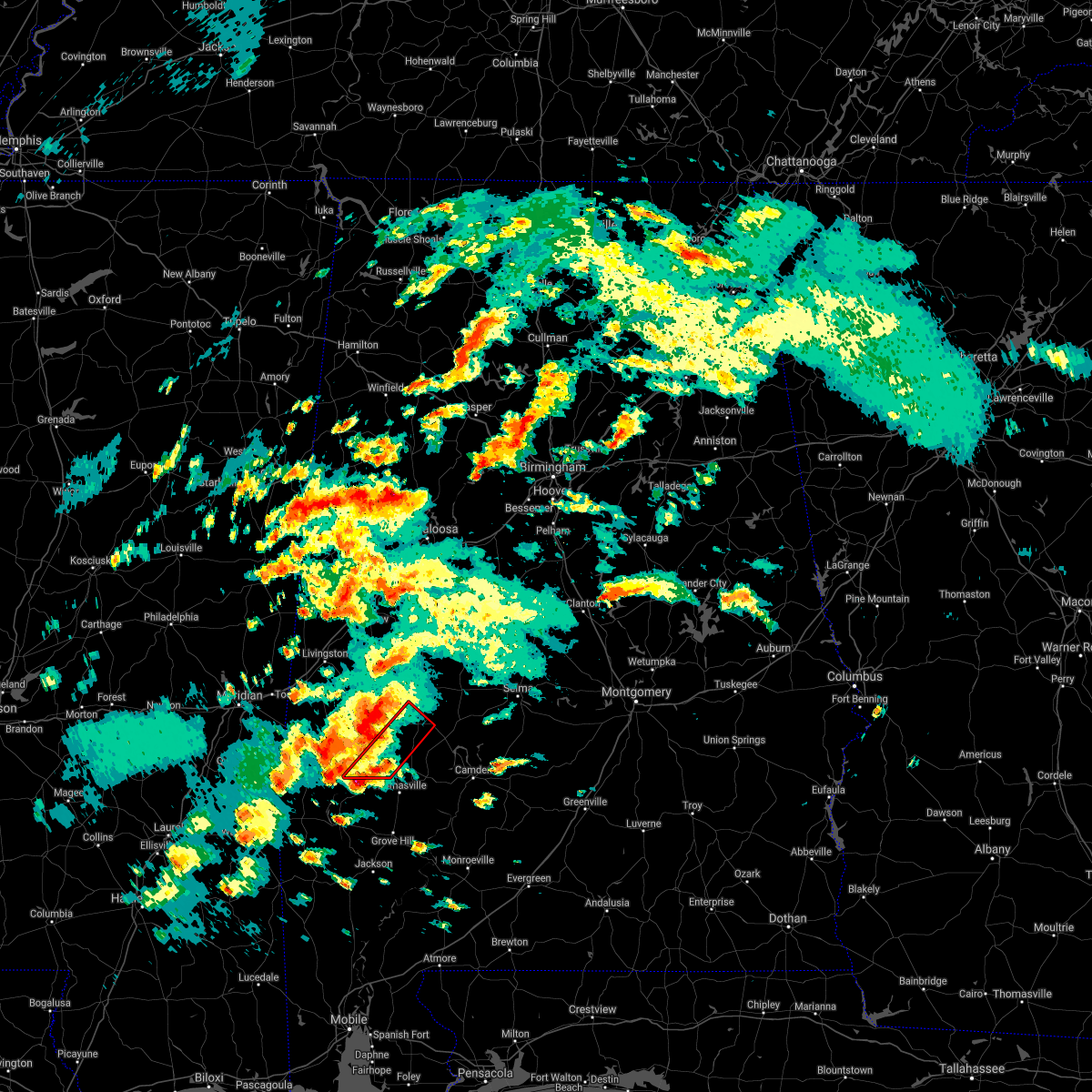 At 209 pm cdt, a severe thunderstorm capable of producing a tornado was located near putnam, or 15 miles west of thomasville, moving northeast at 35 mph (radar indicated rotation). Hazards include tornado and quarter size hail. Flying debris will be dangerous to those caught without shelter. mobile homes will be damaged or destroyed. damage to roofs, windows, and vehicles will occur. Tree damage is likely. At 209 pm cdt, a severe thunderstorm capable of producing a tornado was located near putnam, or 15 miles west of thomasville, moving northeast at 35 mph (radar indicated rotation). Hazards include tornado and quarter size hail. Flying debris will be dangerous to those caught without shelter. mobile homes will be damaged or destroyed. damage to roofs, windows, and vehicles will occur. Tree damage is likely.
|
| 3/16/2021 3:22 AM CDT |
 The national weather service in birmingham has issued a * severe thunderstorm warning for. southeastern marengo county in southwestern alabama. until 400 am cdt. At 322 am cdt, a severe thunderstorm was located near linden, moving east at 25 mph. The national weather service in birmingham has issued a * severe thunderstorm warning for. southeastern marengo county in southwestern alabama. until 400 am cdt. At 322 am cdt, a severe thunderstorm was located near linden, moving east at 25 mph.
|
| 8/21/2020 6:25 PM CDT |
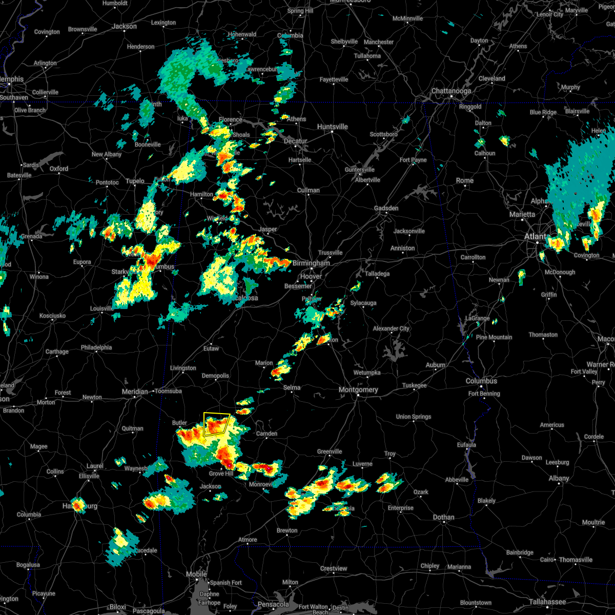 The severe thunderstorm warning for south central marengo county will expire at 630 pm cdt, the storm which prompted the warning has weakened below severe limits. therefore, the warning will be allowed to expire. however gusty winds and heavy rain are still possible with this thunderstorm. to report severe weather, contact your nearest law enforcement agency. they will relay your report to the national weather service birmingham. The severe thunderstorm warning for south central marengo county will expire at 630 pm cdt, the storm which prompted the warning has weakened below severe limits. therefore, the warning will be allowed to expire. however gusty winds and heavy rain are still possible with this thunderstorm. to report severe weather, contact your nearest law enforcement agency. they will relay your report to the national weather service birmingham.
|
| 8/21/2020 6:10 PM CDT |
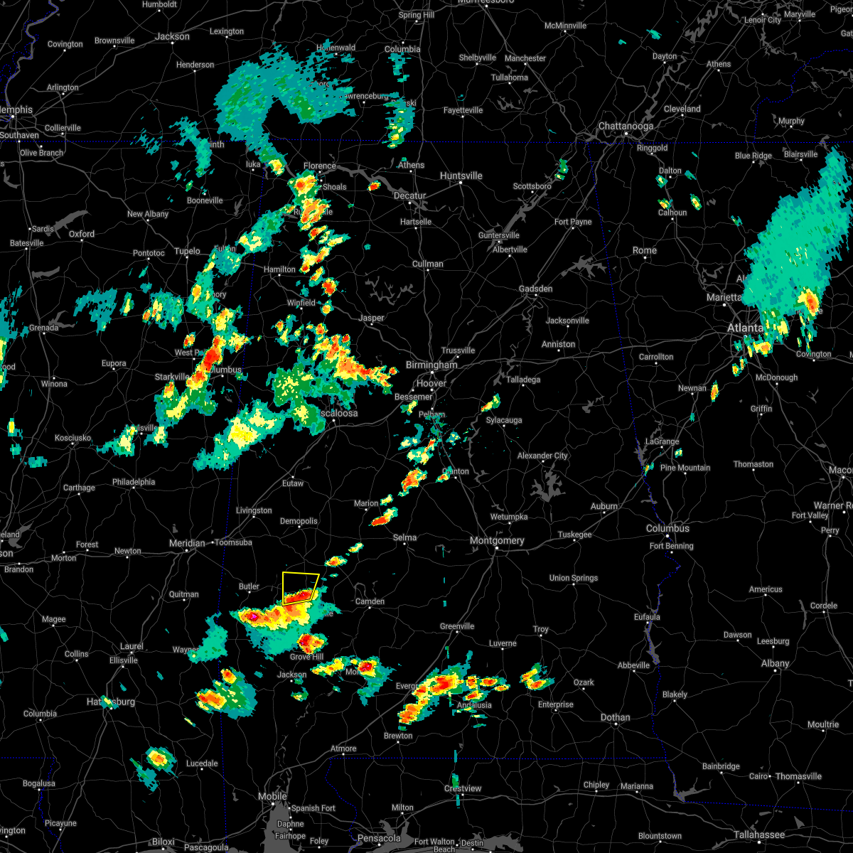 At 610 pm cdt, a severe thunderstorm was located over sweet water, or 14 miles northwest of thomasville, moving north at 20 mph (radar indicated). Hazards include 60 mph wind gusts and penny size hail. Expect damage to roofs, siding, and trees. Locations impacted include, sweet water, wayne, dixons mill, miller, half acre and octagon. At 610 pm cdt, a severe thunderstorm was located over sweet water, or 14 miles northwest of thomasville, moving north at 20 mph (radar indicated). Hazards include 60 mph wind gusts and penny size hail. Expect damage to roofs, siding, and trees. Locations impacted include, sweet water, wayne, dixons mill, miller, half acre and octagon.
|
| 8/21/2020 6:05 PM CDT |
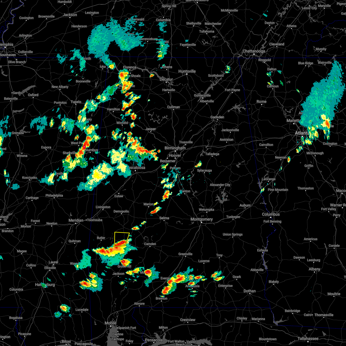 At 605 pm cdt, a severe thunderstorm was located over sweet water, or 13 miles northwest of thomasville, moving north at 20 mph (radar indicated). Hazards include 60 mph wind gusts and quarter size hail. Hail damage to vehicles is expected. expect wind damage to roofs, siding, and trees. Locations impacted include, sweet water, wayne, miller, dixons mill, half acre, octagon, clayhill and nicholsville. At 605 pm cdt, a severe thunderstorm was located over sweet water, or 13 miles northwest of thomasville, moving north at 20 mph (radar indicated). Hazards include 60 mph wind gusts and quarter size hail. Hail damage to vehicles is expected. expect wind damage to roofs, siding, and trees. Locations impacted include, sweet water, wayne, miller, dixons mill, half acre, octagon, clayhill and nicholsville.
|
| 8/21/2020 5:50 PM CDT |
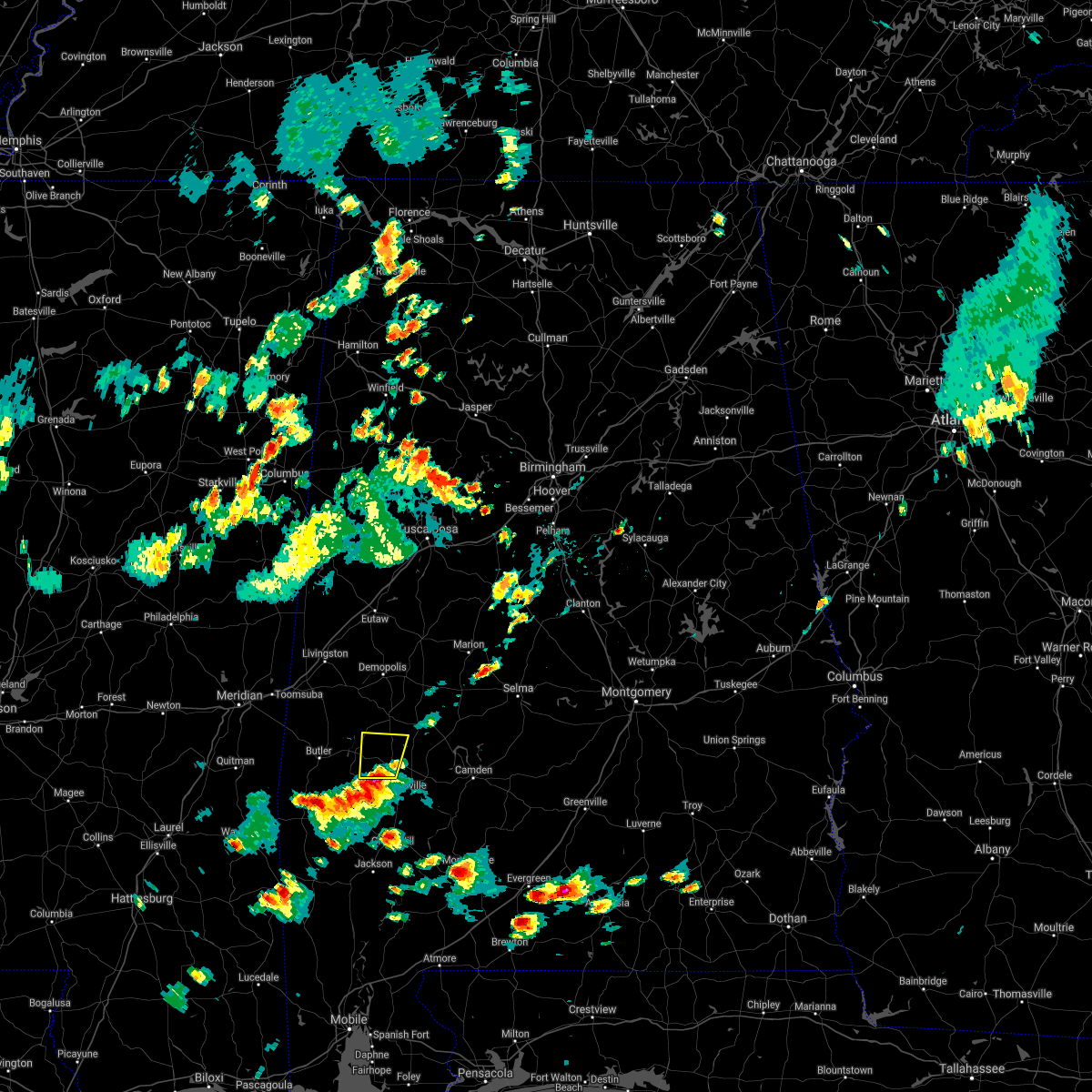 At 550 pm cdt, a severe thunderstorm was located near dixons mill, or 10 miles northwest of thomasville, moving north at 20 mph (radar indicated). Hazards include 60 mph wind gusts and quarter size hail. Hail damage to vehicles is expected. Expect wind damage to roofs, siding, and trees. At 550 pm cdt, a severe thunderstorm was located near dixons mill, or 10 miles northwest of thomasville, moving north at 20 mph (radar indicated). Hazards include 60 mph wind gusts and quarter size hail. Hail damage to vehicles is expected. Expect wind damage to roofs, siding, and trees.
|
| 6/25/2020 8:06 PM CDT |
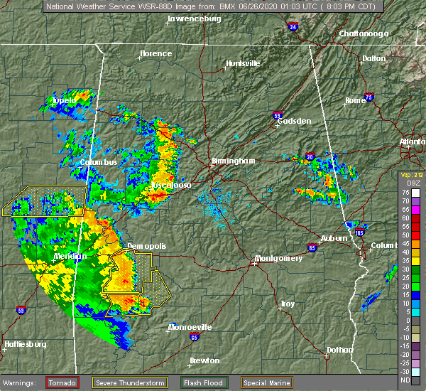 At 806 pm cdt, severe thunderstorms were located along a line extending from demopolis to near surginer, moving northeast at 40 mph (radar indicated). Hazards include 60 mph wind gusts. Expect damage to roofs, siding, and trees. Locations impacted include, demopolis, linden, uniontown, jefferson, thomaston, sweet water, myrtlewood, faunsdale, dayton, consul, surginer, freddie jones field, pin hook, magnolia, wayne, miller, chickasaw state park, dixons mill, vineland and half acre. At 806 pm cdt, severe thunderstorms were located along a line extending from demopolis to near surginer, moving northeast at 40 mph (radar indicated). Hazards include 60 mph wind gusts. Expect damage to roofs, siding, and trees. Locations impacted include, demopolis, linden, uniontown, jefferson, thomaston, sweet water, myrtlewood, faunsdale, dayton, consul, surginer, freddie jones field, pin hook, magnolia, wayne, miller, chickasaw state park, dixons mill, vineland and half acre.
|
| 6/25/2020 7:32 PM CDT |
 At 732 pm cdt, a severe thunderstorm was located near putnam, or 10 miles southeast of butler, moving northeast at 35 mph (radar indicated). Hazards include 60 mph wind gusts. expect damage to roofs, siding, and trees At 732 pm cdt, a severe thunderstorm was located near putnam, or 10 miles southeast of butler, moving northeast at 35 mph (radar indicated). Hazards include 60 mph wind gusts. expect damage to roofs, siding, and trees
|
| 4/19/2020 5:55 PM CDT |
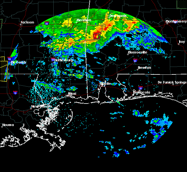 At 554 pm cdt, a severe thunderstorm capable of producing a tornado was located 7 miles southwest of putnam, or 8 miles southeast of butler, moving east at 50 mph (radar indicated rotation). Hazards include tornado and quarter size hail. Flying debris will be dangerous to those caught without shelter. mobile homes will be damaged or destroyed. damage to roofs, windows, and vehicles will occur. Tree damage is likely. At 554 pm cdt, a severe thunderstorm capable of producing a tornado was located 7 miles southwest of putnam, or 8 miles southeast of butler, moving east at 50 mph (radar indicated rotation). Hazards include tornado and quarter size hail. Flying debris will be dangerous to those caught without shelter. mobile homes will be damaged or destroyed. damage to roofs, windows, and vehicles will occur. Tree damage is likely.
|
| 4/8/2020 4:33 PM CDT |
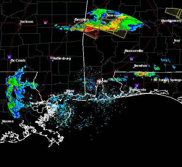 At 433 pm cdt, a severe thunderstorm was located near butler, moving east at 60 mph (radar indicated). Hazards include 60 mph wind gusts and half dollar size hail. Hail damage to vehicles is expected. Expect wind damage to roofs, siding, and trees. At 433 pm cdt, a severe thunderstorm was located near butler, moving east at 60 mph (radar indicated). Hazards include 60 mph wind gusts and half dollar size hail. Hail damage to vehicles is expected. Expect wind damage to roofs, siding, and trees.
|
| 3/31/2020 8:13 AM CDT |
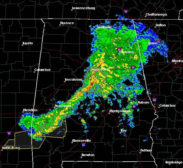 At 813 am cdt, a severe thunderstorm was located over dixons mill, or 9 miles north of thomasville, moving east at 65 mph (radar indicated). Hazards include 60 mph wind gusts. expect damage to roofs, siding, and trees At 813 am cdt, a severe thunderstorm was located over dixons mill, or 9 miles north of thomasville, moving east at 65 mph (radar indicated). Hazards include 60 mph wind gusts. expect damage to roofs, siding, and trees
|
| 10/25/2019 8:21 PM CDT |
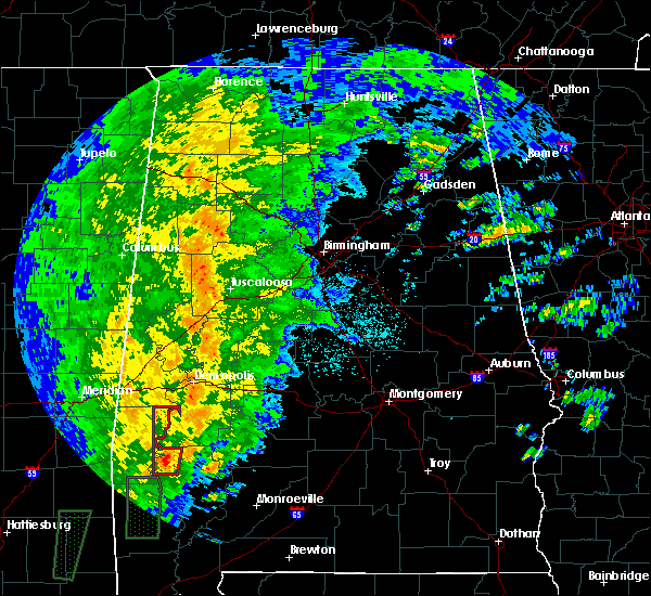 At 821 pm cdt, a severe thunderstorm capable of producing a tornado was located 8 miles south of putnam, or 17 miles west of thomasville, moving north at 35 mph (radar indicated rotation). Hazards include tornado. Flying debris will be dangerous to those caught without shelter. mobile homes will be damaged or destroyed. damage to roofs, windows, and vehicles will occur. Tree damage is likely. At 821 pm cdt, a severe thunderstorm capable of producing a tornado was located 8 miles south of putnam, or 17 miles west of thomasville, moving north at 35 mph (radar indicated rotation). Hazards include tornado. Flying debris will be dangerous to those caught without shelter. mobile homes will be damaged or destroyed. damage to roofs, windows, and vehicles will occur. Tree damage is likely.
|
| 6/7/2019 10:39 AM CDT |
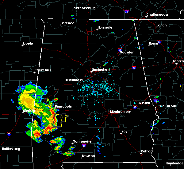 At 1039 am cdt, severe thunderstorms were located along a line extending from linden to near dixons mill, moving east at 40 mph (radar indicated). Hazards include 60 mph wind gusts. Expect damage to roofs, siding, and trees. Locations impacted include, linden, thomaston, sweet water, dayton, freddie jones field, shawnee, consul, magnolia, wayne, surginer, miller, dixons mill, vineland, carleys, octagon, clayhill and calvary. At 1039 am cdt, severe thunderstorms were located along a line extending from linden to near dixons mill, moving east at 40 mph (radar indicated). Hazards include 60 mph wind gusts. Expect damage to roofs, siding, and trees. Locations impacted include, linden, thomaston, sweet water, dayton, freddie jones field, shawnee, consul, magnolia, wayne, surginer, miller, dixons mill, vineland, carleys, octagon, clayhill and calvary.
|
| 6/7/2019 10:17 AM CDT |
 At 1015 am cdt, severe thunderstorms were located along a line extending from near pennington to near putnam, moving east at 40 mph (radar indicated). Hazards include 60 mph wind gusts. expect damage to roofs, siding, and trees At 1015 am cdt, severe thunderstorms were located along a line extending from near pennington to near putnam, moving east at 40 mph (radar indicated). Hazards include 60 mph wind gusts. expect damage to roofs, siding, and trees
|
| 7/22/2018 11:38 AM CDT |
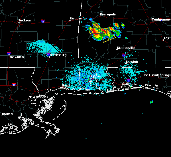 At 1137 am cdt, a cluster of severe thunderstorms were located near nanafalia to near surginer, moving southeast at 25 mph (radar indicated). Hazards include 60 mph wind gusts and quarter size hail. Hail damage to vehicles is expected. Expect wind damage to roofs, siding, and trees. At 1137 am cdt, a cluster of severe thunderstorms were located near nanafalia to near surginer, moving southeast at 25 mph (radar indicated). Hazards include 60 mph wind gusts and quarter size hail. Hail damage to vehicles is expected. Expect wind damage to roofs, siding, and trees.
|
| 7/22/2018 11:22 AM CDT |
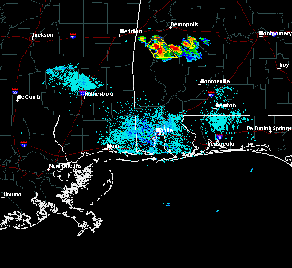 At 1122 am cdt, a severe thunderstorm was located over pennington, or 11 miles northeast of butler, moving southeast at 35 mph (radar indicated). Hazards include 60 mph wind gusts and quarter size hail. Hail damage to vehicles is expected. Expect wind damage to roofs, siding, and trees. At 1122 am cdt, a severe thunderstorm was located over pennington, or 11 miles northeast of butler, moving southeast at 35 mph (radar indicated). Hazards include 60 mph wind gusts and quarter size hail. Hail damage to vehicles is expected. Expect wind damage to roofs, siding, and trees.
|
| 6/28/2018 5:40 PM CDT | Trees blown down near sweetwate in marengo county AL, 0.5 miles NE of Sweet Water, AL |
| 6/28/2018 5:08 PM CDT |
 At 508 pm cdt, severe thunderstorms were located along a line extending from pickensville to near central mills, moving southwest at 25 mph (radar indicated). Hazards include 60 mph wind gusts. expect damage to roofs, siding, and trees At 508 pm cdt, severe thunderstorms were located along a line extending from pickensville to near central mills, moving southwest at 25 mph (radar indicated). Hazards include 60 mph wind gusts. expect damage to roofs, siding, and trees
|
| 9/23/2017 6:39 PM CDT |
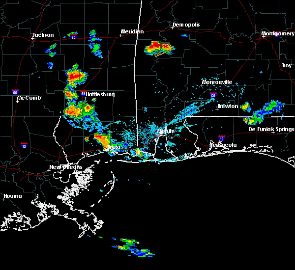 At 638 pm cdt, a severe thunderstorm was located near myrtlewood, or 12 miles southwest of linden, moving west at 20 mph (radar indicated). Hazards include 60 mph wind gusts and penny size hail. expect damage to roofs, siding, and trees At 638 pm cdt, a severe thunderstorm was located near myrtlewood, or 12 miles southwest of linden, moving west at 20 mph (radar indicated). Hazards include 60 mph wind gusts and penny size hail. expect damage to roofs, siding, and trees
|
| 5/1/2017 12:19 AM CDT |
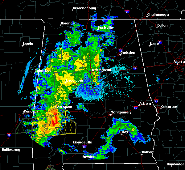 At 1219 am cdt, a severe thunderstorm was located over sweet water, or 13 miles south of linden, moving northeast at 50 mph (radar indicated). Hazards include 60 mph wind gusts and nickel size hail. Expect damage to roofs, siding, and trees. Locations impacted include, linden, thomaston, sweet water, myrtlewood, dayton, freddie jones field, consul, magnolia, wayne, surginer, miller, dixons mill, vineland, providence, half acre, octagon, clayhill, nicholsville and calvary. At 1219 am cdt, a severe thunderstorm was located over sweet water, or 13 miles south of linden, moving northeast at 50 mph (radar indicated). Hazards include 60 mph wind gusts and nickel size hail. Expect damage to roofs, siding, and trees. Locations impacted include, linden, thomaston, sweet water, myrtlewood, dayton, freddie jones field, consul, magnolia, wayne, surginer, miller, dixons mill, vineland, providence, half acre, octagon, clayhill, nicholsville and calvary.
|
| 5/1/2017 12:08 AM CDT |
 At 1208 am cdt, a severe thunderstorm was located over nanafalia, or 14 miles east of butler, moving northeast at 55 mph (radar indicated). Hazards include 60 mph wind gusts and nickel size hail. Expect damage to roofs, siding, and trees. Locations impacted include, linden, thomaston, sweet water, myrtlewood, dayton, putnam, freddie jones field, nanafalia, consul, magnolia, wayne, surginer, miller, dixons mill, vineland, providence, half acre, octagon, clayhill and nicholsville. At 1208 am cdt, a severe thunderstorm was located over nanafalia, or 14 miles east of butler, moving northeast at 55 mph (radar indicated). Hazards include 60 mph wind gusts and nickel size hail. Expect damage to roofs, siding, and trees. Locations impacted include, linden, thomaston, sweet water, myrtlewood, dayton, putnam, freddie jones field, nanafalia, consul, magnolia, wayne, surginer, miller, dixons mill, vineland, providence, half acre, octagon, clayhill and nicholsville.
|
| 4/30/2017 11:55 PM CDT |
 At 1154 pm cdt, a severe thunderstorm was located near butler, moving northeast at 50 mph (radar indicated). Hazards include 60 mph wind gusts and nickel size hail. expect damage to roofs, siding, and trees At 1154 pm cdt, a severe thunderstorm was located near butler, moving northeast at 50 mph (radar indicated). Hazards include 60 mph wind gusts and nickel size hail. expect damage to roofs, siding, and trees
|
| 1/21/2017 6:05 AM CST |
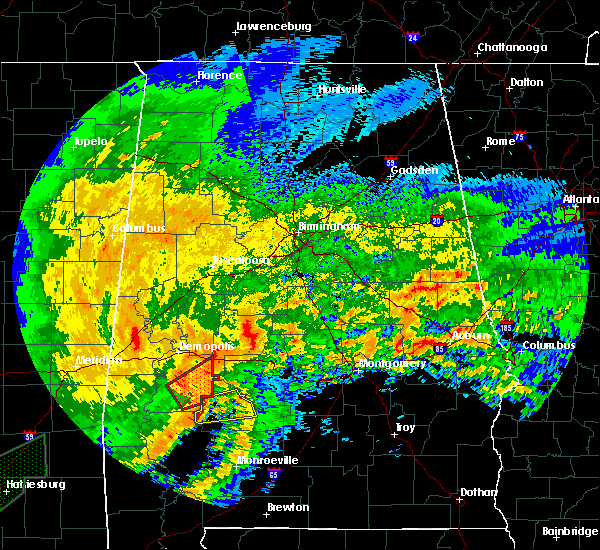 At 605 am cst, a severe thunderstorm capable of producing a tornado was located over magnolia, or 11 miles southeast of linden, moving northeast at 45 mph (radar indicated rotation). Hazards include tornado. Flying debris will be dangerous to those caught without shelter. mobile homes will be damaged or destroyed. damage to roofs, windows, and vehicles will occur. tree damage is likely. Locations impacted include, linden, uniontown, thomaston, dayton, dixons mill, magnolia, surginer, wayne, consul, miller, freddie jones field, octagon, calvary and clayhill. At 605 am cst, a severe thunderstorm capable of producing a tornado was located over magnolia, or 11 miles southeast of linden, moving northeast at 45 mph (radar indicated rotation). Hazards include tornado. Flying debris will be dangerous to those caught without shelter. mobile homes will be damaged or destroyed. damage to roofs, windows, and vehicles will occur. tree damage is likely. Locations impacted include, linden, uniontown, thomaston, dayton, dixons mill, magnolia, surginer, wayne, consul, miller, freddie jones field, octagon, calvary and clayhill.
|
| 1/21/2017 5:44 AM CST |
 At 543 am cst, a severe thunderstorm capable of producing a tornado was located over nanafalia, or 15 miles east of butler, moving northeast at 45 mph (radar indicated rotation). Hazards include tornado. Flying debris will be dangerous to those caught without shelter. mobile homes will be damaged or destroyed. damage to roofs, windows, and vehicles will occur. tree damage is likely. Locations impacted include, linden, uniontown, thomaston, sweet water, dayton, nanafalia, dixons mill, magnolia, surginer, wayne, vineland, consul, shawnee, miller, freddie jones field, putnam, octagon, half acre, calvary and nicholsville. At 543 am cst, a severe thunderstorm capable of producing a tornado was located over nanafalia, or 15 miles east of butler, moving northeast at 45 mph (radar indicated rotation). Hazards include tornado. Flying debris will be dangerous to those caught without shelter. mobile homes will be damaged or destroyed. damage to roofs, windows, and vehicles will occur. tree damage is likely. Locations impacted include, linden, uniontown, thomaston, sweet water, dayton, nanafalia, dixons mill, magnolia, surginer, wayne, vineland, consul, shawnee, miller, freddie jones field, putnam, octagon, half acre, calvary and nicholsville.
|
| 1/21/2017 5:33 AM CST |
 At 533 am cst, a severe thunderstorm capable of producing a tornado was located over putnam, or 9 miles southeast of butler, moving northeast at 45 mph (radar indicated rotation). Hazards include tornado. Flying debris will be dangerous to those caught without shelter. mobile homes will be damaged or destroyed. damage to roofs, windows, and vehicles will occur. tree damage is likely. Locations impacted include, linden, uniontown, thomaston, sweet water, dayton, nanafalia, dixons mill, magnolia, surginer, wayne, vineland, consul, shawnee, miller, freddie jones field, putnam, octagon, half acre, calvary and nicholsville. At 533 am cst, a severe thunderstorm capable of producing a tornado was located over putnam, or 9 miles southeast of butler, moving northeast at 45 mph (radar indicated rotation). Hazards include tornado. Flying debris will be dangerous to those caught without shelter. mobile homes will be damaged or destroyed. damage to roofs, windows, and vehicles will occur. tree damage is likely. Locations impacted include, linden, uniontown, thomaston, sweet water, dayton, nanafalia, dixons mill, magnolia, surginer, wayne, vineland, consul, shawnee, miller, freddie jones field, putnam, octagon, half acre, calvary and nicholsville.
|
| 1/21/2017 5:21 AM CST |
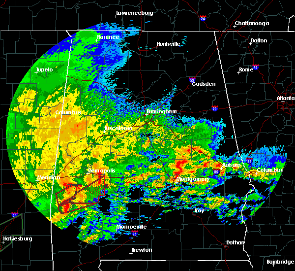 At 521 am cst, a severe thunderstorm capable of producing a tornado was located near toxey, or 10 miles south of butler, moving northeast at 45 mph (radar indicated rotation). Hazards include tornado. Flying debris will be dangerous to those caught without shelter. mobile homes will be damaged or destroyed. damage to roofs, windows, and vehicles will occur. Tree damage is likely. At 521 am cst, a severe thunderstorm capable of producing a tornado was located near toxey, or 10 miles south of butler, moving northeast at 45 mph (radar indicated rotation). Hazards include tornado. Flying debris will be dangerous to those caught without shelter. mobile homes will be damaged or destroyed. damage to roofs, windows, and vehicles will occur. Tree damage is likely.
|
| 6/17/2016 4:59 PM CDT |
 At 458 pm cdt, severe thunderstorms were located along a line extending from near deatsville to benton to near sweet water, moving southeast at 30 mph (radar indicated). Hazards include 60 mph wind gusts. Expect damage to roofs. siding. and trees. Locations impacted include, prattville, millbrook, deatsville, autaugaville, thomaston, sweet water, orrville, benton, dixons mill, wayne, central mills, putnam, dallas lake, nanafalia, magnolia, old cahaba park, surginer, autauga county airport, vineland and dannelly reservoir. At 458 pm cdt, severe thunderstorms were located along a line extending from near deatsville to benton to near sweet water, moving southeast at 30 mph (radar indicated). Hazards include 60 mph wind gusts. Expect damage to roofs. siding. and trees. Locations impacted include, prattville, millbrook, deatsville, autaugaville, thomaston, sweet water, orrville, benton, dixons mill, wayne, central mills, putnam, dallas lake, nanafalia, magnolia, old cahaba park, surginer, autauga county airport, vineland and dannelly reservoir.
|
| 6/17/2016 4:45 PM CDT |
 At 445 pm cdt, severe thunderstorms were located along a line extending from near marbury to near tyler to myrtlewood, moving south at 40 mph (radar indicated). Hazards include 60 mph wind gusts. Expect damage to roofs. siding. and trees. Locations impacted include, prattville, selma, millbrook, linden, selmont-west selmont, deatsville, autaugaville, thomaston, sweet water, orrville, myrtlewood, dayton, benton, bogue chitto, memorial stadium, vida junction, marbury, dallas county horse arena, dallas lake and magnolia. At 445 pm cdt, severe thunderstorms were located along a line extending from near marbury to near tyler to myrtlewood, moving south at 40 mph (radar indicated). Hazards include 60 mph wind gusts. Expect damage to roofs. siding. and trees. Locations impacted include, prattville, selma, millbrook, linden, selmont-west selmont, deatsville, autaugaville, thomaston, sweet water, orrville, myrtlewood, dayton, benton, bogue chitto, memorial stadium, vida junction, marbury, dallas county horse arena, dallas lake and magnolia.
|
| 6/17/2016 4:28 PM CDT |
 At 428 pm cdt, severe thunderstorms were located along a line extending from near higgins ferry park to selma to 7 miles south of coatopa, moving southeast at 45 mph (radar indicated). Hazards include 60 mph wind gusts. Expect damage to roofs. siding. and trees. Locations impacted include, prattville, selma, millbrook, demopolis, valley grande, linden, uniontown, selmont-west selmont, jefferson, deatsville, autaugaville, thomaston, sweet water, orrville, billingsley, myrtlewood, faunsdale, dayton, benton and bogue chitto. At 428 pm cdt, severe thunderstorms were located along a line extending from near higgins ferry park to selma to 7 miles south of coatopa, moving southeast at 45 mph (radar indicated). Hazards include 60 mph wind gusts. Expect damage to roofs. siding. and trees. Locations impacted include, prattville, selma, millbrook, demopolis, valley grande, linden, uniontown, selmont-west selmont, jefferson, deatsville, autaugaville, thomaston, sweet water, orrville, billingsley, myrtlewood, faunsdale, dayton, benton and bogue chitto.
|
| 6/17/2016 4:09 PM CDT |
 At 409 pm cdt, severe thunderstorms were located along a line extending from near calera to near marion to near tishabee, moving south at 25 mph (radar indicated). Hazards include 60 mph wind gusts. Expect damage to roofs. siding. And trees. At 409 pm cdt, severe thunderstorms were located along a line extending from near calera to near marion to near tishabee, moving south at 25 mph (radar indicated). Hazards include 60 mph wind gusts. Expect damage to roofs. siding. And trees.
|
| 3/31/2016 7:01 PM CDT |
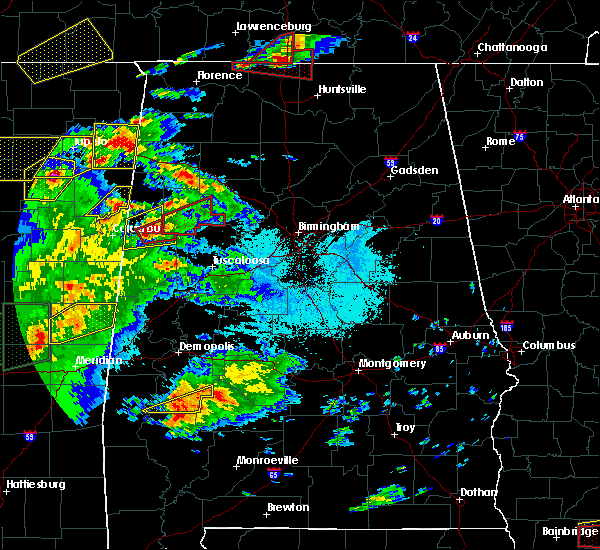 At 701 pm cdt, a severe thunderstorm was located over dixons mill, or 7 miles north of thomasville, moving east at 40 mph (radar indicated). Hazards include 60 mph wind gusts and quarter size hail. Hail damage to vehicles is expected. expect wind damage to roofs, siding, and trees. locations impacted include, dixons mill, magnolia, vineland, surginer, wayne, shawnee and clayhill. A tornado watch remains in effect until 100 am cdt for southwestern alabama. At 701 pm cdt, a severe thunderstorm was located over dixons mill, or 7 miles north of thomasville, moving east at 40 mph (radar indicated). Hazards include 60 mph wind gusts and quarter size hail. Hail damage to vehicles is expected. expect wind damage to roofs, siding, and trees. locations impacted include, dixons mill, magnolia, vineland, surginer, wayne, shawnee and clayhill. A tornado watch remains in effect until 100 am cdt for southwestern alabama.
|
| 3/31/2016 6:43 PM CDT |
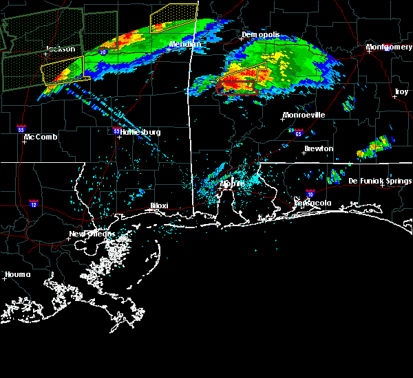 At 643 pm cdt, a severe thunderstorm was located near putnam, or 14 miles west of thomasville, moving east at 40 mph (radar indicated). Hazards include 60 mph wind gusts and quarter size hail. Hail damage to vehicles is expected. expect wind damage to roofs, siding, and trees. locations impacted include, sweet water, dixons mill, magnolia, vineland, surginer, wayne, shawnee, putnam, nicholsville, clayhill and slater. A tornado watch remains in effect until 100 am cdt for southwestern alabama. At 643 pm cdt, a severe thunderstorm was located near putnam, or 14 miles west of thomasville, moving east at 40 mph (radar indicated). Hazards include 60 mph wind gusts and quarter size hail. Hail damage to vehicles is expected. expect wind damage to roofs, siding, and trees. locations impacted include, sweet water, dixons mill, magnolia, vineland, surginer, wayne, shawnee, putnam, nicholsville, clayhill and slater. A tornado watch remains in effect until 100 am cdt for southwestern alabama.
|
| 3/31/2016 6:33 PM CDT |
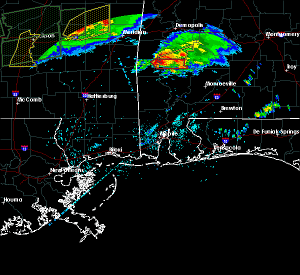 At 632 pm cdt, a severe thunderstorm was located near putnam, or 12 miles southeast of butler, moving east at 40 mph (radar indicated). Hazards include 60 mph wind gusts and quarter size hail. Hail damage to vehicles is expected. Expect wind damage to roofs, siding, and trees. At 632 pm cdt, a severe thunderstorm was located near putnam, or 12 miles southeast of butler, moving east at 40 mph (radar indicated). Hazards include 60 mph wind gusts and quarter size hail. Hail damage to vehicles is expected. Expect wind damage to roofs, siding, and trees.
|
| 2/23/2016 7:01 PM CST |
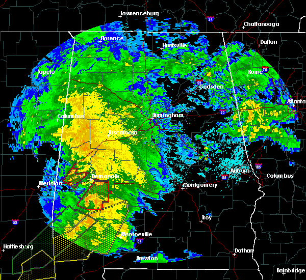 At 701 pm cst, severe thunderstorms capable of producing tornadoes were located along a line extending from near sweet water to near vineland, moving northeast at 55 mph (radar indicated rotation). Hazards include tornado. Flying debris will be dangerous to those caught without shelter. mobile homes will be damaged or destroyed. damage to roofs, windows and vehicles will occur. tree damage is likely. Locations impacted include, linden, uniontown, thomaston, sweet water, faunsdale, dayton, nanafalia, dixons mill, magnolia, surginer, wayne, chickasaw state park, vineland, consul, miller, freddie jones field, providence, old spring hill, octagon and half acre. At 701 pm cst, severe thunderstorms capable of producing tornadoes were located along a line extending from near sweet water to near vineland, moving northeast at 55 mph (radar indicated rotation). Hazards include tornado. Flying debris will be dangerous to those caught without shelter. mobile homes will be damaged or destroyed. damage to roofs, windows and vehicles will occur. tree damage is likely. Locations impacted include, linden, uniontown, thomaston, sweet water, faunsdale, dayton, nanafalia, dixons mill, magnolia, surginer, wayne, chickasaw state park, vineland, consul, miller, freddie jones field, providence, old spring hill, octagon and half acre.
|
| 2/23/2016 6:50 PM CST |
 At 650 pm cst, severe thunderstorms capable of producing a tornado were located along a line extending from near nanafalia to thomasville, moving northeast at 55 mph (radar indicated rotation). Hazards include tornado. Flying debris will be dangerous to those caught without shelter. mobile homes will be damaged or destroyed. damage to roofs, windows and vehicles will occur. Tree damage is likely. At 650 pm cst, severe thunderstorms capable of producing a tornado were located along a line extending from near nanafalia to thomasville, moving northeast at 55 mph (radar indicated rotation). Hazards include tornado. Flying debris will be dangerous to those caught without shelter. mobile homes will be damaged or destroyed. damage to roofs, windows and vehicles will occur. Tree damage is likely.
|
| 2/15/2016 4:33 PM CST |
 At 432 pm cst, severe thunderstorms were located along a line extending from near akron to 6 miles east of arcola to near miller, moving east at 45 mph (radar indicated). Hazards include 60 mph wind gusts. Expect damage to roofs. siding and trees. locations impacted include, demopolis, eutaw, greensboro, linden, forkland, thomaston, akron, sweet water, newbern, faunsdale, dayton, dixons mill, pin hook, duffys bend, wayne, wedgeworth, greensboro municipal airport, walden quarters, freddie jones field and sawyerville. A tornado watch remains in effect until 900 pm cst for southwestern alabama. At 432 pm cst, severe thunderstorms were located along a line extending from near akron to 6 miles east of arcola to near miller, moving east at 45 mph (radar indicated). Hazards include 60 mph wind gusts. Expect damage to roofs. siding and trees. locations impacted include, demopolis, eutaw, greensboro, linden, forkland, thomaston, akron, sweet water, newbern, faunsdale, dayton, dixons mill, pin hook, duffys bend, wayne, wedgeworth, greensboro municipal airport, walden quarters, freddie jones field and sawyerville. A tornado watch remains in effect until 900 pm cst for southwestern alabama.
|
| 2/15/2016 4:12 PM CST |
 At 412 pm cst, severe thunderstorms were located along a line extending from near eutaw to near chickasaw state park to near dixons mill, moving east at 90 mph (radar indicated). Hazards include 60 mph wind gusts. Expect damage to roofs. siding and trees. locations impacted include, demopolis, eutaw, greensboro, linden, forkland, thomaston, akron, boligee, sweet water, newbern, faunsdale, dayton, duffys bend, thornhill, allison, walden quarters, magnolia, surginer, chickasaw state park and evansville. this includes interstate 20 between mile markers 32 and 40. A tornado watch remains in effect until 900 pm cst for southwestern alabama. At 412 pm cst, severe thunderstorms were located along a line extending from near eutaw to near chickasaw state park to near dixons mill, moving east at 90 mph (radar indicated). Hazards include 60 mph wind gusts. Expect damage to roofs. siding and trees. locations impacted include, demopolis, eutaw, greensboro, linden, forkland, thomaston, akron, boligee, sweet water, newbern, faunsdale, dayton, duffys bend, thornhill, allison, walden quarters, magnolia, surginer, chickasaw state park and evansville. this includes interstate 20 between mile markers 32 and 40. A tornado watch remains in effect until 900 pm cst for southwestern alabama.
|
| 2/15/2016 3:48 PM CST |
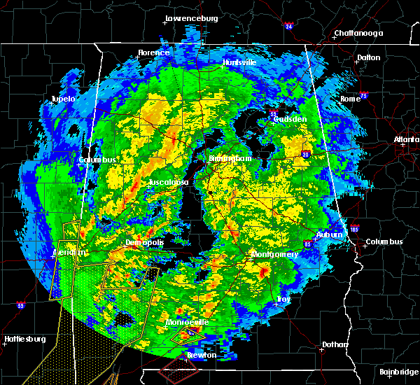 At 348 pm cst, severe thunderstorms were located along a line extending from near emelle to 6 miles northeast of toxey, moving east at 55 mph (radar indicated). Hazards include 60 mph wind gusts. Expect damage to roofs. Siding and trees. At 348 pm cst, severe thunderstorms were located along a line extending from near emelle to 6 miles northeast of toxey, moving east at 55 mph (radar indicated). Hazards include 60 mph wind gusts. Expect damage to roofs. Siding and trees.
|
| 7/15/2015 8:33 PM CDT |
 At 833 pm cdt, severe thunderstorms were located along a line extending from near myrtlewood to near freddie jones field to near dayton, moving southeast at 20 mph (radar indicated). Hazards include 60 mph wind gusts and quarter size hail. Hail damage to vehicles is expected. expect wind damage to roofs, siding and trees. locations impacted include, linden, uniontown, jefferson, thomaston, sweet water, myrtlewood, faunsdale, dayton, magnolia, pin hook, chickasaw state park, consul, miller, freddie jones field, providence, old spring hill, u. s. 80 and al 28, octagon, half acre and calvary. At 833 pm cdt, severe thunderstorms were located along a line extending from near myrtlewood to near freddie jones field to near dayton, moving southeast at 20 mph (radar indicated). Hazards include 60 mph wind gusts and quarter size hail. Hail damage to vehicles is expected. expect wind damage to roofs, siding and trees. locations impacted include, linden, uniontown, jefferson, thomaston, sweet water, myrtlewood, faunsdale, dayton, magnolia, pin hook, chickasaw state park, consul, miller, freddie jones field, providence, old spring hill, u. s. 80 and al 28, octagon, half acre and calvary.
|
| 7/15/2015 8:18 PM CDT |
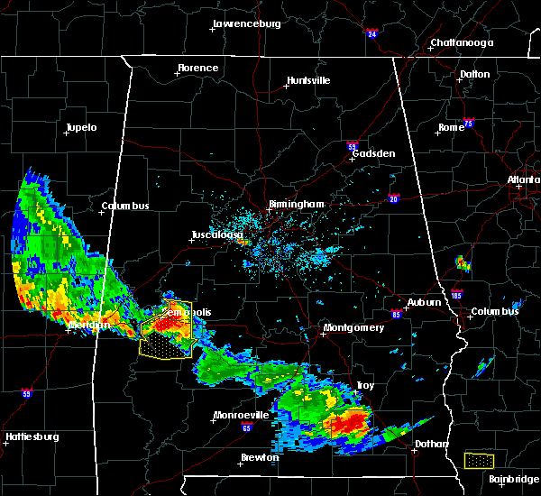 At 818 pm cdt, severe thunderstorms were located along a line extending from pin hook to 6 miles northeast of chickasaw state park to near dayton, moving south at 35 mph (radar indicated). Hazards include 60 mph wind gusts and quarter size hail. Hail damage to vehicles is expected. expect wind damage to roofs, siding and trees. Locations impacted include, demopolis, linden, uniontown, jefferson, thomaston, sweet water, newbern, myrtlewood, faunsdale, dayton, pin hook, freddie jones field, magnolia, chickasaw state park, consul, arcola, miller, providence, demopolis municipal airport and octagon. At 818 pm cdt, severe thunderstorms were located along a line extending from pin hook to 6 miles northeast of chickasaw state park to near dayton, moving south at 35 mph (radar indicated). Hazards include 60 mph wind gusts and quarter size hail. Hail damage to vehicles is expected. expect wind damage to roofs, siding and trees. Locations impacted include, demopolis, linden, uniontown, jefferson, thomaston, sweet water, newbern, myrtlewood, faunsdale, dayton, pin hook, freddie jones field, magnolia, chickasaw state park, consul, arcola, miller, providence, demopolis municipal airport and octagon.
|
| 7/15/2015 8:00 PM CDT |
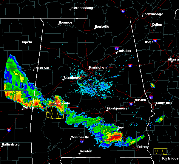 At 800 pm cdt, severe thunderstorms were located along a line extending from near demopolis to arcola to faunsdale, moving south at 25 mph (radar indicated). Hazards include 60 mph wind gusts and quarter size hail. Hail damage to vehicles is expected. Expect wind damage to roofs, siding and trees. At 800 pm cdt, severe thunderstorms were located along a line extending from near demopolis to arcola to faunsdale, moving south at 25 mph (radar indicated). Hazards include 60 mph wind gusts and quarter size hail. Hail damage to vehicles is expected. Expect wind damage to roofs, siding and trees.
|
| 12/25/2012 3:55 PM CST | Trees were blown down along marengo road 8 between sweetwater and dixons mil in marengo county AL, 4 miles NW of Sweet Water, AL |
| 12/25/2012 3:20 PM CST | Trees were blown down along marengo road 8 between sweetwater and dixons mil in marengo county AL, 4 miles NW of Sweet Water, AL |
| 12/25/2012 3:20 PM CST | Trees were blown down along marengo road 8 between sweetwater and dixons mill. several additional trees were blown down in vangale communit in marengo county AL, 4 miles NW of Sweet Water, AL |
| 1/1/0001 12:00 AM | Quarter sized hail reported 0.5 miles NE of Sweet Water, AL |
| 1/1/0001 12:00 AM | Tennis Ball sized hail reported 8.5 miles SSE of Sweet Water, AL |
Hail Maps for Sweet Water, AL


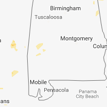


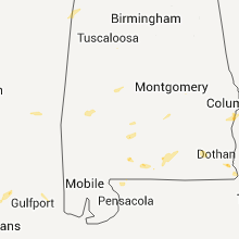


Connect with Interactive Hail Maps