

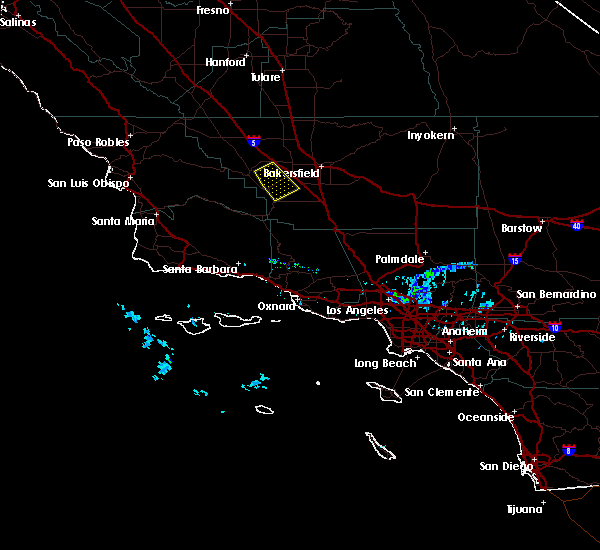
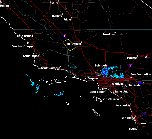
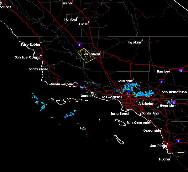
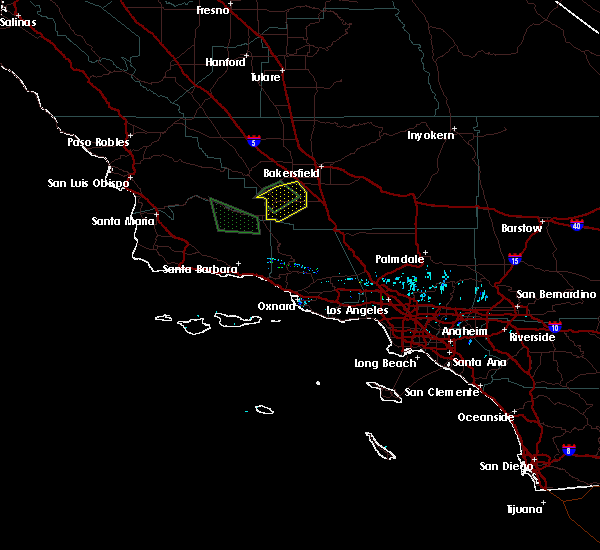
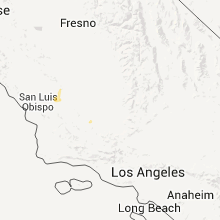
Hail Map for Taft, CA
The Taft, CA area has had 2 reports of on-the-ground hail by trained spotters, and has been under severe weather warnings 0 times during the past 12 months. Doppler radar has detected hail at or near Taft, CA on 2 occasions.
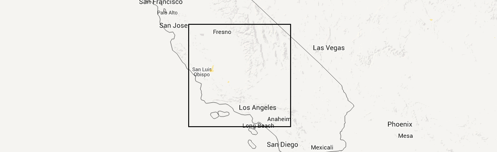
| Name: | Taft, CA |
| Where Located: | 28.9 miles SW of Bakersfield, CA |
| Map: | Google Map for Taft, CA |
| Population: | 9327 |
| Housing Units: | 2525 |
| More Info: | Search Google for Taft, CA |
5
The Top Recent Hail Date for Taft, CA is Wednesday, June 10, 2015 (1st out of 2)
Hail and Wind Damage Spotted near Taft, CA
| Date / Time | Report Details |
|---|---|
| 5/25/2019 3:27 PM PDT |
 At 326 pm pdt, a severe thunderstorm was located about 7 miles east of dustin acres, or about 18 miles southwest of bakersfield, moving to the southeast at 10 mph (radar indicated). Hazards include half dollar size hail. damage to vehicles is expected At 326 pm pdt, a severe thunderstorm was located about 7 miles east of dustin acres, or about 18 miles southwest of bakersfield, moving to the southeast at 10 mph (radar indicated). Hazards include half dollar size hail. damage to vehicles is expected
|
| 5/25/2019 3:07 PM PDT |
 At 306 pm pdt, a severe thunderstorm was located near dustin acres, or 24 miles west of bakersfield, moving southeast at 15 mph (radar indicated). Hazards include quarter size hail. Potentially damaging hail is possible with this storm. very heavy rain and road flooding is possible. this storm is bringing frequent cloud to ground lightning as well. Locations impacted include, bakersfield, tupman, dustin acres, valley acres, rosedale, harris ranch and buttonwillow. At 306 pm pdt, a severe thunderstorm was located near dustin acres, or 24 miles west of bakersfield, moving southeast at 15 mph (radar indicated). Hazards include quarter size hail. Potentially damaging hail is possible with this storm. very heavy rain and road flooding is possible. this storm is bringing frequent cloud to ground lightning as well. Locations impacted include, bakersfield, tupman, dustin acres, valley acres, rosedale, harris ranch and buttonwillow.
|
| 5/25/2019 2:46 PM PDT |
 At 244 pm pdt, a severe thunderstorm was located near tupman, or 26 miles west of bakersfield, moving southeast at 15 mph (radar indicated. impacts, large potentially damaging hail along with frequent lightning and very heavy heavy rain with possible flooding). Hazards include quarter size hail. At 244 pm pdt, a severe thunderstorm was located near tupman, or 26 miles west of bakersfield, moving southeast at 15 mph (radar indicated. impacts, large potentially damaging hail along with frequent lightning and very heavy heavy rain with possible flooding). Hazards include quarter size hail.
|
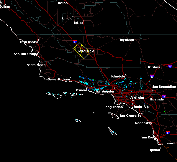
| 2/17/2019 4:55 PM PST |
 The severe thunderstorm warning for central kern county will expire at 500 pm pst, the storm which prompted the warning has weakened below severe limits, and no longer poses an immediate threat to life or property. therefore, the warning will be allowed to expire. The severe thunderstorm warning for central kern county will expire at 500 pm pst, the storm which prompted the warning has weakened below severe limits, and no longer poses an immediate threat to life or property. therefore, the warning will be allowed to expire.
|
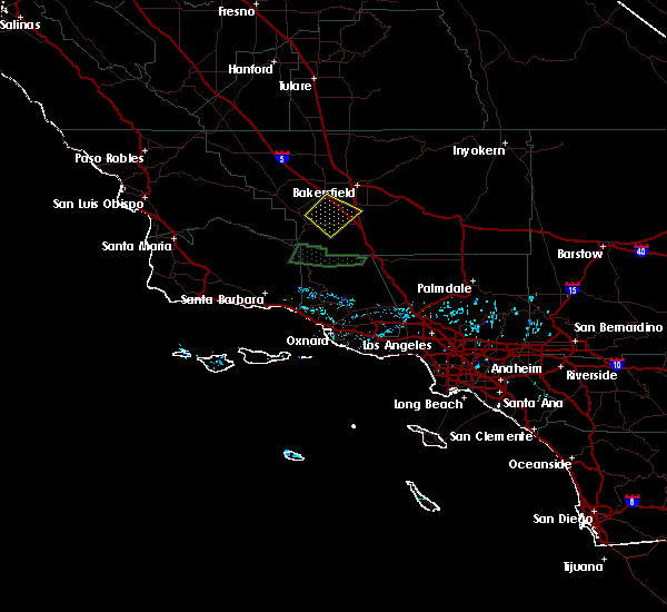
| 2/17/2019 4:37 PM PST |
 At 436 pm pst, a severe thunderstorm was located near valley acres, or 24 miles west of bakersfield, moving southeast at 40 mph (radar indicated). Hazards include quarter size hail. Damage to vehicles is expected. Locations impacted include, taft, maricopa, ford city, tupman, dustin acres, valley acres and south taft. At 436 pm pst, a severe thunderstorm was located near valley acres, or 24 miles west of bakersfield, moving southeast at 40 mph (radar indicated). Hazards include quarter size hail. Damage to vehicles is expected. Locations impacted include, taft, maricopa, ford city, tupman, dustin acres, valley acres and south taft.
|
| 2/17/2019 4:23 PM PST |
 At 422 pm pst, a severe thunderstorm was located 7 miles northeast of mckittrick, or 28 miles west of bakersfield, moving southeast at 45 mph (radar indicated). Hazards include quarter size hail. damage to vehicles is expected At 422 pm pst, a severe thunderstorm was located 7 miles northeast of mckittrick, or 28 miles west of bakersfield, moving southeast at 45 mph (radar indicated). Hazards include quarter size hail. damage to vehicles is expected
|
| 6/10/2015 5:45 PM PDT | Quarter sized hail reported 3 miles ESE of Taft, CA, hail lasted about 3-4 minutes. reported via social media. |
| 6/10/2015 5:35 PM PDT |
 At 533 pm pdt, doppler radar continued to indicate a severe thunderstorm capable of producing quarter size hail and damaging winds in excess of 60 mph. however, storm intensity is decreasing at this time. this storm was located 15 miles northwest of golden hills, or 21 miles east of bakersfield, moving east at 10 mph. locations impacted include, taft, maricopa, taft heights and south taft. At 533 pm pdt, doppler radar continued to indicate a severe thunderstorm capable of producing quarter size hail and damaging winds in excess of 60 mph. however, storm intensity is decreasing at this time. this storm was located 15 miles northwest of golden hills, or 21 miles east of bakersfield, moving east at 10 mph. locations impacted include, taft, maricopa, taft heights and south taft.
|
| 6/10/2015 5:15 PM PDT | Quarter sized hail reported 2.5 miles SSE of Taft, CA, hail reported near ford city. |
| 6/10/2015 5:07 PM PDT |
 At 505 pm pdt, doppler radar indicated a severe thunderstorm capable of producing quarter size hail and damaging winds in excess of 60 mph. this storm was located 7 miles east of dustin acres, or 16 miles southwest of bakersfield, and moving east at 10 mph. heavy downpours coupled with the slow storm motion could create minor urban/rural flooding and road ponding. turn around don/t drown. At 505 pm pdt, doppler radar indicated a severe thunderstorm capable of producing quarter size hail and damaging winds in excess of 60 mph. this storm was located 7 miles east of dustin acres, or 16 miles southwest of bakersfield, and moving east at 10 mph. heavy downpours coupled with the slow storm motion could create minor urban/rural flooding and road ponding. turn around don/t drown.
|
Hail Maps for Taft, CA

Connect with Interactive Hail Maps