

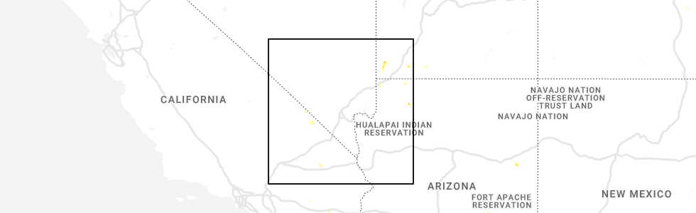
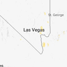
Hail Map for Tecopa, CA
The Tecopa, CA area has had 1 report of on-the-ground hail by trained spotters, and has been under severe weather warnings 0 times during the past 12 months. Doppler radar has detected hail at or near Tecopa, CA on 6 occasions.
| Name: | Tecopa, CA |
| Where Located: | 63.7 miles WSW of Las Vegas, NV |
| Map: | Google Map for Tecopa, CA |
| Population: | 150 |
| Housing Units: | 159 |
| More Info: | Search Google for Tecopa, CA |
0
The Top Recent Hail Date for Tecopa, CA is Monday, August 15, 2022 (6th out of 6)
Hail and Wind Damage Spotted near Tecopa, CA
| Date / Time | Report Details |
|---|---|
| 7/25/2021 10:36 PM PDT |
 The severe thunderstorm warning for north central san bernardino, southeastern inyo, northwestern clark and southern nye counties will expire at 1045 pm pdt, the storms which prompted the warning have weakened below severe limits, and no longer pose an immediate threat to life or property. therefore, the warning will be allowed to expire. however gusty winds are still possible with these thunderstorms. The severe thunderstorm warning for north central san bernardino, southeastern inyo, northwestern clark and southern nye counties will expire at 1045 pm pdt, the storms which prompted the warning have weakened below severe limits, and no longer pose an immediate threat to life or property. therefore, the warning will be allowed to expire. however gusty winds are still possible with these thunderstorms.
|
| 7/25/2021 10:32 PM PDT |
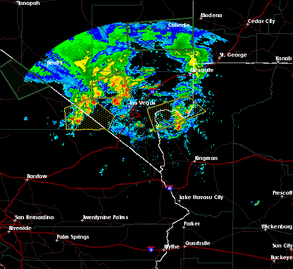
 At 1029 pm pdt, severe thunderstorms were located along a line extending from 15 miles north of texas springs campground to near tecopa to 13 miles northwest of mountain pass, moving west at 45 mph. strongest winds have been north of desert rock where gusts to 50-57 mph were observed (radar indicated). Hazards include 60 mph wind gusts. Expect damage to roofs and trees. locations impacted include, pahrump, beatty, jean, shoshone, furnace creek, primm, mercury, spring mountains, sandy valley, goodsprings, texas springs campground, indian springs, mountain springs, mcwilliams campground, willow creek campground, death valley junction, amargosa valley, mary jane falls campground, dolomite campground and lathrop wells. this includes the following highways, interstate 15 in california near mile marker 186. Interstate 15 in nevada between mile markers 1 and 18. At 1029 pm pdt, severe thunderstorms were located along a line extending from 15 miles north of texas springs campground to near tecopa to 13 miles northwest of mountain pass, moving west at 45 mph. strongest winds have been north of desert rock where gusts to 50-57 mph were observed (radar indicated). Hazards include 60 mph wind gusts. Expect damage to roofs and trees. locations impacted include, pahrump, beatty, jean, shoshone, furnace creek, primm, mercury, spring mountains, sandy valley, goodsprings, texas springs campground, indian springs, mountain springs, mcwilliams campground, willow creek campground, death valley junction, amargosa valley, mary jane falls campground, dolomite campground and lathrop wells. this includes the following highways, interstate 15 in california near mile marker 186. Interstate 15 in nevada between mile markers 1 and 18.
|
| 7/25/2021 10:32 PM PDT |
 At 1029 pm pdt, severe thunderstorms were located along a line extending from 15 miles north of texas springs campground to near tecopa to 13 miles northwest of mountain pass, moving west at 45 mph. strongest winds have been north of desert rock where gusts to 50-57 mph were observed (radar indicated). Hazards include 60 mph wind gusts. Expect damage to roofs and trees. locations impacted include, pahrump, beatty, jean, shoshone, furnace creek, primm, mercury, spring mountains, sandy valley, goodsprings, texas springs campground, indian springs, mountain springs, mcwilliams campground, willow creek campground, death valley junction, amargosa valley, mary jane falls campground, dolomite campground and lathrop wells. this includes the following highways, interstate 15 in california near mile marker 186. Interstate 15 in nevada between mile markers 1 and 18. At 1029 pm pdt, severe thunderstorms were located along a line extending from 15 miles north of texas springs campground to near tecopa to 13 miles northwest of mountain pass, moving west at 45 mph. strongest winds have been north of desert rock where gusts to 50-57 mph were observed (radar indicated). Hazards include 60 mph wind gusts. Expect damage to roofs and trees. locations impacted include, pahrump, beatty, jean, shoshone, furnace creek, primm, mercury, spring mountains, sandy valley, goodsprings, texas springs campground, indian springs, mountain springs, mcwilliams campground, willow creek campground, death valley junction, amargosa valley, mary jane falls campground, dolomite campground and lathrop wells. this includes the following highways, interstate 15 in california near mile marker 186. Interstate 15 in nevada between mile markers 1 and 18.
|
| 7/25/2021 9:55 PM PDT |
 The national weather service in las vegas has issued a * severe thunderstorm warning for. north central san bernardino county in southern california. southeastern inyo county in south central california. northwestern clark county in southern nevada. Southern nye county in south central nevada. The national weather service in las vegas has issued a * severe thunderstorm warning for. north central san bernardino county in southern california. southeastern inyo county in south central california. northwestern clark county in southern nevada. Southern nye county in south central nevada.
|
| 7/25/2021 9:55 PM PDT |
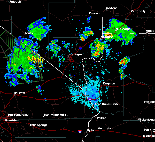
 At 951 pm pdt, severe thunderstorms were located along a line extending from near indian springs to 7 miles west of sandy valley to 11 miles north of nipton road mile marker 3, moving west at 45 mph (radar indicated). Hazards include 70 mph wind gusts. Expect considerable tree damage. Damage is likely to mobile homes, roofs, and outbuildings. At 951 pm pdt, severe thunderstorms were located along a line extending from near indian springs to 7 miles west of sandy valley to 11 miles north of nipton road mile marker 3, moving west at 45 mph (radar indicated). Hazards include 70 mph wind gusts. Expect considerable tree damage. Damage is likely to mobile homes, roofs, and outbuildings.
|
| 8/11/2018 10:25 PM PDT |
 The severe thunderstorm warning for north central san bernardino, southeastern inyo, southwestern clark and southeastern nye counties will expire at 1030 pm pdt, the storms and outflow which prompted the warning have weakened below severe limits, and no longer pose an immediate threat to life or property. therefore, the warning will be allowed to expire. however gusty winds are still possible with these thunderstorms. The severe thunderstorm warning for north central san bernardino, southeastern inyo, southwestern clark and southeastern nye counties will expire at 1030 pm pdt, the storms and outflow which prompted the warning have weakened below severe limits, and no longer pose an immediate threat to life or property. therefore, the warning will be allowed to expire. however gusty winds are still possible with these thunderstorms.
|
| 8/11/2018 10:25 PM PDT |
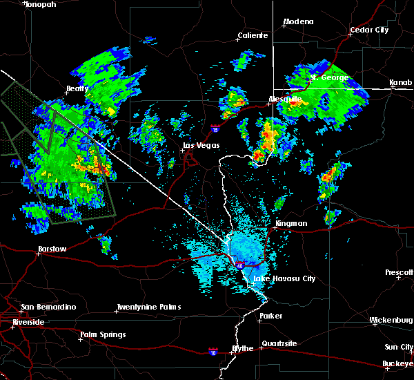
 At 925 pm pdt, severe thunderstorms were located along a line extending from 11 miles west of mountain springs to 17 miles south of railroad pass, moving southwest at 30 mph. these storms are producing very strong, damaging winds. blowing dust will accompany severe winds (radar indicated). Hazards include 70 mph wind gusts. Expect considerable tree damage. Damage is likely to mobile homes, roofs, and outbuildings. At 925 pm pdt, severe thunderstorms were located along a line extending from 11 miles west of mountain springs to 17 miles south of railroad pass, moving southwest at 30 mph. these storms are producing very strong, damaging winds. blowing dust will accompany severe winds (radar indicated). Hazards include 70 mph wind gusts. Expect considerable tree damage. Damage is likely to mobile homes, roofs, and outbuildings.
|
| 8/11/2018 9:25 PM PDT |
 The national weather service in las vegas has issued a * severe thunderstorm warning for. north central san bernardino county in southern california. southeastern inyo county in south central california. southwestern clark county in southern nevada. Southeastern nye county in south central nevada. The national weather service in las vegas has issued a * severe thunderstorm warning for. north central san bernardino county in southern california. southeastern inyo county in south central california. southwestern clark county in southern nevada. Southeastern nye county in south central nevada.
|
| 7/1/2016 11:11 PM PDT | The severe thunderstorm warning for southeastern inyo. west central clark and southeastern nye counties will expire at 1115 pm pdt. the storm which prompted the warning has weakened below severe limits. and no longer poses an immediate threat to life or property. therefore the warning will be allowed to expire. Gusty winds and. |
| 7/1/2016 11:11 PM PDT | The severe thunderstorm warning for southeastern inyo. west central clark and southeastern nye counties will expire at 1115 pm pdt. the storm which prompted the warning has weakened below severe limits. and no longer poses an immediate threat to life or property. therefore the warning will be allowed to expire. Gusty winds and. |
| 7/1/2016 10:57 PM PDT |
 At 1057 pm pdt, doppler radar indicated a severe thunderstorm capable of producing damaging winds in excess of 60 mph. this storm was located 12 miles southeast of pahrump, moving southeast at 40 mph. locations impacted include, pahrump, shoshone, tecopa, sandy valley and mountain springs. At 1057 pm pdt, doppler radar indicated a severe thunderstorm capable of producing damaging winds in excess of 60 mph. this storm was located 12 miles southeast of pahrump, moving southeast at 40 mph. locations impacted include, pahrump, shoshone, tecopa, sandy valley and mountain springs.
|
| 7/1/2016 10:45 PM PDT |
 At 1043 pm pdt, trained weather spotters reported a severe thunderstorm producing damaging winds in excess of 60 mph. this storm was located near pahrump, and moving southeast at 40 mph. this warning replaces the previous severe thunderstorm warning in effect for the area. At 1043 pm pdt, trained weather spotters reported a severe thunderstorm producing damaging winds in excess of 60 mph. this storm was located near pahrump, and moving southeast at 40 mph. this warning replaces the previous severe thunderstorm warning in effect for the area.
|
| 10/4/2015 5:08 PM PDT |
 At 507 pm pdt, doppler radar indicated a severe thunderstorm capable of producing damaging winds in excess of 60 mph. this storm was located near shoshone, moving north at 25 mph. locations impacted include, shoshone, death valley junction and tecopa. At 507 pm pdt, doppler radar indicated a severe thunderstorm capable of producing damaging winds in excess of 60 mph. this storm was located near shoshone, moving north at 25 mph. locations impacted include, shoshone, death valley junction and tecopa.
|
| 10/4/2015 4:52 PM PDT |
 At 451 pm pdt, doppler radar indicated a severe thunderstorm capable of producing quarter size hail and damaging winds in excess of 60 mph. this storm was located over shoshone, and moving north at 30 mph. At 451 pm pdt, doppler radar indicated a severe thunderstorm capable of producing quarter size hail and damaging winds in excess of 60 mph. this storm was located over shoshone, and moving north at 30 mph.
|
| 10/11/2012 5:23 PM PDT | Quarter sized hail reported 18.8 miles WSW of Tecopa, CA |
Hail Maps for Tecopa, CA


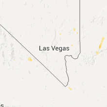

Connect with Interactive Hail Maps