

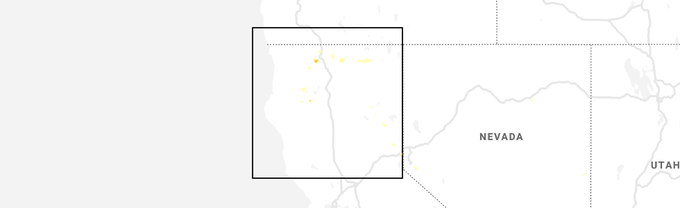
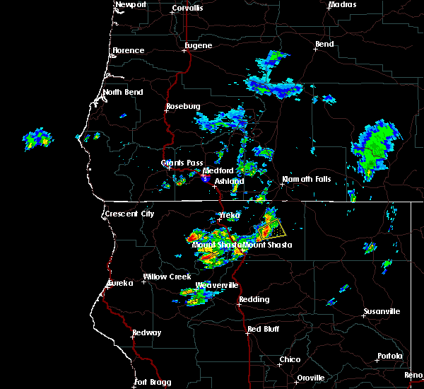
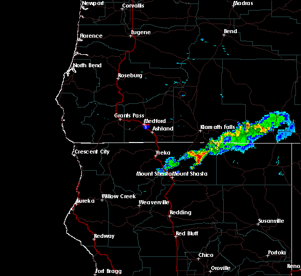
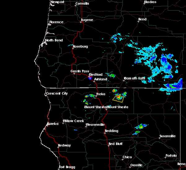
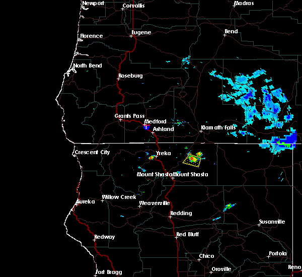
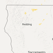
Hail Map for Tennant, CA
The Tennant, CA area has had 0 reports of on-the-ground hail by trained spotters, and has been under severe weather warnings 0 times during the past 12 months. Doppler radar has detected hail at or near Tennant, CA on 4 occasions.
| Name: | Tennant, CA |
| Where Located: | 71.2 miles SE of Medford, OR |
| Map: | Google Map for Tennant, CA |
| Population: | 41 |
| Housing Units: | 89 |
| More Info: | Search Google for Tennant, CA |
5
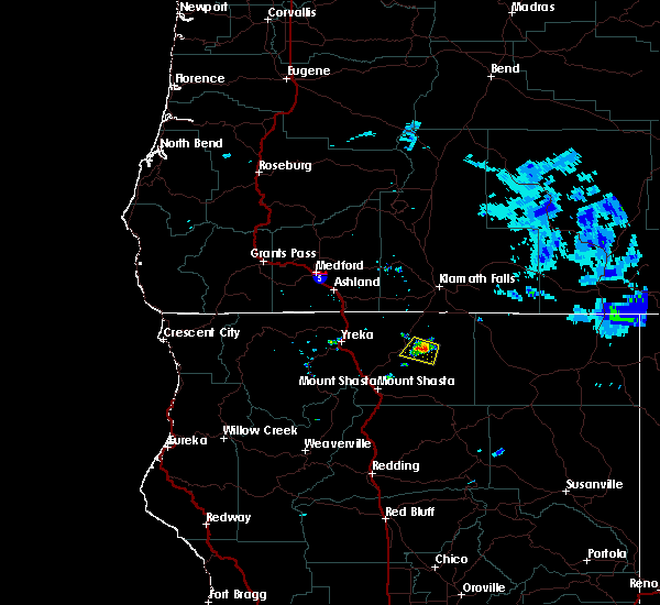
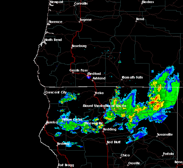
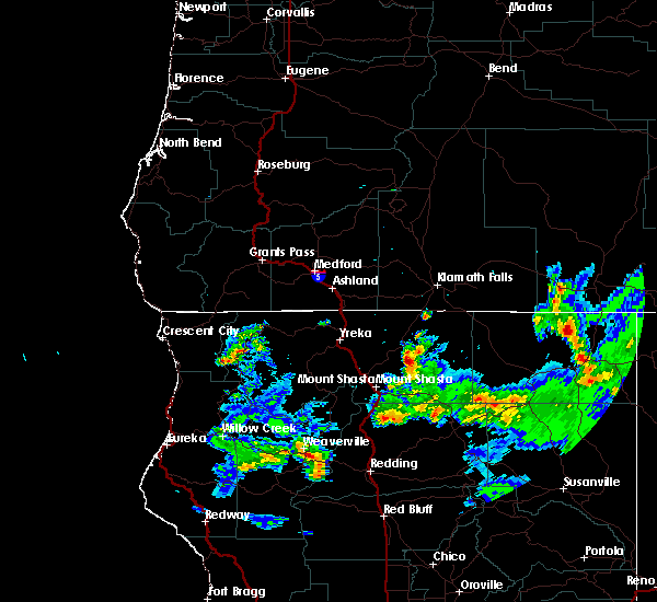
The Top Recent Hail Date for Tennant, CA is Wednesday, July 22, 2020 (2nd out of 4)
Hail and Wind Damage Spotted near Tennant, CA
| Date / Time | Report Details |
|---|---|
| 7/22/2020 2:55 PM PDT |
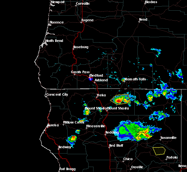 At 254 pm pdt, a severe thunderstorm was located over bray, or 29 miles northeast of mount shasta, and is nearly stationary (radar indicated). Hazards include 60 mph wind gusts and quarter size hail. Hail damage to vehicles is expected. expect wind damage to roofs, siding, and trees. locations impacted include, tennant, four corners snow park, medicine lake campground and bray. This includes us 97 in california near mile markers 30. At 254 pm pdt, a severe thunderstorm was located over bray, or 29 miles northeast of mount shasta, and is nearly stationary (radar indicated). Hazards include 60 mph wind gusts and quarter size hail. Hail damage to vehicles is expected. expect wind damage to roofs, siding, and trees. locations impacted include, tennant, four corners snow park, medicine lake campground and bray. This includes us 97 in california near mile markers 30.
|
| 7/22/2020 2:36 PM PDT |
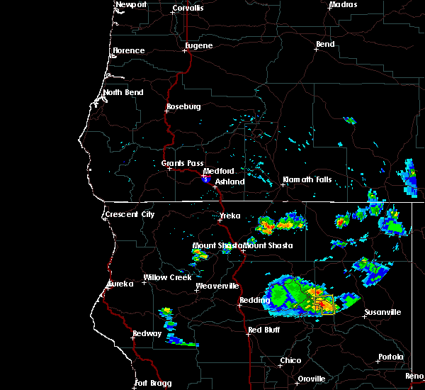 At 235 pm pdt, a severe thunderstorm was located over bray, or 29 miles northeast of mount shasta, and is nearly stationary (radar indicated). Hazards include 60 mph wind gusts and quarter size hail. Hail damage to vehicles is expected. Expect wind damage to roofs, siding, and trees. At 235 pm pdt, a severe thunderstorm was located over bray, or 29 miles northeast of mount shasta, and is nearly stationary (radar indicated). Hazards include 60 mph wind gusts and quarter size hail. Hail damage to vehicles is expected. Expect wind damage to roofs, siding, and trees.
|
| 7/15/2018 2:50 PM PDT |
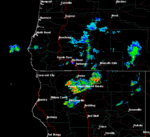 At 250 pm pdt, a severe thunderstorm was located over tennant, or 27 miles northeast of mount shasta, moving east at 10 mph (radar indicated). Hazards include 60 mph wind gusts and quarter size hail. Hail damage to vehicles is expected. expect wind damage to roofs, siding, and trees. Locations impacted include, tennant and bray. At 250 pm pdt, a severe thunderstorm was located over tennant, or 27 miles northeast of mount shasta, moving east at 10 mph (radar indicated). Hazards include 60 mph wind gusts and quarter size hail. Hail damage to vehicles is expected. expect wind damage to roofs, siding, and trees. Locations impacted include, tennant and bray.
|
| 7/15/2018 2:36 PM PDT |
 At 235 pm pdt, a severe thunderstorm was located near tennant, or 24 miles northeast of mount shasta, moving east at 10 mph (radar indicated). Hazards include 60 mph wind gusts and quarter size hail. Hail damage to vehicles is expected. Expect wind damage to roofs, siding, and trees. At 235 pm pdt, a severe thunderstorm was located near tennant, or 24 miles northeast of mount shasta, moving east at 10 mph (radar indicated). Hazards include 60 mph wind gusts and quarter size hail. Hail damage to vehicles is expected. Expect wind damage to roofs, siding, and trees.
|
| 6/19/2017 8:44 PM PDT |
 At 843 pm pdt, a severe thunderstorm was located 7 miles northwest of four corners snow park, or 34 miles south of klamath falls, and is nearly stationary (radar indicated). Hazards include 60 mph wind gusts, quarter size hail, and extremely heavy rain. Hail damage to vehicles is expected. Expect wind damage to roofs, siding, and trees. At 843 pm pdt, a severe thunderstorm was located 7 miles northwest of four corners snow park, or 34 miles south of klamath falls, and is nearly stationary (radar indicated). Hazards include 60 mph wind gusts, quarter size hail, and extremely heavy rain. Hail damage to vehicles is expected. Expect wind damage to roofs, siding, and trees.
|
| 7/5/2015 2:25 PM PDT |
 The severe thunderstorm warning for east central siskiyou county will expire at 230 pm pdt, the storm which prompted the warning has weakened below severe limits, and no longer poses an immediate threat to life or property. therefore the warning will be allowed to expire. however heavy rain is still possible with this thunderstorm north of bray and tennant. The severe thunderstorm warning for east central siskiyou county will expire at 230 pm pdt, the storm which prompted the warning has weakened below severe limits, and no longer poses an immediate threat to life or property. therefore the warning will be allowed to expire. however heavy rain is still possible with this thunderstorm north of bray and tennant.
|
| 7/5/2015 2:10 PM PDT |
 At 209 pm pdt, doppler radar indicated a severe thunderstorm capable of producing quarter size hail. this storm was located over bray, or 30 miles northeast of mount shasta, and was nearly stationary. locations impacted include, bray and tennant. At 209 pm pdt, doppler radar indicated a severe thunderstorm capable of producing quarter size hail. this storm was located over bray, or 30 miles northeast of mount shasta, and was nearly stationary. locations impacted include, bray and tennant.
|
| 7/5/2015 1:52 PM PDT |
 At 151 pm pdt, doppler radar indicated a severe thunderstorm capable of producing quarter size hail. this storm was located near bray, or 31 miles northeast of mount shasta, and moving south at 5 mph. At 151 pm pdt, doppler radar indicated a severe thunderstorm capable of producing quarter size hail. this storm was located near bray, or 31 miles northeast of mount shasta, and moving south at 5 mph.
|
| 6/9/2015 4:38 PM PDT |
 The severe thunderstorm warning for east central siskiyou county will expire at 445 pm pdt, the storm which prompted the warning has weakened below severe limits, and no longer poses an immediate threat to life or property. therefore the warning will be allowed to expire. however heavy rain is still possible with this thunderstorm. The severe thunderstorm warning for east central siskiyou county will expire at 445 pm pdt, the storm which prompted the warning has weakened below severe limits, and no longer poses an immediate threat to life or property. therefore the warning will be allowed to expire. however heavy rain is still possible with this thunderstorm.
|
| 6/9/2015 3:57 PM PDT |
 At 356 pm pdt, doppler radar indicated a severe thunderstorm capable of producing quarter size hail. this storm was located near tennant, or 22 miles northeast of mount shasta, and moving south at 10 mph. At 356 pm pdt, doppler radar indicated a severe thunderstorm capable of producing quarter size hail. this storm was located near tennant, or 22 miles northeast of mount shasta, and moving south at 10 mph.
|
Hail Maps for Tennant, CA


Connect with Interactive Hail Maps