

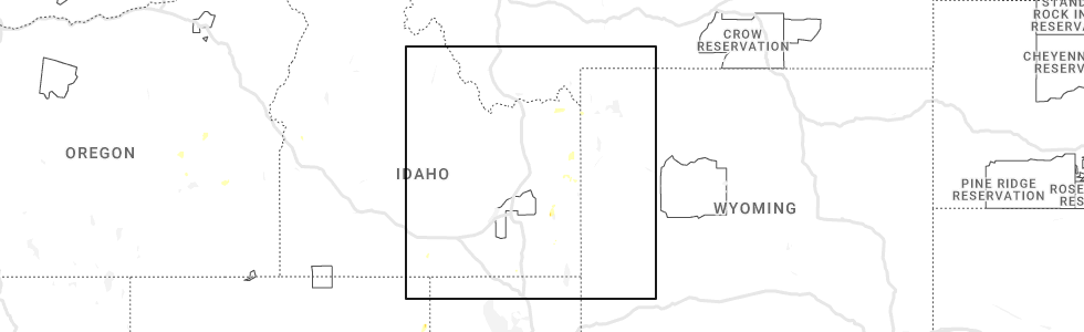
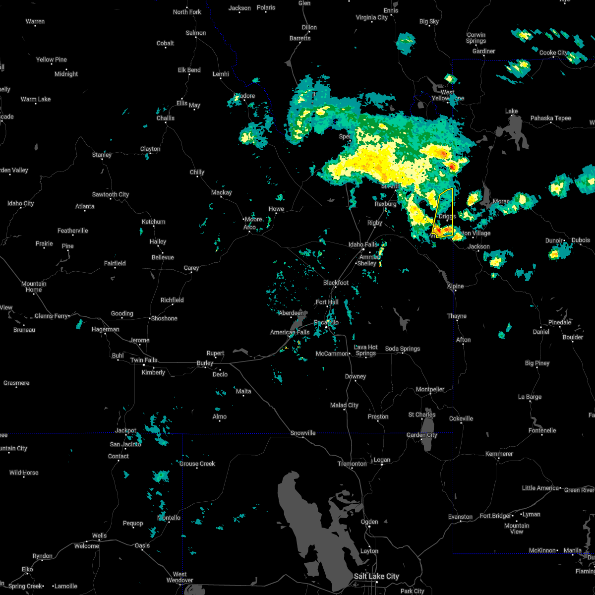
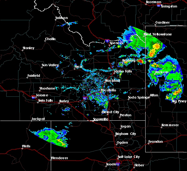
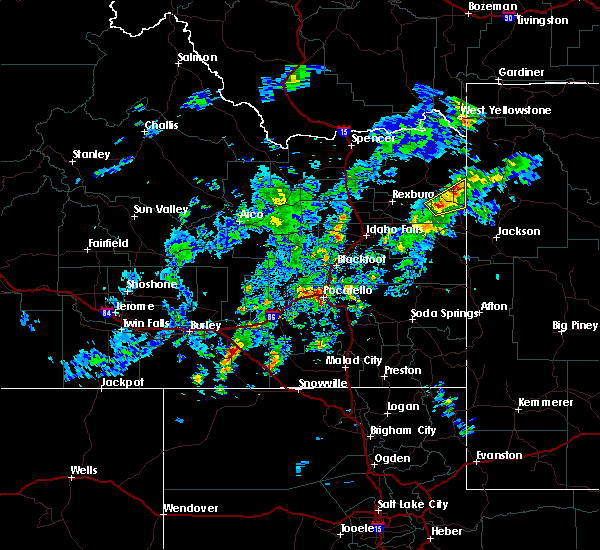
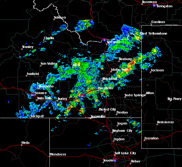
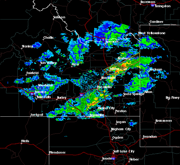
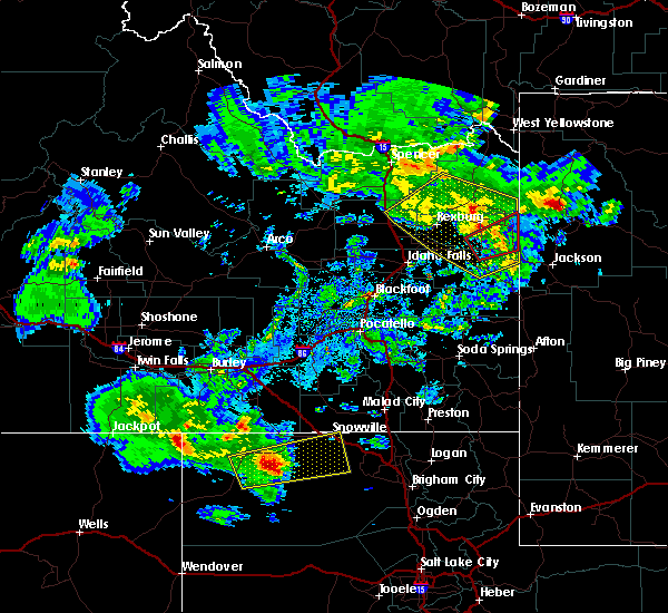
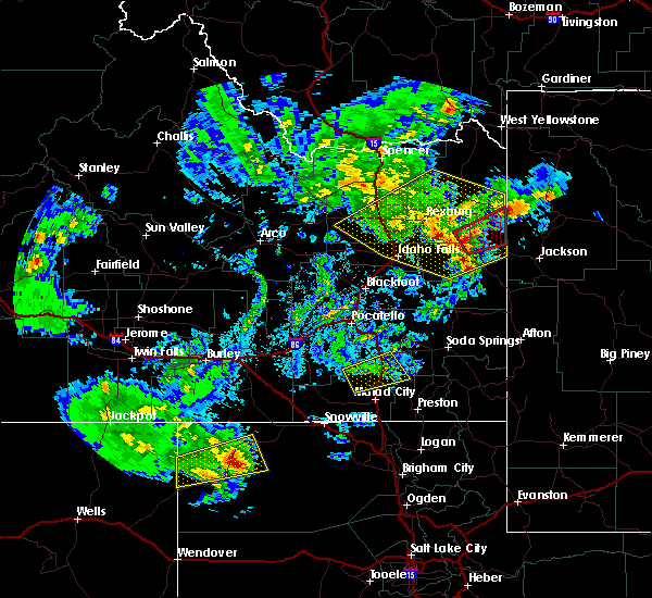
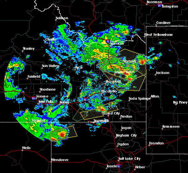
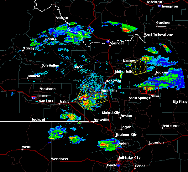
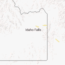
Hail Map for Tetonia, ID
The Tetonia, ID area has had 3 reports of on-the-ground hail by trained spotters, and has been under severe weather warnings 2 times during the past 12 months. Doppler radar has detected hail at or near Tetonia, ID on 9 occasions, including 1 occasion during the past year.
| Name: | Tetonia, ID |
| Where Located: | 49.5 miles ENE of Idaho Falls, ID |
| Map: | Google Map for Tetonia, ID |
| Population: | 269 |
| Housing Units: | 122 |
| More Info: | Search Google for Tetonia, ID |
0
The Top Recent Hail Date for Tetonia, ID is Saturday, August 26, 2023 (2nd out of 9)
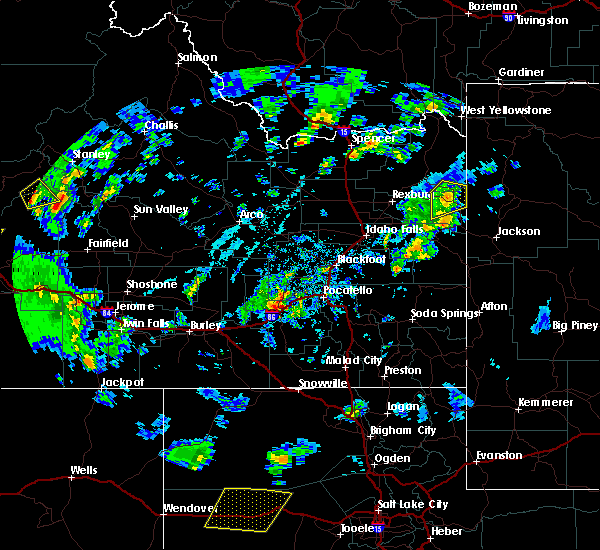
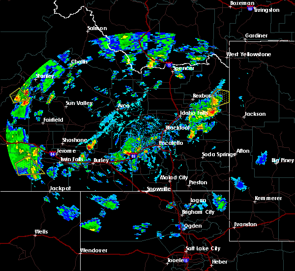
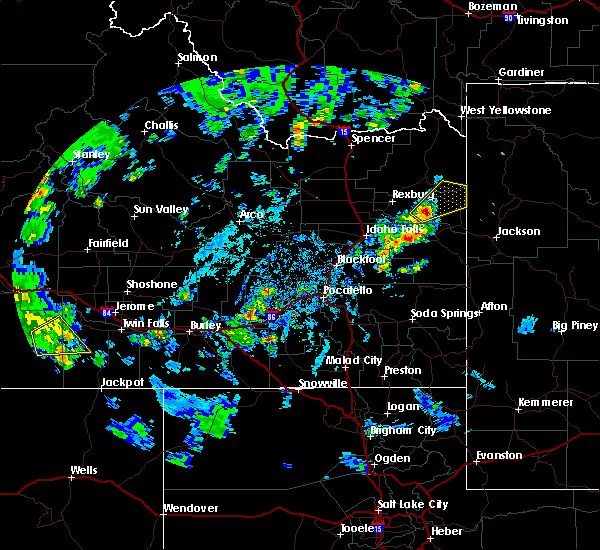
Hail and Wind Damage Spotted near Tetonia, ID
| Date / Time | Report Details |
|---|---|
| 7/1/2023 6:12 PM MDT |
 The severe thunderstorm warning for central teton county will expire at 615 pm mdt, the storm which prompted the warning has moved out of the area. therefore, the warning will be allowed to expire. however gusty winds are still possible. The severe thunderstorm warning for central teton county will expire at 615 pm mdt, the storm which prompted the warning has moved out of the area. therefore, the warning will be allowed to expire. however gusty winds are still possible.
|
| 7/1/2023 6:05 PM MDT | Fall river rural electric cooperative reports 33 customers without power along n 3000 w south of tetoni in teton county ID, 0.9 miles N of Tetonia, ID |
| 7/1/2023 6:00 PM MDT | Fall river rural electric cooperative reports 183 customers without power just west of tetoni in teton county ID, 2.4 miles ESE of Tetonia, ID |
| 7/1/2023 5:52 PM MDT |
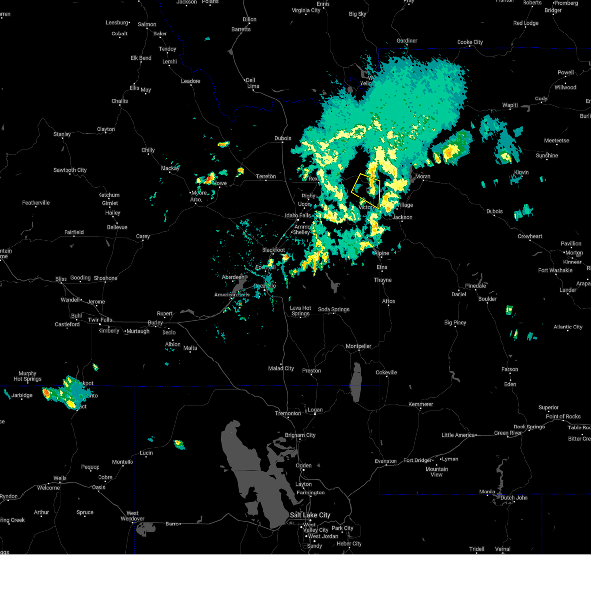
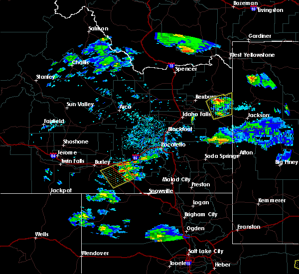
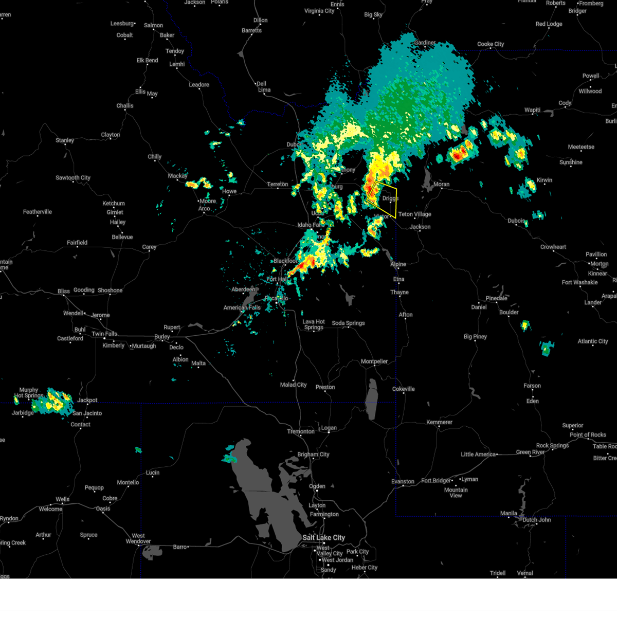 At 552 pm mdt, a severe thunderstorm was located near tetonia, or near felt, moving southeast at 40 mph (radar indicated). Hazards include 60 mph wind gusts and penny size hail. expect damage to roofs, siding, and trees At 552 pm mdt, a severe thunderstorm was located near tetonia, or near felt, moving southeast at 40 mph (radar indicated). Hazards include 60 mph wind gusts and penny size hail. expect damage to roofs, siding, and trees
|
| 7/1/2023 5:50 PM MDT | Very strong winds reported in tetonia. 4 foot by 4 foot tarp ripped in half. tree limb down. phone line taken off residence. greenhouse damaged at tetonia elementary. t in teton county ID, 0.2 miles NNE of Tetonia, ID |
| 7/1/2023 5:50 PM MDT | 3 large trees... one cottonwood and two aspens... blown down in driveway along n 1000 e south of e 7000 n. one tree was 16 inches in diameter. photos provided via socia in teton county ID, 4 miles W of Tetonia, ID |
| 7/1/2023 5:47 PM MDT | Tree limbs dow in teton county ID, 0.6 miles ENE of Tetonia, ID |
| 7/1/2023 5:46 PM MDT | Tree limb down on a pickup truck with minimal damage along n 5th st. time estimate in teton county ID, 0.5 miles S of Tetonia, ID |
| 7/1/2023 5:46 PM MDT | Ruby carson park littered with large and small downed tree limbs. photos provided via social media. time estimate in teton county ID, 0.2 miles NNE of Tetonia, ID |
| 7/2/2022 7:16 PM MDT |
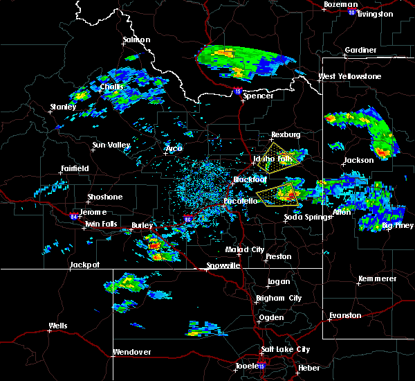
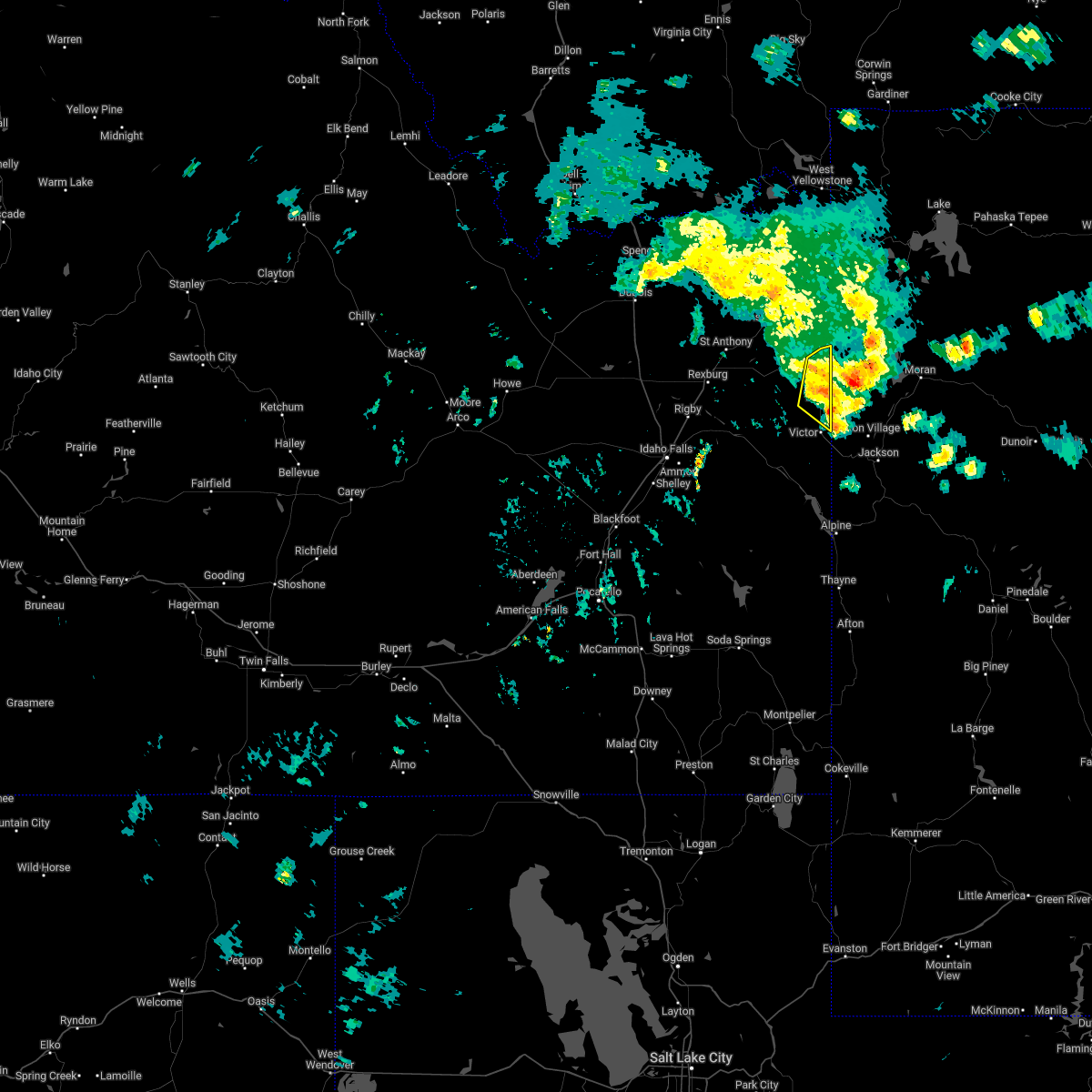 At 715 pm mdt, a severe thunderstorm was located near tetonia, or near felt, moving north at 40 mph (radar indicated). Hazards include 60 mph wind gusts and quarter size hail. Hail damage to vehicles is expected. expect wind damage to roofs, siding, and trees. locations impacted include, driggs, felt and tetonia. hail threat, observed max hail size, 1. 00 in wind threat, radar indicated max wind gust, 60 mph. At 715 pm mdt, a severe thunderstorm was located near tetonia, or near felt, moving north at 40 mph (radar indicated). Hazards include 60 mph wind gusts and quarter size hail. Hail damage to vehicles is expected. expect wind damage to roofs, siding, and trees. locations impacted include, driggs, felt and tetonia. hail threat, observed max hail size, 1. 00 in wind threat, radar indicated max wind gust, 60 mph.
|
| 7/2/2022 6:57 PM MDT |
 At 657 pm mdt, a severe thunderstorm was located near victor, or near driggs, moving north at 40 mph (radar indicated). Hazards include 60 mph wind gusts and quarter size hail. Hail damage to vehicles is expected. Expect wind damage to roofs, siding, and trees. At 657 pm mdt, a severe thunderstorm was located near victor, or near driggs, moving north at 40 mph (radar indicated). Hazards include 60 mph wind gusts and quarter size hail. Hail damage to vehicles is expected. Expect wind damage to roofs, siding, and trees.
|
| 7/23/2020 6:11 PM MDT |
 The severe thunderstorm warning for teton and southeastern fremont counties will expire at 615 pm mdt, the storm which prompted the warning has weakened below severe limits, and no longer poses an immediate threat to life or property. therefore, the warning will be allowed to expire. to report severe weather, contact your nearest law enforcement agency. they will relay your report to the national weather service pocatello. The severe thunderstorm warning for teton and southeastern fremont counties will expire at 615 pm mdt, the storm which prompted the warning has weakened below severe limits, and no longer poses an immediate threat to life or property. therefore, the warning will be allowed to expire. to report severe weather, contact your nearest law enforcement agency. they will relay your report to the national weather service pocatello.
|
| 7/23/2020 5:54 PM MDT |
 At 553 pm mdt, a severe thunderstorm was located near felt, moving northeast at 30 mph (radar indicated). Hazards include 60 mph wind gusts. Expect damage to roofs, siding, and trees. Locations impacted include, felt, tetonia and tetonia research station. At 553 pm mdt, a severe thunderstorm was located near felt, moving northeast at 30 mph (radar indicated). Hazards include 60 mph wind gusts. Expect damage to roofs, siding, and trees. Locations impacted include, felt, tetonia and tetonia research station.
|
| 7/23/2020 5:36 PM MDT |
 At 535 pm mdt, a severe thunderstorm was located 15 miles southeast of teton, or 16 miles southwest of felt, moving northeast at 30 mph (radar indicated). Hazards include 60 mph wind gusts and quarter size hail. Hail damage to vehicles is expected. Expect wind damage to roofs, siding, and trees. At 535 pm mdt, a severe thunderstorm was located 15 miles southeast of teton, or 16 miles southwest of felt, moving northeast at 30 mph (radar indicated). Hazards include 60 mph wind gusts and quarter size hail. Hail damage to vehicles is expected. Expect wind damage to roofs, siding, and trees.
|
| 4/30/2020 7:15 PM MDT | Mesonet station 2979 d6 - bott in teton county ID, 11.1 miles ESE of Tetonia, ID |
| 8/4/2019 7:47 PM MDT |
 At 744 pm mdt, a severe thunderstorm was located over felt, moving northeast at 25 mph (radar indicated). Hazards include quarter size hail. damage to vehicles is expected At 744 pm mdt, a severe thunderstorm was located over felt, moving northeast at 25 mph (radar indicated). Hazards include quarter size hail. damage to vehicles is expected
|
| 5/31/2018 2:10 PM MDT | Quarter sized hail reported 10.6 miles ESE of Tetonia, ID, public reports hail damage to cars/trucks while driving between driggs to rexburg in the green canyon area. |
| 5/30/2018 2:02 PM MDT |
 At 201 pm mdt, a severe thunderstorm was located near tetonia or 7 miles southwest of felt, moving northeast at 25 mph (radar indicated). Hazards include 60 mph wind gusts and quarter size hail. Hail damage to vehicles is expected. expect wind damage to roofs, siding, and trees. Locations impacted include, felt, tetonia and tetonia research station. At 201 pm mdt, a severe thunderstorm was located near tetonia or 7 miles southwest of felt, moving northeast at 25 mph (radar indicated). Hazards include 60 mph wind gusts and quarter size hail. Hail damage to vehicles is expected. expect wind damage to roofs, siding, and trees. Locations impacted include, felt, tetonia and tetonia research station.
|
| 5/30/2018 1:49 PM MDT |
 The national weather service in pocatello has issued a * severe thunderstorm warning for. northern teton county in eastern idaho. southeastern fremont county in southeastern idaho. east central madison county in southeastern idaho. Until 215 pm mdt. The national weather service in pocatello has issued a * severe thunderstorm warning for. northern teton county in eastern idaho. southeastern fremont county in southeastern idaho. east central madison county in southeastern idaho. Until 215 pm mdt.
|
| 4/7/2018 7:26 PM MDT |
 At 726 pm mdt, a severe thunderstorm was located 8 miles east of ririe or 11 miles northeast of ririe reservoir, moving northeast at 60 mph (radar indicated). Hazards include 70 mph wind gusts. Expect considerable tree damage. Damage is likely to mobile homes, roofs, and outbuildings. At 726 pm mdt, a severe thunderstorm was located 8 miles east of ririe or 11 miles northeast of ririe reservoir, moving northeast at 60 mph (radar indicated). Hazards include 70 mph wind gusts. Expect considerable tree damage. Damage is likely to mobile homes, roofs, and outbuildings.
|
| 8/14/2015 7:58 PM MDT | The severe thunderstorm warning for east central bingham, central jefferson, northeastern caribou, eastern clark, fremont, bonneville, madison and teton counties will expire at 800 pm mdt, the storms which prompted the warning have weakened below severe limits and exited the warned area. therefore the warning will be allowed to expire. however small hail, gusty winds and heavy rain are still possible with these thunderstorms. |
| 8/14/2015 7:42 PM MDT |
 At 739 pm mdt, doppler radar indicated a line of severe thunderstorms capable of producing damaging winds in excess of 60 mph. these storms were located along a line extending from 10 miles northeast of kilgore to 6 miles southwest of island park reservoir to near felt to 6 miles west of alpine, moving northeast at 55 mph. locations impacted include, rexburg, rigby, driggs, ashton, dubois, swan valley, felt, marysville, lorenzo, henrys lake, ririe reservoir, wayan, idmon, palisades reservoir, blackfoot reservoir, victor, sugar city, teton, ririe and parker. At 739 pm mdt, doppler radar indicated a line of severe thunderstorms capable of producing damaging winds in excess of 60 mph. these storms were located along a line extending from 10 miles northeast of kilgore to 6 miles southwest of island park reservoir to near felt to 6 miles west of alpine, moving northeast at 55 mph. locations impacted include, rexburg, rigby, driggs, ashton, dubois, swan valley, felt, marysville, lorenzo, henrys lake, ririe reservoir, wayan, idmon, palisades reservoir, blackfoot reservoir, victor, sugar city, teton, ririe and parker.
|
| 8/14/2015 7:28 PM MDT |
 At 727 pm mdt, doppler radar indicated a line of severe thunderstorms capable of producing damaging winds in excess of 60 mph. these storms were located along a line extending from 6 miles northwest of kilgore to 11 miles southeast of idmon to 12 miles southeast of teton to near wayan, moving northeast at 55 mph. in addition, multiple reports of 55 to 60 mph winds reported earlier near interstate 15. also, tree limbs were reported down along the salem highway a few minutes ago. locations impacted include, rexburg, rigby, driggs, ashton, dubois, swan valley, felt, marysville, lorenzo, henrys lake, ririe reservoir, wayan, idmon, palisades reservoir, blackfoot reservoir, ammon, victor, iona, sugar city and ucon. At 727 pm mdt, doppler radar indicated a line of severe thunderstorms capable of producing damaging winds in excess of 60 mph. these storms were located along a line extending from 6 miles northwest of kilgore to 11 miles southeast of idmon to 12 miles southeast of teton to near wayan, moving northeast at 55 mph. in addition, multiple reports of 55 to 60 mph winds reported earlier near interstate 15. also, tree limbs were reported down along the salem highway a few minutes ago. locations impacted include, rexburg, rigby, driggs, ashton, dubois, swan valley, felt, marysville, lorenzo, henrys lake, ririe reservoir, wayan, idmon, palisades reservoir, blackfoot reservoir, ammon, victor, iona, sugar city and ucon.
|
| 8/14/2015 7:11 PM MDT |
 At 711 pm mdt, doppler radar indicated a line of severe thunderstorms capable of producing damaging winds in excess of 60 mph. these storms were located along a line extending from spencer to 12 miles east of dubois to near archer to near blackfoot reservoir, and moving northeast at 55 mph. 60 mph winds were recently reported at sage junction. At 711 pm mdt, doppler radar indicated a line of severe thunderstorms capable of producing damaging winds in excess of 60 mph. these storms were located along a line extending from spencer to 12 miles east of dubois to near archer to near blackfoot reservoir, and moving northeast at 55 mph. 60 mph winds were recently reported at sage junction.
|
| 8/5/2015 4:11 PM MDT |
 The severe thunderstorm warning for eastern jefferson, southeastern clark, southern fremont, northeastern bonneville, madison and teton counties will expire at 415 pm mdt, the storms which prompted the warning have weakened below severe limits, and no longer poses an immediate threat to life or property. therefore the warning will be allowed to expire. however small. The severe thunderstorm warning for eastern jefferson, southeastern clark, southern fremont, northeastern bonneville, madison and teton counties will expire at 415 pm mdt, the storms which prompted the warning have weakened below severe limits, and no longer poses an immediate threat to life or property. therefore the warning will be allowed to expire. however small.
|
| 8/5/2015 4:10 PM MDT |
 The tornado warning for northern bonneville, southeastern madison and teton counties will expire at 415 pm mdt, the storm which prompted the warning has weakened and no longer appears to be capable of producing a tornado. therefore the warning will be allowed to expire. however small hail, gusty winds and heavy rain are still possible with this thunderstorm. The tornado warning for northern bonneville, southeastern madison and teton counties will expire at 415 pm mdt, the storm which prompted the warning has weakened and no longer appears to be capable of producing a tornado. therefore the warning will be allowed to expire. however small hail, gusty winds and heavy rain are still possible with this thunderstorm.
|
| 8/5/2015 3:49 PM MDT |
 At 348 pm mdt, doppler radar indicated a line of severe thunderstorms capable of producing damaging winds in excess of 60 mph. these storms were located along a line extending from 8 miles northwest of egin to 7 miles east of teton to near swan valley, moving northeast at 45 mph. locations impacted include, rexburg, rigby, driggs, ashton, swan valley, felt, marysville, lorenzo, ririe reservoir, victor, sugar city, menan, teton, ririe, parker, tetonia, irwin, hamer, drummond and egin. At 348 pm mdt, doppler radar indicated a line of severe thunderstorms capable of producing damaging winds in excess of 60 mph. these storms were located along a line extending from 8 miles northwest of egin to 7 miles east of teton to near swan valley, moving northeast at 45 mph. locations impacted include, rexburg, rigby, driggs, ashton, swan valley, felt, marysville, lorenzo, ririe reservoir, victor, sugar city, menan, teton, ririe, parker, tetonia, irwin, hamer, drummond and egin.
|
| 8/5/2015 3:46 PM MDT |
 At 345 pm mdt, doppler radar indicated a severe thunderstorm capable of producing a tornado. this dangerous storm was located 14 miles north of swan valley, moving northeast at 45 mph. locations impacted include, driggs, felt, victor, tetonia and pine creek pass. At 345 pm mdt, doppler radar indicated a severe thunderstorm capable of producing a tornado. this dangerous storm was located 14 miles north of swan valley, moving northeast at 45 mph. locations impacted include, driggs, felt, victor, tetonia and pine creek pass.
|
| 8/5/2015 3:27 PM MDT |
 At 327 pm mdt, doppler radar indicated a severe thunderstorm capable of producing a tornado. this dangerous storm was located near ririe reservoir, and moving northeast at 45 mph. At 327 pm mdt, doppler radar indicated a severe thunderstorm capable of producing a tornado. this dangerous storm was located near ririe reservoir, and moving northeast at 45 mph.
|
| 8/5/2015 3:24 PM MDT |
 At 324 pm mdt, doppler radar indicated a line of severe thunderstorms capable of producing quarter size hail and damaging winds in excess of 60 mph. these storms were located along a line extending from 6 miles southwest of hamer to archer to 12 miles west of swan valley, and moving northeast at 45 mph. At 324 pm mdt, doppler radar indicated a line of severe thunderstorms capable of producing quarter size hail and damaging winds in excess of 60 mph. these storms were located along a line extending from 6 miles southwest of hamer to archer to 12 miles west of swan valley, and moving northeast at 45 mph.
|
| 8/4/2015 4:44 PM MDT |
 At 443 pm mdt, doppler radar indicated a line of severe thunderstorms capable of producing damaging winds in excess of 60 mph. these storms were located along a line extending from near teton to near archer to ririe, moving east at 40 mph. locations impacted include, rexburg, rigby, driggs, lorenzo, felt, ririe reservoir, sugar city, menan, ririe, lewisville, tetonia, egin, plano, archer, green canyon hot springs, heise, newdale, tetonia research station and thornton. At 443 pm mdt, doppler radar indicated a line of severe thunderstorms capable of producing damaging winds in excess of 60 mph. these storms were located along a line extending from near teton to near archer to ririe, moving east at 40 mph. locations impacted include, rexburg, rigby, driggs, lorenzo, felt, ririe reservoir, sugar city, menan, ririe, lewisville, tetonia, egin, plano, archer, green canyon hot springs, heise, newdale, tetonia research station and thornton.
|
| 8/4/2015 4:29 PM MDT |
 At 428 pm mdt, doppler radar indicated a line of severe thunderstorms capable of producing damaging winds in excess of 60 mph. these storms were located along a line extending from plano to near lorenzo to near rigby, and moving east at 40 mph. At 428 pm mdt, doppler radar indicated a line of severe thunderstorms capable of producing damaging winds in excess of 60 mph. these storms were located along a line extending from plano to near lorenzo to near rigby, and moving east at 40 mph.
|
| 6/15/2015 5:10 PM MDT |
 The severe thunderstorm warning for northeastern bonneville, southeastern madison and teton counties will expire at 515 pm mdt, the storm which prompted the warning has weakened below severe limits and exited the warned area. therefore the warning will be allowed to expire. The severe thunderstorm warning for northeastern bonneville, southeastern madison and teton counties will expire at 515 pm mdt, the storm which prompted the warning has weakened below severe limits and exited the warned area. therefore the warning will be allowed to expire.
|
| 6/15/2015 4:46 PM MDT |
 At 446 pm mdt, doppler radar indicated a severe thunderstorm capable of producing quarter size hail and damaging winds in excess of 60 mph. this storm was located near tetonia, or near driggs, moving northeast at 40 mph. locations impacted include, driggs, felt, victor, tetonia, green canyon hot springs, tetonia research station and pine creek pass. At 446 pm mdt, doppler radar indicated a severe thunderstorm capable of producing quarter size hail and damaging winds in excess of 60 mph. this storm was located near tetonia, or near driggs, moving northeast at 40 mph. locations impacted include, driggs, felt, victor, tetonia, green canyon hot springs, tetonia research station and pine creek pass.
|
| 6/15/2015 4:19 PM MDT |
 At 418 pm mdt, doppler radar indicated a severe thunderstorm capable of producing quarter size hail and damaging winds in excess of 60 mph. this storm was located 13 miles east of ririe, or 13 miles northeast of ririe reservoir, and moving northeast at 40 mph. At 418 pm mdt, doppler radar indicated a severe thunderstorm capable of producing quarter size hail and damaging winds in excess of 60 mph. this storm was located 13 miles east of ririe, or 13 miles northeast of ririe reservoir, and moving northeast at 40 mph.
|
| 6/1/2015 5:28 PM MDT | At 527 pm mdt, doppler radar indicated a severe thunderstorm capable of producing quarter size hail and damaging winds in excess of 60 mph. this storm was located near felt, moving northeast at 40 mph. locations impacted include, felt, tetonia and tetonia research station. |
| 6/1/2015 5:20 PM MDT | Half Dollar sized hail reported 0.5 miles S of Tetonia, ID, reported via social media to channel 3. hail stones of various sizes covering the ground. time based on radar. |
| 6/1/2015 5:13 PM MDT | At 513 pm mdt, doppler radar indicated a severe thunderstorm capable of producing quarter size hail and damaging winds in excess of 60 mph. this storm was located 7 miles west of tetonia, or 7 miles southwest of felt, and moving northeast at 40 mph. |
| 5/31/2015 10:27 PM MDT | At 1025 pm mdt, doppler radar indicated the leading edge of outflow from thunderstorms capable of producing damaging winds in excess of 60 mph. these storms were located along a line extending from near drummond to 6 miles east of felt to 6 miles west of teton pass, moving east at 35 mph. locations impacted include, driggs, ashton, swan valley, marysville, felt, victor, tetonia, drummond, warm river, green canyon hot springs, tetonia research station and pine creek pass. |
| 5/31/2015 10:12 PM MDT | The severe thunderstorm warning for eastern jefferson, southern fremont, northeastern bonneville, madison and teton counties will expire at 1015 pm mdt, this warning has been replaced with a new severe thunderstorm warning in effect until 1045 pm. |
| 5/31/2015 10:11 PM MDT | At 1010 pm mdt, doppler radar indicated outflow from thunderstorms capable of producing damaging winds in excess of 60 mph. these storms were located along a line extending from near marysville to near felt to 7 miles south of victor, and moving east at 35 mph. |
| 5/31/2015 9:58 PM MDT | At 956 pm mdt, doppler radar indicated the leading edge of outflow winds in excess of 60 mph, extending from 12 miles west of ashton reservoir to 6 miles southeast of chester to 8 miles north of swan valley, moving northeast at 50 mph. up to half inch hail may also be falling from near swan valley to south of newdale. locations impacted include, rexburg, rigby, driggs, ashton, swan valley, felt, ririe reservoir, marysville, lorenzo, victor, sugar city, ucon, menan, teton, ririe, roberts, lewisville, parker, tetonia and drummond. |
| 5/31/2015 9:39 PM MDT | At 937 pm mdt, doppler radar indicated outflow winds from thunderstorms capable of producing damaging winds in excess of 60 mph. these storms were located along a line extending from 7 miles north of roberts to near archer to 7 miles west of swan valley, and moving northeast at 45 mph. quarter size hail may also be falling with this just west of swan valley. |
| 5/30/2015 6:50 PM MDT | At 649 pm mdt, doppler radar indicated a severe thunderstorm capable of producing damaging winds in excess of 60 mph. this storm was located 14 miles west of victor moving east at 45 mph. |
| 5/31/2014 5:39 PM MDT | Golf Ball sized hail reported 0.5 miles S of Tetonia, ID |
Hail Maps for Tetonia, ID


Connect with Interactive Hail Maps