

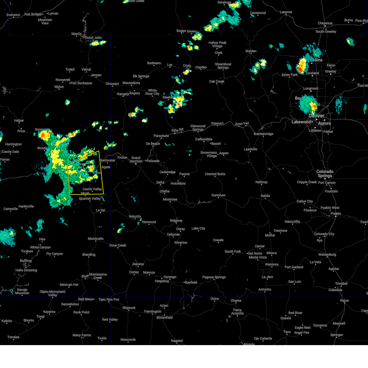
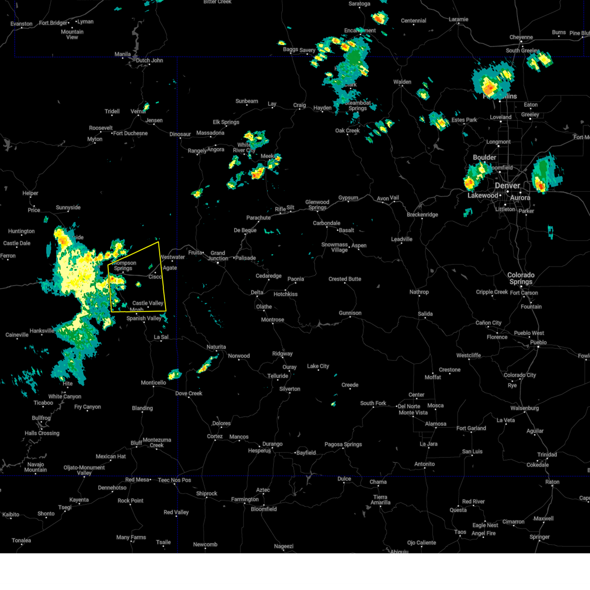
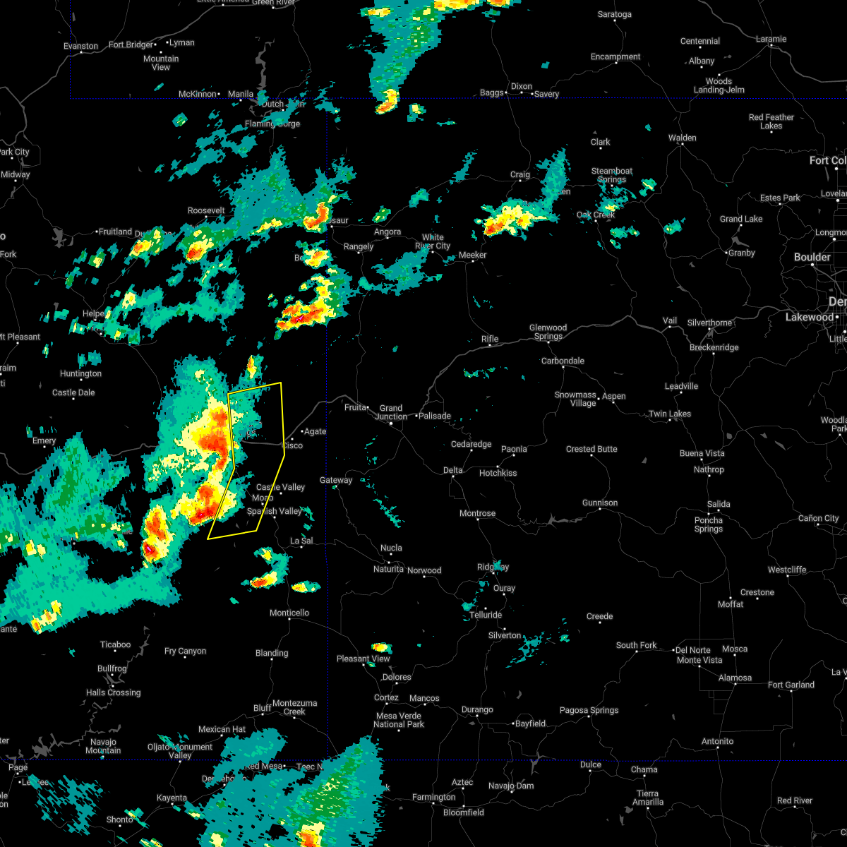
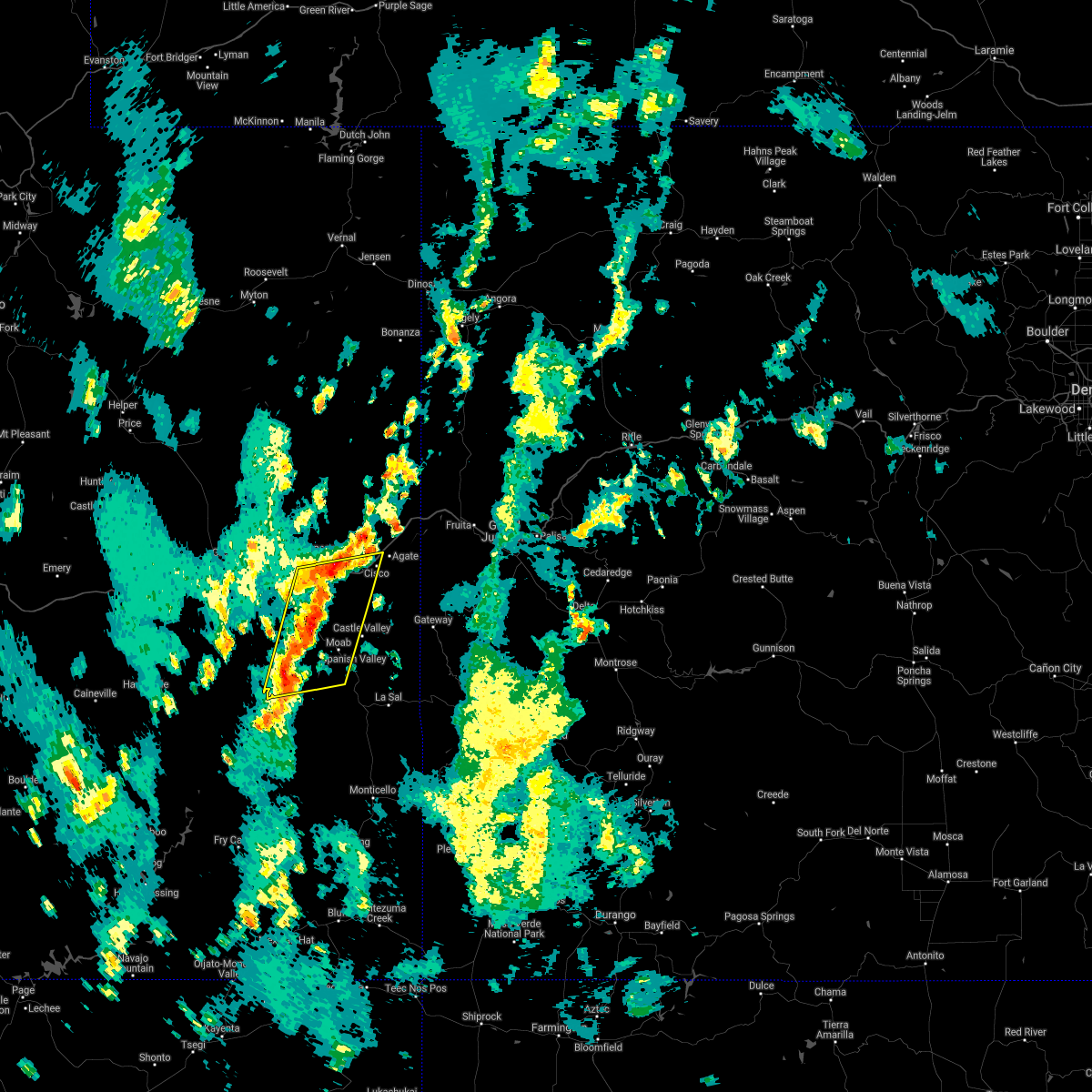
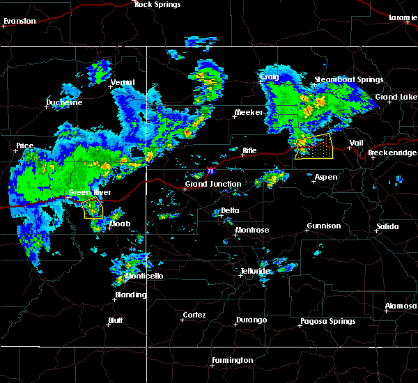
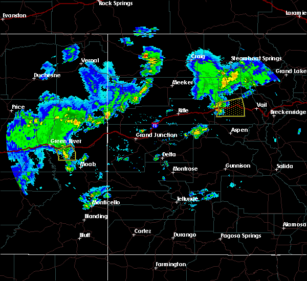
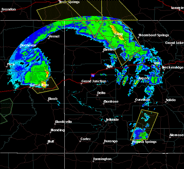
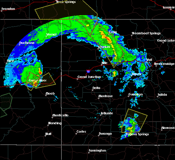
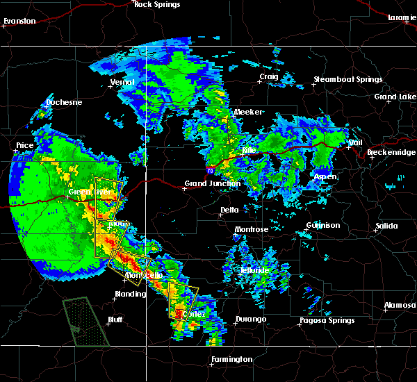
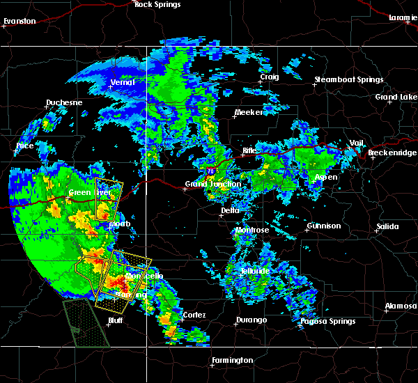
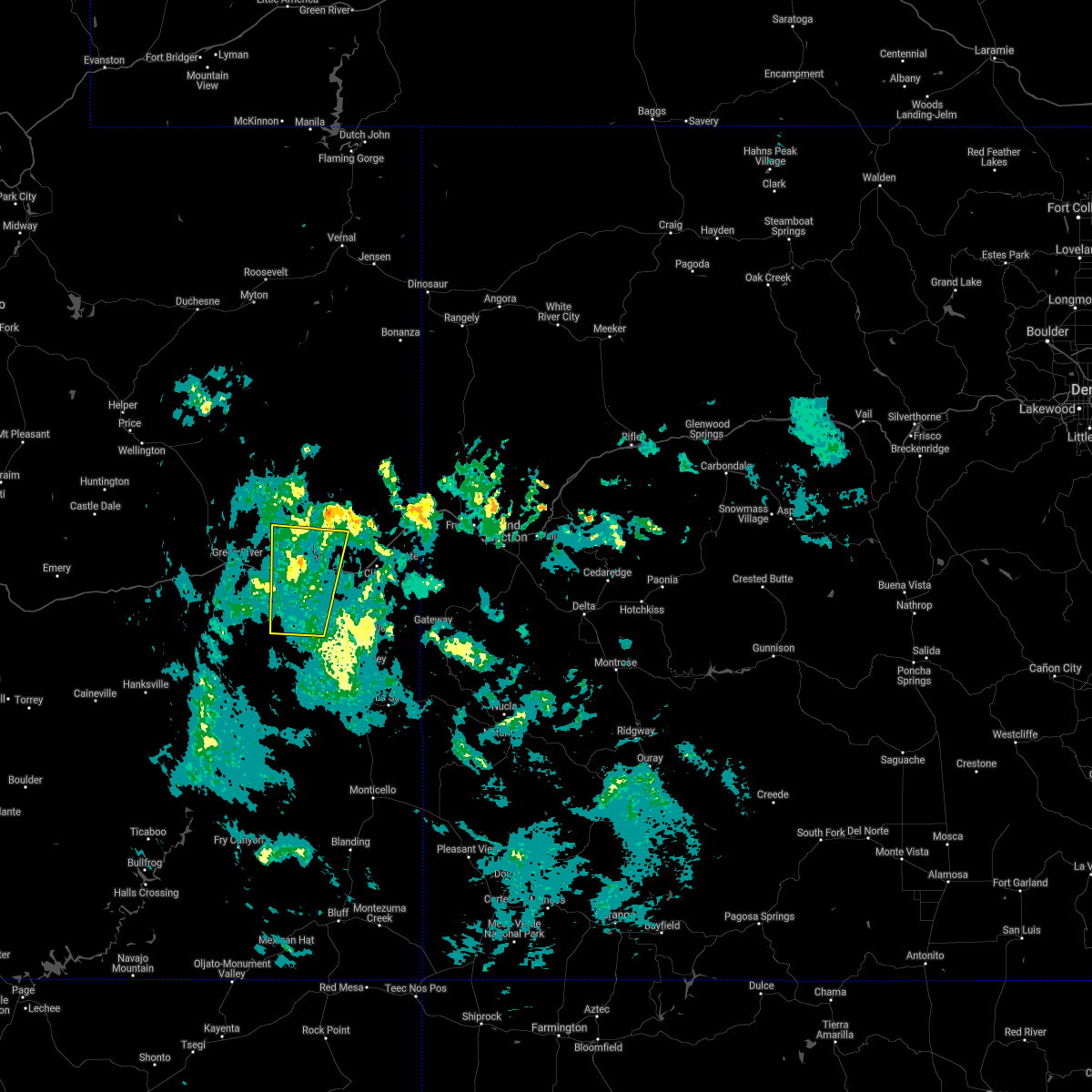
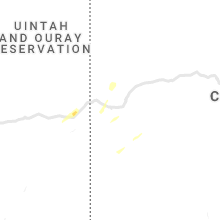
Hail Map for Thompson Springs, UT
The Thompson Springs, UT area has had 0 reports of on-the-ground hail by trained spotters, and has been under severe weather warnings 2 times during the past 12 months. Doppler radar has detected hail at or near Thompson Springs, UT on 3 occasions.
| Name: | Thompson Springs, UT |
| Where Located: | 61.5 miles W of Grand Junction, CO |
| Map: | Google Map for Thompson Springs, UT |
| Population: | 39 |
| Housing Units: | 43 |
| More Info: | Search Google for Thompson Springs, UT |
5
The Top Recent Hail Date for Thompson Springs, UT is Sunday, September 22, 2013 (1st out of 3)

Hail and Wind Damage Spotted near Thompson Springs, UT
| Date / Time | Report Details |
|---|---|
| 8/3/2023 5:12 PM MDT |
 The severe thunderstorm warning for southeastern grand county will expire at 515 pm mdt, the storms which prompted the warning have weakened below severe limits, and no longer pose an immediate threat to life or property. therefore, the warning will be allowed to expire. however gusty winds are still possible with these thunderstorms. The severe thunderstorm warning for southeastern grand county will expire at 515 pm mdt, the storms which prompted the warning have weakened below severe limits, and no longer pose an immediate threat to life or property. therefore, the warning will be allowed to expire. however gusty winds are still possible with these thunderstorms.
|
| 8/3/2023 4:30 PM MDT |
 At 429 pm mdt, severe thunderstorms were located along a line extending from 25 miles east of green river to near moab, moving east at 30 mph (canyonlands airport reported 60 mph wind gust). Hazards include 60 mph wind gusts. expect damage to roofs, siding, and trees At 429 pm mdt, severe thunderstorms were located along a line extending from 25 miles east of green river to near moab, moving east at 30 mph (canyonlands airport reported 60 mph wind gust). Hazards include 60 mph wind gusts. expect damage to roofs, siding, and trees
|
| 10/2/2022 4:03 PM MDT |
 At 403 pm mdt, severe thunderstorms were located along a line extending from 26 miles northeast of green river to 18 miles northwest of moab to near canyonlands national park, moving east at 25 mph (radar indicated). Hazards include 60 mph wind gusts and quarter size hail. Hail damage to vehicles is expected. expect wind damage to roofs, siding, and trees. these severe thunderstorms will remain over mainly rural areas of northern san juan and central grand counties, including the following locations, arches national park and dead horse point state park. this includes the following highways, interstate 70 in utah between mile markers 184 and 206. u. s. highway 191 in utah between mile markers 124 and 147. utah 128 between mile markers 0 and 5, and between mile markers 8 and 12, and near mile marker 44. utah 279 between mile markers 0 and 15. utah 313 between mile markers 0 and 22. hail threat, radar indicated max hail size, 1. 00 in wind threat, radar indicated max wind gust, 60 mph. At 403 pm mdt, severe thunderstorms were located along a line extending from 26 miles northeast of green river to 18 miles northwest of moab to near canyonlands national park, moving east at 25 mph (radar indicated). Hazards include 60 mph wind gusts and quarter size hail. Hail damage to vehicles is expected. expect wind damage to roofs, siding, and trees. these severe thunderstorms will remain over mainly rural areas of northern san juan and central grand counties, including the following locations, arches national park and dead horse point state park. this includes the following highways, interstate 70 in utah between mile markers 184 and 206. u. s. highway 191 in utah between mile markers 124 and 147. utah 128 between mile markers 0 and 5, and between mile markers 8 and 12, and near mile marker 44. utah 279 between mile markers 0 and 15. utah 313 between mile markers 0 and 22. hail threat, radar indicated max hail size, 1. 00 in wind threat, radar indicated max wind gust, 60 mph.
|
| 8/18/2021 4:36 PM MDT |
 At 435 pm mdt, severe thunderstorms were located along a line extending from thompson springs to near canyonlands national park, moving east at 20 mph (radar indicated). Hazards include 60 mph wind gusts. Expect damage to roofs, siding, and trees. these severe thunderstorms will remain over mainly rural areas of northern san juan and southeastern grand counties, including the following locations, arches national park, cisco and dead horse point state park. this includes the following highways, interstate 70 in utah between mile markers 183 and 213. u. s. highway 191 in utah between mile markers 120 and 155. utah 128 between mile markers 0 and 16, and between mile markers 39 and 44. utah 279 between mile markers 0 and 15. utah 313 between mile markers 0 and 22. hail threat, radar indicated max hail size, <. 75 in wind threat, radar indicated max wind gust, 60 mph. At 435 pm mdt, severe thunderstorms were located along a line extending from thompson springs to near canyonlands national park, moving east at 20 mph (radar indicated). Hazards include 60 mph wind gusts. Expect damage to roofs, siding, and trees. these severe thunderstorms will remain over mainly rural areas of northern san juan and southeastern grand counties, including the following locations, arches national park, cisco and dead horse point state park. this includes the following highways, interstate 70 in utah between mile markers 183 and 213. u. s. highway 191 in utah between mile markers 120 and 155. utah 128 between mile markers 0 and 16, and between mile markers 39 and 44. utah 279 between mile markers 0 and 15. utah 313 between mile markers 0 and 22. hail threat, radar indicated max hail size, <. 75 in wind threat, radar indicated max wind gust, 60 mph.
|
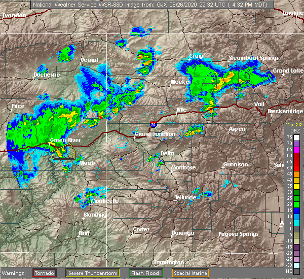
| 6/26/2020 4:54 PM MDT |
 The severe thunderstorm warning for south central grand county will expire at 500 pm mdt, the storm which prompted the warning has moved out of the area. therefore the warning will be allowed to expire. however gusty winds are still possible with this thunderstorm. The severe thunderstorm warning for south central grand county will expire at 500 pm mdt, the storm which prompted the warning has moved out of the area. therefore the warning will be allowed to expire. however gusty winds are still possible with this thunderstorm.
|
| 6/26/2020 4:45 PM MDT |
 At 444 pm mdt, a severe thunderstorm was located 21 miles northwest of moab, moving east at 20 mph (a 61 mph wind gust was observed at canyonlands airport at 4:34 pm mdt). Hazards include 60 mph wind gusts and penny size hail. Expect damage to roofs, siding, and trees. this severe thunderstorm will remain over mainly rural areas of south central grand county. this includes the following highways, interstate 70 in utah between mile markers 179 and 189. u. s. Highway 191 in utah between mile markers 140 and 157. At 444 pm mdt, a severe thunderstorm was located 21 miles northwest of moab, moving east at 20 mph (a 61 mph wind gust was observed at canyonlands airport at 4:34 pm mdt). Hazards include 60 mph wind gusts and penny size hail. Expect damage to roofs, siding, and trees. this severe thunderstorm will remain over mainly rural areas of south central grand county. this includes the following highways, interstate 70 in utah between mile markers 179 and 189. u. s. Highway 191 in utah between mile markers 140 and 157.
|
| 6/26/2020 4:36 PM MDT |
 At 436 pm mdt, a severe thunderstorm was located 20 miles southeast of green river, moving east at 20 mph (radar indicated). Hazards include 60 mph wind gusts and penny size hail. Expect damage to roofs, siding, and trees. this severe thunderstorm will remain over mainly rural areas of southwestern grand county. this includes the following highways, interstate 70 in utah between mile markers 180 and 189. u. s. Highway 191 in utah between mile markers 140 and 157. At 436 pm mdt, a severe thunderstorm was located 20 miles southeast of green river, moving east at 20 mph (radar indicated). Hazards include 60 mph wind gusts and penny size hail. Expect damage to roofs, siding, and trees. this severe thunderstorm will remain over mainly rural areas of southwestern grand county. this includes the following highways, interstate 70 in utah between mile markers 180 and 189. u. s. Highway 191 in utah between mile markers 140 and 157.
|
| 6/26/2020 4:34 PM MDT | Storm damage reported in grand county UT, 14.1 miles N of Thompson Springs, UT |
| 6/26/2020 4:24 PM MDT |
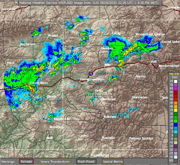 At 423 pm mdt, a severe thunderstorm was located 18 miles southeast of green river, moving east at 20 mph (radar indicated). Hazards include 60 mph wind gusts and penny size hail. Expect damage to roofs, siding, and trees. this severe thunderstorm will remain over mainly rural areas of southwestern grand county, including canyonlands airport. this includes the following highways, interstate 70 in utah between mile markers 180 and 189. u. s. Highway 191 in utah between mile markers 140 and 157. At 423 pm mdt, a severe thunderstorm was located 18 miles southeast of green river, moving east at 20 mph (radar indicated). Hazards include 60 mph wind gusts and penny size hail. Expect damage to roofs, siding, and trees. this severe thunderstorm will remain over mainly rural areas of southwestern grand county, including canyonlands airport. this includes the following highways, interstate 70 in utah between mile markers 180 and 189. u. s. Highway 191 in utah between mile markers 140 and 157.
|
| 6/6/2020 1:41 PM MDT |
 At 141 pm mdt, a severe thunderstorm was located 31 miles east of green river, moving northeast at 50 mph (radar indicated). Hazards include 60 mph wind gusts and quarter size hail. Hail damage to vehicles is expected. expect wind damage to roofs, siding, and trees. locations impacted include, cisco. this includes the following highways, interstate 70 in utah between mile markers 185 and 213. Utah 128 between mile markers 40 and 44. At 141 pm mdt, a severe thunderstorm was located 31 miles east of green river, moving northeast at 50 mph (radar indicated). Hazards include 60 mph wind gusts and quarter size hail. Hail damage to vehicles is expected. expect wind damage to roofs, siding, and trees. locations impacted include, cisco. this includes the following highways, interstate 70 in utah between mile markers 185 and 213. Utah 128 between mile markers 40 and 44.
|
| 6/6/2020 1:24 PM MDT |
 At 124 pm mdt, a severe thunderstorm was located 18 miles east of green river, moving northeast at 50 mph (radar indicated). Hazards include 60 mph wind gusts and quarter size hail. Hail damage to vehicles is expected. Expect wind damage to roofs, siding, and trees. At 124 pm mdt, a severe thunderstorm was located 18 miles east of green river, moving northeast at 50 mph (radar indicated). Hazards include 60 mph wind gusts and quarter size hail. Hail damage to vehicles is expected. Expect wind damage to roofs, siding, and trees.
|
| 6/6/2020 10:48 AM MDT |
 At 1047 am mdt, a severe thunderstorm was located 20 miles north of moab, moving north at 55 mph (radar indicated). Hazards include 60 mph wind gusts and quarter size hail. Hail damage to vehicles is expected. expect wind damage to roofs, siding, and trees. locations impacted include, arches national park. This includes interstate 70 in utah between mile markers 188 and 203. At 1047 am mdt, a severe thunderstorm was located 20 miles north of moab, moving north at 55 mph (radar indicated). Hazards include 60 mph wind gusts and quarter size hail. Hail damage to vehicles is expected. expect wind damage to roofs, siding, and trees. locations impacted include, arches national park. This includes interstate 70 in utah between mile markers 188 and 203.
|
| 6/6/2020 10:24 AM MDT |
 At 1024 am mdt, a severe thunderstorm was located 13 miles north of moab, moving north at 55 mph (radar indicated). Hazards include 70 mph wind gusts and quarter size hail. Hail damage to vehicles is expected. expect considerable tree damage. Wind damage is also likely to mobile homes, roofs, and outbuildings. At 1024 am mdt, a severe thunderstorm was located 13 miles north of moab, moving north at 55 mph (radar indicated). Hazards include 70 mph wind gusts and quarter size hail. Hail damage to vehicles is expected. expect considerable tree damage. Wind damage is also likely to mobile homes, roofs, and outbuildings.
|
| 6/5/2020 7:58 PM MDT |
 The severe thunderstorm warning for southwestern grand county will expire at 800 pm mdt, the storm which prompted the warning has moved out of the area. therefore, the warning will be allowed to expire. winds gusts to 40 mph will be possible over the next hour. The severe thunderstorm warning for southwestern grand county will expire at 800 pm mdt, the storm which prompted the warning has moved out of the area. therefore, the warning will be allowed to expire. winds gusts to 40 mph will be possible over the next hour.
|
| 6/5/2020 7:43 PM MDT |
 At 742 pm mdt, a severe thunderstorm was located 20 miles east of green river, moving north at 45 mph (radar indicated). Hazards include damaging winds in excess of 60 mph. Expect damage to roofs, siding, and trees. this severe thunderstorm will remain over mainly rural areas of southwestern grand county. this includes the following highways, interstate 70 in utah between mile markers 175 and 197. u. s. highway 191 in utah between mile markers 135 and 157. Utah 313 between mile markers 18 and 22. At 742 pm mdt, a severe thunderstorm was located 20 miles east of green river, moving north at 45 mph (radar indicated). Hazards include damaging winds in excess of 60 mph. Expect damage to roofs, siding, and trees. this severe thunderstorm will remain over mainly rural areas of southwestern grand county. this includes the following highways, interstate 70 in utah between mile markers 175 and 197. u. s. highway 191 in utah between mile markers 135 and 157. Utah 313 between mile markers 18 and 22.
|
| 6/5/2020 7:35 PM MDT | Semi blown over near mile marker 183. recent wind gusts over 70 mph reported at canyonlands airport just south of this locatio in grand county UT, 5 miles E of Thompson Springs, UT |
| 6/5/2020 7:30 PM MDT | Storm damage reported in grand county UT, 14.1 miles N of Thompson Springs, UT |
| 6/5/2020 7:27 PM MDT |
 At 727 pm mdt, doppler radar indicated a severe thunderstorm capable of producing damaging winds in excess of 60 mph. this storm was located 19 miles northwest of moab, and moving north at 45 mph. * this severe thunderstorm will remain over mainly rural areas of southwestern grand county. this includes the following highways, interstate 70 in utah between mile markers 175 and 197. u.s. highway 191 in utah between mile markers 135 and 157. utah 313 between mile markers 18 and 22. At 727 pm mdt, doppler radar indicated a severe thunderstorm capable of producing damaging winds in excess of 60 mph. this storm was located 19 miles northwest of moab, and moving north at 45 mph. * this severe thunderstorm will remain over mainly rural areas of southwestern grand county. this includes the following highways, interstate 70 in utah between mile markers 175 and 197. u.s. highway 191 in utah between mile markers 135 and 157. utah 313 between mile markers 18 and 22.
|
| 5/11/2020 3:44 PM MDT | Storm damage reported in grand county UT, 14.1 miles N of Thompson Springs, UT |
| 9/10/2019 12:02 PM MDT | Asos station kcny canyonlands field airpor in grand county UT, 13.5 miles NNE of Thompson Springs, UT |
| 8/6/2019 5:53 PM MDT | Asos station kcny canyonlands field airpor in grand county UT, 13.5 miles NNE of Thompson Springs, UT |
| 4/26/2019 2:18 PM MDT | Storm damage reported in grand county UT, 14.1 miles N of Thompson Springs, UT |
| 8/21/2018 2:56 PM MDT | Asos station cny... canyonlands field airpor in grand county UT, 14.2 miles NNE of Thompson Springs, UT |
| 8/10/2017 9:20 PM MDT | Asos station cny... canyonlands/moab airpor in grand county UT, 14.2 miles NNE of Thompson Springs, UT |
| 10/10/2016 7:00 PM MDT | Asos station canyonlands field airport /cny in grand county UT, 14.2 miles NNE of Thompson Springs, UT |
| 10/3/2016 7:02 AM MDT | Asos station canyonlands field airport /cny in grand county UT, 14.2 miles NNE of Thompson Springs, UT |
| 5/5/2016 6:44 PM MDT | Asos station canyonlands field airport /cny/ in grand county UT, 14.2 miles NNE of Thompson Springs, UT |
| 7/15/2015 4:15 PM MDT |
 At 415 pm mdt, doppler radar indicated a severe thunderstorm capable of producing damaging winds in excess of 60 mph. this storm was located 17 miles northeast of green river, and moving east at 35 mph. * this severe thunderstorm will remain over mainly rural areas of northwestern grand county north of interstate 70. At 415 pm mdt, doppler radar indicated a severe thunderstorm capable of producing damaging winds in excess of 60 mph. this storm was located 17 miles northeast of green river, and moving east at 35 mph. * this severe thunderstorm will remain over mainly rural areas of northwestern grand county north of interstate 70.
|
| 5/28/2015 3:30 PM MDT | Storm damage reported in grand county UT, 5.7 miles ENE of Thompson Springs, UT |
| 5/28/2015 3:20 PM MDT | At 318 pm mdt, a severe thunderstorm was located 16 miles east of green river, moving southeast at 20 mph (radar indicated). Hazards include 70 mph wind gusts and quarter size hail. Hail damage to vehicles is expected. expect considerable tree damage. wind damage is also likely to mobile homes, roofs and outbuildings. This severe thunderstorm will remain over mainly rural areas of west central grand county. |
| 5/28/2015 2:54 PM MDT | At 253 pm mdt, a severe thunderstorm was located 12 miles northeast of green river, moving southeast at 20 mph (radar indicated). Hazards include 60 to 70 mph wind gusts and quarter size hail. Hail damage to vehicles is expected. expect wind damage to roofs, siding and trees. This severe thunderstorm will remain over mainly rural areas of west central grand county. |
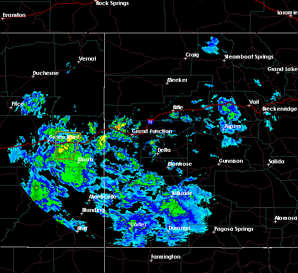
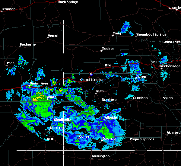
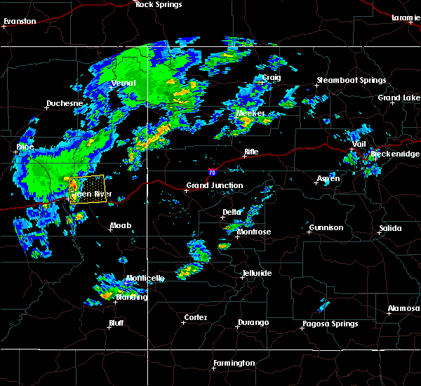
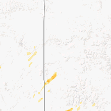
Hail Maps for Thompson Springs, UT

Connect with Interactive Hail Maps