

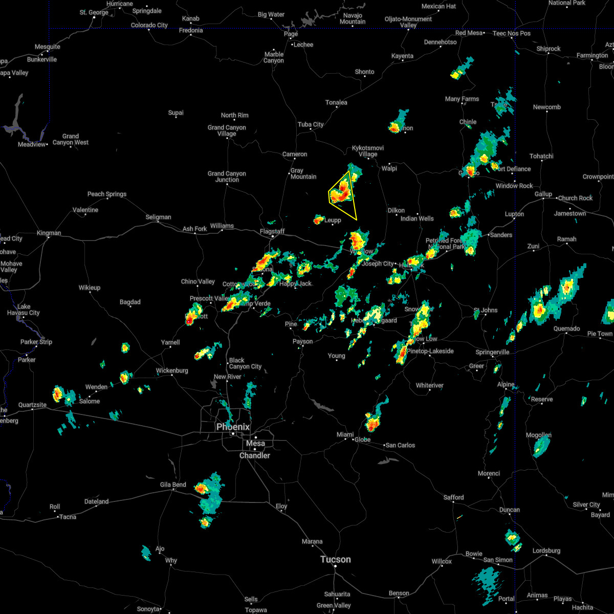
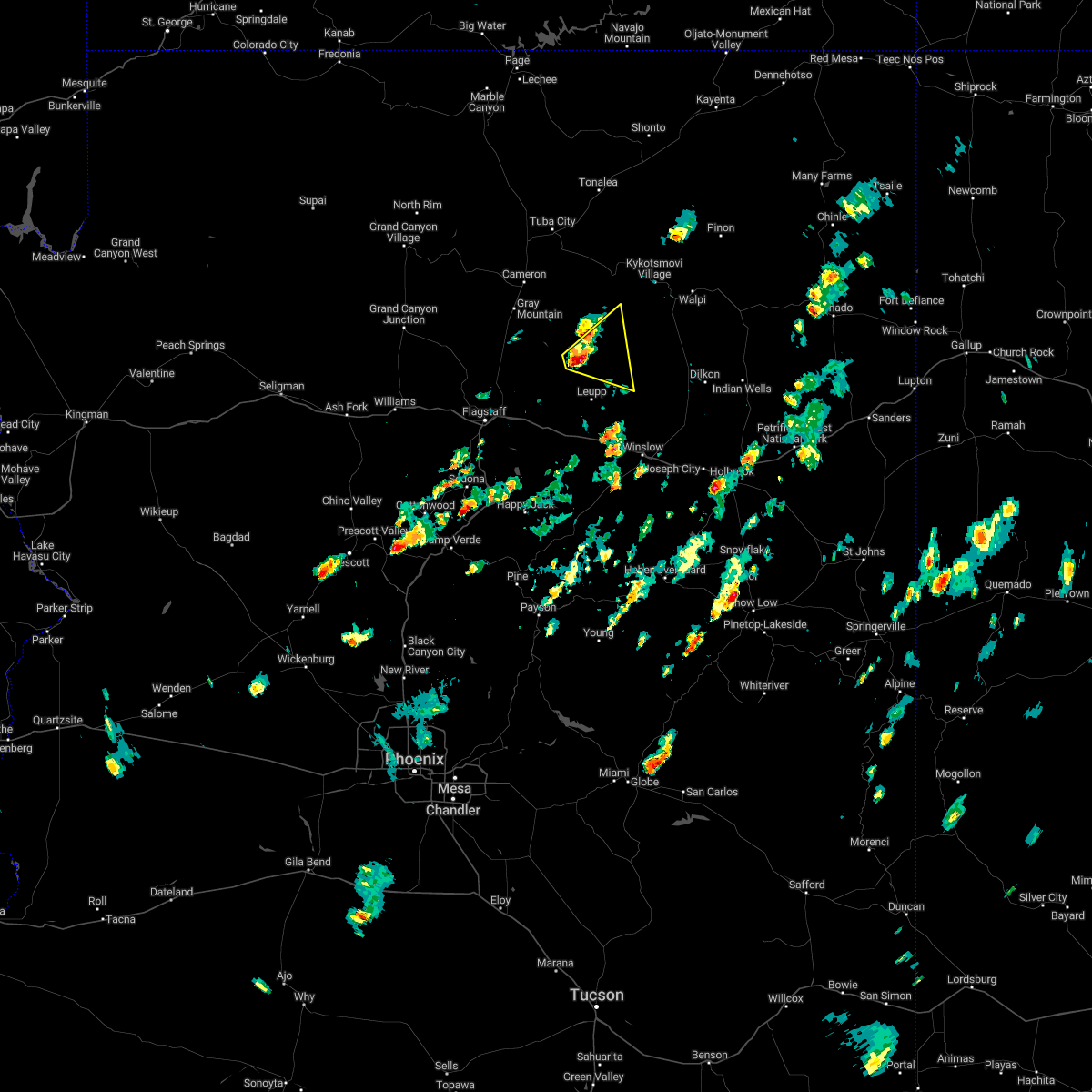
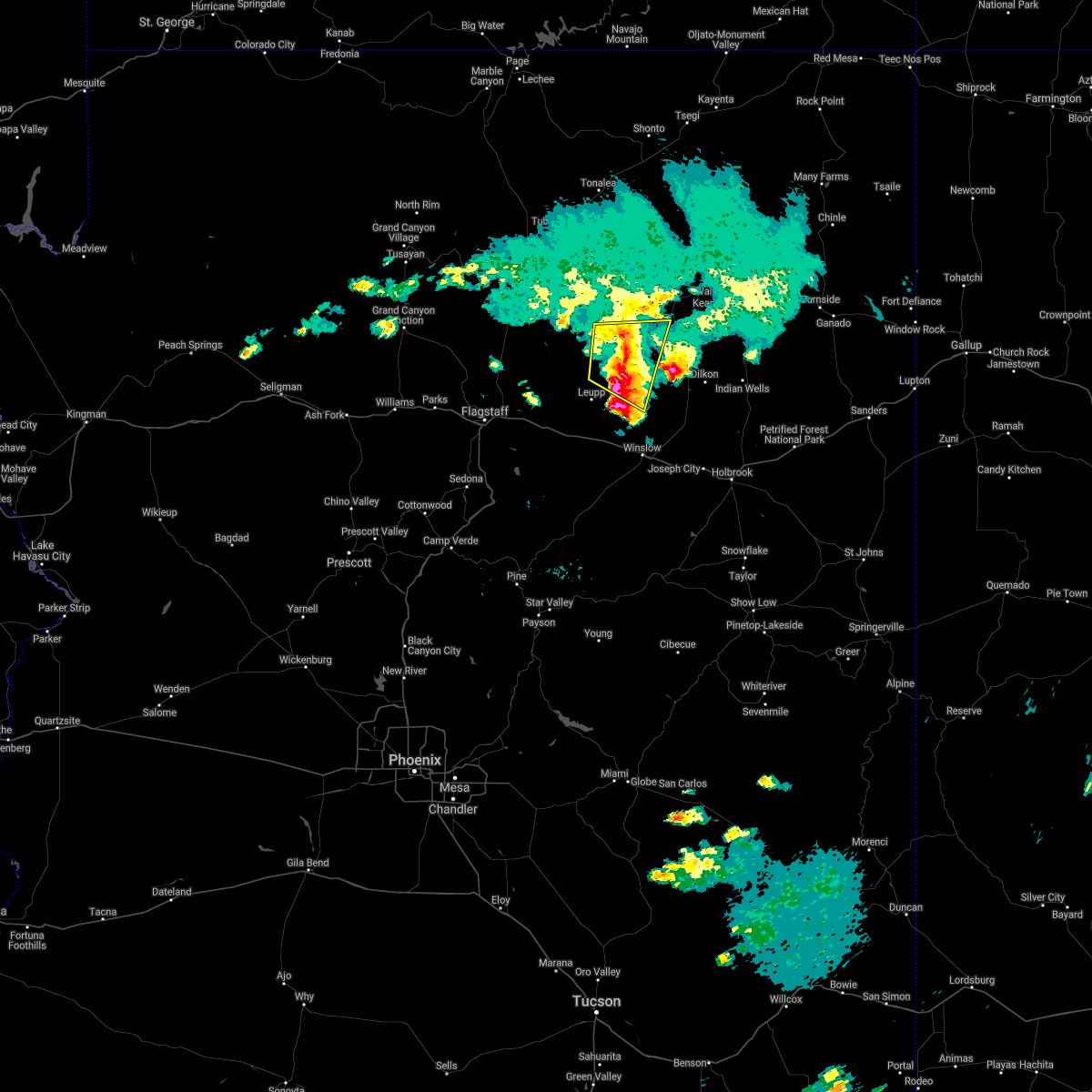
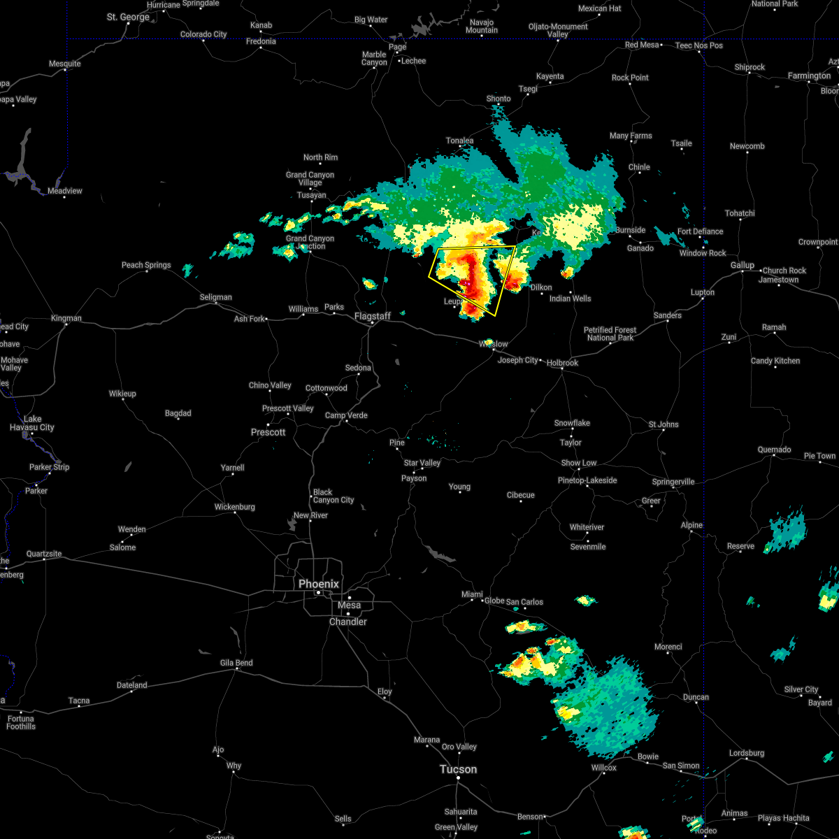
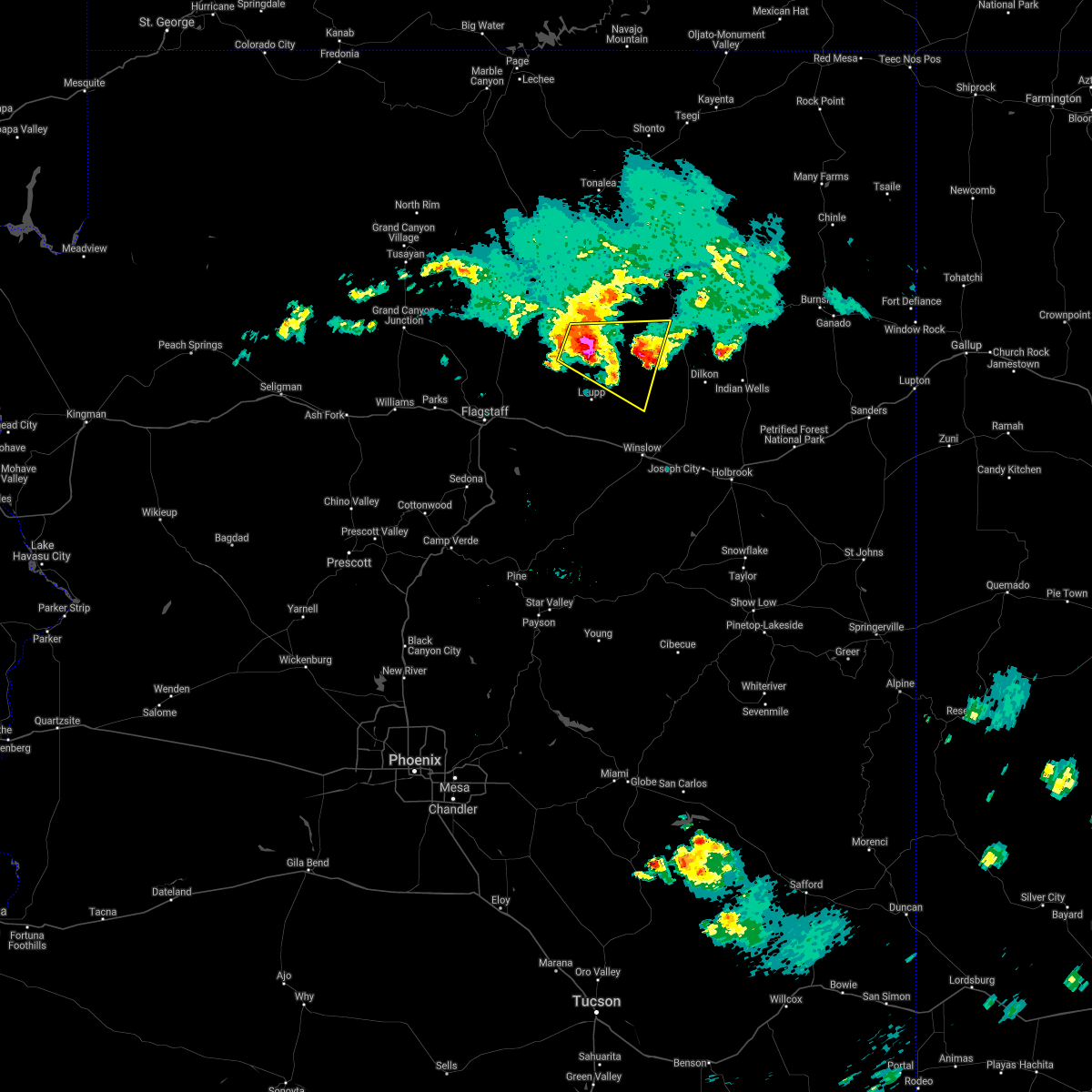
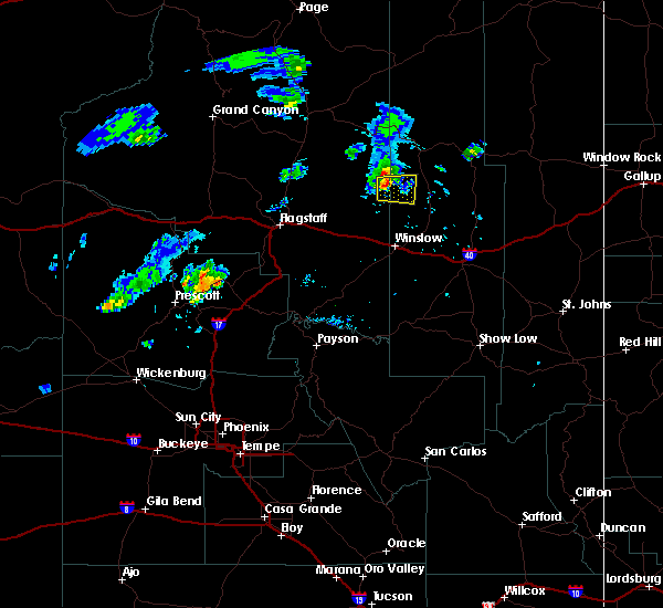
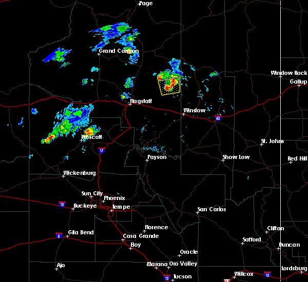
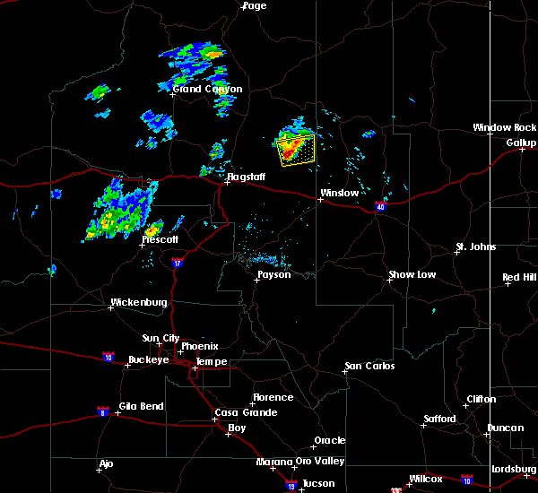
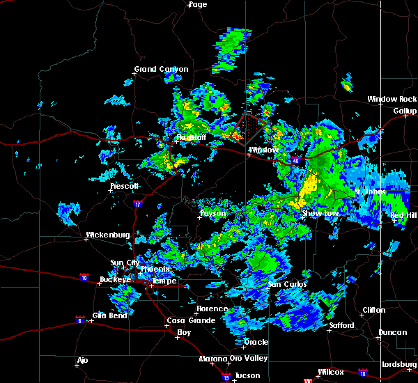
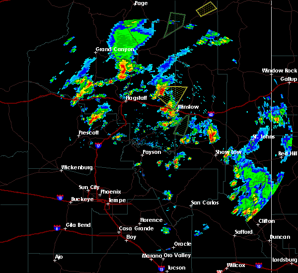
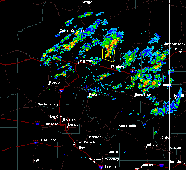
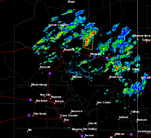
Hail Map for Tolani Lake, AZ
The Tolani Lake, AZ area has had 0 reports of on-the-ground hail by trained spotters, and has been under severe weather warnings 0 times during the past 12 months. Doppler radar has detected hail at or near Tolani Lake, AZ on 6 occasions.
| Name: | Tolani Lake, AZ |
| Where Located: | 48.2 miles ENE of Flagstaff, AZ |
| Map: | Google Map for Tolani Lake, AZ |
| Population: | 280 |
| Housing Units: | 98 |
| More Info: | Search Google for Tolani Lake, AZ |
0
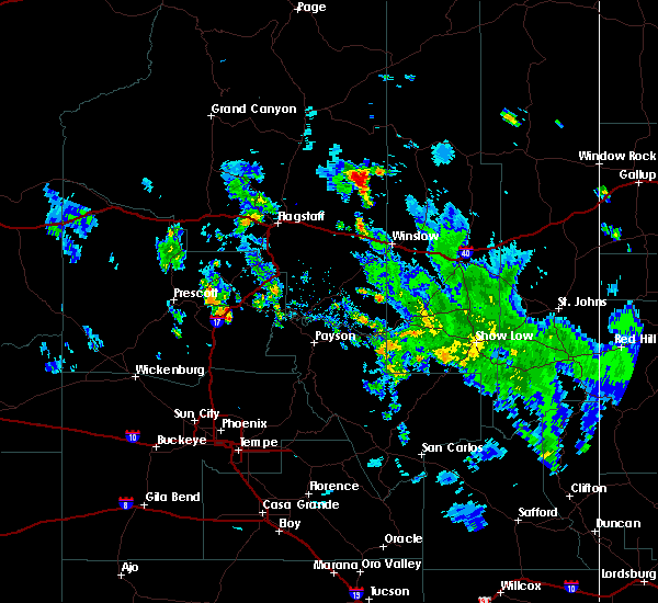
The Top Recent Hail Date for Tolani Lake, AZ is Thursday, June 23, 2022 (3rd out of 6)

Hail and Wind Damage Spotted near Tolani Lake, AZ
| Date / Time | Report Details |
|---|---|
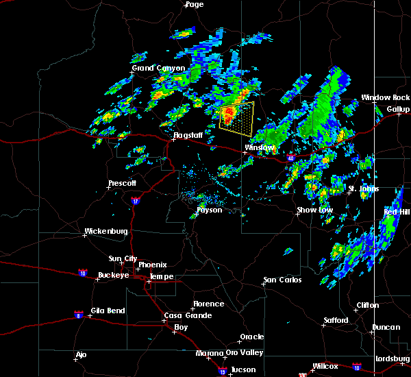
| 9/22/2022 2:47 PM MDT |
 At 145 pm mst, a severe thunderstorm was located near tolani lake, or 35 miles north of winslow, moving east at 15 to 20 mph. this storm is showing signs of weakening, but still could produce severe hail (radar indicated). Hazards include quarter size hail and winds up to 50 mph possible. Damage to vehicles is expected. locations impacted include, tolani lake. hail threat, radar indicated max hail size, 1. 00 in wind threat, radar indicated max wind gust, <50 mph. At 145 pm mst, a severe thunderstorm was located near tolani lake, or 35 miles north of winslow, moving east at 15 to 20 mph. this storm is showing signs of weakening, but still could produce severe hail (radar indicated). Hazards include quarter size hail and winds up to 50 mph possible. Damage to vehicles is expected. locations impacted include, tolani lake. hail threat, radar indicated max hail size, 1. 00 in wind threat, radar indicated max wind gust, <50 mph.
|
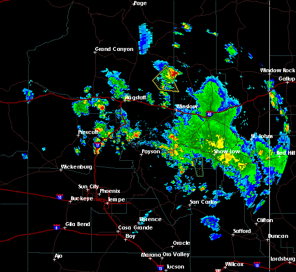
| 9/22/2022 2:19 PM MDT |
 At 117 pm mst, a severe thunderstorm was located 12 miles west of tolani lake, or 37 miles northeast of flagstaff, moving east at 15 to 20 mph (radar indicated). Hazards include quarter size hail and winds up to 50 mph possible. damage to vehicles is expected At 117 pm mst, a severe thunderstorm was located 12 miles west of tolani lake, or 37 miles northeast of flagstaff, moving east at 15 to 20 mph (radar indicated). Hazards include quarter size hail and winds up to 50 mph possible. damage to vehicles is expected
|
| 9/1/2018 4:29 PM MST |
 At 429 pm mst, a severe thunderstorm was located 9 miles east of tolani lake, or 30 miles north of winslow, moving east at 20 mph (radar indicated). Hazards include 60 mph wind gusts and half dollar size hail. Hail damage to vehicles is expected. expect wind damage to roofs, siding, and trees. Locations impacted include, tolani lake. At 429 pm mst, a severe thunderstorm was located 9 miles east of tolani lake, or 30 miles north of winslow, moving east at 20 mph (radar indicated). Hazards include 60 mph wind gusts and half dollar size hail. Hail damage to vehicles is expected. expect wind damage to roofs, siding, and trees. Locations impacted include, tolani lake.
|
| 9/1/2018 5:16 PM MDT |
 At 416 pm mst, a severe thunderstorm was located near tolani lake, or 33 miles north of winslow, moving east at 35 mph (radar indicated). Hazards include two inch hail and 60 mph wind gusts. People and animals outdoors will be injured. expect hail damage to roofs, siding, windows, and vehicles. expect wind damage to roofs, siding, and trees. Locations impacted include, tolani lake. At 416 pm mst, a severe thunderstorm was located near tolani lake, or 33 miles north of winslow, moving east at 35 mph (radar indicated). Hazards include two inch hail and 60 mph wind gusts. People and animals outdoors will be injured. expect hail damage to roofs, siding, windows, and vehicles. expect wind damage to roofs, siding, and trees. Locations impacted include, tolani lake.
|
| 9/1/2018 4:57 PM MDT |
 At 356 pm mst, a severe thunderstorm was located 11 miles northwest of tolani lake, or 39 miles northwest of winslow, moving east at 25 mph (radar indicated). Hazards include two inch hail and 60 mph wind gusts. People and animals outdoors will be injured. expect hail damage to roofs, siding, windows, and vehicles. Expect wind damage to roofs, siding, and trees. At 356 pm mst, a severe thunderstorm was located 11 miles northwest of tolani lake, or 39 miles northwest of winslow, moving east at 25 mph (radar indicated). Hazards include two inch hail and 60 mph wind gusts. People and animals outdoors will be injured. expect hail damage to roofs, siding, windows, and vehicles. Expect wind damage to roofs, siding, and trees.
|
| 8/27/2016 7:43 PM MDT |
 At 642 pm mst, doppler radar indicated a severe thunderstorm capable of producing half dollar size hail and damaging winds in excess of 60 mph. this storm was located near tolani lake, or 32 miles north of winslow, and moving east at 15 mph. * this severe thunderstorm will remain over mainly rural areas of coconino and navajo counties. At 642 pm mst, doppler radar indicated a severe thunderstorm capable of producing half dollar size hail and damaging winds in excess of 60 mph. this storm was located near tolani lake, or 32 miles north of winslow, and moving east at 15 mph. * this severe thunderstorm will remain over mainly rural areas of coconino and navajo counties.
|
| 8/27/2016 7:15 PM MDT |
 At 613 pm mst, doppler radar indicated a severe thunderstorm capable of producing quarter size hail and damaging winds in excess of 60 mph. this storm was located 7 miles northwest of tolani lake, or 35 miles north of winslow, moving east at 10 mph and crossing luepp- oraibi road. locations impacted include, tolani lake and sand springs. At 613 pm mst, doppler radar indicated a severe thunderstorm capable of producing quarter size hail and damaging winds in excess of 60 mph. this storm was located 7 miles northwest of tolani lake, or 35 miles north of winslow, moving east at 10 mph and crossing luepp- oraibi road. locations impacted include, tolani lake and sand springs.
|
| 8/27/2016 6:55 PM MDT |
 At 554 pm mst, doppler radar indicated a severe thunderstorm capable of producing half dollar size hail and damaging winds in excess of 60 mph. this storm was located 9 miles northwest of leupp, or 35 miles northwest of winslow, and moving east at 10 mph. * locations impacted also include, tolani lake. At 554 pm mst, doppler radar indicated a severe thunderstorm capable of producing half dollar size hail and damaging winds in excess of 60 mph. this storm was located 9 miles northwest of leupp, or 35 miles northwest of winslow, and moving east at 10 mph. * locations impacted also include, tolani lake.
|
| 10/6/2015 6:40 PM MDT |
 At 539 pm mst, doppler radar indicated a severe thunderstorm capable of producing a tornado. this dangerous storm was located 8 miles east of leupp, or 17 miles north of winslow, and moving northeast at 25 mph. * this tornadic thunderstorm will remain over mainly rural areas of southeastern coconino and west central navajo counties. At 539 pm mst, doppler radar indicated a severe thunderstorm capable of producing a tornado. this dangerous storm was located 8 miles east of leupp, or 17 miles north of winslow, and moving northeast at 25 mph. * this tornadic thunderstorm will remain over mainly rural areas of southeastern coconino and west central navajo counties.
|
| 8/31/2015 2:20 PM MDT |
 At 119 pm mst, doppler radar indicated a severe thunderstorm capable of producing quarter size hail and damaging winds in excess of 60 mph. this storm was located over sunrise, or 24 miles northwest of winslow, and moving southeast at 35 mph. At 119 pm mst, doppler radar indicated a severe thunderstorm capable of producing quarter size hail and damaging winds in excess of 60 mph. this storm was located over sunrise, or 24 miles northwest of winslow, and moving southeast at 35 mph.
|
| 8/8/2015 4:11 PM MDT |
 The severe thunderstorm warning for southeastern coconino and west central navajo counties will expire at 315 pm mst, the storm which prompted the warning has weakened below severe limits, and no longer poses an immediate threat to life or property. therefore the warning will be allowed to expire. however gusty winds and heavy rain are still possible with this thunderstorm. The severe thunderstorm warning for southeastern coconino and west central navajo counties will expire at 315 pm mst, the storm which prompted the warning has weakened below severe limits, and no longer poses an immediate threat to life or property. therefore the warning will be allowed to expire. however gusty winds and heavy rain are still possible with this thunderstorm.
|
| 8/8/2015 4:05 PM MDT |
 At 304 pm mst, doppler radar indicated a severe thunderstorm capable of producing damaging winds in excess of 60 mph. this storm was located 8 miles east of tolani lake, or 25 miles north of winslow, moving east at 30 mph. nickel size hail may also accompany the damaging winds. locations impacted include, tolani lake. At 304 pm mst, doppler radar indicated a severe thunderstorm capable of producing damaging winds in excess of 60 mph. this storm was located 8 miles east of tolani lake, or 25 miles north of winslow, moving east at 30 mph. nickel size hail may also accompany the damaging winds. locations impacted include, tolani lake.
|
| 8/8/2015 3:45 PM MDT |
 At 244 pm mst, doppler radar indicated a severe thunderstorm capable of producing damaging winds in excess of 60 mph. this storm was located over tolani lake, or 29 miles north of winslow, and moving east at 30 mph. nickel size hail may also accompany the damaging winds. At 244 pm mst, doppler radar indicated a severe thunderstorm capable of producing damaging winds in excess of 60 mph. this storm was located over tolani lake, or 29 miles north of winslow, and moving east at 30 mph. nickel size hail may also accompany the damaging winds.
|
| 7/4/2015 5:21 PM MDT |
 The severe thunderstorm warning for east central coconino and western navajo counties will expire at 430 pm mst, the storm which prompted the warning has weakened below severe limits and exited the warned area. therefore the warning will be allowed to expire. however small hail, gusty winds and heavy rain are still possible with this thunderstorm. The severe thunderstorm warning for east central coconino and western navajo counties will expire at 430 pm mst, the storm which prompted the warning has weakened below severe limits and exited the warned area. therefore the warning will be allowed to expire. however small hail, gusty winds and heavy rain are still possible with this thunderstorm.
|
| 7/4/2015 4:44 PM MDT |
 At 343 pm mst, doppler radar indicated a severe thunderstorm capable of producing quarter size hail and damaging winds in excess of 60 mph. this storm was located 9 miles northwest of tolani lake, or 36 miles northwest of winslow, and moving northeast at 10 mph. At 343 pm mst, doppler radar indicated a severe thunderstorm capable of producing quarter size hail and damaging winds in excess of 60 mph. this storm was located 9 miles northwest of tolani lake, or 36 miles northwest of winslow, and moving northeast at 10 mph.
|
| 6/5/2015 10:33 PM MDT | At 932 pm mst, doppler radar indicated a severe thunderstorm capable of producing quarter size hail and damaging winds in excess of 60 mph. this storm was located over milepost 60 on sr 99, or 13 miles northwest of winslow, and moving northeast at 35 mph. |
Hail Maps for Tolani Lake, AZ


Connect with Interactive Hail Maps