

Hail Map for Trowbridge Park, MI
The Trowbridge Park, MI area has had 0 reports of on-the-ground hail by trained spotters, and has been under severe weather warnings 6 times during the past 12 months. Doppler radar has detected hail at or near Trowbridge Park, MI on 11 occasions, including 1 occasion during the past year.
| Name: | Trowbridge Park, MI |
| Where Located: | 1.5 miles WNW of Marquette, MI |
| Map: | Google Map for Trowbridge Park, MI |
| Population: | 2176 |
| Housing Units: | 960 |
| More Info: | Search Google for Trowbridge Park, MI |
0
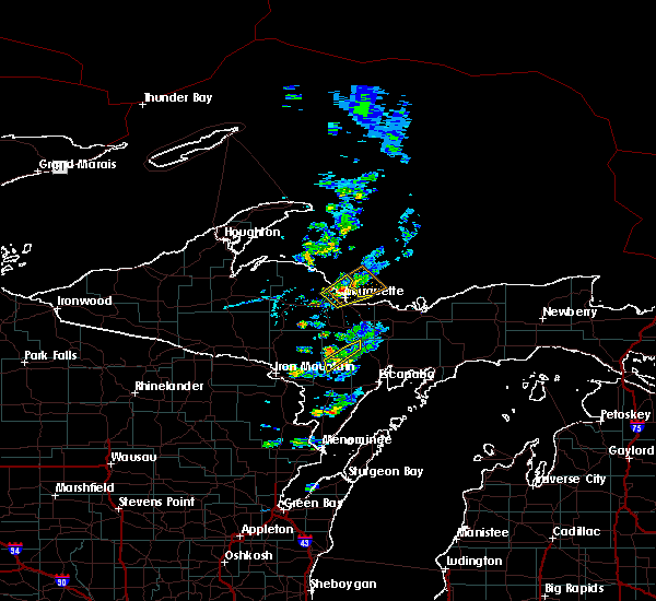
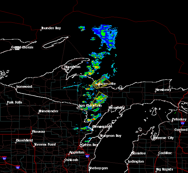
The Top Recent Hail Date for Trowbridge Park, MI is Monday, July 10, 2023 (11th out of 11)

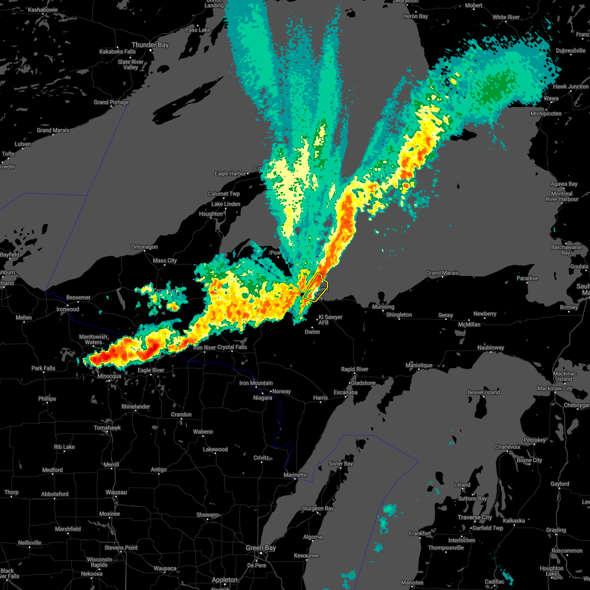
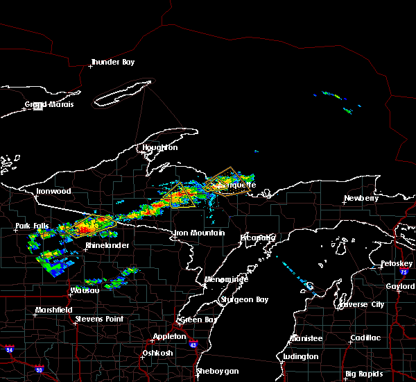
Hail and Wind Damage Spotted near Trowbridge Park, MI
| Date / Time | Report Details |
|---|---|
| 10/5/2023 4:24 PM EDT |
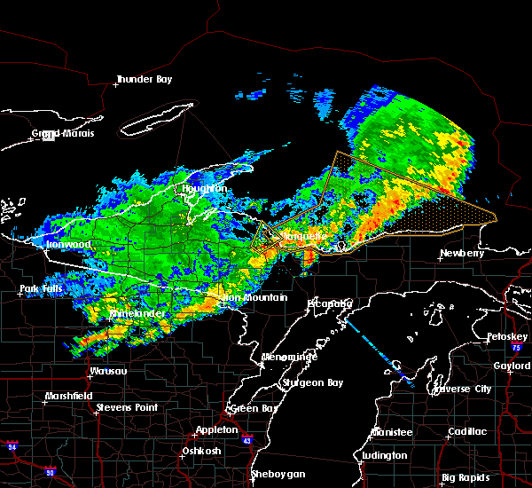
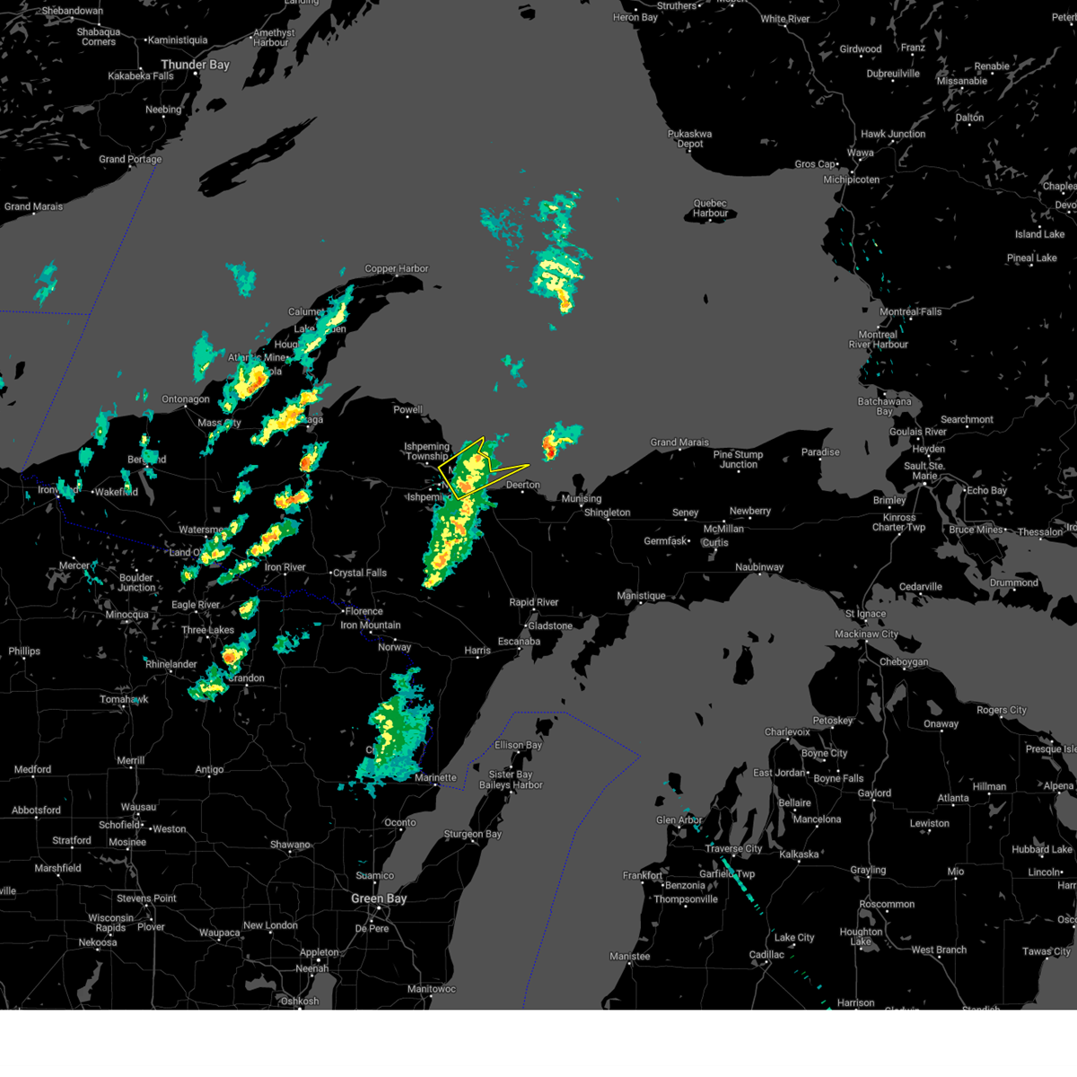 At 423 pm edt, a severe thunderstorm was located near harvey, or near marquette, moving northeast at 40 mph (radar indicated). Hazards include 60 mph wind gusts. Expect damage to roofs, siding, and trees. locations impacted include, marquette, presque isle, little presque isle, harvey, trowbridge park, the 553 and 480 crossroads, and sugarloaf mountain. hail threat, radar indicated max hail size, <. 75 in wind threat, radar indicated max wind gust, 60 mph. At 423 pm edt, a severe thunderstorm was located near harvey, or near marquette, moving northeast at 40 mph (radar indicated). Hazards include 60 mph wind gusts. Expect damage to roofs, siding, and trees. locations impacted include, marquette, presque isle, little presque isle, harvey, trowbridge park, the 553 and 480 crossroads, and sugarloaf mountain. hail threat, radar indicated max hail size, <. 75 in wind threat, radar indicated max wind gust, 60 mph.
|
| 10/5/2023 4:12 PM EDT |
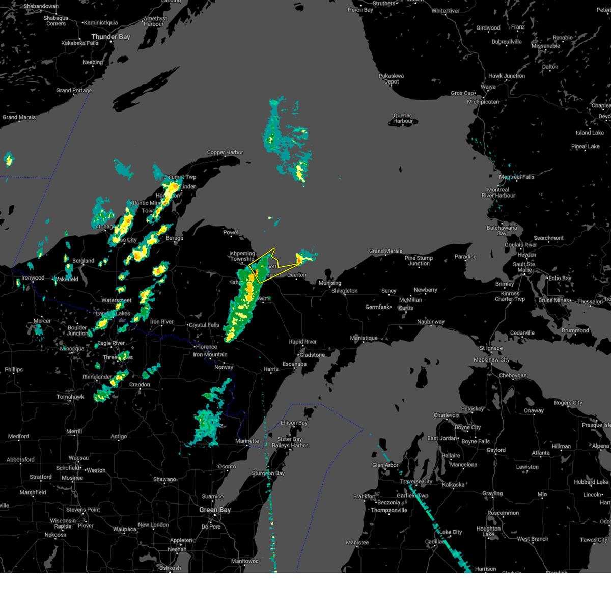 At 412 pm edt, a severe thunderstorm was located over trowbridge park, or over marquette, moving northeast at 50 mph (radar indicated). Hazards include 60 mph wind gusts. expect damage to roofs, siding, and trees At 412 pm edt, a severe thunderstorm was located over trowbridge park, or over marquette, moving northeast at 50 mph (radar indicated). Hazards include 60 mph wind gusts. expect damage to roofs, siding, and trees
|
| 7/27/2023 8:54 PM EDT |
 The severe thunderstorm warning for central marquette county will expire at 900 pm edt, the storm which prompted the warning has moved out of the area. therefore, the warning will be allowed to expire. however gusty winds and heavy rain are still possible with this thunderstorm. a severe thunderstorm watch remains in effect until midnight edt for north central upper michigan. The severe thunderstorm warning for central marquette county will expire at 900 pm edt, the storm which prompted the warning has moved out of the area. therefore, the warning will be allowed to expire. however gusty winds and heavy rain are still possible with this thunderstorm. a severe thunderstorm watch remains in effect until midnight edt for north central upper michigan.
|
| 7/27/2023 8:46 PM EDT |
 At 846 pm edt, a severe thunderstorm was located over harvey, or over marquette, moving east at 70 mph (radar indicated). Hazards include 60 mph wind gusts and penny size hail. Expect damage to roofs, siding, and trees. this severe thunderstorm will be near, shot point around 855 pm edt. deerton around 900 pm edt. other locations in the path of this severe thunderstorm include au train. hail threat, radar indicated max hail size, 0. 75 in wind threat, radar indicated max wind gust, 60 mph. At 846 pm edt, a severe thunderstorm was located over harvey, or over marquette, moving east at 70 mph (radar indicated). Hazards include 60 mph wind gusts and penny size hail. Expect damage to roofs, siding, and trees. this severe thunderstorm will be near, shot point around 855 pm edt. deerton around 900 pm edt. other locations in the path of this severe thunderstorm include au train. hail threat, radar indicated max hail size, 0. 75 in wind threat, radar indicated max wind gust, 60 mph.
|
| 7/27/2023 8:41 PM EDT |
 At 841 pm edt, a severe thunderstorm was located over ishpeming, moving east at 50 mph (radar indicated). Hazards include 60 mph wind gusts and penny size hail. Expect damage to roofs, siding, and trees. locations impacted include, marquette and trowbridge park. hail threat, radar indicated max hail size, 0. 75 in wind threat, radar indicated max wind gust, 60 mph. At 841 pm edt, a severe thunderstorm was located over ishpeming, moving east at 50 mph (radar indicated). Hazards include 60 mph wind gusts and penny size hail. Expect damage to roofs, siding, and trees. locations impacted include, marquette and trowbridge park. hail threat, radar indicated max hail size, 0. 75 in wind threat, radar indicated max wind gust, 60 mph.
|
| 7/27/2023 8:22 PM EDT |
 At 822 pm edt, a severe thunderstorm was located over champion, or 15 miles west of ishpeming, moving east at 50 mph (radar indicated). Hazards include 60 mph wind gusts and penny size hail. Expect damage to roofs, siding, and trees. this severe thunderstorm will be near, west ishpeming around 835 pm edt. ishpeming around 840 pm edt. other locations in the path of this severe thunderstorm include negaunee, marquette and trowbridge park. hail threat, radar indicated max hail size, 0. 75 in wind threat, radar indicated max wind gust, 60 mph. At 822 pm edt, a severe thunderstorm was located over champion, or 15 miles west of ishpeming, moving east at 50 mph (radar indicated). Hazards include 60 mph wind gusts and penny size hail. Expect damage to roofs, siding, and trees. this severe thunderstorm will be near, west ishpeming around 835 pm edt. ishpeming around 840 pm edt. other locations in the path of this severe thunderstorm include negaunee, marquette and trowbridge park. hail threat, radar indicated max hail size, 0. 75 in wind threat, radar indicated max wind gust, 60 mph.
|
| 8/2/2022 9:43 PM EDT |
 At 943 pm edt, a severe thunderstorm was located near champion, or 13 miles west of ishpeming, moving east at 30 mph (radar indicated). Hazards include 60 mph wind gusts and quarter size hail. Hail damage to vehicles is expected. expect wind damage to roofs, siding, and trees. this severe storm will be near, west ishpeming around 1000 pm edt. ishpeming around 1005 pm edt. negaunee around 1010 pm edt. other locations impacted by this severe thunderstorm include humboldt, national mine, palmer, diorite, van riper state park and republic. hail threat, radar indicated max hail size, 1. 00 in wind threat, radar indicated max wind gust, 60 mph. At 943 pm edt, a severe thunderstorm was located near champion, or 13 miles west of ishpeming, moving east at 30 mph (radar indicated). Hazards include 60 mph wind gusts and quarter size hail. Hail damage to vehicles is expected. expect wind damage to roofs, siding, and trees. this severe storm will be near, west ishpeming around 1000 pm edt. ishpeming around 1005 pm edt. negaunee around 1010 pm edt. other locations impacted by this severe thunderstorm include humboldt, national mine, palmer, diorite, van riper state park and republic. hail threat, radar indicated max hail size, 1. 00 in wind threat, radar indicated max wind gust, 60 mph.
|
| 8/2/2022 9:26 PM EDT |
 At 925 pm edt, a severe thunderstorm was located over lake michigamme, or 16 miles west of ishpeming, moving east at 35 mph (radar indicated). Hazards include 60 mph wind gusts and quarter size hail. Hail damage to vehicles is expected. expect wind damage to roofs, siding, and trees. this severe thunderstorm will be near, west ishpeming around 945 pm edt. ishpeming around 950 pm edt. negaunee around 955 pm edt. marquette and trowbridge park around 1010 pm edt. other locations impacted by this severe thunderstorm include palmer, diorite, van riper state park, humboldt, national mine, big bass lake and republic. hail threat, radar indicated max hail size, 1. 00 in wind threat, radar indicated max wind gust, 60 mph. At 925 pm edt, a severe thunderstorm was located over lake michigamme, or 16 miles west of ishpeming, moving east at 35 mph (radar indicated). Hazards include 60 mph wind gusts and quarter size hail. Hail damage to vehicles is expected. expect wind damage to roofs, siding, and trees. this severe thunderstorm will be near, west ishpeming around 945 pm edt. ishpeming around 950 pm edt. negaunee around 955 pm edt. marquette and trowbridge park around 1010 pm edt. other locations impacted by this severe thunderstorm include palmer, diorite, van riper state park, humboldt, national mine, big bass lake and republic. hail threat, radar indicated max hail size, 1. 00 in wind threat, radar indicated max wind gust, 60 mph.
|
| 8/28/2021 7:22 PM EDT |
 At 722 pm edt, a severe thunderstorm was located 9 miles northwest of negaunee, or 9 miles north of ishpeming, moving east at 35 mph (radar indicated). Hazards include 70 mph wind gusts and penny size hail. Expect considerable tree damage. damage is likely to mobile homes, roofs, and outbuildings. this severe thunderstorm will be near, marquette, little presque isle and trowbridge park around 740 pm edt. presque isle around 745 pm edt. other locations impacted by this severe thunderstorm include halfway village and sugarloaf mountain. thunderstorm damage threat, considerable hail threat, radar indicated max hail size, 0. 75 in wind threat, radar indicated max wind gust, 70 mph. At 722 pm edt, a severe thunderstorm was located 9 miles northwest of negaunee, or 9 miles north of ishpeming, moving east at 35 mph (radar indicated). Hazards include 70 mph wind gusts and penny size hail. Expect considerable tree damage. damage is likely to mobile homes, roofs, and outbuildings. this severe thunderstorm will be near, marquette, little presque isle and trowbridge park around 740 pm edt. presque isle around 745 pm edt. other locations impacted by this severe thunderstorm include halfway village and sugarloaf mountain. thunderstorm damage threat, considerable hail threat, radar indicated max hail size, 0. 75 in wind threat, radar indicated max wind gust, 70 mph.
|
| 9/25/2020 10:53 PM EDT |
 At 1053 pm edt, severe thunderstorms were located along a line extending from near presque isle to 6 miles south of ishpeming, moving east-southeast at 40 mph (radar indicated). Hazards include 60 mph wind gusts and nickel size hail. Expect damage to roofs, siding, and trees. Locations impacted include, marquette, presque isle, trowbridge park and sugarloaf mountain. At 1053 pm edt, severe thunderstorms were located along a line extending from near presque isle to 6 miles south of ishpeming, moving east-southeast at 40 mph (radar indicated). Hazards include 60 mph wind gusts and nickel size hail. Expect damage to roofs, siding, and trees. Locations impacted include, marquette, presque isle, trowbridge park and sugarloaf mountain.
|
| 9/25/2020 10:31 PM EDT |
 At 1031 pm edt, severe thunderstorms were located along a line extending from near big bay to near champion, moving east- southeast at 40 mph (radar indicated). Hazards include 60 mph wind gusts and quarter size hail. Hail damage to vehicles is expected. Expect wind damage to roofs, siding, and trees. At 1031 pm edt, severe thunderstorms were located along a line extending from near big bay to near champion, moving east- southeast at 40 mph (radar indicated). Hazards include 60 mph wind gusts and quarter size hail. Hail damage to vehicles is expected. Expect wind damage to roofs, siding, and trees.
|
| 8/9/2020 11:26 PM EDT |
 At 1126 pm edt/1026 pm cdt/, severe thunderstorms were located along a line extending from near trowbridge park to near k i sawyer to 7 miles south of gwinn to 7 miles northeast of foster city, moving east at 50 mph (radar indicated). Hazards include 60 mph wind gusts. Expect damage to roofs, siding, and trees. locations impacted include, marquette, ishpeming, presque isle, negaunee, felch, little presque isle, k. i. Sawyer airport, k i sawyer, trowbridge park, harvey, gwinn and sands. At 1126 pm edt/1026 pm cdt/, severe thunderstorms were located along a line extending from near trowbridge park to near k i sawyer to 7 miles south of gwinn to 7 miles northeast of foster city, moving east at 50 mph (radar indicated). Hazards include 60 mph wind gusts. Expect damage to roofs, siding, and trees. locations impacted include, marquette, ishpeming, presque isle, negaunee, felch, little presque isle, k. i. Sawyer airport, k i sawyer, trowbridge park, harvey, gwinn and sands.
|
| 8/9/2020 11:15 PM EDT |
 At 1115 pm edt/1015 pm cdt/, severe thunderstorms were located along a line extending from near negaunee to near gwinn to 13 miles northwest of watson to near felch, moving east at 50 mph (radar indicated). Hazards include 60 mph wind gusts and penny size hail. Expect damage to roofs, siding, and trees. locations impacted include, marquette, ishpeming, presque isle, negaunee, felch, little presque isle, west ishpeming, k. i. Sawyer airport, k i sawyer, trowbridge park, harvey and gwinn. At 1115 pm edt/1015 pm cdt/, severe thunderstorms were located along a line extending from near negaunee to near gwinn to 13 miles northwest of watson to near felch, moving east at 50 mph (radar indicated). Hazards include 60 mph wind gusts and penny size hail. Expect damage to roofs, siding, and trees. locations impacted include, marquette, ishpeming, presque isle, negaunee, felch, little presque isle, west ishpeming, k. i. Sawyer airport, k i sawyer, trowbridge park, harvey and gwinn.
|
| 8/9/2020 10:53 PM EDT |
 At 1053 pm edt/953 pm cdt/, severe thunderstorms were located along a line extending from near champion to 12 miles south of west ishpeming to 11 miles southeast of witch lake to 6 miles south of channing, moving east at 50 mph (radar indicated). Hazards include 60 mph wind gusts and penny size hail. expect damage to roofs, siding, and trees At 1053 pm edt/953 pm cdt/, severe thunderstorms were located along a line extending from near champion to 12 miles south of west ishpeming to 11 miles southeast of witch lake to 6 miles south of channing, moving east at 50 mph (radar indicated). Hazards include 60 mph wind gusts and penny size hail. expect damage to roofs, siding, and trees
|
| 8/27/2019 3:42 PM EDT |
 At 340 pm edt, severe thunderstorms were located along a line extending from 8 miles northeast of little presque isle to near k i sawyer, moving east at 45 mph (radar indicated). Hazards include 60 mph wind gusts and penny size hail. expect damage to roofs, siding, and trees At 340 pm edt, severe thunderstorms were located along a line extending from 8 miles northeast of little presque isle to near k i sawyer, moving east at 45 mph (radar indicated). Hazards include 60 mph wind gusts and penny size hail. expect damage to roofs, siding, and trees
|
| 8/27/2019 3:23 PM EDT |
 At 322 pm edt, severe thunderstorms were located along a line extending from 6 miles west of big bay to 11 miles northwest of little presque isle to near negaunee to 13 miles east of witch lake, moving east at 45 mph. a 54 mph wind gust was measured at the nws office in negaunee township at about 3:20 pm edt (radar indicated). Hazards include 60 mph wind gusts and penny size hail. expect damage to roofs, siding, and trees At 322 pm edt, severe thunderstorms were located along a line extending from 6 miles west of big bay to 11 miles northwest of little presque isle to near negaunee to 13 miles east of witch lake, moving east at 45 mph. a 54 mph wind gust was measured at the nws office in negaunee township at about 3:20 pm edt (radar indicated). Hazards include 60 mph wind gusts and penny size hail. expect damage to roofs, siding, and trees
|
| 8/27/2019 3:11 PM EDT |
 At 310 pm edt/210 pm cdt/, severe thunderstorms were located along a line extending from 8 miles south of skanee to 10 miles north of champion to near west ishpeming to near channing, moving east at 45 mph (radar indicated). Hazards include 60 mph wind gusts and penny size hail. Expect damage to roofs, siding, and trees. Locations impacted include, marquette, ishpeming, baraga, l`anse, presque isle, negaunee, michigamme, champion, little presque isle, west ishpeming, squaw lake and trowbridge park. At 310 pm edt/210 pm cdt/, severe thunderstorms were located along a line extending from 8 miles south of skanee to 10 miles north of champion to near west ishpeming to near channing, moving east at 45 mph (radar indicated). Hazards include 60 mph wind gusts and penny size hail. Expect damage to roofs, siding, and trees. Locations impacted include, marquette, ishpeming, baraga, l`anse, presque isle, negaunee, michigamme, champion, little presque isle, west ishpeming, squaw lake and trowbridge park.
|
| 8/27/2019 2:57 PM EDT |
 At 256 pm edt/156 pm cdt/, severe thunderstorms were located along a line extending from l`anse to 7 miles north of michigamme to 6 miles south of champion to near channing, moving east at 45 mph (radar indicated). Hazards include 60 mph wind gusts and penny size hail. expect damage to roofs, siding, and trees At 256 pm edt/156 pm cdt/, severe thunderstorms were located along a line extending from l`anse to 7 miles north of michigamme to 6 miles south of champion to near channing, moving east at 45 mph (radar indicated). Hazards include 60 mph wind gusts and penny size hail. expect damage to roofs, siding, and trees
|
| 6/30/2018 6:22 PM EDT |
 At 622 pm edt, a severe thunderstorm was located near trowbridge park, or near marquette, moving northeast at 25 mph (radar indicated). Hazards include 60 mph wind gusts and quarter size hail. Hail damage to vehicles is expected. expect wind damage to roofs, siding, and trees. Locations impacted include, marquette, presque isle, trowbridge park, little presque isle and sugarloaf mountain. At 622 pm edt, a severe thunderstorm was located near trowbridge park, or near marquette, moving northeast at 25 mph (radar indicated). Hazards include 60 mph wind gusts and quarter size hail. Hail damage to vehicles is expected. expect wind damage to roofs, siding, and trees. Locations impacted include, marquette, presque isle, trowbridge park, little presque isle and sugarloaf mountain.
|
| 6/30/2018 6:03 PM EDT |
 At 603 pm edt, a severe thunderstorm was located over negaunee, or near ishpeming, moving northeast at 25 mph (radar indicated). Hazards include 60 mph wind gusts and quarter size hail. Hail damage to vehicles is expected. Expect wind damage to roofs, siding, and trees. At 603 pm edt, a severe thunderstorm was located over negaunee, or near ishpeming, moving northeast at 25 mph (radar indicated). Hazards include 60 mph wind gusts and quarter size hail. Hail damage to vehicles is expected. Expect wind damage to roofs, siding, and trees.
|
| 6/29/2018 1:17 PM EDT |
 At 116 pm edt, severe thunderstorms were located along a line extending from 10 miles northeast of presque isle to 9 miles east of witch lake, moving east at 40 mph (radar indicated). Hazards include 60 mph wind gusts and quarter size hail. Hail damage to vehicles is expected. expect wind damage to roofs, siding, and trees. locations impacted include, marquette, ishpeming, presque isle, negaunee, michigamme, champion, little presque isle, west ishpeming, k. i. Sawyer airport, the huron islands, k i sawyer and trowbridge park. At 116 pm edt, severe thunderstorms were located along a line extending from 10 miles northeast of presque isle to 9 miles east of witch lake, moving east at 40 mph (radar indicated). Hazards include 60 mph wind gusts and quarter size hail. Hail damage to vehicles is expected. expect wind damage to roofs, siding, and trees. locations impacted include, marquette, ishpeming, presque isle, negaunee, michigamme, champion, little presque isle, west ishpeming, k. i. Sawyer airport, the huron islands, k i sawyer and trowbridge park.
|
| 6/29/2018 12:48 PM EDT |
 At 1247 pm edt, severe thunderstorms were located along a line extending from 9 miles northeast of big bay to 7 miles north of squaw lake, moving east at 45 mph (radar indicated). Hazards include 60 mph wind gusts and quarter size hail. Hail damage to vehicles is expected. expect considerable tree damage. wind damage is also likely to mobile homes, roofs, and outbuildings. locations impacted include, marquette, ishpeming, presque isle, negaunee, michigamme, champion, little presque isle, west ishpeming, k. i. Sawyer airport, the huron islands, k i sawyer and trowbridge park. At 1247 pm edt, severe thunderstorms were located along a line extending from 9 miles northeast of big bay to 7 miles north of squaw lake, moving east at 45 mph (radar indicated). Hazards include 60 mph wind gusts and quarter size hail. Hail damage to vehicles is expected. expect considerable tree damage. wind damage is also likely to mobile homes, roofs, and outbuildings. locations impacted include, marquette, ishpeming, presque isle, negaunee, michigamme, champion, little presque isle, west ishpeming, k. i. Sawyer airport, the huron islands, k i sawyer and trowbridge park.
|
| 6/29/2018 12:24 PM EDT |
 At 1223 pm edt, severe thunderstorms were located along a line extending from 10 miles north of the huron islands to near three lakes, moving east at 50 mph (radar indicated). Hazards include 70 mph wind gusts and quarter size hail. Hail damage to vehicles is expected. expect considerable tree damage. Wind damage is also likely to mobile homes, roofs, and outbuildings. At 1223 pm edt, severe thunderstorms were located along a line extending from 10 miles north of the huron islands to near three lakes, moving east at 50 mph (radar indicated). Hazards include 70 mph wind gusts and quarter size hail. Hail damage to vehicles is expected. expect considerable tree damage. Wind damage is also likely to mobile homes, roofs, and outbuildings.
|
| 6/16/2018 6:46 AM EDT |
 At 645 am edt, a severe thunderstorm was located near trowbridge park, or near marquette, moving east at 25 mph (radar indicated). Hazards include quarter size hail. Damage to vehicles is expected. this severe storm will be near, marquette around 650 am edt. trowbridge park around 655 am edt. presque isle and harvey around 700 am edt. Other locations impacted by this severe thunderstorm include sands, the 553 and 480 crossroads, skandia, palmer and beaver grove. At 645 am edt, a severe thunderstorm was located near trowbridge park, or near marquette, moving east at 25 mph (radar indicated). Hazards include quarter size hail. Damage to vehicles is expected. this severe storm will be near, marquette around 650 am edt. trowbridge park around 655 am edt. presque isle and harvey around 700 am edt. Other locations impacted by this severe thunderstorm include sands, the 553 and 480 crossroads, skandia, palmer and beaver grove.
|
| 6/16/2018 6:36 AM EDT |
 At 635 am edt, a severe thunderstorm was located over negaunee, or near ishpeming, moving east at 30 mph (trained weather spotters). Hazards include quarter size hail. Damage to vehicles is expected. this severe storm will be near, marquette and trowbridge park around 645 am edt. presque isle around 650 am edt. harvey around 655 am edt. Other locations impacted by this severe thunderstorm include sands, skandia, palmer, beaver grove, the 553 and 480 crossroads, national mine and sugarloaf mountain. At 635 am edt, a severe thunderstorm was located over negaunee, or near ishpeming, moving east at 30 mph (trained weather spotters). Hazards include quarter size hail. Damage to vehicles is expected. this severe storm will be near, marquette and trowbridge park around 645 am edt. presque isle around 650 am edt. harvey around 655 am edt. Other locations impacted by this severe thunderstorm include sands, skandia, palmer, beaver grove, the 553 and 480 crossroads, national mine and sugarloaf mountain.
|
| 6/16/2018 6:25 AM EDT |
 At 624 am edt, a severe thunderstorm was located over ishpeming, moving east at 30 mph (trained weather spotters reported quarter sized hail in ishpeming at 622 am edt). Hazards include quarter size hail. Damage to vehicles is expected. this severe thunderstorm will be near, negaunee around 630 am edt. marquette and trowbridge park around 645 am edt. presque isle around 650 am edt. harvey around 655 am edt. Other locations impacted by this severe thunderstorm include sands, skandia, palmer, beaver grove, the 553 and 480 crossroads, national mine and sugarloaf mountain. At 624 am edt, a severe thunderstorm was located over ishpeming, moving east at 30 mph (trained weather spotters reported quarter sized hail in ishpeming at 622 am edt). Hazards include quarter size hail. Damage to vehicles is expected. this severe thunderstorm will be near, negaunee around 630 am edt. marquette and trowbridge park around 645 am edt. presque isle around 650 am edt. harvey around 655 am edt. Other locations impacted by this severe thunderstorm include sands, skandia, palmer, beaver grove, the 553 and 480 crossroads, national mine and sugarloaf mountain.
|
| 5/26/2018 12:47 PM EDT |
 At 1247 pm edt, a severe thunderstorm was located near negaunee, or 7 miles southwest of marquette, moving southeast at 15 mph (radar indicated). Hazards include 60 mph wind gusts and quarter size hail. Hail damage to vehicles is expected. expect wind damage to roofs, siding, and trees. locations impacted include, marquette, ishpeming, negaunee, k. i. Sawyer airport, k i sawyer, trowbridge park, harvey, gwinn, sands, skandia, beaver grove and the 553 and 480 crossroads. At 1247 pm edt, a severe thunderstorm was located near negaunee, or 7 miles southwest of marquette, moving southeast at 15 mph (radar indicated). Hazards include 60 mph wind gusts and quarter size hail. Hail damage to vehicles is expected. expect wind damage to roofs, siding, and trees. locations impacted include, marquette, ishpeming, negaunee, k. i. Sawyer airport, k i sawyer, trowbridge park, harvey, gwinn, sands, skandia, beaver grove and the 553 and 480 crossroads.
|
| 5/26/2018 12:26 PM EDT |
 The national weather service in marquette has issued a * severe thunderstorm warning for. southeastern marquette county in north central upper michigan. Until 115 pm edt * at 1226 pm edt, a severe thunderstorm was located near negaunee, or near marquette, moving southeast at 20 mph. The national weather service in marquette has issued a * severe thunderstorm warning for. southeastern marquette county in north central upper michigan. Until 115 pm edt * at 1226 pm edt, a severe thunderstorm was located near negaunee, or near marquette, moving southeast at 20 mph.
|
| 9/22/2017 2:17 PM EDT |
 At 217 pm edt, a severe thunderstorm was located near marquette, moving northeast at 25 mph (radar indicated). Hazards include 60 mph wind gusts and quarter size hail. Hail damage to vehicles is expected. expect wind damage to roofs, siding, and trees. Locations impacted include, marquette, presque isle, and sugarloaf mountain. At 217 pm edt, a severe thunderstorm was located near marquette, moving northeast at 25 mph (radar indicated). Hazards include 60 mph wind gusts and quarter size hail. Hail damage to vehicles is expected. expect wind damage to roofs, siding, and trees. Locations impacted include, marquette, presque isle, and sugarloaf mountain.
|
| 9/22/2017 2:02 PM EDT |
 At 201 pm edt, a severe thunderstorm was located near negaunee, moving northeast at 35 mph (radar indicated). Hazards include quarter size hail. Damage to vehicles is expected. Locations impacted include, ishpeming, negaunee, little presque isle, trowbridge park, halfway village and sugarloaf mountain. At 201 pm edt, a severe thunderstorm was located near negaunee, moving northeast at 35 mph (radar indicated). Hazards include quarter size hail. Damage to vehicles is expected. Locations impacted include, ishpeming, negaunee, little presque isle, trowbridge park, halfway village and sugarloaf mountain.
|
| 9/22/2017 1:50 PM EDT |
 At 149 pm edt, a severe thunderstorm was located over west ishpeming, or over ishpeming, moving northeast at 35 mph (radar indicated). Hazards include quarter size hail. damage to vehicles is expected At 149 pm edt, a severe thunderstorm was located over west ishpeming, or over ishpeming, moving northeast at 35 mph (radar indicated). Hazards include quarter size hail. damage to vehicles is expected
|
| 4/10/2017 2:58 AM EDT |
 At 258 am edt, severe thunderstorms were located along a line extending from 7 miles north of west ishpeming to near negaunee, moving northeast at 45 mph (radar indicated). Hazards include 70 mph wind gusts and quarter size hail. Hail damage to vehicles is expected. expect considerable tree damage. Wind damage is also likely to mobile homes, roofs, and outbuildings. At 258 am edt, severe thunderstorms were located along a line extending from 7 miles north of west ishpeming to near negaunee, moving northeast at 45 mph (radar indicated). Hazards include 70 mph wind gusts and quarter size hail. Hail damage to vehicles is expected. expect considerable tree damage. Wind damage is also likely to mobile homes, roofs, and outbuildings.
|
| 4/10/2017 2:34 AM EDT |
 At 233 am edt, a severe thunderstorm was located near champion, or 12 miles west of ishpeming, moving northeast at 45 mph (radar indicated). Hazards include 60 mph wind gusts and quarter size hail. Hail damage to vehicles is expected. expect wind damage to roofs, siding, and trees. Locations impacted include, ishpeming, negaunee, champion, squaw lake, trowbridge park, west ishpeming, witch lake, lake michigamme, harvey, republic, humboldt, van riper state park, palmer, diorite and national mine. At 233 am edt, a severe thunderstorm was located near champion, or 12 miles west of ishpeming, moving northeast at 45 mph (radar indicated). Hazards include 60 mph wind gusts and quarter size hail. Hail damage to vehicles is expected. expect wind damage to roofs, siding, and trees. Locations impacted include, ishpeming, negaunee, champion, squaw lake, trowbridge park, west ishpeming, witch lake, lake michigamme, harvey, republic, humboldt, van riper state park, palmer, diorite and national mine.
|
| 4/10/2017 2:20 AM EDT |
 At 216 am edt/116 am cdt/, a severe thunderstorm was located near squaw lake, or 19 miles northeast of crystal falls, moving northeast at 45 mph (radar indicated). Hazards include 60 mph wind gusts and quarter size hail. Hail damage to vehicles is expected. Expect wind damage to roofs, siding, and trees. At 216 am edt/116 am cdt/, a severe thunderstorm was located near squaw lake, or 19 miles northeast of crystal falls, moving northeast at 45 mph (radar indicated). Hazards include 60 mph wind gusts and quarter size hail. Hail damage to vehicles is expected. Expect wind damage to roofs, siding, and trees.
|
| 7/21/2016 8:19 AM EDT |
 At 818 am edt, severe thunderstorms were located along a line extending from 12 miles northeast of presque isle to marquette to 9 miles southwest of gwinn, moving east at 60 mph (radar indicated. downed trees have been reported across western marquette county). Hazards include 60 mph wind gusts and penny size hail. Expect damage to roofs. siding and trees. Locations impacted include, marquette, presque isle, negaunee, gwinn, shot point, harvey, little presque isle, k i sawyer, trowbridge park, sands, skandia, the 553 and 480 crossroads, palmer, carlshend, big bass lake, little lake, silver lake, sugarloaf mountain and beaver grove. At 818 am edt, severe thunderstorms were located along a line extending from 12 miles northeast of presque isle to marquette to 9 miles southwest of gwinn, moving east at 60 mph (radar indicated. downed trees have been reported across western marquette county). Hazards include 60 mph wind gusts and penny size hail. Expect damage to roofs. siding and trees. Locations impacted include, marquette, presque isle, negaunee, gwinn, shot point, harvey, little presque isle, k i sawyer, trowbridge park, sands, skandia, the 553 and 480 crossroads, palmer, carlshend, big bass lake, little lake, silver lake, sugarloaf mountain and beaver grove.
|
| 7/21/2016 8:02 AM EDT |
 At 802 am edt, severe thunderstorms were located along a line extending from 19 miles northeast of big bay to saux head point to near west ishpeming to near witch lake, moving east at 55 mph (law enforcement. numerous trees and powerlines were reported down across baraga county). Hazards include 60 mph wind gusts and penny size hail. Expect damage to roofs. siding and trees. Locations impacted include, marquette, ishpeming, presque isle, negaunee, gwinn, shot point, harvey, k i sawyer, trowbridge park, witch lake, halfway village, little presque isle, saux head point, west ishpeming, sands, republic, skandia, humboldt, national mine and the 553 and 480 crossroads. At 802 am edt, severe thunderstorms were located along a line extending from 19 miles northeast of big bay to saux head point to near west ishpeming to near witch lake, moving east at 55 mph (law enforcement. numerous trees and powerlines were reported down across baraga county). Hazards include 60 mph wind gusts and penny size hail. Expect damage to roofs. siding and trees. Locations impacted include, marquette, ishpeming, presque isle, negaunee, gwinn, shot point, harvey, k i sawyer, trowbridge park, witch lake, halfway village, little presque isle, saux head point, west ishpeming, sands, republic, skandia, humboldt, national mine and the 553 and 480 crossroads.
|
| 7/21/2016 7:49 AM EDT |
 At 748 am edt, severe thunderstorms were located along a line extending from 8 miles north of big bay to 13 miles south of huron river point to near lake michigamme to 7 miles northwest of channing, moving east at 55 mph (law enforcement. numerous trees and powerlines were reported down across baraga county). Hazards include 60 mph wind gusts and penny size hail. Expect damage to roofs. siding and trees. Locations impacted include, marquette, ishpeming, presque isle, negaunee, michigamme, champion, the huron islands, gwinn, shot point, squaw lake, harvey, lake michigamme, big bay, k i sawyer, trowbridge park, witch lake, halfway village, little presque isle, saux head point and huron river point. At 748 am edt, severe thunderstorms were located along a line extending from 8 miles north of big bay to 13 miles south of huron river point to near lake michigamme to 7 miles northwest of channing, moving east at 55 mph (law enforcement. numerous trees and powerlines were reported down across baraga county). Hazards include 60 mph wind gusts and penny size hail. Expect damage to roofs. siding and trees. Locations impacted include, marquette, ishpeming, presque isle, negaunee, michigamme, champion, the huron islands, gwinn, shot point, squaw lake, harvey, lake michigamme, big bay, k i sawyer, trowbridge park, witch lake, halfway village, little presque isle, saux head point and huron river point.
|
| 7/21/2016 7:33 AM EDT |
 At 731 am edt, severe thunderstorms were located along a line extending from near point abbaye to 7 miles east of skanee to 7 miles north of three lakes to near amasa, moving east at 55 mph (law enforcement. at 725 am edt numerous trees and powerlines were reported down across baraga county). Hazards include 70 mph wind gusts and nickel size hail. Expect considerable tree damage. damage is likely to mobile homes, roofs and outbuildings. Locations impacted include, marquette, ishpeming, presque isle, negaunee, michigamme, champion, the huron islands, gwinn, shot point, squaw lake, harvey, lake michigamme, big bay, k i sawyer, trowbridge park, witch lake, halfway village, little presque isle, saux head point and huron river point. At 731 am edt, severe thunderstorms were located along a line extending from near point abbaye to 7 miles east of skanee to 7 miles north of three lakes to near amasa, moving east at 55 mph (law enforcement. at 725 am edt numerous trees and powerlines were reported down across baraga county). Hazards include 70 mph wind gusts and nickel size hail. Expect considerable tree damage. damage is likely to mobile homes, roofs and outbuildings. Locations impacted include, marquette, ishpeming, presque isle, negaunee, michigamme, champion, the huron islands, gwinn, shot point, squaw lake, harvey, lake michigamme, big bay, k i sawyer, trowbridge park, witch lake, halfway village, little presque isle, saux head point and huron river point.
|
| 7/21/2016 7:14 AM EDT |
 At 712 am edt, severe thunderstorms were located along a line extending from near the lower entrance of portage canal to near assinins to near alberta to 14 miles northwest of iron river, moving east at 65 mph (law enforcement. these storms have downed numerous trees and powerlines with measured wind gusts over 60 mph over western upper michigan). Hazards include 70 mph wind gusts and nickel size hail. Expect considerable tree damage. Damage is likely to mobile homes, roofs and outbuildings. At 712 am edt, severe thunderstorms were located along a line extending from near the lower entrance of portage canal to near assinins to near alberta to 14 miles northwest of iron river, moving east at 65 mph (law enforcement. these storms have downed numerous trees and powerlines with measured wind gusts over 60 mph over western upper michigan). Hazards include 70 mph wind gusts and nickel size hail. Expect considerable tree damage. Damage is likely to mobile homes, roofs and outbuildings.
|
| 7/17/2016 6:29 PM EDT |
 At 628 pm edt, a severe thunderstorm was located over negaunee, or near ishpeming, moving southeast at 40 mph (radar indicated). Hazards include 60 mph wind gusts and penny size hail. Expect damage to roofs. Siding and trees. At 628 pm edt, a severe thunderstorm was located over negaunee, or near ishpeming, moving southeast at 40 mph (radar indicated). Hazards include 60 mph wind gusts and penny size hail. Expect damage to roofs. Siding and trees.
|
| 7/6/2016 12:07 AM EDT |
 At 1206 am edt, severe thunderstorms were located along a line extending from the huron islands to near michigamme to 8 miles southwest of u.s. 141 between covington and amasa, moving east at 70 mph (radar indicated). Hazards include 60 mph wind gusts. Expect damage to roofs. Siding and trees. At 1206 am edt, severe thunderstorms were located along a line extending from the huron islands to near michigamme to 8 miles southwest of u.s. 141 between covington and amasa, moving east at 70 mph (radar indicated). Hazards include 60 mph wind gusts. Expect damage to roofs. Siding and trees.
|
| 6/1/2016 6:22 PM EDT |
 At 622 pm edt, a severe thunderstorm was located over little presque isle, or near presque isle, moving northeast at 20 mph (radar indicated). Hazards include quarter size hail. Damage to vehicles is expected. This severe thunderstorm will remain over mainly rural areas of central marquette county, including the following locations: sugarloaf mountain. At 622 pm edt, a severe thunderstorm was located over little presque isle, or near presque isle, moving northeast at 20 mph (radar indicated). Hazards include quarter size hail. Damage to vehicles is expected. This severe thunderstorm will remain over mainly rural areas of central marquette county, including the following locations: sugarloaf mountain.
|
| 6/1/2016 6:13 PM EDT |
 At 613 pm edt, a severe thunderstorm was located over trowbridge park, or near marquette, moving northeast at 15 mph (radar indicated). Hazards include quarter size hail. Damage to vehicles is expected. this severe thunderstorm will be near, marquette and harvey around 620 pm edt. little presque isle around 625 pm edt. presque isle around 630 pm edt. Other locations impacted by this severe thunderstorm include sugarloaf mountain. At 613 pm edt, a severe thunderstorm was located over trowbridge park, or near marquette, moving northeast at 15 mph (radar indicated). Hazards include quarter size hail. Damage to vehicles is expected. this severe thunderstorm will be near, marquette and harvey around 620 pm edt. little presque isle around 625 pm edt. presque isle around 630 pm edt. Other locations impacted by this severe thunderstorm include sugarloaf mountain.
|
| 9/7/2015 2:24 AM EDT |
 At 223 am edt, a severe thunderstorm was located over saux head point, or 14 miles northwest of presque isle, moving east at 40 mph (radar indicated). Hazards include 60 mph wind gusts. Expect damage to roofs. siding and trees. This severe thunderstorm will remain over mainly rural areas of central marquette county, including the following locations, national mine, the 553 and 480 crossroads, palmer, sands, silver lake basin, diorite, sugarloaf mountain and beaver grove. At 223 am edt, a severe thunderstorm was located over saux head point, or 14 miles northwest of presque isle, moving east at 40 mph (radar indicated). Hazards include 60 mph wind gusts. Expect damage to roofs. siding and trees. This severe thunderstorm will remain over mainly rural areas of central marquette county, including the following locations, national mine, the 553 and 480 crossroads, palmer, sands, silver lake basin, diorite, sugarloaf mountain and beaver grove.
|
| 9/7/2015 2:13 AM EDT |
 At 213 am edt, a severe thunderstorm was located near big bay, or 18 miles north of ishpeming, moving east at 35 mph (radar indicated). Hazards include 60 mph wind gusts. Expect damage to roofs. siding and trees. this severe storm will be near, halfway village around 225 am edt. Other locations impacted by this severe thunderstorm include national mine, the 553 and 480 crossroads, palmer, sands, silver lake basin, humboldt, diorite, sugarloaf mountain, van riper state park and mountain lake. At 213 am edt, a severe thunderstorm was located near big bay, or 18 miles north of ishpeming, moving east at 35 mph (radar indicated). Hazards include 60 mph wind gusts. Expect damage to roofs. siding and trees. this severe storm will be near, halfway village around 225 am edt. Other locations impacted by this severe thunderstorm include national mine, the 553 and 480 crossroads, palmer, sands, silver lake basin, humboldt, diorite, sugarloaf mountain, van riper state park and mountain lake.
|
| 9/7/2015 1:57 AM EDT |
 At 156 am edt, a severe thunderstorm was located 10 miles southwest of big bay, or 22 miles northwest of ishpeming, moving east at 35 mph (radar indicated). Hazards include 60 mph wind gusts. Expect damage to roofs. siding and trees. this severe storm will be near, big bay around 210 am edt. halfway village around 225 am edt. Other locations impacted by this severe thunderstorm include national mine, the 553 and 480 crossroads, palmer, diorite, mountain lake, mount arvon, island lake, sands, silver lake basin and humboldt. At 156 am edt, a severe thunderstorm was located 10 miles southwest of big bay, or 22 miles northwest of ishpeming, moving east at 35 mph (radar indicated). Hazards include 60 mph wind gusts. Expect damage to roofs. siding and trees. this severe storm will be near, big bay around 210 am edt. halfway village around 225 am edt. Other locations impacted by this severe thunderstorm include national mine, the 553 and 480 crossroads, palmer, diorite, mountain lake, mount arvon, island lake, sands, silver lake basin and humboldt.
|
| 9/7/2015 1:46 AM EDT |
 At 146 am edt, a severe thunderstorm was located 11 miles southeast of skanee, or 19 miles east of l`anse, moving east at 50 mph (radar indicated). Hazards include 60 mph wind gusts. Expect damage to roofs. siding and trees. this severe thunderstorm will be near, big bay around 205 am edt. halfway village around 210 am edt. Other locations impacted by this severe thunderstorm include national mine, the 553 and 480 crossroads, palmer, diorite, mountain lake, mount arvon, island lake, sands, silver lake basin and humboldt. At 146 am edt, a severe thunderstorm was located 11 miles southeast of skanee, or 19 miles east of l`anse, moving east at 50 mph (radar indicated). Hazards include 60 mph wind gusts. Expect damage to roofs. siding and trees. this severe thunderstorm will be near, big bay around 205 am edt. halfway village around 210 am edt. Other locations impacted by this severe thunderstorm include national mine, the 553 and 480 crossroads, palmer, diorite, mountain lake, mount arvon, island lake, sands, silver lake basin and humboldt.
|
| 5/30/2013 6:45 PM EDT | Measured off of hand held anemometer in marquette county MI, 1.5 miles ENE of Trowbridge Park, MI |
Hail Maps for Trowbridge Park, MI


Connect with Interactive Hail Maps