

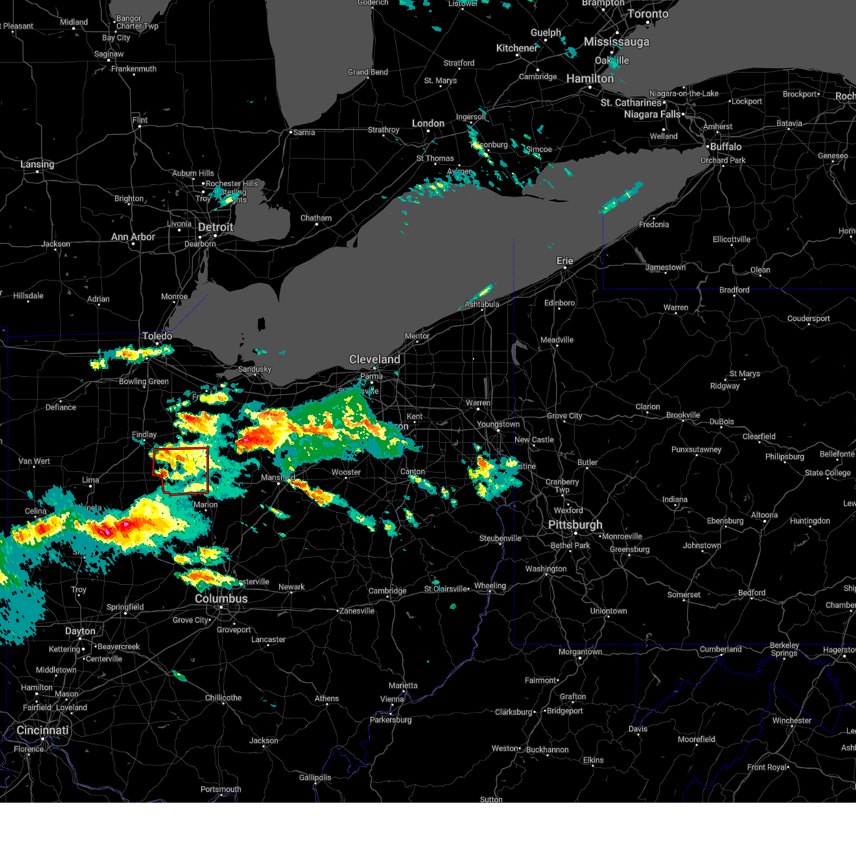
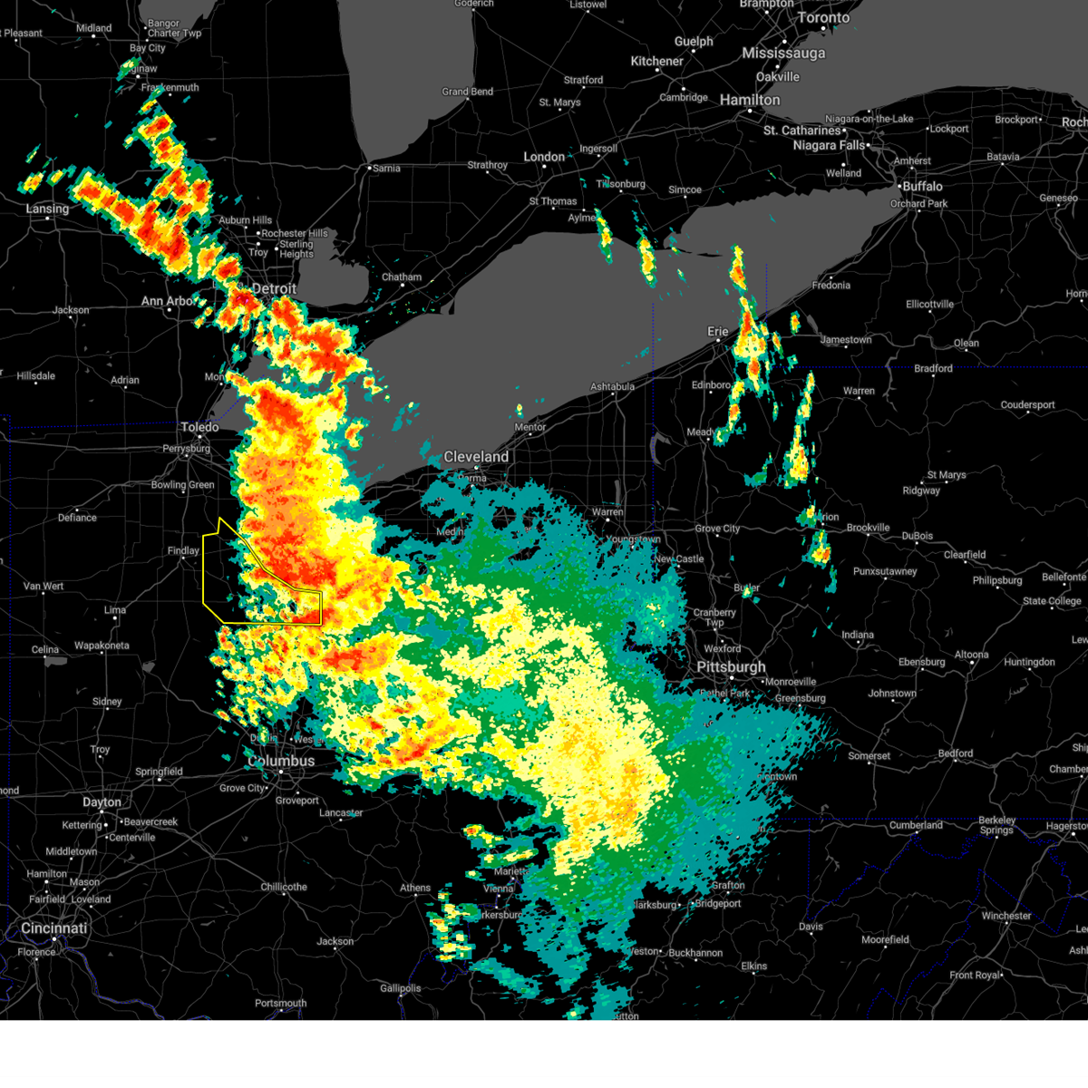
Hail Map for Vanlue, OH
The Vanlue, OH area has had 4 reports of on-the-ground hail by trained spotters, and has been under severe weather warnings 29 times during the past 12 months. Doppler radar has detected hail at or near Vanlue, OH on 37 occasions, including 1 occasion during the past year.
| Name: | Vanlue, OH |
| Where Located: | 74.3 miles NNW of Columbus, OH |
| Map: | Google Map for Vanlue, OH |
| Population: | 359 |
| Housing Units: | 152 |
| More Info: | Search Google for Vanlue, OH |
1
The Top Recent Hail Date for Vanlue, OH is Saturday, August 12, 2023 (9th out of 37)

Hail and Wind Damage Spotted near Vanlue, OH
| Date / Time | Report Details |
|---|---|
| 4/17/2024 3:14 PM EDT |
 the severe thunderstorm warning has been cancelled and is no longer in effect the severe thunderstorm warning has been cancelled and is no longer in effect
|
| 4/17/2024 2:59 PM EDT |
 At 259 pm edt, severe thunderstorms were located along a line extending from near perrysburg to near north baltimore to near arlington, moving northeast at 45 mph (radar indicated). Hazards include 60 mph wind gusts and penny size hail. Expect damage to trees and power lines. Locations impacted include, toledo, findlay, bowling green, fostoria, perrysburg, rossford, waterville, northwood, north baltimore, arlington, arcadia, rawson, vanlue, van buren, maumee, walbridge, pemberville, millbury, haskins, and luckey. At 259 pm edt, severe thunderstorms were located along a line extending from near perrysburg to near north baltimore to near arlington, moving northeast at 45 mph (radar indicated). Hazards include 60 mph wind gusts and penny size hail. Expect damage to trees and power lines. Locations impacted include, toledo, findlay, bowling green, fostoria, perrysburg, rossford, waterville, northwood, north baltimore, arlington, arcadia, rawson, vanlue, van buren, maumee, walbridge, pemberville, millbury, haskins, and luckey.
|
| 4/17/2024 2:27 PM EDT |
 Svrcle the national weather service in cleveland has issued a * severe thunderstorm warning for, wood county in northwestern ohio, hancock county in northwestern ohio, southwestern lucas county in northwestern ohio, * until 330 pm edt. * at 227 pm edt, severe thunderstorms were located along a line extending from near mcclure to near elida, moving northeast at 25 mph (radar indicated). Hazards include 60 mph wind gusts and penny size hail. expect damage to trees and power lines Svrcle the national weather service in cleveland has issued a * severe thunderstorm warning for, wood county in northwestern ohio, hancock county in northwestern ohio, southwestern lucas county in northwestern ohio, * until 330 pm edt. * at 227 pm edt, severe thunderstorms were located along a line extending from near mcclure to near elida, moving northeast at 25 mph (radar indicated). Hazards include 60 mph wind gusts and penny size hail. expect damage to trees and power lines
|
| 3/14/2024 8:10 PM EDT |
 the tornado warning has been cancelled and is no longer in effect the tornado warning has been cancelled and is no longer in effect
|
| 3/14/2024 7:58 PM EDT |
 The storm which prompted the warning has weakened below severe limits, and has exited the warned area. therefore, the warning will be allowed to expire. however, heavy rain is still possible with this thunderstorm. a tornado watch remains in effect until midnight edt for northwestern ohio. The storm which prompted the warning has weakened below severe limits, and has exited the warned area. therefore, the warning will be allowed to expire. however, heavy rain is still possible with this thunderstorm. a tornado watch remains in effect until midnight edt for northwestern ohio.
|
| 3/14/2024 7:56 PM EDT |
 the tornado warning has been cancelled and is no longer in effect the tornado warning has been cancelled and is no longer in effect
|
| 3/14/2024 7:56 PM EDT |
 At 756 pm edt, a severe thunderstorm capable of producing a tornado was located near forest, or 11 miles west of upper sandusky, moving east at 40 mph (weather spotters reported a funnel cloud). Hazards include tornado and quarter size hail. Flying debris will be dangerous to those caught without shelter. mobile homes will be damaged or destroyed. damage to roofs, windows, and vehicles will occur. tree damage is likely. this dangerous storm will be near, upper sandusky around 805 pm edt. Other locations impacted by this tornadic thunderstorm include mount blanchard, kirby, wharton, harpster, carey, and nevada. At 756 pm edt, a severe thunderstorm capable of producing a tornado was located near forest, or 11 miles west of upper sandusky, moving east at 40 mph (weather spotters reported a funnel cloud). Hazards include tornado and quarter size hail. Flying debris will be dangerous to those caught without shelter. mobile homes will be damaged or destroyed. damage to roofs, windows, and vehicles will occur. tree damage is likely. this dangerous storm will be near, upper sandusky around 805 pm edt. Other locations impacted by this tornadic thunderstorm include mount blanchard, kirby, wharton, harpster, carey, and nevada.
|
| 3/14/2024 7:46 PM EDT |
 Torcle the national weather service in cleveland has issued a * tornado warning for, northwestern marion county in north central ohio, wyandot county in northwestern ohio, southeastern hancock county in northwestern ohio, * until 830 pm edt. * at 746 pm edt, a severe thunderstorm capable of producing a tornado was located over arlington, or 10 miles south of findlay, moving east at 35 mph (radar indicated rotation). Hazards include tornado and quarter size hail. Flying debris will be dangerous to those caught without shelter. mobile homes will be damaged or destroyed. damage to roofs, windows, and vehicles will occur. tree damage is likely. this dangerous storm will be near, upper sandusky around 810 pm edt. sycamore around 820 pm edt. Other locations impacted by this tornadic thunderstorm include wharton, carey, mount blanchard, williamstown, kirby, harpster, and nevada. Torcle the national weather service in cleveland has issued a * tornado warning for, northwestern marion county in north central ohio, wyandot county in northwestern ohio, southeastern hancock county in northwestern ohio, * until 830 pm edt. * at 746 pm edt, a severe thunderstorm capable of producing a tornado was located over arlington, or 10 miles south of findlay, moving east at 35 mph (radar indicated rotation). Hazards include tornado and quarter size hail. Flying debris will be dangerous to those caught without shelter. mobile homes will be damaged or destroyed. damage to roofs, windows, and vehicles will occur. tree damage is likely. this dangerous storm will be near, upper sandusky around 810 pm edt. sycamore around 820 pm edt. Other locations impacted by this tornadic thunderstorm include wharton, carey, mount blanchard, williamstown, kirby, harpster, and nevada.
|
| 3/14/2024 7:40 PM EDT |
 At 739 pm edt, a severe thunderstorm was located near arlington, or 8 miles south of findlay, moving east at 60 mph (radar indicated). Hazards include 60 mph wind gusts and quarter size hail. Minor damage to vehicles is possible. expect damage to trees and power lines. Locations impacted include, findlay, arlington, vanlue, mount blanchard, jenera, and williamstown. At 739 pm edt, a severe thunderstorm was located near arlington, or 8 miles south of findlay, moving east at 60 mph (radar indicated). Hazards include 60 mph wind gusts and quarter size hail. Minor damage to vehicles is possible. expect damage to trees and power lines. Locations impacted include, findlay, arlington, vanlue, mount blanchard, jenera, and williamstown.
|
| 3/14/2024 7:19 PM EDT |
 Svrcle the national weather service in cleveland has issued a * severe thunderstorm warning for, southern hancock county in northwestern ohio, * until 800 pm edt. * at 719 pm edt, a severe thunderstorm was located over pandora, or near bluffton, moving east at 65 mph (radar indicated). Hazards include ping pong ball size hail and 60 mph wind gusts. People and animals outdoors will be injured. expect hail damage to roofs, siding, windows, and vehicles. Expect damage to trees and power lines. Svrcle the national weather service in cleveland has issued a * severe thunderstorm warning for, southern hancock county in northwestern ohio, * until 800 pm edt. * at 719 pm edt, a severe thunderstorm was located over pandora, or near bluffton, moving east at 65 mph (radar indicated). Hazards include ping pong ball size hail and 60 mph wind gusts. People and animals outdoors will be injured. expect hail damage to roofs, siding, windows, and vehicles. Expect damage to trees and power lines.
|
| 3/14/2024 7:15 PM EDT |
 The tornadic thunderstorm which prompted the warning has moved out of the warned area. therefore, the warning has been allowed to expire. a tornado watch remains in effect until midnight edt for northwestern ohio. The tornadic thunderstorm which prompted the warning has moved out of the warned area. therefore, the warning has been allowed to expire. a tornado watch remains in effect until midnight edt for northwestern ohio.
|
| 3/14/2024 7:03 PM EDT |
 At 703 pm edt, a confirmed tornado was located near vanlue, or 7 miles east of findlay, moving east at 45 mph (law enforcement confirmed tornado). Hazards include damaging tornado and quarter size hail. Flying debris will be dangerous to those caught without shelter. mobile homes will be damaged or destroyed. damage to roofs, windows, and vehicles will occur. tree damage is likely. This tornadic thunderstorm will remain over mainly rural areas of east central hancock county. At 703 pm edt, a confirmed tornado was located near vanlue, or 7 miles east of findlay, moving east at 45 mph (law enforcement confirmed tornado). Hazards include damaging tornado and quarter size hail. Flying debris will be dangerous to those caught without shelter. mobile homes will be damaged or destroyed. damage to roofs, windows, and vehicles will occur. tree damage is likely. This tornadic thunderstorm will remain over mainly rural areas of east central hancock county.
|
| 3/14/2024 6:55 PM EDT |
 At 654 pm edt, a severe thunderstorm capable of producing a tornado was located over findlay, moving east at 45 mph. at 653 pm, a trained spotter reported a funnel cloud just west of findlay (radar indicated rotation). Hazards include tornado and ping pong ball size hail. Flying debris will be dangerous to those caught without shelter. mobile homes will be damaged or destroyed. damage to roofs, windows, and vehicles will occur. tree damage is likely. This dangerous storm will be near, vanlue around 700 pm edt. At 654 pm edt, a severe thunderstorm capable of producing a tornado was located over findlay, moving east at 45 mph. at 653 pm, a trained spotter reported a funnel cloud just west of findlay (radar indicated rotation). Hazards include tornado and ping pong ball size hail. Flying debris will be dangerous to those caught without shelter. mobile homes will be damaged or destroyed. damage to roofs, windows, and vehicles will occur. tree damage is likely. This dangerous storm will be near, vanlue around 700 pm edt.
|
| 3/14/2024 6:45 PM EDT |
 Torcle the national weather service in cleveland has issued a * tornado warning for, central hancock county in northwestern ohio, * until 715 pm edt. * at 645 pm edt, a severe thunderstorm capable of producing a tornado was located near findlay, moving east at 40 mph (radar indicated rotation). Hazards include tornado and ping pong ball size hail. Flying debris will be dangerous to those caught without shelter. mobile homes will be damaged or destroyed. damage to roofs, windows, and vehicles will occur. tree damage is likely. this dangerous storm will be near, findlay around 650 pm edt. vanlue around 700 pm edt. Other locations impacted by this tornadic thunderstorm include benton ridge. Torcle the national weather service in cleveland has issued a * tornado warning for, central hancock county in northwestern ohio, * until 715 pm edt. * at 645 pm edt, a severe thunderstorm capable of producing a tornado was located near findlay, moving east at 40 mph (radar indicated rotation). Hazards include tornado and ping pong ball size hail. Flying debris will be dangerous to those caught without shelter. mobile homes will be damaged or destroyed. damage to roofs, windows, and vehicles will occur. tree damage is likely. this dangerous storm will be near, findlay around 650 pm edt. vanlue around 700 pm edt. Other locations impacted by this tornadic thunderstorm include benton ridge.
|
| 8/24/2023 2:27 AM EDT |
 The severe thunderstorm warning for marion, wyandot, morrow, southwestern crawford and hancock counties will expire at 230 am edt, the storms which prompted the warning have moved out of the area. therefore, the warning will be allowed to expire. however gusty winds and heavy rain are still possible with these thunderstorms. The severe thunderstorm warning for marion, wyandot, morrow, southwestern crawford and hancock counties will expire at 230 am edt, the storms which prompted the warning have moved out of the area. therefore, the warning will be allowed to expire. however gusty winds and heavy rain are still possible with these thunderstorms.
|
| 8/24/2023 1:50 AM EDT |
 At 150 am edt, severe thunderstorms were located along a line extending from near arcadia to near upper sandusky to 6 miles southwest of bucyrus, moving southwest at 40 mph (radar indicated). Hazards include 60 mph wind gusts. Expect damage to trees and power lines. locations impacted include, fostoria, bucyrus, upper sandusky, galion, crestline, forest, sycamore, arcadia, vanlue, new riegel, carey, benton, nevada, wharton, north robinson, harpster, kirby, bascom, oceola and sulpher springs. hail threat, radar indicated max hail size, <. 75 in wind threat, radar indicated max wind gust, 60 mph. At 150 am edt, severe thunderstorms were located along a line extending from near arcadia to near upper sandusky to 6 miles southwest of bucyrus, moving southwest at 40 mph (radar indicated). Hazards include 60 mph wind gusts. Expect damage to trees and power lines. locations impacted include, fostoria, bucyrus, upper sandusky, galion, crestline, forest, sycamore, arcadia, vanlue, new riegel, carey, benton, nevada, wharton, north robinson, harpster, kirby, bascom, oceola and sulpher springs. hail threat, radar indicated max hail size, <. 75 in wind threat, radar indicated max wind gust, 60 mph.
|
| 8/24/2023 1:49 AM EDT |
 At 149 am edt, severe thunderstorms were located along a line extending from 7 miles northeast of marion to near upper sandusky to near arcadia, moving southwest at 40 mph (radar indicated). Hazards include 60 mph wind gusts. expect damage to trees and power lines At 149 am edt, severe thunderstorms were located along a line extending from 7 miles northeast of marion to near upper sandusky to near arcadia, moving southwest at 40 mph (radar indicated). Hazards include 60 mph wind gusts. expect damage to trees and power lines
|
| 8/24/2023 1:24 AM EDT |
 At 124 am edt, severe thunderstorms were located along a line extending from near fostoria to near sycamore to near crestline, moving southwest at 25 mph (radar indicated). Hazards include 60 mph wind gusts. expect damage to trees and power lines At 124 am edt, severe thunderstorms were located along a line extending from near fostoria to near sycamore to near crestline, moving southwest at 25 mph (radar indicated). Hazards include 60 mph wind gusts. expect damage to trees and power lines
|
| 8/12/2023 2:21 PM EDT |
 At 220 pm edt, a severe thunderstorm was located over vanlue, or 9 miles southeast of findlay, moving east at 40 mph (radar indicated). Hazards include 60 mph wind gusts and quarter size hail. Minor damage to vehicles is possible. Expect damage to trees and power lines. At 220 pm edt, a severe thunderstorm was located over vanlue, or 9 miles southeast of findlay, moving east at 40 mph (radar indicated). Hazards include 60 mph wind gusts and quarter size hail. Minor damage to vehicles is possible. Expect damage to trees and power lines.
|
| 8/12/2023 1:07 PM EDT |
 The severe thunderstorm warning for central seneca, northern wyandot, northwestern crawford and southeastern hancock counties will expire at 115 pm edt, the storm which prompted the warning has moved out of hancock county. a severe thunderstorm warning remains in effect for portions of seneca, crawford and wyandot counties until 145 pm. a tornado watch remains in effect until 900 pm edt for north central and northwestern ohio. The severe thunderstorm warning for central seneca, northern wyandot, northwestern crawford and southeastern hancock counties will expire at 115 pm edt, the storm which prompted the warning has moved out of hancock county. a severe thunderstorm warning remains in effect for portions of seneca, crawford and wyandot counties until 145 pm. a tornado watch remains in effect until 900 pm edt for north central and northwestern ohio.
|
| 8/12/2023 12:38 PM EDT |
 At 1238 pm edt, a severe thunderstorm was located over vanlue, or 10 miles east of findlay, moving northeast at 35 mph (radar indicated). Hazards include ping pong ball size hail and 60 mph wind gusts. People and animals outdoors will be injured. expect hail damage to roofs, siding, windows, and vehicles. expect damage to trees and power lines. locations impacted include, tiffin, fostoria, bloomville, sycamore, vanlue, new riegel, carey, republic, wharton and bascom. hail threat, radar indicated max hail size, 1. 50 in wind threat, radar indicated max wind gust, 60 mph. At 1238 pm edt, a severe thunderstorm was located over vanlue, or 10 miles east of findlay, moving northeast at 35 mph (radar indicated). Hazards include ping pong ball size hail and 60 mph wind gusts. People and animals outdoors will be injured. expect hail damage to roofs, siding, windows, and vehicles. expect damage to trees and power lines. locations impacted include, tiffin, fostoria, bloomville, sycamore, vanlue, new riegel, carey, republic, wharton and bascom. hail threat, radar indicated max hail size, 1. 50 in wind threat, radar indicated max wind gust, 60 mph.
|
| 8/12/2023 12:29 PM EDT |
 At 1228 pm edt, a severe thunderstorm was located near vanlue, or 7 miles southeast of findlay, moving northeast at 35 mph (radar indicated). Hazards include 60 mph wind gusts and quarter size hail. Minor damage to vehicles is possible. Expect damage to trees and power lines. At 1228 pm edt, a severe thunderstorm was located near vanlue, or 7 miles southeast of findlay, moving northeast at 35 mph (radar indicated). Hazards include 60 mph wind gusts and quarter size hail. Minor damage to vehicles is possible. Expect damage to trees and power lines.
|
| 8/12/2023 12:18 PM EDT |
 At 1217 pm edt, a severe thunderstorm was located near arlington, or 8 miles south of findlay, moving northeast at 35 mph (radar indicated). Hazards include 60 mph wind gusts and quarter size hail. Minor damage to vehicles is possible. expect damage to trees and power lines. locations impacted include, findlay, fostoria, arlington, arcadia, rawson, vanlue, mount blanchard, benton ridge, jenera and williamstown. hail threat, radar indicated max hail size, 1. 00 in wind threat, radar indicated max wind gust, 60 mph. At 1217 pm edt, a severe thunderstorm was located near arlington, or 8 miles south of findlay, moving northeast at 35 mph (radar indicated). Hazards include 60 mph wind gusts and quarter size hail. Minor damage to vehicles is possible. expect damage to trees and power lines. locations impacted include, findlay, fostoria, arlington, arcadia, rawson, vanlue, mount blanchard, benton ridge, jenera and williamstown. hail threat, radar indicated max hail size, 1. 00 in wind threat, radar indicated max wind gust, 60 mph.
|
| 8/12/2023 11:57 AM EDT |
 At 1156 am edt, a severe thunderstorm was located near bluffton, moving east at 50 mph (radar indicated). Hazards include 60 mph wind gusts and quarter size hail. Minor damage to vehicles is possible. Expect damage to trees and power lines. At 1156 am edt, a severe thunderstorm was located near bluffton, moving east at 50 mph (radar indicated). Hazards include 60 mph wind gusts and quarter size hail. Minor damage to vehicles is possible. Expect damage to trees and power lines.
|
| 7/29/2023 4:13 AM EDT |
 At 412 am edt, severe thunderstorms were located along a line extending from near findlay to waynesfield, moving east at 60 mph (radar indicated). Hazards include 60 mph wind gusts. expect damage to trees and power lines At 412 am edt, severe thunderstorms were located along a line extending from near findlay to waynesfield, moving east at 60 mph (radar indicated). Hazards include 60 mph wind gusts. expect damage to trees and power lines
|
| 7/20/2023 7:11 PM EDT |
 At 710 pm edt, severe thunderstorms were located along a line extending from 8 miles northeast of bloomville to forest, moving east at 40 mph (radar indicated). Hazards include 60 mph wind gusts and quarter size hail. Minor damage to vehicles is possible. Expect damage to trees and power lines. At 710 pm edt, severe thunderstorms were located along a line extending from 8 miles northeast of bloomville to forest, moving east at 40 mph (radar indicated). Hazards include 60 mph wind gusts and quarter size hail. Minor damage to vehicles is possible. Expect damage to trees and power lines.
|
| 7/20/2023 7:03 PM EDT |
 At 702 pm edt, a severe thunderstorm was located near arlington, or 11 miles south of findlay, moving northeast at 50 mph (radar indicated). Hazards include 60 mph wind gusts and quarter size hail. Minor damage to vehicles is possible. expect damage to trees and power lines. locations impacted include, bluffton, arlington, vanlue, mount blanchard, jenera and williamstown. hail threat, radar indicated max hail size, 1. 00 in wind threat, radar indicated max wind gust, 60 mph. At 702 pm edt, a severe thunderstorm was located near arlington, or 11 miles south of findlay, moving northeast at 50 mph (radar indicated). Hazards include 60 mph wind gusts and quarter size hail. Minor damage to vehicles is possible. expect damage to trees and power lines. locations impacted include, bluffton, arlington, vanlue, mount blanchard, jenera and williamstown. hail threat, radar indicated max hail size, 1. 00 in wind threat, radar indicated max wind gust, 60 mph.
|
| 7/20/2023 6:47 PM EDT |
 At 647 pm edt, a severe thunderstorm was located over ada, moving northeast at 35 mph (radar indicated). Hazards include golf ball size hail and 70 mph wind gusts. People and animals outdoors will be injured. expect hail damage to roofs, siding, windows, and vehicles. expect considerable tree damage. wind damage is also likely to mobile homes, roofs, and outbuildings. locations impacted include, findlay, bluffton, arlington, rawson, vanlue, mount blanchard, benton ridge, jenera, mount cory and williamstown. thunderstorm damage threat, considerable hail threat, radar indicated max hail size, 1. 75 in wind threat, radar indicated max wind gust, 70 mph. At 647 pm edt, a severe thunderstorm was located over ada, moving northeast at 35 mph (radar indicated). Hazards include golf ball size hail and 70 mph wind gusts. People and animals outdoors will be injured. expect hail damage to roofs, siding, windows, and vehicles. expect considerable tree damage. wind damage is also likely to mobile homes, roofs, and outbuildings. locations impacted include, findlay, bluffton, arlington, rawson, vanlue, mount blanchard, benton ridge, jenera, mount cory and williamstown. thunderstorm damage threat, considerable hail threat, radar indicated max hail size, 1. 75 in wind threat, radar indicated max wind gust, 70 mph.
|
| 7/20/2023 6:36 PM EDT |
 At 636 pm edt, a severe thunderstorm was located near alger, or near ada, moving northeast at 35 mph (radar indicated). Hazards include golf ball size hail and 60 mph wind gusts. People and animals outdoors will be injured. expect hail damage to roofs, siding, windows, and vehicles. Expect damage to trees and power lines. At 636 pm edt, a severe thunderstorm was located near alger, or near ada, moving northeast at 35 mph (radar indicated). Hazards include golf ball size hail and 60 mph wind gusts. People and animals outdoors will be injured. expect hail damage to roofs, siding, windows, and vehicles. Expect damage to trees and power lines.
|
| 4/1/2023 11:42 AM EDT |
 The severe thunderstorm warning for ottawa, seneca, wyandot, sandusky, crawford, wood, eastern hancock and lucas counties will expire at 1145 am edt, the storms which prompted the warning have moved out of the area. therefore, the warning will be allowed to expire. even behind the thunderstorms, gusty winds in excess of 50 mph remain possible early this afternoon. The severe thunderstorm warning for ottawa, seneca, wyandot, sandusky, crawford, wood, eastern hancock and lucas counties will expire at 1145 am edt, the storms which prompted the warning have moved out of the area. therefore, the warning will be allowed to expire. even behind the thunderstorms, gusty winds in excess of 50 mph remain possible early this afternoon.
|
| 4/1/2023 11:25 AM EDT |
 At 1124 am edt, severe thunderstorms were located along a line extending from 7 miles north of oak harbor to near bloomville to near morral, moving east at 70 mph. wind gusts in excess of 50 mph are continuing even after the thunderstorms exit (radar indicated). Hazards include 60 mph wind gusts and penny size hail. Expect damage to trees and power lines. locations impacted include, toledo, findlay, bowling green, tiffin, fremont, fostoria, bucyrus, upper sandusky, port clinton, kelleys island, put-in-bay, perrysburg, oregon, sylvania, galion, bellevue, clyde, rossford, waterville and northwood. hail threat, radar indicated max hail size, 0. 75 in wind threat, radar indicated max wind gust, 60 mph. At 1124 am edt, severe thunderstorms were located along a line extending from 7 miles north of oak harbor to near bloomville to near morral, moving east at 70 mph. wind gusts in excess of 50 mph are continuing even after the thunderstorms exit (radar indicated). Hazards include 60 mph wind gusts and penny size hail. Expect damage to trees and power lines. locations impacted include, toledo, findlay, bowling green, tiffin, fremont, fostoria, bucyrus, upper sandusky, port clinton, kelleys island, put-in-bay, perrysburg, oregon, sylvania, galion, bellevue, clyde, rossford, waterville and northwood. hail threat, radar indicated max hail size, 0. 75 in wind threat, radar indicated max wind gust, 60 mph.
|
| 4/1/2023 11:00 AM EDT |
 At 1059 am edt, severe thunderstorms were located along a line extending from lambertville to 6 miles northeast of forest, moving east at 65 mph. toledo express airport and allen county airport gusted to 56 mph with these storms (radar indicated). Hazards include 60 mph wind gusts. expect damage to trees and power lines At 1059 am edt, severe thunderstorms were located along a line extending from lambertville to 6 miles northeast of forest, moving east at 65 mph. toledo express airport and allen county airport gusted to 56 mph with these storms (radar indicated). Hazards include 60 mph wind gusts. expect damage to trees and power lines
|
| 2/27/2023 4:16 PM EST |
 At 414 pm est, severe thunderstorms were located along a line extending from near bowling green to near findlay to near arlington, moving east at 50 mph (radar indicated). Hazards include 60 mph wind gusts. Expect damage to trees and power lines. locations impacted include, findlay, tiffin, fostoria, upper sandusky, bluffton, north baltimore, mccomb, forest, arlington, arcadia, rawson, vanlue, van buren, new riegel, carey, bloomdale, mount blanchard, wharton, benton ridge and jenera. hail threat, radar indicated max hail size, <. 75 in wind threat, radar indicated max wind gust, 60 mph. At 414 pm est, severe thunderstorms were located along a line extending from near bowling green to near findlay to near arlington, moving east at 50 mph (radar indicated). Hazards include 60 mph wind gusts. Expect damage to trees and power lines. locations impacted include, findlay, tiffin, fostoria, upper sandusky, bluffton, north baltimore, mccomb, forest, arlington, arcadia, rawson, vanlue, van buren, new riegel, carey, bloomdale, mount blanchard, wharton, benton ridge and jenera. hail threat, radar indicated max hail size, <. 75 in wind threat, radar indicated max wind gust, 60 mph.
|
| 2/27/2023 3:55 PM EST |
 At 354 pm est, severe thunderstorms were located along a line extending from near deshler to near ottawa to near lima, moving east at 50 mph (radar indicated). Hazards include 60 mph wind gusts. expect damage to trees and power lines At 354 pm est, severe thunderstorms were located along a line extending from near deshler to near ottawa to near lima, moving east at 50 mph (radar indicated). Hazards include 60 mph wind gusts. expect damage to trees and power lines
|
| 1/19/2023 4:35 PM EST |
 At 435 pm est, a severe thunderstorm was located over arlington, or 10 miles south of findlay, moving northeast at 40 mph (radar indicated). Hazards include 60 mph wind gusts. Expect damage to trees and power lines. locations impacted include, arlington, vanlue, new riegel, carey, mount blanchard, jenera and williamstown. hail threat, radar indicated max hail size, <. 75 in wind threat, radar indicated max wind gust, 60 mph. At 435 pm est, a severe thunderstorm was located over arlington, or 10 miles south of findlay, moving northeast at 40 mph (radar indicated). Hazards include 60 mph wind gusts. Expect damage to trees and power lines. locations impacted include, arlington, vanlue, new riegel, carey, mount blanchard, jenera and williamstown. hail threat, radar indicated max hail size, <. 75 in wind threat, radar indicated max wind gust, 60 mph.
|
| 1/19/2023 4:21 PM EST |
 At 421 pm est, a severe thunderstorm was located over ada, moving northeast at 35 mph (radar indicated). Hazards include 60 mph wind gusts and quarter size hail. Minor damage to vehicles is possible. Expect damage to trees and power lines. At 421 pm est, a severe thunderstorm was located over ada, moving northeast at 35 mph (radar indicated). Hazards include 60 mph wind gusts and quarter size hail. Minor damage to vehicles is possible. Expect damage to trees and power lines.
|
| 8/29/2022 6:52 PM EDT |
 The severe thunderstorm warning for hancock county will expire at 700 pm edt, the storms which prompted the warning are moving out out of the area. therefore, the warning will be allowed to expire. gusty winds remain possible with these storms until they exit the area through 700 pm. a severe thunderstorm watch remains in effect until 1000 pm edt for northwestern ohio. The severe thunderstorm warning for hancock county will expire at 700 pm edt, the storms which prompted the warning are moving out out of the area. therefore, the warning will be allowed to expire. gusty winds remain possible with these storms until they exit the area through 700 pm. a severe thunderstorm watch remains in effect until 1000 pm edt for northwestern ohio.
|
| 8/29/2022 6:09 PM EDT |
 At 608 pm edt, severe thunderstorms were located along a line extending from near deshler to 6 miles south of columbus grove, moving east at 45 mph (emergency management. multiple reports of tree damage have been receieved from this line of storms in henry and van wert counties). Hazards include 60 mph wind gusts. expect damage to trees and power lines At 608 pm edt, severe thunderstorms were located along a line extending from near deshler to 6 miles south of columbus grove, moving east at 45 mph (emergency management. multiple reports of tree damage have been receieved from this line of storms in henry and van wert counties). Hazards include 60 mph wind gusts. expect damage to trees and power lines
|
| 7/23/2022 10:48 AM EDT |
 At 1048 am edt, severe thunderstorms were located along a line extending from 6 miles north of upper sandusky to near marseilles, moving east at 45 mph (radar indicated). Hazards include 60 mph wind gusts and penny size hail. Expect damage to trees and power lines. locations impacted include, upper sandusky, forest, sycamore, vanlue, marseilles, carey, wharton and kirby. hail threat, radar indicated max hail size, 0. 75 in wind threat, radar indicated max wind gust, 60 mph. At 1048 am edt, severe thunderstorms were located along a line extending from 6 miles north of upper sandusky to near marseilles, moving east at 45 mph (radar indicated). Hazards include 60 mph wind gusts and penny size hail. Expect damage to trees and power lines. locations impacted include, upper sandusky, forest, sycamore, vanlue, marseilles, carey, wharton and kirby. hail threat, radar indicated max hail size, 0. 75 in wind threat, radar indicated max wind gust, 60 mph.
|
| 7/23/2022 10:25 AM EDT |
 At 1024 am edt, severe thunderstorms were located along a line extending from near rawson to near ada, moving east at 40 mph. at 1022 am, public reports estimated 60 mph winds just east of bluffton (public). Hazards include 60 mph wind gusts and penny size hail. expect damage to trees and power lines At 1024 am edt, severe thunderstorms were located along a line extending from near rawson to near ada, moving east at 40 mph. at 1022 am, public reports estimated 60 mph winds just east of bluffton (public). Hazards include 60 mph wind gusts and penny size hail. expect damage to trees and power lines
|
| 6/13/2022 11:01 PM EDT |
 At 1100 pm edt, severe thunderstorms were located along a line extending from near new washington to 7 miles east of upper sandusky to marseilles, moving southeast at 65 mph (trained weather spotters). Hazards include 70 mph wind gusts and quarter size hail. Minor damage to vehicles is possible. expect considerable tree damage. wind damage is also likely to mobile homes, roofs, and outbuildings. locations impacted include, tiffin, upper sandusky, forest, arlington, bloomville, sycamore, vanlue, new riegel, carey, attica, nevada, mount blanchard, wharton, jenera, harpster, kirby and williamstown. thunderstorm damage threat, considerable hail threat, radar indicated max hail size, 1. 00 in wind threat, radar indicated max wind gust, 70 mph. At 1100 pm edt, severe thunderstorms were located along a line extending from near new washington to 7 miles east of upper sandusky to marseilles, moving southeast at 65 mph (trained weather spotters). Hazards include 70 mph wind gusts and quarter size hail. Minor damage to vehicles is possible. expect considerable tree damage. wind damage is also likely to mobile homes, roofs, and outbuildings. locations impacted include, tiffin, upper sandusky, forest, arlington, bloomville, sycamore, vanlue, new riegel, carey, attica, nevada, mount blanchard, wharton, jenera, harpster, kirby and williamstown. thunderstorm damage threat, considerable hail threat, radar indicated max hail size, 1. 00 in wind threat, radar indicated max wind gust, 70 mph.
|
| 6/13/2022 10:47 PM EDT |
 At 1046 pm edt, severe thunderstorms were located along a line extending from near tiffin to vanlue to near arlington, moving southeast at 70 mph (radar indicated and spotter confirmed). Hazards include 70 mph wind gusts and half dollar size hail. People and animals outdoors will be injured. expect hail damage to roofs, siding, windows, and vehicles. expect considerable tree damage. wind damage is also likely to mobile homes, roofs, and outbuildings. locations impacted include, findlay, tiffin, fostoria, upper sandusky, bluffton, forest, arlington, bloomville, sycamore, arcadia, rawson, vanlue, new riegel, carey, attica, nevada, bloomdale, mount blanchard, wharton and benton ridge. thunderstorm damage threat, considerable hail threat, radar indicated max hail size, 1. 25 in wind threat, radar indicated max wind gust, 70 mph. At 1046 pm edt, severe thunderstorms were located along a line extending from near tiffin to vanlue to near arlington, moving southeast at 70 mph (radar indicated and spotter confirmed). Hazards include 70 mph wind gusts and half dollar size hail. People and animals outdoors will be injured. expect hail damage to roofs, siding, windows, and vehicles. expect considerable tree damage. wind damage is also likely to mobile homes, roofs, and outbuildings. locations impacted include, findlay, tiffin, fostoria, upper sandusky, bluffton, forest, arlington, bloomville, sycamore, arcadia, rawson, vanlue, new riegel, carey, attica, nevada, bloomdale, mount blanchard, wharton and benton ridge. thunderstorm damage threat, considerable hail threat, radar indicated max hail size, 1. 25 in wind threat, radar indicated max wind gust, 70 mph.
|
| 6/13/2022 10:19 PM EDT |
 At 1019 pm edt, a severe thunderstorm was located near mccomb, or 11 miles northwest of findlay, moving southeast at 60 mph (radar indicated). Hazards include 70 mph wind gusts and quarter size hail. Minor damage to vehicles is possible. expect considerable tree damage. Wind damage is also likely to mobile homes, roofs, and outbuildings. At 1019 pm edt, a severe thunderstorm was located near mccomb, or 11 miles northwest of findlay, moving southeast at 60 mph (radar indicated). Hazards include 70 mph wind gusts and quarter size hail. Minor damage to vehicles is possible. expect considerable tree damage. Wind damage is also likely to mobile homes, roofs, and outbuildings.
|
| 6/1/2022 7:28 PM EDT |
 At 728 pm edt, a severe thunderstorm was located near findlay, moving east at 40 mph (radar indicated). Hazards include 70 mph wind gusts and ping pong ball size hail. People and animals outdoors will be injured. expect hail damage to roofs, siding, windows, and vehicles. expect considerable tree damage. Wind damage is also likely to mobile homes, roofs, and outbuildings. At 728 pm edt, a severe thunderstorm was located near findlay, moving east at 40 mph (radar indicated). Hazards include 70 mph wind gusts and ping pong ball size hail. People and animals outdoors will be injured. expect hail damage to roofs, siding, windows, and vehicles. expect considerable tree damage. Wind damage is also likely to mobile homes, roofs, and outbuildings.
|
| 5/21/2022 4:54 PM EDT |
 At 454 pm edt, a severe thunderstorm was located near tiffin, moving east at 25 mph (radar indicated). Hazards include 60 mph wind gusts and quarter size hail. Minor damage to vehicles is possible. expect damage to trees and power lines. locations impacted include, tiffin, fostoria, forest, vanlue, new riegel, carey, mount blanchard, wharton and bascom. hail threat, radar indicated max hail size, 1. 00 in wind threat, radar indicated max wind gust, 60 mph. At 454 pm edt, a severe thunderstorm was located near tiffin, moving east at 25 mph (radar indicated). Hazards include 60 mph wind gusts and quarter size hail. Minor damage to vehicles is possible. expect damage to trees and power lines. locations impacted include, tiffin, fostoria, forest, vanlue, new riegel, carey, mount blanchard, wharton and bascom. hail threat, radar indicated max hail size, 1. 00 in wind threat, radar indicated max wind gust, 60 mph.
|
| 5/21/2022 4:51 PM EDT | Quarter sized hail reported 0.5 miles NE of Vanlue, OH |
| 5/21/2022 4:39 PM EDT |
 At 439 pm edt, a severe thunderstorm was located over new riegel, or 8 miles southwest of tiffin, moving east at 25 mph (radar indicated). Hazards include 60 mph wind gusts and quarter size hail. Minor damage to vehicles is possible. expect damage to trees and power lines. locations impacted include, findlay, tiffin, fostoria, forest, arlington, arcadia, rawson, vanlue, new riegel, carey, mount blanchard, wharton, jenera, bascom and williamstown. hail threat, radar indicated max hail size, 1. 00 in wind threat, radar indicated max wind gust, 60 mph. At 439 pm edt, a severe thunderstorm was located over new riegel, or 8 miles southwest of tiffin, moving east at 25 mph (radar indicated). Hazards include 60 mph wind gusts and quarter size hail. Minor damage to vehicles is possible. expect damage to trees and power lines. locations impacted include, findlay, tiffin, fostoria, forest, arlington, arcadia, rawson, vanlue, new riegel, carey, mount blanchard, wharton, jenera, bascom and williamstown. hail threat, radar indicated max hail size, 1. 00 in wind threat, radar indicated max wind gust, 60 mph.
|
| 5/21/2022 4:24 PM EDT |
 At 424 pm edt, a severe thunderstorm was located near vanlue, or 11 miles south of fostoria, moving east at 25 mph (radar indicated). Hazards include ping pong ball size hail and 60 mph wind gusts. People and animals outdoors will be injured. expect hail damage to roofs, siding, windows, and vehicles. expect damage to trees and power lines. locations impacted include, findlay, tiffin, fostoria, bluffton, forest, arlington, arcadia, rawson, vanlue, new riegel, carey, mount blanchard, wharton, benton ridge, jenera, mount cory, bascom and williamstown. hail threat, radar indicated max hail size, 1. 50 in wind threat, radar indicated max wind gust, 60 mph. At 424 pm edt, a severe thunderstorm was located near vanlue, or 11 miles south of fostoria, moving east at 25 mph (radar indicated). Hazards include ping pong ball size hail and 60 mph wind gusts. People and animals outdoors will be injured. expect hail damage to roofs, siding, windows, and vehicles. expect damage to trees and power lines. locations impacted include, findlay, tiffin, fostoria, bluffton, forest, arlington, arcadia, rawson, vanlue, new riegel, carey, mount blanchard, wharton, benton ridge, jenera, mount cory, bascom and williamstown. hail threat, radar indicated max hail size, 1. 50 in wind threat, radar indicated max wind gust, 60 mph.
|
| 5/21/2022 4:18 PM EDT |
 At 417 pm edt, a severe thunderstorm was located over vanlue, or 10 miles southeast of findlay, moving east at 25 mph (radar indicated). Hazards include 60 mph wind gusts and quarter size hail. Minor damage to vehicles is possible. Expect damage to trees and power lines. At 417 pm edt, a severe thunderstorm was located over vanlue, or 10 miles southeast of findlay, moving east at 25 mph (radar indicated). Hazards include 60 mph wind gusts and quarter size hail. Minor damage to vehicles is possible. Expect damage to trees and power lines.
|
| 5/3/2022 5:52 PM EDT |
 At 552 pm edt, a severe thunderstorm capable of producing a tornado was located over arcadia, or 7 miles east of findlay, moving northeast at 50 mph (radar indicated rotation). Hazards include tornado and quarter size hail. Flying debris will be dangerous to those caught without shelter. mobile homes will be damaged or destroyed. damage to roofs, windows, and vehicles will occur. Tree damage is likely. At 552 pm edt, a severe thunderstorm capable of producing a tornado was located over arcadia, or 7 miles east of findlay, moving northeast at 50 mph (radar indicated rotation). Hazards include tornado and quarter size hail. Flying debris will be dangerous to those caught without shelter. mobile homes will be damaged or destroyed. damage to roofs, windows, and vehicles will occur. Tree damage is likely.
|
| 5/3/2022 5:50 PM EDT |
 At 549 pm edt, a severe thunderstorm capable of producing a tornado was located near findlay, moving northeast at 50 mph (radar indicated rotation). Hazards include tornado and quarter size hail. Flying debris will be dangerous to those caught without shelter. mobile homes will be damaged or destroyed. damage to roofs, windows, and vehicles will occur. tree damage is likely. Locations impacted include, findlay, arcadia and vanlue. At 549 pm edt, a severe thunderstorm capable of producing a tornado was located near findlay, moving northeast at 50 mph (radar indicated rotation). Hazards include tornado and quarter size hail. Flying debris will be dangerous to those caught without shelter. mobile homes will be damaged or destroyed. damage to roofs, windows, and vehicles will occur. tree damage is likely. Locations impacted include, findlay, arcadia and vanlue.
|
| 5/3/2022 5:48 PM EDT |
 At 547 pm edt, severe thunderstorms were located along a line extending from near rawson to near arlington to near ada, moving east at 50 mph (radar indicated). Hazards include 70 mph wind gusts and quarter size hail. Minor damage to vehicles is possible. expect considerable tree damage. Wind damage is also likely to mobile homes, roofs, and outbuildings. At 547 pm edt, severe thunderstorms were located along a line extending from near rawson to near arlington to near ada, moving east at 50 mph (radar indicated). Hazards include 70 mph wind gusts and quarter size hail. Minor damage to vehicles is possible. expect considerable tree damage. Wind damage is also likely to mobile homes, roofs, and outbuildings.
|
| 5/3/2022 5:45 PM EDT |
 At 544 pm edt, severe thunderstorms were located along a line extending from near findlay to near arlington to near dunkirk, moving east at 60 mph (radar indicated). Hazards include 70 mph wind gusts and quarter size hail. Minor damage to vehicles is possible. expect considerable tree damage. wind damage is also likely to mobile homes, roofs, and outbuildings. locations impacted include, findlay, fostoria, bluffton, mccomb, arlington, arcadia, rawson, vanlue, van buren, mount blanchard, benton ridge, jenera, mount cory and williamstown. thunderstorm damage threat, considerable hail threat, radar indicated max hail size, 1. 00 in wind threat, radar indicated max wind gust, 70 mph. At 544 pm edt, severe thunderstorms were located along a line extending from near findlay to near arlington to near dunkirk, moving east at 60 mph (radar indicated). Hazards include 70 mph wind gusts and quarter size hail. Minor damage to vehicles is possible. expect considerable tree damage. wind damage is also likely to mobile homes, roofs, and outbuildings. locations impacted include, findlay, fostoria, bluffton, mccomb, arlington, arcadia, rawson, vanlue, van buren, mount blanchard, benton ridge, jenera, mount cory and williamstown. thunderstorm damage threat, considerable hail threat, radar indicated max hail size, 1. 00 in wind threat, radar indicated max wind gust, 70 mph.
|
| 5/3/2022 5:39 PM EDT |
 At 538 pm edt, a severe thunderstorm capable of producing a tornado was located near rawson, or near findlay, moving northeast at 45 mph (radar indicated rotation). Hazards include tornado and quarter size hail. Flying debris will be dangerous to those caught without shelter. mobile homes will be damaged or destroyed. damage to roofs, windows, and vehicles will occur. tree damage is likely. Locations impacted include, findlay, bluffton, north baltimore, mccomb, arcadia, rawson, vanlue, van buren, benton ridge, jenera, mount cory and bairdstown. At 538 pm edt, a severe thunderstorm capable of producing a tornado was located near rawson, or near findlay, moving northeast at 45 mph (radar indicated rotation). Hazards include tornado and quarter size hail. Flying debris will be dangerous to those caught without shelter. mobile homes will be damaged or destroyed. damage to roofs, windows, and vehicles will occur. tree damage is likely. Locations impacted include, findlay, bluffton, north baltimore, mccomb, arcadia, rawson, vanlue, van buren, benton ridge, jenera, mount cory and bairdstown.
|
| 5/3/2022 5:22 PM EDT |
 At 521 pm edt, a severe thunderstorm capable of producing a tornado was located over pandora, or near bluffton, moving northeast at 50 mph (radar indicated rotation). Hazards include tornado. Flying debris will be dangerous to those caught without shelter. mobile homes will be damaged or destroyed. damage to roofs, windows, and vehicles will occur. tree damage is likely. this dangerous storm will be near, rawson around 535 pm edt. findlay and van buren around 545 pm edt. arcadia around 555 pm edt. Other locations impacted by this tornadic thunderstorm include jenera, benton ridge, mount cory, bairdstown and mount blanchard. At 521 pm edt, a severe thunderstorm capable of producing a tornado was located over pandora, or near bluffton, moving northeast at 50 mph (radar indicated rotation). Hazards include tornado. Flying debris will be dangerous to those caught without shelter. mobile homes will be damaged or destroyed. damage to roofs, windows, and vehicles will occur. tree damage is likely. this dangerous storm will be near, rawson around 535 pm edt. findlay and van buren around 545 pm edt. arcadia around 555 pm edt. Other locations impacted by this tornadic thunderstorm include jenera, benton ridge, mount cory, bairdstown and mount blanchard.
|
| 5/3/2022 5:12 PM EDT |
 At 512 pm edt, severe thunderstorms were located along a line extending from near ottoville to 6 miles southwest of columbus grove to near elida, moving northeast at 45 mph (radar indicated). Hazards include 70 mph wind gusts and quarter size hail. Minor damage to vehicles is possible. expect considerable tree damage. Wind damage is also likely to mobile homes, roofs, and outbuildings. At 512 pm edt, severe thunderstorms were located along a line extending from near ottoville to 6 miles southwest of columbus grove to near elida, moving northeast at 45 mph (radar indicated). Hazards include 70 mph wind gusts and quarter size hail. Minor damage to vehicles is possible. expect considerable tree damage. Wind damage is also likely to mobile homes, roofs, and outbuildings.
|
| 8/29/2021 7:33 PM EDT |
 At 732 pm edt, a severe thunderstorm was located near vanlue, or 7 miles southeast of findlay, moving northeast at 35 mph (radar indicated). Hazards include 60 mph wind gusts and penny size hail. Expect damage to trees and power lines. locations impacted include, findlay, fostoria, bluffton, forest, arlington, arcadia, rawson, vanlue, mount blanchard, wharton, jenera, mount cory and williamstown. hail threat, observed max hail size, 0. 75 in wind threat, radar indicated max wind gust, 60 mph. At 732 pm edt, a severe thunderstorm was located near vanlue, or 7 miles southeast of findlay, moving northeast at 35 mph (radar indicated). Hazards include 60 mph wind gusts and penny size hail. Expect damage to trees and power lines. locations impacted include, findlay, fostoria, bluffton, forest, arlington, arcadia, rawson, vanlue, mount blanchard, wharton, jenera, mount cory and williamstown. hail threat, observed max hail size, 0. 75 in wind threat, radar indicated max wind gust, 60 mph.
|
| 8/29/2021 7:15 PM EDT |
 At 714 pm edt, a severe thunderstorm was located over arlington, or 9 miles south of findlay, moving northeast at 35 mph (radar indicated). Hazards include 60 mph wind gusts and penny size hail. expect damage to trees and power lines At 714 pm edt, a severe thunderstorm was located over arlington, or 9 miles south of findlay, moving northeast at 35 mph (radar indicated). Hazards include 60 mph wind gusts and penny size hail. expect damage to trees and power lines
|
| 8/11/2021 3:35 PM EDT |
 At 334 pm edt, severe thunderstorms were located along a line extending from north baltimore to near findlay to near chippewa park, moving east at 45 mph (radar indicated). Hazards include 70 mph wind gusts. Expect considerable tree damage. Damage is likely to mobile homes, roofs, and outbuildings. At 334 pm edt, severe thunderstorms were located along a line extending from north baltimore to near findlay to near chippewa park, moving east at 45 mph (radar indicated). Hazards include 70 mph wind gusts. Expect considerable tree damage. Damage is likely to mobile homes, roofs, and outbuildings.
|
| 8/11/2021 3:18 PM EDT |
 At 318 pm edt, severe thunderstorms were located along a line extending from near holland to near mccomb to near wapakoneta, moving east at 55 mph (radar indicated). Hazards include 60 mph wind gusts. Expect damage to trees and power lines. locations impacted include, toledo, findlay, bowling green, fostoria, bluffton, swanton, perrysburg, oregon, sylvania, rossford, waterville, northwood, whitehouse, north baltimore, holland, mccomb, weston, arlington, arcadia and rawson. hail threat, radar indicated max hail size, <. 75 in wind threat, radar indicated max wind gust, 60 mph. At 318 pm edt, severe thunderstorms were located along a line extending from near holland to near mccomb to near wapakoneta, moving east at 55 mph (radar indicated). Hazards include 60 mph wind gusts. Expect damage to trees and power lines. locations impacted include, toledo, findlay, bowling green, fostoria, bluffton, swanton, perrysburg, oregon, sylvania, rossford, waterville, northwood, whitehouse, north baltimore, holland, mccomb, weston, arlington, arcadia and rawson. hail threat, radar indicated max hail size, <. 75 in wind threat, radar indicated max wind gust, 60 mph.
|
| 8/11/2021 2:48 PM EDT |
 At 247 pm edt, severe thunderstorms were located along a line extending from fayette to 6 miles southeast of defiance to near celina, moving east at 55 mph (radar indicated). Hazards include 60 mph wind gusts and penny size hail. expect damage to trees and power lines At 247 pm edt, severe thunderstorms were located along a line extending from fayette to 6 miles southeast of defiance to near celina, moving east at 55 mph (radar indicated). Hazards include 60 mph wind gusts and penny size hail. expect damage to trees and power lines
|
| 8/11/2021 8:29 AM EDT |
 At 828 am edt, a severe thunderstorm was located near findlay, moving east at 35 mph (radar indicated). Hazards include 60 mph wind gusts. expect damage to trees and power lines At 828 am edt, a severe thunderstorm was located near findlay, moving east at 35 mph (radar indicated). Hazards include 60 mph wind gusts. expect damage to trees and power lines
|
| 7/7/2021 2:57 PM EDT |
 At 257 pm edt, a severe thunderstorm was located near vanlue, or 9 miles northwest of upper sandusky, moving east at 20 mph (radar indicated). Hazards include 60 mph wind gusts and quarter size hail. Minor damage to vehicles is possible. expect damage to trees and power lines. Locations impacted include, tiffin, fostoria, upper sandusky, forest, sycamore, vanlue, new riegel, carey, nevada, wharton and bascom. At 257 pm edt, a severe thunderstorm was located near vanlue, or 9 miles northwest of upper sandusky, moving east at 20 mph (radar indicated). Hazards include 60 mph wind gusts and quarter size hail. Minor damage to vehicles is possible. expect damage to trees and power lines. Locations impacted include, tiffin, fostoria, upper sandusky, forest, sycamore, vanlue, new riegel, carey, nevada, wharton and bascom.
|
| 7/7/2021 2:46 PM EDT |
 At 245 pm edt, a severe thunderstorm was located near vanlue, or 11 miles northwest of upper sandusky, moving east at 20 mph (radar indicated). Hazards include 70 mph wind gusts and quarter size hail. Minor damage to vehicles is possible. expect considerable tree damage. Wind damage is also likely to mobile homes, roofs, and outbuildings. At 245 pm edt, a severe thunderstorm was located near vanlue, or 11 miles northwest of upper sandusky, moving east at 20 mph (radar indicated). Hazards include 70 mph wind gusts and quarter size hail. Minor damage to vehicles is possible. expect considerable tree damage. Wind damage is also likely to mobile homes, roofs, and outbuildings.
|
| 11/15/2020 11:17 AM EST |
 At 1116 am est, severe thunderstorms were located along a line extending from near arlington to 6 miles southeast of alger, moving northeast at 75 mph (radar indicated). Hazards include 70 mph wind gusts. Expect considerable tree damage. Damage is likely to mobile homes, roofs, and outbuildings. At 1116 am est, severe thunderstorms were located along a line extending from near arlington to 6 miles southeast of alger, moving northeast at 75 mph (radar indicated). Hazards include 70 mph wind gusts. Expect considerable tree damage. Damage is likely to mobile homes, roofs, and outbuildings.
|
| 11/15/2020 11:09 AM EST |
 At 1108 am est, severe thunderstorms were located along a line extending from near weston to near lima, moving northeast at 55 mph (radar indicated). Hazards include 70 mph wind gusts. Expect considerable tree damage. damage is likely to mobile homes, roofs, and outbuildings. Locations impacted include, toledo, findlay, bowling green, tiffin, fremont, fostoria, port clinton, bluffton, perrysburg, oregon, rossford, northwood, north baltimore, oak harbor, gibsonburg, genoa, woodville, elmore, arcadia and rawson. At 1108 am est, severe thunderstorms were located along a line extending from near weston to near lima, moving northeast at 55 mph (radar indicated). Hazards include 70 mph wind gusts. Expect considerable tree damage. damage is likely to mobile homes, roofs, and outbuildings. Locations impacted include, toledo, findlay, bowling green, tiffin, fremont, fostoria, port clinton, bluffton, perrysburg, oregon, rossford, northwood, north baltimore, oak harbor, gibsonburg, genoa, woodville, elmore, arcadia and rawson.
|
| 11/15/2020 10:48 AM EST |
 At 1048 am est, severe thunderstorms were located along a line extending from near holgate to near cridersville, moving northeast at 55 mph (radar indicated). Hazards include 70 mph wind gusts and penny size hail. Expect considerable tree damage. Damage is likely to mobile homes, roofs, and outbuildings. At 1048 am est, severe thunderstorms were located along a line extending from near holgate to near cridersville, moving northeast at 55 mph (radar indicated). Hazards include 70 mph wind gusts and penny size hail. Expect considerable tree damage. Damage is likely to mobile homes, roofs, and outbuildings.
|
| 10/23/2020 5:47 PM EDT |
 At 546 pm edt, severe thunderstorms were located along a line extending from oak harbor to near vanlue, moving east at 60 mph (radar indicated). Hazards include 70 mph wind gusts and penny size hail. Expect considerable tree damage. damage is likely to mobile homes, roofs, and outbuildings. Locations impacted include, tiffin, fremont, fostoria, upper sandusky, oak harbor, gibsonburg, woodville, forest, elmore, green springs, sycamore, arcadia, vanlue, new riegel, ballville, carey, bradner, wayne, nevada and bettsville. At 546 pm edt, severe thunderstorms were located along a line extending from oak harbor to near vanlue, moving east at 60 mph (radar indicated). Hazards include 70 mph wind gusts and penny size hail. Expect considerable tree damage. damage is likely to mobile homes, roofs, and outbuildings. Locations impacted include, tiffin, fremont, fostoria, upper sandusky, oak harbor, gibsonburg, woodville, forest, elmore, green springs, sycamore, arcadia, vanlue, new riegel, ballville, carey, bradner, wayne, nevada and bettsville.
|
| 10/23/2020 5:28 PM EDT |
 At 527 pm edt, severe thunderstorms were located along a line extending from near woodville to 6 miles east of bluffton, moving east at 45 mph (radar indicated). Hazards include 70 mph wind gusts and penny size hail. these storms have already produced damaging wind gusts in wood and hancock counties. Expect considerable tree damage. damage is likely to mobile homes, roofs, and outbuildings. Locations impacted include, findlay, bowling green, tiffin, fremont, fostoria, upper sandusky, north baltimore, oak harbor, gibsonburg, woodville, mccomb, forest, arlington, elmore, green springs, sycamore, arcadia, rawson, vanlue and van buren. At 527 pm edt, severe thunderstorms were located along a line extending from near woodville to 6 miles east of bluffton, moving east at 45 mph (radar indicated). Hazards include 70 mph wind gusts and penny size hail. these storms have already produced damaging wind gusts in wood and hancock counties. Expect considerable tree damage. damage is likely to mobile homes, roofs, and outbuildings. Locations impacted include, findlay, bowling green, tiffin, fremont, fostoria, upper sandusky, north baltimore, oak harbor, gibsonburg, woodville, mccomb, forest, arlington, elmore, green springs, sycamore, arcadia, rawson, vanlue and van buren.
|
| 10/23/2020 5:10 PM EDT |
 At 510 pm edt, severe thunderstorms were located along a line extending from near bowling green to near columbus grove, moving east at 45 mph (radar indicated). Hazards include 60 mph wind gusts and penny size hail. expect damage to trees and power lines At 510 pm edt, severe thunderstorms were located along a line extending from near bowling green to near columbus grove, moving east at 45 mph (radar indicated). Hazards include 60 mph wind gusts and penny size hail. expect damage to trees and power lines
|
| 7/10/2020 1:27 PM EDT |
 At 127 pm edt, a severe thunderstorm was located over forest, or 11 miles west of upper sandusky, moving northeast at 35 mph (radar indicated). Hazards include 60 mph wind gusts and quarter size hail. Minor damage to vehicles is possible. Expect damage to trees and power lines. At 127 pm edt, a severe thunderstorm was located over forest, or 11 miles west of upper sandusky, moving northeast at 35 mph (radar indicated). Hazards include 60 mph wind gusts and quarter size hail. Minor damage to vehicles is possible. Expect damage to trees and power lines.
|
| 7/10/2020 1:08 PM EDT |
 At 107 pm edt, a severe thunderstorm was located near findlay, moving northeast at 30 mph (radar indicated). Hazards include 60 mph wind gusts and penny size hail. Expect damage to trees and power lines. Locations impacted include, findlay, fostoria, bluffton, north baltimore, mccomb, arlington, arcadia, rawson, vanlue, van buren, bloomdale, benton ridge, jenera, mount cory and bairdstown. At 107 pm edt, a severe thunderstorm was located near findlay, moving northeast at 30 mph (radar indicated). Hazards include 60 mph wind gusts and penny size hail. Expect damage to trees and power lines. Locations impacted include, findlay, fostoria, bluffton, north baltimore, mccomb, arlington, arcadia, rawson, vanlue, van buren, bloomdale, benton ridge, jenera, mount cory and bairdstown.
|
| 7/10/2020 12:29 PM EDT |
 At 1228 pm edt, a severe thunderstorm was located over rawson, or near bluffton, moving northeast at 20 mph (radar indicated). Hazards include 60 mph wind gusts and penny size hail. expect damage to trees and power lines At 1228 pm edt, a severe thunderstorm was located over rawson, or near bluffton, moving northeast at 20 mph (radar indicated). Hazards include 60 mph wind gusts and penny size hail. expect damage to trees and power lines
|
| 6/10/2020 5:31 PM EDT |
 At 531 pm edt, a severe thunderstorm was located near mccomb, or 10 miles east of ottawa, moving north at 60 mph (radar indicated). Hazards include 70 mph wind gusts and quarter size hail. Minor damage to vehicles is possible. expect considerable tree damage. wind damage is also likely to mobile homes, roofs, and outbuildings. Locations impacted include, findlay, fostoria, bluffton, mccomb, arlington, arcadia, rawson, vanlue, van buren, mount blanchard, benton ridge, jenera, mount cory and williamstown. At 531 pm edt, a severe thunderstorm was located near mccomb, or 10 miles east of ottawa, moving north at 60 mph (radar indicated). Hazards include 70 mph wind gusts and quarter size hail. Minor damage to vehicles is possible. expect considerable tree damage. wind damage is also likely to mobile homes, roofs, and outbuildings. Locations impacted include, findlay, fostoria, bluffton, mccomb, arlington, arcadia, rawson, vanlue, van buren, mount blanchard, benton ridge, jenera, mount cory and williamstown.
|
| 6/10/2020 5:14 PM EDT |
 At 514 pm edt, a severe thunderstorm was located near bluffton, moving north at 60 mph (radar indicated). Hazards include 70 mph wind gusts and quarter size hail. Minor damage to vehicles is possible. expect considerable tree damage. Wind damage is also likely to mobile homes, roofs, and outbuildings. At 514 pm edt, a severe thunderstorm was located near bluffton, moving north at 60 mph (radar indicated). Hazards include 70 mph wind gusts and quarter size hail. Minor damage to vehicles is possible. expect considerable tree damage. Wind damage is also likely to mobile homes, roofs, and outbuildings.
|
| 5/14/2020 4:40 PM EDT |
 At 439 pm edt, severe thunderstorms were located along a line extending from near arcadia to near ada, moving east at 60 mph. a 63 mph wind gust was reported at findlay airport (radar indicated). Hazards include 60 mph wind gusts. expect damage to trees and power lines At 439 pm edt, severe thunderstorms were located along a line extending from near arcadia to near ada, moving east at 60 mph. a 63 mph wind gust was reported at findlay airport (radar indicated). Hazards include 60 mph wind gusts. expect damage to trees and power lines
|
| 5/10/2020 3:57 PM EDT |
 At 356 pm edt, severe thunderstorms were located along a line extending from near fostoria to 7 miles southwest of la rue, moving northeast at 45 mph (radar indicated). Hazards include 60 mph wind gusts. Expect damage to trees and power lines. Locations impacted include, findlay, marion, tiffin, fostoria, upper sandusky, bluffton, north baltimore, mccomb, forest, arlington, prospect, sycamore, la rue, arcadia, rawson, morral, vanlue, waldo, van buren and new riegel. At 356 pm edt, severe thunderstorms were located along a line extending from near fostoria to 7 miles southwest of la rue, moving northeast at 45 mph (radar indicated). Hazards include 60 mph wind gusts. Expect damage to trees and power lines. Locations impacted include, findlay, marion, tiffin, fostoria, upper sandusky, bluffton, north baltimore, mccomb, forest, arlington, prospect, sycamore, la rue, arcadia, rawson, morral, vanlue, waldo, van buren and new riegel.
|
| 5/10/2020 3:18 PM EDT |
 At 318 pm edt, severe thunderstorms were located along a line extending from near morenci to lakeview, moving east at 40 mph (radar indicated). Hazards include 60 mph wind gusts. expect damage to trees and power lines At 318 pm edt, severe thunderstorms were located along a line extending from near morenci to lakeview, moving east at 40 mph (radar indicated). Hazards include 60 mph wind gusts. expect damage to trees and power lines
|
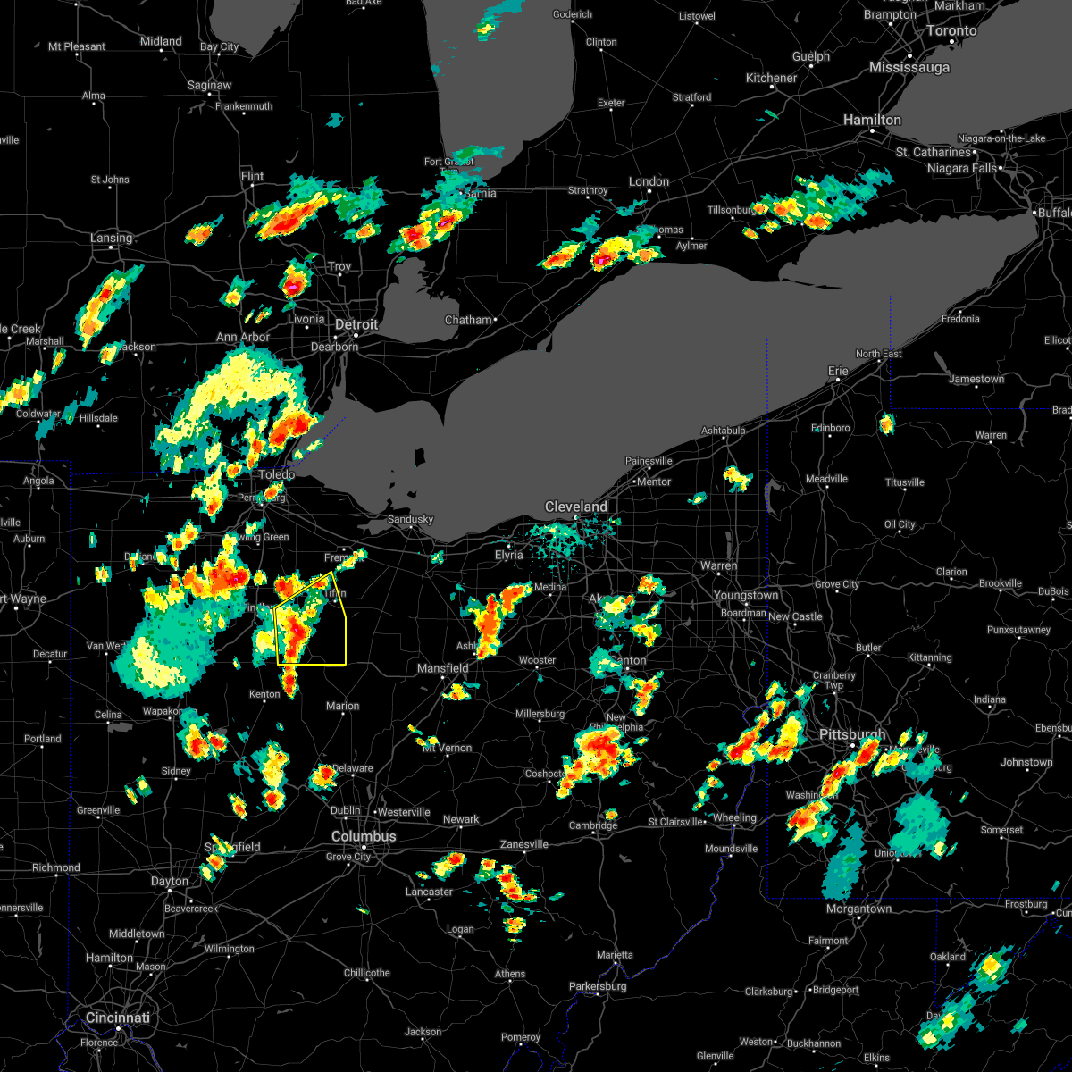
| 3/28/2020 9:38 AM EDT |
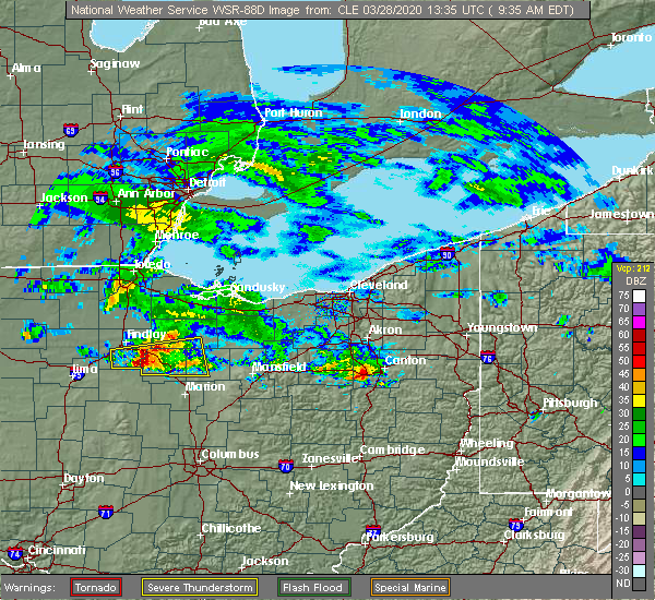 At 937 am edt, a severe thunderstorm was located near forest, or 10 miles west of upper sandusky, moving east at 70 mph (radar indicated). Hazards include golf ball size hail. this storm recently produced golf ball size hail in arlington. People and animals outdoors will be injured. expect damage to roofs, siding, windows, and vehicles. Locations impacted include, bucyrus, upper sandusky, forest, bloomville, sycamore, vanlue, carey, benton, nevada, mount blanchard, wharton, kirby and oceola. At 937 am edt, a severe thunderstorm was located near forest, or 10 miles west of upper sandusky, moving east at 70 mph (radar indicated). Hazards include golf ball size hail. this storm recently produced golf ball size hail in arlington. People and animals outdoors will be injured. expect damage to roofs, siding, windows, and vehicles. Locations impacted include, bucyrus, upper sandusky, forest, bloomville, sycamore, vanlue, carey, benton, nevada, mount blanchard, wharton, kirby and oceola.
|
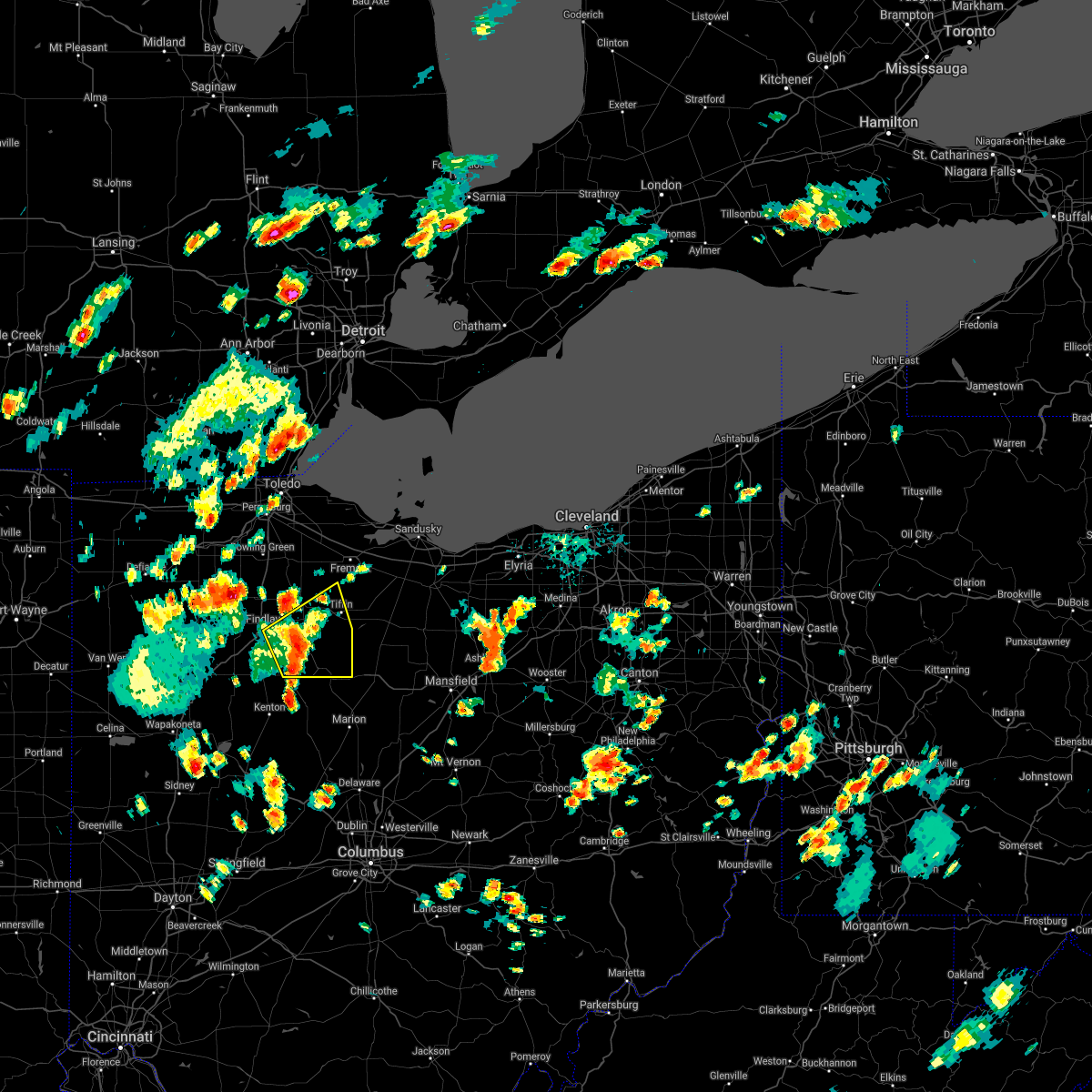
| 3/28/2020 9:30 AM EDT |
 At 929 am edt, a severe thunderstorm was located near arlington, or 11 miles south of findlay, moving east at 70 mph (radar indicated). Hazards include golf ball size hail. People and animals outdoors will be injured. expect damage to roofs, siding, windows, and vehicles. Locations impacted include, bucyrus, upper sandusky, forest, arlington, bloomville, sycamore, vanlue, carey, benton, nevada, mount blanchard, wharton, jenera, kirby, oceola and williamstown. At 929 am edt, a severe thunderstorm was located near arlington, or 11 miles south of findlay, moving east at 70 mph (radar indicated). Hazards include golf ball size hail. People and animals outdoors will be injured. expect damage to roofs, siding, windows, and vehicles. Locations impacted include, bucyrus, upper sandusky, forest, arlington, bloomville, sycamore, vanlue, carey, benton, nevada, mount blanchard, wharton, jenera, kirby, oceola and williamstown.
|
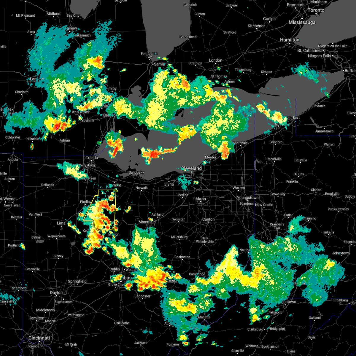
| 3/28/2020 9:13 AM EDT |
 At 912 am edt, a severe thunderstorm was located near columbus grove, or near bluffton, moving east at 60 mph (radar indicated). Hazards include ping pong ball size hail. People and animals outdoors will be injured. Expect damage to roofs, siding, windows, and vehicles. At 912 am edt, a severe thunderstorm was located near columbus grove, or near bluffton, moving east at 60 mph (radar indicated). Hazards include ping pong ball size hail. People and animals outdoors will be injured. Expect damage to roofs, siding, windows, and vehicles.
|
| 9/13/2019 5:56 PM EDT |
 At 555 pm edt, severe thunderstorms were located along a line extending from near fostoria to near findlay, moving northeast at 50 mph (radar indicated). Hazards include 60 mph wind gusts. Expect damage to trees and power lines. Locations impacted include, findlay, bowling green, tiffin, fostoria, bluffton, north baltimore, arlington, green springs, arcadia, rawson, vanlue, van buren, new riegel, pemberville, bradner, wayne, bloomdale, bettsville, risingsun and cygnet. At 555 pm edt, severe thunderstorms were located along a line extending from near fostoria to near findlay, moving northeast at 50 mph (radar indicated). Hazards include 60 mph wind gusts. Expect damage to trees and power lines. Locations impacted include, findlay, bowling green, tiffin, fostoria, bluffton, north baltimore, arlington, green springs, arcadia, rawson, vanlue, van buren, new riegel, pemberville, bradner, wayne, bloomdale, bettsville, risingsun and cygnet.
|
| 9/13/2019 5:41 PM EDT |
 The national weather service in cleveland has issued a * severe thunderstorm warning for. western seneca county in northwestern ohio. southeastern wood county in northwestern ohio. hancock county in northwestern ohio. Until 630 pm edt. The national weather service in cleveland has issued a * severe thunderstorm warning for. western seneca county in northwestern ohio. southeastern wood county in northwestern ohio. hancock county in northwestern ohio. Until 630 pm edt.
|
| 7/2/2019 9:58 PM EDT |
 The severe thunderstorm warning for western seneca, wyandot and eastern hancock counties will expire at 1000 pm edt, the storms which prompted the warning have weakened below severe limits, and no longer pose an immediate threat to life or property. therefore, the warning will be allowed to expire. however small hail and gusty winds are still possible with these thunderstorms. to report severe weather, contact your nearest law enforcement agency. they will relay your report to the national weather service cleveland. The severe thunderstorm warning for western seneca, wyandot and eastern hancock counties will expire at 1000 pm edt, the storms which prompted the warning have weakened below severe limits, and no longer pose an immediate threat to life or property. therefore, the warning will be allowed to expire. however small hail and gusty winds are still possible with these thunderstorms. to report severe weather, contact your nearest law enforcement agency. they will relay your report to the national weather service cleveland.
|
| 7/2/2019 9:41 PM EDT |
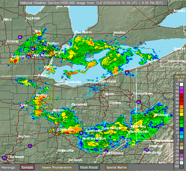 At 940 pm edt, severe thunderstorms were located along a line extending from near fostoria to near kenton, moving east at 35 mph (radar indicated). Hazards include 60 mph wind gusts and penny size hail. Expect damage to trees and power lines. Locations impacted include, tiffin, fostoria, upper sandusky, forest, arlington, sycamore, arcadia, morral, vanlue, new riegel, marseilles, carey, nevada, bettsville, mount blanchard, wharton, harpster, kirby, bascom and williamstown. At 940 pm edt, severe thunderstorms were located along a line extending from near fostoria to near kenton, moving east at 35 mph (radar indicated). Hazards include 60 mph wind gusts and penny size hail. Expect damage to trees and power lines. Locations impacted include, tiffin, fostoria, upper sandusky, forest, arlington, sycamore, arcadia, morral, vanlue, new riegel, marseilles, carey, nevada, bettsville, mount blanchard, wharton, harpster, kirby, bascom and williamstown.
|
| 7/2/2019 9:33 PM EDT |
 At 931 pm edt, severe thunderstorms were located along a line extending from 6 miles north of fostoria to near kenton, moving east at 35 mph (radar indicated. wind damage was recently reported in hancock county near findlay). Hazards include 60 mph wind gusts and penny size hail. Expect damage to trees and power lines. Locations impacted include, findlay, tiffin, fremont, fostoria, upper sandusky, north baltimore, oak harbor, gibsonburg, genoa, woodville, forest, arlington, elmore, sycamore, arcadia, rawson, morral, vanlue, van buren and new riegel. At 931 pm edt, severe thunderstorms were located along a line extending from 6 miles north of fostoria to near kenton, moving east at 35 mph (radar indicated. wind damage was recently reported in hancock county near findlay). Hazards include 60 mph wind gusts and penny size hail. Expect damage to trees and power lines. Locations impacted include, findlay, tiffin, fremont, fostoria, upper sandusky, north baltimore, oak harbor, gibsonburg, genoa, woodville, forest, arlington, elmore, sycamore, arcadia, rawson, morral, vanlue, van buren and new riegel.
|
| 7/2/2019 9:10 PM EDT |
 At 910 pm edt, severe thunderstorms were located along a line extending from near perrysburg to near bluffton, moving east at 35 mph (radar indicated. these storms have had a history of producing 50 to 60 mph winds across northwest ohio this evening). Hazards include 60 mph wind gusts and penny size hail. expect damage to trees and power lines At 910 pm edt, severe thunderstorms were located along a line extending from near perrysburg to near bluffton, moving east at 35 mph (radar indicated. these storms have had a history of producing 50 to 60 mph winds across northwest ohio this evening). Hazards include 60 mph wind gusts and penny size hail. expect damage to trees and power lines
|
| 7/2/2019 6:28 PM EDT |
 At 628 pm edt, severe thunderstorms were located along a line extending from fostoria to near rawson, moving west at 30 mph (radar indicated). Hazards include 60 mph wind gusts and nickel size hail. Expect damage to trees and power lines. Locations impacted include, findlay, tiffin, fostoria, upper sandusky, forest, arlington, bloomville, sycamore, arcadia, rawson, vanlue, new riegel, carey, mount blanchard, wharton, benton ridge, jenera, kirby and bascom. At 628 pm edt, severe thunderstorms were located along a line extending from fostoria to near rawson, moving west at 30 mph (radar indicated). Hazards include 60 mph wind gusts and nickel size hail. Expect damage to trees and power lines. Locations impacted include, findlay, tiffin, fostoria, upper sandusky, forest, arlington, bloomville, sycamore, arcadia, rawson, vanlue, new riegel, carey, mount blanchard, wharton, benton ridge, jenera, kirby and bascom.
|
| 7/2/2019 6:17 PM EDT |
 At 617 pm edt, severe thunderstorms were located along a line extending from near arcadia to near mccomb, moving southeast at 40 mph (radar indicated). Hazards include 60 mph wind gusts and nickel size hail. Expect damage to trees and power lines. Locations impacted include, findlay, tiffin, fostoria, upper sandusky, north baltimore, forest, arlington, bloomville, sycamore, arcadia, rawson, vanlue, van buren, new riegel, carey, bloomdale, mount blanchard, wharton, benton ridge and jenera. At 617 pm edt, severe thunderstorms were located along a line extending from near arcadia to near mccomb, moving southeast at 40 mph (radar indicated). Hazards include 60 mph wind gusts and nickel size hail. Expect damage to trees and power lines. Locations impacted include, findlay, tiffin, fostoria, upper sandusky, north baltimore, forest, arlington, bloomville, sycamore, arcadia, rawson, vanlue, van buren, new riegel, carey, bloomdale, mount blanchard, wharton, benton ridge and jenera.
|
| 7/2/2019 6:00 PM EDT |
 At 600 pm edt, severe thunderstorms were located along a line extending from near north baltimore to near mccomb, moving southeast at 40 mph (radar indicated). Hazards include 60 mph wind gusts and nickel size hail. expect damage to trees and power lines At 600 pm edt, severe thunderstorms were located along a line extending from near north baltimore to near mccomb, moving southeast at 40 mph (radar indicated). Hazards include 60 mph wind gusts and nickel size hail. expect damage to trees and power lines
|
| 7/2/2019 5:22 PM EDT |
 The severe thunderstorm warning for southwestern seneca, northwestern wyandot and northeastern hancock counties will expire at 530 pm edt, this warning will be allowed to expire. but, a severe thunderstorm warning still remains in effect for southwestern seneca, northwestern wyandot and northeastern hancock counties. to report severe weather, contact your nearest law enforcement agency. they will relay your report to the national weather service cleveland. The severe thunderstorm warning for southwestern seneca, northwestern wyandot and northeastern hancock counties will expire at 530 pm edt, this warning will be allowed to expire. but, a severe thunderstorm warning still remains in effect for southwestern seneca, northwestern wyandot and northeastern hancock counties. to report severe weather, contact your nearest law enforcement agency. they will relay your report to the national weather service cleveland.
|
| 7/2/2019 5:08 PM EDT |
 At 507 pm edt, a severe thunderstorm was located near new riegel, or 7 miles south of fostoria, moving east at 50 mph (radar indicated). Hazards include 60 mph wind gusts and quarter size hail. Minor damage to vehicles is possible. expect damage to trees and power lines. Locations impacted include, findlay, vanlue, new riegel and carey. At 507 pm edt, a severe thunderstorm was located near new riegel, or 7 miles south of fostoria, moving east at 50 mph (radar indicated). Hazards include 60 mph wind gusts and quarter size hail. Minor damage to vehicles is possible. expect damage to trees and power lines. Locations impacted include, findlay, vanlue, new riegel and carey.
|
| 7/2/2019 4:58 PM EDT |
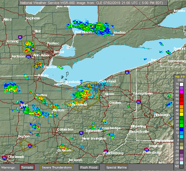 At 458 pm edt, a severe thunderstorm was located over vanlue, or 8 miles east of findlay, moving east at 40 mph (radar indicated). Hazards include 60 mph wind gusts and quarter size hail. Minor damage to vehicles is possible. expect damage to trees and power lines. Locations impacted include, findlay, upper sandusky, vanlue, new riegel, carey and nevada. At 458 pm edt, a severe thunderstorm was located over vanlue, or 8 miles east of findlay, moving east at 40 mph (radar indicated). Hazards include 60 mph wind gusts and quarter size hail. Minor damage to vehicles is possible. expect damage to trees and power lines. Locations impacted include, findlay, upper sandusky, vanlue, new riegel, carey and nevada.
|
| 7/2/2019 4:43 PM EDT |
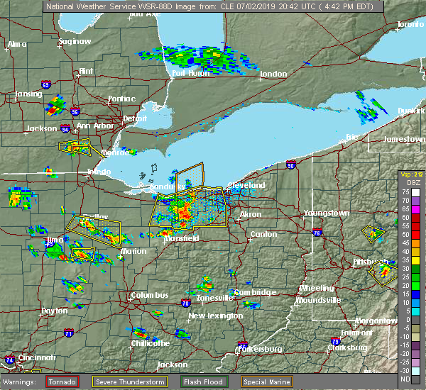 At 442 pm edt, a severe thunderstorm was located over vanlue, or 9 miles southeast of findlay, moving southeast at 25 mph (radar indicated). Hazards include 60 mph wind gusts and quarter size hail. Minor damage to vehicles is possible. expect damage to trees and power lines. Locations impacted include, findlay, upper sandusky, arlington, sycamore, vanlue, new riegel, carey, nevada, mount blanchard, wharton, harpster and kirby. At 442 pm edt, a severe thunderstorm was located over vanlue, or 9 miles southeast of findlay, moving southeast at 25 mph (radar indicated). Hazards include 60 mph wind gusts and quarter size hail. Minor damage to vehicles is possible. expect damage to trees and power lines. Locations impacted include, findlay, upper sandusky, arlington, sycamore, vanlue, new riegel, carey, nevada, mount blanchard, wharton, harpster and kirby.
|
| 7/2/2019 4:30 PM EDT |
 At 430 pm edt, a severe thunderstorm was located near findlay, moving southeast at 25 mph (radar indicated). Hazards include 60 mph wind gusts and quarter size hail. Minor damage to vehicles is possible. Expect damage to trees and power lines. At 430 pm edt, a severe thunderstorm was located near findlay, moving southeast at 25 mph (radar indicated). Hazards include 60 mph wind gusts and quarter size hail. Minor damage to vehicles is possible. Expect damage to trees and power lines.
|
| 6/5/2019 4:27 PM EDT |
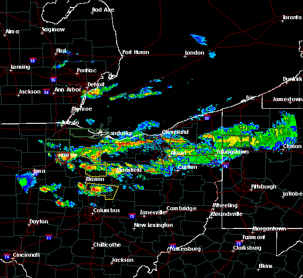 At 427 pm edt, a severe thunderstorm was located near vanlue, or 8 miles east of findlay, moving southeast at 25 mph (radar indicated). Hazards include 60 mph wind gusts and penny size hail. expect damage to trees and power lines At 427 pm edt, a severe thunderstorm was located near vanlue, or 8 miles east of findlay, moving southeast at 25 mph (radar indicated). Hazards include 60 mph wind gusts and penny size hail. expect damage to trees and power lines
|
| 6/5/2019 4:08 PM EDT |
 At 336 pm edt, a severe thunderstorm was located over deshler, or 16 miles southeast of napoleon, moving southeast at 25 mph (radar indicated). Hazards include 60 mph wind gusts and penny size hail. expect damage to trees and power lines At 336 pm edt, a severe thunderstorm was located over deshler, or 16 miles southeast of napoleon, moving southeast at 25 mph (radar indicated). Hazards include 60 mph wind gusts and penny size hail. expect damage to trees and power lines
|
| 6/5/2019 3:37 PM EDT |
 At 336 pm edt, a severe thunderstorm was located over deshler, or 16 miles southeast of napoleon, moving southeast at 25 mph (radar indicated). Hazards include 60 mph wind gusts and penny size hail. expect damage to trees and power lines At 336 pm edt, a severe thunderstorm was located over deshler, or 16 miles southeast of napoleon, moving southeast at 25 mph (radar indicated). Hazards include 60 mph wind gusts and penny size hail. expect damage to trees and power lines
|
| 6/5/2019 3:18 PM EDT |
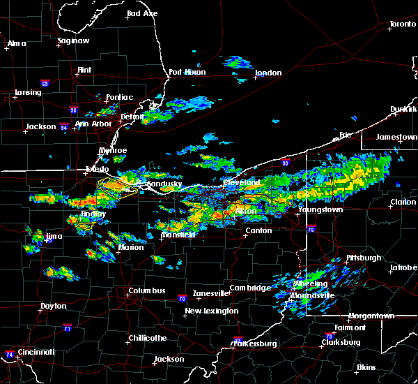 At 317 pm edt, a severe thunderstorm was located near arlington, or 7 miles south of findlay, moving east at 25 mph (radar indicated). Hazards include 60 mph wind gusts and quarter size hail. Minor damage to vehicles is possible. expect damage to trees and power lines. Locations impacted include, vanlue. At 317 pm edt, a severe thunderstorm was located near arlington, or 7 miles south of findlay, moving east at 25 mph (radar indicated). Hazards include 60 mph wind gusts and quarter size hail. Minor damage to vehicles is possible. expect damage to trees and power lines. Locations impacted include, vanlue.
|
| 6/5/2019 2:55 PM EDT |
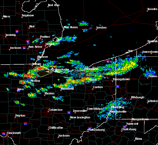 At 255 pm edt, a severe thunderstorm was located near leipsic, or near ottawa, moving east at 25 mph (radar indicated). Hazards include 60 mph wind gusts and quarter size hail. Minor damage to vehicles is possible. Expect damage to trees and power lines. At 255 pm edt, a severe thunderstorm was located near leipsic, or near ottawa, moving east at 25 mph (radar indicated). Hazards include 60 mph wind gusts and quarter size hail. Minor damage to vehicles is possible. Expect damage to trees and power lines.
|
| 6/1/2019 7:10 PM EDT |
 At 709 pm edt, a severe thunderstorm was located near findlay, moving east at 20 mph (radar indicated). Hazards include 60 mph wind gusts and quarter size hail. Minor damage to vehicles is possible. expect damage to trees and power lines. Locations impacted include, findlay, tiffin, fostoria, arlington, sycamore, arcadia, rawson, vanlue, new riegel, carey, bloomdale, bettsville, mount blanchard, benton ridge, mount cory and bascom. At 709 pm edt, a severe thunderstorm was located near findlay, moving east at 20 mph (radar indicated). Hazards include 60 mph wind gusts and quarter size hail. Minor damage to vehicles is possible. expect damage to trees and power lines. Locations impacted include, findlay, tiffin, fostoria, arlington, sycamore, arcadia, rawson, vanlue, new riegel, carey, bloomdale, bettsville, mount blanchard, benton ridge, mount cory and bascom.
|
| 6/1/2019 6:44 PM EDT |
 At 643 pm edt, a severe thunderstorm was located near rawson, or near findlay, moving east at 20 mph (radar indicated). Hazards include 60 mph wind gusts and quarter size hail. Minor damage to vehicles is possible. Expect damage to trees and power lines. At 643 pm edt, a severe thunderstorm was located near rawson, or near findlay, moving east at 20 mph (radar indicated). Hazards include 60 mph wind gusts and quarter size hail. Minor damage to vehicles is possible. Expect damage to trees and power lines.
|
| 5/28/2019 5:35 PM EDT |
 The severe thunderstorm warning for hancock county will expire at 545 pm edt, the storm which prompted the warning has weakened below severe limits, and has exited the warned area. therefore, the warning will be allowed to expire. however small hail is still possible with this thunderstorm. a severe thunderstorm watch remains in effect until 800 pm edt for northwestern ohio. to report severe weather, contact your nearest law enforcement agency. they will relay your report to the national weather service cleveland. The severe thunderstorm warning for hancock county will expire at 545 pm edt, the storm which prompted the warning has weakened below severe limits, and has exited the warned area. therefore, the warning will be allowed to expire. however small hail is still possible with this thunderstorm. a severe thunderstorm watch remains in effect until 800 pm edt for northwestern ohio. to report severe weather, contact your nearest law enforcement agency. they will relay your report to the national weather service cleveland.
|
| 5/28/2019 5:08 PM EDT |
 At 507 pm edt, a severe thunderstorm was located over mccomb, or 9 miles west of findlay, moving east at 45 mph. at 505 pm edt, mccomb fire department reported one inch hail in mccomb (law enforcement). Hazards include ping pong ball size hail and 60 mph wind gusts. People and animals outdoors will be injured. expect hail damage to roofs, siding, windows, and vehicles. expect damage to trees and power lines. Locations impacted include, findlay, fostoria, north baltimore, mccomb, arcadia, vanlue, van buren, bloomdale, benton ridge and bairdstown. At 507 pm edt, a severe thunderstorm was located over mccomb, or 9 miles west of findlay, moving east at 45 mph. at 505 pm edt, mccomb fire department reported one inch hail in mccomb (law enforcement). Hazards include ping pong ball size hail and 60 mph wind gusts. People and animals outdoors will be injured. expect hail damage to roofs, siding, windows, and vehicles. expect damage to trees and power lines. Locations impacted include, findlay, fostoria, north baltimore, mccomb, arcadia, vanlue, van buren, bloomdale, benton ridge and bairdstown.
|
| 5/28/2019 4:48 PM EDT |
 At 448 pm edt, a severe thunderstorm was located over leipsic, or near ottawa, moving east at 35 mph (radar indicated). Hazards include ping pong ball size hail and 60 mph wind gusts. People and animals outdoors will be injured. expect hail damage to roofs, siding, windows, and vehicles. Expect damage to trees and power lines. At 448 pm edt, a severe thunderstorm was located over leipsic, or near ottawa, moving east at 35 mph (radar indicated). Hazards include ping pong ball size hail and 60 mph wind gusts. People and animals outdoors will be injured. expect hail damage to roofs, siding, windows, and vehicles. Expect damage to trees and power lines.
|
| 5/23/2019 6:42 AM EDT |
 The national weather service in cleveland has issued a * severe thunderstorm warning for. western seneca county in northwestern ohio. northern wyandot county in northwestern ohio. hancock county in northwestern ohio. Until 730 am edt. The national weather service in cleveland has issued a * severe thunderstorm warning for. western seneca county in northwestern ohio. northern wyandot county in northwestern ohio. hancock county in northwestern ohio. Until 730 am edt.
|
| 11/5/2017 5:18 PM EDT |
 At 418 pm est, a line of severe thunderstorms were located across southeastern wood county and eastern hancock county, moving east at 40 mph (radar indicated). Hazards include 60 mph wind gusts. Expect damage to trees and power lines. locations impacted include, findlay, fostoria, north baltimore, forest, arlington, arcadia, vanlue, van buren, bloomdale, cygnet, mount blanchard, jerry city, wharton, west millgrove, bairdstown and williamstown. A tornado watch remains in effect until 700 pm est for northwestern ohio. At 418 pm est, a line of severe thunderstorms were located across southeastern wood county and eastern hancock county, moving east at 40 mph (radar indicated). Hazards include 60 mph wind gusts. Expect damage to trees and power lines. locations impacted include, findlay, fostoria, north baltimore, forest, arlington, arcadia, vanlue, van buren, bloomdale, cygnet, mount blanchard, jerry city, wharton, west millgrove, bairdstown and williamstown. A tornado watch remains in effect until 700 pm est for northwestern ohio.
|
| 11/5/2017 5:01 PM EDT |
 At 401 pm est, a severe thunderstorm was located near findlay, moving east at 40 mph (radar indicated). Hazards include 60 mph wind gusts and penny size hail. expect damage to trees and power lines At 401 pm est, a severe thunderstorm was located near findlay, moving east at 40 mph (radar indicated). Hazards include 60 mph wind gusts and penny size hail. expect damage to trees and power lines
|
| 7/16/2017 5:55 PM EDT |
 The severe thunderstorm warning for hancock county will expire at 600 pm edt, the storm which prompted the warning has weakened below severe limits, and no longer poses an immediate threat to life or property. therefore the warning will be allowed to expire. however gusty winds and heavy rain are still possible with this thunderstorm. The severe thunderstorm warning for hancock county will expire at 600 pm edt, the storm which prompted the warning has weakened below severe limits, and no longer poses an immediate threat to life or property. therefore the warning will be allowed to expire. however gusty winds and heavy rain are still possible with this thunderstorm.
|
| 7/16/2017 5:26 PM EDT |
 At 524 pm edt, a severe thunderstorm was located near mccomb, or near findlay, and is moving southeast at 30 mph (radar indicated. at 5:22 pm 1 inch hail was reported in mccomb). Hazards include 60 mph wind gusts and quarter size hail. Minor damage to vehicles is possible. expect damage to trees and power lines. Locations impacted include, findlay, fostoria, bluffton, north baltimore, mccomb, arlington, arcadia, rawson, vanlue, van buren, mount blanchard, benton ridge, jenera, mount cory and williamstown. At 524 pm edt, a severe thunderstorm was located near mccomb, or near findlay, and is moving southeast at 30 mph (radar indicated. at 5:22 pm 1 inch hail was reported in mccomb). Hazards include 60 mph wind gusts and quarter size hail. Minor damage to vehicles is possible. expect damage to trees and power lines. Locations impacted include, findlay, fostoria, bluffton, north baltimore, mccomb, arlington, arcadia, rawson, vanlue, van buren, mount blanchard, benton ridge, jenera, mount cory and williamstown.
|
| 7/16/2017 4:55 PM EDT |
 At 454 pm edt, a severe thunderstorm was located near deshler, or 13 miles northeast of ottawa, moving southeast at 35 mph (radar indicated). Hazards include 60 mph wind gusts and quarter size hail. Minor damage to vehicles is possible. Expect damage to trees and power lines. At 454 pm edt, a severe thunderstorm was located near deshler, or 13 miles northeast of ottawa, moving southeast at 35 mph (radar indicated). Hazards include 60 mph wind gusts and quarter size hail. Minor damage to vehicles is possible. Expect damage to trees and power lines.
|
| 7/10/2017 12:05 PM EDT |
 At 1204 pm edt, a severe thunderstorm was located near rawson, or 7 miles southwest of findlay, moving east at 35 mph (radar indicated). Hazards include 60 mph wind gusts. Expect damage to trees and power lines. Locations impacted include, findlay, tiffin, fostoria, upper sandusky, forest, arlington, sycamore, arcadia, morral, vanlue, new riegel, marseilles, carey, nevada, bloomdale, mount blanchard, wharton, jenera, harpster and kirby. At 1204 pm edt, a severe thunderstorm was located near rawson, or 7 miles southwest of findlay, moving east at 35 mph (radar indicated). Hazards include 60 mph wind gusts. Expect damage to trees and power lines. Locations impacted include, findlay, tiffin, fostoria, upper sandusky, forest, arlington, sycamore, arcadia, morral, vanlue, new riegel, marseilles, carey, nevada, bloomdale, mount blanchard, wharton, jenera, harpster and kirby.
|
| 7/10/2017 11:49 AM EDT |
 At 1149 am edt, a severe thunderstorm was located near rawson, or near bluffton, moving east at 35 mph (radar indicated). Hazards include 60 mph wind gusts. expect damage to trees and power lines At 1149 am edt, a severe thunderstorm was located near rawson, or near bluffton, moving east at 35 mph (radar indicated). Hazards include 60 mph wind gusts. expect damage to trees and power lines
|
| 7/7/2017 11:09 AM EDT |
 At 1107 am edt, a severe thunderstorm was located near van buren, north of findlay, moving east at 25 mph. nickel size hail was reported in van buren with this storm. Hazards include 60 mph wind gusts and quarter size hail. Minor damage to vehicles is possible. expect damage to trees and power lines. Locations impacted include, findlay, fostoria, bluffton, north baltimore, mccomb, arlington, arcadia, rawson, vanlue, van buren, bloomdale, mount blanchard, hoytville, benton ridge, jenera, mount cory, bairdstown and williamstown. At 1107 am edt, a severe thunderstorm was located near van buren, north of findlay, moving east at 25 mph. nickel size hail was reported in van buren with this storm. Hazards include 60 mph wind gusts and quarter size hail. Minor damage to vehicles is possible. expect damage to trees and power lines. Locations impacted include, findlay, fostoria, bluffton, north baltimore, mccomb, arlington, arcadia, rawson, vanlue, van buren, bloomdale, mount blanchard, hoytville, benton ridge, jenera, mount cory, bairdstown and williamstown.
|
| 7/7/2017 10:51 AM EDT |
 At 1049 am edt, a severe thunderstorm was located near vanlue, or 9 miles northwest of upper sandusky, moving east at 25 mph. hail one inch in diameter was reported in vanlue with this storm (radar indicated). Hazards include 60 mph wind gusts and quarter size hail. Minor damage to vehicles is possible. expect damage to trees and power lines. Locations impacted include, findlay, tiffin, fostoria, upper sandusky, forest, arlington, sycamore, arcadia, vanlue, van buren, new riegel, carey, nevada, bloomdale, mount blanchard, wharton, bairdstown, kirby, bascom and williamstown. At 1049 am edt, a severe thunderstorm was located near vanlue, or 9 miles northwest of upper sandusky, moving east at 25 mph. hail one inch in diameter was reported in vanlue with this storm (radar indicated). Hazards include 60 mph wind gusts and quarter size hail. Minor damage to vehicles is possible. expect damage to trees and power lines. Locations impacted include, findlay, tiffin, fostoria, upper sandusky, forest, arlington, sycamore, arcadia, vanlue, van buren, new riegel, carey, nevada, bloomdale, mount blanchard, wharton, bairdstown, kirby, bascom and williamstown.
|
| 7/7/2017 10:46 AM EDT |
 At 1046 am edt, a severe thunderstorm was located near deshler, or 13 miles northeast of ottawa, moving east at 50 mph (radar indicated). Hazards include 60 mph wind gusts and quarter size hail. Minor damage to vehicles is possible. Expect damage to trees and power lines. At 1046 am edt, a severe thunderstorm was located near deshler, or 13 miles northeast of ottawa, moving east at 50 mph (radar indicated). Hazards include 60 mph wind gusts and quarter size hail. Minor damage to vehicles is possible. Expect damage to trees and power lines.
|
| 7/7/2017 10:37 AM EDT | Quarter sized hail reported 0.4 miles SSW of Vanlue, OH, several pieces of 3/4 inch to 1 inch hail reported in vanlue. |
| 7/7/2017 10:34 AM EDT |
 At 1034 am edt, a severe thunderstorm was located over vanlue, or 7 miles southeast of findlay, moving east at 30 mph (radar indicated). Hazards include 60 mph wind gusts and quarter size hail. Minor damage to vehicles is possible. Expect damage to trees and power lines. At 1034 am edt, a severe thunderstorm was located over vanlue, or 7 miles southeast of findlay, moving east at 30 mph (radar indicated). Hazards include 60 mph wind gusts and quarter size hail. Minor damage to vehicles is possible. Expect damage to trees and power lines.
|
| 7/3/2017 5:55 PM EDT |
 The severe thunderstorm warning for central hancock county will expire at 600 pm edt, the storm which prompted the warning has weakened below severe limits, and no longer poses an immediate threat to life or property. therefore the warning will be allowed to expire. to report severe weather, contact your nearest law enforcement agency. they will relay your report to the national weather service cleveland. The severe thunderstorm warning for central hancock county will expire at 600 pm edt, the storm which prompted the warning has weakened below severe limits, and no longer poses an immediate threat to life or property. therefore the warning will be allowed to expire. to report severe weather, contact your nearest law enforcement agency. they will relay your report to the national weather service cleveland.
|
| 7/3/2017 5:45 PM EDT |
 At 544 pm edt, a severe thunderstorm was located near vanlue, or 7 miles southeast of findlay, moving southeast at 30 mph. at 538 pm an automated sensor at the findlay airport measured a 58 mph wind gust (radar indicated). Hazards include 60 mph wind gusts and quarter size hail. Minor damage to vehicles is possible. expect damage to trees and power lines. Locations impacted include, findlay, arlington, rawson, vanlue, mount blanchard and jenera. At 544 pm edt, a severe thunderstorm was located near vanlue, or 7 miles southeast of findlay, moving southeast at 30 mph. at 538 pm an automated sensor at the findlay airport measured a 58 mph wind gust (radar indicated). Hazards include 60 mph wind gusts and quarter size hail. Minor damage to vehicles is possible. expect damage to trees and power lines. Locations impacted include, findlay, arlington, rawson, vanlue, mount blanchard and jenera.
|
| 7/3/2017 5:20 PM EDT |
 At 520 pm edt, a severe thunderstorm was located over mccomb, or 7 miles west of findlay, moving southeast at 30 mph (radar indicated). Hazards include 60 mph wind gusts and quarter size hail. Minor damage to vehicles is possible. Expect damage to trees and power lines. At 520 pm edt, a severe thunderstorm was located over mccomb, or 7 miles west of findlay, moving southeast at 30 mph (radar indicated). Hazards include 60 mph wind gusts and quarter size hail. Minor damage to vehicles is possible. Expect damage to trees and power lines.
|
| 6/13/2017 6:10 PM EDT |
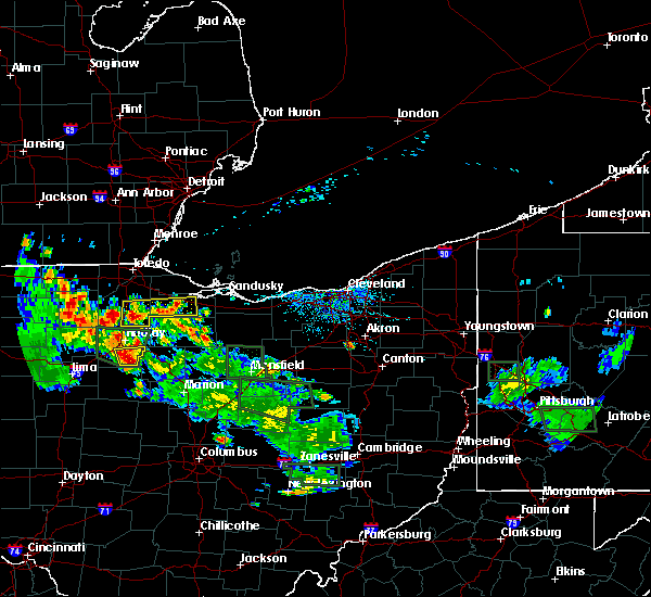 At 610 pm edt, a severe thunderstorm was located near arlington, or 12 miles south of findlay, moving southeast at 35 mph (radar indicated). Hazards include 60 mph wind gusts and quarter size hail. Minor damage to vehicles is possible. expect damage to trees and power lines. Locations impacted include, arlington, vanlue, mount blanchard and williamstown. At 610 pm edt, a severe thunderstorm was located near arlington, or 12 miles south of findlay, moving southeast at 35 mph (radar indicated). Hazards include 60 mph wind gusts and quarter size hail. Minor damage to vehicles is possible. expect damage to trees and power lines. Locations impacted include, arlington, vanlue, mount blanchard and williamstown.
|
| 6/13/2017 5:53 PM EDT |
 At 553 pm edt, a severe thunderstorm was located near dunkirk, or 11 miles northeast of ada, moving southeast at 25 mph (radar indicated). Hazards include 60 mph wind gusts and quarter size hail. Minor damage to vehicles is possible. Expect damage to trees and power lines. At 553 pm edt, a severe thunderstorm was located near dunkirk, or 11 miles northeast of ada, moving southeast at 25 mph (radar indicated). Hazards include 60 mph wind gusts and quarter size hail. Minor damage to vehicles is possible. Expect damage to trees and power lines.
|
| 6/13/2017 4:27 PM EDT |
 At 426 pm edt, a severe thunderstorm was located near fostoria, moving east at 15 mph (radar indicated). Hazards include 60 mph wind gusts and quarter size hail. Minor damage to vehicles is possible. Expect damage to trees and power lines. At 426 pm edt, a severe thunderstorm was located near fostoria, moving east at 15 mph (radar indicated). Hazards include 60 mph wind gusts and quarter size hail. Minor damage to vehicles is possible. Expect damage to trees and power lines.
|
| 4/30/2017 6:14 PM EDT |
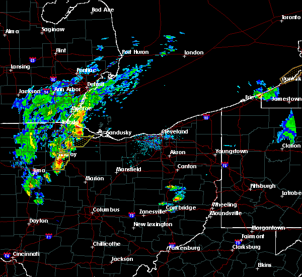 At 614 pm edt, a severe thunderstorm was located near findlay, moving northeast at 55 mph (radar indicated). Hazards include 60 mph wind gusts and penny size hail. Expect damage to roofs, siding, and trees. Locations impacted include, findlay, arlington, arcadia, vanlue, mount blanchard and williamstown. At 614 pm edt, a severe thunderstorm was located near findlay, moving northeast at 55 mph (radar indicated). Hazards include 60 mph wind gusts and penny size hail. Expect damage to roofs, siding, and trees. Locations impacted include, findlay, arlington, arcadia, vanlue, mount blanchard and williamstown.
|
| 4/30/2017 5:58 PM EDT |
 At 558 pm edt, a severe thunderstorm was located near bluffton, moving northeast at 55 mph (radar indicated). Hazards include 60 mph wind gusts and penny size hail. expect damage to roofs, siding, and trees At 558 pm edt, a severe thunderstorm was located near bluffton, moving northeast at 55 mph (radar indicated). Hazards include 60 mph wind gusts and penny size hail. expect damage to roofs, siding, and trees
|
| 4/20/2017 5:43 PM EDT |
 At 541 pm edt, a severe thunderstorm was located near mccomb and findlay, moving east at 35 mph. this storm was located over us route 224 (radar indicated). Hazards include 60 mph wind gusts and quarter size hail. torrential rainfall is occurring with this storm. Hail damage to vehicles is expected. expect wind damage to roofs, siding, and trees. Locations impacted include, findlay, fostoria, north baltimore, mccomb, arcadia, rawson, vanlue, van buren, bloomdale, benton ridge, mount cory and bairdstown. At 541 pm edt, a severe thunderstorm was located near mccomb and findlay, moving east at 35 mph. this storm was located over us route 224 (radar indicated). Hazards include 60 mph wind gusts and quarter size hail. torrential rainfall is occurring with this storm. Hail damage to vehicles is expected. expect wind damage to roofs, siding, and trees. Locations impacted include, findlay, fostoria, north baltimore, mccomb, arcadia, rawson, vanlue, van buren, bloomdale, benton ridge, mount cory and bairdstown.
|
| 4/20/2017 5:27 PM EDT |
 At 525 pm edt, a severe thunderstorm was located near ottawa, moving east at 35 mph (radar indicated). Hazards include 60 mph wind gusts and quarter size hail. Hail damage to vehicles is expected. Expect wind damage to roofs, siding, and trees. At 525 pm edt, a severe thunderstorm was located near ottawa, moving east at 35 mph (radar indicated). Hazards include 60 mph wind gusts and quarter size hail. Hail damage to vehicles is expected. Expect wind damage to roofs, siding, and trees.
|
| 3/1/2017 3:59 AM EST |
 At 359 am est, severe thunderstorms were located along a line extending from 14 miles northwest of put-in-bay to 9 miles north of fostoria to near findlay, moving east at 65 mph (radar indicated). Hazards include 60 mph wind gusts and quarter size hail. Hail damage to vehicles is expected. Expect wind damage to roofs, siding, and trees. At 359 am est, severe thunderstorms were located along a line extending from 14 miles northwest of put-in-bay to 9 miles north of fostoria to near findlay, moving east at 65 mph (radar indicated). Hazards include 60 mph wind gusts and quarter size hail. Hail damage to vehicles is expected. Expect wind damage to roofs, siding, and trees.
|
| 3/1/2017 3:43 AM EST |
 At 342 am est, severe thunderstorms were located along a line extending from near oregon to near weston to near columbus grove, moving east at 55 mph (radar indicated). Hazards include 60 mph wind gusts and quarter size hail. Hail damage to vehicles is expected. expect wind damage to roofs, siding, and trees. Locations impacted include, toledo, findlay, bowling green, tiffin, fremont, fostoria, bluffton, perrysburg, oregon, rossford, waterville, northwood, north baltimore, oak harbor, gibsonburg, genoa, woodville, mccomb, weston and arlington. At 342 am est, severe thunderstorms were located along a line extending from near oregon to near weston to near columbus grove, moving east at 55 mph (radar indicated). Hazards include 60 mph wind gusts and quarter size hail. Hail damage to vehicles is expected. expect wind damage to roofs, siding, and trees. Locations impacted include, toledo, findlay, bowling green, tiffin, fremont, fostoria, bluffton, perrysburg, oregon, rossford, waterville, northwood, north baltimore, oak harbor, gibsonburg, genoa, woodville, mccomb, weston and arlington.
|
| 3/1/2017 3:18 AM EST |
 At 317 am est, severe thunderstorms were located along a line extending from 8 miles north of swanton to near holgate to near van wert, moving east at 65 mph (radar indicated). Hazards include 60 mph wind gusts and quarter size hail. Hail damage to vehicles is expected. Expect wind damage to roofs, siding, and trees. At 317 am est, severe thunderstorms were located along a line extending from 8 miles north of swanton to near holgate to near van wert, moving east at 65 mph (radar indicated). Hazards include 60 mph wind gusts and quarter size hail. Hail damage to vehicles is expected. Expect wind damage to roofs, siding, and trees.
|
| 3/1/2017 12:55 AM EST |
 At 1254 am est, severe thunderstorms were located along a line extending from near fostoria to 6 miles northwest of crestline to near chesterville, moving northeast at 85 mph (radar indicated). Hazards include 60 mph wind gusts and quarter size hail. Hail damage to vehicles is expected. Expect wind damage to roofs, siding, and trees. At 1254 am est, severe thunderstorms were located along a line extending from near fostoria to 6 miles northwest of crestline to near chesterville, moving northeast at 85 mph (radar indicated). Hazards include 60 mph wind gusts and quarter size hail. Hail damage to vehicles is expected. Expect wind damage to roofs, siding, and trees.
|
| 1/10/2017 9:07 PM EST |
 At 907 pm est, a severe thunderstorm was located near vanlue, or 10 miles south of fostoria, moving east at 70 mph (radar indicated). Hazards include 60 mph wind gusts. expect damage to roofs, siding, and trees At 907 pm est, a severe thunderstorm was located near vanlue, or 10 miles south of fostoria, moving east at 70 mph (radar indicated). Hazards include 60 mph wind gusts. expect damage to roofs, siding, and trees
|
| 10/30/2016 9:51 AM EDT |
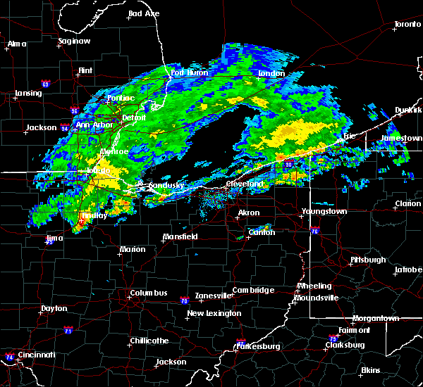 At 951 am edt, a severe thunderstorm was located over vanlue, or 8 miles southeast of findlay, moving east at 60 mph (radar indicated). Hazards include 60 mph wind gusts and quarter size hail. Hail damage to wehicles is expected. Expect damage to roofs, siding and trees. At 951 am edt, a severe thunderstorm was located over vanlue, or 8 miles southeast of findlay, moving east at 60 mph (radar indicated). Hazards include 60 mph wind gusts and quarter size hail. Hail damage to wehicles is expected. Expect damage to roofs, siding and trees.
|
| 8/11/2016 4:37 PM EDT |
 The severe thunderstorm warning for northwestern wyandot, eastern hancock and western seneca counties will expire at 445 pm edt, the storm which prompted the warning has weakened below severe limits, and no longer pose an immediate threat to life or property. therefore the warning will be allowed to expire. The severe thunderstorm warning for northwestern wyandot, eastern hancock and western seneca counties will expire at 445 pm edt, the storm which prompted the warning has weakened below severe limits, and no longer pose an immediate threat to life or property. therefore the warning will be allowed to expire.
|
| 8/11/2016 4:24 PM EDT |
 At 423 pm edt, a severe thunderstorm was located near findlay, moving east at 20 mph (radar indicated). Hazards include 60 mph wind gusts and penny size hail. Expect damage to roofs. siding and trees. Locations impacted include, findlay, fostoria, north baltimore, arlington, arcadia, vanlue, van buren, new riegel, carey, bloomdale, mount blanchard and bairdstown. At 423 pm edt, a severe thunderstorm was located near findlay, moving east at 20 mph (radar indicated). Hazards include 60 mph wind gusts and penny size hail. Expect damage to roofs. siding and trees. Locations impacted include, findlay, fostoria, north baltimore, arlington, arcadia, vanlue, van buren, new riegel, carey, bloomdale, mount blanchard and bairdstown.
|
| 8/11/2016 3:56 PM EDT |
 At 356 pm edt, a severe thunderstorm was located over findlay, moving east at 20 mph (radar indicated). Hazards include 60 mph wind gusts and penny size hail. Expect damage to roofs. Siding and trees. At 356 pm edt, a severe thunderstorm was located over findlay, moving east at 20 mph (radar indicated). Hazards include 60 mph wind gusts and penny size hail. Expect damage to roofs. Siding and trees.
|
| 7/21/2016 6:20 PM EDT |
 The severe thunderstorm warning for central hancock county will expire at 630 pm edt, the storms which prompted the warning have weakened below severe limits, and no longer pose an immediate threat to life or property. therefore the warning will be allowed to expire. however gusty winds are still possible with these thunderstorms. The severe thunderstorm warning for central hancock county will expire at 630 pm edt, the storms which prompted the warning have weakened below severe limits, and no longer pose an immediate threat to life or property. therefore the warning will be allowed to expire. however gusty winds are still possible with these thunderstorms.
|
| 7/21/2016 6:06 PM EDT |
 At 606 pm edt, severe thunderstorms were located along a line extending from near arcadia to near rawson, moving southeast at 30 mph (radar indicated). Hazards include 60 mph wind gusts and penny size hail. Expect damage to roofs. siding and trees. Locations impacted include, findlay, bluffton, arcadia, rawson, vanlue, benton ridge, jenera and mount cory. At 606 pm edt, severe thunderstorms were located along a line extending from near arcadia to near rawson, moving southeast at 30 mph (radar indicated). Hazards include 60 mph wind gusts and penny size hail. Expect damage to roofs. siding and trees. Locations impacted include, findlay, bluffton, arcadia, rawson, vanlue, benton ridge, jenera and mount cory.
|
| 7/21/2016 5:56 PM EDT |
 At 556 pm edt, severe thunderstorms were located along a line extending from near north baltimore to mccomb, moving southeast at 20 mph (radar indicated). Hazards include 60 mph wind gusts and penny size hail. Expect damage to roofs. siding and trees. Locations impacted include, findlay, bluffton, north baltimore, mccomb, arcadia, rawson, vanlue, van buren, bloomdale, benton ridge, jenera, mount cory and bairdstown. At 556 pm edt, severe thunderstorms were located along a line extending from near north baltimore to mccomb, moving southeast at 20 mph (radar indicated). Hazards include 60 mph wind gusts and penny size hail. Expect damage to roofs. siding and trees. Locations impacted include, findlay, bluffton, north baltimore, mccomb, arcadia, rawson, vanlue, van buren, bloomdale, benton ridge, jenera, mount cory and bairdstown.
|
| 7/21/2016 5:29 PM EDT |
 At 529 pm edt, severe thunderstorms were located along a line extending from near weston to near deshler, moving southeast at 25 mph (radar indicated). Hazards include 60 mph wind gusts and quarter size hail. Hail damage to vehicles is expected. Expect wind damage to roofs, siding and trees. At 529 pm edt, severe thunderstorms were located along a line extending from near weston to near deshler, moving southeast at 25 mph (radar indicated). Hazards include 60 mph wind gusts and quarter size hail. Hail damage to vehicles is expected. Expect wind damage to roofs, siding and trees.
|
| 7/18/2016 4:53 AM EDT |
 At 452 am edt, a severe thunderstorm was located near vanlue, or 7 miles east of findlay, moving east at 35 mph (radar indicated). Hazards include 60 mph wind gusts. Expect damage to roofs. siding and trees. Locations impacted include, findlay, fostoria, arlington, arcadia, vanlue, bloomdale, mount blanchard and jenera. At 452 am edt, a severe thunderstorm was located near vanlue, or 7 miles east of findlay, moving east at 35 mph (radar indicated). Hazards include 60 mph wind gusts. Expect damage to roofs. siding and trees. Locations impacted include, findlay, fostoria, arlington, arcadia, vanlue, bloomdale, mount blanchard and jenera.
|
| 7/18/2016 4:31 AM EDT |
 At 430 am edt, a severe thunderstorm was located over findlay, moving northeast at 20 mph (radar indicated). Hazards include 60 mph wind gusts. Expect damage to roofs. Siding and trees. At 430 am edt, a severe thunderstorm was located over findlay, moving northeast at 20 mph (radar indicated). Hazards include 60 mph wind gusts. Expect damage to roofs. Siding and trees.
|
| 6/26/2016 7:55 PM EDT |
 At 754 pm edt, a cluster of severe thunderstorms was located over southern hancock county moving northeast at 30 mph (radar indicated). Hazards include 60 mph wind gusts. Expect damage to roofs. siding and trees. Locations impacted include, findlay, arlington, rawson, vanlue, marseilles, carey, mount blanchard, wharton, jenera, mount cory, kirby and williamstown. At 754 pm edt, a cluster of severe thunderstorms was located over southern hancock county moving northeast at 30 mph (radar indicated). Hazards include 60 mph wind gusts. Expect damage to roofs. siding and trees. Locations impacted include, findlay, arlington, rawson, vanlue, marseilles, carey, mount blanchard, wharton, jenera, mount cory, kirby and williamstown.
|
| 6/26/2016 7:34 PM EDT |
 At 734 pm edt, a severe thunderstorm was located near ada, moving northeast at 30 mph (radar indicated). Hazards include 60 mph wind gusts and quarter size hail. Hail damage to vehicles is expected. Expect wind damage to roofs, siding and trees. At 734 pm edt, a severe thunderstorm was located near ada, moving northeast at 30 mph (radar indicated). Hazards include 60 mph wind gusts and quarter size hail. Hail damage to vehicles is expected. Expect wind damage to roofs, siding and trees.
|
| 12/23/2015 6:31 PM EST | At 629 pm est, severe thunderstorms were located along a line extending from 6 miles northeast of monroe to near new riegel, moving east at 45 mph. a 49 mph gust was measured at the findlay airport at 627 pm (radar indicated). Hazards include 60 mph wind gusts. Expect wind damage to roofs. siding and trees. Locations impacted include, toledo, findlay, bowling green, fostoria, perrysburg, oregon, rossford, northwood, north baltimore, arlington, arcadia, vanlue, van buren, maumee, ottawa hills, walbridge, pemberville, millbury, luckey and bradner. |
| 12/23/2015 5:56 PM EST | At 556 pm est, severe thunderstorms were located along a line extending from near blissfield to near columbus grove, moving east at 65 mph. these are very dangerous storms (radar indicated). Hazards include 80 mph wind gusts and quarter size hail. Flying debris will be dangerous to those caught without shelter. mobile homes will be heavily damaged. expect considerable damage to roofs, windows and vehicles. Extensive tree damage and power outages are likely. |
| 9/2/2015 6:22 PM EDT |
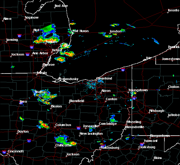 The severe thunderstorm warning for northern wyandot, east central hancock and southwestern seneca counties will expire at 630 pm edt, the storm which prompted the warning has weakened below severe limits, and no longer pose an immediate threat to life or property. therefore the warning will be allowed to expire. The severe thunderstorm warning for northern wyandot, east central hancock and southwestern seneca counties will expire at 630 pm edt, the storm which prompted the warning has weakened below severe limits, and no longer pose an immediate threat to life or property. therefore the warning will be allowed to expire.
|
| 9/2/2015 5:48 PM EDT |
 At 547 pm edt, a severe thunderstorm was located over new riegel, or 8 miles south of fostoria, moving southeast at 10 mph (radar indicated). Hazards include 60 mph wind gusts and penny size hail. Expect damage to roofs. Siding and trees. At 547 pm edt, a severe thunderstorm was located over new riegel, or 8 miles south of fostoria, moving southeast at 10 mph (radar indicated). Hazards include 60 mph wind gusts and penny size hail. Expect damage to roofs. Siding and trees.
|
| 8/23/2015 7:09 PM EDT |
 At 709 pm edt, a severe thunderstorm was located near vanlue, or near findlay, moving east at 35 mph (radar indicated). Hazards include 60 mph wind gusts and quarter size hail. Hail damage to vehicles is expected. expect wind damage to roofs, siding and trees. Locations impacted include, findlay, arlington, rawson, vanlue, mount blanchard, benton ridge, jenera and mount cory. At 709 pm edt, a severe thunderstorm was located near vanlue, or near findlay, moving east at 35 mph (radar indicated). Hazards include 60 mph wind gusts and quarter size hail. Hail damage to vehicles is expected. expect wind damage to roofs, siding and trees. Locations impacted include, findlay, arlington, rawson, vanlue, mount blanchard, benton ridge, jenera and mount cory.
|
| 8/23/2015 6:49 PM EDT |
 At 648 pm edt, a severe thunderstorm was located near rawson, or near bluffton, moving east at 30 mph (radar indicated). Hazards include 60 mph wind gusts and quarter size hail. Hail damage to vehicles is expected. Expect wind damage to roofs, siding and trees. At 648 pm edt, a severe thunderstorm was located near rawson, or near bluffton, moving east at 30 mph (radar indicated). Hazards include 60 mph wind gusts and quarter size hail. Hail damage to vehicles is expected. Expect wind damage to roofs, siding and trees.
|
| 7/19/2015 4:50 PM EDT | Several large tree branches down in a campground in vanlu in hancock county OH, 0.4 miles SSW of Vanlue, OH |
| 7/19/2015 4:38 PM EDT |
 At 435 pm edt, a severe thunderstorm was located near vanlue, or 10 miles northwest of upper sandusky, moving east at 45 mph. another potentially severe thunderstorm was located over eastern seneca county near bloomville, moving east at 35 mph (radar indicated). Hazards include 60 mph wind gusts and quarter size hail. Hail damage to vehicles is expected. expect wind damage to roofs, siding and trees. Locations impacted include, tiffin, upper sandusky, forest, bloomville, sycamore, morral, vanlue, new riegel, marseilles, carey, attica, nevada, republic, wharton, harpster, kirby and bascom. At 435 pm edt, a severe thunderstorm was located near vanlue, or 10 miles northwest of upper sandusky, moving east at 45 mph. another potentially severe thunderstorm was located over eastern seneca county near bloomville, moving east at 35 mph (radar indicated). Hazards include 60 mph wind gusts and quarter size hail. Hail damage to vehicles is expected. expect wind damage to roofs, siding and trees. Locations impacted include, tiffin, upper sandusky, forest, bloomville, sycamore, morral, vanlue, new riegel, marseilles, carey, attica, nevada, republic, wharton, harpster, kirby and bascom.
|
| 7/19/2015 4:30 PM EDT | Several large tree branches down in a campground in vanlu in hancock county OH, 0.4 miles SSW of Vanlue, OH |
| 7/19/2015 4:16 PM EDT |
 At 415 pm edt, a severe thunderstorm was located near findlay, moving east at 35 mph. additional severe thunderstorms were located along a broken line eastward into seneca county as well (radar indicated). Hazards include 60 mph wind gusts and nickel size hail. Expect damage to roofs. Siding and trees. At 415 pm edt, a severe thunderstorm was located near findlay, moving east at 35 mph. additional severe thunderstorms were located along a broken line eastward into seneca county as well (radar indicated). Hazards include 60 mph wind gusts and nickel size hail. Expect damage to roofs. Siding and trees.
|
| 6/12/2015 2:18 PM EDT |
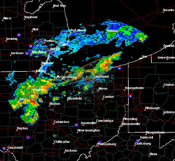 At 217 pm edt, a severe thunderstorm was located near arlington, or 11 miles southeast of findlay, moving east at 65 mph (radar indicated). Hazards include 70 mph wind gusts and penny size hail. Expect considerable tree damage. Damage is likely to mobile homes, roofs and outbuildings. At 217 pm edt, a severe thunderstorm was located near arlington, or 11 miles southeast of findlay, moving east at 65 mph (radar indicated). Hazards include 70 mph wind gusts and penny size hail. Expect considerable tree damage. Damage is likely to mobile homes, roofs and outbuildings.
|
| 6/12/2015 2:10 PM EDT |
 At 207 pm edt, a severe thunderstorm was located near fostoria, moving east at 45 mph. another severe thunderstorm was located south of findlay and it is moving east at 60 mph (radar indicated). Hazards include 60 mph wind gusts and quarter size hail. Hail damage to vehicles is expected. expect wind damage to roofs, siding and trees. Locations impacted include, findlay, tiffin, fostoria, north baltimore, mccomb, arcadia, rawson, vanlue, van buren, new riegel, bloomdale, bettsville, benton ridge, bairdstown, kansas and bascom. At 207 pm edt, a severe thunderstorm was located near fostoria, moving east at 45 mph. another severe thunderstorm was located south of findlay and it is moving east at 60 mph (radar indicated). Hazards include 60 mph wind gusts and quarter size hail. Hail damage to vehicles is expected. expect wind damage to roofs, siding and trees. Locations impacted include, findlay, tiffin, fostoria, north baltimore, mccomb, arcadia, rawson, vanlue, van buren, new riegel, bloomdale, bettsville, benton ridge, bairdstown, kansas and bascom.
|
| 6/12/2015 1:38 PM EDT |
 At 137 pm edt, a severe thunderstorm was located over van buren, or near findlay, moving east at 60 mph (radar indicated). Hazards include 60 mph wind gusts and quarter size hail. Hail damage to vehicles is expected. Expect wind damage to roofs, siding and trees. At 137 pm edt, a severe thunderstorm was located over van buren, or near findlay, moving east at 60 mph (radar indicated). Hazards include 60 mph wind gusts and quarter size hail. Hail damage to vehicles is expected. Expect wind damage to roofs, siding and trees.
|
| 5/26/2015 5:37 PM EDT | Kfdy asos measured a wind gust of 61kt in hancock county OH, 2.5 miles S of Vanlue, OH |
| 4/10/2013 3:40 PM EDT | Barn blown down in hancock county OH, 2.8 miles NNE of Vanlue, OH |
| 6/29/2012 4:37 PM EDT | Trees dow in hancock county OH, 0.4 miles SSW of Vanlue, OH |
| 1/1/0001 12:00 AM | Hen Egg sized hail reported 0.4 miles SSW of Vanlue, OH |
| 1/1/0001 12:00 AM | Golf Ball sized hail reported 0.4 miles SSW of Vanlue, OH, 1 1/2 in - 1 3/4 in hail |
Hail Maps for Vanlue, OH


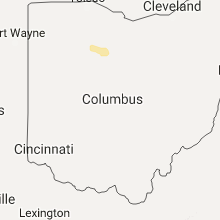
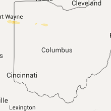
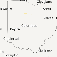


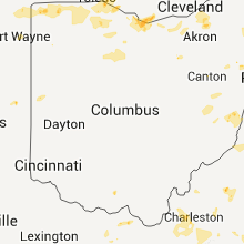


Connect with Interactive Hail Maps