

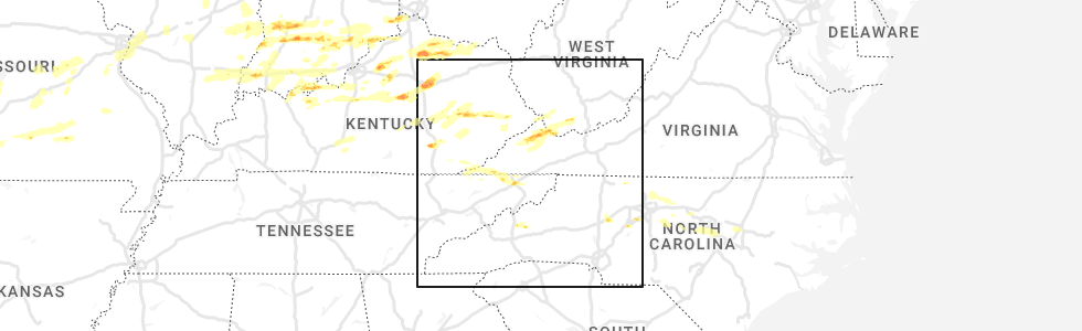
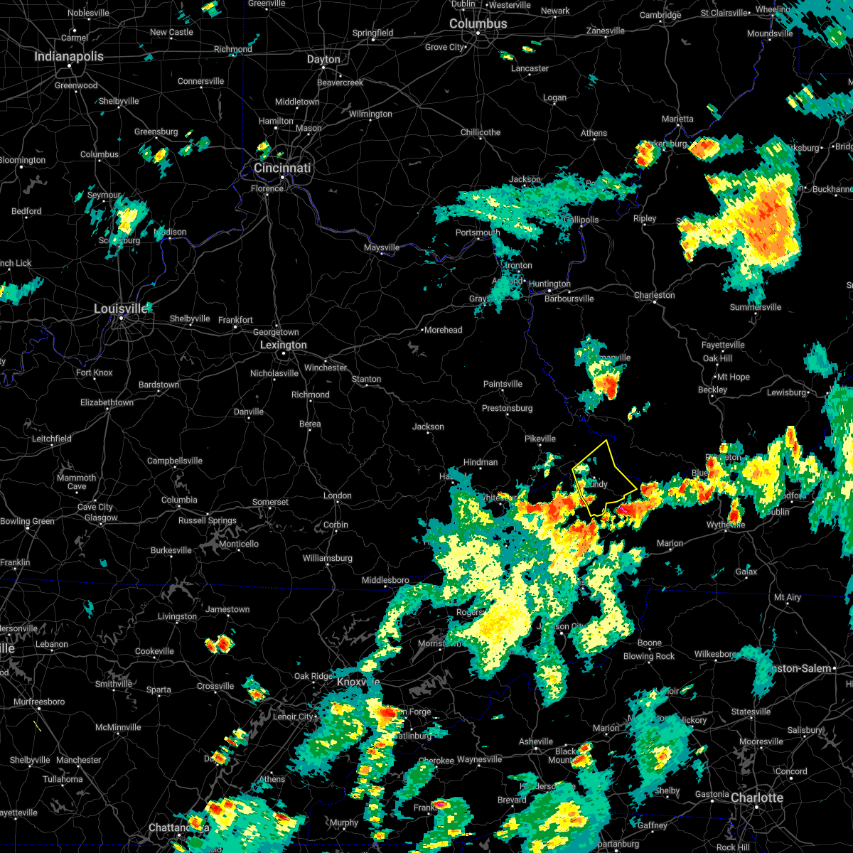
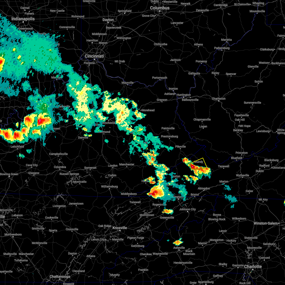
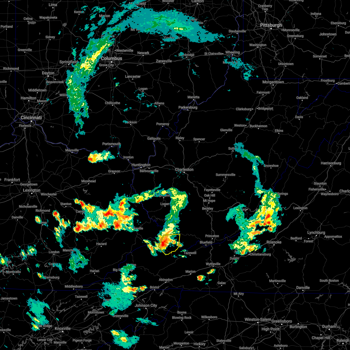
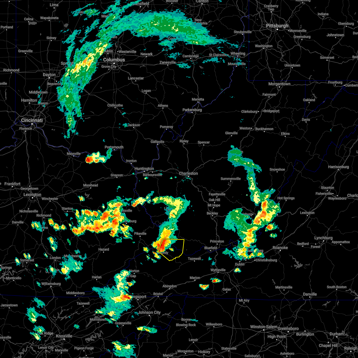
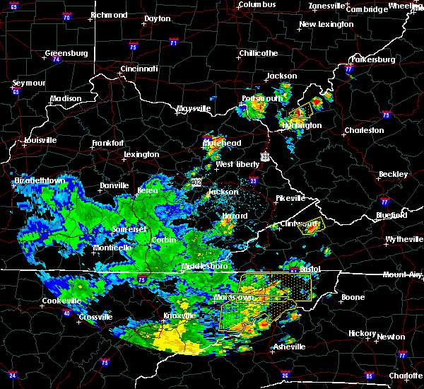
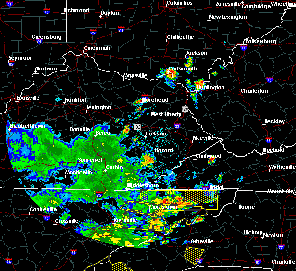
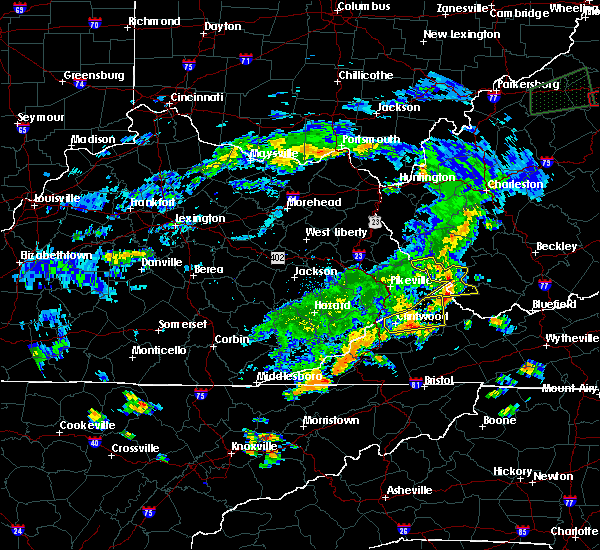
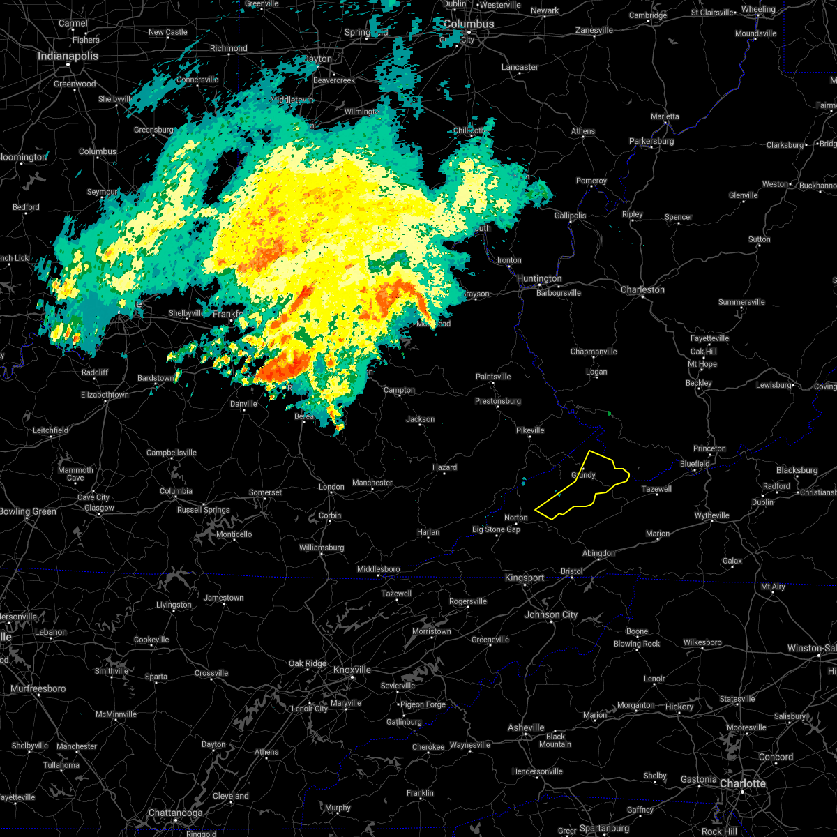
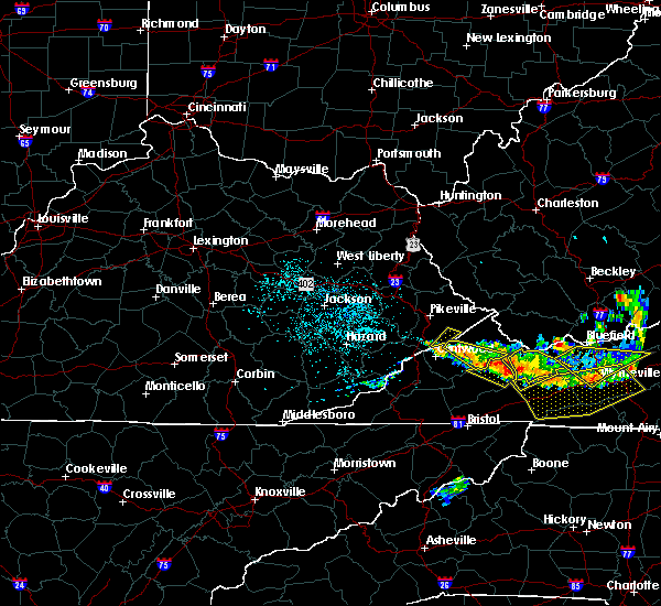
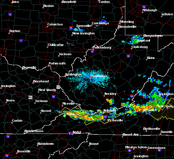
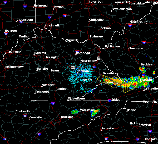
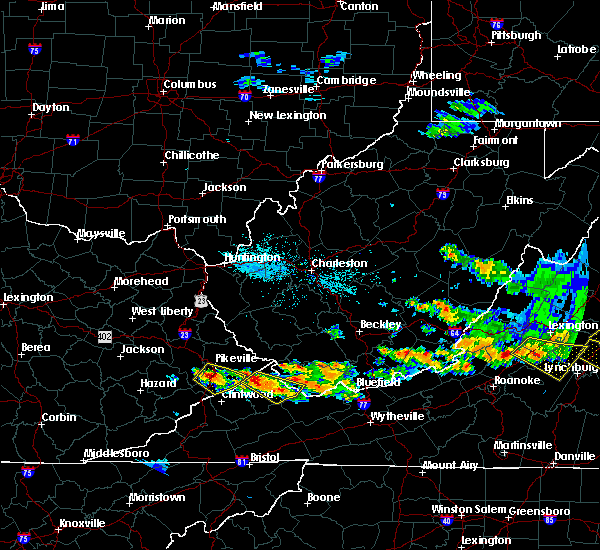
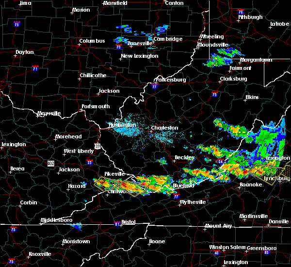
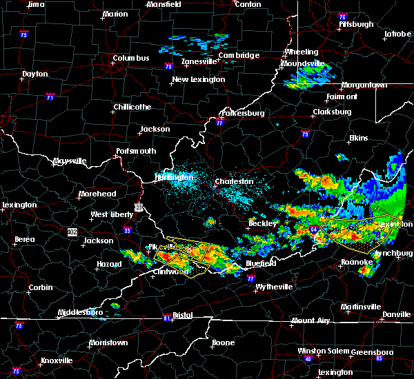
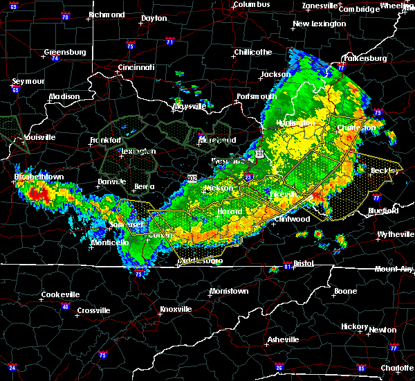
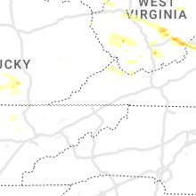
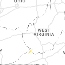
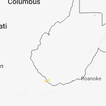
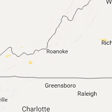
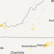
Hail Map for Vansant, VA
The Vansant, VA area has had 0 reports of on-the-ground hail by trained spotters, and has been under severe weather warnings 6 times during the past 12 months. Doppler radar has detected hail at or near Vansant, VA on 26 occasions.
| Name: | Vansant, VA |
| Where Located: | 44.9 miles N of Bristol, TN |
| Map: | Google Map for Vansant, VA |
| Population: | 470 |
| Housing Units: | 282 |
| More Info: | Search Google for Vansant, VA |
5
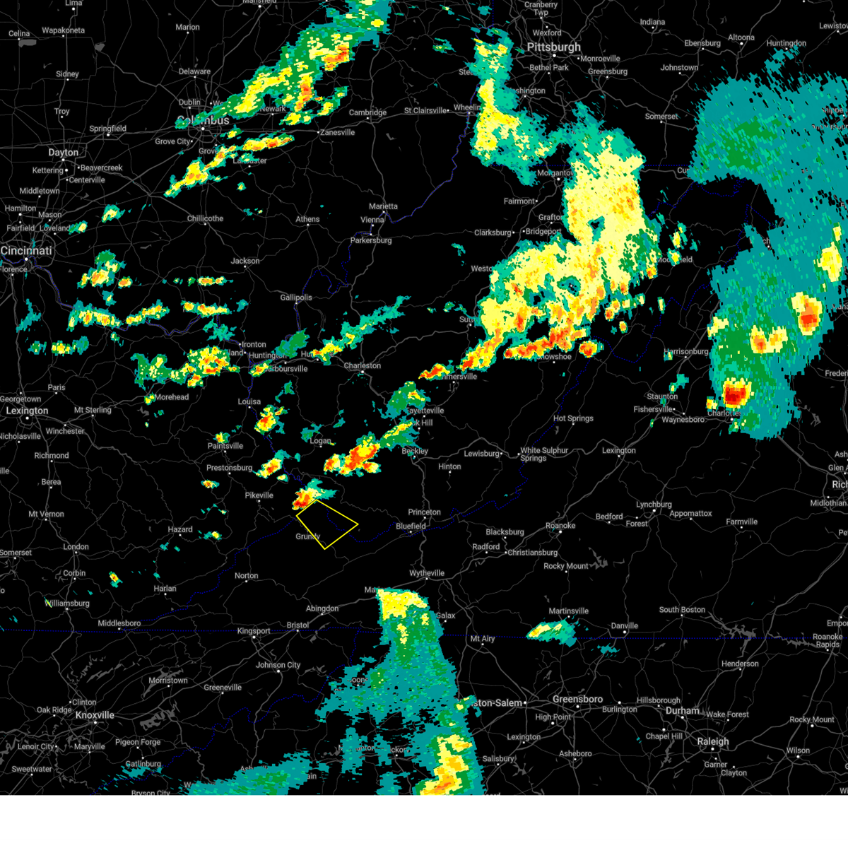
The Top Recent Hail Date for Vansant, VA is Thursday, May 19, 2022 (1st out of 26)
Hail and Wind Damage Spotted near Vansant, VA
| Date / Time | Report Details |
|---|---|
| 8/7/2023 5:10 PM EDT |
 At 510 pm edt, a severe thunderstorm was located near paw paw, or 7 miles north of grundy, moving southeast at 40 mph (radar indicated). Hazards include ping pong ball size hail and 60 mph wind gusts. People and animals outdoors will be injured. expect hail damage to roofs, siding, windows, and vehicles. Expect wind damage to roofs, siding, and trees. At 510 pm edt, a severe thunderstorm was located near paw paw, or 7 miles north of grundy, moving southeast at 40 mph (radar indicated). Hazards include ping pong ball size hail and 60 mph wind gusts. People and animals outdoors will be injured. expect hail damage to roofs, siding, windows, and vehicles. Expect wind damage to roofs, siding, and trees.
|
| 7/29/2023 4:47 PM EDT |
 At 446 pm edt, severe thunderstorms were located along a line extending from near john flannagan lake to near trammel to 9 miles south of clintwood to near wise to near norton, moving southeast at 30 mph (radar indicated). Hazards include 60 mph wind gusts and penny size hail. Expect damage to roofs, siding, and trees. locations impacted include, grundy, haysi, davenport, breaks interstate, john flannagan lake, trammel, big rock, clinchco, nora, vansant, mcclure, and oakwood. hail threat, radar indicated max hail size, 0. 75 in wind threat, radar indicated max wind gust, 60 mph. At 446 pm edt, severe thunderstorms were located along a line extending from near john flannagan lake to near trammel to 9 miles south of clintwood to near wise to near norton, moving southeast at 30 mph (radar indicated). Hazards include 60 mph wind gusts and penny size hail. Expect damage to roofs, siding, and trees. locations impacted include, grundy, haysi, davenport, breaks interstate, john flannagan lake, trammel, big rock, clinchco, nora, vansant, mcclure, and oakwood. hail threat, radar indicated max hail size, 0. 75 in wind threat, radar indicated max wind gust, 60 mph.
|
| 7/29/2023 4:29 PM EDT |
 At 429 pm edt, severe thunderstorms were located along a line extending from near ashcamp to near clintwood to wise to near big stone gap, moving southeast at 35 mph (radar indicated). Hazards include 60 mph wind gusts and penny size hail. expect damage to roofs, siding, and trees At 429 pm edt, severe thunderstorms were located along a line extending from near ashcamp to near clintwood to wise to near big stone gap, moving southeast at 35 mph (radar indicated). Hazards include 60 mph wind gusts and penny size hail. expect damage to roofs, siding, and trees
|
| 5/16/2023 5:39 PM EDT |
 At 538 pm edt, a severe thunderstorm was located 7 miles southeast of grundy, moving east at 55 mph. this is a destructive storm for oakwood (radar indicated). Hazards include 80 mph wind gusts. Flying debris will be dangerous to those caught without shelter. mobile homes will be heavily damaged. expect considerable damage to roofs, windows, and vehicles. extensive tree damage and power outages are likely. locations impacted include, clintwood, grundy, haysi, davenport, john flannagan lake, trammel, clinchco, nora, vansant, mcclure and oakwood. thunderstorm damage threat, destructive hail threat, radar indicated max hail size, <. 75 in wind threat, radar indicated max wind gust, 80 mph. At 538 pm edt, a severe thunderstorm was located 7 miles southeast of grundy, moving east at 55 mph. this is a destructive storm for oakwood (radar indicated). Hazards include 80 mph wind gusts. Flying debris will be dangerous to those caught without shelter. mobile homes will be heavily damaged. expect considerable damage to roofs, windows, and vehicles. extensive tree damage and power outages are likely. locations impacted include, clintwood, grundy, haysi, davenport, john flannagan lake, trammel, clinchco, nora, vansant, mcclure and oakwood. thunderstorm damage threat, destructive hail threat, radar indicated max hail size, <. 75 in wind threat, radar indicated max wind gust, 80 mph.
|
| 5/16/2023 5:38 PM EDT | Tree down along robinson fork road in the area of garden cree in buchanan county VA, 6.5 miles NNW of Vansant, VA |
| 5/16/2023 5:22 PM EDT |
 At 521 pm edt, a severe thunderstorm was located over haysi, moving east at 55 mph. this is a destructive storm for haysi (radar indicated). Hazards include 90 mph wind gusts. You are in a life-threatening situation. flying debris may be deadly to those caught without shelter. mobile homes will be heavily damaged or destroyed. homes and businesses will have substantial roof and window damage. Expect extensive tree damage and power outages. At 521 pm edt, a severe thunderstorm was located over haysi, moving east at 55 mph. this is a destructive storm for haysi (radar indicated). Hazards include 90 mph wind gusts. You are in a life-threatening situation. flying debris may be deadly to those caught without shelter. mobile homes will be heavily damaged or destroyed. homes and businesses will have substantial roof and window damage. Expect extensive tree damage and power outages.
|
| 8/5/2022 7:13 PM EDT |
 The severe thunderstorm warning for buchanan county will expire at 715 pm edt, the storm which prompted the warning has moved out of the area. therefore, the warning will be allowed to expire. The severe thunderstorm warning for buchanan county will expire at 715 pm edt, the storm which prompted the warning has moved out of the area. therefore, the warning will be allowed to expire.
|
| 8/5/2022 7:00 PM EDT | Virginia state police dispatch advised one of their troopers reported a tree down 1000 block of cydney circle at keen mountain camp road. time estimated by rada in buchanan county VA, 7 miles WNW of Vansant, VA |
| 8/5/2022 6:36 PM EDT | Buchanan county 911 center advised there is a tree down on patterson road and route 638. time was estimated by rada in buchanan county VA, 6.2 miles WSW of Vansant, VA |
| 8/5/2022 6:23 PM EDT |
 At 623 pm edt, a severe thunderstorm was located over raven, or near richlands, moving north at 10 mph (radar indicated). Hazards include 60 mph wind gusts and penny size hail. expect damage to roofs, siding, and trees At 623 pm edt, a severe thunderstorm was located over raven, or near richlands, moving north at 10 mph (radar indicated). Hazards include 60 mph wind gusts and penny size hail. expect damage to roofs, siding, and trees
|
| 6/17/2022 2:30 PM EDT |
 At 230 pm edt, severe thunderstorms were located along a line extending from jenkins to near bald knob, moving southeast at 45 mph (radar indicated). Hazards include 60 mph wind gusts. expect damage to roofs, siding, and trees At 230 pm edt, severe thunderstorms were located along a line extending from jenkins to near bald knob, moving southeast at 45 mph (radar indicated). Hazards include 60 mph wind gusts. expect damage to roofs, siding, and trees
|
| 6/2/2022 2:53 PM EDT |
 At 252 pm edt, a severe thunderstorm was located near trammel, or 9 miles southeast of clintwood, moving east at 35 mph (radar indicated). Hazards include 60 mph wind gusts and penny size hail. expect damage to roofs, siding, and trees At 252 pm edt, a severe thunderstorm was located near trammel, or 9 miles southeast of clintwood, moving east at 35 mph (radar indicated). Hazards include 60 mph wind gusts and penny size hail. expect damage to roofs, siding, and trees
|
| 5/19/2022 6:40 PM EDT | Large healthy tree down due to high win in buchanan county VA, 7.5 miles WSW of Vansant, VA |
| 5/19/2022 6:40 PM EDT |
 The tornado warning for west central buchanan county will expire at 645 pm edt, the tornado threat has diminished and the tornado warning has been cancelled. however, large hail and damaging winds remain likely and a severe thunderstorm warning remains in effect for the area. however small hail, gusty winds and heavy rain are still possible with this thunderstorm. to report severe weather, contact your nearest law enforcement agency. they will relay your report to the national weather service charleston west virginia. remember, a severe thunderstorm warning still remains in effect. The tornado warning for west central buchanan county will expire at 645 pm edt, the tornado threat has diminished and the tornado warning has been cancelled. however, large hail and damaging winds remain likely and a severe thunderstorm warning remains in effect for the area. however small hail, gusty winds and heavy rain are still possible with this thunderstorm. to report severe weather, contact your nearest law enforcement agency. they will relay your report to the national weather service charleston west virginia. remember, a severe thunderstorm warning still remains in effect.
|
| 5/19/2022 6:35 PM EDT |
 The severe thunderstorm warning for east central dickenson and southwestern buchanan counties will expire at 645 pm edt, the storm which prompted the warning has moved out of the area. therefore, the warning will be allowed to expire. however small hail, gusty winds and heavy rain are still possible with this thunderstorm. The severe thunderstorm warning for east central dickenson and southwestern buchanan counties will expire at 645 pm edt, the storm which prompted the warning has moved out of the area. therefore, the warning will be allowed to expire. however small hail, gusty winds and heavy rain are still possible with this thunderstorm.
|
| 5/19/2022 6:33 PM EDT | Utility lines down from severe winds. numerous power outages reporte in buchanan county VA, 7.4 miles N of Vansant, VA |
| 5/19/2022 6:21 PM EDT |
 At 621 pm edt, a severe thunderstorm capable of producing a tornado was located near davenport, moving east at 20 mph (radar indicated rotation). Hazards include tornado and ping pong ball size hail. Flying debris will be dangerous to those caught without shelter. mobile homes will be damaged or destroyed. damage to roofs, windows, and vehicles will occur. tree damage is likely. This tornadic thunderstorm will remain over mainly rural areas of west central buchanan county, including the following locations, vansant. At 621 pm edt, a severe thunderstorm capable of producing a tornado was located near davenport, moving east at 20 mph (radar indicated rotation). Hazards include tornado and ping pong ball size hail. Flying debris will be dangerous to those caught without shelter. mobile homes will be damaged or destroyed. damage to roofs, windows, and vehicles will occur. tree damage is likely. This tornadic thunderstorm will remain over mainly rural areas of west central buchanan county, including the following locations, vansant.
|
| 5/19/2022 6:08 PM EDT |
 At 608 pm edt, a severe thunderstorm was located near haysi, moving east at 30 mph (radar indicated). Hazards include 70 mph wind gusts and ping pong ball size hail. People and animals outdoors will be injured. expect hail damage to roofs, siding, windows, and vehicles. expect considerable tree damage. Wind damage is also likely to mobile homes, roofs, and outbuildings. At 608 pm edt, a severe thunderstorm was located near haysi, moving east at 30 mph (radar indicated). Hazards include 70 mph wind gusts and ping pong ball size hail. People and animals outdoors will be injured. expect hail damage to roofs, siding, windows, and vehicles. expect considerable tree damage. Wind damage is also likely to mobile homes, roofs, and outbuildings.
|
| 7/10/2021 4:48 PM EDT |
 At 447 pm edt, a severe thunderstorm was located near grundy, moving southeast at 15 mph (radar indicated). Hazards include 60 mph wind gusts and penny size hail. Expect damage to roofs, siding, and trees. Locations impacted include, grundy, bradshaw, stacy, vansant, avondale, jolo, oakwood and roseann. At 447 pm edt, a severe thunderstorm was located near grundy, moving southeast at 15 mph (radar indicated). Hazards include 60 mph wind gusts and penny size hail. Expect damage to roofs, siding, and trees. Locations impacted include, grundy, bradshaw, stacy, vansant, avondale, jolo, oakwood and roseann.
|
| 7/10/2021 4:30 PM EDT |
 At 430 pm edt, a severe thunderstorm was located near grundy, moving east at 15 mph (radar indicated). Hazards include 60 mph wind gusts and penny size hail. expect damage to roofs, siding, and trees At 430 pm edt, a severe thunderstorm was located near grundy, moving east at 15 mph (radar indicated). Hazards include 60 mph wind gusts and penny size hail. expect damage to roofs, siding, and trees
|
| 6/21/2021 6:10 PM EDT |
 At 609 pm edt, a severe thunderstorm was located over clintwood, moving east at 30 mph (radar indicated). Hazards include 60 mph wind gusts and penny size hail. expect damage to roofs, siding, and trees At 609 pm edt, a severe thunderstorm was located over clintwood, moving east at 30 mph (radar indicated). Hazards include 60 mph wind gusts and penny size hail. expect damage to roofs, siding, and trees
|
| 7/17/2020 5:07 PM EDT |
 The severe thunderstorm warning for central dickenson and southwestern buchanan counties will expire at 515 pm edt, the storm which prompted the warning has weakened below severe limits, and no longer poses an immediate threat to life or property. therefore, the warning will be allowed to expire. The severe thunderstorm warning for central dickenson and southwestern buchanan counties will expire at 515 pm edt, the storm which prompted the warning has weakened below severe limits, and no longer poses an immediate threat to life or property. therefore, the warning will be allowed to expire.
|
| 7/17/2020 4:48 PM EDT |
 At 447 pm edt, a severe thunderstorm was located near haysi, moving east at 20 mph (radar indicated). Hazards include 60 mph wind gusts and penny size hail. Expect damage to roofs, siding, and trees. Locations impacted include, clintwood, grundy, haysi, john flannagan lake, clinchco, vansant and mcclure. At 447 pm edt, a severe thunderstorm was located near haysi, moving east at 20 mph (radar indicated). Hazards include 60 mph wind gusts and penny size hail. Expect damage to roofs, siding, and trees. Locations impacted include, clintwood, grundy, haysi, john flannagan lake, clinchco, vansant and mcclure.
|
| 7/17/2020 4:28 PM EDT |
 At 428 pm edt, a severe thunderstorm was located near haysi, moving east at 20 mph (radar indicated). Hazards include 60 mph wind gusts and penny size hail. expect damage to roofs, siding, and trees At 428 pm edt, a severe thunderstorm was located near haysi, moving east at 20 mph (radar indicated). Hazards include 60 mph wind gusts and penny size hail. expect damage to roofs, siding, and trees
|
| 1/11/2020 7:47 PM EST |
 At 746 pm est, severe thunderstorms were located along a line extending from near phyllis to near grundy to near claypool hill to near chilhowie, moving northeast at 65 mph (radar indicated). Hazards include 60 mph wind gusts. Expect damage to roofs, siding, and trees. Locations impacted include, grundy, big rock, stacy, vansant, hurley, oakwood and roseann. At 746 pm est, severe thunderstorms were located along a line extending from near phyllis to near grundy to near claypool hill to near chilhowie, moving northeast at 65 mph (radar indicated). Hazards include 60 mph wind gusts. Expect damage to roofs, siding, and trees. Locations impacted include, grundy, big rock, stacy, vansant, hurley, oakwood and roseann.
|
| 1/11/2020 7:40 PM EST | Trees down along route 83 near prater in buchanan county VA, 5.9 miles ENE of Vansant, VA |
| 1/11/2020 7:35 PM EST |
 At 735 pm est, severe thunderstorms were located along a line extending from near rockhouse to john flannagan lake to 8 miles northwest of allison gap to near abingdon, moving northeast at 65 mph (radar indicated). Hazards include 60 mph wind gusts. Expect damage to roofs, siding, and trees. Locations impacted include, grundy, haysi, davenport, breaks interstate, john flannagan lake, big rock, clinchco, stacy, vansant, hurley, oakwood and roseann. At 735 pm est, severe thunderstorms were located along a line extending from near rockhouse to john flannagan lake to 8 miles northwest of allison gap to near abingdon, moving northeast at 65 mph (radar indicated). Hazards include 60 mph wind gusts. Expect damage to roofs, siding, and trees. Locations impacted include, grundy, haysi, davenport, breaks interstate, john flannagan lake, big rock, clinchco, stacy, vansant, hurley, oakwood and roseann.
|
| 1/11/2020 7:15 PM EST |
 At 714 pm est, severe thunderstorms were located along a line extending from deane to near payne gap to 7 miles south of cleveland va to near bristol tn, moving northeast at 65 mph (radar indicated). Hazards include 70 mph wind gusts. Expect considerable tree damage. Damage is likely to mobile homes, roofs, and outbuildings. At 714 pm est, severe thunderstorms were located along a line extending from deane to near payne gap to 7 miles south of cleveland va to near bristol tn, moving northeast at 65 mph (radar indicated). Hazards include 70 mph wind gusts. Expect considerable tree damage. Damage is likely to mobile homes, roofs, and outbuildings.
|
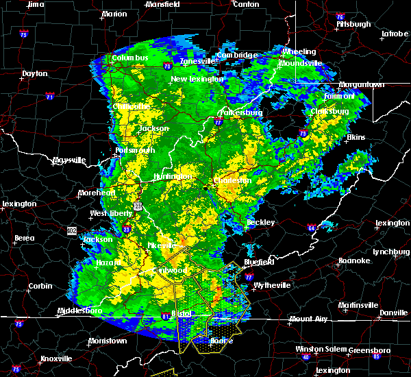
| 10/31/2019 1:37 PM EDT |
 The severe thunderstorm warning for central buchanan and southwestern mcdowell counties will expire at 145 pm edt, the storm which prompted the warning has moved out of the area. therefore, the warning will be allowed to expire. however gusty winds are still possible behind the cold front. The severe thunderstorm warning for central buchanan and southwestern mcdowell counties will expire at 145 pm edt, the storm which prompted the warning has moved out of the area. therefore, the warning will be allowed to expire. however gusty winds are still possible behind the cold front.
|
| 10/31/2019 1:37 PM EDT |
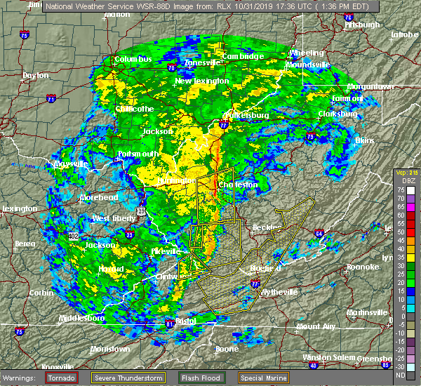 The severe thunderstorm warning for central buchanan and southwestern mcdowell counties will expire at 145 pm edt, the storm which prompted the warning has moved out of the area. therefore, the warning will be allowed to expire. however gusty winds are still possible behind the cold front. The severe thunderstorm warning for central buchanan and southwestern mcdowell counties will expire at 145 pm edt, the storm which prompted the warning has moved out of the area. therefore, the warning will be allowed to expire. however gusty winds are still possible behind the cold front.
|
| 10/31/2019 1:20 PM EDT |
 At 120 pm edt, a severe thunderstorm was located 7 miles southeast of argo, or 12 miles northeast of grundy, moving northeast at 55 mph (radar indicated). Hazards include 60 mph wind gusts. Expect damage to roofs, siding, and trees. Locations impacted include, grundy, bradshaw, stacy, vansant, hurley, jolo and roseann. At 120 pm edt, a severe thunderstorm was located 7 miles southeast of argo, or 12 miles northeast of grundy, moving northeast at 55 mph (radar indicated). Hazards include 60 mph wind gusts. Expect damage to roofs, siding, and trees. Locations impacted include, grundy, bradshaw, stacy, vansant, hurley, jolo and roseann.
|
| 10/31/2019 1:20 PM EDT |
 A severe thunderstorm warning remains in effect until 145 pm edt for central buchanan and southwestern mcdowell counties. at 120 pm edt, a severe thunderstorm was located 7 miles southeast of argo, or 12 miles northeast of grundy, moving northeast at 55 mph. hazard. 60 mph wind gusts. source. Radar indicated. A severe thunderstorm warning remains in effect until 145 pm edt for central buchanan and southwestern mcdowell counties. at 120 pm edt, a severe thunderstorm was located 7 miles southeast of argo, or 12 miles northeast of grundy, moving northeast at 55 mph. hazard. 60 mph wind gusts. source. Radar indicated.
|
| 10/31/2019 12:57 PM EDT |
 The national weather service in charleston west virginia has issued a * severe thunderstorm warning for. northeastern dickenson county in southwestern virginia. buchanan county in southwestern virginia. southwestern mcdowell county in southern west virginia. Until 145 pm edt. The national weather service in charleston west virginia has issued a * severe thunderstorm warning for. northeastern dickenson county in southwestern virginia. buchanan county in southwestern virginia. southwestern mcdowell county in southern west virginia. Until 145 pm edt.
|
| 5/29/2019 4:10 PM EDT |
 The severe thunderstorm warning for southeastern dickenson and southwestern buchanan counties will expire at 415 pm edt, the storm which prompted the warning has moved out of the area. therefore, the warning will be allowed to expire. however, another strong storm may move into western dickenson county over the next 30 minutes. this new storm may produce small hail and wind gusts to greater than 40 mph. a severe thunderstorm watch remains in effect until 700 pm edt for southwestern virginia. to report severe weather, contact your nearest law enforcement agency. they will relay your report to the national weather service charleston west virginia. The severe thunderstorm warning for southeastern dickenson and southwestern buchanan counties will expire at 415 pm edt, the storm which prompted the warning has moved out of the area. therefore, the warning will be allowed to expire. however, another strong storm may move into western dickenson county over the next 30 minutes. this new storm may produce small hail and wind gusts to greater than 40 mph. a severe thunderstorm watch remains in effect until 700 pm edt for southwestern virginia. to report severe weather, contact your nearest law enforcement agency. they will relay your report to the national weather service charleston west virginia.
|
| 5/29/2019 3:59 PM EDT |
 At 358 pm edt, a severe thunderstorm was located near grundy, moving east at 35 mph (radar indicated). Hazards include 60 mph wind gusts and quarter size hail. Hail damage to vehicles is expected. expect wind damage to roofs, siding, and trees. Locations impacted include, grundy, davenport, trammel, stacy, oakwood and vansant. At 358 pm edt, a severe thunderstorm was located near grundy, moving east at 35 mph (radar indicated). Hazards include 60 mph wind gusts and quarter size hail. Hail damage to vehicles is expected. expect wind damage to roofs, siding, and trees. Locations impacted include, grundy, davenport, trammel, stacy, oakwood and vansant.
|
| 5/29/2019 3:17 PM EDT |
 At 316 pm edt, a severe thunderstorm was located over shelby gap, or near clintwood, moving east at 35 mph. additional severe thunderstorms are also expected to move into the warned area over the next hour (radar indicated). Hazards include 70 mph wind gusts and ping pong ball size hail. People and animals outdoors will be injured. expect hail damage to roofs, siding, windows, and vehicles. expect considerable tree damage. Wind damage is also likely to mobile homes, roofs, and outbuildings. At 316 pm edt, a severe thunderstorm was located over shelby gap, or near clintwood, moving east at 35 mph. additional severe thunderstorms are also expected to move into the warned area over the next hour (radar indicated). Hazards include 70 mph wind gusts and ping pong ball size hail. People and animals outdoors will be injured. expect hail damage to roofs, siding, windows, and vehicles. expect considerable tree damage. Wind damage is also likely to mobile homes, roofs, and outbuildings.
|
| 4/4/2018 2:04 AM EDT |
 At 200 am edt, a line of severe thunderstorms was located near clintwood, moving east at 55 mph (radar indicated). Hazards include 60 mph wind gusts. Expect damage to roofs, siding, and trees. locations impacted include, clintwood, grundy, haysi, breaks interstate, davenport, john flannagan lake, delbarton, big rock, red jacket, trammel, paw paw, clinchco, oakwood, stacy, nora, vansant, varney, hurley, mcclure and meador. At 200 am edt, a line of severe thunderstorms was located near clintwood, moving east at 55 mph (radar indicated). Hazards include 60 mph wind gusts. Expect damage to roofs, siding, and trees. locations impacted include, clintwood, grundy, haysi, breaks interstate, davenport, john flannagan lake, delbarton, big rock, red jacket, trammel, paw paw, clinchco, oakwood, stacy, nora, vansant, varney, hurley, mcclure and meador.
|
| 4/4/2018 1:35 AM EDT |
 At 134 am edt, a line of severe thunderstorms were located over day, or near whitesburg, moving east at 55 mph (radar indicated). Hazards include 60 mph wind gusts. expect damage to roofs, siding, and trees At 134 am edt, a line of severe thunderstorms were located over day, or near whitesburg, moving east at 55 mph (radar indicated). Hazards include 60 mph wind gusts. expect damage to roofs, siding, and trees
|
| 7/6/2016 8:26 PM EDT |
 The severe thunderstorm warning for southeastern buchanan county will expire at 830 pm edt, the storm which prompted the warning weakened below severe limits and exited the warned area. therefore, the warning will be allowed to expire. however gusty winds are still possible with this thunderstorm. The severe thunderstorm warning for southeastern buchanan county will expire at 830 pm edt, the storm which prompted the warning weakened below severe limits and exited the warned area. therefore, the warning will be allowed to expire. however gusty winds are still possible with this thunderstorm.
|
| 7/6/2016 8:04 PM EDT |
 At 804 pm edt, a severe thunderstorm was located 7 miles southeast of grundy, moving east at 20 mph (radar indicated). Hazards include 60 mph wind gusts. Expect damage to roofs. siding. and trees. Locations impacted include, oakwood and vansant. At 804 pm edt, a severe thunderstorm was located 7 miles southeast of grundy, moving east at 20 mph (radar indicated). Hazards include 60 mph wind gusts. Expect damage to roofs. siding. and trees. Locations impacted include, oakwood and vansant.
|
| 7/6/2016 8:00 PM EDT | Sheriff reports tree down across deskins rd rt 620 near licklog branch in buchanan county VA, 3.5 miles NNW of Vansant, VA |
| 7/6/2016 7:44 PM EDT |
 At 744 pm edt, a severe thunderstorm was located near davenport, moving east at 20 mph (radar indicated). Hazards include 60 mph wind gusts and quarter size hail. Hail damage to vehicles is expected. Expect wind damage to roofs, siding, and trees. At 744 pm edt, a severe thunderstorm was located near davenport, moving east at 20 mph (radar indicated). Hazards include 60 mph wind gusts and quarter size hail. Hail damage to vehicles is expected. Expect wind damage to roofs, siding, and trees.
|
| 7/4/2016 7:47 PM EDT |
 At 747 pm edt, a severe thunderstorm was located near haysi, moving east at 45 mph (radar indicated). Hazards include 60 mph wind gusts and quarter size hail. Hail damage to vehicles is expected. expect wind damage to roofs, siding, and trees. Locations impacted include, grundy, haysi and vansant. At 747 pm edt, a severe thunderstorm was located near haysi, moving east at 45 mph (radar indicated). Hazards include 60 mph wind gusts and quarter size hail. Hail damage to vehicles is expected. expect wind damage to roofs, siding, and trees. Locations impacted include, grundy, haysi and vansant.
|
| 7/4/2016 7:20 PM EDT |
 At 720 pm edt, a severe thunderstorm was located near gaskill, or near clintwood, moving east at 45 mph (radar indicated). Hazards include 60 mph wind gusts and quarter size hail. Hail damage to vehicles is expected. Expect wind damage to roofs, siding, and trees. At 720 pm edt, a severe thunderstorm was located near gaskill, or near clintwood, moving east at 45 mph (radar indicated). Hazards include 60 mph wind gusts and quarter size hail. Hail damage to vehicles is expected. Expect wind damage to roofs, siding, and trees.
|
| 6/23/2016 8:42 PM EDT |
 The severe thunderstorm warning for southern dickenson and buchanan counties will expire at 845 pm edt. the storms which prompted the warning have moved out of the area. therefore. the warning will be allowed to expire. a tornado watch remains in effect until 1000 pm edt for southwestern virginia. And southern west virginia. The severe thunderstorm warning for southern dickenson and buchanan counties will expire at 845 pm edt. the storms which prompted the warning have moved out of the area. therefore. the warning will be allowed to expire. a tornado watch remains in effect until 1000 pm edt for southwestern virginia. And southern west virginia.
|
| 6/23/2016 8:26 PM EDT |
 At 825 pm edt, severe thunderstorms were located along a line extending from 9 miles west of war to near glen burke to near trammel, moving east at 50 mph (radar indicated). Hazards include 60 mph wind gusts. Expect damage to roofs. siding. and trees. locations impacted include, grundy, davenport, trammel, oakwood, roseann, nora, stacy and vansant. A tornado watch remains in effect until 1000 pm edt for southwestern virginia, and southern west virginia. At 825 pm edt, severe thunderstorms were located along a line extending from 9 miles west of war to near glen burke to near trammel, moving east at 50 mph (radar indicated). Hazards include 60 mph wind gusts. Expect damage to roofs. siding. and trees. locations impacted include, grundy, davenport, trammel, oakwood, roseann, nora, stacy and vansant. A tornado watch remains in effect until 1000 pm edt for southwestern virginia, and southern west virginia.
|
| 6/23/2016 8:20 PM EDT | Trees down in southern buchanan county. time estimated from rada in buchanan county VA, 6.3 miles WNW of Vansant, VA |
| 6/23/2016 8:13 PM EDT |
 At 813 pm edt, severe thunderstorms were located along a line extending from near paw paw to near grundy to near clintwood, moving east at 60 mph (radar indicated). Hazards include 60 mph wind gusts and penny size hail. Expect damage to roofs. siding. And trees. At 813 pm edt, severe thunderstorms were located along a line extending from near paw paw to near grundy to near clintwood, moving east at 60 mph (radar indicated). Hazards include 60 mph wind gusts and penny size hail. Expect damage to roofs. siding. And trees.
|
| 6/23/2016 7:56 PM EDT |
 At 755 pm edt, a severe thunderstorm was located over haysi, moving southeast at 50 mph (radar indicated). Hazards include 60 mph wind gusts. Expect damage to roofs. siding. and trees. locations impacted include, clintwood, grundy, haysi, john flannagan lake, davenport, breaks interstate, trammel, clinchco, oakwood, mcclure, nora and vansant. A tornado watch remains in effect until 1000 pm edt for southwestern virginia. At 755 pm edt, a severe thunderstorm was located over haysi, moving southeast at 50 mph (radar indicated). Hazards include 60 mph wind gusts. Expect damage to roofs. siding. and trees. locations impacted include, clintwood, grundy, haysi, john flannagan lake, davenport, breaks interstate, trammel, clinchco, oakwood, mcclure, nora and vansant. A tornado watch remains in effect until 1000 pm edt for southwestern virginia.
|
| 6/23/2016 7:38 PM EDT |
 At 737 pm edt, a severe thunderstorm was located over lookout, or 8 miles northwest of john flannagan lake, moving southeast at 65 mph (radar indicated). Hazards include 60 mph wind gusts and penny size hail. Expect damage to roofs. siding. And trees. At 737 pm edt, a severe thunderstorm was located over lookout, or 8 miles northwest of john flannagan lake, moving southeast at 65 mph (radar indicated). Hazards include 60 mph wind gusts and penny size hail. Expect damage to roofs. siding. And trees.
|
| 6/16/2016 9:41 PM EDT |
 At 941 pm edt, a severe thunderstorm was located over haysi, moving southeast at 30 mph (radar indicated). Hazards include 60 mph wind gusts and quarter size hail. Hail damage to vehicles is expected. expect wind damage to roofs, siding, and trees. Locations impacted include, haysi, john flannagan lake, davenport, oakwood and vansant. At 941 pm edt, a severe thunderstorm was located over haysi, moving southeast at 30 mph (radar indicated). Hazards include 60 mph wind gusts and quarter size hail. Hail damage to vehicles is expected. expect wind damage to roofs, siding, and trees. Locations impacted include, haysi, john flannagan lake, davenport, oakwood and vansant.
|
| 6/16/2016 9:24 PM EDT |
 The severe thunderstorm warning for central buchanan and southwestern mcdowell counties will expire at 930 pm edt, the storm which prompted the warning has weakened below severe limits, and no longer pose an immediate threat to life or property. therefore, the warning will be allowed to expire. however gusty winds are still possible with this thunderstorm. a severe thunderstorm watch remains in effect until 1000 pm edt for southern west virginia. The severe thunderstorm warning for central buchanan and southwestern mcdowell counties will expire at 930 pm edt, the storm which prompted the warning has weakened below severe limits, and no longer pose an immediate threat to life or property. therefore, the warning will be allowed to expire. however gusty winds are still possible with this thunderstorm. a severe thunderstorm watch remains in effect until 1000 pm edt for southern west virginia.
|
| 6/16/2016 9:12 PM EDT |
 At 912 pm edt, a severe thunderstorm was located over rockhouse, or near breaks interstate, moving southeast at 30 mph (radar indicated). Hazards include 60 mph wind gusts and quarter size hail. Hail damage to vehicles is expected. Expect wind damage to roofs, siding, and trees. At 912 pm edt, a severe thunderstorm was located over rockhouse, or near breaks interstate, moving southeast at 30 mph (radar indicated). Hazards include 60 mph wind gusts and quarter size hail. Hail damage to vehicles is expected. Expect wind damage to roofs, siding, and trees.
|
| 6/16/2016 8:53 PM EDT |
 At 852 pm edt, a severe thunderstorm was located near hanover, or 10 miles northwest of welch, and is nearly stationary (radar indicated). Hazards include 60 mph wind gusts. Expect damage to roofs. siding. and trees. Locations impacted include, grundy, war, big rock, jolo, oakwood, roseann, stacy and vansant. At 852 pm edt, a severe thunderstorm was located near hanover, or 10 miles northwest of welch, and is nearly stationary (radar indicated). Hazards include 60 mph wind gusts. Expect damage to roofs. siding. and trees. Locations impacted include, grundy, war, big rock, jolo, oakwood, roseann, stacy and vansant.
|
| 6/16/2016 8:32 PM EDT |
 At 831 pm edt, a severe thunderstorm was located over fedscreek, or 8 miles north of breaks interstate, moving southeast at 35 mph (radar indicated). Hazards include 70 mph wind gusts and quarter size hail. Hail damage to vehicles is expected. expect considerable tree damage. Wind damage is also likely to mobile homes, roofs, and outbuildings. At 831 pm edt, a severe thunderstorm was located over fedscreek, or 8 miles north of breaks interstate, moving southeast at 35 mph (radar indicated). Hazards include 70 mph wind gusts and quarter size hail. Hail damage to vehicles is expected. expect considerable tree damage. Wind damage is also likely to mobile homes, roofs, and outbuildings.
|
| 5/1/2016 8:57 PM EDT | The severe thunderstorm warning for northeastern dickenson and southwestern buchanan counties will expire at 900 pm edt, the storm which prompted the warning has weakened below severe limits, and no longer poses an immediate threat to life or property. therefore the warning will be allowed to expire. |
| 5/1/2016 8:49 PM EDT |
 At 849 pm edt, a severe thunderstorm was located near davenport, moving east at 30 mph (radar indicated). Hazards include 60 mph wind gusts and quarter size hail. Hail damage to vehicles is expected. expect wind damage to roofs, siding, and trees. Locations impacted include, haysi, clinchco and vansant. At 849 pm edt, a severe thunderstorm was located near davenport, moving east at 30 mph (radar indicated). Hazards include 60 mph wind gusts and quarter size hail. Hail damage to vehicles is expected. expect wind damage to roofs, siding, and trees. Locations impacted include, haysi, clinchco and vansant.
|
| 5/1/2016 8:40 PM EDT |
 At 839 pm edt, a severe thunderstorm was located near haysi, moving east at 30 mph (radar indicated). Hazards include 60 mph wind gusts and quarter size hail. Hail damage to vehicles is expected. expect wind damage to roofs, siding, and trees. Locations impacted include, haysi, john flannagan lake, clinchco and vansant. At 839 pm edt, a severe thunderstorm was located near haysi, moving east at 30 mph (radar indicated). Hazards include 60 mph wind gusts and quarter size hail. Hail damage to vehicles is expected. expect wind damage to roofs, siding, and trees. Locations impacted include, haysi, john flannagan lake, clinchco and vansant.
|
| 5/1/2016 8:14 PM EDT |
 At 814 pm edt, a severe thunderstorm was located near shelby gap, or near clintwood, moving east at 30 mph (radar indicated). Hazards include 60 mph wind gusts and quarter size hail. Hail damage to vehicles is expected. Expect wind damage to roofs, siding, and trees. At 814 pm edt, a severe thunderstorm was located near shelby gap, or near clintwood, moving east at 30 mph (radar indicated). Hazards include 60 mph wind gusts and quarter size hail. Hail damage to vehicles is expected. Expect wind damage to roofs, siding, and trees.
|
| 5/1/2016 7:23 PM EDT |
 At 723 pm edt, a severe thunderstorm was located over paw paw, or 12 miles north of grundy, moving southeast at 50 mph (radar indicated). Hazards include 60 mph wind gusts and quarter size hail. Hail damage to vehicles is expected. Expect wind damage to roofs, siding, and trees. At 723 pm edt, a severe thunderstorm was located over paw paw, or 12 miles north of grundy, moving southeast at 50 mph (radar indicated). Hazards include 60 mph wind gusts and quarter size hail. Hail damage to vehicles is expected. Expect wind damage to roofs, siding, and trees.
|
| 7/13/2015 5:27 PM EDT |
 The national weather service in charleston west virginia has issued a * severe thunderstorm warning for. dickenson county in virginia. southern buchanan county in virginia. until 630 pm edt * at 526 pm edt. Doppler radar indicated a line of severe. The national weather service in charleston west virginia has issued a * severe thunderstorm warning for. dickenson county in virginia. southern buchanan county in virginia. until 630 pm edt * at 526 pm edt. Doppler radar indicated a line of severe.
|
| 6/23/2015 8:16 PM EDT |
 At 815 pm edt, doppler radar indicated a severe thunderstorm capable of producing half dollar size hail and damaging winds in excess of 60 mph. this storm was located near haysi, moving southeast at 25 mph. locations impacted include, grundy, haysi, breaks interstate, john flannagan lake, davenport and vansant. At 815 pm edt, doppler radar indicated a severe thunderstorm capable of producing half dollar size hail and damaging winds in excess of 60 mph. this storm was located near haysi, moving southeast at 25 mph. locations impacted include, grundy, haysi, breaks interstate, john flannagan lake, davenport and vansant.
|
| 6/23/2015 8:04 PM EDT |
 At 804 pm edt, doppler radar indicated a severe thunderstorm capable of producing half dollar size hail and damaging winds in excess of 60 mph. this storm was located over breaks interstate, and moving southeast at 20 mph. At 804 pm edt, doppler radar indicated a severe thunderstorm capable of producing half dollar size hail and damaging winds in excess of 60 mph. this storm was located over breaks interstate, and moving southeast at 20 mph.
|
| 6/18/2015 7:15 PM EDT | At 715 pm edt, doppler radar indicated a severe thunderstorm capable of producing quarter size hail and damaging winds in excess of 60 mph. this storm was located over jewell ridge, or 8 miles north of richlands, moving southeast at 30 mph. locations impacted include, grundy, oakwood, roseann, vansant, stacy and hurley. |
| 6/18/2015 6:51 PM EDT | At 650 pm edt, doppler radar indicated a severe thunderstorm capable of producing quarter size hail and damaging winds in excess of 60 mph. this storm was located 9 miles northwest of jewell ridge, or 10 miles east of grundy, moving east at 30 mph. locations impacted include, grundy, breaks interstate, big rock, paw paw, oakwood, roseann, vansant, stacy and hurley. |
| 6/18/2015 6:51 PM EDT | At 651 pm edt, doppler radar indicated a severe thunderstorm capable of producing quarter size hail and damaging winds in excess of 60 mph. this storm was located near grundy, and moving southeast at 35 mph. |
| 6/18/2015 6:51 PM EDT | At 650 pm edt, doppler radar indicated a severe thunderstorm capable of producing quarter size hail and damaging winds in excess of 60 mph. this storm was located 9 miles northwest of jewell ridge, or 10 miles east of grundy, moving east at 30 mph. locations impacted include, grundy, breaks interstate, big rock, paw paw, oakwood, roseann, vansant, stacy and hurley. |
| 6/18/2015 6:30 PM EDT | At 630 pm edt, doppler radar indicated a severe thunderstorm capable of producing quarter size hail and damaging winds in excess of 60 mph. this storm was located near grundy, moving east at 30 mph. locations impacted include, grundy, breaks interstate, big rock, paw paw, bradshaw, iaeger, jolo, oakwood, roseann, panther, avondale, vansant, stacy and hurley. |
| 6/18/2015 6:30 PM EDT | At 630 pm edt, doppler radar indicated a severe thunderstorm capable of producing quarter size hail and damaging winds in excess of 60 mph. this storm was located near grundy, moving east at 30 mph. locations impacted include, grundy, breaks interstate, big rock, paw paw, bradshaw, iaeger, jolo, oakwood, roseann, panther, avondale, vansant, stacy and hurley. |
| 6/18/2015 6:08 PM EDT | At 607 pm edt, doppler radar indicated a severe thunderstorm capable of producing quarter size hail and damaging winds in excess of 60 mph. this storm was located over fedscreek, or 9 miles northeast of breaks interstate, and moving east at 30 mph. |
| 6/18/2015 6:08 PM EDT | At 607 pm edt, doppler radar indicated a severe thunderstorm capable of producing quarter size hail and damaging winds in excess of 60 mph. this storm was located over fedscreek, or 9 miles northeast of breaks interstate, and moving east at 30 mph. |
| 4/28/2014 4:43 PM EDT | 63 mph wind gust reported from a home weather station in rowe... va at 4...43 pm in buchanan county VA, 5.6 miles NNW of Vansant, VA |
| 7/5/2012 2:35 PM EDT | Multiple trees down. trees down on power lines. power outage in buchanan county VA, 9.6 miles NNE of Vansant, VA |
Hail Maps for Vansant, VA


Connect with Interactive Hail Maps