

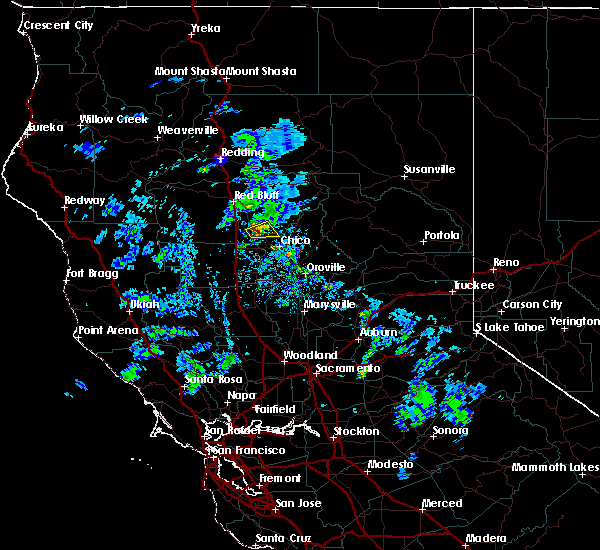
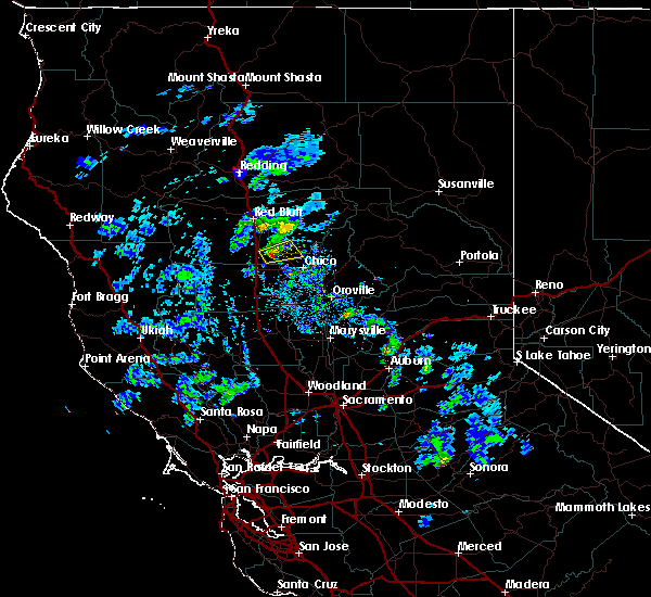
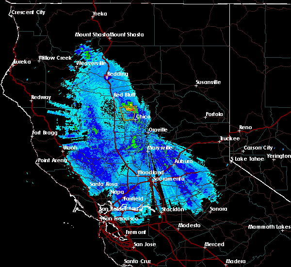
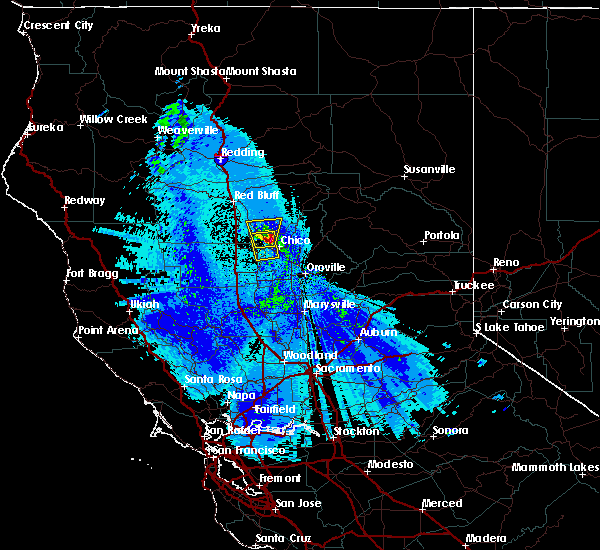
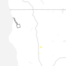
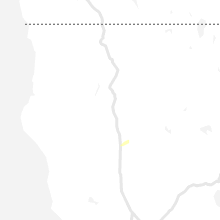
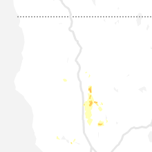
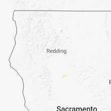
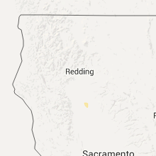
Hail Map for Vina, CA
The Vina, CA area has had 1 report of on-the-ground hail by trained spotters, and has been under severe weather warnings 0 times during the past 12 months. Doppler radar has detected hail at or near Vina, CA on 7 occasions.
| Name: | Vina, CA |
| Where Located: | 48.4 miles SSE of Redding, CA |
| Map: | Google Map for Vina, CA |
| Population: | 237 |
| Housing Units: | 76 |
| More Info: | Search Google for Vina, CA |
5
The Top Recent Hail Date for Vina, CA is Thursday, March 23, 2023 (1st out of 7)

Hail and Wind Damage Spotted near Vina, CA
| Date / Time | Report Details |
|---|---|
| 3/23/2023 5:35 PM PDT | Quarter sized hail reported 4.6 miles NW of Vina, CA, haille road. time estimated by radar. |
| 3/23/2023 5:18 PM PDT |
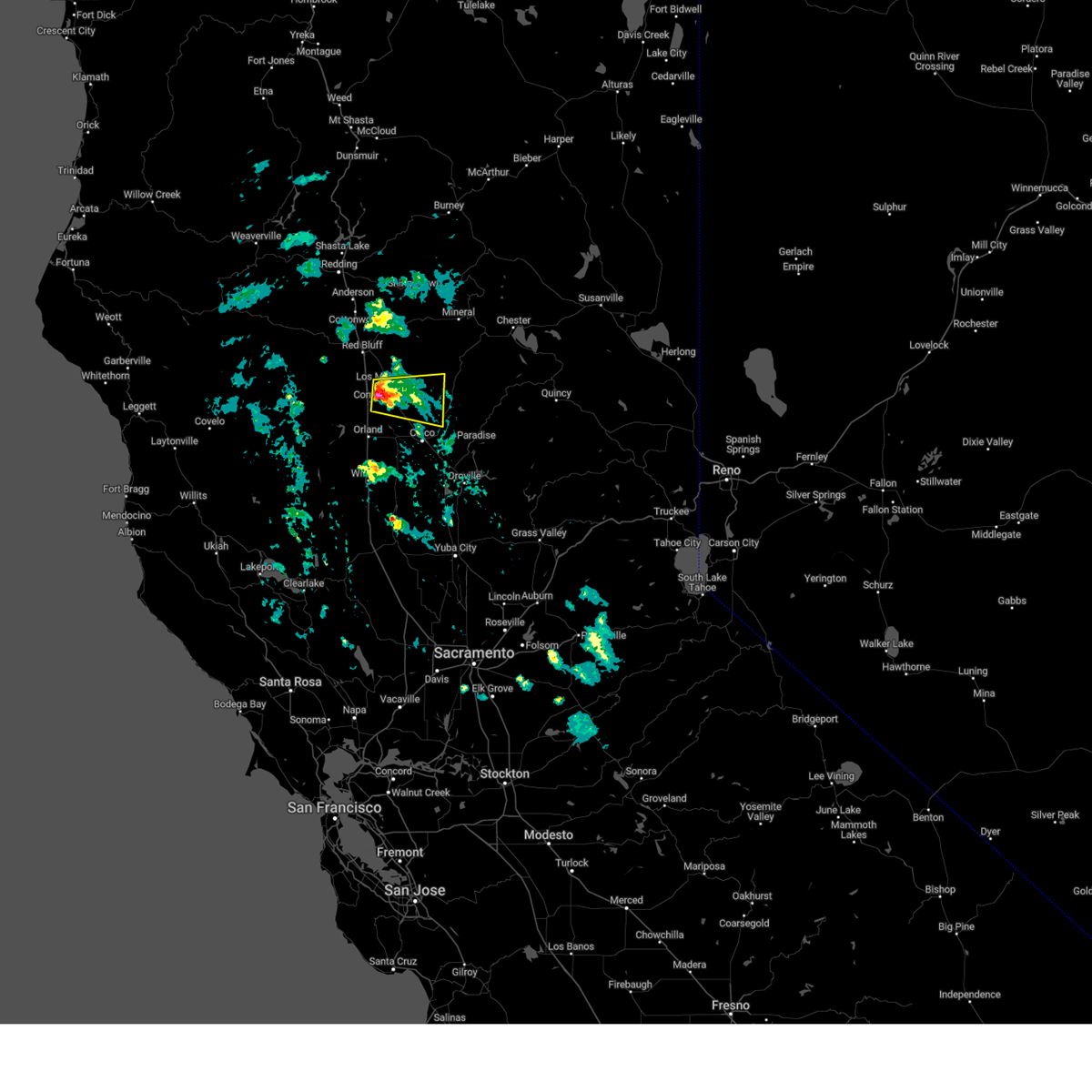 At 517 pm pdt, a severe thunderstorm was located over vina, or near corning, moving east at 15 mph (radar indicated). Hazards include quarter size hail. damage to vehicles is expected At 517 pm pdt, a severe thunderstorm was located over vina, or near corning, moving east at 15 mph (radar indicated). Hazards include quarter size hail. damage to vehicles is expected
|
| 4/25/2021 5:46 PM PDT |
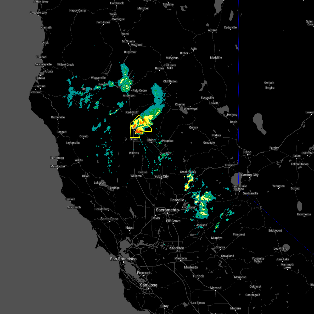 At 545 pm pdt, a severe thunderstorm was located near corning, moving northeast at 15 mph (radar indicated). Hazards include quarter size hail. signicant hail accumulations of several inches possible along highway 99 near los molinos and near corning. Damage to agriculture and hazardous driving. Locations impacted include, corning, tehama, richfield, gerber-las flores, vina and los molinos. At 545 pm pdt, a severe thunderstorm was located near corning, moving northeast at 15 mph (radar indicated). Hazards include quarter size hail. signicant hail accumulations of several inches possible along highway 99 near los molinos and near corning. Damage to agriculture and hazardous driving. Locations impacted include, corning, tehama, richfield, gerber-las flores, vina and los molinos.
|
| 4/25/2021 5:14 PM PDT |
 At 511 pm pdt, a severe thunderstorm was located near los molinos, or 10 miles northeast of corning, moving northeast at 20 mph (radar indicated). Hazards include quarter size hail. signicant hail accumulations of several inches possible along highway 99 near los molinos. damage to agriculture and hazardous driving At 511 pm pdt, a severe thunderstorm was located near los molinos, or 10 miles northeast of corning, moving northeast at 20 mph (radar indicated). Hazards include quarter size hail. signicant hail accumulations of several inches possible along highway 99 near los molinos. damage to agriculture and hazardous driving
|
| 8/10/2019 12:48 PM PDT |
 At 1247 pm pdt, a severe thunderstorm was located 8 miles northwest of orland, moving east at 25 mph (radar indicated). Hazards include 50 mph wind gusts and quarter size hail. hail damage to vehicles and possible wind damage to trees At 1247 pm pdt, a severe thunderstorm was located 8 miles northwest of orland, moving east at 25 mph (radar indicated). Hazards include 50 mph wind gusts and quarter size hail. hail damage to vehicles and possible wind damage to trees
|
| 3/16/2018 6:18 PM PDT |
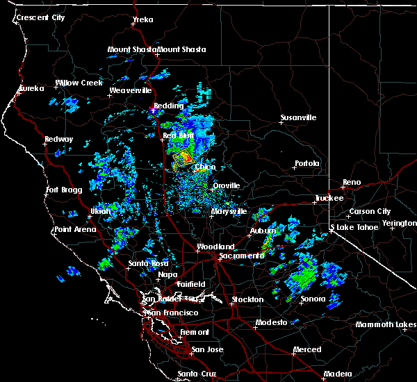 At 615 pm pdt, a severe thunderstorm was located 8 miles east of vina, or 15 miles north of chico, moving northeast at 15 mph. the storm has shown signs of weakening since 605 pm, but is still capable of producing half inch or larger hail which may accumulate on the ground (radar indicated). Hazards include half to three quarter inch size hail. Damage to vehicles, and hail accumulating on the ground. Locations impacted include, rural areas east of vina. At 615 pm pdt, a severe thunderstorm was located 8 miles east of vina, or 15 miles north of chico, moving northeast at 15 mph. the storm has shown signs of weakening since 605 pm, but is still capable of producing half inch or larger hail which may accumulate on the ground (radar indicated). Hazards include half to three quarter inch size hail. Damage to vehicles, and hail accumulating on the ground. Locations impacted include, rural areas east of vina.
|
| 3/16/2018 6:02 PM PDT |
 The national weather service in sacramento has issued a * severe thunderstorm warning for. south central tehama county in northern california. west central butte county in northern california. Until 630 pm pdt * at 600 pm pdt, a severe thunderstorm was located near vina, or 11. The national weather service in sacramento has issued a * severe thunderstorm warning for. south central tehama county in northern california. west central butte county in northern california. Until 630 pm pdt * at 600 pm pdt, a severe thunderstorm was located near vina, or 11.
|
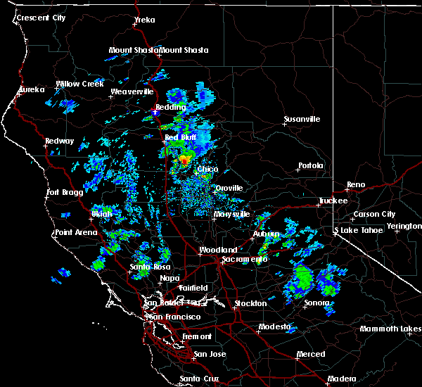
| 3/16/2018 5:44 PM PDT |
 At 543 pm pdt, a severe thunderstorm was located near vina, or 12 miles east of corning, moving northeast at 10 mph. this storm has a history of producing at least dime sized hail (radar indicated). Hazards include quarter size hail or larger. Damage to vehicles is expected. Locations impacted include, vina. At 543 pm pdt, a severe thunderstorm was located near vina, or 12 miles east of corning, moving northeast at 10 mph. this storm has a history of producing at least dime sized hail (radar indicated). Hazards include quarter size hail or larger. Damage to vehicles is expected. Locations impacted include, vina.
|
| 3/16/2018 5:24 PM PDT |
 At 522 pm pdt, a severe thunderstorm was located near vina, or 7 miles southeast of corning, moving east to northeast at 10 to 15 mph (radar indicated). Hazards include quarter size or larger hail. damage to vehicles is expected At 522 pm pdt, a severe thunderstorm was located near vina, or 7 miles southeast of corning, moving east to northeast at 10 to 15 mph (radar indicated). Hazards include quarter size or larger hail. damage to vehicles is expected
|
| 5/4/2016 10:43 PM PDT | The severe thunderstorm warning for northeastern glenn, south central tehama and west central butte counties will expire at 1045 pm pdt, the storm which prompted the warning has weakened below severe limits, and no longer poses an immediate threat to life or property. therefore the warning will be allowed to expire. however small hail and heavy rain are still possible with this thunderstorm. |
| 5/4/2016 10:31 PM PDT |
 At 1030 pm pdt, doppler radar indicated a severe thunderstorm capable of producing quarter size hail and damaging winds in excess of 60 mph. this storm was located near vina, or 13 miles east of corning, moving north at 25 mph. locations impacted include, vina. At 1030 pm pdt, doppler radar indicated a severe thunderstorm capable of producing quarter size hail and damaging winds in excess of 60 mph. this storm was located near vina, or 13 miles east of corning, moving north at 25 mph. locations impacted include, vina.
|
| 5/4/2016 10:12 PM PDT |
 At 1010 pm pdt, doppler radar indicated a severe thunderstorm capable of producing quarter size hail and damaging winds in excess of 60 mph. this storm was located over nord, or 7 miles northwest of chico, and moving north at 15 mph. At 1010 pm pdt, doppler radar indicated a severe thunderstorm capable of producing quarter size hail and damaging winds in excess of 60 mph. this storm was located over nord, or 7 miles northwest of chico, and moving north at 15 mph.
|
| 1/23/2016 3:51 PM PST |
 At 349 pm pst, trained weather spotters reported a severe thunderstorm producing deep hail on i5. this storm was located over richfield, or near corning, and moving south at 9 mph. At 349 pm pst, trained weather spotters reported a severe thunderstorm producing deep hail on i5. this storm was located over richfield, or near corning, and moving south at 9 mph.
|
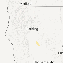
Hail Maps for Vina, CA

Connect with Interactive Hail Maps