

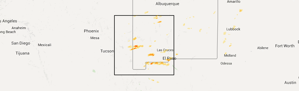
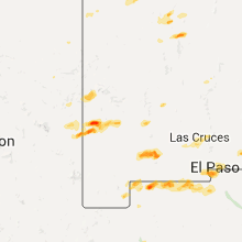
Hail Map for Virden, NM
The Virden, NM area has had 0 reports of on-the-ground hail by trained spotters, and has been under severe weather warnings 0 times during the past 12 months. Doppler radar has detected hail at or near Virden, NM on 4 occasions.
| Name: | Virden, NM |
| Where Located: | 42.7 miles W of Silver City, NM |
| Map: | Google Map for Virden, NM |
| Population: | 152 |
| Housing Units: | 70 |
| More Info: | Search Google for Virden, NM |
5
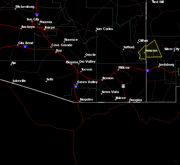
The Top Recent Hail Date for Virden, NM is Friday, July 10, 2015 (1st out of 4)
Hail and Wind Damage Spotted near Virden, NM
| Date / Time | Report Details |
|---|---|
| 7/31/2020 6:49 PM MDT |
 At 649 pm mdt, a severe thunderstorm was located 13 miles north of redrock, moving south at 15 mph (radar indicated). Hazards include 60 mph wind gusts and quarter size hail. Hail damage to vehicles is expected. Expect wind damage to roofs, siding, and trees. At 649 pm mdt, a severe thunderstorm was located 13 miles north of redrock, moving south at 15 mph (radar indicated). Hazards include 60 mph wind gusts and quarter size hail. Hail damage to vehicles is expected. Expect wind damage to roofs, siding, and trees.
|
| 10/20/2015 1:54 PM MDT |
 At 154 pm mdt, a severe thunderstorm was located 5 miles west of redrock, moving north at 20 mph (radar indicated). Hazards include 60 mph wind gusts and quarter size hail. Hail damage to vehicles is expected. Expect wind damage to roofs, siding and trees. At 154 pm mdt, a severe thunderstorm was located 5 miles west of redrock, moving north at 20 mph (radar indicated). Hazards include 60 mph wind gusts and quarter size hail. Hail damage to vehicles is expected. Expect wind damage to roofs, siding and trees.
|
| 7/10/2015 4:19 PM MDT |
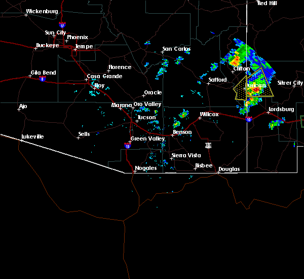 At 419 pm mdt, a severe thunderstorm was located 8 miles northeast of virden, or 9 miles northwest of redrock, moving east at 35 mph (radar indicated). Hazards include 60 mph wind gusts and quarter size hail. Hail damage to vehicles is expected. expect wind damage to roofs, siding and trees. Locations impacted include, redrock, and virden. At 419 pm mdt, a severe thunderstorm was located 8 miles northeast of virden, or 9 miles northwest of redrock, moving east at 35 mph (radar indicated). Hazards include 60 mph wind gusts and quarter size hail. Hail damage to vehicles is expected. expect wind damage to roofs, siding and trees. Locations impacted include, redrock, and virden.
|
| 7/10/2015 4:15 PM MDT | Big limbs off trees in grant county NM, 15.9 miles W of Virden, NM |
| 7/10/2015 3:56 PM MDT |
 At 356 pm mdt, a severe thunderstorm was located near virden, or 17 miles west of redrock, moving east at 40 mph (radar indicated). Hazards include 60 mph wind gusts and quarter size hail. Hail damage to vehicles is expected. Expect wind damage to roofs, siding and trees. At 356 pm mdt, a severe thunderstorm was located near virden, or 17 miles west of redrock, moving east at 40 mph (radar indicated). Hazards include 60 mph wind gusts and quarter size hail. Hail damage to vehicles is expected. Expect wind damage to roofs, siding and trees.
|
| 7/10/2013 10:40 PM MDT | Wind took down an 8 inch diameter tre in hidalgo county NM, 0.2 miles WSW of Virden, NM |
Hail Maps for Virden, NM

Connect with Interactive Hail Maps