

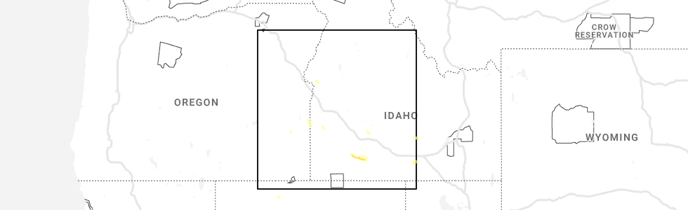
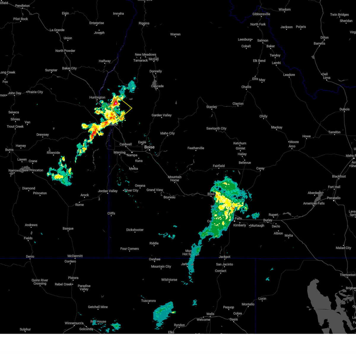
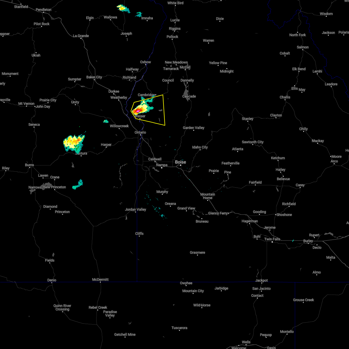
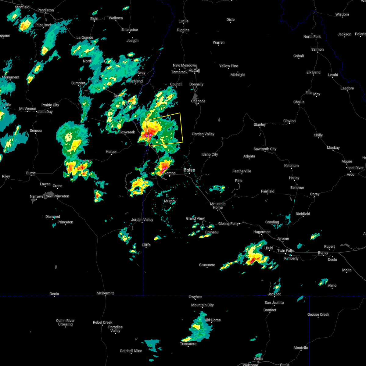
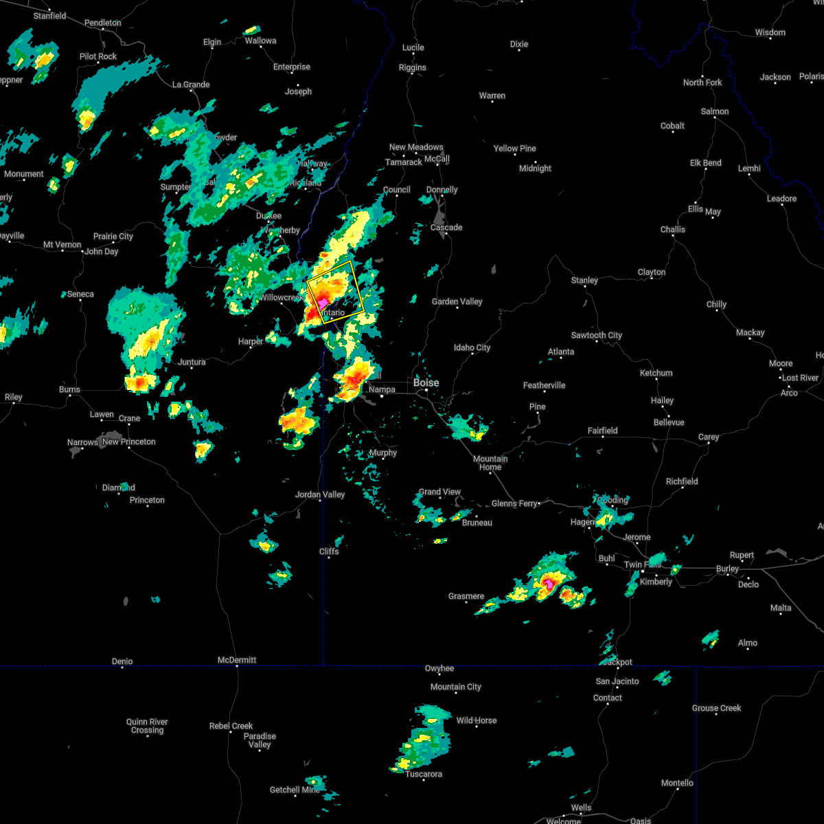
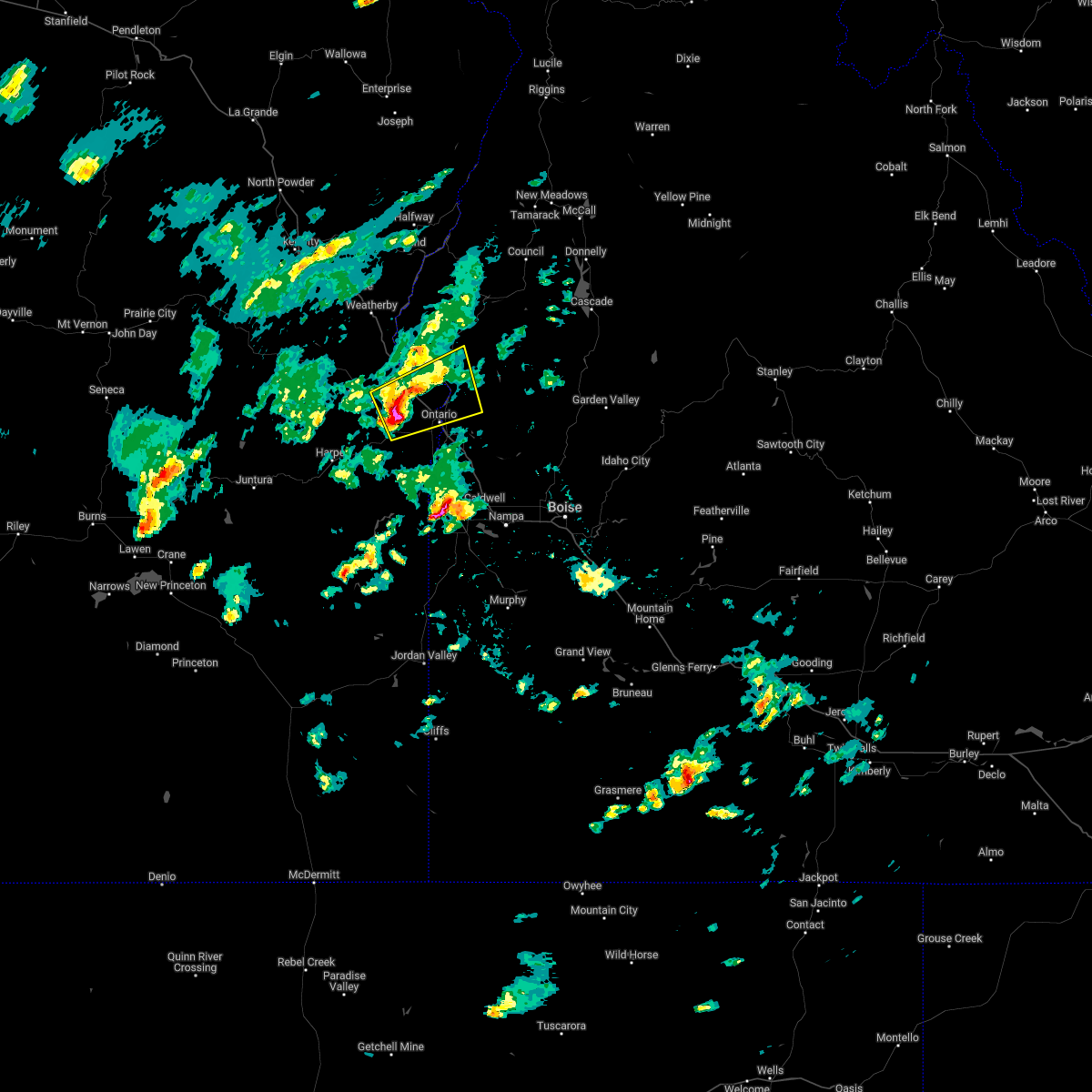
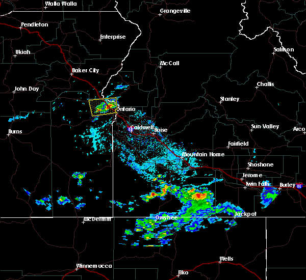
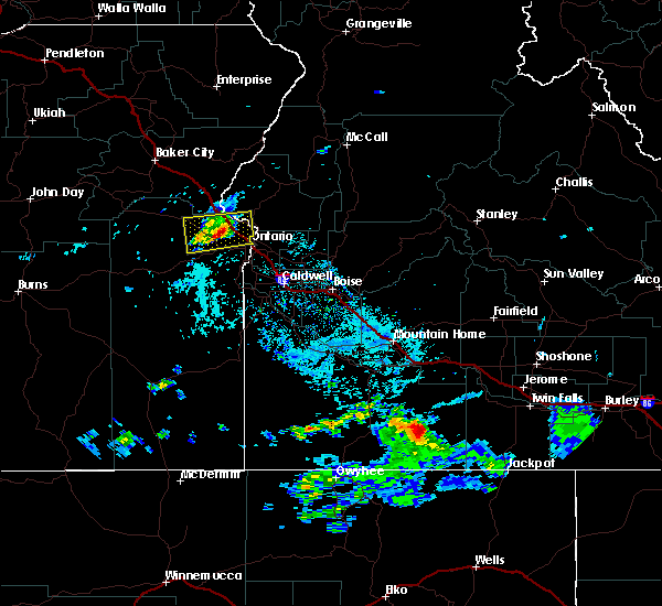
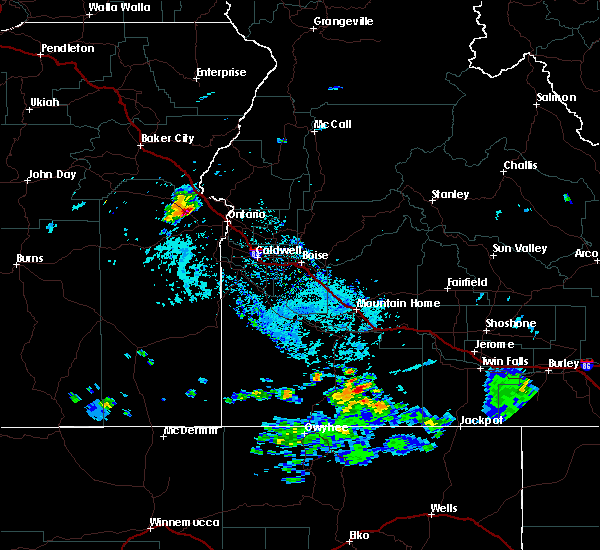
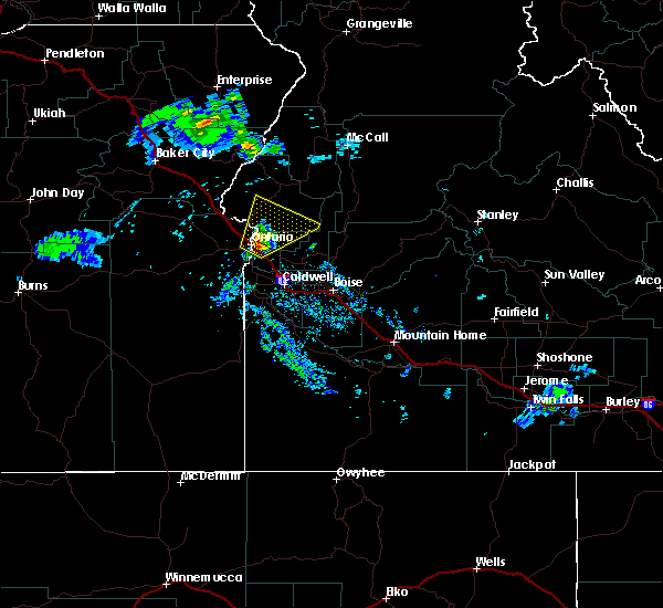
Hail Map for Weiser, ID
The Weiser, ID area has had 0 reports of on-the-ground hail by trained spotters, and has been under severe weather warnings 8 times during the past 12 months. Doppler radar has detected hail at or near Weiser, ID on 2 occasions, including 1 occasion during the past year.
| Name: | Weiser, ID |
| Where Located: | 59 miles NW of Boise, ID |
| Map: | Google Map for Weiser, ID |
| Population: | 5507 |
| Housing Units: | 2355 |
| More Info: | Search Google for Weiser, ID |
0
The Top Recent Hail Date for Weiser, ID is Tuesday, June 13, 2023 (2nd out of 2)
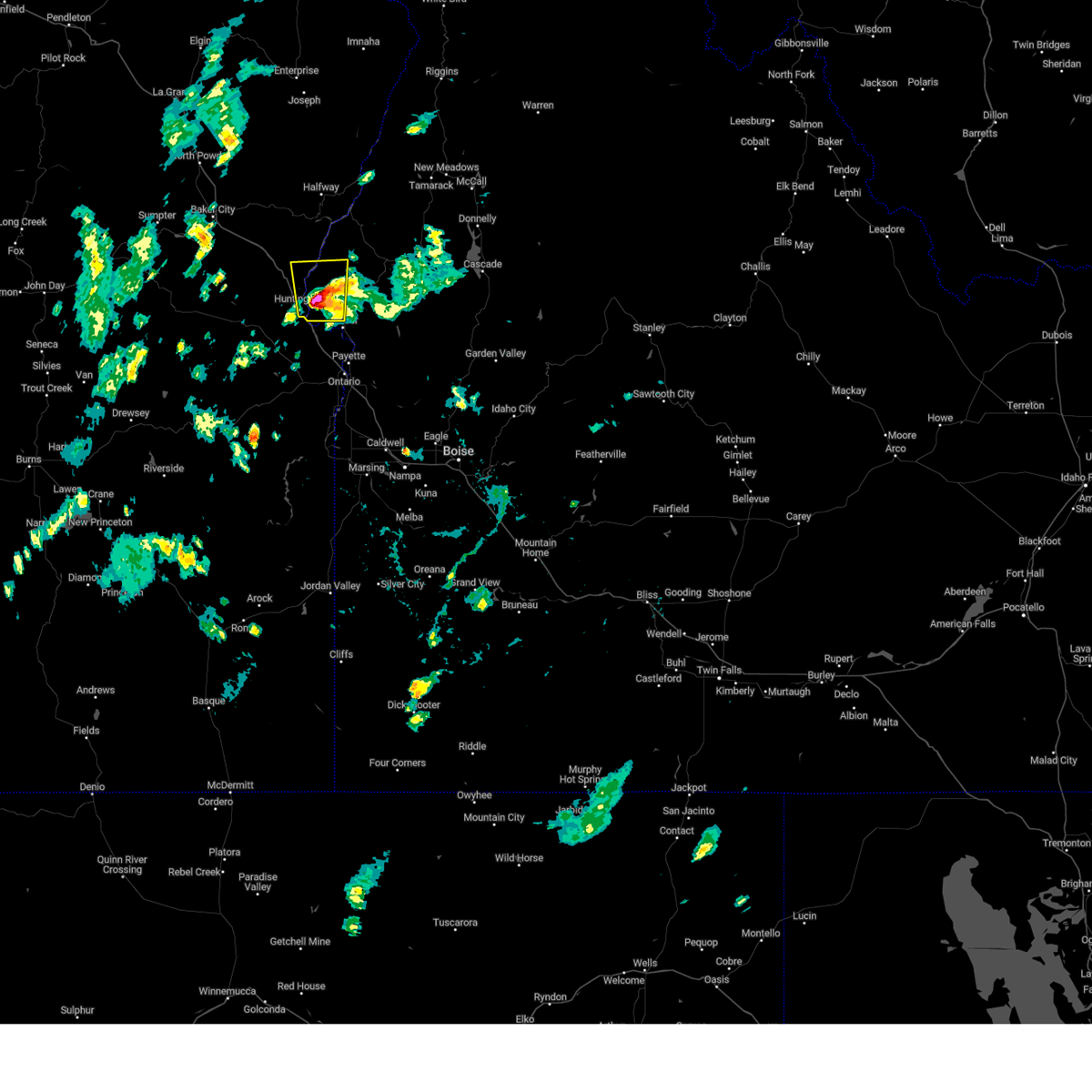
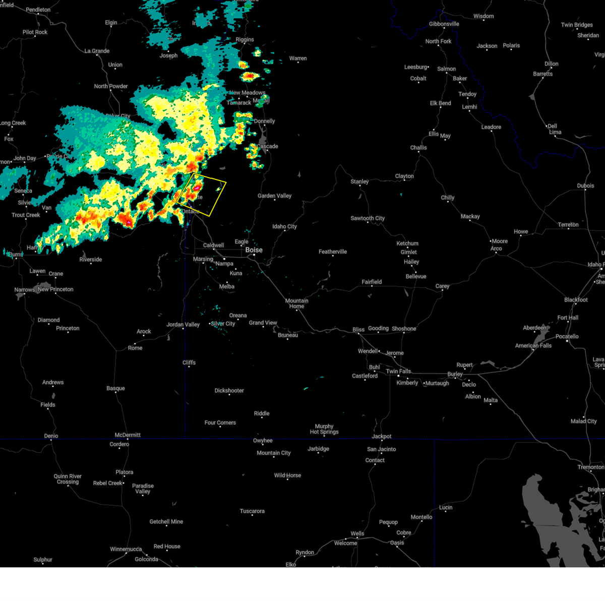
Hail and Wind Damage Spotted near Weiser, ID
| Date / Time | Report Details |
|---|---|
| 8/22/2023 5:43 PM MDT |
 The severe thunderstorm warning for southwestern washington and southeastern baker counties will expire at 545 pm mdt/445 pm pdt/, the storm which prompted the warning has weakened below severe limits, and no longer poses an immediate threat to life or property. therefore, the warning will be allowed to expire. however heavy rain is still possible with this thunderstorm. when safe to do so, please relay storm reports to the national weather service in boise via local law enforcement, or national weather service boise facebook and twitter accounts. The severe thunderstorm warning for southwestern washington and southeastern baker counties will expire at 545 pm mdt/445 pm pdt/, the storm which prompted the warning has weakened below severe limits, and no longer poses an immediate threat to life or property. therefore, the warning will be allowed to expire. however heavy rain is still possible with this thunderstorm. when safe to do so, please relay storm reports to the national weather service in boise via local law enforcement, or national weather service boise facebook and twitter accounts.
|
| 8/22/2023 5:19 PM MDT |
 At 518 pm mdt/418 pm pdt/, a severe thunderstorm was located near henley basin, or 9 miles northwest of weiser, moving north at 25 mph (radar indicated). Hazards include ping pong ball size hail and 60 mph wind gusts. People and animals outdoors will be injured. expect hail damage to roofs, siding, windows, and vehicles. expect wind damage to roofs, siding, and trees. this severe storm will be near, henley basin around 520 pm mdt. mcchord butte and southern brownlee reservoir around 540 pm mdt. hail threat, radar indicated max hail size, 1. 50 in wind threat, radar indicated max wind gust, 60 mph. At 518 pm mdt/418 pm pdt/, a severe thunderstorm was located near henley basin, or 9 miles northwest of weiser, moving north at 25 mph (radar indicated). Hazards include ping pong ball size hail and 60 mph wind gusts. People and animals outdoors will be injured. expect hail damage to roofs, siding, windows, and vehicles. expect wind damage to roofs, siding, and trees. this severe storm will be near, henley basin around 520 pm mdt. mcchord butte and southern brownlee reservoir around 540 pm mdt. hail threat, radar indicated max hail size, 1. 50 in wind threat, radar indicated max wind gust, 60 mph.
|
| 8/22/2023 4:56 PM MDT |
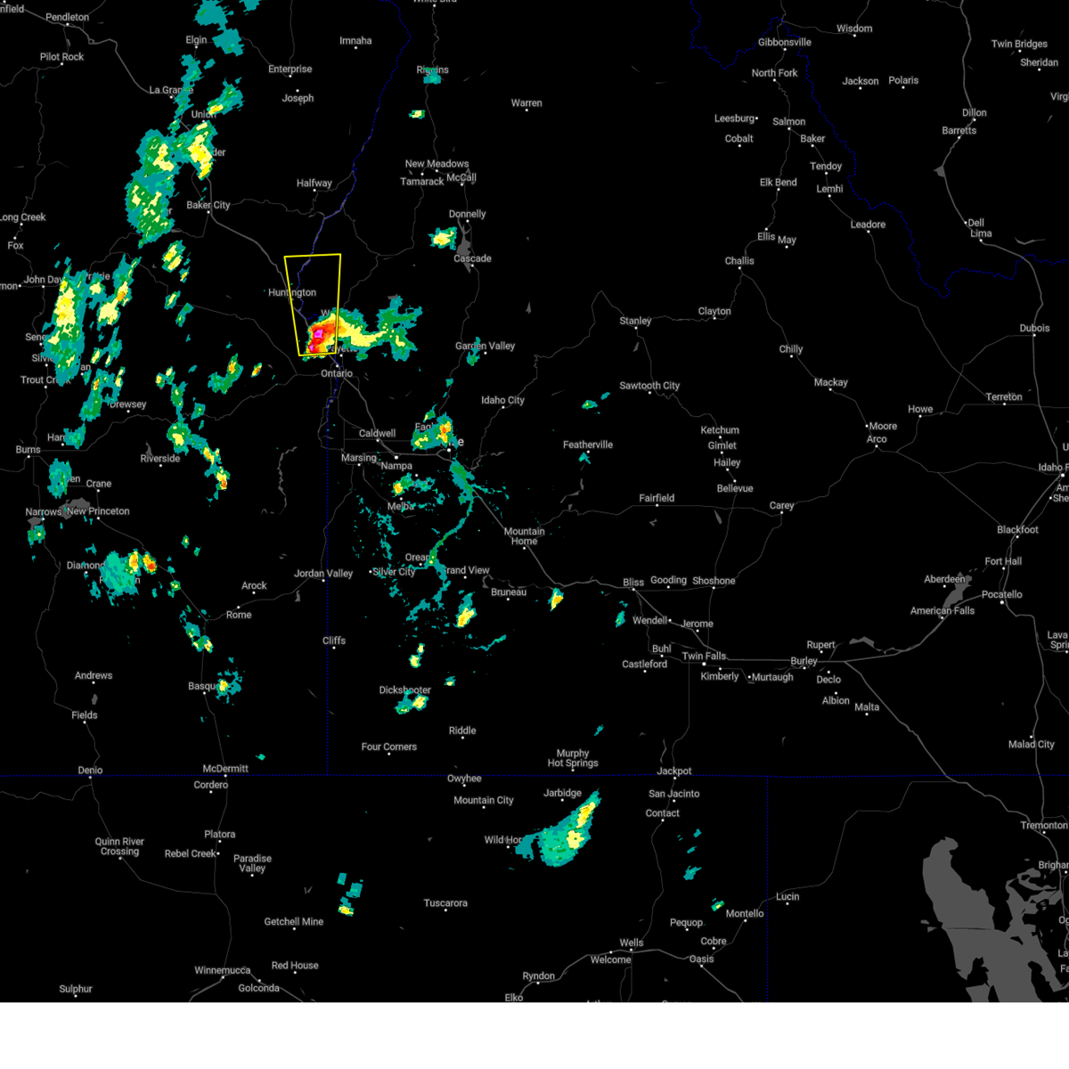 At 455 pm mdt/355 pm pdt/, a severe thunderstorm was located over moores hollow, or 7 miles southwest of weiser, moving north at 25 mph (radar indicated). Hazards include 60 mph wind gusts, quarter size hail and torrential rain. Hail damage to vehicles is expected. expect wind damage to roofs, siding, and trees. localized flooding is possible. this severe thunderstorm will be near, indian head mountain around 500 pm mdt. henley basin around 520 pm mdt. mcchord butte and southern brownlee reservoir around 540 pm mdt. hail threat, radar indicated max hail size, 1. 00 in wind threat, radar indicated max wind gust, 60 mph. At 455 pm mdt/355 pm pdt/, a severe thunderstorm was located over moores hollow, or 7 miles southwest of weiser, moving north at 25 mph (radar indicated). Hazards include 60 mph wind gusts, quarter size hail and torrential rain. Hail damage to vehicles is expected. expect wind damage to roofs, siding, and trees. localized flooding is possible. this severe thunderstorm will be near, indian head mountain around 500 pm mdt. henley basin around 520 pm mdt. mcchord butte and southern brownlee reservoir around 540 pm mdt. hail threat, radar indicated max hail size, 1. 00 in wind threat, radar indicated max wind gust, 60 mph.
|
| 8/7/2023 3:58 PM MDT |
 At 358 pm mdt, a severe thunderstorm was located near annex, or near weiser, and is nearly stationary (radar indicated). Hazards include 60 mph wind gusts and quarter size hail. Hail damage to vehicles is expected. expect wind damage to roofs, siding, and trees. this severe thunderstorm will remain over mainly rural areas of northwestern payette, south central washington and northeastern malheur counties. hail threat, radar indicated max hail size, 1. 00 in wind threat, radar indicated max wind gust, 60 mph. At 358 pm mdt, a severe thunderstorm was located near annex, or near weiser, and is nearly stationary (radar indicated). Hazards include 60 mph wind gusts and quarter size hail. Hail damage to vehicles is expected. expect wind damage to roofs, siding, and trees. this severe thunderstorm will remain over mainly rural areas of northwestern payette, south central washington and northeastern malheur counties. hail threat, radar indicated max hail size, 1. 00 in wind threat, radar indicated max wind gust, 60 mph.
|
| 6/13/2023 9:57 PM MDT |
 At 956 pm mdt, a severe thunderstorm was located near presley bridge, or near weiser, moving southeast at 25 mph (radar indicated). Hazards include 60 mph wind gusts and quarter size hail. Hail damage to vehicles is expected. expect wind damage to roofs, siding, and trees. this severe thunderstorm will be near, presley bridge around 1000 pm mdt. bear creek summit around 1010 pm mdt. paddock valley reservoir around 1020 pm mdt. hail threat, radar indicated max hail size, 1. 00 in wind threat, radar indicated max wind gust, 60 mph. At 956 pm mdt, a severe thunderstorm was located near presley bridge, or near weiser, moving southeast at 25 mph (radar indicated). Hazards include 60 mph wind gusts and quarter size hail. Hail damage to vehicles is expected. expect wind damage to roofs, siding, and trees. this severe thunderstorm will be near, presley bridge around 1000 pm mdt. bear creek summit around 1010 pm mdt. paddock valley reservoir around 1020 pm mdt. hail threat, radar indicated max hail size, 1. 00 in wind threat, radar indicated max wind gust, 60 mph.
|
| 9/7/2022 6:41 PM MDT |
 At 640 pm mdt/540 pm pdt/, severe thunderstorms were located along a line extending from richland to near homedale, moving east-northeast at 55 mph (radar indicated). Hazards include 70 mph wind gusts. Expect considerable tree damage. damage is likely to mobile homes, roofs, and outbuildings. severe thunderstorms will be near, halfway, richland and carson around 550 pm pdt. cambridge around 650 pm mdt. oxbow dam and brownlee dam around 600 pm pdt. goodrich and brownlee reservoir around 700 pm mdt. emmett, eagle, council and bear around 710 pm mdt. sweet, horseshoe bend, montour and lost valley reservoir around 720 pm mdt. mccall, gardena, ola and new meadows around 730 pm mdt. thunderstorm damage threat, considerable hail threat, radar indicated max hail size, <. 75 in wind threat, radar indicated max wind gust, 70 mph. At 640 pm mdt/540 pm pdt/, severe thunderstorms were located along a line extending from richland to near homedale, moving east-northeast at 55 mph (radar indicated). Hazards include 70 mph wind gusts. Expect considerable tree damage. damage is likely to mobile homes, roofs, and outbuildings. severe thunderstorms will be near, halfway, richland and carson around 550 pm pdt. cambridge around 650 pm mdt. oxbow dam and brownlee dam around 600 pm pdt. goodrich and brownlee reservoir around 700 pm mdt. emmett, eagle, council and bear around 710 pm mdt. sweet, horseshoe bend, montour and lost valley reservoir around 720 pm mdt. mccall, gardena, ola and new meadows around 730 pm mdt. thunderstorm damage threat, considerable hail threat, radar indicated max hail size, <. 75 in wind threat, radar indicated max wind gust, 70 mph.
|
| 9/7/2022 6:08 PM MDT |
 At 606 pm mdt/506 pm pdt/, severe thunderstorms were located along a line extending from near brogan to castro ridge, moving east at 60 mph (radar indicated). Hazards include 70 mph wind gusts. Expect considerable tree damage. damage is likely to mobile homes, roofs, and outbuildings. severe thunderstorms will be near, castro ridge, parsnip peak, little grassy reservoir and antelope reservoir around 610 pm mdt. reynolds, south mountain, henley basin and black warrior mountain around 620 pm mdt. weiser, silver city, murphy and melba around 630 pm mdt. payette, ontario, parma and emmett around 640 pm mdt. thunderstorm damage threat, considerable hail threat, radar indicated max hail size, <. 75 in wind threat, radar indicated max wind gust, 70 mph. At 606 pm mdt/506 pm pdt/, severe thunderstorms were located along a line extending from near brogan to castro ridge, moving east at 60 mph (radar indicated). Hazards include 70 mph wind gusts. Expect considerable tree damage. damage is likely to mobile homes, roofs, and outbuildings. severe thunderstorms will be near, castro ridge, parsnip peak, little grassy reservoir and antelope reservoir around 610 pm mdt. reynolds, south mountain, henley basin and black warrior mountain around 620 pm mdt. weiser, silver city, murphy and melba around 630 pm mdt. payette, ontario, parma and emmett around 640 pm mdt. thunderstorm damage threat, considerable hail threat, radar indicated max hail size, <. 75 in wind threat, radar indicated max wind gust, 70 mph.
|
| 8/3/2022 7:55 PM MDT |
 At 754 pm mdt, a severe thunderstorm was located near mann creek reservoir, or near weiser, moving east at 20 mph (radar indicated). Hazards include 60 mph wind gusts and quarter size hail. Hail damage to vehicles is expected. Expect wind damage to roofs, siding, and trees. At 754 pm mdt, a severe thunderstorm was located near mann creek reservoir, or near weiser, moving east at 20 mph (radar indicated). Hazards include 60 mph wind gusts and quarter size hail. Hail damage to vehicles is expected. Expect wind damage to roofs, siding, and trees.
|
| 6/5/2022 3:10 PM MDT |
 At 309 pm mdt, a severe thunderstorm was located near payette, moving east at 35 mph (radar indicated). Hazards include 60 mph wind gusts and quarter size hail. Hail damage to vehicles is expected. Expect wind damage to roofs, siding, and trees. At 309 pm mdt, a severe thunderstorm was located near payette, moving east at 35 mph (radar indicated). Hazards include 60 mph wind gusts and quarter size hail. Hail damage to vehicles is expected. Expect wind damage to roofs, siding, and trees.
|
| 6/5/2022 2:55 PM MDT |
 At 255 pm mdt, a severe thunderstorm was located near payette, moving east at 35 mph (radar indicated). Hazards include 60 mph wind gusts and quarter size hail. Hail damage to vehicles is expected. expect wind damage to roofs, siding, and trees. this severe thunderstorm will remain over mainly rural areas of northwestern payette, south central washington and northeastern malheur counties. hail threat, radar indicated max hail size, 1. 00 in wind threat, radar indicated max wind gust, 60 mph. At 255 pm mdt, a severe thunderstorm was located near payette, moving east at 35 mph (radar indicated). Hazards include 60 mph wind gusts and quarter size hail. Hail damage to vehicles is expected. expect wind damage to roofs, siding, and trees. this severe thunderstorm will remain over mainly rural areas of northwestern payette, south central washington and northeastern malheur counties. hail threat, radar indicated max hail size, 1. 00 in wind threat, radar indicated max wind gust, 60 mph.
|
| 6/5/2022 2:33 PM MDT |
 At 233 pm mdt, a severe thunderstorm was located near vale, or 10 miles west of ontario, moving east at 30 mph (radar indicated). Hazards include 60 mph wind gusts and quarter size hail. Hail damage to vehicles is expected. expect wind damage to roofs, siding, and trees. this severe thunderstorm will be near, moores hollow around 240 pm mdt. ontario around 250 pm mdt. payette, weiser, fruitland and annex around 300 pm mdt. hail threat, radar indicated max hail size, 1. 00 in wind threat, radar indicated max wind gust, 60 mph. At 233 pm mdt, a severe thunderstorm was located near vale, or 10 miles west of ontario, moving east at 30 mph (radar indicated). Hazards include 60 mph wind gusts and quarter size hail. Hail damage to vehicles is expected. expect wind damage to roofs, siding, and trees. this severe thunderstorm will be near, moores hollow around 240 pm mdt. ontario around 250 pm mdt. payette, weiser, fruitland and annex around 300 pm mdt. hail threat, radar indicated max hail size, 1. 00 in wind threat, radar indicated max wind gust, 60 mph.
|
| 6/22/2021 8:52 PM MDT | Mesonet station deai1 catfis in washington county ID, 11.4 miles ESE of Weiser, ID |
| 8/17/2020 5:52 PM MDT | Mesonet station deai1 catfis in washington county ID, 11.4 miles ESE of Weiser, ID |
| 6/24/2020 4:57 PM MDT |
 At 457 pm mdt, a severe thunderstorm was located near moores hollow, or near payette, moving east at 25 mph (radar indicated). Hazards include 70 mph wind gusts and quarter size hail. Hail damage to vehicles is expected. expect considerable tree damage. wind damage is also likely to mobile homes, roofs, and outbuildings. this severe thunderstorm will be near, payette, weiser and annex around 510 pm mdt. Presley bridge around 540 pm mdt. At 457 pm mdt, a severe thunderstorm was located near moores hollow, or near payette, moving east at 25 mph (radar indicated). Hazards include 70 mph wind gusts and quarter size hail. Hail damage to vehicles is expected. expect considerable tree damage. wind damage is also likely to mobile homes, roofs, and outbuildings. this severe thunderstorm will be near, payette, weiser and annex around 510 pm mdt. Presley bridge around 540 pm mdt.
|
| 6/24/2020 4:40 PM MDT |
 At 438 pm mdt, a severe thunderstorm was located near moores hollow, or 11 miles northwest of ontario, moving east at 30 mph. this storm will cross i-84 about 10 miles north of ontario around 450 pm (radar indicated). Hazards include 70 mph wind gusts and quarter size hail. Hail damage to vehicles is expected. expect considerable tree damage. wind damage is also likely to mobile homes, roofs, and outbuildings. this severe storm will be near, moores hollow and indian head mountain around 440 pm mdt. Ontario, weiser and annex around 500 pm mdt. At 438 pm mdt, a severe thunderstorm was located near moores hollow, or 11 miles northwest of ontario, moving east at 30 mph. this storm will cross i-84 about 10 miles north of ontario around 450 pm (radar indicated). Hazards include 70 mph wind gusts and quarter size hail. Hail damage to vehicles is expected. expect considerable tree damage. wind damage is also likely to mobile homes, roofs, and outbuildings. this severe storm will be near, moores hollow and indian head mountain around 440 pm mdt. Ontario, weiser and annex around 500 pm mdt.
|
| 6/24/2020 4:21 PM MDT |
 At 421 pm mdt, a severe thunderstorm was located 7 miles northeast of bully creek reservoir, or 18 miles west of ontario, moving east at 30 mph (radar indicated). Hazards include 70 mph wind gusts and quarter size hail. Hail damage to vehicles is expected. expect considerable tree damage. wind damage is also likely to mobile homes, roofs, and outbuildings. this severe thunderstorm will be near, vale around 430 pm mdt. moores hollow and indian head mountain around 440 pm mdt. Ontario, weiser and annex around 500 pm mdt. At 421 pm mdt, a severe thunderstorm was located 7 miles northeast of bully creek reservoir, or 18 miles west of ontario, moving east at 30 mph (radar indicated). Hazards include 70 mph wind gusts and quarter size hail. Hail damage to vehicles is expected. expect considerable tree damage. wind damage is also likely to mobile homes, roofs, and outbuildings. this severe thunderstorm will be near, vale around 430 pm mdt. moores hollow and indian head mountain around 440 pm mdt. Ontario, weiser and annex around 500 pm mdt.
|
| 5/6/2018 6:26 PM MDT |
 At 625 pm mdt, a severe thunderstorm was located near fruitland, or near payette, moving northeast at 40 mph (radar indicated). Hazards include 60 mph wind gusts and quarter size hail. Hail damage to vehicles is expected. expect wind damage to roofs, siding, and trees. this severe thunderstorm will be near, weiser, french corner and annex around 640 pm mdt. Bear creek summit, paddock valley reservoir, presley bridge and mann creek reservoir around 650 pm mdt. At 625 pm mdt, a severe thunderstorm was located near fruitland, or near payette, moving northeast at 40 mph (radar indicated). Hazards include 60 mph wind gusts and quarter size hail. Hail damage to vehicles is expected. expect wind damage to roofs, siding, and trees. this severe thunderstorm will be near, weiser, french corner and annex around 640 pm mdt. Bear creek summit, paddock valley reservoir, presley bridge and mann creek reservoir around 650 pm mdt.
|
| 4/23/2012 9:45 PM MDT | Large tree limbs reported down and power outages at weise in washington county ID, 0.2 miles NE of Weiser, ID |
Hail Maps for Weiser, ID


Connect with Interactive Hail Maps