| 6/5/2022 6:30 PM MDT |
Quarter sized hail reported 0.5 miles S of Wendell, ID
|
| 6/5/2022 6:14 PM MDT |
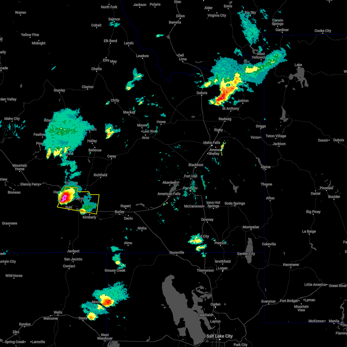 At 613 pm mdt, a severe thunderstorm was located near wendell, or 12 miles south of gooding, moving east at 40 mph (radar indicated). Hazards include 60 mph wind gusts and quarter size hail. Hail damage to vehicles is expected. Expect wind damage to roofs, siding, and trees. At 613 pm mdt, a severe thunderstorm was located near wendell, or 12 miles south of gooding, moving east at 40 mph (radar indicated). Hazards include 60 mph wind gusts and quarter size hail. Hail damage to vehicles is expected. Expect wind damage to roofs, siding, and trees.
|
| 6/5/2022 5:30 PM MDT |
 At 530 pm mdt, a severe thunderstorm was located over deadman flat, or 9 miles south of glenns ferry, moving east at 40 mph (radar indicated). Hazards include 60 mph wind gusts and quarter size hail. Hail damage to vehicles is expected. expect wind damage to roofs, siding, and trees. this severe thunderstorm will be near, twentymile butte around 540 pm mdt. bliss around 550 pm mdt. hagerman around 600 pm mdt. wendell, buhl and filer around 610 pm mdt. hail threat, radar indicated max hail size, 1. 00 in wind threat, radar indicated max wind gust, 60 mph. At 530 pm mdt, a severe thunderstorm was located over deadman flat, or 9 miles south of glenns ferry, moving east at 40 mph (radar indicated). Hazards include 60 mph wind gusts and quarter size hail. Hail damage to vehicles is expected. expect wind damage to roofs, siding, and trees. this severe thunderstorm will be near, twentymile butte around 540 pm mdt. bliss around 550 pm mdt. hagerman around 600 pm mdt. wendell, buhl and filer around 610 pm mdt. hail threat, radar indicated max hail size, 1. 00 in wind threat, radar indicated max wind gust, 60 mph.
|
| 7/31/2021 9:10 PM MDT |
Report from mping: 3-inch tree limbs broken; power poles broke in gooding county ID, 5.8 miles ENE of Wendell, ID
|
| 7/4/2021 7:40 PM MDT |
Report from mping: 1-inch tree limbs broken; shingles blown of in gooding county ID, 5.8 miles ENE of Wendell, ID
|
| 8/26/2020 7:21 PM MDT |
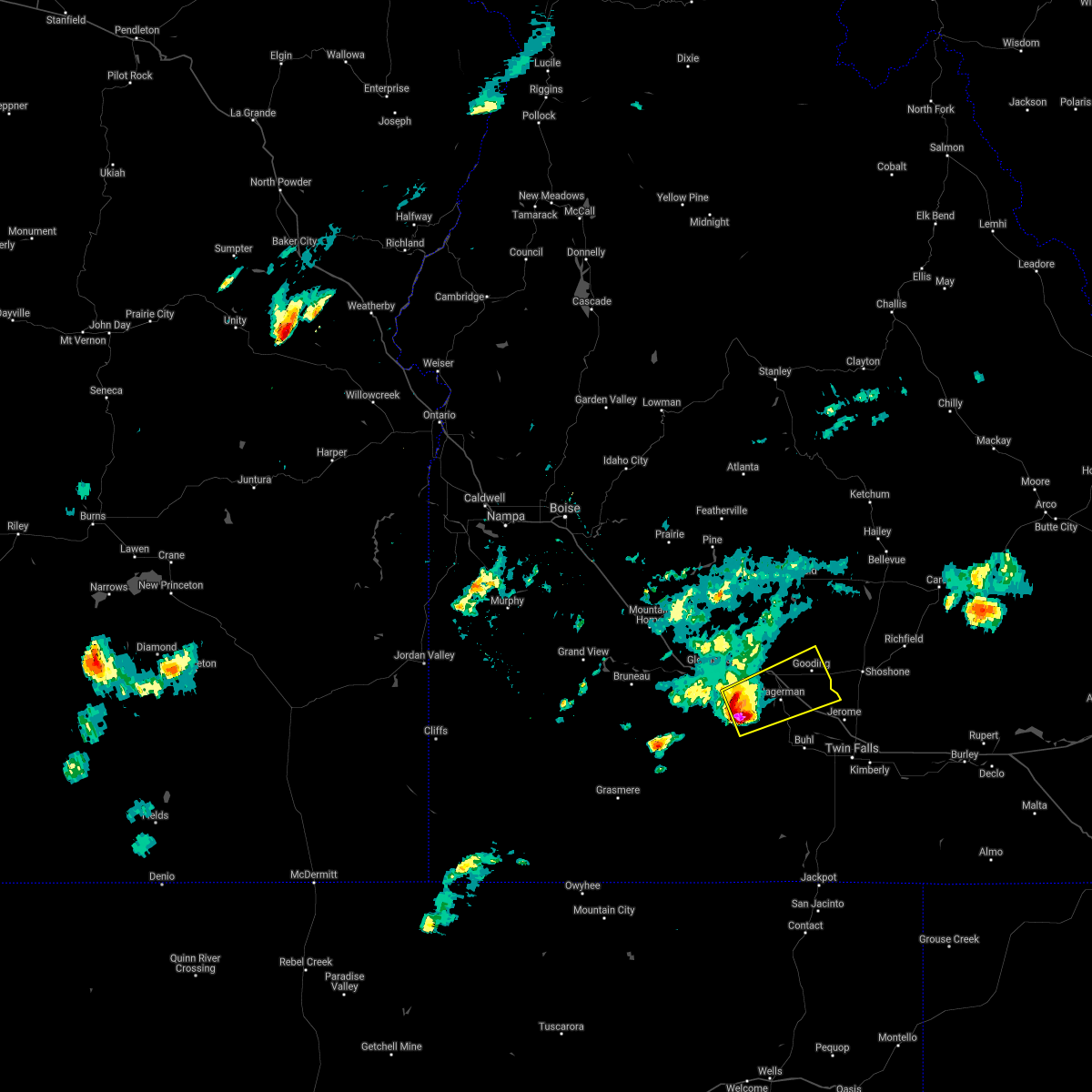 At 721 pm mdt, a severe thunderstorm was located near twentymile butte, or 17 miles southeast of glenns ferry, moving northeast at 35 mph (radar indicated). Hazards include two inch hail and 60 mph wind gusts. People and animals outdoors will be injured. expect hail damage to roofs, siding, windows, and vehicles. expect wind damage to roofs, siding, and trees. this severe thunderstorm will be near, hagerman and bliss around 740 pm mdt. wendell around 750 pm mdt. Gooding around 800 pm mdt. At 721 pm mdt, a severe thunderstorm was located near twentymile butte, or 17 miles southeast of glenns ferry, moving northeast at 35 mph (radar indicated). Hazards include two inch hail and 60 mph wind gusts. People and animals outdoors will be injured. expect hail damage to roofs, siding, windows, and vehicles. expect wind damage to roofs, siding, and trees. this severe thunderstorm will be near, hagerman and bliss around 740 pm mdt. wendell around 750 pm mdt. Gooding around 800 pm mdt.
|
| 8/26/2020 6:49 PM MDT |
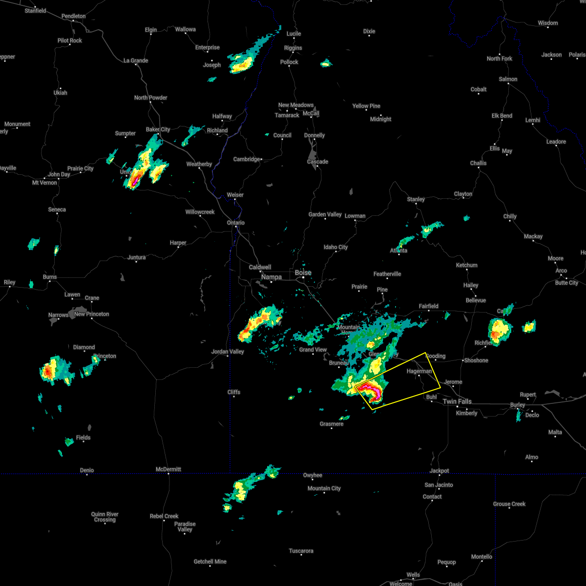 At 649 pm mdt, a severe thunderstorm was located near crows nest butte, or 19 miles south of glenns ferry, moving east at 40 mph (radar indicated). Hazards include golf ball size hail and 60 mph wind gusts. People and animals outdoors will be injured. expect hail damage to roofs, siding, windows, and vehicles. expect wind damage to roofs, siding, and trees. this severe thunderstorm will be near, crows nest butte around 650 pm mdt. deadman flat around 700 pm mdt. twentymile butte around 710 pm mdt. Hagerman, wendell and bliss around 730 pm mdt. At 649 pm mdt, a severe thunderstorm was located near crows nest butte, or 19 miles south of glenns ferry, moving east at 40 mph (radar indicated). Hazards include golf ball size hail and 60 mph wind gusts. People and animals outdoors will be injured. expect hail damage to roofs, siding, windows, and vehicles. expect wind damage to roofs, siding, and trees. this severe thunderstorm will be near, crows nest butte around 650 pm mdt. deadman flat around 700 pm mdt. twentymile butte around 710 pm mdt. Hagerman, wendell and bliss around 730 pm mdt.
|
| 10/19/2019 2:00 PM MDT |
Line of 4 power poles knocked down on roa in gooding county ID, 0.5 miles S of Wendell, ID
|
| 9/6/2019 1:09 PM MDT |
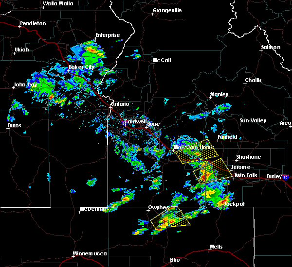 At 109 pm mdt, a severe thunderstorm was located 8 miles south of hagerman, or 19 miles southwest of gooding, moving northeast at 30 mph (radar indicated). Hazards include 60 mph wind gusts and quarter size hail. Hail damage to vehicles is expected. expect wind damage to roofs, siding, and trees. this severe storm will be near, hagerman and buhl around 120 pm mdt. Gooding and wendell around 130 pm mdt. At 109 pm mdt, a severe thunderstorm was located 8 miles south of hagerman, or 19 miles southwest of gooding, moving northeast at 30 mph (radar indicated). Hazards include 60 mph wind gusts and quarter size hail. Hail damage to vehicles is expected. expect wind damage to roofs, siding, and trees. this severe storm will be near, hagerman and buhl around 120 pm mdt. Gooding and wendell around 130 pm mdt.
|
| 9/6/2019 12:44 PM MDT |
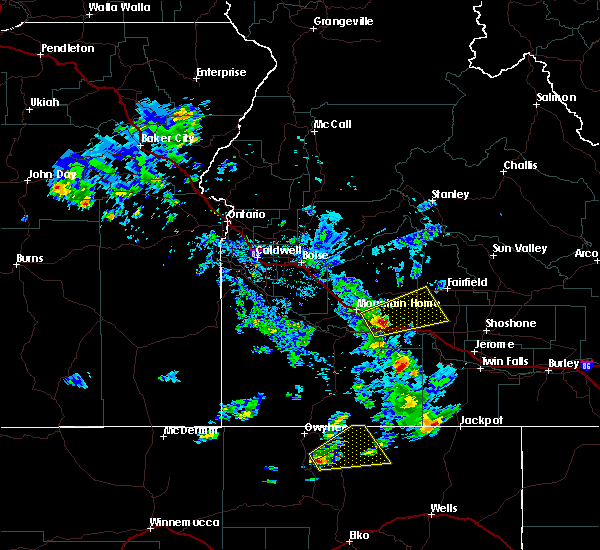 At 1244 pm mdt, a severe thunderstorm was located 7 miles southeast of twentymile butte, or 24 miles southeast of glenns ferry, moving northeast at 30 mph (radar indicated). Hazards include 60 mph wind gusts and quarter size hail. Hail damage to vehicles is expected. expect wind damage to roofs, siding, and trees. this severe thunderstorm will be near, hagerman and buhl around 120 pm mdt. Gooding and wendell around 130 pm mdt. At 1244 pm mdt, a severe thunderstorm was located 7 miles southeast of twentymile butte, or 24 miles southeast of glenns ferry, moving northeast at 30 mph (radar indicated). Hazards include 60 mph wind gusts and quarter size hail. Hail damage to vehicles is expected. expect wind damage to roofs, siding, and trees. this severe thunderstorm will be near, hagerman and buhl around 120 pm mdt. Gooding and wendell around 130 pm mdt.
|
| 6/4/2017 8:25 PM MDT |
 The severe thunderstorm warning for northern twin falls, jerome and southeastern gooding counties will expire at 830 pm mdt, the storm which prompted the warning has moved out of the area. therefore the warning will be allowed to expire. when safe to do so, please relay storm reports to the national weather service in boise via local law enforcement, or national weather service boise facebook and twitter accounts. The severe thunderstorm warning for northern twin falls, jerome and southeastern gooding counties will expire at 830 pm mdt, the storm which prompted the warning has moved out of the area. therefore the warning will be allowed to expire. when safe to do so, please relay storm reports to the national weather service in boise via local law enforcement, or national weather service boise facebook and twitter accounts.
|
| 6/4/2017 7:46 PM MDT |
 At 744 pm mdt, thunderstorm outflow winds associated with a cold front were located near wendell, or 12 miles south of gooding, moving east at 65 mph (radar indicated). Hazards include 60 to 70 mph wind gusts. Expect damage to roofs, siding, and trees. this severe thunderstorm will be near, jerome and filer around 750 pm mdt. twin falls, kimberly, hansen and minidoka national monument around 815 pm mdt. Hazelton, eden, milner dam and murtaugh around 825 pm mdt. At 744 pm mdt, thunderstorm outflow winds associated with a cold front were located near wendell, or 12 miles south of gooding, moving east at 65 mph (radar indicated). Hazards include 60 to 70 mph wind gusts. Expect damage to roofs, siding, and trees. this severe thunderstorm will be near, jerome and filer around 750 pm mdt. twin falls, kimberly, hansen and minidoka national monument around 815 pm mdt. Hazelton, eden, milner dam and murtaugh around 825 pm mdt.
|
| 12/21/2015 7:46 PM MST |
 At 746 pm mst, doppler radar indicated a severe thunderstorm capable of producing destructive winds in excess of 70 mph. this storm was located 7 miles northeast of twentymile butte, or 17 miles southeast of glenns ferry, and moving east at 50 mph. * this severe thunderstorm will be near, hagerman around 750 pm mst. jerome, wendell, buhl and filer around 810 pm mst. At 746 pm mst, doppler radar indicated a severe thunderstorm capable of producing destructive winds in excess of 70 mph. this storm was located 7 miles northeast of twentymile butte, or 17 miles southeast of glenns ferry, and moving east at 50 mph. * this severe thunderstorm will be near, hagerman around 750 pm mst. jerome, wendell, buhl and filer around 810 pm mst.
|
| 10/16/2012 12:05 PM MDT |
Observer reports numerous 8 inch diameter trees dow in gooding county ID, 0.6 miles SE of Wendell, ID
|
 At 613 pm mdt, a severe thunderstorm was located near wendell, or 12 miles south of gooding, moving east at 40 mph (radar indicated). Hazards include 60 mph wind gusts and quarter size hail. Hail damage to vehicles is expected. Expect wind damage to roofs, siding, and trees.
 At 530 pm mdt, a severe thunderstorm was located over deadman flat, or 9 miles south of glenns ferry, moving east at 40 mph (radar indicated). Hazards include 60 mph wind gusts and quarter size hail. Hail damage to vehicles is expected. expect wind damage to roofs, siding, and trees. this severe thunderstorm will be near, twentymile butte around 540 pm mdt. bliss around 550 pm mdt. hagerman around 600 pm mdt. wendell, buhl and filer around 610 pm mdt. hail threat, radar indicated max hail size, 1. 00 in wind threat, radar indicated max wind gust, 60 mph.
 At 721 pm mdt, a severe thunderstorm was located near twentymile butte, or 17 miles southeast of glenns ferry, moving northeast at 35 mph (radar indicated). Hazards include two inch hail and 60 mph wind gusts. People and animals outdoors will be injured. expect hail damage to roofs, siding, windows, and vehicles. expect wind damage to roofs, siding, and trees. this severe thunderstorm will be near, hagerman and bliss around 740 pm mdt. wendell around 750 pm mdt. Gooding around 800 pm mdt.
 At 649 pm mdt, a severe thunderstorm was located near crows nest butte, or 19 miles south of glenns ferry, moving east at 40 mph (radar indicated). Hazards include golf ball size hail and 60 mph wind gusts. People and animals outdoors will be injured. expect hail damage to roofs, siding, windows, and vehicles. expect wind damage to roofs, siding, and trees. this severe thunderstorm will be near, crows nest butte around 650 pm mdt. deadman flat around 700 pm mdt. twentymile butte around 710 pm mdt. Hagerman, wendell and bliss around 730 pm mdt.
 At 109 pm mdt, a severe thunderstorm was located 8 miles south of hagerman, or 19 miles southwest of gooding, moving northeast at 30 mph (radar indicated). Hazards include 60 mph wind gusts and quarter size hail. Hail damage to vehicles is expected. expect wind damage to roofs, siding, and trees. this severe storm will be near, hagerman and buhl around 120 pm mdt. Gooding and wendell around 130 pm mdt.
 At 1244 pm mdt, a severe thunderstorm was located 7 miles southeast of twentymile butte, or 24 miles southeast of glenns ferry, moving northeast at 30 mph (radar indicated). Hazards include 60 mph wind gusts and quarter size hail. Hail damage to vehicles is expected. expect wind damage to roofs, siding, and trees. this severe thunderstorm will be near, hagerman and buhl around 120 pm mdt. Gooding and wendell around 130 pm mdt.
 The severe thunderstorm warning for northern twin falls, jerome and southeastern gooding counties will expire at 830 pm mdt, the storm which prompted the warning has moved out of the area. therefore the warning will be allowed to expire. when safe to do so, please relay storm reports to the national weather service in boise via local law enforcement, or national weather service boise facebook and twitter accounts.
 At 744 pm mdt, thunderstorm outflow winds associated with a cold front were located near wendell, or 12 miles south of gooding, moving east at 65 mph (radar indicated). Hazards include 60 to 70 mph wind gusts. Expect damage to roofs, siding, and trees. this severe thunderstorm will be near, jerome and filer around 750 pm mdt. twin falls, kimberly, hansen and minidoka national monument around 815 pm mdt. Hazelton, eden, milner dam and murtaugh around 825 pm mdt.
 At 746 pm mst, doppler radar indicated a severe thunderstorm capable of producing destructive winds in excess of 70 mph. this storm was located 7 miles northeast of twentymile butte, or 17 miles southeast of glenns ferry, and moving east at 50 mph. * this severe thunderstorm will be near, hagerman around 750 pm mst. jerome, wendell, buhl and filer around 810 pm mst.



Connect with Interactive Hail Maps