

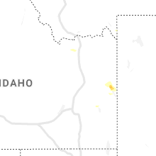
Hail Map for West Yellowstone, MT
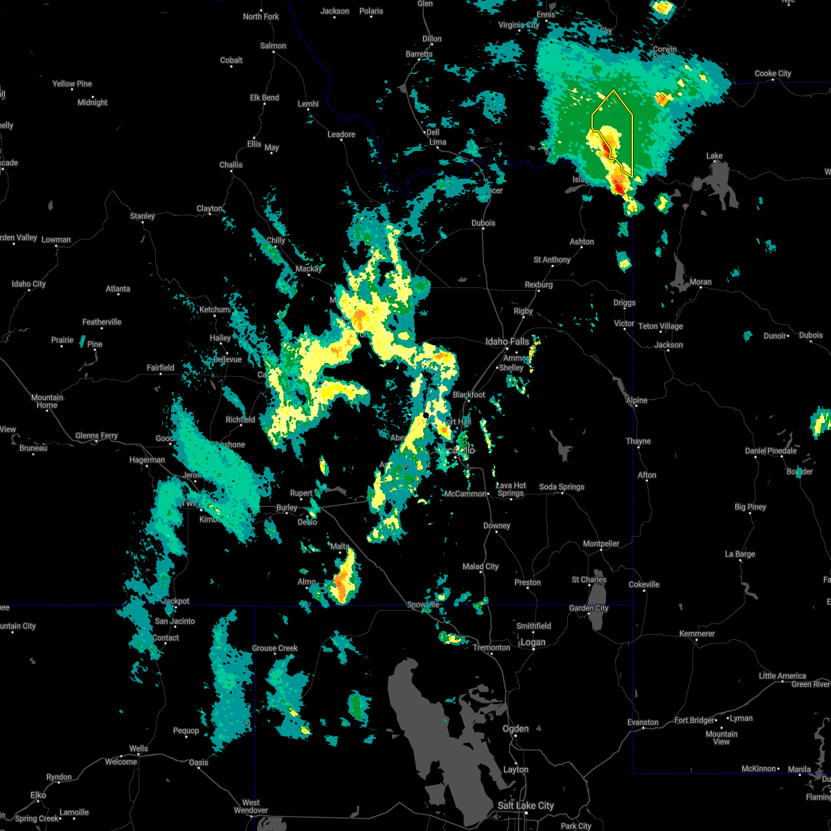
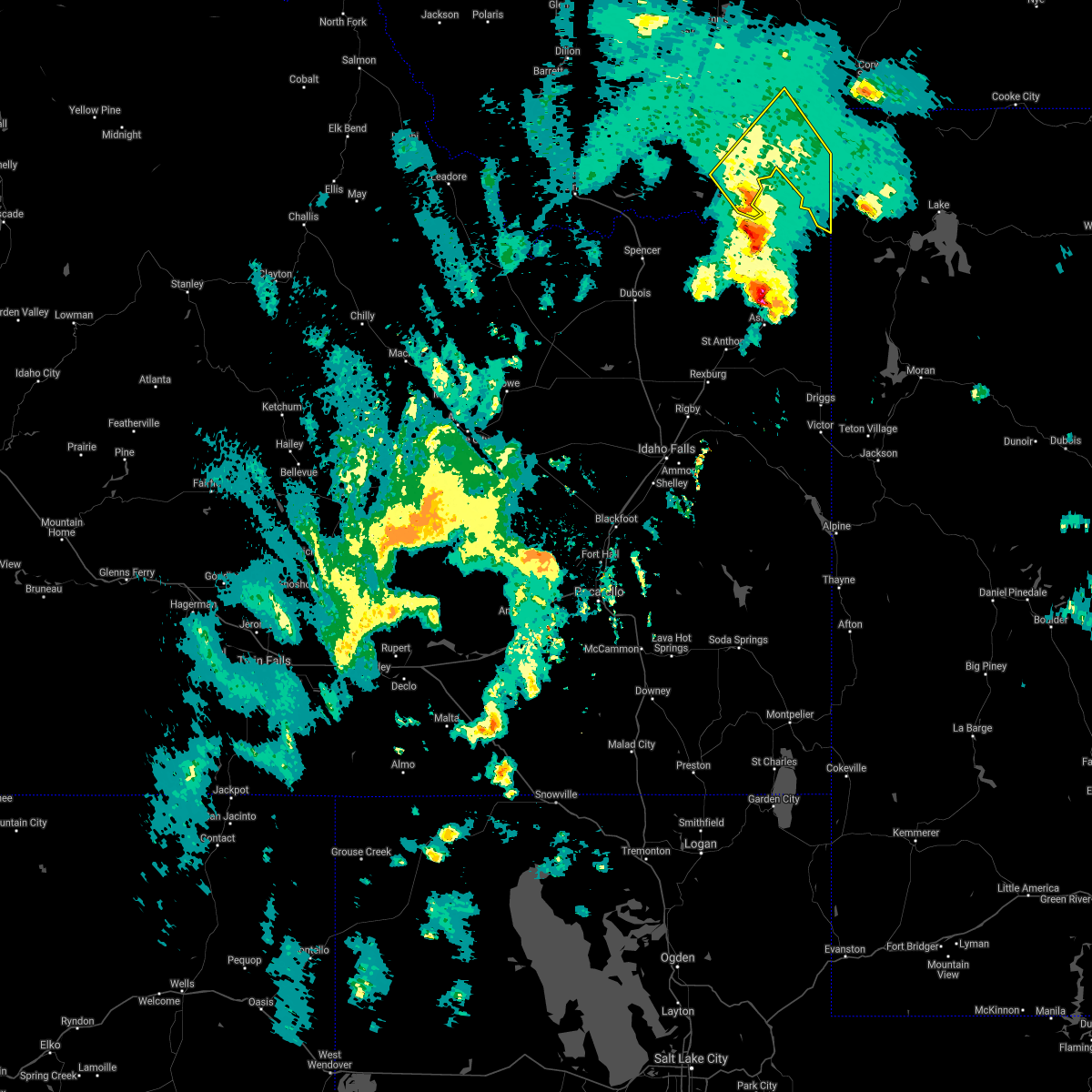
The West Yellowstone, MT area has had 0 reports of on-the-ground hail by trained spotters, and has been under severe weather warnings 0 times during the past 12 months. Doppler radar has detected hail at or near West Yellowstone, MT on 4 occasions.
| Name: | West Yellowstone, MT |
| Where Located: | 70.2 miles S of Bozeman, MT |
| Map: | Google Map for West Yellowstone, MT |
| Population: | 1271 |
| Housing Units: | 969 |
| More Info: | Search Google for West Yellowstone, MT |
5
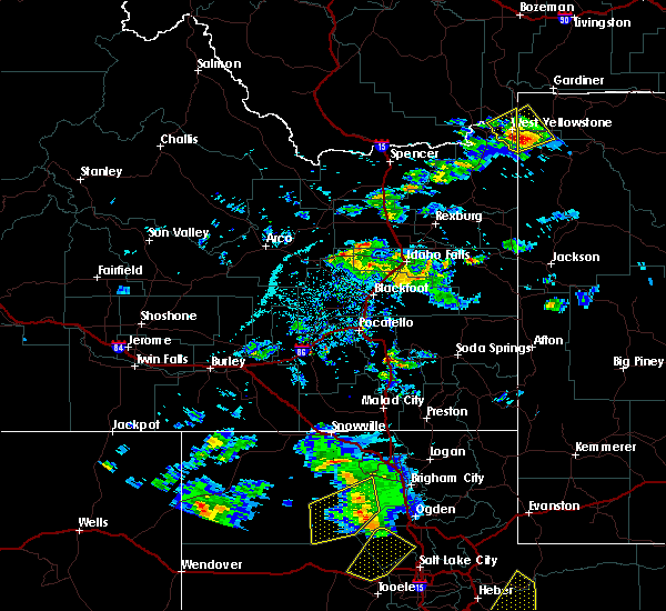
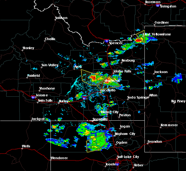
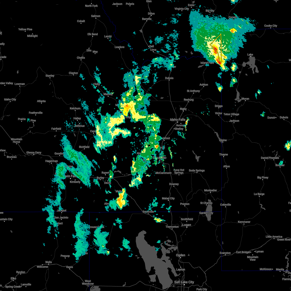
The Top Recent Hail Date for West Yellowstone, MT is Tuesday, August 2, 2022 (1st out of 4)
Hail and Wind Damage Spotted near West Yellowstone, MT
| Date / Time | Report Details |
|---|---|
| 9/10/2021 6:58 PM MDT |
 The severe thunderstorm warning for madison, central beaverhead and south central gallatin counties will expire at 700 pm mdt, the storms which prompted the warning have weakened below severe limits, and have exited the warned area. therefore, the warning will be allowed to expire. however gusty winds are still possible with these thunderstorms. to report severe weather, contact your nearest law enforcement agency. they will relay your report to the national weather service great falls. The severe thunderstorm warning for madison, central beaverhead and south central gallatin counties will expire at 700 pm mdt, the storms which prompted the warning have weakened below severe limits, and have exited the warned area. therefore, the warning will be allowed to expire. however gusty winds are still possible with these thunderstorms. to report severe weather, contact your nearest law enforcement agency. they will relay your report to the national weather service great falls.
|
| 9/10/2021 6:38 PM MDT |
 At 636 pm mdt, severe thunderstorms were located along a line extending from 24 miles north of wisdom to near harlequin lake, moving northeast at 50 mph (radar indicated. at 611 pm mdt, a 63 mph wind gust was reported at the dillon airport). Hazards include 70 mph wind gusts. Expect considerable tree damage. damage is likely to mobile homes, roofs, and outbuildings. blowing dust and smoke will also reduce visibility. locations impacted include, dillon, west yellowstone, sheridan, virginia city, ennis, twin bridges, pony, wisdom, alder, divide lake, silver star, west entrance, big sky, melrose, wise river, dewey, targhee pass, cameron, waterloo and glen. thunderstorm damage threat, considerable hail threat, radar indicated max hail size, <. 75 in wind threat, observed max wind gust, 70 mph. At 636 pm mdt, severe thunderstorms were located along a line extending from 24 miles north of wisdom to near harlequin lake, moving northeast at 50 mph (radar indicated. at 611 pm mdt, a 63 mph wind gust was reported at the dillon airport). Hazards include 70 mph wind gusts. Expect considerable tree damage. damage is likely to mobile homes, roofs, and outbuildings. blowing dust and smoke will also reduce visibility. locations impacted include, dillon, west yellowstone, sheridan, virginia city, ennis, twin bridges, pony, wisdom, alder, divide lake, silver star, west entrance, big sky, melrose, wise river, dewey, targhee pass, cameron, waterloo and glen. thunderstorm damage threat, considerable hail threat, radar indicated max hail size, <. 75 in wind threat, observed max wind gust, 70 mph.
|
| 9/10/2021 6:12 PM MDT |
 At 612 pm mdt, severe thunderstorms were located along a line extending from 16 miles southeast of conner to near island park village, moving northeast at 50 mph (radar indicated). Hazards include 70 mph wind gusts. Expect considerable tree damage. Damage is likely to mobile homes, roofs, and outbuildings. At 612 pm mdt, severe thunderstorms were located along a line extending from 16 miles southeast of conner to near island park village, moving northeast at 50 mph (radar indicated). Hazards include 70 mph wind gusts. Expect considerable tree damage. Damage is likely to mobile homes, roofs, and outbuildings.
|
| 5/6/2020 3:58 PM MDT | Report from mping: 1-inch tree limbs broken; shingles blown of in gallatin county MT, 9 miles SSE of West Yellowstone, MT |
| 7/16/2019 1:45 PM MDT | Public reported about 2 dozen large trees down at the koa near west yellowstone. some tents blown away. some awnings destroyed. wind speeds and time of event are estima in gallatin county MT, 5.8 miles ESE of West Yellowstone, MT |
| 6/6/2019 4:48 PM MDT |
 At 448 pm mdt, a severe thunderstorm was located near west entrance, or near west yellowstone, moving northeast at 40 mph (radar indicated). Hazards include 60 mph wind gusts and quarter size hail. Hail damage to vehicles is expected. expect wind damage to roofs, siding, and trees. Locations impacted include, west yellowstone and west entrance. At 448 pm mdt, a severe thunderstorm was located near west entrance, or near west yellowstone, moving northeast at 40 mph (radar indicated). Hazards include 60 mph wind gusts and quarter size hail. Hail damage to vehicles is expected. expect wind damage to roofs, siding, and trees. Locations impacted include, west yellowstone and west entrance.
|
| 6/6/2019 4:31 PM MDT |
 At 430 pm mdt, a severe thunderstorm was located near island park village, or 9 miles southeast of henrys lake, moving northeast at 30 mph (radar indicated). Hazards include 60 mph wind gusts and quarter size hail. Hail damage to vehicles is expected. Expect wind damage to roofs, siding, and trees. At 430 pm mdt, a severe thunderstorm was located near island park village, or 9 miles southeast of henrys lake, moving northeast at 30 mph (radar indicated). Hazards include 60 mph wind gusts and quarter size hail. Hail damage to vehicles is expected. Expect wind damage to roofs, siding, and trees.
|
| 5/31/2018 6:59 PM MDT |
 At 659 pm mdt, severe thunderstorms were located along a line extending from 11 miles northeast of henrys lake to west yellowstone to 9 miles southwest of mystic falls, moving northeast at 40 mph. this storm has a history of producing large hail near island park, idaho (trained weather spotters). Hazards include 60 mph wind gusts and quarter size hail. Hail damage to vehicles is expected. Expect wind damage to roofs, siding, and trees. At 659 pm mdt, severe thunderstorms were located along a line extending from 11 miles northeast of henrys lake to west yellowstone to 9 miles southwest of mystic falls, moving northeast at 40 mph. this storm has a history of producing large hail near island park, idaho (trained weather spotters). Hazards include 60 mph wind gusts and quarter size hail. Hail damage to vehicles is expected. Expect wind damage to roofs, siding, and trees.
|
| 5/31/2018 6:51 PM MDT |
 At 650 pm mdt, severe thunderstorms were located along a line extending from 6 miles north of henrys lake to 7 miles southwest of west yellowstone to 11 miles east of ponds lodge, moving northeast at 40 mph (trained weather spotters. this storm has a history of producing large hail in island park, idaho). Hazards include 60 mph wind gusts and quarter size hail. Hail damage to vehicles is expected. expect wind damage to roofs, siding, and trees. Locations impacted include, west yellowstone, west entrance and yellowstone village. At 650 pm mdt, severe thunderstorms were located along a line extending from 6 miles north of henrys lake to 7 miles southwest of west yellowstone to 11 miles east of ponds lodge, moving northeast at 40 mph (trained weather spotters. this storm has a history of producing large hail in island park, idaho). Hazards include 60 mph wind gusts and quarter size hail. Hail damage to vehicles is expected. expect wind damage to roofs, siding, and trees. Locations impacted include, west yellowstone, west entrance and yellowstone village.
|
| 5/31/2018 6:20 PM MDT |
 At 619 pm mdt, severe thunderstorms were located along a line extending from 13 miles northwest of henrys lake to near shotgun village to near ashton reservoir, moving northeast at 35 mph (radar indicated). Hazards include 60 mph wind gusts and penny size hail. expect damage to roofs, siding, and trees At 619 pm mdt, severe thunderstorms were located along a line extending from 13 miles northwest of henrys lake to near shotgun village to near ashton reservoir, moving northeast at 35 mph (radar indicated). Hazards include 60 mph wind gusts and penny size hail. expect damage to roofs, siding, and trees
|
Hail Maps for West Yellowstone, MT


Connect with Interactive Hail Maps