

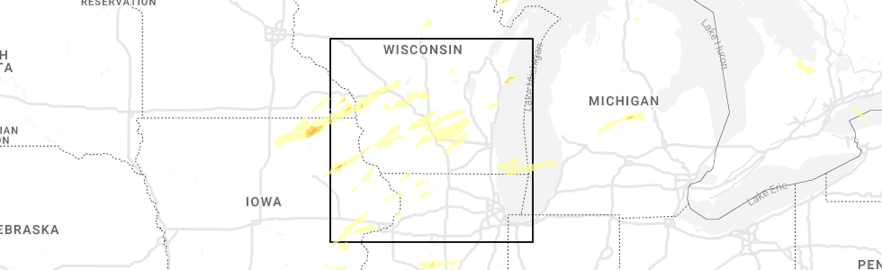
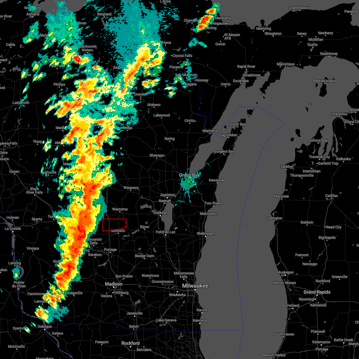
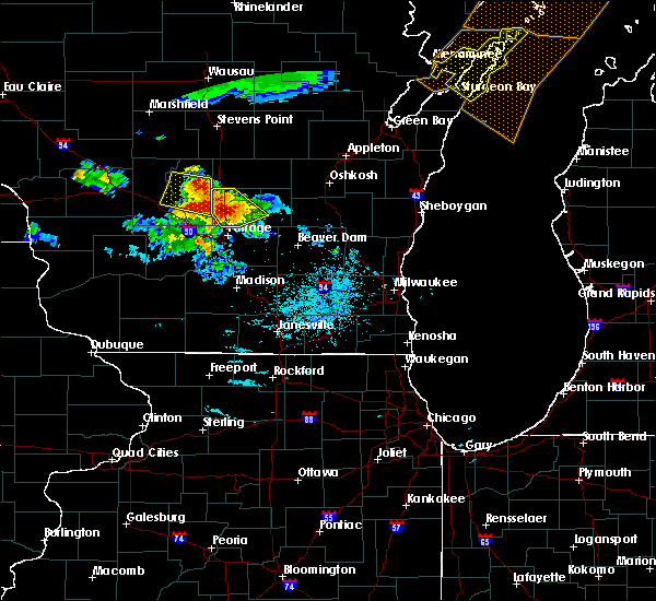
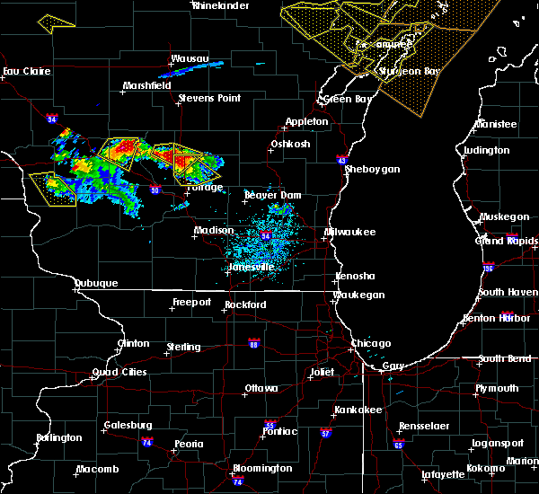
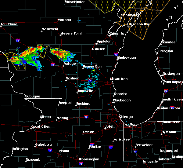
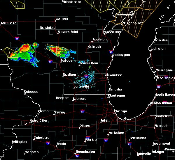
Hail Map for Westfield, WI
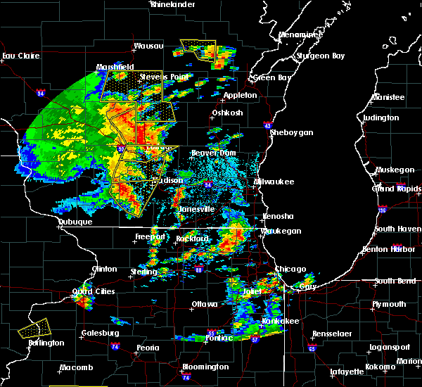
The Westfield, WI area has had 7 reports of on-the-ground hail by trained spotters, and has been under severe weather warnings 5 times during the past 12 months. Doppler radar has detected hail at or near Westfield, WI on 32 occasions.
| Name: | Westfield, WI |
| Where Located: | 56.4 miles N of Madison, WI |
| Map: | Google Map for Westfield, WI |
| Population: | 1254 |
| Housing Units: | 578 |
| More Info: | Search Google for Westfield, WI |
3
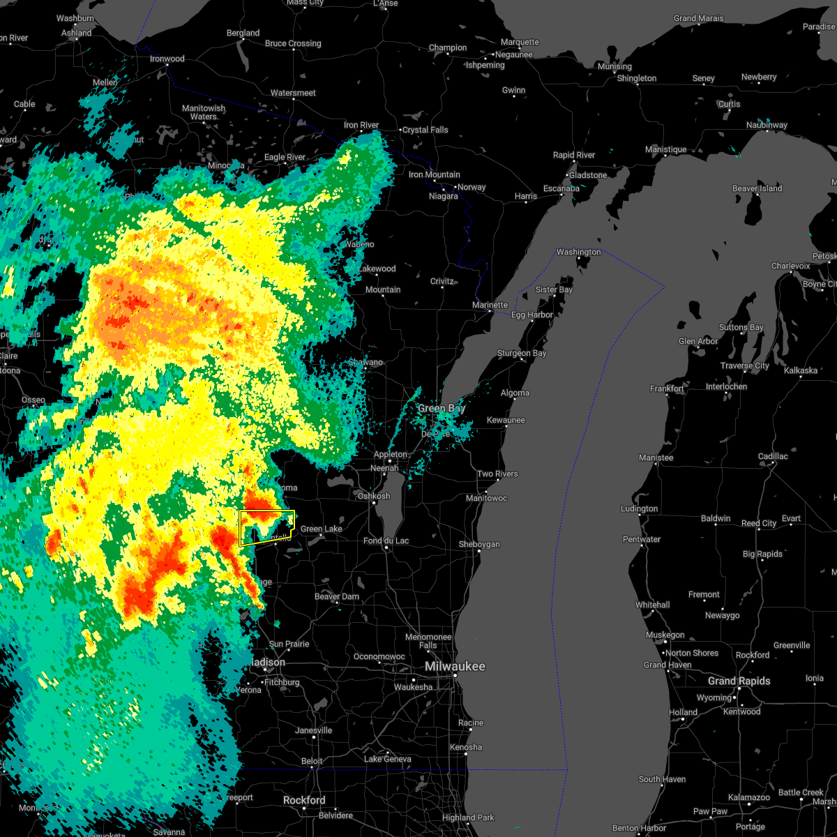
The Top Recent Hail Date for Westfield, WI is Wednesday, June 15, 2022 (11th out of 32)
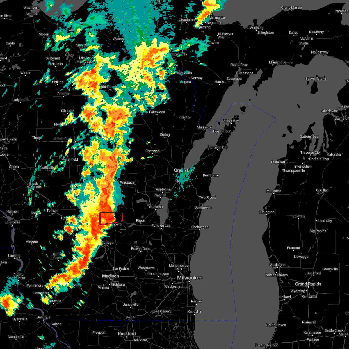
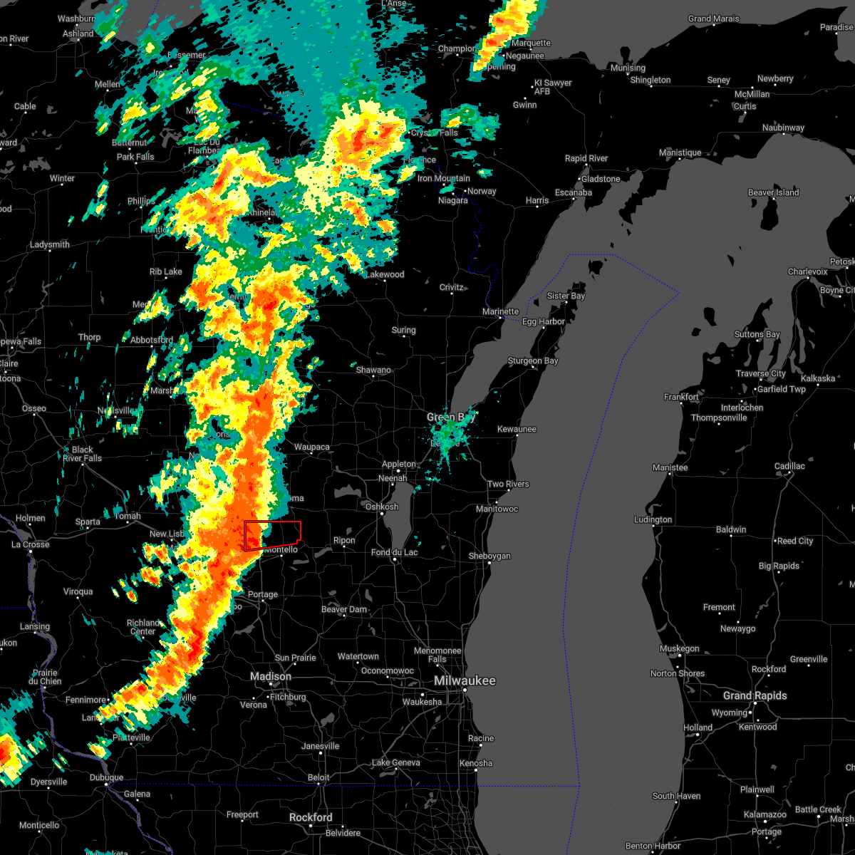
Hail and Wind Damage Spotted near Westfield, WI
| Date / Time | Report Details |
|---|---|
| 8/11/2023 8:43 PM CDT |
 At 842 pm cdt, severe thunderstorms were located along a line extending from near berlin to near montello to near wisconsin dells, moving southeast at 45 mph (emergency management reported tree damage across northwest marquette county). Hazards include 60 mph wind gusts. expect damage to roofs, siding, and trees At 842 pm cdt, severe thunderstorms were located along a line extending from near berlin to near montello to near wisconsin dells, moving southeast at 45 mph (emergency management reported tree damage across northwest marquette county). Hazards include 60 mph wind gusts. expect damage to roofs, siding, and trees
|
| 7/28/2023 9:13 PM CDT |
 At 913 pm cdt, severe thunderstorms were located along a line extending from near westfield to near portage to 10 miles north of spring green, moving southeast at 45 mph (radar indicated). Hazards include 70 mph wind gusts and ping pong ball size hail. People and animals outdoors will be injured. expect hail damage to roofs, siding, windows, and vehicles. expect considerable tree damage. wind damage is also likely to mobile homes, roofs, and outbuildings. Locations impacted include, baraboo, portage, reedsburg, prairie du sac, sauk city, wisconsin dells, lake wisconsin, lodi, lake delton, poynette, pardeeville, spring green, montello, west baraboo, westfield, rio, lawrence, packwaukee, plain, and wyocena. At 913 pm cdt, severe thunderstorms were located along a line extending from near westfield to near portage to 10 miles north of spring green, moving southeast at 45 mph (radar indicated). Hazards include 70 mph wind gusts and ping pong ball size hail. People and animals outdoors will be injured. expect hail damage to roofs, siding, windows, and vehicles. expect considerable tree damage. wind damage is also likely to mobile homes, roofs, and outbuildings. Locations impacted include, baraboo, portage, reedsburg, prairie du sac, sauk city, wisconsin dells, lake wisconsin, lodi, lake delton, poynette, pardeeville, spring green, montello, west baraboo, westfield, rio, lawrence, packwaukee, plain, and wyocena.
|
| 7/28/2023 9:02 PM CDT |
 At 901 pm cdt, severe thunderstorms were located along a line extending from 9 miles northwest of westfield to 8 miles northwest of portage to 9 miles east of richland center, moving southeast at 45 mph (radar indicated). Hazards include ping pong ball size hail and 60 mph wind gusts. People and animals outdoors will be injured. expect hail damage to roofs, siding, windows, and vehicles. expect wind damage to roofs, siding, and trees. Locations impacted include, baraboo, portage, reedsburg, prairie du sac, sauk city, wisconsin dells, lake wisconsin, lodi, lake delton, poynette, pardeeville, spring green, montello, west baraboo, westfield, rio, lawrence, packwaukee, plain, and wyocena. At 901 pm cdt, severe thunderstorms were located along a line extending from 9 miles northwest of westfield to 8 miles northwest of portage to 9 miles east of richland center, moving southeast at 45 mph (radar indicated). Hazards include ping pong ball size hail and 60 mph wind gusts. People and animals outdoors will be injured. expect hail damage to roofs, siding, windows, and vehicles. expect wind damage to roofs, siding, and trees. Locations impacted include, baraboo, portage, reedsburg, prairie du sac, sauk city, wisconsin dells, lake wisconsin, lodi, lake delton, poynette, pardeeville, spring green, montello, west baraboo, westfield, rio, lawrence, packwaukee, plain, and wyocena.
|
| 7/28/2023 8:38 PM CDT |
 At 837 pm cdt, severe thunderstorms were located along a line extending from 7 miles south of new rome to 9 miles northwest of wisconsin dells to 9 miles southeast of la farge, moving southeast at 50 mph (radar indicated). Hazards include ping pong ball size hail and 60 mph wind gusts. People and animals outdoors will be injured. expect hail damage to roofs, siding, windows, and vehicles. Expect wind damage to roofs, siding, and trees. At 837 pm cdt, severe thunderstorms were located along a line extending from 7 miles south of new rome to 9 miles northwest of wisconsin dells to 9 miles southeast of la farge, moving southeast at 50 mph (radar indicated). Hazards include ping pong ball size hail and 60 mph wind gusts. People and animals outdoors will be injured. expect hail damage to roofs, siding, windows, and vehicles. Expect wind damage to roofs, siding, and trees.
|
| 7/26/2023 5:22 AM CDT |
 At 522 am cdt, severe thunderstorms were located along a line extending from near friendship to 6 miles north of reedsburg, moving east at 45 mph (radar indicated). Hazards include 60 mph wind gusts and quarter size hail. Hail damage to vehicles is expected. Expect wind damage to roofs, siding, and trees. At 522 am cdt, severe thunderstorms were located along a line extending from near friendship to 6 miles north of reedsburg, moving east at 45 mph (radar indicated). Hazards include 60 mph wind gusts and quarter size hail. Hail damage to vehicles is expected. Expect wind damage to roofs, siding, and trees.
|
| 4/4/2023 11:10 PM CDT |
 At 1110 pm cdt, severe thunderstorms were located along a line extending from wisconsin dells to near rio to near columbus, moving northeast at 50 mph (radar indicated). Hazards include half dollar size hail. damage to vehicles is expected At 1110 pm cdt, severe thunderstorms were located along a line extending from wisconsin dells to near rio to near columbus, moving northeast at 50 mph (radar indicated). Hazards include half dollar size hail. damage to vehicles is expected
|
| 7/23/2022 5:36 PM CDT |
 At 536 pm cdt, severe thunderstorms were located along a line extending from 7 miles northwest of princeton to 6 miles north of randolph to near poynette, moving east at 50 mph (law enforcement). Hazards include 60 mph wind gusts. Expect damage to roofs, siding, and trees. locations impacted include, baraboo, portage, berlin, lake wisconsin, pardeeville, randolph, montello, markesan, westfield, princeton, rio, green lake, cambria, lawrence, packwaukee, manchester, wyocena, mecan, oxford and endeavor. hail threat, radar indicated max hail size, <. 75 in wind threat, radar indicated max wind gust, 60 mph. At 536 pm cdt, severe thunderstorms were located along a line extending from 7 miles northwest of princeton to 6 miles north of randolph to near poynette, moving east at 50 mph (law enforcement). Hazards include 60 mph wind gusts. Expect damage to roofs, siding, and trees. locations impacted include, baraboo, portage, berlin, lake wisconsin, pardeeville, randolph, montello, markesan, westfield, princeton, rio, green lake, cambria, lawrence, packwaukee, manchester, wyocena, mecan, oxford and endeavor. hail threat, radar indicated max hail size, <. 75 in wind threat, radar indicated max wind gust, 60 mph.
|
| 7/23/2022 5:20 PM CDT |
 At 519 pm cdt, severe thunderstorms were located along a line extending from westfield to 8 miles north of portage to near baraboo, moving east at 50 mph (law enforcement reported multiple trees and power lines downed across northern sauk county). Hazards include 60 mph wind gusts. Expect damage to roofs, siding, and trees. locations impacted include, baraboo, portage, berlin, lake wisconsin, pardeeville, randolph, montello, markesan, westfield, princeton, rio, green lake, cambria, lawrence, packwaukee, manchester, wyocena, mecan, oxford and endeavor. hail threat, radar indicated max hail size, <. 75 in wind threat, radar indicated max wind gust, 60 mph. At 519 pm cdt, severe thunderstorms were located along a line extending from westfield to 8 miles north of portage to near baraboo, moving east at 50 mph (law enforcement reported multiple trees and power lines downed across northern sauk county). Hazards include 60 mph wind gusts. Expect damage to roofs, siding, and trees. locations impacted include, baraboo, portage, berlin, lake wisconsin, pardeeville, randolph, montello, markesan, westfield, princeton, rio, green lake, cambria, lawrence, packwaukee, manchester, wyocena, mecan, oxford and endeavor. hail threat, radar indicated max hail size, <. 75 in wind threat, radar indicated max wind gust, 60 mph.
|
| 7/23/2022 5:04 PM CDT |
 At 503 pm cdt, severe thunderstorms were located along a line extending from 10 miles southwest of westfield to 6 miles east of wisconsin dells to near lake delton, moving northeast at 50 mph. additional severe thunderstorms are moving northeast at 50 mph across marquette and green lake counties (radar indicated). Hazards include 60 mph wind gusts. expect damage to roofs, siding, and trees At 503 pm cdt, severe thunderstorms were located along a line extending from 10 miles southwest of westfield to 6 miles east of wisconsin dells to near lake delton, moving northeast at 50 mph. additional severe thunderstorms are moving northeast at 50 mph across marquette and green lake counties (radar indicated). Hazards include 60 mph wind gusts. expect damage to roofs, siding, and trees
|
| 7/23/2022 4:43 PM CDT |
 At 442 pm cdt, a severe thunderstorm was located 7 miles southwest of wautoma, moving east at 35 mph. an additional severe storm located west of brooks was moving east at 35 mph (radar indicated). Hazards include 60 mph wind gusts and quarter size hail. Hail damage to vehicles is expected. expect wind damage to roofs, siding, and trees. locations impacted include, westfield, lawrence, neshkoro, springfield corners and harrisville. hail threat, radar indicated max hail size, 1. 00 in wind threat, radar indicated max wind gust, 60 mph. At 442 pm cdt, a severe thunderstorm was located 7 miles southwest of wautoma, moving east at 35 mph. an additional severe storm located west of brooks was moving east at 35 mph (radar indicated). Hazards include 60 mph wind gusts and quarter size hail. Hail damage to vehicles is expected. expect wind damage to roofs, siding, and trees. locations impacted include, westfield, lawrence, neshkoro, springfield corners and harrisville. hail threat, radar indicated max hail size, 1. 00 in wind threat, radar indicated max wind gust, 60 mph.
|
| 7/23/2022 4:15 PM CDT |
 At 415 pm cdt, a severe thunderstorm was located near adams, or near friendship, moving east at 40 mph (radar indicated). Hazards include 60 mph wind gusts and half dollar size hail. Hail damage to vehicles is expected. Expect wind damage to roofs, siding, and trees. At 415 pm cdt, a severe thunderstorm was located near adams, or near friendship, moving east at 40 mph (radar indicated). Hazards include 60 mph wind gusts and half dollar size hail. Hail damage to vehicles is expected. Expect wind damage to roofs, siding, and trees.
|
| 6/15/2022 5:30 PM CDT |
 At 529 pm cdt, a severe thunderstorm capable of producing a tornado was located near wautoma, moving northeast at 60 mph (radar indicated rotation. at 528 pm, wind damage was reported in westfield. winds will impact neshkoro). Hazards include tornado, quarter size hail, 80 mph winds. Flying debris will be dangerous to those caught without shelter. mobile homes will be damaged or destroyed. damage to roofs, windows, and vehicles will occur. tree damage is likely. Locations impacted include, westfield, lawrence, neshkoro, springfield corners and harrisville. At 529 pm cdt, a severe thunderstorm capable of producing a tornado was located near wautoma, moving northeast at 60 mph (radar indicated rotation. at 528 pm, wind damage was reported in westfield. winds will impact neshkoro). Hazards include tornado, quarter size hail, 80 mph winds. Flying debris will be dangerous to those caught without shelter. mobile homes will be damaged or destroyed. damage to roofs, windows, and vehicles will occur. tree damage is likely. Locations impacted include, westfield, lawrence, neshkoro, springfield corners and harrisville.
|
| 6/15/2022 5:26 PM CDT | Storm damage reported in marquette county WI, 6.3 miles SE of Westfield, WI |
| 6/15/2022 5:23 PM CDT | Reports of multiple trees and limbs down around town with estimate 60-70 mph wind in marquette county WI, 0.4 miles N of Westfield, WI |
| 6/15/2022 5:17 PM CDT |
 At 516 pm cdt, a severe thunderstorm capable of producing a tornado was located 7 miles northwest of westfield, or 10 miles east of friendship, moving northeast at 60 mph (radar indicated rotation). Hazards include tornado, quarter size hail, and 80 mph winds. Flying debris will be dangerous to those caught without shelter. mobile homes will be damaged or destroyed. damage to roofs, windows, and vehicles will occur. tree damage is likely. Locations impacted include, westfield, lawrence, neshkoro, springfield corners and harrisville. At 516 pm cdt, a severe thunderstorm capable of producing a tornado was located 7 miles northwest of westfield, or 10 miles east of friendship, moving northeast at 60 mph (radar indicated rotation). Hazards include tornado, quarter size hail, and 80 mph winds. Flying debris will be dangerous to those caught without shelter. mobile homes will be damaged or destroyed. damage to roofs, windows, and vehicles will occur. tree damage is likely. Locations impacted include, westfield, lawrence, neshkoro, springfield corners and harrisville.
|
| 6/15/2022 5:09 PM CDT |
 At 509 pm cdt, a severe thunderstorm capable of producing a tornado was located near adams, or near friendship, moving northeast at 60 mph (radar indicated rotation). Hazards include tornado and quarter size hail. Flying debris will be dangerous to those caught without shelter. mobile homes will be damaged or destroyed. damage to roofs, windows, and vehicles will occur. Tree damage is likely. At 509 pm cdt, a severe thunderstorm capable of producing a tornado was located near adams, or near friendship, moving northeast at 60 mph (radar indicated rotation). Hazards include tornado and quarter size hail. Flying debris will be dangerous to those caught without shelter. mobile homes will be damaged or destroyed. damage to roofs, windows, and vehicles will occur. Tree damage is likely.
|
| 6/15/2022 5:02 PM CDT |
 At 502 pm cdt, severe thunderstorms were located along a line extending from near adams to 12 miles north of lake delton to near wisconsin dells, moving east at 55 mph (radar indicated). Hazards include 70 mph wind gusts and quarter size hail. Hail damage to vehicles is expected. expect considerable tree damage. Wind damage is also likely to mobile homes, roofs, and outbuildings. At 502 pm cdt, severe thunderstorms were located along a line extending from near adams to 12 miles north of lake delton to near wisconsin dells, moving east at 55 mph (radar indicated). Hazards include 70 mph wind gusts and quarter size hail. Hail damage to vehicles is expected. expect considerable tree damage. Wind damage is also likely to mobile homes, roofs, and outbuildings.
|
| 9/7/2021 8:57 AM CDT |
 The national weather service in milwaukee/sullivan has issued a * severe thunderstorm warning for. northern green lake county in south central wisconsin. northern marquette county in south central wisconsin. until 945 am cdt. At 857 am cdt, a severe thunderstorm was located 8 miles northwest. The national weather service in milwaukee/sullivan has issued a * severe thunderstorm warning for. northern green lake county in south central wisconsin. northern marquette county in south central wisconsin. until 945 am cdt. At 857 am cdt, a severe thunderstorm was located 8 miles northwest.
|
| 9/7/2021 8:47 AM CDT | Quarter sized hail reported 0.3 miles S of Westfield, WI, time estimated from radar. |
| 8/11/2021 3:10 PM CDT |
 At 310 pm cdt, a severe thunderstorm was located near westfield, or 10 miles southwest of wautoma, moving east at 45 mph (radar indicated). Hazards include 60 mph wind gusts and quarter size hail. Hail damage to vehicles is expected. expect wind damage to roofs, siding, and trees. Locations impacted include, berlin, westfield, princeton, green lake, lawrence, neshkoro, springfield corners and harrisville. At 310 pm cdt, a severe thunderstorm was located near westfield, or 10 miles southwest of wautoma, moving east at 45 mph (radar indicated). Hazards include 60 mph wind gusts and quarter size hail. Hail damage to vehicles is expected. expect wind damage to roofs, siding, and trees. Locations impacted include, berlin, westfield, princeton, green lake, lawrence, neshkoro, springfield corners and harrisville.
|
| 8/11/2021 2:46 PM CDT |
 At 245 pm cdt, a severe thunderstorm was located near adams, or near friendship, moving east at 45 mph (radar indicated). Hazards include 60 mph wind gusts and quarter size hail. Hail damage to vehicles is expected. Expect wind damage to roofs, siding, and trees. At 245 pm cdt, a severe thunderstorm was located near adams, or near friendship, moving east at 45 mph (radar indicated). Hazards include 60 mph wind gusts and quarter size hail. Hail damage to vehicles is expected. Expect wind damage to roofs, siding, and trees.
|
| 7/28/2021 11:44 PM CDT |
 At 1143 pm cdt, severe thunderstorms were located along a line extending from near southern lake winnebago to near ripon to 6 miles north of westfield, moving southeast at 55 mph (radar indicated). Hazards include 70 mph wind gusts and penny size hail. Expect considerable tree damage. damage is likely to mobile homes, roofs, and outbuildings. locations impacted include, fond du lac, waupun, ripon, berlin, north fond du lac, campbellsport, montello, markesan, westfield, princeton, oakfield, rosendale, green lake, brandon, southern lake winnebago, lawrence, taycheedah, ashford, lamartine and byron. People attending fond du lac airport should seek safe shelter immediately!. At 1143 pm cdt, severe thunderstorms were located along a line extending from near southern lake winnebago to near ripon to 6 miles north of westfield, moving southeast at 55 mph (radar indicated). Hazards include 70 mph wind gusts and penny size hail. Expect considerable tree damage. damage is likely to mobile homes, roofs, and outbuildings. locations impacted include, fond du lac, waupun, ripon, berlin, north fond du lac, campbellsport, montello, markesan, westfield, princeton, oakfield, rosendale, green lake, brandon, southern lake winnebago, lawrence, taycheedah, ashford, lamartine and byron. People attending fond du lac airport should seek safe shelter immediately!.
|
| 7/28/2021 11:18 PM CDT |
 At 1118 pm cdt, severe thunderstorms were located along a line extending from 8 miles west of menasha to near redgranite to 8 miles south of lake wazeecha, moving southeast at 45 mph (radar indicated). Hazards include 60 mph wind gusts and penny size hail. expect damage to roofs, siding, and trees At 1118 pm cdt, severe thunderstorms were located along a line extending from 8 miles west of menasha to near redgranite to 8 miles south of lake wazeecha, moving southeast at 45 mph (radar indicated). Hazards include 60 mph wind gusts and penny size hail. expect damage to roofs, siding, and trees
|
| 8/25/2020 12:13 AM CDT |
 At 1212 am cdt, a severe thunderstorm was located near westfield, or 16 miles south of wautoma, moving southeast at 30 mph (radar indicated). Hazards include 60 mph wind gusts and quarter size hail. Hail damage to vehicles is expected. expect wind damage to roofs, siding, and trees. Locations impacted include, montello, markesan, westfield, princeton, lawrence, packwaukee, manchester, mecan, neshkoro, kingston, marquette, glen oak, harrisville, springfield corners and dalton. At 1212 am cdt, a severe thunderstorm was located near westfield, or 16 miles south of wautoma, moving southeast at 30 mph (radar indicated). Hazards include 60 mph wind gusts and quarter size hail. Hail damage to vehicles is expected. expect wind damage to roofs, siding, and trees. Locations impacted include, montello, markesan, westfield, princeton, lawrence, packwaukee, manchester, mecan, neshkoro, kingston, marquette, glen oak, harrisville, springfield corners and dalton.
|
| 8/24/2020 11:47 PM CDT |
 At 1147 pm cdt, a severe thunderstorm was located over westfield, or 15 miles southwest of wautoma, moving southeast at 25 mph (radar indicated). Hazards include 60 mph wind gusts and quarter size hail. Hail damage to vehicles is expected. Expect wind damage to roofs, siding, and trees. At 1147 pm cdt, a severe thunderstorm was located over westfield, or 15 miles southwest of wautoma, moving southeast at 25 mph (radar indicated). Hazards include 60 mph wind gusts and quarter size hail. Hail damage to vehicles is expected. Expect wind damage to roofs, siding, and trees.
|
| 8/24/2020 11:43 PM CDT | Ping Pong Ball sized hail reported 0.3 miles S of Westfield, WI, ping pong ball size hail reported. time estimated from radar. |
| 8/10/2020 8:35 AM CDT |
 The severe thunderstorm warning for north central green lake and northern marquette counties will expire at 845 am cdt, the storm which prompted the warning has weakened below severe limits, and no longer poses an immediate threat to life or property. therefore, the warning will be allowed to expire. The severe thunderstorm warning for north central green lake and northern marquette counties will expire at 845 am cdt, the storm which prompted the warning has weakened below severe limits, and no longer poses an immediate threat to life or property. therefore, the warning will be allowed to expire.
|
| 8/10/2020 8:02 AM CDT |
 At 801 am cdt, a severe thunderstorm was located over friendship, moving east at 50 mph (radar indicated). Hazards include 60 mph wind gusts and nickel size hail. expect damage to roofs, siding, and trees At 801 am cdt, a severe thunderstorm was located over friendship, moving east at 50 mph (radar indicated). Hazards include 60 mph wind gusts and nickel size hail. expect damage to roofs, siding, and trees
|
| 7/19/2020 3:59 AM CDT |
 At 359 am cdt, severe thunderstorms were located along a line extending from near berlin to near wisconsin dells, moving east at 55 mph (radar indicated). Hazards include 60 mph wind gusts and quarter size hail. Hail damage to vehicles is expected. expect wind damage to roofs, siding, and trees. Locations impacted include, portage, berlin, wisconsin dells, montello, westfield, princeton, green lake, lawrence, packwaukee, mecan, oxford, endeavor, neshkoro, marquette, glen oak, harrisville, springfield corners and briggsville. At 359 am cdt, severe thunderstorms were located along a line extending from near berlin to near wisconsin dells, moving east at 55 mph (radar indicated). Hazards include 60 mph wind gusts and quarter size hail. Hail damage to vehicles is expected. expect wind damage to roofs, siding, and trees. Locations impacted include, portage, berlin, wisconsin dells, montello, westfield, princeton, green lake, lawrence, packwaukee, mecan, oxford, endeavor, neshkoro, marquette, glen oak, harrisville, springfield corners and briggsville.
|
| 7/19/2020 3:43 AM CDT |
 At 342 am cdt, severe thunderstorms were located along a line extending from near westfield to 7 miles southeast of mauston, moving southeast at 25 mph (radar indicated). Hazards include 60 mph wind gusts and quarter size hail. Hail damage to vehicles is expected. Expect wind damage to roofs, siding, and trees. At 342 am cdt, severe thunderstorms were located along a line extending from near westfield to 7 miles southeast of mauston, moving southeast at 25 mph (radar indicated). Hazards include 60 mph wind gusts and quarter size hail. Hail damage to vehicles is expected. Expect wind damage to roofs, siding, and trees.
|
| 7/9/2020 5:42 PM CDT |
 The severe thunderstorm warning for columbia, northwestern dane, marquette and eastern sauk counties will expire at 545 pm cdt, the storms which prompted the warning have moved out of the area. therefore, the warning will be allowed to expire. however gusty winds and heavy rain are still possible with these thunderstorms. a severe thunderstorm watch remains in effect until 1100 pm cdt for south central wisconsin. remember, a severe thunderstorm warning still remains in effect for northeastern dane and eastern columbia counties. The severe thunderstorm warning for columbia, northwestern dane, marquette and eastern sauk counties will expire at 545 pm cdt, the storms which prompted the warning have moved out of the area. therefore, the warning will be allowed to expire. however gusty winds and heavy rain are still possible with these thunderstorms. a severe thunderstorm watch remains in effect until 1100 pm cdt for south central wisconsin. remember, a severe thunderstorm warning still remains in effect for northeastern dane and eastern columbia counties.
|
| 7/9/2020 5:19 PM CDT |
 At 518 pm cdt, severe thunderstorms were located along a line extending from near lake delton to windsor, moving northeast at 35 mph (emergency management. trees and powerlines have been reported down in arena and in sauk city). Hazards include 60 mph wind gusts and nickel size hail. Expect damage to roofs, siding, and trees. Locations impacted include, middleton, waunakee, baraboo, portage, mount horeb, windsor, prairie du sac, sauk city, wisconsin dells, lake wisconsin, deforest, cross plains, lodi, lake delton, poynette, pardeeville, montello, west baraboo, black earth and westfield. At 518 pm cdt, severe thunderstorms were located along a line extending from near lake delton to windsor, moving northeast at 35 mph (emergency management. trees and powerlines have been reported down in arena and in sauk city). Hazards include 60 mph wind gusts and nickel size hail. Expect damage to roofs, siding, and trees. Locations impacted include, middleton, waunakee, baraboo, portage, mount horeb, windsor, prairie du sac, sauk city, wisconsin dells, lake wisconsin, deforest, cross plains, lodi, lake delton, poynette, pardeeville, montello, west baraboo, black earth and westfield.
|
| 7/9/2020 5:09 PM CDT |
 At 508 pm cdt, severe thunderstorms were located along a line extending from near wisconsin dells to near lodi, moving northeast at 45 mph (emergency management. trees and powerlines were reported down in the arena area). Hazards include 60 mph wind gusts and nickel size hail. Expect damage to roofs, siding, and trees. Locations impacted include, middleton, waunakee, baraboo, portage, mount horeb, windsor, prairie du sac, sauk city, wisconsin dells, lake wisconsin, deforest, cross plains, lodi, lake delton, poynette, pardeeville, mazomanie, montello, west baraboo and black earth. At 508 pm cdt, severe thunderstorms were located along a line extending from near wisconsin dells to near lodi, moving northeast at 45 mph (emergency management. trees and powerlines were reported down in the arena area). Hazards include 60 mph wind gusts and nickel size hail. Expect damage to roofs, siding, and trees. Locations impacted include, middleton, waunakee, baraboo, portage, mount horeb, windsor, prairie du sac, sauk city, wisconsin dells, lake wisconsin, deforest, cross plains, lodi, lake delton, poynette, pardeeville, mazomanie, montello, west baraboo and black earth.
|
| 7/9/2020 4:55 PM CDT |
 At 455 pm cdt, severe thunderstorms were located along a line extending from reedsburg to near cross plains, moving northeast at 45 mph (radar indicated). Hazards include 60 mph wind gusts and nickel size hail. expect damage to roofs, siding, and trees At 455 pm cdt, severe thunderstorms were located along a line extending from reedsburg to near cross plains, moving northeast at 45 mph (radar indicated). Hazards include 60 mph wind gusts and nickel size hail. expect damage to roofs, siding, and trees
|
| 6/2/2020 8:07 PM CDT |
 At 807 pm cdt, severe thunderstorms were located along a line extending from near rosendale to near pardeeville, moving southeast at 30 mph (radar indicated). Hazards include 60 mph wind gusts and quarter size hail. Hail damage to vehicles is expected. expect wind damage to roofs, siding, and trees. Locations impacted include, berlin, montello, markesan, westfield, princeton, green lake, lawrence, manchester, neshkoro, kingston, marquette, glen oak, harrisville, springfield corners and dalton. At 807 pm cdt, severe thunderstorms were located along a line extending from near rosendale to near pardeeville, moving southeast at 30 mph (radar indicated). Hazards include 60 mph wind gusts and quarter size hail. Hail damage to vehicles is expected. expect wind damage to roofs, siding, and trees. Locations impacted include, berlin, montello, markesan, westfield, princeton, green lake, lawrence, manchester, neshkoro, kingston, marquette, glen oak, harrisville, springfield corners and dalton.
|
| 6/2/2020 7:49 PM CDT |
 At 747 pm cdt, severe thunderstorms were located along a line extending from near rush lake to 8 miles north of portage, moving southeast at 40 mph (radar indicated). Hazards include 60 mph wind gusts and quarter size hail. Hail damage to vehicles is expected. expect wind damage to roofs, siding, and trees. Locations impacted include, berlin, montello, markesan, westfield, princeton, green lake, lawrence, manchester, neshkoro, kingston, marquette, glen oak, harrisville, springfield corners and dalton. At 747 pm cdt, severe thunderstorms were located along a line extending from near rush lake to 8 miles north of portage, moving southeast at 40 mph (radar indicated). Hazards include 60 mph wind gusts and quarter size hail. Hail damage to vehicles is expected. expect wind damage to roofs, siding, and trees. Locations impacted include, berlin, montello, markesan, westfield, princeton, green lake, lawrence, manchester, neshkoro, kingston, marquette, glen oak, harrisville, springfield corners and dalton.
|
| 6/2/2020 7:29 PM CDT |
 At 728 pm cdt, severe thunderstorms were located along a line extending from near berlin to 8 miles southwest of westfield, moving southeast at 30 mph (radar indicated). Hazards include 60 mph wind gusts and quarter size hail. Hail damage to vehicles is expected. expect wind damage to roofs, siding, and trees. Locations impacted include, berlin, montello, markesan, westfield, princeton, green lake, lawrence, manchester, neshkoro, kingston, marquette, glen oak, harrisville, springfield corners and dalton. At 728 pm cdt, severe thunderstorms were located along a line extending from near berlin to 8 miles southwest of westfield, moving southeast at 30 mph (radar indicated). Hazards include 60 mph wind gusts and quarter size hail. Hail damage to vehicles is expected. expect wind damage to roofs, siding, and trees. Locations impacted include, berlin, montello, markesan, westfield, princeton, green lake, lawrence, manchester, neshkoro, kingston, marquette, glen oak, harrisville, springfield corners and dalton.
|
| 6/2/2020 7:15 PM CDT | She shed went rolling down the driveway. lots of trees and branches down. time estimated from rada in marquette county WI, 1.5 miles ENE of Westfield, WI |
| 6/2/2020 7:12 PM CDT |
 At 711 pm cdt, severe thunderstorms were located along a line extending from near wautoma to near westfield, moving southeast at 30 mph (radar indicated). Hazards include 60 mph wind gusts and quarter size hail. Hail damage to vehicles is expected. Expect wind damage to roofs, siding, and trees. At 711 pm cdt, severe thunderstorms were located along a line extending from near wautoma to near westfield, moving southeast at 30 mph (radar indicated). Hazards include 60 mph wind gusts and quarter size hail. Hail damage to vehicles is expected. Expect wind damage to roofs, siding, and trees.
|
| 4/20/2020 7:35 PM CDT |
 At 734 pm cdt, a severe thunderstorm was located 7 miles south of princeton, or 17 miles west of ripon, moving southeast at 50 mph (radar indicated). Hazards include 60 mph wind gusts. pea size hail. Expect damage to roofs, siding, and trees. Locations impacted include, berlin, montello, markesan, princeton, green lake, packwaukee, manchester, oxford, endeavor, neshkoro, kingston, marquette, glen oak, harrisville, dalton and briggsville. At 734 pm cdt, a severe thunderstorm was located 7 miles south of princeton, or 17 miles west of ripon, moving southeast at 50 mph (radar indicated). Hazards include 60 mph wind gusts. pea size hail. Expect damage to roofs, siding, and trees. Locations impacted include, berlin, montello, markesan, princeton, green lake, packwaukee, manchester, oxford, endeavor, neshkoro, kingston, marquette, glen oak, harrisville, dalton and briggsville.
|
| 4/20/2020 7:04 PM CDT |
 At 703 pm cdt, a severe thunderstorm was located near westfield, or 11 miles east of friendship, moving southeast at 50 mph (radar indicated). Hazards include 60 mph wind gusts. pea size hail. expect damage to roofs, siding, and trees At 703 pm cdt, a severe thunderstorm was located near westfield, or 11 miles east of friendship, moving southeast at 50 mph (radar indicated). Hazards include 60 mph wind gusts. pea size hail. expect damage to roofs, siding, and trees
|
| 8/7/2019 8:57 PM CDT |
 The severe thunderstorm warning for northern green lake and marquette counties will expire at 900 pm cdt, the storms which prompted the warning have moved out of the area. therefore, the warning will be allowed to expire. however small hail and gusty winds are still possible with these thunderstorms. The severe thunderstorm warning for northern green lake and marquette counties will expire at 900 pm cdt, the storms which prompted the warning have moved out of the area. therefore, the warning will be allowed to expire. however small hail and gusty winds are still possible with these thunderstorms.
|
| 8/7/2019 8:35 PM CDT |
 At 834 pm cdt, severe thunderstorms were located along a line extending from near princeton to 8 miles southwest of westfield, moving southeast at 25 mph (radar indicated). Hazards include 60 mph wind gusts and quarter size hail. Hail damage to vehicles is expected. expect wind damage to roofs, siding, and trees. Locations impacted include, montello, westfield, princeton, lawrence, packwaukee, oxford, endeavor, neshkoro, glen oak and harrisville. At 834 pm cdt, severe thunderstorms were located along a line extending from near princeton to 8 miles southwest of westfield, moving southeast at 25 mph (radar indicated). Hazards include 60 mph wind gusts and quarter size hail. Hail damage to vehicles is expected. expect wind damage to roofs, siding, and trees. Locations impacted include, montello, westfield, princeton, lawrence, packwaukee, oxford, endeavor, neshkoro, glen oak and harrisville.
|
| 8/7/2019 8:18 PM CDT |
 At 817 pm cdt, severe thunderstorms were located along a line extending from near wautoma to 9 miles west of westfield, moving southeast at 30 mph (radar indicated). Hazards include 70 mph wind gusts and half dollar size hail. Hail damage to vehicles is expected. expect considerable tree damage. Wind damage is also likely to mobile homes, roofs, and outbuildings. At 817 pm cdt, severe thunderstorms were located along a line extending from near wautoma to 9 miles west of westfield, moving southeast at 30 mph (radar indicated). Hazards include 70 mph wind gusts and half dollar size hail. Hail damage to vehicles is expected. expect considerable tree damage. Wind damage is also likely to mobile homes, roofs, and outbuildings.
|
| 8/5/2019 7:42 PM CDT |
 At 742 pm cdt, a severe thunderstorm was located near montello, or 15 miles south of wautoma, moving southeast at 45 mph (radar indicated). Hazards include 60 mph wind gusts. Expect damage to roofs, siding, and trees. Locations impacted include, montello, westfield, princeton, green lake, lawrence, packwaukee, endeavor, neshkoro, marquette, springfield corners, glen oak and harrisville. At 742 pm cdt, a severe thunderstorm was located near montello, or 15 miles south of wautoma, moving southeast at 45 mph (radar indicated). Hazards include 60 mph wind gusts. Expect damage to roofs, siding, and trees. Locations impacted include, montello, westfield, princeton, green lake, lawrence, packwaukee, endeavor, neshkoro, marquette, springfield corners, glen oak and harrisville.
|
| 8/5/2019 7:30 PM CDT |
 At 729 pm cdt, a severe thunderstorm was located 8 miles southwest of wautoma, moving southeast at 45 mph (radar indicated). Hazards include 60 mph wind gusts. expect damage to roofs, siding, and trees At 729 pm cdt, a severe thunderstorm was located 8 miles southwest of wautoma, moving southeast at 45 mph (radar indicated). Hazards include 60 mph wind gusts. expect damage to roofs, siding, and trees
|
| 7/20/2019 11:11 AM CDT |
 At 1111 am cdt, severe thunderstorms were located along a line extending from 8 miles southeast of new london to 6 miles northeast of berlin to near westfield, moving east at 65 mph (radar indicated). Hazards include 60 mph wind gusts. Expect damage to roofs, siding, and trees. Locations impacted include, berlin, montello, westfield, princeton, green lake, lawrence, packwaukee, oxford, neshkoro, marquette, glen oak, harrisville and springfield corners. At 1111 am cdt, severe thunderstorms were located along a line extending from 8 miles southeast of new london to 6 miles northeast of berlin to near westfield, moving east at 65 mph (radar indicated). Hazards include 60 mph wind gusts. Expect damage to roofs, siding, and trees. Locations impacted include, berlin, montello, westfield, princeton, green lake, lawrence, packwaukee, oxford, neshkoro, marquette, glen oak, harrisville and springfield corners.
|
| 7/20/2019 10:49 AM CDT |
 At 1048 am cdt, severe thunderstorms were located along a line extending from chain o` lakes-king to near wautoma to adams, moving east at 65 mph (trained weather spotters. this line has a history of producing widespread wind damage across central wisconsin). Hazards include 60 mph wind gusts. expect damage to roofs, siding, and trees At 1048 am cdt, severe thunderstorms were located along a line extending from chain o` lakes-king to near wautoma to adams, moving east at 65 mph (trained weather spotters. this line has a history of producing widespread wind damage across central wisconsin). Hazards include 60 mph wind gusts. expect damage to roofs, siding, and trees
|
| 6/30/2019 10:29 AM CDT |
 At 1027 am cdt, severe thunderstorms were located along a line extending from near berlin to near west baraboo, moving southeast at 45 mph (radar indicated. there was also a report from law enforcement of winds up to 60 mph with large tree branches down near endeavor). Hazards include 60 mph wind gusts and half dollar size hail. Hail damage to vehicles is expected. expect wind damage to roofs, siding, and trees. Locations impacted include, baraboo, portage, wisconsin dells, lake wisconsin, berlin, lake delton, pardeeville, randolph, montello, markesan, west baraboo, westfield, princeton, green lake, cambria, lawrence, packwaukee, manchester, wyocena and north freedom. At 1027 am cdt, severe thunderstorms were located along a line extending from near berlin to near west baraboo, moving southeast at 45 mph (radar indicated. there was also a report from law enforcement of winds up to 60 mph with large tree branches down near endeavor). Hazards include 60 mph wind gusts and half dollar size hail. Hail damage to vehicles is expected. expect wind damage to roofs, siding, and trees. Locations impacted include, baraboo, portage, wisconsin dells, lake wisconsin, berlin, lake delton, pardeeville, randolph, montello, markesan, west baraboo, westfield, princeton, green lake, cambria, lawrence, packwaukee, manchester, wyocena and north freedom.
|
| 6/30/2019 10:12 AM CDT |
 The national weather service in milwaukee/sullivan has issued a * severe thunderstorm warning for. green lake county in south central wisconsin. northwestern columbia county in south central wisconsin. marquette county in south central wisconsin. Northeastern sauk county in south central wisconsin. The national weather service in milwaukee/sullivan has issued a * severe thunderstorm warning for. green lake county in south central wisconsin. northwestern columbia county in south central wisconsin. marquette county in south central wisconsin. Northeastern sauk county in south central wisconsin.
|
| 6/27/2019 3:57 PM CDT |
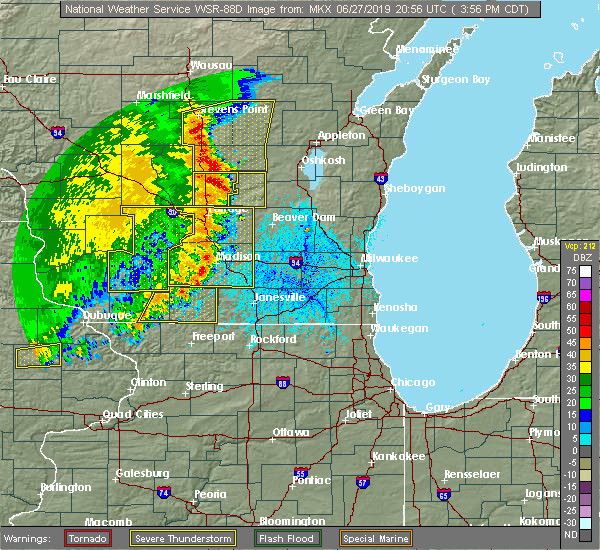 At 355 pm cdt, severe thunderstorms were located along a line extending from near wautoma to 7 miles north of pardeeville, moving east at 40 mph (emergency management. at 340 pm, trees were reported down near briggsville). Hazards include 60 mph wind gusts and quarter size hail. Hail damage to vehicles is expected. expect wind damage to roofs, siding, and trees. Locations impacted include, montello, westfield, lawrence, packwaukee, oxford, endeavor, neshkoro, springfield corners, briggsville, glen oak and harrisville. At 355 pm cdt, severe thunderstorms were located along a line extending from near wautoma to 7 miles north of pardeeville, moving east at 40 mph (emergency management. at 340 pm, trees were reported down near briggsville). Hazards include 60 mph wind gusts and quarter size hail. Hail damage to vehicles is expected. expect wind damage to roofs, siding, and trees. Locations impacted include, montello, westfield, lawrence, packwaukee, oxford, endeavor, neshkoro, springfield corners, briggsville, glen oak and harrisville.
|
| 6/27/2019 3:31 PM CDT |
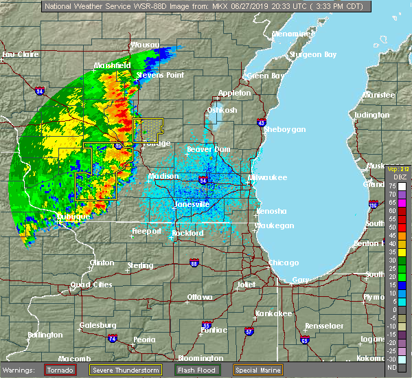 At 331 pm cdt, severe thunderstorms were located along a line extending from 10 miles east of friendship to 7 miles east of wisconsin dells, moving northeast at 30 mph (radar indicated). Hazards include 60 mph wind gusts and quarter size hail. Hail damage to vehicles is expected. Expect wind damage to roofs, siding, and trees. At 331 pm cdt, severe thunderstorms were located along a line extending from 10 miles east of friendship to 7 miles east of wisconsin dells, moving northeast at 30 mph (radar indicated). Hazards include 60 mph wind gusts and quarter size hail. Hail damage to vehicles is expected. Expect wind damage to roofs, siding, and trees.
|
| 8/28/2018 2:53 PM CDT |
 At 253 pm cdt, severe thunderstorms were located along a line extending from near friendship to 8 miles southwest of westfield to near lake delton, moving east at 40 mph (law enforcement. this storm has a history of tree damage across adams county). Hazards include 60 mph wind gusts and quarter size hail. Hail damage to vehicles is expected. expect wind damage to roofs, siding, and trees. Locations impacted include, wisconsin dells, lake delton, montello, westfield, lawrence, packwaukee, oxford, endeavor, neshkoro, glen oak, harrisville, springfield corners and briggsville. At 253 pm cdt, severe thunderstorms were located along a line extending from near friendship to 8 miles southwest of westfield to near lake delton, moving east at 40 mph (law enforcement. this storm has a history of tree damage across adams county). Hazards include 60 mph wind gusts and quarter size hail. Hail damage to vehicles is expected. expect wind damage to roofs, siding, and trees. Locations impacted include, wisconsin dells, lake delton, montello, westfield, lawrence, packwaukee, oxford, endeavor, neshkoro, glen oak, harrisville, springfield corners and briggsville.
|
| 8/28/2018 2:50 PM CDT |
 At 250 pm cdt, severe thunderstorms were located along a line extending from near friendship to 9 miles southwest of westfield to near lake delton, moving east at 40 mph (radar indicated). Hazards include 60 mph wind gusts and quarter size hail. Hail damage to vehicles is expected. expect wind damage to roofs, siding, and trees. locations impacted include, wisconsin dells, lake delton, montello, westfield, lawrence, packwaukee, oxford, endeavor, neshkoro, glen oak, harrisville, springfield corners and briggsville. A tornado warning is also in effect for marquette county. At 250 pm cdt, severe thunderstorms were located along a line extending from near friendship to 9 miles southwest of westfield to near lake delton, moving east at 40 mph (radar indicated). Hazards include 60 mph wind gusts and quarter size hail. Hail damage to vehicles is expected. expect wind damage to roofs, siding, and trees. locations impacted include, wisconsin dells, lake delton, montello, westfield, lawrence, packwaukee, oxford, endeavor, neshkoro, glen oak, harrisville, springfield corners and briggsville. A tornado warning is also in effect for marquette county.
|
| 8/28/2018 2:36 PM CDT |
 At 236 pm cdt, severe thunderstorms were located along a line extending from near dellwood to 9 miles north of wisconsin dells to near reedsburg, moving northeast at 35 mph (radar indicated). Hazards include 60 mph wind gusts and quarter size hail. Hail damage to vehicles is expected. expect wind damage to roofs, siding, and trees. Locations impacted include, reedsburg, wisconsin dells, lake delton, montello, westfield, lawrence, packwaukee, oxford, endeavor, neshkoro, glen oak, harrisville, springfield corners and briggsville. At 236 pm cdt, severe thunderstorms were located along a line extending from near dellwood to 9 miles north of wisconsin dells to near reedsburg, moving northeast at 35 mph (radar indicated). Hazards include 60 mph wind gusts and quarter size hail. Hail damage to vehicles is expected. expect wind damage to roofs, siding, and trees. Locations impacted include, reedsburg, wisconsin dells, lake delton, montello, westfield, lawrence, packwaukee, oxford, endeavor, neshkoro, glen oak, harrisville, springfield corners and briggsville.
|
| 8/28/2018 2:29 PM CDT |
 At 228 pm cdt, severe thunderstorms were located along a line extending from near dellwood to 8 miles northwest of wisconsin dells to reedsburg, moving northeast at 35 mph (radar indicated). Hazards include 60 mph wind gusts and quarter size hail. Hail damage to vehicles is expected. Expect wind damage to roofs, siding, and trees. At 228 pm cdt, severe thunderstorms were located along a line extending from near dellwood to 8 miles northwest of wisconsin dells to reedsburg, moving northeast at 35 mph (radar indicated). Hazards include 60 mph wind gusts and quarter size hail. Hail damage to vehicles is expected. Expect wind damage to roofs, siding, and trees.
|
| 8/27/2018 9:52 PM CDT |
 The severe thunderstorm warning for northern green lake and northern marquette counties will expire at 1000 pm cdt, the storm which prompted the warning has weakened below severe limits, and no longer poses an immediate threat to life or property. therefore, the warning will be allowed to expire. however gusty winds and heavy rain are still possible with this thunderstorm. The severe thunderstorm warning for northern green lake and northern marquette counties will expire at 1000 pm cdt, the storm which prompted the warning has weakened below severe limits, and no longer poses an immediate threat to life or property. therefore, the warning will be allowed to expire. however gusty winds and heavy rain are still possible with this thunderstorm.
|
| 8/27/2018 9:31 PM CDT |
 At 931 pm cdt, a severe thunderstorm was located near westfield, or 12 miles southwest of wautoma, moving east at 50 mph (radar indicated). Hazards include 60 mph wind gusts. Expect damage to roofs, siding, and trees. Locations impacted include, berlin, montello, westfield, princeton, green lake, lawrence, oxford, neshkoro, springfield corners and harrisville. At 931 pm cdt, a severe thunderstorm was located near westfield, or 12 miles southwest of wautoma, moving east at 50 mph (radar indicated). Hazards include 60 mph wind gusts. Expect damage to roofs, siding, and trees. Locations impacted include, berlin, montello, westfield, princeton, green lake, lawrence, oxford, neshkoro, springfield corners and harrisville.
|
| 8/27/2018 9:12 PM CDT |
 At 911 pm cdt, a severe thunderstorm was located near adams, or near friendship, moving east at 50 mph (radar indicated). Hazards include 60 mph wind gusts. expect damage to roofs, siding, and trees At 911 pm cdt, a severe thunderstorm was located near adams, or near friendship, moving east at 50 mph (radar indicated). Hazards include 60 mph wind gusts. expect damage to roofs, siding, and trees
|
| 8/26/2018 4:23 PM CDT |
 At 422 pm cdt, a severe thunderstorm was located 8 miles north of montello, or 9 miles south of wautoma, moving east at 25 mph (law enforcement. trees have been reported down across sauk county). Hazards include 60 mph wind gusts and penny size hail. Expect damage to roofs, siding, and trees. Locations impacted include, berlin, westfield, lawrence, neshkoro, springfield corners and harrisville. At 422 pm cdt, a severe thunderstorm was located 8 miles north of montello, or 9 miles south of wautoma, moving east at 25 mph (law enforcement. trees have been reported down across sauk county). Hazards include 60 mph wind gusts and penny size hail. Expect damage to roofs, siding, and trees. Locations impacted include, berlin, westfield, lawrence, neshkoro, springfield corners and harrisville.
|
| 8/26/2018 4:17 PM CDT |
 At 416 pm cdt, a severe thunderstorm was located 7 miles east of westfield, or 11 miles south of wautoma, moving east at 25 mph (law enforcement. numerous trees were reported down in sauk county over the last half hour). Hazards include 60 mph wind gusts and penny size hail. expect damage to roofs, siding, and trees At 416 pm cdt, a severe thunderstorm was located 7 miles east of westfield, or 11 miles south of wautoma, moving east at 25 mph (law enforcement. numerous trees were reported down in sauk county over the last half hour). Hazards include 60 mph wind gusts and penny size hail. expect damage to roofs, siding, and trees
|
| 7/1/2018 1:26 PM CDT |
 At 126 pm cdt, a severe thunderstorm was located near montello, or 16 miles south of wautoma, moving northeast at 40 mph (radar indicated). Hazards include 60 mph wind gusts. Expect damage to roofs, siding, and trees. locations impacted include, montello, westfield, packwaukee, oxford, endeavor, neshkoro, glen oak, briggsville and harrisville. A tornado watch remains in effect until 700 pm cdt for south central wisconsin. At 126 pm cdt, a severe thunderstorm was located near montello, or 16 miles south of wautoma, moving northeast at 40 mph (radar indicated). Hazards include 60 mph wind gusts. Expect damage to roofs, siding, and trees. locations impacted include, montello, westfield, packwaukee, oxford, endeavor, neshkoro, glen oak, briggsville and harrisville. A tornado watch remains in effect until 700 pm cdt for south central wisconsin.
|
| 7/1/2018 1:16 PM CDT |
 At 115 pm cdt, a severe thunderstorm was located 7 miles south of westfield, or 15 miles north of portage, moving northeast at 50 mph (radar indicated). Hazards include 60 mph wind gusts. Expect damage to roofs, siding, and trees. locations impacted include, montello, westfield, packwaukee, oxford, endeavor, neshkoro, glen oak, briggsville and harrisville. A tornado watch remains in effect until 700 pm cdt for south central wisconsin. At 115 pm cdt, a severe thunderstorm was located 7 miles south of westfield, or 15 miles north of portage, moving northeast at 50 mph (radar indicated). Hazards include 60 mph wind gusts. Expect damage to roofs, siding, and trees. locations impacted include, montello, westfield, packwaukee, oxford, endeavor, neshkoro, glen oak, briggsville and harrisville. A tornado watch remains in effect until 700 pm cdt for south central wisconsin.
|
| 7/1/2018 1:10 PM CDT |
 At 106 pm cdt, a severe thunderstorm was located 8 miles northeast of wisconsin dells, moving northeast at 40 mph (radar indicated). Hazards include 60 mph wind gusts. expect damage to roofs, siding, and trees At 106 pm cdt, a severe thunderstorm was located 8 miles northeast of wisconsin dells, moving northeast at 40 mph (radar indicated). Hazards include 60 mph wind gusts. expect damage to roofs, siding, and trees
|
| 6/30/2018 6:53 PM CDT |
 At 651 pm cdt, severe thunderstorms were located along a line extending from near westfield to 6 miles northwest of portage to 6 miles southwest of west baraboo, moving east at 50 mph (law enforcement. these storms have a history of producing tree damage, and winds measured between 50 and 60 mph). Hazards include 60 mph wind gusts. expect damage to roofs, siding, and trees At 651 pm cdt, severe thunderstorms were located along a line extending from near westfield to 6 miles northwest of portage to 6 miles southwest of west baraboo, moving east at 50 mph (law enforcement. these storms have a history of producing tree damage, and winds measured between 50 and 60 mph). Hazards include 60 mph wind gusts. expect damage to roofs, siding, and trees
|
| 8/3/2017 6:25 PM CDT |
 At 624 pm cdt, a severe thunderstorm was located 10 miles south of westfield, or 13 miles north of portage, moving east at 35 mph (radar indicated). Hazards include 60 mph wind gusts and quarter size hail. Hail damage to vehicles is expected. Expect wind damage to roofs, siding, and trees. At 624 pm cdt, a severe thunderstorm was located 10 miles south of westfield, or 13 miles north of portage, moving east at 35 mph (radar indicated). Hazards include 60 mph wind gusts and quarter size hail. Hail damage to vehicles is expected. Expect wind damage to roofs, siding, and trees.
|
| 7/12/2017 8:06 PM CDT |
 At 805 pm cdt, a severe thunderstorm was located near westfield, or 11 miles southwest of wautoma, moving east at 30 mph (radar indicated). Hazards include 60 mph wind gusts. expect damage to roofs, siding, and trees At 805 pm cdt, a severe thunderstorm was located near westfield, or 11 miles southwest of wautoma, moving east at 30 mph (radar indicated). Hazards include 60 mph wind gusts. expect damage to roofs, siding, and trees
|
| 7/7/2017 12:29 AM CDT |
 At 1229 am cdt, a severe thunderstorm was located over montello, or 15 miles south of wautoma, moving southeast at 45 mph (radar indicated). Hazards include 60 mph wind gusts and half dollar size hail. Hail damage to vehicles is expected. expect wind damage to roofs, siding, and trees. Locations impacted include, montello, markesan, westfield, princeton, green lake, lawrence, packwaukee, manchester, endeavor, kingston, marquette, glen oak, harrisville, springfield corners and dalton. At 1229 am cdt, a severe thunderstorm was located over montello, or 15 miles south of wautoma, moving southeast at 45 mph (radar indicated). Hazards include 60 mph wind gusts and half dollar size hail. Hail damage to vehicles is expected. expect wind damage to roofs, siding, and trees. Locations impacted include, montello, markesan, westfield, princeton, green lake, lawrence, packwaukee, manchester, endeavor, kingston, marquette, glen oak, harrisville, springfield corners and dalton.
|
| 7/7/2017 12:22 AM CDT |
 At 1222 am cdt, a severe thunderstorm was located near westfield, or 13 miles southwest of wautoma, moving southeast at 45 mph (radar indicated). Hazards include 60 mph wind gusts and quarter size hail. Hail damage to vehicles is expected. Expect wind damage to roofs, siding, and trees. At 1222 am cdt, a severe thunderstorm was located near westfield, or 13 miles southwest of wautoma, moving southeast at 45 mph (radar indicated). Hazards include 60 mph wind gusts and quarter size hail. Hail damage to vehicles is expected. Expect wind damage to roofs, siding, and trees.
|
| 7/6/2017 10:08 PM CDT |
 The severe thunderstorm warning for southwestern green lake and marquette counties will expire at 1015 pm cdt, the storm which prompted the warning has weakened below severe limits, and no longer poses an immediate threat to life or property. therefore the warning will be allowed to expire. however small hail and gusty winds are still possible with this thunderstorm. The severe thunderstorm warning for southwestern green lake and marquette counties will expire at 1015 pm cdt, the storm which prompted the warning has weakened below severe limits, and no longer poses an immediate threat to life or property. therefore the warning will be allowed to expire. however small hail and gusty winds are still possible with this thunderstorm.
|
| 7/6/2017 10:00 PM CDT |
 At 1000 pm cdt, a severe thunderstorm was located near montello, or 13 miles north of portage, moving southeast at 15 mph (radar indicated). Hazards include 60 mph wind gusts and quarter size hail. Hail damage to vehicles is expected. expect wind damage to roofs, siding, and trees. Locations impacted include, montello, westfield, lawrence, packwaukee, oxford, endeavor, marquette, springfield corners, glen oak and harrisville. At 1000 pm cdt, a severe thunderstorm was located near montello, or 13 miles north of portage, moving southeast at 15 mph (radar indicated). Hazards include 60 mph wind gusts and quarter size hail. Hail damage to vehicles is expected. expect wind damage to roofs, siding, and trees. Locations impacted include, montello, westfield, lawrence, packwaukee, oxford, endeavor, marquette, springfield corners, glen oak and harrisville.
|
| 7/6/2017 9:43 PM CDT |
 At 943 pm cdt, a severe thunderstorm was located near westfield, or 16 miles north of portage, moving southeast at 15 mph (radar indicated). Hazards include ping pong ball size hail and 60 mph wind gusts. People and animals outdoors will be injured. expect hail damage to roofs, siding, windows, and vehicles. expect wind damage to roofs, siding, and trees. Locations impacted include, montello, westfield, lawrence, packwaukee, oxford, endeavor, marquette, springfield corners, glen oak and harrisville. At 943 pm cdt, a severe thunderstorm was located near westfield, or 16 miles north of portage, moving southeast at 15 mph (radar indicated). Hazards include ping pong ball size hail and 60 mph wind gusts. People and animals outdoors will be injured. expect hail damage to roofs, siding, windows, and vehicles. expect wind damage to roofs, siding, and trees. Locations impacted include, montello, westfield, lawrence, packwaukee, oxford, endeavor, marquette, springfield corners, glen oak and harrisville.
|
| 7/6/2017 9:29 PM CDT | Quarter sized hail reported 4 miles E of Westfield, WI, delayed report. quarter size hail in lawrence. also multiple tree branches down. time estimated from radar. |
| 7/6/2017 9:21 PM CDT |
 At 920 pm cdt, a severe thunderstorm was located over westfield, or 16 miles southeast of friendship, moving southeast at 15 mph (radar indicated). Hazards include two inch hail and 60 mph wind gusts. People and animals outdoors will be injured. expect hail damage to roofs, siding, windows, and vehicles. expect wind damage to roofs, siding, and trees. Locations impacted include, montello, westfield, lawrence, packwaukee, oxford, endeavor, marquette, springfield corners, glen oak and harrisville. At 920 pm cdt, a severe thunderstorm was located over westfield, or 16 miles southeast of friendship, moving southeast at 15 mph (radar indicated). Hazards include two inch hail and 60 mph wind gusts. People and animals outdoors will be injured. expect hail damage to roofs, siding, windows, and vehicles. expect wind damage to roofs, siding, and trees. Locations impacted include, montello, westfield, lawrence, packwaukee, oxford, endeavor, marquette, springfield corners, glen oak and harrisville.
|
| 7/6/2017 9:09 PM CDT |
 At 909 pm cdt, a severe thunderstorm was located near westfield, or 13 miles east of friendship, moving southeast at 15 mph (radar indicated). Hazards include two inch hail and 60 mph wind gusts. People and animals outdoors will be injured. expect hail damage to roofs, siding, windows, and vehicles. Expect wind damage to roofs, siding, and trees. At 909 pm cdt, a severe thunderstorm was located near westfield, or 13 miles east of friendship, moving southeast at 15 mph (radar indicated). Hazards include two inch hail and 60 mph wind gusts. People and animals outdoors will be injured. expect hail damage to roofs, siding, windows, and vehicles. Expect wind damage to roofs, siding, and trees.
|
| 7/6/2017 9:02 PM CDT |
 At 901 pm cdt, a severe thunderstorm was located near westfield, or 12 miles east of friendship, moving southeast at 15 mph (radar indicated). Hazards include two inch hail and 60 mph wind gusts. People and animals outdoors will be injured. expect hail damage to roofs, siding, windows, and vehicles. expect wind damage to roofs, siding, and trees. Locations impacted include, westfield, lawrence, oxford, springfield corners and harrisville. At 901 pm cdt, a severe thunderstorm was located near westfield, or 12 miles east of friendship, moving southeast at 15 mph (radar indicated). Hazards include two inch hail and 60 mph wind gusts. People and animals outdoors will be injured. expect hail damage to roofs, siding, windows, and vehicles. expect wind damage to roofs, siding, and trees. Locations impacted include, westfield, lawrence, oxford, springfield corners and harrisville.
|
| 7/6/2017 8:53 PM CDT |
 At 852 pm cdt, a severe thunderstorm was located 7 miles northwest of westfield, or 10 miles east of friendship, moving southeast at 15 mph (radar indicated). Hazards include ping pong ball size hail and 60 mph wind gusts. People and animals outdoors will be injured. expect hail damage to roofs, siding, windows, and vehicles. expect wind damage to roofs, siding, and trees. Locations impacted include, westfield, lawrence, oxford, springfield corners and harrisville. At 852 pm cdt, a severe thunderstorm was located 7 miles northwest of westfield, or 10 miles east of friendship, moving southeast at 15 mph (radar indicated). Hazards include ping pong ball size hail and 60 mph wind gusts. People and animals outdoors will be injured. expect hail damage to roofs, siding, windows, and vehicles. expect wind damage to roofs, siding, and trees. Locations impacted include, westfield, lawrence, oxford, springfield corners and harrisville.
|
| 7/6/2017 8:37 PM CDT |
 At 837 pm cdt, a severe thunderstorm was located 7 miles east of friendship, moving southeast at 10 mph (radar indicated). Hazards include quarter size hail. damage to vehicles is expected At 837 pm cdt, a severe thunderstorm was located 7 miles east of friendship, moving southeast at 10 mph (radar indicated). Hazards include quarter size hail. damage to vehicles is expected
|
| 6/14/2017 2:54 PM CDT |
 The severe thunderstorm warning for marquette county will expire at 300 pm cdt, the storms which prompted the warning have moved out of the area. therefore the warning will be allowed to expire. a severe thunderstorm watch remains in effect until 800 pm cdt for south central wisconsin. The severe thunderstorm warning for marquette county will expire at 300 pm cdt, the storms which prompted the warning have moved out of the area. therefore the warning will be allowed to expire. a severe thunderstorm watch remains in effect until 800 pm cdt for south central wisconsin.
|
| 6/14/2017 2:37 PM CDT |
 At 237 pm cdt, severe thunderstorms were located along a line extending from near westfield to near montello, moving northeast at 45 mph (law enforcement. these storms have a history of producing tree damage in multiple locations across the county). Hazards include 60 mph wind gusts and quarter size hail. Hail damage to vehicles is expected. expect wind damage to roofs, siding, and trees. Locations impacted include, montello, westfield, neshkoro, springfield corners, glen oak and harrisville. At 237 pm cdt, severe thunderstorms were located along a line extending from near westfield to near montello, moving northeast at 45 mph (law enforcement. these storms have a history of producing tree damage in multiple locations across the county). Hazards include 60 mph wind gusts and quarter size hail. Hail damage to vehicles is expected. expect wind damage to roofs, siding, and trees. Locations impacted include, montello, westfield, neshkoro, springfield corners, glen oak and harrisville.
|
| 6/14/2017 2:21 PM CDT |
 The national weather service in milwaukee/sullivan has issued a * severe thunderstorm warning for. marquette county in south central wisconsin. Until 300 pm cdt * at 221 pm cdt, severe thunderstorms were located along a line extending from 11 miles northeast of wisconsin dells to 7 miles. The national weather service in milwaukee/sullivan has issued a * severe thunderstorm warning for. marquette county in south central wisconsin. Until 300 pm cdt * at 221 pm cdt, severe thunderstorms were located along a line extending from 11 miles northeast of wisconsin dells to 7 miles.
|
| 6/14/2017 2:16 PM CDT | Multiple trees and branches down in lawrence w in marquette county WI, 4 miles E of Westfield, WI |
| 5/17/2017 9:07 PM CDT |
 At 906 pm cdt, severe thunderstorms were located along a line extending from near westfield to near montello to 7 miles south of rio, moving northeast at 60 mph (law enforcement. columbia county sheriff reports that trees are down throughout the county). Hazards include 60 mph wind gusts. Expect damage to roofs, siding, and trees. locations impacted include, beaver dam, portage, columbus, berlin, poynette, pardeeville, fall river, montello, markesan, westfield, princeton, rio, green lake, cambria, lawrence, fox lake, packwaukee, manchester, arlington and wyocena. A tornado watch remains in effect until 100 am cdt for south central and southeastern wisconsin. At 906 pm cdt, severe thunderstorms were located along a line extending from near westfield to near montello to 7 miles south of rio, moving northeast at 60 mph (law enforcement. columbia county sheriff reports that trees are down throughout the county). Hazards include 60 mph wind gusts. Expect damage to roofs, siding, and trees. locations impacted include, beaver dam, portage, columbus, berlin, poynette, pardeeville, fall river, montello, markesan, westfield, princeton, rio, green lake, cambria, lawrence, fox lake, packwaukee, manchester, arlington and wyocena. A tornado watch remains in effect until 100 am cdt for south central and southeastern wisconsin.
|
| 5/17/2017 8:55 PM CDT |
 At 855 pm cdt, severe thunderstorms were located along a line extending from near friendship to 7 miles north of portage to near deforest, moving northeast at 55 mph (radar indicated). Hazards include 60 mph wind gusts and penny size hail. expect damage to roofs, siding, and trees At 855 pm cdt, severe thunderstorms were located along a line extending from near friendship to 7 miles north of portage to near deforest, moving northeast at 55 mph (radar indicated). Hazards include 60 mph wind gusts and penny size hail. expect damage to roofs, siding, and trees
|
| 5/17/2017 8:49 PM CDT |
 At 849 pm cdt, severe thunderstorms were located along a line extending from 6 miles west of necedah to 10 miles northeast of wisconsin dells to near poynette, moving east at 60 mph (radar indicated). Hazards include 60 mph wind gusts and nickel size hail. Expect damage to roofs, siding, and trees. locations impacted include, baraboo, portage, prairie du sac, sauk city, wisconsin dells, lake wisconsin, lodi, lake delton, poynette, pardeeville, west baraboo, westfield, lawrence, packwaukee, arlington, wyocena, oxford, endeavor, merrimac and harmony grove. A tornado watch remains in effect until 100 am cdt for south central wisconsin. At 849 pm cdt, severe thunderstorms were located along a line extending from 6 miles west of necedah to 10 miles northeast of wisconsin dells to near poynette, moving east at 60 mph (radar indicated). Hazards include 60 mph wind gusts and nickel size hail. Expect damage to roofs, siding, and trees. locations impacted include, baraboo, portage, prairie du sac, sauk city, wisconsin dells, lake wisconsin, lodi, lake delton, poynette, pardeeville, west baraboo, westfield, lawrence, packwaukee, arlington, wyocena, oxford, endeavor, merrimac and harmony grove. A tornado watch remains in effect until 100 am cdt for south central wisconsin.
|
| 5/17/2017 8:36 PM CDT |
 At 835 pm cdt, severe thunderstorms were located along a line extending from near tomah to 7 miles northwest of wisconsin dells to near prairie du sac, moving northeast at 55 mph (radar indicated). Hazards include 70 mph wind gusts and quarter size hail. Hail damage to vehicles is expected. expect considerable tree damage. wind damage is also likely to mobile homes, roofs, and outbuildings. locations impacted include, baraboo, portage, reedsburg, prairie du sac, sauk city, wisconsin dells, lake wisconsin, lodi, lake delton, poynette, pardeeville, west baraboo, westfield, lawrence, packwaukee, arlington, plain, wyocena, north freedom and oxford. A tornado watch remains in effect until 1100 pm cdt for south central wisconsin. At 835 pm cdt, severe thunderstorms were located along a line extending from near tomah to 7 miles northwest of wisconsin dells to near prairie du sac, moving northeast at 55 mph (radar indicated). Hazards include 70 mph wind gusts and quarter size hail. Hail damage to vehicles is expected. expect considerable tree damage. wind damage is also likely to mobile homes, roofs, and outbuildings. locations impacted include, baraboo, portage, reedsburg, prairie du sac, sauk city, wisconsin dells, lake wisconsin, lodi, lake delton, poynette, pardeeville, west baraboo, westfield, lawrence, packwaukee, arlington, plain, wyocena, north freedom and oxford. A tornado watch remains in effect until 1100 pm cdt for south central wisconsin.
|
| 5/17/2017 8:22 PM CDT |
 At 821 pm cdt, severe thunderstorms were located along a line extending from 7 miles southeast of sparta to near reedsburg to 8 miles northwest of mazomanie, moving northeast at 55 mph (radar indicated). Hazards include 60 mph wind gusts and quarter size hail. Hail damage to vehicles is expected. Expect wind damage to roofs, siding, and trees. At 821 pm cdt, severe thunderstorms were located along a line extending from 7 miles southeast of sparta to near reedsburg to 8 miles northwest of mazomanie, moving northeast at 55 mph (radar indicated). Hazards include 60 mph wind gusts and quarter size hail. Hail damage to vehicles is expected. Expect wind damage to roofs, siding, and trees.
|
| 3/6/2017 11:24 PM CST |
 At 1124 pm cst, severe thunderstorms were located along a line extending from 9 miles north of redgranite to portage, moving northeast at 50 mph (radar indicated). Hazards include 60 mph wind gusts and penny size hail. Expect damage to roofs, siding, and trees. Locations impacted include, portage, lake wisconsin, berlin, poynette, pardeeville, montello, markesan, westfield, princeton, rio, green lake, cambria, lawrence, packwaukee, manchester, wyocena, oxford, endeavor, neshkoro and friesland. At 1124 pm cst, severe thunderstorms were located along a line extending from 9 miles north of redgranite to portage, moving northeast at 50 mph (radar indicated). Hazards include 60 mph wind gusts and penny size hail. Expect damage to roofs, siding, and trees. Locations impacted include, portage, lake wisconsin, berlin, poynette, pardeeville, montello, markesan, westfield, princeton, rio, green lake, cambria, lawrence, packwaukee, manchester, wyocena, oxford, endeavor, neshkoro and friesland.
|
| 3/6/2017 11:17 PM CST |
 At 1117 pm cst, severe thunderstorms were located along a line extending from near wautoma to near portage, moving northeast at 50 mph (radar indicated). Hazards include 60 mph wind gusts and penny size hail. Expect damage to roofs, siding, and trees. Locations impacted include, baraboo, portage, wisconsin dells, lake wisconsin, berlin, lake delton, poynette, pardeeville, montello, markesan, west baraboo, westfield, princeton, rio, green lake, cambria, lawrence, packwaukee, manchester and wyocena. At 1117 pm cst, severe thunderstorms were located along a line extending from near wautoma to near portage, moving northeast at 50 mph (radar indicated). Hazards include 60 mph wind gusts and penny size hail. Expect damage to roofs, siding, and trees. Locations impacted include, baraboo, portage, wisconsin dells, lake wisconsin, berlin, lake delton, poynette, pardeeville, montello, markesan, west baraboo, westfield, princeton, rio, green lake, cambria, lawrence, packwaukee, manchester and wyocena.
|
| 3/6/2017 11:08 PM CST |
 At 1107 pm cst, severe thunderstorms were located along a line extending from near wautoma to near baraboo, moving northeast at 50 mph (radar indicated). Hazards include 60 mph wind gusts and penny size hail. expect damage to roofs, siding, and trees At 1107 pm cst, severe thunderstorms were located along a line extending from near wautoma to near baraboo, moving northeast at 50 mph (radar indicated). Hazards include 60 mph wind gusts and penny size hail. expect damage to roofs, siding, and trees
|
| 3/6/2017 11:01 PM CST |
 At 1101 pm cst, severe thunderstorms were located along a line extending from near amherst to 12 miles northeast of wisconsin dells, moving northeast at 55 mph (radar indicated). Hazards include 60 mph wind gusts and penny size hail. Expect damage to roofs, siding, and trees. Locations impacted include, baraboo, portage, prairie du sac, sauk city, wisconsin dells, lake wisconsin, lodi, lake delton, spring green, west baraboo, westfield, lawrence, packwaukee, plain, north freedom, oxford, endeavor, merrimac, rock springs and harmony grove. At 1101 pm cst, severe thunderstorms were located along a line extending from near amherst to 12 miles northeast of wisconsin dells, moving northeast at 55 mph (radar indicated). Hazards include 60 mph wind gusts and penny size hail. Expect damage to roofs, siding, and trees. Locations impacted include, baraboo, portage, prairie du sac, sauk city, wisconsin dells, lake wisconsin, lodi, lake delton, spring green, west baraboo, westfield, lawrence, packwaukee, plain, north freedom, oxford, endeavor, merrimac, rock springs and harmony grove.
|
| 3/6/2017 10:46 PM CST |
 At 1046 pm cst, severe thunderstorms were located along a line extending from near plainfield to near lake delton, moving northeast at 65 mph (radar indicated). Hazards include 60 mph wind gusts and penny size hail. Expect damage to roofs, siding, and trees. Locations impacted include, baraboo, portage, reedsburg, prairie du sac, sauk city, wisconsin dells, lake wisconsin, lodi, lake delton, spring green, west baraboo, westfield, lawrence, packwaukee, plain, north freedom, oxford, endeavor, merrimac and rock springs. At 1046 pm cst, severe thunderstorms were located along a line extending from near plainfield to near lake delton, moving northeast at 65 mph (radar indicated). Hazards include 60 mph wind gusts and penny size hail. Expect damage to roofs, siding, and trees. Locations impacted include, baraboo, portage, reedsburg, prairie du sac, sauk city, wisconsin dells, lake wisconsin, lodi, lake delton, spring green, west baraboo, westfield, lawrence, packwaukee, plain, north freedom, oxford, endeavor, merrimac and rock springs.
|
| 3/6/2017 10:28 PM CST |
 At 1027 pm cst, severe thunderstorms were located along a line extending from near friendship to 12 miles north of spring green, moving northeast at 60 mph (radar indicated). Hazards include 60 mph wind gusts and penny size hail. expect damage to roofs, siding, and trees At 1027 pm cst, severe thunderstorms were located along a line extending from near friendship to 12 miles north of spring green, moving northeast at 60 mph (radar indicated). Hazards include 60 mph wind gusts and penny size hail. expect damage to roofs, siding, and trees
|
| 7/21/2016 4:43 PM CDT |
 At 442 pm cdt, a severe thunderstorm was located over westfield, or 15 miles southwest of wautoma, moving southeast at 35 mph (radar indicated). Hazards include 70 mph wind gusts and quarter size hail. Hail damage to vehicles is expected. expect considerable tree damage. wind damage is also likely to mobile homes, roofs, and outbuildings. Locations impacted include, portage, berlin, montello, markesan, westfield, princeton, green lake, lawrence, packwaukee, manchester, oxford, endeavor, neshkoro, kingston, marquette, briggsville, springfield corners, glen oak, harrisville and dalton. At 442 pm cdt, a severe thunderstorm was located over westfield, or 15 miles southwest of wautoma, moving southeast at 35 mph (radar indicated). Hazards include 70 mph wind gusts and quarter size hail. Hail damage to vehicles is expected. expect considerable tree damage. wind damage is also likely to mobile homes, roofs, and outbuildings. Locations impacted include, portage, berlin, montello, markesan, westfield, princeton, green lake, lawrence, packwaukee, manchester, oxford, endeavor, neshkoro, kingston, marquette, briggsville, springfield corners, glen oak, harrisville and dalton.
|
| 7/21/2016 4:15 PM CDT |
 At 414 pm cdt, a severe thunderstorm was located near friendship, moving southeast at 35 mph (radar indicated). Hazards include 60 mph wind gusts and quarter size hail. Hail damage to vehicles is expected. Expect wind damage to roofs, siding, and trees. At 414 pm cdt, a severe thunderstorm was located near friendship, moving southeast at 35 mph (radar indicated). Hazards include 60 mph wind gusts and quarter size hail. Hail damage to vehicles is expected. Expect wind damage to roofs, siding, and trees.
|
| 7/21/2016 9:02 AM CDT |
 At 901 am cdt, a severe thunderstorm was located near markesan, or 8 miles southwest of ripon, moving southeast at 40 mph. at 859 am cdt, trees were reported down in shields township (law enforcement). Hazards include 60 mph wind gusts. Expect damage to roofs. siding. and trees. Locations impacted include, berlin, montello, markesan, westfield, princeton, green lake, manchester, neshkoro, kingston, marquette, springfield corners, harrisville and dalton. At 901 am cdt, a severe thunderstorm was located near markesan, or 8 miles southwest of ripon, moving southeast at 40 mph. at 859 am cdt, trees were reported down in shields township (law enforcement). Hazards include 60 mph wind gusts. Expect damage to roofs. siding. and trees. Locations impacted include, berlin, montello, markesan, westfield, princeton, green lake, manchester, neshkoro, kingston, marquette, springfield corners, harrisville and dalton.
|
| 7/21/2016 8:57 AM CDT |
 At 857 am cdt, a severe thunderstorm was located 10 miles southwest of montello, or 13 miles north of portage, moving southeast at 40 mph (radar indicated). Hazards include 60 mph wind gusts. Expect damage to roofs. siding. and trees. Locations impacted include, westfield, lawrence, packwaukee, oxford, endeavor, briggsville and glen oak. At 857 am cdt, a severe thunderstorm was located 10 miles southwest of montello, or 13 miles north of portage, moving southeast at 40 mph (radar indicated). Hazards include 60 mph wind gusts. Expect damage to roofs. siding. and trees. Locations impacted include, westfield, lawrence, packwaukee, oxford, endeavor, briggsville and glen oak.
|
| 7/21/2016 8:56 AM CDT |
 At 855 am cdt, a severe thunderstorm was located near green lake, or 9 miles west of ripon, moving southeast at 40 mph. at 847 am cdt, a wind gust of 44 mph was measured in berlin (radar indicated). Hazards include 60 mph wind gusts. Expect damage to roofs. siding. and trees. Locations impacted include, berlin, montello, markesan, westfield, princeton, green lake, manchester, neshkoro, kingston, marquette, springfield corners, harrisville and dalton. At 855 am cdt, a severe thunderstorm was located near green lake, or 9 miles west of ripon, moving southeast at 40 mph. at 847 am cdt, a wind gust of 44 mph was measured in berlin (radar indicated). Hazards include 60 mph wind gusts. Expect damage to roofs. siding. and trees. Locations impacted include, berlin, montello, markesan, westfield, princeton, green lake, manchester, neshkoro, kingston, marquette, springfield corners, harrisville and dalton.
|
| 7/21/2016 8:49 AM CDT |
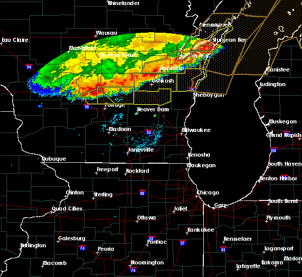 At 849 am cdt, a severe thunderstorm was located 8 miles southwest of westfield, or 14 miles northeast of wisconsin dells, moving southeast at 40 mph (radar indicated). Hazards include 60 mph wind gusts. Expect damage to roofs. siding. And trees. At 849 am cdt, a severe thunderstorm was located 8 miles southwest of westfield, or 14 miles northeast of wisconsin dells, moving southeast at 40 mph (radar indicated). Hazards include 60 mph wind gusts. Expect damage to roofs. siding. And trees.
|
| 7/21/2016 8:46 AM CDT |
 At 846 am cdt, a severe thunderstorm was located near princeton, or 9 miles southwest of berlin, moving southeast at 40 mph (radar indicated). Hazards include 60 mph wind gusts. Expect damage to roofs. siding. and trees. Locations impacted include, berlin, montello, markesan, westfield, princeton, green lake, manchester, neshkoro, kingston, marquette, springfield corners, harrisville and dalton. At 846 am cdt, a severe thunderstorm was located near princeton, or 9 miles southwest of berlin, moving southeast at 40 mph (radar indicated). Hazards include 60 mph wind gusts. Expect damage to roofs. siding. and trees. Locations impacted include, berlin, montello, markesan, westfield, princeton, green lake, manchester, neshkoro, kingston, marquette, springfield corners, harrisville and dalton.
|
| 7/21/2016 8:31 AM CDT |
 At 831 am cdt, a severe thunderstorm was located near wautoma, moving southeast at 40 mph (radar indicated). Hazards include 60 mph wind gusts. Expect damage to roofs. siding. and trees. Locations impacted include, berlin, montello, markesan, westfield, princeton, green lake, manchester, neshkoro, kingston, marquette, springfield corners, harrisville and dalton. At 831 am cdt, a severe thunderstorm was located near wautoma, moving southeast at 40 mph (radar indicated). Hazards include 60 mph wind gusts. Expect damage to roofs. siding. and trees. Locations impacted include, berlin, montello, markesan, westfield, princeton, green lake, manchester, neshkoro, kingston, marquette, springfield corners, harrisville and dalton.
|
| 7/21/2016 8:18 AM CDT |
 At 818 am cdt, a severe thunderstorm was located near wautoma, moving southeast at 40 mph (radar indicated). Hazards include 60 mph wind gusts. Expect damage to roofs. siding. And trees. At 818 am cdt, a severe thunderstorm was located near wautoma, moving southeast at 40 mph (radar indicated). Hazards include 60 mph wind gusts. Expect damage to roofs. siding. And trees.
|
| 7/7/2016 8:16 PM CDT |
 At 815 pm cdt, a severe thunderstorm was located near montello, or 13 miles south of wautoma, moving east at 35 mph. local law enforcement reported a funnel cloud with this storm north of westfield. this is a dangerous storm. seek shelter now! (radar indicated). Hazards include 60 mph wind gusts. Expect damage to roofs. siding. and trees. locations impacted include, berlin, westfield, princeton, neshkoro and harrisville. People attending marquette county fair should seek safe shelter immediately!. At 815 pm cdt, a severe thunderstorm was located near montello, or 13 miles south of wautoma, moving east at 35 mph. local law enforcement reported a funnel cloud with this storm north of westfield. this is a dangerous storm. seek shelter now! (radar indicated). Hazards include 60 mph wind gusts. Expect damage to roofs. siding. and trees. locations impacted include, berlin, westfield, princeton, neshkoro and harrisville. People attending marquette county fair should seek safe shelter immediately!.
|
| 7/7/2016 8:04 PM CDT |
 At 804 pm cdt, a severe thunderstorm was located near westfield, or 14 miles southwest of wautoma, moving east at 35 mph (radar indicated). Hazards include 60 mph wind gusts. Expect damage to roofs. siding. And trees. At 804 pm cdt, a severe thunderstorm was located near westfield, or 14 miles southwest of wautoma, moving east at 35 mph (radar indicated). Hazards include 60 mph wind gusts. Expect damage to roofs. siding. And trees.
|
| 7/6/2016 12:11 AM CDT |
 At 1209 am cdt, severe thunderstorms were located along a line extending from near princeton to 6 miles north of sun prairie, moving southeast at 55 mph. law enforcement reported many trees down across sauk county (radar indicated). Hazards include 60 mph wind gusts. Expect damage to roofs. siding. and trees. Locations impacted include, portage, columbus, lake wisconsin, lodi, poynette, pardeeville, fall river, montello, markesan, westfield, rio, cambria, lawrence, packwaukee, manchester, arlington, wyocena, oxford and endeavor. At 1209 am cdt, severe thunderstorms were located along a line extending from near princeton to 6 miles north of sun prairie, moving southeast at 55 mph. law enforcement reported many trees down across sauk county (radar indicated). Hazards include 60 mph wind gusts. Expect damage to roofs. siding. and trees. Locations impacted include, portage, columbus, lake wisconsin, lodi, poynette, pardeeville, fall river, montello, markesan, westfield, rio, cambria, lawrence, packwaukee, manchester, arlington, wyocena, oxford and endeavor.
|
| 7/5/2016 11:46 PM CDT |
 At 1146 pm cdt, a severe thunderstorm was located 11 miles northeast of wisconsin dells, moving east at 45 mph (radar indicated). Hazards include 60 mph wind gusts. Expect damage to roofs. siding. And trees. At 1146 pm cdt, a severe thunderstorm was located 11 miles northeast of wisconsin dells, moving east at 45 mph (radar indicated). Hazards include 60 mph wind gusts. Expect damage to roofs. siding. And trees.
|
| 6/15/2016 5:29 PM CDT |
 At 528 pm cdt, a severe thunderstorm was located over westfield, or 14 miles southwest of wautoma, moving southeast at 40 mph (radar indicated). Hazards include ping pong ball size hail and 60 mph wind gusts. People and animals outdoors will be injured. expect hail damage to roofs, siding, windows, and vehicles. expect wind damage to roofs, siding, and trees. locations impacted include, montello, westfield, lawrence, neshkoro, springfield corners, glen oak and harrisville. A tornado watch remains in effect until 800 pm cdt for south central wisconsin. At 528 pm cdt, a severe thunderstorm was located over westfield, or 14 miles southwest of wautoma, moving southeast at 40 mph (radar indicated). Hazards include ping pong ball size hail and 60 mph wind gusts. People and animals outdoors will be injured. expect hail damage to roofs, siding, windows, and vehicles. expect wind damage to roofs, siding, and trees. locations impacted include, montello, westfield, lawrence, neshkoro, springfield corners, glen oak and harrisville. A tornado watch remains in effect until 800 pm cdt for south central wisconsin.
|
| 6/15/2016 5:04 PM CDT |
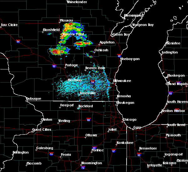 At 504 pm cdt, a severe thunderstorm was located near friendship, moving southeast at 30 mph (radar indicated). Hazards include two inch hail and 70 mph wind gusts. People and animals outdoors will be injured. expect hail damage to roofs, siding, windows, and vehicles. expect considerable tree damage. Wind damage is also likely to mobile homes, roofs, and outbuildings. At 504 pm cdt, a severe thunderstorm was located near friendship, moving southeast at 30 mph (radar indicated). Hazards include two inch hail and 70 mph wind gusts. People and animals outdoors will be injured. expect hail damage to roofs, siding, windows, and vehicles. expect considerable tree damage. Wind damage is also likely to mobile homes, roofs, and outbuildings.
|
| 6/10/2016 7:43 PM CDT |
 At 743 pm cdt, a severe thunderstorm was located near montello, or 15 miles northeast of portage, moving southeast at 45 mph (radar indicated). Hazards include 60 mph wind gusts and penny size hail. Expect damage to roofs. siding. and trees. locations impacted include, berlin, montello, markesan, westfield, princeton, green lake, packwaukee, manchester, oxford, endeavor, neshkoro, friesland, kingston, marquette, glen oak, harrisville and dalton. People attending june dairy days should seek safe shelter immediately!. At 743 pm cdt, a severe thunderstorm was located near montello, or 15 miles northeast of portage, moving southeast at 45 mph (radar indicated). Hazards include 60 mph wind gusts and penny size hail. Expect damage to roofs. siding. and trees. locations impacted include, berlin, montello, markesan, westfield, princeton, green lake, packwaukee, manchester, oxford, endeavor, neshkoro, friesland, kingston, marquette, glen oak, harrisville and dalton. People attending june dairy days should seek safe shelter immediately!.
|
| 6/10/2016 7:26 PM CDT |
 At 725 pm cdt, a severe thunderstorm was located near mauston, moving southeast at 45 mph (radar indicated). Hazards include 60 mph wind gusts and nickel size hail. Expect damage to roofs. siding. And trees. At 725 pm cdt, a severe thunderstorm was located near mauston, moving southeast at 45 mph (radar indicated). Hazards include 60 mph wind gusts and nickel size hail. Expect damage to roofs. siding. And trees.
|
| 5/25/2016 6:12 PM CDT |
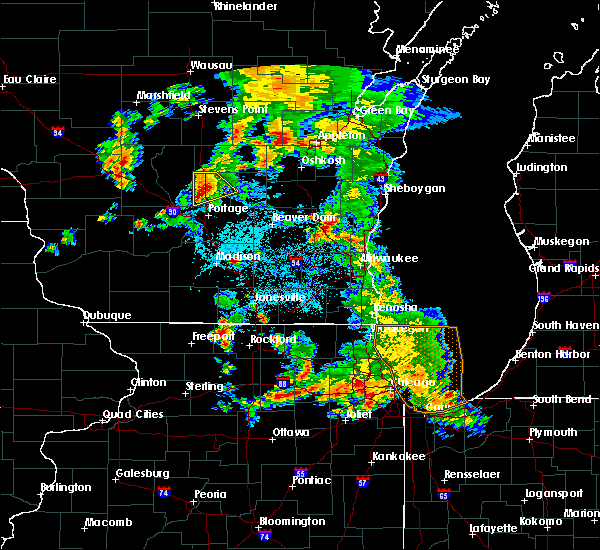 At 612 pm cdt, a severe thunderstorm was located 8 miles south of westfield, or 14 miles north of portage, moving northeast at 20 mph (radar indicated). Hazards include 60 mph wind gusts and quarter size hail. Hail damage to vehicles is expected. Expect wind damage to roofs, siding, and trees. At 612 pm cdt, a severe thunderstorm was located 8 miles south of westfield, or 14 miles north of portage, moving northeast at 20 mph (radar indicated). Hazards include 60 mph wind gusts and quarter size hail. Hail damage to vehicles is expected. Expect wind damage to roofs, siding, and trees.
|
| 7/18/2015 4:59 AM CDT |
 At 457 am cdt, severe thunderstorms were located along a line extending from near wautoma to 12 miles west of prairie du sac, moving east at 40 mph. the reedsburg area is under a particularly strong part of the line. hail is likely in that area, headed toward baraboo (radar indicated). Hazards include 60 mph wind gusts and quarter size hail. Hail damage to vehicles is expected. expect wind damage to roofs, siding and trees. Locations impacted include, baraboo, portage, reedsburg, berlin, prairie du sac, sauk city, wisconsin dells, lake wisconsin, lodi, lake delton, poynette, pardeeville, montello, west baraboo, westfield, princeton, green lake, lawrence, packwaukee and plain. At 457 am cdt, severe thunderstorms were located along a line extending from near wautoma to 12 miles west of prairie du sac, moving east at 40 mph. the reedsburg area is under a particularly strong part of the line. hail is likely in that area, headed toward baraboo (radar indicated). Hazards include 60 mph wind gusts and quarter size hail. Hail damage to vehicles is expected. expect wind damage to roofs, siding and trees. Locations impacted include, baraboo, portage, reedsburg, berlin, prairie du sac, sauk city, wisconsin dells, lake wisconsin, lodi, lake delton, poynette, pardeeville, montello, west baraboo, westfield, princeton, green lake, lawrence, packwaukee and plain.
|
| 7/18/2015 4:45 AM CDT |
 At 445 am cdt, severe thunderstorms were located along a line extending from near wautoma to 12 miles southwest of reedsburg, moving east at 40 mph (radar indicated). Hazards include 60 mph wind gusts. Expect damage to roofs. Siding and trees. At 445 am cdt, severe thunderstorms were located along a line extending from near wautoma to 12 miles southwest of reedsburg, moving east at 40 mph (radar indicated). Hazards include 60 mph wind gusts. Expect damage to roofs. Siding and trees.
|
| 7/13/2015 3:18 AM CDT |
 At 317 am cdt, severe thunderstorms were located along a line extending from 6 miles northwest of wautoma to 7 miles south of westfield to near wonewoc, moving east at 40 mph (radar indicated). Hazards include 60 mph wind gusts and quarter size hail. Hail damage to vehicles is expected. expect wind damage to roofs, siding and trees. locations impacted include, reedsburg, wisconsin dells, lake delton, montello, westfield, lawrence, packwaukee, north freedom, oxford, endeavor, neshkoro, la valle, rock springs, ironton, springfield corners, briggsville, glen oak, harrisville and rocky arbor state park. People attending the marquette county fair should seek safe shelter immediately!. At 317 am cdt, severe thunderstorms were located along a line extending from 6 miles northwest of wautoma to 7 miles south of westfield to near wonewoc, moving east at 40 mph (radar indicated). Hazards include 60 mph wind gusts and quarter size hail. Hail damage to vehicles is expected. expect wind damage to roofs, siding and trees. locations impacted include, reedsburg, wisconsin dells, lake delton, montello, westfield, lawrence, packwaukee, north freedom, oxford, endeavor, neshkoro, la valle, rock springs, ironton, springfield corners, briggsville, glen oak, harrisville and rocky arbor state park. People attending the marquette county fair should seek safe shelter immediately!.
|
| 7/13/2015 3:04 AM CDT |
 At 303 am cdt, severe thunderstorms were located along a line extending from near plainfield to 10 miles southeast of adams to hillsboro, moving east at 40 mph (radar indicated). Hazards include 60 mph wind gusts and quarter size hail. Hail damage to vehicles is expected. expect wind damage to roofs, siding and trees. locations impacted include, reedsburg, wisconsin dells, lake delton, montello, westfield, lawrence, packwaukee, north freedom, oxford, endeavor, neshkoro, la valle, rock springs, ironton, springfield corners, briggsville, glen oak, harrisville and rocky arbor state park. People attending the marquette county fair should seek safe shelter immediately!. At 303 am cdt, severe thunderstorms were located along a line extending from near plainfield to 10 miles southeast of adams to hillsboro, moving east at 40 mph (radar indicated). Hazards include 60 mph wind gusts and quarter size hail. Hail damage to vehicles is expected. expect wind damage to roofs, siding and trees. locations impacted include, reedsburg, wisconsin dells, lake delton, montello, westfield, lawrence, packwaukee, north freedom, oxford, endeavor, neshkoro, la valle, rock springs, ironton, springfield corners, briggsville, glen oak, harrisville and rocky arbor state park. People attending the marquette county fair should seek safe shelter immediately!.
|
| 7/13/2015 2:46 AM CDT |
 At 246 am cdt, severe thunderstorms were located along a line extending from 8 miles southeast of new rome to near castle rock lake to 7 miles northeast of la farge, moving east at 40 mph (radar indicated). Hazards include 60 mph wind gusts and quarter size hail. Hail damage to vehicles is expected. Expect wind damage to roofs, siding and trees. At 246 am cdt, severe thunderstorms were located along a line extending from 8 miles southeast of new rome to near castle rock lake to 7 miles northeast of la farge, moving east at 40 mph (radar indicated). Hazards include 60 mph wind gusts and quarter size hail. Hail damage to vehicles is expected. Expect wind damage to roofs, siding and trees.
|
| 8/16/2012 3:45 AM CDT | Tree down on elk road in the township of westfield. time estimate in marquette county WI, 0.4 miles N of Westfield, WI |
| 1/1/0001 12:00 AM | Storm damage reported in marquette county WI, 1 miles S of Westfield, WI |
| 1/1/0001 12:00 AM | Numerious trees down across north western marquette county reported by sheriff departmen in marquette county WI, 1 miles S of Westfield, WI |
| 1/1/0001 12:00 AM | Baseball sized hail reported 1.1 miles N of Westfield, WI |
| 1/1/0001 12:00 AM | Grapefruit sized hail reported 1.1 miles WNW of Westfield, WI |
| 1/1/0001 12:00 AM | Hen Egg sized hail reported 0.4 miles N of Westfield, WI |
| 1/1/0001 12:00 AM | Hen Egg sized hail reported 0.4 miles N of Westfield, WI |
Hail Maps for Westfield, WI


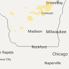


Connect with Interactive Hail Maps