

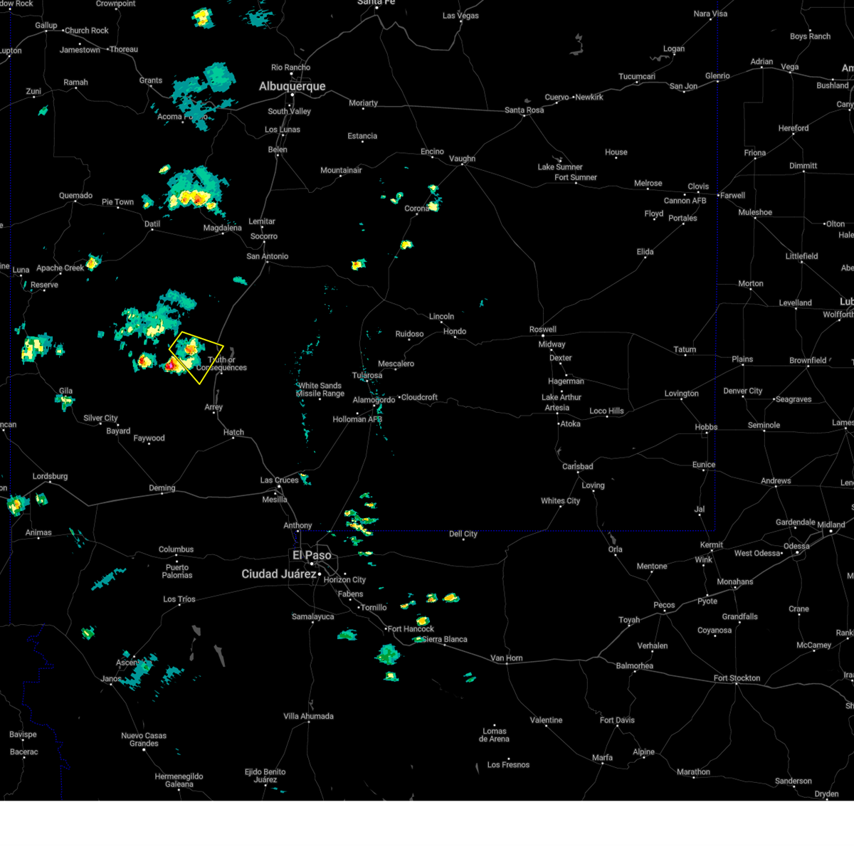
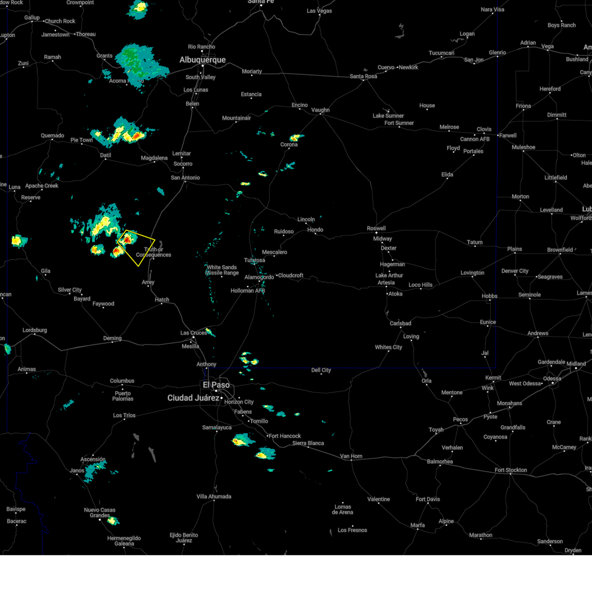
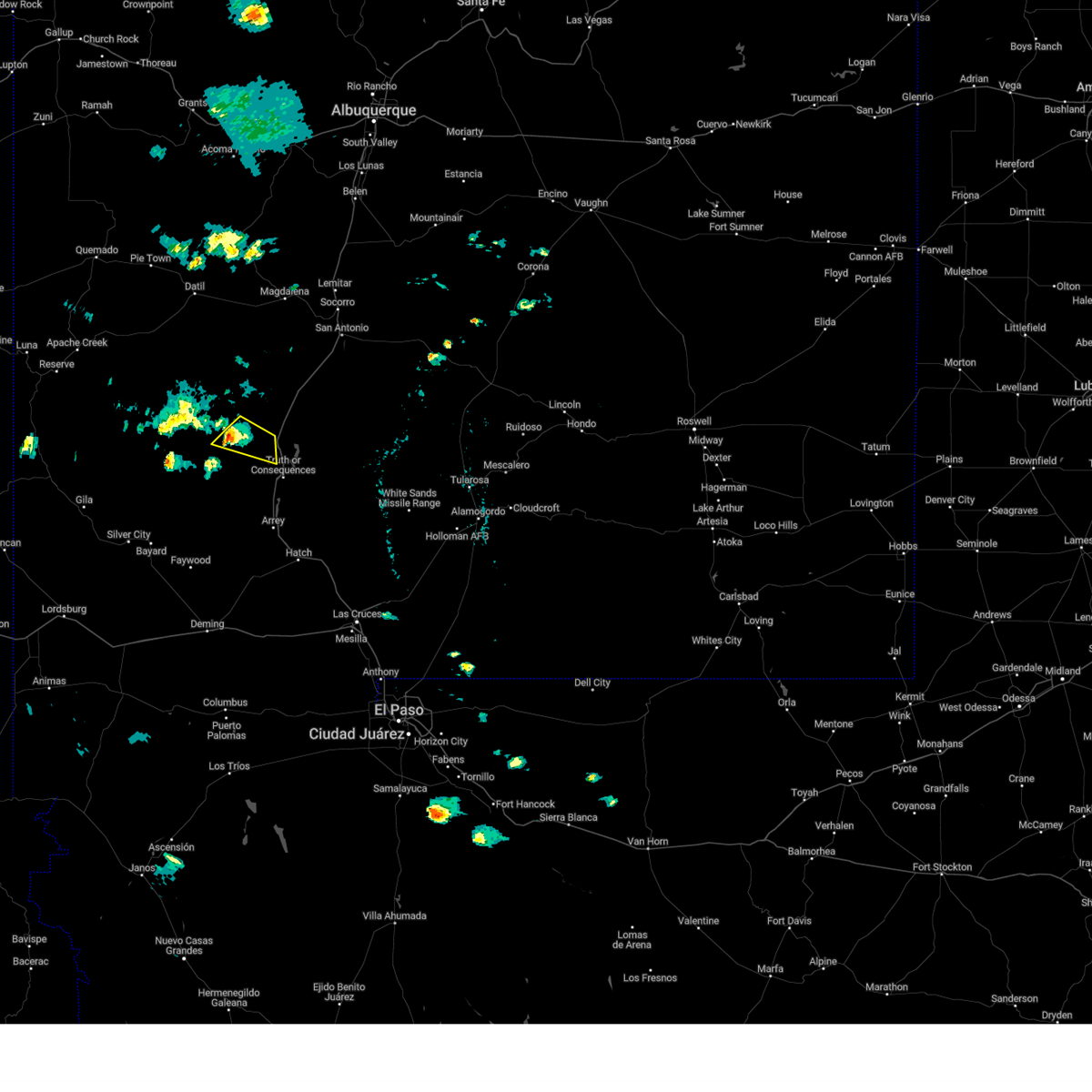
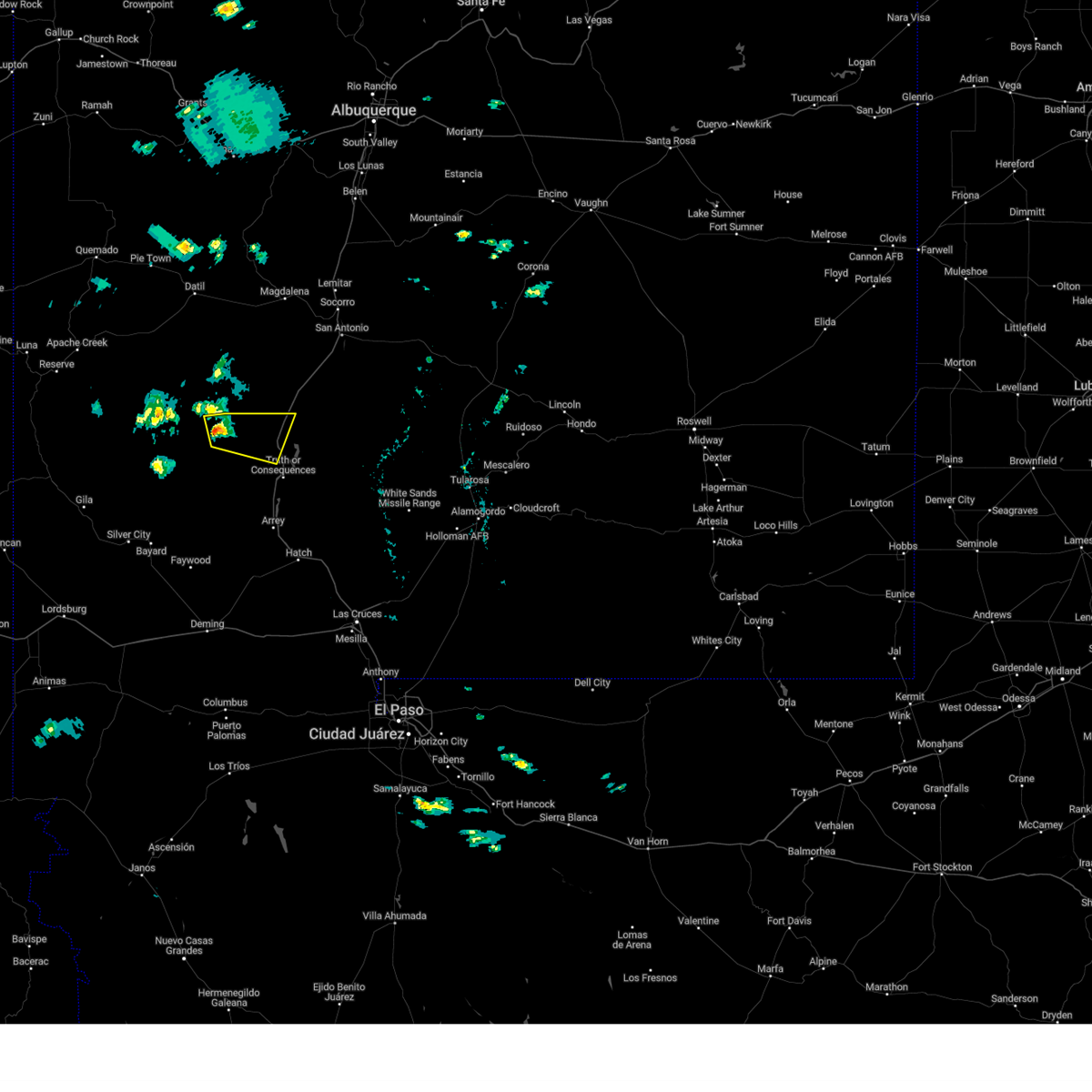
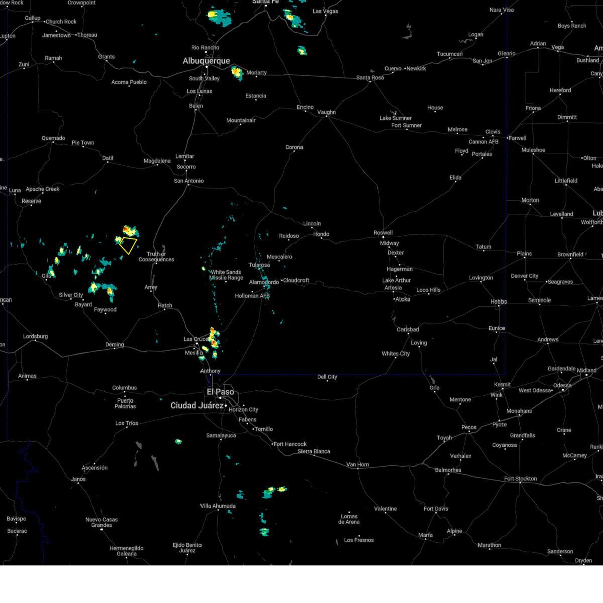
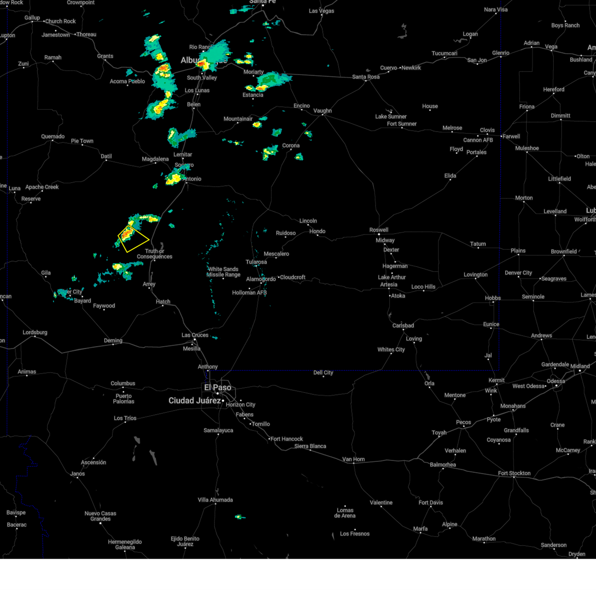
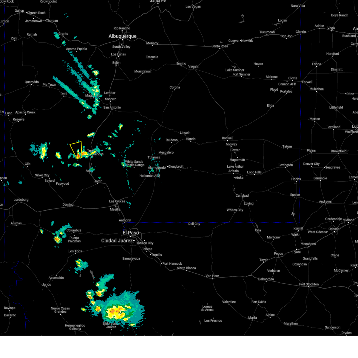
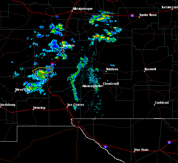
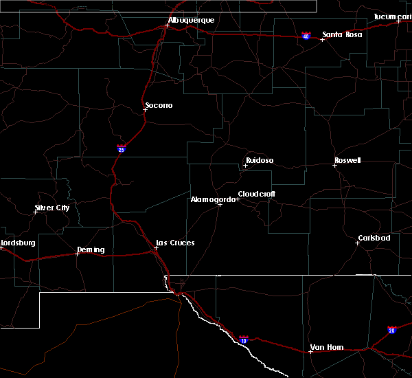
Hail Map for Winston, NM
The Winston, NM area has had 4 reports of on-the-ground hail by trained spotters, and has been under severe weather warnings 7 times during the past 12 months. Doppler radar has detected hail at or near Winston, NM on 7 occasions, including 1 occasion during the past year.
| Name: | Winston, NM |
| Where Located: | 53.7 miles NE of Silver City, NM |
| Map: | Google Map for Winston, NM |
| Population: | 61 |
| Housing Units: | 67 |
| More Info: | Search Google for Winston, NM |
5
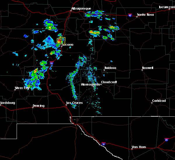
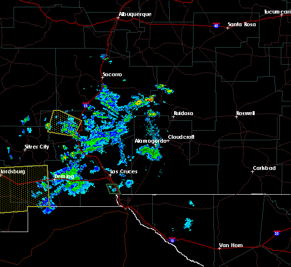
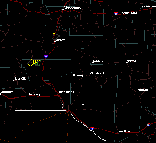
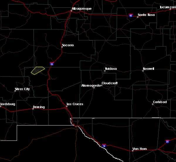
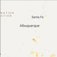
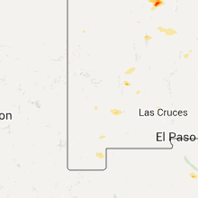
The Top Recent Hail Date for Winston, NM is Sunday, September 17, 2023 (2nd out of 7)

Hail and Wind Damage Spotted near Winston, NM
| Date / Time | Report Details |
|---|---|
| 9/17/2023 4:08 PM MDT |
 At 407 pm mdt, a severe thunderstorm was located 7 miles southeast of winston, and is slowly drifing southeast (public. at winston hail size was documented to be 1.0" to 1.5" with damage to automobile windshields). Hazards include half dollar size hail. Damage to vehicles is expected. locations impacted include, cuchillo, winston, san miguel, alamosa canyon, chise, upper palomas canyon, and las placitas. this includes interstate 25 in new mexico between mile markers 84 and 88. hail threat, observed max hail size, 1. 25 in wind threat, radar indicated max wind gust, <50 mph. At 407 pm mdt, a severe thunderstorm was located 7 miles southeast of winston, and is slowly drifing southeast (public. at winston hail size was documented to be 1.0" to 1.5" with damage to automobile windshields). Hazards include half dollar size hail. Damage to vehicles is expected. locations impacted include, cuchillo, winston, san miguel, alamosa canyon, chise, upper palomas canyon, and las placitas. this includes interstate 25 in new mexico between mile markers 84 and 88. hail threat, observed max hail size, 1. 25 in wind threat, radar indicated max wind gust, <50 mph.
|
| 9/17/2023 3:45 PM MDT |
 At 344 pm mdt, a severe thunderstorm was located 4 miles southeast of winston, moving southeast at 7 mph (radar indicated and public reports of large damaging hail). Hazards include ping pong ball size hail and 60 mph wind gusts. People and animals outdoors will be injured. expect hail damage to roofs, siding, windows, and vehicles. Expect wind damage to roofs, siding, and trees. At 344 pm mdt, a severe thunderstorm was located 4 miles southeast of winston, moving southeast at 7 mph (radar indicated and public reports of large damaging hail). Hazards include ping pong ball size hail and 60 mph wind gusts. People and animals outdoors will be injured. expect hail damage to roofs, siding, windows, and vehicles. Expect wind damage to roofs, siding, and trees.
|
| 9/17/2023 3:33 PM MDT |
 At 331 pm mdt, a severe thunderstorm was located 6 miles northeast of winston, moving northeast at 10 mph (public. reports of 1.5" to 2.0" hail was reported at and north of winston, nm. automobile windshield was broken due to hail impacts). Hazards include ping pong ball size hail, and possibly larger, and 40 to 60 mph wind gusts. People and animals outdoors will be injured. expect hail damage to roofs, siding, windows, and vehicles. expect wind damage to roofs, siding, and trees. locations impacted include, monticello, cuchillo, winston, chloride, and las placitas. hail threat, radar indicated max hail size, 1. 50 in wind threat, radar indicated max wind gust, 60 mph. At 331 pm mdt, a severe thunderstorm was located 6 miles northeast of winston, moving northeast at 10 mph (public. reports of 1.5" to 2.0" hail was reported at and north of winston, nm. automobile windshield was broken due to hail impacts). Hazards include ping pong ball size hail, and possibly larger, and 40 to 60 mph wind gusts. People and animals outdoors will be injured. expect hail damage to roofs, siding, windows, and vehicles. expect wind damage to roofs, siding, and trees. locations impacted include, monticello, cuchillo, winston, chloride, and las placitas. hail threat, radar indicated max hail size, 1. 50 in wind threat, radar indicated max wind gust, 60 mph.
|
| 9/17/2023 3:15 PM MDT | Hen Egg sized hail reported 0.4 miles SSE of Winston, NM, winston general store reported large hail. customers had broken windshield and dented truck. |
| 9/17/2023 3:04 PM MDT |
 At 303 pm mdt, a severe thunderstorm was located near winston, moving northeast at 10 mph (radar indicated). Hazards include ping pong ball size hail and 60 mph wind gusts. People and animals outdoors will be injured. expect hail damage to roofs, siding, windows, and vehicles. Expect wind damage to roofs, siding, and trees. At 303 pm mdt, a severe thunderstorm was located near winston, moving northeast at 10 mph (radar indicated). Hazards include ping pong ball size hail and 60 mph wind gusts. People and animals outdoors will be injured. expect hail damage to roofs, siding, windows, and vehicles. Expect wind damage to roofs, siding, and trees.
|
| 8/28/2023 2:36 PM MDT |
 At 235 pm mdt, a severe thunderstorm was located near winston, moving southeast at 15 mph (radar indicated). Hazards include 60 mph wind gusts and quarter size hail. Hail damage to vehicles is expected. Expect wind damage to roofs, siding, and trees. At 235 pm mdt, a severe thunderstorm was located near winston, moving southeast at 15 mph (radar indicated). Hazards include 60 mph wind gusts and quarter size hail. Hail damage to vehicles is expected. Expect wind damage to roofs, siding, and trees.
|
| 5/21/2023 1:48 PM MDT |
 At 148 pm mdt, a severe thunderstorm was located near winston, moving southeast at 10 mph (radar indicated). Hazards include quarter size hail. damage to vehicles is expected At 148 pm mdt, a severe thunderstorm was located near winston, moving southeast at 10 mph (radar indicated). Hazards include quarter size hail. damage to vehicles is expected
|
| 5/13/2023 4:53 PM MDT |
 At 452 pm mdt, a severe thunderstorm was located 6 miles west of san miguel, moving north at 20 mph (radar indicated). Hazards include 60 mph wind gusts and quarter size hail. Hail damage to vehicles is expected. Expect wind damage to roofs, siding, and trees. At 452 pm mdt, a severe thunderstorm was located 6 miles west of san miguel, moving north at 20 mph (radar indicated). Hazards include 60 mph wind gusts and quarter size hail. Hail damage to vehicles is expected. Expect wind damage to roofs, siding, and trees.
|
| 6/24/2020 3:51 PM MDT |
 The severe thunderstorm warning for northwestern sierra county will expire at 400 pm mdt, the storm which prompted the warning has weakened below severe limits, and no longer poses an immediate threat to life or property. therefore, the warning will be allowed to expire. however small hail and gusty winds are still possible with this thunderstorm. The severe thunderstorm warning for northwestern sierra county will expire at 400 pm mdt, the storm which prompted the warning has weakened below severe limits, and no longer poses an immediate threat to life or property. therefore, the warning will be allowed to expire. however small hail and gusty winds are still possible with this thunderstorm.
|
| 6/24/2020 3:21 PM MDT |
 The national weather service in el paso has issued a * severe thunderstorm warning for. northwestern sierra county in south central new mexico. until 400 pm mdt. At 321 pm mdt, a severe thunderstorm was located over winston, moving northeast at 25 mph. The national weather service in el paso has issued a * severe thunderstorm warning for. northwestern sierra county in south central new mexico. until 400 pm mdt. At 321 pm mdt, a severe thunderstorm was located over winston, moving northeast at 25 mph.
|
| 7/19/2017 7:03 PM MDT |
 At 703 pm mdt, a severe thunderstorm was located near cuchillo, or 11 miles northwest of truth or consequences, moving west at 25 mph (radar indicated). Hazards include 60 mph wind gusts and nickel size hail. expect damage to roofs, siding, and trees At 703 pm mdt, a severe thunderstorm was located near cuchillo, or 11 miles northwest of truth or consequences, moving west at 25 mph (radar indicated). Hazards include 60 mph wind gusts and nickel size hail. expect damage to roofs, siding, and trees
|
| 7/9/2015 3:25 PM MDT |
 The severe thunderstorm warning for northwestern sierra county will expire at 330 pm mdt, the storm which prompted the warning has weakened below severe limits, and no longer poses an immediate threat to life or property. therefore the warning will be allowed to expire. however gusty winds are still possible with this thunderstorm. The severe thunderstorm warning for northwestern sierra county will expire at 330 pm mdt, the storm which prompted the warning has weakened below severe limits, and no longer poses an immediate threat to life or property. therefore the warning will be allowed to expire. however gusty winds are still possible with this thunderstorm.
|
| 7/9/2015 2:45 PM MDT | Quarter sized hail reported 1.9 miles E of Winston, NM, vfd chief reported quarter size hail and intense rainfall near chloride. |
| 7/9/2015 2:40 PM MDT |
 At 239 pm mdt, a severe thunderstorm was located over chloride, or over winston, moving northeast at 25 mph (radar indicated). Hazards include 60 mph wind gusts and quarter size hail. Hail damage to vehicles is expected. Expect wind damage to roofs, siding and trees. At 239 pm mdt, a severe thunderstorm was located over chloride, or over winston, moving northeast at 25 mph (radar indicated). Hazards include 60 mph wind gusts and quarter size hail. Hail damage to vehicles is expected. Expect wind damage to roofs, siding and trees.
|
| 7/8/2015 1:58 PM MDT |
 At 157 pm mdt, a severe thunderstorm was located just southwest of monticello, moving northeast at 25 mph. additional thunderstorms were redeveloping near chloride, and may become severe (trained weather spotters). Hazards include 60 mph wind gusts and half dollar size hail. Hail damage to vehicles is expected. expect wind damage to roofs, siding and trees. Locations impacted include, monticello, placitas, winston, chloride, chise. At 157 pm mdt, a severe thunderstorm was located just southwest of monticello, moving northeast at 25 mph. additional thunderstorms were redeveloping near chloride, and may become severe (trained weather spotters). Hazards include 60 mph wind gusts and half dollar size hail. Hail damage to vehicles is expected. expect wind damage to roofs, siding and trees. Locations impacted include, monticello, placitas, winston, chloride, chise.
|
| 7/8/2015 1:42 PM MDT |
 At 141 pm mdt, a severe thunderstorm was located near winston and chloride, moving northeast at 25 mph. trained spotters have reported quarter size, one inch diameter, hail near winston (trained weather spotters). Hazards include 60 mph wind gusts and quarter size hail. Hail damage to vehicles is expected. expect wind damage to roofs, siding and trees. Locations impacted include, winston, monticello, chloride, placitas. At 141 pm mdt, a severe thunderstorm was located near winston and chloride, moving northeast at 25 mph. trained spotters have reported quarter size, one inch diameter, hail near winston (trained weather spotters). Hazards include 60 mph wind gusts and quarter size hail. Hail damage to vehicles is expected. expect wind damage to roofs, siding and trees. Locations impacted include, winston, monticello, chloride, placitas.
|
| 7/8/2015 1:40 PM MDT | Quarter sized hail reported 3.1 miles N of Winston, NM, trained spotter reported quarter size hail near winston. hail sounded intense over phone. |
| 7/8/2015 1:34 PM MDT |
 At 134 pm mdt, a severe thunderstorm was located near chloride, just south of winston, moving northeast at 25 mph (radar indicated). Hazards include 60 mph wind gusts and quarter size hail. Hail damage to vehicles is expected. Expect wind damage to roofs, siding and trees. At 134 pm mdt, a severe thunderstorm was located near chloride, just south of winston, moving northeast at 25 mph (radar indicated). Hazards include 60 mph wind gusts and quarter size hail. Hail damage to vehicles is expected. Expect wind damage to roofs, siding and trees.
|
| 7/7/2015 1:12 PM MDT |
 At 112 pm mdt, a severe thunderstorm was located just west of monticello, moving east at 25 mph (radar indicated). Hazards include 60 mph wind gusts and quarter size hail. Hail damage to vehicles is expected. Expect wind damage to roofs, siding and trees. At 112 pm mdt, a severe thunderstorm was located just west of monticello, moving east at 25 mph (radar indicated). Hazards include 60 mph wind gusts and quarter size hail. Hail damage to vehicles is expected. Expect wind damage to roofs, siding and trees.
|
| 4/9/2012 3:44 PM MDT | Quarter sized hail reported 2.4 miles NNW of Winston, NM |
Hail Maps for Winston, NM


Connect with Interactive Hail Maps