

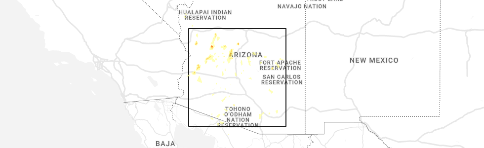
Hail Map for Wittmann, AZ
The Wittmann, AZ area has had 0 reports of on-the-ground hail by trained spotters, and has been under severe weather warnings 2 times during the past 12 months. Doppler radar has detected hail at or near Wittmann, AZ on 7 occasions.
| Name: | Wittmann, AZ |
| Where Located: | 34.2 miles NW of Phoenix, AZ |
| Map: | Google Map for Wittmann, AZ |
| Population: | 763 |
| Housing Units: | 301 |
| More Info: | Search Google for Wittmann, AZ |
0
The Top Recent Hail Date for Wittmann, AZ is Tuesday, August 23, 2022 (4th out of 7)
Hail and Wind Damage Spotted near Wittmann, AZ
| Date / Time | Report Details |
|---|---|
| 7/26/2023 11:11 PM MST |
 The severe thunderstorm warning for gila and maricopa counties will expire at 1115 pm mst, the thunderstorm winds which prompted the warning have weakened below severe limits. therefore, the warning will be allowed to expire. The severe thunderstorm warning for gila and maricopa counties will expire at 1115 pm mst, the thunderstorm winds which prompted the warning have weakened below severe limits. therefore, the warning will be allowed to expire.
|
| 7/26/2023 10:33 PM MST |
 At 1033 pm mst, severe thunderstorm winds were located along a line extending from near peoria to 6 miles north of desert ridge marketplace to round valley, moving northwest at 45 mph (radar indicated). Hazards include 60 mph wind gusts. expect damage to roofs, siding, and trees At 1033 pm mst, severe thunderstorm winds were located along a line extending from near peoria to 6 miles north of desert ridge marketplace to round valley, moving northwest at 45 mph (radar indicated). Hazards include 60 mph wind gusts. expect damage to roofs, siding, and trees
|
| 1/1/2023 2:11 PM MST |
 The severe thunderstorm warning for maricopa county will expire at 215 pm mst, the storms which prompted the warning have weakened below severe limits, and no longer pose an immediate threat to life or property. therefore, the warning will be allowed to expire. however gusty winds are still possible with these thunderstorms. The severe thunderstorm warning for maricopa county will expire at 215 pm mst, the storms which prompted the warning have weakened below severe limits, and no longer pose an immediate threat to life or property. therefore, the warning will be allowed to expire. however gusty winds are still possible with these thunderstorms.
|
| 1/1/2023 2:04 PM MST |
 At 203 pm mst, severe thunderstorms were located along a line extending from near morristown to near buckeye to 8 miles west of painted rock dam, moving northeast at 50 mph (radar indicated). Hazards include 60 mph wind gusts. Expect damage to roofs, siding, and trees. locations impacted include, surprise, buckeye, wittmann, circle city, white tank mountain park, morristown, palo verde nuclear generation station, wintersburg and hassayampa. this includes the following highways, az interstate 10 between mile markers 95 and 117. us highway 60 between mile markers 115 and 136. az route 74 between mile markers 1 and 14. hail threat, radar indicated max hail size, <. 75 in wind threat, radar indicated max wind gust, 60 mph. At 203 pm mst, severe thunderstorms were located along a line extending from near morristown to near buckeye to 8 miles west of painted rock dam, moving northeast at 50 mph (radar indicated). Hazards include 60 mph wind gusts. Expect damage to roofs, siding, and trees. locations impacted include, surprise, buckeye, wittmann, circle city, white tank mountain park, morristown, palo verde nuclear generation station, wintersburg and hassayampa. this includes the following highways, az interstate 10 between mile markers 95 and 117. us highway 60 between mile markers 115 and 136. az route 74 between mile markers 1 and 14. hail threat, radar indicated max hail size, <. 75 in wind threat, radar indicated max wind gust, 60 mph.
|
| 1/1/2023 1:54 PM MST |
 At 154 pm mst, severe thunderstorms were located along a line extending from near morristown to 7 miles northwest of buckeye to 11 miles southwest of palo verde nuclear generation station, moving northeast at 55 mph (radar indicated). Hazards include 60 mph wind gusts. Expect damage to roofs, siding, and trees. locations impacted include, surprise, buckeye, wittmann, tonopah, circle city, white tank mountain park, morristown, palo verde nuclear generation station, wintersburg and hassayampa. this includes the following highways, az interstate 10 between mile markers 92 and 117. us highway 60 between mile markers 114 and 136. az route 74 between mile markers 1 and 14. hail threat, radar indicated max hail size, <. 75 in wind threat, radar indicated max wind gust, 60 mph. At 154 pm mst, severe thunderstorms were located along a line extending from near morristown to 7 miles northwest of buckeye to 11 miles southwest of palo verde nuclear generation station, moving northeast at 55 mph (radar indicated). Hazards include 60 mph wind gusts. Expect damage to roofs, siding, and trees. locations impacted include, surprise, buckeye, wittmann, tonopah, circle city, white tank mountain park, morristown, palo verde nuclear generation station, wintersburg and hassayampa. this includes the following highways, az interstate 10 between mile markers 92 and 117. us highway 60 between mile markers 114 and 136. az route 74 between mile markers 1 and 14. hail threat, radar indicated max hail size, <. 75 in wind threat, radar indicated max wind gust, 60 mph.
|
| 1/1/2023 1:41 PM MST |
 At 141 pm mst, severe thunderstorms were located along a line extending from 13 miles north of tonopah to near wintersburg to 8 miles southwest of palo verde nuclear generation station, moving northeast at 55 mph (radar indicated). Hazards include 60 mph wind gusts. expect damage to roofs, siding, and trees At 141 pm mst, severe thunderstorms were located along a line extending from 13 miles north of tonopah to near wintersburg to 8 miles southwest of palo verde nuclear generation station, moving northeast at 55 mph (radar indicated). Hazards include 60 mph wind gusts. expect damage to roofs, siding, and trees
|
| 8/27/2022 1:28 PM MST | At 128 pm mst, a severe thunderstorm was located near white tank mountain park, or 8 miles west of sun city west, moving southeast at 15 mph (radar indicated). Hazards include 60 mph wind gusts. expect damage to roofs, siding, and trees |
| 8/27/2022 1:24 PM MST | At 124 pm mst, a severe thunderstorm was located near white tank mountain park, or 11 miles southwest of wittmann, moving southeast at 10 mph (radar indicated). Hazards include 60 mph wind gusts. Expect damage to roofs, siding, and trees. locations impacted include, surprise, wittmann and white tank mountain park. this includes us highway 60 between mile markers 126 and 137. hail threat, radar indicated max hail size, <. 75 in wind threat, radar indicated max wind gust, 60 mph. |
| 8/27/2022 1:07 PM MST | At 107 pm mst, a severe thunderstorm was located 9 miles northwest of white tank mountain park, or 11 miles southwest of wittmann, moving southeast at 10 mph (radar indicated). Hazards include 60 mph wind gusts. expect damage to roofs, siding, and trees |
| 8/23/2022 6:36 PM MST | At 635 pm mst, severe thunderstorms were located along a line extending from 8 miles southeast of aguila to 15 miles southwest of morristown to 7 miles northeast of wintersburg, moving southwest at 10 mph (radar indicated). Hazards include 60 mph wind gusts and quarter size hail. Hail damage to vehicles is expected. expect wind damage to roofs, siding, and trees. locations impacted include, surprise, buckeye, wittmann, circle city and morristown. this includes the following highways, az interstate 10 between mile markers 96 and 109. us highway 60 between mile markers 85 and 103, and between mile markers 117 and 132. az route 74 between mile markers 1 and 9. hail threat, radar indicated max hail size, 1. 00 in wind threat, radar indicated max wind gust, 60 mph. |
| 8/23/2022 5:58 PM MST | At 558 pm mst, severe thunderstorms were located along a line extending from 9 miles east of aguila to 10 miles southwest of morristown to 10 miles west of white tank mountain park, moving southwest at 10 mph (radar indicated). Hazards include 60 mph wind gusts and quarter size hail. Hail damage to vehicles is expected. Expect wind damage to roofs, siding, and trees. |
| 8/23/2022 5:16 PM MST | At 516 pm mst, severe thunderstorms were located along a line extending from 8 miles northwest of congress to 7 miles south of yarnell to 8 miles west of castle hot springs, moving southwest at 25 mph (radar indicated). Hazards include 60 mph wind gusts. expect damage to roofs, siding, and trees |
| 8/21/2022 6:53 PM MST | At 653 pm mst, a severe thunderstorm was located 8 miles northeast of wickenburg, moving southwest at 10 mph (radar indicated). Hazards include 60 mph wind gusts. expect damage to roofs, siding, and trees |
| 8/20/2022 8:29 PM MST |
 At 828 pm mst, a severe thunderstorm was located over wittmann, moving south at 10 mph (radar indicated). Hazards include 60 mph wind gusts. Expect damage to roofs, siding, and trees. locations impacted include, peoria, surprise, wittmann, sun city west, circle city, sun city, surprise stadium, white tank mountain park, morristown, beardsley and vistancia. this includes the following highways, us highway 60 between mile markers 110 and 144. az route 74 between mile markers 1 and 21. az route 303 between mile markers 112 and 132. hail threat, radar indicated max hail size, <. 75 in wind threat, radar indicated max wind gust, 60 mph. At 828 pm mst, a severe thunderstorm was located over wittmann, moving south at 10 mph (radar indicated). Hazards include 60 mph wind gusts. Expect damage to roofs, siding, and trees. locations impacted include, peoria, surprise, wittmann, sun city west, circle city, sun city, surprise stadium, white tank mountain park, morristown, beardsley and vistancia. this includes the following highways, us highway 60 between mile markers 110 and 144. az route 74 between mile markers 1 and 21. az route 303 between mile markers 112 and 132. hail threat, radar indicated max hail size, <. 75 in wind threat, radar indicated max wind gust, 60 mph.
|
| 8/20/2022 8:09 PM MST |
 At 809 pm mst, a severe thunderstorm was located over wittmann, moving south at 10 mph (radar indicated). Hazards include 60 mph wind gusts. Expect damage to roofs, siding, and trees. locations impacted include, peoria, surprise, wittmann, sun city west, circle city, sun city, surprise stadium, white tank mountain park, morristown, beardsley and vistancia. this includes the following highways, us highway 60 between mile markers 110 and 144. az route 74 between mile markers 1 and 21. az route 303 between mile markers 112 and 132. hail threat, radar indicated max hail size, <. 75 in wind threat, radar indicated max wind gust, 60 mph. At 809 pm mst, a severe thunderstorm was located over wittmann, moving south at 10 mph (radar indicated). Hazards include 60 mph wind gusts. Expect damage to roofs, siding, and trees. locations impacted include, peoria, surprise, wittmann, sun city west, circle city, sun city, surprise stadium, white tank mountain park, morristown, beardsley and vistancia. this includes the following highways, us highway 60 between mile markers 110 and 144. az route 74 between mile markers 1 and 21. az route 303 between mile markers 112 and 132. hail threat, radar indicated max hail size, <. 75 in wind threat, radar indicated max wind gust, 60 mph.
|
| 8/20/2022 7:53 PM MST |
 At 752 pm mst, a severe thunderstorm was located 7 miles northeast of wittmann, moving south at 5 mph (radar indicated). Hazards include 60 mph wind gusts. expect damage to roofs, siding, and trees At 752 pm mst, a severe thunderstorm was located 7 miles northeast of wittmann, moving south at 5 mph (radar indicated). Hazards include 60 mph wind gusts. expect damage to roofs, siding, and trees
|
| 8/14/2022 4:39 PM MST |
 The severe thunderstorm warning for maricopa county will expire at 445 pm mst, the storm which prompted the warning has weakened below severe limits, and no longer poses an immediate threat to life or property. therefore, the warning will be allowed to expire. however heavy rain is still possible with this thunderstorm. The severe thunderstorm warning for maricopa county will expire at 445 pm mst, the storm which prompted the warning has weakened below severe limits, and no longer poses an immediate threat to life or property. therefore, the warning will be allowed to expire. however heavy rain is still possible with this thunderstorm.
|
| 8/14/2022 4:27 PM MST |
 At 427 pm mst, a severe thunderstorm was located over sun city, moving southeast at 20 mph (radar indicated). Hazards include 60 mph wind gusts and penny size hail. Expect damage to roofs, siding, and trees. locations impacted include, phoenix, glendale, peoria, surprise, avondale, el mirage, youngtown, sun city west, waddell, circle city, sun city, wittmann, litchfield park, deer valley airport and white tank mountain park. this includes the following highways, az interstate 17 between mile markers 210 and 219. us highway 60 between mile markers 121 and 156. az route 101 between mile markers 3 and 25. hail threat, radar indicated max hail size, 0. 75 in wind threat, radar indicated max wind gust, 60 mph. At 427 pm mst, a severe thunderstorm was located over sun city, moving southeast at 20 mph (radar indicated). Hazards include 60 mph wind gusts and penny size hail. Expect damage to roofs, siding, and trees. locations impacted include, phoenix, glendale, peoria, surprise, avondale, el mirage, youngtown, sun city west, waddell, circle city, sun city, wittmann, litchfield park, deer valley airport and white tank mountain park. this includes the following highways, az interstate 17 between mile markers 210 and 219. us highway 60 between mile markers 121 and 156. az route 101 between mile markers 3 and 25. hail threat, radar indicated max hail size, 0. 75 in wind threat, radar indicated max wind gust, 60 mph.
|
| 8/14/2022 4:02 PM MST | Power poles down along w patton r in maricopa county AZ, 6 miles ENE of Wittmann, AZ |
| 8/14/2022 3:58 PM MST |
 At 358 pm mst, a severe thunderstorm was located near beardsley, or near sun city west, moving southeast at 20 mph (radar indicated). Hazards include 60 mph wind gusts and penny size hail. expect damage to roofs, siding, and trees At 358 pm mst, a severe thunderstorm was located near beardsley, or near sun city west, moving southeast at 20 mph (radar indicated). Hazards include 60 mph wind gusts and penny size hail. expect damage to roofs, siding, and trees
|
| 8/14/2022 3:43 PM MST |
 At 343 pm mst, a severe thunderstorm was located near morristown, or 7 miles north of circle city, moving northeast at 5 mph (radar indicated). Hazards include 60 mph wind gusts and penny size hail. Expect damage to roofs, siding, and trees. locations impacted include, surprise, wickenburg, wittmann, sun city west, circle city, lake pleasant, morristown, beardsley and vistancia. this includes the following highways, us highway 60 between mile markers 93 and 141. az route 74 between mile markers 1 and 24. az route 303 between mile markers 117 and 132. hail threat, radar indicated max hail size, 0. 75 in wind threat, radar indicated max wind gust, 60 mph. At 343 pm mst, a severe thunderstorm was located near morristown, or 7 miles north of circle city, moving northeast at 5 mph (radar indicated). Hazards include 60 mph wind gusts and penny size hail. Expect damage to roofs, siding, and trees. locations impacted include, surprise, wickenburg, wittmann, sun city west, circle city, lake pleasant, morristown, beardsley and vistancia. this includes the following highways, us highway 60 between mile markers 93 and 141. az route 74 between mile markers 1 and 24. az route 303 between mile markers 117 and 132. hail threat, radar indicated max hail size, 0. 75 in wind threat, radar indicated max wind gust, 60 mph.
|
| 8/14/2022 3:23 PM MST |
 At 323 pm mst, a severe thunderstorm was located near morristown, or near circle city, moving northeast at 5 mph (radar indicated). Hazards include 60 mph wind gusts. expect damage to roofs, siding, and trees At 323 pm mst, a severe thunderstorm was located near morristown, or near circle city, moving northeast at 5 mph (radar indicated). Hazards include 60 mph wind gusts. expect damage to roofs, siding, and trees
|
| 8/7/2022 8:16 PM MST |
 At 816 pm mst, a severe thunderstorm was located near white tank mountain park, or 7 miles west of waddell, moving south at 5 mph (radar indicated). Hazards include 60 mph wind gusts and nickel size hail. Expect damage to roofs, siding, and trees. locations impacted include, glendale, surprise, avondale, goodyear, buckeye, el mirage, sun city west, waddell, litchfield park, white tank mountain park, luke afb, beardsley, surprise stadium and vistancia. this includes the following highways, az interstate 10 between mile markers 121 and 130. us highway 60 between mile markers 129 and 144. az route 303 between mile markers 105 and 123. hail threat, radar indicated max hail size, 0. 88 in wind threat, radar indicated max wind gust, 60 mph. At 816 pm mst, a severe thunderstorm was located near white tank mountain park, or 7 miles west of waddell, moving south at 5 mph (radar indicated). Hazards include 60 mph wind gusts and nickel size hail. Expect damage to roofs, siding, and trees. locations impacted include, glendale, surprise, avondale, goodyear, buckeye, el mirage, sun city west, waddell, litchfield park, white tank mountain park, luke afb, beardsley, surprise stadium and vistancia. this includes the following highways, az interstate 10 between mile markers 121 and 130. us highway 60 between mile markers 129 and 144. az route 303 between mile markers 105 and 123. hail threat, radar indicated max hail size, 0. 88 in wind threat, radar indicated max wind gust, 60 mph.
|
| 8/7/2022 7:59 PM MST |
 At 759 pm mst, a severe thunderstorm was located near white tank mountain park, or near waddell, moving south at 5 mph (radar indicated). Hazards include 60 mph wind gusts and nickel size hail. expect damage to roofs, siding, and trees At 759 pm mst, a severe thunderstorm was located near white tank mountain park, or near waddell, moving south at 5 mph (radar indicated). Hazards include 60 mph wind gusts and nickel size hail. expect damage to roofs, siding, and trees
|
| 8/7/2022 7:38 PM MST |
 At 738 pm mst, a severe thunderstorm was located over beardsley, or near sun city west, moving south at 15 mph (radar indicated). Hazards include 60 mph wind gusts and nickel size hail. Expect damage to roofs, siding, and trees. locations impacted include, peoria, surprise, el mirage, youngtown, sun city west, sun city, waddell, wittmann, lake pleasant, beardsley, downtown peoria, surprise stadium, arrowhead mall and vistancia. this includes the following highways, us highway 60 between mile markers 129 and 151. az route 101 between mile markers 10 and 17. az route 74 between mile markers 8 and 24. hail threat, radar indicated max hail size, 0. 88 in wind threat, radar indicated max wind gust, 60 mph. At 738 pm mst, a severe thunderstorm was located over beardsley, or near sun city west, moving south at 15 mph (radar indicated). Hazards include 60 mph wind gusts and nickel size hail. Expect damage to roofs, siding, and trees. locations impacted include, peoria, surprise, el mirage, youngtown, sun city west, sun city, waddell, wittmann, lake pleasant, beardsley, downtown peoria, surprise stadium, arrowhead mall and vistancia. this includes the following highways, us highway 60 between mile markers 129 and 151. az route 101 between mile markers 10 and 17. az route 74 between mile markers 8 and 24. hail threat, radar indicated max hail size, 0. 88 in wind threat, radar indicated max wind gust, 60 mph.
|
| 8/7/2022 7:13 PM MST |
 At 713 pm mst, a severe thunderstorm was located near beardsley, or near sun city west, moving south at 15 mph (radar indicated). Hazards include 60 mph wind gusts and nickel size hail. expect damage to roofs, siding, and trees At 713 pm mst, a severe thunderstorm was located near beardsley, or near sun city west, moving south at 15 mph (radar indicated). Hazards include 60 mph wind gusts and nickel size hail. expect damage to roofs, siding, and trees
|
| 7/17/2022 10:40 PM MST |
 At 1040 pm mst, severe thunderstorms were located along a line extending from 7 miles southwest of wagoner to near wickenburg to 19 miles southwest of morristown to 6 miles northeast of tonopah, moving northwest at 35 mph (radar indicated). Hazards include 60 mph wind gusts. Expect damage to roofs, siding, and trees. locations impacted include, wickenburg, wittmann, tonopah, circle city and morristown. this includes the following highways, az interstate 10 between mile markers 85 and 96. us highway 60 between mile markers 88 and 128. az route 74 between mile markers 1 and 9. hail threat, radar indicated max hail size, <. 75 in wind threat, radar indicated max wind gust, 60 mph. At 1040 pm mst, severe thunderstorms were located along a line extending from 7 miles southwest of wagoner to near wickenburg to 19 miles southwest of morristown to 6 miles northeast of tonopah, moving northwest at 35 mph (radar indicated). Hazards include 60 mph wind gusts. Expect damage to roofs, siding, and trees. locations impacted include, wickenburg, wittmann, tonopah, circle city and morristown. this includes the following highways, az interstate 10 between mile markers 85 and 96. us highway 60 between mile markers 88 and 128. az route 74 between mile markers 1 and 9. hail threat, radar indicated max hail size, <. 75 in wind threat, radar indicated max wind gust, 60 mph.
|
| 7/17/2022 10:12 PM MST |
 At 1012 pm mst, severe thunderstorms were located along a line extending from near castle hot springs to near circle city to 9 miles west of white tank mountain park to near buckeye, moving northwest at 35 mph (radar indicated). Hazards include 60 mph wind gusts. expect damage to roofs, siding, and trees At 1012 pm mst, severe thunderstorms were located along a line extending from near castle hot springs to near circle city to 9 miles west of white tank mountain park to near buckeye, moving northwest at 35 mph (radar indicated). Hazards include 60 mph wind gusts. expect damage to roofs, siding, and trees
|
| 7/17/2022 10:10 PM MST |
 At 1010 pm mst, severe thunderstorms were located along a line extending from 7 miles northeast of wittmann to 9 miles south of circle city to 7 miles southwest of white tank mountain park to buckeye, moving west at 25 mph (radar indicated). Hazards include 60 mph wind gusts. Expect damage to roofs, siding, and trees. locations impacted include, surprise, buckeye, sun city west, wittmann, circle city, palo verde, perryville, white tank mountain park, beardsley, morristown, vistancia, hassayampa and arlington. this includes the following highways, az interstate 10 between mile markers 106 and 121. us highway 60 between mile markers 122 and 141. az route 74 between mile markers 2 and 16. hail threat, radar indicated max hail size, <. 75 in wind threat, radar indicated max wind gust, 60 mph. At 1010 pm mst, severe thunderstorms were located along a line extending from 7 miles northeast of wittmann to 9 miles south of circle city to 7 miles southwest of white tank mountain park to buckeye, moving west at 25 mph (radar indicated). Hazards include 60 mph wind gusts. Expect damage to roofs, siding, and trees. locations impacted include, surprise, buckeye, sun city west, wittmann, circle city, palo verde, perryville, white tank mountain park, beardsley, morristown, vistancia, hassayampa and arlington. this includes the following highways, az interstate 10 between mile markers 106 and 121. us highway 60 between mile markers 122 and 141. az route 74 between mile markers 2 and 16. hail threat, radar indicated max hail size, <. 75 in wind threat, radar indicated max wind gust, 60 mph.
|
| 7/17/2022 10:01 PM MST |
 At 1000 pm mst, severe thunderstorms were located along a line extending from 6 miles east of wittmann to 6 miles southwest of white tank mountain park to near liberty, moving northwest at 30 mph (radar indicated). Hazards include 60 mph wind gusts. Expect damage to roofs, siding, and trees. locations impacted include, glendale, peoria, surprise, goodyear, buckeye, el mirage, youngtown, sun city west, waddell, circle city, wittmann, sun city, litchfield park, palo verde and white tank mountain park. this includes the following highways, az interstate 10 between mile markers 106 and 128. us highway 60 between mile markers 122 and 146. az route 74 between mile markers 2 and 16. hail threat, radar indicated max hail size, <. 75 in wind threat, radar indicated max wind gust, 60 mph. At 1000 pm mst, severe thunderstorms were located along a line extending from 6 miles east of wittmann to 6 miles southwest of white tank mountain park to near liberty, moving northwest at 30 mph (radar indicated). Hazards include 60 mph wind gusts. Expect damage to roofs, siding, and trees. locations impacted include, glendale, peoria, surprise, goodyear, buckeye, el mirage, youngtown, sun city west, waddell, circle city, wittmann, sun city, litchfield park, palo verde and white tank mountain park. this includes the following highways, az interstate 10 between mile markers 106 and 128. us highway 60 between mile markers 122 and 146. az route 74 between mile markers 2 and 16. hail threat, radar indicated max hail size, <. 75 in wind threat, radar indicated max wind gust, 60 mph.
|
| 7/17/2022 9:45 PM MST |
 At 944 pm mst, severe thunderstorms were located along a line extending from sun city west to near luke afb to estrella mountain ranch, moving west at 25 mph (radar indicated). Hazards include 60 mph wind gusts. expect damage to roofs, siding, and trees At 944 pm mst, severe thunderstorms were located along a line extending from sun city west to near luke afb to estrella mountain ranch, moving west at 25 mph (radar indicated). Hazards include 60 mph wind gusts. expect damage to roofs, siding, and trees
|
| 7/16/2022 8:06 PM MST |
 At 806 pm mst, a severe thunderstorm was located over beardsley, or over sun city west, moving west at 15 mph (radar indicated). Hazards include 60 mph wind gusts. Expect damage to roofs, siding, and trees. locations impacted include, surprise, el mirage, youngtown, wittmann, sun city west, sun city, waddell, surprise stadium, white tank mountain park, beardsley and vistancia. this includes the following highways, us highway 60 between mile markers 125 and 148. az route 74 between mile markers 4 and 12. az route 303 between mile markers 112 and 129. hail threat, radar indicated max hail size, <. 75 in wind threat, radar indicated max wind gust, 60 mph. At 806 pm mst, a severe thunderstorm was located over beardsley, or over sun city west, moving west at 15 mph (radar indicated). Hazards include 60 mph wind gusts. Expect damage to roofs, siding, and trees. locations impacted include, surprise, el mirage, youngtown, wittmann, sun city west, sun city, waddell, surprise stadium, white tank mountain park, beardsley and vistancia. this includes the following highways, us highway 60 between mile markers 125 and 148. az route 74 between mile markers 4 and 12. az route 303 between mile markers 112 and 129. hail threat, radar indicated max hail size, <. 75 in wind threat, radar indicated max wind gust, 60 mph.
|
| 7/16/2022 7:47 PM MST |
 At 747 pm mst, a severe thunderstorm was located over surprise, moving west at 15 mph (radar indicated). Hazards include 60 mph wind gusts. expect damage to roofs, siding, and trees At 747 pm mst, a severe thunderstorm was located over surprise, moving west at 15 mph (radar indicated). Hazards include 60 mph wind gusts. expect damage to roofs, siding, and trees
|
| 8/16/2021 11:33 PM MST |
 At 1133 pm mst, severe thunderstorms were located along a line extending from near white tank mountain park to near liberty to 9 miles south of estrella mountain ranch to 7 miles west of estrella sailport to 8 miles northwest of chui-chu, moving southwest at 35 mph (radar indicated). Hazards include 70 mph wind gusts and nickel size hail. Expect considerable tree damage. damage is likely to mobile homes, roofs, and outbuildings. locations impacted include, phoenix, mesa, chandler, glendale, scottsdale, gilbert, tempe, peoria, surprise, avondale, goodyear, buckeye, casa grande, el mirage and paradise valley. this includes the following highways, az interstate 10 between mile markers 117 and 204. az interstate 17 between mile markers 195 and 219. az interstate 8 between mile markers 146 and 178. thunderstorm damage threat, considerable hail threat, radar indicated max hail size, 0. 88 in wind threat, radar indicated max wind gust, 70 mph. At 1133 pm mst, severe thunderstorms were located along a line extending from near white tank mountain park to near liberty to 9 miles south of estrella mountain ranch to 7 miles west of estrella sailport to 8 miles northwest of chui-chu, moving southwest at 35 mph (radar indicated). Hazards include 70 mph wind gusts and nickel size hail. Expect considerable tree damage. damage is likely to mobile homes, roofs, and outbuildings. locations impacted include, phoenix, mesa, chandler, glendale, scottsdale, gilbert, tempe, peoria, surprise, avondale, goodyear, buckeye, casa grande, el mirage and paradise valley. this includes the following highways, az interstate 10 between mile markers 117 and 204. az interstate 17 between mile markers 195 and 219. az interstate 8 between mile markers 146 and 178. thunderstorm damage threat, considerable hail threat, radar indicated max hail size, 0. 88 in wind threat, radar indicated max wind gust, 70 mph.
|
| 8/16/2021 10:54 PM MST |
 At 1054 pm mst, severe thunderstorms were located along a line extending from near deer valley airport to arizona state fairgrounds to south phoenix to 6 miles east of bapchule, moving southwest at 30 mph. these are destructive storms for phoenix metro area (radar indicated). Hazards include 80 mph wind gusts and quarter size hail. Flying debris will be dangerous to those caught without shelter. mobile homes will be heavily damaged. expect considerable damage to roofs, windows, and vehicles. Extensive tree damage and power outages are likely. At 1054 pm mst, severe thunderstorms were located along a line extending from near deer valley airport to arizona state fairgrounds to south phoenix to 6 miles east of bapchule, moving southwest at 30 mph. these are destructive storms for phoenix metro area (radar indicated). Hazards include 80 mph wind gusts and quarter size hail. Flying debris will be dangerous to those caught without shelter. mobile homes will be heavily damaged. expect considerable damage to roofs, windows, and vehicles. Extensive tree damage and power outages are likely.
|
| 8/13/2021 10:08 PM MST |
 At 1007 pm mst, severe thunderstorms were located along a line extending from near congress to near wickenburg to near morristown, moving east at 35 mph (radar indicated). Hazards include 60 mph wind gusts and nickel size hail. Expect damage to roofs, siding, and trees. locations impacted include, wickenburg, wittmann, circle city, morristown and aguila. this includes the following highways, us highway 60 between mile markers 83 and 131. az route 74 between mile markers 1 and 10. hail threat, radar indicated max hail size, 0. 88 in wind threat, radar indicated max wind gust, 60 mph. At 1007 pm mst, severe thunderstorms were located along a line extending from near congress to near wickenburg to near morristown, moving east at 35 mph (radar indicated). Hazards include 60 mph wind gusts and nickel size hail. Expect damage to roofs, siding, and trees. locations impacted include, wickenburg, wittmann, circle city, morristown and aguila. this includes the following highways, us highway 60 between mile markers 83 and 131. az route 74 between mile markers 1 and 10. hail threat, radar indicated max hail size, 0. 88 in wind threat, radar indicated max wind gust, 60 mph.
|
| 8/13/2021 9:55 PM MST | 60 mph gust measured from home weather statio in maricopa county AZ, 2.2 miles NE of Wittmann, AZ |
| 8/13/2021 9:38 PM MST |
 At 938 pm mst, severe thunderstorms were located along a line extending from near walnut grove to 11 miles west of castle hot springs to 6 miles west of lake pleasant, moving west at 35 mph (radar indicated). Hazards include 60 mph wind gusts and nickel size hail. expect damage to roofs, siding, and trees At 938 pm mst, severe thunderstorms were located along a line extending from near walnut grove to 11 miles west of castle hot springs to 6 miles west of lake pleasant, moving west at 35 mph (radar indicated). Hazards include 60 mph wind gusts and nickel size hail. expect damage to roofs, siding, and trees
|
| 11/29/2019 2:56 AM MST |
 The severe thunderstorm warning for maricopa county will expire at 300 am mst, the storms which prompted the warning have weakened below severe limits, and no longer pose an immediate threat to life or property. therefore, the warning will be allowed to expire. however gusty winds and heavy rain are still possible with these thunderstorms. The severe thunderstorm warning for maricopa county will expire at 300 am mst, the storms which prompted the warning have weakened below severe limits, and no longer pose an immediate threat to life or property. therefore, the warning will be allowed to expire. however gusty winds and heavy rain are still possible with these thunderstorms.
|
| 11/29/2019 2:47 AM MST |
 At 246 am mst, severe thunderstorms were located along a line extending from 9 miles west of castle hot springs to wittmann to near white tank mountain park, moving northeast at 30 mph (radar indicated). Hazards include 60 mph wind gusts. Expect damage to roofs, siding, and trees. locations impacted include, surprise, wittmann, sun city west, circle city, lake pleasant, white tank mountain park, beardsley and vistancia. this includes the following highways, us highway 60 between mile markers 123 and 141. az route 74 between mile markers 2 and 24. Az route 303 between mile markers 116 and 132. At 246 am mst, severe thunderstorms were located along a line extending from 9 miles west of castle hot springs to wittmann to near white tank mountain park, moving northeast at 30 mph (radar indicated). Hazards include 60 mph wind gusts. Expect damage to roofs, siding, and trees. locations impacted include, surprise, wittmann, sun city west, circle city, lake pleasant, white tank mountain park, beardsley and vistancia. this includes the following highways, us highway 60 between mile markers 123 and 141. az route 74 between mile markers 2 and 24. Az route 303 between mile markers 116 and 132.
|
| 11/29/2019 2:34 AM MST |
 At 234 am mst, severe thunderstorms were located along a line extending from near wickenburg to morristown to 8 miles southwest of white tank mountain park, moving northeast at 50 mph (radar indicated). Hazards include 60 mph wind gusts. expect damage to roofs, siding, and trees At 234 am mst, severe thunderstorms were located along a line extending from near wickenburg to morristown to 8 miles southwest of white tank mountain park, moving northeast at 50 mph (radar indicated). Hazards include 60 mph wind gusts. expect damage to roofs, siding, and trees
|
| 9/2/2018 6:01 PM MST |
 At 601 pm mst, a severe thunderstorm was located over circle city, moving north at 15 mph (radar indicated). Hazards include 60 mph wind gusts and quarter size hail. Hail damage to vehicles is expected. expect wind damage to roofs, siding, and trees. locations impacted include, surprise, wittmann, circle city and morristown. this includes the following highways, us highway 60 between mile markers 118 and 136. Az route 74 between mile markers 1 and 15. At 601 pm mst, a severe thunderstorm was located over circle city, moving north at 15 mph (radar indicated). Hazards include 60 mph wind gusts and quarter size hail. Hail damage to vehicles is expected. expect wind damage to roofs, siding, and trees. locations impacted include, surprise, wittmann, circle city and morristown. this includes the following highways, us highway 60 between mile markers 118 and 136. Az route 74 between mile markers 1 and 15.
|
| 9/2/2018 5:31 PM MST |
 At 531 pm mst, a severe thunderstorm was located near wittmann, moving north at 15 mph (radar indicated). Hazards include 60 mph wind gusts and quarter size hail. Hail damage to vehicles is expected. Expect wind damage to roofs, siding, and trees. At 531 pm mst, a severe thunderstorm was located near wittmann, moving north at 15 mph (radar indicated). Hazards include 60 mph wind gusts and quarter size hail. Hail damage to vehicles is expected. Expect wind damage to roofs, siding, and trees.
|
| 8/12/2018 7:46 PM MST |
 At 746 pm mst, a severe thunderstorm was located over wittmann, moving west at 15 mph (radar indicated). Hazards include 60 mph wind gusts and quarter size hail. Hail damage to vehicles is expected. expect wind damage to roofs, siding, and trees. locations impacted include, surprise, wittmann, sun city west, circle city, surprise stadium, white tank mountain park, morristown and beardsley. this includes the following highways, us highway 60 between mile markers 122 and 144. az route 74 between mile markers 4 and 13. Az route 303 between mile markers 113 and 122. At 746 pm mst, a severe thunderstorm was located over wittmann, moving west at 15 mph (radar indicated). Hazards include 60 mph wind gusts and quarter size hail. Hail damage to vehicles is expected. expect wind damage to roofs, siding, and trees. locations impacted include, surprise, wittmann, sun city west, circle city, surprise stadium, white tank mountain park, morristown and beardsley. this includes the following highways, us highway 60 between mile markers 122 and 144. az route 74 between mile markers 4 and 13. Az route 303 between mile markers 113 and 122.
|
| 8/12/2018 7:36 PM MST | Power poles down in roadway near 211th avenue and dove valley road. power out as well. report from social media. time estimated from rada in maricopa county AZ, 0.5 miles SSW of Wittmann, AZ |
| 8/12/2018 7:35 PM MST |
 At 735 pm mst, a severe thunderstorm was located near wittmann, moving west at 15 mph (radar indicated). Hazards include 60 mph wind gusts and half dollar size hail. Hail damage to vehicles is expected. Expect wind damage to roofs, siding, and trees. At 735 pm mst, a severe thunderstorm was located near wittmann, moving west at 15 mph (radar indicated). Hazards include 60 mph wind gusts and half dollar size hail. Hail damage to vehicles is expected. Expect wind damage to roofs, siding, and trees.
|
| 8/12/2018 6:58 PM MST |
 At 658 pm mst, a severe thunderstorm was located near beardsley, or near wittmann, moving southwest at 15 mph (radar indicated). Hazards include 70 mph wind gusts and half dollar size hail. Hail damage to vehicles is expected. expect considerable tree damage. wind damage is also likely to mobile homes, roofs, and outbuildings. locations impacted include, surprise, wittmann, sun city west, circle city, lake pleasant, morristown, beardsley and vistancia. this includes the following highways, us highway 60 between mile markers 121 and 141. az route 74 between mile markers 1 and 29. Az route 303 between mile markers 118 and 135. At 658 pm mst, a severe thunderstorm was located near beardsley, or near wittmann, moving southwest at 15 mph (radar indicated). Hazards include 70 mph wind gusts and half dollar size hail. Hail damage to vehicles is expected. expect considerable tree damage. wind damage is also likely to mobile homes, roofs, and outbuildings. locations impacted include, surprise, wittmann, sun city west, circle city, lake pleasant, morristown, beardsley and vistancia. this includes the following highways, us highway 60 between mile markers 121 and 141. az route 74 between mile markers 1 and 29. Az route 303 between mile markers 118 and 135.
|
| 8/12/2018 6:48 PM MST |
 At 648 pm mst, a severe thunderstorm was located 7 miles north of beardsley, or 8 miles east of wittmann, moving southwest at 15 mph (radar indicated). Hazards include 60 mph wind gusts and half dollar size hail. Hail damage to vehicles is expected. Expect wind damage to roofs, siding, and trees. At 648 pm mst, a severe thunderstorm was located 7 miles north of beardsley, or 8 miles east of wittmann, moving southwest at 15 mph (radar indicated). Hazards include 60 mph wind gusts and half dollar size hail. Hail damage to vehicles is expected. Expect wind damage to roofs, siding, and trees.
|
| 8/9/2018 8:46 PM MST |
 The national weather service in phoenix has issued a * severe thunderstorm warning for. maricopa county in south central arizona. until 915 pm mst. At 846 pm mst, a severe thunderstorm was located over beardsley, or near sun city west, moving southwest at 15 mph. The national weather service in phoenix has issued a * severe thunderstorm warning for. maricopa county in south central arizona. until 915 pm mst. At 846 pm mst, a severe thunderstorm was located over beardsley, or near sun city west, moving southwest at 15 mph.
|
| 8/2/2018 7:53 PM MST | Spotter reports that wind snapped a branch with a 5 inch diameter off of a tree in his yard.. in maricopa county AZ, 4.5 miles ENE of Wittmann, AZ |
| 6/11/2016 4:21 PM MST |
 At 421 pm mst, doppler radar indicated a severe thunderstorm capable of producing quarter size hail and damaging winds in excess of 60 mph. this storm was located 8 miles west of castle hot springs, or 9 miles northeast of circle city, moving north at 30 mph. locations impacted include, circle city and morristown. At 421 pm mst, doppler radar indicated a severe thunderstorm capable of producing quarter size hail and damaging winds in excess of 60 mph. this storm was located 8 miles west of castle hot springs, or 9 miles northeast of circle city, moving north at 30 mph. locations impacted include, circle city and morristown.
|
| 6/11/2016 4:04 PM MST |
 At 403 pm mst, doppler radar indicated a severe thunderstorm capable of producing quarter size hail and damaging winds in excess of 60 mph. this storm was located over wittmann, and moving north at 30 mph. At 403 pm mst, doppler radar indicated a severe thunderstorm capable of producing quarter size hail and damaging winds in excess of 60 mph. this storm was located over wittmann, and moving north at 30 mph.
|
| 10/19/2015 6:08 PM MST |
 The severe thunderstorm warning for northwestern maricopa county will expire at 615 pm mst, the severe thunderstorm which prompted the warning has weakened considerably. therefore, the warning will be allowed to expire at 615 pm. brief heavy rain and gusty winds can still be expected with this storm over the next 15 minutes as it moves over wickenburg and the surrounding area. The severe thunderstorm warning for northwestern maricopa county will expire at 615 pm mst, the severe thunderstorm which prompted the warning has weakened considerably. therefore, the warning will be allowed to expire at 615 pm. brief heavy rain and gusty winds can still be expected with this storm over the next 15 minutes as it moves over wickenburg and the surrounding area.
|
| 10/19/2015 5:48 PM MST |
 At 543 pm mst, doppler radar indicated the severe thunderstorm had weakened. this storm still has the potential to rapidly strengthen again, and is capable of producing quarter size hail and damaging winds in excess of 60 mph. this storm is currently located south of wickenburg. locations impacted include, wickenburg, wittmann, and the vulture mine road. At 543 pm mst, doppler radar indicated the severe thunderstorm had weakened. this storm still has the potential to rapidly strengthen again, and is capable of producing quarter size hail and damaging winds in excess of 60 mph. this storm is currently located south of wickenburg. locations impacted include, wickenburg, wittmann, and the vulture mine road.
|
| 10/19/2015 5:24 PM MST |
 At 522 pm mst, doppler radar indicated a severe thunderstorm capable of producing quarter size hail and damaging winds in excess of 60 mph. this storm was located 14 miles northeast of tonopah, and moving quickly northeast toward wickenburg. At 522 pm mst, doppler radar indicated a severe thunderstorm capable of producing quarter size hail and damaging winds in excess of 60 mph. this storm was located 14 miles northeast of tonopah, and moving quickly northeast toward wickenburg.
|
| 7/6/2015 7:35 PM MST | Numerous power poles blown dow in maricopa county AZ, 0.4 miles NE of Wittmann, AZ |
| 6/29/2015 7:58 PM MST |
 At 756 pm mst, trained weather spotters reported severe thunderstorms producing damaging winds in excess of 60 mph. these storms were centered over wickenburg, and moving west at 10 mph. penny size hail may also accompany the damaging winds. At 756 pm mst, trained weather spotters reported severe thunderstorms producing damaging winds in excess of 60 mph. these storms were centered over wickenburg, and moving west at 10 mph. penny size hail may also accompany the damaging winds.
|
Hail Maps for Wittmann, AZ


Connect with Interactive Hail Maps