

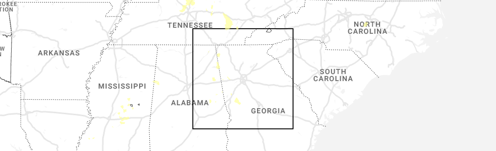
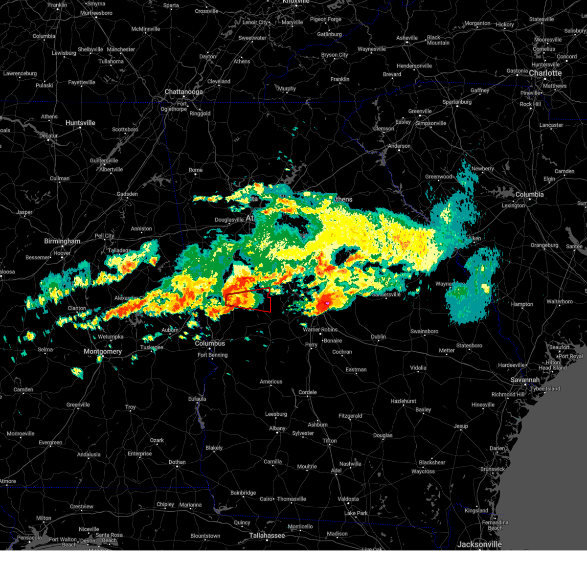
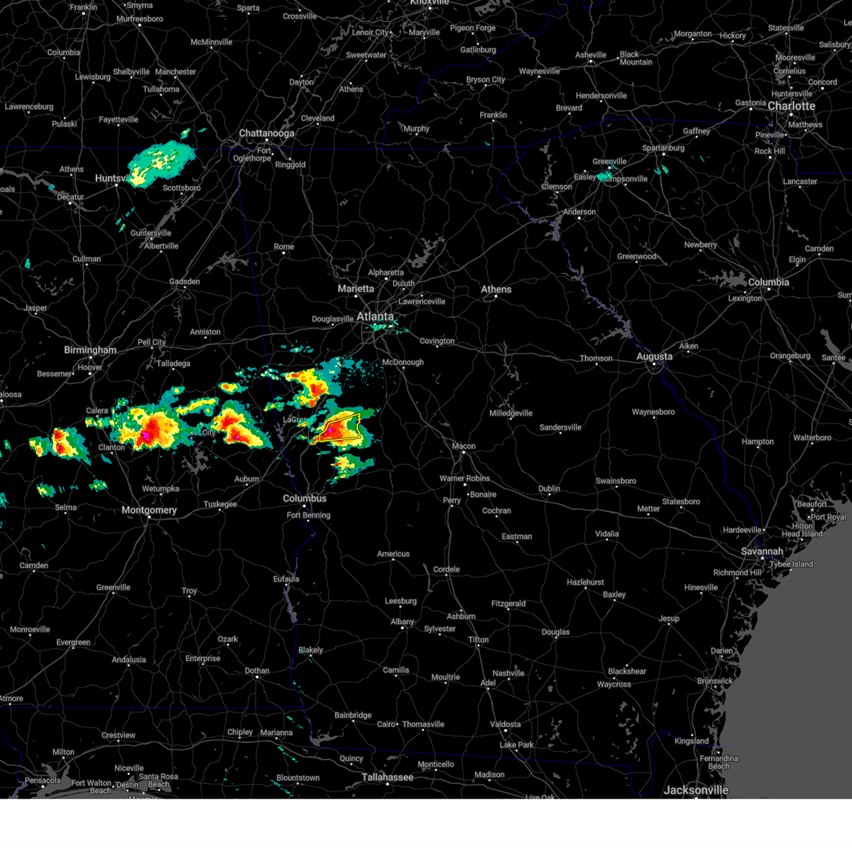
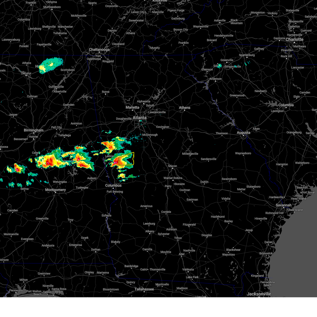
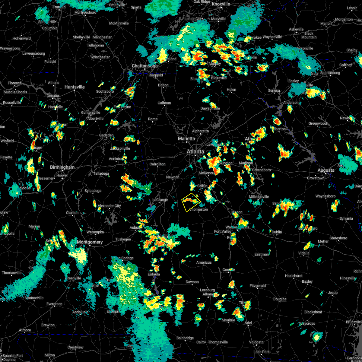
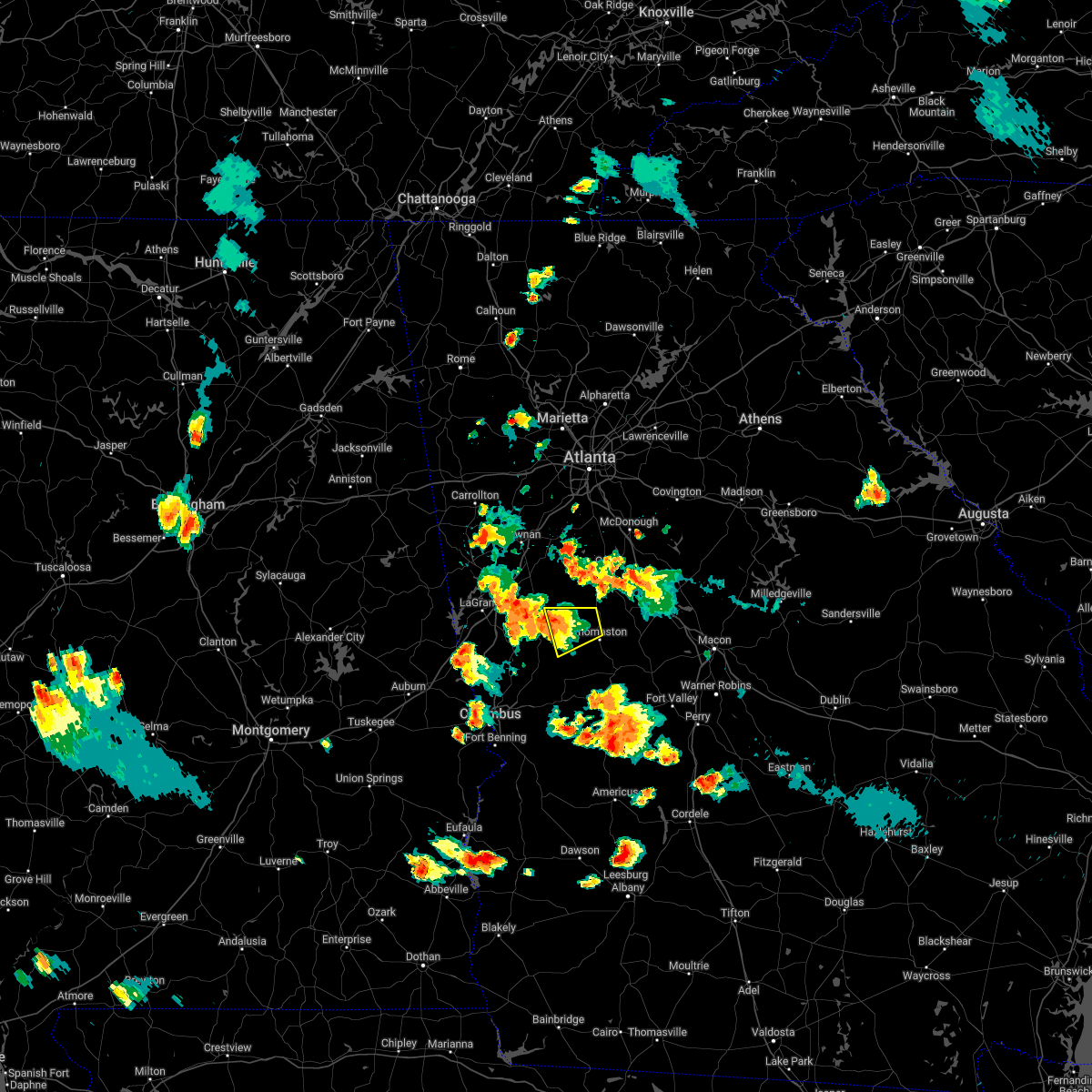
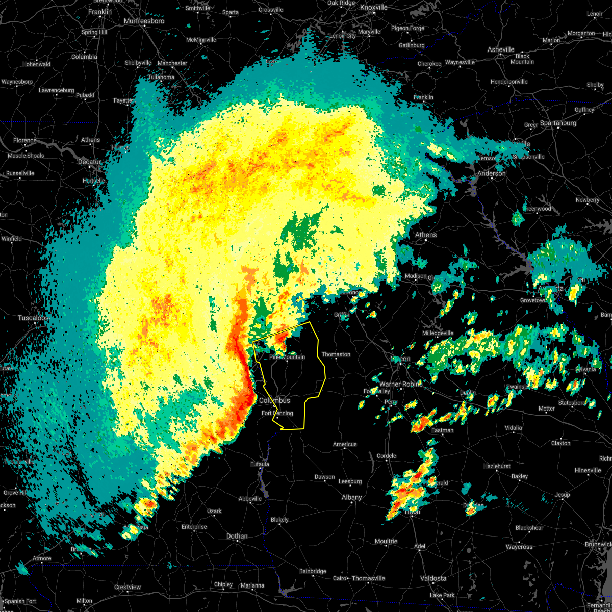
Hail Map for Woodbury, GA
The Woodbury, GA area has had 1 report of on-the-ground hail by trained spotters, and has been under severe weather warnings 12 times during the past 12 months. Doppler radar has detected hail at or near Woodbury, GA on 39 occasions, including 3 occasions during the past year.
| Name: | Woodbury, GA |
| Where Located: | 53.7 miles SSW of Atlanta, GA |
| Map: | Google Map for Woodbury, GA |
| Population: | 961 |
| Housing Units: | 461 |
| More Info: | Search Google for Woodbury, GA |
2
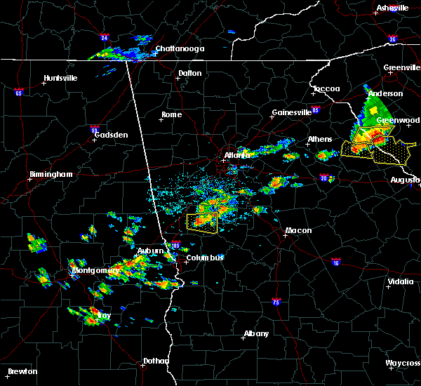
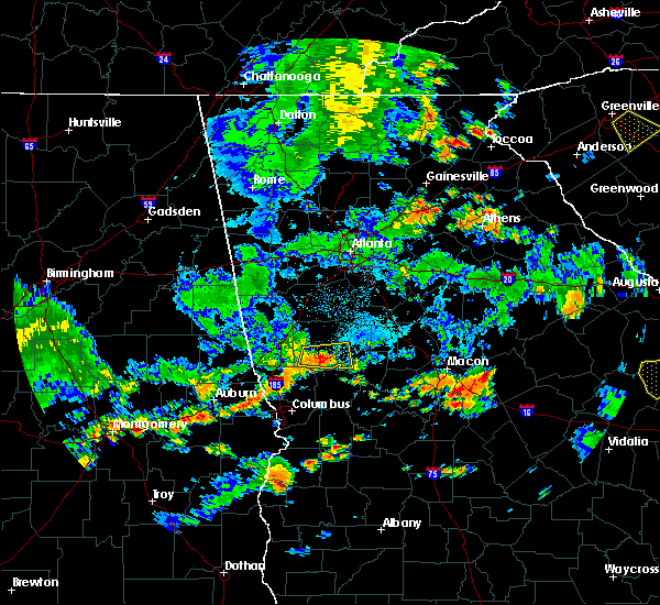
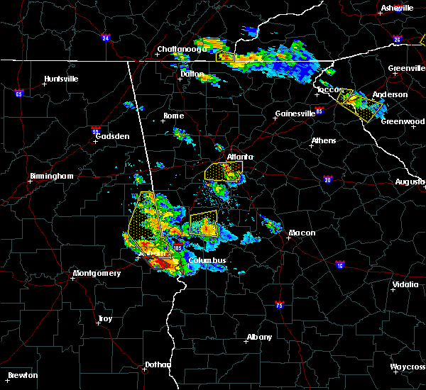
The Top Recent Hail Date for Woodbury, GA is Friday, June 30, 2023 (6th out of 39)
Hail and Wind Damage Spotted near Woodbury, GA
| Date / Time | Report Details |
|---|---|
| 2/28/2024 3:55 PM EST |
 Svrffc the national weather service in peachtree city has issued a * severe thunderstorm warning for, spalding county in west central georgia, fayette county in north central georgia, meriwether county in west central georgia, pike county in west central georgia, henry county in north central georgia, southeastern heard county in west central georgia, troup county in west central georgia, central butts county in central georgia, coweta county in west central georgia, southern clayton county in north central georgia, * until 445 pm est. * at 354 pm est, severe thunderstorms were located along a line extending from near fayetteville to near corinth to near abbottsford, moving east at 50 mph (radar indicated). Hazards include 60 mph wind gusts. expect damage to roofs, siding, and trees Svrffc the national weather service in peachtree city has issued a * severe thunderstorm warning for, spalding county in west central georgia, fayette county in north central georgia, meriwether county in west central georgia, pike county in west central georgia, henry county in north central georgia, southeastern heard county in west central georgia, troup county in west central georgia, central butts county in central georgia, coweta county in west central georgia, southern clayton county in north central georgia, * until 445 pm est. * at 354 pm est, severe thunderstorms were located along a line extending from near fayetteville to near corinth to near abbottsford, moving east at 50 mph (radar indicated). Hazards include 60 mph wind gusts. expect damage to roofs, siding, and trees
|
| 8/6/2023 5:52 PM EDT |
 At 552 pm edt, severe thunderstorms were located along a line extending from near zebulon to sprewell bluff state park to near baughville, moving east at 40 mph (radar indicated). Hazards include 60 mph wind gusts and penny size hail. Expect damage to roofs, siding, and trees. locations impacted include, manchester, woodland, sunset village, sprewell bluff state park, crest, pleasant hill, and atwater. hail threat, radar indicated max hail size, 0. 75 in wind threat, radar indicated max wind gust, 60 mph. At 552 pm edt, severe thunderstorms were located along a line extending from near zebulon to sprewell bluff state park to near baughville, moving east at 40 mph (radar indicated). Hazards include 60 mph wind gusts and penny size hail. Expect damage to roofs, siding, and trees. locations impacted include, manchester, woodland, sunset village, sprewell bluff state park, crest, pleasant hill, and atwater. hail threat, radar indicated max hail size, 0. 75 in wind threat, radar indicated max wind gust, 60 mph.
|
| 8/6/2023 5:24 PM EDT |
 At 523 pm edt, severe thunderstorms were located along a line extending from near haralson to harris city to near hamilton, moving east at 40 mph (radar indicated). Hazards include 60 mph wind gusts and penny size hail. expect damage to roofs, siding, and trees At 523 pm edt, severe thunderstorms were located along a line extending from near haralson to harris city to near hamilton, moving east at 40 mph (radar indicated). Hazards include 60 mph wind gusts and penny size hail. expect damage to roofs, siding, and trees
|
| 8/3/2023 5:49 PM EDT |
 At 549 pm edt, severe thunderstorms were located along a line extending from near sandy creek to near haralson to piedmont heights, moving east at 45 mph (radar indicated). Hazards include 60 mph wind gusts. Expect damage to roofs, siding, and trees. locations impacted include, lagrange, fayetteville, greenville, peachtree city, west point, senoia, hogansville, woodbury, luthersville, brooks, molena, williamson, haralson, woolsey, lone oak, gay, concord, starrs mill, mountville, and cannonville. hail threat, radar indicated max hail size, <. 75 in wind threat, radar indicated max wind gust, 60 mph. At 549 pm edt, severe thunderstorms were located along a line extending from near sandy creek to near haralson to piedmont heights, moving east at 45 mph (radar indicated). Hazards include 60 mph wind gusts. Expect damage to roofs, siding, and trees. locations impacted include, lagrange, fayetteville, greenville, peachtree city, west point, senoia, hogansville, woodbury, luthersville, brooks, molena, williamson, haralson, woolsey, lone oak, gay, concord, starrs mill, mountville, and cannonville. hail threat, radar indicated max hail size, <. 75 in wind threat, radar indicated max wind gust, 60 mph.
|
| 8/3/2023 5:31 PM EDT |
 At 531 pm edt, severe thunderstorms were located along a line extending from near palmetto to near moreland to standing rock, moving southeast at 40 mph (radar indicated). Hazards include 60 mph wind gusts. expect damage to roofs, siding, and trees At 531 pm edt, severe thunderstorms were located along a line extending from near palmetto to near moreland to standing rock, moving southeast at 40 mph (radar indicated). Hazards include 60 mph wind gusts. expect damage to roofs, siding, and trees
|
| 6/30/2023 3:57 PM EDT |
 At 357 pm edt, severe thunderstorms were located along a line extending from near odessadale to near woodbury to near atwater, moving south at 20 mph (radar indicated). Hazards include 60 mph wind gusts and quarter size hail. Hail damage to vehicles is expected. expect wind damage to roofs, siding, and trees. locations impacted include, thomaston, greenville, woodbury, sunset village, crest, raleigh, sunnyside, atwater, hannahs mill and harris city. hail threat, radar indicated max hail size, 1. 00 in wind threat, radar indicated max wind gust, 60 mph. At 357 pm edt, severe thunderstorms were located along a line extending from near odessadale to near woodbury to near atwater, moving south at 20 mph (radar indicated). Hazards include 60 mph wind gusts and quarter size hail. Hail damage to vehicles is expected. expect wind damage to roofs, siding, and trees. locations impacted include, thomaston, greenville, woodbury, sunset village, crest, raleigh, sunnyside, atwater, hannahs mill and harris city. hail threat, radar indicated max hail size, 1. 00 in wind threat, radar indicated max wind gust, 60 mph.
|
| 6/30/2023 3:41 PM EDT |
 At 341 pm edt, a severe thunderstorm was located over raleigh, or 7 miles southeast of greenville, moving south at 25 mph (radar indicated). Hazards include 60 mph wind gusts and quarter size hail. Hail damage to vehicles is expected. Expect wind damage to roofs, siding, and trees. At 341 pm edt, a severe thunderstorm was located over raleigh, or 7 miles southeast of greenville, moving south at 25 mph (radar indicated). Hazards include 60 mph wind gusts and quarter size hail. Hail damage to vehicles is expected. Expect wind damage to roofs, siding, and trees.
|
| 6/30/2023 3:27 PM EDT |
 At 327 pm edt, severe thunderstorms were located along a line extending from saint marks to near wooster to near zebulon, moving south at 20 mph (radar indicated). Hazards include 60 mph wind gusts and quarter size hail. Hail damage to vehicles is expected. Expect wind damage to roofs, siding, and trees. At 327 pm edt, severe thunderstorms were located along a line extending from saint marks to near wooster to near zebulon, moving south at 20 mph (radar indicated). Hazards include 60 mph wind gusts and quarter size hail. Hail damage to vehicles is expected. Expect wind damage to roofs, siding, and trees.
|
| 6/25/2023 8:10 PM EDT |
 The severe thunderstorm warning for meriwether, troup and southeastern coweta counties will expire at 815 pm edt, the storms which prompted the warning have moved out of the area. therefore, the warning will be allowed to expire. a severe thunderstorm watch remains in effect until 100 am edt for north central and west central georgia. The severe thunderstorm warning for meriwether, troup and southeastern coweta counties will expire at 815 pm edt, the storms which prompted the warning have moved out of the area. therefore, the warning will be allowed to expire. a severe thunderstorm watch remains in effect until 100 am edt for north central and west central georgia.
|
| 6/25/2023 7:51 PM EDT |
 At 750 pm edt, severe thunderstorms were located along a line extending from long cane to odessadale to near woodbury, moving south at 40 mph (radar indicated). Hazards include 60 mph wind gusts. Expect damage to roofs, siding, and trees. locations impacted include, lagrange, greenville, manchester, west point, hogansville, grantville, pine mountain, woodbury, luthersville, warm springs, haralson, lone oak, gay, mountville, cannonville, louise, odessadale, stovall, piedmont heights and harrisonville. hail threat, radar indicated max hail size, <. 75 in wind threat, radar indicated max wind gust, 60 mph. At 750 pm edt, severe thunderstorms were located along a line extending from long cane to odessadale to near woodbury, moving south at 40 mph (radar indicated). Hazards include 60 mph wind gusts. Expect damage to roofs, siding, and trees. locations impacted include, lagrange, greenville, manchester, west point, hogansville, grantville, pine mountain, woodbury, luthersville, warm springs, haralson, lone oak, gay, mountville, cannonville, louise, odessadale, stovall, piedmont heights and harrisonville. hail threat, radar indicated max hail size, <. 75 in wind threat, radar indicated max wind gust, 60 mph.
|
| 6/25/2023 7:33 PM EDT |
 At 733 pm edt, severe thunderstorms were located along a line extending from near standing rock to near hogansville to gay, moving south at 40 mph (radar indicated). Hazards include 60 mph wind gusts. Expect damage to roofs, siding, and trees. locations impacted include, newnan, lagrange, franklin, greenville, peachtree city, tyrone, manchester, west point, senoia, hogansville, grantville, pine mountain, woodbury, luthersville, warm springs, centralhatchee, moreland, sharpsburg, turin and haralson. hail threat, radar indicated max hail size, <. 75 in wind threat, radar indicated max wind gust, 60 mph. At 733 pm edt, severe thunderstorms were located along a line extending from near standing rock to near hogansville to gay, moving south at 40 mph (radar indicated). Hazards include 60 mph wind gusts. Expect damage to roofs, siding, and trees. locations impacted include, newnan, lagrange, franklin, greenville, peachtree city, tyrone, manchester, west point, senoia, hogansville, grantville, pine mountain, woodbury, luthersville, warm springs, centralhatchee, moreland, sharpsburg, turin and haralson. hail threat, radar indicated max hail size, <. 75 in wind threat, radar indicated max wind gust, 60 mph.
|
| 6/25/2023 7:19 PM EDT |
 At 718 pm edt, severe thunderstorms were located along a line extending from glenn to near grantville to alvaton, moving south at 40 mph (radar indicated). Hazards include 60 mph wind gusts. expect damage to roofs, siding, and trees At 718 pm edt, severe thunderstorms were located along a line extending from glenn to near grantville to alvaton, moving south at 40 mph (radar indicated). Hazards include 60 mph wind gusts. expect damage to roofs, siding, and trees
|
| 3/27/2023 7:17 AM EDT |
 At 716 am edt, a severe thunderstorm capable of producing a tornado was located over raleigh, or near greenville, moving east at 35 mph (radar indicated rotation). Hazards include tornado and quarter size hail. Flying debris will be dangerous to those caught without shelter. mobile homes will be damaged or destroyed. damage to roofs, windows, and vehicles will occur. tree damage is likely. Locations impacted include, thomaston, woodbury, molena, meansville, sunset village, lincoln park, the rock, raleigh, atwater, lifsey springs, redbone crossroads, crest, sunnyside, hannahs mill and imlac. At 716 am edt, a severe thunderstorm capable of producing a tornado was located over raleigh, or near greenville, moving east at 35 mph (radar indicated rotation). Hazards include tornado and quarter size hail. Flying debris will be dangerous to those caught without shelter. mobile homes will be damaged or destroyed. damage to roofs, windows, and vehicles will occur. tree damage is likely. Locations impacted include, thomaston, woodbury, molena, meansville, sunset village, lincoln park, the rock, raleigh, atwater, lifsey springs, redbone crossroads, crest, sunnyside, hannahs mill and imlac.
|
| 3/27/2023 7:08 AM EDT |
 At 708 am edt, a severe thunderstorm capable of producing a tornado was located over harris city, or near greenville, moving east at 40 mph (radar indicated rotation). Hazards include tornado and quarter size hail. Flying debris will be dangerous to those caught without shelter. mobile homes will be damaged or destroyed. damage to roofs, windows, and vehicles will occur. Tree damage is likely. At 708 am edt, a severe thunderstorm capable of producing a tornado was located over harris city, or near greenville, moving east at 40 mph (radar indicated rotation). Hazards include tornado and quarter size hail. Flying debris will be dangerous to those caught without shelter. mobile homes will be damaged or destroyed. damage to roofs, windows, and vehicles will occur. Tree damage is likely.
|
| 3/27/2023 6:58 AM EDT |
 At 658 am edt, a severe thunderstorm was located over f.d. roosevelt state park, or 8 miles northeast of hamilton, moving east at 45 mph (radar indicated). Hazards include 60 mph wind gusts and penny size hail. expect damage to roofs, siding, and trees At 658 am edt, a severe thunderstorm was located over f.d. roosevelt state park, or 8 miles northeast of hamilton, moving east at 45 mph (radar indicated). Hazards include 60 mph wind gusts and penny size hail. expect damage to roofs, siding, and trees
|
| 3/27/2023 12:36 AM EDT |
 At 1235 am edt, severe thunderstorms were located along a line extending from near luthersville to juniper, moving east at 65 mph (radar indicated). Hazards include 60 mph wind gusts. Expect damage to roofs, siding, and trees. locations impacted include, hamilton, talbotton, greenville, manchester, pine mountain, woodbury, luthersville, waverly hall, warm springs, woodland, junction city, geneva, lone oak, gay, pine mountain-callaway gardens, north fort benning, bibb city, upatoi, shiloh and f. d. roosevelt state park. hail threat, radar indicated max hail size, <. 75 in wind threat, radar indicated max wind gust, 60 mph. At 1235 am edt, severe thunderstorms were located along a line extending from near luthersville to juniper, moving east at 65 mph (radar indicated). Hazards include 60 mph wind gusts. Expect damage to roofs, siding, and trees. locations impacted include, hamilton, talbotton, greenville, manchester, pine mountain, woodbury, luthersville, waverly hall, warm springs, woodland, junction city, geneva, lone oak, gay, pine mountain-callaway gardens, north fort benning, bibb city, upatoi, shiloh and f. d. roosevelt state park. hail threat, radar indicated max hail size, <. 75 in wind threat, radar indicated max wind gust, 60 mph.
|
| 3/27/2023 12:22 AM EDT |
 At 1222 am edt, severe thunderstorms were located along a line extending from near harrisonville to near north fort benning, moving east at 75 mph (radar indicated). Hazards include 60 mph wind gusts. Expect damage to roofs, siding, and trees. locations impacted include, columbus, lagrange, hamilton, talbotton, greenville, manchester, hogansville, pine mountain, woodbury, luthersville, waverly hall, warm springs, woodland, junction city, geneva, lone oak, gay, pine mountain-callaway gardens, north fort benning and river view. hail threat, radar indicated max hail size, <. 75 in wind threat, radar indicated max wind gust, 60 mph. At 1222 am edt, severe thunderstorms were located along a line extending from near harrisonville to near north fort benning, moving east at 75 mph (radar indicated). Hazards include 60 mph wind gusts. Expect damage to roofs, siding, and trees. locations impacted include, columbus, lagrange, hamilton, talbotton, greenville, manchester, hogansville, pine mountain, woodbury, luthersville, waverly hall, warm springs, woodland, junction city, geneva, lone oak, gay, pine mountain-callaway gardens, north fort benning and river view. hail threat, radar indicated max hail size, <. 75 in wind threat, radar indicated max wind gust, 60 mph.
|
| 3/26/2023 11:57 PM EDT |
 At 1157 pm edt, severe thunderstorms were located along a line extending from near penton to near marvyn, moving east at 65 mph (radar indicated). Hazards include 60 mph wind gusts and penny size hail. expect damage to roofs, siding, and trees At 1157 pm edt, severe thunderstorms were located along a line extending from near penton to near marvyn, moving east at 65 mph (radar indicated). Hazards include 60 mph wind gusts and penny size hail. expect damage to roofs, siding, and trees
|
| 3/26/2023 7:25 AM EDT |
 At 725 am edt, a severe thunderstorm was located over durand, or 7 miles south of greenville, moving east at 45 mph (radar indicated). Hazards include 60 mph wind gusts and quarter size hail. Hail damage to vehicles is expected. Expect wind damage to roofs, siding, and trees. At 725 am edt, a severe thunderstorm was located over durand, or 7 miles south of greenville, moving east at 45 mph (radar indicated). Hazards include 60 mph wind gusts and quarter size hail. Hail damage to vehicles is expected. Expect wind damage to roofs, siding, and trees.
|
| 3/26/2023 5:40 AM EDT |
 The severe thunderstorm warning for east central meriwether county will expire at 545 am edt, the storm which prompted the warning has moved out of the area. therefore, the warning will be allowed to expire. a severe thunderstorm watch remains in effect until 900 am edt for west central georgia. to report severe weather, contact your nearest law enforcement agency. they will relay your report to the national weather service peachtree city. The severe thunderstorm warning for east central meriwether county will expire at 545 am edt, the storm which prompted the warning has moved out of the area. therefore, the warning will be allowed to expire. a severe thunderstorm watch remains in effect until 900 am edt for west central georgia. to report severe weather, contact your nearest law enforcement agency. they will relay your report to the national weather service peachtree city.
|
| 3/26/2023 5:33 AM EDT |
 At 533 am edt, a severe thunderstorm was located over concord, or near zebulon, moving east at 45 mph (radar indicated). Hazards include ping pong ball size hail and 60 mph wind gusts. People and animals outdoors will be injured. expect hail damage to roofs, siding, windows, and vehicles. expect wind damage to roofs, siding, and trees. locations impacted include, woodbury and imlac. hail threat, radar indicated max hail size, 1. 50 in wind threat, radar indicated max wind gust, 60 mph. At 533 am edt, a severe thunderstorm was located over concord, or near zebulon, moving east at 45 mph (radar indicated). Hazards include ping pong ball size hail and 60 mph wind gusts. People and animals outdoors will be injured. expect hail damage to roofs, siding, windows, and vehicles. expect wind damage to roofs, siding, and trees. locations impacted include, woodbury and imlac. hail threat, radar indicated max hail size, 1. 50 in wind threat, radar indicated max wind gust, 60 mph.
|
| 3/26/2023 5:30 AM EDT | Quarter sized hail reported 0.3 miles S of Woodbury, GA, report via social media. |
| 3/26/2023 5:13 AM EDT |
 At 513 am edt, a severe thunderstorm was located over greenville, moving east at 45 mph (radar indicated). Hazards include two inch hail and 60 mph wind gusts. People and animals outdoors will be injured. expect hail damage to roofs, siding, windows, and vehicles. expect wind damage to roofs, siding, and trees. locations impacted include, greenville, woodbury, gay, stovall, harris city and imlac. thunderstorm damage threat, considerable hail threat, radar indicated max hail size, 2. 00 in wind threat, radar indicated max wind gust, 60 mph. At 513 am edt, a severe thunderstorm was located over greenville, moving east at 45 mph (radar indicated). Hazards include two inch hail and 60 mph wind gusts. People and animals outdoors will be injured. expect hail damage to roofs, siding, windows, and vehicles. expect wind damage to roofs, siding, and trees. locations impacted include, greenville, woodbury, gay, stovall, harris city and imlac. thunderstorm damage threat, considerable hail threat, radar indicated max hail size, 2. 00 in wind threat, radar indicated max wind gust, 60 mph.
|
| 3/26/2023 5:05 AM EDT |
 At 505 am edt, a severe thunderstorm was located over stovall, or near greenville, moving east at 45 mph (radar indicated). Hazards include two inch hail and 60 mph wind gusts. People and animals outdoors will be injured. expect hail damage to roofs, siding, windows, and vehicles. locations impacted include, greenville, woodbury, gay, stovall, raleigh, durand, harris city, odessadale and imlac. thunderstorm damage threat, considerable hail threat, observed max hail size, 2. 00 in wind threat, radar indicated max wind gust, 60 mph. At 505 am edt, a severe thunderstorm was located over stovall, or near greenville, moving east at 45 mph (radar indicated). Hazards include two inch hail and 60 mph wind gusts. People and animals outdoors will be injured. expect hail damage to roofs, siding, windows, and vehicles. locations impacted include, greenville, woodbury, gay, stovall, raleigh, durand, harris city, odessadale and imlac. thunderstorm damage threat, considerable hail threat, observed max hail size, 2. 00 in wind threat, radar indicated max wind gust, 60 mph.
|
| 3/26/2023 4:55 AM EDT |
 At 455 am edt, a severe thunderstorm was located near smiths crossroad, or 7 miles southeast of lagrange, moving east at 45 mph (radar indicated). Hazards include ping pong ball size hail and 60 mph wind gusts. People and animals outdoors will be injured. expect hail damage to roofs, siding, windows, and vehicles. Expect wind damage to roofs, siding, and trees. At 455 am edt, a severe thunderstorm was located near smiths crossroad, or 7 miles southeast of lagrange, moving east at 45 mph (radar indicated). Hazards include ping pong ball size hail and 60 mph wind gusts. People and animals outdoors will be injured. expect hail damage to roofs, siding, windows, and vehicles. Expect wind damage to roofs, siding, and trees.
|
| 1/12/2023 4:42 PM EST |
 The severe thunderstorm warning for southern meriwether, southern pike, upson, talbot, northwestern taylor, harris and southwestern lamar counties will expire at 445 pm est, the storms which prompted the warning have weakened below severe limits, and no longer pose an immediate threat to life or property. therefore, the warning will be allowed to expire. however gusty winds are still possible with these thunderstorms. a tornado watch remains in effect until 700 pm est for central and west central georgia. The severe thunderstorm warning for southern meriwether, southern pike, upson, talbot, northwestern taylor, harris and southwestern lamar counties will expire at 445 pm est, the storms which prompted the warning have weakened below severe limits, and no longer pose an immediate threat to life or property. therefore, the warning will be allowed to expire. however gusty winds are still possible with these thunderstorms. a tornado watch remains in effect until 700 pm est for central and west central georgia.
|
| 1/12/2023 4:04 PM EST |
 At 403 pm est, severe thunderstorms were located along a line extending from raleigh to near hamilton to near mountain hill, moving east at 50 mph (radar indicated). Hazards include 60 mph wind gusts. expect damage to roofs, siding, and trees At 403 pm est, severe thunderstorms were located along a line extending from raleigh to near hamilton to near mountain hill, moving east at 50 mph (radar indicated). Hazards include 60 mph wind gusts. expect damage to roofs, siding, and trees
|
| 1/12/2023 3:53 PM EST |
 At 353 pm est, a confirmed tornado was located near saint marks, or near greenville, moving east at 55 mph (radar confirmed tornado). Hazards include damaging tornado. Flying debris will be dangerous to those caught without shelter. mobile homes will be damaged or destroyed. damage to roofs, windows, and vehicles will occur. tree damage is likely. Locations impacted include, greenville, woodbury, rocky mount, saint marks, stovall, harris city, odessadale and wooster. At 353 pm est, a confirmed tornado was located near saint marks, or near greenville, moving east at 55 mph (radar confirmed tornado). Hazards include damaging tornado. Flying debris will be dangerous to those caught without shelter. mobile homes will be damaged or destroyed. damage to roofs, windows, and vehicles will occur. tree damage is likely. Locations impacted include, greenville, woodbury, rocky mount, saint marks, stovall, harris city, odessadale and wooster.
|
| 1/12/2023 3:36 PM EST |
 At 336 pm est, a tornado producing storm was located over lagrange, moving northeast at 40 mph (radar confirmed tornado). Hazards include damaging tornado. Flying debris will be dangerous to those caught without shelter. mobile homes will be damaged or destroyed. damage to roofs, windows, and vehicles will occur. Tree damage is likely. At 336 pm est, a tornado producing storm was located over lagrange, moving northeast at 40 mph (radar confirmed tornado). Hazards include damaging tornado. Flying debris will be dangerous to those caught without shelter. mobile homes will be damaged or destroyed. damage to roofs, windows, and vehicles will occur. Tree damage is likely.
|
| 7/3/2022 5:41 PM EDT |
 At 540 pm edt, a severe thunderstorm was located near molena, or 9 miles west of zebulon, and is nearly stationary (radar indicated). Hazards include 60 mph wind gusts and quarter size hail. Hail damage to vehicles is expected. Expect wind damage to roofs, siding, and trees. At 540 pm edt, a severe thunderstorm was located near molena, or 9 miles west of zebulon, and is nearly stationary (radar indicated). Hazards include 60 mph wind gusts and quarter size hail. Hail damage to vehicles is expected. Expect wind damage to roofs, siding, and trees.
|
| 6/15/2022 8:04 PM EDT |
 At 804 pm edt, a severe thunderstorm was located over molena, or 10 miles southwest of zebulon, moving southwest at 25 mph (radar indicated). Hazards include 60 mph wind gusts and quarter size hail. Hail damage to vehicles is expected. Expect wind damage to roofs, siding, and trees. At 804 pm edt, a severe thunderstorm was located over molena, or 10 miles southwest of zebulon, moving southwest at 25 mph (radar indicated). Hazards include 60 mph wind gusts and quarter size hail. Hail damage to vehicles is expected. Expect wind damage to roofs, siding, and trees.
|
| 6/15/2022 7:43 PM EDT |
 The severe thunderstorm warning for southeastern meriwether, southwestern pike, northwestern upson and north central talbot counties will expire at 745 pm edt, the storm which prompted the warning has moved out of the area. therefore, the warning will be allowed to expire. remember, a severe thunderstorm warning still remains in effect for meriwether county. The severe thunderstorm warning for southeastern meriwether, southwestern pike, northwestern upson and north central talbot counties will expire at 745 pm edt, the storm which prompted the warning has moved out of the area. therefore, the warning will be allowed to expire. remember, a severe thunderstorm warning still remains in effect for meriwether county.
|
| 6/15/2022 7:25 PM EDT | Roof blown off of a home on dromedary s in meriwether county GA, 0.4 miles N of Woodbury, GA |
| 6/15/2022 7:20 PM EDT | Several trees reported down at the intersection of hwy 85 and main st. traffic light blown off pol in meriwether county GA, 0.7 miles ENE of Woodbury, GA |
| 6/15/2022 7:07 PM EDT |
 At 707 pm edt, a severe thunderstorm was located over crest, or 8 miles northwest of thomaston, moving west at 10 mph (radar indicated). Hazards include 60 mph wind gusts and quarter size hail. Hail damage to vehicles is expected. Expect wind damage to roofs, siding, and trees. At 707 pm edt, a severe thunderstorm was located over crest, or 8 miles northwest of thomaston, moving west at 10 mph (radar indicated). Hazards include 60 mph wind gusts and quarter size hail. Hail damage to vehicles is expected. Expect wind damage to roofs, siding, and trees.
|
| 2/3/2022 8:58 PM EST |
 The severe thunderstorm warning for southwestern spalding, eastern meriwether, pike, northwestern upson, northwestern talbot and northeastern harris counties will expire at 900 pm est, the storms which prompted the warning have weakened below severe limits, and have exited the warned area. therefore, the warning will be allowed to expire. however heavy rain is still possible with these thunderstorms. The severe thunderstorm warning for southwestern spalding, eastern meriwether, pike, northwestern upson, northwestern talbot and northeastern harris counties will expire at 900 pm est, the storms which prompted the warning have weakened below severe limits, and have exited the warned area. therefore, the warning will be allowed to expire. however heavy rain is still possible with these thunderstorms.
|
| 2/3/2022 8:41 PM EST |
 At 840 pm est, severe thunderstorms were located along a line extending from williamson to manchester, moving east at 45 mph (radar indicated). Hazards include 60 mph wind gusts. Expect damage to roofs, siding, and trees. locations impacted include, griffin, zebulon, manchester, woodbury, warm springs, woodland, molena, williamson, gay, east griffin, f. d. roosevelt state park, raleigh, hilltop, lifsey springs, flint hill, hollonville, rover, crest, zetella and imlac. hail threat, radar indicated max hail size, <. 75 in wind threat, radar indicated max wind gust, 60 mph. At 840 pm est, severe thunderstorms were located along a line extending from williamson to manchester, moving east at 45 mph (radar indicated). Hazards include 60 mph wind gusts. Expect damage to roofs, siding, and trees. locations impacted include, griffin, zebulon, manchester, woodbury, warm springs, woodland, molena, williamson, gay, east griffin, f. d. roosevelt state park, raleigh, hilltop, lifsey springs, flint hill, hollonville, rover, crest, zetella and imlac. hail threat, radar indicated max hail size, <. 75 in wind threat, radar indicated max wind gust, 60 mph.
|
| 2/3/2022 8:11 PM EST |
 At 810 pm est, severe thunderstorms were located along a line extending from near greenville to near hamilton, moving east at 45 mph (radar indicated). Hazards include 60 mph wind gusts. expect damage to roofs, siding, and trees At 810 pm est, severe thunderstorms were located along a line extending from near greenville to near hamilton, moving east at 45 mph (radar indicated). Hazards include 60 mph wind gusts. expect damage to roofs, siding, and trees
|
| 7/12/2021 6:40 PM EDT |
 The severe thunderstorm warning for meriwether, pike, northwestern upson and eastern troup counties will expire at 645 pm edt, the storms which prompted the warning are weakening below severe limits, and therefore, the warning will be allowed to expire. however, gusty winds and heavy rain are still possible with these thunderstorms. to report severe weather, contact your nearest law enforcement agency. they will relay your report to the national weather service peachtree city. The severe thunderstorm warning for meriwether, pike, northwestern upson and eastern troup counties will expire at 645 pm edt, the storms which prompted the warning are weakening below severe limits, and therefore, the warning will be allowed to expire. however, gusty winds and heavy rain are still possible with these thunderstorms. to report severe weather, contact your nearest law enforcement agency. they will relay your report to the national weather service peachtree city.
|
| 7/12/2021 6:27 PM EDT |
 At 627 pm edt, severe thunderstorms were located along a line extending from crest to near greenville to smiths crossroad, moving northeast at 40 mph (radar indicated). Hazards include 60 mph wind gusts. Expect damage to roofs, siding, and trees. Locations impacted include, lagrange, thomaston, zebulon, greenville, manchester, hogansville, woodbury, luthersville, warm springs, molena, williamson, meansville, lone oak, gay, sunset village, mountville, atwater, hilltop, louise and odessadale. At 627 pm edt, severe thunderstorms were located along a line extending from crest to near greenville to smiths crossroad, moving northeast at 40 mph (radar indicated). Hazards include 60 mph wind gusts. Expect damage to roofs, siding, and trees. Locations impacted include, lagrange, thomaston, zebulon, greenville, manchester, hogansville, woodbury, luthersville, warm springs, molena, williamson, meansville, lone oak, gay, sunset village, mountville, atwater, hilltop, louise and odessadale.
|
| 7/12/2021 6:11 PM EDT |
 At 609 pm edt, severe thunderstorms were located along a line extending from near woodland to durand to near whitesville-pine lake, moving northeast at 35 mph (radar indicated). Hazards include 60 mph wind gusts and penny size hail. expect damage to roofs, siding, and trees At 609 pm edt, severe thunderstorms were located along a line extending from near woodland to durand to near whitesville-pine lake, moving northeast at 35 mph (radar indicated). Hazards include 60 mph wind gusts and penny size hail. expect damage to roofs, siding, and trees
|
| 5/4/2021 9:02 PM EDT |
 At 902 pm edt, severe thunderstorms were located along a line extending from big springs to near durand to near flint hill to near olive branch to near eelbeck/west fort benning, moving northeast at 80 mph (radar indicated). Hazards include 60 mph wind gusts and quarter size hail. Hail damage to vehicles is expected. expect wind damage to roofs, siding, and trees. locations impacted include, lagrange, hamilton, talbotton, greenville, cusseta, manchester, pine mountain, woodbury, waverly hall, warm springs, woodland, geneva, gay, upatoi, f. d. Roosevelt state park, mountville, jamestown/south fort benning, baughville, flint hill and odessadale. At 902 pm edt, severe thunderstorms were located along a line extending from big springs to near durand to near flint hill to near olive branch to near eelbeck/west fort benning, moving northeast at 80 mph (radar indicated). Hazards include 60 mph wind gusts and quarter size hail. Hail damage to vehicles is expected. expect wind damage to roofs, siding, and trees. locations impacted include, lagrange, hamilton, talbotton, greenville, cusseta, manchester, pine mountain, woodbury, waverly hall, warm springs, woodland, geneva, gay, upatoi, f. d. Roosevelt state park, mountville, jamestown/south fort benning, baughville, flint hill and odessadale.
|
| 5/4/2021 8:49 PM EDT |
 At 849 pm edt, severe thunderstorms were located along a line extending from near baughs crossroads to near cataula to near midland to fort benning/lawson army air fld, moving east at 65 mph (radar indicated). Hazards include 70 mph wind gusts and quarter size hail. Hail damage to vehicles is expected. expect considerable tree damage. wind damage is also likely to mobile homes, roofs, and outbuildings. locations impacted include, lagrange, hamilton, talbotton, greenville, cusseta, manchester, west point, pine mountain, woodbury, waverly hall, warm springs, woodland, geneva, gay, fort benning/lawson army air fld, north fort benning, upatoi, f. d. Roosevelt state park, cataula and columbus metropolitan airport. At 849 pm edt, severe thunderstorms were located along a line extending from near baughs crossroads to near cataula to near midland to fort benning/lawson army air fld, moving east at 65 mph (radar indicated). Hazards include 70 mph wind gusts and quarter size hail. Hail damage to vehicles is expected. expect considerable tree damage. wind damage is also likely to mobile homes, roofs, and outbuildings. locations impacted include, lagrange, hamilton, talbotton, greenville, cusseta, manchester, west point, pine mountain, woodbury, waverly hall, warm springs, woodland, geneva, gay, fort benning/lawson army air fld, north fort benning, upatoi, f. d. Roosevelt state park, cataula and columbus metropolitan airport.
|
| 5/4/2021 8:29 PM EDT |
 At 829 pm edt, severe thunderstorms were located along a line extending from fredonia to near beulah to smiths station to hatchechubbe, moving east at 60 mph (radar indicated). Hazards include 70 mph wind gusts and half dollar size hail. Hail damage to vehicles is expected. expect considerable tree damage. wind damage is also likely to mobile homes, roofs, and outbuildings. locations impacted include, lagrange, hamilton, talbotton, greenville, cusseta, manchester, west point, pine mountain, woodbury, waverly hall, warm springs, woodland, geneva, gay, fort benning/lawson army air fld, north fort benning, bibb city, upatoi, f. d. Roosevelt state park and green island hills. At 829 pm edt, severe thunderstorms were located along a line extending from fredonia to near beulah to smiths station to hatchechubbe, moving east at 60 mph (radar indicated). Hazards include 70 mph wind gusts and half dollar size hail. Hail damage to vehicles is expected. expect considerable tree damage. wind damage is also likely to mobile homes, roofs, and outbuildings. locations impacted include, lagrange, hamilton, talbotton, greenville, cusseta, manchester, west point, pine mountain, woodbury, waverly hall, warm springs, woodland, geneva, gay, fort benning/lawson army air fld, north fort benning, bibb city, upatoi, f. d. Roosevelt state park and green island hills.
|
| 5/4/2021 8:25 PM EDT |
 At 825 pm edt, severe thunderstorms were located along a line extending from near denson to near beans mill to marvyn to near warriorstand, moving east at 65 mph (radar indicated). Hazards include 70 mph wind gusts and quarter size hail. Hail damage to vehicles is expected. expect considerable tree damage. Wind damage is also likely to mobile homes, roofs, and outbuildings. At 825 pm edt, severe thunderstorms were located along a line extending from near denson to near beans mill to marvyn to near warriorstand, moving east at 65 mph (radar indicated). Hazards include 70 mph wind gusts and quarter size hail. Hail damage to vehicles is expected. expect considerable tree damage. Wind damage is also likely to mobile homes, roofs, and outbuildings.
|
| 10/10/2020 6:00 PM EDT |
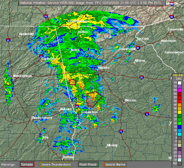 At 600 pm edt, a severe thunderstorm capable of producing a tornado was located over molena, or 11 miles east of greenville, moving north at 40 mph (radar indicated rotation). Hazards include tornado. Flying debris will be dangerous to those caught without shelter. mobile homes will be damaged or destroyed. damage to roofs, windows, and vehicles will occur. tree damage is likely. Locations impacted include, woodbury, molena, gay, crest, hilltop, lifsey springs and imlac. At 600 pm edt, a severe thunderstorm capable of producing a tornado was located over molena, or 11 miles east of greenville, moving north at 40 mph (radar indicated rotation). Hazards include tornado. Flying debris will be dangerous to those caught without shelter. mobile homes will be damaged or destroyed. damage to roofs, windows, and vehicles will occur. tree damage is likely. Locations impacted include, woodbury, molena, gay, crest, hilltop, lifsey springs and imlac.
|
| 10/10/2020 5:39 PM EDT |
 At 539 pm edt, a severe thunderstorm capable of producing a tornado was located over woodland, or 9 miles north of talbotton, moving north at 40 mph (radar indicated rotation). Hazards include tornado. Flying debris will be dangerous to those caught without shelter. mobile homes will be damaged or destroyed. damage to roofs, windows, and vehicles will occur. tree damage is likely. Locations impacted include, greenville, manchester, woodbury, warm springs, woodland, molena, meansville, gay, sunset village, raleigh, atwater, hilltop, lifsey springs, flint hill, sprewell bluff state park, crest, pleasant hill, sunnyside, harris city and imlac. At 539 pm edt, a severe thunderstorm capable of producing a tornado was located over woodland, or 9 miles north of talbotton, moving north at 40 mph (radar indicated rotation). Hazards include tornado. Flying debris will be dangerous to those caught without shelter. mobile homes will be damaged or destroyed. damage to roofs, windows, and vehicles will occur. tree damage is likely. Locations impacted include, greenville, manchester, woodbury, warm springs, woodland, molena, meansville, gay, sunset village, raleigh, atwater, hilltop, lifsey springs, flint hill, sprewell bluff state park, crest, pleasant hill, sunnyside, harris city and imlac.
|
| 10/10/2020 5:27 PM EDT |
 At 527 pm edt, a severe thunderstorm capable of producing a tornado was located over olive branch, or near talbotton, moving north at 40 mph (radar indicated rotation). Hazards include tornado. Flying debris will be dangerous to those caught without shelter. mobile homes will be damaged or destroyed. damage to roofs, windows, and vehicles will occur. Tree damage is likely. At 527 pm edt, a severe thunderstorm capable of producing a tornado was located over olive branch, or near talbotton, moving north at 40 mph (radar indicated rotation). Hazards include tornado. Flying debris will be dangerous to those caught without shelter. mobile homes will be damaged or destroyed. damage to roofs, windows, and vehicles will occur. Tree damage is likely.
|
| 7/25/2020 5:13 PM EDT |
 At 513 pm edt, a severe thunderstorm was located near greenville, moving northeast at 10 mph (radar indicated). Hazards include 60 mph wind gusts and half dollar size hail. Hail damage to vehicles is expected. Expect wind damage to roofs, siding, and trees. At 513 pm edt, a severe thunderstorm was located near greenville, moving northeast at 10 mph (radar indicated). Hazards include 60 mph wind gusts and half dollar size hail. Hail damage to vehicles is expected. Expect wind damage to roofs, siding, and trees.
|
| 7/25/2020 4:40 PM EDT |
 The national weather service in peachtree city has issued a * severe thunderstorm warning for. northeastern meriwether county in west central georgia. pike county in west central georgia. northwestern upson county in west central georgia. Until 515 pm edt. The national weather service in peachtree city has issued a * severe thunderstorm warning for. northeastern meriwether county in west central georgia. pike county in west central georgia. northwestern upson county in west central georgia. Until 515 pm edt.
|
| 7/15/2020 8:12 PM EDT |
 The severe thunderstorm warning for northern meriwether county will expire at 815 pm edt, the storm which prompted the warning has weakened below severe limits, and no longer poses an immediate threat to life or property. therefore, the warning will be allowed to expire. to report severe weather, contact your nearest law enforcement agency. they will relay your report to the national weather service peachtree city. The severe thunderstorm warning for northern meriwether county will expire at 815 pm edt, the storm which prompted the warning has weakened below severe limits, and no longer poses an immediate threat to life or property. therefore, the warning will be allowed to expire. to report severe weather, contact your nearest law enforcement agency. they will relay your report to the national weather service peachtree city.
|
| 7/15/2020 7:33 PM EDT |
 At 733 pm edt, a severe thunderstorm was located over gay, or 8 miles northeast of greenville, moving west at 15 mph (radar indicated). Hazards include 60 mph wind gusts and quarter size hail. Hail damage to vehicles is expected. Expect wind damage to roofs, siding, and trees. At 733 pm edt, a severe thunderstorm was located over gay, or 8 miles northeast of greenville, moving west at 15 mph (radar indicated). Hazards include 60 mph wind gusts and quarter size hail. Hail damage to vehicles is expected. Expect wind damage to roofs, siding, and trees.
|
| 6/30/2020 3:12 PM EDT |
 At 312 pm edt, a severe thunderstorm was located over durand, or 7 miles south of greenville, moving southeast at 25 mph (radar indicated). Hazards include 60 mph wind gusts. Expect damage to roofs, siding, and trees. Locations impacted include, manchester, woodbury, warm springs, raleigh, durand, harris city and flint hill. At 312 pm edt, a severe thunderstorm was located over durand, or 7 miles south of greenville, moving southeast at 25 mph (radar indicated). Hazards include 60 mph wind gusts. Expect damage to roofs, siding, and trees. Locations impacted include, manchester, woodbury, warm springs, raleigh, durand, harris city and flint hill.
|
| 6/30/2020 2:54 PM EDT |
 At 254 pm edt, a severe thunderstorm was located over stovall, or 8 miles southwest of greenville, moving southeast at 25 mph (radar indicated). Hazards include 60 mph wind gusts and quarter size hail. Hail damage to vehicles is expected. Expect wind damage to roofs, siding, and trees. At 254 pm edt, a severe thunderstorm was located over stovall, or 8 miles southwest of greenville, moving southeast at 25 mph (radar indicated). Hazards include 60 mph wind gusts and quarter size hail. Hail damage to vehicles is expected. Expect wind damage to roofs, siding, and trees.
|
| 6/21/2020 6:22 PM EDT | Media reports structural damage at fuel south at the corner of ga-85 and ga-109 in meriwether county GA, 0.7 miles NW of Woodbury, GA |
| 6/10/2020 5:08 PM EDT |
 At 507 pm edt, severe thunderstorms extending from near saint marks to near harris city and durand, moving northeast at 35 mph (radar indicated). Hazards include 60 mph wind gusts. Expect damage to roofs, siding, and trees. Locations impacted include, greenville, manchester, woodbury, warm springs, gay, saint marks, stovall, raleigh, durand, harris city, odessadale and imlac. At 507 pm edt, severe thunderstorms extending from near saint marks to near harris city and durand, moving northeast at 35 mph (radar indicated). Hazards include 60 mph wind gusts. Expect damage to roofs, siding, and trees. Locations impacted include, greenville, manchester, woodbury, warm springs, gay, saint marks, stovall, raleigh, durand, harris city, odessadale and imlac.
|
| 6/10/2020 4:56 PM EDT |
 At 455 pm edt, a severe thunderstorm was located near stovall, moving northeast at 30 mph (radar indicated). Hazards include 60 mph wind gusts. expect damage to roofs, siding, and trees At 455 pm edt, a severe thunderstorm was located near stovall, moving northeast at 30 mph (radar indicated). Hazards include 60 mph wind gusts. expect damage to roofs, siding, and trees
|
| 5/24/2020 4:46 PM EDT |
 At 446 pm edt, a severe thunderstorm was located over atwater, or near thomaston, moving northwest at 20 mph (radar indicated). Hazards include 60 mph wind gusts and quarter size hail. Hail damage to vehicles is expected. Expect wind damage to roofs, siding, and trees. At 446 pm edt, a severe thunderstorm was located over atwater, or near thomaston, moving northwest at 20 mph (radar indicated). Hazards include 60 mph wind gusts and quarter size hail. Hail damage to vehicles is expected. Expect wind damage to roofs, siding, and trees.
|
| 5/24/2020 4:11 PM EDT |
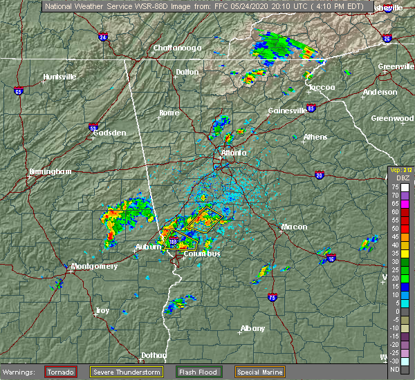 At 411 pm edt, a severe thunderstorm was located near greenville, moving west at 5 mph (radar indicated). Hazards include 60 mph wind gusts and penny size hail. Expect damage to roofs, siding, and trees. Locations impacted include, greenville, manchester, woodbury, warm springs, molena, gay, raleigh, durand, harris city and imlac. At 411 pm edt, a severe thunderstorm was located near greenville, moving west at 5 mph (radar indicated). Hazards include 60 mph wind gusts and penny size hail. Expect damage to roofs, siding, and trees. Locations impacted include, greenville, manchester, woodbury, warm springs, molena, gay, raleigh, durand, harris city and imlac.
|
| 5/24/2020 3:52 PM EDT |
 At 352 pm edt, a severe thunderstorm was located over imlac, or near greenville, and is nearly stationary. a second severe thunderstorm was located just east of durand and was also nearly stationary (radar indicated). Hazards include 60 mph wind gusts and penny size hail. expect damage to roofs, siding, and trees At 352 pm edt, a severe thunderstorm was located over imlac, or near greenville, and is nearly stationary. a second severe thunderstorm was located just east of durand and was also nearly stationary (radar indicated). Hazards include 60 mph wind gusts and penny size hail. expect damage to roofs, siding, and trees
|
| 5/22/2020 5:39 PM EDT |
 At 539 pm edt, a severe thunderstorm was located over odessadale, or near greenville, moving east at 25 mph (radar indicated). Hazards include 60 mph wind gusts and quarter size hail. Hail damage to vehicles is expected. expect wind damage to roofs, siding, and trees. Locations impacted include, greenville, woodbury, warm springs, gay, stovall, raleigh, durand, harris city, odessadale, imlac and wooster. At 539 pm edt, a severe thunderstorm was located over odessadale, or near greenville, moving east at 25 mph (radar indicated). Hazards include 60 mph wind gusts and quarter size hail. Hail damage to vehicles is expected. expect wind damage to roofs, siding, and trees. Locations impacted include, greenville, woodbury, warm springs, gay, stovall, raleigh, durand, harris city, odessadale, imlac and wooster.
|
| 5/22/2020 5:26 PM EDT |
 At 526 pm edt, a severe thunderstorm was located over big springs, or 7 miles southeast of lagrange, moving east at 25 mph (radar indicated). Hazards include 60 mph wind gusts and quarter size hail. Hail damage to vehicles is expected. Expect wind damage to roofs, siding, and trees. At 526 pm edt, a severe thunderstorm was located over big springs, or 7 miles southeast of lagrange, moving east at 25 mph (radar indicated). Hazards include 60 mph wind gusts and quarter size hail. Hail damage to vehicles is expected. Expect wind damage to roofs, siding, and trees.
|
| 4/13/2020 1:43 AM EDT |
 At 142 am edt, severe thunderstorms were located along a line extending from near stovall to pine mountain to near hamilton, moving east at 55 mph (radar indicated). Hazards include 60 mph wind gusts. Expect damage to roofs, siding, and trees. locations impacted include, hamilton, greenville, manchester, pine mountain, woodbury, warm springs, gay, f. d. Roosevelt state park, raleigh, odessadale, stovall, durand, harris city, imlac and wooster. At 142 am edt, severe thunderstorms were located along a line extending from near stovall to pine mountain to near hamilton, moving east at 55 mph (radar indicated). Hazards include 60 mph wind gusts. Expect damage to roofs, siding, and trees. locations impacted include, hamilton, greenville, manchester, pine mountain, woodbury, warm springs, gay, f. d. Roosevelt state park, raleigh, odessadale, stovall, durand, harris city, imlac and wooster.
|
| 4/13/2020 1:24 AM EDT |
 At 124 am edt, severe thunderstorms were located along a line extending from lakeview to near west point to near river view, moving northeast at 55 mph (radar indicated). Hazards include 60 mph wind gusts. expect damage to roofs, siding, and trees At 124 am edt, severe thunderstorms were located along a line extending from lakeview to near west point to near river view, moving northeast at 55 mph (radar indicated). Hazards include 60 mph wind gusts. expect damage to roofs, siding, and trees
|
| 3/31/2020 12:14 PM EDT |
 At 1214 pm edt, severe thunderstorms were located along a line extending from near mckibben to near crest, moving east at 45 mph (radar indicated). Hazards include 60 mph wind gusts. Expect damage to roofs, siding, and trees. Locations impacted include, thomaston, barnesville, zebulon, manchester, woodbury, milner, warm springs, woodland, molena, williamson, orchard hill, meansville, aldora, sunset village, lincoln park, the rock, atwater, hilltop, flint hill and sprewell bluff state park. At 1214 pm edt, severe thunderstorms were located along a line extending from near mckibben to near crest, moving east at 45 mph (radar indicated). Hazards include 60 mph wind gusts. Expect damage to roofs, siding, and trees. Locations impacted include, thomaston, barnesville, zebulon, manchester, woodbury, milner, warm springs, woodland, molena, williamson, orchard hill, meansville, aldora, sunset village, lincoln park, the rock, atwater, hilltop, flint hill and sprewell bluff state park.
|
| 3/31/2020 11:32 AM EDT |
 At 1132 am edt, severe thunderstorms were located along a line extending from near haralson to near whitesville-pine lake, moving east at 45 mph (radar indicated). Hazards include 60 mph wind gusts. expect damage to roofs, siding, and trees At 1132 am edt, severe thunderstorms were located along a line extending from near haralson to near whitesville-pine lake, moving east at 45 mph (radar indicated). Hazards include 60 mph wind gusts. expect damage to roofs, siding, and trees
|
| 3/31/2020 11:18 AM EDT |
 At 1118 am edt, a severe thunderstorm was located over sharpsburg, or 9 miles east of newnan, moving east at 60 mph (radar indicated). Hazards include 70 mph wind gusts. Expect considerable tree damage. damage is likely to mobile homes, roofs, and outbuildings. Locations impacted include, newnan, lagrange, greenville, peachtree city, palmetto, senoia, hogansville, grantville, woodbury, luthersville, moreland, sharpsburg, turin, haralson, lone oak, gay, east newnan, corinth, mountville and louise. At 1118 am edt, a severe thunderstorm was located over sharpsburg, or 9 miles east of newnan, moving east at 60 mph (radar indicated). Hazards include 70 mph wind gusts. Expect considerable tree damage. damage is likely to mobile homes, roofs, and outbuildings. Locations impacted include, newnan, lagrange, greenville, peachtree city, palmetto, senoia, hogansville, grantville, woodbury, luthersville, moreland, sharpsburg, turin, haralson, lone oak, gay, east newnan, corinth, mountville and louise.
|
| 3/31/2020 11:04 AM EDT |
 At 1104 am edt, a severe thunderstorm was located near powers crossroads, or near newnan, moving east at 60 mph (radar indicated). Hazards include 70 mph wind gusts. Expect considerable tree damage. damage is likely to mobile homes, roofs, and outbuildings. Locations impacted include, newnan, lagrange, franklin, greenville, peachtree city, tyrone, palmetto, senoia, hogansville, grantville, woodbury, luthersville, whitesburg, centralhatchee, moreland, sharpsburg, turin, haralson, lone oak and gay. At 1104 am edt, a severe thunderstorm was located near powers crossroads, or near newnan, moving east at 60 mph (radar indicated). Hazards include 70 mph wind gusts. Expect considerable tree damage. damage is likely to mobile homes, roofs, and outbuildings. Locations impacted include, newnan, lagrange, franklin, greenville, peachtree city, tyrone, palmetto, senoia, hogansville, grantville, woodbury, luthersville, whitesburg, centralhatchee, moreland, sharpsburg, turin, haralson, lone oak and gay.
|
| 3/31/2020 10:31 AM EDT |
 At 1030 am edt, a severe thunderstorm was located over tennant, or over wedowee, moving east at 60 mph (radar indicated). Hazards include 60 mph wind gusts. expect damage to roofs, siding, and trees At 1030 am edt, a severe thunderstorm was located over tennant, or over wedowee, moving east at 60 mph (radar indicated). Hazards include 60 mph wind gusts. expect damage to roofs, siding, and trees
|
| 2/6/2020 12:25 PM EST |
 At 1224 pm est, severe thunderstorms were located along a line extending from near gay to near woodland to near baughville to cusseta, moving east at 55 mph (radar indicated). Hazards include 60 mph wind gusts. expect damage to roofs, siding, and trees At 1224 pm est, severe thunderstorms were located along a line extending from near gay to near woodland to near baughville to cusseta, moving east at 55 mph (radar indicated). Hazards include 60 mph wind gusts. expect damage to roofs, siding, and trees
|
| 1/11/2020 5:44 PM EST |
 At 544 pm est, severe thunderstorms were located along a line extending from tyrone to near haralson to near crest to near geneva, moving east at 55 mph (radar indicated). Hazards include 60 mph wind gusts. Expect damage to roofs, siding, and trees. Locations impacted include, newnan, griffin, fayetteville, thomaston, barnesville, jonesboro, zebulon, talbotton, peachtree city, stockbridge, hampton, tyrone, lovejoy, manchester, senoia, woodbury, milner, brooks, warm springs and woodland. At 544 pm est, severe thunderstorms were located along a line extending from tyrone to near haralson to near crest to near geneva, moving east at 55 mph (radar indicated). Hazards include 60 mph wind gusts. Expect damage to roofs, siding, and trees. Locations impacted include, newnan, griffin, fayetteville, thomaston, barnesville, jonesboro, zebulon, talbotton, peachtree city, stockbridge, hampton, tyrone, lovejoy, manchester, senoia, woodbury, milner, brooks, warm springs and woodland.
|
| 1/11/2020 5:29 PM EST |
 At 528 pm est, severe thunderstorms were located along a line extending from dunaway gardens to near luthersville to near warm springs to near upatoi, moving east at 55 mph (radar indicated). Hazards include 60 mph wind gusts. expect damage to roofs, siding, and trees At 528 pm est, severe thunderstorms were located along a line extending from dunaway gardens to near luthersville to near warm springs to near upatoi, moving east at 55 mph (radar indicated). Hazards include 60 mph wind gusts. expect damage to roofs, siding, and trees
|
| 1/11/2020 4:47 PM EST |
 At 446 pm est, severe thunderstorms were located along a line extending from rock mills to near beulah to near hatchechubbe, moving northeast at 60 mph (radar indicated). Hazards include 60 mph wind gusts. expect damage to roofs, siding, and trees At 446 pm est, severe thunderstorms were located along a line extending from rock mills to near beulah to near hatchechubbe, moving northeast at 60 mph (radar indicated). Hazards include 60 mph wind gusts. expect damage to roofs, siding, and trees
|
| 6/22/2019 7:17 PM EDT |
 At 717 pm edt, severe thunderstorms were located along a line extending from gay to near sprewell bluff state park to near waverly hall, moving southeast at 35 mph (radar indicated). Hazards include 60 mph wind gusts and quarter size hail. Hail damage to vehicles is expected. Expect wind damage to roofs, siding, and trees. At 717 pm edt, severe thunderstorms were located along a line extending from gay to near sprewell bluff state park to near waverly hall, moving southeast at 35 mph (radar indicated). Hazards include 60 mph wind gusts and quarter size hail. Hail damage to vehicles is expected. Expect wind damage to roofs, siding, and trees.
|
| 6/22/2019 6:45 PM EDT |
 At 645 pm edt, severe thunderstorms were located along a line extending from hogansville to west point, moving southeast at 35 mph (radar indicated). Hazards include 60 mph wind gusts and quarter size hail. Hail damage to vehicles is expected. Expect wind damage to roofs, siding, and trees. At 645 pm edt, severe thunderstorms were located along a line extending from hogansville to west point, moving southeast at 35 mph (radar indicated). Hazards include 60 mph wind gusts and quarter size hail. Hail damage to vehicles is expected. Expect wind damage to roofs, siding, and trees.
|
| 6/20/2019 3:19 PM EDT |
 At 319 pm edt, a severe thunderstorm was located over woodbury, or near greenville, moving east at 35 mph (radar indicated). Hazards include 60 mph wind gusts and penny size hail. Expect damage to roofs, siding, and trees. Locations impacted include, woodbury, molena, raleigh and imlac. At 319 pm edt, a severe thunderstorm was located over woodbury, or near greenville, moving east at 35 mph (radar indicated). Hazards include 60 mph wind gusts and penny size hail. Expect damage to roofs, siding, and trees. Locations impacted include, woodbury, molena, raleigh and imlac.
|
| 6/20/2019 3:05 PM EDT |
 At 305 pm edt, a severe thunderstorm was located over greenville, moving east at 35 mph (radar indicated). Hazards include 60 mph wind gusts and quarter size hail. Hail damage to vehicles is expected. expect wind damage to roofs, siding, and trees. Locations impacted include, greenville, woodbury, molena, gay, stovall, raleigh, durand, harris city, odessadale and imlac. At 305 pm edt, a severe thunderstorm was located over greenville, moving east at 35 mph (radar indicated). Hazards include 60 mph wind gusts and quarter size hail. Hail damage to vehicles is expected. expect wind damage to roofs, siding, and trees. Locations impacted include, greenville, woodbury, molena, gay, stovall, raleigh, durand, harris city, odessadale and imlac.
|
| 6/20/2019 2:48 PM EDT |
 At 248 pm edt, a severe thunderstorm was located over mountville, or 7 miles east of lagrange, moving east at 35 mph (radar indicated). Hazards include 60 mph wind gusts and penny size hail. expect damage to roofs, siding, and trees At 248 pm edt, a severe thunderstorm was located over mountville, or 7 miles east of lagrange, moving east at 35 mph (radar indicated). Hazards include 60 mph wind gusts and penny size hail. expect damage to roofs, siding, and trees
|
| 3/3/2019 4:39 PM EST |
 At 439 pm est, a severe thunderstorm was located over warm springs, or 9 miles south of greenville, moving east at 40 mph (radar indicated). Hazards include 60 mph wind gusts. Expect damage to roofs, siding, and trees. locations impacted include, greenville, manchester, woodbury, warm springs, molena, sunset village, raleigh, flint hill, sprewell bluff state park, crest, harris city, imlac and sunnyside. A tornado watch remains in effect until 800 pm est for west central georgia. At 439 pm est, a severe thunderstorm was located over warm springs, or 9 miles south of greenville, moving east at 40 mph (radar indicated). Hazards include 60 mph wind gusts. Expect damage to roofs, siding, and trees. locations impacted include, greenville, manchester, woodbury, warm springs, molena, sunset village, raleigh, flint hill, sprewell bluff state park, crest, harris city, imlac and sunnyside. A tornado watch remains in effect until 800 pm est for west central georgia.
|
| 3/3/2019 4:28 PM EST |
 At 428 pm est, a severe thunderstorm was located over pine mountain, or 8 miles north of hamilton, moving east at 40 mph (radar indicated). Hazards include 60 mph wind gusts. expect damage to roofs, siding, and trees At 428 pm est, a severe thunderstorm was located over pine mountain, or 8 miles north of hamilton, moving east at 40 mph (radar indicated). Hazards include 60 mph wind gusts. expect damage to roofs, siding, and trees
|
| 2/21/2019 6:39 PM EST |
 At 638 pm est, a severe thunderstorm capable of producing a tornado was located over durand, moving northeast at 20 mph (radar indicated rotation). Hazards include tornado. Flying debris will be dangerous to those caught without shelter. mobile homes will be damaged or destroyed. damage to roofs, windows, and vehicles will occur. Tree damage is likely. At 638 pm est, a severe thunderstorm capable of producing a tornado was located over durand, moving northeast at 20 mph (radar indicated rotation). Hazards include tornado. Flying debris will be dangerous to those caught without shelter. mobile homes will be damaged or destroyed. damage to roofs, windows, and vehicles will occur. Tree damage is likely.
|
| 8/29/2018 7:08 PM EDT |
 The severe thunderstorm warning for southern meriwether county will expire at 715 pm edt, the storm which prompted the warning has weakened below severe limits, and no longer poses an immediate threat to life or property. therefore, the warning will be allowed to expire. The severe thunderstorm warning for southern meriwether county will expire at 715 pm edt, the storm which prompted the warning has weakened below severe limits, and no longer poses an immediate threat to life or property. therefore, the warning will be allowed to expire.
|
| 8/29/2018 6:46 PM EDT |
 At 645 pm edt, a severe thunderstorm was located over warm springs, or 10 miles south of greenville, moving northwest at 5 mph (radar indicated). Hazards include 60 mph wind gusts. expect damage to roofs, siding, and trees At 645 pm edt, a severe thunderstorm was located over warm springs, or 10 miles south of greenville, moving northwest at 5 mph (radar indicated). Hazards include 60 mph wind gusts. expect damage to roofs, siding, and trees
|
| 8/9/2018 6:05 PM EDT |
 At 550 pm edt, a severe thunderstorm was located over raleigh, or 8 miles southeast of greenville, moving east at 15 mph (radar indicated). Hazards include 60 mph wind gusts and quarter size hail. Hail damage to vehicles is expected. Expect wind damage to roofs, siding, and trees. At 550 pm edt, a severe thunderstorm was located over raleigh, or 8 miles southeast of greenville, moving east at 15 mph (radar indicated). Hazards include 60 mph wind gusts and quarter size hail. Hail damage to vehicles is expected. Expect wind damage to roofs, siding, and trees.
|
| 8/9/2018 5:50 PM EDT |
 At 550 pm edt, a severe thunderstorm was located over raleigh, or 8 miles southeast of greenville, moving east at 15 mph (radar indicated). Hazards include 60 mph wind gusts and quarter size hail. Hail damage to vehicles is expected. Expect wind damage to roofs, siding, and trees. At 550 pm edt, a severe thunderstorm was located over raleigh, or 8 miles southeast of greenville, moving east at 15 mph (radar indicated). Hazards include 60 mph wind gusts and quarter size hail. Hail damage to vehicles is expected. Expect wind damage to roofs, siding, and trees.
|
| 7/21/2018 7:10 PM EDT |
 At 701 pm edt, a severe thunderstorm was located over greenville, moving east at 35 mph (radar indicated). Hazards include 60 mph wind gusts and quarter size hail. Hail damage to vehicles is expected. expect wind damage to roofs, siding, and trees. Locations impacted include, greenville, manchester, woodbury, warm springs, gay, alvaton, raleigh, durand, harris city, odessadale, imlac and wooster. At 701 pm edt, a severe thunderstorm was located over greenville, moving east at 35 mph (radar indicated). Hazards include 60 mph wind gusts and quarter size hail. Hail damage to vehicles is expected. expect wind damage to roofs, siding, and trees. Locations impacted include, greenville, manchester, woodbury, warm springs, gay, alvaton, raleigh, durand, harris city, odessadale, imlac and wooster.
|
| 7/21/2018 7:01 PM EDT |
 At 701 pm edt, a severe thunderstorm was located over greenville, moving east at 35 mph (radar indicated). Hazards include 60 mph wind gusts and quarter size hail. Hail damage to vehicles is expected. expect wind damage to roofs, siding, and trees. Locations impacted include, greenville, manchester, woodbury, warm springs, gay, alvaton, raleigh, durand, harris city, odessadale, imlac and wooster. At 701 pm edt, a severe thunderstorm was located over greenville, moving east at 35 mph (radar indicated). Hazards include 60 mph wind gusts and quarter size hail. Hail damage to vehicles is expected. expect wind damage to roofs, siding, and trees. Locations impacted include, greenville, manchester, woodbury, warm springs, gay, alvaton, raleigh, durand, harris city, odessadale, imlac and wooster.
|
| 7/21/2018 6:43 PM EDT |
 At 643 pm edt, a severe thunderstorm was located over big springs, or 7 miles east of lagrange, moving east at 35 mph (radar indicated). Hazards include 60 mph wind gusts and quarter size hail. Hail damage to vehicles is expected. Expect wind damage to roofs, siding, and trees. At 643 pm edt, a severe thunderstorm was located over big springs, or 7 miles east of lagrange, moving east at 35 mph (radar indicated). Hazards include 60 mph wind gusts and quarter size hail. Hail damage to vehicles is expected. Expect wind damage to roofs, siding, and trees.
|
| 6/28/2018 2:02 PM EDT |
 At 201 pm edt, severe thunderstorms were located along a line extending from near franklin to raleigh, moving southwest at 35 mph (radar indicated). Hazards include 60 mph wind gusts and up to quarter size hail. Hail damage to vehicles is expected. Expect wind damage to roofs, siding, and trees. At 201 pm edt, severe thunderstorms were located along a line extending from near franklin to raleigh, moving southwest at 35 mph (radar indicated). Hazards include 60 mph wind gusts and up to quarter size hail. Hail damage to vehicles is expected. Expect wind damage to roofs, siding, and trees.
|
| 6/28/2018 1:57 PM EDT |
 At 156 pm edt, severe thunderstorms were located along a line extending from corinth to near woodbury, moving southwest at 35 mph (radar indicated). Hazards include 60 mph wind gusts. Expect damage to roofs, siding, and trees. Locations impacted include, newnan, greenville, hogansville, grantville, woodbury, luthersville, moreland, molena, haralson, lone oak, gay, east newnan, corinth, rocky mount, saint marks, hilltop, hollonville, alvaton, imlac and wooster. At 156 pm edt, severe thunderstorms were located along a line extending from corinth to near woodbury, moving southwest at 35 mph (radar indicated). Hazards include 60 mph wind gusts. Expect damage to roofs, siding, and trees. Locations impacted include, newnan, greenville, hogansville, grantville, woodbury, luthersville, moreland, molena, haralson, lone oak, gay, east newnan, corinth, rocky mount, saint marks, hilltop, hollonville, alvaton, imlac and wooster.
|
| 6/28/2018 1:26 PM EDT |
 At 126 pm edt, severe thunderstorms were located along a line extending from madras to near hollonville, moving south at 30 mph (radar indicated). Hazards include 60 mph wind gusts. expect damage to roofs, siding, and trees At 126 pm edt, severe thunderstorms were located along a line extending from madras to near hollonville, moving south at 30 mph (radar indicated). Hazards include 60 mph wind gusts. expect damage to roofs, siding, and trees
|
| 6/22/2018 6:55 PM EDT |
 At 654 pm edt, severe thunderstorms were located along a line extending from handy to near luthersville to rocky mount to imlac, moving northeast at 40 mph (radar indicated). Hazards include 60 mph wind gusts. expect damage to roofs, siding, and trees At 654 pm edt, severe thunderstorms were located along a line extending from handy to near luthersville to rocky mount to imlac, moving northeast at 40 mph (radar indicated). Hazards include 60 mph wind gusts. expect damage to roofs, siding, and trees
|
| 6/3/2018 9:15 PM EDT |
 At 913 pm edt, a severe thunderstorm was located over the rock, or near barnesville, moving southeast at 40 mph (radar indicated). Hazards include 60 mph wind gusts and penny size hail. expect damage to roofs, siding, and trees At 913 pm edt, a severe thunderstorm was located over the rock, or near barnesville, moving southeast at 40 mph (radar indicated). Hazards include 60 mph wind gusts and penny size hail. expect damage to roofs, siding, and trees
|
| 6/1/2018 5:21 PM EDT |
 At 521 pm edt, severe thunderstorms were located along a line extending from birdie to hilltop to near saint marks, moving south at 50 mph (radar indicated). Hazards include 60 mph wind gusts. expect damage to roofs, siding, and trees At 521 pm edt, severe thunderstorms were located along a line extending from birdie to hilltop to near saint marks, moving south at 50 mph (radar indicated). Hazards include 60 mph wind gusts. expect damage to roofs, siding, and trees
|
| 12/20/2017 1:41 PM EST |
 The severe thunderstorm warning for central meriwether, southern pike, upson and southwestern lamar counties will expire at 145 pm est, the storm which prompted the warning has weakened below severe limits, and has exited the warned area. therefore, the warning will be allowed to expire. The severe thunderstorm warning for central meriwether, southern pike, upson and southwestern lamar counties will expire at 145 pm est, the storm which prompted the warning has weakened below severe limits, and has exited the warned area. therefore, the warning will be allowed to expire.
|
| 12/20/2017 1:15 PM EST | Fruit stand destroyed along imlac rd near intersection walnut creek rd. damage was from possible tornad in meriwether county GA, 2.5 miles SSE of Woodbury, GA |
| 12/20/2017 1:15 PM EST | Several trees down on carroll chunn rd. south of the intersection with imlac rd. possible that damage was from a tornad in meriwether county GA, 2.4 miles S of Woodbury, GA |
| 12/20/2017 1:09 PM EST |
 At 109 pm est, a severe thunderstorm was located over harris city, or near greenville, moving east at 50 mph (radar indicated). Hazards include 60 mph wind gusts. expect damage to roofs, siding, and trees At 109 pm est, a severe thunderstorm was located over harris city, or near greenville, moving east at 50 mph (radar indicated). Hazards include 60 mph wind gusts. expect damage to roofs, siding, and trees
|
| 9/22/2017 5:43 PM EDT |
 At 543 pm edt, a severe thunderstorm was located near molena, or 8 miles southwest of zebulon, and is nearly stationary (radar indicated). Hazards include 60 mph wind gusts and penny size hail. expect damage to roofs, siding, and trees At 543 pm edt, a severe thunderstorm was located near molena, or 8 miles southwest of zebulon, and is nearly stationary (radar indicated). Hazards include 60 mph wind gusts and penny size hail. expect damage to roofs, siding, and trees
|
| 6/22/2017 4:36 PM EDT |
 The tornado warning for southwestern meriwether and eastern harris counties will expire at 445 pm edt, the storm which prompted the warning has weakened below severe limits, and no longer appears capable of producing a tornado. therefore the warning will be allowed to expire. to report severe weather, contact your nearest law enforcement agency. they will relay your report to the national weather service peachtree city. The tornado warning for southwestern meriwether and eastern harris counties will expire at 445 pm edt, the storm which prompted the warning has weakened below severe limits, and no longer appears capable of producing a tornado. therefore the warning will be allowed to expire. to report severe weather, contact your nearest law enforcement agency. they will relay your report to the national weather service peachtree city.
|
| 6/22/2017 4:06 PM EDT |
 At 405 pm edt, a severe thunderstorm capable of producing a tornado was located over cataula, or near hamilton, moving northeast at 25 mph (radar indicated rotation). Hazards include tornado. Flying debris will be dangerous to those caught without shelter. mobile homes will be damaged or destroyed. damage to roofs, windows, and vehicles will occur. Tree damage is likely. At 405 pm edt, a severe thunderstorm capable of producing a tornado was located over cataula, or near hamilton, moving northeast at 25 mph (radar indicated rotation). Hazards include tornado. Flying debris will be dangerous to those caught without shelter. mobile homes will be damaged or destroyed. damage to roofs, windows, and vehicles will occur. Tree damage is likely.
|
| 6/15/2017 6:20 PM EDT |
 At 619 pm edt, severe thunderstorms were located along a line extending from madras to near corinth to near glenn, moving southeast at 30 mph (radar indicated). Hazards include 60 mph wind gusts. expect damage to roofs, siding, and trees At 619 pm edt, severe thunderstorms were located along a line extending from madras to near corinth to near glenn, moving southeast at 30 mph (radar indicated). Hazards include 60 mph wind gusts. expect damage to roofs, siding, and trees
|
| 4/5/2017 10:40 PM EDT |
 At 1040 pm edt, a severe thunderstorm was located over mountville, or 9 miles east of lagrange, moving east at 60 mph (radar indicated). Hazards include 60 mph wind gusts and quarter size hail. Hail damage to vehicles is expected. Expect wind damage to roofs, siding, and trees. At 1040 pm edt, a severe thunderstorm was located over mountville, or 9 miles east of lagrange, moving east at 60 mph (radar indicated). Hazards include 60 mph wind gusts and quarter size hail. Hail damage to vehicles is expected. Expect wind damage to roofs, siding, and trees.
|
| 4/5/2017 5:48 AM EDT |
 At 547 am edt, a severe thunderstorm was located over harris city, or near greenville, moving northeast at 55 mph (radar indicated). Hazards include quarter size hail. Damage to vehicles is expected. Locations impacted include, greenville, manchester, woodbury, warm springs, raleigh, durand and harris city. At 547 am edt, a severe thunderstorm was located over harris city, or near greenville, moving northeast at 55 mph (radar indicated). Hazards include quarter size hail. Damage to vehicles is expected. Locations impacted include, greenville, manchester, woodbury, warm springs, raleigh, durand and harris city.
|
| 4/5/2017 5:32 AM EDT |
 At 532 am edt, a severe thunderstorm was located near pine mountain, or near hamilton, moving northeast at 55 mph (radar indicated). Hazards include quarter size hail. damage to vehicles is expected At 532 am edt, a severe thunderstorm was located near pine mountain, or near hamilton, moving northeast at 55 mph (radar indicated). Hazards include quarter size hail. damage to vehicles is expected
|
| 2/7/2017 5:27 PM EST |
 At 526 pm est, a severe thunderstorm was located over woodbury, or near greenville, moving northeast at 30 mph (radar indicated). Hazards include 60 mph wind gusts. Expect damage to roofs, siding, and trees. Locations impacted include, thomaston, zebulon, greenville, manchester, woodbury, warm springs, molena, meansville, gay, sunset village, raleigh, atwater, hilltop, lifsey springs, flint hill, hollonville, alvaton, crest, sunnyside and hannahs mill. At 526 pm est, a severe thunderstorm was located over woodbury, or near greenville, moving northeast at 30 mph (radar indicated). Hazards include 60 mph wind gusts. Expect damage to roofs, siding, and trees. Locations impacted include, thomaston, zebulon, greenville, manchester, woodbury, warm springs, molena, meansville, gay, sunset village, raleigh, atwater, hilltop, lifsey springs, flint hill, hollonville, alvaton, crest, sunnyside and hannahs mill.
|
| 2/7/2017 5:08 PM EST |
 At 507 pm est, a severe thunderstorm was located near durand, moving northeast at 30 mph (radar indicated). Hazards include 60 mph wind gusts. expect damage to roofs, siding, and trees At 507 pm est, a severe thunderstorm was located near durand, moving northeast at 30 mph (radar indicated). Hazards include 60 mph wind gusts. expect damage to roofs, siding, and trees
|
| 2/7/2017 4:57 PM EST |
 At 457 pm est, a severe thunderstorm was located over stovall, or southwest of greenville, moving northeast at 45 mph (radar indicated). Hazards include 60 mph wind gusts. Expect damage to roofs, siding, and trees. locations impacted include, lagrange, hamilton, greenville, manchester, hogansville, pine mountain, woodbury, warm springs, lone oak, gay, rocky mount, f. d. Roosevelt state park, saint marks, raleigh, mountville, louise, odessadale, stovall, big springs and durand. At 457 pm est, a severe thunderstorm was located over stovall, or southwest of greenville, moving northeast at 45 mph (radar indicated). Hazards include 60 mph wind gusts. Expect damage to roofs, siding, and trees. locations impacted include, lagrange, hamilton, greenville, manchester, hogansville, pine mountain, woodbury, warm springs, lone oak, gay, rocky mount, f. d. Roosevelt state park, saint marks, raleigh, mountville, louise, odessadale, stovall, big springs and durand.
|
| 2/7/2017 4:29 PM EST |
 At 428 pm est, a severe thunderstorm was located over whitesville- pine lake, moving northeast at 45 mph (radar indicated). Hazards include 60 mph wind gusts. expect damage to roofs, siding, and trees At 428 pm est, a severe thunderstorm was located over whitesville- pine lake, moving northeast at 45 mph (radar indicated). Hazards include 60 mph wind gusts. expect damage to roofs, siding, and trees
|
| 11/30/2016 2:32 PM EST |
 At 232 pm est, a severe thunderstorm capable of producing a tornado was located over stovall, or 9 miles southwest of greenville, moving east at 55 mph (radar indicated rotation). Hazards include tornado. Flying debris will be dangerous to those caught without shelter. mobile homes will be damaged or destroyed. damage to roofs, windows, and vehicles will occur. Tree damage is likely. At 232 pm est, a severe thunderstorm capable of producing a tornado was located over stovall, or 9 miles southwest of greenville, moving east at 55 mph (radar indicated rotation). Hazards include tornado. Flying debris will be dangerous to those caught without shelter. mobile homes will be damaged or destroyed. damage to roofs, windows, and vehicles will occur. Tree damage is likely.
|
| 11/30/2016 2:23 PM EST |
 At 223 pm est, severe thunderstorms were located along a line extending from near hogansville to stovall to near pine mountain, moving northeast at 50 mph (radar indicated). Hazards include 60 mph wind gusts. Expect damage to roofs. siding. And trees. At 223 pm est, severe thunderstorms were located along a line extending from near hogansville to stovall to near pine mountain, moving northeast at 50 mph (radar indicated). Hazards include 60 mph wind gusts. Expect damage to roofs. siding. And trees.
|
| 7/11/2016 5:42 PM EDT |
 At 542 pm edt, a severe thunderstorm was located near greenville, moving northeast at 30 mph (radar indicated). Hazards include 60 mph wind gusts. Expect damage to roofs. siding. and trees. Other locations in the warning include but are not limited to greenville, manchester, woodbury, warm springs, gay, saint marks, wooster, raleigh, durand, harris city, odessadale and imlac. At 542 pm edt, a severe thunderstorm was located near greenville, moving northeast at 30 mph (radar indicated). Hazards include 60 mph wind gusts. Expect damage to roofs. siding. and trees. Other locations in the warning include but are not limited to greenville, manchester, woodbury, warm springs, gay, saint marks, wooster, raleigh, durand, harris city, odessadale and imlac.
|
| 7/11/2016 5:33 PM EDT |
 At 533 pm edt, a severe thunderstorm was located near pine mountain, or 9 miles southwest of greenville, moving northeast at 30 mph (radar indicated). Hazards include 60 mph wind gusts. Expect damage to roofs. siding. and trees. Other locations in the warning include but are not limited to greenville, manchester, pine mountain, woodbury, warm springs, gay, wooster, raleigh, durand, harris city, big springs, saint marks, odessadale, stovall and imlac. At 533 pm edt, a severe thunderstorm was located near pine mountain, or 9 miles southwest of greenville, moving northeast at 30 mph (radar indicated). Hazards include 60 mph wind gusts. Expect damage to roofs. siding. and trees. Other locations in the warning include but are not limited to greenville, manchester, pine mountain, woodbury, warm springs, gay, wooster, raleigh, durand, harris city, big springs, saint marks, odessadale, stovall and imlac.
|
| 7/11/2016 5:30 PM EDT | 911 call center received reports of multiple trees down. one on hwy 109 and cedar rock rd near woodbury...one on wallace rd near pine mountain...one on east perry st ne in meriwether county GA, 0.4 miles N of Woodbury, GA |
| 7/11/2016 5:08 PM EDT |
 At 508 pm edt, a severe thunderstorm was located over hamilton, moving northeast at 30 mph (radar indicated). Hazards include 60 mph wind gusts. Expect damage to roofs. siding. and trees. other locations in the warning include but are not limited to hamilton, greenville, manchester, pine mountain, woodbury, warm springs, gay, wooster, raleigh, durand, harris city, big springs, saint marks, f. d. Roosevelt state park, odessadale, stovall, imlac and flint hill. At 508 pm edt, a severe thunderstorm was located over hamilton, moving northeast at 30 mph (radar indicated). Hazards include 60 mph wind gusts. Expect damage to roofs. siding. and trees. other locations in the warning include but are not limited to hamilton, greenville, manchester, pine mountain, woodbury, warm springs, gay, wooster, raleigh, durand, harris city, big springs, saint marks, f. d. Roosevelt state park, odessadale, stovall, imlac and flint hill.
|
| 6/26/2016 3:30 PM EDT |
 At 330 pm edt, a severe thunderstorm was located over molena, or 11 miles southwest of zebulon, moving southwest at 10 mph (radar indicated). Hazards include 60 mph wind gusts and nickel size hail. Expect damage to roofs. siding. and trees. Other locations in the warning include but are not limited to greenville, manchester, woodbury, molena, raleigh, crest and imlac. At 330 pm edt, a severe thunderstorm was located over molena, or 11 miles southwest of zebulon, moving southwest at 10 mph (radar indicated). Hazards include 60 mph wind gusts and nickel size hail. Expect damage to roofs. siding. and trees. Other locations in the warning include but are not limited to greenville, manchester, woodbury, molena, raleigh, crest and imlac.
|
| 6/16/2016 7:12 PM EDT |
 At 712 pm edt, severe thunderstorms were located along a line extending from near greenville to 7 miles south of lagrange, moving south at 35 mph (radar indicated). Hazards include 60 mph wind gusts and quarter size hail. Hail damage to vehicles is expected. expect wind damage to roofs, siding, and trees. Other locations in the warning include but are not limited to hamilton, talbotton, manchester, pine mountain, woodbury, waverly hall, warm springs, woodland, junction city, geneva, baughs crossroads, jones crossroads, pleasant hill, harris city, mountain hill, bartletts ferry dam, fortson, juniper, lake harding and baughville. At 712 pm edt, severe thunderstorms were located along a line extending from near greenville to 7 miles south of lagrange, moving south at 35 mph (radar indicated). Hazards include 60 mph wind gusts and quarter size hail. Hail damage to vehicles is expected. expect wind damage to roofs, siding, and trees. Other locations in the warning include but are not limited to hamilton, talbotton, manchester, pine mountain, woodbury, waverly hall, warm springs, woodland, junction city, geneva, baughs crossroads, jones crossroads, pleasant hill, harris city, mountain hill, bartletts ferry dam, fortson, juniper, lake harding and baughville.
|
| 6/16/2016 6:56 PM EDT |
 At 655 pm edt, severe thunderstorms were located along a line extending from near greenville to near lagrange, moving southeast at 30 mph (radar indicated). Hazards include 60 mph wind gusts and quarter size hail. Hail damage to vehicles is expected. expect wind damage to roofs, siding, and trees. Other locations in the warning include but are not limited to lagrange, greenville, hogansville, pine mountain, woodbury, lone oak, gay, wooster, baughs crossroads, durand, harris city, big springs, rocky mount, mountville, saint marks, abbottsford, state line park, louise, piedmont heights and odessadale. At 655 pm edt, severe thunderstorms were located along a line extending from near greenville to near lagrange, moving southeast at 30 mph (radar indicated). Hazards include 60 mph wind gusts and quarter size hail. Hail damage to vehicles is expected. expect wind damage to roofs, siding, and trees. Other locations in the warning include but are not limited to lagrange, greenville, hogansville, pine mountain, woodbury, lone oak, gay, wooster, baughs crossroads, durand, harris city, big springs, rocky mount, mountville, saint marks, abbottsford, state line park, louise, piedmont heights and odessadale.
|
| 6/16/2016 6:31 PM EDT |
 At 631 pm edt, severe thunderstorms were located along a line extending from grantville to 6 miles northwest of lagrange, moving southeast at 30 mph (radar indicated). Hazards include 60 mph wind gusts and quarter size hail. Hail damage to vehicles is expected. expect wind damage to roofs, siding, and trees. Other locations in the warning include but are not limited to lagrange, greenville, hogansville, grantville, pine mountain, woodbury, luthersville, moreland, lone oak, gay, corinth, baughs crossroads, harris city, rocky mount, abbottsford, state line park, cannonville, imlac, wooster and durand. At 631 pm edt, severe thunderstorms were located along a line extending from grantville to 6 miles northwest of lagrange, moving southeast at 30 mph (radar indicated). Hazards include 60 mph wind gusts and quarter size hail. Hail damage to vehicles is expected. expect wind damage to roofs, siding, and trees. Other locations in the warning include but are not limited to lagrange, greenville, hogansville, grantville, pine mountain, woodbury, luthersville, moreland, lone oak, gay, corinth, baughs crossroads, harris city, rocky mount, abbottsford, state line park, cannonville, imlac, wooster and durand.
|
| 4/7/2016 12:38 AM EDT |
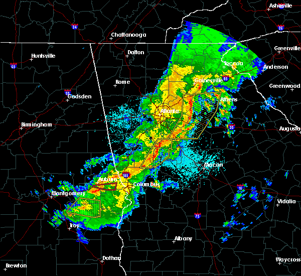 At 1237 am edt, severe thunderstorms were located along a line extending from near sunny side to warm springs, moving east at 55 mph (radar indicated). Hazards include 60 mph wind gusts and quarter size hail. Hail damage to vehicles is expected. expect wind damage to roofs, siding, and trees. Other locations in the warning include but are not limited to griffin, zebulon, manchester, woodbury, brooks, warm springs, molena, williamson, orchard hill, meansville, sunny side, gay, east griffin, sunset village, digbey, crest, lifsey springs, hollonville, highland mills and atwater. At 1237 am edt, severe thunderstorms were located along a line extending from near sunny side to warm springs, moving east at 55 mph (radar indicated). Hazards include 60 mph wind gusts and quarter size hail. Hail damage to vehicles is expected. expect wind damage to roofs, siding, and trees. Other locations in the warning include but are not limited to griffin, zebulon, manchester, woodbury, brooks, warm springs, molena, williamson, orchard hill, meansville, sunny side, gay, east griffin, sunset village, digbey, crest, lifsey springs, hollonville, highland mills and atwater.
|
| 4/7/2016 12:26 AM EDT |
 At 1226 am edt, severe thunderstorms were located along a line extending from near senoia to near pine mountain, moving east at 50 mph (radar indicated). Hazards include 60 mph wind gusts and quarter size hail. Hail damage to vehicles is expected. expect wind damage to roofs, siding, and trees. Other locations in the warning include but are not limited to griffin, zebulon, greenville, peachtree city, manchester, senoia, pine mountain, woodbury, luthersville, brooks, warm springs, molena, williamson, sharpsburg, turin, orchard hill, meansville, haralson, sunny side and gay. At 1226 am edt, severe thunderstorms were located along a line extending from near senoia to near pine mountain, moving east at 50 mph (radar indicated). Hazards include 60 mph wind gusts and quarter size hail. Hail damage to vehicles is expected. expect wind damage to roofs, siding, and trees. Other locations in the warning include but are not limited to griffin, zebulon, greenville, peachtree city, manchester, senoia, pine mountain, woodbury, luthersville, brooks, warm springs, molena, williamson, sharpsburg, turin, orchard hill, meansville, haralson, sunny side and gay.
|
| 4/7/2016 12:09 AM EDT |
 At 1209 am edt, severe thunderstorms were located along a line extending from near east newnan to 8 miles east of west point, moving east at 50 mph (radar indicated). Hazards include 60 mph wind gusts and quarter size hail. Hail damage to vehicles is expected. expect wind damage to roofs, siding, and trees. Other locations in the warning include but are not limited to lagrange, griffin, zebulon, greenville, peachtree city, manchester, senoia, hogansville, grantville, pine mountain, woodbury, luthersville, brooks, warm springs, moreland, molena, williamson, sharpsburg, turin and orchard hill. At 1209 am edt, severe thunderstorms were located along a line extending from near east newnan to 8 miles east of west point, moving east at 50 mph (radar indicated). Hazards include 60 mph wind gusts and quarter size hail. Hail damage to vehicles is expected. expect wind damage to roofs, siding, and trees. Other locations in the warning include but are not limited to lagrange, griffin, zebulon, greenville, peachtree city, manchester, senoia, hogansville, grantville, pine mountain, woodbury, luthersville, brooks, warm springs, moreland, molena, williamson, sharpsburg, turin and orchard hill.
|
| 7/10/2015 4:15 PM EDT |
 At 415 pm edt, severe thunderstorms were located extending from near luthersville to near hogansville to near lagrange, moving northeast at 10 mph (radar indicated). Hazards include 60 mph wind gusts and penny size hail. Expect damage to roofs. siding and trees. Other locations in the warning include but are not limited to lagrange, greenville, manchester, west point, hogansville, pine mountain, woodbury, luthersville, warm springs, lone oak, gay, harrisonville, baughs crossroads, harris city, rocky mount, abbottsford, state line park, cannonville, alvaton and imlac. At 415 pm edt, severe thunderstorms were located extending from near luthersville to near hogansville to near lagrange, moving northeast at 10 mph (radar indicated). Hazards include 60 mph wind gusts and penny size hail. Expect damage to roofs. siding and trees. Other locations in the warning include but are not limited to lagrange, greenville, manchester, west point, hogansville, pine mountain, woodbury, luthersville, warm springs, lone oak, gay, harrisonville, baughs crossroads, harris city, rocky mount, abbottsford, state line park, cannonville, alvaton and imlac.
|
| 7/4/2015 1:51 AM EDT |
 At 151 am edt, a severe thunderstorm was located near lagrange, moving east at 50 mph (radar indicated). Hazards include 60 mph wind gusts. Expect damage to roofs. siding and trees. Other locations in the warning include but are not limited to greenville, senoia, hogansville, grantville, woodbury, luthersville, haralson, lone oak, gay, wooster, harris city, big springs, rocky mount, mountville, saint marks, louise, odessadale, stovall, alvaton and imlac. At 151 am edt, a severe thunderstorm was located near lagrange, moving east at 50 mph (radar indicated). Hazards include 60 mph wind gusts. Expect damage to roofs. siding and trees. Other locations in the warning include but are not limited to greenville, senoia, hogansville, grantville, woodbury, luthersville, haralson, lone oak, gay, wooster, harris city, big springs, rocky mount, mountville, saint marks, louise, odessadale, stovall, alvaton and imlac.
|
| 6/9/2015 2:52 PM EDT |
 At 252 pm edt, severe thunderstorms were located along a line extending from near milner to near greenville, moving east at 25 mph (radar indicated). Hazards include 60 mph wind gusts and quarter size hail. Hail damage to vehicles is expected. expect wind damage to roofs, siding and trees. Other locations in the warning include but are not limited to thomaston, barnesville, forsyth, zebulon, greenville, woodbury, milner, warm springs, molena, yatesville, meansville, aldora, the rock, sunset village, collier, crest, harris city, lifsey springs, atwater and johnstonville. At 252 pm edt, severe thunderstorms were located along a line extending from near milner to near greenville, moving east at 25 mph (radar indicated). Hazards include 60 mph wind gusts and quarter size hail. Hail damage to vehicles is expected. expect wind damage to roofs, siding and trees. Other locations in the warning include but are not limited to thomaston, barnesville, forsyth, zebulon, greenville, woodbury, milner, warm springs, molena, yatesville, meansville, aldora, the rock, sunset village, collier, crest, harris city, lifsey springs, atwater and johnstonville.
|
| 5/26/2015 3:55 PM EDT | Multiple trees and powerlines down north of woodbur in meriwether county GA, 1.8 miles SSE of Woodbury, GA |
| 5/26/2015 3:55 PM EDT | At 355 pm edt, a severe thunderstorm was located near warm springs, or near greenville, moving northeast at 35 mph (radar indicated). Hazards include 60 mph wind gusts and nickel size hail. Expect damage to roofs. siding and trees. Other locations in the warning include but are not limited to greenville, manchester, woodbury, warm springs, molena, gay, wooster, raleigh, durand, harris city, alvaton, imlac and hilltop. |
| 3/31/2015 7:49 PM EDT | A severe thunderstorm warning remains in effect until 800 pm edt for northwestern upson. southwestern pike and eastern meriwether counties. at 749 pm edt. doppler radar indicated a line of severe thunderstorms capable of producing quarter size hail and destructive winds in excess of 70 mph. These storms were located along a line. |
| 3/31/2015 7:20 PM EDT | The national weather service in peachtree city has issued a * severe thunderstorm warning for. northwestern upson county in west central georgia. southwestern pike county in west central georgia. meriwether county in west central georgia. Until 800 pm edt. |
Hail Maps for Woodbury, GA


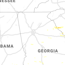


Connect with Interactive Hail Maps