| 8/12/2022 5:00 PM MDT |
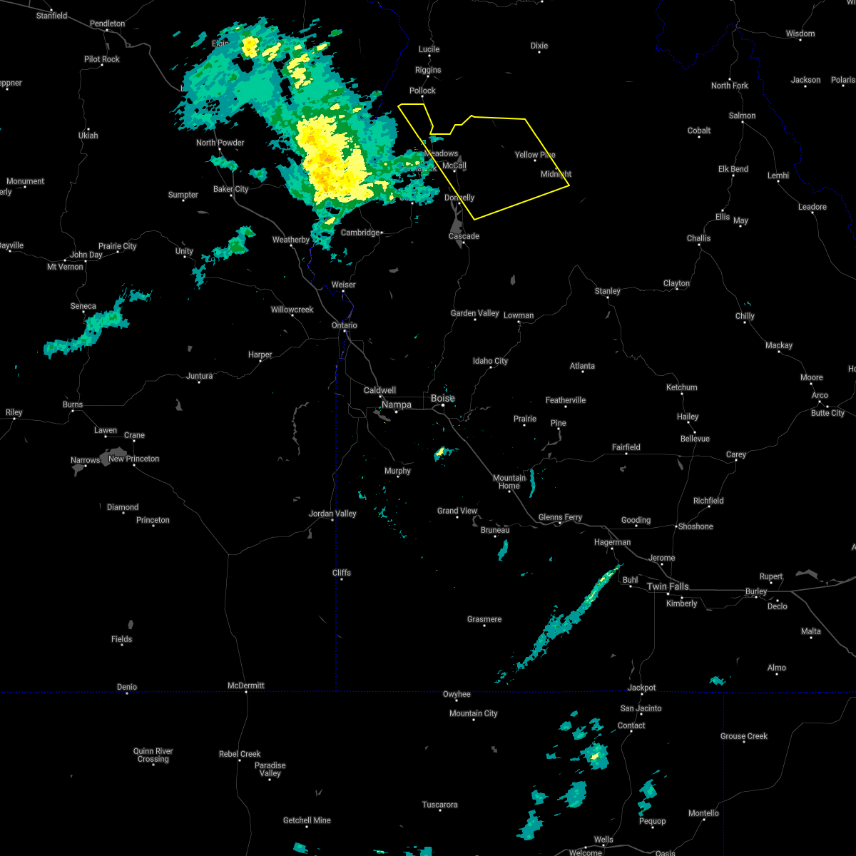
Golf Ball sized hail reported 0.4 miles NNE of Yellow Pine, ID, spotter reported isolated golf ball size hail dropping out of passing thunderstorm.
|
| 8/17/2020 7:20 PM MDT |
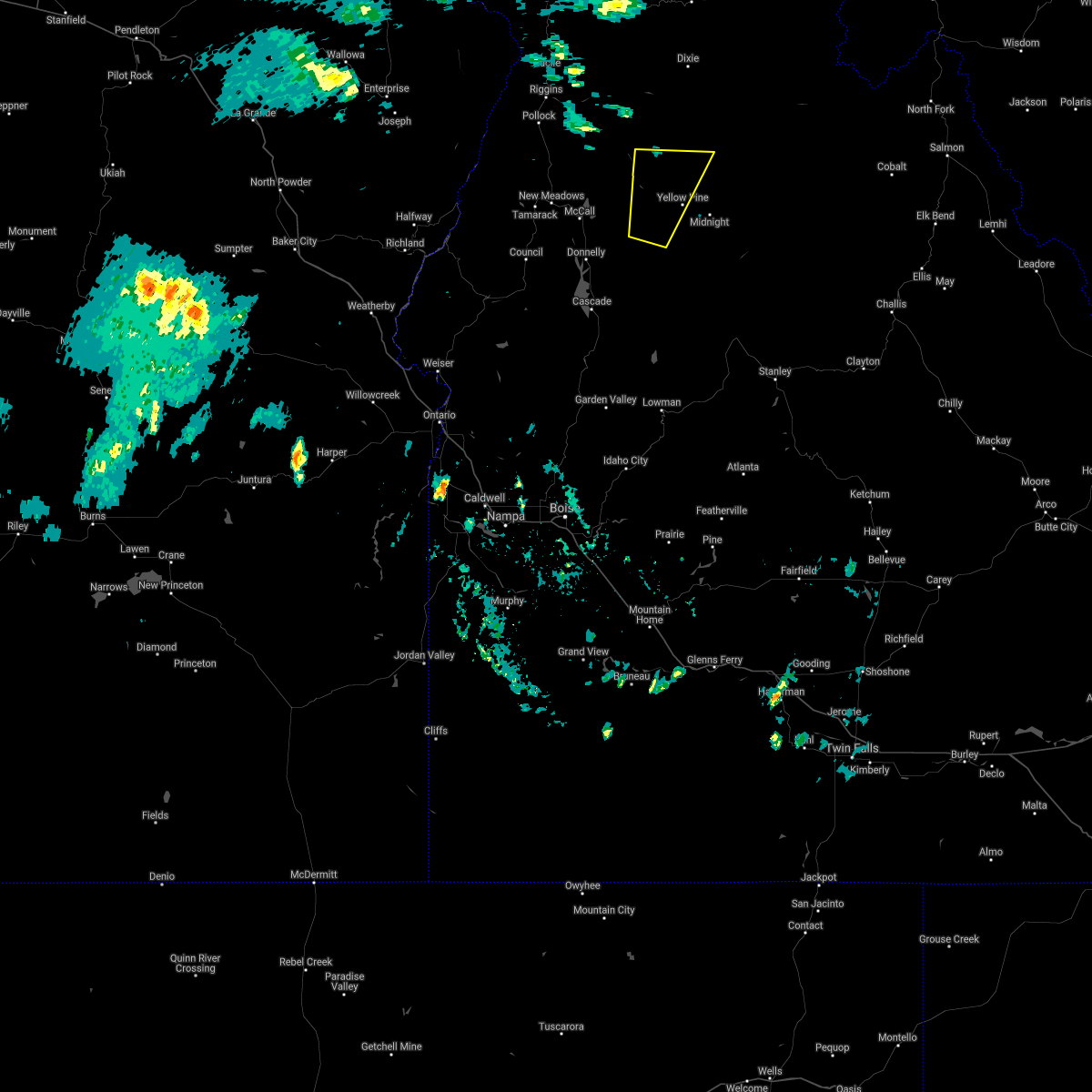
 At 719 pm mdt, severe thunderstorms were located along a line extending from near pollock mountain to near paddy flat work center, moving northeast at 45 mph (radar indicated). Hazards include 70 mph wind gusts. Expect considerable tree damage. damage is likely to mobile homes, roofs, and outbuildings. severe thunderstorms will be near, paddy flat work center, lake fork guard station, little payette lake and payette lake around 720 pm mdt. poverty flat campground, upper payette lake and lick creek summit around 730 pm mdt. Halfway station, krassel work center, yellow pine and pistol rock around 740 pm mdt. At 719 pm mdt, severe thunderstorms were located along a line extending from near pollock mountain to near paddy flat work center, moving northeast at 45 mph (radar indicated). Hazards include 70 mph wind gusts. Expect considerable tree damage. damage is likely to mobile homes, roofs, and outbuildings. severe thunderstorms will be near, paddy flat work center, lake fork guard station, little payette lake and payette lake around 720 pm mdt. poverty flat campground, upper payette lake and lick creek summit around 730 pm mdt. Halfway station, krassel work center, yellow pine and pistol rock around 740 pm mdt.
|
| 5/6/2018 4:28 PM MDT |
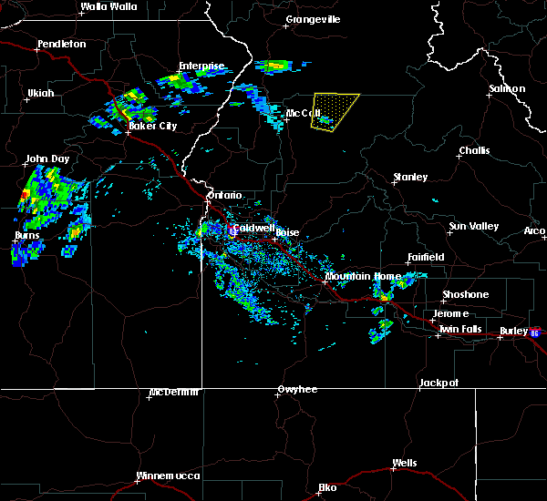
 The severe thunderstorm warning for north central valley county will expire at 430 pm mdt, the storm which prompted the warning has moved out of the area. therefore the warning will be allowed to expire. when safe to do so, please relay storm reports to the national weather service in boise via local law enforcement, or national weather service boise facebook and twitter accounts. The severe thunderstorm warning for north central valley county will expire at 430 pm mdt, the storm which prompted the warning has moved out of the area. therefore the warning will be allowed to expire. when safe to do so, please relay storm reports to the national weather service in boise via local law enforcement, or national weather service boise facebook and twitter accounts.
|
| 5/6/2018 4:08 PM MDT |
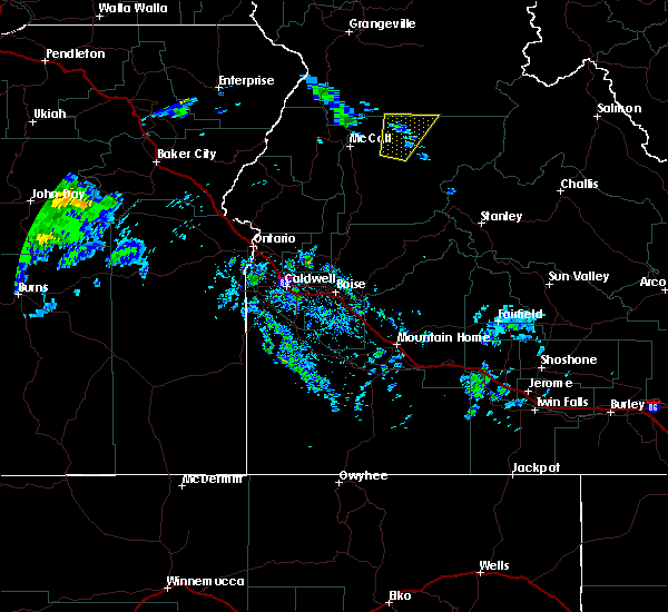 At 408 pm mdt, a severe thunderstorm was located near ponderosa campground, or 26 miles northeast of mccall, moving north at 25 mph (radar indicated). Hazards include 60 mph wind gusts and quarter size hail. Hail damage to vehicles is expected. expect wind damage to roofs, siding, and trees. This severe storm will be near, south fork guard station and elk summit around 420 pm mdt. At 408 pm mdt, a severe thunderstorm was located near ponderosa campground, or 26 miles northeast of mccall, moving north at 25 mph (radar indicated). Hazards include 60 mph wind gusts and quarter size hail. Hail damage to vehicles is expected. expect wind damage to roofs, siding, and trees. This severe storm will be near, south fork guard station and elk summit around 420 pm mdt.
|
| 5/6/2018 3:40 PM MDT |
 At 340 pm mdt, a severe thunderstorm was located near krassel work center, or 21 miles east of mccall, moving north at 25 mph (radar indicated). Hazards include 60 mph wind gusts and quarter size hail. Hail damage to vehicles is expected. expect wind damage to roofs, siding, and trees. this severe thunderstorm will be near, yellow pine around 350 pm mdt. ponderosa campground and parks peak around 400 pm mdt. profile gap around 410 pm mdt. South fork guard station and elk summit around 420 pm mdt. At 340 pm mdt, a severe thunderstorm was located near krassel work center, or 21 miles east of mccall, moving north at 25 mph (radar indicated). Hazards include 60 mph wind gusts and quarter size hail. Hail damage to vehicles is expected. expect wind damage to roofs, siding, and trees. this severe thunderstorm will be near, yellow pine around 350 pm mdt. ponderosa campground and parks peak around 400 pm mdt. profile gap around 410 pm mdt. South fork guard station and elk summit around 420 pm mdt.
|
| 6/4/2012 8:52 PM MDT |
Forest service dispatch reporting 3/4 of a mile of ponderosa pine trees snapped off half way up the trunk. approx 30 ponderosa pine trees 120 feet tall down at the work in valley county ID, 11.9 miles E of Yellow Pine, ID
|
| 6/4/2012 8:40 PM MDT |
Forest service dispatch reporting 3/4 of a mile of ponderosa pine trees snapped off half way up the trunk. approx 30 ponderosa pine trees 120 feet tall down at the work in valley county ID, 11.9 miles E of Yellow Pine, ID
|
| 6/4/2012 8:39 PM MDT |
Tea pot raw in valley county ID, 13.2 miles ENE of Yellow Pine, ID
|


Connect with Interactive Hail Maps