

Hail Map for Ford, KS
The Ford, KS area has had 20 reports of on-the-ground hail by trained spotters, and has been under severe weather warnings 22 times during the past 12 months. Doppler radar has detected hail at or near Ford, KS on 83 occasions, including 3 occasions during the past year.
| Name: | Ford, KS |
| Where Located: | 65.5 miles ESE of Garden City, KS |
| Map: | Google Map for Ford, KS |
| Population: | 216 |
| Housing Units: | 120 |
| More Info: | Search Google for Ford, KS |
0
The Top Recent Hail Date for Ford, KS is Thursday, July 20, 2023 (73rd out of 83)
Hail and Wind Damage Spotted near Ford, KS
| Date / Time | Report Details |
|---|---|
| 7/21/2023 1:00 AM CDT |
 At 100 am cdt, severe thunderstorms were located along a line extending from near bucklin to 10 miles southeast of clark state lake to near ashland to near acres, moving east at 40 mph (radar indicated). Hazards include 70 mph wind gusts. Expect considerable tree damage. damage is likely to mobile homes, roofs, and outbuildings. Locations impacted include, sitka and mullinville. At 100 am cdt, severe thunderstorms were located along a line extending from near bucklin to 10 miles southeast of clark state lake to near ashland to near acres, moving east at 40 mph (radar indicated). Hazards include 70 mph wind gusts. Expect considerable tree damage. damage is likely to mobile homes, roofs, and outbuildings. Locations impacted include, sitka and mullinville.
|
| 7/21/2023 12:55 AM CDT | Mesonet station up835 3.0 w kingsdown (upr in ford county KS, 9.2 miles NNE of Ford, KS |
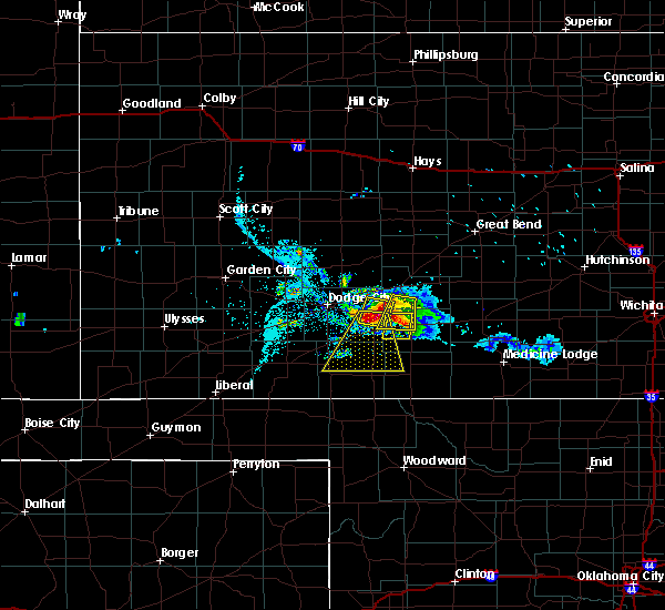
| 7/21/2023 12:46 AM CDT |
 At 1246 am cdt, severe thunderstorms were located along a line extending from near kingsdown to near clark state lake to 8 miles northwest of ashland to 6 miles northwest of englewood, moving southeast at 35 mph (radar indicated). Hazards include 70 mph wind gusts. Expect considerable tree damage. damage is likely to mobile homes, roofs, and outbuildings. these severe storms will be near, clark state lake around 1250 am cdt. Other locations in the path of these severe thunderstorms include ashland, bucklin, acres and sitka. At 1246 am cdt, severe thunderstorms were located along a line extending from near kingsdown to near clark state lake to 8 miles northwest of ashland to 6 miles northwest of englewood, moving southeast at 35 mph (radar indicated). Hazards include 70 mph wind gusts. Expect considerable tree damage. damage is likely to mobile homes, roofs, and outbuildings. these severe storms will be near, clark state lake around 1250 am cdt. Other locations in the path of these severe thunderstorms include ashland, bucklin, acres and sitka.
|
| 7/21/2023 12:34 AM CDT |
 At 1234 am cdt, severe thunderstorms were located along a line extending from near ford to 11 miles southeast of meade, moving east at 20 mph (radar indicated). Hazards include two inch hail and 60 mph wind gusts. People and animals outdoors will be injured. expect hail damage to roofs, siding, windows, and vehicles. expect wind damage to roofs, siding, and trees. severe thunderstorms will be near, ford around 1240 am cdt. other locations in the path of these severe thunderstorms include bucklin, mullinville and acres. thunderstorm damage threat, considerable hail threat, radar indicated max hail size, 2. 00 in wind threat, radar indicated max wind gust, 60 mph. At 1234 am cdt, severe thunderstorms were located along a line extending from near ford to 11 miles southeast of meade, moving east at 20 mph (radar indicated). Hazards include two inch hail and 60 mph wind gusts. People and animals outdoors will be injured. expect hail damage to roofs, siding, windows, and vehicles. expect wind damage to roofs, siding, and trees. severe thunderstorms will be near, ford around 1240 am cdt. other locations in the path of these severe thunderstorms include bucklin, mullinville and acres. thunderstorm damage threat, considerable hail threat, radar indicated max hail size, 2. 00 in wind threat, radar indicated max wind gust, 60 mph.
|
| 7/20/2023 6:56 PM CDT |
 At 656 pm cdt, a severe thunderstorm was located near windhorst, moving east at 30 mph. this is a destructive storm (radar indicated). Hazards include 80 mph wind gusts and nickel size hail. Flying debris will be dangerous to those caught without shelter. mobile homes will be heavily damaged. expect considerable damage to roofs, windows, and vehicles. extensive tree damage and power outages are likely. locations impacted include, mullinville, ford and windhorst. thunderstorm damage threat, destructive hail threat, radar indicated max hail size, 0. 88 in wind threat, radar indicated max wind gust, 80 mph. At 656 pm cdt, a severe thunderstorm was located near windhorst, moving east at 30 mph. this is a destructive storm (radar indicated). Hazards include 80 mph wind gusts and nickel size hail. Flying debris will be dangerous to those caught without shelter. mobile homes will be heavily damaged. expect considerable damage to roofs, windows, and vehicles. extensive tree damage and power outages are likely. locations impacted include, mullinville, ford and windhorst. thunderstorm damage threat, destructive hail threat, radar indicated max hail size, 0. 88 in wind threat, radar indicated max wind gust, 80 mph.
|
| 7/20/2023 6:50 PM CDT |
 At 649 pm cdt, a severe thunderstorm was located near windhorst, moving east at 30 mph. this is a destructive storm (radar indicated). Hazards include 80 mph wind gusts and nickel size hail. Flying debris will be dangerous to those caught without shelter. mobile homes will be heavily damaged. expect considerable damage to roofs, windows, and vehicles. extensive tree damage and power outages are likely. locations impacted include, mullinville. thunderstorm damage threat, destructive hail threat, radar indicated max hail size, 0. 88 in wind threat, radar indicated max wind gust, 80 mph. At 649 pm cdt, a severe thunderstorm was located near windhorst, moving east at 30 mph. this is a destructive storm (radar indicated). Hazards include 80 mph wind gusts and nickel size hail. Flying debris will be dangerous to those caught without shelter. mobile homes will be heavily damaged. expect considerable damage to roofs, windows, and vehicles. extensive tree damage and power outages are likely. locations impacted include, mullinville. thunderstorm damage threat, destructive hail threat, radar indicated max hail size, 0. 88 in wind threat, radar indicated max wind gust, 80 mph.
|
| 7/20/2023 6:26 PM CDT |
 At 626 pm cdt, a severe thunderstorm was located near wright, moving east at 25 mph (radar indicated). Hazards include 70 mph wind gusts and nickel size hail. Expect considerable tree damage. damage is likely to mobile homes, roofs, and outbuildings. this severe thunderstorm will be near, spearville around 630 pm cdt. ford around 635 pm cdt. windhorst around 645 pm cdt. other locations in the path of this severe thunderstorm include mullinville. thunderstorm damage threat, considerable hail threat, radar indicated max hail size, 0. 88 in wind threat, radar indicated max wind gust, 70 mph. At 626 pm cdt, a severe thunderstorm was located near wright, moving east at 25 mph (radar indicated). Hazards include 70 mph wind gusts and nickel size hail. Expect considerable tree damage. damage is likely to mobile homes, roofs, and outbuildings. this severe thunderstorm will be near, spearville around 630 pm cdt. ford around 635 pm cdt. windhorst around 645 pm cdt. other locations in the path of this severe thunderstorm include mullinville. thunderstorm damage threat, considerable hail threat, radar indicated max hail size, 0. 88 in wind threat, radar indicated max wind gust, 70 mph.
|
| 7/17/2023 6:40 PM CDT |
 At 640 pm cdt, a severe thunderstorm was located near bucklin, moving south at 15 mph (radar indicated). Hazards include tennis ball size hail and 70 mph wind gusts. People and animals outdoors will be injured. expect hail damage to roofs, siding, windows, and vehicles. expect considerable tree damage. wind damage is also likely to mobile homes, roofs, and outbuildings. Locations impacted include, bucklin, mullinville, ford, bloom, clark state lake and kingsdown. At 640 pm cdt, a severe thunderstorm was located near bucklin, moving south at 15 mph (radar indicated). Hazards include tennis ball size hail and 70 mph wind gusts. People and animals outdoors will be injured. expect hail damage to roofs, siding, windows, and vehicles. expect considerable tree damage. wind damage is also likely to mobile homes, roofs, and outbuildings. Locations impacted include, bucklin, mullinville, ford, bloom, clark state lake and kingsdown.
|
| 7/17/2023 6:24 PM CDT |
 At 623 pm cdt, a severe thunderstorm was located near bucklin, moving south at 15 mph. this is a destructive storm for kingsdown, bucklin, mullinville, ford, clark state lake, bloom, and adjacent areas (radar indicated). Hazards include 80 mph wind gusts and tennis ball size hail. Flying debris will be dangerous to those caught without shelter. mobile homes will be heavily damaged. expect considerable damage to roofs, windows, and vehicles. extensive tree damage and power outages are likely. This severe thunderstorm will remain over mainly rural areas of eastern ford, western kiowa, northwestern comanche, southwestern edwards and northern clark counties. At 623 pm cdt, a severe thunderstorm was located near bucklin, moving south at 15 mph. this is a destructive storm for kingsdown, bucklin, mullinville, ford, clark state lake, bloom, and adjacent areas (radar indicated). Hazards include 80 mph wind gusts and tennis ball size hail. Flying debris will be dangerous to those caught without shelter. mobile homes will be heavily damaged. expect considerable damage to roofs, windows, and vehicles. extensive tree damage and power outages are likely. This severe thunderstorm will remain over mainly rural areas of eastern ford, western kiowa, northwestern comanche, southwestern edwards and northern clark counties.
|
| 7/17/2023 6:15 PM CDT |
 At 614 pm cdt, a severe thunderstorm was located near bucklin, moving south at 15 mph. this is a destructive storm for kingsdown, bucklin, mullinville, ford, clark state lake, bloom, and adjacent areas (radar indicated). Hazards include 80 mph wind gusts and tennis ball size hail. Flying debris will be dangerous to those caught without shelter. mobile homes will be heavily damaged. expect considerable damage to roofs, windows, and vehicles. extensive tree damage and power outages are likely. this severe thunderstorm will be near, bucklin around 630 pm cdt. thunderstorm damage threat, destructive hail threat, radar indicated max hail size, 2. 50 in wind threat, radar indicated max wind gust, 80 mph. At 614 pm cdt, a severe thunderstorm was located near bucklin, moving south at 15 mph. this is a destructive storm for kingsdown, bucklin, mullinville, ford, clark state lake, bloom, and adjacent areas (radar indicated). Hazards include 80 mph wind gusts and tennis ball size hail. Flying debris will be dangerous to those caught without shelter. mobile homes will be heavily damaged. expect considerable damage to roofs, windows, and vehicles. extensive tree damage and power outages are likely. this severe thunderstorm will be near, bucklin around 630 pm cdt. thunderstorm damage threat, destructive hail threat, radar indicated max hail size, 2. 50 in wind threat, radar indicated max wind gust, 80 mph.
|
| 7/17/2023 5:55 PM CDT | Building structure damage in ford county KS, 0.5 miles SE of Ford, KS |
| 7/17/2023 5:37 PM CDT |
 At 536 pm cdt, a severe thunderstorm was located 7 miles east of windhorst, moving south at 15 mph. this is a destructive storm for kingsdown, bucklin, mullinville, greensburg, and adjacent areas (radar indicated). Hazards include baseball size hail and 70 mph wind gusts. People and animals outdoors will be severely injured. Expect shattered windows, extensive damage to roofs, siding, and vehicles. At 536 pm cdt, a severe thunderstorm was located 7 miles east of windhorst, moving south at 15 mph. this is a destructive storm for kingsdown, bucklin, mullinville, greensburg, and adjacent areas (radar indicated). Hazards include baseball size hail and 70 mph wind gusts. People and animals outdoors will be severely injured. Expect shattered windows, extensive damage to roofs, siding, and vehicles.
|
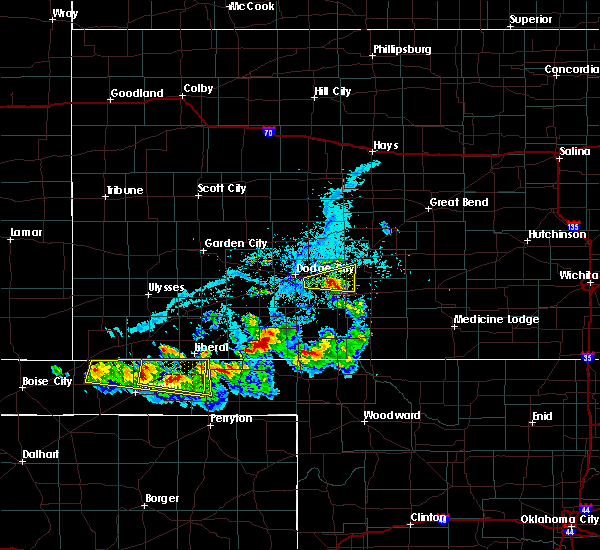
| 7/16/2023 9:20 PM CDT | Ping Pong Ball sized hail reported 2.9 miles NW of Ford, KS |
| 7/16/2023 9:15 PM CDT |
 At 915 pm cdt, a severe thunderstorm was located near bucklin, moving south at 30 mph (public). Hazards include two inch hail and 60 mph wind gusts. People and animals outdoors will be injured. expect hail damage to roofs, siding, windows, and vehicles. expect wind damage to roofs, siding, and trees. this severe thunderstorm will remain over mainly rural areas of southeastern ford, southwestern kiowa, northern comanche and northeastern clark counties. thunderstorm damage threat, considerable hail threat, observed max hail size, 2. 00 in wind threat, radar indicated max wind gust, 60 mph. At 915 pm cdt, a severe thunderstorm was located near bucklin, moving south at 30 mph (public). Hazards include two inch hail and 60 mph wind gusts. People and animals outdoors will be injured. expect hail damage to roofs, siding, windows, and vehicles. expect wind damage to roofs, siding, and trees. this severe thunderstorm will remain over mainly rural areas of southeastern ford, southwestern kiowa, northern comanche and northeastern clark counties. thunderstorm damage threat, considerable hail threat, observed max hail size, 2. 00 in wind threat, radar indicated max wind gust, 60 mph.
|
| 7/16/2023 9:13 PM CDT | Quarter sized hail reported 2.9 miles NW of Ford, KS |
| 7/16/2023 9:07 PM CDT | Hen Egg sized hail reported 1.9 miles NNW of Ford, KS, report received from social media with pictures. |
| 7/16/2023 8:58 PM CDT |
 At 858 pm cdt, a severe thunderstorm was located near bucklin, moving south at 30 mph (radar indicated). Hazards include ping pong ball size hail and 60 mph wind gusts. People and animals outdoors will be injured. expect hail damage to roofs, siding, windows, and vehicles. expect wind damage to roofs, siding, and trees. this severe thunderstorm will be near, bucklin and kingsdown around 910 pm cdt. hail threat, radar indicated max hail size, 1. 50 in wind threat, radar indicated max wind gust, 60 mph. At 858 pm cdt, a severe thunderstorm was located near bucklin, moving south at 30 mph (radar indicated). Hazards include ping pong ball size hail and 60 mph wind gusts. People and animals outdoors will be injured. expect hail damage to roofs, siding, windows, and vehicles. expect wind damage to roofs, siding, and trees. this severe thunderstorm will be near, bucklin and kingsdown around 910 pm cdt. hail threat, radar indicated max hail size, 1. 50 in wind threat, radar indicated max wind gust, 60 mph.
|
| 6/27/2023 9:11 PM CDT |
 At 910 pm cdt, severe thunderstorms were located along a line extending from 13 miles northwest of jetmore to near bucklin, moving northeast at 50 mph (radar indicated). Hazards include 70 mph wind gusts. Expect considerable tree damage. damage is likely to mobile homes, roofs, and outbuildings. thunderstorm damage threat, considerable hail threat, radar indicated max hail size, <. 75 in wind threat, radar indicated max wind gust, 70 mph. At 910 pm cdt, severe thunderstorms were located along a line extending from 13 miles northwest of jetmore to near bucklin, moving northeast at 50 mph (radar indicated). Hazards include 70 mph wind gusts. Expect considerable tree damage. damage is likely to mobile homes, roofs, and outbuildings. thunderstorm damage threat, considerable hail threat, radar indicated max hail size, <. 75 in wind threat, radar indicated max wind gust, 70 mph.
|
| 6/27/2023 9:03 PM CDT |
 At 903 pm cdt, severe thunderstorms were located along a line extending from near wright to 6 miles south of sitka, moving northeast at 35 mph (radar indicated). Hazards include 70 mph wind gusts. Expect considerable tree damage. damage is likely to mobile homes, roofs, and outbuildings. locations impacted include, dodge city, ashland, coldwater, bucklin, spearville, minneola, protection, mullinville, ford, offerle, bloom, englewood, sitka, clark state lake, kingsdown, howell, wright, lake coldwater, bellefont and windhorst. thunderstorm damage threat, considerable hail threat, radar indicated max hail size, <. 75 in wind threat, radar indicated max wind gust, 70 mph. At 903 pm cdt, severe thunderstorms were located along a line extending from near wright to 6 miles south of sitka, moving northeast at 35 mph (radar indicated). Hazards include 70 mph wind gusts. Expect considerable tree damage. damage is likely to mobile homes, roofs, and outbuildings. locations impacted include, dodge city, ashland, coldwater, bucklin, spearville, minneola, protection, mullinville, ford, offerle, bloom, englewood, sitka, clark state lake, kingsdown, howell, wright, lake coldwater, bellefont and windhorst. thunderstorm damage threat, considerable hail threat, radar indicated max hail size, <. 75 in wind threat, radar indicated max wind gust, 70 mph.
|
| 6/27/2023 8:47 PM CDT | Mesonet station up835 3.0 w kingsdown (upr in ford county KS, 9.2 miles NNE of Ford, KS |
| 6/27/2023 8:38 PM CDT |
 At 838 pm cdt, severe thunderstorms were located along a line extending from 6 miles east of ensign to near englewood, moving northeast at 35 mph (radar indicated). Hazards include 70 mph wind gusts. Expect considerable tree damage. Damage is likely to mobile homes, roofs, and outbuildings. At 838 pm cdt, severe thunderstorms were located along a line extending from 6 miles east of ensign to near englewood, moving northeast at 35 mph (radar indicated). Hazards include 70 mph wind gusts. Expect considerable tree damage. Damage is likely to mobile homes, roofs, and outbuildings.
|
| 6/17/2023 9:37 PM CDT | Reported through social medi in ford county KS, 11.4 miles N of Ford, KS |
| 6/17/2023 8:37 PM CDT |
 At 837 pm cdt, severe thunderstorms were located along a line extending from 9 miles northwest of hanston to near offerle to near bucklin, moving east at 40 mph (radar indicated). Hazards include 70 mph wind gusts. Expect considerable tree damage. damage is likely to mobile homes, roofs, and outbuildings. Locations impacted include, gray, kinsley, jetmore, bucklin, spearville, mullinville, burdett, ford, hanston, offerle, rozel, bloom, kingsdown, bellefont and windhorst. At 837 pm cdt, severe thunderstorms were located along a line extending from 9 miles northwest of hanston to near offerle to near bucklin, moving east at 40 mph (radar indicated). Hazards include 70 mph wind gusts. Expect considerable tree damage. damage is likely to mobile homes, roofs, and outbuildings. Locations impacted include, gray, kinsley, jetmore, bucklin, spearville, mullinville, burdett, ford, hanston, offerle, rozel, bloom, kingsdown, bellefont and windhorst.
|
| 6/17/2023 8:20 PM CDT | Tree down... reported through social medi in ford county KS, 0.5 miles SE of Ford, KS |
| 6/15/2023 5:56 PM CDT |
 At 555 pm cdt, severe thunderstorms were located along a line extending from 7 miles south of ft. dodge to 10 miles northwest of ashland to near englewood, moving east at 25 mph (radar indicated). Hazards include 70 mph wind gusts and nickel size hail. Expect considerable tree damage. damage is likely to mobile homes, roofs, and outbuildings. Locations impacted include, ashland, bucklin, minneola, ford, bloom, englewood, sitka, clark state lake, kingsdown and acres. At 555 pm cdt, severe thunderstorms were located along a line extending from 7 miles south of ft. dodge to 10 miles northwest of ashland to near englewood, moving east at 25 mph (radar indicated). Hazards include 70 mph wind gusts and nickel size hail. Expect considerable tree damage. damage is likely to mobile homes, roofs, and outbuildings. Locations impacted include, ashland, bucklin, minneola, ford, bloom, englewood, sitka, clark state lake, kingsdown and acres.
|
| 6/15/2023 5:53 PM CDT |
 At 553 pm cdt, severe thunderstorms were located along a line extending from near ford to 11 miles north of buffalo, moving east at 25 mph (radar indicated). Hazards include 70 mph wind gusts and half dollar size hail. Hail damage to vehicles is expected. expect considerable tree damage. wind damage is also likely to mobile homes, roofs, and outbuildings. severe thunderstorms will be near, bucklin around 600 pm cdt. other locations in the path of these severe thunderstorms include mullinville, buttermilk and greensburg. thunderstorm damage threat, considerable hail threat, radar indicated max hail size, 1. 25 in wind threat, radar indicated max wind gust, 70 mph. At 553 pm cdt, severe thunderstorms were located along a line extending from near ford to 11 miles north of buffalo, moving east at 25 mph (radar indicated). Hazards include 70 mph wind gusts and half dollar size hail. Hail damage to vehicles is expected. expect considerable tree damage. wind damage is also likely to mobile homes, roofs, and outbuildings. severe thunderstorms will be near, bucklin around 600 pm cdt. other locations in the path of these severe thunderstorms include mullinville, buttermilk and greensburg. thunderstorm damage threat, considerable hail threat, radar indicated max hail size, 1. 25 in wind threat, radar indicated max wind gust, 70 mph.
|
| 6/15/2023 5:33 PM CDT |
 At 532 pm cdt, severe thunderstorms were located along a line extending from near ensign to near fowler to 10 miles northwest of knowles, moving east at 30 mph (radar indicated). Hazards include 70 mph wind gusts and nickel size hail. Expect considerable tree damage. damage is likely to mobile homes, roofs, and outbuildings. These severe thunderstorms will remain over mainly rural areas of southern ford, eastern meade and clark counties. At 532 pm cdt, severe thunderstorms were located along a line extending from near ensign to near fowler to 10 miles northwest of knowles, moving east at 30 mph (radar indicated). Hazards include 70 mph wind gusts and nickel size hail. Expect considerable tree damage. damage is likely to mobile homes, roofs, and outbuildings. These severe thunderstorms will remain over mainly rural areas of southern ford, eastern meade and clark counties.
|
| 5/30/2023 10:21 PM CDT |
 The severe thunderstorm warning for northeastern ford, southeastern ness, hodgeman, western pawnee and western edwards counties will expire at 1030 pm cdt, the storms which prompted the warning have weakened below severe limits, and no longer pose an immediate threat to life or property. therefore, the warning will be allowed to expire. however gusty winds are still possible with these thunderstorms. a severe thunderstorm watch remains in effect until 1100 pm cdt for south central, southwestern and west central kansas. The severe thunderstorm warning for northeastern ford, southeastern ness, hodgeman, western pawnee and western edwards counties will expire at 1030 pm cdt, the storms which prompted the warning have weakened below severe limits, and no longer pose an immediate threat to life or property. therefore, the warning will be allowed to expire. however gusty winds are still possible with these thunderstorms. a severe thunderstorm watch remains in effect until 1100 pm cdt for south central, southwestern and west central kansas.
|
| 5/30/2023 10:05 PM CDT |
 At 1004 pm cdt, severe thunderstorms were located along a line extending from 6 miles north of gray to 6 miles southeast of jetmore to near dodge city, moving southeast at 40 mph (radar indicated). Hazards include 60 mph wind gusts and penny size hail. Expect damage to roofs, siding, and trees. locations impacted include, gray, spearville, burdett, rozel, bellefont, offerle, ford, sanford, kinsley, windhorst, garfield and frizell. hail threat, radar indicated max hail size, 0. 75 in wind threat, radar indicated max wind gust, 60 mph. At 1004 pm cdt, severe thunderstorms were located along a line extending from 6 miles north of gray to 6 miles southeast of jetmore to near dodge city, moving southeast at 40 mph (radar indicated). Hazards include 60 mph wind gusts and penny size hail. Expect damage to roofs, siding, and trees. locations impacted include, gray, spearville, burdett, rozel, bellefont, offerle, ford, sanford, kinsley, windhorst, garfield and frizell. hail threat, radar indicated max hail size, 0. 75 in wind threat, radar indicated max wind gust, 60 mph.
|
| 5/30/2023 9:46 PM CDT |
 At 945 pm cdt, severe thunderstorms were located along a line extending from 10 miles south of ness city to 8 miles west of jetmore to 8 miles northeast of cimarron, moving southeast at 40 mph (radar indicated). Hazards include 60 mph wind gusts and penny size hail. Expect damage to roofs, siding, and trees. severe thunderstorms will be near, jetmore around 1000 pm cdt. other locations in the path of these severe thunderstorms include gray, dodge city, spearville, burdett, wright, ft. dodge, rozel, bellefont, kinsley, ford, offerle and sanford. hail threat, radar indicated max hail size, 0. 75 in wind threat, radar indicated max wind gust, 60 mph. At 945 pm cdt, severe thunderstorms were located along a line extending from 10 miles south of ness city to 8 miles west of jetmore to 8 miles northeast of cimarron, moving southeast at 40 mph (radar indicated). Hazards include 60 mph wind gusts and penny size hail. Expect damage to roofs, siding, and trees. severe thunderstorms will be near, jetmore around 1000 pm cdt. other locations in the path of these severe thunderstorms include gray, dodge city, spearville, burdett, wright, ft. dodge, rozel, bellefont, kinsley, ford, offerle and sanford. hail threat, radar indicated max hail size, 0. 75 in wind threat, radar indicated max wind gust, 60 mph.
|
| 2/26/2023 6:30 PM CST |
 At 629 pm cst, severe thunderstorms were located along a line extending from near rozel to near offerle to kingsdown, moving northeast at 70 mph (radar indicated). Hazards include 60 mph wind gusts and penny size hail. Expect damage to roofs, siding, and trees. Locations impacted include, gray, kinsley, bucklin, greensburg, haviland, lewis, mullinville, ford, offerle, garfield, rozel, fellsburg, kingsdown, sanford, frizell, bellefont, windhorst and centerview. At 629 pm cst, severe thunderstorms were located along a line extending from near rozel to near offerle to kingsdown, moving northeast at 70 mph (radar indicated). Hazards include 60 mph wind gusts and penny size hail. Expect damage to roofs, siding, and trees. Locations impacted include, gray, kinsley, bucklin, greensburg, haviland, lewis, mullinville, ford, offerle, garfield, rozel, fellsburg, kingsdown, sanford, frizell, bellefont, windhorst and centerview.
|
| 2/26/2023 6:19 PM CST |
 At 618 pm cst, severe thunderstorms were located along a line extending from near hanston to 8 miles west of ashland, moving east at 45 mph (radar indicated). Hazards include 70 mph wind gusts and half dollar size hail. Hail damage to vehicles is expected. expect considerable tree damage. wind damage is also likely to mobile homes, roofs, and outbuildings. Locations impacted include, gray, hanston, rozel, sanford, coldwater, frizell and lake coldwater. At 618 pm cst, severe thunderstorms were located along a line extending from near hanston to 8 miles west of ashland, moving east at 45 mph (radar indicated). Hazards include 70 mph wind gusts and half dollar size hail. Hail damage to vehicles is expected. expect considerable tree damage. wind damage is also likely to mobile homes, roofs, and outbuildings. Locations impacted include, gray, hanston, rozel, sanford, coldwater, frizell and lake coldwater.
|
| 2/26/2023 5:57 PM CST |
 At 555 pm cst, severe thunderstorms were located along a line extending from 6 miles west of jetmore to 12 miles southeast of meade, moving east at 45 mph (radar indicated). Hazards include 70 mph wind gusts and half dollar size hail. Hail damage to vehicles is expected. expect considerable tree damage. wind damage is also likely to mobile homes, roofs, and outbuildings. severe thunderstorms will be near, jetmore around 605 pm cst. Other locations in the path of these severe thunderstorms include hanston, gray, ashland, sitka, rozel, protection and sanford. At 555 pm cst, severe thunderstorms were located along a line extending from 6 miles west of jetmore to 12 miles southeast of meade, moving east at 45 mph (radar indicated). Hazards include 70 mph wind gusts and half dollar size hail. Hail damage to vehicles is expected. expect considerable tree damage. wind damage is also likely to mobile homes, roofs, and outbuildings. severe thunderstorms will be near, jetmore around 605 pm cst. Other locations in the path of these severe thunderstorms include hanston, gray, ashland, sitka, rozel, protection and sanford.
|
| 6/22/2022 7:56 PM CDT |
 At 756 pm cdt, a severe thunderstorm was located near bucklin, moving northeast at 20 mph (radar indicated). Hazards include 60 mph wind gusts and half dollar size hail. Hail damage to vehicles is expected. expect wind damage to roofs, siding, and trees. this severe thunderstorm will be near, windhorst around 810 pm cdt. other locations in the path of this severe thunderstorm include offerle. hail threat, radar indicated max hail size, 1. 25 in wind threat, radar indicated max wind gust, 60 mph. At 756 pm cdt, a severe thunderstorm was located near bucklin, moving northeast at 20 mph (radar indicated). Hazards include 60 mph wind gusts and half dollar size hail. Hail damage to vehicles is expected. expect wind damage to roofs, siding, and trees. this severe thunderstorm will be near, windhorst around 810 pm cdt. other locations in the path of this severe thunderstorm include offerle. hail threat, radar indicated max hail size, 1. 25 in wind threat, radar indicated max wind gust, 60 mph.
|
| 6/6/2022 8:48 PM CDT |
 At 848 pm cdt, a severe thunderstorm was located very near ft. dodge, moving east at 40 mph (radar indicated). Hazards include two inch hail and 60 mph wind gusts. People and animals outdoors will be injured. expect hail damage to roofs, siding, windows, and vehicles. expect wind damage to roofs, siding, and trees. locations impacted include, ford and windhorst. thunderstorm damage threat, considerable hail threat, radar indicated max hail size, 2. 00 in wind threat, radar indicated max wind gust, 60 mph. At 848 pm cdt, a severe thunderstorm was located very near ft. dodge, moving east at 40 mph (radar indicated). Hazards include two inch hail and 60 mph wind gusts. People and animals outdoors will be injured. expect hail damage to roofs, siding, windows, and vehicles. expect wind damage to roofs, siding, and trees. locations impacted include, ford and windhorst. thunderstorm damage threat, considerable hail threat, radar indicated max hail size, 2. 00 in wind threat, radar indicated max wind gust, 60 mph.
|
| 6/6/2022 8:37 PM CDT | At 837 pm cdt, a severe thunderstorm was located near dodge city, moving east at 40 mph (radar indicated). Hazards include 60 mph wind gusts. Expect damage to roofs, siding, and trees. this severe thunderstorm will be near, ft. dodge around 850 pm cdt. wright around 855 pm cdt. other locations in the path of this severe thunderstorm include ford, windhorst and bucklin. hail threat, radar indicated max hail size, <. 75 in wind threat, radar indicated max wind gust, 60 mph. |
| 5/18/2022 11:15 PM CDT |
 At 1115 pm cdt, severe thunderstorms were located along a line extending from 7 miles north of wright to near bloom to near knowles, moving east at 30 mph (radar indicated). Hazards include 70 mph wind gusts. Expect considerable tree damage. damage is likely to mobile homes, roofs, and outbuildings. locations impacted include, clark state lake, kingsdown, spearville, bellefont and windhorst. thunderstorm damage threat, considerable hail threat, radar indicated max hail size, <. 75 in wind threat, radar indicated max wind gust, 70 mph. At 1115 pm cdt, severe thunderstorms were located along a line extending from 7 miles north of wright to near bloom to near knowles, moving east at 30 mph (radar indicated). Hazards include 70 mph wind gusts. Expect considerable tree damage. damage is likely to mobile homes, roofs, and outbuildings. locations impacted include, clark state lake, kingsdown, spearville, bellefont and windhorst. thunderstorm damage threat, considerable hail threat, radar indicated max hail size, <. 75 in wind threat, radar indicated max wind gust, 70 mph.
|
| 5/18/2022 10:42 PM CDT |
 At 1041 pm cdt, severe thunderstorms were located along a line extending from 9 miles southeast of kalvesta to 7 miles north of fowler to 7 miles northeast of forgan, moving east at 30 mph (radar indicated). Hazards include 70 mph wind gusts. Expect considerable tree damage. damage is likely to mobile homes, roofs, and outbuildings. severe thunderstorms will be near, fowler around 1045 pm cdt. minneola around 1100 pm cdt. other locations in the path of these severe thunderstorms include dodge city, bloom, kingsdown, wright, clark state lake, spearville and bellefont. thunderstorm damage threat, considerable hail threat, radar indicated max hail size, <. 75 in wind threat, radar indicated max wind gust, 70 mph. At 1041 pm cdt, severe thunderstorms were located along a line extending from 9 miles southeast of kalvesta to 7 miles north of fowler to 7 miles northeast of forgan, moving east at 30 mph (radar indicated). Hazards include 70 mph wind gusts. Expect considerable tree damage. damage is likely to mobile homes, roofs, and outbuildings. severe thunderstorms will be near, fowler around 1045 pm cdt. minneola around 1100 pm cdt. other locations in the path of these severe thunderstorms include dodge city, bloom, kingsdown, wright, clark state lake, spearville and bellefont. thunderstorm damage threat, considerable hail threat, radar indicated max hail size, <. 75 in wind threat, radar indicated max wind gust, 70 mph.
|
| 5/2/2022 3:07 PM CDT |
 The severe thunderstorm warning for southeastern ford county will expire at 315 pm cdt, the storm which prompted the warning has moved out of the area. therefore, the warning will be allowed to expire. a tornado watch remains in effect until 1000 pm cdt for southwestern kansas. The severe thunderstorm warning for southeastern ford county will expire at 315 pm cdt, the storm which prompted the warning has moved out of the area. therefore, the warning will be allowed to expire. a tornado watch remains in effect until 1000 pm cdt for southwestern kansas.
|
| 5/2/2022 2:52 PM CDT |
 At 251 pm cdt, a severe thunderstorm was located near kingsdown, moving east at 25 mph (radar indicated). Hazards include golf ball size hail and 60 mph wind gusts. People and animals outdoors will be injured. expect hail damage to roofs, siding, windows, and vehicles. expect wind damage to roofs, siding, and trees. locations impacted include, bucklin, ford and kingsdown. thunderstorm damage threat, considerable hail threat, radar indicated max hail size, 1. 75 in wind threat, radar indicated max wind gust, 60 mph. At 251 pm cdt, a severe thunderstorm was located near kingsdown, moving east at 25 mph (radar indicated). Hazards include golf ball size hail and 60 mph wind gusts. People and animals outdoors will be injured. expect hail damage to roofs, siding, windows, and vehicles. expect wind damage to roofs, siding, and trees. locations impacted include, bucklin, ford and kingsdown. thunderstorm damage threat, considerable hail threat, radar indicated max hail size, 1. 75 in wind threat, radar indicated max wind gust, 60 mph.
|
| 5/2/2022 2:50 PM CDT | Quarter sized hail reported 7.9 miles N of Ford, KS |
| 5/2/2022 2:35 PM CDT |
 At 235 pm cdt, a severe thunderstorm was located near bloom, moving east at 25 mph (radar indicated). Hazards include golf ball size hail and 60 mph wind gusts. People and animals outdoors will be injured. expect hail damage to roofs, siding, windows, and vehicles. expect wind damage to roofs, siding, and trees. locations impacted include, ford, kingsdown and bucklin. thunderstorm damage threat, considerable hail threat, radar indicated max hail size, 1. 75 in wind threat, radar indicated max wind gust, 60 mph. At 235 pm cdt, a severe thunderstorm was located near bloom, moving east at 25 mph (radar indicated). Hazards include golf ball size hail and 60 mph wind gusts. People and animals outdoors will be injured. expect hail damage to roofs, siding, windows, and vehicles. expect wind damage to roofs, siding, and trees. locations impacted include, ford, kingsdown and bucklin. thunderstorm damage threat, considerable hail threat, radar indicated max hail size, 1. 75 in wind threat, radar indicated max wind gust, 60 mph.
|
| 5/2/2022 2:26 PM CDT |
 At 226 pm cdt, a severe thunderstorm was located 7 miles north of bloom, moving east at 25 mph (radar indicated). Hazards include 60 mph wind gusts and quarter size hail. Hail damage to vehicles is expected. expect wind damage to roofs, siding, and trees. this severe thunderstorm will be near, bloom around 235 pm cdt. other locations in the path of this severe thunderstorm include ford, kingsdown and bucklin. hail threat, radar indicated max hail size, 1. 00 in wind threat, radar indicated max wind gust, 60 mph. At 226 pm cdt, a severe thunderstorm was located 7 miles north of bloom, moving east at 25 mph (radar indicated). Hazards include 60 mph wind gusts and quarter size hail. Hail damage to vehicles is expected. expect wind damage to roofs, siding, and trees. this severe thunderstorm will be near, bloom around 235 pm cdt. other locations in the path of this severe thunderstorm include ford, kingsdown and bucklin. hail threat, radar indicated max hail size, 1. 00 in wind threat, radar indicated max wind gust, 60 mph.
|
| 4/27/2022 7:54 PM CDT |
 At 754 pm cdt, severe thunderstorms were located along a line extending from 6 miles south of ft. dodge to near clark state lake to 10 miles northwest of acres, moving east at 35 mph (radar indicated). Hazards include 70 mph wind gusts and quarter size hail. Hail damage to vehicles is expected. expect considerable tree damage. wind damage is also likely to mobile homes, roofs, and outbuildings. severe thunderstorms will be near, clark state lake and kingsdown around 800 pm cdt. acres around 810 pm cdt. other locations in the path of these severe thunderstorms include ford, ashland, bucklin and sitka. thunderstorm damage threat, considerable hail threat, radar indicated max hail size, 1. 00 in wind threat, radar indicated max wind gust, 70 mph. At 754 pm cdt, severe thunderstorms were located along a line extending from 6 miles south of ft. dodge to near clark state lake to 10 miles northwest of acres, moving east at 35 mph (radar indicated). Hazards include 70 mph wind gusts and quarter size hail. Hail damage to vehicles is expected. expect considerable tree damage. wind damage is also likely to mobile homes, roofs, and outbuildings. severe thunderstorms will be near, clark state lake and kingsdown around 800 pm cdt. acres around 810 pm cdt. other locations in the path of these severe thunderstorms include ford, ashland, bucklin and sitka. thunderstorm damage threat, considerable hail threat, radar indicated max hail size, 1. 00 in wind threat, radar indicated max wind gust, 70 mph.
|
| 4/23/2022 3:32 AM CDT |
 At 332 am cdt, severe thunderstorms were located along a line extending from near windhorst to near englewood, moving east at 45 mph (radar indicated). Hazards include 60 mph wind gusts. Expect damage to roofs, siding, and trees. locations impacted include, ashland, sitka and protection. hail threat, radar indicated max hail size, <. 75 in wind threat, radar indicated max wind gust, 60 mph. At 332 am cdt, severe thunderstorms were located along a line extending from near windhorst to near englewood, moving east at 45 mph (radar indicated). Hazards include 60 mph wind gusts. Expect damage to roofs, siding, and trees. locations impacted include, ashland, sitka and protection. hail threat, radar indicated max hail size, <. 75 in wind threat, radar indicated max wind gust, 60 mph.
|
| 4/23/2022 2:42 AM CDT |
 At 241 am cdt, severe thunderstorms were located along a line extending from near the haggard elev to 9 miles southeast of hayne, moving east at 45 mph (radar indicated). Hazards include 60 mph wind gusts. Expect damage to roofs, siding, and trees. severe thunderstorms will be near, the haggard elev around 245 am cdt. ensign around 250 am cdt. meade state park around 300 am cdt. other locations in the path of these severe thunderstorms include ford, englewood, acres, ashland and sitka. hail threat, radar indicated max hail size, <. 75 in wind threat, radar indicated max wind gust, 60 mph. At 241 am cdt, severe thunderstorms were located along a line extending from near the haggard elev to 9 miles southeast of hayne, moving east at 45 mph (radar indicated). Hazards include 60 mph wind gusts. Expect damage to roofs, siding, and trees. severe thunderstorms will be near, the haggard elev around 245 am cdt. ensign around 250 am cdt. meade state park around 300 am cdt. other locations in the path of these severe thunderstorms include ford, englewood, acres, ashland and sitka. hail threat, radar indicated max hail size, <. 75 in wind threat, radar indicated max wind gust, 60 mph.
|
| 10/12/2021 10:51 PM CDT |
 At 1050 pm cdt, severe thunderstorms were located along a line extending from near offerle to near windhorst to near kingsdown, moving east at 60 mph (radar indicated). Hazards include 70 mph wind gusts and penny size hail. Expect considerable tree damage. damage is likely to mobile homes, roofs, and outbuildings. severe thunderstorms will be near, offerle around 1055 pm cdt. kinsley around 1100 pm cdt. lewis and mullinville around 1110 pm cdt. Other locations in the path of these severe thunderstorms include centerview, greensburg, belpre, fellsburg and trousdale. At 1050 pm cdt, severe thunderstorms were located along a line extending from near offerle to near windhorst to near kingsdown, moving east at 60 mph (radar indicated). Hazards include 70 mph wind gusts and penny size hail. Expect considerable tree damage. damage is likely to mobile homes, roofs, and outbuildings. severe thunderstorms will be near, offerle around 1055 pm cdt. kinsley around 1100 pm cdt. lewis and mullinville around 1110 pm cdt. Other locations in the path of these severe thunderstorms include centerview, greensburg, belpre, fellsburg and trousdale.
|
| 10/12/2021 10:20 PM CDT |
 At 1019 pm cdt, severe thunderstorms were located along a line extending from 13 miles north of jetmore to 8 miles east of ensign to 7 miles northeast of forgan, moving northeast at 60 mph (radar indicated). Hazards include 70 mph wind gusts and quarter size hail. Hail damage to vehicles is expected. expect considerable tree damage. wind damage is also likely to mobile homes, roofs, and outbuildings. severe thunderstorms will be near, dodge city and ft. dodge around 1030 pm cdt. wright around 1035 pm cdt. Other locations in the path of these severe thunderstorms include ford, spearville, windhorst, bellefont and ashland. At 1019 pm cdt, severe thunderstorms were located along a line extending from 13 miles north of jetmore to 8 miles east of ensign to 7 miles northeast of forgan, moving northeast at 60 mph (radar indicated). Hazards include 70 mph wind gusts and quarter size hail. Hail damage to vehicles is expected. expect considerable tree damage. wind damage is also likely to mobile homes, roofs, and outbuildings. severe thunderstorms will be near, dodge city and ft. dodge around 1030 pm cdt. wright around 1035 pm cdt. Other locations in the path of these severe thunderstorms include ford, spearville, windhorst, bellefont and ashland.
|
| 8/7/2021 8:55 PM CDT |
 At 855 pm cdt, a severe thunderstorm was located near ford, moving east at 40 mph (radar indicated). Hazards include 60 mph wind gusts and penny size hail. Expect damage to roofs, siding, and trees. locations impacted include, windhorst. hail threat, radar indicated max hail size, 0. 75 in wind threat, radar indicated max wind gust, 60 mph. At 855 pm cdt, a severe thunderstorm was located near ford, moving east at 40 mph (radar indicated). Hazards include 60 mph wind gusts and penny size hail. Expect damage to roofs, siding, and trees. locations impacted include, windhorst. hail threat, radar indicated max hail size, 0. 75 in wind threat, radar indicated max wind gust, 60 mph.
|
| 8/7/2021 8:30 PM CDT |
 At 830 pm cdt, a severe thunderstorm was located 7 miles southwest of dodge city, moving east at 40 mph (radar indicated). Hazards include 60 mph wind gusts and half dollar size hail. Hail damage to vehicles is expected. expect wind damage to roofs, siding, and trees. this severe thunderstorm will be near, dodge city around 840 pm cdt. ft. dodge around 845 pm cdt. wright around 850 pm cdt. other locations in the path of this severe thunderstorm include ford and windhorst. hail threat, radar indicated max hail size, 1. 25 in wind threat, radar indicated max wind gust, 60 mph. At 830 pm cdt, a severe thunderstorm was located 7 miles southwest of dodge city, moving east at 40 mph (radar indicated). Hazards include 60 mph wind gusts and half dollar size hail. Hail damage to vehicles is expected. expect wind damage to roofs, siding, and trees. this severe thunderstorm will be near, dodge city around 840 pm cdt. ft. dodge around 845 pm cdt. wright around 850 pm cdt. other locations in the path of this severe thunderstorm include ford and windhorst. hail threat, radar indicated max hail size, 1. 25 in wind threat, radar indicated max wind gust, 60 mph.
|
| 7/25/2021 1:55 PM CDT |
 At 154 pm cdt, a severe thunderstorm was located near mullinville, moving east at 20 mph (radar indicated). Hazards include 60 mph wind gusts. Expect damage to roofs, siding, and trees. This severe storm will be near, mullinville around 210 pm cdt. At 154 pm cdt, a severe thunderstorm was located near mullinville, moving east at 20 mph (radar indicated). Hazards include 60 mph wind gusts. Expect damage to roofs, siding, and trees. This severe storm will be near, mullinville around 210 pm cdt.
|
| 7/25/2021 1:40 PM CDT |
 At 140 pm cdt, a severe thunderstorm was located near windhorst, moving southeast at 20 mph (radar indicated). Hazards include 60 mph wind gusts. expect damage to roofs, siding, and trees At 140 pm cdt, a severe thunderstorm was located near windhorst, moving southeast at 20 mph (radar indicated). Hazards include 60 mph wind gusts. expect damage to roofs, siding, and trees
|
| 6/25/2021 7:22 PM CDT |
 At 720 pm cdt, a severe thunderstorm was located very near minneola, moving north at 35 mph (radar indicated). Hazards include 60 mph wind gusts and quarter size hail. Hail damage to vehicles is expected. expect wind damage to roofs, siding, and trees. this severe thunderstorm will be near, bloom around 725 pm cdt. other locations in the path of this severe thunderstorm include ft. Dodge and dodge city. At 720 pm cdt, a severe thunderstorm was located very near minneola, moving north at 35 mph (radar indicated). Hazards include 60 mph wind gusts and quarter size hail. Hail damage to vehicles is expected. expect wind damage to roofs, siding, and trees. this severe thunderstorm will be near, bloom around 725 pm cdt. other locations in the path of this severe thunderstorm include ft. Dodge and dodge city.
|
| 5/26/2021 7:41 PM CDT |
 At 741 pm cdt, a severe thunderstorm was located near howell, moving northeast at 35 mph (radar indicated). Hazards include 60 mph wind gusts and quarter size hail. Hail damage to vehicles is expected. expect wind damage to roofs, siding, and trees. locations impacted include, dodge city, ford, wright, ft. Dodge and howell. At 741 pm cdt, a severe thunderstorm was located near howell, moving northeast at 35 mph (radar indicated). Hazards include 60 mph wind gusts and quarter size hail. Hail damage to vehicles is expected. expect wind damage to roofs, siding, and trees. locations impacted include, dodge city, ford, wright, ft. Dodge and howell.
|
| 5/26/2021 7:30 PM CDT |
 At 730 pm cdt, a severe thunderstorm was located near ensign, moving northeast at 25 mph (radar indicated). Hazards include golf ball size hail and 60 mph wind gusts. People and animals outdoors will be injured. expect hail damage to roofs, siding, windows, and vehicles. Expect wind damage to roofs, siding, and trees. At 730 pm cdt, a severe thunderstorm was located near ensign, moving northeast at 25 mph (radar indicated). Hazards include golf ball size hail and 60 mph wind gusts. People and animals outdoors will be injured. expect hail damage to roofs, siding, windows, and vehicles. Expect wind damage to roofs, siding, and trees.
|
| 5/5/2021 6:03 PM CDT |
 At 603 pm cdt, severe thunderstorms were located along a line extending from 6 miles east of ford to near kingsdown to 6 miles east of fowler, moving southeast at 40 mph (radar indicated). Hazards include 60 mph wind gusts and quarter size hail. Hail damage to vehicles is expected. expect wind damage to roofs, siding, and trees. Locations impacted include, bucklin, minneola, mullinville, ford, bloom, clark state lake and kingsdown. At 603 pm cdt, severe thunderstorms were located along a line extending from 6 miles east of ford to near kingsdown to 6 miles east of fowler, moving southeast at 40 mph (radar indicated). Hazards include 60 mph wind gusts and quarter size hail. Hail damage to vehicles is expected. expect wind damage to roofs, siding, and trees. Locations impacted include, bucklin, minneola, mullinville, ford, bloom, clark state lake and kingsdown.
|
| 5/5/2021 5:41 PM CDT |
 At 539 pm cdt, a severe thunderstorm was located 7 miles southeast of ensign, moving southeast at 25 mph (radar indicated and spotter reported. quarter size hail was reported 2 miles northwest of dodge city at 532 pm). Hazards include 60 mph wind gusts and half dollar size hail. Hail damage to vehicles is expected. Expect wind damage to roofs, siding, and trees. At 539 pm cdt, a severe thunderstorm was located 7 miles southeast of ensign, moving southeast at 25 mph (radar indicated and spotter reported. quarter size hail was reported 2 miles northwest of dodge city at 532 pm). Hazards include 60 mph wind gusts and half dollar size hail. Hail damage to vehicles is expected. Expect wind damage to roofs, siding, and trees.
|
| 5/2/2021 10:09 PM CDT |
 The severe thunderstorm warning for ford, southern hodgeman, eastern meade and clark counties will expire at 1015 pm cdt, the storms which prompted the warning have weakened below severe limits, and no longer pose an immediate threat to life or property. therefore, the warning will be allowed to expire. however gusty winds are still possible with these thunderstorms. a severe thunderstorm watch remains in effect until midnight cdt for southwestern kansas. The severe thunderstorm warning for ford, southern hodgeman, eastern meade and clark counties will expire at 1015 pm cdt, the storms which prompted the warning have weakened below severe limits, and no longer pose an immediate threat to life or property. therefore, the warning will be allowed to expire. however gusty winds are still possible with these thunderstorms. a severe thunderstorm watch remains in effect until midnight cdt for southwestern kansas.
|
| 5/2/2021 9:57 PM CDT |
 At 956 pm cdt, severe thunderstorms were located along a line extending from 9 miles south of jetmore to near englewood, moving east at 35 mph (radar indicated). Hazards include 60 mph wind gusts and quarter size hail. Hail damage to vehicles is expected. expect wind damage to roofs, siding, and trees. locations impacted include, dodge city, ashland, bucklin, spearville, minneola, fowler, ford, bloom, englewood, sitka, clark state lake, kingsdown, wright, bellefont, windhorst, acres and ft. Dodge. At 956 pm cdt, severe thunderstorms were located along a line extending from 9 miles south of jetmore to near englewood, moving east at 35 mph (radar indicated). Hazards include 60 mph wind gusts and quarter size hail. Hail damage to vehicles is expected. expect wind damage to roofs, siding, and trees. locations impacted include, dodge city, ashland, bucklin, spearville, minneola, fowler, ford, bloom, englewood, sitka, clark state lake, kingsdown, wright, bellefont, windhorst, acres and ft. Dodge.
|
| 5/2/2021 9:36 PM CDT |
 At 936 pm cdt, severe thunderstorms were located along a line extending from 10 miles southeast of kalvesta to 11 miles west of englewood, moving east at 35 mph (radar indicated). Hazards include 60 mph wind gusts and penny size hail. expect damage to roofs, siding, and trees At 936 pm cdt, severe thunderstorms were located along a line extending from 10 miles southeast of kalvesta to 11 miles west of englewood, moving east at 35 mph (radar indicated). Hazards include 60 mph wind gusts and penny size hail. expect damage to roofs, siding, and trees
|
| 8/29/2020 1:54 AM CDT |
 At 153 am cdt, a severe thunderstorm was located near kingsdown, moving east at 30 mph (radar indicated). Hazards include an outflow boundary with 60 mph wind gusts. expect damage to roofs, siding, and trees At 153 am cdt, a severe thunderstorm was located near kingsdown, moving east at 30 mph (radar indicated). Hazards include an outflow boundary with 60 mph wind gusts. expect damage to roofs, siding, and trees
|
| 8/29/2020 1:40 AM CDT |
 At 140 am cdt, a severe thunderstorm was located 11 miles northeast of howell, moving east at 30 mph (radar indicated). Hazards include 60 mph wind gusts and quarter size hail. Hail damage to vehicles is expected. expect wind damage to roofs, siding, and trees. locations impacted include, dodge city, jetmore, spearville, ford, howell, bellefont, wright, windhorst and ft. Dodge. At 140 am cdt, a severe thunderstorm was located 11 miles northeast of howell, moving east at 30 mph (radar indicated). Hazards include 60 mph wind gusts and quarter size hail. Hail damage to vehicles is expected. expect wind damage to roofs, siding, and trees. locations impacted include, dodge city, jetmore, spearville, ford, howell, bellefont, wright, windhorst and ft. Dodge.
|
| 8/10/2020 6:21 PM CDT |
 The severe thunderstorm warning for eastern ford county will expire at 630 pm cdt, the storm which prompted the warning has weakened below severe limits, and no longer poses an immediate threat to life or property. therefore, the warning will be allowed to expire. however gusty winds are still possible with this thunderstorm. The severe thunderstorm warning for eastern ford county will expire at 630 pm cdt, the storm which prompted the warning has weakened below severe limits, and no longer poses an immediate threat to life or property. therefore, the warning will be allowed to expire. however gusty winds are still possible with this thunderstorm.
|
| 8/10/2020 5:56 PM CDT |
 At 556 pm cdt, a severe thunderstorm was located near spearville, moving northeast at 5 mph. a second severe storm was located near ford moving east at 5 mph (radar indicated). Hazards include 60 mph wind gusts and quarter size hail. Hail damage to vehicles is expected. Expect wind damage to roofs, siding, and trees. At 556 pm cdt, a severe thunderstorm was located near spearville, moving northeast at 5 mph. a second severe storm was located near ford moving east at 5 mph (radar indicated). Hazards include 60 mph wind gusts and quarter size hail. Hail damage to vehicles is expected. Expect wind damage to roofs, siding, and trees.
|
| 7/29/2020 7:54 PM CDT |
 At 753 pm cdt, the leading edge gust front of severe thunderstorms were located along a line extending from near dodge city to near minneola to near fowler, moving southeast at 50 mph (radar indicated). Hazards include 60 mph wind gusts. Expect damage to roofs, siding, and trees. Locations impacted include, ashland, bucklin, minneola, fowler, ford, ensign, bloom, clark state lake and kingsdown. At 753 pm cdt, the leading edge gust front of severe thunderstorms were located along a line extending from near dodge city to near minneola to near fowler, moving southeast at 50 mph (radar indicated). Hazards include 60 mph wind gusts. Expect damage to roofs, siding, and trees. Locations impacted include, ashland, bucklin, minneola, fowler, ford, ensign, bloom, clark state lake and kingsdown.
|
| 7/29/2020 7:33 PM CDT |
 At 732 pm cdt, the leading edge of severe thunderstorms were located along a line extending from near howell to near ensign to 7 miles south of montezuma, moving southeast at 50 mph (radar indicated). Hazards include 60 mph wind gusts and penny size hail. expect damage to roofs, siding, and trees At 732 pm cdt, the leading edge of severe thunderstorms were located along a line extending from near howell to near ensign to 7 miles south of montezuma, moving southeast at 50 mph (radar indicated). Hazards include 60 mph wind gusts and penny size hail. expect damage to roofs, siding, and trees
|
| 7/15/2020 12:41 AM CDT |
 The severe thunderstorm warning for western ford, central finney, northwestern meade, gray and northeastern haskell counties will expire at 1245 am cdt, the storms which prompted the warning has weakened below severe limits, and moved out of the warned area. therefore, the warning will be allowed to expire. heavy rainfall and wind gusts to near 50 mph will continue for the next hour. a severe thunderstorm watch remains in effect until 300 am cdt for southwestern kansas. The severe thunderstorm warning for western ford, central finney, northwestern meade, gray and northeastern haskell counties will expire at 1245 am cdt, the storms which prompted the warning has weakened below severe limits, and moved out of the warned area. therefore, the warning will be allowed to expire. heavy rainfall and wind gusts to near 50 mph will continue for the next hour. a severe thunderstorm watch remains in effect until 300 am cdt for southwestern kansas.
|
| 7/15/2020 12:20 AM CDT |
 At 1219 am cdt, severe thunderstorms were located along a line extending from 10 miles north of charleston to 9 miles northwest of acres, moving northeast at 25 mph (radar indicated). Hazards include 60 mph wind gusts. Expect damage to roofs, siding, and trees. locations impacted include, dodge city, garden city, cimarron, montezuma, pierceville, copeland, ingalls, ford, ensign, charleston, howell, wright, plymell, kalvesta, the haggard elev, ft. Dodge and tice. At 1219 am cdt, severe thunderstorms were located along a line extending from 10 miles north of charleston to 9 miles northwest of acres, moving northeast at 25 mph (radar indicated). Hazards include 60 mph wind gusts. Expect damage to roofs, siding, and trees. locations impacted include, dodge city, garden city, cimarron, montezuma, pierceville, copeland, ingalls, ford, ensign, charleston, howell, wright, plymell, kalvesta, the haggard elev, ft. Dodge and tice.
|
| 7/14/2020 11:58 PM CDT |
 At 1158 pm cdt, severe thunderstorms were located along a line extending from near garden city to 10 miles southeast of meade state park, moving east at 25 mph (radar indicated). Hazards include 60 mph wind gusts and penny size hail. expect damage to roofs, siding, and trees At 1158 pm cdt, severe thunderstorms were located along a line extending from near garden city to 10 miles southeast of meade state park, moving east at 25 mph (radar indicated). Hazards include 60 mph wind gusts and penny size hail. expect damage to roofs, siding, and trees
|
| 7/13/2020 12:17 AM CDT |
 At 1217 am cdt, a severe thunderstorm was located near cimarron, moving southeast at 15 mph (radar indicated). Hazards include 60 mph wind gusts and penny size hail. Expect damage to roofs, siding, and trees. locations impacted include, dodge city, cimarron, montezuma, copeland, ford, ensign, howell, wright, the haggard elev and ft. Dodge. At 1217 am cdt, a severe thunderstorm was located near cimarron, moving southeast at 15 mph (radar indicated). Hazards include 60 mph wind gusts and penny size hail. Expect damage to roofs, siding, and trees. locations impacted include, dodge city, cimarron, montezuma, copeland, ford, ensign, howell, wright, the haggard elev and ft. Dodge.
|
| 7/12/2020 11:39 PM CDT |
 At 1139 pm cdt, a severe thunderstorm was located 9 miles north of ingalls, moving southeast at 15 mph (radar indicated). Hazards include 60 mph wind gusts and quarter size hail. Hail damage to vehicles is expected. Expect wind damage to roofs, siding, and trees. At 1139 pm cdt, a severe thunderstorm was located 9 miles north of ingalls, moving southeast at 15 mph (radar indicated). Hazards include 60 mph wind gusts and quarter size hail. Hail damage to vehicles is expected. Expect wind damage to roofs, siding, and trees.
|
| 6/24/2020 9:10 PM CDT | Social media report of 50-60 mph wind gust in ford county KS, 7.2 miles N of Ford, KS |
| 6/24/2020 8:51 PM CDT |
 At 851 pm cdt, a severe thunderstorm was located near bucklin, moving south at 15 mph (radar indicated). Hazards include 60 mph wind gusts and quarter size hail. Hail damage to vehicles is expected. expect wind damage to roofs, siding, and trees. Locations impacted include, bucklin, ford, bloom, clark state lake and kingsdown. At 851 pm cdt, a severe thunderstorm was located near bucklin, moving south at 15 mph (radar indicated). Hazards include 60 mph wind gusts and quarter size hail. Hail damage to vehicles is expected. expect wind damage to roofs, siding, and trees. Locations impacted include, bucklin, ford, bloom, clark state lake and kingsdown.
|
| 6/24/2020 8:35 PM CDT | Quarter sized hail reported 0.8 miles WNW of Ford, KS, storm spotter driving on hwy 400 reporting quarter size hail and winds at least 60 mph. |
| 6/24/2020 8:28 PM CDT |
 At 827 pm cdt, a severe thunderstorm was located near windhorst, moving south at 15 mph (radar indicated). Hazards include 70 mph wind gusts and quarter size hail. Hail damage to vehicles is expected. expect considerable tree damage. wind damage is also likely to mobile homes, roofs, and outbuildings. Locations impacted include, ford. At 827 pm cdt, a severe thunderstorm was located near windhorst, moving south at 15 mph (radar indicated). Hazards include 70 mph wind gusts and quarter size hail. Hail damage to vehicles is expected. expect considerable tree damage. wind damage is also likely to mobile homes, roofs, and outbuildings. Locations impacted include, ford.
|
| 6/24/2020 8:26 PM CDT |
 At 826 pm cdt, a severe thunderstorm was located near ford, moving south at 35 mph (radar indicated). Hazards include ping pong ball size hail and 60 mph wind gusts. People and animals outdoors will be injured. expect hail damage to roofs, siding, windows, and vehicles. Expect wind damage to roofs, siding, and trees. At 826 pm cdt, a severe thunderstorm was located near ford, moving south at 35 mph (radar indicated). Hazards include ping pong ball size hail and 60 mph wind gusts. People and animals outdoors will be injured. expect hail damage to roofs, siding, windows, and vehicles. Expect wind damage to roofs, siding, and trees.
|
| 6/24/2020 8:12 PM CDT |
 At 812 pm cdt, a severe thunderstorm was located near windhorst, moving south at 15 mph (radar indicated). Hazards include 70 mph wind gusts and quarter size hail. Hail damage to vehicles is expected. expect considerable tree damage. Wind damage is also likely to mobile homes, roofs, and outbuildings. At 812 pm cdt, a severe thunderstorm was located near windhorst, moving south at 15 mph (radar indicated). Hazards include 70 mph wind gusts and quarter size hail. Hail damage to vehicles is expected. expect considerable tree damage. Wind damage is also likely to mobile homes, roofs, and outbuildings.
|
| 6/21/2020 5:30 PM CDT |
 At 530 pm cdt, severe thunderstorms were located along a line extending from near windhorst to near fowler, moving southeast at 40 mph. these are very dangerous storms (radar indicated). Hazards include 80 mph wind gusts and half dollar size hail. Flying debris will be dangerous to those caught without shelter. mobile homes will be heavily damaged. expect considerable damage to roofs, windows, and vehicles. Extensive tree damage and power outages are likely. At 530 pm cdt, severe thunderstorms were located along a line extending from near windhorst to near fowler, moving southeast at 40 mph. these are very dangerous storms (radar indicated). Hazards include 80 mph wind gusts and half dollar size hail. Flying debris will be dangerous to those caught without shelter. mobile homes will be heavily damaged. expect considerable damage to roofs, windows, and vehicles. Extensive tree damage and power outages are likely.
|
| 6/21/2020 12:36 AM CDT |
 At 1235 am cdt, severe thunderstorms were located along a line extending from near mullinville to 9 miles northwest of minneola, moving southeast at 35 mph (radar indicated). Hazards include half dollar size hail. damage to vehicles is expected At 1235 am cdt, severe thunderstorms were located along a line extending from near mullinville to 9 miles northwest of minneola, moving southeast at 35 mph (radar indicated). Hazards include half dollar size hail. damage to vehicles is expected
|
| 6/21/2020 12:13 AM CDT |
 At 1212 am cdt, a severe thunderstorm was located near bucklin, moving southeast at 25 mph (radar indicated). Hazards include quarter size hail. Damage to vehicles is expected. Locations impacted include, bucklin, mullinville, ford, clark state lake and kingsdown. At 1212 am cdt, a severe thunderstorm was located near bucklin, moving southeast at 25 mph (radar indicated). Hazards include quarter size hail. Damage to vehicles is expected. Locations impacted include, bucklin, mullinville, ford, clark state lake and kingsdown.
|
| 6/20/2020 11:45 PM CDT |
 At 1144 pm cdt, a severe thunderstorm was located near ford, moving southeast at 25 mph (radar indicated). Hazards include 60 mph wind gusts and half dollar size hail. Hail damage to vehicles is expected. Expect wind damage to roofs, siding, and trees. At 1144 pm cdt, a severe thunderstorm was located near ford, moving southeast at 25 mph (radar indicated). Hazards include 60 mph wind gusts and half dollar size hail. Hail damage to vehicles is expected. Expect wind damage to roofs, siding, and trees.
|
| 6/20/2020 11:34 PM CDT |
 At 1133 pm cdt, a severe thunderstorm was located near ford, moving southeast at 25 mph (radar indicated. at 1115 pm...quarter size hail was observed at the dodge city airport). Hazards include 60 mph wind gusts and half dollar size hail. Hail damage to vehicles is expected. expect wind damage to roofs, siding, and trees. locations impacted include, dodge city, bucklin, minneola, ford, bloom, kingsdown, wright and ft. Dodge. At 1133 pm cdt, a severe thunderstorm was located near ford, moving southeast at 25 mph (radar indicated. at 1115 pm...quarter size hail was observed at the dodge city airport). Hazards include 60 mph wind gusts and half dollar size hail. Hail damage to vehicles is expected. expect wind damage to roofs, siding, and trees. locations impacted include, dodge city, bucklin, minneola, ford, bloom, kingsdown, wright and ft. Dodge.
|
| 6/20/2020 11:06 PM CDT |
 At 1105 pm cdt, a severe thunderstorm was located very near ft. dodge, moving southeast at 35 mph (radar indicated). Hazards include two inch hail and 60 mph wind gusts. People and animals outdoors will be injured. expect hail damage to roofs, siding, windows, and vehicles. Expect wind damage to roofs, siding, and trees. At 1105 pm cdt, a severe thunderstorm was located very near ft. dodge, moving southeast at 35 mph (radar indicated). Hazards include two inch hail and 60 mph wind gusts. People and animals outdoors will be injured. expect hail damage to roofs, siding, windows, and vehicles. Expect wind damage to roofs, siding, and trees.
|
| 6/11/2020 6:15 PM CDT |
 At 614 pm cdt, a severe thunderstorm was located near windhorst, moving east at 30 mph (trained weather spotters reported quarter sized hail 3 miles southeast of ft. dodge at 555 pm). Hazards include quarter size hail. Damage to vehicles is expected. Locations impacted include, windhorst. At 614 pm cdt, a severe thunderstorm was located near windhorst, moving east at 30 mph (trained weather spotters reported quarter sized hail 3 miles southeast of ft. dodge at 555 pm). Hazards include quarter size hail. Damage to vehicles is expected. Locations impacted include, windhorst.
|
| 6/11/2020 5:57 PM CDT |
 At 557 pm cdt, a severe thunderstorm was located near ford, moving east at 25 mph (radar indicated). Hazards include quarter size hail. damage to vehicles is expected At 557 pm cdt, a severe thunderstorm was located near ford, moving east at 25 mph (radar indicated). Hazards include quarter size hail. damage to vehicles is expected
|
| 5/24/2020 8:01 PM CDT |
 At 800 pm cdt, a severe thunderstorm was located near bloom, moving northeast at 20 mph. this is a very dangerous storm (trained weather spotters. at 745 pm cdt, baseball size hail was reported on the east side of minneola). Hazards include baseball size hail and 60 mph wind gusts. People and animals outdoors will be severely injured. expect shattered windows, extensive damage to roofs, siding, and vehicles. Locations impacted include, bucklin, mullinville, ford, bloom and kingsdown. At 800 pm cdt, a severe thunderstorm was located near bloom, moving northeast at 20 mph. this is a very dangerous storm (trained weather spotters. at 745 pm cdt, baseball size hail was reported on the east side of minneola). Hazards include baseball size hail and 60 mph wind gusts. People and animals outdoors will be severely injured. expect shattered windows, extensive damage to roofs, siding, and vehicles. Locations impacted include, bucklin, mullinville, ford, bloom and kingsdown.
|
| 5/24/2020 7:40 PM CDT |
 At 739 pm cdt, a severe thunderstorm was located near minneola, moving north at 20 mph. a second severe thunderstorm was located 4 miles north of clark state lake, also moving north at 20 mph (trained weather spotters. at 736 pm cdt, tennis ball size hail was reported in minneola). Hazards include tennis ball size hail and 60 mph wind gusts. People and animals outdoors will be injured. expect hail damage to roofs, siding, windows, and vehicles. Expect wind damage to roofs, siding, and trees. At 739 pm cdt, a severe thunderstorm was located near minneola, moving north at 20 mph. a second severe thunderstorm was located 4 miles north of clark state lake, also moving north at 20 mph (trained weather spotters. at 736 pm cdt, tennis ball size hail was reported in minneola). Hazards include tennis ball size hail and 60 mph wind gusts. People and animals outdoors will be injured. expect hail damage to roofs, siding, windows, and vehicles. Expect wind damage to roofs, siding, and trees.
|
| 8/29/2019 9:55 PM CDT |
 The severe thunderstorm warning for northeastern ford, northwestern kiowa, southeastern hodgeman and southwestern edwards counties will expire at 1000 pm cdt, the severe thunderstorm which prompted the warning has weakened below severe limits and moved out of the warned area therefore, the warning will be allowed to expire 10 pm cdt. a severe thunderstorm watch remains in effect until 300 am cdt for south central and southwestern kansas. The severe thunderstorm warning for northeastern ford, northwestern kiowa, southeastern hodgeman and southwestern edwards counties will expire at 1000 pm cdt, the severe thunderstorm which prompted the warning has weakened below severe limits and moved out of the warned area therefore, the warning will be allowed to expire 10 pm cdt. a severe thunderstorm watch remains in effect until 300 am cdt for south central and southwestern kansas.
|
| 8/29/2019 9:21 PM CDT |
 At 920 pm cdt, a severe thunderstorm was located near spearville, moving southeast at 20 mph (trained weather spotters. trained weather spotters estimated winds of 60 to 70 mph at spearville at 9:20 pm cdt). Hazards include 70 mph wind gusts and quarter size hail. Hail damage to vehicles is expected. expect considerable tree damage. wind damage is also likely to mobile homes, roofs, and outbuildings. Locations impacted include, bucklin, spearville, mullinville, ford, offerle, bellefont, wright, windhorst and centerview. At 920 pm cdt, a severe thunderstorm was located near spearville, moving southeast at 20 mph (trained weather spotters. trained weather spotters estimated winds of 60 to 70 mph at spearville at 9:20 pm cdt). Hazards include 70 mph wind gusts and quarter size hail. Hail damage to vehicles is expected. expect considerable tree damage. wind damage is also likely to mobile homes, roofs, and outbuildings. Locations impacted include, bucklin, spearville, mullinville, ford, offerle, bellefont, wright, windhorst and centerview.
|
| 8/29/2019 9:14 PM CDT |
 At 914 pm cdt, a severe thunderstorm was located very near spearville, moving southeast at 25 mph (radar indicated). Hazards include 60 mph wind gusts and quarter size hail. Hail damage to vehicles is expected. Expect wind damage to roofs, siding, and trees. At 914 pm cdt, a severe thunderstorm was located very near spearville, moving southeast at 25 mph (radar indicated). Hazards include 60 mph wind gusts and quarter size hail. Hail damage to vehicles is expected. Expect wind damage to roofs, siding, and trees.
|
| 8/13/2019 8:43 PM CDT |
 At 842 pm cdt, severe thunderstorms were located along a line extending from near belpre to 12 miles northwest of coldwater to near fowler, moving southeast at 55 mph (radar indicated). Hazards include 70 mph wind gusts. Expect considerable tree damage. damage is likely to mobile homes, roofs, and outbuildings. Locations impacted include, dodge city, kinsley, ashland, coldwater, bucklin, greensburg, minneola, haviland, fowler, protection, mullinville, ford, offerle, bloom, englewood, sitka, wilmore, fellsburg, wright and wellsford. At 842 pm cdt, severe thunderstorms were located along a line extending from near belpre to 12 miles northwest of coldwater to near fowler, moving southeast at 55 mph (radar indicated). Hazards include 70 mph wind gusts. Expect considerable tree damage. damage is likely to mobile homes, roofs, and outbuildings. Locations impacted include, dodge city, kinsley, ashland, coldwater, bucklin, greensburg, minneola, haviland, fowler, protection, mullinville, ford, offerle, bloom, englewood, sitka, wilmore, fellsburg, wright and wellsford.
|
| 8/13/2019 8:16 PM CDT |
 At 815 pm cdt, severe thunderstorms were located along a line extending from near kinsley to near ford to near ensign, moving southeast at 50 mph (radar indicated). Hazards include 70 mph wind gusts and half dollar size hail. Hail damage to vehicles is expected. expect considerable tree damage. Wind damage is also likely to mobile homes, roofs, and outbuildings. At 815 pm cdt, severe thunderstorms were located along a line extending from near kinsley to near ford to near ensign, moving southeast at 50 mph (radar indicated). Hazards include 70 mph wind gusts and half dollar size hail. Hail damage to vehicles is expected. expect considerable tree damage. Wind damage is also likely to mobile homes, roofs, and outbuildings.
|
| 8/13/2019 8:09 PM CDT |
 At 808 pm cdt, severe thunderstorms were located along a line extending from near burdett to near spearville to near ensign, moving south at 50 mph. these are very dangerous storms (radar indicated). Hazards include 80 mph wind gusts and half dollar size hail. Flying debris will be dangerous to those caught without shelter. mobile homes will be heavily damaged. expect considerable damage to roofs, windows, and vehicles. extensive tree damage and power outages are likely. Locations impacted include, dodge city, gray, cimarron, kinsley, jetmore, spearville, lewis, bazine, burdett, ford, hanston, offerle, garfield, mccracken, ensign, rozel, alexander, howell, wright and sanford. At 808 pm cdt, severe thunderstorms were located along a line extending from near burdett to near spearville to near ensign, moving south at 50 mph. these are very dangerous storms (radar indicated). Hazards include 80 mph wind gusts and half dollar size hail. Flying debris will be dangerous to those caught without shelter. mobile homes will be heavily damaged. expect considerable damage to roofs, windows, and vehicles. extensive tree damage and power outages are likely. Locations impacted include, dodge city, gray, cimarron, kinsley, jetmore, spearville, lewis, bazine, burdett, ford, hanston, offerle, garfield, mccracken, ensign, rozel, alexander, howell, wright and sanford.
|
| 8/13/2019 7:29 PM CDT |
 At 728 pm cdt, severe thunderstorms were located along a line extending from near mccracken to 8 miles south of ness city to 8 miles northwest of kalvesta, moving south at 50 mph. these are very dangerous storms (radar indicated). Hazards include 80 mph wind gusts and ping pong ball size hail. Flying debris will be dangerous to those caught without shelter. mobile homes will be heavily damaged. expect considerable damage to roofs, windows, and vehicles. Extensive tree damage and power outages are likely. At 728 pm cdt, severe thunderstorms were located along a line extending from near mccracken to 8 miles south of ness city to 8 miles northwest of kalvesta, moving south at 50 mph. these are very dangerous storms (radar indicated). Hazards include 80 mph wind gusts and ping pong ball size hail. Flying debris will be dangerous to those caught without shelter. mobile homes will be heavily damaged. expect considerable damage to roofs, windows, and vehicles. Extensive tree damage and power outages are likely.
|
| 6/23/2019 2:19 AM CDT |
 At 218 am cdt, a severe thunderstorm was located very near windhorst, moving east at 40 mph (radar indicated). Hazards include quarter size hail. large accumulations of small hail are possible. Damage to vehicles is expected. Locations impacted include, spearville, ford and windhorst. At 218 am cdt, a severe thunderstorm was located very near windhorst, moving east at 40 mph (radar indicated). Hazards include quarter size hail. large accumulations of small hail are possible. Damage to vehicles is expected. Locations impacted include, spearville, ford and windhorst.
|
| 6/23/2019 1:55 AM CDT |
 At 153 am cdt, a severe thunderstorm was located very near dodge city, moving northeast at 35 mph (trained spotters. trained spotters have reported quarter size hail with this storm. large accumulations of small hail are possible). Hazards include 60 mph wind gusts and quarter size hail. Hail damage to vehicles is expected. Expect wind damage to roofs, siding, and trees. At 153 am cdt, a severe thunderstorm was located very near dodge city, moving northeast at 35 mph (trained spotters. trained spotters have reported quarter size hail with this storm. large accumulations of small hail are possible). Hazards include 60 mph wind gusts and quarter size hail. Hail damage to vehicles is expected. Expect wind damage to roofs, siding, and trees.
|
| 6/19/2019 5:39 PM CDT |
 At 538 pm cdt, a severe thunderstorm was located near bloom, moving east at 25 mph. this is a very dangerous storm (public. the public reported 3 inch hail 14 miles south of dodge city at 5:38 pm cdt). Hazards include baseball size hail. People and animals outdoors will be severely injured. expect shattered windows, extensive damage to roofs, siding, and vehicles. Locations impacted include, minneola, ford and bloom. At 538 pm cdt, a severe thunderstorm was located near bloom, moving east at 25 mph. this is a very dangerous storm (public. the public reported 3 inch hail 14 miles south of dodge city at 5:38 pm cdt). Hazards include baseball size hail. People and animals outdoors will be severely injured. expect shattered windows, extensive damage to roofs, siding, and vehicles. Locations impacted include, minneola, ford and bloom.
|
| 6/19/2019 5:33 PM CDT |
 At 532 pm cdt, a severe thunderstorm was located near bloom, moving southeast at 20 mph. Hazards include two inch hail and 70 mph wind gusts. public, the public reported golf ball size hail on us 283 north of minneola at 5:32 pm cdt. People and animals outdoors will be injured. expect hail damage to roofs, siding, windows, and vehicles. expect considerable tree damage. wind damage is also likely to mobile homes, roofs, and outbuildings. Locations impacted include, minneola, ford and bloom. At 532 pm cdt, a severe thunderstorm was located near bloom, moving southeast at 20 mph. Hazards include two inch hail and 70 mph wind gusts. public, the public reported golf ball size hail on us 283 north of minneola at 5:32 pm cdt. People and animals outdoors will be injured. expect hail damage to roofs, siding, windows, and vehicles. expect considerable tree damage. wind damage is also likely to mobile homes, roofs, and outbuildings. Locations impacted include, minneola, ford and bloom.
|
| 6/19/2019 5:22 PM CDT |
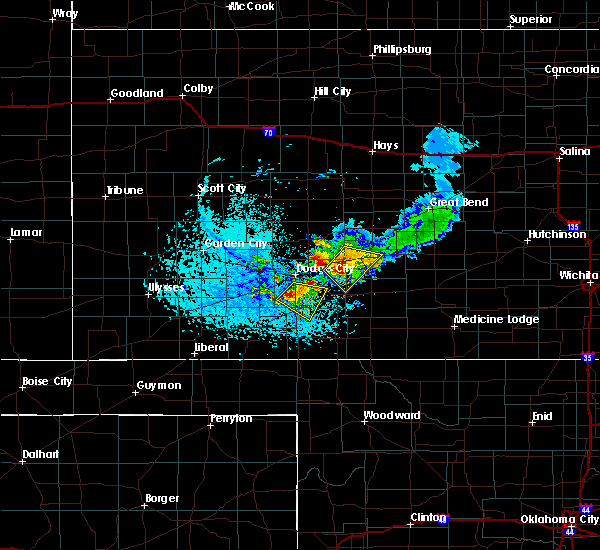 At 521 pm cdt, a severe thunderstorm was located 8 miles north of minneola, moving southeast at 25 mph (radar indicated). Hazards include ping pong ball size hail and 60 mph wind gusts. People and animals outdoors will be injured. expect hail damage to roofs, siding, windows, and vehicles. expect wind damage to roofs, siding, and trees. Locations impacted include, minneola, ford and bloom. At 521 pm cdt, a severe thunderstorm was located 8 miles north of minneola, moving southeast at 25 mph (radar indicated). Hazards include ping pong ball size hail and 60 mph wind gusts. People and animals outdoors will be injured. expect hail damage to roofs, siding, windows, and vehicles. expect wind damage to roofs, siding, and trees. Locations impacted include, minneola, ford and bloom.
|
| 6/19/2019 5:09 PM CDT |
 At 509 pm cdt, a severe thunderstorm was located 8 miles east of ensign, moving southeast at 25 mph (radar indicated). Hazards include 60 mph wind gusts and half dollar size hail. Hail damage to vehicles is expected. Expect wind damage to roofs, siding, and trees. At 509 pm cdt, a severe thunderstorm was located 8 miles east of ensign, moving southeast at 25 mph (radar indicated). Hazards include 60 mph wind gusts and half dollar size hail. Hail damage to vehicles is expected. Expect wind damage to roofs, siding, and trees.
|
| 6/14/2019 10:33 PM CDT |
 At 1033 pm cdt, a severe thunderstorm was located near ford, moving east at 40 mph (radar indicated). Hazards include 60 mph wind gusts and quarter size hail. Hail damage to vehicles is expected. Expect wind damage to roofs, siding, and trees. At 1033 pm cdt, a severe thunderstorm was located near ford, moving east at 40 mph (radar indicated). Hazards include 60 mph wind gusts and quarter size hail. Hail damage to vehicles is expected. Expect wind damage to roofs, siding, and trees.
|
| 6/3/2019 10:01 PM CDT |
 At 1001 pm cdt, severe thunderstorms were located along a line extending from 7 miles southeast of windhorst to near knowles, moving east at 35 mph (radar indicated). Hazards include 60 mph wind gusts and quarter size hail. Hail damage to vehicles is expected. expect wind damage to roofs, siding, and trees. Locations impacted include, ashland, bucklin, minneola, mullinville, ford, bloom, englewood, sitka, clark state lake, kingsdown and acres. At 1001 pm cdt, severe thunderstorms were located along a line extending from 7 miles southeast of windhorst to near knowles, moving east at 35 mph (radar indicated). Hazards include 60 mph wind gusts and quarter size hail. Hail damage to vehicles is expected. expect wind damage to roofs, siding, and trees. Locations impacted include, ashland, bucklin, minneola, mullinville, ford, bloom, englewood, sitka, clark state lake, kingsdown and acres.
|
| 6/3/2019 9:46 PM CDT |
 At 946 pm cdt, severe thunderstorms were located along a line extending from 7 miles east of ford to near knowles, moving east at 30 mph (radar indicated). Hazards include 60 mph wind gusts and quarter size hail. Hail damage to vehicles is expected. expect wind damage to roofs, siding, and trees. Locations impacted include, ashland, bucklin, minneola, fowler, mullinville, ford, bloom, englewood, sitka, clark state lake, kingsdown and acres. At 946 pm cdt, severe thunderstorms were located along a line extending from 7 miles east of ford to near knowles, moving east at 30 mph (radar indicated). Hazards include 60 mph wind gusts and quarter size hail. Hail damage to vehicles is expected. expect wind damage to roofs, siding, and trees. Locations impacted include, ashland, bucklin, minneola, fowler, mullinville, ford, bloom, englewood, sitka, clark state lake, kingsdown and acres.
|
| 6/3/2019 9:26 PM CDT |
 At 925 pm cdt, severe thunderstorms were located along a line extending from 7 miles southwest of dodge city to near floris, moving southeast at 15 mph (radar indicated). Hazards include 60 mph wind gusts and quarter size hail. Hail damage to vehicles is expected. Expect wind damage to roofs, siding, and trees. At 925 pm cdt, severe thunderstorms were located along a line extending from 7 miles southwest of dodge city to near floris, moving southeast at 15 mph (radar indicated). Hazards include 60 mph wind gusts and quarter size hail. Hail damage to vehicles is expected. Expect wind damage to roofs, siding, and trees.
|
| 5/26/2019 11:22 PM CDT |
 The severe thunderstorm warning for ford county will expire at 1130 pm cdt, the storm which prompted the warning has moved out of the area. therefore, the warning will be allowed to expire. however gusty winds are still possible with this thunderstorm. a severe thunderstorm watch remains in effect until 200 am cdt for south central and southwestern kansas. remember, a severe thunderstorm warning still remains in effect for eastern ford county until midnight. The severe thunderstorm warning for ford county will expire at 1130 pm cdt, the storm which prompted the warning has moved out of the area. therefore, the warning will be allowed to expire. however gusty winds are still possible with this thunderstorm. a severe thunderstorm watch remains in effect until 200 am cdt for south central and southwestern kansas. remember, a severe thunderstorm warning still remains in effect for eastern ford county until midnight.
|
| 5/26/2019 11:12 PM CDT |
 At 1111 pm cdt, a severe thunderstorm was located near wright, moving northeast at 55 mph (radar indicated). Hazards include 70 mph wind gusts and nickel size hail. Expect considerable tree damage. damage is likely to mobile homes, roofs, and outbuildings. locations impacted include, dodge city, spearville, ford, howell, bellefont, wright, windhorst and ft. Dodge. At 1111 pm cdt, a severe thunderstorm was located near wright, moving northeast at 55 mph (radar indicated). Hazards include 70 mph wind gusts and nickel size hail. Expect considerable tree damage. damage is likely to mobile homes, roofs, and outbuildings. locations impacted include, dodge city, spearville, ford, howell, bellefont, wright, windhorst and ft. Dodge.
|
| 5/26/2019 11:10 PM CDT |
 The severe thunderstorm warning for southern ford, southwestern kiowa, meade, western comanche, southern gray and clark counties will expire at 1115 pm cdt, the storms which prompted the warning have moved out of the area. therefore, the warning will be allowed to expire. however gusty winds are still possible with these thunderstorms. a severe thunderstorm watch remains in effect until 200 am cdt for south central and southwestern kansas. remember, a severe thunderstorm warning still remains in effect for comanche, kiowa, eastern clark and eastern ford counties until midnight. The severe thunderstorm warning for southern ford, southwestern kiowa, meade, western comanche, southern gray and clark counties will expire at 1115 pm cdt, the storms which prompted the warning have moved out of the area. therefore, the warning will be allowed to expire. however gusty winds are still possible with these thunderstorms. a severe thunderstorm watch remains in effect until 200 am cdt for south central and southwestern kansas. remember, a severe thunderstorm warning still remains in effect for comanche, kiowa, eastern clark and eastern ford counties until midnight.
|
| 5/26/2019 11:07 PM CDT |
 At 1106 pm cdt, severe thunderstorms were located along a line extending from 6 miles northwest of spearville to 9 miles east of clark state lake to 7 miles north of buffalo, moving northeast at 70 mph (radar indicated). Hazards include 70 mph wind gusts and penny size hail. Expect considerable tree damage. Damage is likely to mobile homes, roofs, and outbuildings. At 1106 pm cdt, severe thunderstorms were located along a line extending from 6 miles northwest of spearville to 9 miles east of clark state lake to 7 miles north of buffalo, moving northeast at 70 mph (radar indicated). Hazards include 70 mph wind gusts and penny size hail. Expect considerable tree damage. Damage is likely to mobile homes, roofs, and outbuildings.
|
| 5/26/2019 10:50 PM CDT |
 At 1050 pm cdt, severe thunderstorms were located along a line extending from 7 miles east of ensign to 7 miles southwest of clark state lake to near laverne, moving east at 55 mph (radar indicated). Hazards include 70 mph wind gusts and nickel size hail. Expect considerable tree damage. damage is likely to mobile homes, roofs, and outbuildings. Locations impacted include, meade, ashland, coldwater, bucklin, minneola, fowler, protection, mullinville, ford, bloom, englewood, sitka, clark state lake, kingsdown, missler, lake coldwater, acres and buttermilk. At 1050 pm cdt, severe thunderstorms were located along a line extending from 7 miles east of ensign to 7 miles southwest of clark state lake to near laverne, moving east at 55 mph (radar indicated). Hazards include 70 mph wind gusts and nickel size hail. Expect considerable tree damage. damage is likely to mobile homes, roofs, and outbuildings. Locations impacted include, meade, ashland, coldwater, bucklin, minneola, fowler, protection, mullinville, ford, bloom, englewood, sitka, clark state lake, kingsdown, missler, lake coldwater, acres and buttermilk.
|
| 5/26/2019 10:49 PM CDT |
 At 1048 pm cdt, a severe thunderstorm was located near ensign, moving east at 45 mph (radar indicated). Hazards include 70 mph wind gusts and nickel size hail. Expect considerable tree damage. damage is likely to mobile homes, roofs, and outbuildings. locations impacted include, dodge city, cimarron, montezuma, spearville, ingalls, ford, ensign, charleston, howell, wright, bellefont, windhorst, the haggard elev and ft. Dodge. At 1048 pm cdt, a severe thunderstorm was located near ensign, moving east at 45 mph (radar indicated). Hazards include 70 mph wind gusts and nickel size hail. Expect considerable tree damage. damage is likely to mobile homes, roofs, and outbuildings. locations impacted include, dodge city, cimarron, montezuma, spearville, ingalls, ford, ensign, charleston, howell, wright, bellefont, windhorst, the haggard elev and ft. Dodge.
|
| 5/26/2019 10:35 PM CDT |
 At 1035 pm cdt, a severe thunderstorm was located near montezuma, moving northeast at 50 mph (radar indicated). Hazards include 60 mph wind gusts and nickel size hail. expect damage to roofs, siding, and trees At 1035 pm cdt, a severe thunderstorm was located near montezuma, moving northeast at 50 mph (radar indicated). Hazards include 60 mph wind gusts and nickel size hail. expect damage to roofs, siding, and trees
|
| 5/26/2019 10:22 PM CDT |
 At 1022 pm cdt, severe thunderstorms were located along a line extending from near montezuma to near meade to 9 miles west of slapout, moving east at 50 mph (radar indicated). Hazards include 70 mph wind gusts and nickel size hail. Expect considerable tree damage. Damage is likely to mobile homes, roofs, and outbuildings. At 1022 pm cdt, severe thunderstorms were located along a line extending from near montezuma to near meade to 9 miles west of slapout, moving east at 50 mph (radar indicated). Hazards include 70 mph wind gusts and nickel size hail. Expect considerable tree damage. Damage is likely to mobile homes, roofs, and outbuildings.
|
| 5/25/2019 5:35 PM CDT |
 At 535 pm cdt, a severe thunderstorm was located 7 miles northwest of bloom, moving northeast at 20 mph (radar indicated). Hazards include 60 mph wind gusts and nickel size hail. expect damage to roofs, siding, and trees At 535 pm cdt, a severe thunderstorm was located 7 miles northwest of bloom, moving northeast at 20 mph (radar indicated). Hazards include 60 mph wind gusts and nickel size hail. expect damage to roofs, siding, and trees
|
| 5/23/2019 6:07 PM CDT |
 At 606 pm cdt, a severe thunderstorm was located near fowler, moving northeast at 40 mph (radar indicated). Hazards include golf ball size hail and 60 mph wind gusts. People and animals outdoors will be injured. expect hail damage to roofs, siding, windows, and vehicles. Expect wind damage to roofs, siding, and trees. At 606 pm cdt, a severe thunderstorm was located near fowler, moving northeast at 40 mph (radar indicated). Hazards include golf ball size hail and 60 mph wind gusts. People and animals outdoors will be injured. expect hail damage to roofs, siding, windows, and vehicles. Expect wind damage to roofs, siding, and trees.
|
| 5/23/2019 4:21 PM CDT |
 The severe thunderstorm warning for northeastern ford, northwestern kiowa, southeastern hodgeman, southwestern pawnee and western edwards counties will expire at 430 pm cdt, the storm which prompted the warning has weakened below severe limits, and no longer poses an immediate threat to life or property. therefore, the warning will be allowed to expire. however small hail and heavy rain are still possible with this thunderstorm. a tornado watch remains in effect until 1000 pm cdt for south central kansas. a severe thunderstorm watch remains in effect until 1000 pm cdt for south central and southwestern kansas. The severe thunderstorm warning for northeastern ford, northwestern kiowa, southeastern hodgeman, southwestern pawnee and western edwards counties will expire at 430 pm cdt, the storm which prompted the warning has weakened below severe limits, and no longer poses an immediate threat to life or property. therefore, the warning will be allowed to expire. however small hail and heavy rain are still possible with this thunderstorm. a tornado watch remains in effect until 1000 pm cdt for south central kansas. a severe thunderstorm watch remains in effect until 1000 pm cdt for south central and southwestern kansas.
|
| 5/23/2019 4:11 PM CDT |
 At 411 pm cdt, a severe thunderstorm was located near ford, moving north at 50 mph (radar indicated). Hazards include 60 mph wind gusts and half dollar size hail. Hail damage to vehicles is expected. expect wind damage to roofs, siding, and trees. Locations impacted include, gray, kinsley, jetmore, spearville, ford, hanston, offerle, bellefont and windhorst. At 411 pm cdt, a severe thunderstorm was located near ford, moving north at 50 mph (radar indicated). Hazards include 60 mph wind gusts and half dollar size hail. Hail damage to vehicles is expected. expect wind damage to roofs, siding, and trees. Locations impacted include, gray, kinsley, jetmore, spearville, ford, hanston, offerle, bellefont and windhorst.
|
| 5/23/2019 4:03 PM CDT |
 At 402 pm cdt, a severe thunderstorm was located near wright, moving north at 60 mph (radar indicated. at 356 pm, half dollar size hail was reported at the dodge city airport). Hazards include ping pong ball size hail and 60 mph wind gusts. People and animals outdoors will be injured. expect hail damage to roofs, siding, windows, and vehicles. expect wind damage to roofs, siding, and trees. locations impacted include, dodge city, gray, kinsley, jetmore, bucklin, spearville, ford, hanston, offerle, howell, wright, bellefont, windhorst and ft. Dodge. At 402 pm cdt, a severe thunderstorm was located near wright, moving north at 60 mph (radar indicated. at 356 pm, half dollar size hail was reported at the dodge city airport). Hazards include ping pong ball size hail and 60 mph wind gusts. People and animals outdoors will be injured. expect hail damage to roofs, siding, windows, and vehicles. expect wind damage to roofs, siding, and trees. locations impacted include, dodge city, gray, kinsley, jetmore, bucklin, spearville, ford, hanston, offerle, howell, wright, bellefont, windhorst and ft. Dodge.
|
| 5/23/2019 3:45 PM CDT |
 At 344 pm cdt, a severe thunderstorm was located 8 miles northwest of bloom, moving north at 50 mph. this replaces the previous warning for ford county (radar indicated). Hazards include ping pong ball size hail and 60 mph wind gusts. People and animals outdoors will be injured. expect hail damage to roofs, siding, windows, and vehicles. Expect wind damage to roofs, siding, and trees. At 344 pm cdt, a severe thunderstorm was located 8 miles northwest of bloom, moving north at 50 mph. this replaces the previous warning for ford county (radar indicated). Hazards include ping pong ball size hail and 60 mph wind gusts. People and animals outdoors will be injured. expect hail damage to roofs, siding, windows, and vehicles. Expect wind damage to roofs, siding, and trees.
|
| 5/23/2019 3:35 PM CDT |
 At 335 pm cdt, a severe thunderstorm was located near minneola, moving north at 50 mph (radar indicated). Hazards include 60 mph wind gusts and half dollar size hail. Hail damage to vehicles is expected. expect wind damage to roofs, siding, and trees. Locations impacted include, bucklin, minneola, ford, bloom and kingsdown. At 335 pm cdt, a severe thunderstorm was located near minneola, moving north at 50 mph (radar indicated). Hazards include 60 mph wind gusts and half dollar size hail. Hail damage to vehicles is expected. expect wind damage to roofs, siding, and trees. Locations impacted include, bucklin, minneola, ford, bloom and kingsdown.
|
| 5/23/2019 3:16 PM CDT |
 At 315 pm cdt, a severe thunderstorm was located 10 miles northwest of acres, moving north at 50 mph (radar indicated). Hazards include 60 mph wind gusts and half dollar size hail. Hail damage to vehicles is expected. Expect wind damage to roofs, siding, and trees. At 315 pm cdt, a severe thunderstorm was located 10 miles northwest of acres, moving north at 50 mph (radar indicated). Hazards include 60 mph wind gusts and half dollar size hail. Hail damage to vehicles is expected. Expect wind damage to roofs, siding, and trees.
|
| 5/17/2019 9:21 PM CDT |
 A tornado warning remains in effect until 930 pm cdt for eastern ford county. at 920 pm cdt, a confirmed large and extremely dangerous tornado was located near ford, moving northeast at 40 mph. this is a particularly dangerous situation. take cover now! hazard. Damaging tornado. A tornado warning remains in effect until 930 pm cdt for eastern ford county. at 920 pm cdt, a confirmed large and extremely dangerous tornado was located near ford, moving northeast at 40 mph. this is a particularly dangerous situation. take cover now! hazard. Damaging tornado.
|
| 5/17/2019 9:12 PM CDT |
 At 911 pm cdt, a confirmed large and extremely dangerous tornado was located 7 miles southwest of ford, moving northeast at 40 mph. this is a particularly dangerous situation. take cover now! (law enforcement confirmed tornado). Hazards include damaging tornado. You are in a life-threatening situation. flying debris may be deadly to those caught without shelter. mobile homes will be destroyed. considerable damage to homes, businesses, and vehicles is likely and complete destruction is possible. the tornado will be near, ford around 920 pm cdt. spearville and windhorst around 930 pm cdt. bellefont around 935 pm cdt. Offerle around 940 pm cdt. At 911 pm cdt, a confirmed large and extremely dangerous tornado was located 7 miles southwest of ford, moving northeast at 40 mph. this is a particularly dangerous situation. take cover now! (law enforcement confirmed tornado). Hazards include damaging tornado. You are in a life-threatening situation. flying debris may be deadly to those caught without shelter. mobile homes will be destroyed. considerable damage to homes, businesses, and vehicles is likely and complete destruction is possible. the tornado will be near, ford around 920 pm cdt. spearville and windhorst around 930 pm cdt. bellefont around 935 pm cdt. Offerle around 940 pm cdt.
|
| 5/17/2019 9:05 PM CDT |
 At 902 pm cdt, a confirmed tornado was located near bloom, moving northeast at 40 mph (law enforcement confirmed tornado. multiple reports of a large damaging tornado north of bloom). Hazards include damaging tornado and tennis ball size hail. Flying debris will be dangerous to those caught without shelter. mobile homes will be damaged or destroyed. damage to roofs, windows, and vehicles will occur. tree damage is likely. this tornado will be near, ford around 915 pm cdt. Spearville around 930 pm cdt. At 902 pm cdt, a confirmed tornado was located near bloom, moving northeast at 40 mph (law enforcement confirmed tornado. multiple reports of a large damaging tornado north of bloom). Hazards include damaging tornado and tennis ball size hail. Flying debris will be dangerous to those caught without shelter. mobile homes will be damaged or destroyed. damage to roofs, windows, and vehicles will occur. tree damage is likely. this tornado will be near, ford around 915 pm cdt. Spearville around 930 pm cdt.
|
| 5/17/2019 8:48 PM CDT |
 At 848 pm cdt, a confirmed tornado was located very near minneola, moving northeast at 45 mph (law enforcement confirmed tornado). Hazards include damaging tornado and tennis ball size hail. Flying debris will be dangerous to those caught without shelter. mobile homes will be damaged or destroyed. damage to roofs, windows, and vehicles will occur. tree damage is likely. the tornado will be near, bloom around 900 pm cdt. kingsdown around 910 pm cdt. Ford around 915 pm cdt. At 848 pm cdt, a confirmed tornado was located very near minneola, moving northeast at 45 mph (law enforcement confirmed tornado). Hazards include damaging tornado and tennis ball size hail. Flying debris will be dangerous to those caught without shelter. mobile homes will be damaged or destroyed. damage to roofs, windows, and vehicles will occur. tree damage is likely. the tornado will be near, bloom around 900 pm cdt. kingsdown around 910 pm cdt. Ford around 915 pm cdt.
|
| 5/17/2019 8:37 PM CDT |
 At 837 pm cdt, a severe thunderstorm capable of producing a tornado was located near fowler, moving northeast at 40 mph (weather spotters reported funnel cloud). Hazards include tornado and tennis ball size hail. Flying debris will be dangerous to those caught without shelter. mobile homes will be damaged or destroyed. damage to roofs, windows, and vehicles will occur. tree damage is likely. This dangerous storm will be near, dodge city around 905 pm cdt. At 837 pm cdt, a severe thunderstorm capable of producing a tornado was located near fowler, moving northeast at 40 mph (weather spotters reported funnel cloud). Hazards include tornado and tennis ball size hail. Flying debris will be dangerous to those caught without shelter. mobile homes will be damaged or destroyed. damage to roofs, windows, and vehicles will occur. tree damage is likely. This dangerous storm will be near, dodge city around 905 pm cdt.
|
| 5/6/2019 10:41 PM CDT |
 At 1041 pm cdt, severe thunderstorms were located along a line extending from near hanston to near mullinville to near bucklin, moving east at 50 mph (radar indicated). Hazards include 70 mph wind gusts and quarter size hail. Hail damage to vehicles is expected. expect considerable tree damage. wind damage is also likely to mobile homes, roofs, and outbuildings. locations impacted include, dodge city, gray, kinsley, jetmore, bucklin, greensburg, spearville, mullinville, burdett, ford, hanston, offerle, bloom, clark state lake, kingsdown, wright, bellefont, windhorst and ft. Dodge. At 1041 pm cdt, severe thunderstorms were located along a line extending from near hanston to near mullinville to near bucklin, moving east at 50 mph (radar indicated). Hazards include 70 mph wind gusts and quarter size hail. Hail damage to vehicles is expected. expect considerable tree damage. wind damage is also likely to mobile homes, roofs, and outbuildings. locations impacted include, dodge city, gray, kinsley, jetmore, bucklin, greensburg, spearville, mullinville, burdett, ford, hanston, offerle, bloom, clark state lake, kingsdown, wright, bellefont, windhorst and ft. Dodge.
|
| 5/6/2019 10:13 PM CDT |
 At 1013 pm cdt, severe thunderstorms were located along a line extending from 11 miles northeast of kalvesta to near wright to near bloom, moving east at 70 mph (radar indicated). Hazards include 60 mph wind gusts and quarter size hail. Hail damage to vehicles is expected. Expect wind damage to roofs, siding, and trees. At 1013 pm cdt, severe thunderstorms were located along a line extending from 11 miles northeast of kalvesta to near wright to near bloom, moving east at 70 mph (radar indicated). Hazards include 60 mph wind gusts and quarter size hail. Hail damage to vehicles is expected. Expect wind damage to roofs, siding, and trees.
|
| 5/6/2019 9:32 PM CDT |
 The national weather service in dodge city has issued a * severe thunderstorm warning for. ford county in southwestern kansas. northeastern finney county in southwestern kansas. hodgeman county in southwestern kansas. Northern meade county in southwestern kansas. The national weather service in dodge city has issued a * severe thunderstorm warning for. ford county in southwestern kansas. northeastern finney county in southwestern kansas. hodgeman county in southwestern kansas. Northern meade county in southwestern kansas.
|
| 5/5/2019 6:52 PM CDT |
 The severe thunderstorm warning for eastern ford county will expire at 700 pm cdt, the severe thunderstorm which prompted the warning has weakened. therefore, the warning will be allowed to expire. however gusty winds and heavy rain are still possible with this thunderstorm. a severe thunderstorm watch remains in effect until 1100 pm cdt for southwestern kansas. The severe thunderstorm warning for eastern ford county will expire at 700 pm cdt, the severe thunderstorm which prompted the warning has weakened. therefore, the warning will be allowed to expire. however gusty winds and heavy rain are still possible with this thunderstorm. a severe thunderstorm watch remains in effect until 1100 pm cdt for southwestern kansas.
|
| 5/5/2019 6:39 PM CDT |
 At 639 pm cdt, a severe thunderstorm was located very near ft. dodge, moving southeast at 15 mph (radar indicated). Hazards include 60 mph wind gusts and quarter size hail. Hail damage to vehicles is expected. expect wind damage to roofs, siding, and trees. locations impacted include, dodge city, bucklin, ford, wright, kingsdown and ft. Dodge. At 639 pm cdt, a severe thunderstorm was located very near ft. dodge, moving southeast at 15 mph (radar indicated). Hazards include 60 mph wind gusts and quarter size hail. Hail damage to vehicles is expected. expect wind damage to roofs, siding, and trees. locations impacted include, dodge city, bucklin, ford, wright, kingsdown and ft. Dodge.
|
| 5/5/2019 6:19 PM CDT |
 At 619 pm cdt, a severe thunderstorm was located near dodge city, moving south at 15 mph (radar indicated). Hazards include ping pong ball size hail and 60 mph wind gusts. People and animals outdoors will be injured. expect hail damage to roofs, siding, windows, and vehicles. Expect wind damage to roofs, siding, and trees. At 619 pm cdt, a severe thunderstorm was located near dodge city, moving south at 15 mph (radar indicated). Hazards include ping pong ball size hail and 60 mph wind gusts. People and animals outdoors will be injured. expect hail damage to roofs, siding, windows, and vehicles. Expect wind damage to roofs, siding, and trees.
|
| 7/27/2018 8:25 PM CDT |
 At 824 pm cdt, a severe thunderstorm was located 5 miles northeast of offerle, moving south at 25 mph. this is a very dangerous storm (radar indicated). Hazards include 80 mph wind gusts and two inch hail. Flying debris will be dangerous to those caught without shelter. mobile homes will be heavily damaged. expect considerable damage to roofs, windows, and vehicles. extensive tree damage and power outages are likely. Locations impacted include, kinsley, spearville, lewis, ford, offerle, fellsburg, bellefont, windhorst and centerview. At 824 pm cdt, a severe thunderstorm was located 5 miles northeast of offerle, moving south at 25 mph. this is a very dangerous storm (radar indicated). Hazards include 80 mph wind gusts and two inch hail. Flying debris will be dangerous to those caught without shelter. mobile homes will be heavily damaged. expect considerable damage to roofs, windows, and vehicles. extensive tree damage and power outages are likely. Locations impacted include, kinsley, spearville, lewis, ford, offerle, fellsburg, bellefont, windhorst and centerview.
|
| 7/27/2018 8:05 PM CDT |
 At 804 pm cdt, a severe thunderstorm was located 6 miles southeast of gray, moving southeast at 20 mph (radar indicated). Hazards include 70 mph wind gusts and half dollar size hail. Hail damage to vehicles is expected. expect considerable tree damage. Wind damage is also likely to mobile homes, roofs, and outbuildings. At 804 pm cdt, a severe thunderstorm was located 6 miles southeast of gray, moving southeast at 20 mph (radar indicated). Hazards include 70 mph wind gusts and half dollar size hail. Hail damage to vehicles is expected. expect considerable tree damage. Wind damage is also likely to mobile homes, roofs, and outbuildings.
|
| 7/25/2018 10:07 PM CDT |
 The severe thunderstorm warning for ford, kiowa, eastern meade, comanche, southwestern edwards and clark counties will expire at 1015 pm cdt, the storms which prompted the warning have weakened below severe limits, and no longer pose an immediate threat to life or property. therefore, the warning will be allowed to expire. however gusty winds and heavy rain are still possible with these thunderstorms. a severe thunderstorm watch remains in effect until 100 am cdt for south central and southwestern kansas. The severe thunderstorm warning for ford, kiowa, eastern meade, comanche, southwestern edwards and clark counties will expire at 1015 pm cdt, the storms which prompted the warning have weakened below severe limits, and no longer pose an immediate threat to life or property. therefore, the warning will be allowed to expire. however gusty winds and heavy rain are still possible with these thunderstorms. a severe thunderstorm watch remains in effect until 100 am cdt for south central and southwestern kansas.
|
| 7/25/2018 9:39 PM CDT |
 At 938 pm cdt, severe thunderstorms were located along a line extending from 6 miles southwest of centerview to 3 miles northwest of bucklin to 4 miles west of dodge city, moving south at 45 mph (radar indicated). Hazards include 70 mph wind gusts and penny size hail. Expect considerable tree damage. damage is likely to mobile homes, roofs, and outbuildings. Locations impacted include, dodge city, ashland, coldwater, bucklin, greensburg, minneola, fowler, protection, mullinville, ford, bloom, englewood, sitka, wilmore, clark state lake, kingsdown, wright, lake coldwater, windhorst and acres. At 938 pm cdt, severe thunderstorms were located along a line extending from 6 miles southwest of centerview to 3 miles northwest of bucklin to 4 miles west of dodge city, moving south at 45 mph (radar indicated). Hazards include 70 mph wind gusts and penny size hail. Expect considerable tree damage. damage is likely to mobile homes, roofs, and outbuildings. Locations impacted include, dodge city, ashland, coldwater, bucklin, greensburg, minneola, fowler, protection, mullinville, ford, bloom, englewood, sitka, wilmore, clark state lake, kingsdown, wright, lake coldwater, windhorst and acres.
|
| 7/25/2018 9:09 PM CDT |
 The national weather service in dodge city has issued a * severe thunderstorm warning for. ford county in southwestern kansas. kiowa county in south central kansas. eastern meade county in southwestern kansas. Comanche county in south central kansas. The national weather service in dodge city has issued a * severe thunderstorm warning for. ford county in southwestern kansas. kiowa county in south central kansas. eastern meade county in southwestern kansas. Comanche county in south central kansas.
|
| 7/19/2018 7:31 PM CDT | Golf Ball sized hail reported 3.1 miles N of Ford, KS, facebook post with golf ball south of ford. |
| 7/19/2018 7:24 PM CDT | Quarter sized hail reported 3.1 miles N of Ford, KS, facebook post quarter size hail. |
| 7/19/2018 7:12 PM CDT |
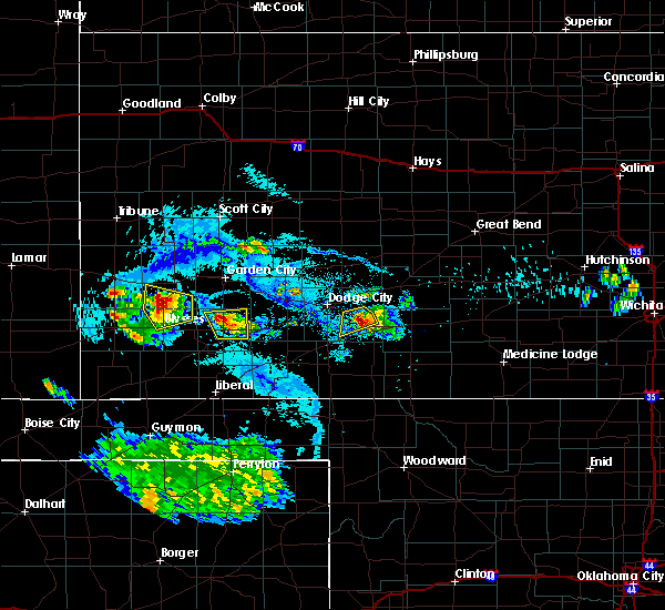 At 711 pm cdt, a severe thunderstorm was located very near ford, moving southeast at 15 mph (radar indicated). Hazards include two inch hail and 60 mph wind gusts. People and animals outdoors will be injured. expect hail damage to roofs, siding, windows, and vehicles. expect wind damage to roofs, siding, and trees. Locations impacted include, ford. At 711 pm cdt, a severe thunderstorm was located very near ford, moving southeast at 15 mph (radar indicated). Hazards include two inch hail and 60 mph wind gusts. People and animals outdoors will be injured. expect hail damage to roofs, siding, windows, and vehicles. expect wind damage to roofs, siding, and trees. Locations impacted include, ford.
|
| 7/19/2018 7:09 PM CDT | Hen Egg sized hail reported 2.5 miles S of Ford, KS |
| 7/19/2018 6:54 PM CDT |
 At 654 pm cdt, a severe thunderstorm was located 4 miles northwest of ford, moving southeast at 20 mph (radar indicated). Hazards include two inch hail and 60 mph wind gusts. People and animals outdoors will be injured. expect hail damage to roofs, siding, windows, and vehicles. expect wind damage to roofs, siding, and trees. Locations impacted include, ford. At 654 pm cdt, a severe thunderstorm was located 4 miles northwest of ford, moving southeast at 20 mph (radar indicated). Hazards include two inch hail and 60 mph wind gusts. People and animals outdoors will be injured. expect hail damage to roofs, siding, windows, and vehicles. expect wind damage to roofs, siding, and trees. Locations impacted include, ford.
|
| 7/19/2018 6:38 PM CDT |
 At 637 pm cdt, a severe thunderstorm was located 3 miles east of wright, moving southeast at 20 mph (radar indicated). Hazards include 60 mph wind gusts and half dollar size hail. Hail damage to vehicles is expected. Expect wind damage to roofs, siding, and trees. At 637 pm cdt, a severe thunderstorm was located 3 miles east of wright, moving southeast at 20 mph (radar indicated). Hazards include 60 mph wind gusts and half dollar size hail. Hail damage to vehicles is expected. Expect wind damage to roofs, siding, and trees.
|
| 6/24/2018 9:37 PM CDT |
 At 937 pm cdt, severe thunderstorms were located along a line extending from 5 miles north of jetmore to 4 miles south of dodge city, moving east at 70 mph (radar indicated). Hazards include 70 mph wind gusts and ping pong ball size hail. People and animals outdoors will be injured. expect hail damage to roofs, siding, windows, and vehicles. expect considerable tree damage. Wind damage is also likely to mobile homes, roofs, and outbuildings. At 937 pm cdt, severe thunderstorms were located along a line extending from 5 miles north of jetmore to 4 miles south of dodge city, moving east at 70 mph (radar indicated). Hazards include 70 mph wind gusts and ping pong ball size hail. People and animals outdoors will be injured. expect hail damage to roofs, siding, windows, and vehicles. expect considerable tree damage. Wind damage is also likely to mobile homes, roofs, and outbuildings.
|
| 6/24/2018 9:13 PM CDT |
 At 913 pm cdt, severe thunderstorms were located along a line extending from 13 miles north of kalvesta to 5 miles north of howell to near montezuma, moving east at 40 mph (radar indicated). Hazards include 70 mph wind gusts and penny size hail. Expect considerable tree damage. damage is likely to mobile homes, roofs, and outbuildings. Locations impacted include, dodge city, gray, cimarron, montezuma, jetmore, spearville, copeland, ingalls, ford, hanston, ensign, bloom, kingsdown, howell, wright, tice, kalvesta, bellefont, windhorst and the haggard elev. At 913 pm cdt, severe thunderstorms were located along a line extending from 13 miles north of kalvesta to 5 miles north of howell to near montezuma, moving east at 40 mph (radar indicated). Hazards include 70 mph wind gusts and penny size hail. Expect considerable tree damage. damage is likely to mobile homes, roofs, and outbuildings. Locations impacted include, dodge city, gray, cimarron, montezuma, jetmore, spearville, copeland, ingalls, ford, hanston, ensign, bloom, kingsdown, howell, wright, tice, kalvesta, bellefont, windhorst and the haggard elev.
|
| 6/24/2018 8:47 PM CDT |
 At 847 pm cdt, severe thunderstorms were located along a line extending from 14 miles south of dighton to 4 miles northeast of charleston to 6 miles north of tice, moving east at 45 mph (radar indicated). Hazards include 70 mph wind gusts and penny size hail. Expect considerable tree damage. Damage is likely to mobile homes, roofs, and outbuildings. At 847 pm cdt, severe thunderstorms were located along a line extending from 14 miles south of dighton to 4 miles northeast of charleston to 6 miles north of tice, moving east at 45 mph (radar indicated). Hazards include 70 mph wind gusts and penny size hail. Expect considerable tree damage. Damage is likely to mobile homes, roofs, and outbuildings.
|
| 6/24/2018 6:38 AM CDT |
 At 638 am cdt, a severe thunderstorm was located 3 miles southwest of clark state lake, moving northeast at 35 mph (radar indicated). Hazards include quarter size hail. Damage to vehicles is expected. Locations impacted include, ashland, bucklin, minneola, ford, bloom, sitka, clark state lake, kingsdown and acres. At 638 am cdt, a severe thunderstorm was located 3 miles southwest of clark state lake, moving northeast at 35 mph (radar indicated). Hazards include quarter size hail. Damage to vehicles is expected. Locations impacted include, ashland, bucklin, minneola, ford, bloom, sitka, clark state lake, kingsdown and acres.
|
| 6/24/2018 6:22 AM CDT |
 At 622 am cdt, a severe thunderstorm was located 6 miles south of minneola, moving northeast at 30 mph (radar indicated). Hazards include quarter size hail. damage to vehicles is expected At 622 am cdt, a severe thunderstorm was located 6 miles south of minneola, moving northeast at 30 mph (radar indicated). Hazards include quarter size hail. damage to vehicles is expected
|
| 6/23/2018 11:50 PM CDT |
 At 1150 pm cdt, severe thunderstorms were located along a line extending from 4 miles southwest of garfield to 6 miles southwest of greensburg to 5 miles northwest of acres, moving east at 40 mph (radar indicated). Hazards include 70 mph wind gusts and penny size hail. Expect considerable tree damage. damage is likely to mobile homes, roofs, and outbuildings. Locations impacted include, kinsley, ashland, coldwater, bucklin, greensburg, spearville, haviland, macksville, protection, lewis, mullinville, ford, offerle, bloom, belpre, englewood, sitka, wilmore, fellsburg and wellsford. At 1150 pm cdt, severe thunderstorms were located along a line extending from 4 miles southwest of garfield to 6 miles southwest of greensburg to 5 miles northwest of acres, moving east at 40 mph (radar indicated). Hazards include 70 mph wind gusts and penny size hail. Expect considerable tree damage. damage is likely to mobile homes, roofs, and outbuildings. Locations impacted include, kinsley, ashland, coldwater, bucklin, greensburg, spearville, haviland, macksville, protection, lewis, mullinville, ford, offerle, bloom, belpre, englewood, sitka, wilmore, fellsburg and wellsford.
|
| 6/23/2018 11:37 PM CDT |
 At 1137 pm cdt, severe thunderstorms were located along a line extending from 8 miles south of rozel to near mullinville to 11 miles south of minneola, moving east at 40 mph (radar indicated). Hazards include 70 mph wind gusts and penny size hail. Expect considerable tree damage. damage is likely to mobile homes, roofs, and outbuildings. Locations impacted include, gray, larned, kinsley, ashland, coldwater, bucklin, greensburg, spearville, haviland, macksville, protection, lewis, mullinville, burdett, ford, hanston, offerle, garfield, rozel and bloom. At 1137 pm cdt, severe thunderstorms were located along a line extending from 8 miles south of rozel to near mullinville to 11 miles south of minneola, moving east at 40 mph (radar indicated). Hazards include 70 mph wind gusts and penny size hail. Expect considerable tree damage. damage is likely to mobile homes, roofs, and outbuildings. Locations impacted include, gray, larned, kinsley, ashland, coldwater, bucklin, greensburg, spearville, haviland, macksville, protection, lewis, mullinville, burdett, ford, hanston, offerle, garfield, rozel and bloom.
|
| 6/23/2018 11:16 PM CDT |
 At 1116 pm cdt, severe thunderstorms were located along a line extending from near hanston to 2 miles southeast of ford to near minneola, moving east at 40 mph (radar indicated). Hazards include 70 mph wind gusts and penny size hail. Expect considerable tree damage. Damage is likely to mobile homes, roofs, and outbuildings. At 1116 pm cdt, severe thunderstorms were located along a line extending from near hanston to 2 miles southeast of ford to near minneola, moving east at 40 mph (radar indicated). Hazards include 70 mph wind gusts and penny size hail. Expect considerable tree damage. Damage is likely to mobile homes, roofs, and outbuildings.
|
| 6/23/2018 11:02 PM CDT |
 At 1102 pm cdt, severe thunderstorms were located along a line extending from 10 miles north of jetmore to 4 miles west of spearville to 7 miles east of ensign, moving east at 45 mph (radar indicated). Hazards include 70 mph wind gusts and penny size hail. Expect considerable tree damage. damage is likely to mobile homes, roofs, and outbuildings. locations impacted include, dodge city, gray, kinsley, jetmore, bucklin, spearville, mullinville, burdett, ford, hanston, offerle, ensign, rozel, bloom, kingsdown, howell, wright, bellefont, windhorst and ft. Dodge. At 1102 pm cdt, severe thunderstorms were located along a line extending from 10 miles north of jetmore to 4 miles west of spearville to 7 miles east of ensign, moving east at 45 mph (radar indicated). Hazards include 70 mph wind gusts and penny size hail. Expect considerable tree damage. damage is likely to mobile homes, roofs, and outbuildings. locations impacted include, dodge city, gray, kinsley, jetmore, bucklin, spearville, mullinville, burdett, ford, hanston, offerle, ensign, rozel, bloom, kingsdown, howell, wright, bellefont, windhorst and ft. Dodge.
|
| 6/23/2018 10:42 PM CDT |
 At 1042 pm cdt, severe thunderstorms were located along a line extending from near ness city to 8 miles north of dodge city to 3 miles north of the haggard elev, moving east at 40 mph (radar indicated). Hazards include 70 mph wind gusts and nickel size hail. Expect considerable tree damage. Damage is likely to mobile homes, roofs, and outbuildings. At 1042 pm cdt, severe thunderstorms were located along a line extending from near ness city to 8 miles north of dodge city to 3 miles north of the haggard elev, moving east at 40 mph (radar indicated). Hazards include 70 mph wind gusts and nickel size hail. Expect considerable tree damage. Damage is likely to mobile homes, roofs, and outbuildings.
|
| 6/22/2018 7:32 PM CDT |
 At 732 pm cdt, severe thunderstorms were located along a line extending from 4 miles south of belpre to 9 miles south of minneola, moving southeast at 20 mph (radar indicated). Hazards include 70 mph wind gusts and nickel size hail. Expect considerable tree damage. damage is likely to mobile homes, roofs, and outbuildings. Locations impacted include, pratt, ashland, coldwater, bucklin, greensburg, minneola, haviland, protection, mullinville, ford, sawyer, bloom, cullison, isabel, coats, sitka, lake city, wilmore, sun city and fellsburg. At 732 pm cdt, severe thunderstorms were located along a line extending from 4 miles south of belpre to 9 miles south of minneola, moving southeast at 20 mph (radar indicated). Hazards include 70 mph wind gusts and nickel size hail. Expect considerable tree damage. damage is likely to mobile homes, roofs, and outbuildings. Locations impacted include, pratt, ashland, coldwater, bucklin, greensburg, minneola, haviland, protection, mullinville, ford, sawyer, bloom, cullison, isabel, coats, sitka, lake city, wilmore, sun city and fellsburg.
|
| 6/22/2018 7:06 PM CDT |
 At 705 pm cdt, severe thunderstorms were located along a line extending from belpre to 7 miles north of fowler, moving southeast at 45 mph. these are very dangerous storms (radar indicated). Hazards include 80 mph wind gusts and nickel size hail. Flying debris will be dangerous to those caught without shelter. mobile homes will be heavily damaged. expect considerable damage to roofs, windows, and vehicles. Extensive tree damage and power outages are likely. At 705 pm cdt, severe thunderstorms were located along a line extending from belpre to 7 miles north of fowler, moving southeast at 45 mph. these are very dangerous storms (radar indicated). Hazards include 80 mph wind gusts and nickel size hail. Flying debris will be dangerous to those caught without shelter. mobile homes will be heavily damaged. expect considerable damage to roofs, windows, and vehicles. Extensive tree damage and power outages are likely.
|
| 6/22/2018 7:00 PM CDT |
 At 700 pm cdt, severe thunderstorms were located along a line extending from 5 miles southwest of garfield to 8 miles southeast of ensign, moving southeast at 45 mph (radar indicated). Hazards include 70 mph wind gusts and penny size hail. Expect considerable tree damage. damage is likely to mobile homes, roofs, and outbuildings. Locations impacted include, dodge city, kinsley, bucklin, greensburg, spearville, minneola, lewis, mullinville, ford, offerle, garfield, ensign, bloom, belpre, fellsburg, clark state lake, kingsdown, howell, wright and bellefont. At 700 pm cdt, severe thunderstorms were located along a line extending from 5 miles southwest of garfield to 8 miles southeast of ensign, moving southeast at 45 mph (radar indicated). Hazards include 70 mph wind gusts and penny size hail. Expect considerable tree damage. damage is likely to mobile homes, roofs, and outbuildings. Locations impacted include, dodge city, kinsley, bucklin, greensburg, spearville, minneola, lewis, mullinville, ford, offerle, garfield, ensign, bloom, belpre, fellsburg, clark state lake, kingsdown, howell, wright and bellefont.
|
| 6/22/2018 6:43 PM CDT |
 At 643 pm cdt, severe thunderstorms were located along a line extending from near rozel to 4 miles northwest of ensign, moving southeast at 50 mph (radar indicated). Hazards include 70 mph wind gusts and nickel size hail. Expect considerable tree damage. damage is likely to mobile homes, roofs, and outbuildings. Locations impacted include, dodge city, gray, cimarron, kinsley, jetmore, bucklin, greensburg, spearville, minneola, lewis, mullinville, burdett, ford, hanston, offerle, garfield, ensign, rozel, bloom and belpre. At 643 pm cdt, severe thunderstorms were located along a line extending from near rozel to 4 miles northwest of ensign, moving southeast at 50 mph (radar indicated). Hazards include 70 mph wind gusts and nickel size hail. Expect considerable tree damage. damage is likely to mobile homes, roofs, and outbuildings. Locations impacted include, dodge city, gray, cimarron, kinsley, jetmore, bucklin, greensburg, spearville, minneola, lewis, mullinville, burdett, ford, hanston, offerle, garfield, ensign, rozel, bloom and belpre.
|
| 6/22/2018 6:19 PM CDT |
 At 618 pm cdt, severe thunderstorms were located along a line extending from 6 miles south of bazine to 5 miles north of ingalls, moving southeast at 45 mph (radar indicated). Hazards include 70 mph wind gusts and quarter size hail. Hail damage to vehicles is expected. expect considerable tree damage. Wind damage is also likely to mobile homes, roofs, and outbuildings. At 618 pm cdt, severe thunderstorms were located along a line extending from 6 miles south of bazine to 5 miles north of ingalls, moving southeast at 45 mph (radar indicated). Hazards include 70 mph wind gusts and quarter size hail. Hail damage to vehicles is expected. expect considerable tree damage. Wind damage is also likely to mobile homes, roofs, and outbuildings.
|
| 6/19/2018 11:23 PM CDT |
 At 1122 pm cdt, severe thunderstorms were located along a line extending from 4 miles east of pawnee rock to 6 miles north of greensburg to 6 miles southwest of minneola, moving southeast at 35 mph (radar indicated). Hazards include 70 mph wind gusts. Expect considerable tree damage. damage is likely to mobile homes, roofs, and outbuildings. locations impacted include, pratt, larned, kinsley, st. john, ashland, coldwater, bucklin, greensburg, minneola, haviland, macksville, protection, lewis, mullinville, ford, garfield, rozel, hudson, bloom and cullison. At 1104 pm, a 65 mph wind gust was reported 3 miles west of larned. At 1122 pm cdt, severe thunderstorms were located along a line extending from 4 miles east of pawnee rock to 6 miles north of greensburg to 6 miles southwest of minneola, moving southeast at 35 mph (radar indicated). Hazards include 70 mph wind gusts. Expect considerable tree damage. damage is likely to mobile homes, roofs, and outbuildings. locations impacted include, pratt, larned, kinsley, st. john, ashland, coldwater, bucklin, greensburg, minneola, haviland, macksville, protection, lewis, mullinville, ford, garfield, rozel, hudson, bloom and cullison. At 1104 pm, a 65 mph wind gust was reported 3 miles west of larned.
|
| 6/19/2018 10:53 PM CDT |
 At 1053 pm cdt, severe thunderstorms were located along a line extending from near la crosse to 2 miles south of offerle to 3 miles northwest of minneola, moving east at 40 mph (radar indicated). Hazards include 70 mph wind gusts. Expect considerable tree damage. Damage is likely to mobile homes, roofs, and outbuildings. At 1053 pm cdt, severe thunderstorms were located along a line extending from near la crosse to 2 miles south of offerle to 3 miles northwest of minneola, moving east at 40 mph (radar indicated). Hazards include 70 mph wind gusts. Expect considerable tree damage. Damage is likely to mobile homes, roofs, and outbuildings.
|
| 6/19/2018 10:39 PM CDT |
 At 1038 pm cdt, the leading edge of severe thunderstorm high winds were located along a line extending from 2 miles southeast of nekoma to 8 miles northwest of offerle to 5 miles south of ensign, moving east at 60 mph (radar indicated). Hazards include 70 mph wind gusts. Expect considerable tree damage. damage is likely to mobile homes, roofs, and outbuildings. Locations impacted include, gray, larned, kinsley, ashland, jetmore, coldwater, bucklin, greensburg, spearville, minneola, haviland, protection, lewis, bazine, mullinville, burdett, ford, hanston, offerle and garfield. At 1038 pm cdt, the leading edge of severe thunderstorm high winds were located along a line extending from 2 miles southeast of nekoma to 8 miles northwest of offerle to 5 miles south of ensign, moving east at 60 mph (radar indicated). Hazards include 70 mph wind gusts. Expect considerable tree damage. damage is likely to mobile homes, roofs, and outbuildings. Locations impacted include, gray, larned, kinsley, ashland, jetmore, coldwater, bucklin, greensburg, spearville, minneola, haviland, protection, lewis, bazine, mullinville, burdett, ford, hanston, offerle and garfield.
|
| 6/19/2018 10:03 PM CDT |
 At 1002 pm cdt, severe thunderstorms were located along a line extending from 5 miles northeast of ransom to 5 miles southeast of kalvesta to 9 miles northwest of tice, moving southeast at 60 mph (radar indicated). Hazards include 70 mph wind gusts and penny size hail. Expect considerable tree damage. Damage is likely to mobile homes, roofs, and outbuildings. At 1002 pm cdt, severe thunderstorms were located along a line extending from 5 miles northeast of ransom to 5 miles southeast of kalvesta to 9 miles northwest of tice, moving southeast at 60 mph (radar indicated). Hazards include 70 mph wind gusts and penny size hail. Expect considerable tree damage. Damage is likely to mobile homes, roofs, and outbuildings.
|
| 6/7/2018 2:54 AM CDT |
 At 254 am cdt, severe thunderstorms were located along a line extending from 6 miles northwest of greensburg to 9 miles southwest of buttermilk, moving east at 15 mph (radar indicated). Hazards include 70 mph wind gusts and quarter size hail. Hail damage to vehicles is expected. expect considerable tree damage. wind damage is also likely to mobile homes, roofs, and outbuildings. Locations impacted include, ashland, coldwater, bucklin, protection, mullinville, ford, sitka, clark state lake, kingsdown, lake coldwater and buttermilk. At 254 am cdt, severe thunderstorms were located along a line extending from 6 miles northwest of greensburg to 9 miles southwest of buttermilk, moving east at 15 mph (radar indicated). Hazards include 70 mph wind gusts and quarter size hail. Hail damage to vehicles is expected. expect considerable tree damage. wind damage is also likely to mobile homes, roofs, and outbuildings. Locations impacted include, ashland, coldwater, bucklin, protection, mullinville, ford, sitka, clark state lake, kingsdown, lake coldwater and buttermilk.
|
| 6/7/2018 2:26 AM CDT |
 At 225 am cdt, severe thunderstorms were located along a line extending from 6 miles north of mullinville to 11 miles south of sitka, moving east at 15 mph (radar indicated). Hazards include 70 mph wind gusts and quarter size hail. Hail damage to vehicles is expected. expect considerable tree damage. Wind damage is also likely to mobile homes, roofs, and outbuildings. At 225 am cdt, severe thunderstorms were located along a line extending from 6 miles north of mullinville to 11 miles south of sitka, moving east at 15 mph (radar indicated). Hazards include 70 mph wind gusts and quarter size hail. Hail damage to vehicles is expected. expect considerable tree damage. Wind damage is also likely to mobile homes, roofs, and outbuildings.
|
| 5/29/2018 6:07 PM CDT |
 At 545 pm cdt, a severe thunderstorm was located 3 miles south of ford, moving east at 20 mph. this is a very dangerous storm (radar indicated). Hazards include baseball size hail and 60 mph wind gusts. People and animals outdoors will be severely injured. Expect shattered windows, extensive damage to roofs, siding, and vehicles. At 545 pm cdt, a severe thunderstorm was located 3 miles south of ford, moving east at 20 mph. this is a very dangerous storm (radar indicated). Hazards include baseball size hail and 60 mph wind gusts. People and animals outdoors will be severely injured. Expect shattered windows, extensive damage to roofs, siding, and vehicles.
|
| 5/29/2018 6:00 PM CDT | Baseball sized hail reported 0.4 miles SSW of Ford, KS, baseball size hail. |
| 5/29/2018 6:00 PM CDT | Baseball sized hail reported 7.9 miles N of Ford, KS, baseball size hail. |
| 5/29/2018 5:55 PM CDT | Ping Pong Ball sized hail reported 7.9 miles N of Ford, KS, ping pong size. |
| 5/29/2018 5:45 PM CDT |
 At 545 pm cdt, a severe thunderstorm was located 3 miles south of ford, moving east at 20 mph. this is a very dangerous storm (radar indicated). Hazards include baseball size hail and 60 mph wind gusts. People and animals outdoors will be severely injured. Expect shattered windows, extensive damage to roofs, siding, and vehicles. At 545 pm cdt, a severe thunderstorm was located 3 miles south of ford, moving east at 20 mph. this is a very dangerous storm (radar indicated). Hazards include baseball size hail and 60 mph wind gusts. People and animals outdoors will be severely injured. Expect shattered windows, extensive damage to roofs, siding, and vehicles.
|
| 5/29/2018 5:32 PM CDT |
 The national weather service in dodge city has issued a * tornado warning for. southeastern ford county in southwestern kansas. Until 615 pm cdt * at 532 pm cdt, a severe thunderstorm capable of producing a tornado was located 4 miles southwest of ford, moving east at 25 mph. The national weather service in dodge city has issued a * tornado warning for. southeastern ford county in southwestern kansas. Until 615 pm cdt * at 532 pm cdt, a severe thunderstorm capable of producing a tornado was located 4 miles southwest of ford, moving east at 25 mph.
|
| 5/29/2018 5:02 PM CDT |
 The national weather service in dodge city has issued a * severe thunderstorm warning for. northeastern ford county in southwestern kansas. northwestern kiowa county in south central kansas. southwestern edwards county in south central kansas. Until 545 pm cdt. The national weather service in dodge city has issued a * severe thunderstorm warning for. northeastern ford county in southwestern kansas. northwestern kiowa county in south central kansas. southwestern edwards county in south central kansas. Until 545 pm cdt.
|
| 5/29/2018 4:42 PM CDT | Approximately 10 power lines/poles snappe in ford county KS, 6.6 miles N of Ford, KS |
| 5/18/2018 7:52 PM CDT |
 The severe thunderstorm warning for southeastern ford, western kiowa, western comanche and eastern clark counties will expire at 800 pm cdt, the storms which prompted the warning have weakened below severe limits, and no longer poses an immediate threat to life or property. therefore the warning will be allowed to expire. however small hail, gusty winds and heavy rain are still possible with this thunderstorm. a severe thunderstorm watch remains in effect until 1100 pm cdt for south central and southwestern kansas. The severe thunderstorm warning for southeastern ford, western kiowa, western comanche and eastern clark counties will expire at 800 pm cdt, the storms which prompted the warning have weakened below severe limits, and no longer poses an immediate threat to life or property. therefore the warning will be allowed to expire. however small hail, gusty winds and heavy rain are still possible with this thunderstorm. a severe thunderstorm watch remains in effect until 1100 pm cdt for south central and southwestern kansas.
|
| 5/18/2018 7:41 PM CDT |
 At 701 pm cdt, a severe thunderstorm was located 7 miles south of sitka, moving north at 25 mph (radar indicated). Hazards include golf ball size hail and 60 mph wind gusts. People and animals outdoors will be injured. expect hail damage to roofs, siding, windows, and vehicles. Expect wind damage to roofs, siding, and trees. At 701 pm cdt, a severe thunderstorm was located 7 miles south of sitka, moving north at 25 mph (radar indicated). Hazards include golf ball size hail and 60 mph wind gusts. People and animals outdoors will be injured. expect hail damage to roofs, siding, windows, and vehicles. Expect wind damage to roofs, siding, and trees.
|
| 5/18/2018 7:35 PM CDT |
 At 734 pm cdt, a severe thunderstorm was located 4 miles southwest of ford, moving north at 35 mph (radar indicated). Hazards include golf ball size hail and 70 mph wind gusts. People and animals outdoors will be injured. expect hail damage to roofs, siding, windows, and vehicles. expect considerable tree damage. wind damage is also likely to mobile homes, roofs, and outbuildings. At 730 pm, a suspected microburst caused roof damage 3 miles east of dodge city. At 734 pm cdt, a severe thunderstorm was located 4 miles southwest of ford, moving north at 35 mph (radar indicated). Hazards include golf ball size hail and 70 mph wind gusts. People and animals outdoors will be injured. expect hail damage to roofs, siding, windows, and vehicles. expect considerable tree damage. wind damage is also likely to mobile homes, roofs, and outbuildings. At 730 pm, a suspected microburst caused roof damage 3 miles east of dodge city.
|
| 5/18/2018 7:26 PM CDT |
 At 725 pm cdt, a severe thunderstorm was located very near bloom, moving northeast at 40 mph (radar indicated). Hazards include ping pong ball size hail and 60 mph wind gusts. People and animals outdoors will be injured. expect hail damage to roofs, siding, windows, and vehicles. expect wind damage to roofs, siding, and trees. Locations impacted include, minneola, ford, bloom and clark state lake. At 725 pm cdt, a severe thunderstorm was located very near bloom, moving northeast at 40 mph (radar indicated). Hazards include ping pong ball size hail and 60 mph wind gusts. People and animals outdoors will be injured. expect hail damage to roofs, siding, windows, and vehicles. expect wind damage to roofs, siding, and trees. Locations impacted include, minneola, ford, bloom and clark state lake.
|
| 5/18/2018 7:12 PM CDT |
 At 711 pm cdt, a severe thunderstorm was located 5 miles south of minneola, moving northeast at 40 mph (radar indicated). Hazards include ping pong ball size hail and 60 mph wind gusts. People and animals outdoors will be injured. expect hail damage to roofs, siding, windows, and vehicles. expect wind damage to roofs, siding, and trees. Locations impacted include, minneola, ford, bloom and clark state lake. At 711 pm cdt, a severe thunderstorm was located 5 miles south of minneola, moving northeast at 40 mph (radar indicated). Hazards include ping pong ball size hail and 60 mph wind gusts. People and animals outdoors will be injured. expect hail damage to roofs, siding, windows, and vehicles. expect wind damage to roofs, siding, and trees. Locations impacted include, minneola, ford, bloom and clark state lake.
|
| 5/18/2018 7:01 PM CDT |
 At 701 pm cdt, a severe thunderstorm was located 7 miles south of sitka, moving north at 25 mph (radar indicated). Hazards include golf ball size hail and 60 mph wind gusts. People and animals outdoors will be injured. expect hail damage to roofs, siding, windows, and vehicles. Expect wind damage to roofs, siding, and trees. At 701 pm cdt, a severe thunderstorm was located 7 miles south of sitka, moving north at 25 mph (radar indicated). Hazards include golf ball size hail and 60 mph wind gusts. People and animals outdoors will be injured. expect hail damage to roofs, siding, windows, and vehicles. Expect wind damage to roofs, siding, and trees.
|
| 5/18/2018 6:46 PM CDT |
 At 646 pm cdt, a severe thunderstorm was located 12 miles southeast of fowler, moving north at 35 mph (radar indicated). Hazards include ping pong ball size hail and 60 mph wind gusts. People and animals outdoors will be injured. expect hail damage to roofs, siding, windows, and vehicles. Expect wind damage to roofs, siding, and trees. At 646 pm cdt, a severe thunderstorm was located 12 miles southeast of fowler, moving north at 35 mph (radar indicated). Hazards include ping pong ball size hail and 60 mph wind gusts. People and animals outdoors will be injured. expect hail damage to roofs, siding, windows, and vehicles. Expect wind damage to roofs, siding, and trees.
|
| 5/13/2018 7:09 PM CDT |
 At 707 pm cdt, a severe thunderstorm was located 4 miles northwest of clark state lake, moving north at 25 mph (radar indicated). Hazards include 60 mph wind gusts and quarter size hail. Hail damage to vehicles is expected. Expect wind damage to roofs, siding, and trees. At 707 pm cdt, a severe thunderstorm was located 4 miles northwest of clark state lake, moving north at 25 mph (radar indicated). Hazards include 60 mph wind gusts and quarter size hail. Hail damage to vehicles is expected. Expect wind damage to roofs, siding, and trees.
|
| 5/1/2018 4:38 PM CDT |
 At 438 pm cdt, a severe thunderstorm was located 3 miles northwest of bucklin, moving northeast at 35 mph (radar indicated). Hazards include ping pong ball size hail and 60 mph wind gusts. People and animals outdoors will be injured. expect hail damage to roofs, siding, windows, and vehicles. Expect wind damage to roofs, siding, and trees. At 438 pm cdt, a severe thunderstorm was located 3 miles northwest of bucklin, moving northeast at 35 mph (radar indicated). Hazards include ping pong ball size hail and 60 mph wind gusts. People and animals outdoors will be injured. expect hail damage to roofs, siding, windows, and vehicles. Expect wind damage to roofs, siding, and trees.
|
| 6/29/2017 5:46 PM CDT |
 At 1045 pm cdt, a severe thunderstorm was located 7 miles north of fowler, or 15 miles southeast of montezuma, moving east at 15 mph (radar indicated). Hazards include ping pong ball size hail and 60 mph wind gusts. People and animals outdoors will be injured. expect hail damage to roofs, siding, windows, and vehicles. Expect wind damage to roofs, siding, and trees. At 1045 pm cdt, a severe thunderstorm was located 7 miles north of fowler, or 15 miles southeast of montezuma, moving east at 15 mph (radar indicated). Hazards include ping pong ball size hail and 60 mph wind gusts. People and animals outdoors will be injured. expect hail damage to roofs, siding, windows, and vehicles. Expect wind damage to roofs, siding, and trees.
|
| 6/22/2017 8:31 PM CDT |
 At 829 pm cdt, a severe thunderstorm was located 3 miles southwest of windhorst, or 17 miles east of dodge city, moving east at 20 mph (radar indicated). Hazards include 60 mph wind gusts and penny size hail. Expect damage to roofs, siding, and trees. Locations impacted include, dodge city, kinsley, greensburg, spearville, bucklin, haviland, lewis, mullinville, ford, offerle, fort dodge, wright, belpre, wellsford, trousdale, belvidere, bellefont, kingsdown, centerview and fellsburg. At 829 pm cdt, a severe thunderstorm was located 3 miles southwest of windhorst, or 17 miles east of dodge city, moving east at 20 mph (radar indicated). Hazards include 60 mph wind gusts and penny size hail. Expect damage to roofs, siding, and trees. Locations impacted include, dodge city, kinsley, greensburg, spearville, bucklin, haviland, lewis, mullinville, ford, offerle, fort dodge, wright, belpre, wellsford, trousdale, belvidere, bellefont, kingsdown, centerview and fellsburg.
|
| 6/22/2017 8:13 PM CDT |
 At 812 pm cdt, a severe thunderstorm was located 4 miles east of wright, or 11 miles east of dodge city, moving east at 30 mph (radar indicated). Hazards include 70 mph wind gusts and penny size hail. Expect considerable tree damage. Damage is likely to mobile homes, roofs, and outbuildings. At 812 pm cdt, a severe thunderstorm was located 4 miles east of wright, or 11 miles east of dodge city, moving east at 30 mph (radar indicated). Hazards include 70 mph wind gusts and penny size hail. Expect considerable tree damage. Damage is likely to mobile homes, roofs, and outbuildings.
|
| 6/22/2017 8:07 PM CDT |
 At 805 pm cdt, a severe thunderstorm was located 3 miles northwest of wright, or 5 miles northeast of dodge city, moving east at 35 mph (radar indicated. at 8 pm the asos at the dodge city airport reported winds gusting to 62 mph). Hazards include 60 mph wind gusts and penny size hail. Expect damage to roofs, siding, and trees. Locations impacted include, dodge city, spearville, ford, fort dodge, wright, bellefont, windhorst, willroads garden, rolling hill estates, dodge city regional airport, boot hill casino, ford state lake and hain state lake. At 805 pm cdt, a severe thunderstorm was located 3 miles northwest of wright, or 5 miles northeast of dodge city, moving east at 35 mph (radar indicated. at 8 pm the asos at the dodge city airport reported winds gusting to 62 mph). Hazards include 60 mph wind gusts and penny size hail. Expect damage to roofs, siding, and trees. Locations impacted include, dodge city, spearville, ford, fort dodge, wright, bellefont, windhorst, willroads garden, rolling hill estates, dodge city regional airport, boot hill casino, ford state lake and hain state lake.
|
| 6/22/2017 7:31 PM CDT |
 The national weather service in dodge city has issued a * severe thunderstorm warning for. ford county in southwestern kansas. southern hodgeman county in southwestern kansas. Until 815 pm cdt * at 730 pm cdt, a severe thunderstorm was located 4 miles northwest. The national weather service in dodge city has issued a * severe thunderstorm warning for. ford county in southwestern kansas. southern hodgeman county in southwestern kansas. Until 815 pm cdt * at 730 pm cdt, a severe thunderstorm was located 4 miles northwest.
|
| 6/21/2017 7:43 PM CDT |
 At 742 pm cdt, the gust front from severe thunderstorms was located along a line extending from ford to 4 miles southwest of kingsdown to 10 miles south of minneola, moving southeast at 40 mph (radar indicated). Hazards include 60 mph wind gusts and penny size hail. Expect damage to roofs, siding, and trees. Locations impacted include, bucklin, minneola, ford, bloom, kingsdown and clark state lake. At 742 pm cdt, the gust front from severe thunderstorms was located along a line extending from ford to 4 miles southwest of kingsdown to 10 miles south of minneola, moving southeast at 40 mph (radar indicated). Hazards include 60 mph wind gusts and penny size hail. Expect damage to roofs, siding, and trees. Locations impacted include, bucklin, minneola, ford, bloom, kingsdown and clark state lake.
|
| 6/21/2017 7:01 PM CDT |
 At 700 pm cdt, severe thunderstorms were located along a line extending from 9 miles north of dodge city to 6 miles southeast of montezuma, moving southeast at 30 mph (radar indicated). Hazards include 60 mph wind gusts and nickel size hail. expect damage to roofs, siding, and trees At 700 pm cdt, severe thunderstorms were located along a line extending from 9 miles north of dodge city to 6 miles southeast of montezuma, moving southeast at 30 mph (radar indicated). Hazards include 60 mph wind gusts and nickel size hail. expect damage to roofs, siding, and trees
|
| 6/13/2017 7:21 PM CDT |
 At 720 pm cdt, a severe thunderstorm was located 5 miles southwest of windhorst, or 16 miles east of dodge city, moving north at 60 mph (radar indicated. trained spotters have reported wind gusts near 60 mph with this storm near ford). Hazards include golf ball size hail and 70 mph wind gusts. People and animals outdoors will be injured. expect hail damage to roofs, siding, windows, and vehicles. expect considerable tree damage. wind damage is also likely to mobile homes, roofs, and outbuildings. Locations impacted include, bucklin, ford, offerle, bloom, kingsdown, windhorst and willroads garden. At 720 pm cdt, a severe thunderstorm was located 5 miles southwest of windhorst, or 16 miles east of dodge city, moving north at 60 mph (radar indicated. trained spotters have reported wind gusts near 60 mph with this storm near ford). Hazards include golf ball size hail and 70 mph wind gusts. People and animals outdoors will be injured. expect hail damage to roofs, siding, windows, and vehicles. expect considerable tree damage. wind damage is also likely to mobile homes, roofs, and outbuildings. Locations impacted include, bucklin, ford, offerle, bloom, kingsdown, windhorst and willroads garden.
|
| 6/13/2017 7:19 PM CDT | Half Dollar sized hail reported 0.4 miles NNW of Ford, KS, report was slightly larger than quarters. |
| 6/13/2017 7:16 PM CDT |
 At 716 pm cdt, a severe thunderstorm was located near ford, or 16 miles east of dodge city, moving north at 50 mph (radar indicated). Hazards include golf ball size hail and 70 mph wind gusts. People and animals outdoors will be injured. expect hail damage to roofs, siding, windows, and vehicles. expect considerable tree damage. wind damage is also likely to mobile homes, roofs, and outbuildings. Locations impacted include, bucklin, ford, offerle, bloom, kingsdown, windhorst and willroads garden. At 716 pm cdt, a severe thunderstorm was located near ford, or 16 miles east of dodge city, moving north at 50 mph (radar indicated). Hazards include golf ball size hail and 70 mph wind gusts. People and animals outdoors will be injured. expect hail damage to roofs, siding, windows, and vehicles. expect considerable tree damage. wind damage is also likely to mobile homes, roofs, and outbuildings. Locations impacted include, bucklin, ford, offerle, bloom, kingsdown, windhorst and willroads garden.
|
| 6/13/2017 7:05 PM CDT |
 At 705 pm cdt, a severe thunderstorm was located near kingsdown, or 20 miles southeast of dodge city, moving north at 50 mph (radar indicated). Hazards include two inch hail and 70 mph wind gusts. People and animals outdoors will be injured. expect hail damage to roofs, siding, windows, and vehicles. expect considerable tree damage. wind damage is also likely to mobile homes, roofs, and outbuildings. Locations impacted include, bucklin, minneola, ford, offerle, bloom, kingsdown, windhorst, clark state lake and willroads garden. At 705 pm cdt, a severe thunderstorm was located near kingsdown, or 20 miles southeast of dodge city, moving north at 50 mph (radar indicated). Hazards include two inch hail and 70 mph wind gusts. People and animals outdoors will be injured. expect hail damage to roofs, siding, windows, and vehicles. expect considerable tree damage. wind damage is also likely to mobile homes, roofs, and outbuildings. Locations impacted include, bucklin, minneola, ford, offerle, bloom, kingsdown, windhorst, clark state lake and willroads garden.
|
| 6/13/2017 7:00 PM CDT |
 At 659 pm cdt, a severe thunderstorm was located 4 miles northwest of clark state lake, or 17 miles north of ashland, moving north at 50 mph (radar indicated). Hazards include golf ball size hail and 70 mph wind gusts. People and animals outdoors will be injured. expect hail damage to roofs, siding, windows, and vehicles. expect considerable tree damage. Wind damage is also likely to mobile homes, roofs, and outbuildings. At 659 pm cdt, a severe thunderstorm was located 4 miles northwest of clark state lake, or 17 miles north of ashland, moving north at 50 mph (radar indicated). Hazards include golf ball size hail and 70 mph wind gusts. People and animals outdoors will be injured. expect hail damage to roofs, siding, windows, and vehicles. expect considerable tree damage. Wind damage is also likely to mobile homes, roofs, and outbuildings.
|
| 5/25/2017 7:54 PM CDT |
 At 753 pm cdt, a severe thunderstorm was located 9 miles northwest of wright, or 10 miles north of dodge city, moving east at 40 mph (radar indicated). Hazards include 60 mph wind gusts and quarter size hail. Hail damage to vehicles is expected. expect wind damage to roofs, siding, and trees. Locations impacted include, dodge city, spearville, ford, fort dodge, wright, bellefont, windhorst, willroads garden, rolling hill estates, dodge city regional airport, boot hill casino, ford state lake and hain state lake. At 753 pm cdt, a severe thunderstorm was located 9 miles northwest of wright, or 10 miles north of dodge city, moving east at 40 mph (radar indicated). Hazards include 60 mph wind gusts and quarter size hail. Hail damage to vehicles is expected. expect wind damage to roofs, siding, and trees. Locations impacted include, dodge city, spearville, ford, fort dodge, wright, bellefont, windhorst, willroads garden, rolling hill estates, dodge city regional airport, boot hill casino, ford state lake and hain state lake.
|
| 5/25/2017 7:40 PM CDT |
 At 739 pm cdt, a severe thunderstorm was located 4 miles north of howell, or 9 miles northwest of dodge city, moving southeast at 30 mph (radar indicated). Hazards include 60 mph wind gusts and quarter size hail. Hail damage to vehicles is expected. Expect wind damage to roofs, siding, and trees. At 739 pm cdt, a severe thunderstorm was located 4 miles north of howell, or 9 miles northwest of dodge city, moving southeast at 30 mph (radar indicated). Hazards include 60 mph wind gusts and quarter size hail. Hail damage to vehicles is expected. Expect wind damage to roofs, siding, and trees.
|
| 5/18/2017 5:33 PM CDT |
 At 531 pm cdt, a line of severe thunderstorms capable of producing a tornado was located just north of minneola northeast to just southeast of ford, and is nearly stationary (radar indicated rotation). Hazards include tornado and tennis ball size hail. Flying debris will be dangerous to those caught without shelter. mobile homes will be damaged or destroyed. damage to roofs, windows, and vehicles will occur. tree damage is likely. This tornadic thunderstorm will remain over mainly rural areas of southeastern ford and northern clark counties. At 531 pm cdt, a line of severe thunderstorms capable of producing a tornado was located just north of minneola northeast to just southeast of ford, and is nearly stationary (radar indicated rotation). Hazards include tornado and tennis ball size hail. Flying debris will be dangerous to those caught without shelter. mobile homes will be damaged or destroyed. damage to roofs, windows, and vehicles will occur. tree damage is likely. This tornadic thunderstorm will remain over mainly rural areas of southeastern ford and northern clark counties.
|
| 5/18/2017 5:18 PM CDT |
 At 518 pm cdt, a severe thunderstorm capable of producing a tornado was located 3 miles northwest of bloom, or 17 miles south of dodge city, moving northeast at 10 mph (radar indicated rotation). Hazards include tornado and tennis ball size hail. Flying debris will be dangerous to those caught without shelter. mobile homes will be damaged or destroyed. damage to roofs, windows, and vehicles will occur. tree damage is likely. this dangerous storm will be near, ford around 600 pm cdt. Other locations impacted by this tornadic thunderstorm include willroads garden. At 518 pm cdt, a severe thunderstorm capable of producing a tornado was located 3 miles northwest of bloom, or 17 miles south of dodge city, moving northeast at 10 mph (radar indicated rotation). Hazards include tornado and tennis ball size hail. Flying debris will be dangerous to those caught without shelter. mobile homes will be damaged or destroyed. damage to roofs, windows, and vehicles will occur. tree damage is likely. this dangerous storm will be near, ford around 600 pm cdt. Other locations impacted by this tornadic thunderstorm include willroads garden.
|
| 5/16/2017 6:29 PM CDT |
 At 629 pm cdt, a severe thunderstorm capable of producing a tornado was located 3 miles southeast of ford, or 20 miles southeast of dodge city, moving northeast at 20 mph (radar indicated rotation). Hazards include tornado and hail up to two inches in diameter. Flying debris will be dangerous to those caught without shelter. mobile homes will be damaged or destroyed. damage to roofs, windows, and vehicles will occur. tree damage is likely. this dangerous storm will be near, bucklin around 635 pm cdt. Windhorst around 700 pm cdt. At 629 pm cdt, a severe thunderstorm capable of producing a tornado was located 3 miles southeast of ford, or 20 miles southeast of dodge city, moving northeast at 20 mph (radar indicated rotation). Hazards include tornado and hail up to two inches in diameter. Flying debris will be dangerous to those caught without shelter. mobile homes will be damaged or destroyed. damage to roofs, windows, and vehicles will occur. tree damage is likely. this dangerous storm will be near, bucklin around 635 pm cdt. Windhorst around 700 pm cdt.
|
| 5/16/2017 6:27 PM CDT |
 At 627 pm cdt, a severe thunderstorm was located very near ford, or 16 miles southeast of dodge city, moving northeast at 25 mph. this is a very dangerous storm (radar indicated). Hazards include 80 mph wind gusts and two inch hail. Flying debris will be dangerous to those caught without shelter. mobile homes will be heavily damaged. expect considerable damage to roofs, windows, and vehicles. extensive tree damage and power outages are likely. locations impacted include, bucklin, ford and kingsdown. A tornado watch remains in effect until 1000 pm cdt for south central and southwestern kansas. At 627 pm cdt, a severe thunderstorm was located very near ford, or 16 miles southeast of dodge city, moving northeast at 25 mph. this is a very dangerous storm (radar indicated). Hazards include 80 mph wind gusts and two inch hail. Flying debris will be dangerous to those caught without shelter. mobile homes will be heavily damaged. expect considerable damage to roofs, windows, and vehicles. extensive tree damage and power outages are likely. locations impacted include, bucklin, ford and kingsdown. A tornado watch remains in effect until 1000 pm cdt for south central and southwestern kansas.
|
| 5/16/2017 6:23 PM CDT |
 At 622 pm cdt, a severe thunderstorm was located 3 miles southwest of ford, or 16 miles southeast of dodge city, moving northeast at 25 mph (radar indicated). Hazards include golf ball size hail and 70 mph wind gusts. People and animals outdoors will be injured. expect hail damage to roofs, siding, windows, and vehicles. expect considerable tree damage. wind damage is also likely to mobile homes, roofs, and outbuildings. locations impacted include, bucklin, ford and kingsdown. A tornado watch remains in effect until 1000 pm cdt for south central and southwestern kansas. At 622 pm cdt, a severe thunderstorm was located 3 miles southwest of ford, or 16 miles southeast of dodge city, moving northeast at 25 mph (radar indicated). Hazards include golf ball size hail and 70 mph wind gusts. People and animals outdoors will be injured. expect hail damage to roofs, siding, windows, and vehicles. expect considerable tree damage. wind damage is also likely to mobile homes, roofs, and outbuildings. locations impacted include, bucklin, ford and kingsdown. A tornado watch remains in effect until 1000 pm cdt for south central and southwestern kansas.
|
| 5/16/2017 6:06 PM CDT | Baseball sized hail reported 8.2 miles NNE of Ford, KS, mping report. |
| 5/16/2017 6:06 PM CDT |
 At 606 pm cdt, a severe thunderstorm was located near bloom, or 19 miles southeast of dodge city, moving northeast at 25 mph (radar indicated). Hazards include tennis ball size hail and 70 mph wind gusts. People and animals outdoors will be injured. expect hail damage to roofs, siding, windows, and vehicles. expect considerable tree damage. Wind damage is also likely to mobile homes, roofs, and outbuildings. At 606 pm cdt, a severe thunderstorm was located near bloom, or 19 miles southeast of dodge city, moving northeast at 25 mph (radar indicated). Hazards include tennis ball size hail and 70 mph wind gusts. People and animals outdoors will be injured. expect hail damage to roofs, siding, windows, and vehicles. expect considerable tree damage. Wind damage is also likely to mobile homes, roofs, and outbuildings.
|
| 5/16/2017 5:40 PM CDT |
 At 540 pm cdt, a severe thunderstorm was located 8 miles northwest of bloom, or 13 miles south of dodge city, moving northeast at 15 mph (radar indicated). Hazards include 60 mph wind gusts and quarter size hail. Hail damage to vehicles is expected. expect wind damage to roofs, siding, and trees. locations impacted include, dodge city, ford, fort dodge, wright, willroads garden, dodge city regional airport and ford state lake. A tornado watch remains in effect until 1000 pm cdt for southwestern kansas. At 540 pm cdt, a severe thunderstorm was located 8 miles northwest of bloom, or 13 miles south of dodge city, moving northeast at 15 mph (radar indicated). Hazards include 60 mph wind gusts and quarter size hail. Hail damage to vehicles is expected. expect wind damage to roofs, siding, and trees. locations impacted include, dodge city, ford, fort dodge, wright, willroads garden, dodge city regional airport and ford state lake. A tornado watch remains in effect until 1000 pm cdt for southwestern kansas.
|
| 5/16/2017 5:29 PM CDT |
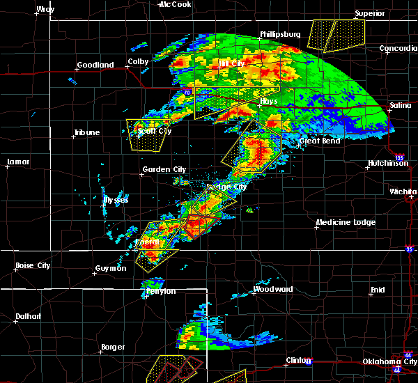 At 529 pm cdt, a severe thunderstorm was located 7 miles north of minneola, or 15 miles south of dodge city, moving northeast at 15 mph (radar indicated). Hazards include 60 mph wind gusts and half dollar size hail. Hail damage to vehicles is expected. Expect wind damage to roofs, siding, and trees. At 529 pm cdt, a severe thunderstorm was located 7 miles north of minneola, or 15 miles south of dodge city, moving northeast at 15 mph (radar indicated). Hazards include 60 mph wind gusts and half dollar size hail. Hail damage to vehicles is expected. Expect wind damage to roofs, siding, and trees.
|
| 5/16/2017 4:52 PM CDT |
 The severe thunderstorm warning for southern ford, northeastern meade and northwestern clark counties will expire at 500 pm cdt, the storm which prompted the warning has weakened below severe limits, and no longer poses an immediate threat to life or property. therefore the warning will be allowed to expire. a tornado watch remains in effect until 1000 pm cdt for southwestern kansas. The severe thunderstorm warning for southern ford, northeastern meade and northwestern clark counties will expire at 500 pm cdt, the storm which prompted the warning has weakened below severe limits, and no longer poses an immediate threat to life or property. therefore the warning will be allowed to expire. a tornado watch remains in effect until 1000 pm cdt for southwestern kansas.
|
| 5/16/2017 4:41 PM CDT |
 At 441 pm cdt, a severe thunderstorm was located very near wright, or 8 miles east of dodge city, moving northeast at 25 mph (radar indicated). Hazards include 70 mph wind gusts and quarter size hail. Hail damage to vehicles is expected. expect considerable tree damage. wind damage is also likely to mobile homes, roofs, and outbuildings. locations impacted include, spearville, bucklin, ford, offerle, fort dodge, wright, bellefont, windhorst, willroads garden, dodge city regional airport, ford state lake and hain state lake. A tornado watch remains in effect until 1000 pm cdt for south central and southwestern kansas. At 441 pm cdt, a severe thunderstorm was located very near wright, or 8 miles east of dodge city, moving northeast at 25 mph (radar indicated). Hazards include 70 mph wind gusts and quarter size hail. Hail damage to vehicles is expected. expect considerable tree damage. wind damage is also likely to mobile homes, roofs, and outbuildings. locations impacted include, spearville, bucklin, ford, offerle, fort dodge, wright, bellefont, windhorst, willroads garden, dodge city regional airport, ford state lake and hain state lake. A tornado watch remains in effect until 1000 pm cdt for south central and southwestern kansas.
|
| 5/16/2017 4:29 PM CDT |
 At 429 pm cdt, a severe thunderstorm was located 5 miles northwest of bloom, or 14 miles south of dodge city, moving northeast at 30 mph (radar indicated). Hazards include 70 mph wind gusts and ping pong ball size hail. People and animals outdoors will be injured. expect hail damage to roofs, siding, windows, and vehicles. expect considerable tree damage. wind damage is also likely to mobile homes, roofs, and outbuildings. locations impacted include, bucklin, minneola, fowler, ford, bloom and kingsdown. A tornado watch remains in effect until 1000 pm cdt for southwestern kansas. At 429 pm cdt, a severe thunderstorm was located 5 miles northwest of bloom, or 14 miles south of dodge city, moving northeast at 30 mph (radar indicated). Hazards include 70 mph wind gusts and ping pong ball size hail. People and animals outdoors will be injured. expect hail damage to roofs, siding, windows, and vehicles. expect considerable tree damage. wind damage is also likely to mobile homes, roofs, and outbuildings. locations impacted include, bucklin, minneola, fowler, ford, bloom and kingsdown. A tornado watch remains in effect until 1000 pm cdt for southwestern kansas.
|
| 5/16/2017 4:24 PM CDT |
 The national weather service in dodge city has issued a * severe thunderstorm warning for. ford county in southwestern kansas. northwestern kiowa county in south central kansas. southeastern hodgeman county in southwestern kansas. Southwestern edwards county in south central kansas. The national weather service in dodge city has issued a * severe thunderstorm warning for. ford county in southwestern kansas. northwestern kiowa county in south central kansas. southeastern hodgeman county in southwestern kansas. Southwestern edwards county in south central kansas.
|
| 5/16/2017 4:10 PM CDT |
 At 410 pm cdt, a severe thunderstorm was located 3 miles west of minneola, or 18 miles northeast of meade, moving northeast at 30 mph (radar indicated). Hazards include golf ball size hail and 70 mph wind gusts. People and animals outdoors will be injured. expect hail damage to roofs, siding, windows, and vehicles. expect considerable tree damage. Wind damage is also likely to mobile homes, roofs, and outbuildings. At 410 pm cdt, a severe thunderstorm was located 3 miles west of minneola, or 18 miles northeast of meade, moving northeast at 30 mph (radar indicated). Hazards include golf ball size hail and 70 mph wind gusts. People and animals outdoors will be injured. expect hail damage to roofs, siding, windows, and vehicles. expect considerable tree damage. Wind damage is also likely to mobile homes, roofs, and outbuildings.
|
| 3/24/2017 1:04 AM CDT |
 At 101 am cdt, a severe thunderstorm was located 3 miles southeast of wright, or 10 miles east of dodge city, moving east at 40 mph (radar indicated. at 12:49 am a wind gust of 67 mph was reported at the dodge city airport). Hazards include 60 mph wind gusts. Expect damage to roofs, siding, and trees. Locations impacted include, dodge city, jetmore, spearville, bucklin, mullinville, ford, fort dodge, wright, windhorst, willroads garden, rolling hill estates, dodge city regional airport, boot hill casino, ford state lake, jetmore city lake and hain state lake. At 101 am cdt, a severe thunderstorm was located 3 miles southeast of wright, or 10 miles east of dodge city, moving east at 40 mph (radar indicated. at 12:49 am a wind gust of 67 mph was reported at the dodge city airport). Hazards include 60 mph wind gusts. Expect damage to roofs, siding, and trees. Locations impacted include, dodge city, jetmore, spearville, bucklin, mullinville, ford, fort dodge, wright, windhorst, willroads garden, rolling hill estates, dodge city regional airport, boot hill casino, ford state lake, jetmore city lake and hain state lake.
|
| 3/24/2017 12:53 AM CDT |
 At 1253 am cdt, a severe thunderstorm was located 3 miles southeast of fort dodge, or 8 miles southeast of dodge city, moving northeast at 40 mph (radar indicated). Hazards include 70 mph wind gusts. Expect considerable tree damage. Damage is likely to mobile homes, roofs, and outbuildings. At 1253 am cdt, a severe thunderstorm was located 3 miles southeast of fort dodge, or 8 miles southeast of dodge city, moving northeast at 40 mph (radar indicated). Hazards include 70 mph wind gusts. Expect considerable tree damage. Damage is likely to mobile homes, roofs, and outbuildings.
|
| 7/27/2016 5:43 PM CDT |
 At 543 pm cdt, a severe thunderstorm was located very near ft. dodge, moving south at 5 mph (radar indicated). Hazards include 60 mph wind gusts and quarter size hail. Hail damage to vehicles is expected. Expect wind damage to roofs, siding, and trees. At 543 pm cdt, a severe thunderstorm was located very near ft. dodge, moving south at 5 mph (radar indicated). Hazards include 60 mph wind gusts and quarter size hail. Hail damage to vehicles is expected. Expect wind damage to roofs, siding, and trees.
|
| 7/15/2016 6:00 PM CDT |
 At 559 pm cdt, a severe thunderstorm was located 8 miles northeast of howell, moving south at 25 mph. this is a very dangerous storm (radar indicated). Hazards include 80 mph wind gusts and tennis ball size hail. Flying debris will be dangerous to those caught without shelter. mobile homes will be heavily damaged. expect considerable damage to roofs, windows, and vehicles. extensive tree damage and power outages are likely. locations impacted include, dodge city, ford, howell, ft. dodge, wright and kingsdown. Dodge city is in the path of this significant severe thunderstorm!. At 559 pm cdt, a severe thunderstorm was located 8 miles northeast of howell, moving south at 25 mph. this is a very dangerous storm (radar indicated). Hazards include 80 mph wind gusts and tennis ball size hail. Flying debris will be dangerous to those caught without shelter. mobile homes will be heavily damaged. expect considerable damage to roofs, windows, and vehicles. extensive tree damage and power outages are likely. locations impacted include, dodge city, ford, howell, ft. dodge, wright and kingsdown. Dodge city is in the path of this significant severe thunderstorm!.
|
| 7/15/2016 5:45 PM CDT |
 At 544 pm cdt, a severe thunderstorm was located 12 miles southeast of kalvesta, moving south at 25 mph (radar indicated). Hazards include tennis ball size hail and 70 mph wind gusts. People and animals outdoors will be injured. expect hail damage to roofs, siding, windows, and vehicles. expect considerable tree damage. Wind damage is also likely to mobile homes, roofs, and outbuildings. At 544 pm cdt, a severe thunderstorm was located 12 miles southeast of kalvesta, moving south at 25 mph (radar indicated). Hazards include tennis ball size hail and 70 mph wind gusts. People and animals outdoors will be injured. expect hail damage to roofs, siding, windows, and vehicles. expect considerable tree damage. Wind damage is also likely to mobile homes, roofs, and outbuildings.
|
| 5/26/2016 8:42 PM CDT | The severe thunderstorm warning for eastern ford, southwestern edwards and northwestern kiowa counties will expire at 845 pm cdt, the severe thunderstorm which prompted the warning has weakened below severe limits. the severe thunderstorm warning will be allowed to expire at 845 pm. a tornado watch remains in effect until 1000 pm cdt for southwestern kansas. |
| 5/26/2016 8:31 PM CDT |
 At 831 pm cdt, a severe thunderstorm was located 6 miles southeast of windhorst, moving northeast at 40 mph (radar indicated). Hazards include 70 mph wind gusts and half dollar size hail. Hail damage to vehicles is expected. expect considerable tree damage. wind damage is also likely to mobile homes, roofs and outbuildings. locations impacted include, bucklin, mullinville, ford and windhorst. A tornado watch remains in effect until 1000 pm cdt for southwestern kansas. At 831 pm cdt, a severe thunderstorm was located 6 miles southeast of windhorst, moving northeast at 40 mph (radar indicated). Hazards include 70 mph wind gusts and half dollar size hail. Hail damage to vehicles is expected. expect considerable tree damage. wind damage is also likely to mobile homes, roofs and outbuildings. locations impacted include, bucklin, mullinville, ford and windhorst. A tornado watch remains in effect until 1000 pm cdt for southwestern kansas.
|
| 5/26/2016 8:15 PM CDT |
 At 815 pm cdt, a severe thunderstorm was located 5 miles north of bucklin, moving northeast at 40 mph (radar indicated). Hazards include tennis ball size hail and 60 mph wind gusts. People and animals outdoors will be injured. expect hail damage to roofs, siding, windows and vehicles. expect wind damage to roofs, siding and trees. locations impacted include, bucklin, mullinville, ford, bloom, windhorst and kingsdown. A tornado watch remains in effect until 1000 pm cdt for southwestern kansas. At 815 pm cdt, a severe thunderstorm was located 5 miles north of bucklin, moving northeast at 40 mph (radar indicated). Hazards include tennis ball size hail and 60 mph wind gusts. People and animals outdoors will be injured. expect hail damage to roofs, siding, windows and vehicles. expect wind damage to roofs, siding and trees. locations impacted include, bucklin, mullinville, ford, bloom, windhorst and kingsdown. A tornado watch remains in effect until 1000 pm cdt for southwestern kansas.
|
| 5/26/2016 8:06 PM CDT |
 At 806 pm cdt, a severe thunderstorm was located 3 miles north of bucklin, moving northeast at 40 mph (radar indicated). Hazards include tennis ball size hail and 60 mph wind gusts. People and animals outdoors will be injured. expect hail damage to roofs, siding, windows and vehicles. Expect wind damage to roofs, siding and trees. At 806 pm cdt, a severe thunderstorm was located 3 miles north of bucklin, moving northeast at 40 mph (radar indicated). Hazards include tennis ball size hail and 60 mph wind gusts. People and animals outdoors will be injured. expect hail damage to roofs, siding, windows and vehicles. Expect wind damage to roofs, siding and trees.
|
| 5/26/2016 6:59 PM CDT |
 At 659 pm cdt, a severe thunderstorm was located near bucklin, moving northeast at 45 mph (radar indicated). Hazards include two inch hail and 60 mph wind gusts. People and animals outdoors will be injured. expect hail damage to roofs, siding, windows and vehicles. expect wind damage to roofs, siding and trees. locations impacted include, kinsley, bucklin, mullinville, ford, offerle, bloom, centerview, kingsdown, fellsburg and windhorst. A tornado watch remains in effect until 1000 pm cdt for southwestern kansas. At 659 pm cdt, a severe thunderstorm was located near bucklin, moving northeast at 45 mph (radar indicated). Hazards include two inch hail and 60 mph wind gusts. People and animals outdoors will be injured. expect hail damage to roofs, siding, windows and vehicles. expect wind damage to roofs, siding and trees. locations impacted include, kinsley, bucklin, mullinville, ford, offerle, bloom, centerview, kingsdown, fellsburg and windhorst. A tornado watch remains in effect until 1000 pm cdt for southwestern kansas.
|
| 5/26/2016 6:40 PM CDT |
 At 640 pm cdt, a severe thunderstorm was located very near kingsdown, moving northeast at 30 mph (radar indicated). Hazards include two inch hail. People and animals outdoors will be injured. Expect damage to roofs, siding, windows and vehicles. At 640 pm cdt, a severe thunderstorm was located very near kingsdown, moving northeast at 30 mph (radar indicated). Hazards include two inch hail. People and animals outdoors will be injured. Expect damage to roofs, siding, windows and vehicles.
|
| 5/26/2016 5:28 PM CDT |
 At 528 pm cdt, a severe thunderstorm was located 7 miles northwest of minneola, moving northeast at 40 mph (radar indicated). Hazards include half dollar size hail. Damage to vehicles is expected. locations impacted include, ford. A tornado watch remains in effect until 1000 pm cdt for southwestern kansas. At 528 pm cdt, a severe thunderstorm was located 7 miles northwest of minneola, moving northeast at 40 mph (radar indicated). Hazards include half dollar size hail. Damage to vehicles is expected. locations impacted include, ford. A tornado watch remains in effect until 1000 pm cdt for southwestern kansas.
|
| 5/26/2016 5:19 PM CDT |
 At 519 pm cdt, a severe thunderstorm was located 5 miles northeast of fowler, moving northeast at 35 mph (radar indicated). Hazards include half dollar size hail. damage to vehicles is expected At 519 pm cdt, a severe thunderstorm was located 5 miles northeast of fowler, moving northeast at 35 mph (radar indicated). Hazards include half dollar size hail. damage to vehicles is expected
|
| 5/26/2016 3:20 PM CDT |
 At 320 pm cdt, a severe thunderstorm was located 6 miles southeast of windhorst, moving east at 20 mph (radar indicated). Hazards include quarter size hail. Damage to vehicles is expected. locations impacted include, bucklin, mullinville, ford and windhorst. A tornado watch remains in effect until 1000 pm cdt for southwestern kansas. At 320 pm cdt, a severe thunderstorm was located 6 miles southeast of windhorst, moving east at 20 mph (radar indicated). Hazards include quarter size hail. Damage to vehicles is expected. locations impacted include, bucklin, mullinville, ford and windhorst. A tornado watch remains in effect until 1000 pm cdt for southwestern kansas.
|
| 5/26/2016 3:05 PM CDT |
 At 305 pm cdt, a severe thunderstorm was located 3 miles northwest of bucklin, moving northeast at 35 mph (radar indicated). Hazards include half dollar size hail. damage to vehicles is expected At 305 pm cdt, a severe thunderstorm was located 3 miles northwest of bucklin, moving northeast at 35 mph (radar indicated). Hazards include half dollar size hail. damage to vehicles is expected
|
| 5/26/2016 2:07 PM CDT |
 At 207 pm cdt, a severe thunderstorm was located 5 miles northwest of mullinville, moving northeast at 30 mph (radar indicated). Hazards include two inch hail and 70 mph wind gusts. People and animals outdoors will be injured. expect hail damage to roofs, siding, windows and vehicles. expect considerable tree damage. wind damage is also likely to mobile homes, roofs and outbuildings. locations impacted include, bucklin, mullinville, ford, windhorst and kingsdown. A tornado watch remains in effect until 1000 pm cdt for southwestern kansas. At 207 pm cdt, a severe thunderstorm was located 5 miles northwest of mullinville, moving northeast at 30 mph (radar indicated). Hazards include two inch hail and 70 mph wind gusts. People and animals outdoors will be injured. expect hail damage to roofs, siding, windows and vehicles. expect considerable tree damage. wind damage is also likely to mobile homes, roofs and outbuildings. locations impacted include, bucklin, mullinville, ford, windhorst and kingsdown. A tornado watch remains in effect until 1000 pm cdt for southwestern kansas.
|
| 5/26/2016 1:41 PM CDT |
 At 141 pm cdt, a severe thunderstorm was located 4 miles southeast of kingsdown, moving northeast at 30 mph (radar indicated). Hazards include two inch hail and 70 mph wind gusts. People and animals outdoors will be injured. expect hail damage to roofs, siding, windows and vehicles. expect considerable tree damage. Wind damage is also likely to mobile homes, roofs and outbuildings. At 141 pm cdt, a severe thunderstorm was located 4 miles southeast of kingsdown, moving northeast at 30 mph (radar indicated). Hazards include two inch hail and 70 mph wind gusts. People and animals outdoors will be injured. expect hail damage to roofs, siding, windows and vehicles. expect considerable tree damage. Wind damage is also likely to mobile homes, roofs and outbuildings.
|
| 11/16/2015 9:36 PM CST |
 At 934 pm cst, severe thunderstorms were located along a line extending from 7 miles west of jetmore to 6 miles north of bloom, moving northeast at 60 mph (radar indicated. at 930 pm, a wind gusts at 62 mph was recorded at the national weather service office on the eastern extremity of dodge city). Hazards include 60 mph wind gusts and penny size hail. Expect damage to roofs. siding and trees. locations impacted include, dodge city, jetmore, spearville, ford, hanston, bellefont, wright, ft. dodge and windhorst. A tornado watch remains in effect until 300 am cst for southwestern kansas. At 934 pm cst, severe thunderstorms were located along a line extending from 7 miles west of jetmore to 6 miles north of bloom, moving northeast at 60 mph (radar indicated. at 930 pm, a wind gusts at 62 mph was recorded at the national weather service office on the eastern extremity of dodge city). Hazards include 60 mph wind gusts and penny size hail. Expect damage to roofs. siding and trees. locations impacted include, dodge city, jetmore, spearville, ford, hanston, bellefont, wright, ft. dodge and windhorst. A tornado watch remains in effect until 300 am cst for southwestern kansas.
|
| 11/16/2015 9:24 PM CST |
 At 924 pm cst, severe thunderstorms were located along a line extending from 9 miles southeast of kalvesta to 5 miles northwest of minneola, moving northeast at 45 mph (radar indicated). Hazards include 60 mph wind gusts and penny size hail. Expect damage to roofs. Siding and trees. At 924 pm cst, severe thunderstorms were located along a line extending from 9 miles southeast of kalvesta to 5 miles northwest of minneola, moving northeast at 45 mph (radar indicated). Hazards include 60 mph wind gusts and penny size hail. Expect damage to roofs. Siding and trees.
|
| 11/4/2015 10:15 PM CST |
 At 1014 pm cst, severe thunderstorms were located along a line extending from 7 miles north of wright to 10 miles southwest of ft. dodge, moving east at 35 mph (radar indicated). Hazards include 60 mph wind gusts. Expect damage to roofs. siding and trees. locations impacted include, dodge city, spearville, ford, wright and ft. Dodge. At 1014 pm cst, severe thunderstorms were located along a line extending from 7 miles north of wright to 10 miles southwest of ft. dodge, moving east at 35 mph (radar indicated). Hazards include 60 mph wind gusts. Expect damage to roofs. siding and trees. locations impacted include, dodge city, spearville, ford, wright and ft. Dodge.
|
| 11/4/2015 9:43 PM CST |
 At 943 pm cst, a severe thunderstorm was located very near the haggard elev, moving northeast at 45 mph (radar indicated). Hazards include 60 mph wind gusts. Expect damage to roofs. Siding and trees. At 943 pm cst, a severe thunderstorm was located very near the haggard elev, moving northeast at 45 mph (radar indicated). Hazards include 60 mph wind gusts. Expect damage to roofs. Siding and trees.
|
| 9/10/2015 9:15 PM CDT |
 At 914 pm cdt, a severe thunderstorm was located very near spearville, moving southeast at 20 mph (radar indicated). Hazards include 60 mph wind gusts and quarter size hail. Hail damage to vehicles is expected. Expect wind damage to roofs, siding and trees. At 914 pm cdt, a severe thunderstorm was located very near spearville, moving southeast at 20 mph (radar indicated). Hazards include 60 mph wind gusts and quarter size hail. Hail damage to vehicles is expected. Expect wind damage to roofs, siding and trees.
|
| 7/19/2015 11:06 PM CDT |
 The severe thunderstorm warning for hodgeman and ford counties will expire at 1115 pm cdt, the line of storms which prompted the warning have weakened below severe limits, and no longer pose an immediate threat to life or property. therefore the warning will be allowed to expire. The severe thunderstorm warning for hodgeman and ford counties will expire at 1115 pm cdt, the line of storms which prompted the warning have weakened below severe limits, and no longer pose an immediate threat to life or property. therefore the warning will be allowed to expire.
|
| 7/19/2015 10:14 PM CDT |
 At 1013 pm cdt, the leading front of severe thunderstorms was located along a line extending from 11 miles north of jetmore to near fowler, moving east at 45 mph (radar indicated). Hazards include 60 mph wind gusts. Expect damage to roofs. Siding and trees. At 1013 pm cdt, the leading front of severe thunderstorms was located along a line extending from 11 miles north of jetmore to near fowler, moving east at 45 mph (radar indicated). Hazards include 60 mph wind gusts. Expect damage to roofs. Siding and trees.
|
| 6/11/2015 10:41 PM CDT |
 At 1041 pm cdt, a severe thunderstorm was located very near windhorst, moving north at 70 mph (radar indicated). Hazards include quarter size hail. Damage to vehicles is expected. Locations impacted include, bucklin, spearville, ford, bellefont and windhorst. At 1041 pm cdt, a severe thunderstorm was located very near windhorst, moving north at 70 mph (radar indicated). Hazards include quarter size hail. Damage to vehicles is expected. Locations impacted include, bucklin, spearville, ford, bellefont and windhorst.
|
| 6/11/2015 10:12 PM CDT |
 At 1011 pm cdt, a severe thunderstorm was located near kingsdown, moving north at 35 mph (radar indicated). Hazards include ping pong ball size hail. People and animals outdoors will be injured. Expect damage to roofs, siding, windows and vehicles. At 1011 pm cdt, a severe thunderstorm was located near kingsdown, moving north at 35 mph (radar indicated). Hazards include ping pong ball size hail. People and animals outdoors will be injured. Expect damage to roofs, siding, windows and vehicles.
|
| 5/27/2015 9:50 PM CDT | The severe thunderstorm warning for northeastern ford county will expire at 1000 pm cdt, the storm which prompted the warning has moved out of the area. therefore the warning will be allowed to expire. however small. |
| 5/27/2015 9:41 PM CDT | At 941 pm cdt, a severe thunderstorm was located 5 miles southwest of windhorst, moving east at 30 mph (radar indicated). Hazards include 60 mph wind gusts. Expect damage to roofs. siding and trees. Locations impacted include, spearville, ford, bellefont and windhorst. |
| 5/27/2015 9:28 PM CDT | At 927 pm cdt, a severe thunderstorm was located near wright, moving east at 30 mph (radar indicated). Hazards include 60 mph wind gusts. Expect damage to roofs. siding and trees. locations impacted include, spearville, ford, bellefont, wright, windhorst and ft. dodge. A tornado watch remains in effect until 1000 pm cdt for southwestern kansas. |
| 5/27/2015 9:16 PM CDT | At 916 pm cdt, a severe thunderstorm was located near dodge city, moving east at 30 mph (radar indicated). Hazards include 60 mph wind gusts. Expect damage to roofs. Siding and trees. |
| 5/25/2015 1:05 AM CDT | At 104 am cdt, a severe thunderstorm was located 3 miles east of wright, moving east at 25 mph (radar indicated). Hazards include 60 mph wind gusts and quarter size hail. Hail damage to vehicles is expected. expect wind damage to roofs, siding and trees. locations impacted include, dodge city, spearville, mullinville, ford, offerle, bellefont, wright, ft. dodge and windhorst. A tornado watch remains in effect until 300 am cdt for southwestern kansas. |
| 5/25/2015 12:50 AM CDT | At 1250 am cdt, a severe thunderstorm was located very near ft. dodge, moving east at 25 mph (radar indicated). Hazards include 60 mph wind gusts and quarter size hail. Hail damage to vehicles is expected. Expect wind damage to roofs, siding and trees. |
| 5/9/2015 8:44 PM CDT | At 843 pm cdt, a severe thunderstorm was located 3 miles west of bucklin, moving northeast at 35 mph (radar indicated). Hazards include 60 mph wind gusts and half dollar size hail. Hail damage to vehicles is expected. Expect wind damage to roofs, siding and trees. |
| 10/1/2014 8:15 PM CDT | Quarter sized hail reported 2.5 miles NW of Ford, KS |
| 6/30/2014 8:31 PM CDT | Quarter sized hail reported 3.1 miles S of Ford, KS |
| 6/30/2014 8:31 PM CDT | Quarter sized hail reported 4.4 miles ENE of Ford, KS |
| 6/1/2014 7:35 PM CDT | Small branches were blown dow in ford county KS, 4.3 miles NW of Ford, KS |
| 6/1/2014 7:30 PM CDT | A 15x30 foot metal shed was blown about 200 feet. 2-3 inch diameter tree limbs blown dow in ford county KS, 4.1 miles NNE of Ford, KS |
| 4/23/2014 7:55 PM CDT | Ping Pong Ball sized hail reported 4.4 miles ENE of Ford, KS |
| 7/23/2013 7:34 PM CDT | Winds were estimated to be in excess of 60 mp in ford county KS, 3.8 miles N of Ford, KS |
| 7/23/2013 7:20 PM CDT | Kwch storm chaser estimated wind gusts of 60 to 65 mp in ford county KS, 1.9 miles W of Ford, KS |
| 7/23/2013 7:10 PM CDT | Storm damage reported in ford county KS, 1.3 miles SW of Ford, KS |
| 6/27/2013 5:06 PM CDT | Storm damage reported in ford county KS, 2.4 miles N of Ford, KS |
| 6/24/2013 8:20 PM CDT | Golf Ball sized hail reported 3.6 miles ENE of Ford, KS |
| 6/24/2013 8:15 PM CDT | Storm damage reported in ford county KS, 1.3 miles SW of Ford, KS |
| 8/18/2012 8:30 AM CDT | A 24 foot stock trailer and a 500 bushel grain cart were blown ove in ford county KS, 9.8 miles NNE of Ford, KS |
| 8/3/2012 9:40 PM CDT | Numerous limbs 8-9 inches in diameter were blown down. a power line was blown loose from a bui in ford county KS, 8.7 miles ENE of Ford, KS |
| 5/30/2012 8:13 PM CDT | Storm damage reported in ford county KS, 6.4 miles WSW of Ford, KS |
| 4/14/2012 7:58 PM CDT | Quarter sized hail reported 10 miles N of Ford, KS, windows were knocked out by hail in kingsdown. |
| 1/1/0001 12:00 AM | Four inch tree limbs were blown dow in ford county KS, 0.4 miles SSW of Ford, KS |
| 1/1/0001 12:00 AM | Quarter sized hail reported 2.8 miles ESE of Ford, KS, the hail size was anywhere from pea to quarter. |
Hail Maps for Ford, KS


Connect with Interactive Hail Maps