

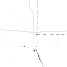
Hail Map for Wednesday, July 14, 2021

Number of Impacted Households on 7/14/2021
0
Impacted by 1" or Larger Hail
0
Impacted by 1.75" or Larger Hail
0
Impacted by 2.5" or Larger Hail
Square Miles of Populated Area Impacted on 7/14/2021
0
Impacted by 1" or Larger Hail
0
Impacted by 1.75" or Larger Hail
0
Impacted by 2.5" or Larger Hail


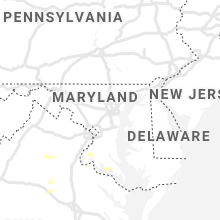


Cities Most Affected by Hail Storms of 7/14/2021
| Hail Size | Demographics of Zip Codes Affected | ||||||
|---|---|---|---|---|---|---|---|
| City | Count | Average | Largest | Pop Density | House Value | Income | Age |
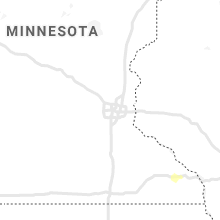
| Bosler, WY | 1 | 2.00 | 2.00 | 0 | $145k | $12.2k | 42.8 |
| Amherst, MA | 1 | 1.75 | 1.75 | 449 | $178k | $42.6k | 24.0 |
| Cheyenne, WY | 1 | 1.75 | 1.75 | 26 | $135k | $54.6k | 42.7 |
Hail and Wind Damage Spotted on 7/14/2021
Filter by Report Type:Hail ReportsWind Reports
States Impacted
Iowa, Michigan, New York, Virginia, Vermont, New Hampshire, Wisconsin, New Jersey, Maryland, Wyoming, Massachusetts, North Carolina, Utah, Arizona, IllinoisIowa
| Local Time | Report Details |
|---|---|
| 8:41 AM CDT | Trees on power line in story county IA, 30.9 miles NNE of Des Moines, IA |
| 5:14 PM CDT | Half Dollar sized hail reported near Clarksville, IA, 37 miles SE of Mason City, IA |
| 6:08 PM CDT | Reported at truck stop in town in floyd county IA, 26.9 miles E of Mason City, IA |
| 6:08 PM CDT | Reported at truck stop in town in floyd county IA, 23.3 miles E of Mason City, IA |
| 6:17 PM CDT | Numerous trees down. time estimated from rada in black hawk county IA, 50.1 miles NW of Cedar Rapids, IA |
| 6:22 PM CDT | Trees down. time estimate in black hawk county IA, 50.1 miles NW of Cedar Rapids, IA |
| 6:23 PM CDT | Reports of building damage around town in fayette county IA, 50.1 miles NNW of Cedar Rapids, IA |
| 7:24 PM CDT | Dysart fire called out for a downed transformer that started a fir in tama county IA, 35.3 miles WNW of Cedar Rapids, IA |
| 8:23 PM CDT | Large tree branches dow in story county IA, 32.6 miles NE of Des Moines, IA |
| 9:50 PM CDT | Damage to home and machine shed. report relayed by em. possible tornado. time estimated from rada in jones county IA, 26.7 miles NE of Cedar Rapids, IA |
| 10:33 PM CDT | County official reported estimated wind gusts of up to 60 mph generally 6 miles west of the tipton are in cedar county IA, 26.3 miles ESE of Cedar Rapids, IA |
| 10:56 PM CDT | Ham radio relay of estimated 60 mph wind gust just west of new libert in cedar county IA, 43.7 miles ESE of Cedar Rapids, IA |
| 11:15 PM CDT | Law enforcement relaying a public report of 60 mph winds near springbroo in jackson county IA, 62.7 miles ENE of Cedar Rapids, IA |
Michigan
| Local Time | Report Details |
|---|---|
| 3:00 PM EDT | Campground host of indian river campground reports 400-500 foot area of trees uprooted... many 3 feet or more in diameter. the campground is inaccessible. no injuries r in schoolcraft county MI, 55.7 miles ESE of Marquette, MI |
New York
| Local Time | Report Details |
|---|---|
| 3:10 PM EDT | Several reports of trees and wires down in center brunswick. time estimated from rada in rensselaer county NY, 17.2 miles ESE of Schenectady, NY |
| 3:21 PM EDT | Trees down blocking coila r in washington county NY, 31.3 miles ENE of Schenectady, NY |
| 3:43 PM EDT | Several reports of trees and wires down in the poestenkill area. time estimated from rada in rensselaer county NY, 21.1 miles ESE of Schenectady, NY |
Virginia
| Local Time | Report Details |
|---|---|
| 3:13 PM EDT | Tree down along route 231 at route 67 in madison county VA, 74 miles NNW of Richmond, VA |
| 3:32 PM EDT | Wires down in the 400 block of james madison highwa in culpeper county VA, 69.8 miles NNW of Richmond, VA |
| 3:32 PM EDT | Wires down in the 2100 block of country club roa in culpeper county VA, 69.5 miles NNW of Richmond, VA |
| 3:36 PM EDT | Wires down in the 200 block of chesnut driv in culpeper county VA, 68.1 miles NNW of Richmond, VA |
| 3:36 PM EDT | Wires down in the 200 block of chesnut driv in culpeper county VA, 68.1 miles NNW of Richmond, VA |
| 3:36 PM EDT | Wires down along on west asher stree in culpeper county VA, 69.3 miles NNW of Richmond, VA |
| 3:36 PM EDT | Downed tree onto wires off of webster lan in culpeper county VA, 68.7 miles NNW of Richmond, VA |
| 3:41 PM EDT | Tree down on wires on hunting shire lane... off of henderson roa in fairfax county VA, 53.4 miles SW of Baltimore, MD |
| 3:45 PM EDT | Tree down in the 3000 block of shelby roa in madison county VA, 67.1 miles NNW of Richmond, VA |
| 4:08 PM EDT | Tree down at leeds manor road and crest hill roa in fauquier county VA, 82.2 miles WSW of Baltimore, MD |
| 4:08 PM EDT | Tree down on free state road at mountjoy roa in fauquier county VA, 74.8 miles WSW of Baltimore, MD |
| 4:25 PM EDT | Tree down near st adams dr and joshua rd in stafford county VA, 67.8 miles N of Richmond, VA |
| 4:26 PM EDT | Tree in the roadway near garrisonville road and algrace boulevar in stafford county VA, 67.9 miles N of Richmond, VA |
| 4:35 PM EDT | Trees down near intersection of kellogg mill rd and bethany way in stafford county VA, 63.1 miles N of Richmond, VA |
| 4:45 PM EDT | Tree down in 14000 block of thomas nelson hwy blocking sb lanes in nelson county VA, 68.7 miles WNW of Richmond, VA |
| 4:49 PM EDT | Trees down near piedmont drive and chancellor park driv in spotsylvania county VA, 53.1 miles N of Richmond, VA |
| 4:55 PM EDT | Tree blocking the roadway in the 5900 block of harrison roa in spotsylvania county VA, 53.2 miles N of Richmond, VA |
| 5:00 PM EDT | Tree down near salem village drive and elwyn cour in spotsylvania county VA, 52.5 miles N of Richmond, VA |
| 5:04 PM EDT | Large tree down in the 5400 block of leavells crossing driv in spotsylvania county VA, 51.9 miles N of Richmond, VA |
| 5:04 PM EDT | Tree and wires down on rollingwood drive near sarah lan in spotsylvania county VA, 52.1 miles N of Richmond, VA |
| 5:06 PM EDT | Trees and wires down in 2000 block of lafayette blvd in city of fredericks county VA, 54.4 miles N of Richmond, VA |
| 5:09 PM EDT | Tree blocking the roadway near lee drive and lansdowne roa in spotsylvania county VA, 53.1 miles N of Richmond, VA |
| 5:09 PM EDT | Tree into the front of a home on bentley cour in spotsylvania county VA, 53.7 miles N of Richmond, VA |
| 5:09 PM EDT | Tree in the roadway near shannon drive and lansdowne roa in spotsylvania county VA, 53.9 miles N of Richmond, VA |
| 5:10 PM EDT | Storm damage reported in spotsylvania county VA, 54 miles NNE of Richmond, VA |
| 5:12 PM EDT | Wires down near tazewell st and pendleton rd in stafford county VA, 55.6 miles NNE of Richmond, VA |
| 5:23 PM EDT | Large tree down across james madison pkwy and davis dr in king george county VA, 64.7 miles NNE of Richmond, VA |
| 5:31 PM EDT | Several trees reported down se of the town of louis in louisa county VA, 36.5 miles NNW of Richmond, VA |
| 5:38 PM EDT | Storm damage reported in anz536 county VA, 68.1 miles NNE of Richmond, VA |
| 5:58 PM EDT | Numerous trees down between yanceyville and apple grov in louisa county VA, 31.3 miles NNW of Richmond, VA |
| 6:00 PM EDT | Widespread tree damage south and southeast of mineral. route 33 blocked in multiple locations by large (2ft diameter) uprooted trees. report via twitte in louisa county VA, 31.6 miles NNW of Richmond, VA |
| 6:00 PM EDT | Multiple trees down south and southeast of minera in louisa county VA, 30.3 miles NNW of Richmond, VA |
| 6:19 PM EDT | Trees down along jefferson highwa in louisa county VA, 26.9 miles NNW of Richmond, VA |
| 7:00 PM EDT | Trees downed along us-360. time radar-estimate in northumberland county VA, 69.8 miles ENE of Richmond, VA |
Vermont
| Local Time | Report Details |
|---|---|
| 3:23 PM EDT | Multiple reports of trees and wires down around shaftsbury. time estimated from rada in bennington county VT, 39.8 miles ENE of Schenectady, NY |
| 4:08 PM EDT | Trees down on ray hill rd. time estimated from rada in windham county VT, 54.5 miles E of Schenectady, NY |
| 4:47 PM EDT | Tree down on wires. time estimated from rada in windham county VT, 71.8 miles E of Schenectady, NY |
New Hampshire
| Local Time | Report Details |
|---|---|
| 3:37 PM EDT | Tree down on farman ave. time based on radar estimat in grafton county NH, 73.5 miles SE of Burlington, VT |
| 3:37 PM EDT | Trees down at east wilder boat launch. time estimated by rada in grafton county NH, 74.2 miles SE of Burlington, VT |
| 3:39 PM EDT | Tree down across alden road and 0.75 hail. time estimated based on rada in grafton county NH, 75 miles SE of Burlington, VT |
| 4:00 PM EDT | Quarter sized hail reported near Canaan, NH, 80.6 miles SE of Burlington, VT, hail on us highway 4 west of canaan. radar estimated time. |
Wisconsin
| Local Time | Report Details |
|---|---|
| 2:40 PM CDT | Ping Pong Ball sized hail reported near Rhinelander, WI, 8.8 miles NE of Rhinelander, WI, reported by sheriff deputy near highway 17 and jennie webber lake road south of sugar camp. |
| 3:38 PM CDT | A few tree limbs snapped in city. via social media in calumet county WI, 23.1 miles S of Green Bay, WI |
| 3:40 PM CDT | Multiple large branches down. estimated wind 60mp in brown county WI, 2 miles WNW of Green Bay, WI |
| 4:10 PM CDT | Several trees down in the northwest portion of manitowoc and points to the northwest in manitowoc count in manitowoc county WI, 32.3 miles SSE of Green Bay, WI |
| 5:22 PM CDT | Multiple trees down in north freedom. time estimated via rada in sauk county WI, 35.8 miles NW of Madison, WI |
| 5:25 PM CDT | *** 1 inj *** report of roof damage to a garage along with trees down on spring valley rd. time estimated via rada in sauk county WI, 41.2 miles NW of Madison, WI |
| 5:28 PM CDT | Quarter sized hail reported near Baraboo, WI, 33.5 miles NNW of Madison, WI, report relayed via social media. time estimated via radar. |
| 5:30 PM CDT | Multiple reports of downed trees... limbs... and powerlines across baraboo and the surrounding areas. time estimated based on rada in sauk county WI, 32.7 miles NNW of Madison, WI |
| 5:45 PM CDT | Reports of downed trees and limbs around the caledonia area in columbia county. time estimated via rada in columbia county WI, 29.1 miles NNW of Madison, WI |
| 5:55 PM CDT | Reports of downed trees and limbs around the poynette area. time estimated via rada in columbia county WI, 22.6 miles N of Madison, WI |
| 12:47 AM CDT | Multiple reports of trees and power lines down in the beloit area. time estimated from rada in rock county WI, 42.5 miles SSE of Madison, WI |
| 1:28 AM CDT | Medium sized tree branches fallen around neighborhoo in walworth county WI, 48.7 miles SE of Madison, WI |
New Jersey
| Local Time | Report Details |
|---|---|
| 3:55 PM EDT | Downed trees and power lines in chatham. time estimated from rada in morris county NJ, 20.7 miles W of Brooklyn, NY |
| 4:00 PM EDT | Reports of wires dow in union county NJ, 20 miles W of Brooklyn, NY |
| 7:04 PM EDT | Wires down near route 35. power outages in the area. time estimated from rada in monmouth county NJ, 21.1 miles SSW of Brooklyn, NY |
| 7:24 PM EDT | Downed wires near hazlet avenue and route 35. time estimated from rada in monmouth county NJ, 21.3 miles SSW of Brooklyn, NY |
| 7:26 PM EDT | Downed power lines near a residence on park avenue. time estimated from rada in monmouth county NJ, 19.8 miles SSW of Brooklyn, NY |
Maryland
| Local Time | Report Details |
|---|---|
| 4:44 PM EDT | Numerous trees down in the marbury are in charles county MD, 57.9 miles SSW of Baltimore, MD |
| 5:04 PM EDT | Tree down onto wires near port tobacco road and mill swamp roa in charles county MD, 61.4 miles SSW of Baltimore, MD |
| 5:09 PM EDT | Several trees down in the la plata are in charles county MD, 56.1 miles SSW of Baltimore, MD |
| 5:51 PM EDT | Tree down along budds creek roa in st. marys county MD, 64.8 miles S of Baltimore, MD |
| 5:55 PM EDT | Tree down along dixie lyon road near oema cour in st. marys county MD, 58.8 miles S of Baltimore, MD |
| 6:00 PM EDT | Tree down near colton point road and paul ellis roa in st. marys county MD, 71 miles NE of Richmond, VA |
| 6:21 PM EDT | Three trees down near the intersection of hatchet thickett road and olen mattingly road in st. marys county MD, 70.9 miles NE of Richmond, VA |
| 6:24 PM EDT | Tree down near the intersection of vista road and sotterly road in st. marys county MD, 68.4 miles S of Baltimore, MD |
| 6:24 PM EDT | Numerous trees down in the wildewood area in st. marys county MD, 67.7 miles S of Baltimore, MD |
| 6:30 PM EDT | Storm damage reported in anz537 county MD, 75 miles NE of Richmond, VA |
| 6:33 PM EDT | Numerous trees down on three notch road between first colony blvd and chancellors run roa in st. marys county MD, 68.6 miles S of Baltimore, MD |
| 6:37 PM EDT | Tree and wires on the roadway near point lookout road and winters lan in st. marys county MD, 72.5 miles S of Baltimore, MD |
| 6:42 PM EDT | Storm damage reported in anz537 county MD, 75 miles NE of Richmond, VA |
| 6:42 PM EDT | Wires down along charles street in solomon in calvert county MD, 67.4 miles S of Baltimore, MD |
Wyoming
| Local Time | Report Details |
|---|---|
| 2:51 PM MDT | Ping Pong Ball sized hail reported near Horse Creek, WY, 25 miles E of Laramie, WY, hail fell for ten minutes from 251 to 301. |
| 3:00 PM MDT | Ping Pong Ball sized hail reported near Cheyenne, WY, 25.5 miles E of Laramie, WY, hail covering ground. |
| 3:00 PM MDT | Quarter sized hail reported near Cheyenne, WY, 26.3 miles E of Laramie, WY |
| 3:13 PM MDT | Golf Ball sized hail reported near Cheyenne, WY, 30.5 miles ESE of Laramie, WY |
| 3:20 PM MDT | Half Dollar sized hail reported near Cheyenne, WY, 32.7 miles ESE of Laramie, WY, reports of quarter to half dollar-sized hail. |
| 7:40 PM MDT | Hen Egg sized hail reported near Bosler, WY, 23.7 miles NNW of Laramie, WY, hail sizes ranged from quarters to eggs. |
Massachusetts
| Local Time | Report Details |
|---|---|
| 5:23 PM EDT | Tree down on pine meadow road near the s curves in franklin county MA, 76.7 miles E of Schenectady, NY |
| 5:40 PM EDT | Quarter sized hail reported near Erving, MA, 73.8 miles NW of Providence, RI, quarter size hail |
| 5:45 PM EDT | Tree and wires down on wells street and state roa in franklin county MA, 73.8 miles NW of Providence, RI |
| 5:45 PM EDT | Tree down on munns ferry road in franklin county MA, 74.2 miles E of Schenectady, NY |
| 5:50 PM EDT | Tree and lines down on montague road and mormon hollow road in franklin county MA, 71.3 miles NW of Providence, RI |
| 5:55 PM EDT | Tree and wires down on east chestbut hill rd at chestbut hill loop in franklin county MA, 74.5 miles ESE of Schenectady, NY |
| 6:00 PM EDT | Tree and wires down on long plain road in franklin county MA, 70.6 miles NW of Providence, RI |
| 6:22 PM EDT | Half Dollar sized hail reported near Amherst, MA, 68.7 miles NW of Providence, RI, half dollar size hail |
| 6:24 PM EDT | Tree down on montague rd in franklin county MA, 66.7 miles NW of Providence, RI |
| 6:25 PM EDT | Tree down blocking road on enfield road in hampshire county MA, 64.5 miles NW of Providence, RI |
| 6:30 PM EDT | Tree down across strong street in hampshire county MA, 68.7 miles NW of Providence, RI |
| 6:30 PM EDT | Golf Ball sized hail reported near Amherst, MA, 64.5 miles NW of Providence, RI, golf ball size hail |
| 6:38 PM EDT | Tree down across daniel shays highway in franklin county MA, 66.3 miles NW of Providence, RI |
| 7:00 PM EDT | Tree down on wires; utility pole snapped on federal street in hampshire county MA, 59.4 miles WNW of Providence, RI |
North Carolina
| Local Time | Report Details |
|---|---|
| 6:42 PM EDT | Several trees down across the northern half of the count in randolph county NC, 67.3 miles W of Raleigh, NC |
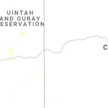
Utah
| Local Time | Report Details |
|---|---|
| 4:45 PM MDT | Quarter sized hail reported near Cedar City, UT, 53.9 miles NNE of Saint George, UT, hail up to quarter size measured. reported via social media. |
| 7:11 PM MDT | Asos station kcny 16 nw moa in grand county UT, 67.6 miles WSW of Grand Junction, CO |
| 7:25 PM MDT | Brimstone reservoir raws sit in beaver county UT, 72.3 miles WSW of Monroe, UT |
| 8:03 PM MDT | Power lines down in veyo in washington county UT, 16.8 miles NNW of Saint George, UT |
| 8:13 PM MDT | Corrects previous tstm wnd dmg report from 16 nw moab. 5 to 6 power lines were broken off just south of the canyonlands airport near blue hills rd. this was reported to in grand county UT, 67.1 miles WSW of Grand Junction, CO |
| 8:24 PM MDT | Power lines down and power out in town. trees down on lava flow stree in washington county UT, 4 miles WNW of Saint George, UT |
| 8:38 PM MDT | Skylights blown off roof. heavy rain falling into hom in washington county UT, 2 miles S of Saint George, UT |
| 8:56 PM MDT | Power lines down in washington in washington county UT, 5.3 miles ENE of Saint George, UT |
Arizona
| Local Time | Report Details |
|---|---|
| 9:09 PM MST | Mesonet station as887 wende in la paz county AZ, 61.9 miles SE of Lake Havasu City, AZ |
Illinois
| Local Time | Report Details |
|---|---|
| 12:00 AM CDT | Tree reported to be blown dow in stephenson county IL, 58.8 miles SSW of Madison, WI |
| 12:10 AM CDT | Large tree branch reported down just outside of tow in carroll county IL, 70.9 miles SSW of Madison, WI |
| 12:15 AM CDT | At least one tree reported to be blown down in freepor in stephenson county IL, 56.1 miles SSW of Madison, WI |
| 1:09 AM CDT | Tree limb down in a yard that brought down some wires. also received a report from broadcast media of small tree limbs down in town. time estimated from rada in boone county IL, 62.6 miles SSE of Madison, WI |
Connect with Interactive Hail Maps