

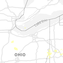
Hail Map for Saturday, July 23, 2022

Number of Impacted Households on 7/23/2022
0
Impacted by 1" or Larger Hail
0
Impacted by 1.75" or Larger Hail
0
Impacted by 2.5" or Larger Hail
Square Miles of Populated Area Impacted on 7/23/2022
0
Impacted by 1" or Larger Hail
0
Impacted by 1.75" or Larger Hail
0
Impacted by 2.5" or Larger Hail


Cities Most Affected by Hail Storms of 7/23/2022
| Hail Size | Demographics of Zip Codes Affected | ||||||
|---|---|---|---|---|---|---|---|
| City | Count | Average | Largest | Pop Density | House Value | Income | Age |
| Edgerton, WI | 3 | 2.25 | 3.00 | 157 | $109k | $50.1k | 40.2 |
| Gibbon, MN | 3 | 2.17 | 3.00 | 10 | $58k | $37.1k | 45.3 |
| Fairfax, MN | 1 | 2.00 | 2.00 | 9 | $53k | $36.0k | 46.8 |
| Cropsey, IL | 1 | 1.75 | 1.75 | 9 | $62k | $42.6k | 37.6 |
| Fort Wayne, IN | 1 | 1.75 | 1.75 | 2522 | $97k | $50.8k | 37.2 |
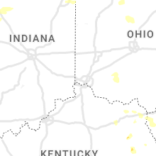
Hail and Wind Damage Spotted on 7/23/2022
Filter by Report Type:Hail ReportsWind Reports
States Impacted
Indiana, Illinois, South Dakota, Ohio, Minnesota, North Carolina, Pennsylvania, West Virginia, Kentucky, Iowa, South Carolina, Florida, Nebraska, Wisconsin, New York, Maryland, Kansas, Michigan, Virginia, Vermont, Georgia, Tennessee, New Hampshire, Colorado, New Mexico, ArizonaIndiana
| Local Time | Report Details |
|---|---|
| 7:00 AM CDT | Measured 67 mph wind gust with a mobile anemometer at the intersection of sr 10 and 49 in wheatfiel in jasper county IN, 56.6 miles SSE of Chicago, IL |
| 8:10 AM EDT | Health 10 inch diameter tree limb broke. via faceboo in kosciusko county IN, 41.3 miles WNW of Fort Wayne, IN |
| 8:15 AM EDT | Tree down. time estimated from rada in fulton county IN, 55.5 miles W of Fort Wayne, IN |
| 8:20 AM EDT | Tree down. time estimated from rada in fulton county IN, 45.6 miles W of Fort Wayne, IN |
| 8:25 AM EDT | Tree down. time estimated from rada in fulton county IN, 70.6 miles W of Fort Wayne, IN |
| 8:25 AM EDT | Trees and utility lines down. time estimated from rada in fulton county IN, 70.6 miles W of Fort Wayne, IN |
| 8:25 AM EDT | Tree down. time estimated from rada in fulton county IN, 71.1 miles W of Fort Wayne, IN |
| 8:27 AM EDT | Tree down. time estimated from rada in fulton county IN, 69.6 miles W of Fort Wayne, IN |
| 8:30 AM EDT | Tree down. time estimated from rada in fulton county IN, 68.1 miles W of Fort Wayne, IN |
| 8:30 AM EDT | Roof off a house... damage to another house from fallen trees. crop damage in numerous locations. time estimated from rada in pulaski county IN, 73.3 miles W of Fort Wayne, IN |
| 8:35 AM EDT | Golf Ball sized hail reported near Fort Wayne, IN, 3.5 miles NE of Fort Wayne, IN, report from mping: golf ball. |
| 8:44 AM EDT | Trees and powerlines over road. time estimated from rada in cass county IN, 74.6 miles W of Fort Wayne, IN |
| 8:44 AM EDT | Multiple trees down on 1500 block of 3rd st in logansport. time estimated from rada in cass county IN, 69.8 miles WSW of Fort Wayne, IN |
| 8:55 AM EDT | Monticello white county airpor in white county IN, 72.9 miles NNW of Indianapolis, IN |
| 8:56 AM EDT | Storm damage reported in miami county IN, 61.6 miles WSW of Fort Wayne, IN |
| 9:13 AM EDT | Report from mping: 1-inch tree limbs broken; shingles blown of in howard county IN, 47.8 miles N of Indianapolis, IN |
| 9:20 AM EDT | Heard over scanner reports of trees down and debris in roadwa in grant county IN, 45.3 miles SW of Fort Wayne, IN |
| 9:21 AM EDT | Report from mping: 1-inch tree limbs broken; shingles blown of in howard county IN, 45.8 miles N of Indianapolis, IN |
| 9:22 AM EDT | Heard on scanner report of tree on house and power line in grant county IN, 47.2 miles SW of Fort Wayne, IN |
| 9:25 AM EDT | Tree down on power line. time estimated from rada in grant county IN, 52 miles NNE of Indianapolis, IN |
| 10:00 AM EDT | Numerous reports of trees and power lines reported down across the count in delaware county IN, 50.2 miles NE of Indianapolis, IN |
| 10:05 AM EDT | Various locations have limbs down in the northern part of county (summitville... alexandria area). some of these locations have taken power lines dow in madison county IN, 42.2 miles NE of Indianapolis, IN |
| 10:10 AM EDT | Report from mping: 1-inch tree limbs broken; shingles blown of in randolph county IN, 62.2 miles S of Fort Wayne, IN |
| 10:11 AM EDT | Report from mping: 3-inch tree limbs broken; power poles broke in howard county IN, 50.1 miles N of Indianapolis, IN |
| 10:19 AM EDT | Large tree down on washington street. time estimated from rada in wayne county IN, 53.6 miles E of Indianapolis, IN |
| 10:21 AM EDT | Large tree down on us35 and round barn. time estimated from rada in wayne county IN, 61.2 miles NNW of Cincinnati, OH |
| 10:21 AM EDT | Numerous reports of trees and power lines down across hamilton count in hamilton county IN, 21.2 miles NNE of Indianapolis, IN |
| 10:25 AM EDT | 8 trees down scattered througout wayne county. all reports north of i-70. time estimated from rada in wayne county IN, 58.7 miles NNW of Cincinnati, OH |
| 10:29 AM EDT | A couple of medium-sized branches down. photo verified. time estimated from rada in wayne county IN, 53.1 miles NNW of Cincinnati, OH |
| 11:36 AM CDT | Quarter sized hail reported near Rensselaer, IN, 71.4 miles SSE of Chicago, IL, report from mping: quarter (1.00 in.). |
| 1:00 PM EDT | Trees and power lines dow in white county IN, 78 miles NNW of Indianapolis, IN |
Illinois
| Local Time | Report Details |
|---|---|
| 7:24 AM CDT | Quarter sized hail reported near Polo, IL, 76.1 miles S of Madison, WI, photo shared via social media. |
| 10:12 AM CDT | Quarter sized hail reported near Plainfield, IL, 38.6 miles SW of Chicago, IL, largest hailstones were about quarter size. |
| 10:22 AM CDT | Quarter sized hail reported near Naperville, IL, 30.3 miles WSW of Chicago, IL, several reports of nickel to quarter size hail on the south side of naperville. |
| 1:26 PM CDT | Large tree limb blown down. relayed by media. time estimate in mclean county IL, 45.7 miles E of Peoria, IL |
| 2:09 PM CDT | Golf Ball sized hail reported near Cropsey, IL, 55.9 miles E of Peoria, IL |
| 2:09 PM CDT | Storm damage reported in mclean county IL, 55.9 miles E of Peoria, IL |
| 2:17 PM CDT | Delayed report. em reports significant tree damage in town. numerous tree limbs down on cars and two houses with trees through the roof. power lines down. large trees u in mclean county IL, 51.6 miles E of Peoria, IL |
| 2:47 PM CDT | Tree downed on pine st. in gibson city. time estimated from rada in ford county IL, 65.4 miles ESE of Peoria, IL |
| 5:20 PM CDT | Power line down and two power poles leaning over. time estimate in woodford county IL, 32 miles ENE of Peoria, IL |
| 1:03 AM CDT | Tree down on house in the city limits... per law enforcement... time estimated by rada in jo daviess county IL, 69.6 miles SW of Madison, WI |
| 1:22 AM CDT | Report of tree down at the apple canyon camp grounds... time estimated from rada in jo daviess county IL, 54.7 miles SW of Madison, WI |
South Dakota
| Local Time | Report Details |
|---|---|
| 7:46 AM CDT | Mesonet station 291 4n altamont (sddot in deuel county SD, 47.4 miles W of Montevideo, MN |
| 7:47 AM CDT | Mesonet station 182 waubay (sddot in day county SD, 54 miles E of Aberdeen, SD |
| 7:57 AM CDT | Mesonet station 200 wallace (sddot in clark county SD, 53.2 miles ESE of Aberdeen, SD |
| 8:15 AM CDT | South shore mesone in codington county SD, 59.4 miles W of Montevideo, MN |
| 8:18 AM CDT | Radio statio in codington county SD, 62.8 miles ESE of Aberdeen, SD |
| 8:24 AM CDT | Asos station katy watertown muni a in codington county SD, 70.4 miles W of Montevideo, MN |
Ohio
| Local Time | Report Details |
|---|---|
| 9:35 AM EDT | Numerous trees and power lines down. park shelter destroyed. time estimated from rada in van wert county OH, 32.8 miles SE of Fort Wayne, IN |
| 10:08 AM EDT | Tree down on greenville road. removed by law enforcement. time estimated from rada in auglaize county OH, 52.2 miles SE of Fort Wayne, IN |
| 10:18 AM EDT | Tree down on indian trail road. time estimated from rada in mercer county OH, 58.2 miles SSE of Fort Wayne, IN |
| 10:20 AM EDT | Estimated frequent 50-60 mph gusts in bluffton near the hancock/allen county line... perhaps briefly stronge in hancock county OH, 65.4 miles E of Fort Wayne, IN |
| 10:21 AM EDT | Numerous trees and power poles down primarily between versailles... greenville... and ansonia. time estimated from rada in darke county OH, 68.2 miles SSE of Fort Wayne, IN |
| 10:26 AM EDT | Trees down. time estimated from radar in shelby county OH, 64.1 miles SE of Fort Wayne, IN |
| 10:27 AM EDT | Power pole down on state route 119. time estimated from rada in shelby county OH, 63.2 miles SE of Fort Wayne, IN |
| 10:27 AM EDT | Large branch and several smaller branches down. photo verified. time estimated from rada in darke county OH, 69.9 miles N of Cincinnati, OH |
| 10:28 AM EDT | Tree down over road. time estimated from rada in shelby county OH, 68.3 miles WNW of Columbus, OH |
| 10:31 AM EDT | Trees and poles down in new paris area. time estimated from rada in preble county OH, 54.2 miles NNW of Cincinnati, OH |
| 10:32 AM EDT | Tree down over road. time estimated from rada in shelby county OH, 65.6 miles WNW of Columbus, OH |
| 10:33 AM EDT | Tree fell on wires. time estimated from rada in preble county OH, 55.1 miles N of Cincinnati, OH |
| 10:34 AM EDT | Tree down on power lin in hancock county OH, 71.1 miles NNW of Columbus, OH |
| 10:39 AM EDT | Several large branches and a fence down near washington primary school. photo verified. time estimated from rada in miami county OH, 68.4 miles WNW of Columbus, OH |
| 10:43 AM EDT | 256 calls came in to the 911 center regarding storm damage throughout the county. numerous trees and power poles down. time estimated from rada in miami county OH, 65.5 miles W of Columbus, OH |
| 10:46 AM EDT | Numerous trees down near ridge avenue. photo verified. time estimated from rada in miami county OH, 64.2 miles W of Columbus, OH |
| 10:47 AM EDT | First financial bank sign damaged from winds. photo verified. time estimated from rada in miami county OH, 64.2 miles W of Columbus, OH |
| 10:54 AM EDT | Power poles down on township hwy 199 west. time estimated from rada in logan county OH, 47.1 miles WNW of Columbus, OH |
| 10:58 AM EDT | Power pole down on east newell street. time estimated from rada in logan county OH, 44.3 miles WNW of Columbus, OH |
| 11:02 AM EDT | Power pole down on north main street. time estimated from rada in clark county OH, 54 miles W of Columbus, OH |
| 11:02 AM EDT | Power pole down on east carpenter drive. time estimated from rada in clark county OH, 55.3 miles W of Columbus, OH |
| 11:04 AM EDT | Numerous reports of trees and power poles down throughout champaign county. time estimated from rada in champaign county OH, 42 miles WNW of Columbus, OH |
| 11:06 AM EDT | One large tree uprooted into power lines.... another large tree down. photo verified. time estimated from rada in logan county OH, 41.5 miles NW of Columbus, OH |
| 11:07 AM EDT | Power pole fell. photo verified. time estimated from rada in champaign county OH, 40.9 miles WNW of Columbus, OH |
| 11:20 AM EDT | Numerous reports of trees down between richwood and milford center. time estimated from rada in union county OH, 30.8 miles NW of Columbus, OH |
| 11:21 AM EDT | Medium-sized branch down. photo verified. time estimated from rada in champaign county OH, 34.5 miles WNW of Columbus, OH |
| 11:24 AM EDT | Corrects previous tstm wnd dmg report from 1 s marion. poles and lines down on barks rd at southland pkwy... temporarily closing the road dow in marion county OH, 41.8 miles N of Columbus, OH |
| 11:31 AM EDT | 2 trees down in bucyrus - one down on a power line in aumiller park and one down blocking a roa in crawford county OH, 57.8 miles N of Columbus, OH |
| 11:35 AM EDT | From personal weather statio in delaware county OH, 31.9 miles NNW of Columbus, OH |
| 11:37 AM EDT | 4 inch diameter tree dow in delaware county OH, 24.1 miles N of Columbus, OH |
| 11:42 AM EDT | Roof damage reported to 911. also... numerous calls throughout madison county reporting trees and power poles down. time estimated from rada in madison county OH, 27.3 miles SW of Columbus, OH |
| 11:43 AM EDT | Large branch down at indian springs school. photo verified. time estimated from rada in delaware county OH, 17.2 miles NNW of Columbus, OH |
| 11:45 AM EDT | Several branches down from one tree. photo verified. time estimated from rada in delaware county OH, 18.1 miles N of Columbus, OH |
| 11:47 AM EDT | Several trees down in the marengo are in morrow county OH, 31.9 miles NNE of Columbus, OH |
| 11:49 AM EDT | From personal weather statio in delaware county OH, 16.4 miles N of Columbus, OH |
| 11:49 AM EDT | Very small branches down morse and high street. photo verifie in franklin county OH, 6.8 miles N of Columbus, OH |
| 11:49 AM EDT | Tree on wires. photo verified. time estimated from rada in greene county OH, 45.3 miles WSW of Columbus, OH |
| 11:51 AM EDT | A few 6 inch limbs down. time estimated from rada in delaware county OH, 14.5 miles NNE of Columbus, OH |
| 11:52 AM EDT | Numerous reports of trees and power poles down... mainly in sunbury area and east part of delaware county. time estimated from rada in delaware county OH, 21.3 miles NNE of Columbus, OH |
| 11:54 AM EDT | Tree on roof in hilltop neighborhood. photo verified. time estimated from rada in franklin county OH, 4.4 miles WSW of Columbus, OH |
| 11:54 AM EDT | Large decaying tree fell. photo verified. time estimate in franklin county OH, 12.8 miles NNW of Columbus, OH |
| 12:00 PM EDT | Tree down at township rd 15 and county rd 1 in morrow county OH, 32.1 miles NNE of Columbus, OH |
| 12:09 PM EDT | Numerous trees down across knox county... especially in fredericktown... mt vernon... and martinsbur in knox county OH, 40.6 miles NE of Columbus, OH |
| 12:14 PM EDT | Large branch fell on house on south hinde. photo verified. time estimated from rada in fayette county OH, 37.5 miles SW of Columbus, OH |
| 12:19 PM EDT | Smaller trees and branches down. photo verified. time estimated from rada in licking county OH, 27.2 miles E of Columbus, OH |
| 12:22 PM EDT | Reports of several small trees down across the southwest part of holmes count in holmes county OH, 56.3 miles NE of Columbus, OH |
| 12:26 PM EDT | Observer witnessed 8-10 inch healthy tree branch fal in licking county OH, 39 miles ENE of Columbus, OH |
| 12:27 PM EDT | Trees down on east main street near a gazebo. photo verified. time estimated from rada in licking county OH, 34.3 miles ENE of Columbus, OH |
| 1:00 PM EDT | Numerous trees and powerlines down in west lafayette and west of coshocton along us 36 and county road 621. powerlines and trees down and on fire along county road in coshocton county OH, 69.7 miles ENE of Columbus, OH |
| 1:00 PM EDT | Large tree fell in house... knocking down power lines. photo verified. time estimated from rada in ross county OH, 43.6 miles S of Columbus, OH |
| 1:10 PM EDT | Multiple large trees down. power lines dow in muskingum county OH, 66.8 miles E of Columbus, OH |
| 1:12 PM EDT | Report of power lines down. time estimated based on rada in tuscarawas county OH, 77.3 miles ENE of Columbus, OH |
| 1:12 PM EDT | Reports of power lines down. time estimated based on rada in tuscarawas county OH, 62.4 miles SSE of Cleveland, OH |
| 1:15 PM EDT | Storm damage reported in tuscarawas county OH, 77.3 miles ENE of Columbus, OH |
| 1:15 PM EDT | Storm damage reported in tuscarawas county OH, 71.2 miles S of Cleveland, OH |
| 1:16 PM EDT | Reports of power lines down. time estimated based on rada in tuscarawas county OH, 71.2 miles S of Cleveland, OH |
| 1:24 PM EDT | Report of power lines down. time estimated based on rada in tuscarawas county OH, 71.4 miles W of Pittsburgh, PA |
| 1:30 PM EDT | Multiple trees down on polerlines across the count in vinton county OH, 56.5 miles SSE of Columbus, OH |
| 1:34 PM EDT | Trees down. time estimated by rada in guernsey county OH, 81.9 miles E of Columbus, OH |
| 1:36 PM EDT | Trees down. time estimated on rada in guernsey county OH, 74.8 miles WSW of Pittsburgh, PA |
| 1:50 PM EDT | Trees and power lines dow in carroll county OH, 49.9 miles W of Pittsburgh, PA |
| 1:54 PM EDT | Multiple trees on powerlines down across the count in athens county OH, 67 miles SE of Columbus, OH |
| 1:55 PM EDT | Report of multiple trees down creating issues on state route 147. time estimated based on rada in belmont county OH, 61.9 miles WSW of Pittsburgh, PA |
| 1:58 PM EDT | Report of power lines down and power outages around richmond. time estimated based on rada in jefferson county OH, 40.7 miles W of Pittsburgh, PA |
| 1:59 PM EDT | Report of multiple trees down along state route 148. time estimated based on rada in belmont county OH, 69.3 miles WSW of Pittsburgh, PA |
| 2:00 PM EDT | Report of multiple trees down. time estimated based on rada in belmont county OH, 53.7 miles WSW of Pittsburgh, PA |
| 2:00 PM EDT | Report from mping: 1-inch tree limbs broken; shingles blown of in meigs county OH, 56 miles NNW of Charleston, WV |
| 2:05 PM EDT | Over a dozen shingles blown from a roof on a hous in jefferson county OH, 34.7 miles W of Pittsburgh, PA |
| 2:07 PM EDT | Report of multiple trees down along state route 148. time estimated based on rada in belmont county OH, 69.3 miles WSW of Pittsburgh, PA |
| 2:07 PM EDT | Report of numerous trees down in the area. time estimated based on rada in columbiana county OH, 32.9 miles WNW of Pittsburgh, PA |
| 2:17 PM EDT | Report of trees and power lines down across southern portion of columbiana county. location and time estimated based on rada in columbiana county OH, 34.9 miles WNW of Pittsburgh, PA |
| 2:18 PM EDT | Multiple trees on powerlines down across the count in meigs county OH, 55.2 miles NNW of Charleston, WV |
| 2:35 PM EDT | Report of power lines down. time estimated based on rada in monroe county OH, 64.8 miles SW of Pittsburgh, PA |
| 2:35 PM EDT | Report of trees down along state route 255. time estimated based on rada in monroe county OH, 74.4 miles SW of Pittsburgh, PA |
Minnesota
| Local Time | Report Details |
|---|---|
| 9:34 AM CDT | Quarter sized hail reported near Renville, MN, 28.1 miles ESE of Montevideo, MN, report from mping: quarter (1.00 in.). |
| 9:34 AM CDT | Quarter sized hail reported near Renville, MN, 28.5 miles ESE of Montevideo, MN, mping report. |
| 9:50 AM CDT | Quarter sized hail reported near Franklin, MN, 50.9 miles SE of Montevideo, MN |
| 10:00 AM CDT | Mndot wind sensor west of clara cit in chippewa county MN, 16.1 miles E of Montevideo, MN |
| 10:05 AM CDT | Mndot wind sensor west of clara cit in chippewa county MN, 16.1 miles E of Montevideo, MN |
| 10:09 AM CDT | Hen Egg sized hail reported near Fairfax, MN, 57.9 miles ESE of Montevideo, MN |
| 10:18 AM CDT | Golf Ball sized hail reported near Gibbon, MN, 63.1 miles ESE of Montevideo, MN, report from mping: golf ball (1.75 in.). |
| 10:18 AM CDT | Golf Ball sized hail reported near Gibbon, MN, 62.3 miles ESE of Montevideo, MN, mping report. |
| 10:18 AM CDT | Several trees and power lines were blown down between renville and olivia. time is estimated based on radar and duratio in renville county MN, 31.4 miles ESE of Montevideo, MN |
| 10:28 AM CDT | Kovl - airpor in renville county MN, 35.8 miles ESE of Montevideo, MN |
| 10:30 AM CDT | Various tree limbs down... some large in siz in renville county MN, 37.6 miles ESE of Montevideo, MN |
| 10:30 AM CDT | Tea Cup sized hail reported near Gibbon, MN, 65.7 miles ESE of Montevideo, MN, picture relayed to nws by emergency management. |
| 10:43 AM CDT | Storm damage reported in crow wing county MN, 81.6 miles SSE of Bemidji, MN |
| 10:50 AM CDT | Several trees were blown down around buffalo lake. time is estimated based on radar and duratio in renville county MN, 55.9 miles ESE of Montevideo, MN |
| 11:03 AM CDT | Ping Pong Ball sized hail reported near Gaylord, MN, 55.5 miles WSW of Minneapolis, MN |
| 11:20 AM CDT | Mndot wind senso in blue earth county MN, 68.6 miles SSW of Minneapolis, MN |
| 12:45 PM CDT | Multiple 10 to 15 inch diameter trees down... power lines down... and branches down in kenyo in goodhue county MN, 50.8 miles SSE of Minneapolis, MN |
| 12:53 PM CDT | A couple structures damaged in claremont area in dodge county MN, 62.5 miles N of Mason City, IA |
| 1:11 PM CDT | Quarter sized hail reported near Pine Island, MN, 62.8 miles SSE of Minneapolis, MN |
| 1:15 PM CDT | Quarter sized hail reported near Oronoco, MN, 66.3 miles SSE of Minneapolis, MN |
| 1:33 PM CDT | Numerous trees blown down. time estimate in olmsted county MN, 62.8 miles WNW of La Crosse, WI |
| 1:34 PM CDT | At mayo helipor in olmsted county MN, 62.9 miles WNW of La Crosse, WI |
| 1:35 PM CDT | Storm damage reported in olmsted county MN, 62.3 miles WNW of La Crosse, WI |
| 1:35 PM CDT | Rochester mayo helipad k9mn reported a wind gust of 66 mp in olmsted county MN, 62.9 miles WNW of La Crosse, WI |
| 1:38 PM CDT | Several 8-12 inch diameter branches blown dow in olmsted county MN, 62.3 miles WNW of La Crosse, WI |
| 1:40 PM CDT | Storm damage reported in olmsted county MN, 62.3 miles WNW of La Crosse, WI |
| 1:44 PM CDT | Storm damage reported in mower county MN, 46.8 miles NNE of Mason City, IA |
| 1:49 PM CDT | Report from mping: trees uprooted or snapped; roof blown of in dodge county MN, 62.8 miles NNE of Mason City, IA |
| 1:50 PM CDT | Reports of trees down on southwest and northwest side of town. time estimate in mower county MN, 38 miles NNE of Mason City, IA |
| 1:54 PM CDT | Report from mping: trees uprooted or snapped; roof blown of in olmsted county MN, 63.4 miles WNW of La Crosse, WI |
| 3:00 PM CDT | Trees blown down in winona county MN, 35.8 miles WNW of La Crosse, WI |
| 3:05 PM CDT | Storm damage reported in houston county MN, 17 miles WSW of La Crosse, WI |
| 3:06 PM CDT | Trees blown down in houston county MN, 10.2 miles WSW of La Crosse, WI |
| 4:20 PM CDT | Report from mping: 3-inch tree limbs broken; power poles broke in fillmore county MN, 44.1 miles W of La Crosse, WI |
| 4:49 PM CDT | Report from mping: 3-inch tree limbs broken; power poles broke in houston county MN, 17 miles W of La Crosse, WI |
| 8:35 PM CDT | Measured at the airpor in waseca county MN, 64.3 miles SSW of Minneapolis, MN |
North Carolina
| Local Time | Report Details |
|---|---|
| 11:23 AM EDT | Public report of trees down. time estimated by rada in guilford county NC, 72.4 miles NE of Charlotte, NC |
| 3:31 PM EDT | Report of trees and power lines down at address on goodman lake roa in rowan county NC, 40.1 miles NE of Charlotte, NC |
| 5:18 PM EDT | Trees were reported down along sacred lane near lloyd stewart roa in harnett county NC, 32.3 miles SW of Raleigh, NC |
| 6:03 PM EDT | Numerous trees were reported down in camero in moore county NC, 46.9 miles SW of Raleigh, NC |
| 6:36 PM EDT | Trees were reported down on power lines near west morganton road near u.s. highway in moore county NC, 60.6 miles SW of Raleigh, NC |
| 7:33 PM EDT | Quarter sized hail reported near West Jefferson, NC, 42.1 miles ESE of Bristol, TN |
| 7:33 PM EDT | Trees down in west jefferso in ashe county NC, 42.1 miles ESE of Bristol, TN |
| 8:26 PM EDT | Four trees blown down near shepard branch road and south toward jenkins valley roa in buncombe county NC, 62 miles N of Greenville, SC |
| 9:13 PM EDT | Tree down along dobbins mill roa in surry county NC, 77.8 miles N of Charlotte, NC |
| 9:33 PM EDT | Tree down along i-77 south near elki in surry county NC, 70.8 miles N of Charlotte, NC |
| 9:33 PM EDT | Tree down along joe layne mill roa in surry county NC, 74.4 miles N of Charlotte, NC |
| 9:36 PM EDT | Tree down near intersection of cc camp road and friendship church roa in surry county NC, 72.9 miles N of Charlotte, NC |
| 9:54 PM EDT | Trees down across roadway on sloans mill rd and pioneer r in iredell county NC, 53.6 miles N of Charlotte, NC |
| 9:54 PM EDT | Trees down blocking entire roadway on east houstonville rd and harmony hw in iredell county NC, 54.6 miles N of Charlotte, NC |
| 9:58 PM EDT | Multiple trees blown down in northwest part of the count in davie county NC, 54.3 miles NNE of Charlotte, NC |
| 10:44 PM EDT | Multiple trees down from airport road north toward cannon r in mcdowell county NC, 59.1 miles S of Bristol, TN |
| 10:53 PM EDT | Trees down on linville s in burke county NC, 63.6 miles WNW of Charlotte, NC |
| 10:55 PM EDT | County reports trees down along sain r in mcdowell county NC, 64.2 miles WNW of Charlotte, NC |
| 11:05 PM EDT | Trees and powerlines down along walker r in mcdowell county NC, 62.8 miles WNW of Charlotte, NC |
| 11:08 PM EDT | Trees down at highway 64 and 22 in mcdowell county NC, 62 miles WNW of Charlotte, NC |
| 11:23 PM EDT | Corrects previous tstm wnd dmg report from 4 nnw high point. public report of trees down. time estimated by rada in guilford county NC, 72.4 miles NE of Charlotte, NC |
| 11:46 PM EDT | Power outage caused by fallen trees damaging equipment. time estimated by rada in guilford county NC, 67.4 miles WNW of Raleigh, NC |
Pennsylvania
| Local Time | Report Details |
|---|---|
| 2:12 PM EDT | Report of split tree and several tree branches down. time estimated based on rada in allegheny county PA, 6.2 miles E of Pittsburgh, PA |
| 2:32 PM EDT | Report of multiple trees and power lines dow in beaver county PA, 32.1 miles NW of Pittsburgh, PA |
| 2:35 PM EDT | Report of tree dow in beaver county PA, 18.3 miles NW of Pittsburgh, PA |
| 2:36 PM EDT | Storm damage reported in washington county PA, 35.8 miles SW of Pittsburgh, PA |
| 2:45 PM EDT | Report of trees and power lines down. time estimated based on rada in washington county PA, 17.2 miles SW of Pittsburgh, PA |
| 2:49 PM EDT | Large tree down on a car. no injurie in allegheny county PA, 7.3 miles NW of Pittsburgh, PA |
| 2:49 PM EDT | Report of tree and power line dow in beaver county PA, 17.2 miles NW of Pittsburgh, PA |
| 2:49 PM EDT | 2 trees snapped and 2 trees uproote in washington county PA, 12 miles SSW of Pittsburgh, PA |
| 2:53 PM EDT | Estimated wind gust of 60 mph plus report of branches and wires dow in allegheny county PA, 4.9 miles SSW of Pittsburgh, PA |
| 2:53 PM EDT | Estimated wind gust of 60 mph plus report of branches and wires dow in allegheny county PA, 4.9 miles SSW of Pittsburgh, PA |
| 2:55 PM EDT | Report of large tree limbs down in collier townshi in allegheny county PA, 5.3 miles WSW of Pittsburgh, PA |
| 2:59 PM EDT | Quarter sized hail reported near Pittsburgh, PA, 6.4 miles N of Pittsburgh, PA |
| 2:59 PM EDT | Quarter sized hail reported near Pittsburgh, PA, 5.9 miles NNW of Pittsburgh, PA |
| 3:00 PM EDT | Numerous trees dow in allegheny county PA, 6 miles NNE of Pittsburgh, PA |
| 3:04 PM EDT | Report of large tree limbs down in baldwi in allegheny county PA, 4 miles S of Pittsburgh, PA |
| 3:05 PM EDT | Tree down near ppg paints aren in allegheny county PA, 0.9 miles E of Pittsburgh, PA |
| 3:05 PM EDT | Tree down in schenley park in allegheny county PA, 2 miles E of Pittsburgh, PA |
| 3:08 PM EDT | Report of large tree branches down along route 4 in allegheny county PA, 12.4 miles ESE of Pittsburgh, PA |
| 3:08 PM EDT | Report of large tree branches dow in allegheny county PA, 13.9 miles SE of Pittsburgh, PA |
| 3:09 PM EDT | Storm damage reported in allegheny county PA, 6.8 miles SE of Pittsburgh, PA |
| 3:13 PM EDT | Large tree down blocking greer way in oakmon in allegheny county PA, 10 miles NE of Pittsburgh, PA |
| 3:13 PM EDT | Quarter sized hail reported near Pittsburgh, PA, 7.8 miles E of Pittsburgh, PA |
| 3:20 PM EDT | Tree down on route 88 in washington county PA, 20.4 miles SSE of Pittsburgh, PA |
| 3:35 PM EDT | Trees down in armstrong county PA, 29.5 miles ENE of Pittsburgh, PA |
| 3:36 PM EDT | Half Dollar sized hail reported near Greensburg, PA, 24.9 miles ESE of Pittsburgh, PA |
| 3:49 PM EDT | Trees down in armstrong county PA, 38.7 miles ENE of Pittsburgh, PA |
| 4:40 PM EDT | Minor damage across the county. main area of damage across the city of johnstown. tree and wires down in johnstow in cambria county PA, 57.3 miles E of Pittsburgh, PA |
| 5:03 PM EDT | Multiple trees down near bedfor in bedford county PA, 63.4 miles SSW of State College, PA |
| 5:05 PM EDT | Several trees down in snakes spring townshi in bedford county PA, 53.3 miles SSW of State College, PA |
| 5:55 PM EDT | A few trees down between flickerville rd and the 5000 block of pleasant grove r in fulton county PA, 68.9 miles SSW of State College, PA |
West Virginia
| Local Time | Report Details |
|---|---|
| 2:16 PM EDT | Storm damage reported in ohio county WV, 38.7 miles WSW of Pittsburgh, PA |
| 2:21 PM EDT | Half of a 12 inch apple tree knocked down... fence blown down and moved a few feet... smaller maple tree knocked over... piece of roof blown off of bar in mason county WV, 50.4 miles NNW of Charleston, WV |
| 2:41 PM EDT | Power outages and several trees dow in tyler county WV, 75 miles NW of Elkins, WV |
| 2:45 PM EDT | Report of trees and power lines down. time estimated based on rada in wetzel county WV, 70.5 miles SW of Pittsburgh, PA |
| 2:57 PM EDT | Multiple trees down on roadwa in tyler county WV, 72.5 miles NW of Elkins, WV |
| 3:00 PM EDT | Ten trees down across roads and power outage in jackson county WV, 31.2 miles N of Charleston, WV |
| 3:04 PM EDT | Report of trees and power lines dow in wetzel county WV, 61.8 miles SSW of Pittsburgh, PA |
| 3:12 PM EDT | Multiple trees and powerlines dow in roane county WV, 34.7 miles NNE of Charleston, WV |
| 3:18 PM EDT | Multiple trees and powerlines down at gandeevill in roane county WV, 27.7 miles NNE of Charleston, WV |
| 3:22 PM EDT | Report of trees and power lines dow in wetzel county WV, 55.3 miles NW of Elkins, WV |
| 3:30 PM EDT | Multiple trees down and power outage in doddridge county WV, 48.4 miles WNW of Elkins, WV |
| 3:42 PM EDT | Tree dow in taylor county WV, 29.6 miles NNW of Elkins, WV |
| 3:42 PM EDT | Tree dow in harrison county WV, 46.2 miles NW of Elkins, WV |
| 3:48 PM EDT | Tree down at shinnston pik in harrison county WV, 36.2 miles NW of Elkins, WV |
| 3:48 PM EDT | Tree down at crooked run roa in harrison county WV, 38.8 miles NW of Elkins, WV |
| 3:54 PM EDT | Multiple trees down at sand for in lewis county WV, 47.4 miles WNW of Elkins, WV |
| 3:58 PM EDT | Multiple trees down across the tow in lewis county WV, 34.6 miles WNW of Elkins, WV |
| 4:04 PM EDT | Report of trees and power lines dow in wetzel county WV, 61.8 miles SSW of Pittsburgh, PA |
| 4:14 PM EDT | Trees down in preston county in preston county WV, 38.7 miles NNE of Elkins, WV |
| 4:15 PM EDT | Multiple trees down on few phone lines at mount neb in nicholas county WV, 44.1 miles ESE of Charleston, WV |
| 4:18 PM EDT | Several trees down on poweline in upshur county WV, 28.1 miles WSW of Elkins, WV |
| 4:22 PM EDT | Multiple trees and powelines down across the tow in upshur county WV, 24.7 miles W of Elkins, WV |
| 4:27 PM EDT | Tree down and branches down on us-50 near the s-curves east of skylin in mineral county WV, 48.8 miles NE of Elkins, WV |
| 4:30 PM EDT | Multiple trees down at dian in webster county WV, 41.3 miles SW of Elkins, WV |
| 4:30 PM EDT | Trees dow in pocahontas county WV, 35.8 miles SSW of Elkins, WV |
| 4:35 PM EDT | Trees and lines were blown down on north fork hwy near corners r in grant county WV, 34.6 miles E of Elkins, WV |
| 4:36 PM EDT | Multiple trees on powerlines down at point momentu in webster county WV, 43.2 miles SW of Elkins, WV |
| 4:40 PM EDT | A tree blew down near brick school rd and ridge r in grant county WV, 37.7 miles ENE of Elkins, WV |
| 4:42 PM EDT | Multiple trees down reported across the tow in webster county WV, 43.7 miles SW of Elkins, WV |
| 4:43 PM EDT | Tree down 7200 block of northwestern turnpik in mineral county WV, 54.1 miles ENE of Elkins, WV |
| 4:58 PM EDT | A tree blew down near upper patterson creek rd and ed welsh r in mineral county WV, 58.5 miles NE of Elkins, WV |
| 4:59 PM EDT | Two trees down south of fishers near the south potomac river on river roa in hardy county WV, 45.5 miles E of Elkins, WV |
| 5:01 PM EDT | A tree blew down and downed power lines near the 1200 block of rogers r in mineral county WV, 59.6 miles ENE of Elkins, WV |
| 5:05 PM EDT | Tree down on petersburg pike near brushy run roa in pendleton county WV, 32.6 miles E of Elkins, WV |
| 5:12 PM EDT | Tree down on petersburg pik in pendleton county WV, 32 miles ESE of Elkins, WV |
| 5:14 PM EDT | Few trees down near intersection of old fields rd and us rt 220 in hardy county WV, 50.4 miles ENE of Elkins, WV |
| 5:15 PM EDT | Several trees down near intersection of reynolds gap rd and us rt 220 in hardy county WV, 50.2 miles ENE of Elkins, WV |
| 5:18 PM EDT | Large tree down along trough rd and clover d in hardy county WV, 52.4 miles ENE of Elkins, WV |
| 5:23 PM EDT | Two trees blew down on springfield pike near magnolia p in hampshire county WV, 71.8 miles ENE of Elkins, WV |
| 5:27 PM EDT | Tree down in renic in greenbrier county WV, 54.4 miles NNW of Roanoke, VA |
| 5:28 PM EDT | A tree blew down at a residence 2 mi south of frankli in pendleton county WV, 34.8 miles SE of Elkins, WV |
| 5:29 PM EDT | Tree down on constable hollow road near inkerma in hardy county WV, 59.2 miles ENE of Elkins, WV |
| 5:31 PM EDT | Tree down on blue gray trail near kiser gap road. trees also down on kiser gap road. wires down to in pendleton county WV, 34.2 miles ESE of Elkins, WV |
| 5:36 PM EDT | Numerous trees down on sweedlin valley roa in pendleton county WV, 40 miles ESE of Elkins, WV |
| 5:38 PM EDT | Numerous trees down on ford hill road near kirb in hampshire county WV, 63.5 miles ENE of Elkins, WV |
| 5:39 PM EDT | Tree down on boones mountain roa in greenbrier county WV, 47.9 miles NNW of Roanoke, VA |
| 5:41 PM EDT | Tree down along anthony roa in greenbrier county WV, 48.6 miles NNW of Roanoke, VA |
| 6:07 PM EDT | A tree blew down near hancock rd and river r in morgan county WV, 78.1 miles SSW of State College, PA |
| 6:09 PM EDT | Numerous reports of trees... wires... and branches down in berkley spring in morgan county WV, 82.6 miles SSW of State College, PA |
| 6:12 PM EDT | Trees down on river road... hancock road... fairview drive... and pious ridge roa in morgan county WV, 78 miles SSW of State College, PA |
Kentucky
| Local Time | Report Details |
|---|---|
| 3:10 PM EDT | Multiple trees down along county road in boyd county KY, 59.8 miles W of Charleston, WV |
| 4:05 PM EDT | Multiple trees down across road in lawrence county KY, 65.8 miles ENE of Irvine, KY |
| 5:33 PM EDT | Public video of tree down on powerline. time estimated from radar shows outflow moving through the are in pike county KY, 50.6 miles NNW of Bristol, TN |
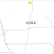
Iowa
| Local Time | Report Details |
|---|---|
| 2:18 PM CDT | Half Dollar sized hail reported near Forest City, IA, 22.6 miles WNW of Mason City, IA, few hailstones of half dollar size. |
| 8:25 PM CDT | Coop observer estimated wind gusts at 65 to 70 mph and reported tree damage in the are in harrison county IA, 39.7 miles N of Omaha, NE |
| 8:30 PM CDT | Emergency management relayed report of downed large trees destroying a couple of house in harrison county IA, 31.3 miles N of Omaha, NE |
| 8:45 PM CDT | Storm damage reported in sac county IA, 24.5 miles SSE of Storm Lake, IA |
| 9:02 PM CDT | Storm damage reported in crawford county IA, 44.1 miles S of Storm Lake, IA |
| 9:03 PM CDT | Harlan airport awos measured a peak wind gust of 63 mp in shelby county IA, 38.2 miles NE of Omaha, NE |
| 9:28 PM CDT | Entire trees down and power out in lake view. delayed repor in sac county IA, 25.2 miles SSE of Storm Lake, IA |
| 10:56 PM CDT | 51 knot gust at asos station kmcw mason city airpor in cerro gordo county IA, 6.5 miles W of Mason City, IA |
| 11:25 PM CDT | Many trees and powerlines down across central winneshiek county from north of decorah to fort atkinson. time estimated from rada in winneshiek county IA, 44.5 miles SW of La Crosse, WI |
| 11:27 PM CDT | Report of a roof off a house and cars overturned near the northeast iowa community college campus. time estimated from rada in winneshiek county IA, 53.6 miles SW of La Crosse, WI |
| 11:40 PM CDT | Estimated 50-60 mph and lasted for 5 minute in buchanan county IA, 46.8 miles NNW of Cedar Rapids, IA |
| 11:41 PM CDT | Deputy estimated at intersection of highways 9 and 51 in allamakee county IA, 40.5 miles SSW of La Crosse, WI |
| 11:45 PM CDT | Small branches down in town along with some minor floodin in allamakee county IA, 39.2 miles SSW of La Crosse, WI |
| 11:55 PM CDT | Awos station kiib independence arp in buchanan county IA, 35.6 miles NNW of Cedar Rapids, IA |
| 12:02 AM CDT | Reports of power lines down in clayton county IA, 52.3 miles N of Cedar Rapids, IA |
| 12:10 AM CDT | Report of tree down in greeley. relayed from e in delaware county IA, 45.7 miles NNE of Cedar Rapids, IA |
| 12:15 AM CDT | Power lines down; estimated 1600 people without powe in delaware county IA, 36.6 miles NNE of Cedar Rapids, IA |
| 12:15 AM CDT | Power lines down in mancheste in buchanan county IA, 46.8 miles NNW of Cedar Rapids, IA |
| 12:20 AM CDT | Trees down over road in delaware county IA, 35.9 miles NNE of Cedar Rapids, IA |
| 12:48 AM CDT | Storm damage reported in dubuque county IA, 63.7 miles NE of Cedar Rapids, IA |
| 12:53 AM CDT | Storm damage reported in dubuque county IA, 57 miles ENE of Cedar Rapids, IA |
South Carolina
| Local Time | Report Details |
|---|---|
| 3:30 PM EDT | Trained spotter reported a tree down on his vehicle and shared a picture. it could have been brought down by thunderstorm outflow or a lightning strik in berkeley county SC, 21 miles SSE of Charleston, SC |
| 3:50 PM EDT | Quarter sized hail reported near Charleston, SC, 21 miles SSE of Charleston, SC, a picture of quarter-sized hail on clements ferry road was shared on socal media. |
| 3:50 PM EDT | Quarter sized hail reported near Charleston, SC, 21.7 miles SSE of Charleston, SC, a picture of quarter-sized hail near the intersection of clements ferry road and beresford run was shared on social media. |
| 4:00 PM EDT | A towing company near the co0per river reported 50-60 mph winds for several minutes with a gust to 80 mph atop the roof that is approximately 40-50 feet above the groun in charleston county SC, 24.2 miles S of Charleston, SC |
| 4:23 PM EDT | Picture shared of a tree down on ashley river road near maclaura hall. time estimated based on rada in charleston county SC, 23.4 miles S of Charleston, SC |
| 4:29 PM EDT | A tree fell across a power line near the intersection of church creek drive and mona avenue. time estimated by rada in charleston county SC, 25.3 miles S of Charleston, SC |
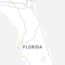
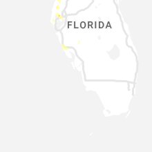
Florida
| Local Time | Report Details |
|---|---|
| 3:35 PM EDT | Tree limb fell on a power line along orange ave and resulted in a power outag in leon county FL, 2.7 miles SE of Tallahassee, FL |
| 5:05 PM EDT | Social media picture with large tree downed blocking roadwa in hillsborough county FL, 36.9 miles N of Bradenton, FL |
Nebraska
| Local Time | Report Details |
|---|---|
| 3:07 PM CDT | Storm damage reported in red willow county NE, 60.9 miles NNE of Colby, KS |
| 3:29 PM CDT | Storm damage reported in red willow county NE, 60.9 miles NNE of Colby, KS |
| 3:36 PM CDT | Thunderstorm wind gust of 60 to 70 mph estimated at this locatio in frontier county NE, 56.8 miles SE of North Platte, NE |
| 4:02 PM CDT | Storm damage reported in red willow county NE, 66.9 miles NNE of Colby, KS |
| 4:07 PM CDT | Ping Pong Ball sized hail reported near Lexington, NE, 62 miles ESE of North Platte, NE, public report and video relayed to dispatcher. |
| 4:13 PM CDT | Quarter sized hail reported near Overton, NE, 66.4 miles ESE of North Platte, NE, facebook video depicts hail to at least quarter size at overton golf course. |
| 4:37 PM CDT | Estimated 50 to 60 mph wind in buffalo county NE, 55.8 miles WSW of Grand Island, NE |
| 4:40 PM CDT | Ping Pong Ball sized hail reported near Amherst, NE, 46.2 miles W of Grand Island, NE, spotter relayed second hand report of hail at sartoria. time estimated from radar. |
| 4:45 PM CDT | Ping Pong Ball sized hail reported near Pleasanton, NE, 46.1 miles W of Grand Island, NE, facebook photo of hail that appears to be at least half dollar size. time estimated from radar. |
| 4:46 PM CDT | Spotter network report of several 4 inch diameter branches down on west side of overton. time of event estimated from rada in dawson county NE, 64.2 miles W of Grand Island, NE |
| 4:54 PM CDT | Davis weatherlink statio in buffalo county NE, 58 miles WSW of Grand Island, NE |
| 5:07 PM CDT | Half Dollar sized hail reported near Ravenna, NE, 36.3 miles WNW of Grand Island, NE, quarter to half dollar size hail. time estimated from radar. |
| 5:44 PM CDT | Quarter sized hail reported near Elba, NE, 27.9 miles NNW of Grand Island, NE, hail up to quarter size. also estimated winds to around 50 mph with small branches down. time estimated from radar. |
| 5:46 PM CDT | Several 13 inch diameter tree limbs snapped off as well as trees blown down. estimated 60 to 70 mph wind gust in howard county NE, 27.9 miles NNW of Grand Island, NE |
| 5:52 PM CDT | Received a twitter report of tree damage across town and was confirmed by howard county dispatch. time estimated from rada in howard county NE, 20.7 miles NNW of Grand Island, NE |
| 5:59 PM CDT | Knecushi in howard county NE, 19 miles NNW of Grand Island, NE |
| 6:07 PM CDT | 8-10 inch tree branches down around tow in greeley county NE, 32.9 miles N of Grand Island, NE |
| 6:21 PM CDT | Time estimated from radar. large tree blown ove in hamilton county NE, 21.2 miles ENE of Grand Island, NE |
| 6:35 PM CDT | Ping Pong Ball sized hail reported near Albion, NE, 52.7 miles NNE of Grand Island, NE, trained spotter reported ping pong ball sized hail. |
| 6:47 PM CDT | Half Dollar sized hail reported near Albion, NE, 55.5 miles NNE of Grand Island, NE |
| 7:11 PM CDT | Storm damage reported in madison county NE, 69.9 miles ESE of Oneill, NE |
| 7:15 PM CDT | Storm damage reported in platte county NE, 75.6 miles NE of Grand Island, NE |
| 7:26 PM CDT | Updates previous tstm wnd gst report from 3 ssw norfol in madison county NE, 69.9 miles ESE of Oneill, NE |
| 7:50 PM CDT | Corrects time of previous tstm wnd dmg report from 3 sse central city. time estimated from radar. large tree blown ove in hamilton county NE, 21.2 miles ENE of Grand Island, NE |
| 8:15 PM CDT | Tekamah asos measured a peak wind gust of 74 mp in burt county NE, 37.3 miles NNW of Omaha, NE |
| 8:15 PM CDT | Law enforcement relayed reports of several medium to large size trees down in the city. additionally... a car was blown off the road west of tow in burt county NE, 38.7 miles NNW of Omaha, NE |
| 8:25 PM CDT | Updates previous tstm wnd gst report from tekamah asos. peak sustained measured wind was 51 mph and peak measured gust was 75 mp in burt county NE, 37.3 miles NNW of Omaha, NE |
Wisconsin
| Local Time | Report Details |
|---|---|
| 3:20 PM CDT | Time estimated. campers flipped and trees down blocking rail lin in vernon county WI, 10.7 miles S of La Crosse, WI |
| 3:22 PM CDT | Lots of tree damage in stoddard and genoa areas in vernon county WI, 10.7 miles S of La Crosse, WI |
| 3:25 PM CDT | Multiple large trees downed throughout the city of la crosse... some causing damage to homes and other structure in la crosse county WI, 1.6 miles NE of La Crosse, WI |
| 3:30 PM CDT | Storm damage reported in la crosse county WI, 3.3 miles N of La Crosse, WI |
| 3:33 PM CDT | 2 large pine trees blown down in vernon county WI, 7.9 miles SSE of La Crosse, WI |
| 4:03 PM CDT | Storm damage reported in monroe county WI, 28.1 miles E of La Crosse, WI |
| 4:03 PM CDT | Report from mping: 3-inch tree limbs broken; power poles broke in juneau county WI, 58 miles E of La Crosse, WI |
| 4:43 PM CDT | Large tree snapped down the middl in la crosse county WI, 1.4 miles SE of La Crosse, WI |
| 5:00 PM CDT | Corrects previous non-tstm wnd dmg report from spring lake. two trees down. report via social media. time estimate in waushara county WI, 65.7 miles N of Madison, WI |
| 5:10 PM CDT | Reports of of tree damage in the northern part of sauk county. relayed bylaw enforcement. estimated winds 60 mp in sauk county WI, 44.7 miles NW of Madison, WI |
| 5:20 PM CDT | Report and photo of mid sized tree down in the middle of driveway. time approximate. report via social medi in waushara county WI, 65.6 miles WSW of Green Bay, WI |
| 5:21 PM CDT | Trees down on county highway e in waushara county WI, 64 miles WSW of Green Bay, WI |
| 5:28 PM CDT | Trees down in yard. report via social media. time estimated by rada in winnebago county WI, 54.3 miles SW of Green Bay, WI |
| 5:30 PM CDT | Tree down in road. estimated 60 mp in fond du lac county WI, 60.3 miles NNE of Madison, WI |
| 5:32 PM CDT | Report on social media of trees and power lines down. time estimated by rada in winnebago county WI, 49.6 miles SW of Green Bay, WI |
| 5:33 PM CDT | Gusts estimated at 60-65 mp in columbia county WI, 32.5 miles N of Madison, WI |
| 5:35 PM CDT | Several trees and power lines down. several power poles were snappe in winnebago county WI, 49.6 miles SW of Green Bay, WI |
| 5:38 PM CDT | Branches down. report from social media. time estimated by rada in winnebago county WI, 44.5 miles SW of Green Bay, WI |
| 5:42 PM CDT | Numerous trees dow in winnebago county WI, 42.2 miles SW of Green Bay, WI |
| 5:50 PM CDT | Measured wind gust off highway 45 in oshkosh. spotter noted a few trees down. time estimated by rada in winnebago county WI, 43.8 miles SW of Green Bay, WI |
| 5:50 PM CDT | Photo and report of tree down and covering 17th avenue in oshkosh. time estimated by rada in winnebago county WI, 31.3 miles SW of Green Bay, WI |
| 5:50 PM CDT | Measured wind gust off highway 45 in oshkosh. spotter noted a few trees down. time estimated by rada in winnebago county WI, 43.8 miles SW of Green Bay, WI |
| 5:50 PM CDT | Plane flipped and tree fell on car on eaa ground in winnebago county WI, 45.8 miles SW of Green Bay, WI |
| 5:50 PM CDT | Storm damage reported in winnebago county WI, 45.2 miles SW of Green Bay, WI |
| 5:52 PM CDT | Report from mping: 1-inch tree limbs broken; shingles blown of in winnebago county WI, 32.9 miles SW of Green Bay, WI |
| 5:53 PM CDT | Report from mping: 3-inch tree limbs broken; power poles broke in winnebago county WI, 46.4 miles SW of Green Bay, WI |
| 5:54 PM CDT | Several trees down on the southwest side of appleto in outagamie county WI, 26.8 miles SW of Green Bay, WI |
| 5:55 PM CDT | Small trees bent over. heard one tree crack. estimated wind gusts to around 60 mph. located about 1.5 nw miles from the airpor in winnebago county WI, 43.8 miles SW of Green Bay, WI |
| 5:55 PM CDT | Approximately 15 inch diameter tree snapped. located in fox crossing west of 41. report and photo via social media. time estimated by rada in winnebago county WI, 30.7 miles SW of Green Bay, WI |
| 5:58 PM CDT | Storm damage reported in outagamie county WI, 26.7 miles SW of Green Bay, WI |
| 5:59 PM CDT | Storm damage reported in dodge county WI, 37.7 miles NNE of Madison, WI |
| 6:03 PM CDT | A tree fell onto 2 campers at high cliff state park. two injuries were reporte in calumet county WI, 27.4 miles SSW of Green Bay, WI |
| 6:05 PM CDT | Strong thunderstorm winds destroyed a dock on lake winnebag in calumet county WI, 33.8 miles SSW of Green Bay, WI |
| 6:07 PM CDT | Storm damage reported in calumet county WI, 27.4 miles SSW of Green Bay, WI |
| 6:20 PM CDT | Branches and a street light dow in dodge county WI, 38.4 miles NE of Madison, WI |
| 6:28 PM CDT | Report from mping: 3-inch tree limbs broken; power poles broke in fond du lac county WI, 64.5 miles SSW of Green Bay, WI |
| 6:30 PM CDT | Report from mping: 3-inch tree limbs broken; power poles broke in calumet county WI, 34.2 miles SSW of Green Bay, WI |
| 6:32 PM CDT | Report from mping: 1-inch tree limbs broken; shingles blown of in fond du lac county WI, 53.7 miles SSW of Green Bay, WI |
| 6:36 PM CDT | Power line dow in manitowoc county WI, 32.3 miles S of Green Bay, WI |
| 6:37 PM CDT | Report from mping: 3-inch tree limbs broken; power poles broke in dodge county WI, 43.7 miles ENE of Madison, WI |
| 6:37 PM CDT | Trees down in the 2200 block of oneida stree in brown county WI, 3.3 miles WSW of Green Bay, WI |
| 6:45 PM CDT | Trees down. report via social media. time estimated by rada in manitowoc county WI, 34.6 miles SSE of Green Bay, WI |
| 6:47 PM CDT | A few trees down on the north side of manitowo in manitowoc county WI, 32.8 miles SSE of Green Bay, WI |
| 6:49 PM CDT | Trees down on highway 29 east of townline rd. time estimated by rada in kewaunee county WI, 19 miles ESE of Green Bay, WI |
| 6:56 PM CDT | Storm damage reported in sheboygan county WI, 54.1 miles SSE of Green Bay, WI |
| 6:59 PM CDT | Storm damage reported in ozaukee county WI, 70.5 miles ENE of Madison, WI |
| 7:01 PM CDT | Report from mping: 3-inch tree limbs broken; power poles broke in sheboygan county WI, 56.2 miles SSE of Green Bay, WI |
| 7:06 PM CDT | Quarter sized hail reported near Madison, WI, 2.5 miles ESE of Madison, WI, report from mping: quarter (1.00 in.). |
| 7:19 PM CDT | Report from mping: 3-inch tree limbs broken; power poles broke in dane county WI, 18.9 miles SE of Madison, WI |
| 7:39 PM CDT | Report from mping: 1-inch tree limbs broken; shingles blown of in fond du lac county WI, 56 miles SSW of Green Bay, WI |
| 7:45 PM CDT | Tea Cup sized hail reported near Edgerton, WI, 20.9 miles SE of Madison, WI, in albion. |
| 7:45 PM CDT | Quarter sized hail reported near Edgerton, WI, 20.9 miles SE of Madison, WI |
| 7:48 PM CDT | Golf Ball sized hail reported near Edgerton, WI, 22 miles SE of Madison, WI, broadcast media relayed a report of golf ball to near egg sized hail in the albion area near lake koshkonong. time estimated based on radar. |
| 7:50 PM CDT | Report from mping: 1-inch tree limbs broken; shingles blown of in waukesha county WI, 64.5 miles E of Madison, WI |
| 7:55 PM CDT | Half Dollar sized hail reported near Edgerton, WI, 25 miles SE of Madison, WI, report via social media. |
| 8:00 PM CDT | Quarter sized hail reported near Milton, WI, 26.2 miles SE of Madison, WI, reported via social media. |
| 8:00 PM CDT | Hen Egg sized hail reported near Edgerton, WI, 24.2 miles SE of Madison, WI |
| 9:36 PM CDT | Trained spotter law enforcement report. pea size hai in green lake county WI, 47.3 miles NNE of Madison, WI |
| 10:07 PM CDT | Reports of sporadic tree damage across the north half of dodge county... north of highway 60. couple reports of limbs on houses and cars. one report of a lightning stri in dodge county WI, 38.4 miles NE of Madison, WI |
| 10:55 PM CDT | Delayed report of a healthy 6 to 8 inch diameter tree branch dow in washington county WI, 58.2 miles ENE of Madison, WI |
| 11:58 PM CDT | Large tree limb down. time estimated from rada in milwaukee county WI, 72 miles E of Madison, WI |
| 1:44 AM CDT | Estimated winds 60-65 relayed on social medi in dane county WI, 13.6 miles W of Madison, WI |
| 1:55 AM CDT | Storm damage reported in dodge county WI, 41.7 miles NE of Madison, WI |
| 2:00 AM CDT | Power outages across northern green county and southern dane count in green county WI, 21.2 miles SSW of Madison, WI |
| 2:05 AM CDT | Storm damage reported in dane county WI, 10 miles NE of Madison, WI |
| 2:23 AM CDT | Top of a tree snapped. report via social medi in rock county WI, 32.9 miles SE of Madison, WI |
| 2:26 AM CDT | Multiple trees down across sauk county from both rounds of storms over the past hou in sauk county WI, 39.1 miles NW of Madison, WI |
| 2:28 AM CDT | Reports of multiple trees damaged around fort atkinson. time estimated based on rada in jefferson county WI, 29.4 miles ESE of Madison, WI |
New York
| Local Time | Report Details |
|---|---|
| 4:35 PM EDT | Report of multiple trees down across little valley... ellicottville... and franklinvill in cattaraugus county NY, 44 miles S of Buffalo, NY |
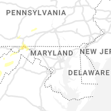
Maryland
| Local Time | Report Details |
|---|---|
| 4:39 PM EDT | A tree blew down near the 8600 block of rock lodge r in garrett county MD, 56.2 miles NE of Elkins, WV |
| 4:49 PM EDT | Tree down on power lines in 1800 block of garrett highwa in garrett county MD, 40.6 miles NE of Elkins, WV |
| 5:48 PM EDT | Several trees blew down on md-51 on the md side of the md/wv lin in allegany county MD, 76.7 miles NE of Elkins, WV |
| 6:08 PM EDT | Numerous trees and powerlines were reported down along w main st in hancock m in washington county MD, 64.1 miles WNW of Baltimore, MD |
| 6:12 PM EDT | Main street in hancock closed due to downed trees... branches... and wires. additional trees down just outside of hancoc in washington county MD, 77.2 miles SSW of State College, PA |
| 6:16 PM EDT | Tree down on i-70 near millstone roa in washington county MD, 77.4 miles S of State College, PA |
| 6:34 PM EDT | Numerous trees blew down in the area of st paul r in washington county MD, 73.5 miles WNW of Baltimore, MD |
| 6:36 PM EDT | Numerous trees blew down along 4 locks r in washington county MD, 75.2 miles WNW of Baltimore, MD |
| 6:39 PM EDT | Tree down on vehicle at 7-eleven in woodstock off of i-8 in howard county MD, 14.2 miles W of Baltimore, MD |
| 6:52 PM EDT | Tree down on route 40 westbound near cleveland avenu in washington county MD, 63.6 miles WNW of Baltimore, MD |
| 6:53 PM EDT | Tree and numerous large branches down near pangborn par in washington county MD, 63.4 miles WNW of Baltimore, MD |
| 6:53 PM EDT | Numerous trees were reported down near halfway blvd and virginia av in washington county MD, 65.6 miles WNW of Baltimore, MD |
| 6:55 PM EDT | Tree down on md-180 near cemetery circl in frederick county MD, 56.4 miles W of Baltimore, MD |
Kansas
| Local Time | Report Details |
|---|---|
| 4:28 PM CDT | Storm damage reported in decatur county KS, 57.9 miles NE of Colby, KS |
Michigan
| Local Time | Report Details |
|---|---|
| 6:15 PM EDT | Report on facebook of trees down in northeastern gladwin count in gladwin county MI, 74.4 miles SSW of Alpena, MI |
| 9:24 PM EDT | Station kmimuske10 in muskegon county MI, 34.8 miles WNW of Grand Rapids, MI |
| 9:39 PM EDT | Mesonet station xmsk muskegon north breakwater ligh in lmz847 county MI, 38.5 miles WNW of Grand Rapids, MI |
| 9:57 PM EDT | Large branches down on waverly between chicago drive and 8t in ottawa county MI, 24.5 miles WSW of Grand Rapids, MI |
| 10:05 PM EDT | Tree down over lake michigan drive. time estimated from radar. report from twitte in kent county MI, 1 miles WNW of Grand Rapids, MI |
| 10:06 PM EDT | Gust measured in new salem. via twitte in allegan county MI, 20.3 miles SSW of Grand Rapids, MI |
| 10:35 PM EDT | 10 inch tree limbs blocking m-43 south of podunk lake. time estimated from rada in barry county MI, 29.8 miles SSE of Grand Rapids, MI |
| 10:40 PM EDT | Time is estimated. spotter also reported pea size hail. relayed by woodt in ionia county MI, 30.3 miles ESE of Grand Rapids, MI |
| 10:47 PM EDT | Report from mping: 3-inch tree limbs broken; power poles broke in kent county MI, 1 miles WNW of Grand Rapids, MI |
| 10:54 PM EDT | Snapped trees and large limbs dow in ionia county MI, 40.7 miles ESE of Grand Rapids, MI |
| 11:00 PM EDT | Wwmt reports power poles down in kalamazo in kalamazoo county MI, 46.9 miles S of Grand Rapids, MI |
| 11:15 PM EDT | Asos station klan lansin in clinton county MI, 48.1 miles WSW of Flint, MI |
| 11:16 PM EDT | Report from mping: 3-inch tree limbs broken; power poles broke in van buren county MI, 62.7 miles S of Grand Rapids, MI |
| 11:38 PM EDT | Shiawassee county central dispatch reports several trees and wires down throughout the county... particularly across northern area in shiawassee county MI, 25 miles W of Flint, MI |
| 11:39 PM EDT | Report from mping: trees uprooted or snappe in kent county MI, 0.9 miles N of Grand Rapids, MI |
Virginia
| Local Time | Report Details |
|---|---|
| 6:24 PM EDT | Tree down along craig creek roa in botetourt county VA, 26.8 miles N of Roanoke, VA |
| 6:26 PM EDT | Two trees down due to thunderstorm winds in the goshen are in rockbridge county VA, 54.5 miles NNE of Roanoke, VA |
| 6:39 PM EDT | Tree down on vehicle at 7-eleven in woodstock off of i-8 in shenandoah county VA, 71 miles E of Elkins, WV |
| 6:48 PM EDT | Tree down along wilderness roa in bland county VA, 56.5 miles W of Roanoke, VA |
| 6:48 PM EDT | Multiple trees down in bastia in bland county VA, 67.2 miles W of Roanoke, VA |
| 6:53 PM EDT | Tree down at intersection of springwood road and flowing spring roa in botetourt county VA, 18.4 miles NNE of Roanoke, VA |
| 6:53 PM EDT | Multiple trees down due to thunderstorm winds in the rockbridge baths are in rockbridge county VA, 51.9 miles NNE of Roanoke, VA |
| 6:56 PM EDT | One tree down due to thunderstorms winds at the intersection of flowing spring road and springwood roa in botetourt county VA, 18.4 miles NNE of Roanoke, VA |
| 7:06 PM EDT | Trees down along little creek highwa in bland county VA, 59 miles WSW of Roanoke, VA |
| 7:07 PM EDT | One tree down due to thunderstorm winds along the 400 block of maury river roa in rockbridge county VA, 46.9 miles NE of Roanoke, VA |
| 7:14 PM EDT | One tree down due to thunderstorm winds along the 300 block of muse roa in botetourt county VA, 14.9 miles NNE of Roanoke, VA |
| 7:17 PM EDT | Tree down along muse roa in botetourt county VA, 15.6 miles NNE of Roanoke, VA |
| 10:00 PM EDT | Trees down and around 2...000 power outages between short pump and henrico likely caused by storm. time estimate in henrico county VA, 10.1 miles NNE of Richmond, VA |
Vermont
| Local Time | Report Details |
|---|---|
| 7:18 PM EDT | Quarter sized hail reported near Canaan, VT, 83.5 miles ENE of Burlington, VT, hail fell for 10-12 minutes with hail briefly covering the ground. hail size ranged from dimes to quarters. |
| 7:30 PM EDT | Quarter sized hail reported near Norton, VT, 82.4 miles ENE of Burlington, VT, hail fell along route 114e. |
Georgia
| Local Time | Report Details |
|---|---|
| 7:23 PM EDT | Minor damage reported along cowart dr associated with a downburs in cook county GA, 43 miles SW of Douglas, GA |
| 7:35 PM EDT | Several large trees were blown down near the area of highway 37 and indian creek rd and were blocking the highwa in cook county GA, 39.8 miles SW of Douglas, GA |
Tennessee
| Local Time | Report Details |
|---|---|
| 7:35 PM EDT | Report via social media of two medium sized trees down with time estimated from rada in bradley county TN, 35.3 miles ENE of Chattanooga, TN |
New Hampshire
| Local Time | Report Details |
|---|---|
| 7:43 PM EDT | Downed trees and branches across nh hwy 145. time estimated by rada in coos county NH, 90.9 miles ENE of Burlington, VT |
| 7:45 PM EDT | Half Dollar sized hail reported near Colebrook, NH, 90 miles ENE of Burlington, VT, hail observed north of downtown colebrook. biggest hail was the size of half dollars. time estimated by radar. |
| 7:50 PM EDT | Half Dollar sized hail reported near Colebrook, NH, 90.7 miles ENE of Burlington, VT, observed hail for about 6-7 minutes on reed road north of highway 26. largest hail stones were 1.25 inches in diameter. time estimated by radar. |
Colorado
| Local Time | Report Details |
|---|---|
| 6:59 PM MDT | Storm damage reported in prowers county CO, 95.1 miles W of Garden City, KS |
| 6:59 PM MDT | Storm damage reported in prowers county CO, 95.1 miles W of Garden City, KS |
| 7:00 PM MDT | Storm damage reported in prowers county CO, 95.7 miles W of Garden City, KS |
| 7:01 PM MDT | Asos station klaa lamar airpor in prowers county CO, 98.8 miles W of Garden City, KS |
| 7:14 PM MDT | Corrects previous tstm wnd gst report from 4 wsw lama in prowers county CO, 99.4 miles W of Garden City, KS |
| 7:14 PM MDT | Corrects previous tstm wnd gst report from 4 wsw lama in prowers county CO, 99.4 miles W of Garden City, KS |
New Mexico
| Local Time | Report Details |
|---|---|
| 12:00 AM MDT | Storm damage reported in grant county NM, 22 miles NW of Silver City, NM |
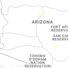
Arizona
| Local Time | Report Details |
|---|---|
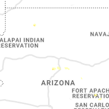
| 11:44 PM MST | Asos station kalk pioneer airfiel in cochise county AZ, 53.3 miles SE of Tucson, AZ |
Connect with Interactive Hail Maps