

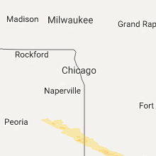
Hail Map for Monday, March 20, 2017

Number of Impacted Households on 3/20/2017
0
Impacted by 1" or Larger Hail
0
Impacted by 1.75" or Larger Hail
0
Impacted by 2.5" or Larger Hail
Square Miles of Populated Area Impacted on 3/20/2017
0
Impacted by 1" or Larger Hail
0
Impacted by 1.75" or Larger Hail
0
Impacted by 2.5" or Larger Hail


Cities Most Affected by Hail Storms of 3/20/2017
| Hail Size | Demographics of Zip Codes Affected | ||||||
|---|---|---|---|---|---|---|---|
| City | Count | Average | Largest | Pop Density | House Value | Income | Age |
| Hoopeston, IL | 2 | 2.38 | 2.75 | 53 | $51k | $32.8k | 41.7 |
| Rushville, IN | 1 | 1.75 | 1.75 | 48 | $85k | $37.2k | 40.1 |
Hail and Wind Damage Spotted on 3/20/2017
Filter by Report Type:Hail ReportsWind Reports
Illinois
| Local Time | Report Details |
|---|---|
| 11:02 AM CDT | Quarter sized hail reported near Pontiac, IL, 51.4 miles ENE of Peoria, IL |
| 11:28 AM CDT | Quarter sized hail reported near Watseka, IL, 75.1 miles S of Chicago, IL |
| 11:31 AM CDT | Quarter sized hail reported near Watseka, IL, 76.4 miles S of Chicago, IL, two reports from watseka relayed via twitter. |
| 11:43 AM CDT | Quarter sized hail reported near Chatsworth, IL, 68.2 miles E of Peoria, IL |
| 12:06 PM CDT | Half Dollar sized hail reported near Piper City, IL, 73.5 miles E of Peoria, IL |
| 12:16 PM CDT | Hen Egg sized hail reported near Hoopeston, IL, 77.8 miles NNE of Mattoon, IL |
| 12:30 PM CDT | Baseball sized hail reported near Hoopeston, IL, 77.8 miles NNE of Mattoon, IL |
Indiana
| Local Time | Report Details |
|---|---|
| 2:00 PM EDT | Quarter sized hail reported near Williamsport, IN, 74.6 miles WNW of Indianapolis, IN, time estimated from radar. |
| 2:15 PM EDT | Quarter sized hail reported near Attica, IN, 68.2 miles WNW of Indianapolis, IN, . |
| 2:19 PM EDT | Quarter sized hail reported near Westpoint, IN, 61.1 miles NW of Indianapolis, IN, intersection of in-25 and 800s. |
| 2:42 PM EDT | Quarter sized hail reported near Linden, IN, 49.8 miles NW of Indianapolis, IN, . |
| 3:45 PM EDT | Quarter sized hail reported near Whitestown, IN, 19.3 miles NNW of Indianapolis, IN, time estimated from radar. relayed via social media. |
| 3:54 PM EDT | Quarter sized hail reported near Lebanon, IN, 25 miles NW of Indianapolis, IN, reported at 8250 west oak street... lebanon... in. still falling at 1558 edt. |
| 4:00 PM EDT | Quarter sized hail reported near Indianapolis, IN, 8.9 miles NNE of Indianapolis, IN, . |
| 4:00 PM EDT | Half Dollar sized hail reported near Zionsville, IN, 13.9 miles NNW of Indianapolis, IN, report via twitter. |
| 4:00 PM EDT | Quarter sized hail reported near Indianapolis, IN, 10.7 miles N of Indianapolis, IN, . |
| 4:15 PM EDT | Quarter sized hail reported near Zionsville, IN, 14.7 miles NNW of Indianapolis, IN, heavy hail fell for 15-25 minutes. |
| 4:20 PM EDT | Quarter sized hail reported near Indianapolis, IN, 10 miles NNE of Indianapolis, IN, . |
| 4:30 PM EDT | Quarter sized hail reported near Greenfield, IN, 11.9 miles E of Indianapolis, IN, located at 100 north and 700 west in cumberland... in. |
| 5:02 PM EDT | Golf Ball sized hail reported near Rushville, IN, 31.8 miles ESE of Indianapolis, IN, . |
Tennessee
| Local Time | Report Details |
|---|---|
| 5:50 PM CDT | Twitter photos show a large tree was blown down and heavily damaged a small house near erin. time estimated based on rada in stewart county TN, 44.4 miles ENE of Mc Kenzie, TN |
| 7:19 PM CDT | At the intersection of brusch creek road and cc road a 60 foot long large tree was blocking the roa in williamson county TN, 23.1 miles SW of Nashville, TN |
Connect with Interactive Hail Maps