

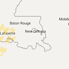
Hail Map for Wednesday, March 29, 2017

Number of Impacted Households on 3/29/2017
0
Impacted by 1" or Larger Hail
0
Impacted by 1.75" or Larger Hail
0
Impacted by 2.5" or Larger Hail
Square Miles of Populated Area Impacted on 3/29/2017
0
Impacted by 1" or Larger Hail
0
Impacted by 1.75" or Larger Hail
0
Impacted by 2.5" or Larger Hail


Cities Most Affected by Hail Storms of 3/29/2017
| Hail Size | Demographics of Zip Codes Affected | ||||||
|---|---|---|---|---|---|---|---|
| City | Count | Average | Largest | Pop Density | House Value | Income | Age |
| Fulton, MO | 2 | 1.75 | 1.75 | 88 | $82k | $36.9k | 35.1 |
| Creole, LA | 1 | 1.75 | 1.75 | 4 | $47k | $26.9k | 46.9 |
Hail and Wind Damage Spotted on 3/29/2017
Filter by Report Type:Hail ReportsWind Reports
Texas
| Local Time | Report Details |
|---|---|
| 10:32 AM CDT | Trees down at braewick and braeswood in harris county TX, 9.6 miles SW of Houston, TX |
| 10:35 AM CDT | Collapsed carport and window damage at the azalea place apartments. possible tornado damag in harris county TX, 8.3 miles WSW of Houston, TX |
| 11:30 AM CDT | Social media report of trees down on 4500 holly street near new castle. large trees down. time estimated was around 1130 a in harris county TX, 6.8 miles SW of Houston, TX |
| 3:01 PM CDT | Quarter sized hail reported near Port Arthur, TX, 17.1 miles SW of Beaumont, TX, many dime size a few quarter size |
| 3:10 PM CDT | Numerous ship cantainers moved and dropped near barbers cut. possible tornad in harris county TX, 22.9 miles ESE of Houston, TX |
| 3:12 PM CDT | Roof damage 13100 bay park road... pasadena. possible tornad in harris county TX, 14.9 miles ESE of Houston, TX |
| 3:15 PM CDT | Sheriffs department reports large tree down across us 69 in tyler county TX, 37 miles SSE of Lufkin, TX |
| 4:08 PM CDT | Sheriffs dept reports trees down on hwy 19 in jasper county TX, 49.9 miles SE of Lufkin, TX |
| 4:10 PM CDT | Ping Pong Ball sized hail reported near Jasper, TX, 51.6 miles SE of Lufkin, TX |
| 4:39 PM CDT | Sheriffs dept reports trees down near farrsville. 88-d displayed td in newton county TX, 58 miles ESE of Lufkin, TX |
| 5:01 PM CDT | Quarter sized hail reported near Port Arthur, TX, 17.6 miles SW of Beaumont, TX, hail mostly dime size with a few quarter size hail |
| 5:17 PM CDT | Quarter sized hail reported near Port Arthur, TX, 17.6 miles SW of Beaumont, TX, public reports quarter size hail in port arthur |
| 5:20 PM CDT | Quarter sized hail reported near Port Arthur, TX, 22 miles SW of Beaumont, TX |
| 5:20 PM CDT | Kbmt reports estimated 60 mph winds on major drive in beaumon in jefferson county TX, 24.2 miles W of Beaumont, TX |
| 5:20 PM CDT | Quarter sized hail reported near Port Arthur, TX, 17.6 miles SW of Beaumont, TX |
| 6:04 PM CDT | Kbmt relayed a public report of trees down at sul ross and williamsburg in the regina howell area of beaumon in jefferson county TX, 24.2 miles W of Beaumont, TX |
| 6:10 PM CDT | Quarter sized hail reported near Port Neches, TX, 14.8 miles SW of Beaumont, TX, kbmt relayed a public report of quarter size hail near port neches. |
Kansas
| Local Time | Report Details |
|---|---|
| 4:00 PM CDT | Quarter sized hail reported near Berryton, KS, 52.8 miles ESE of Manhattan, KS, . |
| 5:28 PM CDT | Quarter sized hail reported near Olathe, KS, 16.4 miles SW of Kansas City, MO, reported via social media |
| 5:29 PM CDT | Quarter sized hail reported near Olathe, KS, 19.1 miles SW of Kansas City, MO |
Oklahoma
| Local Time | Report Details |
|---|---|
| 5:17 PM CDT | Quarter sized hail reported near Catoosa, OK, 13.1 miles ENE of Tulsa, OK |
Louisiana
| Local Time | Report Details |
|---|---|
| 5:18 PM CDT | Several trees down along highway 191 north of the da in sabine county LA, 68.6 miles E of Lufkin, TX |
| 6:25 PM CDT | Tree down along cele cook driv in natchitoches county LA, 61.9 miles SE of Shreveport, LA |
| 6:35 PM CDT | Golf Ball sized hail reported near Creole, LA, 36.9 miles SE of Beaumont, TX |
| 6:45 PM CDT | Several trees reported down in cameron county LA, 28.3 miles E of Beaumont, TX |
| 7:11 PM CDT | Tree down just south of provenca in natchitoches county LA, 67.7 miles SSE of Shreveport, LA |
| 8:06 PM CDT | Tree dow in union county LA, 19.9 miles WSW of Bastrop, LA |
| 8:06 PM CDT | Tree dow in union county LA, 16.2 miles W of Bastrop, LA |
| 8:15 PM CDT | 2 trees down on hwy 133 in richland county LA, 20.6 miles SSE of Bastrop, LA |
| 8:17 PM CDT | Kplc relaed a report from the oakdale chief of police of damage related to a possible tornado that included trees down along hwy 165... a roof blown off of a murphy gas in allen county LA, 56.4 miles NW of Lafayette, LA |
| 8:20 PM CDT | Quarter sized hail reported near Jennings, LA, 40 miles WNW of Lafayette, LA |
| 8:20 PM CDT | Quarter sized hail reported near Branch, LA, 17.6 miles WNW of Lafayette, LA |
| 8:23 PM CDT | Tree down and three barns damaged in acadia county LA, 35.2 miles WNW of Lafayette, LA |
| 8:30 PM CDT | Quarter sized hail reported near Branch, LA, 17.6 miles WNW of Lafayette, LA |
| 8:38 PM CDT | Quarter sized hail reported near Duson, LA, 10.4 miles W of Lafayette, LA |
| 8:57 PM CDT | Quarter sized hail reported near Duson, LA, 7.3 miles WSW of Lafayette, LA, public reported quarter size hail via social media. |
| 9:22 PM CDT | Power line down at intersection of 2nd and millikin street. in east carroll county LA, 42.8 miles E of Bastrop, LA |
Arkansas
| Local Time | Report Details |
|---|---|
| 6:22 PM CDT | Quarter sized hail reported near Havana, AR, 53.8 miles ESE of Fort Smith, AR, quarter size hail rrported in havana and points north. |
| 7:25 PM CDT | Quarter sized hail reported near Diamond City, AR, 55.6 miles SSE of Springfield, MO, law enforcement in diamond city reported quarter sized hail as storm passed through. also saw rain-wrapped funnel. could not tell if it was in contact with the ground a |
| 7:52 PM CDT | Large trees were reported uprooted and snappe in garland county AR, 54.5 miles NE of Nashville, AR |
| 8:33 PM CDT | Quarter sized hail reported near Mountain Home, AR, 85.8 miles SSE of Springfield, MO |
| 9:35 PM CDT | Quarter sized hail reported near Damascus, AR, 43.5 miles N of Little Rock, AR |
| 12:31 AM CDT | Quarter sized hail reported near Cherokee Village, AR, 93.6 miles S of Salem, MO |
Missouri
| Local Time | Report Details |
|---|---|
| 6:44 PM CDT | Quarter sized hail reported near Dixon, MO, 44 miles NW of Salem, MO, quarter size hail reported 7 miles north of dixon. |
| 7:05 PM CDT | Quarter sized hail reported near Grain Valley, MO, 22.4 miles SE of Kansas City, MO |
| 7:20 PM CDT | Quarter sized hail reported near Sumner, MO, 68.4 miles NW of Columbia, MO |
| 7:37 PM CDT | Golf Ball sized hail reported near Fulton, MO, 23.9 miles ESE of Columbia, MO |
| 7:38 PM CDT | Golf Ball sized hail reported near Fulton, MO, 23.7 miles ESE of Columbia, MO |
| 8:27 PM CDT | Quarter sized hail reported near Camdenton, MO, 59.8 miles NNE of Springfield, MO, quarter size hail just south of ha ha tonka state park. time based on radar. |
| 8:37 PM CDT | Quarter sized hail reported near Monroe City, MO, 53.2 miles S of Kahoka, MO, dime to quarter |
| 8:50 PM CDT | Quarter sized hail reported near Green Castle, MO, 64.2 miles W of Kahoka, MO |
| 9:04 PM CDT | Quarter sized hail reported near Durham, MO, 31.3 miles S of Kahoka, MO, located in durham. |
| 9:51 PM CDT | Ping Pong Ball sized hail reported near Jefferson City, MO, 28.4 miles SSE of Columbia, MO, . |
| 11:00 PM CDT | Troop i and dent county law enforcement reported heavy damage to a house in the area near short bend off highway 19 and county road 3340. another home in the area was a in dent county MO, 8.8 miles NE of Salem, MO |
| 12:50 AM CDT | Half Dollar sized hail reported near Thayer, MO, 77.7 miles S of Salem, MO, half dollar size hail reported near the state line just southeast of thayer along highway 63 |
Mississippi
| Local Time | Report Details |
|---|---|
| 9:44 PM CDT | Tree on a home on pear lan in washington county MS, 66 miles NE of Bastrop, LA |
| 9:45 PM CDT | Mobile home lost part of its roo in washington county MS, 65 miles ENE of Bastrop, LA |
| 9:45 PM CDT | Power line down on mckinley av in washington county MS, 67.2 miles ENE of Bastrop, LA |
| 9:50 PM CDT | Power lines down on hwy 43 in washington county MS, 67.5 miles ENE of Bastrop, LA |
| 9:58 PM CDT | Storm damage reported in washington county MS, 72.2 miles NE of Bastrop, LA |
| 10:25 PM CDT | Trees down on memorial dr and north bayo in bolivar county MS, 94.3 miles SSW of Memphis, TN |
| 10:50 PM CDT | Tree fell on home on laurel av in adams county MS, 86.9 miles SW of Jackson, MS |
| 10:50 PM CDT | Trees down on kaiser lake r in adams county MS, 81.4 miles SW of Jackson, MS |
| 10:56 PM CDT | Trees down on rand r in adams county MS, 83.1 miles SW of Jackson, MS |
| 11:10 PM CDT | Tree down across tate roa in jefferson county MS, 76 miles SW of Jackson, MS |
| 12:32 AM CDT | Tree down across bogue chitto r in franklin county MS, 67.6 miles SSW of Jackson, MS |
| 12:45 AM CDT | Power lines dow in copiah county MS, 25.2 miles SW of Jackson, MS |
| 12:58 AM CDT | Tree on a home on old us-51 n in lincoln county MS, 50.8 miles SSW of Jackson, MS |
| 12:58 AM CDT | Multiple trees down in downtown brookhave in lincoln county MS, 51.8 miles SSW of Jackson, MS |
| 1:00 AM CDT | 4 homes with trees on them and numerous roads blocked by downed trees around tow in lincoln county MS, 51.8 miles SSW of Jackson, MS |
| 1:01 AM CDT | Tree on home on pritchard s in lincoln county MS, 51.8 miles SSW of Jackson, MS |
| 1:15 AM CDT | Storm damage reported in lincoln county MS, 49.3 miles SSW of Jackson, MS |
| 1:25 AM CDT | Trees down along lake castle roads with power outages in the are in madison county MS, 11.2 miles N of Jackson, MS |
| 1:25 AM CDT | Trees down on powerlines along robinhood road. picture seen via social medi in hinds county MS, 4.3 miles N of Jackson, MS |
Illinois
| Local Time | Report Details |
|---|---|
| 9:52 PM CDT | Quarter sized hail reported near Quincy, IL, 42.6 miles SSE of Kahoka, MO, . |
Connect with Interactive Hail Maps