

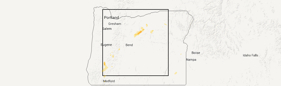
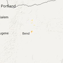
Hail Map for Antelope, OR
The Antelope, OR area has had 1 report of on-the-ground hail by trained spotters, and has been under severe weather warnings 0 times during the past 12 months. Doppler radar has detected hail at or near Antelope, OR on 4 occasions.
| Name: | Antelope, OR |
| Where Located: | 42.5 miles N of Bend, OR |
| Map: | Google Map for Antelope, OR |
| Population: | 46 |
| Housing Units: | 43 |
| More Info: | Search Google for Antelope, OR |
5
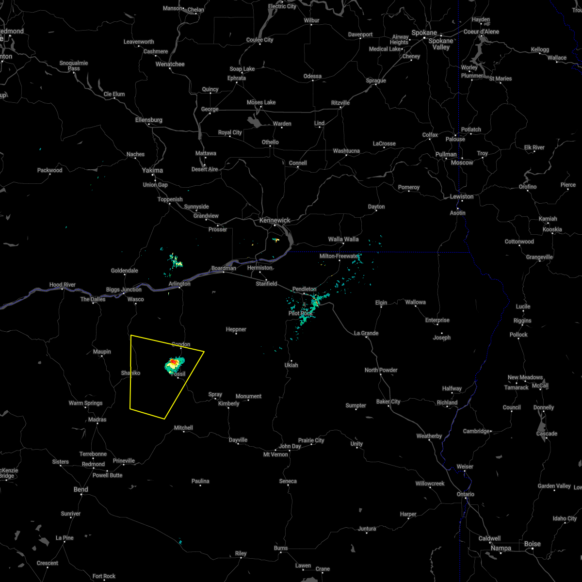
The Top Recent Hail Date for Antelope, OR is Monday, April 23, 2012 (1st out of 4)
Hail and Wind Damage Spotted near Antelope, OR
| Date / Time | Report Details |
|---|---|
| 5/19/2023 6:48 PM PDT | Mesonet station npfo3 north pole ridg in wasco county OR, 12.1 miles SW of Antelope, OR |
| 8/18/2020 7:22 PM PDT |
 At 721 pm pdt, a severe thunderstorm was located 8 miles west of mayville, or 10 miles northwest of fossil, moving north at 30 mph (radar indicated). Hazards include 60 mph wind gusts and penny size hail, along with heavy rain and frequent lightning is likely. Expect damage to roofs, siding, and trees. Locations impacted include, condon, fossil, antelope, shaniko, kent, mayville and clarno. At 721 pm pdt, a severe thunderstorm was located 8 miles west of mayville, or 10 miles northwest of fossil, moving north at 30 mph (radar indicated). Hazards include 60 mph wind gusts and penny size hail, along with heavy rain and frequent lightning is likely. Expect damage to roofs, siding, and trees. Locations impacted include, condon, fossil, antelope, shaniko, kent, mayville and clarno.
|
| 8/18/2020 6:40 PM PDT |
 At 639 pm pdt, a severe thunderstorm was located 8 miles south of clarno, or 20 miles southwest of fossil, moving north at 30 mph (radar indicated). Hazards include 60 mph wind gusts and penny size hail, along with heavy rain and frequent lightning are likely. expect damage to roofs, siding, and trees At 639 pm pdt, a severe thunderstorm was located 8 miles south of clarno, or 20 miles southwest of fossil, moving north at 30 mph (radar indicated). Hazards include 60 mph wind gusts and penny size hail, along with heavy rain and frequent lightning are likely. expect damage to roofs, siding, and trees
|
| 6/26/2019 3:48 PM PDT | Raws site npfo3 in wasco county OR, 12.1 miles SW of Antelope, OR |
| 5/4/2017 11:43 PM PDT |
 At 1142 pm pdt, doppler radar indicated a severe thunderstorm capable of producing large hail up to ping pong ball size and damaging winds in excess of 60 mph. this storm has a history of producing hen egg size hail. this storm was located near south junction, or 20 miles north of madras, and moving northeast at 40 mph. At 1142 pm pdt, doppler radar indicated a severe thunderstorm capable of producing large hail up to ping pong ball size and damaging winds in excess of 60 mph. this storm has a history of producing hen egg size hail. this storm was located near south junction, or 20 miles north of madras, and moving northeast at 40 mph.
|
| 5/4/2017 11:26 PM PDT |
 At 1125 pm pdt, trained weather spotters reported a severe thunderstorm producing large damaging hail up to two inches in diameter and damaging winds in excess of 60 mph. this storm was located over willowdale, or 16 miles northeast of madras, moving northeast at 45 mph. locations impacted include, madras, antelope, gateway, south junction, warm springs, willowdale, simnasho and warm springs reservation. At 1125 pm pdt, trained weather spotters reported a severe thunderstorm producing large damaging hail up to two inches in diameter and damaging winds in excess of 60 mph. this storm was located over willowdale, or 16 miles northeast of madras, moving northeast at 45 mph. locations impacted include, madras, antelope, gateway, south junction, warm springs, willowdale, simnasho and warm springs reservation.
|
| 5/4/2017 10:53 PM PDT |
 At 1045 pm pdt, trained weather spotters reported a severe thunderstorm producing large damaging hail up to golf ball size and damaging winds in excess of 60 mph. this storm was located near culver, or 9 miles southwest of madras, and moving northeast at 45 mph. At 1045 pm pdt, trained weather spotters reported a severe thunderstorm producing large damaging hail up to golf ball size and damaging winds in excess of 60 mph. this storm was located near culver, or 9 miles southwest of madras, and moving northeast at 45 mph.
|
| 4/7/2017 12:48 PM PDT | North pole ridge raws in wasco county OR, 12.1 miles SW of Antelope, OR |
| 7/18/2016 6:49 PM PDT |
 At 646 pm pdt, doppler radar indicated a strong to severe thunderstorm capable of producing quarter size hail. the recent radar trend showed the storm decreasing in intensity, but hail up to one inch in diameter is still possible. this storm was located just west of shaniko, or 21 miles west of fossil, moving northeast at 35 mph. locations impacted include, antelope, shaniko, clarno and kent. At 646 pm pdt, doppler radar indicated a strong to severe thunderstorm capable of producing quarter size hail. the recent radar trend showed the storm decreasing in intensity, but hail up to one inch in diameter is still possible. this storm was located just west of shaniko, or 21 miles west of fossil, moving northeast at 35 mph. locations impacted include, antelope, shaniko, clarno and kent.
|
| 7/18/2016 6:32 PM PDT |
 At 631 pm pdt, doppler radar indicated a severe thunderstorm capable of producing quarter size hail. this storm was located over shaniko, or 26 miles west of fossil, and moving northeast at 35 mph. At 631 pm pdt, doppler radar indicated a severe thunderstorm capable of producing quarter size hail. this storm was located over shaniko, or 26 miles west of fossil, and moving northeast at 35 mph.
|
| 4/23/2012 7:00 PM PDT | Quarter sized hail reported 12.4 miles W of Antelope, OR, public reported hail up to 1 inch in diameter and winds of 40 to 50 mph. |
Hail Maps for Antelope, OR


Connect with Interactive Hail Maps