

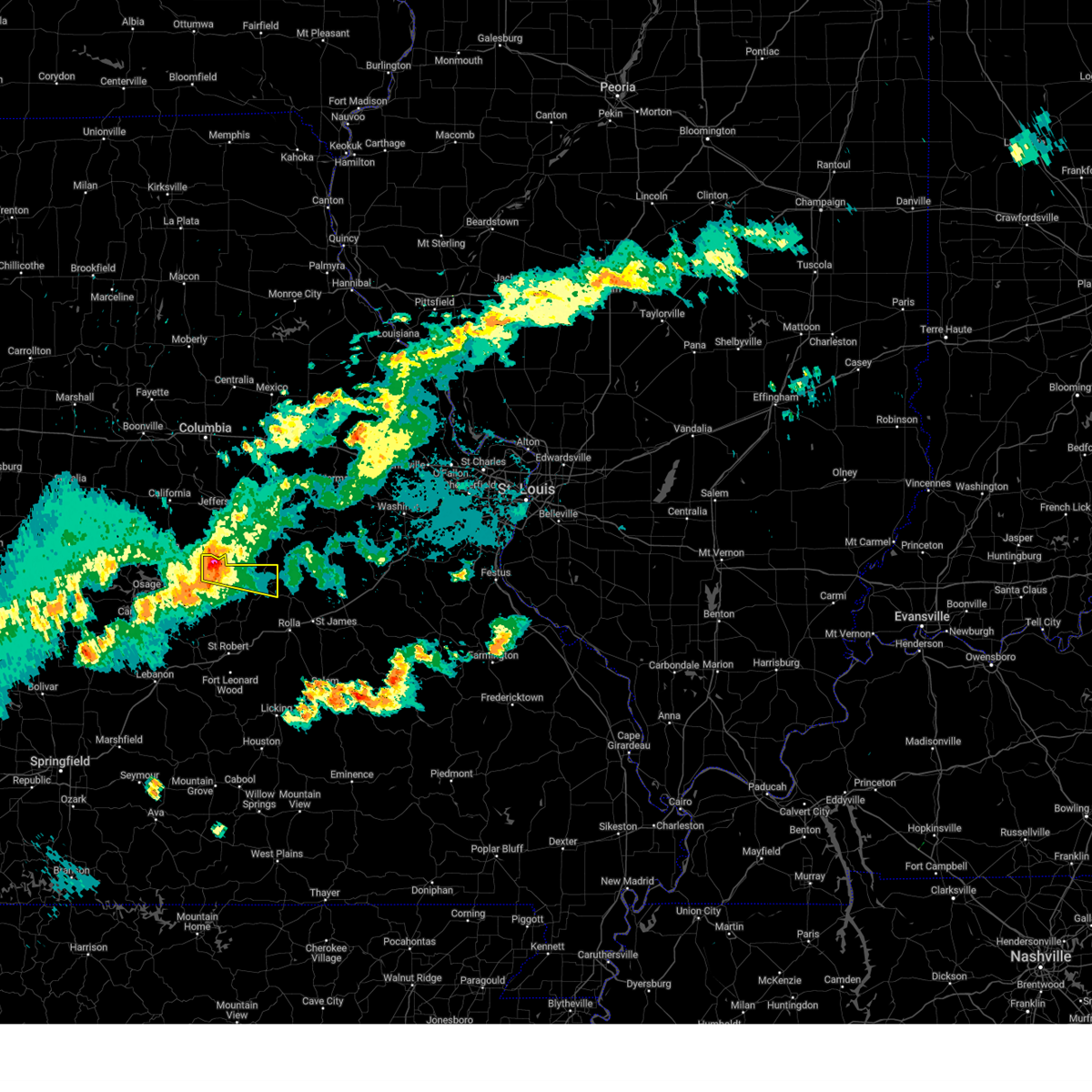
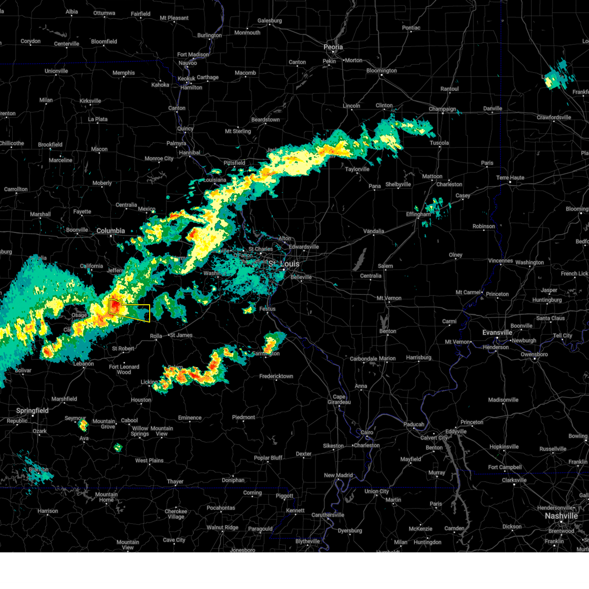
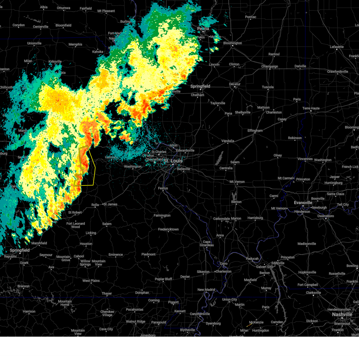
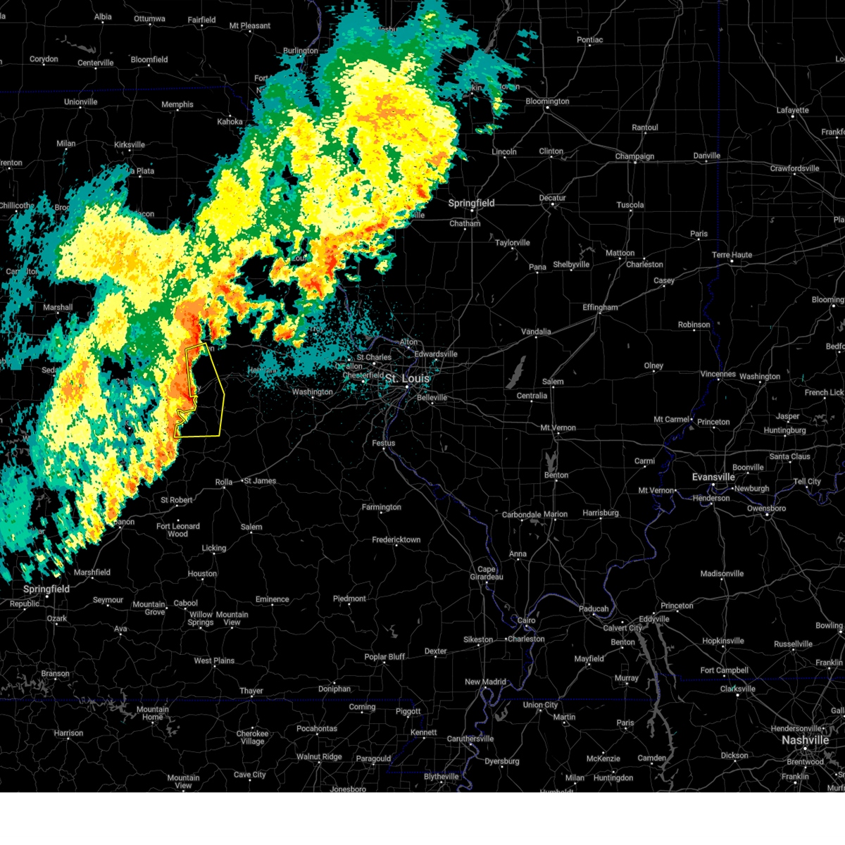
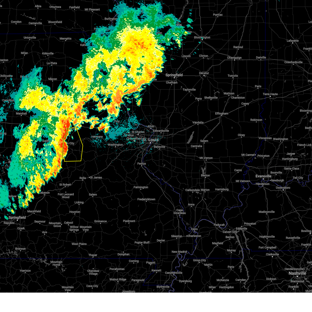
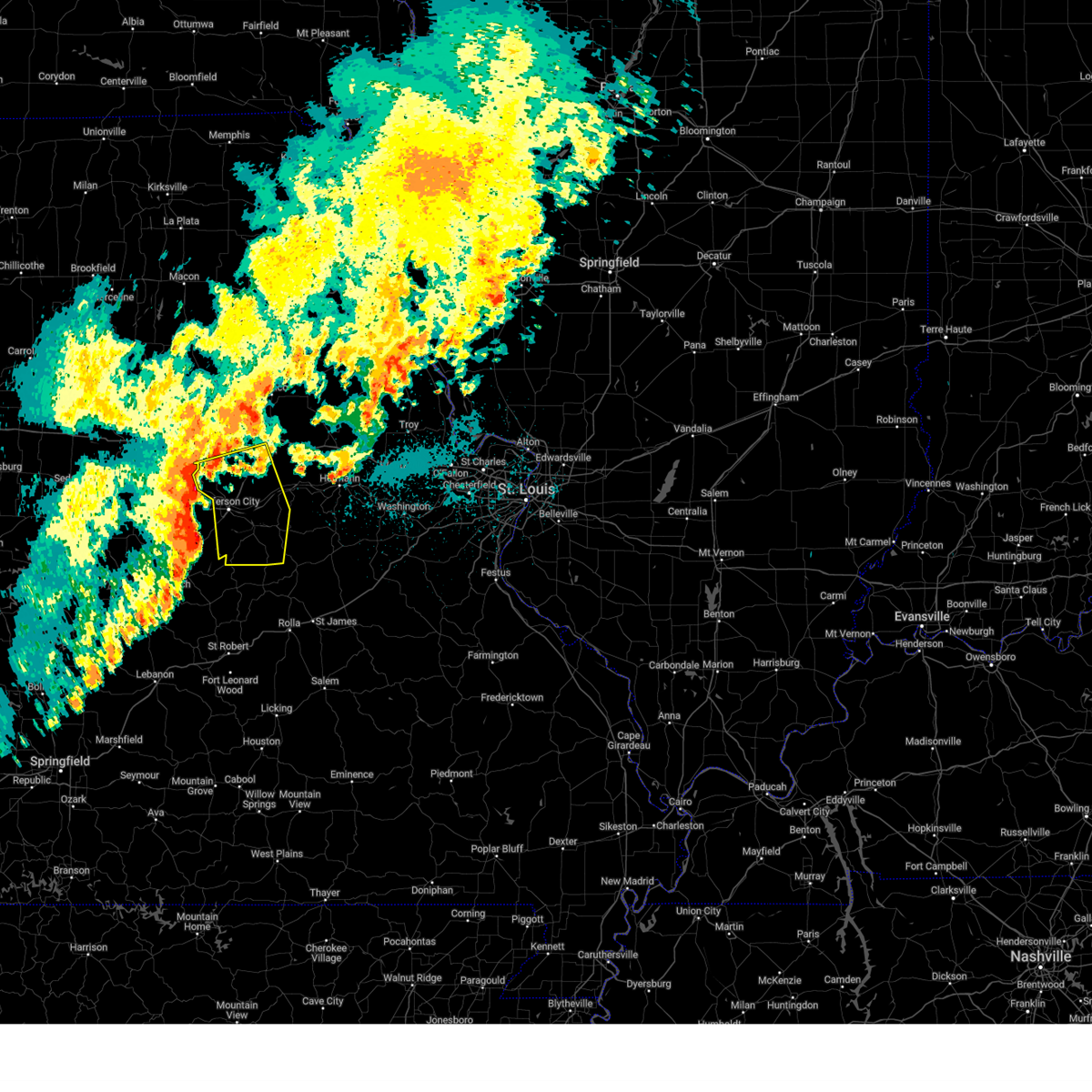
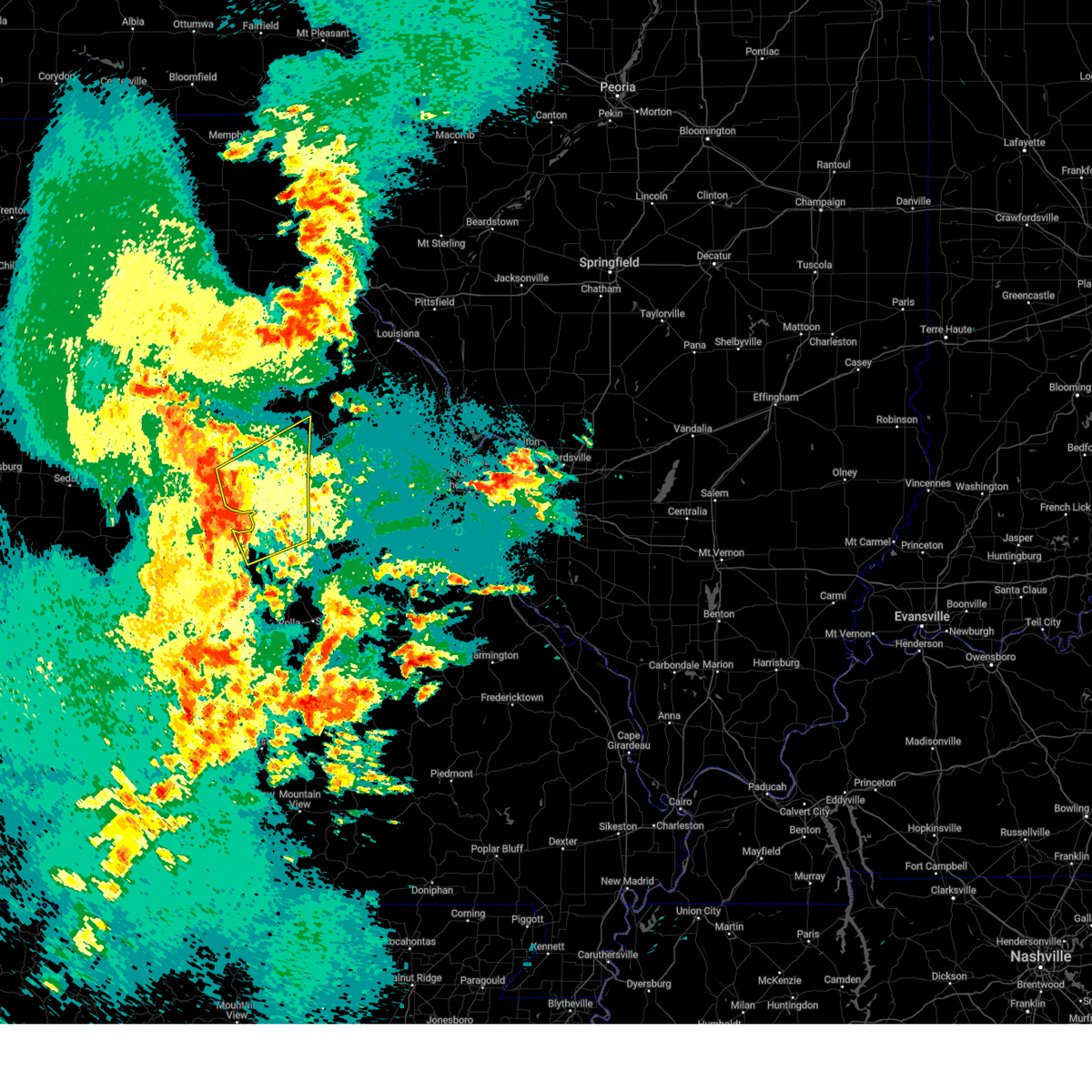
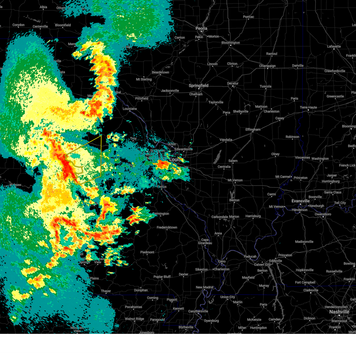
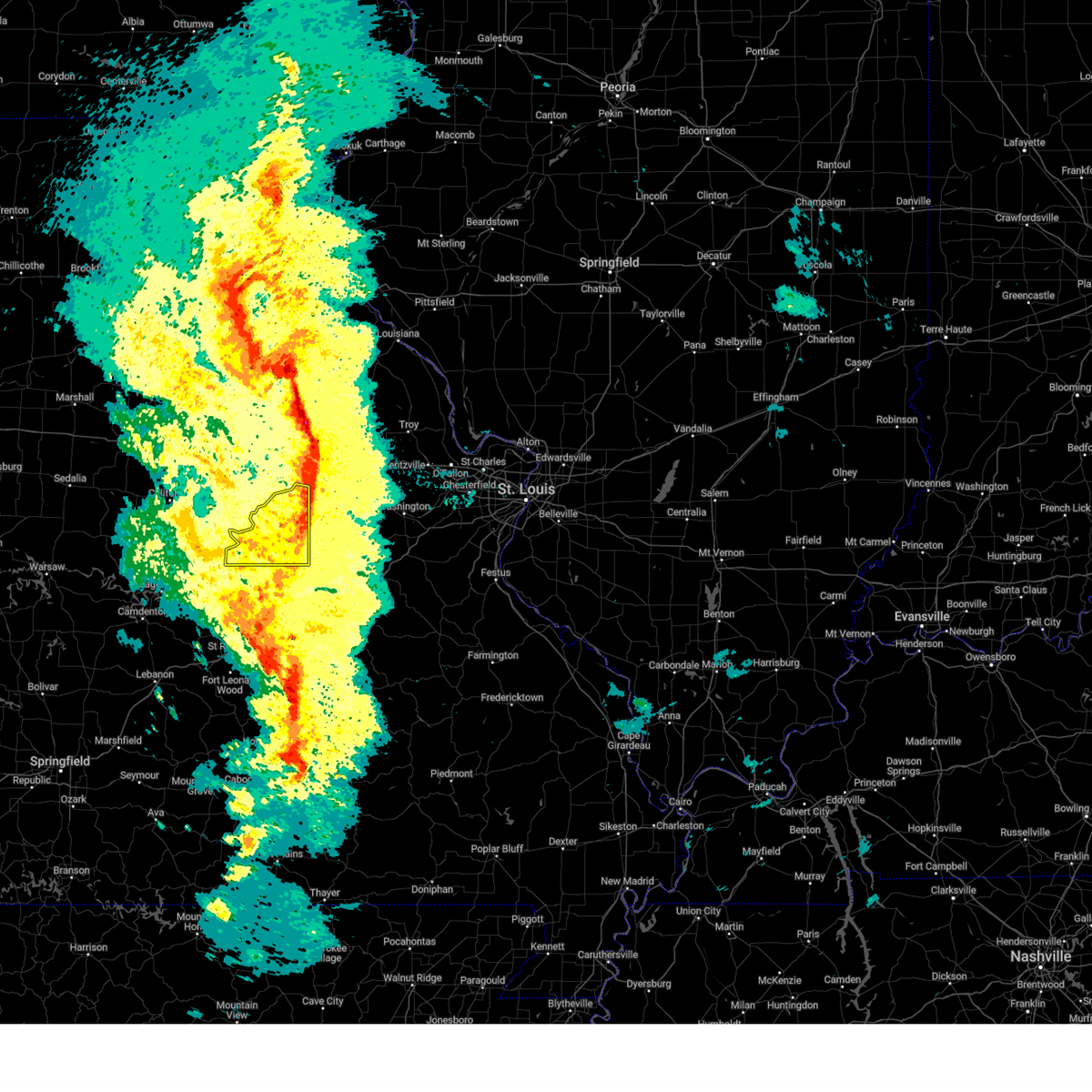
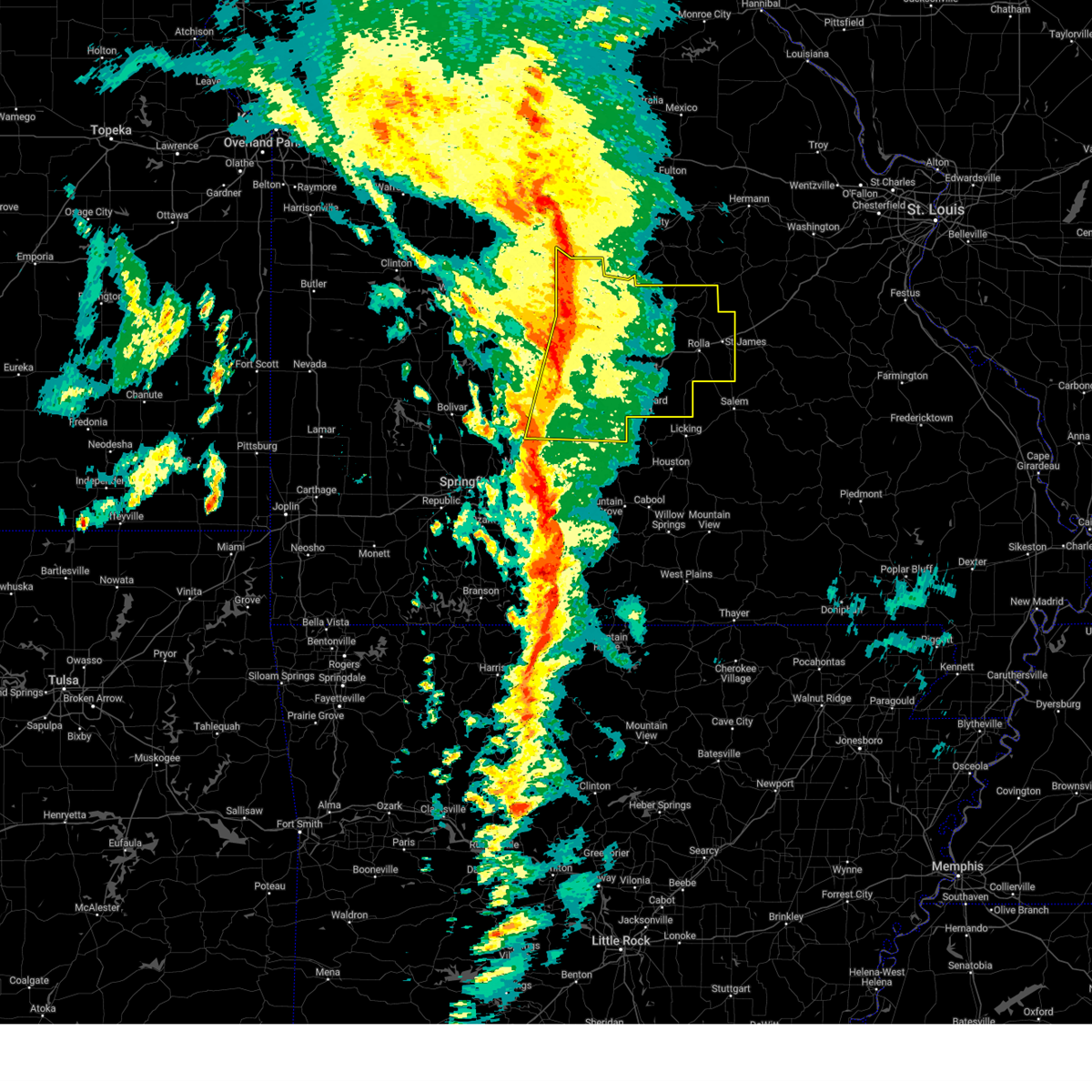
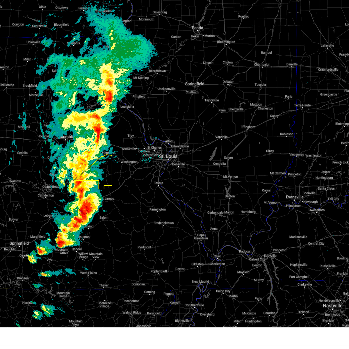
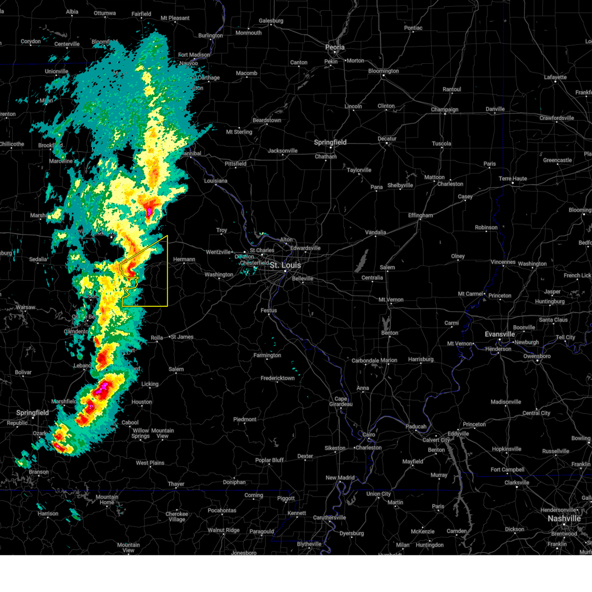
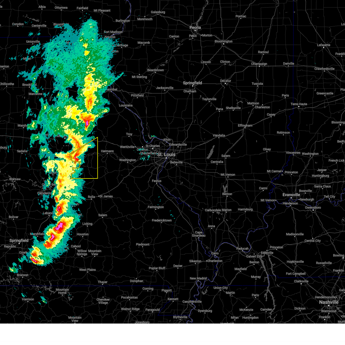
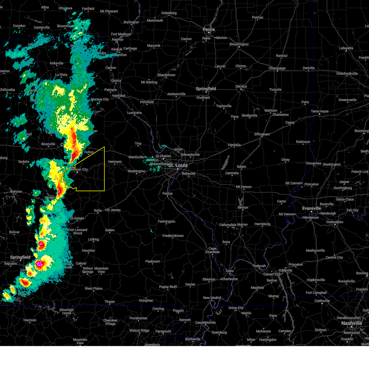
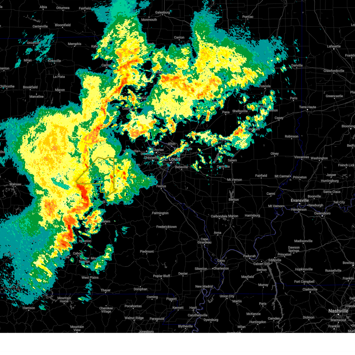
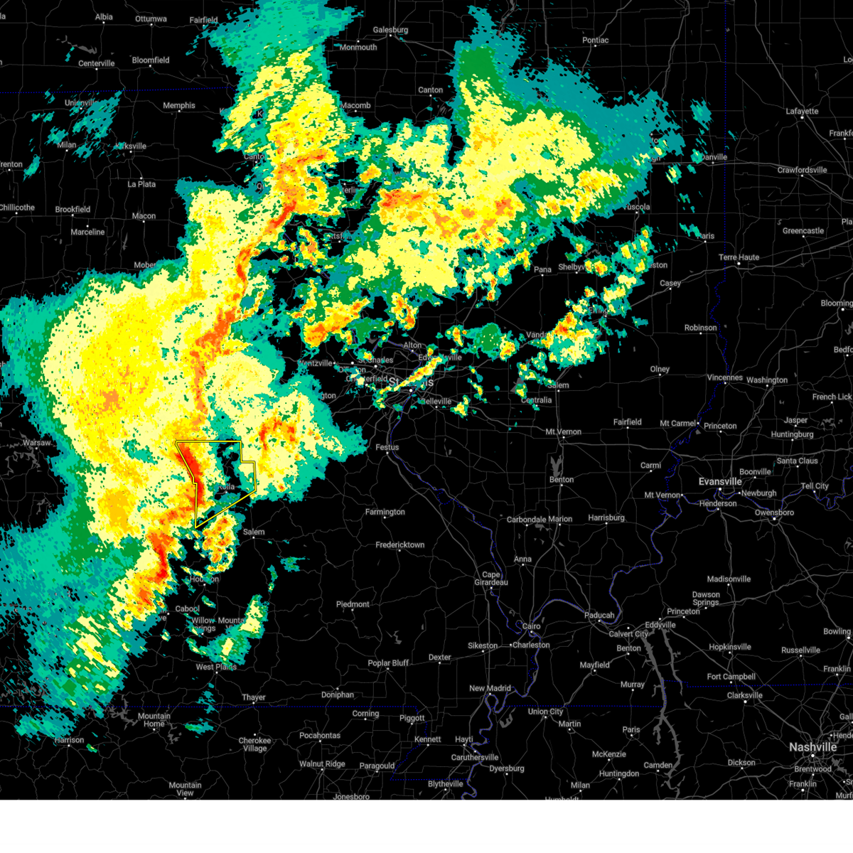
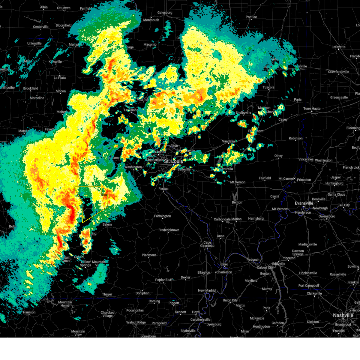
Hail Map for Argyle, MO
The Argyle, MO area has had 0 reports of on-the-ground hail by trained spotters, and has been under severe weather warnings 32 times during the past 12 months. Doppler radar has detected hail at or near Argyle, MO on 56 occasions, including 1 occasion during the past year.
| Name: | Argyle, MO |
| Where Located: | 48.3 miles SSE of Columbia, MO |
| Map: | Google Map for Argyle, MO |
| Population: | 162 |
| Housing Units: | 81 |
| More Info: | Search Google for Argyle, MO |
0
The Top Recent Hail Date for Argyle, MO is Thursday, August 15, 2024 (53rd out of 56)

Hail and Wind Damage Spotted near Argyle, MO
| Date / Time | Report Details |
|---|---|
| 6/8/2025 9:04 PM CDT |
 the severe thunderstorm warning has been cancelled and is no longer in effect the severe thunderstorm warning has been cancelled and is no longer in effect
|
| 6/8/2025 8:54 PM CDT |
 Svrsgf the national weather service in springfield has issued a * severe thunderstorm warning for, northwestern maries county in central missouri, northeastern miller county in central missouri, * until 945 pm cdt. * at 854 pm cdt, a severe thunderstorm was located near st. thomas, or 17 miles east of eldon, moving east at 30 mph (radar indicated). Hazards include half dollar size hail. damage to vehicles is expected Svrsgf the national weather service in springfield has issued a * severe thunderstorm warning for, northwestern maries county in central missouri, northeastern miller county in central missouri, * until 945 pm cdt. * at 854 pm cdt, a severe thunderstorm was located near st. thomas, or 17 miles east of eldon, moving east at 30 mph (radar indicated). Hazards include half dollar size hail. damage to vehicles is expected
|
| 6/3/2025 10:10 PM CDT |
 The storms which prompted the warning have weakened below severe limits, and no longer pose an immediate threat to life or property. therefore, the warning will be allowed to expire. however, gusty winds and heavy rain are still possible with these thunderstorms. The storms which prompted the warning have weakened below severe limits, and no longer pose an immediate threat to life or property. therefore, the warning will be allowed to expire. however, gusty winds and heavy rain are still possible with these thunderstorms.
|
| 6/3/2025 10:02 PM CDT |
 the severe thunderstorm warning has been cancelled and is no longer in effect the severe thunderstorm warning has been cancelled and is no longer in effect
|
| 6/3/2025 10:02 PM CDT |
 At 1002 pm cdt, severe thunderstorms were located along a line from 5 miles southwest of auxvasse to near westphalia, or along a line from 7 miles north of fulton to 13 miles southwest of linn, moving northeast at 35 mph (radar indicated). Hazards include 60 mph wind gusts and small hail. Expect damage to roofs, siding, and trees. Other locations impacted by the severe thunderstorm include carrington, meta, tebbetts, bonnots mill, koeltztown, argyle, loose creek, frankenstein and mokane. At 1002 pm cdt, severe thunderstorms were located along a line from 5 miles southwest of auxvasse to near westphalia, or along a line from 7 miles north of fulton to 13 miles southwest of linn, moving northeast at 35 mph (radar indicated). Hazards include 60 mph wind gusts and small hail. Expect damage to roofs, siding, and trees. Other locations impacted by the severe thunderstorm include carrington, meta, tebbetts, bonnots mill, koeltztown, argyle, loose creek, frankenstein and mokane.
|
| 6/3/2025 9:49 PM CDT |
 At 949 pm cdt, severe thunderstorms were located along a line from 9 miles northeast of columbia regional airport to over st. thomas, or along a line from 9 miles west of fulton to 16 miles south of jefferson city, moving northeast at 35 mph (radar indicated). Hazards include 60 mph wind gusts and small hail. Expect damage to roofs, siding, and trees. this severe thunderstorm will be near, jefferson city around 930 pm cdt. other locations impacted by the severe thunderstorm include guthrie, schubert, carrington, osage bend, wainwright, osage city, meta, tebbetts, bonnots mill and koeltztown. This includes the following state parks, clarks hill/norton historic site and jefferson landing historic site. At 949 pm cdt, severe thunderstorms were located along a line from 9 miles northeast of columbia regional airport to over st. thomas, or along a line from 9 miles west of fulton to 16 miles south of jefferson city, moving northeast at 35 mph (radar indicated). Hazards include 60 mph wind gusts and small hail. Expect damage to roofs, siding, and trees. this severe thunderstorm will be near, jefferson city around 930 pm cdt. other locations impacted by the severe thunderstorm include guthrie, schubert, carrington, osage bend, wainwright, osage city, meta, tebbetts, bonnots mill and koeltztown. This includes the following state parks, clarks hill/norton historic site and jefferson landing historic site.
|
| 6/3/2025 9:49 PM CDT |
 the severe thunderstorm warning has been cancelled and is no longer in effect the severe thunderstorm warning has been cancelled and is no longer in effect
|
| 6/3/2025 9:24 PM CDT |
 Svrlsx the national weather service in st louis has issued a * severe thunderstorm warning for, southeastern boone county in central missouri, southwestern callaway county in central missouri, central cole county in central missouri, osage county in central missouri, * until 1015 pm cdt. * at 924 pm cdt, severe thunderstorms were located along a line from over easley to 11 miles south of hickory hill, or along a line from 5 miles northwest of ashland to 26 miles southwest of jefferson city, moving northeast at 35 mph (radar indicated). Hazards include 60 mph wind gusts and small hail. expect damage to roofs, siding, and trees Svrlsx the national weather service in st louis has issued a * severe thunderstorm warning for, southeastern boone county in central missouri, southwestern callaway county in central missouri, central cole county in central missouri, osage county in central missouri, * until 1015 pm cdt. * at 924 pm cdt, severe thunderstorms were located along a line from over easley to 11 miles south of hickory hill, or along a line from 5 miles northwest of ashland to 26 miles southwest of jefferson city, moving northeast at 35 mph (radar indicated). Hazards include 60 mph wind gusts and small hail. expect damage to roofs, siding, and trees
|
| 5/19/2025 9:21 PM CDT | At 921 pm cdt, a severe thunderstorm was located 8 miles southeast of fulton, moving northeast at 40 mph (radar indicated). Hazards include 60 mph wind gusts. Expect damage to roofs, siding, and trees. locations impacted include, fulton, linn, new bloomfield, freeburg, chamois, westphalia, lake mykee town, rich fountain, williamsburg, shamrock, mokane, kingdom city, steedman, frankenstein, reform, tebbetts, portland, bonnots mill, loose creek and wainwright. This includes interstate 70 in missouri between exits 155 and 161. |
| 5/19/2025 9:21 PM CDT | the severe thunderstorm warning has been cancelled and is no longer in effect |
| 5/19/2025 9:00 PM CDT |
 At 900 pm cdt, a severe thunderstorm was located over lake mykee, or near holts summit, moving northeast at 40 mph (radar indicated). Hazards include 60 mph wind gusts. Expect damage to roofs, siding, and trees. locations impacted include, jefferson city, fulton, ashland, holts summit, linn, columbia regional airport, new bloomfield, freeburg, chamois, westphalia, lake mykee town, lake mykee, rich fountain, williamsburg, shamrock, mokane, kingdom city, tebbetts, steedman and frankenstein. This includes interstate 70 in missouri between exits 155 and 161. At 900 pm cdt, a severe thunderstorm was located over lake mykee, or near holts summit, moving northeast at 40 mph (radar indicated). Hazards include 60 mph wind gusts. Expect damage to roofs, siding, and trees. locations impacted include, jefferson city, fulton, ashland, holts summit, linn, columbia regional airport, new bloomfield, freeburg, chamois, westphalia, lake mykee town, lake mykee, rich fountain, williamsburg, shamrock, mokane, kingdom city, tebbetts, steedman and frankenstein. This includes interstate 70 in missouri between exits 155 and 161.
|
| 5/19/2025 8:42 PM CDT |
 Svrlsx the national weather service in st louis has issued a * severe thunderstorm warning for, southeastern boone county in central missouri, callaway county in central missouri, osage county in central missouri, * until 945 pm cdt. * at 842 pm cdt, a severe thunderstorm was located near jefferson city, moving northeast at 50 mph (radar indicated). Hazards include 60 mph wind gusts. expect damage to roofs, siding, and trees Svrlsx the national weather service in st louis has issued a * severe thunderstorm warning for, southeastern boone county in central missouri, callaway county in central missouri, osage county in central missouri, * until 945 pm cdt. * at 842 pm cdt, a severe thunderstorm was located near jefferson city, moving northeast at 50 mph (radar indicated). Hazards include 60 mph wind gusts. expect damage to roofs, siding, and trees
|
| 4/20/2025 5:56 PM CDT |
 The storms which prompted the warning have moved out of the area. therefore, the warning will be allowed to expire. however, gusty winds are still possible with these thunderstorms. The storms which prompted the warning have moved out of the area. therefore, the warning will be allowed to expire. however, gusty winds are still possible with these thunderstorms.
|
| 4/20/2025 5:42 PM CDT |
 the severe thunderstorm warning has been cancelled and is no longer in effect the severe thunderstorm warning has been cancelled and is no longer in effect
|
| 4/20/2025 5:42 PM CDT |
 At 541 pm cdt, severe thunderstorms were located along a line extending from near williamsburg to 7 miles southeast of chamois to near willow springs, moving northeast at 60 mph (public). Hazards include 60 mph wind gusts and nickel size hail. Expect damage to roofs, siding, and trees. locations impacted include, fort leonard wood, brinktown, crocker, st. james, beulah, devil's elbow, vichy, waynesville, laquey, newburg, st. robert, rolla, belle, northwye, edgar springs, doolittle, swedeborg, vienna, ozark springs, and jerome. This includes interstate 44 between mile markers 149 and 169, and between mile markers 171 and 200. At 541 pm cdt, severe thunderstorms were located along a line extending from near williamsburg to 7 miles southeast of chamois to near willow springs, moving northeast at 60 mph (public). Hazards include 60 mph wind gusts and nickel size hail. Expect damage to roofs, siding, and trees. locations impacted include, fort leonard wood, brinktown, crocker, st. james, beulah, devil's elbow, vichy, waynesville, laquey, newburg, st. robert, rolla, belle, northwye, edgar springs, doolittle, swedeborg, vienna, ozark springs, and jerome. This includes interstate 44 between mile markers 149 and 169, and between mile markers 171 and 200.
|
| 4/20/2025 5:21 PM CDT |
 At 521 pm cdt, severe thunderstorms were located along a line from over lake mykee to 18 miles southwest of freeburg, or along a line from near holts summit to 30 miles southwest of linn, moving east at 50 mph (radar indicated). Hazards include 60 mph wind gusts and quarter size hail. Hail damage to vehicles is expected. expect wind damage to roofs, siding, and trees. Other locations impacted by the severe thunderstorm include meta, koeltztown, argyle, loose creek, bonnots mill, frankenstein and morrison. At 521 pm cdt, severe thunderstorms were located along a line from over lake mykee to 18 miles southwest of freeburg, or along a line from near holts summit to 30 miles southwest of linn, moving east at 50 mph (radar indicated). Hazards include 60 mph wind gusts and quarter size hail. Hail damage to vehicles is expected. expect wind damage to roofs, siding, and trees. Other locations impacted by the severe thunderstorm include meta, koeltztown, argyle, loose creek, bonnots mill, frankenstein and morrison.
|
| 4/20/2025 5:16 PM CDT | At 516 pm cdt, severe thunderstorms were located along a line extending from near new bloomfield to near westphalia to 17 miles south of norwood, moving northeast at 60 mph (public). Hazards include 60 mph wind gusts and nickel size hail. Expect damage to roofs, siding, and trees. locations impacted include, competition, crocker, beulah, lynchburg, sleeper, richland, falcon, stoutland, laquey, st. robert, rolla, edgar springs, vienna, iberia, ozark springs, st. elizabeth, rosati, fort leonard wood, brinktown, and st. james. This includes interstate 44 between mile markers 132 and 169, and between mile markers 171 and 200. |
| 4/20/2025 5:16 PM CDT | the severe thunderstorm warning has been cancelled and is no longer in effect |
| 4/20/2025 4:54 PM CDT |
 Svrlsx the national weather service in st louis has issued a * severe thunderstorm warning for, osage county in central missouri, * until 600 pm cdt. * at 454 pm cdt, severe thunderstorms were located along a line from over russellville to 31 miles south of hickory hill, or along a line from 9 miles southeast of california to 45 miles south of jefferson city, moving northeast at 55 mph (radar indicated). Hazards include 60 mph wind gusts. Expect damage to roofs, siding, and trees. this severe thunderstorm will be near, wardsville around 505 pm cdt. Other locations impacted by the severe thunderstorm include meta, argyle, koeltztown, bonnots mill, loose creek, frankenstein and morrison. Svrlsx the national weather service in st louis has issued a * severe thunderstorm warning for, osage county in central missouri, * until 600 pm cdt. * at 454 pm cdt, severe thunderstorms were located along a line from over russellville to 31 miles south of hickory hill, or along a line from 9 miles southeast of california to 45 miles south of jefferson city, moving northeast at 55 mph (radar indicated). Hazards include 60 mph wind gusts. Expect damage to roofs, siding, and trees. this severe thunderstorm will be near, wardsville around 505 pm cdt. Other locations impacted by the severe thunderstorm include meta, argyle, koeltztown, bonnots mill, loose creek, frankenstein and morrison.
|
| 4/20/2025 4:54 PM CDT |
 Svrsgf the national weather service in springfield has issued a * severe thunderstorm warning for, maries county in central missouri, southeastern dallas county in southwestern missouri, miller county in central missouri, laclede county in southwestern missouri, pulaski county in central missouri, phelps county in east central missouri, eastern camden county in central missouri, southeastern morgan county in central missouri, * until 600 pm cdt. * at 453 pm cdt, severe thunderstorms were located along a line extending from mcgirk to 9 miles south of hickory hill to 14 miles northwest of gainesville, moving northeast at 55 mph (public). Hazards include 70 mph wind gusts and nickel size hail. Expect considerable tree damage. Damage is likely to mobile homes, roofs, and outbuildings. Svrsgf the national weather service in springfield has issued a * severe thunderstorm warning for, maries county in central missouri, southeastern dallas county in southwestern missouri, miller county in central missouri, laclede county in southwestern missouri, pulaski county in central missouri, phelps county in east central missouri, eastern camden county in central missouri, southeastern morgan county in central missouri, * until 600 pm cdt. * at 453 pm cdt, severe thunderstorms were located along a line extending from mcgirk to 9 miles south of hickory hill to 14 miles northwest of gainesville, moving northeast at 55 mph (public). Hazards include 70 mph wind gusts and nickel size hail. Expect considerable tree damage. Damage is likely to mobile homes, roofs, and outbuildings.
|
| 3/23/2025 5:53 AM CDT |
 the severe thunderstorm warning has been cancelled and is no longer in effect the severe thunderstorm warning has been cancelled and is no longer in effect
|
| 3/23/2025 5:44 AM CDT |
 the severe thunderstorm warning has been cancelled and is no longer in effect the severe thunderstorm warning has been cancelled and is no longer in effect
|
| 3/23/2025 5:44 AM CDT |
 At 544 am cdt, a severe thunderstorm was located over vienna, or 19 miles northwest of rolla, moving east at 50 mph (radar indicated). Hazards include 60 mph wind gusts and quarter size hail. Hail damage to vehicles is expected. expect wind damage to roofs, siding, and trees. Locations impacted include, vienna, brinktown, and belle. At 544 am cdt, a severe thunderstorm was located over vienna, or 19 miles northwest of rolla, moving east at 50 mph (radar indicated). Hazards include 60 mph wind gusts and quarter size hail. Hail damage to vehicles is expected. expect wind damage to roofs, siding, and trees. Locations impacted include, vienna, brinktown, and belle.
|
| 3/23/2025 5:26 AM CDT |
 Svrsgf the national weather service in springfield has issued a * severe thunderstorm warning for, maries county in central missouri, east central miller county in central missouri, * until 615 am cdt. * at 526 am cdt, a severe thunderstorm was located 9 miles northeast of iberia, or 23 miles southeast of eldon, moving east at 50 mph (radar indicated). Hazards include 60 mph wind gusts and quarter size hail. Hail damage to vehicles is expected. Expect wind damage to roofs, siding, and trees. Svrsgf the national weather service in springfield has issued a * severe thunderstorm warning for, maries county in central missouri, east central miller county in central missouri, * until 615 am cdt. * at 526 am cdt, a severe thunderstorm was located 9 miles northeast of iberia, or 23 miles southeast of eldon, moving east at 50 mph (radar indicated). Hazards include 60 mph wind gusts and quarter size hail. Hail damage to vehicles is expected. Expect wind damage to roofs, siding, and trees.
|
| 3/14/2025 7:43 PM CDT |
 Svrlsx the national weather service in st louis has issued a * severe thunderstorm warning for, southeastern osage county in central missouri, gasconade county in east central missouri, * until 845 pm cdt. * at 743 pm cdt, a severe thunderstorm was located 13 miles south of freeburg, or 25 miles south of linn, moving northeast at 55 mph (radar indicated). Hazards include 70 mph wind gusts and quarter size hail. Hail damage to vehicles is expected. expect considerable tree damage. Wind damage is also likely to mobile homes, roofs, and outbuildings. Svrlsx the national weather service in st louis has issued a * severe thunderstorm warning for, southeastern osage county in central missouri, gasconade county in east central missouri, * until 845 pm cdt. * at 743 pm cdt, a severe thunderstorm was located 13 miles south of freeburg, or 25 miles south of linn, moving northeast at 55 mph (radar indicated). Hazards include 70 mph wind gusts and quarter size hail. Hail damage to vehicles is expected. expect considerable tree damage. Wind damage is also likely to mobile homes, roofs, and outbuildings.
|
| 3/14/2025 7:07 PM CDT |
 Svrsgf the national weather service in springfield has issued a * severe thunderstorm warning for, maries county in central missouri, miller county in central missouri, northern pulaski county in central missouri, northern phelps county in east central missouri, southeastern camden county in central missouri, * until 800 pm cdt. * at 706 pm cdt, severe thunderstorms were located along a line extending from near st. martins to near iberia to near richland, moving northeast at 45 mph (radar indicated). Hazards include 70 mph wind gusts and half dollar size hail. Hail damage to vehicles is expected. expect considerable tree damage. Wind damage is also likely to mobile homes, roofs, and outbuildings. Svrsgf the national weather service in springfield has issued a * severe thunderstorm warning for, maries county in central missouri, miller county in central missouri, northern pulaski county in central missouri, northern phelps county in east central missouri, southeastern camden county in central missouri, * until 800 pm cdt. * at 706 pm cdt, severe thunderstorms were located along a line extending from near st. martins to near iberia to near richland, moving northeast at 45 mph (radar indicated). Hazards include 70 mph wind gusts and half dollar size hail. Hail damage to vehicles is expected. expect considerable tree damage. Wind damage is also likely to mobile homes, roofs, and outbuildings.
|
| 3/14/2025 7:06 PM CDT |
 At 706 pm cdt, a severe thunderstorm was located near holts summit, moving northeast at 60 mph (trained spotters reported. at 7:01 pm a 74 mph wind gust was reported in jefferson city). Hazards include 70 mph wind gusts and quarter size hail. Hail damage to vehicles is expected. expect considerable tree damage. wind damage is also likely to mobile homes, roofs, and outbuildings. other locations impacted by the severe thunderstorm include wainwright, bonnots mill, tebbetts, mokane, steedman and reform. This includes interstate 70 in missouri near exit 161. At 706 pm cdt, a severe thunderstorm was located near holts summit, moving northeast at 60 mph (trained spotters reported. at 7:01 pm a 74 mph wind gust was reported in jefferson city). Hazards include 70 mph wind gusts and quarter size hail. Hail damage to vehicles is expected. expect considerable tree damage. wind damage is also likely to mobile homes, roofs, and outbuildings. other locations impacted by the severe thunderstorm include wainwright, bonnots mill, tebbetts, mokane, steedman and reform. This includes interstate 70 in missouri near exit 161.
|
| 3/14/2025 7:06 PM CDT |
 the severe thunderstorm warning has been cancelled and is no longer in effect the severe thunderstorm warning has been cancelled and is no longer in effect
|
| 3/14/2025 6:30 PM CDT |
 Svrlsx the national weather service in st louis has issued a * severe thunderstorm warning for, southern callaway county in central missouri, cole county in central missouri, osage county in central missouri, * until 730 pm cdt. * at 630 pm cdt, a severe thunderstorm was located 10 miles southwest of hickory hill, or 22 miles south of california, moving northeast at 75 mph (radar indicated). Hazards include 70 mph wind gusts and quarter size hail. Hail damage to vehicles is expected. expect considerable tree damage. wind damage is also likely to mobile homes, roofs, and outbuildings. this severe thunderstorm will be near, hickory hill, st. thomas and russellville around 640 pm cdt. other locations impacted by the severe thunderstorm include eugene, enon, lohman, wainwright, osage city, schubert, tebbetts, bonnots mill, mokane and reform. this includes the following state parks, clarks hill/norton historic site and jefferson landing historic site. This includes interstate 70 in missouri near exit 161. Svrlsx the national weather service in st louis has issued a * severe thunderstorm warning for, southern callaway county in central missouri, cole county in central missouri, osage county in central missouri, * until 730 pm cdt. * at 630 pm cdt, a severe thunderstorm was located 10 miles southwest of hickory hill, or 22 miles south of california, moving northeast at 75 mph (radar indicated). Hazards include 70 mph wind gusts and quarter size hail. Hail damage to vehicles is expected. expect considerable tree damage. wind damage is also likely to mobile homes, roofs, and outbuildings. this severe thunderstorm will be near, hickory hill, st. thomas and russellville around 640 pm cdt. other locations impacted by the severe thunderstorm include eugene, enon, lohman, wainwright, osage city, schubert, tebbetts, bonnots mill, mokane and reform. this includes the following state parks, clarks hill/norton historic site and jefferson landing historic site. This includes interstate 70 in missouri near exit 161.
|
| 11/4/2024 8:18 PM CST |
 Svrlsx the national weather service in st louis has issued a * severe thunderstorm warning for, osage county in central missouri, northwestern crawford county in east central missouri, gasconade county in east central missouri, * until 900 pm cst. * at 818 pm cst, severe thunderstorms were located along a line from near freeburg to 25 miles south of freeburg, or along a line from 14 miles southwest of linn to 27 miles west of cuba, moving northeast at 55 mph (broadcast media reported. at 8:00 cdt, broadcast media reported 60 mph winds in iberia, mo). Hazards include 60 mph wind gusts. expect damage to roofs, siding, and trees Svrlsx the national weather service in st louis has issued a * severe thunderstorm warning for, osage county in central missouri, northwestern crawford county in east central missouri, gasconade county in east central missouri, * until 900 pm cst. * at 818 pm cst, severe thunderstorms were located along a line from near freeburg to 25 miles south of freeburg, or along a line from 14 miles southwest of linn to 27 miles west of cuba, moving northeast at 55 mph (broadcast media reported. at 8:00 cdt, broadcast media reported 60 mph winds in iberia, mo). Hazards include 60 mph wind gusts. expect damage to roofs, siding, and trees
|
| 11/4/2024 8:10 PM CST |
 At 807 pm cst, severe thunderstorms were located along a line extending from 10 miles northeast of iberia to 6 miles northeast of dixon to 6 miles east of st. robert, moving northeast at 60 mph (trained weather spotters. 60 mph winds were reported near iberia). Hazards include 60 mph wind gusts. Expect damage to roofs, siding, and trees. locations impacted include, rolla, st. james, belle, doolittle, vienna, newburg, brinktown, northwye, jerome, vichy, and rosati. This includes interstate 44 near mile marker 169, and between mile markers 171 and 200. At 807 pm cst, severe thunderstorms were located along a line extending from 10 miles northeast of iberia to 6 miles northeast of dixon to 6 miles east of st. robert, moving northeast at 60 mph (trained weather spotters. 60 mph winds were reported near iberia). Hazards include 60 mph wind gusts. Expect damage to roofs, siding, and trees. locations impacted include, rolla, st. james, belle, doolittle, vienna, newburg, brinktown, northwye, jerome, vichy, and rosati. This includes interstate 44 near mile marker 169, and between mile markers 171 and 200.
|
| 11/4/2024 8:00 PM CST |
 Svrsgf the national weather service in springfield has issued a * severe thunderstorm warning for, maries county in central missouri, phelps county in east central missouri, * until 845 pm cst. * at 800 pm cst, severe thunderstorms were located along a line extending from near iberia to dixon to fort leonard wood, moving northeast at 60 mph (radar indicated). Hazards include 60 mph wind gusts. expect damage to roofs, siding, and trees Svrsgf the national weather service in springfield has issued a * severe thunderstorm warning for, maries county in central missouri, phelps county in east central missouri, * until 845 pm cst. * at 800 pm cst, severe thunderstorms were located along a line extending from near iberia to dixon to fort leonard wood, moving northeast at 60 mph (radar indicated). Hazards include 60 mph wind gusts. expect damage to roofs, siding, and trees
|
| 5/26/2024 5:09 PM CDT |
 Svrsgf the national weather service in springfield has issued a * severe thunderstorm warning for, maries county in central missouri, southeastern miller county in central missouri, north central laclede county in southwestern missouri, northern pulaski county in central missouri, northern phelps county in east central missouri, southeastern camden county in central missouri, * until 615 pm cdt. * at 508 pm cdt, severe thunderstorms were located along a line extending from near belle to near dixon to 10 miles west of richland, moving east at 30 mph (radar indicated). Hazards include golf ball size hail and 60 mph wind gusts. People and animals outdoors will be injured. expect hail damage to roofs, siding, windows, and vehicles. Expect wind damage to roofs, siding, and trees. Svrsgf the national weather service in springfield has issued a * severe thunderstorm warning for, maries county in central missouri, southeastern miller county in central missouri, north central laclede county in southwestern missouri, northern pulaski county in central missouri, northern phelps county in east central missouri, southeastern camden county in central missouri, * until 615 pm cdt. * at 508 pm cdt, severe thunderstorms were located along a line extending from near belle to near dixon to 10 miles west of richland, moving east at 30 mph (radar indicated). Hazards include golf ball size hail and 60 mph wind gusts. People and animals outdoors will be injured. expect hail damage to roofs, siding, windows, and vehicles. Expect wind damage to roofs, siding, and trees.
|
| 5/26/2024 4:46 PM CDT |
 the severe thunderstorm warning has been cancelled and is no longer in effect the severe thunderstorm warning has been cancelled and is no longer in effect
|
| 5/26/2024 4:46 PM CDT |
 At 443 pm cdt, a severe thunderstorm was located near iberia, or 17 miles east of osage beach, moving east at 50 mph (radar indicated). Hazards include two inch hail and 60 mph wind gusts. People and animals outdoors will be injured. expect hail damage to roofs, siding, windows, and vehicles. expect wind damage to roofs, siding, and trees. locations impacted include, iberia, vienna, st. Elizabeth, tuscumbia, brumley, brinktown, ulman, and marys home. At 443 pm cdt, a severe thunderstorm was located near iberia, or 17 miles east of osage beach, moving east at 50 mph (radar indicated). Hazards include two inch hail and 60 mph wind gusts. People and animals outdoors will be injured. expect hail damage to roofs, siding, windows, and vehicles. expect wind damage to roofs, siding, and trees. locations impacted include, iberia, vienna, st. Elizabeth, tuscumbia, brumley, brinktown, ulman, and marys home.
|
| 5/26/2024 4:37 PM CDT |
 The storm which prompted the warning has weakened below severe limits, and no longer poses an immediate threat to life or property. therefore, the warning will be allowed to expire. a tornado watch remains in effect until 1100 pm cdt for central missouri. The storm which prompted the warning has weakened below severe limits, and no longer poses an immediate threat to life or property. therefore, the warning will be allowed to expire. a tornado watch remains in effect until 1100 pm cdt for central missouri.
|
| 5/26/2024 4:28 PM CDT |
 the severe thunderstorm warning has been cancelled and is no longer in effect the severe thunderstorm warning has been cancelled and is no longer in effect
|
| 5/26/2024 4:28 PM CDT |
 At 426 pm cdt, a severe thunderstorm was located over osage beach, moving east at 35 mph. this is a destructive storm for osage beach (radar indicated. at 425 pm, 2 inch hail was reported in osage beach). Hazards include baseball size hail and 60 mph wind gusts. People and animals outdoors will be severely injured. expect shattered windows, extensive damage to roofs, siding, and vehicles. locations impacted include, lake of the ozarks, lake of the ozarks state park, eldon, osage beach, village of four seasons, lake ozark, iberia, vienna, st. Elizabeth, tuscumbia, bagnell, brumley, lakeside, brinktown, ulman, lakeview, kaiser, marys home, and aurora springs. At 426 pm cdt, a severe thunderstorm was located over osage beach, moving east at 35 mph. this is a destructive storm for osage beach (radar indicated. at 425 pm, 2 inch hail was reported in osage beach). Hazards include baseball size hail and 60 mph wind gusts. People and animals outdoors will be severely injured. expect shattered windows, extensive damage to roofs, siding, and vehicles. locations impacted include, lake of the ozarks, lake of the ozarks state park, eldon, osage beach, village of four seasons, lake ozark, iberia, vienna, st. Elizabeth, tuscumbia, bagnell, brumley, lakeside, brinktown, ulman, lakeview, kaiser, marys home, and aurora springs.
|
| 5/26/2024 4:20 PM CDT |
 At 420 pm cdt, a severe thunderstorm was located over hickory hill, moving east at 40 mph (radar indicated). Hazards include 60 mph wind gusts and quarter size hail. Hail damage to vehicles is expected. expect wind damage to roofs, siding, and trees. locations impacted include, wardsville, taos, westphalia, st. Thomas, brazito, hickory hill, meta, eugene, argyle, schubert, koeltztown, and osage bend. At 420 pm cdt, a severe thunderstorm was located over hickory hill, moving east at 40 mph (radar indicated). Hazards include 60 mph wind gusts and quarter size hail. Hail damage to vehicles is expected. expect wind damage to roofs, siding, and trees. locations impacted include, wardsville, taos, westphalia, st. Thomas, brazito, hickory hill, meta, eugene, argyle, schubert, koeltztown, and osage bend.
|
| 5/26/2024 4:09 PM CDT |
 Svrsgf the national weather service in springfield has issued a * severe thunderstorm warning for, western maries county in central missouri, miller county in central missouri, north central camden county in central missouri, southeastern morgan county in central missouri, * until 515 pm cdt. * at 408 pm cdt, a severe thunderstorm was located over village of four seasons, or near osage beach, moving east at 50 mph. this is a destructive storm for laurie, village of four seasons, lake ozark (radar indicated). Hazards include baseball size hail and 60 mph wind gusts. People and animals outdoors will be severely injured. Expect shattered windows, extensive damage to roofs, siding, and vehicles. Svrsgf the national weather service in springfield has issued a * severe thunderstorm warning for, western maries county in central missouri, miller county in central missouri, north central camden county in central missouri, southeastern morgan county in central missouri, * until 515 pm cdt. * at 408 pm cdt, a severe thunderstorm was located over village of four seasons, or near osage beach, moving east at 50 mph. this is a destructive storm for laurie, village of four seasons, lake ozark (radar indicated). Hazards include baseball size hail and 60 mph wind gusts. People and animals outdoors will be severely injured. Expect shattered windows, extensive damage to roofs, siding, and vehicles.
|
| 5/26/2024 4:06 PM CDT |
 Svrlsx the national weather service in st louis has issued a * severe thunderstorm warning for, southern cole county in central missouri, southwestern osage county in central missouri, * until 445 pm cdt. * at 406 pm cdt, a severe thunderstorm was located near eldon, moving east at 40 mph (radar indicated). Hazards include 60 mph wind gusts and quarter size hail. Hail damage to vehicles is expected. Expect wind damage to roofs, siding, and trees. Svrlsx the national weather service in st louis has issued a * severe thunderstorm warning for, southern cole county in central missouri, southwestern osage county in central missouri, * until 445 pm cdt. * at 406 pm cdt, a severe thunderstorm was located near eldon, moving east at 40 mph (radar indicated). Hazards include 60 mph wind gusts and quarter size hail. Hail damage to vehicles is expected. Expect wind damage to roofs, siding, and trees.
|
| 5/24/2024 3:54 PM CDT |
 the severe thunderstorm warning has been cancelled and is no longer in effect the severe thunderstorm warning has been cancelled and is no longer in effect
|
| 5/24/2024 3:54 PM CDT |
 At 353 pm cdt, a severe thunderstorm was located 8 miles northeast of iberia, or 21 miles north of waynesville, moving northeast at 30 mph (radar indicated). Hazards include 60 mph wind gusts and half dollar size hail. Hail damage to vehicles is expected. expect wind damage to roofs, siding, and trees. Locations impacted include, belle, vienna, and brinktown. At 353 pm cdt, a severe thunderstorm was located 8 miles northeast of iberia, or 21 miles north of waynesville, moving northeast at 30 mph (radar indicated). Hazards include 60 mph wind gusts and half dollar size hail. Hail damage to vehicles is expected. expect wind damage to roofs, siding, and trees. Locations impacted include, belle, vienna, and brinktown.
|
| 5/24/2024 3:39 PM CDT |
 At 338 pm cdt, a severe thunderstorm was located over iberia, or 18 miles north of waynesville, moving northeast at 30 mph (radar indicated). Hazards include 60 mph wind gusts and half dollar size hail. Hail damage to vehicles is expected. expect wind damage to roofs, siding, and trees. locations impacted include, belle, crocker, iberia, vienna, st. Elizabeth, and brinktown. At 338 pm cdt, a severe thunderstorm was located over iberia, or 18 miles north of waynesville, moving northeast at 30 mph (radar indicated). Hazards include 60 mph wind gusts and half dollar size hail. Hail damage to vehicles is expected. expect wind damage to roofs, siding, and trees. locations impacted include, belle, crocker, iberia, vienna, st. Elizabeth, and brinktown.
|
| 5/24/2024 3:30 PM CDT |
 Svrsgf the national weather service in springfield has issued a * severe thunderstorm warning for, maries county in central missouri, southeastern miller county in central missouri, northwestern pulaski county in central missouri, * until 415 pm cdt. * at 329 pm cdt, a severe thunderstorm was located near iberia, or 17 miles north of waynesville, moving northeast at 30 mph (radar indicated). Hazards include 60 mph wind gusts and quarter size hail. Hail damage to vehicles is expected. Expect wind damage to roofs, siding, and trees. Svrsgf the national weather service in springfield has issued a * severe thunderstorm warning for, maries county in central missouri, southeastern miller county in central missouri, northwestern pulaski county in central missouri, * until 415 pm cdt. * at 329 pm cdt, a severe thunderstorm was located near iberia, or 17 miles north of waynesville, moving northeast at 30 mph (radar indicated). Hazards include 60 mph wind gusts and quarter size hail. Hail damage to vehicles is expected. Expect wind damage to roofs, siding, and trees.
|
| 5/21/2024 8:11 PM CDT |
 The storm which prompted the warning has moved out of the area. therefore, the warning will be allowed to expire. a tornado watch remains in effect until midnight cdt for central missouri. remember, a severe thunderstorm warning still remains in effect for portions of osage and gasconade county. The storm which prompted the warning has moved out of the area. therefore, the warning will be allowed to expire. a tornado watch remains in effect until midnight cdt for central missouri. remember, a severe thunderstorm warning still remains in effect for portions of osage and gasconade county.
|
| 5/21/2024 7:58 PM CDT |
 At 758 pm cdt, a severe thunderstorm was located near westphalia, moving east at 30 mph (radar indicated). Hazards include 60 mph wind gusts and quarter size hail. Hail damage to vehicles is expected. expect wind damage to roofs, siding, and trees. Locations impacted include, wardsville, freeburg, westphalia, meta, argyle, koeltztown, and loose creek. At 758 pm cdt, a severe thunderstorm was located near westphalia, moving east at 30 mph (radar indicated). Hazards include 60 mph wind gusts and quarter size hail. Hail damage to vehicles is expected. expect wind damage to roofs, siding, and trees. Locations impacted include, wardsville, freeburg, westphalia, meta, argyle, koeltztown, and loose creek.
|
| 5/21/2024 7:58 PM CDT |
 the severe thunderstorm warning has been cancelled and is no longer in effect the severe thunderstorm warning has been cancelled and is no longer in effect
|
| 5/21/2024 7:32 PM CDT |
 Svrlsx the national weather service in st louis has issued a * severe thunderstorm warning for, southeastern cole county in central missouri, southwestern osage county in central missouri, * until 815 pm cdt. * at 732 pm cdt, a severe thunderstorm was located over st. thomas, moving east at 30 mph (radar indicated). Hazards include 60 mph wind gusts and quarter size hail. Hail damage to vehicles is expected. Expect wind damage to roofs, siding, and trees. Svrlsx the national weather service in st louis has issued a * severe thunderstorm warning for, southeastern cole county in central missouri, southwestern osage county in central missouri, * until 815 pm cdt. * at 732 pm cdt, a severe thunderstorm was located over st. thomas, moving east at 30 mph (radar indicated). Hazards include 60 mph wind gusts and quarter size hail. Hail damage to vehicles is expected. Expect wind damage to roofs, siding, and trees.
|
| 5/8/2024 10:37 AM CDT |
 The storm which prompted the warning has moved out of the area. therefore, the warning will be allowed to expire. however, small hail and heavy rain are still possible with this thunderstorm. a severe thunderstorm watch remains in effect until 200 pm cdt for central missouri. The storm which prompted the warning has moved out of the area. therefore, the warning will be allowed to expire. however, small hail and heavy rain are still possible with this thunderstorm. a severe thunderstorm watch remains in effect until 200 pm cdt for central missouri.
|
| 5/8/2024 10:23 AM CDT |
 the severe thunderstorm warning has been cancelled and is no longer in effect the severe thunderstorm warning has been cancelled and is no longer in effect
|
| 5/8/2024 10:23 AM CDT |
 At 1022 am cdt, a severe thunderstorm was located over freeburg, moving east at 45 mph (radar indicated). Hazards include 60 mph wind gusts and quarter size hail. Hail damage to vehicles is expected. expect wind damage to roofs, siding, and trees. Locations impacted include, freeburg, rich fountain, meta, argyle, and koeltztown. At 1022 am cdt, a severe thunderstorm was located over freeburg, moving east at 45 mph (radar indicated). Hazards include 60 mph wind gusts and quarter size hail. Hail damage to vehicles is expected. expect wind damage to roofs, siding, and trees. Locations impacted include, freeburg, rich fountain, meta, argyle, and koeltztown.
|
| 5/8/2024 10:08 AM CDT |
 At 1008 am cdt, a severe thunderstorm was located near st. thomas, or 19 miles south of jefferson city, moving east at 40 mph (radar indicated). Hazards include 60 mph wind gusts and half dollar size hail. Hail damage to vehicles is expected. expect wind damage to roofs, siding, and trees. locations impacted include, st. Elizabeth and brinktown. At 1008 am cdt, a severe thunderstorm was located near st. thomas, or 19 miles south of jefferson city, moving east at 40 mph (radar indicated). Hazards include 60 mph wind gusts and half dollar size hail. Hail damage to vehicles is expected. expect wind damage to roofs, siding, and trees. locations impacted include, st. Elizabeth and brinktown.
|
| 5/8/2024 9:55 AM CDT |
 Svrlsx the national weather service in st louis has issued a * severe thunderstorm warning for, southwestern cole county in central missouri, southwestern osage county in central missouri, * until 1045 am cdt. * at 954 am cdt, a severe thunderstorm was located near hickory hill, moving east at 40 mph (radar indicated). Hazards include 60 mph wind gusts and half dollar size hail. Hail damage to vehicles is expected. Expect wind damage to roofs, siding, and trees. Svrlsx the national weather service in st louis has issued a * severe thunderstorm warning for, southwestern cole county in central missouri, southwestern osage county in central missouri, * until 1045 am cdt. * at 954 am cdt, a severe thunderstorm was located near hickory hill, moving east at 40 mph (radar indicated). Hazards include 60 mph wind gusts and half dollar size hail. Hail damage to vehicles is expected. Expect wind damage to roofs, siding, and trees.
|
| 5/8/2024 9:54 AM CDT |
 At 954 am cdt, a severe thunderstorm was located near hickory hill, or 13 miles east of eldon, moving east at 45 mph (radar indicated). Hazards include 60 mph wind gusts and half dollar size hail. Hail damage to vehicles is expected. expect wind damage to roofs, siding, and trees. locations impacted include, st. Elizabeth, tuscumbia, eugene, marys home, brinktown, and etterville. At 954 am cdt, a severe thunderstorm was located near hickory hill, or 13 miles east of eldon, moving east at 45 mph (radar indicated). Hazards include 60 mph wind gusts and half dollar size hail. Hail damage to vehicles is expected. expect wind damage to roofs, siding, and trees. locations impacted include, st. Elizabeth, tuscumbia, eugene, marys home, brinktown, and etterville.
|
| 5/8/2024 9:43 AM CDT |
 Svrsgf the national weather service in springfield has issued a * severe thunderstorm warning for, northwestern maries county in central missouri, central miller county in central missouri, * until 1030 am cdt. * at 943 am cdt, a severe thunderstorm was located near eldon, moving east at 45 mph (radar indicated). Hazards include 60 mph wind gusts and half dollar size hail. Hail damage to vehicles is expected. Expect wind damage to roofs, siding, and trees. Svrsgf the national weather service in springfield has issued a * severe thunderstorm warning for, northwestern maries county in central missouri, central miller county in central missouri, * until 1030 am cdt. * at 943 am cdt, a severe thunderstorm was located near eldon, moving east at 45 mph (radar indicated). Hazards include 60 mph wind gusts and half dollar size hail. Hail damage to vehicles is expected. Expect wind damage to roofs, siding, and trees.
|
| 5/7/2024 2:53 AM CDT |
 At 253 am cdt, severe thunderstorms were located along a line extending from 7 miles south of williamsburg to 7 miles northwest of mount sterling to near vienna, moving east at 40 mph (radar indicated). Hazards include 60 mph wind gusts. Expect damage to roofs, siding, and trees. Locations impacted include, linn, belle, freeburg, chamois, rich fountain, and frankenstein. At 253 am cdt, severe thunderstorms were located along a line extending from 7 miles south of williamsburg to 7 miles northwest of mount sterling to near vienna, moving east at 40 mph (radar indicated). Hazards include 60 mph wind gusts. Expect damage to roofs, siding, and trees. Locations impacted include, linn, belle, freeburg, chamois, rich fountain, and frankenstein.
|
| 5/7/2024 2:15 AM CDT |
 Svrlsx the national weather service in st louis has issued a * severe thunderstorm warning for, osage county in central missouri, * until 315 am cdt. * at 214 am cdt, severe thunderstorms were located along a line extending from near lake mykee town to near wardsville to near iberia, moving east at 40 mph (radar indicated). Hazards include 60 mph wind gusts. expect damage to roofs, siding, and trees Svrlsx the national weather service in st louis has issued a * severe thunderstorm warning for, osage county in central missouri, * until 315 am cdt. * at 214 am cdt, severe thunderstorms were located along a line extending from near lake mykee town to near wardsville to near iberia, moving east at 40 mph (radar indicated). Hazards include 60 mph wind gusts. expect damage to roofs, siding, and trees
|
| 4/18/2024 4:25 PM CDT |
 At 424 pm cdt, a severe thunderstorm was located near belle, or 17 miles south of linn, moving east at 35 mph (radar indicated). Hazards include 60 mph wind gusts and quarter size hail. Hail damage to vehicles is expected. expect wind damage to roofs, siding, and trees. Locations impacted include, belle, iberia, vienna, brinktown, and vichy. At 424 pm cdt, a severe thunderstorm was located near belle, or 17 miles south of linn, moving east at 35 mph (radar indicated). Hazards include 60 mph wind gusts and quarter size hail. Hail damage to vehicles is expected. expect wind damage to roofs, siding, and trees. Locations impacted include, belle, iberia, vienna, brinktown, and vichy.
|
| 4/18/2024 4:05 PM CDT |
 At 404 pm cdt, a severe thunderstorm was located near vienna, or 20 miles southwest of linn, moving east at 35 mph (radar indicated). Hazards include 60 mph wind gusts and quarter size hail. Hail damage to vehicles is expected. expect wind damage to roofs, siding, and trees. locations impacted include, belle, iberia, vienna, st. Elizabeth, brumley, brinktown, ulman, and vichy. At 404 pm cdt, a severe thunderstorm was located near vienna, or 20 miles southwest of linn, moving east at 35 mph (radar indicated). Hazards include 60 mph wind gusts and quarter size hail. Hail damage to vehicles is expected. expect wind damage to roofs, siding, and trees. locations impacted include, belle, iberia, vienna, st. Elizabeth, brumley, brinktown, ulman, and vichy.
|
| 4/18/2024 3:56 PM CDT |
 The storm which prompted the warning has weakened below severe limits, and no longer poses an immediate threat to life or property. therefore, the warning will be allowed to expire. a severe thunderstorm watch remains in effect until 800 pm cdt for central missouri. The storm which prompted the warning has weakened below severe limits, and no longer poses an immediate threat to life or property. therefore, the warning will be allowed to expire. a severe thunderstorm watch remains in effect until 800 pm cdt for central missouri.
|
| 4/18/2024 3:50 PM CDT |
 At 350 pm cdt, a severe thunderstorm was located 9 miles north of iberia, moving east at 35 mph (radar indicated). Hazards include 60 mph wind gusts and quarter size hail. Hail damage to vehicles is expected. expect wind damage to roofs, siding, and trees. Locations impacted include, meta, argyle, and koeltztown. At 350 pm cdt, a severe thunderstorm was located 9 miles north of iberia, moving east at 35 mph (radar indicated). Hazards include 60 mph wind gusts and quarter size hail. Hail damage to vehicles is expected. expect wind damage to roofs, siding, and trees. Locations impacted include, meta, argyle, and koeltztown.
|
| 4/18/2024 3:50 PM CDT |
 the severe thunderstorm warning has been cancelled and is no longer in effect the severe thunderstorm warning has been cancelled and is no longer in effect
|
| 4/18/2024 3:44 PM CDT |
 At 344 pm cdt, a severe thunderstorm was located over st. thomas, moving east at 40 mph (radar indicated). Hazards include 60 mph wind gusts and quarter size hail. Hail damage to vehicles is expected. expect wind damage to roofs, siding, and trees. locations impacted include, wardsville, taos, westphalia, st. Thomas, brazito, meta, argyle, schubert, koeltztown, osage city, and osage bend. At 344 pm cdt, a severe thunderstorm was located over st. thomas, moving east at 40 mph (radar indicated). Hazards include 60 mph wind gusts and quarter size hail. Hail damage to vehicles is expected. expect wind damage to roofs, siding, and trees. locations impacted include, wardsville, taos, westphalia, st. Thomas, brazito, meta, argyle, schubert, koeltztown, osage city, and osage bend.
|
| 4/18/2024 3:41 PM CDT |
 Svrsgf the national weather service in springfield has issued a * severe thunderstorm warning for, maries county in central missouri, miller county in central missouri, * until 445 pm cdt. * at 340 pm cdt, a severe thunderstorm was located 9 miles southwest of st. thomas, or 15 miles southeast of eldon, moving east at 35 mph (radar indicated). Hazards include 60 mph wind gusts and half dollar size hail. Hail damage to vehicles is expected. Expect wind damage to roofs, siding, and trees. Svrsgf the national weather service in springfield has issued a * severe thunderstorm warning for, maries county in central missouri, miller county in central missouri, * until 445 pm cdt. * at 340 pm cdt, a severe thunderstorm was located 9 miles southwest of st. thomas, or 15 miles southeast of eldon, moving east at 35 mph (radar indicated). Hazards include 60 mph wind gusts and half dollar size hail. Hail damage to vehicles is expected. Expect wind damage to roofs, siding, and trees.
|
| 4/18/2024 3:21 PM CDT |
 Svrlsx the national weather service in st louis has issued a * severe thunderstorm warning for, southern cole county in central missouri, southwestern osage county in central missouri, * until 400 pm cdt. * at 321 pm cdt, a severe thunderstorm was located near eldon, moving east at 45 mph (radar indicated). Hazards include 60 mph wind gusts and quarter size hail. Hail damage to vehicles is expected. Expect wind damage to roofs, siding, and trees. Svrlsx the national weather service in st louis has issued a * severe thunderstorm warning for, southern cole county in central missouri, southwestern osage county in central missouri, * until 400 pm cdt. * at 321 pm cdt, a severe thunderstorm was located near eldon, moving east at 45 mph (radar indicated). Hazards include 60 mph wind gusts and quarter size hail. Hail damage to vehicles is expected. Expect wind damage to roofs, siding, and trees.
|
| 4/1/2024 11:28 PM CDT |
 Svrsgf the national weather service in springfield has issued a * severe thunderstorm warning for, maries county in central missouri, miller county in central missouri, northern pulaski county in central missouri, northern phelps county in east central missouri, east central camden county in central missouri, * until 1215 am cdt. * at 1128 pm cdt, a severe thunderstorm was located near iberia, or 14 miles north of waynesville, moving northeast at 60 mph (radar indicated). Hazards include golf ball size hail and 60 mph wind gusts. People and animals outdoors will be injured. expect hail damage to roofs, siding, windows, and vehicles. Expect wind damage to roofs, siding, and trees. Svrsgf the national weather service in springfield has issued a * severe thunderstorm warning for, maries county in central missouri, miller county in central missouri, northern pulaski county in central missouri, northern phelps county in east central missouri, east central camden county in central missouri, * until 1215 am cdt. * at 1128 pm cdt, a severe thunderstorm was located near iberia, or 14 miles north of waynesville, moving northeast at 60 mph (radar indicated). Hazards include golf ball size hail and 60 mph wind gusts. People and animals outdoors will be injured. expect hail damage to roofs, siding, windows, and vehicles. Expect wind damage to roofs, siding, and trees.
|
| 4/1/2024 9:26 PM CDT |
 The storm which prompted the warning has moved out of the area. therefore, the warning will be allowed to expire. a tornado watch remains in effect until midnight cdt for central missouri. The storm which prompted the warning has moved out of the area. therefore, the warning will be allowed to expire. a tornado watch remains in effect until midnight cdt for central missouri.
|
| 4/1/2024 9:08 PM CDT |
 the severe thunderstorm warning has been cancelled and is no longer in effect the severe thunderstorm warning has been cancelled and is no longer in effect
|
| 4/1/2024 9:08 PM CDT |
 At 908 pm cdt, a severe thunderstorm was located near westphalia, moving east at 45 mph (radar indicated). Hazards include 60 mph wind gusts. Expect damage to roofs, siding, and trees. Locations impacted include, jefferson city, holts summit, linn, freeburg, westphalia, rich fountain, meta, argyle, wainwright, koeltztown, frankenstein, tebbetts, loose creek, and bonnots mill. At 908 pm cdt, a severe thunderstorm was located near westphalia, moving east at 45 mph (radar indicated). Hazards include 60 mph wind gusts. Expect damage to roofs, siding, and trees. Locations impacted include, jefferson city, holts summit, linn, freeburg, westphalia, rich fountain, meta, argyle, wainwright, koeltztown, frankenstein, tebbetts, loose creek, and bonnots mill.
|
| 4/1/2024 8:47 PM CDT |
 the severe thunderstorm warning has been cancelled and is no longer in effect the severe thunderstorm warning has been cancelled and is no longer in effect
|
| 4/1/2024 8:47 PM CDT |
 At 846 pm cdt, a severe thunderstorm was located over brazito, moving east at 30 mph (radar indicated). Hazards include 60 mph wind gusts. Expect damage to roofs, siding, and trees. locations impacted include, jefferson city, holts summit, linn, wardsville, st. martins, taos, russellville, freeburg, westphalia, st. thomas, rich fountain, hickory hill, brazito, meta, lohman, eugene, argyle, koeltztown, osage city, and osage bend. This also includes clarks hill/norton historic site and jefferson landing historic site. At 846 pm cdt, a severe thunderstorm was located over brazito, moving east at 30 mph (radar indicated). Hazards include 60 mph wind gusts. Expect damage to roofs, siding, and trees. locations impacted include, jefferson city, holts summit, linn, wardsville, st. martins, taos, russellville, freeburg, westphalia, st. thomas, rich fountain, hickory hill, brazito, meta, lohman, eugene, argyle, koeltztown, osage city, and osage bend. This also includes clarks hill/norton historic site and jefferson landing historic site.
|
| 4/1/2024 8:37 PM CDT |
 Svrlsx the national weather service in st louis has issued a * severe thunderstorm warning for, cole county in central missouri, southwestern callaway county in central missouri, western osage county in central missouri, southeastern moniteau county in central missouri, * until 930 pm cdt. * at 836 pm cdt, a severe thunderstorm was located over brazito, moving east at 40 mph (radar indicated). Hazards include 60 mph wind gusts. expect damage to roofs, siding, and trees Svrlsx the national weather service in st louis has issued a * severe thunderstorm warning for, cole county in central missouri, southwestern callaway county in central missouri, western osage county in central missouri, southeastern moniteau county in central missouri, * until 930 pm cdt. * at 836 pm cdt, a severe thunderstorm was located over brazito, moving east at 40 mph (radar indicated). Hazards include 60 mph wind gusts. expect damage to roofs, siding, and trees
|
| 4/1/2024 8:33 PM CDT |
 the severe thunderstorm warning has been cancelled and is no longer in effect the severe thunderstorm warning has been cancelled and is no longer in effect
|
| 4/1/2024 8:30 PM CDT |
 Svrlsx the national weather service in st louis has issued a * severe thunderstorm warning for, cole county in central missouri, southwestern callaway county in central missouri, western osage county in central missouri, southeastern moniteau county in central missouri, * until 930 pm cdt. * at 830 pm cdt, a severe thunderstorm was located near eldon, moving east at 55 mph (radar indicated). Hazards include 60 mph wind gusts. expect damage to roofs, siding, and trees Svrlsx the national weather service in st louis has issued a * severe thunderstorm warning for, cole county in central missouri, southwestern callaway county in central missouri, western osage county in central missouri, southeastern moniteau county in central missouri, * until 930 pm cdt. * at 830 pm cdt, a severe thunderstorm was located near eldon, moving east at 55 mph (radar indicated). Hazards include 60 mph wind gusts. expect damage to roofs, siding, and trees
|
| 8/2/2023 10:44 PM CDT |
 At 1044 pm cdt, a severe thunderstorm was located near iberia, or 16 miles east of osage beach, moving southeast at 30 mph (public). Hazards include 70 mph wind gusts and quarter size hail. Hail damage to vehicles is expected. expect considerable tree damage. wind damage is also likely to mobile homes, roofs, and outbuildings. locations impacted include, rolla, lake of the ozarks, lake of the ozarks state park, salem, osage beach, st. robert, st. james, lake ozark, dixon, belle, crocker, iberia, doolittle, vienna, newburg, st. elizabeth, saint elizabeth, edgar springs, tuscumbia and bagnell. this includes interstate 44 between mile markers 162 and 169, and between mile markers 171 and 200. thunderstorm damage threat, considerable hail threat, radar indicated max hail size, 1. 00 in wind threat, observed max wind gust, 70 mph. At 1044 pm cdt, a severe thunderstorm was located near iberia, or 16 miles east of osage beach, moving southeast at 30 mph (public). Hazards include 70 mph wind gusts and quarter size hail. Hail damage to vehicles is expected. expect considerable tree damage. wind damage is also likely to mobile homes, roofs, and outbuildings. locations impacted include, rolla, lake of the ozarks, lake of the ozarks state park, salem, osage beach, st. robert, st. james, lake ozark, dixon, belle, crocker, iberia, doolittle, vienna, newburg, st. elizabeth, saint elizabeth, edgar springs, tuscumbia and bagnell. this includes interstate 44 between mile markers 162 and 169, and between mile markers 171 and 200. thunderstorm damage threat, considerable hail threat, radar indicated max hail size, 1. 00 in wind threat, observed max wind gust, 70 mph.
|
| 8/2/2023 10:10 PM CDT |
 The severe thunderstorm warning for maries, northwestern dent, miller, northern pulaski, phelps and east central camden counties will expire at 1015 pm cdt, a new severe thunderstorm warning will replace the existing warning at 1015 pm. a severe thunderstorm watch remains in effect until 300 am cdt for central, south central and east central missouri. The severe thunderstorm warning for maries, northwestern dent, miller, northern pulaski, phelps and east central camden counties will expire at 1015 pm cdt, a new severe thunderstorm warning will replace the existing warning at 1015 pm. a severe thunderstorm watch remains in effect until 300 am cdt for central, south central and east central missouri.
|
| 8/2/2023 10:08 PM CDT |
 At 1007 pm cdt, a severe thunderstorm was located over lake ozark, or near osage beach, moving southeast at 30 mph (radar indicated). Hazards include 60 mph wind gusts and quarter size hail. Hail damage to vehicles is expected. Expect wind damage to roofs, siding, and trees. At 1007 pm cdt, a severe thunderstorm was located over lake ozark, or near osage beach, moving southeast at 30 mph (radar indicated). Hazards include 60 mph wind gusts and quarter size hail. Hail damage to vehicles is expected. Expect wind damage to roofs, siding, and trees.
|
| 8/2/2023 9:30 PM CDT |
 At 930 pm cdt, a severe thunderstorm was located near st. james, or near rolla, moving southeast at 35 mph (radar indicated). Hazards include 60 mph wind gusts and quarter size hail. Hail damage to vehicles is expected. Expect wind damage to roofs, siding, and trees. At 930 pm cdt, a severe thunderstorm was located near st. james, or near rolla, moving southeast at 35 mph (radar indicated). Hazards include 60 mph wind gusts and quarter size hail. Hail damage to vehicles is expected. Expect wind damage to roofs, siding, and trees.
|
| 8/2/2023 9:01 PM CDT |
 At 901 pm cdt, a severe thunderstorm was located 7 miles west of freeburg, moving southeast at 20 mph (radar indicated). Hazards include 60 mph wind gusts and quarter size hail. Hail damage to vehicles is expected. expect wind damage to roofs, siding, and trees. locations impacted include, wardsville, taos, freeburg, westphalia, st. thomas, rich fountain, meta, argyle, schubert, koeltztown, and osage bend. hail threat, radar indicated max hail size, 1. 00 in wind threat, radar indicated max wind gust, 60 mph. At 901 pm cdt, a severe thunderstorm was located 7 miles west of freeburg, moving southeast at 20 mph (radar indicated). Hazards include 60 mph wind gusts and quarter size hail. Hail damage to vehicles is expected. expect wind damage to roofs, siding, and trees. locations impacted include, wardsville, taos, freeburg, westphalia, st. thomas, rich fountain, meta, argyle, schubert, koeltztown, and osage bend. hail threat, radar indicated max hail size, 1. 00 in wind threat, radar indicated max wind gust, 60 mph.
|
| 8/2/2023 8:57 PM CDT |
 At 856 pm cdt, a severe thunderstorm was located near vienna, or 23 miles northwest of rolla, moving southeast at 30 mph (radar indicated). Hazards include golf ball size hail and 60 mph wind gusts. People and animals outdoors will be injured. expect hail damage to roofs, siding, windows, and vehicles. expect wind damage to roofs, siding, and trees. locations impacted include, dixon, belle, vienna, saint elizabeth, st. Elizabeth, brinktown and vichy. At 856 pm cdt, a severe thunderstorm was located near vienna, or 23 miles northwest of rolla, moving southeast at 30 mph (radar indicated). Hazards include golf ball size hail and 60 mph wind gusts. People and animals outdoors will be injured. expect hail damage to roofs, siding, windows, and vehicles. expect wind damage to roofs, siding, and trees. locations impacted include, dixon, belle, vienna, saint elizabeth, st. Elizabeth, brinktown and vichy.
|
| 8/2/2023 8:46 PM CDT |
 At 846 pm cdt, a severe thunderstorm was located 9 miles southeast of st. thomas, or 22 miles southwest of linn, moving southeast at 35 mph (radar indicated). Hazards include 60 mph wind gusts and quarter size hail. Hail damage to vehicles is expected. Expect wind damage to roofs, siding, and trees. At 846 pm cdt, a severe thunderstorm was located 9 miles southeast of st. thomas, or 22 miles southwest of linn, moving southeast at 35 mph (radar indicated). Hazards include 60 mph wind gusts and quarter size hail. Hail damage to vehicles is expected. Expect wind damage to roofs, siding, and trees.
|
| 8/2/2023 8:43 PM CDT |
 At 843 pm cdt, a severe thunderstorm was located near st. thomas, moving southeast at 20 mph (radar indicated). Hazards include 60 mph wind gusts and quarter size hail. Hail damage to vehicles is expected. expect wind damage to roofs, siding, and trees. locations impacted include, wardsville, taos, freeburg, westphalia, st. Thomas, rich fountain, meta, argyle, schubert, koeltztown, and osage bend. At 843 pm cdt, a severe thunderstorm was located near st. thomas, moving southeast at 20 mph (radar indicated). Hazards include 60 mph wind gusts and quarter size hail. Hail damage to vehicles is expected. expect wind damage to roofs, siding, and trees. locations impacted include, wardsville, taos, freeburg, westphalia, st. Thomas, rich fountain, meta, argyle, schubert, koeltztown, and osage bend.
|
| 8/2/2023 8:24 PM CDT |
 At 824 pm cdt, a severe thunderstorm was located near wardsville, moving southeast at 20 mph (radar indicated). Hazards include 60 mph wind gusts and quarter size hail. Hail damage to vehicles is expected. expect wind damage to roofs, siding, and trees. locations impacted include, jefferson city, wardsville, taos, freeburg, westphalia, st. thomas, rich fountain, brazito, meta, argyle, schubert, koeltztown, and osage bend. This also includes jefferson landing historic site. At 824 pm cdt, a severe thunderstorm was located near wardsville, moving southeast at 20 mph (radar indicated). Hazards include 60 mph wind gusts and quarter size hail. Hail damage to vehicles is expected. expect wind damage to roofs, siding, and trees. locations impacted include, jefferson city, wardsville, taos, freeburg, westphalia, st. thomas, rich fountain, brazito, meta, argyle, schubert, koeltztown, and osage bend. This also includes jefferson landing historic site.
|
| 8/2/2023 8:15 PM CDT |
 At 814 pm cdt, a severe thunderstorm was located over wardsville, moving southeast at 25 mph (radar indicated. at 805 pm trained weather spotters reported golf ball sized hail in jefferson city). Hazards include 70 mph wind gusts and ping pong ball size hail. People and animals outdoors will be injured. expect hail damage to roofs, siding, windows, and vehicles. expect considerable tree damage. wind damage is also likely to mobile homes, roofs, and outbuildings. locations impacted include, jefferson city, wardsville, taos, freeburg, westphalia, st. thomas, rich fountain, brazito, meta, argyle, schubert, koeltztown, and osage bend. This also includes jefferson landing historic site. At 814 pm cdt, a severe thunderstorm was located over wardsville, moving southeast at 25 mph (radar indicated. at 805 pm trained weather spotters reported golf ball sized hail in jefferson city). Hazards include 70 mph wind gusts and ping pong ball size hail. People and animals outdoors will be injured. expect hail damage to roofs, siding, windows, and vehicles. expect considerable tree damage. wind damage is also likely to mobile homes, roofs, and outbuildings. locations impacted include, jefferson city, wardsville, taos, freeburg, westphalia, st. thomas, rich fountain, brazito, meta, argyle, schubert, koeltztown, and osage bend. This also includes jefferson landing historic site.
|
| 8/2/2023 8:10 PM CDT |
 At 810 pm cdt, a severe thunderstorm was located over wardsville, moving southeast at 25 mph (radar indicated). Hazards include 70 mph wind gusts and ping pong ball size hail. People and animals outdoors will be injured. expect hail damage to roofs, siding, windows, and vehicles. expect considerable tree damage. Wind damage is also likely to mobile homes, roofs, and outbuildings. At 810 pm cdt, a severe thunderstorm was located over wardsville, moving southeast at 25 mph (radar indicated). Hazards include 70 mph wind gusts and ping pong ball size hail. People and animals outdoors will be injured. expect hail damage to roofs, siding, windows, and vehicles. expect considerable tree damage. Wind damage is also likely to mobile homes, roofs, and outbuildings.
|
| 7/18/2023 9:27 AM CDT |
 At 927 am cdt, a severe thunderstorm was located near vienna, or 22 miles northwest of rolla, moving east at 55 mph (radar indicated). Hazards include 60 mph wind gusts and quarter size hail. Hail damage to vehicles is expected. Expect wind damage to roofs, siding, and trees. At 927 am cdt, a severe thunderstorm was located near vienna, or 22 miles northwest of rolla, moving east at 55 mph (radar indicated). Hazards include 60 mph wind gusts and quarter size hail. Hail damage to vehicles is expected. Expect wind damage to roofs, siding, and trees.
|
| 7/17/2023 4:27 PM CDT |
 The severe thunderstorm warning for southern osage county will expire at 430 pm cdt, the storm which prompted the warning has weakened below severe limits, and no longer poses an immediate threat to life or property. therefore, the warning will be allowed to expire. however, small hail is still possible with this thunderstorm. a severe thunderstorm watch remains in effect until 900 pm cdt for central and east central missouri. The severe thunderstorm warning for southern osage county will expire at 430 pm cdt, the storm which prompted the warning has weakened below severe limits, and no longer poses an immediate threat to life or property. therefore, the warning will be allowed to expire. however, small hail is still possible with this thunderstorm. a severe thunderstorm watch remains in effect until 900 pm cdt for central and east central missouri.
|
| 7/17/2023 4:03 PM CDT |
 At 403 pm cdt, a severe thunderstorm was located near freeburg, moving east at 30 mph (radar indicated). Hazards include two inch hail and 60 mph wind gusts. People and animals outdoors will be injured. expect hail damage to roofs, siding, windows, and vehicles. expect wind damage to roofs, siding, and trees. locations impacted include, belle, freeburg, westphalia, rich fountain, argyle, and koeltztown. thunderstorm damage threat, considerable hail threat, radar indicated max hail size, 2. 00 in wind threat, radar indicated max wind gust, 60 mph. At 403 pm cdt, a severe thunderstorm was located near freeburg, moving east at 30 mph (radar indicated). Hazards include two inch hail and 60 mph wind gusts. People and animals outdoors will be injured. expect hail damage to roofs, siding, windows, and vehicles. expect wind damage to roofs, siding, and trees. locations impacted include, belle, freeburg, westphalia, rich fountain, argyle, and koeltztown. thunderstorm damage threat, considerable hail threat, radar indicated max hail size, 2. 00 in wind threat, radar indicated max wind gust, 60 mph.
|
| 7/17/2023 3:53 PM CDT |
 At 353 pm cdt, a severe thunderstorm was located over freeburg, or 12 miles south of linn, moving southeast at 20 mph (radar indicated). Hazards include golf ball size hail and 60 mph wind gusts. People and animals outdoors will be injured. expect hail damage to roofs, siding, windows, and vehicles. Expect wind damage to roofs, siding, and trees. At 353 pm cdt, a severe thunderstorm was located over freeburg, or 12 miles south of linn, moving southeast at 20 mph (radar indicated). Hazards include golf ball size hail and 60 mph wind gusts. People and animals outdoors will be injured. expect hail damage to roofs, siding, windows, and vehicles. Expect wind damage to roofs, siding, and trees.
|
| 7/17/2023 3:52 PM CDT |
 At 352 pm cdt, a severe thunderstorm was located over freeburg, moving east at 30 mph (radar indicated). Hazards include 60 mph wind gusts and quarter size hail. Hail damage to vehicles is expected. Expect wind damage to roofs, siding, and trees. At 352 pm cdt, a severe thunderstorm was located over freeburg, moving east at 30 mph (radar indicated). Hazards include 60 mph wind gusts and quarter size hail. Hail damage to vehicles is expected. Expect wind damage to roofs, siding, and trees.
|
| 7/16/2023 1:37 PM CDT |
 At 136 pm cdt, a severe thunderstorm was located 7 miles east of st. thomas, moving east at 35 mph (radar indicated). Hazards include 60 mph wind gusts and penny size hail. Expect damage to roofs, siding, and trees. locations impacted include, meta, argyle, and koeltztown. hail threat, radar indicated max hail size, 0. 75 in wind threat, radar indicated max wind gust, 60 mph. At 136 pm cdt, a severe thunderstorm was located 7 miles east of st. thomas, moving east at 35 mph (radar indicated). Hazards include 60 mph wind gusts and penny size hail. Expect damage to roofs, siding, and trees. locations impacted include, meta, argyle, and koeltztown. hail threat, radar indicated max hail size, 0. 75 in wind threat, radar indicated max wind gust, 60 mph.
|
| 7/16/2023 1:23 PM CDT |
 At 122 pm cdt, a severe thunderstorm was located over st. thomas, moving east at 35 mph (radar indicated). Hazards include 60 mph wind gusts and quarter size hail. Hail damage to vehicles is expected. Expect wind damage to roofs, siding, and trees. At 122 pm cdt, a severe thunderstorm was located over st. thomas, moving east at 35 mph (radar indicated). Hazards include 60 mph wind gusts and quarter size hail. Hail damage to vehicles is expected. Expect wind damage to roofs, siding, and trees.
|
| 4/15/2023 4:37 PM CDT |
 The severe thunderstorm warning for osage county will expire at 445 pm cdt, the storm which prompted the warning has moved out of the area. therefore, the warning will be allowed to expire. a severe thunderstorm watch remains in effect until 700 pm cdt for central and east central missouri. The severe thunderstorm warning for osage county will expire at 445 pm cdt, the storm which prompted the warning has moved out of the area. therefore, the warning will be allowed to expire. a severe thunderstorm watch remains in effect until 700 pm cdt for central and east central missouri.
|
| 4/15/2023 4:29 PM CDT |
 At 429 pm cdt, a severe thunderstorm was located near vienna, or 14 miles northwest of rolla, moving northeast at 45 mph (law enforcement). Hazards include two inch hail and 60 mph wind gusts. People and animals outdoors will be injured. expect hail damage to roofs, siding, windows, and vehicles. expect wind damage to roofs, siding, and trees. locations impacted include, belle, vienna, brinktown and vichy. This includes interstate 44 near mile marker 200. At 429 pm cdt, a severe thunderstorm was located near vienna, or 14 miles northwest of rolla, moving northeast at 45 mph (law enforcement). Hazards include two inch hail and 60 mph wind gusts. People and animals outdoors will be injured. expect hail damage to roofs, siding, windows, and vehicles. expect wind damage to roofs, siding, and trees. locations impacted include, belle, vienna, brinktown and vichy. This includes interstate 44 near mile marker 200.
|
| 4/15/2023 4:14 PM CDT |
 At 413 pm cdt, a severe thunderstorm was located near st. thomas, moving northeast at 45 mph (radar indicated). Hazards include ping pong ball size hail and 60 mph wind gusts. People and animals outdoors will be injured. expect hail damage to roofs, siding, windows, and vehicles. expect wind damage to roofs, siding, and trees. locations impacted include, linn, belle, freeburg, westphalia, rich fountain, meta, argyle, and koeltztown. hail threat, radar indicated max hail size, 1. 50 in wind threat, radar indicated max wind gust, 60 mph. At 413 pm cdt, a severe thunderstorm was located near st. thomas, moving northeast at 45 mph (radar indicated). Hazards include ping pong ball size hail and 60 mph wind gusts. People and animals outdoors will be injured. expect hail damage to roofs, siding, windows, and vehicles. expect wind damage to roofs, siding, and trees. locations impacted include, linn, belle, freeburg, westphalia, rich fountain, meta, argyle, and koeltztown. hail threat, radar indicated max hail size, 1. 50 in wind threat, radar indicated max wind gust, 60 mph.
|
| 4/15/2023 3:59 PM CDT |
 At 358 pm cdt, severe thunderstorms were located along a line extending from 6 miles south of hickory hill to iberia to 8 miles north of lebanon, moving northeast at 40 mph (radar indicated. these storms have a history of producing large hail). Hazards include two inch hail and 60 mph wind gusts. People and animals outdoors will be injured. expect hail damage to roofs, siding, windows, and vehicles. Expect wind damage to roofs, siding, and trees. At 358 pm cdt, severe thunderstorms were located along a line extending from 6 miles south of hickory hill to iberia to 8 miles north of lebanon, moving northeast at 40 mph (radar indicated. these storms have a history of producing large hail). Hazards include two inch hail and 60 mph wind gusts. People and animals outdoors will be injured. expect hail damage to roofs, siding, windows, and vehicles. Expect wind damage to roofs, siding, and trees.
|
| 4/15/2023 3:54 PM CDT |
 At 354 pm cdt, a severe thunderstorm was located 9 miles south of hickory hill, moving northeast at 50 mph (radar indicated). Hazards include two inch hail and 60 mph wind gusts. People and animals outdoors will be injured. expect hail damage to roofs, siding, windows, and vehicles. Expect wind damage to roofs, siding, and trees. At 354 pm cdt, a severe thunderstorm was located 9 miles south of hickory hill, moving northeast at 50 mph (radar indicated). Hazards include two inch hail and 60 mph wind gusts. People and animals outdoors will be injured. expect hail damage to roofs, siding, windows, and vehicles. Expect wind damage to roofs, siding, and trees.
|
| 2/27/2023 3:33 AM CST |
 At 333 am cst, a severe thunderstorm was located over wardsville, moving northeast at 60 mph (radar indicated). Hazards include 60 mph wind gusts. Expect damage to roofs, siding, and trees. this severe thunderstorm will remain over mainly rural areas of southeastern cole and central osage counties, including the following locations, meta, schubert, koeltztown, frankenstein, osage city, osage bend, loose creek and bonnots mill. This also includes clarks hill/norton historic site and jefferson landing historic site. At 333 am cst, a severe thunderstorm was located over wardsville, moving northeast at 60 mph (radar indicated). Hazards include 60 mph wind gusts. Expect damage to roofs, siding, and trees. this severe thunderstorm will remain over mainly rural areas of southeastern cole and central osage counties, including the following locations, meta, schubert, koeltztown, frankenstein, osage city, osage bend, loose creek and bonnots mill. This also includes clarks hill/norton historic site and jefferson landing historic site.
|
| 2/27/2023 3:11 AM CST |
 At 311 am cst, a severe thunderstorm was located 7 miles southeast of eldon, moving northeast at 60 mph (radar indicated). Hazards include 60 mph wind gusts. Expect damage to roofs, siding, and trees. this severe thunderstorm will be near, hickory hill around 320 am cst. st. thomas and brazito around 325 am cst. wardsville around 330 am cst. other locations in the path of this severe thunderstorm include taos and westphalia. This also includes clarks hill/norton historic site and jefferson landing historic site. At 311 am cst, a severe thunderstorm was located 7 miles southeast of eldon, moving northeast at 60 mph (radar indicated). Hazards include 60 mph wind gusts. Expect damage to roofs, siding, and trees. this severe thunderstorm will be near, hickory hill around 320 am cst. st. thomas and brazito around 325 am cst. wardsville around 330 am cst. other locations in the path of this severe thunderstorm include taos and westphalia. This also includes clarks hill/norton historic site and jefferson landing historic site.
|
| 6/8/2022 3:58 AM CDT |
 At 358 am cdt, severe thunderstorms were located along a line extending from near freeburg to 6 miles northeast of iberia, moving east at 45 mph (radar indicated). Hazards include 60 mph wind gusts and quarter size hail. Hail damage to vehicles is expected. Expect wind damage to roofs, siding, and trees. At 358 am cdt, severe thunderstorms were located along a line extending from near freeburg to 6 miles northeast of iberia, moving east at 45 mph (radar indicated). Hazards include 60 mph wind gusts and quarter size hail. Hail damage to vehicles is expected. Expect wind damage to roofs, siding, and trees.
|
| 5/19/2022 10:03 AM CDT |
 At 1002 am cdt, a severe thunderstorm was located over freeburg, moving northeast at 30 mph (radar indicated). Hazards include 60 mph wind gusts and quarter size hail. Hail damage to vehicles is expected. expect wind damage to roofs, siding, and trees. locations impacted include, rich fountain and belle. hail threat, radar indicated max hail size, 1. 00 in wind threat, radar indicated max wind gust, 60 mph. At 1002 am cdt, a severe thunderstorm was located over freeburg, moving northeast at 30 mph (radar indicated). Hazards include 60 mph wind gusts and quarter size hail. Hail damage to vehicles is expected. expect wind damage to roofs, siding, and trees. locations impacted include, rich fountain and belle. hail threat, radar indicated max hail size, 1. 00 in wind threat, radar indicated max wind gust, 60 mph.
|
| 5/19/2022 9:57 AM CDT |
 At 956 am cdt, severe thunderstorms were located along a line extending from near westphalia to 9 miles south of belle to 6 miles northwest of salem, moving east at 55 mph (radar indicated). Hazards include 60 mph wind gusts and quarter size hail. Hail damage to vehicles is expected. expect wind damage to roofs, siding, and trees. locations impacted include, rolla, salem, st. james, belle, doolittle, vienna, newburg, edgar springs, brinktown, lenox, beulah, vichy, lake spring, anutt, bangert, howes, northwye, lecoma, jerome, sligo, this includes interstate 44 between mile markers 166 and 169, and between mile markers 171 and 200. hail threat, radar indicated max hail size, 1. 00 in wind threat, radar indicated max wind gust, 60 mph. At 956 am cdt, severe thunderstorms were located along a line extending from near westphalia to 9 miles south of belle to 6 miles northwest of salem, moving east at 55 mph (radar indicated). Hazards include 60 mph wind gusts and quarter size hail. Hail damage to vehicles is expected. expect wind damage to roofs, siding, and trees. locations impacted include, rolla, salem, st. james, belle, doolittle, vienna, newburg, edgar springs, brinktown, lenox, beulah, vichy, lake spring, anutt, bangert, howes, northwye, lecoma, jerome, sligo, this includes interstate 44 between mile markers 166 and 169, and between mile markers 171 and 200. hail threat, radar indicated max hail size, 1. 00 in wind threat, radar indicated max wind gust, 60 mph.
|
| 5/19/2022 9:48 AM CDT |
 At 947 am cdt, a severe thunderstorm was located near vienna, moving northeast at 35 mph (radar indicated). Hazards include 60 mph wind gusts and quarter size hail. Hail damage to vehicles is expected. expect wind damage to roofs, siding, and trees. this severe thunderstorm will be near, freeburg around 1000 am cdt. other locations in the path of this severe thunderstorm include rich fountain and belle. hail threat, radar indicated max hail size, 1. 00 in wind threat, radar indicated max wind gust, 60 mph. At 947 am cdt, a severe thunderstorm was located near vienna, moving northeast at 35 mph (radar indicated). Hazards include 60 mph wind gusts and quarter size hail. Hail damage to vehicles is expected. expect wind damage to roofs, siding, and trees. this severe thunderstorm will be near, freeburg around 1000 am cdt. other locations in the path of this severe thunderstorm include rich fountain and belle. hail threat, radar indicated max hail size, 1. 00 in wind threat, radar indicated max wind gust, 60 mph.
|
| 5/19/2022 9:39 AM CDT |
 At 939 am cdt, severe thunderstorms were located along a line extending from near hickory hill to 6 miles south of vienna to 9 miles north of licking, moving northeast at 55 mph (radar indicated). Hazards include 60 mph wind gusts and quarter size hail. Hail damage to vehicles is expected. Expect wind damage to roofs, siding, and trees. At 939 am cdt, severe thunderstorms were located along a line extending from near hickory hill to 6 miles south of vienna to 9 miles north of licking, moving northeast at 55 mph (radar indicated). Hazards include 60 mph wind gusts and quarter size hail. Hail damage to vehicles is expected. Expect wind damage to roofs, siding, and trees.
|
| 4/5/2022 9:31 PM CDT |
 At 930 pm cdt, severe thunderstorms were located along a line extending from near new florence to near big spring to 8 miles west of hermann to near linn to near freeburg, moving east at 40 mph (radar indicated). Hazards include 60 mph wind gusts. Expect damage to roofs, siding, and trees. locations impacted include, new florence, big spring, jonesburg and hermann. this also includes deutschheim historic site and graham cave state park. this includes interstate 70 in missouri between exits 170 and 183. hail threat, radar indicated max hail size, <. 75 in wind threat, radar indicated max wind gust, 60 mph. At 930 pm cdt, severe thunderstorms were located along a line extending from near new florence to near big spring to 8 miles west of hermann to near linn to near freeburg, moving east at 40 mph (radar indicated). Hazards include 60 mph wind gusts. Expect damage to roofs, siding, and trees. locations impacted include, new florence, big spring, jonesburg and hermann. this also includes deutschheim historic site and graham cave state park. this includes interstate 70 in missouri between exits 170 and 183. hail threat, radar indicated max hail size, <. 75 in wind threat, radar indicated max wind gust, 60 mph.
|
| 4/5/2022 9:14 PM CDT |
 At 913 pm cdt, severe thunderstorms were located along a line extending from near mineola to 11 miles south of williamsburg to near chamois to near taos to near st. thomas, moving east at 30 mph (radar indicated). Hazards include 60 mph wind gusts. Expect damage to roofs, siding, and trees. severe thunderstorms will be near, chamois and mineola around 920 pm cdt. new florence and big spring around 930 pm cdt. at 859 pm the jefferson city reported a 60 mph wind gust. other locations in the path of these severe thunderstorms include linn, freeburg, hermann, jonesburg and rich fountain. this includes interstate 70 in missouri between exits 170 and 183. this also includes deutschheim historic site, clarks hill/norton historic site, and graham cave state park. hail threat, radar indicated max hail size, <. 75 in wind threat, observed max wind gust, 60 mph. At 913 pm cdt, severe thunderstorms were located along a line extending from near mineola to 11 miles south of williamsburg to near chamois to near taos to near st. thomas, moving east at 30 mph (radar indicated). Hazards include 60 mph wind gusts. Expect damage to roofs, siding, and trees. severe thunderstorms will be near, chamois and mineola around 920 pm cdt. new florence and big spring around 930 pm cdt. at 859 pm the jefferson city reported a 60 mph wind gust. other locations in the path of these severe thunderstorms include linn, freeburg, hermann, jonesburg and rich fountain. this includes interstate 70 in missouri between exits 170 and 183. this also includes deutschheim historic site, clarks hill/norton historic site, and graham cave state park. hail threat, radar indicated max hail size, <. 75 in wind threat, observed max wind gust, 60 mph.
|
| 11/14/2020 7:53 PM CST |
 At 753 pm cst, severe thunderstorms were located along a line extending from near rich fountain to near richland to conway, moving northeast at 45 mph (radar indicated). Hazards include 70 mph wind gusts and quarter size hail. Hail damage to vehicles is expected. expect considerable tree damage. wind damage is also likely to mobile homes, roofs, and outbuildings. locations impacted include, northwestern fort leonard wood, lebanon, marshfield, waynesville, st. Robert, rogersville, richland, dixon, belle, morgan, crocker, fordland, conway, vienna, niangua, phillipsburg, stoutland, twin bridges, elkland, grovespring, this includes interstate 44 between mile markers 91 and 132, between mile markers 136 and 169, and between mile markers 171 and 176. At 753 pm cst, severe thunderstorms were located along a line extending from near rich fountain to near richland to conway, moving northeast at 45 mph (radar indicated). Hazards include 70 mph wind gusts and quarter size hail. Hail damage to vehicles is expected. expect considerable tree damage. wind damage is also likely to mobile homes, roofs, and outbuildings. locations impacted include, northwestern fort leonard wood, lebanon, marshfield, waynesville, st. Robert, rogersville, richland, dixon, belle, morgan, crocker, fordland, conway, vienna, niangua, phillipsburg, stoutland, twin bridges, elkland, grovespring, this includes interstate 44 between mile markers 91 and 132, between mile markers 136 and 169, and between mile markers 171 and 176.
|
| 11/14/2020 7:33 PM CST |
 At 733 pm cst, severe thunderstorms were located along a line extending from 8 miles west of freeburg to near lebanon to 6 miles northeast of fair grove, moving northeast at 45 mph (radar indicated). Hazards include 60 mph wind gusts and quarter size hail. Hail damage to vehicles is expected. Expect wind damage to roofs, siding, and trees. At 733 pm cst, severe thunderstorms were located along a line extending from 8 miles west of freeburg to near lebanon to 6 miles northeast of fair grove, moving northeast at 45 mph (radar indicated). Hazards include 60 mph wind gusts and quarter size hail. Hail damage to vehicles is expected. Expect wind damage to roofs, siding, and trees.
|
| 8/31/2020 11:14 AM CDT |
 At 1114 am cdt, severe thunderstorms were located along a line extending from near williamsburg to 6 miles south of chamois to near westphalia to near vienna, moving southeast at 40 mph (law enforcement). Hazards include 60 mph wind gusts. Expect damage to roofs, siding, and trees. locations impacted include, montgomery city, owensville, hermann, new haven, linn, belle, gerald, new florence, jonesburg, bland, freeburg, rosebud, chamois, rich fountain, swiss, big spring, williamsburg, mount sterling, treloar and mineola. this also includes deutschheim historic site and graham cave state park. This includes interstate 70 in missouri between exits 161 and 188. At 1114 am cdt, severe thunderstorms were located along a line extending from near williamsburg to 6 miles south of chamois to near westphalia to near vienna, moving southeast at 40 mph (law enforcement). Hazards include 60 mph wind gusts. Expect damage to roofs, siding, and trees. locations impacted include, montgomery city, owensville, hermann, new haven, linn, belle, gerald, new florence, jonesburg, bland, freeburg, rosebud, chamois, rich fountain, swiss, big spring, williamsburg, mount sterling, treloar and mineola. this also includes deutschheim historic site and graham cave state park. This includes interstate 70 in missouri between exits 161 and 188.
|
| 8/31/2020 11:11 AM CDT |
 At 1111 am cdt, severe thunderstorms were located along a line extending from near taos to near freeburg to near iberia, moving east at 35 mph (radar indicated). Hazards include 60 mph wind gusts. expect damage to roofs, siding, and trees At 1111 am cdt, severe thunderstorms were located along a line extending from near taos to near freeburg to near iberia, moving east at 35 mph (radar indicated). Hazards include 60 mph wind gusts. expect damage to roofs, siding, and trees
|
| 8/31/2020 10:59 AM CDT |
 At 1058 am cdt, severe thunderstorms were located along a line extending from near auxvasse to near chamois to near taos to near st. thomas, moving east at 40 mph (law enforcement. several reports of trees down). Hazards include 60 mph wind gusts. expect damage to roofs, siding, and trees At 1058 am cdt, severe thunderstorms were located along a line extending from near auxvasse to near chamois to near taos to near st. thomas, moving east at 40 mph (law enforcement. several reports of trees down). Hazards include 60 mph wind gusts. expect damage to roofs, siding, and trees
|
| 8/31/2020 10:48 AM CDT |
 At 1048 am cdt, severe thunderstorms were located along a line extending from 7 miles northwest of fulton to near new bloomfield to near jefferson city to hickory hill, moving east at 50 mph (radar indicated). Hazards include 60 mph wind gusts. Expect damage to roofs, siding, and trees. locations impacted include, jefferson city, fulton, ashland, holts summit, linn, columbia regional airport, wardsville, st. martins, taos, new bloomfield, freeburg, chamois, westphalia, lake mykee town, st. thomas, rich fountain, hickory hill, williamsburg, brazito and lake mykee. this also includes clarks hill/norton historic site and jefferson landing historic site. This includes interstate 70 in missouri between exits 137 and 161. At 1048 am cdt, severe thunderstorms were located along a line extending from 7 miles northwest of fulton to near new bloomfield to near jefferson city to hickory hill, moving east at 50 mph (radar indicated). Hazards include 60 mph wind gusts. Expect damage to roofs, siding, and trees. locations impacted include, jefferson city, fulton, ashland, holts summit, linn, columbia regional airport, wardsville, st. martins, taos, new bloomfield, freeburg, chamois, westphalia, lake mykee town, st. thomas, rich fountain, hickory hill, williamsburg, brazito and lake mykee. this also includes clarks hill/norton historic site and jefferson landing historic site. This includes interstate 70 in missouri between exits 137 and 161.
|
| 8/31/2020 10:35 AM CDT |
 At 1035 am cdt, severe thunderstorms were located along a line extending from 7 miles north of columbia regional airport to 6 miles southeast of high point, moving east at 35 mph (radar indicated). Hazards include 60 mph wind gusts. expect damage to roofs, siding, and trees At 1035 am cdt, severe thunderstorms were located along a line extending from 7 miles north of columbia regional airport to 6 miles southeast of high point, moving east at 35 mph (radar indicated). Hazards include 60 mph wind gusts. expect damage to roofs, siding, and trees
|
| 4/28/2020 6:51 PM CDT |
 At 650 pm cdt, severe thunderstorms were located along a line extending from near big spring to near swiss to near bland, moving east at 50 mph (radar indicated). Hazards include 60 mph wind gusts and penny size hail. Expect damage to roofs, siding, and trees. locations impacted include, owensville, hermann, linn, belle, bland, freeburg, rosebud, chamois, rich fountain, swiss, big spring, mount sterling, drake, gasconade, argyle, rhineland, morrison, mckittrick, canaan and portland. This also includes deutschheim historic site. At 650 pm cdt, severe thunderstorms were located along a line extending from near big spring to near swiss to near bland, moving east at 50 mph (radar indicated). Hazards include 60 mph wind gusts and penny size hail. Expect damage to roofs, siding, and trees. locations impacted include, owensville, hermann, linn, belle, bland, freeburg, rosebud, chamois, rich fountain, swiss, big spring, mount sterling, drake, gasconade, argyle, rhineland, morrison, mckittrick, canaan and portland. This also includes deutschheim historic site.
|
| 4/28/2020 6:24 PM CDT |
 At 623 pm cdt, severe thunderstorms were located along a line extending from 7 miles north of chamois to near linn to freeburg, moving east at 50 mph (radar indicated). Hazards include 60 mph wind gusts and penny size hail. expect damage to roofs, siding, and trees At 623 pm cdt, severe thunderstorms were located along a line extending from 7 miles north of chamois to near linn to freeburg, moving east at 50 mph (radar indicated). Hazards include 60 mph wind gusts and penny size hail. expect damage to roofs, siding, and trees
|
| 1/10/2020 7:20 PM CST |
 At 720 pm cst, severe thunderstorms were located along a line extending from iberia to near crocker, moving east at 45 mph (radar indicated). Hazards include 60 mph wind gusts and quarter size hail. Hail damage to vehicles is expected. expect wind damage to roofs, siding, and trees. locations impacted include, rolla, fort leonard wood, waynesville, st. robert, st. James, dixon, belle, doolittle, vienna, newburg, edgar springs, brinktown, beulah, devil`s elbow, vichy, northwye, jerome, rosati, this includes interstate 44 between mile markers 153 and 169, and between mile markers 171 and 200. At 720 pm cst, severe thunderstorms were located along a line extending from iberia to near crocker, moving east at 45 mph (radar indicated). Hazards include 60 mph wind gusts and quarter size hail. Hail damage to vehicles is expected. expect wind damage to roofs, siding, and trees. locations impacted include, rolla, fort leonard wood, waynesville, st. robert, st. James, dixon, belle, doolittle, vienna, newburg, edgar springs, brinktown, beulah, devil`s elbow, vichy, northwye, jerome, rosati, this includes interstate 44 between mile markers 153 and 169, and between mile markers 171 and 200.
|
| 1/10/2020 7:01 PM CST |
 At 701 pm cst, severe thunderstorms were located along a line extending from 6 miles north of richland to 10 miles southwest of waynesville, moving northeast at 45 mph (radar indicated). Hazards include 60 mph wind gusts and quarter size hail. Hail damage to vehicles is expected. Expect wind damage to roofs, siding, and trees. At 701 pm cst, severe thunderstorms were located along a line extending from 6 miles north of richland to 10 miles southwest of waynesville, moving northeast at 45 mph (radar indicated). Hazards include 60 mph wind gusts and quarter size hail. Hail damage to vehicles is expected. Expect wind damage to roofs, siding, and trees.
|
| 10/10/2019 9:06 PM CDT |
 The severe thunderstorm warning for western maries and eastern miller counties will expire at 915 pm cdt, the storms which prompted the warning have weakened below severe limits, and have exited the warned area. therefore, the warning will be allowed to expire. however heavy rain is still possible with these thunderstorms. The severe thunderstorm warning for western maries and eastern miller counties will expire at 915 pm cdt, the storms which prompted the warning have weakened below severe limits, and have exited the warned area. therefore, the warning will be allowed to expire. however heavy rain is still possible with these thunderstorms.
|
| 10/10/2019 8:21 PM CDT |
 At 821 pm cdt, severe thunderstorms were located along a line extending from near hickory hill to 10 miles southwest of st. thomas to 7 miles northwest of iberia to near osage beach, moving east at 40 mph (radar indicated). Hazards include 60 mph wind gusts and penny size hail. Expect damage to roofs, siding, and trees. locations impacted include, iberia, vienna, saint elizabeth, st. Elizabeth, brinktown, ulman, marys home,. At 821 pm cdt, severe thunderstorms were located along a line extending from near hickory hill to 10 miles southwest of st. thomas to 7 miles northwest of iberia to near osage beach, moving east at 40 mph (radar indicated). Hazards include 60 mph wind gusts and penny size hail. Expect damage to roofs, siding, and trees. locations impacted include, iberia, vienna, saint elizabeth, st. Elizabeth, brinktown, ulman, marys home,.
|
| 8/26/2019 2:24 PM CDT |
 At 223 pm cdt, severe thunderstorms were located along a line extending from rich fountain to vienna to near dixon, moving east at 45 mph (radar indicated). Hazards include 60 mph wind gusts and quarter size hail. Hail damage to vehicles is expected. expect wind damage to roofs, siding, and trees. locations impacted include, rolla, st. robert, st. James, dixon, belle, doolittle, vienna, newburg, brinktown, vichy, northwye, jerome, rosati, this includes interstate 44 between mile markers 165 and 169, and between mile markers 171 and 200. At 223 pm cdt, severe thunderstorms were located along a line extending from rich fountain to vienna to near dixon, moving east at 45 mph (radar indicated). Hazards include 60 mph wind gusts and quarter size hail. Hail damage to vehicles is expected. expect wind damage to roofs, siding, and trees. locations impacted include, rolla, st. robert, st. James, dixon, belle, doolittle, vienna, newburg, brinktown, vichy, northwye, jerome, rosati, this includes interstate 44 between mile markers 165 and 169, and between mile markers 171 and 200.
|
| 8/26/2019 2:08 PM CDT |
 At 207 pm cdt, severe thunderstorms were located along a line extending from near westphalia to 8 miles southwest of vienna to near waynesville, moving east at 40 mph (radar indicated). Hazards include 60 mph wind gusts. expect damage to roofs, siding, and trees At 207 pm cdt, severe thunderstorms were located along a line extending from near westphalia to 8 miles southwest of vienna to near waynesville, moving east at 40 mph (radar indicated). Hazards include 60 mph wind gusts. expect damage to roofs, siding, and trees
|
| 8/26/2019 2:04 PM CDT |
 At 204 pm cdt, severe thunderstorms were located along a line extending from near st. thomas to 8 miles northeast of iberia to crocker, moving east at 45 mph (radar indicated). Hazards include 60 mph wind gusts and quarter size hail. Hail damage to vehicles is expected. Expect wind damage to roofs, siding, and trees. At 204 pm cdt, severe thunderstorms were located along a line extending from near st. thomas to 8 miles northeast of iberia to crocker, moving east at 45 mph (radar indicated). Hazards include 60 mph wind gusts and quarter size hail. Hail damage to vehicles is expected. Expect wind damage to roofs, siding, and trees.
|
| 6/4/2019 3:58 PM CDT |
 At 358 pm cdt, severe thunderstorms were located along a line extending from 8 miles northeast of iberia to richland, moving east at 30 mph (radar indicated). Hazards include 60 mph wind gusts and half dollar size hail. Hail damage to vehicles is expected. Expect wind damage to roofs, siding, and trees. At 358 pm cdt, severe thunderstorms were located along a line extending from 8 miles northeast of iberia to richland, moving east at 30 mph (radar indicated). Hazards include 60 mph wind gusts and half dollar size hail. Hail damage to vehicles is expected. Expect wind damage to roofs, siding, and trees.
|
| 5/21/2019 4:35 PM CDT |
 At 435 pm cdt, severe thunderstorms were located along a line extending from near lake mykee town to near westphalia to 6 miles southeast of vienna, moving northeast at 45 mph (radar indicated). Hazards include 60 mph wind gusts and nickel size hail. Expect damage to roofs, siding, and trees. locations impacted include, jefferson city, ashland, holts summit, linn, columbia regional airport, belle, wardsville, taos, new bloomfield, freeburg, westphalia, lake mykee town, rich fountain, lake mykee, argyle, hartsburg, koeltztown, osage city, guthrie and loose creek. This also includes clarks hill/norton historic site and jefferson landing historic site. At 435 pm cdt, severe thunderstorms were located along a line extending from near lake mykee town to near westphalia to 6 miles southeast of vienna, moving northeast at 45 mph (radar indicated). Hazards include 60 mph wind gusts and nickel size hail. Expect damage to roofs, siding, and trees. locations impacted include, jefferson city, ashland, holts summit, linn, columbia regional airport, belle, wardsville, taos, new bloomfield, freeburg, westphalia, lake mykee town, rich fountain, lake mykee, argyle, hartsburg, koeltztown, osage city, guthrie and loose creek. This also includes clarks hill/norton historic site and jefferson landing historic site.
|
| 5/21/2019 4:27 PM CDT |
 At 427 pm cdt, severe thunderstorms were located along a line extending from near jefferson city to 6 miles west of freeburg to 8 miles northwest of doolittle, moving northeast at 50 mph (radar indicated). Hazards include 60 mph wind gusts and nickel size hail. Expect damage to roofs, siding, and trees. locations impacted include, jefferson city, ashland, holts summit, linn, columbia regional airport, belle, wardsville, st. martins, taos, new bloomfield, freeburg, westphalia, lake mykee town, st. thomas, rich fountain, brazito, lake mykee, marion, meta and lohman. This also includes clarks hill/norton historic site and jefferson landing historic site. At 427 pm cdt, severe thunderstorms were located along a line extending from near jefferson city to 6 miles west of freeburg to 8 miles northwest of doolittle, moving northeast at 50 mph (radar indicated). Hazards include 60 mph wind gusts and nickel size hail. Expect damage to roofs, siding, and trees. locations impacted include, jefferson city, ashland, holts summit, linn, columbia regional airport, belle, wardsville, st. martins, taos, new bloomfield, freeburg, westphalia, lake mykee town, st. thomas, rich fountain, brazito, lake mykee, marion, meta and lohman. This also includes clarks hill/norton historic site and jefferson landing historic site.
|
| 5/21/2019 3:59 PM CDT |
 At 358 pm cdt, severe thunderstorms were located along a line extending from near eldon to near iberia to near waynesville, moving northeast at 45 mph (radar indicated). Hazards include 60 mph wind gusts and nickel size hail. expect damage to roofs, siding, and trees At 358 pm cdt, severe thunderstorms were located along a line extending from near eldon to near iberia to near waynesville, moving northeast at 45 mph (radar indicated). Hazards include 60 mph wind gusts and nickel size hail. expect damage to roofs, siding, and trees
|
| 5/21/2019 3:53 PM CDT |
 The national weather service in springfield has issued a * severe thunderstorm warning for. maries county in central missouri. miller county in central missouri. northeastern pulaski county in central missouri. Until 445 pm cdt. The national weather service in springfield has issued a * severe thunderstorm warning for. maries county in central missouri. miller county in central missouri. northeastern pulaski county in central missouri. Until 445 pm cdt.
|
| 5/21/2019 12:22 AM CDT |
 At 1221 am cdt, severe thunderstorms were located along a line extending from near freeburg to near vienna to 10 miles northwest of licking to 15 miles south of fort leonard wood, moving northeast at 30 mph (radar indicated). Hazards include 60 mph wind gusts and penny size hail. Expect damage to roofs, siding, and trees. locations impacted include, rolla, st. James, licking, houston, belle, dawson, doolittle, vienna, newburg, edgar springs, huggins, plato, lenox, beulah, lake spring, success, anutt, bangert, roby, simmons, this includes interstate 44 near mile marker 169, and between mile markers 171 and 200. At 1221 am cdt, severe thunderstorms were located along a line extending from near freeburg to near vienna to 10 miles northwest of licking to 15 miles south of fort leonard wood, moving northeast at 30 mph (radar indicated). Hazards include 60 mph wind gusts and penny size hail. Expect damage to roofs, siding, and trees. locations impacted include, rolla, st. James, licking, houston, belle, dawson, doolittle, vienna, newburg, edgar springs, huggins, plato, lenox, beulah, lake spring, success, anutt, bangert, roby, simmons, this includes interstate 44 near mile marker 169, and between mile markers 171 and 200.
|
| 5/20/2019 11:52 PM CDT |
 The national weather service in springfield has issued a * severe thunderstorm warning for. maries county in central missouri. east central wright county in southwestern missouri. northwestern dent county in south central missouri. Eastern pulaski county in central missouri. The national weather service in springfield has issued a * severe thunderstorm warning for. maries county in central missouri. east central wright county in southwestern missouri. northwestern dent county in south central missouri. Eastern pulaski county in central missouri.
|
| 5/18/2019 5:44 PM CDT |
 At 544 pm cdt, severe thunderstorms were located along a line extending from near freeburg to doolittle, moving northeast at 40 mph (radar indicated). Hazards include 60 mph wind gusts. expect damage to roofs, siding, and trees At 544 pm cdt, severe thunderstorms were located along a line extending from near freeburg to doolittle, moving northeast at 40 mph (radar indicated). Hazards include 60 mph wind gusts. expect damage to roofs, siding, and trees
|
| 5/18/2019 5:35 PM CDT |
 At 534 pm cdt, severe thunderstorms were located along a line extending from near mcgirk to 6 miles northwest of vienna, moving northeast at 50 mph (radar indicated). Hazards include 60 mph wind gusts and quarter size hail. Hail damage to vehicles is expected. expect wind damage to roofs, siding, and trees. locations impacted include, columbia, jefferson city, california, ashland, holts summit, linn, columbia regional airport, belle, wardsville, st. martins, taos, russellville, new bloomfield, freeburg, chamois, westphalia, jamestown, lake mykee town, clarksburg and centertown. This also includes rock bridge state park, clarks hill/norton historic site, and jefferson landing historic site. At 534 pm cdt, severe thunderstorms were located along a line extending from near mcgirk to 6 miles northwest of vienna, moving northeast at 50 mph (radar indicated). Hazards include 60 mph wind gusts and quarter size hail. Hail damage to vehicles is expected. expect wind damage to roofs, siding, and trees. locations impacted include, columbia, jefferson city, california, ashland, holts summit, linn, columbia regional airport, belle, wardsville, st. martins, taos, russellville, new bloomfield, freeburg, chamois, westphalia, jamestown, lake mykee town, clarksburg and centertown. This also includes rock bridge state park, clarks hill/norton historic site, and jefferson landing historic site.
|
| 5/18/2019 5:18 PM CDT |
 At 517 pm cdt, severe thunderstorms were located along a line extending from near high point to near iberia, moving northeast at 50 mph. this storm has a history of producing half-dollar size hail in near camdenton, mo (radar indicated). Hazards include 60 mph wind gusts and quarter size hail. Hail damage to vehicles is expected. Expect wind damage to roofs, siding, and trees. At 517 pm cdt, severe thunderstorms were located along a line extending from near high point to near iberia, moving northeast at 50 mph. this storm has a history of producing half-dollar size hail in near camdenton, mo (radar indicated). Hazards include 60 mph wind gusts and quarter size hail. Hail damage to vehicles is expected. Expect wind damage to roofs, siding, and trees.
|
| 12/1/2018 3:08 AM CST |
 The severe thunderstorm warning for maries, dent and northern phelps counties will expire at 315 am cst, the storms which prompted the warning have weakened below severe limits, and have exited the warned area. therefore, the warning will be allowed to expire. however heavy rain is still possible with these thunderstorms. to report severe weather, contact your nearest law enforcement agency. they will relay your report to the national weather service springfield. The severe thunderstorm warning for maries, dent and northern phelps counties will expire at 315 am cst, the storms which prompted the warning have weakened below severe limits, and have exited the warned area. therefore, the warning will be allowed to expire. however heavy rain is still possible with these thunderstorms. to report severe weather, contact your nearest law enforcement agency. they will relay your report to the national weather service springfield.
|
| 12/1/2018 2:49 AM CST |
 At 249 am cst, severe thunderstorms were located along a line extending from 6 miles northwest of vienna to near rolla to near salem, moving northeast at 65 mph (radar indicated). Hazards include 60 mph wind gusts. Expect damage to roofs, siding, and trees. locations impacted include, rolla, salem, st. james, belle, doolittle, vienna, howes mill, vichy, lake spring, bangert, boss, howes, northwye, lecoma, stone hill, sligo, rosati, gladden, this includes interstate 44 between mile markers 184 and 200. A tornado watch remains in effect until 500 am cst for south central missouri. At 249 am cst, severe thunderstorms were located along a line extending from 6 miles northwest of vienna to near rolla to near salem, moving northeast at 65 mph (radar indicated). Hazards include 60 mph wind gusts. Expect damage to roofs, siding, and trees. locations impacted include, rolla, salem, st. james, belle, doolittle, vienna, howes mill, vichy, lake spring, bangert, boss, howes, northwye, lecoma, stone hill, sligo, rosati, gladden, this includes interstate 44 between mile markers 184 and 200. A tornado watch remains in effect until 500 am cst for south central missouri.
|
| 12/1/2018 2:12 AM CST |
 At 212 am cst, severe thunderstorms were located along a line extending from near richland to near summersville, moving northeast at 50 mph (radar indicated). Hazards include 60 mph wind gusts. expect damage to roofs, siding, and trees At 212 am cst, severe thunderstorms were located along a line extending from near richland to near summersville, moving northeast at 50 mph (radar indicated). Hazards include 60 mph wind gusts. expect damage to roofs, siding, and trees
|
| 8/19/2018 10:42 PM CDT |
 The severe thunderstorm warning for osage and central gasconade counties will expire at 1045 pm cdt, the storm which prompted the warning has weakened below severe limits, and no longer poses an immediate threat to life or property. therefore, the warning will be allowed to expire. however gusty winds and heavy rain are still possible with this thunderstorm. The severe thunderstorm warning for osage and central gasconade counties will expire at 1045 pm cdt, the storm which prompted the warning has weakened below severe limits, and no longer poses an immediate threat to life or property. therefore, the warning will be allowed to expire. however gusty winds and heavy rain are still possible with this thunderstorm.
|
| 8/19/2018 10:32 PM CDT |
 At 1032 pm cdt, a severe thunderstorm was located over freeburg, or 14 miles south of linn, moving northeast at 15 mph (radar indicated). Hazards include 60 mph wind gusts. Expect damage to roofs, siding, and trees. Locations impacted include, belle, vienna,. At 1032 pm cdt, a severe thunderstorm was located over freeburg, or 14 miles south of linn, moving northeast at 15 mph (radar indicated). Hazards include 60 mph wind gusts. Expect damage to roofs, siding, and trees. Locations impacted include, belle, vienna,.
|
| 8/19/2018 10:19 PM CDT |
 At 1004 pm cdt, a severe thunderstorm was located over vienna, moving northeast at 45 mph (radar indicated). Hazards include 60 mph wind gusts. expect damage to roofs, siding, and trees At 1004 pm cdt, a severe thunderstorm was located over vienna, moving northeast at 45 mph (radar indicated). Hazards include 60 mph wind gusts. expect damage to roofs, siding, and trees
|
| 8/19/2018 10:16 PM CDT |
 At 1016 pm cdt, a severe thunderstorm was located near vienna, or 17 miles southwest of linn, moving northeast at 30 mph (radar indicated). Hazards include 60 mph wind gusts. Expect damage to roofs, siding, and trees. Locations impacted include, belle, vienna, brinktown,. At 1016 pm cdt, a severe thunderstorm was located near vienna, or 17 miles southwest of linn, moving northeast at 30 mph (radar indicated). Hazards include 60 mph wind gusts. Expect damage to roofs, siding, and trees. Locations impacted include, belle, vienna, brinktown,.
|
| 8/19/2018 10:04 PM CDT |
 At 1004 pm cdt, a severe thunderstorm was located over vienna, moving northeast at 45 mph (radar indicated). Hazards include 60 mph wind gusts. expect damage to roofs, siding, and trees At 1004 pm cdt, a severe thunderstorm was located over vienna, moving northeast at 45 mph (radar indicated). Hazards include 60 mph wind gusts. expect damage to roofs, siding, and trees
|
| 8/19/2018 9:57 PM CDT |
 At 957 pm cdt, a severe thunderstorm was located 8 miles southwest of vienna, or 21 miles northwest of rolla, moving northeast at 30 mph (radar indicated). Hazards include 60 mph wind gusts. expect damage to roofs, siding, and trees At 957 pm cdt, a severe thunderstorm was located 8 miles southwest of vienna, or 21 miles northwest of rolla, moving northeast at 30 mph (radar indicated). Hazards include 60 mph wind gusts. expect damage to roofs, siding, and trees
|
| 6/26/2018 4:06 PM CDT |
 At 405 pm cdt, severe thunderstorms were located along a line extending from 8 miles northeast of iberia to 9 miles southeast of camdenton to near hermitage, moving southeast at 30 mph (radar indicated). Hazards include 60 mph wind gusts and quarter size hail. Hail damage to vehicles is expected. Expect wind damage to roofs, siding, and trees. At 405 pm cdt, severe thunderstorms were located along a line extending from 8 miles northeast of iberia to 9 miles southeast of camdenton to near hermitage, moving southeast at 30 mph (radar indicated). Hazards include 60 mph wind gusts and quarter size hail. Hail damage to vehicles is expected. Expect wind damage to roofs, siding, and trees.
|
| 6/26/2018 3:57 PM CDT |
 At 356 pm cdt, severe thunderstorms were located along a line extending from big spring to near mount sterling to near rich fountain to 7 miles southwest of westphalia, moving east at 55 mph (radar indicated). Hazards include 60 mph wind gusts and penny size hail. Expect damage to roofs, siding, and trees. locations impacted include, warrenton, owensville, hermann, new haven, linn, belle, gerald, new florence, jonesburg, bland, freeburg, rosebud, westphalia, rich fountain, swiss, big spring, williamsburg, mount sterling, mineola and drake. this also includes deutschheim historic site and graham cave state park. This includes interstate 70 in missouri between exits 161 and 188. At 356 pm cdt, severe thunderstorms were located along a line extending from big spring to near mount sterling to near rich fountain to 7 miles southwest of westphalia, moving east at 55 mph (radar indicated). Hazards include 60 mph wind gusts and penny size hail. Expect damage to roofs, siding, and trees. locations impacted include, warrenton, owensville, hermann, new haven, linn, belle, gerald, new florence, jonesburg, bland, freeburg, rosebud, westphalia, rich fountain, swiss, big spring, williamsburg, mount sterling, mineola and drake. this also includes deutschheim historic site and graham cave state park. This includes interstate 70 in missouri between exits 161 and 188.
|
| 6/26/2018 3:39 PM CDT |
 At 338 pm cdt, severe thunderstorms were located along a line extending from williamsburg to near linn to 6 miles northeast of st. thomas to hickory hill, moving east at 55 mph (law enforcement. trees and limbs were reported down in holts summit). Hazards include 60 mph wind gusts and penny size hail. expect damage to roofs, siding, and trees At 338 pm cdt, severe thunderstorms were located along a line extending from williamsburg to near linn to 6 miles northeast of st. thomas to hickory hill, moving east at 55 mph (law enforcement. trees and limbs were reported down in holts summit). Hazards include 60 mph wind gusts and penny size hail. expect damage to roofs, siding, and trees
|
| 6/26/2018 3:31 PM CDT |
 At 330 pm cdt, severe thunderstorms were located along a line extending from 6 miles southeast of auxvasse to 6 miles northeast of taos to brazito, moving east at 50 mph (radar indicated). Hazards include 60 mph wind gusts and penny size hail. Expect damage to roofs, siding, and trees. locations impacted include, jefferson city, fulton, holts summit, linn, wardsville, st. martins, auxvasse, taos, russellville, new bloomfield, freeburg, chamois, westphalia, lake mykee town, st. thomas, high point, rich fountain, shamrock, hickory hill and williamsburg. this also includes clarks hill/norton historic site and jefferson landing historic site. This includes interstate 70 in missouri between exits 144 and 161. At 330 pm cdt, severe thunderstorms were located along a line extending from 6 miles southeast of auxvasse to 6 miles northeast of taos to brazito, moving east at 50 mph (radar indicated). Hazards include 60 mph wind gusts and penny size hail. Expect damage to roofs, siding, and trees. locations impacted include, jefferson city, fulton, holts summit, linn, wardsville, st. martins, auxvasse, taos, russellville, new bloomfield, freeburg, chamois, westphalia, lake mykee town, st. thomas, high point, rich fountain, shamrock, hickory hill and williamsburg. this also includes clarks hill/norton historic site and jefferson landing historic site. This includes interstate 70 in missouri between exits 144 and 161.
|
| 6/26/2018 3:18 PM CDT |
 At 317 pm cdt, severe thunderstorms were located along a line extending from 6 miles west of auxvasse to jefferson city to near russellville, moving east at 40 mph (radar indicated). Hazards include 60 mph wind gusts and penny size hail. Expect damage to roofs, siding, and trees. locations impacted include, jefferson city, fulton, california, ashland, holts summit, linn, columbia regional airport, wardsville, st. martins, auxvasse, taos, russellville, new bloomfield, freeburg, chamois, westphalia, lake mykee town, centertown, st. thomas and high point. this also includes clarks hill/norton historic site and jefferson landing historic site. This includes interstate 70 in missouri between exits 133 and 161. At 317 pm cdt, severe thunderstorms were located along a line extending from 6 miles west of auxvasse to jefferson city to near russellville, moving east at 40 mph (radar indicated). Hazards include 60 mph wind gusts and penny size hail. Expect damage to roofs, siding, and trees. locations impacted include, jefferson city, fulton, california, ashland, holts summit, linn, columbia regional airport, wardsville, st. martins, auxvasse, taos, russellville, new bloomfield, freeburg, chamois, westphalia, lake mykee town, centertown, st. thomas and high point. this also includes clarks hill/norton historic site and jefferson landing historic site. This includes interstate 70 in missouri between exits 133 and 161.
|
| 6/26/2018 3:01 PM CDT |
 At 301 pm cdt, severe thunderstorms were located along a line extending from near murry to near centertown to 6 miles northwest of high point, moving east at 50 mph (radar indicated). Hazards include 60 mph wind gusts and penny size hail. expect damage to roofs, siding, and trees At 301 pm cdt, severe thunderstorms were located along a line extending from near murry to near centertown to 6 miles northwest of high point, moving east at 50 mph (radar indicated). Hazards include 60 mph wind gusts and penny size hail. expect damage to roofs, siding, and trees
|
| 5/20/2018 8:50 PM CDT |
 At 849 pm cdt, severe thunderstorms were located along a line extending from near westphalia to near rich fountain to near belle, moving northeast at 35 mph (radar indicated). Hazards include 60 mph wind gusts. Expect damage to roofs, siding, and trees. locations impacted include, cuba, owensville, belle, bland, freeburg, rosebud, westphalia, rich fountain, meta, argyle, canaan, koeltztown and oak hill. This includes interstate 44 in missouri between exits 203 and 210. At 849 pm cdt, severe thunderstorms were located along a line extending from near westphalia to near rich fountain to near belle, moving northeast at 35 mph (radar indicated). Hazards include 60 mph wind gusts. Expect damage to roofs, siding, and trees. locations impacted include, cuba, owensville, belle, bland, freeburg, rosebud, westphalia, rich fountain, meta, argyle, canaan, koeltztown and oak hill. This includes interstate 44 in missouri between exits 203 and 210.
|
| 5/20/2018 8:29 PM CDT |
 At 829 pm cdt, severe thunderstorms were located along a line extending from near st. thomas to near freeburg to near vienna to near dixon, moving northeast at 30 mph (radar indicated). Hazards include 60 mph wind gusts. Expect damage to roofs, siding, and trees. Locations impacted include, belle, vienna, brinktown, vichy,. At 829 pm cdt, severe thunderstorms were located along a line extending from near st. thomas to near freeburg to near vienna to near dixon, moving northeast at 30 mph (radar indicated). Hazards include 60 mph wind gusts. Expect damage to roofs, siding, and trees. Locations impacted include, belle, vienna, brinktown, vichy,.
|
| 5/20/2018 8:24 PM CDT |
 At 824 pm cdt, severe thunderstorms were located along a line extending from 6 miles south of st. thomas to near freeburg to 8 miles south of vienna, moving east at 40 mph (radar indicated). Hazards include 60 mph wind gusts. expect damage to roofs, siding, and trees At 824 pm cdt, severe thunderstorms were located along a line extending from 6 miles south of st. thomas to near freeburg to 8 miles south of vienna, moving east at 40 mph (radar indicated). Hazards include 60 mph wind gusts. expect damage to roofs, siding, and trees
|
| 5/20/2018 8:06 PM CDT |
 At 806 pm cdt, severe thunderstorms were located along a line extending from 8 miles south of hickory hill to 10 miles south of st. thomas to 7 miles north of dixon to near crocker, moving northeast at 30 mph (radar indicated). Hazards include 70 mph wind gusts and penny size hail. Expect considerable tree damage. damage is likely to mobile homes, roofs, and outbuildings. locations impacted include, dixon, belle, crocker, vienna, saint elizabeth, st. Elizabeth, brinktown, vichy,. At 806 pm cdt, severe thunderstorms were located along a line extending from 8 miles south of hickory hill to 10 miles south of st. thomas to 7 miles north of dixon to near crocker, moving northeast at 30 mph (radar indicated). Hazards include 70 mph wind gusts and penny size hail. Expect considerable tree damage. damage is likely to mobile homes, roofs, and outbuildings. locations impacted include, dixon, belle, crocker, vienna, saint elizabeth, st. Elizabeth, brinktown, vichy,.
|
| 5/20/2018 7:48 PM CDT |
 At 748 pm cdt, severe thunderstorms were located along a line extending from 11 miles northeast of osage beach to iberia to near crocker, moving east at 30 mph (radar indicated). Hazards include 60 mph wind gusts and penny size hail. Expect damage to roofs, siding, and trees. locations impacted include, dixon, belle, crocker, iberia, vienna, saint elizabeth, st. Elizabeth, tuscumbia, brinktown, ulman, vichy, swedeborg, marys home,. At 748 pm cdt, severe thunderstorms were located along a line extending from 11 miles northeast of osage beach to iberia to near crocker, moving east at 30 mph (radar indicated). Hazards include 60 mph wind gusts and penny size hail. Expect damage to roofs, siding, and trees. locations impacted include, dixon, belle, crocker, iberia, vienna, saint elizabeth, st. Elizabeth, tuscumbia, brinktown, ulman, vichy, swedeborg, marys home,.
|
| 5/20/2018 7:40 PM CDT |
 At 739 pm cdt, severe thunderstorms were located along a line extending from 8 miles southeast of eldon to near iberia to near richland, moving northeast at 30 mph (radar indicated). Hazards include 60 mph wind gusts and penny size hail. expect damage to roofs, siding, and trees At 739 pm cdt, severe thunderstorms were located along a line extending from 8 miles southeast of eldon to near iberia to near richland, moving northeast at 30 mph (radar indicated). Hazards include 60 mph wind gusts and penny size hail. expect damage to roofs, siding, and trees
|
| 5/20/2018 9:05 AM CDT |
 At 905 am cdt, a severe thunderstorm was located near rich fountain, moving east at 45 mph (radar indicated). Hazards include 60 mph wind gusts and quarter size hail. Hail damage to vehicles is expected. Expect wind damage to roofs, siding, and trees. At 905 am cdt, a severe thunderstorm was located near rich fountain, moving east at 45 mph (radar indicated). Hazards include 60 mph wind gusts and quarter size hail. Hail damage to vehicles is expected. Expect wind damage to roofs, siding, and trees.
|
| 5/19/2018 7:23 PM CDT |
 At 721 pm cdt, a severe thunderstorm was located near jefferson city, moving east at 35 mph (radar indicated). Hazards include 60 mph wind gusts. Expect damage to roofs, siding, and trees. locations impacted include, jefferson city, holts summit, wardsville, taos, new bloomfield, westphalia, lake mykee town, st. thomas, brazito, lake mykee, hickory hill, meta, eugene, argyle, wainwright, schubert, koeltztown, osage city and osage bend. This also includes clarks hill/norton historic site and jefferson landing historic site. At 721 pm cdt, a severe thunderstorm was located near jefferson city, moving east at 35 mph (radar indicated). Hazards include 60 mph wind gusts. Expect damage to roofs, siding, and trees. locations impacted include, jefferson city, holts summit, wardsville, taos, new bloomfield, westphalia, lake mykee town, st. thomas, brazito, lake mykee, hickory hill, meta, eugene, argyle, wainwright, schubert, koeltztown, osage city and osage bend. This also includes clarks hill/norton historic site and jefferson landing historic site.
|
| 5/19/2018 6:57 PM CDT |
 At 656 pm cdt, a severe thunderstorm was located near russellville, moving east at 35 mph (radar indicated). Hazards include 60 mph wind gusts. expect damage to roofs, siding, and trees At 656 pm cdt, a severe thunderstorm was located near russellville, moving east at 35 mph (radar indicated). Hazards include 60 mph wind gusts. expect damage to roofs, siding, and trees
|
| 5/19/2018 1:02 PM CDT |
 At 101 pm cdt, severe thunderstorms were located along a line extending from near st. thomas to near dixon, moving northeast at 40 mph (radar indicated). Hazards include 60 mph wind gusts and quarter size hail. Hail damage to vehicles is expected. Expect wind damage to roofs, siding, and trees. At 101 pm cdt, severe thunderstorms were located along a line extending from near st. thomas to near dixon, moving northeast at 40 mph (radar indicated). Hazards include 60 mph wind gusts and quarter size hail. Hail damage to vehicles is expected. Expect wind damage to roofs, siding, and trees.
|
| 4/13/2018 8:19 PM CDT |
 At 819 pm cdt, a severe thunderstorm was located near freeburg, moving northeast at 45 mph (radar indicated). Hazards include 60 mph wind gusts. Expect damage to roofs, siding, and trees. locations impacted include, owensville, belle, bland, freeburg, rich fountain, mount sterling, argyle and canaan. A tornado watch remains in effect until 100 am cdt for central and east central missouri. At 819 pm cdt, a severe thunderstorm was located near freeburg, moving northeast at 45 mph (radar indicated). Hazards include 60 mph wind gusts. Expect damage to roofs, siding, and trees. locations impacted include, owensville, belle, bland, freeburg, rich fountain, mount sterling, argyle and canaan. A tornado watch remains in effect until 100 am cdt for central and east central missouri.
|
| 4/13/2018 8:16 PM CDT |
 At 816 pm cdt, a severe thunderstorm was located over freeburg, or 14 miles southwest of linn, moving northeast at 30 mph (radar indicated). Hazards include 60 mph wind gusts. Expect damage to roofs, siding, and trees. Locations impacted include, vienna, a tornado watch remains in effect until 100 am cdt for central missouri. At 816 pm cdt, a severe thunderstorm was located over freeburg, or 14 miles southwest of linn, moving northeast at 30 mph (radar indicated). Hazards include 60 mph wind gusts. Expect damage to roofs, siding, and trees. Locations impacted include, vienna, a tornado watch remains in effect until 100 am cdt for central missouri.
|
| 4/13/2018 8:11 PM CDT |
 At 811 pm cdt, a severe thunderstorm was located near freeburg, or 17 miles southwest of linn, moving northeast at 35 mph (radar indicated). Hazards include 60 mph wind gusts. Expect damage to roofs, siding, and trees. Locations impacted include, belle, vienna, a tornado watch remains in effect until 100 am cdt for central missouri. At 811 pm cdt, a severe thunderstorm was located near freeburg, or 17 miles southwest of linn, moving northeast at 35 mph (radar indicated). Hazards include 60 mph wind gusts. Expect damage to roofs, siding, and trees. Locations impacted include, belle, vienna, a tornado watch remains in effect until 100 am cdt for central missouri.
|
| 4/13/2018 8:05 PM CDT |
 The national weather service in st louis has issued a * severe thunderstorm warning for. southeastern osage county in central missouri. southern gasconade county in east central missouri. until 845 pm cdt. At 804 pm cdt, a severe thunderstorm was located near vienna,. The national weather service in st louis has issued a * severe thunderstorm warning for. southeastern osage county in central missouri. southern gasconade county in east central missouri. until 845 pm cdt. At 804 pm cdt, a severe thunderstorm was located near vienna,.
|
| 4/13/2018 8:02 PM CDT |
 At 801 pm cdt, a severe thunderstorm was located 8 miles west of vienna, or 23 miles southwest of linn, moving northeast at 35 mph (radar indicated). Hazards include 60 mph wind gusts and quarter size hail. Hail damage to vehicles is expected. expect wind damage to roofs, siding, and trees. Locations impacted include, belle, vienna, brinktown, a tornado watch remains in effect until 100 am cdt for central missouri. At 801 pm cdt, a severe thunderstorm was located 8 miles west of vienna, or 23 miles southwest of linn, moving northeast at 35 mph (radar indicated). Hazards include 60 mph wind gusts and quarter size hail. Hail damage to vehicles is expected. expect wind damage to roofs, siding, and trees. Locations impacted include, belle, vienna, brinktown, a tornado watch remains in effect until 100 am cdt for central missouri.
|
| 4/13/2018 7:50 PM CDT |
 At 750 pm cdt, a severe thunderstorm was located near iberia, or 20 miles north of waynesville, moving northeast at 30 mph (radar indicated). Hazards include 60 mph wind gusts and quarter size hail. Hail damage to vehicles is expected. Expect wind damage to roofs, siding, and trees. At 750 pm cdt, a severe thunderstorm was located near iberia, or 20 miles north of waynesville, moving northeast at 30 mph (radar indicated). Hazards include 60 mph wind gusts and quarter size hail. Hail damage to vehicles is expected. Expect wind damage to roofs, siding, and trees.
|
| 3/26/2018 8:49 AM CDT |
 At 849 am cdt, a severe thunderstorm was located over iberia, or 17 miles north of waynesville, moving east at 35 mph (radar indicated). Hazards include quarter size hail. Damage to vehicles is expected. locations impacted include, iberia, vienna, saint elizabeth, st. Elizabeth, tuscumbia, ulman, marys home,. At 849 am cdt, a severe thunderstorm was located over iberia, or 17 miles north of waynesville, moving east at 35 mph (radar indicated). Hazards include quarter size hail. Damage to vehicles is expected. locations impacted include, iberia, vienna, saint elizabeth, st. Elizabeth, tuscumbia, ulman, marys home,.
|
| 3/26/2018 8:33 AM CDT |
 A severe thunderstorm warning remains in effect until 900 am cdt for northwestern maries and southeastern miller counties. at 833 am cdt, a severe thunderstorm was located 9 miles west of iberia, or 10 miles southeast of osage beach, moving northeast at 55 mph. hazard. Quarter size hail. A severe thunderstorm warning remains in effect until 900 am cdt for northwestern maries and southeastern miller counties. at 833 am cdt, a severe thunderstorm was located 9 miles west of iberia, or 10 miles southeast of osage beach, moving northeast at 55 mph. hazard. Quarter size hail.
|
| 3/26/2018 8:21 AM CDT |
 At 821 am cdt, a severe thunderstorm was located 8 miles south of osage beach, moving northeast at 55 mph (radar indicated). Hazards include quarter size hail. damage to vehicles is expected At 821 am cdt, a severe thunderstorm was located 8 miles south of osage beach, moving northeast at 55 mph (radar indicated). Hazards include quarter size hail. damage to vehicles is expected
|
| 6/17/2017 1:35 AM CDT |
 At 135 am cdt, severe thunderstorms were located along a line extending from near calhoun to near lincoln to near cole camp to near versailles to near mcgirk to near ashland, moving southeast at 50 mph (radar indicated). Hazards include 60 mph wind gusts. expect damage to roofs, siding, and trees At 135 am cdt, severe thunderstorms were located along a line extending from near calhoun to near lincoln to near cole camp to near versailles to near mcgirk to near ashland, moving southeast at 50 mph (radar indicated). Hazards include 60 mph wind gusts. expect damage to roofs, siding, and trees
|
| 5/27/2017 3:31 PM CDT |
 At 331 pm cdt, severe thunderstorms were located along a line extending from near bland to 6 miles northwest of dixon, moving east at 35 mph (radar indicated). Hazards include 60 mph wind gusts and quarter size hail. Hail damage to vehicles is expected. Expect wind damage to roofs, siding, and trees. At 331 pm cdt, severe thunderstorms were located along a line extending from near bland to 6 miles northwest of dixon, moving east at 35 mph (radar indicated). Hazards include 60 mph wind gusts and quarter size hail. Hail damage to vehicles is expected. Expect wind damage to roofs, siding, and trees.
|
| 5/27/2017 3:24 PM CDT |
 At 304 pm cdt, severe thunderstorms were located along a line extending from near st. thomas to 6 miles north of iberia to camdenton, moving east at 55 mph (radar indicated). Hazards include 70 mph wind gusts and half dollar size hail. Hail damage to vehicles is expected. expect considerable tree damage. wind damage is also likely to mobile homes, roofs, and outbuildings. locations impacted include, lake of the ozarks, lake of the ozarks state park, ha ha tonka state park, eldon, osage beach, camdenton, village of four seasons, lake ozark, crocker, iberia, vienna, st. Elizabeth, saint elizabeth, linn creek, tuscumbia, eugene, olean, bagnell, brumley, etterville, a tornado watch remains in effect until 700 pm cdt for central and southwestern missouri. At 304 pm cdt, severe thunderstorms were located along a line extending from near st. thomas to 6 miles north of iberia to camdenton, moving east at 55 mph (radar indicated). Hazards include 70 mph wind gusts and half dollar size hail. Hail damage to vehicles is expected. expect considerable tree damage. wind damage is also likely to mobile homes, roofs, and outbuildings. locations impacted include, lake of the ozarks, lake of the ozarks state park, ha ha tonka state park, eldon, osage beach, camdenton, village of four seasons, lake ozark, crocker, iberia, vienna, st. Elizabeth, saint elizabeth, linn creek, tuscumbia, eugene, olean, bagnell, brumley, etterville, a tornado watch remains in effect until 700 pm cdt for central and southwestern missouri.
|
| 5/27/2017 3:04 PM CDT |
 A severe thunderstorm warning remains in effect until 330 pm cdt for western maries. miller. northwestern pulaski and central camden counties. at 304 pm cdt, severe thunderstorms were located along a line extending from near st. Thomas to 6 miles north of iberia to camdenton, moving east at 55 mph. A severe thunderstorm warning remains in effect until 330 pm cdt for western maries. miller. northwestern pulaski and central camden counties. at 304 pm cdt, severe thunderstorms were located along a line extending from near st. Thomas to 6 miles north of iberia to camdenton, moving east at 55 mph.
|
| 5/27/2017 2:58 PM CDT |
 At 258 pm cdt, severe thunderstorms were located along a line extending from near easley to near centertown to 6 miles southwest of hickory hill, moving east at 60 mph (radar indicated). Hazards include 60 mph wind gusts and nickel size hail. expect damage to roofs, siding, and trees At 258 pm cdt, severe thunderstorms were located along a line extending from near easley to near centertown to 6 miles southwest of hickory hill, moving east at 60 mph (radar indicated). Hazards include 60 mph wind gusts and nickel size hail. expect damage to roofs, siding, and trees
|
| 5/27/2017 2:41 PM CDT |
 At 240 pm cdt, severe thunderstorms were located along a line extending from near high point to lake ozark to 8 miles west of macks creek, moving east at 55 mph (radar indicated). Hazards include 70 mph wind gusts and half dollar size hail. Hail damage to vehicles is expected. expect considerable tree damage. Wind damage is also likely to mobile homes, roofs, and outbuildings. At 240 pm cdt, severe thunderstorms were located along a line extending from near high point to lake ozark to 8 miles west of macks creek, moving east at 55 mph (radar indicated). Hazards include 70 mph wind gusts and half dollar size hail. Hail damage to vehicles is expected. expect considerable tree damage. Wind damage is also likely to mobile homes, roofs, and outbuildings.
|
| 5/19/2017 6:42 PM CDT |
 The severe thunderstorm warning for cole, southern boone, southern callaway, central osage and moniteau counties will expire at 645 pm cdt, the storms which prompted the warning have moved out of the area. therefore the warning will be allowed to expire. however gusty winds and heavy rain are still possible with these thunderstorms. a tornado watch remains in effect until 1000 pm cdt for central and east central missouri. remember, a severe thunderstorm warning still remains in effect for portions of southern boone and northwest cole counties. The severe thunderstorm warning for cole, southern boone, southern callaway, central osage and moniteau counties will expire at 645 pm cdt, the storms which prompted the warning have moved out of the area. therefore the warning will be allowed to expire. however gusty winds and heavy rain are still possible with these thunderstorms. a tornado watch remains in effect until 1000 pm cdt for central and east central missouri. remember, a severe thunderstorm warning still remains in effect for portions of southern boone and northwest cole counties.
|
| 5/19/2017 6:38 PM CDT |
 At 637 pm cdt, severe thunderstorms were located along a line extending from near ashland to westphalia to 8 miles north of doolittle, moving east at 45 mph (radar indicated). Hazards include 60 mph wind gusts and penny size hail. expect damage to roofs, siding, and trees At 637 pm cdt, severe thunderstorms were located along a line extending from near ashland to westphalia to 8 miles north of doolittle, moving east at 45 mph (radar indicated). Hazards include 60 mph wind gusts and penny size hail. expect damage to roofs, siding, and trees
|
| 5/19/2017 6:19 PM CDT |
 At 619 pm cdt, severe thunderstorms were located along a line extending from near clarksburg to near brazito to 6 miles south of st. thomas, moving northeast at 55 mph (radar indicated). Hazards include 60 mph wind gusts and quarter size hail. Hail damage to vehicles is expected. expect wind damage to roofs, siding, and trees. locations impacted include, columbia, jefferson city, california, ashland, tipton, holts summit, linn, columbia regional airport, wardsville, st. martins, taos, russellville, new bloomfield, chamois, westphalia, jamestown, lake mykee town, clarksburg, centertown and st. thomas. this also includes rock bridge state park, clarks hill/norton historic site, and jefferson landing historic site. A tornado watch remains in effect until 1000 pm cdt for central and east central missouri. At 619 pm cdt, severe thunderstorms were located along a line extending from near clarksburg to near brazito to 6 miles south of st. thomas, moving northeast at 55 mph (radar indicated). Hazards include 60 mph wind gusts and quarter size hail. Hail damage to vehicles is expected. expect wind damage to roofs, siding, and trees. locations impacted include, columbia, jefferson city, california, ashland, tipton, holts summit, linn, columbia regional airport, wardsville, st. martins, taos, russellville, new bloomfield, chamois, westphalia, jamestown, lake mykee town, clarksburg, centertown and st. thomas. this also includes rock bridge state park, clarks hill/norton historic site, and jefferson landing historic site. A tornado watch remains in effect until 1000 pm cdt for central and east central missouri.
|
| 5/19/2017 6:00 PM CDT |
 The national weather service in st louis has issued a * severe thunderstorm warning for. cole county in central missouri. southern boone county in central missouri. southern callaway county in central missouri. Central osage county in central missouri. The national weather service in st louis has issued a * severe thunderstorm warning for. cole county in central missouri. southern boone county in central missouri. southern callaway county in central missouri. Central osage county in central missouri.
|
| 3/6/2017 11:41 PM CST |
 The severe thunderstorm warning for southwestern pike county in west central illinois, western lincoln county in east central missouri, east central audrain county in central missouri, montgomery county in east central missouri, southeastern callaway county in central missouri, western franklin county in east central missouri, osage county in central missouri, warren county in east central missouri, pike county in northeastern missouri and gasconade counties in east central missouri will expire at 1145 pm cst, the storms which prompted the warning have weakened below severe limits, and no longer poses an immediate threat to life or property. therefore, the warning will be allowed to expire. a tornado watch remains in effect until 400 am cst for southwestern and west central illinois, and central, northeastern and east central missouri. The severe thunderstorm warning for southwestern pike county in west central illinois, western lincoln county in east central missouri, east central audrain county in central missouri, montgomery county in east central missouri, southeastern callaway county in central missouri, western franklin county in east central missouri, osage county in central missouri, warren county in east central missouri, pike county in northeastern missouri and gasconade counties in east central missouri will expire at 1145 pm cst, the storms which prompted the warning have weakened below severe limits, and no longer poses an immediate threat to life or property. therefore, the warning will be allowed to expire. a tornado watch remains in effect until 400 am cst for southwestern and west central illinois, and central, northeastern and east central missouri.
|
| 3/6/2017 11:27 PM CST |
 At 1127 pm cst, severe thunderstorms were located along a line extending from near pleasant hill to near bellflower to 6 miles northwest of bland, moving east at 50 mph (radar indicated). Hazards include 60 mph wind gusts and quarter size hail. Hail damage to vehicles is expected. expect wind damage to roofs, siding, and trees. locations impacted include, washington, troy, warrenton, bowling green, louisiana, wright city, montgomery city, owensville, hermann, new haven, linn, wellsville, belle, gerald, davis, marthasville, new florence, jonesburg, truesdale and hawk point. this also includes deutschheim historic site, cuivre river state park, and graham cave state park. this includes interstate 70 in missouri between exits 161 and 200. A tornado watch remains in effect until 400 am cst for southwestern and west central illinois, and central, northeastern and east central missouri. At 1127 pm cst, severe thunderstorms were located along a line extending from near pleasant hill to near bellflower to 6 miles northwest of bland, moving east at 50 mph (radar indicated). Hazards include 60 mph wind gusts and quarter size hail. Hail damage to vehicles is expected. expect wind damage to roofs, siding, and trees. locations impacted include, washington, troy, warrenton, bowling green, louisiana, wright city, montgomery city, owensville, hermann, new haven, linn, wellsville, belle, gerald, davis, marthasville, new florence, jonesburg, truesdale and hawk point. this also includes deutschheim historic site, cuivre river state park, and graham cave state park. this includes interstate 70 in missouri between exits 161 and 200. A tornado watch remains in effect until 400 am cst for southwestern and west central illinois, and central, northeastern and east central missouri.
|
| 3/6/2017 11:18 PM CST |
 At 1118 pm cst, severe thunderstorms were located along a line extending from st. thomas to near waynesville, moving east at 45 mph (radar indicated). Hazards include 60 mph wind gusts and quarter size hail. Hail damage to vehicles is expected. expect wind damage to roofs, siding, and trees. locations impacted include, rolla, northern fort leonard wood, lake of the ozarks state park, waynesville, st. robert, st. james, richland, dixon, belle, crocker, iberia, doolittle, vienna, newburg, st. elizabeth, saint elizabeth, edgar springs, stoutland, brumley, beulah, this includes interstate 44 between mile markers 156 and 169, and between mile markers 171 and 200. A tornado watch remains in effect until 300 am cst for central, south central, southwestern and east central missouri. At 1118 pm cst, severe thunderstorms were located along a line extending from st. thomas to near waynesville, moving east at 45 mph (radar indicated). Hazards include 60 mph wind gusts and quarter size hail. Hail damage to vehicles is expected. expect wind damage to roofs, siding, and trees. locations impacted include, rolla, northern fort leonard wood, lake of the ozarks state park, waynesville, st. robert, st. james, richland, dixon, belle, crocker, iberia, doolittle, vienna, newburg, st. elizabeth, saint elizabeth, edgar springs, stoutland, brumley, beulah, this includes interstate 44 between mile markers 156 and 169, and between mile markers 171 and 200. A tornado watch remains in effect until 300 am cst for central, south central, southwestern and east central missouri.
|
| 3/6/2017 11:12 PM CST |
 At 1112 pm cst, severe thunderstorms were located along a line extending from near st. thomas to near waynesville, moving east at 20 mph (radar indicated). Hazards include 60 mph wind gusts and quarter size hail. Hail damage to vehicles is expected. Expect wind damage to roofs, siding, and trees. At 1112 pm cst, severe thunderstorms were located along a line extending from near st. thomas to near waynesville, moving east at 20 mph (radar indicated). Hazards include 60 mph wind gusts and quarter size hail. Hail damage to vehicles is expected. Expect wind damage to roofs, siding, and trees.
|
| 3/6/2017 11:11 PM CST |
 At 1111 pm cst, severe thunderstorms were located along a line extending from 6 miles north of tarrants to near wellsville to near rich fountain, moving east at 60 mph (radar indicated). Hazards include 60 mph wind gusts and quarter size hail. Hail damage to vehicles is expected. expect wind damage to roofs, siding, and trees. locations impacted include, jefferson city, washington, fulton, troy, warrenton, bowling green, vandalia, louisiana, holts summit, wright city, montgomery city, owensville, hermann, new haven, linn, wellsville, belle, gerald, davis and marthasville. this also includes deutschheim historic site, clarks hill/norton historic site, and graham cave state park. this includes interstate 70 in missouri between exits 155 and 200. A tornado watch remains in effect until 400 am cst for southwestern and west central illinois, and central, northeastern and east central missouri. At 1111 pm cst, severe thunderstorms were located along a line extending from 6 miles north of tarrants to near wellsville to near rich fountain, moving east at 60 mph (radar indicated). Hazards include 60 mph wind gusts and quarter size hail. Hail damage to vehicles is expected. expect wind damage to roofs, siding, and trees. locations impacted include, jefferson city, washington, fulton, troy, warrenton, bowling green, vandalia, louisiana, holts summit, wright city, montgomery city, owensville, hermann, new haven, linn, wellsville, belle, gerald, davis and marthasville. this also includes deutschheim historic site, clarks hill/norton historic site, and graham cave state park. this includes interstate 70 in missouri between exits 155 and 200. A tornado watch remains in effect until 400 am cst for southwestern and west central illinois, and central, northeastern and east central missouri.
|
| 3/6/2017 10:55 PM CST |
 At 1054 pm cst, severe thunderstorms were located along a line extending from vandalia to 7 miles northwest of chamois to near st. thomas, moving east at 80 mph (radar indicated). Hazards include 60 mph wind gusts and quarter size hail. Hail damage to vehicles is expected. Expect wind damage to roofs, siding, and trees. At 1054 pm cst, severe thunderstorms were located along a line extending from vandalia to 7 miles northwest of chamois to near st. thomas, moving east at 80 mph (radar indicated). Hazards include 60 mph wind gusts and quarter size hail. Hail damage to vehicles is expected. Expect wind damage to roofs, siding, and trees.
|
| 3/1/2017 1:56 AM CST |
 The severe thunderstorm warning for maries, southeastern miller, north central laclede, pulaski, phelps and southeastern camden counties will expire at 200 am cst, the storms which prompted the warning have moved out of the area. therefore the warning will be allowed to expire. however heavy rain is still possible with these thunderstorms. a tornado watch remains in effect until 400 am cst for south central, central, southwestern and east central missouri. The severe thunderstorm warning for maries, southeastern miller, north central laclede, pulaski, phelps and southeastern camden counties will expire at 200 am cst, the storms which prompted the warning have moved out of the area. therefore the warning will be allowed to expire. however heavy rain is still possible with these thunderstorms. a tornado watch remains in effect until 400 am cst for south central, central, southwestern and east central missouri.
|
| 3/1/2017 1:02 AM CST |
 At 101 am cst, severe thunderstorms were located along a line extending from 6 miles southeast of st. thomas to 8 miles north of lebanon, moving east at 75 mph (radar indicated). Hazards include 60 mph wind gusts and quarter size hail. Hail damage to vehicles is expected. expect wind damage to roofs, siding, and trees. severe thunderstorms will be near, richland around 110 am cst. waynesville, belle and crocker around 120 am cst. northern fort leonard wood and st. robert around 125 am cst. doolittle and newburg around 135 am cst. rolla around 145 am cst. st. james around 150 am cst. other locations impacted by these severe thunderstorms include stoutland, brinktown, northwye, devil`s elbow, swedeborg, ozark springs, jerome, vichy, wet glaize and rosati. this includes interstate 44 between mile markers 143 and 169, and between mile markers 171 and 200. A tornado watch remains in effect until 400 am cst for central, south central, southwestern and east central missouri. At 101 am cst, severe thunderstorms were located along a line extending from 6 miles southeast of st. thomas to 8 miles north of lebanon, moving east at 75 mph (radar indicated). Hazards include 60 mph wind gusts and quarter size hail. Hail damage to vehicles is expected. expect wind damage to roofs, siding, and trees. severe thunderstorms will be near, richland around 110 am cst. waynesville, belle and crocker around 120 am cst. northern fort leonard wood and st. robert around 125 am cst. doolittle and newburg around 135 am cst. rolla around 145 am cst. st. james around 150 am cst. other locations impacted by these severe thunderstorms include stoutland, brinktown, northwye, devil`s elbow, swedeborg, ozark springs, jerome, vichy, wet glaize and rosati. this includes interstate 44 between mile markers 143 and 169, and between mile markers 171 and 200. A tornado watch remains in effect until 400 am cst for central, south central, southwestern and east central missouri.
|
| 7/13/2016 2:25 PM CDT |
 At 224 pm cdt, severe thunderstorms were located along a line extending from 8 miles south of belle to 6 miles east of st. robert, moving east at 55 mph (radar indicated. wind damage has been reported by these storms near the osage beach and lake of the ozarks area. numerous trees and power lines have been blown down). Hazards include 60 mph wind gusts and quarter size hail. Hail damage to vehicles is expected. expect wind damage to roofs, siding, and trees. locations impacted include, rolla, fort leonard wood, waynesville, st. robert, st. James, richland, dixon, belle, crocker, doolittle, vienna, newburg, edgar springs, lecoma, lenox, ozark springs, jerome, swedeborg, northwye, laquey, this includes interstate 44 between mile markers 144 and 169, and between mile markers 171 and 200. At 224 pm cdt, severe thunderstorms were located along a line extending from 8 miles south of belle to 6 miles east of st. robert, moving east at 55 mph (radar indicated. wind damage has been reported by these storms near the osage beach and lake of the ozarks area. numerous trees and power lines have been blown down). Hazards include 60 mph wind gusts and quarter size hail. Hail damage to vehicles is expected. expect wind damage to roofs, siding, and trees. locations impacted include, rolla, fort leonard wood, waynesville, st. robert, st. James, richland, dixon, belle, crocker, doolittle, vienna, newburg, edgar springs, lecoma, lenox, ozark springs, jerome, swedeborg, northwye, laquey, this includes interstate 44 between mile markers 144 and 169, and between mile markers 171 and 200.
|
| 7/13/2016 1:59 PM CDT |
 At 158 pm cdt, severe thunderstorms were located along a line extending from 10 miles northeast of iberia to near richland, moving east at 55 mph (radar indicated. there are multiple reports of trees and power lines have been reported blown down around the lake of the ozarks area with these storms. some damage to boat docks have been reported). Hazards include 60 mph wind gusts and quarter size hail. Hail damage to vehicles is expected. Expect wind damage to roofs, siding, and trees. At 158 pm cdt, severe thunderstorms were located along a line extending from 10 miles northeast of iberia to near richland, moving east at 55 mph (radar indicated. there are multiple reports of trees and power lines have been reported blown down around the lake of the ozarks area with these storms. some damage to boat docks have been reported). Hazards include 60 mph wind gusts and quarter size hail. Hail damage to vehicles is expected. Expect wind damage to roofs, siding, and trees.
|
| 7/13/2016 1:48 PM CDT |
 At 148 pm cdt, severe thunderstorms were located along a line extending from near rensselaer to near williamsburg to st. thomas, moving east at 50 mph (trained weather spotters). Hazards include 60 mph wind gusts. Expect damage to roofs. siding. and trees. locations impacted include, jefferson city, hannibal, fulton, mexico, bowling green, vandalia, ashland, holts summit, montgomery city, owensville, monroe city, hermann, linn, wellsville, santa fe, belle, wardsville, gerald, st. martins and auxvasse. this also includes deutschheim historic site, clarks hill/norton historic site, jefferson landing historic site, graham cave state park, and mark twain lake recreational area. this includes the following highways, interstate 72 near exit 10. Interstate 70 in missouri between exits 133 and 183. At 148 pm cdt, severe thunderstorms were located along a line extending from near rensselaer to near williamsburg to st. thomas, moving east at 50 mph (trained weather spotters). Hazards include 60 mph wind gusts. Expect damage to roofs. siding. and trees. locations impacted include, jefferson city, hannibal, fulton, mexico, bowling green, vandalia, ashland, holts summit, montgomery city, owensville, monroe city, hermann, linn, wellsville, santa fe, belle, wardsville, gerald, st. martins and auxvasse. this also includes deutschheim historic site, clarks hill/norton historic site, jefferson landing historic site, graham cave state park, and mark twain lake recreational area. this includes the following highways, interstate 72 near exit 10. Interstate 70 in missouri between exits 133 and 183.
|
| 7/13/2016 1:40 PM CDT |
 At 139 pm cdt, severe thunderstorms were located along a line extending from near monroe city to near fulton to hickory hill, moving east at 45 mph (trained weather spotters. numerous reports of trees and tree limbs down and power lines down). Hazards include 60 mph wind gusts. Expect damage to roofs. siding. And trees. At 139 pm cdt, severe thunderstorms were located along a line extending from near monroe city to near fulton to hickory hill, moving east at 45 mph (trained weather spotters. numerous reports of trees and tree limbs down and power lines down). Hazards include 60 mph wind gusts. Expect damage to roofs. siding. And trees.
|
| 7/13/2016 1:18 PM CDT |
 At 118 pm cdt, severe thunderstorms were located along a line extending from paris to russellville, moving east at 45 mph (radar indicated). Hazards include 60 mph wind gusts and penny size hail. Expect damage to roofs. siding. and trees. locations impacted include, columbia, jefferson city, fulton, mexico, california, centralia, ashland, tipton, holts summit, linn, paris, santa fe, belle, wardsville, hallsville, st. martins, auxvasse, taos, sturgeon and russellville. this also includes rock bridge state park, finger lakes state park, clarks hill/norton historic site, union covered bridge historic site, jewell cemetery historic site, jefferson landing historic site, and mark twain lake recreational area. This includes interstate 70 in missouri between exits 115 and 161. At 118 pm cdt, severe thunderstorms were located along a line extending from paris to russellville, moving east at 45 mph (radar indicated). Hazards include 60 mph wind gusts and penny size hail. Expect damage to roofs. siding. and trees. locations impacted include, columbia, jefferson city, fulton, mexico, california, centralia, ashland, tipton, holts summit, linn, paris, santa fe, belle, wardsville, hallsville, st. martins, auxvasse, taos, sturgeon and russellville. this also includes rock bridge state park, finger lakes state park, clarks hill/norton historic site, union covered bridge historic site, jewell cemetery historic site, jefferson landing historic site, and mark twain lake recreational area. This includes interstate 70 in missouri between exits 115 and 161.
|
| 7/7/2016 7:53 AM CDT |
 At 753 am cdt, severe thunderstorms were located along a line extending from 6 miles southwest of belle to near richland to 8 miles northeast of pleasant hope, moving southeast at 30 mph (radar indicated). Hazards include 60 mph wind gusts. Expect damage to roofs. siding. and trees. locations impacted include, rolla, fort leonard wood, lebanon, bennett spring state park, waynesville, st. robert, st. James, buffalo, richland, dixon, belle, morgan, crocker, conway, doolittle, vienna, newburg, urbana, edgar springs, phillipsburg, this includes interstate 44 between mile markers 110 and 169, and between mile markers 171 and 200. At 753 am cdt, severe thunderstorms were located along a line extending from 6 miles southwest of belle to near richland to 8 miles northeast of pleasant hope, moving southeast at 30 mph (radar indicated). Hazards include 60 mph wind gusts. Expect damage to roofs. siding. and trees. locations impacted include, rolla, fort leonard wood, lebanon, bennett spring state park, waynesville, st. robert, st. James, buffalo, richland, dixon, belle, morgan, crocker, conway, doolittle, vienna, newburg, urbana, edgar springs, phillipsburg, this includes interstate 44 between mile markers 110 and 169, and between mile markers 171 and 200.
|
| 7/7/2016 7:52 AM CDT |
 At 752 am cdt, severe thunderstorms were located along a line extending from near frankford to near jonesburg to 7 miles southwest of mount sterling, moving east at 35 mph (radar indicated). Hazards include 70 mph wind gusts. Expect considerable tree damage. damage is likely to mobile homes, roofs, and outbuildings. locations impacted include, hannibal, washington, troy, warrenton, bowling green, vandalia, louisiana, wright city, montgomery city, owensville, monroe city, hermann, new haven, linn, wellsville, belle, gerald, davis, marthasville and new london. this also includes deutschheim historic site, clarks hill/norton historic site, and graham cave state park. This includes interstate 70 in missouri between exits 161 and 200. At 752 am cdt, severe thunderstorms were located along a line extending from near frankford to near jonesburg to 7 miles southwest of mount sterling, moving east at 35 mph (radar indicated). Hazards include 70 mph wind gusts. Expect considerable tree damage. damage is likely to mobile homes, roofs, and outbuildings. locations impacted include, hannibal, washington, troy, warrenton, bowling green, vandalia, louisiana, wright city, montgomery city, owensville, monroe city, hermann, new haven, linn, wellsville, belle, gerald, davis, marthasville and new london. this also includes deutschheim historic site, clarks hill/norton historic site, and graham cave state park. This includes interstate 70 in missouri between exits 161 and 200.
|
| 7/7/2016 7:29 AM CDT |
 At 728 am cdt, severe thunderstorms were located along a line extending from near perry to near williamsburg to near westphalia, moving east at 60 mph (radar indicated). Hazards include 70 mph wind gusts. Expect considerable tree damage. damage is likely to mobile homes, roofs, and outbuildings. locations impacted include, hannibal, washington, troy, warrenton, bowling green, vandalia, louisiana, wright city, montgomery city, owensville, monroe city, hermann, new haven, linn, wellsville, belle, gerald, davis, marthasville and new london. this also includes deutschheim historic site and graham cave state park. This includes interstate 70 in missouri between exits 155 and 200. At 728 am cdt, severe thunderstorms were located along a line extending from near perry to near williamsburg to near westphalia, moving east at 60 mph (radar indicated). Hazards include 70 mph wind gusts. Expect considerable tree damage. damage is likely to mobile homes, roofs, and outbuildings. locations impacted include, hannibal, washington, troy, warrenton, bowling green, vandalia, louisiana, wright city, montgomery city, owensville, monroe city, hermann, new haven, linn, wellsville, belle, gerald, davis, marthasville and new london. this also includes deutschheim historic site and graham cave state park. This includes interstate 70 in missouri between exits 155 and 200.
|
| 7/7/2016 7:09 AM CDT |
 At 708 am cdt, severe thunderstorms were located along a line extending from near hickory hill to near camdenton to near urbana, moving southeast at 60 mph (law enforcement). Hazards include 60 mph wind gusts. Expect damage to roofs. siding. And trees. At 708 am cdt, severe thunderstorms were located along a line extending from near hickory hill to near camdenton to near urbana, moving southeast at 60 mph (law enforcement). Hazards include 60 mph wind gusts. Expect damage to roofs. siding. And trees.
|
| 7/7/2016 7:06 AM CDT |
 At 705 am cdt, severe thunderstorms were located along a line extending from near granville to 8 miles northwest of fulton to near russellville, moving east at 60 mph (public reported damage in northern boone county). Hazards include 60 mph wind gusts. Expect damage to roofs. siding. And trees. At 705 am cdt, severe thunderstorms were located along a line extending from near granville to 8 miles northwest of fulton to near russellville, moving east at 60 mph (public reported damage in northern boone county). Hazards include 60 mph wind gusts. Expect damage to roofs. siding. And trees.
|
| 6/26/2016 4:51 PM CDT |
 The severe thunderstorm warning for northwestern maries and east central miller counties will expire at 500 pm cdt, the storm which prompted the warning has weakened below severe limits, and no longer pose an immediate threat to life or property. therefore the warning will be allowed to expire. however heavy rain is still possible with this thunderstorm. The severe thunderstorm warning for northwestern maries and east central miller counties will expire at 500 pm cdt, the storm which prompted the warning has weakened below severe limits, and no longer pose an immediate threat to life or property. therefore the warning will be allowed to expire. however heavy rain is still possible with this thunderstorm.
|
| 6/26/2016 4:32 PM CDT |
 At 431 pm cdt, a severe thunderstorm was located 9 miles southeast of st. thomas, or 22 miles southwest of linn, moving northeast at 30 mph (radar indicated). Hazards include 60 mph wind gusts. Expect damage to roofs. siding. and trees. locations impacted include, saint elizabeth, st. Elizabeth,. At 431 pm cdt, a severe thunderstorm was located 9 miles southeast of st. thomas, or 22 miles southwest of linn, moving northeast at 30 mph (radar indicated). Hazards include 60 mph wind gusts. Expect damage to roofs. siding. and trees. locations impacted include, saint elizabeth, st. Elizabeth,.
|
| 6/26/2016 4:13 PM CDT |
 At 412 pm cdt, a severe thunderstorm was located near iberia, or 18 miles east of osage beach, moving northeast at 55 mph (radar indicated). Hazards include 60 mph wind gusts. Expect damage to roofs. siding. And trees. At 412 pm cdt, a severe thunderstorm was located near iberia, or 18 miles east of osage beach, moving northeast at 55 mph (radar indicated). Hazards include 60 mph wind gusts. Expect damage to roofs. siding. And trees.
|
| 5/28/2016 5:12 PM CDT |
 At 511 pm cdt, a severe thunderstorm was located 10 miles southwest of brinktown, moving northeast at 50 mph. a second strong storm was also located southwest of vichy (radar indicated). Hazards include quarter size hail. damage to vehicles is expected At 511 pm cdt, a severe thunderstorm was located 10 miles southwest of brinktown, moving northeast at 50 mph. a second strong storm was also located southwest of vichy (radar indicated). Hazards include quarter size hail. damage to vehicles is expected
|
| 4/26/2016 12:27 PM CDT | The severe thunderstorm warning for southeastern cole, callaway, northwestern montgomery, eastern audrain and osage counties will expire at 1230 pm cdt, the storms which prompted the warning have moved out of the area. therefore the warning will be allowed to expire. a severe thunderstorm watch remains in effect until 200 pm cdt for central missouri. a severe thunderstorm watch also remains in effect until 700 pm cdt for northeastern missouri. remember, a severe thunderstorm warning still remains in effect for portions of osage, callaway, and audrain counties. |
| 4/26/2016 12:21 PM CDT |
 At 1220 pm cdt, severe thunderstorms were located along a line extending from near farber to near westphalia, moving east at 45 mph (trained weather spotters). Hazards include 60 mph wind gusts and half dollar size hail. Hail damage to vehicles is expected. expect wind damage to roofs, siding, and trees. locations impacted include, jefferson city, fulton, mexico, linn, wellsville, auxvasse, taos, laddonia, freeburg, chamois, westphalia, farber, martinsburg, rich fountain, shamrock, williamsburg, meta, mokane, argyle and rush hill. this also includes clarks hill/norton historic site and graham cave state park. This includes interstate 70 in missouri between exits 148 and 161. At 1220 pm cdt, severe thunderstorms were located along a line extending from near farber to near westphalia, moving east at 45 mph (trained weather spotters). Hazards include 60 mph wind gusts and half dollar size hail. Hail damage to vehicles is expected. expect wind damage to roofs, siding, and trees. locations impacted include, jefferson city, fulton, mexico, linn, wellsville, auxvasse, taos, laddonia, freeburg, chamois, westphalia, farber, martinsburg, rich fountain, shamrock, williamsburg, meta, mokane, argyle and rush hill. this also includes clarks hill/norton historic site and graham cave state park. This includes interstate 70 in missouri between exits 148 and 161.
|
| 4/26/2016 12:02 PM CDT |
 At 1202 pm cdt, severe thunderstorms were located along a line extending from santa fe to near st. thomas, moving east at 45 mph (trained weather spotters reported 2 inch hail west of guthrie). Hazards include two inch hail and 60 mph wind gusts. People and animals outdoors will be injured. expect hail damage to roofs, siding, windows, and vehicles. expect wind damage to roofs, siding, and trees. locations impacted include, jefferson city, fulton, mexico, holts summit, linn, paris, wellsville, santa fe, wardsville, auxvasse, taos, new bloomfield, laddonia, freeburg, chamois, westphalia, lake mykee town, farber, martinsburg and st. thomas. this also includes clarks hill/norton historic site, union covered bridge historic site, jefferson landing historic site, and graham cave state park. This includes interstate 70 in missouri between exits 137 and 161. At 1202 pm cdt, severe thunderstorms were located along a line extending from santa fe to near st. thomas, moving east at 45 mph (trained weather spotters reported 2 inch hail west of guthrie). Hazards include two inch hail and 60 mph wind gusts. People and animals outdoors will be injured. expect hail damage to roofs, siding, windows, and vehicles. expect wind damage to roofs, siding, and trees. locations impacted include, jefferson city, fulton, mexico, holts summit, linn, paris, wellsville, santa fe, wardsville, auxvasse, taos, new bloomfield, laddonia, freeburg, chamois, westphalia, lake mykee town, farber, martinsburg and st. thomas. this also includes clarks hill/norton historic site, union covered bridge historic site, jefferson landing historic site, and graham cave state park. This includes interstate 70 in missouri between exits 137 and 161.
|
| 4/26/2016 11:45 AM CDT |
 At 1144 am cdt, severe thunderstorms were located along a line extending from 6 miles south of paris to near hickory hill, moving east at 45 mph (trained weather spotters. quarter size hail was reported southwest of fulton, and a 58 mph wind gust was measured at columbia regional airport). Hazards include 60 mph wind gusts and half dollar size hail. Hail damage to vehicles is expected. expect wind damage to roofs, siding, and trees. locations impacted include, columbia, jefferson city, fulton, mexico, centralia, ashland, holts summit, linn, paris, wellsville, santa fe, wardsville, hallsville, st. martins, auxvasse, taos, russellville, new bloomfield, laddonia and freeburg. this also includes rock bridge state park, clarks hill/norton historic site, union covered bridge historic site, jewell cemetery historic site, jefferson landing historic site, and graham cave state park. This includes interstate 70 in missouri between exits 125 and 161. At 1144 am cdt, severe thunderstorms were located along a line extending from 6 miles south of paris to near hickory hill, moving east at 45 mph (trained weather spotters. quarter size hail was reported southwest of fulton, and a 58 mph wind gust was measured at columbia regional airport). Hazards include 60 mph wind gusts and half dollar size hail. Hail damage to vehicles is expected. expect wind damage to roofs, siding, and trees. locations impacted include, columbia, jefferson city, fulton, mexico, centralia, ashland, holts summit, linn, paris, wellsville, santa fe, wardsville, hallsville, st. martins, auxvasse, taos, russellville, new bloomfield, laddonia and freeburg. this also includes rock bridge state park, clarks hill/norton historic site, union covered bridge historic site, jewell cemetery historic site, jefferson landing historic site, and graham cave state park. This includes interstate 70 in missouri between exits 125 and 161.
|
| 4/26/2016 11:37 AM CDT |
 At 1137 am cdt, severe thunderstorms were located along a line extending from 7 miles southeast of madison to near russellville, moving east at 45 mph (radar indicated). Hazards include 60 mph wind gusts and half dollar size hail. Hail damage to vehicles is expected. Expect wind damage to roofs, siding, and trees. At 1137 am cdt, severe thunderstorms were located along a line extending from 7 miles southeast of madison to near russellville, moving east at 45 mph (radar indicated). Hazards include 60 mph wind gusts and half dollar size hail. Hail damage to vehicles is expected. Expect wind damage to roofs, siding, and trees.
|
| 8/9/2015 6:03 PM CDT |
 At 602 pm cdt, a severe thunderstorm was located near vienna, moving east at 40 mph (public). Hazards include 70 mph wind gusts and penny size hail. Expect considerable tree damage. damage is likely to mobile homes, roofs and outbuildings. Locations impacted include, belle, vienna, argyle, vichy,. At 602 pm cdt, a severe thunderstorm was located near vienna, moving east at 40 mph (public). Hazards include 70 mph wind gusts and penny size hail. Expect considerable tree damage. damage is likely to mobile homes, roofs and outbuildings. Locations impacted include, belle, vienna, argyle, vichy,.
|
| 8/9/2015 5:55 PM CDT |
 At 554 pm cdt, a severe thunderstorm was located 8 miles northwest of vienna, moving east at 40 mph (public). Hazards include 60 mph wind gusts and penny size hail. Expect damage to roofs. siding and trees. Locations impacted include, belle, vienna, argyle, brinktown, vichy,. At 554 pm cdt, a severe thunderstorm was located 8 miles northwest of vienna, moving east at 40 mph (public). Hazards include 60 mph wind gusts and penny size hail. Expect damage to roofs. siding and trees. Locations impacted include, belle, vienna, argyle, brinktown, vichy,.
|
| 8/9/2015 5:39 PM CDT |
 At 538 pm cdt, a severe thunderstorm was located 9 miles north of iberia, or 18 miles southeast of eldon, moving east at 40 mph (radar indicated). Hazards include 60 mph wind gusts and penny size hail. Expect damage to roofs. Siding and trees. At 538 pm cdt, a severe thunderstorm was located 9 miles north of iberia, or 18 miles southeast of eldon, moving east at 40 mph (radar indicated). Hazards include 60 mph wind gusts and penny size hail. Expect damage to roofs. Siding and trees.
|
| 7/1/2015 11:57 PM CDT | The severe thunderstorm warning for northern texas, pulaski, phelps, maries, and dent counties will expire at midnight cdt, the line of storms which prompted the warning has weakened below severe limits, and no longer poses an immediate threat to life or property. however, heavy rain is still possible with these thunderstorms. a tornado watch remains in effect until midnight cdt thursday morning for southeast kansas and southern missouri. |
| 7/1/2015 10:55 PM CDT |
 At 1052 pm cdt, severe thunderstorms were located along a line extending from 6 miles east of vienna to dixon to richland, and moving southeast at 35 mph (radar indicated). Hazards include 70 mph wind gusts and quarter size hail. Hail damage to vehicles is expected. expect considerable tree damage. Wind damage is also likely to mobile homes, roofs and outbuildings. At 1052 pm cdt, severe thunderstorms were located along a line extending from 6 miles east of vienna to dixon to richland, and moving southeast at 35 mph (radar indicated). Hazards include 70 mph wind gusts and quarter size hail. Hail damage to vehicles is expected. expect considerable tree damage. Wind damage is also likely to mobile homes, roofs and outbuildings.
|
| 7/1/2015 10:23 PM CDT |
 At 1021 pm cdt, severe thunderstorms were located along a line extending from 6 miles southeast of osage beach to 8 miles north of dixon to belle, and moving southeast at 25 mph (radar indicated). Hazards include 60 mph wind gusts and quarter size hail. Hail damage to vehicles is expected. expect wind damage to roofs, siding and trees. locations impacted include, belle, crocker, dixon, doolittle, eldon, iberia, lake ozark, lakeland, newburg, osage beach, rolla, st. james and vienna. this warning also includes lake of the ozarks state park and lake of the ozarks. interstate 44 between mile markers 169 and 199 will also be impacted by severe thunderstorms. A tornado watch remains in effect until midnight cdt thursday morning for southeast kansas and southern missouri. At 1021 pm cdt, severe thunderstorms were located along a line extending from 6 miles southeast of osage beach to 8 miles north of dixon to belle, and moving southeast at 25 mph (radar indicated). Hazards include 60 mph wind gusts and quarter size hail. Hail damage to vehicles is expected. expect wind damage to roofs, siding and trees. locations impacted include, belle, crocker, dixon, doolittle, eldon, iberia, lake ozark, lakeland, newburg, osage beach, rolla, st. james and vienna. this warning also includes lake of the ozarks state park and lake of the ozarks. interstate 44 between mile markers 169 and 199 will also be impacted by severe thunderstorms. A tornado watch remains in effect until midnight cdt thursday morning for southeast kansas and southern missouri.
|
| 7/1/2015 10:02 PM CDT |
 At 958 pm cdt, severe thunderstorms were located along a line extending from lake ozark to 6 miles northeast of iberia to 6 miles northeast of vienna, and moving southeast at 40 mph (radar indicated). Hazards include 60 mph wind gusts and quarter size hail. Hail damage to vehicles is expected. Expect wind damage to roofs, siding and trees. At 958 pm cdt, severe thunderstorms were located along a line extending from lake ozark to 6 miles northeast of iberia to 6 miles northeast of vienna, and moving southeast at 40 mph (radar indicated). Hazards include 60 mph wind gusts and quarter size hail. Hail damage to vehicles is expected. Expect wind damage to roofs, siding and trees.
|
| 7/1/2015 9:36 PM CDT |
 At 935 pm cdt, severe thunderstorms were located along a line extending from eldon to 13 miles southeast of eldon to 7 miles northwest of vienna, and moving south southeast at 25 mph (radar indicated). Hazards include 60 mph wind gusts and quarter size hail. Hail damage to vehicles is expected. expect wind damage to roofs, siding and trees. locations impacted include, eldon, iberia, lake ozark, lakeland, laurie, osage beach, vienna and village of four seasons. this warning also includes lake of the ozarks state park and lake of the ozarks. A tornado watch remains in effect until midnight cdt thursday morning for southeast kansas and southern missouri. At 935 pm cdt, severe thunderstorms were located along a line extending from eldon to 13 miles southeast of eldon to 7 miles northwest of vienna, and moving south southeast at 25 mph (radar indicated). Hazards include 60 mph wind gusts and quarter size hail. Hail damage to vehicles is expected. expect wind damage to roofs, siding and trees. locations impacted include, eldon, iberia, lake ozark, lakeland, laurie, osage beach, vienna and village of four seasons. this warning also includes lake of the ozarks state park and lake of the ozarks. A tornado watch remains in effect until midnight cdt thursday morning for southeast kansas and southern missouri.
|
| 7/1/2015 9:35 PM CDT |
 At 934 pm cdt, severe thunderstorms were located along a line extending from near rich fountain to high point, moving southeast at 20 mph (radar indicated). Hazards include 60 mph wind gusts. Expect damage to roofs. siding and trees. locations impacted include, jefferson city, linn, wardsville, taos, russellville, freeburg, westphalia, st. Thomas, brazito, high point, hickory hill, rich fountain, meta, lohman, eugene, argyle, schubert, koeltztown, loose creek and latham. At 934 pm cdt, severe thunderstorms were located along a line extending from near rich fountain to high point, moving southeast at 20 mph (radar indicated). Hazards include 60 mph wind gusts. Expect damage to roofs. siding and trees. locations impacted include, jefferson city, linn, wardsville, taos, russellville, freeburg, westphalia, st. Thomas, brazito, high point, hickory hill, rich fountain, meta, lohman, eugene, argyle, schubert, koeltztown, loose creek and latham.
|
| 7/1/2015 9:13 PM CDT |
 At 913 pm cdt, severe thunderstorms were located along a line extending from 7 miles southwest of chamois to near russellville, moving southeast at 25 mph (radar indicated). Hazards include 60 mph wind gusts. Expect damage to roofs. Siding and trees. At 913 pm cdt, severe thunderstorms were located along a line extending from 7 miles southwest of chamois to near russellville, moving southeast at 25 mph (radar indicated). Hazards include 60 mph wind gusts. Expect damage to roofs. Siding and trees.
|
| 7/1/2015 9:05 PM CDT |
 At 903 pm cdt, severe thunderstorms were located along a line extending from 9 miles north of eldon to 20 miles northwest of vienna, and moving southeast at 25 mph (radar indicated). Hazards include 60 mph wind gusts and half dollar size hail. Hail damage to vehicles is expected. Expect wind damage to roofs, siding and trees. At 903 pm cdt, severe thunderstorms were located along a line extending from 9 miles north of eldon to 20 miles northwest of vienna, and moving southeast at 25 mph (radar indicated). Hazards include 60 mph wind gusts and half dollar size hail. Hail damage to vehicles is expected. Expect wind damage to roofs, siding and trees.
|
| 5/17/2015 4:27 AM CDT | The severe thunderstorm warning for pulaski, phelps, southeastern miller and maries counties will expire at 430 am cdt, the line of storms which prompted the warning has weakened below severe limits, and no longer poses an immediate threat to life or property. |
| 5/17/2015 4:10 AM CDT | At 406 am cdt, severe thunderstorms were located along a line extending from 6 miles north of vienna to newburg to 8 miles southeast of fort leonard wood, and moving east at 45 mph (radar indicated). Hazards include 60 mph wind gusts. Expect damage to roofs. siding and trees. locations impacted include, belle, dixon, doolittle, fort leonard wood, newburg, rolla, st. james, st. robert, vienna and waynesville. interstate 44 between mile markers 153 and 199 will also be impacted by severe thunderstorms. a severe thunderstorm watch remains in effect until 700 am cdt sunday morning for southern missouri. 75in. |
| 5/17/2015 3:52 AM CDT | At 349 am cdt, severe thunderstorms were located along a line extending from 3 miles north of st. elizabeth to dixon to 16 miles south of fort leonard wood, and moving east at 45 mph (radar indicated). Hazards include 60 mph wind gusts. Expect damage to roofs. siding and trees. locations impacted include, belle, crocker, dixon, doolittle, fort leonard wood, iberia, newburg, richland, rolla, st. james, st. robert, vienna and waynesville. interstate 44 between mile markers 141 and 199 will also be impacted by severe thunderstorms. 75in. |
| 5/17/2015 3:24 AM CDT | At 323 am cdt, severe thunderstorms were located along a line extending from 5 miles north of eldon to 10 miles northwest of richland to 23 miles southwest of fort leonard wood, and moving east at 45 mph (radar indicated). Hazards include 60 mph wind gusts. Expect damage to roofs. Siding and trees. |
| 4/8/2015 12:48 PM CDT | A severe thunderstorm warning remains in effect for osage and southeastern callaway counties until 115 pm cdt. at 1244 pm cdt. a severe thunderstorm was located near linn. and moving east at 35 mph. hazard. golf ball size hail and 60 mph wind gusts. source. Trained weather spotters. |
| 4/8/2015 12:36 PM CDT | The national weather service in st louis has issued a * severe thunderstorm warning for. southeastern callaway county in central missouri. east central cole county in central missouri. osage county in central missouri. Until 115 pm cdt. |
| 4/8/2015 11:58 AM CDT | A severe thunderstorm warning remains in effect for southwestern osage and southeastern cole counties until 1215 pm cdt. at 1157 am cdt. a severe thunderstorm was located near st. thomas. and moving east at 45 mph. hazard. golf ball size hail and 60 mph wind gusts. source. Trained weather spotters. |
| 4/8/2015 11:46 AM CDT | A severe thunderstorm warning remains in effect for southwestern osage and southern cole counties until 1215 pm cdt. at 1144 am cdt. a severe thunderstorm was located near hickory hill. and moving east at 45 mph. hazard. golf ball size hail and 60 mph wind gusts. source. Trained weather spotters reported golf ball size hail in. |
| 4/8/2015 11:33 AM CDT | The national weather service in st louis has issued a * severe thunderstorm warning for. southern cole county in central missouri. southwestern osage county in central missouri. until 1215 pm cdt * at 1132 am cdt. A severe thunderstorm was located near hickory. |
| 4/8/2015 11:33 AM CDT | The national weather service in st louis has issued a * severe thunderstorm warning for. southern cole county in central missouri. southwestern osage county in central missouri. until 1215 pm cdt * at 1132 am cdt. A severe thunderstorm was located near hickory. |
| 1/29/2013 2:20 PM CST | Trees snapped... shed heavily damaged in osage county MO, 0.4 miles SSE of Argyle, MO |
Hail Maps for Argyle, MO


Connect with Interactive Hail Maps