

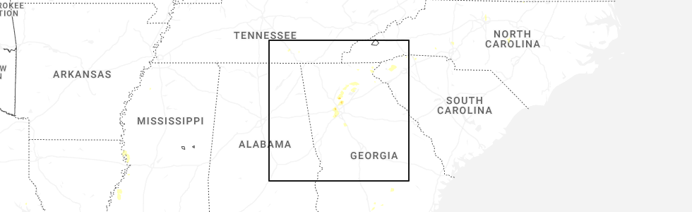
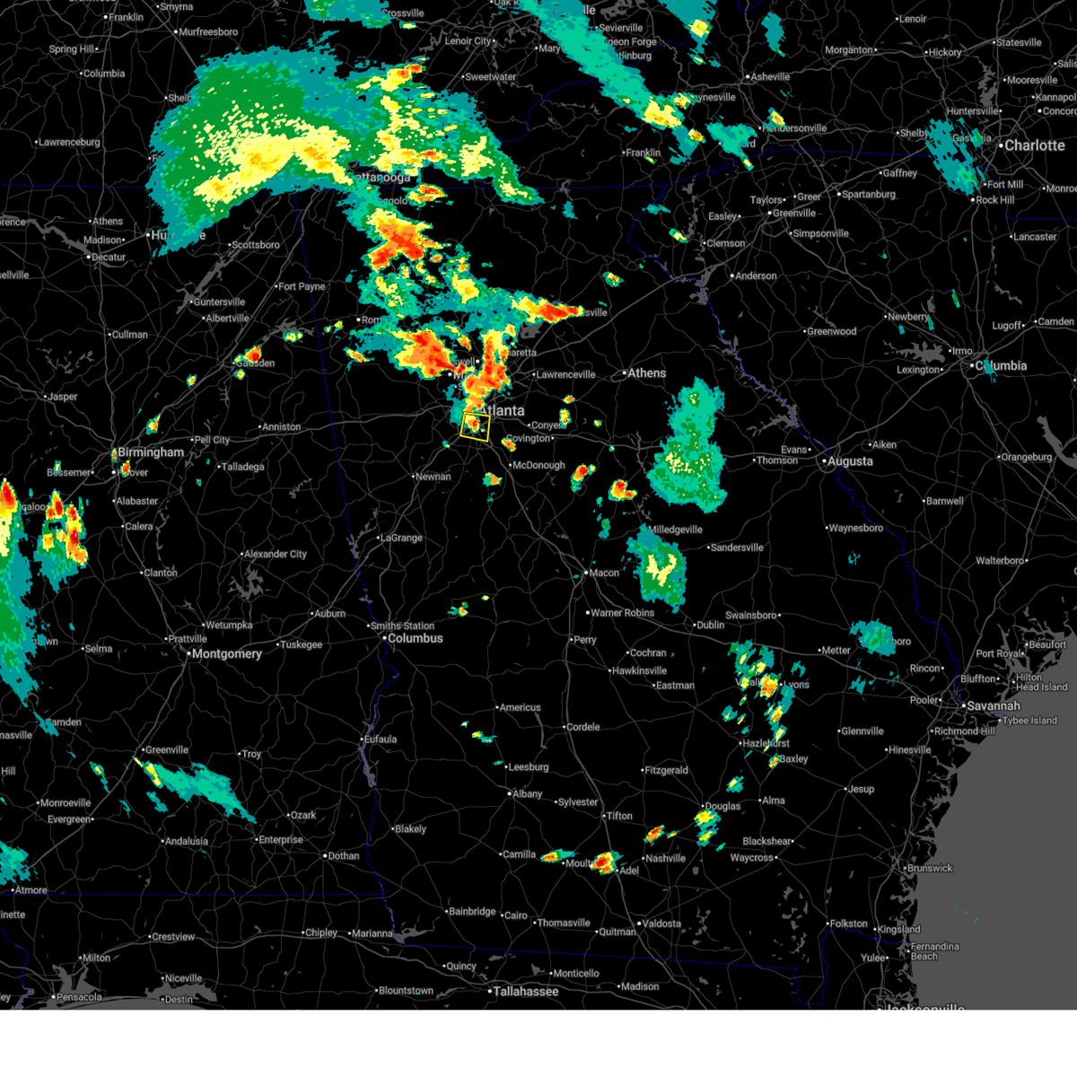
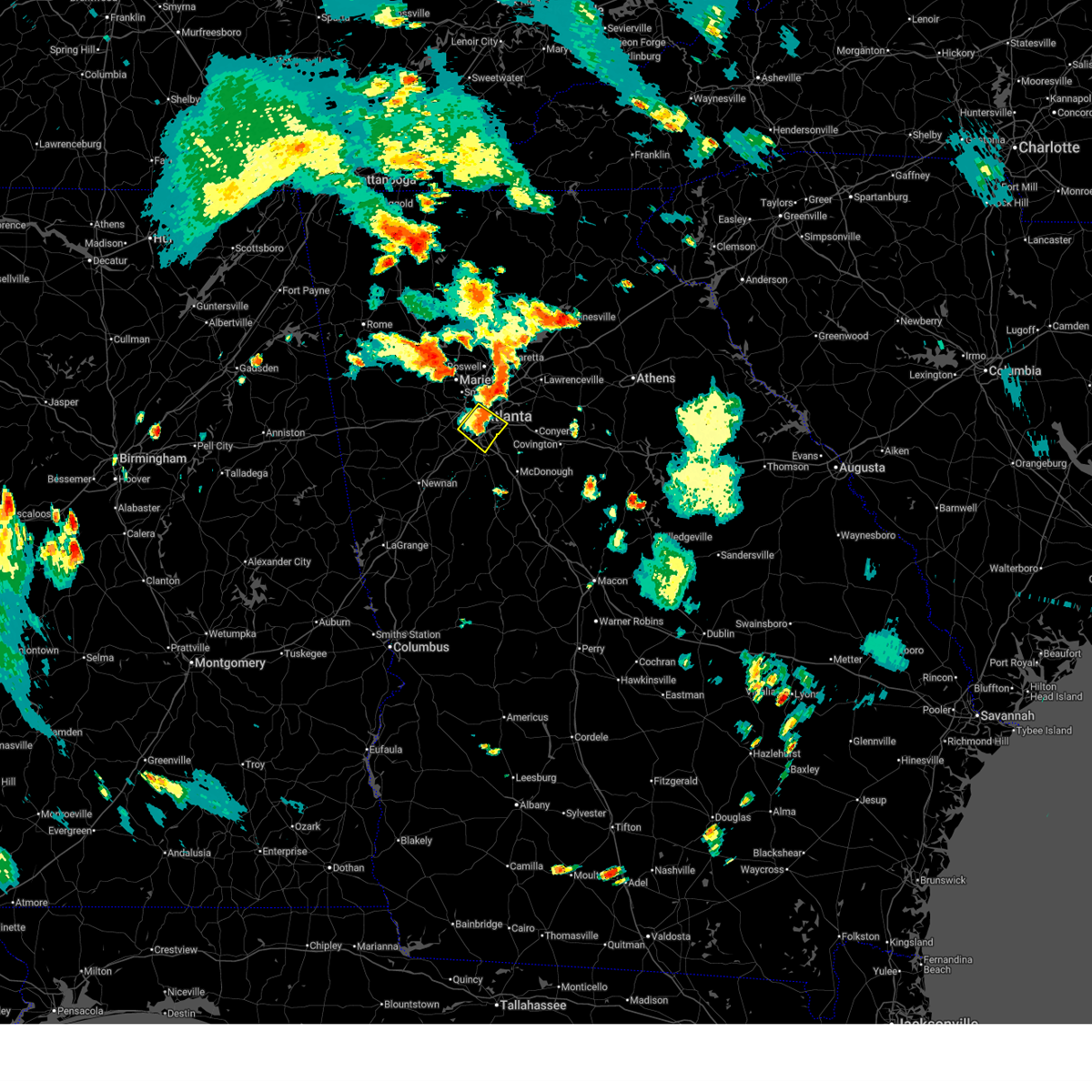
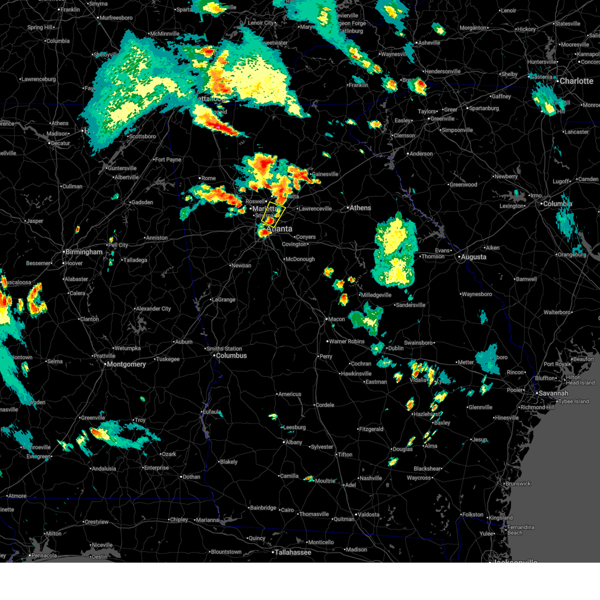
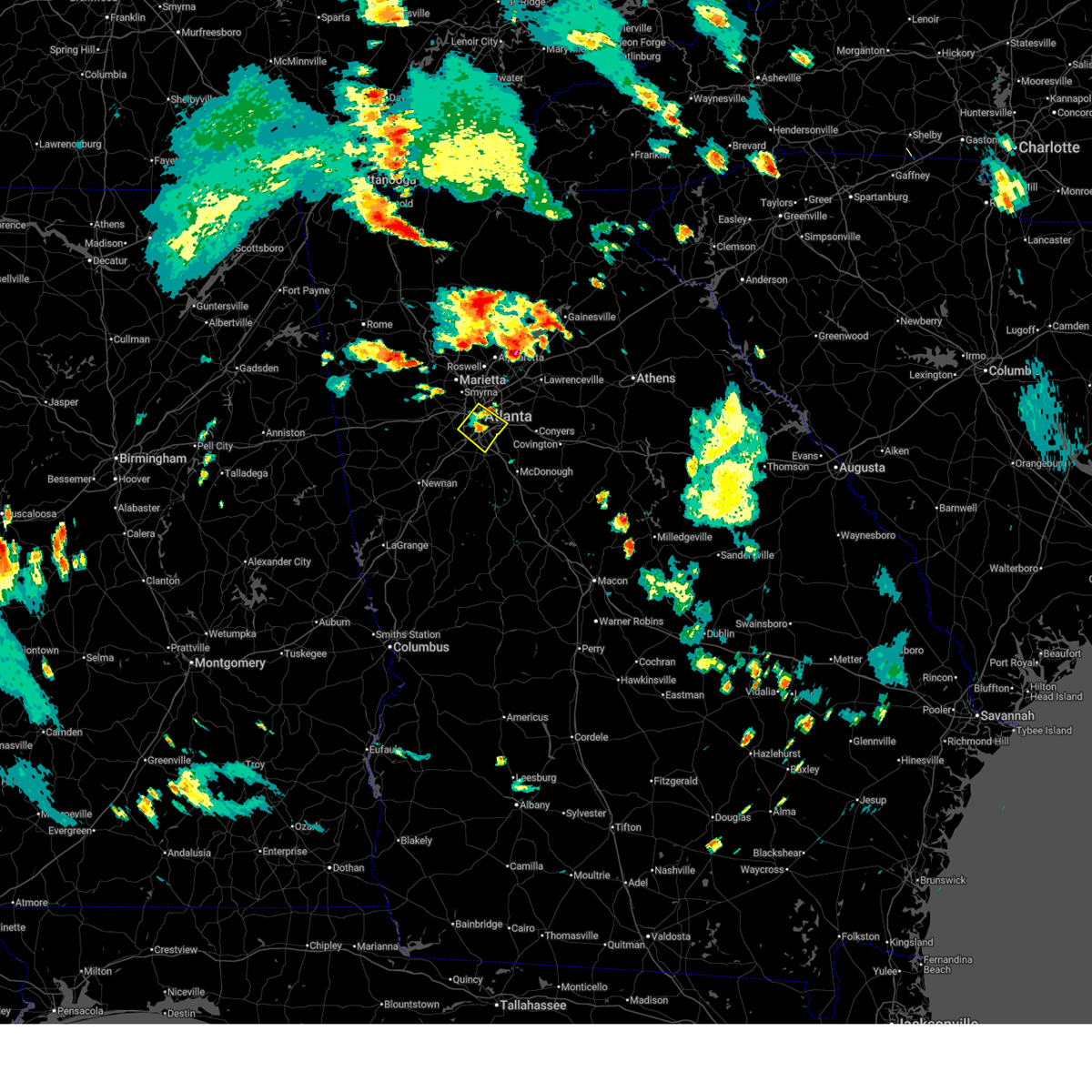
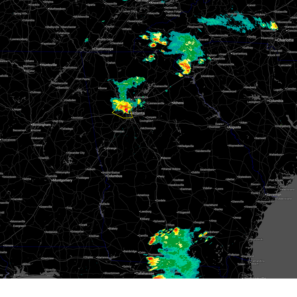
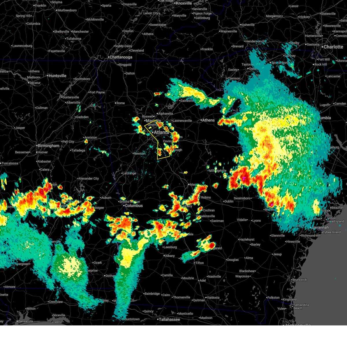
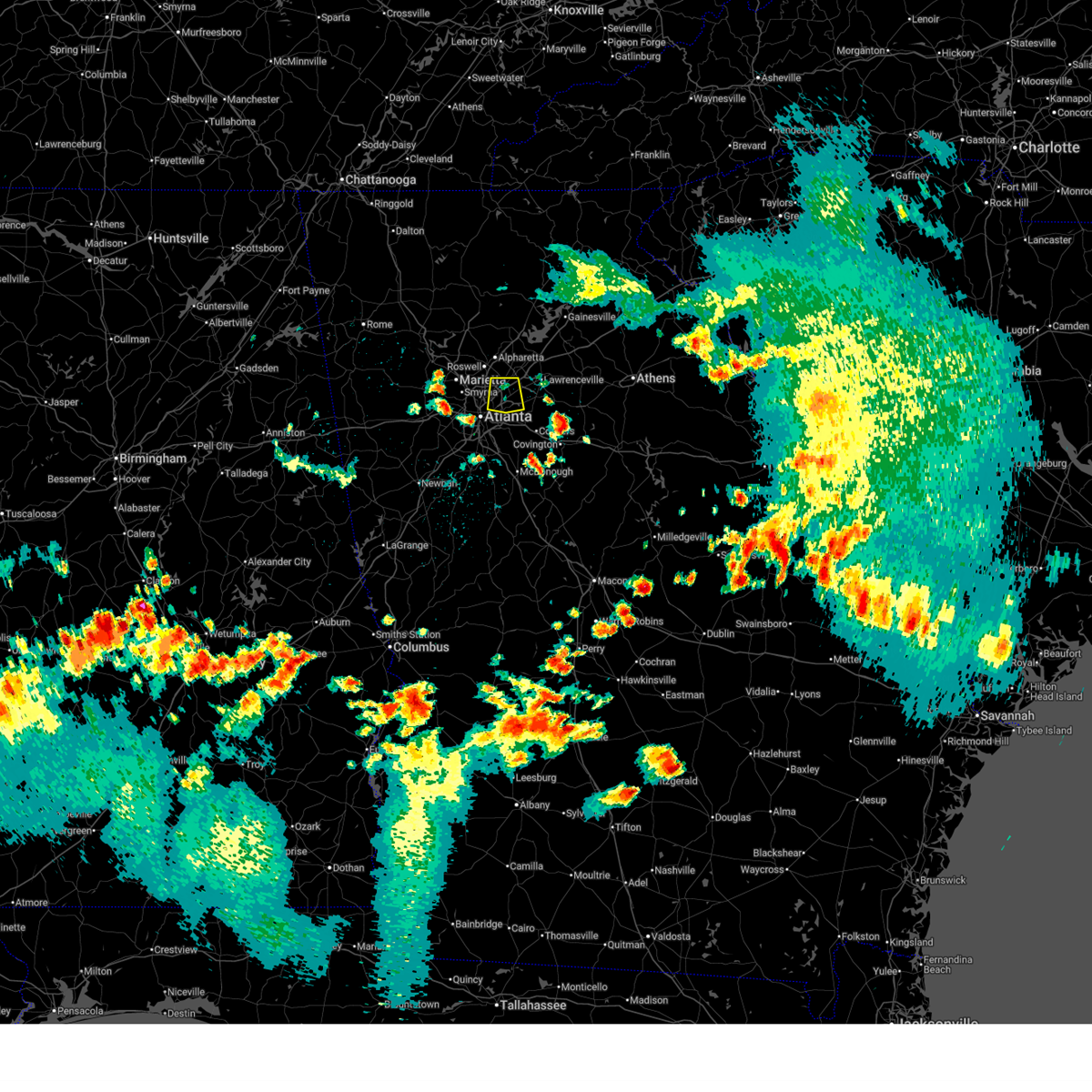
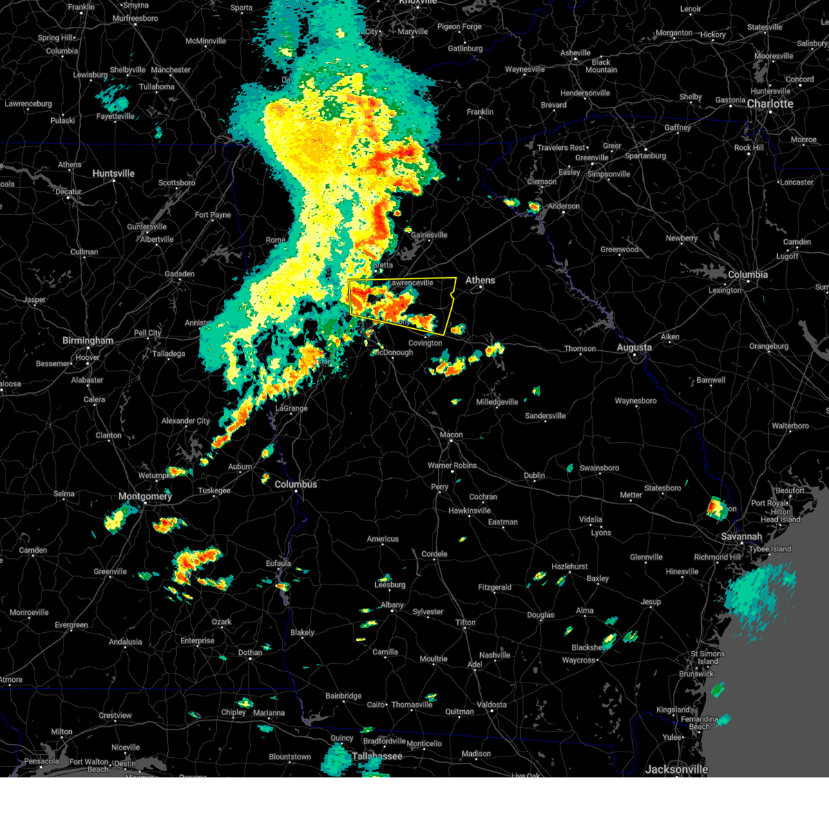
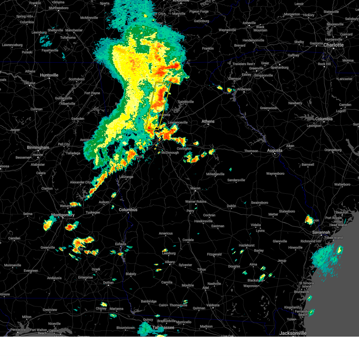
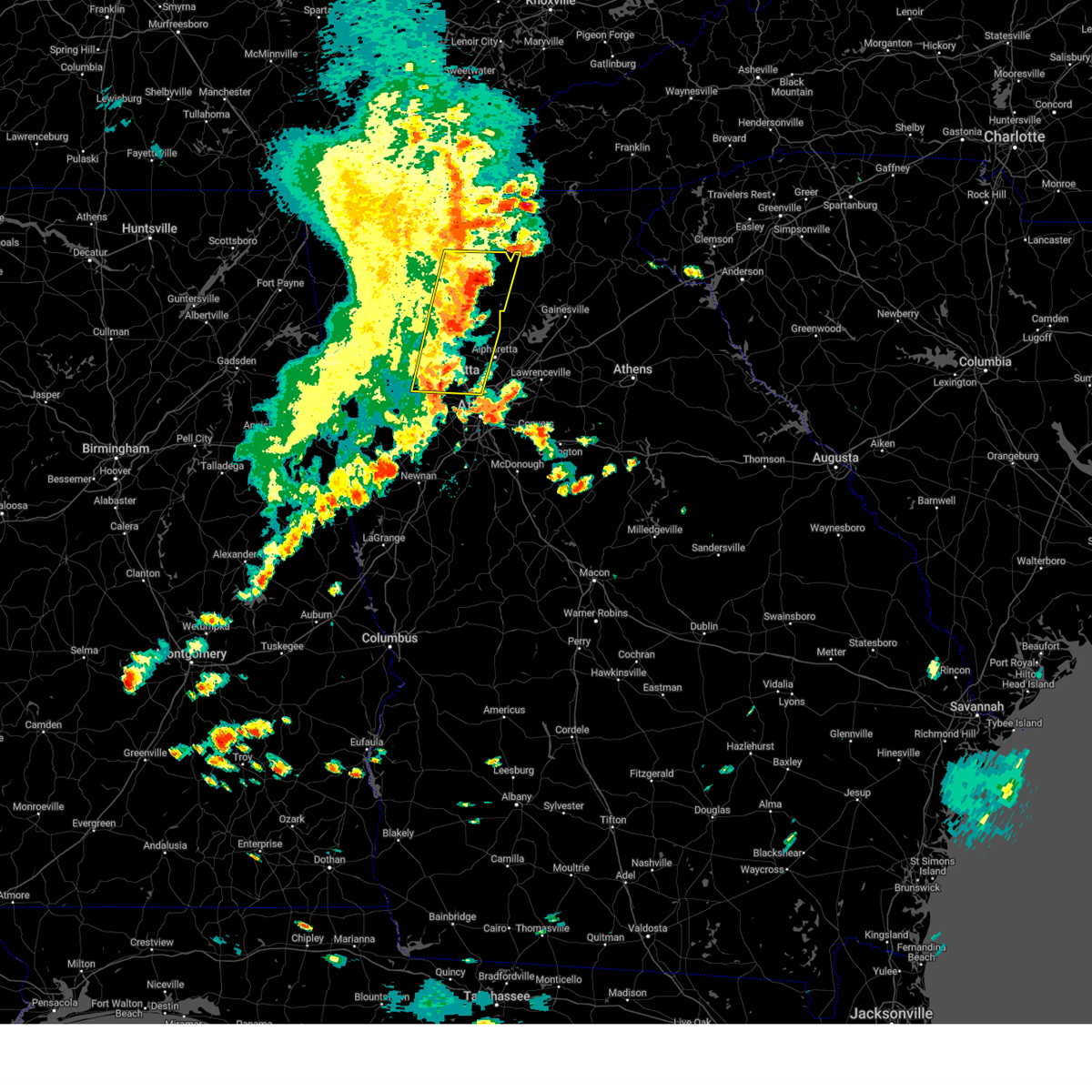
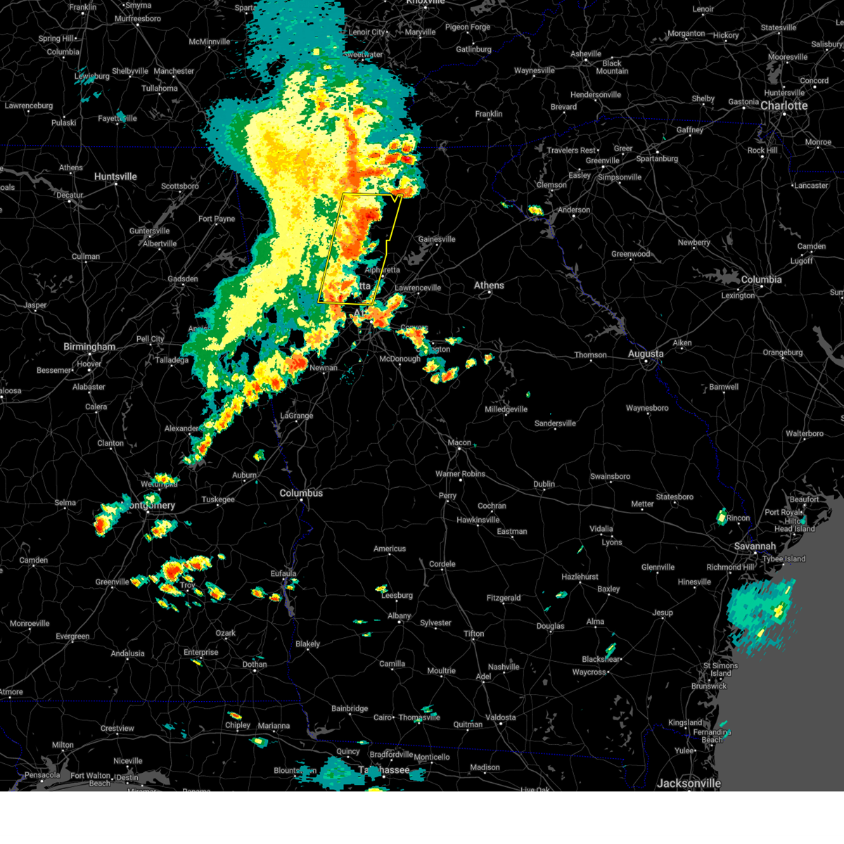
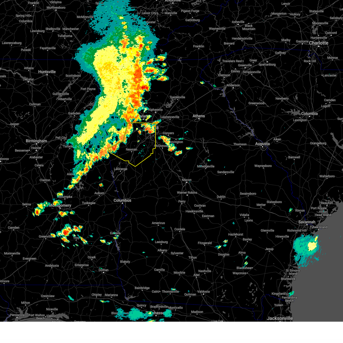
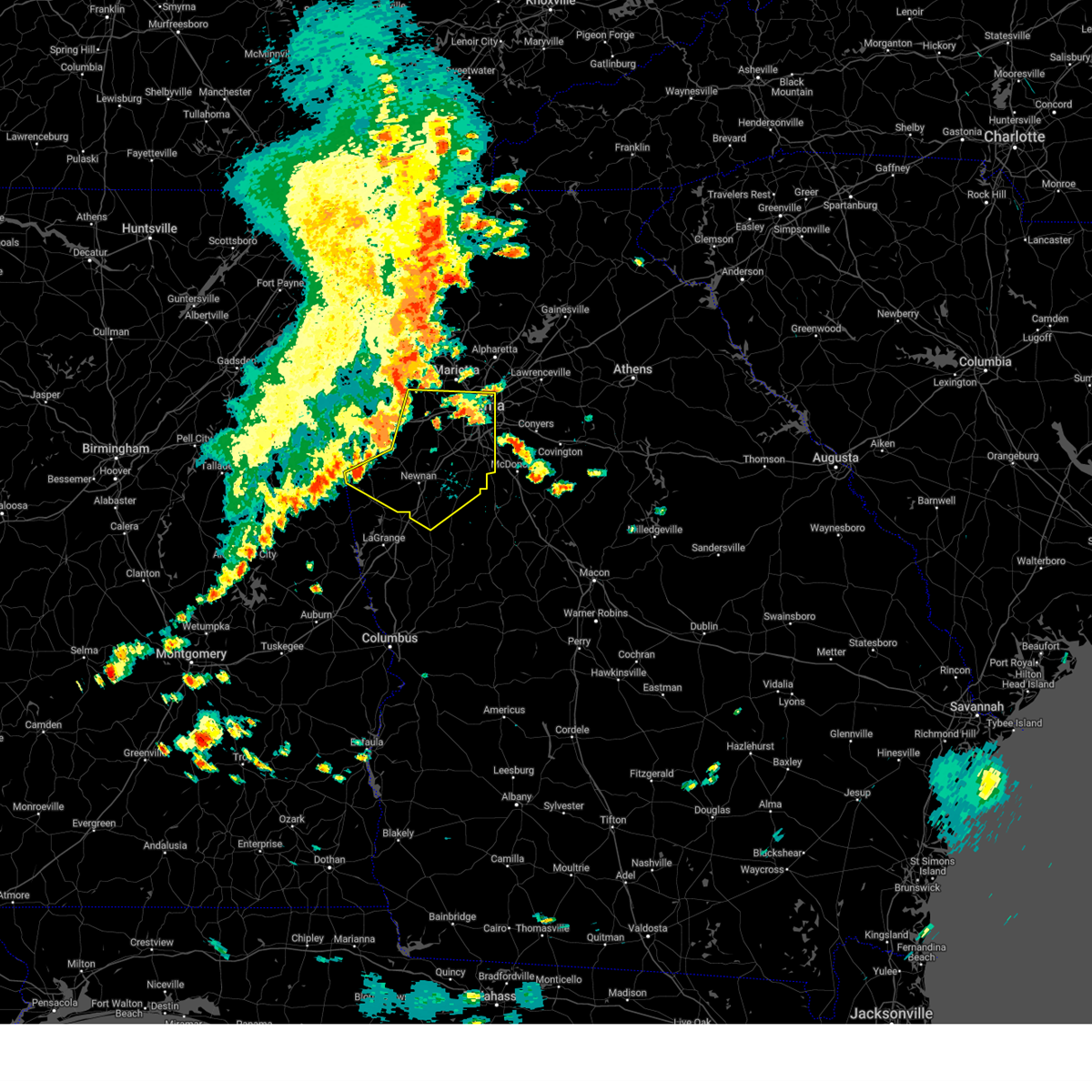
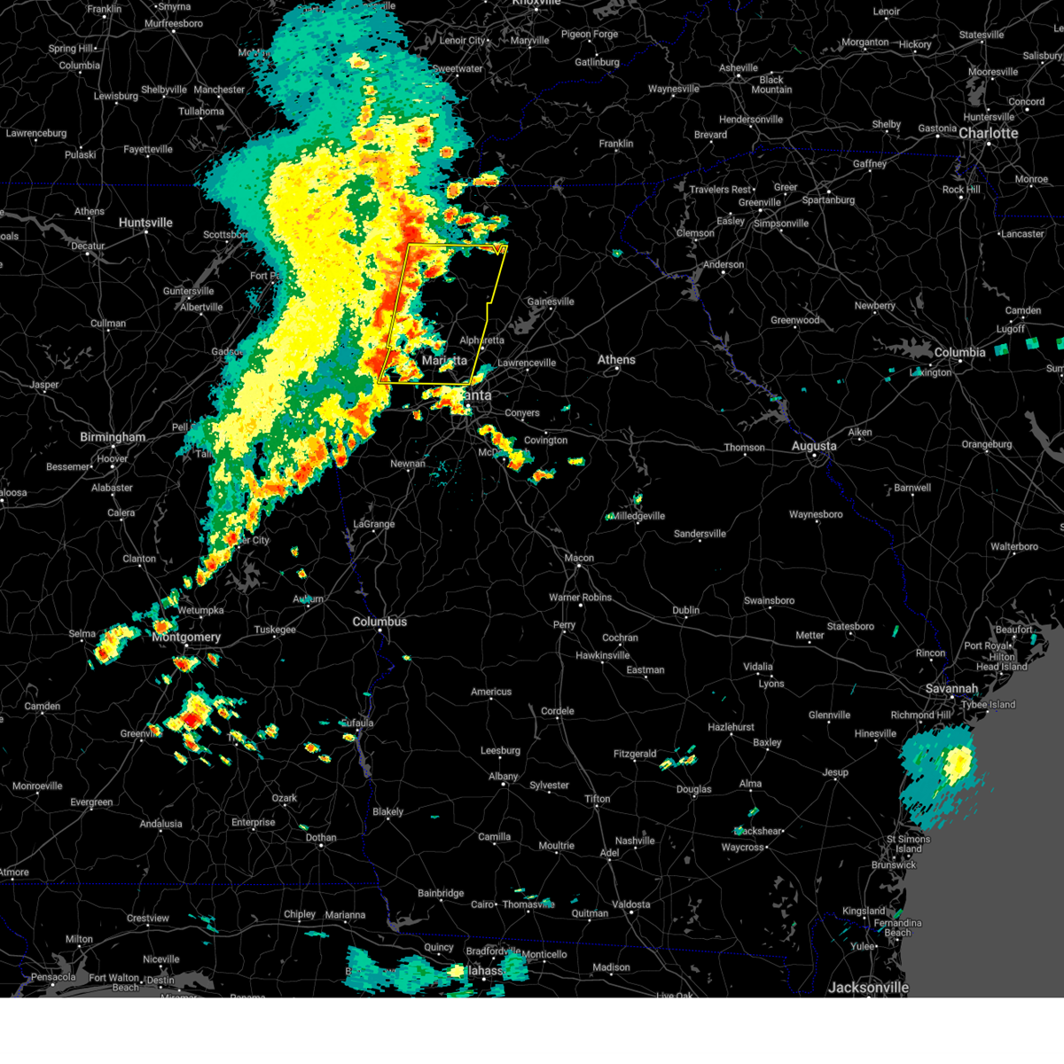
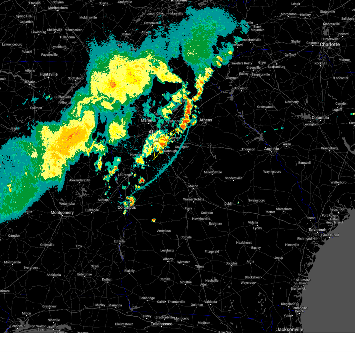
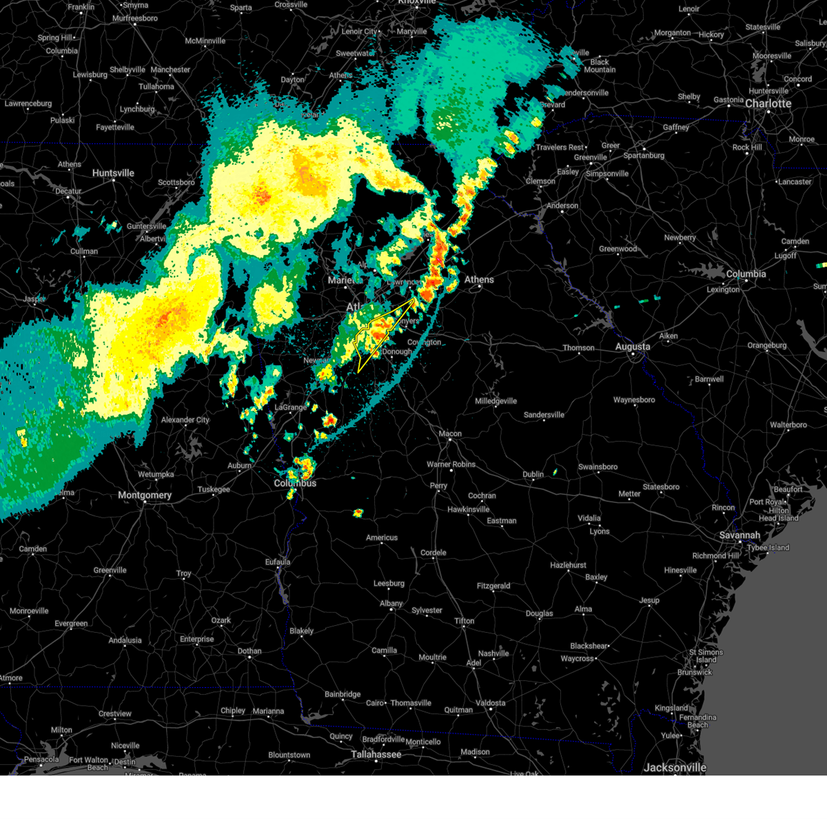
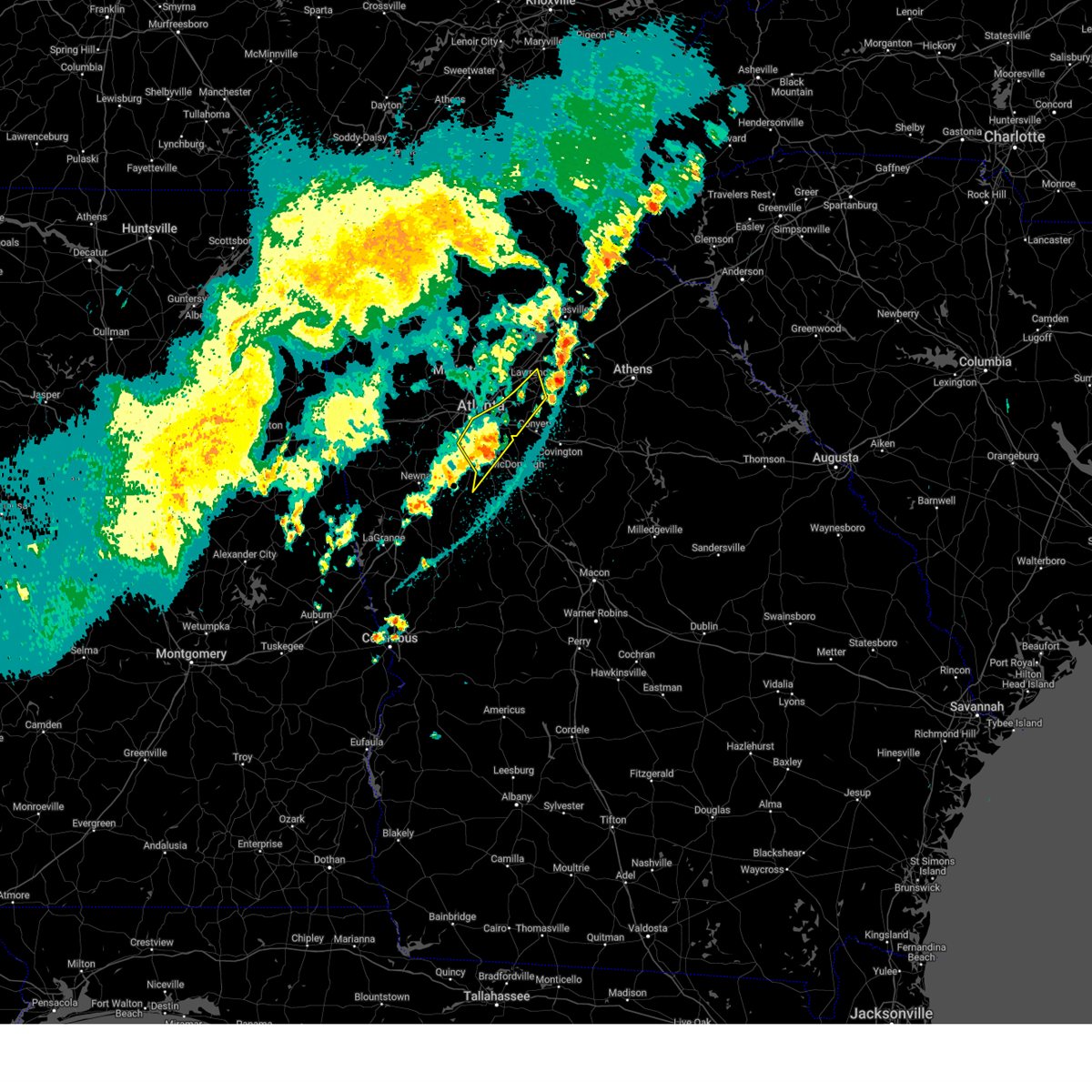
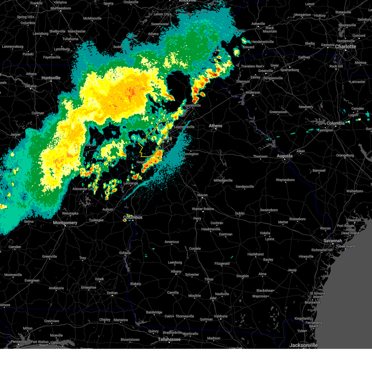
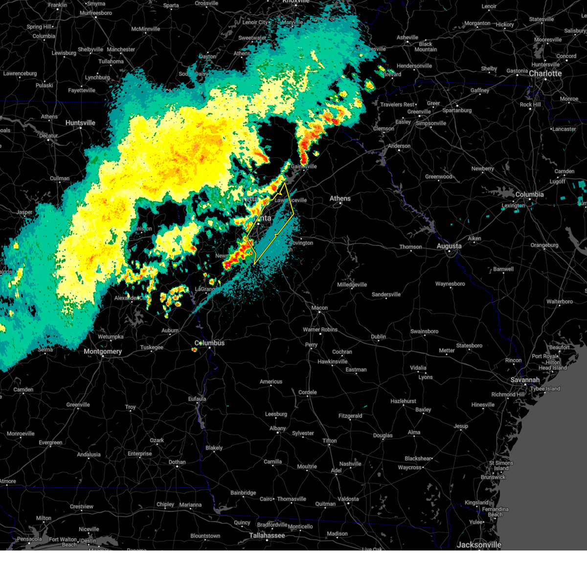
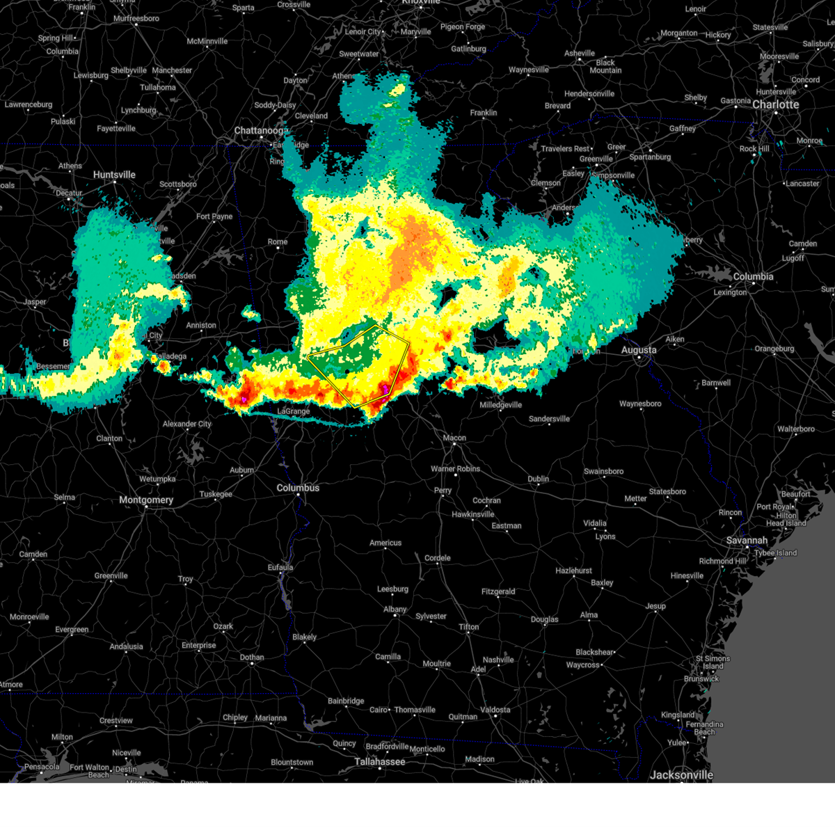
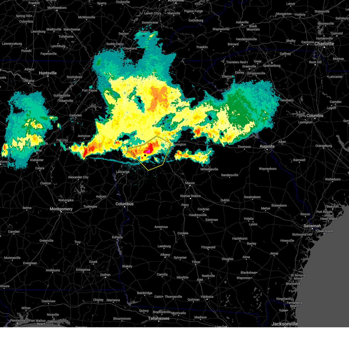
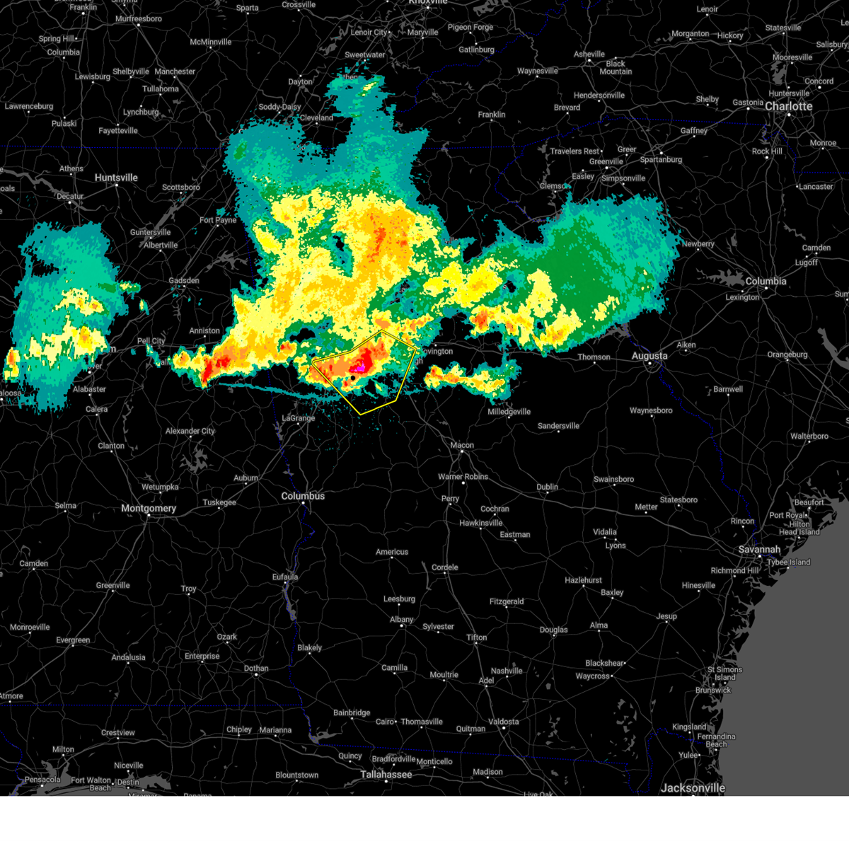
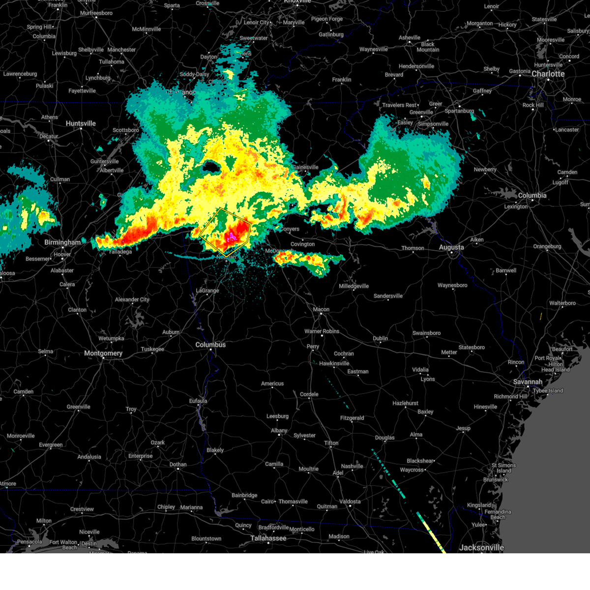
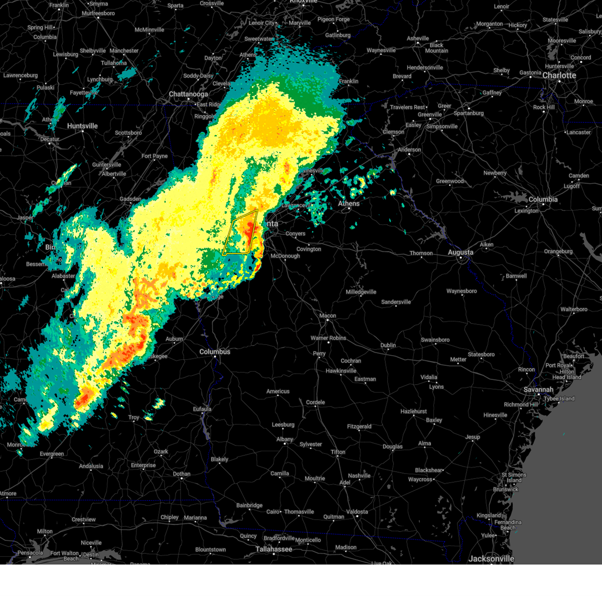
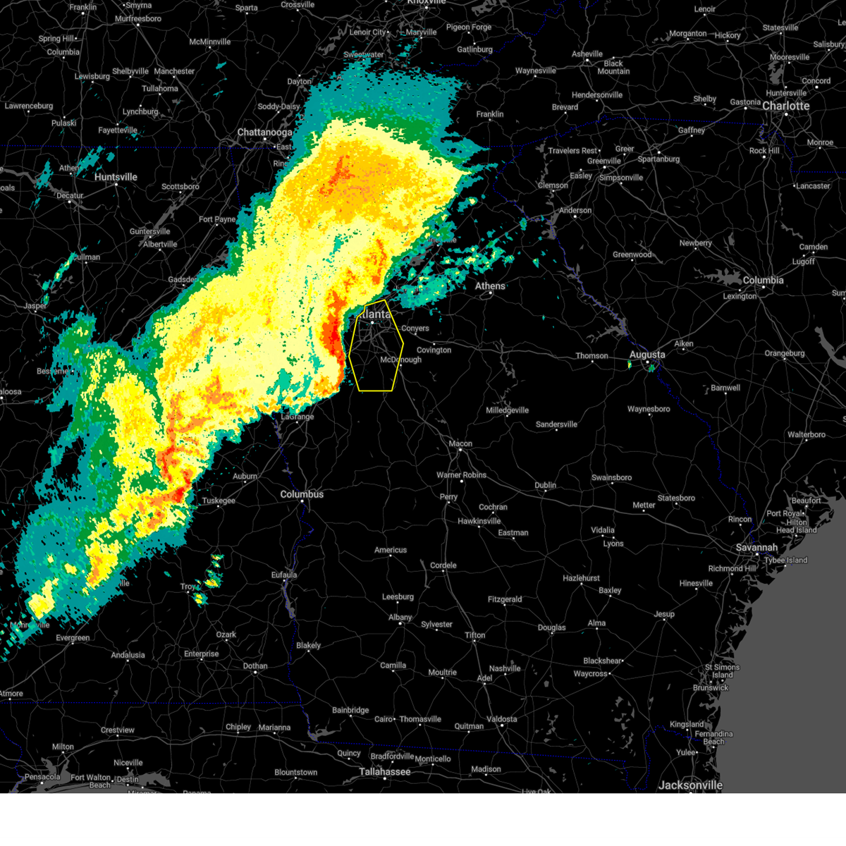
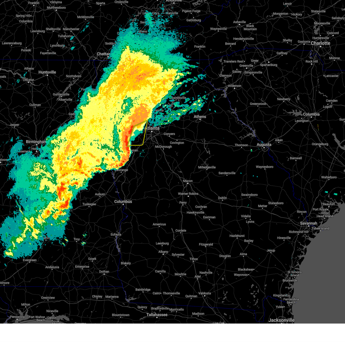
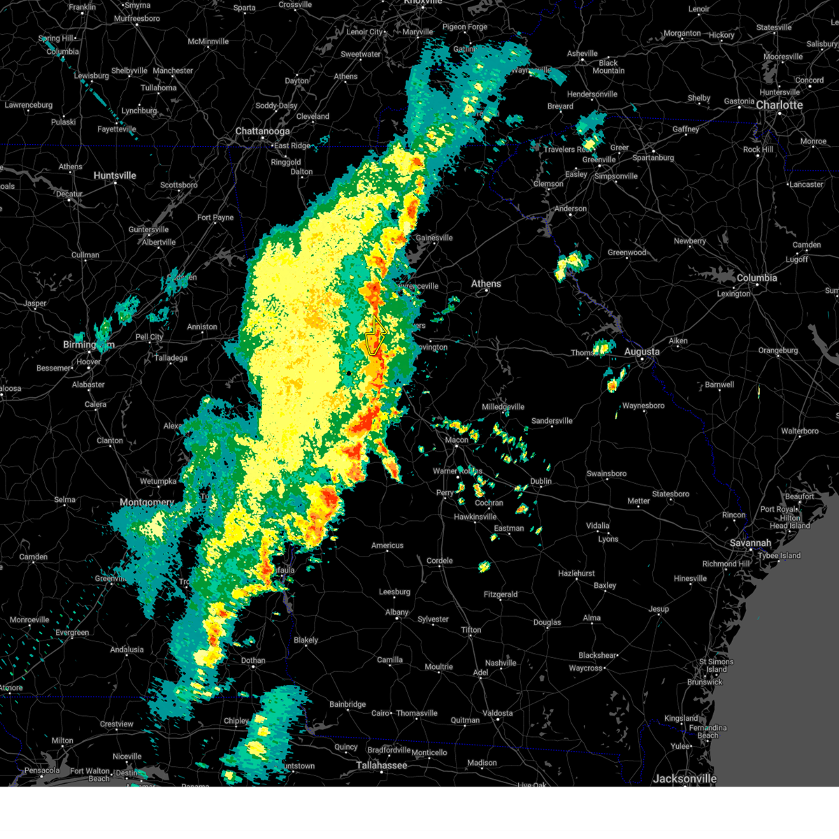
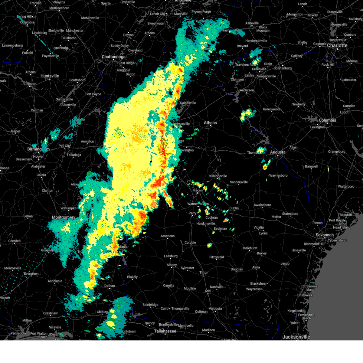
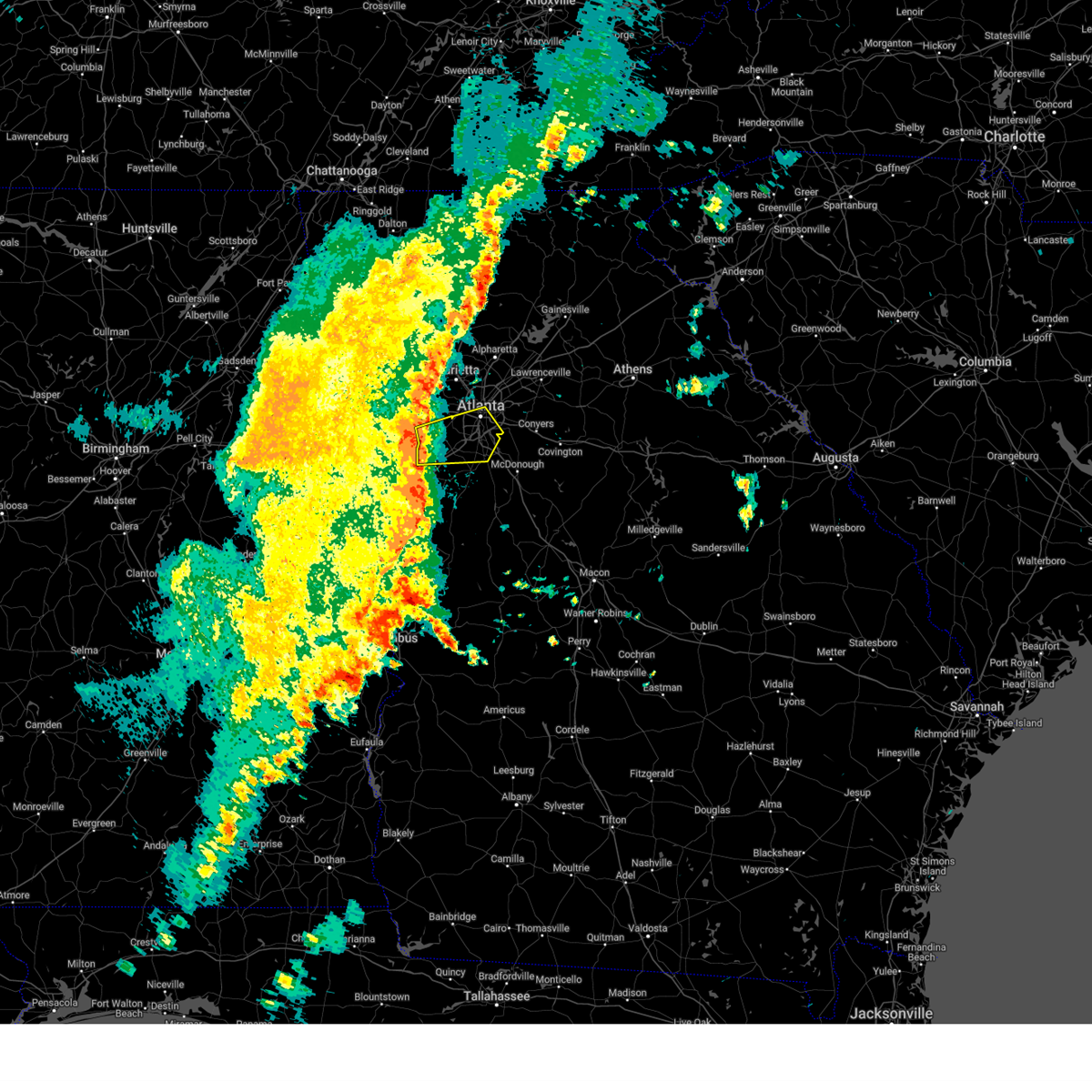
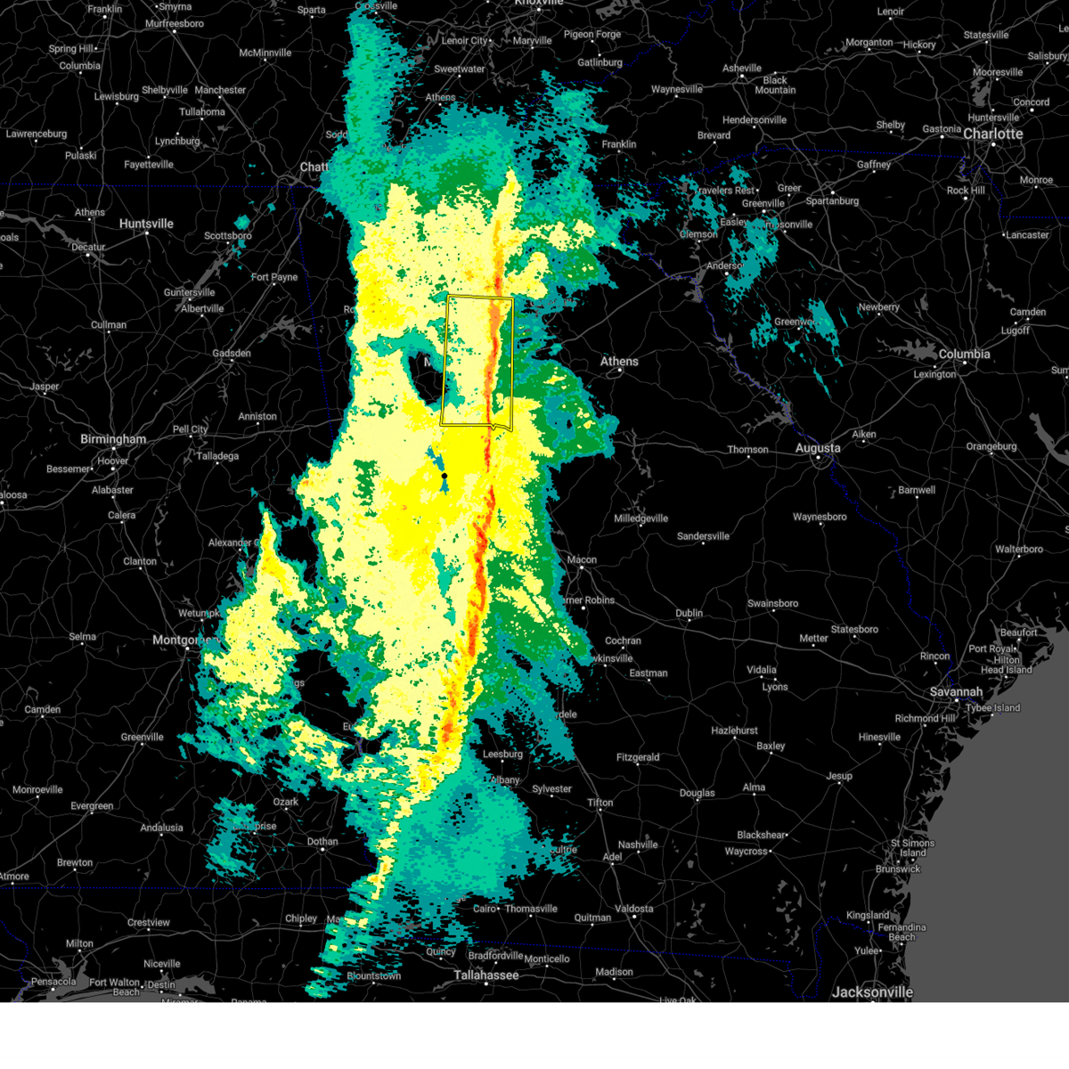
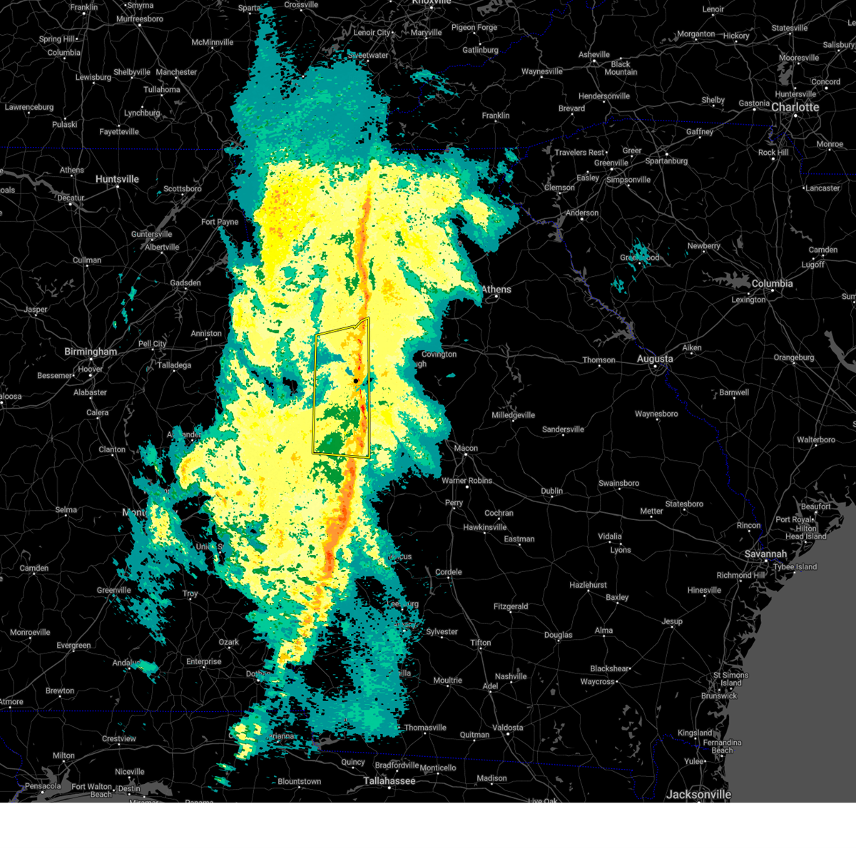
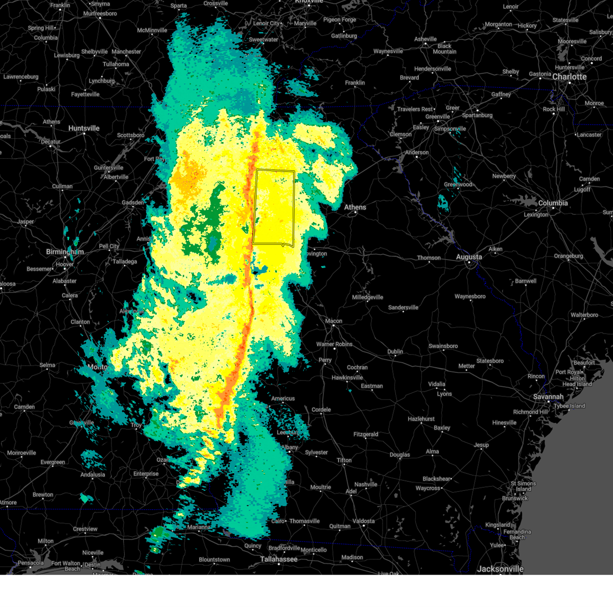
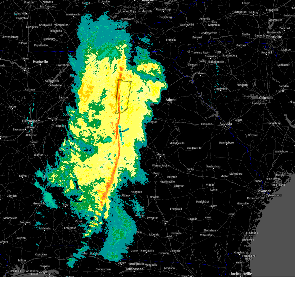
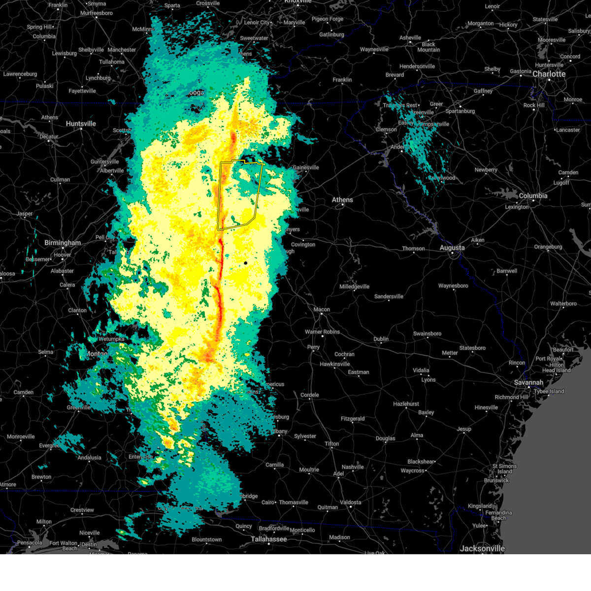
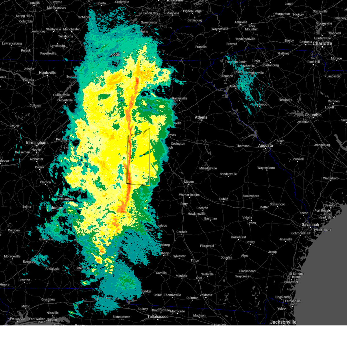
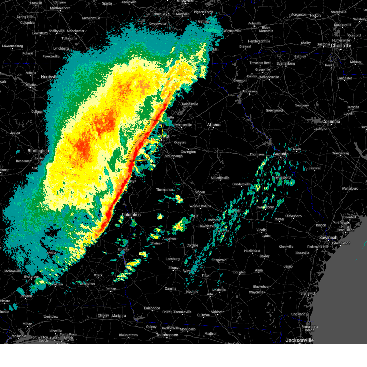
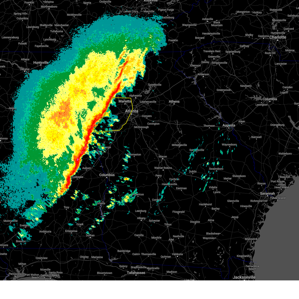
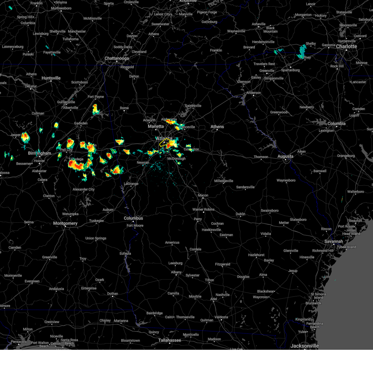
Hail Map for Atlanta, GA
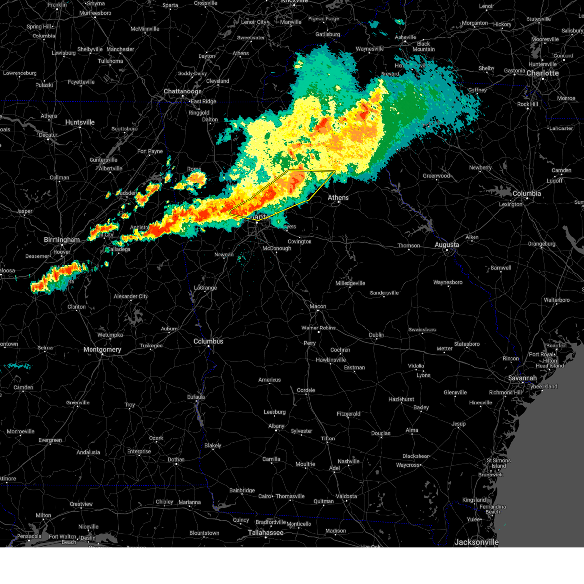
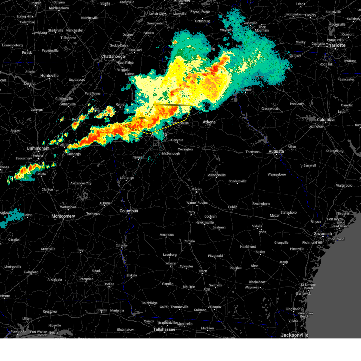
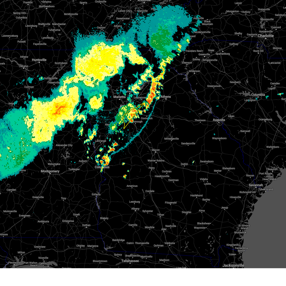
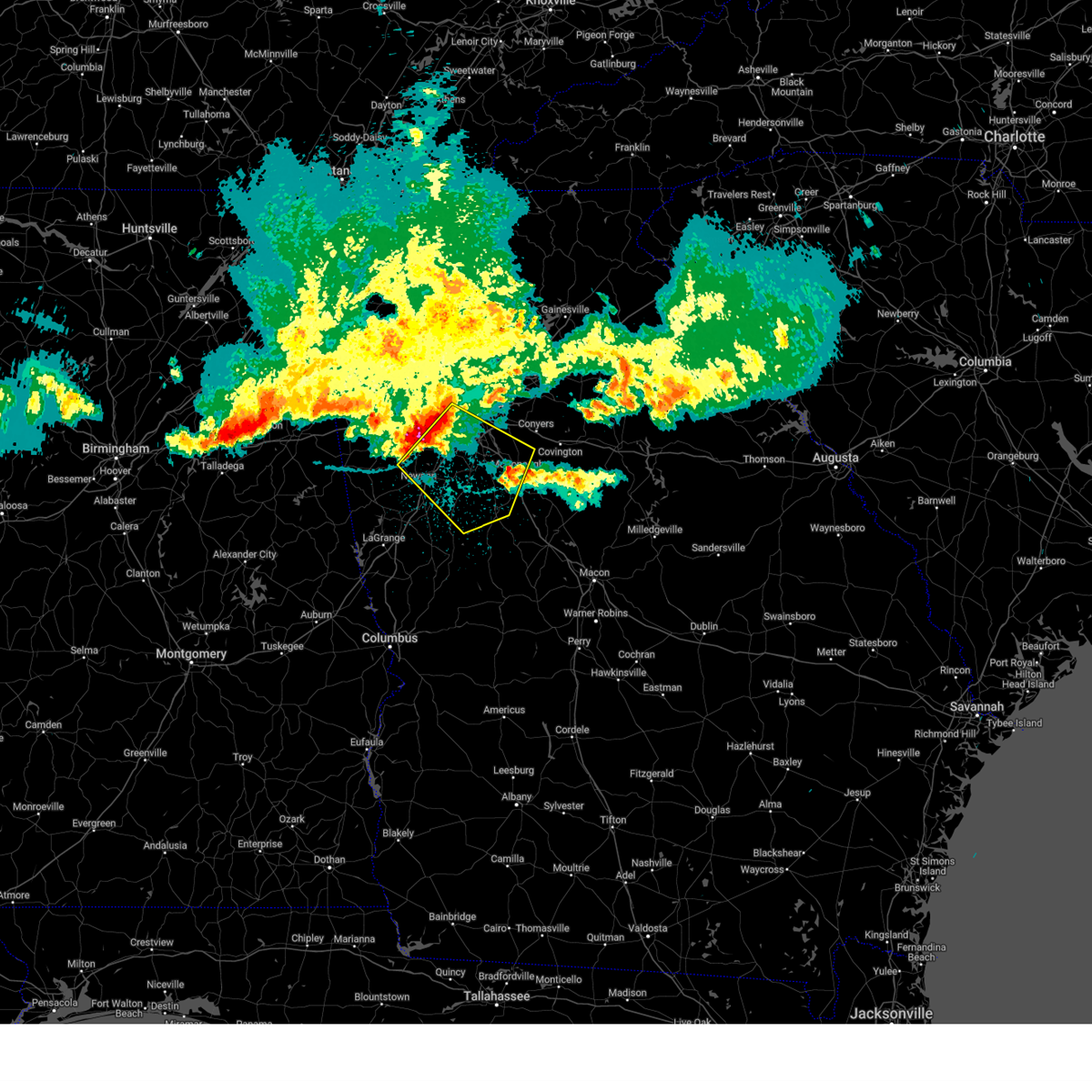
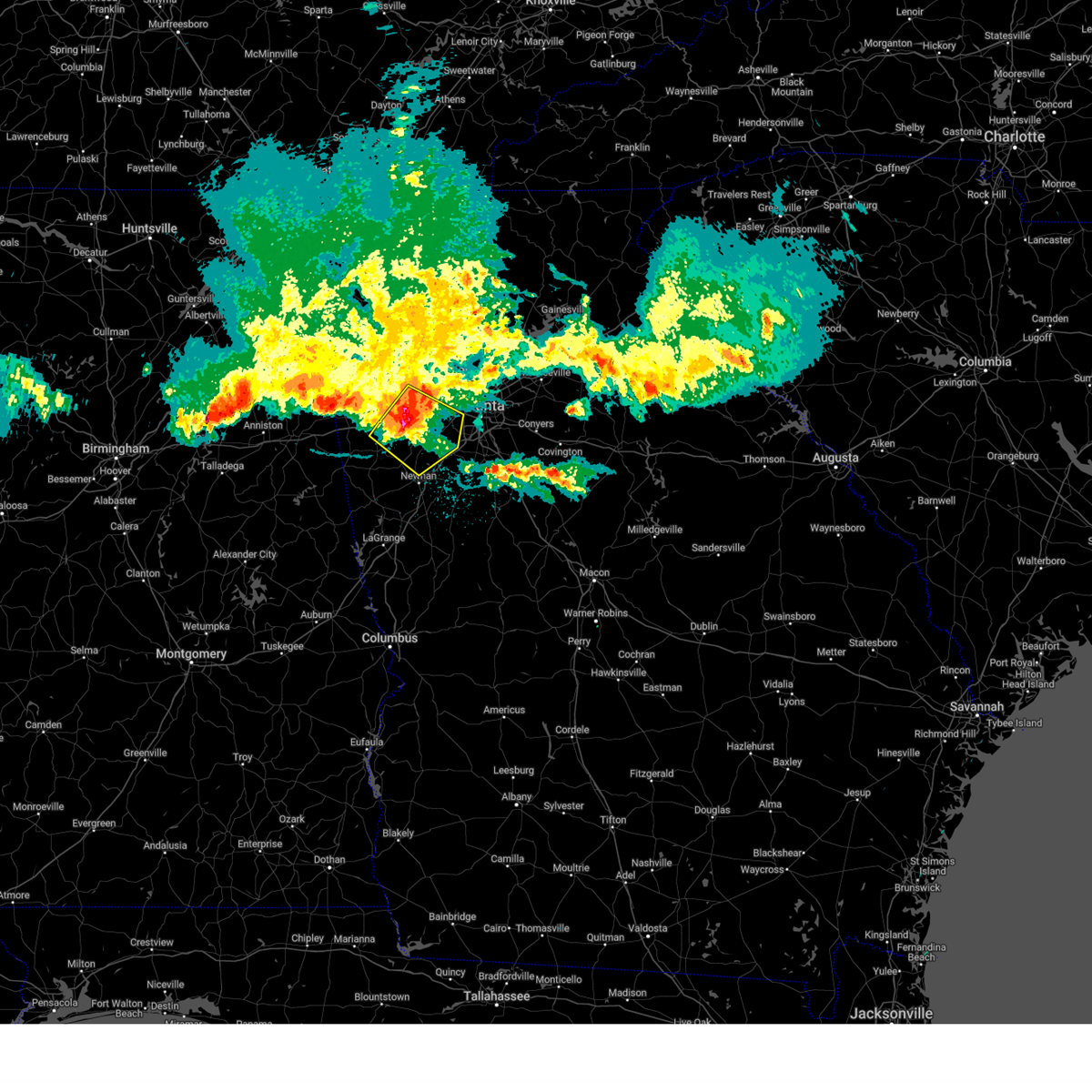
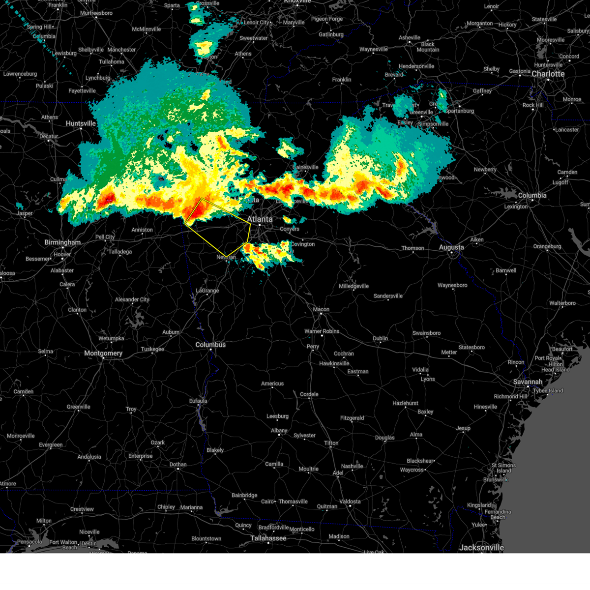
The Atlanta, GA area has had 32 reports of on-the-ground hail by trained spotters, and has been under severe weather warnings 102 times during the past 12 months. Doppler radar has detected hail at or near Atlanta, GA on 98 occasions, including 9 occasions during the past year.
| Name: | Atlanta, GA |
| Where Located: | 1.7 miles NW of Atlanta, GA |
| Map: | Google Map for Atlanta, GA |
| Population: | 420003 |
| Housing Units: | 224573 |
| More Info: | Search Google for Atlanta, GA |
1
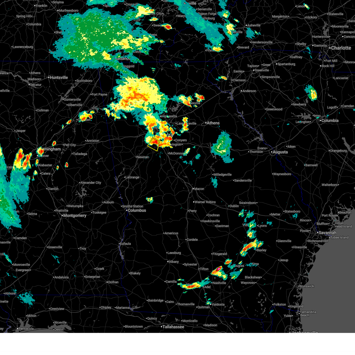
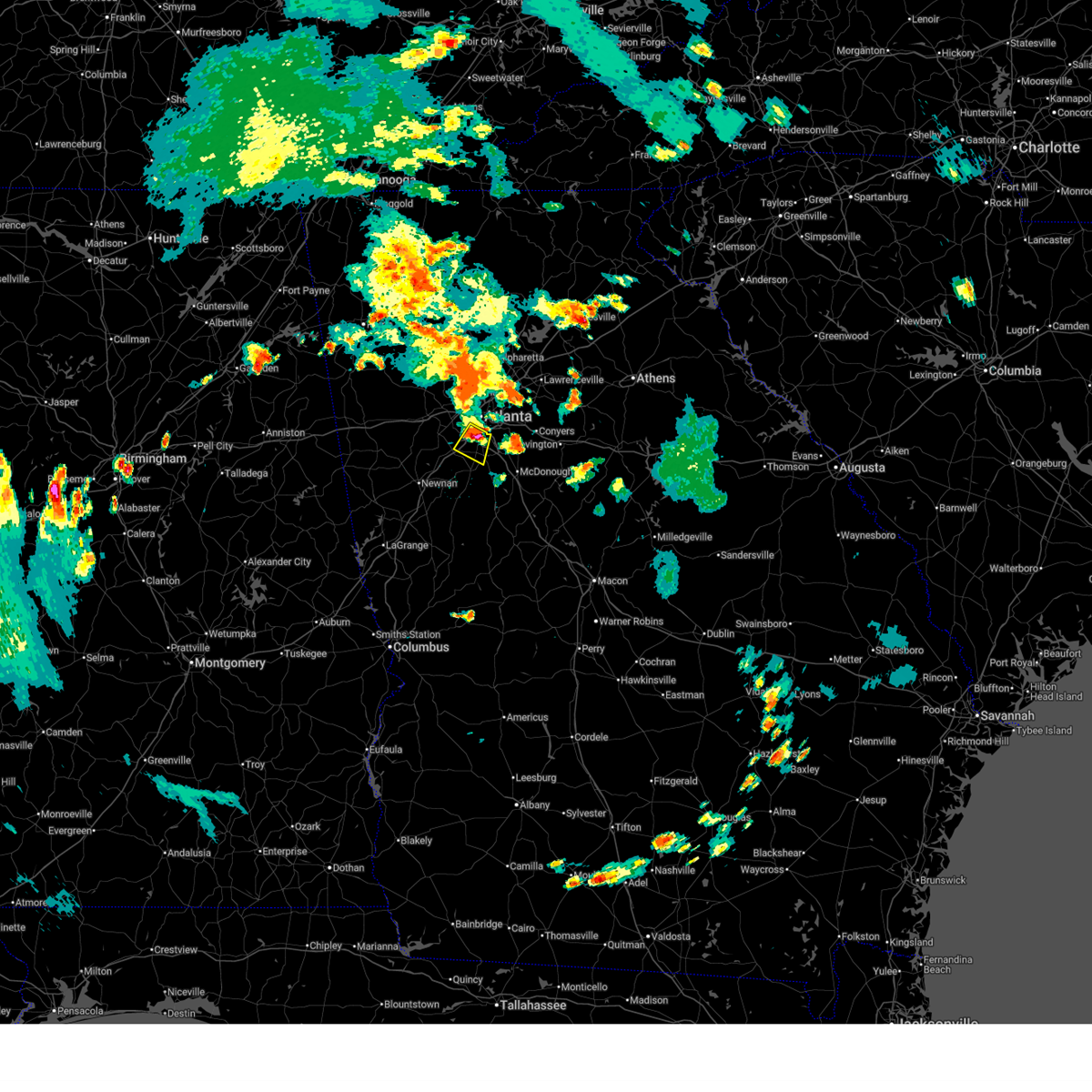
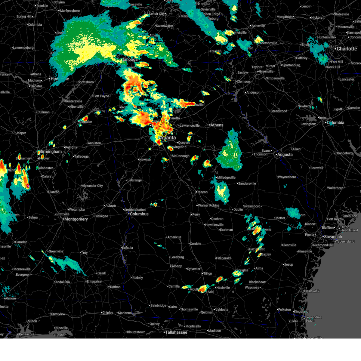
The Top Recent Hail Date for Atlanta, GA is Thursday, June 26, 2025 (13th out of 98)
Hail and Wind Damage Spotted near Atlanta, GA
| Date / Time | Report Details |
|---|---|
| 6/28/2025 6:55 PM EDT | Social media report showing a tree down at lavista rd between houston mill rd nw and n druid hills r in dekalb county GA, 6.8 miles SW of Atlanta, GA |
| 6/27/2025 8:13 PM EDT |
 The storm which prompted the warning has weakened below severe limits, and no longer poses an immediate threat to life or property. therefore, the warning will be allowed to expire. The storm which prompted the warning has weakened below severe limits, and no longer poses an immediate threat to life or property. therefore, the warning will be allowed to expire.
|
| 6/27/2025 7:50 PM EDT |
 Svrffc the national weather service in peachtree city has issued a * severe thunderstorm warning for, northeastern fayette county in north central georgia, northwestern clayton county in north central georgia, south central fulton county in north central georgia, * until 815 pm edt. * at 750 pm edt, a severe thunderstorm was located over hartsfield-jackson airport, or 7 miles northwest of jonesboro, moving southwest at 10 mph (radar indicated). Hazards include 60 mph wind gusts and quarter size hail. Hail damage to vehicles is expected. Expect wind damage to roofs, siding, and trees. Svrffc the national weather service in peachtree city has issued a * severe thunderstorm warning for, northeastern fayette county in north central georgia, northwestern clayton county in north central georgia, south central fulton county in north central georgia, * until 815 pm edt. * at 750 pm edt, a severe thunderstorm was located over hartsfield-jackson airport, or 7 miles northwest of jonesboro, moving southwest at 10 mph (radar indicated). Hazards include 60 mph wind gusts and quarter size hail. Hail damage to vehicles is expected. Expect wind damage to roofs, siding, and trees.
|
| 6/27/2025 7:35 PM EDT |
 The storm which prompted the warning has weakened below severe limits, and no longer poses an immediate threat to life or property. therefore, the warning will be allowed to expire. however, gusty winds and heavy rain are still possible with this thunderstorm. The storm which prompted the warning has weakened below severe limits, and no longer poses an immediate threat to life or property. therefore, the warning will be allowed to expire. however, gusty winds and heavy rain are still possible with this thunderstorm.
|
| 6/27/2025 7:34 PM EDT |
 Svrffc the national weather service in peachtree city has issued a * severe thunderstorm warning for, southwestern dekalb county in north central georgia, northwestern clayton county in north central georgia, southeastern fulton county in north central georgia, * until 800 pm edt. * at 734 pm edt, a severe thunderstorm was located over hapeville, or 7 miles south of atlanta, and is nearly stationary (radar indicated). Hazards include 60 mph wind gusts and quarter size hail. Hail damage to vehicles is expected. Expect wind damage to roofs, siding, and trees. Svrffc the national weather service in peachtree city has issued a * severe thunderstorm warning for, southwestern dekalb county in north central georgia, northwestern clayton county in north central georgia, southeastern fulton county in north central georgia, * until 800 pm edt. * at 734 pm edt, a severe thunderstorm was located over hapeville, or 7 miles south of atlanta, and is nearly stationary (radar indicated). Hazards include 60 mph wind gusts and quarter size hail. Hail damage to vehicles is expected. Expect wind damage to roofs, siding, and trees.
|
| 6/27/2025 7:20 PM EDT |
 The storm which prompted the warning has weakened below severe limits, and no longer poses an immediate threat to life or property. therefore, the warning will be allowed to expire. however, gusty winds are still possible with this thunderstorm. The storm which prompted the warning has weakened below severe limits, and no longer poses an immediate threat to life or property. therefore, the warning will be allowed to expire. however, gusty winds are still possible with this thunderstorm.
|
| 6/27/2025 7:08 PM EDT |
 Svrffc the national weather service in peachtree city has issued a * severe thunderstorm warning for, northwestern dekalb county in north central georgia, west central gwinnett county in north central georgia, east central fulton county in north central georgia, * until 745 pm edt. * at 708 pm edt, a severe thunderstorm was located over doraville, or near peachtree corners, moving northwest at 10 mph (radar indicated). Hazards include 60 mph wind gusts and quarter size hail. Hail damage to vehicles is expected. Expect wind damage to roofs, siding, and trees. Svrffc the national weather service in peachtree city has issued a * severe thunderstorm warning for, northwestern dekalb county in north central georgia, west central gwinnett county in north central georgia, east central fulton county in north central georgia, * until 745 pm edt. * at 708 pm edt, a severe thunderstorm was located over doraville, or near peachtree corners, moving northwest at 10 mph (radar indicated). Hazards include 60 mph wind gusts and quarter size hail. Hail damage to vehicles is expected. Expect wind damage to roofs, siding, and trees.
|
| 6/27/2025 6:47 PM EDT |
 Svrffc the national weather service in peachtree city has issued a * severe thunderstorm warning for, southwestern dekalb county in north central georgia, northwestern clayton county in north central georgia, south central fulton county in north central georgia, * until 730 pm edt. * at 647 pm edt, a severe thunderstorm was located over lakewood park, or near atlanta, and is nearly stationary (radar indicated). Hazards include 60 mph wind gusts and quarter size hail. Hail damage to vehicles is expected. Expect wind damage to roofs, siding, and trees. Svrffc the national weather service in peachtree city has issued a * severe thunderstorm warning for, southwestern dekalb county in north central georgia, northwestern clayton county in north central georgia, south central fulton county in north central georgia, * until 730 pm edt. * at 647 pm edt, a severe thunderstorm was located over lakewood park, or near atlanta, and is nearly stationary (radar indicated). Hazards include 60 mph wind gusts and quarter size hail. Hail damage to vehicles is expected. Expect wind damage to roofs, siding, and trees.
|
| 6/26/2025 6:47 PM EDT | the severe thunderstorm warning has been cancelled and is no longer in effect |
| 6/26/2025 6:39 PM EDT | The storms which prompted the warning have weakened below severe limits, and no longer pose an immediate threat to life or property. therefore, the warning will be allowed to expire. |
| 6/26/2025 6:27 PM EDT | At 627 pm edt, severe thunderstorms were located along a line extending from near city of south fulton to near east point to hartsfield-jackson airport, moving south at 15 mph (radar indicated). Hazards include 60 mph wind gusts and quarter size hail. Hail damage to vehicles is expected. expect wind damage to roofs, siding, and trees. Locations impacted include, atlanta, city of south fulton, east point, union city, forest park, riverdale, college park, morrow, hapeville, lake city, hartsfield-jackson airport, and sandtown. |
| 6/26/2025 6:27 PM EDT | the severe thunderstorm warning has been cancelled and is no longer in effect |
| 6/26/2025 6:22 PM EDT | Svrffc the national weather service in peachtree city has issued a * severe thunderstorm warning for, northwestern fayette county in north central georgia, northeastern coweta county in west central georgia, south central fulton county in north central georgia, * until 700 pm edt. * at 621 pm edt, a severe thunderstorm was located near college park, or near city of south fulton, moving south at 10 mph (radar indicated). Hazards include 60 mph wind gusts and quarter size hail. Hail damage to vehicles is expected. Expect wind damage to roofs, siding, and trees. |
| 6/26/2025 5:58 PM EDT | Svrffc the national weather service in peachtree city has issued a * severe thunderstorm warning for, southwestern dekalb county in north central georgia, southwestern cobb county in north central georgia, northeastern douglas county in north central georgia, northern clayton county in north central georgia, southwestern fulton county in north central georgia, * until 645 pm edt. * at 558 pm edt, severe thunderstorms were located along a line extending from austell to six flags over georgia to bankhead, moving southeast at 10 mph (radar indicated). Hazards include 60 mph wind gusts and quarter size hail. Hail damage to vehicles is expected. Expect wind damage to roofs, siding, and trees. |
| 6/26/2025 5:47 PM EDT |
 At 547 pm edt, severe thunderstorms were located along a line extending from austell to six flags over georgia to sweet auburn, moving south at 10 mph (radar indicated). Hazards include 60 mph wind gusts and quarter size hail. Hail damage to vehicles is expected. expect wind damage to roofs, siding, and trees. Locations impacted include, atlanta, douglasville, city of south fulton, smyrna, east point, college park, powder springs, austell, hapeville, lithia springs, midtown, grant park-zoo atlanta, vinings, brownsville, sweet auburn, cascade heights, lakewood park, sandtown, atlantic station, and mableton. At 547 pm edt, severe thunderstorms were located along a line extending from austell to six flags over georgia to sweet auburn, moving south at 10 mph (radar indicated). Hazards include 60 mph wind gusts and quarter size hail. Hail damage to vehicles is expected. expect wind damage to roofs, siding, and trees. Locations impacted include, atlanta, douglasville, city of south fulton, smyrna, east point, college park, powder springs, austell, hapeville, lithia springs, midtown, grant park-zoo atlanta, vinings, brownsville, sweet auburn, cascade heights, lakewood park, sandtown, atlantic station, and mableton.
|
| 6/26/2025 5:38 PM EDT | Quarter sized hail reported 5 miles SE of Atlanta, GA, report of 1-inch hail at james jackson pkwy and bolton rd nw. |
| 6/26/2025 5:15 PM EDT | Svrffc the national weather service in peachtree city has issued a * severe thunderstorm warning for, southeastern paulding county in northwestern georgia, cobb county in north central georgia, northeastern douglas county in north central georgia, south central fulton county in north central georgia, * until 600 pm edt. * at 514 pm edt, severe thunderstorms were located along a line extending from near jim r miller park to smyrna to near brookhaven, moving south at 10 mph (radar indicated). Hazards include 60 mph wind gusts and quarter size hail. Hail damage to vehicles is expected. Expect wind damage to roofs, siding, and trees. |
| 6/26/2025 5:05 PM EDT | Quarter sized hail reported 15.5 miles SSW of Atlanta, GA, report from mping: quarter (1.00 in.). |
| 6/26/2025 5:03 PM EDT | Quarter sized hail reported 14.5 miles SSW of Atlanta, GA, 1 inch hail reported at n peachtree rd. & starcross ct. |
| 6/26/2025 5:03 PM EDT | Quarter sized hail reported 15.5 miles SSW of Atlanta, GA, report of 1-inch hail at ison rd ne and roswell rd. |
| 6/26/2025 5:03 PM EDT | Quarter sized hail reported 14.9 miles SSW of Atlanta, GA, report of 1-inch hail in dunwoody. |
| 6/26/2025 5:02 PM EDT | Tree reported down on dunwoody club way near the intersection of dunwoody club d in dekalb county GA, 14.9 miles SSW of Atlanta, GA |
| 6/26/2025 5:00 PM EDT | Power pole and lines downed near the intersection of dunwoody club dr and happy hollow rd... leading to power outages in the neighborhoo in dekalb county GA, 15.7 miles SSW of Atlanta, GA |
| 6/26/2025 12:41 AM EDT |
 The storms which prompted the warning have moved out of the area. therefore, the warning will be allowed to expire. however, gusty winds are still possible with these thunderstorms. a severe thunderstorm watch remains in effect until 400 am edt for central, north central and west central georgia. The storms which prompted the warning have moved out of the area. therefore, the warning will be allowed to expire. however, gusty winds are still possible with these thunderstorms. a severe thunderstorm watch remains in effect until 400 am edt for central, north central and west central georgia.
|
| 6/26/2025 12:25 AM EDT |
 Svrffc the national weather service in peachtree city has issued a * severe thunderstorm warning for, north central spalding county in west central georgia, fayette county in north central georgia, southwestern henry county in north central georgia, northeastern coweta county in west central georgia, clayton county in north central georgia, southwestern fulton county in north central georgia, * until 100 am edt. * at 1225 am edt, severe thunderstorms were located along a line extending from lake city to near irondale to atlanta motor speedway, moving west at 25 mph (radar indicated). Hazards include 60 mph wind gusts and quarter size hail. Hail damage to vehicles is expected. Expect wind damage to roofs, siding, and trees. Svrffc the national weather service in peachtree city has issued a * severe thunderstorm warning for, north central spalding county in west central georgia, fayette county in north central georgia, southwestern henry county in north central georgia, northeastern coweta county in west central georgia, clayton county in north central georgia, southwestern fulton county in north central georgia, * until 100 am edt. * at 1225 am edt, severe thunderstorms were located along a line extending from lake city to near irondale to atlanta motor speedway, moving west at 25 mph (radar indicated). Hazards include 60 mph wind gusts and quarter size hail. Hail damage to vehicles is expected. Expect wind damage to roofs, siding, and trees.
|
| 6/26/2025 12:13 AM EDT |
 The storms which prompted the warning have moved out of the area. therefore, the warning will be allowed to expire. a severe thunderstorm watch remains in effect until 200 am edt for north central georgia. a severe thunderstorm watch also remains in effect until 400 am edt for central, north central and west central georgia. The storms which prompted the warning have moved out of the area. therefore, the warning will be allowed to expire. a severe thunderstorm watch remains in effect until 200 am edt for north central georgia. a severe thunderstorm watch also remains in effect until 400 am edt for central, north central and west central georgia.
|
| 6/26/2025 12:13 AM EDT |
 Svrffc the national weather service in peachtree city has issued a * severe thunderstorm warning for, spalding county in west central georgia, southwestern dekalb county in north central georgia, northeastern fayette county in north central georgia, northeastern pike county in west central georgia, henry county in north central georgia, clayton county in north central georgia, south central fulton county in north central georgia, * until 1245 am edt. * at 1212 am edt, severe thunderstorms were located along a line extending from bolton to hidden valley park to near east griffin, moving southwest at 15 mph (radar indicated). Hazards include 60 mph wind gusts and quarter size hail. Hail damage to vehicles is expected. Expect wind damage to roofs, siding, and trees. Svrffc the national weather service in peachtree city has issued a * severe thunderstorm warning for, spalding county in west central georgia, southwestern dekalb county in north central georgia, northeastern fayette county in north central georgia, northeastern pike county in west central georgia, henry county in north central georgia, clayton county in north central georgia, south central fulton county in north central georgia, * until 1245 am edt. * at 1212 am edt, severe thunderstorms were located along a line extending from bolton to hidden valley park to near east griffin, moving southwest at 15 mph (radar indicated). Hazards include 60 mph wind gusts and quarter size hail. Hail damage to vehicles is expected. Expect wind damage to roofs, siding, and trees.
|
| 6/25/2025 11:48 PM EDT |
 Svrffc the national weather service in peachtree city has issued a * severe thunderstorm warning for, rockdale county in north central georgia, northeastern spalding county in west central georgia, dekalb county in north central georgia, southeastern cobb county in north central georgia, henry county in north central georgia, northeastern clayton county in north central georgia, central fulton county in north central georgia, west central newton county in north central georgia, * until 1215 am edt. * at 1148 pm edt, severe thunderstorms were located along a line extending from near brookhaven to milstead to near jenkinsburg, moving southwest at 20 mph (radar indicated). Hazards include 60 mph wind gusts and quarter size hail. Hail damage to vehicles is expected. Expect wind damage to roofs, siding, and trees. Svrffc the national weather service in peachtree city has issued a * severe thunderstorm warning for, rockdale county in north central georgia, northeastern spalding county in west central georgia, dekalb county in north central georgia, southeastern cobb county in north central georgia, henry county in north central georgia, northeastern clayton county in north central georgia, central fulton county in north central georgia, west central newton county in north central georgia, * until 1215 am edt. * at 1148 pm edt, severe thunderstorms were located along a line extending from near brookhaven to milstead to near jenkinsburg, moving southwest at 20 mph (radar indicated). Hazards include 60 mph wind gusts and quarter size hail. Hail damage to vehicles is expected. Expect wind damage to roofs, siding, and trees.
|
| 6/25/2025 11:30 PM EDT |
 Svrffc the national weather service in peachtree city has issued a * severe thunderstorm warning for, northern dekalb county in north central georgia, southwestern gwinnett county in north central georgia, * until midnight edt. * at 1130 pm edt, a severe thunderstorm was located over tucker, or near peachtree corners, moving south at 5 mph (radar indicated). Hazards include 60 mph wind gusts and quarter size hail. Hail damage to vehicles is expected. Expect wind damage to roofs, siding, and trees. Svrffc the national weather service in peachtree city has issued a * severe thunderstorm warning for, northern dekalb county in north central georgia, southwestern gwinnett county in north central georgia, * until midnight edt. * at 1130 pm edt, a severe thunderstorm was located over tucker, or near peachtree corners, moving south at 5 mph (radar indicated). Hazards include 60 mph wind gusts and quarter size hail. Hail damage to vehicles is expected. Expect wind damage to roofs, siding, and trees.
|
| 6/17/2025 6:35 PM EDT | Tree reported down in the parking lot of an apartment complex on cedar ru in fulton county GA, 16.9 miles SSW of Atlanta, GA |
| 6/17/2025 6:34 PM EDT | Tree down near the intersection of roswell road and northridge crossin in fulton county GA, 15.5 miles SSW of Atlanta, GA |
| 6/17/2025 6:03 PM EDT | Tree down along interstate 20 east near fulton industrial boulevar in fulton county GA, 6.6 miles E of Atlanta, GA |
| 6/7/2025 6:00 PM EDT | Tree downed near the walmart in chamblee. near peachtree road and chamblee tucker roa in dekalb county GA, 10.7 miles SW of Atlanta, GA |
| 6/7/2025 5:55 PM EDT |
 Svrffc the national weather service in peachtree city has issued a * severe thunderstorm warning for, northeastern rockdale county in north central georgia, barrow county in north central georgia, dekalb county in north central georgia, eastern cobb county in north central georgia, gwinnett county in north central georgia, walton county in north central georgia, central fulton county in north central georgia, northeastern newton county in north central georgia, * until 645 pm edt. * at 555 pm edt, a severe thunderstorm was located over tucker, or near decatur, moving east at 50 mph (radar indicated). Hazards include 60 mph wind gusts. expect damage to roofs, siding, and trees Svrffc the national weather service in peachtree city has issued a * severe thunderstorm warning for, northeastern rockdale county in north central georgia, barrow county in north central georgia, dekalb county in north central georgia, eastern cobb county in north central georgia, gwinnett county in north central georgia, walton county in north central georgia, central fulton county in north central georgia, northeastern newton county in north central georgia, * until 645 pm edt. * at 555 pm edt, a severe thunderstorm was located over tucker, or near decatur, moving east at 50 mph (radar indicated). Hazards include 60 mph wind gusts. expect damage to roofs, siding, and trees
|
| 6/7/2025 5:53 PM EDT |
 The storms which prompted the warning have weakened below severe limits, and no longer pose an immediate threat to life or property. therefore, the warning will be allowed to expire. however, gusty winds are still possible with these thunderstorms. a severe thunderstorm watch remains in effect until 900 pm edt for north central and west central georgia. The storms which prompted the warning have weakened below severe limits, and no longer pose an immediate threat to life or property. therefore, the warning will be allowed to expire. however, gusty winds are still possible with these thunderstorms. a severe thunderstorm watch remains in effect until 900 pm edt for north central and west central georgia.
|
| 6/7/2025 5:52 PM EDT |
 The storms which prompted the warning have weakened below severe limits, and have exited the warned area. therefore, the warning will be allowed to expire. however, gusty winds and heavy rain are still possible with these thunderstorms. a severe thunderstorm watch remains in effect until 900 pm edt for north central georgia. remember, a severe thunderstorm warning still remains in effect for eastern pickens and western dawson counties. The storms which prompted the warning have weakened below severe limits, and have exited the warned area. therefore, the warning will be allowed to expire. however, gusty winds and heavy rain are still possible with these thunderstorms. a severe thunderstorm watch remains in effect until 900 pm edt for north central georgia. remember, a severe thunderstorm warning still remains in effect for eastern pickens and western dawson counties.
|
| 6/7/2025 5:50 PM EDT | A large tree was downed near the intersection of mcdonough blvd se and jonesboro rd s in fulton county GA, 3.3 miles NNW of Atlanta, GA |
| 6/7/2025 5:47 PM EDT |
 At 547 pm edt, severe thunderstorms were located along a line extending from roy to jim r miller park, moving east at 45 mph (radar indicated). Hazards include 60 mph wind gusts. Expect damage to roofs, siding, and trees. Locations impacted include, atlanta, marietta, canton, jasper, mountain park, sandy springs, roswell, alpharetta, smyrna, milton, kennesaw, woodstock, holly springs, ball ground, nelson, free home, fair oaks, buffington, mount bethel, and amicalola falls state park. At 547 pm edt, severe thunderstorms were located along a line extending from roy to jim r miller park, moving east at 45 mph (radar indicated). Hazards include 60 mph wind gusts. Expect damage to roofs, siding, and trees. Locations impacted include, atlanta, marietta, canton, jasper, mountain park, sandy springs, roswell, alpharetta, smyrna, milton, kennesaw, woodstock, holly springs, ball ground, nelson, free home, fair oaks, buffington, mount bethel, and amicalola falls state park.
|
| 6/7/2025 5:47 PM EDT |
 the severe thunderstorm warning has been cancelled and is no longer in effect the severe thunderstorm warning has been cancelled and is no longer in effect
|
| 6/7/2025 5:46 PM EDT |
 the severe thunderstorm warning has been cancelled and is no longer in effect the severe thunderstorm warning has been cancelled and is no longer in effect
|
| 6/7/2025 5:46 PM EDT |
 At 546 pm edt, severe thunderstorms were located along a line extending from near mableton to near cannongate to near corinth, moving east at 50 mph (radar indicated). Hazards include 60 mph wind gusts. Expect damage to roofs, siding, and trees. Locations impacted include, atlanta, newnan, douglasville, decatur, fayetteville, jonesboro, city of south fulton, sandy springs, smyrna, peachtree city, east point, union city, forest park, riverdale, college park, powder springs, fairburn, chamblee, tyrone, and austell. At 546 pm edt, severe thunderstorms were located along a line extending from near mableton to near cannongate to near corinth, moving east at 50 mph (radar indicated). Hazards include 60 mph wind gusts. Expect damage to roofs, siding, and trees. Locations impacted include, atlanta, newnan, douglasville, decatur, fayetteville, jonesboro, city of south fulton, sandy springs, smyrna, peachtree city, east point, union city, forest park, riverdale, college park, powder springs, fairburn, chamblee, tyrone, and austell.
|
| 6/7/2025 5:35 PM EDT |
 the severe thunderstorm warning has been cancelled and is no longer in effect the severe thunderstorm warning has been cancelled and is no longer in effect
|
| 6/7/2025 5:35 PM EDT |
 At 535 pm edt, severe thunderstorms were located along a line extending from near talona to near powder springs, moving east at 45 mph (radar indicated). Hazards include 60 mph wind gusts. Expect damage to roofs, siding, and trees. Locations impacted include, atlanta, marietta, canton, cartersville, dallas, jasper, mountain park, sandy springs, roswell, alpharetta, smyrna, milton, kennesaw, woodstock, acworth, powder springs, holly springs, hiram, emerson, and ball ground. At 535 pm edt, severe thunderstorms were located along a line extending from near talona to near powder springs, moving east at 45 mph (radar indicated). Hazards include 60 mph wind gusts. Expect damage to roofs, siding, and trees. Locations impacted include, atlanta, marietta, canton, cartersville, dallas, jasper, mountain park, sandy springs, roswell, alpharetta, smyrna, milton, kennesaw, woodstock, acworth, powder springs, holly springs, hiram, emerson, and ball ground.
|
| 6/7/2025 5:26 PM EDT |
 At 526 pm edt, severe thunderstorms were located along a line extending from hiram to near hannah to near frolona, moving east at 50 mph (radar indicated). Hazards include 60 mph wind gusts. Expect damage to roofs, siding, and trees. Locations impacted include, atlanta, newnan, douglasville, decatur, fayetteville, jonesboro, franklin, city of south fulton, sandy springs, smyrna, peachtree city, east point, union city, forest park, riverdale, villa rica, college park, powder springs, fairburn, and chamblee. At 526 pm edt, severe thunderstorms were located along a line extending from hiram to near hannah to near frolona, moving east at 50 mph (radar indicated). Hazards include 60 mph wind gusts. Expect damage to roofs, siding, and trees. Locations impacted include, atlanta, newnan, douglasville, decatur, fayetteville, jonesboro, franklin, city of south fulton, sandy springs, smyrna, peachtree city, east point, union city, forest park, riverdale, villa rica, college park, powder springs, fairburn, and chamblee.
|
| 6/7/2025 5:18 PM EDT |
 Svrffc the national weather service in peachtree city has issued a * severe thunderstorm warning for, southeastern paulding county in northwestern georgia, southwestern dekalb county in north central georgia, fayette county in north central georgia, northwestern meriwether county in west central georgia, eastern carroll county in northwestern georgia, southern cobb county in north central georgia, douglas county in north central georgia, northern heard county in west central georgia, coweta county in west central georgia, clayton county in north central georgia, fulton county in north central georgia, * until 600 pm edt. * at 517 pm edt, severe thunderstorms were located along a line extending from near dallas to near clem to near frolona, moving east at 50 mph (radar indicated). Hazards include 70 mph wind gusts. Expect considerable tree damage. Damage is likely to mobile homes, roofs, and outbuildings. Svrffc the national weather service in peachtree city has issued a * severe thunderstorm warning for, southeastern paulding county in northwestern georgia, southwestern dekalb county in north central georgia, fayette county in north central georgia, northwestern meriwether county in west central georgia, eastern carroll county in northwestern georgia, southern cobb county in north central georgia, douglas county in north central georgia, northern heard county in west central georgia, coweta county in west central georgia, clayton county in north central georgia, fulton county in north central georgia, * until 600 pm edt. * at 517 pm edt, severe thunderstorms were located along a line extending from near dallas to near clem to near frolona, moving east at 50 mph (radar indicated). Hazards include 70 mph wind gusts. Expect considerable tree damage. Damage is likely to mobile homes, roofs, and outbuildings.
|
| 6/7/2025 5:14 PM EDT |
 Svrffc the national weather service in peachtree city has issued a * severe thunderstorm warning for, central paulding county in northwestern georgia, cherokee county in north central georgia, cobb county in north central georgia, west central lumpkin county in north central georgia, southern gilmer county in north central georgia, south central murray county in northwestern georgia, western dawson county in north central georgia, eastern gordon county in northwestern georgia, north central fulton county in north central georgia, pickens county in north central georgia, bartow county in northwestern georgia, * until 600 pm edt. * at 513 pm edt, severe thunderstorms were located along a line extending from carters to near yorkville, moving east at 40 mph (radar indicated). Hazards include 60 mph wind gusts. expect damage to roofs, siding, and trees Svrffc the national weather service in peachtree city has issued a * severe thunderstorm warning for, central paulding county in northwestern georgia, cherokee county in north central georgia, cobb county in north central georgia, west central lumpkin county in north central georgia, southern gilmer county in north central georgia, south central murray county in northwestern georgia, western dawson county in north central georgia, eastern gordon county in northwestern georgia, north central fulton county in north central georgia, pickens county in north central georgia, bartow county in northwestern georgia, * until 600 pm edt. * at 513 pm edt, severe thunderstorms were located along a line extending from carters to near yorkville, moving east at 40 mph (radar indicated). Hazards include 60 mph wind gusts. expect damage to roofs, siding, and trees
|
| 5/25/2025 8:58 PM EDT | the severe thunderstorm warning has been cancelled and is no longer in effect |
| 5/25/2025 8:49 PM EDT | At 849 pm edt, a severe thunderstorm was located over sherwood, or 13 miles northwest of bridgeport, moving southeast at 35 mph (radar indicated). Hazards include 60 mph wind gusts and quarter size hail. Hail damage to vehicles is expected. expect wind damage to roofs, siding, and trees. Locations impacted include, atlanta, peachtree corners, sandy springs, roswell, dunwoody, chamblee, norcross, doraville, north atlanta, tucker, mechanicsville, brookhaven, and chastain memorial park. |
| 5/25/2025 8:49 PM EDT | the severe thunderstorm warning has been cancelled and is no longer in effect |
| 5/25/2025 8:29 PM EDT | Svrffc the national weather service in peachtree city has issued a * severe thunderstorm warning for, northwestern dekalb county in north central georgia, northeastern cobb county in north central georgia, west central gwinnett county in north central georgia, northeastern fulton county in north central georgia, * until 915 pm edt. * at 829 pm edt, a severe thunderstorm was located over sweat mountain, or near mountain park, moving southeast at 35 mph (radar indicated). Hazards include 60 mph wind gusts and quarter size hail. Hail damage to vehicles is expected. Expect wind damage to roofs, siding, and trees. |
| 5/21/2025 1:09 AM EDT |
 the severe thunderstorm warning has been cancelled and is no longer in effect the severe thunderstorm warning has been cancelled and is no longer in effect
|
| 5/21/2025 12:54 AM EDT |
 The storms which prompted the warning have moved out of the area. therefore, the warning will be allowed to expire. a tornado watch remains in effect until 200 am edt for north central and northwestern georgia. remember, a severe thunderstorm warning still remains in effect for cobb, fulton, forsyth, hall, gwinnett, and dekalb. The storms which prompted the warning have moved out of the area. therefore, the warning will be allowed to expire. a tornado watch remains in effect until 200 am edt for north central and northwestern georgia. remember, a severe thunderstorm warning still remains in effect for cobb, fulton, forsyth, hall, gwinnett, and dekalb.
|
| 5/21/2025 12:50 AM EDT |
 Svrffc the national weather service in peachtree city has issued a * severe thunderstorm warning for, northwestern barrow county in north central georgia, northwestern dekalb county in north central georgia, central forsyth county in north central georgia, central cobb county in north central georgia, gwinnett county in north central georgia, southwestern banks county in northeastern georgia, southern hall county in north central georgia, northwestern jackson county in northeastern georgia, northeastern fulton county in north central georgia, * until 130 am edt. * at 1250 am edt, severe thunderstorms were located along a line extending from near oscarville to near roswell to near hiram, moving east at 45 mph (radar indicated). Hazards include 60 mph wind gusts and penny size hail. expect damage to roofs, siding, and trees Svrffc the national weather service in peachtree city has issued a * severe thunderstorm warning for, northwestern barrow county in north central georgia, northwestern dekalb county in north central georgia, central forsyth county in north central georgia, central cobb county in north central georgia, gwinnett county in north central georgia, southwestern banks county in northeastern georgia, southern hall county in north central georgia, northwestern jackson county in northeastern georgia, northeastern fulton county in north central georgia, * until 130 am edt. * at 1250 am edt, severe thunderstorms were located along a line extending from near oscarville to near roswell to near hiram, moving east at 45 mph (radar indicated). Hazards include 60 mph wind gusts and penny size hail. expect damage to roofs, siding, and trees
|
| 5/21/2025 12:47 AM EDT |
 the severe thunderstorm warning has been cancelled and is no longer in effect the severe thunderstorm warning has been cancelled and is no longer in effect
|
| 5/21/2025 12:47 AM EDT |
 At 1247 am edt, severe thunderstorms were located along a line extending from murrayville to near sugar hill to white water park, moving east at 50 mph (radar indicated). Hazards include 60 mph wind gusts and quarter size hail. Hail damage to vehicles is expected. expect wind damage to roofs, siding, and trees. Locations impacted include, atlanta, marietta, gainesville, canton, dallas, cumming, peachtree corners, mountain park, sandy springs, roswell, johns creek, alpharetta, smyrna, dunwoody, milton, kennesaw, duluth, woodstock, acworth, and sugar hill. At 1247 am edt, severe thunderstorms were located along a line extending from murrayville to near sugar hill to white water park, moving east at 50 mph (radar indicated). Hazards include 60 mph wind gusts and quarter size hail. Hail damage to vehicles is expected. expect wind damage to roofs, siding, and trees. Locations impacted include, atlanta, marietta, gainesville, canton, dallas, cumming, peachtree corners, mountain park, sandy springs, roswell, johns creek, alpharetta, smyrna, dunwoody, milton, kennesaw, duluth, woodstock, acworth, and sugar hill.
|
| 5/21/2025 12:19 AM EDT |
 Svrffc the national weather service in peachtree city has issued a * severe thunderstorm warning for, central paulding county in northwestern georgia, cherokee county in north central georgia, northwestern dekalb county in north central georgia, forsyth county in north central georgia, cobb county in north central georgia, northern gwinnett county in north central georgia, southern dawson county in north central georgia, hall county in north central georgia, northeastern fulton county in north central georgia, southeastern pickens county in north central georgia, * until 100 am edt. * at 1219 am edt, severe thunderstorms were located along a line extending from near marblehill to lebanon to near braswell, moving east at 50 mph (radar indicated). Hazards include 60 mph wind gusts and quarter size hail. Hail damage to vehicles is expected. Expect wind damage to roofs, siding, and trees. Svrffc the national weather service in peachtree city has issued a * severe thunderstorm warning for, central paulding county in northwestern georgia, cherokee county in north central georgia, northwestern dekalb county in north central georgia, forsyth county in north central georgia, cobb county in north central georgia, northern gwinnett county in north central georgia, southern dawson county in north central georgia, hall county in north central georgia, northeastern fulton county in north central georgia, southeastern pickens county in north central georgia, * until 100 am edt. * at 1219 am edt, severe thunderstorms were located along a line extending from near marblehill to lebanon to near braswell, moving east at 50 mph (radar indicated). Hazards include 60 mph wind gusts and quarter size hail. Hail damage to vehicles is expected. Expect wind damage to roofs, siding, and trees.
|
| 5/2/2025 10:29 PM EDT |
 The storms which prompted the warning have weakened below severe limits, and no longer pose an immediate threat to life or property. therefore, the warning will be allowed to expire. a severe thunderstorm watch remains in effect until 200 am edt for north central georgia. The storms which prompted the warning have weakened below severe limits, and no longer pose an immediate threat to life or property. therefore, the warning will be allowed to expire. a severe thunderstorm watch remains in effect until 200 am edt for north central georgia.
|
| 5/2/2025 10:21 PM EDT |
 At 1020 pm edt, severe thunderstorms were located along a line extending from near suwanee to morrow, moving east at 25 mph (radar indicated). Hazards include 60 mph wind gusts and penny size hail. Expect damage to roofs, siding, and trees. Locations impacted include, fayetteville, jonesboro, stockbridge, forest park, snellville, riverdale, college park, morrow, lake city, lithonia, woolsey, candler-mcafee, belvedere park, lake spivey, rex, belmont, inman, hidden valley park, jw smith reservoir, and conley. At 1020 pm edt, severe thunderstorms were located along a line extending from near suwanee to morrow, moving east at 25 mph (radar indicated). Hazards include 60 mph wind gusts and penny size hail. Expect damage to roofs, siding, and trees. Locations impacted include, fayetteville, jonesboro, stockbridge, forest park, snellville, riverdale, college park, morrow, lake city, lithonia, woolsey, candler-mcafee, belvedere park, lake spivey, rex, belmont, inman, hidden valley park, jw smith reservoir, and conley.
|
| 5/2/2025 10:21 PM EDT |
 the severe thunderstorm warning has been cancelled and is no longer in effect the severe thunderstorm warning has been cancelled and is no longer in effect
|
| 5/2/2025 10:11 PM EDT |
 At 1011 pm edt, severe thunderstorms were located along a line extending from near suwanee to morrow, moving east at 25 mph (radar indicated). Hazards include 60 mph wind gusts and penny size hail. Expect damage to roofs, siding, and trees. Locations impacted include, atlanta, lawrenceville, decatur, fayetteville, jonesboro, city of south fulton, east point, stockbridge, union city, forest park, snellville, riverdale, college park, lilburn, clarkston, morrow, hapeville, stone mountain, avondale estates, and grayson. At 1011 pm edt, severe thunderstorms were located along a line extending from near suwanee to morrow, moving east at 25 mph (radar indicated). Hazards include 60 mph wind gusts and penny size hail. Expect damage to roofs, siding, and trees. Locations impacted include, atlanta, lawrenceville, decatur, fayetteville, jonesboro, city of south fulton, east point, stockbridge, union city, forest park, snellville, riverdale, college park, lilburn, clarkston, morrow, hapeville, stone mountain, avondale estates, and grayson.
|
| 5/2/2025 9:52 PM EDT |
 The storms which prompted the warning have moved out of the area. therefore, the warning will be allowed to expire. a severe thunderstorm watch remains in effect until 200 am edt for north central, northwestern and west central georgia. The storms which prompted the warning have moved out of the area. therefore, the warning will be allowed to expire. a severe thunderstorm watch remains in effect until 200 am edt for north central, northwestern and west central georgia.
|
| 5/2/2025 9:43 PM EDT |
 Svrffc the national weather service in peachtree city has issued a * severe thunderstorm warning for, dekalb county in north central georgia, northeastern fayette county in north central georgia, central gwinnett county in north central georgia, northwestern henry county in north central georgia, clayton county in north central georgia, southeastern fulton county in north central georgia, * until 1030 pm edt. * at 943 pm edt, severe thunderstorms were located along a line extending from berkeley lake to near union city, moving east at 25 mph (radar indicated). Hazards include 60 mph wind gusts and penny size hail. expect damage to roofs, siding, and trees Svrffc the national weather service in peachtree city has issued a * severe thunderstorm warning for, dekalb county in north central georgia, northeastern fayette county in north central georgia, central gwinnett county in north central georgia, northwestern henry county in north central georgia, clayton county in north central georgia, southeastern fulton county in north central georgia, * until 1030 pm edt. * at 943 pm edt, severe thunderstorms were located along a line extending from berkeley lake to near union city, moving east at 25 mph (radar indicated). Hazards include 60 mph wind gusts and penny size hail. expect damage to roofs, siding, and trees
|
| 5/2/2025 9:12 PM EDT | Svrffc the national weather service in peachtree city has issued a * severe thunderstorm warning for, northwestern dekalb county in north central georgia, central cobb county in north central georgia, douglas county in north central georgia, central fulton county in north central georgia, * until 1000 pm edt. * at 912 pm edt, severe thunderstorms were located along a line extending from smyrna to chattahoochee hill, moving east at 45 mph (radar indicated). Hazards include 60 mph wind gusts. expect damage to roofs, siding, and trees |
| 4/23/2025 2:38 PM EDT | Tree reported down at the intersection of 10th st nw and hemphill ave n in fulton county GA, 1.5 miles SW of Atlanta, GA |
| 4/10/2025 10:04 PM EDT |
 The storm which prompted the warning has moved out of the area. therefore, the warning has been allowed to expire. a severe thunderstorm watch remains in effect until midnight edt for north central, northwestern and west central georgia. The storm which prompted the warning has moved out of the area. therefore, the warning has been allowed to expire. a severe thunderstorm watch remains in effect until midnight edt for north central, northwestern and west central georgia.
|
| 4/10/2025 9:40 PM EDT |
 At 938 pm edt, a severe thunderstorm was located over birdie, or 8 miles northwest of griffin, moving southeast at 50 mph (radar indicated). Hazards include 60 mph wind gusts and half dollar size hail. Hail damage to vehicles is expected. expect wind damage to roofs, siding, and trees. Locations impacted include, turin, rex, woolsey, walker mill, mcdonough, haralson, hidden valley park, rover, cannongate, riverdale, east newnan, kelleytown, madras, highland mills, brooks, experiment, sharpsburg, east griffin, birdie, and sunny side. At 938 pm edt, a severe thunderstorm was located over birdie, or 8 miles northwest of griffin, moving southeast at 50 mph (radar indicated). Hazards include 60 mph wind gusts and half dollar size hail. Hail damage to vehicles is expected. expect wind damage to roofs, siding, and trees. Locations impacted include, turin, rex, woolsey, walker mill, mcdonough, haralson, hidden valley park, rover, cannongate, riverdale, east newnan, kelleytown, madras, highland mills, brooks, experiment, sharpsburg, east griffin, birdie, and sunny side.
|
| 4/10/2025 9:40 PM EDT |
 the severe thunderstorm warning has been cancelled and is no longer in effect the severe thunderstorm warning has been cancelled and is no longer in effect
|
| 4/10/2025 9:20 PM EDT | Integrated terminal weather system at katl reported a 50kt or 58mph wind gus in clayton county GA, 8.4 miles N of Atlanta, GA |
| 4/10/2025 9:16 PM EDT |
 The storm which prompted the warning has moved out of the area. therefore, the warning has been allowed to expire. a severe thunderstorm watch remains in effect until midnight edt for north central, northwestern and west central georgia. The storm which prompted the warning has moved out of the area. therefore, the warning has been allowed to expire. a severe thunderstorm watch remains in effect until midnight edt for north central, northwestern and west central georgia.
|
| 4/10/2025 9:10 PM EDT |
 Svrffc the national weather service in peachtree city has issued a * severe thunderstorm warning for, spalding county in west central georgia, southwestern dekalb county in north central georgia, fayette county in north central georgia, northeastern meriwether county in west central georgia, northern pike county in west central georgia, southeastern carroll county in northwestern georgia, southeastern douglas county in north central georgia, southwestern rockdale county in north central georgia, south central cobb county in north central georgia, henry county in north central georgia, central coweta county in west central georgia, clayton county in north central georgia, southwestern fulton county in north central georgia, * until 1000 pm edt. * at 908 pm edt, a severe thunderstorm was located near palmetto, or near city of south fulton, moving southeast at 50 mph (emergency management). Hazards include golf ball size hail and 60 mph wind gusts. People and animals outdoors will be injured. expect hail damage to roofs, siding, windows, and vehicles. Expect wind damage to roofs, siding, and trees. Svrffc the national weather service in peachtree city has issued a * severe thunderstorm warning for, spalding county in west central georgia, southwestern dekalb county in north central georgia, fayette county in north central georgia, northeastern meriwether county in west central georgia, northern pike county in west central georgia, southeastern carroll county in northwestern georgia, southeastern douglas county in north central georgia, southwestern rockdale county in north central georgia, south central cobb county in north central georgia, henry county in north central georgia, central coweta county in west central georgia, clayton county in north central georgia, southwestern fulton county in north central georgia, * until 1000 pm edt. * at 908 pm edt, a severe thunderstorm was located near palmetto, or near city of south fulton, moving southeast at 50 mph (emergency management). Hazards include golf ball size hail and 60 mph wind gusts. People and animals outdoors will be injured. expect hail damage to roofs, siding, windows, and vehicles. Expect wind damage to roofs, siding, and trees.
|
| 4/10/2025 9:07 PM EDT | Several trees downe in fulton county GA, 14.2 miles ENE of Atlanta, GA |
| 4/10/2025 8:55 PM EDT |
 At 855 pm edt, a severe thunderstorm was located over winston, or near douglasville, moving southeast at 50 mph (radar indicated). Hazards include 60 mph wind gusts and quarter size hail. Hail damage to vehicles is expected. expect wind damage to roofs, siding, and trees. Locations impacted include, chattahoochee hill, lithia springs, brownsville, union city, bill arp, seaton lake, fairplay, city of south fulton, dunaway gardens, abilene, winston, lake val-do-mar, campbellton, sandtown, sweetwater creek state park, byers crossroads, fairburn, hannah, palmetto, and villa rica. At 855 pm edt, a severe thunderstorm was located over winston, or near douglasville, moving southeast at 50 mph (radar indicated). Hazards include 60 mph wind gusts and quarter size hail. Hail damage to vehicles is expected. expect wind damage to roofs, siding, and trees. Locations impacted include, chattahoochee hill, lithia springs, brownsville, union city, bill arp, seaton lake, fairplay, city of south fulton, dunaway gardens, abilene, winston, lake val-do-mar, campbellton, sandtown, sweetwater creek state park, byers crossroads, fairburn, hannah, palmetto, and villa rica.
|
| 4/10/2025 8:55 PM EDT |
 the severe thunderstorm warning has been cancelled and is no longer in effect the severe thunderstorm warning has been cancelled and is no longer in effect
|
| 4/10/2025 8:33 PM EDT |
 Svrffc the national weather service in peachtree city has issued a * severe thunderstorm warning for, southern paulding county in northwestern georgia, haralson county in northwestern georgia, eastern carroll county in northwestern georgia, southwestern cobb county in north central georgia, douglas county in north central georgia, north central coweta county in west central georgia, southwestern fulton county in north central georgia, southeastern polk county in northwestern georgia, * until 915 pm edt. * at 831 pm edt, a severe thunderstorm was located near eubank lake, or near buchanan, moving southeast at 50 mph (radar indicated). Hazards include 60 mph wind gusts and quarter size hail. Hail damage to vehicles is expected. Expect wind damage to roofs, siding, and trees. Svrffc the national weather service in peachtree city has issued a * severe thunderstorm warning for, southern paulding county in northwestern georgia, haralson county in northwestern georgia, eastern carroll county in northwestern georgia, southwestern cobb county in north central georgia, douglas county in north central georgia, north central coweta county in west central georgia, southwestern fulton county in north central georgia, southeastern polk county in northwestern georgia, * until 915 pm edt. * at 831 pm edt, a severe thunderstorm was located near eubank lake, or near buchanan, moving southeast at 50 mph (radar indicated). Hazards include 60 mph wind gusts and quarter size hail. Hail damage to vehicles is expected. Expect wind damage to roofs, siding, and trees.
|
| 4/6/2025 1:12 PM EDT |
 The storms which prompted the warning have moved out of the area. therefore, the warning will be allowed to expire. however, heavy rain is still possible with these thunderstorms. a tornado watch remains in effect until 700 pm edt for north central, northwestern and west central georgia. The storms which prompted the warning have moved out of the area. therefore, the warning will be allowed to expire. however, heavy rain is still possible with these thunderstorms. a tornado watch remains in effect until 700 pm edt for north central, northwestern and west central georgia.
|
| 4/6/2025 12:58 PM EDT |
 Svrffc the national weather service in peachtree city has issued a * severe thunderstorm warning for, southwestern rockdale county in north central georgia, northwestern spalding county in west central georgia, western dekalb county in north central georgia, fayette county in north central georgia, western henry county in north central georgia, clayton county in north central georgia, south central fulton county in north central georgia, * until 145 pm edt. * at 1257 pm edt, severe thunderstorms were located along a line extending from sweetwater creek state park to near turin, moving east at 35 mph (radar indicated). Hazards include 60 mph wind gusts. expect damage to roofs, siding, and trees Svrffc the national weather service in peachtree city has issued a * severe thunderstorm warning for, southwestern rockdale county in north central georgia, northwestern spalding county in west central georgia, western dekalb county in north central georgia, fayette county in north central georgia, western henry county in north central georgia, clayton county in north central georgia, south central fulton county in north central georgia, * until 145 pm edt. * at 1257 pm edt, severe thunderstorms were located along a line extending from sweetwater creek state park to near turin, moving east at 35 mph (radar indicated). Hazards include 60 mph wind gusts. expect damage to roofs, siding, and trees
|
| 4/6/2025 12:39 PM EDT |
 Svrffc the national weather service in peachtree city has issued a * severe thunderstorm warning for, southeastern paulding county in northwestern georgia, east central carroll county in northwestern georgia, southwestern cobb county in north central georgia, douglas county in north central georgia, southwestern fulton county in north central georgia, * until 115 pm edt. * at 1239 pm edt, severe thunderstorms were located along a line extending from powder springs to byers crossroads, moving northeast at 40 mph (radar indicated). Hazards include 60 mph wind gusts. expect damage to roofs, siding, and trees Svrffc the national weather service in peachtree city has issued a * severe thunderstorm warning for, southeastern paulding county in northwestern georgia, east central carroll county in northwestern georgia, southwestern cobb county in north central georgia, douglas county in north central georgia, southwestern fulton county in north central georgia, * until 115 pm edt. * at 1239 pm edt, severe thunderstorms were located along a line extending from powder springs to byers crossroads, moving northeast at 40 mph (radar indicated). Hazards include 60 mph wind gusts. expect damage to roofs, siding, and trees
|
| 3/31/2025 1:08 PM EDT |
 the severe thunderstorm warning has been cancelled and is no longer in effect the severe thunderstorm warning has been cancelled and is no longer in effect
|
| 3/31/2025 1:08 PM EDT |
 At 107 pm edt, a severe thunderstorm was located over ellenwood, or 8 miles south of decatur, moving east at 45 mph (radar indicated). Hazards include 60 mph wind gusts and nickel size hail. Expect damage to roofs, siding, and trees. Locations impacted include, lake city, ellenwood, fort gillem, forest park, jonesboro, conley, gresham park, morrow, little five points, kirkwood, riverdale, panthersville, hapeville, candler-mcafee, and atlanta. At 107 pm edt, a severe thunderstorm was located over ellenwood, or 8 miles south of decatur, moving east at 45 mph (radar indicated). Hazards include 60 mph wind gusts and nickel size hail. Expect damage to roofs, siding, and trees. Locations impacted include, lake city, ellenwood, fort gillem, forest park, jonesboro, conley, gresham park, morrow, little five points, kirkwood, riverdale, panthersville, hapeville, candler-mcafee, and atlanta.
|
| 3/31/2025 12:33 PM EDT |
 Svrffc the national weather service in peachtree city has issued a * severe thunderstorm warning for, southwestern dekalb county in north central georgia, northern fayette county in north central georgia, central douglas county in north central georgia, north central coweta county in west central georgia, clayton county in north central georgia, southwestern fulton county in north central georgia, * until 115 pm edt. * at 1233 pm edt, a severe thunderstorm was located over chattahoochee hill, or 10 miles southwest of city of south fulton, moving east at 45 mph (radar indicated). Hazards include 60 mph wind gusts and nickel size hail. expect damage to roofs, siding, and trees Svrffc the national weather service in peachtree city has issued a * severe thunderstorm warning for, southwestern dekalb county in north central georgia, northern fayette county in north central georgia, central douglas county in north central georgia, north central coweta county in west central georgia, clayton county in north central georgia, southwestern fulton county in north central georgia, * until 115 pm edt. * at 1233 pm edt, a severe thunderstorm was located over chattahoochee hill, or 10 miles southwest of city of south fulton, moving east at 45 mph (radar indicated). Hazards include 60 mph wind gusts and nickel size hail. expect damage to roofs, siding, and trees
|
| 3/5/2025 2:37 AM EST |
 The storms which prompted the warning have weakened below severe limits, and no longer pose an immediate threat to life or property. therefore, the warning will be allowed to expire. a severe thunderstorm watch remains in effect until 400 am est for north central georgia. The storms which prompted the warning have weakened below severe limits, and no longer pose an immediate threat to life or property. therefore, the warning will be allowed to expire. a severe thunderstorm watch remains in effect until 400 am est for north central georgia.
|
| 3/5/2025 2:24 AM EST | A tree was downed into the roadway on ormewood ave s in fulton county GA, 4.4 miles WNW of Atlanta, GA |
| 3/5/2025 2:13 AM EST |
 The storms which prompted the warning have moved out of the area. therefore, the warning will be allowed to expire. a severe thunderstorm watch remains in effect until 400 am est for north central, northwestern and west central georgia. The storms which prompted the warning have moved out of the area. therefore, the warning will be allowed to expire. a severe thunderstorm watch remains in effect until 400 am est for north central, northwestern and west central georgia.
|
| 3/5/2025 2:10 AM EST |
 Svrffc the national weather service in peachtree city has issued a * severe thunderstorm warning for, southwestern rockdale county in north central georgia, spalding county in west central georgia, southwestern dekalb county in north central georgia, fayette county in north central georgia, eastern meriwether county in west central georgia, pike county in west central georgia, henry county in north central georgia, northern upson county in west central georgia, southeastern coweta county in west central georgia, south central fulton county in north central georgia, clayton county in north central georgia, western lamar county in west central georgia, * until 300 am est. * at 210 am est, severe thunderstorms were located along a line extending from near six flags over georgia to near sprewell bluff state park, moving east at 25 mph (radar indicated). Hazards include 60 mph wind gusts. expect damage to roofs, siding, and trees Svrffc the national weather service in peachtree city has issued a * severe thunderstorm warning for, southwestern rockdale county in north central georgia, spalding county in west central georgia, southwestern dekalb county in north central georgia, fayette county in north central georgia, eastern meriwether county in west central georgia, pike county in west central georgia, henry county in north central georgia, northern upson county in west central georgia, southeastern coweta county in west central georgia, south central fulton county in north central georgia, clayton county in north central georgia, western lamar county in west central georgia, * until 300 am est. * at 210 am est, severe thunderstorms were located along a line extending from near six flags over georgia to near sprewell bluff state park, moving east at 25 mph (radar indicated). Hazards include 60 mph wind gusts. expect damage to roofs, siding, and trees
|
| 3/5/2025 2:07 AM EST |
 Svrffc the national weather service in peachtree city has issued a * severe thunderstorm warning for, cherokee county in north central georgia, dekalb county in north central georgia, forsyth county in north central georgia, eastern cobb county in north central georgia, western gwinnett county in north central georgia, south central dawson county in north central georgia, fulton county in north central georgia, * until 245 am est. * at 207 am est, severe thunderstorms were located along a line extending from near talmadge to near east point, moving east at 35 mph (radar indicated). Hazards include 60 mph wind gusts. expect damage to roofs, siding, and trees Svrffc the national weather service in peachtree city has issued a * severe thunderstorm warning for, cherokee county in north central georgia, dekalb county in north central georgia, forsyth county in north central georgia, eastern cobb county in north central georgia, western gwinnett county in north central georgia, south central dawson county in north central georgia, fulton county in north central georgia, * until 245 am est. * at 207 am est, severe thunderstorms were located along a line extending from near talmadge to near east point, moving east at 35 mph (radar indicated). Hazards include 60 mph wind gusts. expect damage to roofs, siding, and trees
|
| 3/5/2025 1:52 AM EST |
 At 151 am est, severe thunderstorms were located along a line extending from near salacoa valley to sweetwater creek state park, moving east at 25 mph (radar indicated). Hazards include 60 mph wind gusts. Expect damage to roofs, siding, and trees. Locations impacted include, marietta, douglasville, canton, mountain park, roswell, smyrna, kennesaw, woodstock, acworth, powder springs, holly springs, austell, ball ground, nelson, waleska, lithia springs, fair oaks, buffington, hickory flat, and kellogg creek. At 151 am est, severe thunderstorms were located along a line extending from near salacoa valley to sweetwater creek state park, moving east at 25 mph (radar indicated). Hazards include 60 mph wind gusts. Expect damage to roofs, siding, and trees. Locations impacted include, marietta, douglasville, canton, mountain park, roswell, smyrna, kennesaw, woodstock, acworth, powder springs, holly springs, austell, ball ground, nelson, waleska, lithia springs, fair oaks, buffington, hickory flat, and kellogg creek.
|
| 3/5/2025 1:52 AM EST |
 the severe thunderstorm warning has been cancelled and is no longer in effect the severe thunderstorm warning has been cancelled and is no longer in effect
|
| 3/5/2025 1:25 AM EST |
 Svrffc the national weather service in peachtree city has issued a * severe thunderstorm warning for, paulding county in northwestern georgia, cherokee county in north central georgia, cobb county in north central georgia, northern douglas county in north central georgia, eastern bartow county in northwestern georgia, * until 215 am est. * at 125 am est, severe thunderstorms were located along a line extending from funkhouser to winston, moving east at 25 mph (radar indicated). Hazards include 60 mph wind gusts. expect damage to roofs, siding, and trees Svrffc the national weather service in peachtree city has issued a * severe thunderstorm warning for, paulding county in northwestern georgia, cherokee county in north central georgia, cobb county in north central georgia, northern douglas county in north central georgia, eastern bartow county in northwestern georgia, * until 215 am est. * at 125 am est, severe thunderstorms were located along a line extending from funkhouser to winston, moving east at 25 mph (radar indicated). Hazards include 60 mph wind gusts. expect damage to roofs, siding, and trees
|
| 3/5/2025 1:24 AM EST |
 Svrffc the national weather service in peachtree city has issued a * severe thunderstorm warning for, southwestern spalding county in west central georgia, fayette county in north central georgia, meriwether county in west central georgia, western pike county in west central georgia, southeastern carroll county in northwestern georgia, southern douglas county in north central georgia, northwestern upson county in west central georgia, eastern troup county in west central georgia, coweta county in west central georgia, southwestern fulton county in north central georgia, northwestern talbot county in west central georgia, northeastern harris county in west central georgia, * until 215 am est. * at 123 am est, severe thunderstorms were located along a line extending from near winston to near pine mountain, moving east at 30 mph (radar indicated). Hazards include 60 mph wind gusts. expect damage to roofs, siding, and trees Svrffc the national weather service in peachtree city has issued a * severe thunderstorm warning for, southwestern spalding county in west central georgia, fayette county in north central georgia, meriwether county in west central georgia, western pike county in west central georgia, southeastern carroll county in northwestern georgia, southern douglas county in north central georgia, northwestern upson county in west central georgia, eastern troup county in west central georgia, coweta county in west central georgia, southwestern fulton county in north central georgia, northwestern talbot county in west central georgia, northeastern harris county in west central georgia, * until 215 am est. * at 123 am est, severe thunderstorms were located along a line extending from near winston to near pine mountain, moving east at 30 mph (radar indicated). Hazards include 60 mph wind gusts. expect damage to roofs, siding, and trees
|
| 2/16/2025 4:52 AM EST | Asos station katl atlant in clayton county GA, 9.3 miles NNE of Atlanta, GA |
| 2/16/2025 4:39 AM EST | Asos station kfty fulton county airport-brown fiel in fulton county GA, 6.1 miles ESE of Atlanta, GA |
| 2/16/2025 4:25 AM EST |
 Svrffc the national weather service in peachtree city has issued a * severe thunderstorm warning for, rockdale county in north central georgia, western barrow county in north central georgia, dekalb county in north central georgia, fayette county in north central georgia, southwestern forsyth county in north central georgia, eastern cobb county in north central georgia, gwinnett county in north central georgia, henry county in north central georgia, northwestern walton county in north central georgia, northern coweta county in west central georgia, fulton county in north central georgia, clayton county in north central georgia, * until 515 am est. * at 424 am est, severe thunderstorms were located along a line extending from near roswell to near six flags over georgia to dunaway gardens, moving east at 55 mph (radar indicated). Hazards include 60 mph wind gusts. expect damage to roofs, siding, and trees Svrffc the national weather service in peachtree city has issued a * severe thunderstorm warning for, rockdale county in north central georgia, western barrow county in north central georgia, dekalb county in north central georgia, fayette county in north central georgia, southwestern forsyth county in north central georgia, eastern cobb county in north central georgia, gwinnett county in north central georgia, henry county in north central georgia, northwestern walton county in north central georgia, northern coweta county in west central georgia, fulton county in north central georgia, clayton county in north central georgia, * until 515 am est. * at 424 am est, severe thunderstorms were located along a line extending from near roswell to near six flags over georgia to dunaway gardens, moving east at 55 mph (radar indicated). Hazards include 60 mph wind gusts. expect damage to roofs, siding, and trees
|
| 2/16/2025 4:17 AM EST |
 the severe thunderstorm warning has been cancelled and is no longer in effect the severe thunderstorm warning has been cancelled and is no longer in effect
|
| 2/16/2025 4:17 AM EST |
 At 417 am est, severe thunderstorms were located along a line extending from near due west to near powder springs to near hannah to near roopville, moving east at 45 mph (radar indicated). Hazards include 60 mph wind gusts. Expect damage to roofs, siding, and trees. Locations impacted include, atlanta, marietta, douglasville, city of south fulton, sandy springs, roswell, smyrna, east point, kennesaw, acworth, union city, villa rica, college park, powder springs, fairburn, tyrone, austell, palmetto, whitesburg, and lithia springs. At 417 am est, severe thunderstorms were located along a line extending from near due west to near powder springs to near hannah to near roopville, moving east at 45 mph (radar indicated). Hazards include 60 mph wind gusts. Expect damage to roofs, siding, and trees. Locations impacted include, atlanta, marietta, douglasville, city of south fulton, sandy springs, roswell, smyrna, east point, kennesaw, acworth, union city, villa rica, college park, powder springs, fairburn, tyrone, austell, palmetto, whitesburg, and lithia springs.
|
| 2/16/2025 3:56 AM EST |
 Svrffc the national weather service in peachtree city has issued a * severe thunderstorm warning for, paulding county in northwestern georgia, carroll county in northwestern georgia, cobb county in north central georgia, douglas county in north central georgia, northwestern heard county in west central georgia, northwestern coweta county in west central georgia, western fulton county in north central georgia, * until 445 am est. * at 356 am est, severe thunderstorms were located along a line extending from near burnt hickory ridge to near new georgia to john tanner state park to near graham, moving east at 45 mph (radar indicated). Hazards include 60 mph wind gusts. expect damage to roofs, siding, and trees Svrffc the national weather service in peachtree city has issued a * severe thunderstorm warning for, paulding county in northwestern georgia, carroll county in northwestern georgia, cobb county in north central georgia, douglas county in north central georgia, northwestern heard county in west central georgia, northwestern coweta county in west central georgia, western fulton county in north central georgia, * until 445 am est. * at 356 am est, severe thunderstorms were located along a line extending from near burnt hickory ridge to near new georgia to john tanner state park to near graham, moving east at 45 mph (radar indicated). Hazards include 60 mph wind gusts. expect damage to roofs, siding, and trees
|
| 8/18/2024 6:11 PM EDT |
 At 610 pm edt, a severe thunderstorm was located over riverdale, or near jonesboro, moving southeast at 20 mph (radar indicated). Hazards include 60 mph wind gusts and penny size hail. Expect damage to roofs, siding, and trees. Locations impacted include, atlanta, jonesboro, city of south fulton, stockbridge, forest park, riverdale, college park, morrow, hapeville, lake city, hartsfield-jackson airport, lake spivey, rex, ellenwood, fort gillem, conley, irondale, and bonanza. At 610 pm edt, a severe thunderstorm was located over riverdale, or near jonesboro, moving southeast at 20 mph (radar indicated). Hazards include 60 mph wind gusts and penny size hail. Expect damage to roofs, siding, and trees. Locations impacted include, atlanta, jonesboro, city of south fulton, stockbridge, forest park, riverdale, college park, morrow, hapeville, lake city, hartsfield-jackson airport, lake spivey, rex, ellenwood, fort gillem, conley, irondale, and bonanza.
|
| 8/18/2024 6:11 PM EDT |
 the severe thunderstorm warning has been cancelled and is no longer in effect the severe thunderstorm warning has been cancelled and is no longer in effect
|
| 8/18/2024 5:49 PM EDT |
 Svrffc the national weather service in peachtree city has issued a * severe thunderstorm warning for, southwestern dekalb county in north central georgia, northeastern fayette county in north central georgia, northwestern henry county in north central georgia, south central fulton county in north central georgia, clayton county in north central georgia, * until 630 pm edt. * at 548 pm edt, a severe thunderstorm was located near city of south fulton, moving southeast at 20 mph (radar indicated). Hazards include 60 mph wind gusts. expect damage to roofs, siding, and trees Svrffc the national weather service in peachtree city has issued a * severe thunderstorm warning for, southwestern dekalb county in north central georgia, northeastern fayette county in north central georgia, northwestern henry county in north central georgia, south central fulton county in north central georgia, clayton county in north central georgia, * until 630 pm edt. * at 548 pm edt, a severe thunderstorm was located near city of south fulton, moving southeast at 20 mph (radar indicated). Hazards include 60 mph wind gusts. expect damage to roofs, siding, and trees
|
| 8/18/2024 4:08 PM EDT |
 The storm which prompted the warning has moved out of the area. therefore, the warning will be allowed to expire. a severe thunderstorm watch remains in effect until 1100 pm edt for north central georgia. The storm which prompted the warning has moved out of the area. therefore, the warning will be allowed to expire. a severe thunderstorm watch remains in effect until 1100 pm edt for north central georgia.
|
| 8/18/2024 3:59 PM EDT |
 At 359 pm edt, a severe thunderstorm was located over gresham park, or near decatur, moving southeast at 30 mph (radar indicated). Hazards include 60 mph wind gusts and penny size hail. Expect damage to roofs, siding, and trees. Locations impacted include, atlanta, decatur, jonesboro, east point, stockbridge, forest park, riverdale, college park, morrow, hapeville, avondale estates, lake city, belvedere park, hartsfield-jackson airport, candler-mcafee, north decatur, rex, hidden valley park, conley, and snapfinger. At 359 pm edt, a severe thunderstorm was located over gresham park, or near decatur, moving southeast at 30 mph (radar indicated). Hazards include 60 mph wind gusts and penny size hail. Expect damage to roofs, siding, and trees. Locations impacted include, atlanta, decatur, jonesboro, east point, stockbridge, forest park, riverdale, college park, morrow, hapeville, avondale estates, lake city, belvedere park, hartsfield-jackson airport, candler-mcafee, north decatur, rex, hidden valley park, conley, and snapfinger.
|
| 8/18/2024 3:58 PM EDT |
 At 357 pm edt, a severe thunderstorm was located over kirkwood, or over decatur, moving southeast at 30 mph (radar indicated). Hazards include 60 mph wind gusts and penny size hail. Expect damage to roofs, siding, and trees. Locations impacted include, atlanta, decatur, east point, grant park-zoo atlanta, druid hills, midtown, north druid hills, north decatur, candler-mcafee, belvedere park, west end, virginia highland, sweet auburn, turner field, piedmont park, kirkwood, cascade heights, lakewood park, east lake, and little five points. At 357 pm edt, a severe thunderstorm was located over kirkwood, or over decatur, moving southeast at 30 mph (radar indicated). Hazards include 60 mph wind gusts and penny size hail. Expect damage to roofs, siding, and trees. Locations impacted include, atlanta, decatur, east point, grant park-zoo atlanta, druid hills, midtown, north druid hills, north decatur, candler-mcafee, belvedere park, west end, virginia highland, sweet auburn, turner field, piedmont park, kirkwood, cascade heights, lakewood park, east lake, and little five points.
|
| 8/18/2024 3:49 PM EDT |
 At 349 pm edt, a severe thunderstorm was located over atlantic station, or over atlanta, moving southeast at 30 mph (radar indicated). Hazards include 60 mph wind gusts and penny size hail. Expect damage to roofs, siding, and trees. Locations impacted include, atlanta, decatur, city of south fulton, sandy springs, east point, north decatur, north atlanta, north druid hills, midtown, grant park-zoo atlanta, druid hills, candler-mcafee, belvedere park, sweet auburn, piedmont park, cascade heights, lakewood park, brookhaven, east lake, and little five points. At 349 pm edt, a severe thunderstorm was located over atlantic station, or over atlanta, moving southeast at 30 mph (radar indicated). Hazards include 60 mph wind gusts and penny size hail. Expect damage to roofs, siding, and trees. Locations impacted include, atlanta, decatur, city of south fulton, sandy springs, east point, north decatur, north atlanta, north druid hills, midtown, grant park-zoo atlanta, druid hills, candler-mcafee, belvedere park, sweet auburn, piedmont park, cascade heights, lakewood park, brookhaven, east lake, and little five points.
|
| 8/18/2024 3:49 PM EDT |
 the severe thunderstorm warning has been cancelled and is no longer in effect the severe thunderstorm warning has been cancelled and is no longer in effect
|
| 8/18/2024 3:48 PM EDT |
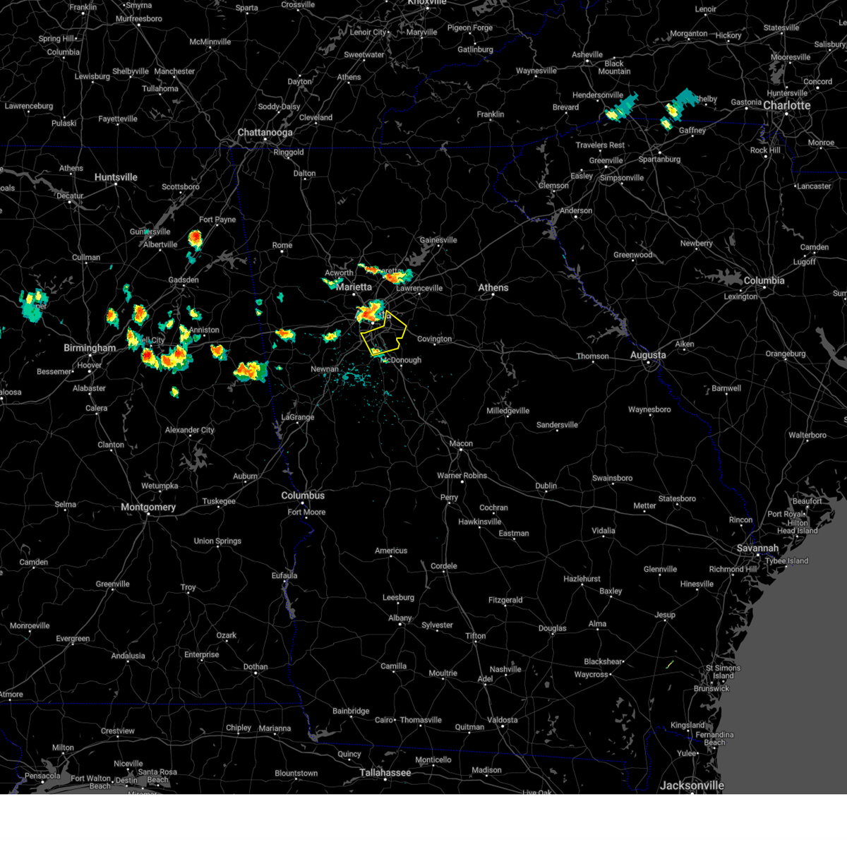 Svrffc the national weather service in peachtree city has issued a * severe thunderstorm warning for, southwestern dekalb county in north central georgia, northwestern henry county in north central georgia, south central fulton county in north central georgia, northern clayton county in north central georgia, * until 430 pm edt. * at 347 pm edt, a severe thunderstorm was located over sweet auburn, or over atlanta, moving southeast at 30 mph (radar indicated). Hazards include 60 mph wind gusts and penny size hail. expect damage to roofs, siding, and trees Svrffc the national weather service in peachtree city has issued a * severe thunderstorm warning for, southwestern dekalb county in north central georgia, northwestern henry county in north central georgia, south central fulton county in north central georgia, northern clayton county in north central georgia, * until 430 pm edt. * at 347 pm edt, a severe thunderstorm was located over sweet auburn, or over atlanta, moving southeast at 30 mph (radar indicated). Hazards include 60 mph wind gusts and penny size hail. expect damage to roofs, siding, and trees
|
| 8/18/2024 3:47 PM EDT | A large tree limb was downed along montag circl in fulton county GA, 3.2 miles W of Atlanta, GA |
| 8/18/2024 3:45 PM EDT | A large tree was downed onto power lines on piedmont avenue ne near 8th street n in fulton county GA, 2.4 miles WSW of Atlanta, GA |
| 8/18/2024 3:37 PM EDT |
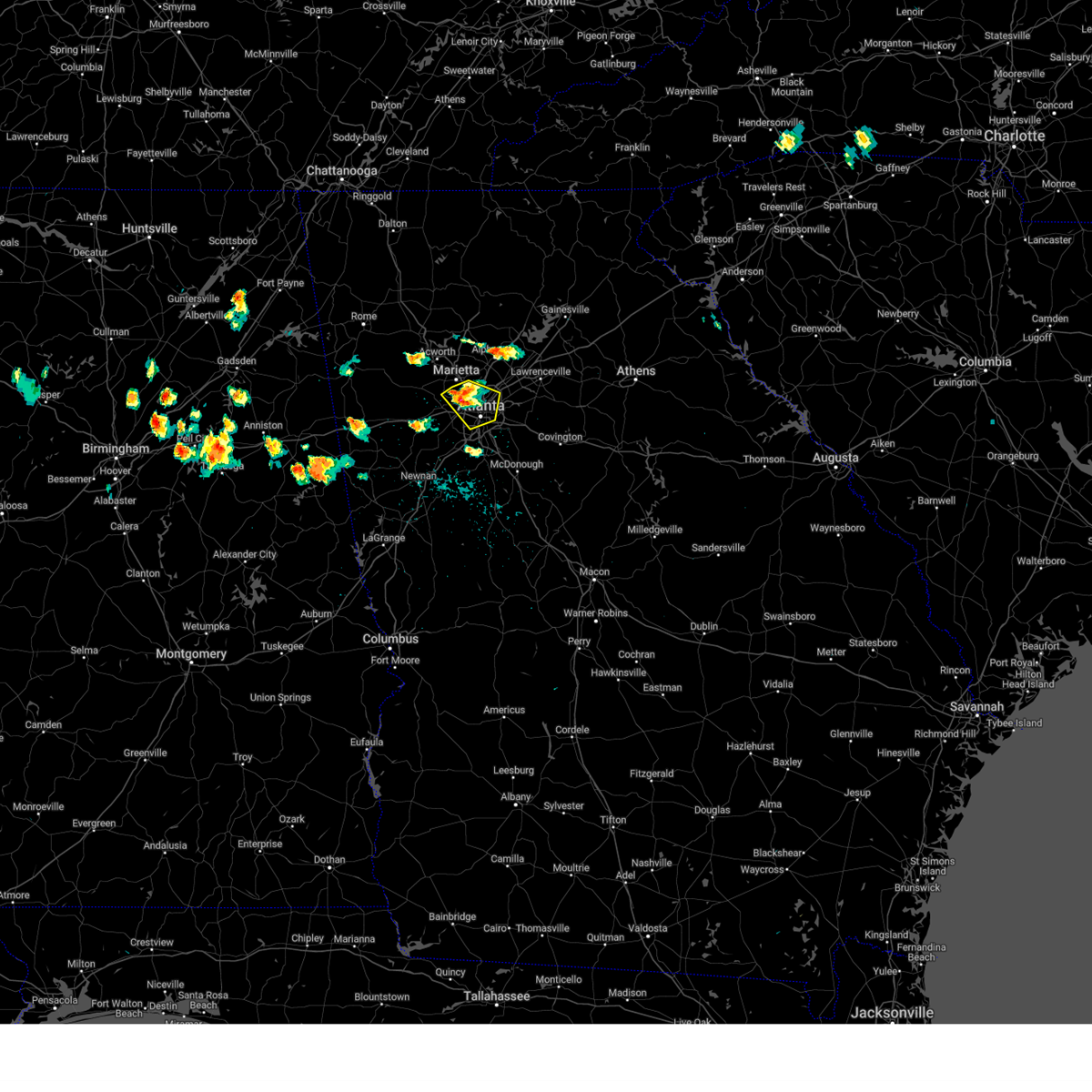 At 337 pm edt, a severe thunderstorm was located over vinings, or near atlanta, moving southeast at 30 mph (radar indicated). Hazards include 60 mph wind gusts and penny size hail. Expect damage to roofs, siding, and trees. Locations impacted include, atlanta, marietta, decatur, city of south fulton, sandy springs, smyrna, east point, chamblee, doraville, north decatur, fair oaks, north atlanta, north druid hills, midtown, grant park-zoo atlanta, druid hills, candler-mcafee, belvedere park, vinings, and sweet auburn. At 337 pm edt, a severe thunderstorm was located over vinings, or near atlanta, moving southeast at 30 mph (radar indicated). Hazards include 60 mph wind gusts and penny size hail. Expect damage to roofs, siding, and trees. Locations impacted include, atlanta, marietta, decatur, city of south fulton, sandy springs, smyrna, east point, chamblee, doraville, north decatur, fair oaks, north atlanta, north druid hills, midtown, grant park-zoo atlanta, druid hills, candler-mcafee, belvedere park, vinings, and sweet auburn.
|
| 8/18/2024 3:27 PM EDT |
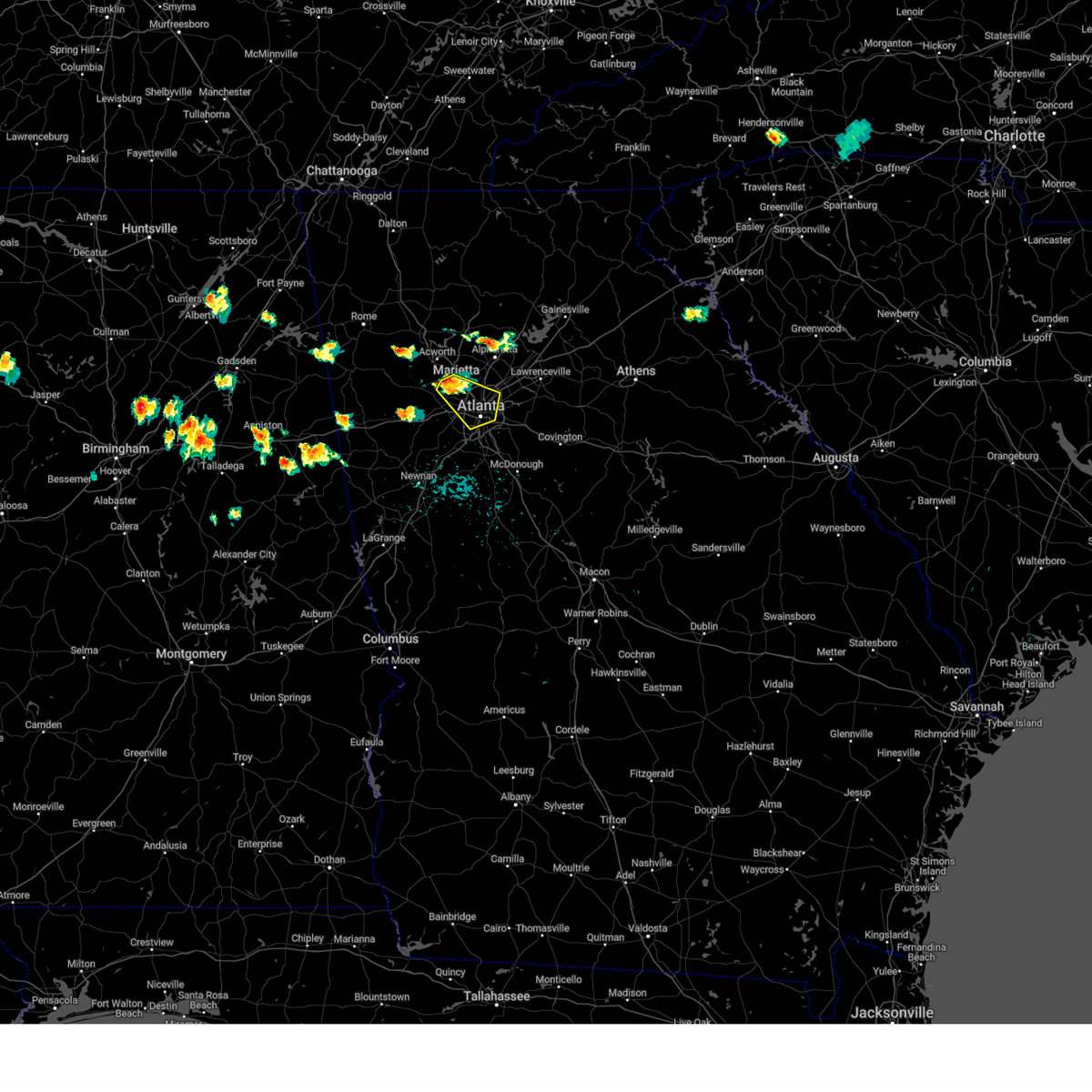 Svrffc the national weather service in peachtree city has issued a * severe thunderstorm warning for, west central dekalb county in north central georgia, central cobb county in north central georgia, central fulton county in north central georgia, * until 415 pm edt. * at 326 pm edt, a severe thunderstorm was located over jim r miller park, or near marietta, moving southeast at 30 mph (radar indicated). Hazards include 60 mph wind gusts and penny size hail. expect damage to roofs, siding, and trees Svrffc the national weather service in peachtree city has issued a * severe thunderstorm warning for, west central dekalb county in north central georgia, central cobb county in north central georgia, central fulton county in north central georgia, * until 415 pm edt. * at 326 pm edt, a severe thunderstorm was located over jim r miller park, or near marietta, moving southeast at 30 mph (radar indicated). Hazards include 60 mph wind gusts and penny size hail. expect damage to roofs, siding, and trees
|
| 7/30/2024 8:31 PM EDT |
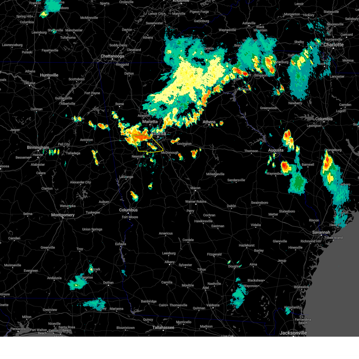 Svrffc the national weather service in peachtree city has issued a * severe thunderstorm warning for, northern fayette county in north central georgia, douglas county in north central georgia, southwestern fulton county in north central georgia, northern clayton county in north central georgia, * until 915 pm edt. * at 831 pm edt, severe thunderstorms were located along a line extending from villa rica to chapel hill to sandtown, moving southeast at 20 mph (radar indicated). Hazards include 60 mph wind gusts and quarter size hail. Hail damage to vehicles is expected. Expect wind damage to roofs, siding, and trees. Svrffc the national weather service in peachtree city has issued a * severe thunderstorm warning for, northern fayette county in north central georgia, douglas county in north central georgia, southwestern fulton county in north central georgia, northern clayton county in north central georgia, * until 915 pm edt. * at 831 pm edt, severe thunderstorms were located along a line extending from villa rica to chapel hill to sandtown, moving southeast at 20 mph (radar indicated). Hazards include 60 mph wind gusts and quarter size hail. Hail damage to vehicles is expected. Expect wind damage to roofs, siding, and trees.
|
| 7/30/2024 8:22 PM EDT | Tree down at vernon ridge court and vernon ridge driv in dekalb county GA, 13.8 miles SSW of Atlanta, GA |
| 7/30/2024 8:21 PM EDT |
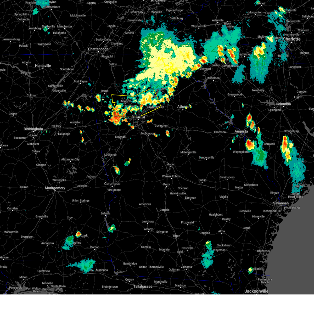 The storms which prompted the warning have weakened below severe limits, and no longer pose an immediate threat to life or property. therefore, the warning will be allowed to expire. a severe thunderstorm watch remains in effect until 1100 pm edt for north central and northwestern georgia. The storms which prompted the warning have weakened below severe limits, and no longer pose an immediate threat to life or property. therefore, the warning will be allowed to expire. a severe thunderstorm watch remains in effect until 1100 pm edt for north central and northwestern georgia.
|
| 7/30/2024 7:52 PM EDT |
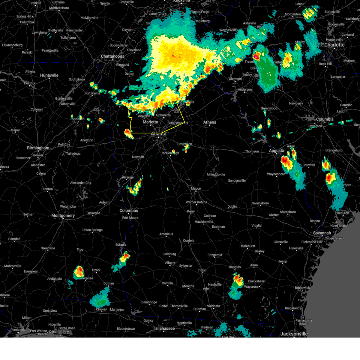 Svrffc the national weather service in peachtree city has issued a * severe thunderstorm warning for, paulding county in northwestern georgia, southern cherokee county in north central georgia, northwestern dekalb county in north central georgia, forsyth county in north central georgia, cobb county in north central georgia, central gwinnett county in north central georgia, southwestern hall county in north central georgia, northeastern fulton county in north central georgia, southern bartow county in northwestern georgia, * until 830 pm edt. * at 752 pm edt, severe thunderstorms were located along a line extending from near silver city to holly springs to near kingston, moving south at 30 mph (radar indicated). Hazards include 60 mph wind gusts and quarter size hail. Hail damage to vehicles is expected. Expect wind damage to roofs, siding, and trees. Svrffc the national weather service in peachtree city has issued a * severe thunderstorm warning for, paulding county in northwestern georgia, southern cherokee county in north central georgia, northwestern dekalb county in north central georgia, forsyth county in north central georgia, cobb county in north central georgia, central gwinnett county in north central georgia, southwestern hall county in north central georgia, northeastern fulton county in north central georgia, southern bartow county in northwestern georgia, * until 830 pm edt. * at 752 pm edt, severe thunderstorms were located along a line extending from near silver city to holly springs to near kingston, moving south at 30 mph (radar indicated). Hazards include 60 mph wind gusts and quarter size hail. Hail damage to vehicles is expected. Expect wind damage to roofs, siding, and trees.
|
| 7/29/2024 8:45 PM EDT |
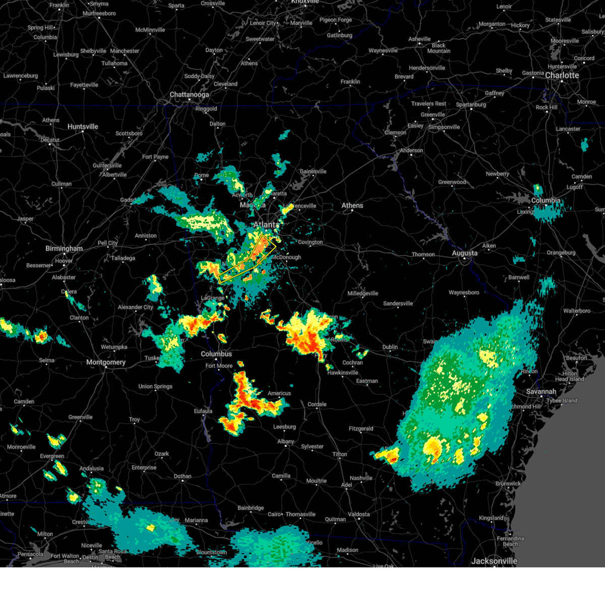 the severe thunderstorm warning has been cancelled and is no longer in effect the severe thunderstorm warning has been cancelled and is no longer in effect
|
| 7/29/2024 8:45 PM EDT |
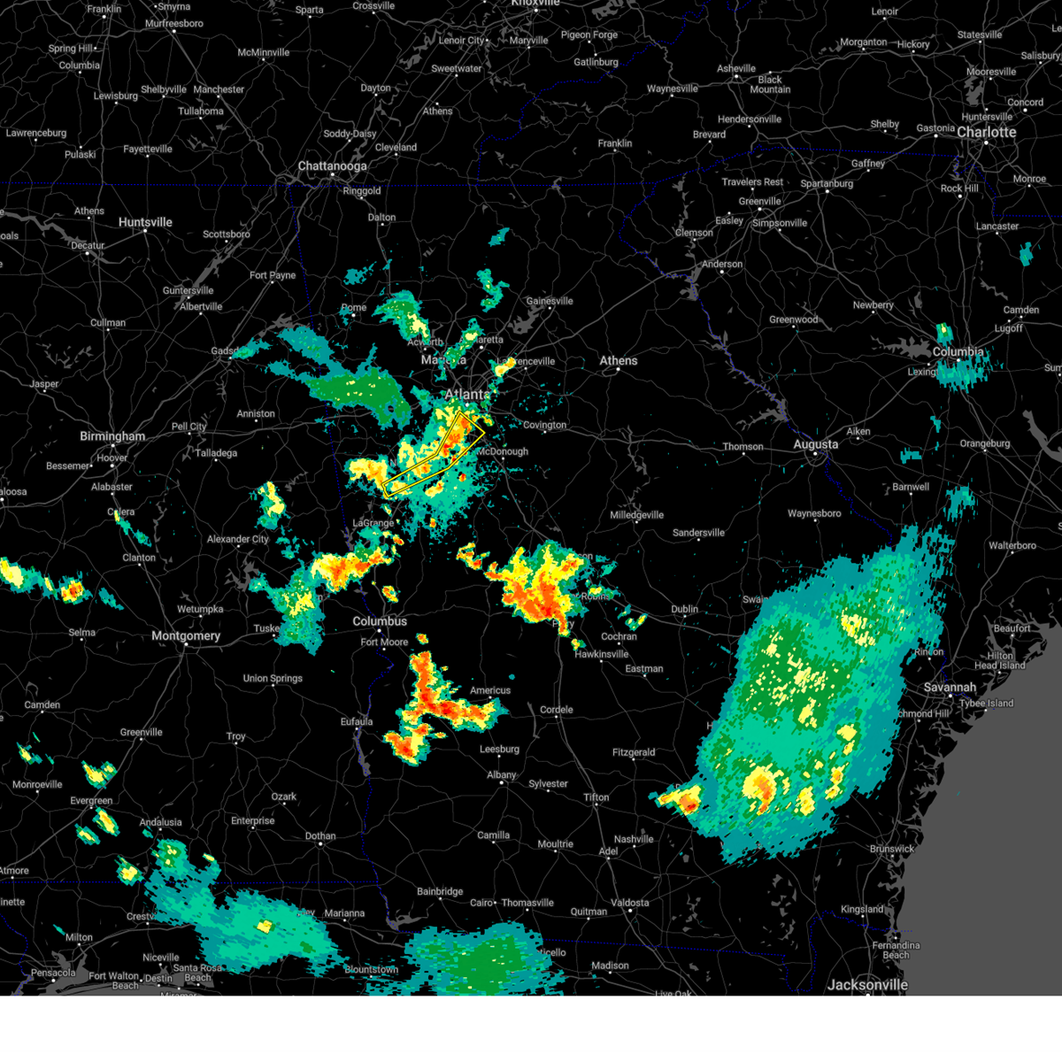 At 845 pm edt, severe thunderstorms were located along a line extending from ellenwood to near fayetteville to near east newnan, moving east at 35 mph (radar indicated). Hazards include 60 mph wind gusts and quarter size hail. Hail damage to vehicles is expected. expect wind damage to roofs, siding, and trees. Locations impacted include, atlanta, newnan, fayetteville, jonesboro, city of south fulton, peachtree city, east point, union city, forest park, riverdale, college park, tyrone, morrow, hapeville, lake city, moreland, sharpsburg, hartsfield-jackson airport, east newnan, and fort gillem. At 845 pm edt, severe thunderstorms were located along a line extending from ellenwood to near fayetteville to near east newnan, moving east at 35 mph (radar indicated). Hazards include 60 mph wind gusts and quarter size hail. Hail damage to vehicles is expected. expect wind damage to roofs, siding, and trees. Locations impacted include, atlanta, newnan, fayetteville, jonesboro, city of south fulton, peachtree city, east point, union city, forest park, riverdale, college park, tyrone, morrow, hapeville, lake city, moreland, sharpsburg, hartsfield-jackson airport, east newnan, and fort gillem.
|
| 7/29/2024 8:44 PM EDT |
 Svrffc the national weather service in peachtree city has issued a * severe thunderstorm warning for, spalding county in west central georgia, fayette county in north central georgia, northeastern meriwether county in west central georgia, northern pike county in west central georgia, western henry county in north central georgia, southern coweta county in west central georgia, clayton county in north central georgia, * until 930 pm edt. * at 843 pm edt, severe thunderstorms were located along a line extending from conley to near sandy creek to near grantville, moving southeast at 35 mph (radar indicated). Hazards include 60 mph wind gusts and quarter size hail. Hail damage to vehicles is expected. Expect wind damage to roofs, siding, and trees. Svrffc the national weather service in peachtree city has issued a * severe thunderstorm warning for, spalding county in west central georgia, fayette county in north central georgia, northeastern meriwether county in west central georgia, northern pike county in west central georgia, western henry county in north central georgia, southern coweta county in west central georgia, clayton county in north central georgia, * until 930 pm edt. * at 843 pm edt, severe thunderstorms were located along a line extending from conley to near sandy creek to near grantville, moving southeast at 35 mph (radar indicated). Hazards include 60 mph wind gusts and quarter size hail. Hail damage to vehicles is expected. Expect wind damage to roofs, siding, and trees.
|
| 7/29/2024 8:38 PM EDT |
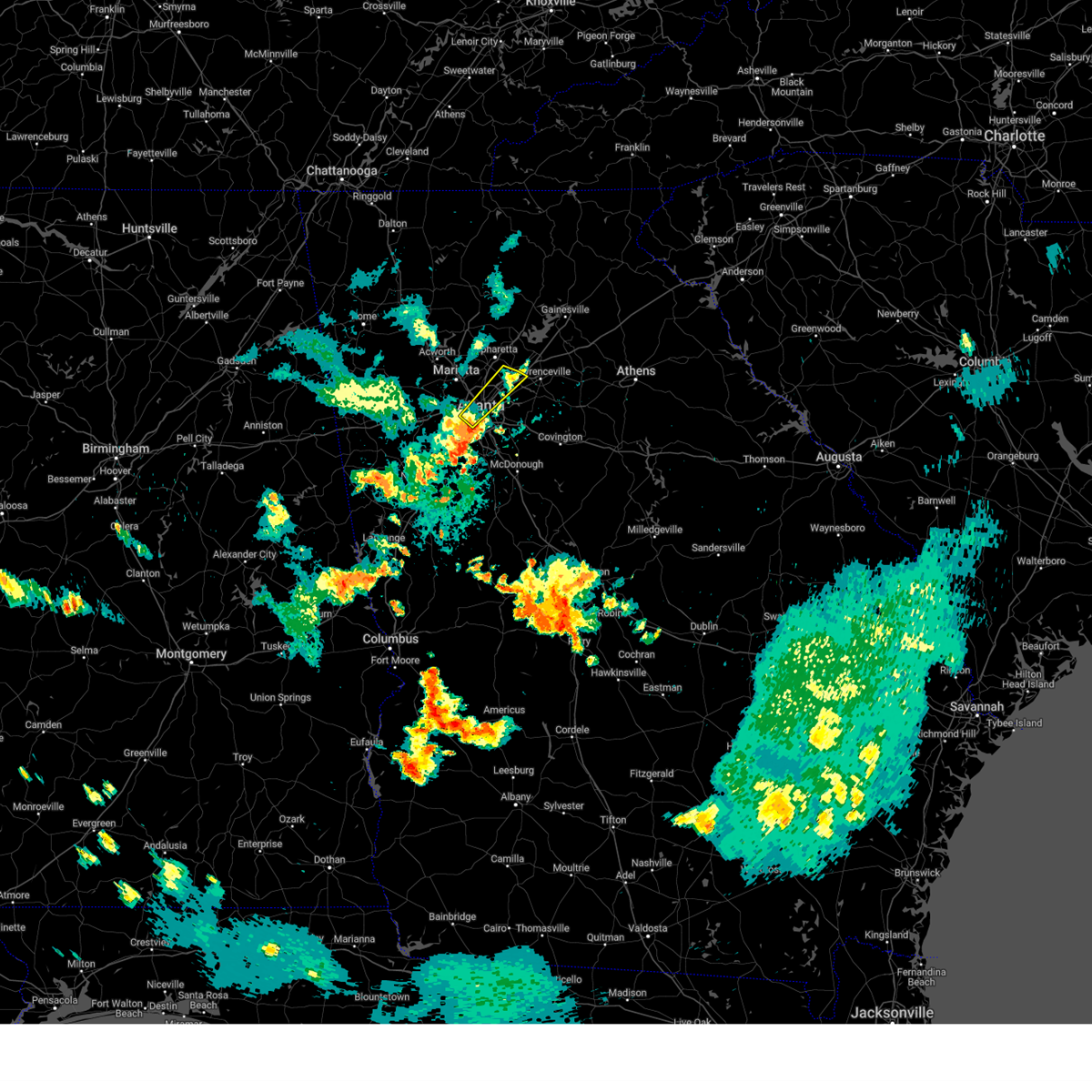 The storms which prompted the warning have weakened below severe limits, and have exited the warned area. therefore, the warning will be allowed to expire. The storms which prompted the warning have weakened below severe limits, and have exited the warned area. therefore, the warning will be allowed to expire.
|
| 7/29/2024 8:27 PM EDT |
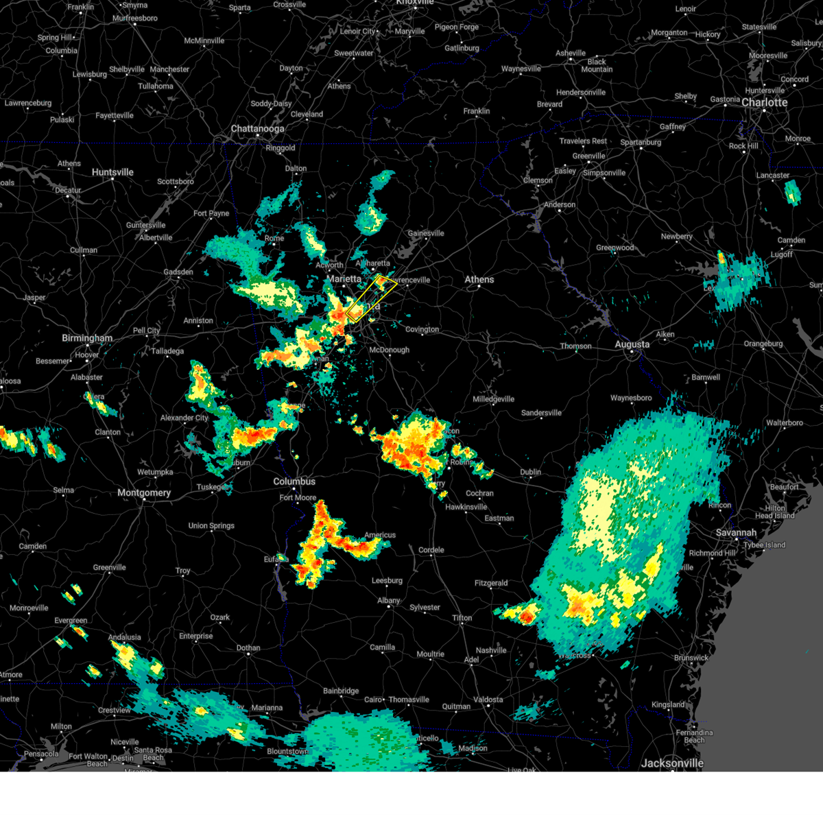 At 827 pm edt, severe thunderstorms were located along a line extending from norcross to cascade heights, moving east at 35 mph (radar indicated). Hazards include 60 mph wind gusts and quarter size hail. Hail damage to vehicles is expected. expect wind damage to roofs, siding, and trees. Locations impacted include, atlanta, peachtree corners, sandy springs, roswell, dunwoody, east point, duluth, chamblee, norcross, doraville, berkeley lake, north atlanta, north druid hills, midtown, druid hills, north decatur, tucker, sweet auburn, piedmont park, and cascade heights. At 827 pm edt, severe thunderstorms were located along a line extending from norcross to cascade heights, moving east at 35 mph (radar indicated). Hazards include 60 mph wind gusts and quarter size hail. Hail damage to vehicles is expected. expect wind damage to roofs, siding, and trees. Locations impacted include, atlanta, peachtree corners, sandy springs, roswell, dunwoody, east point, duluth, chamblee, norcross, doraville, berkeley lake, north atlanta, north druid hills, midtown, druid hills, north decatur, tucker, sweet auburn, piedmont park, and cascade heights.
|
| 7/29/2024 8:27 PM EDT |
 the severe thunderstorm warning has been cancelled and is no longer in effect the severe thunderstorm warning has been cancelled and is no longer in effect
|
| 7/29/2024 8:15 PM EDT |
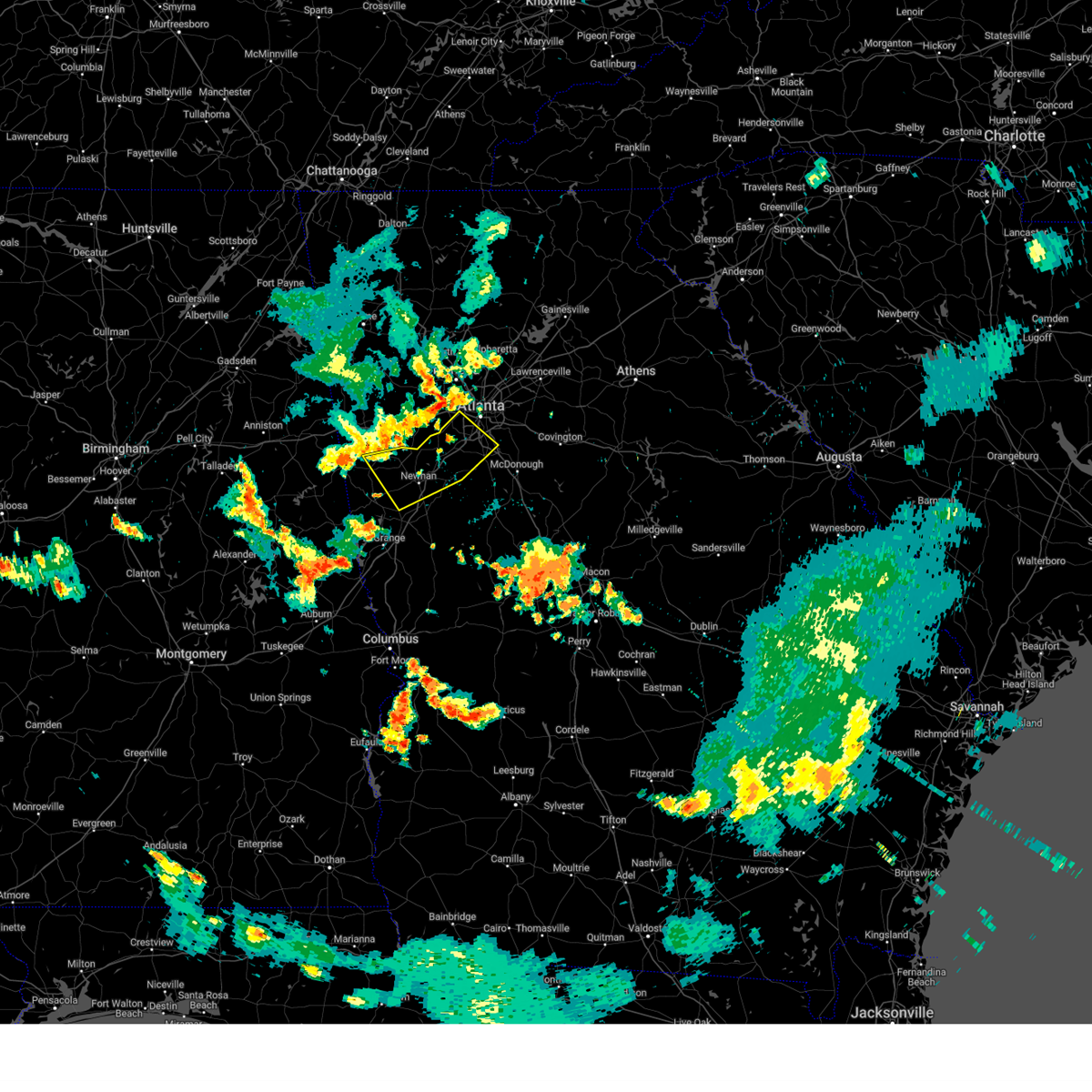 Svrffc the national weather service in peachtree city has issued a * severe thunderstorm warning for, northern fayette county in north central georgia, southeastern carroll county in northwestern georgia, northeastern heard county in west central georgia, coweta county in west central georgia, southwestern fulton county in north central georgia, northern clayton county in north central georgia, * until 900 pm edt. * at 815 pm edt, severe thunderstorms were located along a line extending from mableton to near bill arp to near roopville, moving southeast at 30 mph (radar indicated). Hazards include 60 mph wind gusts and quarter size hail. Hail damage to vehicles is expected. Expect wind damage to roofs, siding, and trees. Svrffc the national weather service in peachtree city has issued a * severe thunderstorm warning for, northern fayette county in north central georgia, southeastern carroll county in northwestern georgia, northeastern heard county in west central georgia, coweta county in west central georgia, southwestern fulton county in north central georgia, northern clayton county in north central georgia, * until 900 pm edt. * at 815 pm edt, severe thunderstorms were located along a line extending from mableton to near bill arp to near roopville, moving southeast at 30 mph (radar indicated). Hazards include 60 mph wind gusts and quarter size hail. Hail damage to vehicles is expected. Expect wind damage to roofs, siding, and trees.
|
| 7/29/2024 8:05 PM EDT |
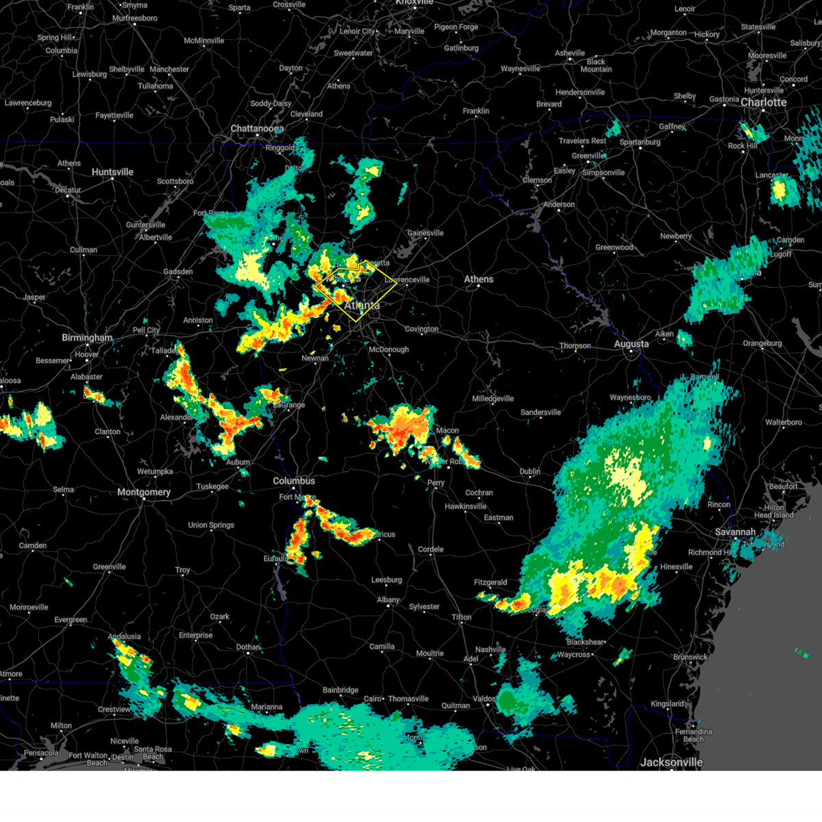 Svrffc the national weather service in peachtree city has issued a * severe thunderstorm warning for, east central paulding county in northwestern georgia, northwestern dekalb county in north central georgia, cobb county in north central georgia, west central gwinnett county in north central georgia, central fulton county in north central georgia, * until 845 pm edt. * at 805 pm edt, severe thunderstorms were located along a line extending from mountain park to near powder springs, moving southeast at 25 mph (radar indicated). Hazards include 60 mph wind gusts and quarter size hail. Hail damage to vehicles is expected. Expect wind damage to roofs, siding, and trees. Svrffc the national weather service in peachtree city has issued a * severe thunderstorm warning for, east central paulding county in northwestern georgia, northwestern dekalb county in north central georgia, cobb county in north central georgia, west central gwinnett county in north central georgia, central fulton county in north central georgia, * until 845 pm edt. * at 805 pm edt, severe thunderstorms were located along a line extending from mountain park to near powder springs, moving southeast at 25 mph (radar indicated). Hazards include 60 mph wind gusts and quarter size hail. Hail damage to vehicles is expected. Expect wind damage to roofs, siding, and trees.
|
| 7/29/2024 7:56 PM EDT |
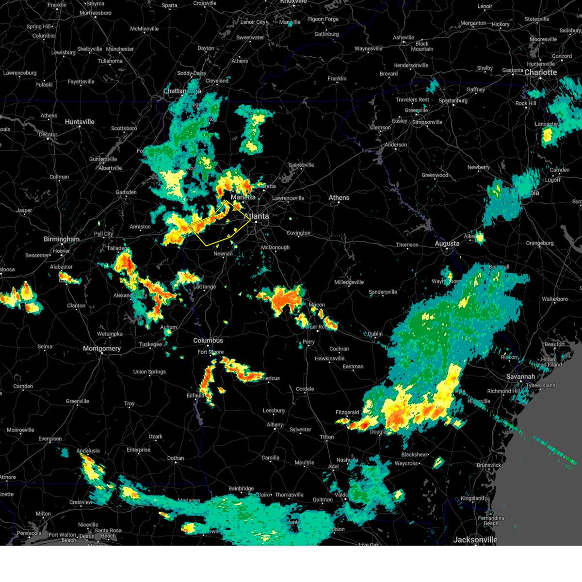 Svrffc the national weather service in peachtree city has issued a * severe thunderstorm warning for, southeastern paulding county in northwestern georgia, southeastern haralson county in northwestern georgia, central carroll county in northwestern georgia, southwestern cobb county in north central georgia, douglas county in north central georgia, southwestern fulton county in north central georgia, * until 830 pm edt. * at 756 pm edt, severe thunderstorms were located along a line extending from near lost mountain park to lake val-do-mar to waco, moving southeast at 25 mph (radar indicated). Hazards include 60 mph wind gusts and quarter size hail. Hail damage to vehicles is expected. Expect wind damage to roofs, siding, and trees. Svrffc the national weather service in peachtree city has issued a * severe thunderstorm warning for, southeastern paulding county in northwestern georgia, southeastern haralson county in northwestern georgia, central carroll county in northwestern georgia, southwestern cobb county in north central georgia, douglas county in north central georgia, southwestern fulton county in north central georgia, * until 830 pm edt. * at 756 pm edt, severe thunderstorms were located along a line extending from near lost mountain park to lake val-do-mar to waco, moving southeast at 25 mph (radar indicated). Hazards include 60 mph wind gusts and quarter size hail. Hail damage to vehicles is expected. Expect wind damage to roofs, siding, and trees.
|
| 7/15/2024 5:20 PM EDT |
 the severe thunderstorm warning has been cancelled and is no longer in effect the severe thunderstorm warning has been cancelled and is no longer in effect
|
| 7/15/2024 5:08 PM EDT |
 At 508 pm edt, a severe thunderstorm was located over clarkston, or near decatur, moving east at 10 mph (radar indicated). Hazards include 60 mph wind gusts. Expect damage to roofs, siding, and trees. Locations impacted include, decatur, lilburn, clarkston, stone mountain, avondale estates, pine lake, tucker, north decatur, druid hills, belvedere park, north druid hills, mountain park, scottdale, and redan. At 508 pm edt, a severe thunderstorm was located over clarkston, or near decatur, moving east at 10 mph (radar indicated). Hazards include 60 mph wind gusts. Expect damage to roofs, siding, and trees. Locations impacted include, decatur, lilburn, clarkston, stone mountain, avondale estates, pine lake, tucker, north decatur, druid hills, belvedere park, north druid hills, mountain park, scottdale, and redan.
|
| 7/15/2024 4:54 PM EDT |
 Svrffc the national weather service in peachtree city has issued a * severe thunderstorm warning for, central dekalb county in north central georgia, southwestern gwinnett county in north central georgia, * until 545 pm edt. * at 454 pm edt, a severe thunderstorm was located over north decatur, or over decatur, moving east at 10 mph (radar indicated). Hazards include 60 mph wind gusts. expect damage to roofs, siding, and trees Svrffc the national weather service in peachtree city has issued a * severe thunderstorm warning for, central dekalb county in north central georgia, southwestern gwinnett county in north central georgia, * until 545 pm edt. * at 454 pm edt, a severe thunderstorm was located over north decatur, or over decatur, moving east at 10 mph (radar indicated). Hazards include 60 mph wind gusts. expect damage to roofs, siding, and trees
|
| 5/27/2024 9:01 AM EDT |
 At 901 am edt, severe thunderstorms were located along a line extending from rosebud to near kelleytown to zetella, moving east at 50 mph (radar indicated). Hazards include 60 mph wind gusts and penny size hail. Expect damage to roofs, siding, and trees. Locations impacted include, atlanta, griffin, mcdonough, decatur, conyers, jonesboro, stockbridge, forest park, snellville, riverdale, college park, lilburn, loganville, chamblee, doraville, clarkston, hampton, morrow, lovejoy, and stone mountain. At 901 am edt, severe thunderstorms were located along a line extending from rosebud to near kelleytown to zetella, moving east at 50 mph (radar indicated). Hazards include 60 mph wind gusts and penny size hail. Expect damage to roofs, siding, and trees. Locations impacted include, atlanta, griffin, mcdonough, decatur, conyers, jonesboro, stockbridge, forest park, snellville, riverdale, college park, lilburn, loganville, chamblee, doraville, clarkston, hampton, morrow, lovejoy, and stone mountain.
|
| 5/27/2024 9:01 AM EDT |
 the severe thunderstorm warning has been cancelled and is no longer in effect the severe thunderstorm warning has been cancelled and is no longer in effect
|
| 5/27/2024 8:52 AM EDT |
 At 850 am edt, severe thunderstorms were located along a line extending from near stone mountain to near hidden valley park to digbey, moving east at 50 mph (radar indicated). Hazards include 60 mph wind gusts and penny size hail. Expect damage to roofs, siding, and trees. Locations impacted include, atlanta, douglasville, griffin, mcdonough, decatur, fayetteville, conyers, jonesboro, city of south fulton, peachtree city, east point, stockbridge, union city, forest park, snellville, riverdale, college park, fairburn, lilburn, and loganville. At 850 am edt, severe thunderstorms were located along a line extending from near stone mountain to near hidden valley park to digbey, moving east at 50 mph (radar indicated). Hazards include 60 mph wind gusts and penny size hail. Expect damage to roofs, siding, and trees. Locations impacted include, atlanta, douglasville, griffin, mcdonough, decatur, fayetteville, conyers, jonesboro, city of south fulton, peachtree city, east point, stockbridge, union city, forest park, snellville, riverdale, college park, fairburn, lilburn, and loganville.
|
| 5/27/2024 8:52 AM EDT |
 the severe thunderstorm warning has been cancelled and is no longer in effect the severe thunderstorm warning has been cancelled and is no longer in effect
|
| 5/27/2024 8:35 AM EDT |
 Svrffc the national weather service in peachtree city has issued a * severe thunderstorm warning for, southeastern paulding county in northwestern georgia, northwestern fayette county in north central georgia, southern cobb county in north central georgia, eastern douglas county in north central georgia, northeastern coweta county in west central georgia, southwestern fulton county in north central georgia, * until 845 am edt. * at 835 am edt, severe thunderstorms were located along a line extending from near hiram to near chattahoochee hills to near arnco-sargent, moving east at 70 mph (radar indicated). Hazards include 60 mph wind gusts and penny size hail. expect damage to roofs, siding, and trees Svrffc the national weather service in peachtree city has issued a * severe thunderstorm warning for, southeastern paulding county in northwestern georgia, northwestern fayette county in north central georgia, southern cobb county in north central georgia, eastern douglas county in north central georgia, northeastern coweta county in west central georgia, southwestern fulton county in north central georgia, * until 845 am edt. * at 835 am edt, severe thunderstorms were located along a line extending from near hiram to near chattahoochee hills to near arnco-sargent, moving east at 70 mph (radar indicated). Hazards include 60 mph wind gusts and penny size hail. expect damage to roofs, siding, and trees
|
| 5/27/2024 8:27 AM EDT |
 Svrffc the national weather service in peachtree city has issued a * severe thunderstorm warning for, rockdale county in north central georgia, spalding county in west central georgia, dekalb county in north central georgia, fayette county in north central georgia, southeastern cobb county in north central georgia, east central douglas county in north central georgia, southern gwinnett county in north central georgia, henry county in north central georgia, coweta county in west central georgia, south central fulton county in north central georgia, clayton county in north central georgia, * until 915 am edt. * at 827 am edt, severe thunderstorms were located along a line extending from bolton to union city to grantville, moving east at 50 mph (radar indicated). Hazards include 60 mph wind gusts and penny size hail. expect damage to roofs, siding, and trees Svrffc the national weather service in peachtree city has issued a * severe thunderstorm warning for, rockdale county in north central georgia, spalding county in west central georgia, dekalb county in north central georgia, fayette county in north central georgia, southeastern cobb county in north central georgia, east central douglas county in north central georgia, southern gwinnett county in north central georgia, henry county in north central georgia, coweta county in west central georgia, south central fulton county in north central georgia, clayton county in north central georgia, * until 915 am edt. * at 827 am edt, severe thunderstorms were located along a line extending from bolton to union city to grantville, moving east at 50 mph (radar indicated). Hazards include 60 mph wind gusts and penny size hail. expect damage to roofs, siding, and trees
|
| 5/9/2024 8:40 AM EDT | Tree downed on cherokee av in fulton county GA, 3 miles WNW of Atlanta, GA |
| 5/9/2024 7:42 AM EDT |
 Svrffc the national weather service in peachtree city has issued a * severe thunderstorm warning for, paulding county in northwestern georgia, southern cherokee county in north central georgia, northwestern dekalb county in north central georgia, southwestern forsyth county in north central georgia, northeastern haralson county in northwestern georgia, cobb county in north central georgia, northeastern douglas county in north central georgia, northern gwinnett county in north central georgia, northeastern fulton county in north central georgia, eastern polk county in northwestern georgia, southern bartow county in northwestern georgia, * until 830 am edt. * at 742 am edt, a severe thunderstorm was located over acworth, or 10 miles northwest of marietta, moving southeast at 65 mph (radar indicated). Hazards include 60 mph wind gusts and penny size hail. expect damage to roofs, siding, and trees Svrffc the national weather service in peachtree city has issued a * severe thunderstorm warning for, paulding county in northwestern georgia, southern cherokee county in north central georgia, northwestern dekalb county in north central georgia, southwestern forsyth county in north central georgia, northeastern haralson county in northwestern georgia, cobb county in north central georgia, northeastern douglas county in north central georgia, northern gwinnett county in north central georgia, northeastern fulton county in north central georgia, eastern polk county in northwestern georgia, southern bartow county in northwestern georgia, * until 830 am edt. * at 742 am edt, a severe thunderstorm was located over acworth, or 10 miles northwest of marietta, moving southeast at 65 mph (radar indicated). Hazards include 60 mph wind gusts and penny size hail. expect damage to roofs, siding, and trees
|
| 2/28/2024 3:59 PM EST |
 At 359 pm est, severe thunderstorms were located along a line extending from walnut grove to almon to near richardson park to irondale, moving southeast at 40 mph (radar indicated). Hazards include 60 mph wind gusts and penny size hail. Expect damage to roofs, siding, and trees. Locations impacted include, mcdonough, conyers, covington, jonesboro, stockbridge, forest park, riverdale, college park, hampton, morrow, lovejoy, hapeville, social circle, lake city, oxford, lithonia, porterdale, walnut grove, jersey, and hartsfield-jackson airport. At 359 pm est, severe thunderstorms were located along a line extending from walnut grove to almon to near richardson park to irondale, moving southeast at 40 mph (radar indicated). Hazards include 60 mph wind gusts and penny size hail. Expect damage to roofs, siding, and trees. Locations impacted include, mcdonough, conyers, covington, jonesboro, stockbridge, forest park, riverdale, college park, hampton, morrow, lovejoy, hapeville, social circle, lake city, oxford, lithonia, porterdale, walnut grove, jersey, and hartsfield-jackson airport.
|
| 2/28/2024 3:26 PM EST | Measured gust from peachtree-dekalb (kpdk) airpor in dekalb county GA, 10.5 miles SW of Atlanta, GA |
| 2/28/2024 3:26 PM EST |
 Svrffc the national weather service in peachtree city has issued a * severe thunderstorm warning for, rockdale county in north central georgia, dekalb county in north central georgia, east central douglas county in north central georgia, southwestern gwinnett county in north central georgia, northern henry county in north central georgia, central walton county in north central georgia, clayton county in north central georgia, southwestern fulton county in north central georgia, central newton county in north central georgia, * until 415 pm est. * at 326 pm est, severe thunderstorms were located along a line extending from lilburn to clarkston to cascade heights to campbellton, moving southeast at 40 mph (radar indicated). Hazards include 60 mph wind gusts and penny size hail. expect damage to roofs, siding, and trees Svrffc the national weather service in peachtree city has issued a * severe thunderstorm warning for, rockdale county in north central georgia, dekalb county in north central georgia, east central douglas county in north central georgia, southwestern gwinnett county in north central georgia, northern henry county in north central georgia, central walton county in north central georgia, clayton county in north central georgia, southwestern fulton county in north central georgia, central newton county in north central georgia, * until 415 pm est. * at 326 pm est, severe thunderstorms were located along a line extending from lilburn to clarkston to cascade heights to campbellton, moving southeast at 40 mph (radar indicated). Hazards include 60 mph wind gusts and penny size hail. expect damage to roofs, siding, and trees
|
| 2/28/2024 3:15 PM EST | Weather station dw1905 atlant in dekalb county GA, 10.7 miles SSW of Atlanta, GA |
| 2/28/2024 3:11 PM EST |
 At 311 pm est, severe thunderstorms were located along a line extending from near dunwoody to bankhead to near chapel hill, moving southeast at 40 mph (radar indicated). Hazards include 60 mph wind gusts. Expect damage to roofs, siding, and trees. Locations impacted include, atlanta, douglasville, decatur, peachtree corners, city of south fulton, sandy springs, roswell, smyrna, dunwoody, east point, union city, college park, fairburn, lilburn, chamblee, norcross, doraville, clarkston, austell, and hapeville. At 311 pm est, severe thunderstorms were located along a line extending from near dunwoody to bankhead to near chapel hill, moving southeast at 40 mph (radar indicated). Hazards include 60 mph wind gusts. Expect damage to roofs, siding, and trees. Locations impacted include, atlanta, douglasville, decatur, peachtree corners, city of south fulton, sandy springs, roswell, smyrna, dunwoody, east point, union city, college park, fairburn, lilburn, chamblee, norcross, doraville, clarkston, austell, and hapeville.
|
| 2/28/2024 2:58 PM EST |
 Svrffc the national weather service in peachtree city has issued a * severe thunderstorm warning for, southeastern paulding county in northwestern georgia, northwestern dekalb county in north central georgia, central cobb county in north central georgia, douglas county in north central georgia, west central gwinnett county in north central georgia, fulton county in north central georgia, * until 330 pm est. * at 258 pm est, severe thunderstorms were located along a line extending from near roswell to smyrna to winston, moving southeast at 35 mph (radar indicated). Hazards include 60 mph wind gusts and penny size hail. expect damage to roofs, siding, and trees Svrffc the national weather service in peachtree city has issued a * severe thunderstorm warning for, southeastern paulding county in northwestern georgia, northwestern dekalb county in north central georgia, central cobb county in north central georgia, douglas county in north central georgia, west central gwinnett county in north central georgia, fulton county in north central georgia, * until 330 pm est. * at 258 pm est, severe thunderstorms were located along a line extending from near roswell to smyrna to winston, moving southeast at 35 mph (radar indicated). Hazards include 60 mph wind gusts and penny size hail. expect damage to roofs, siding, and trees
|
| 2/28/2024 2:35 PM EST |
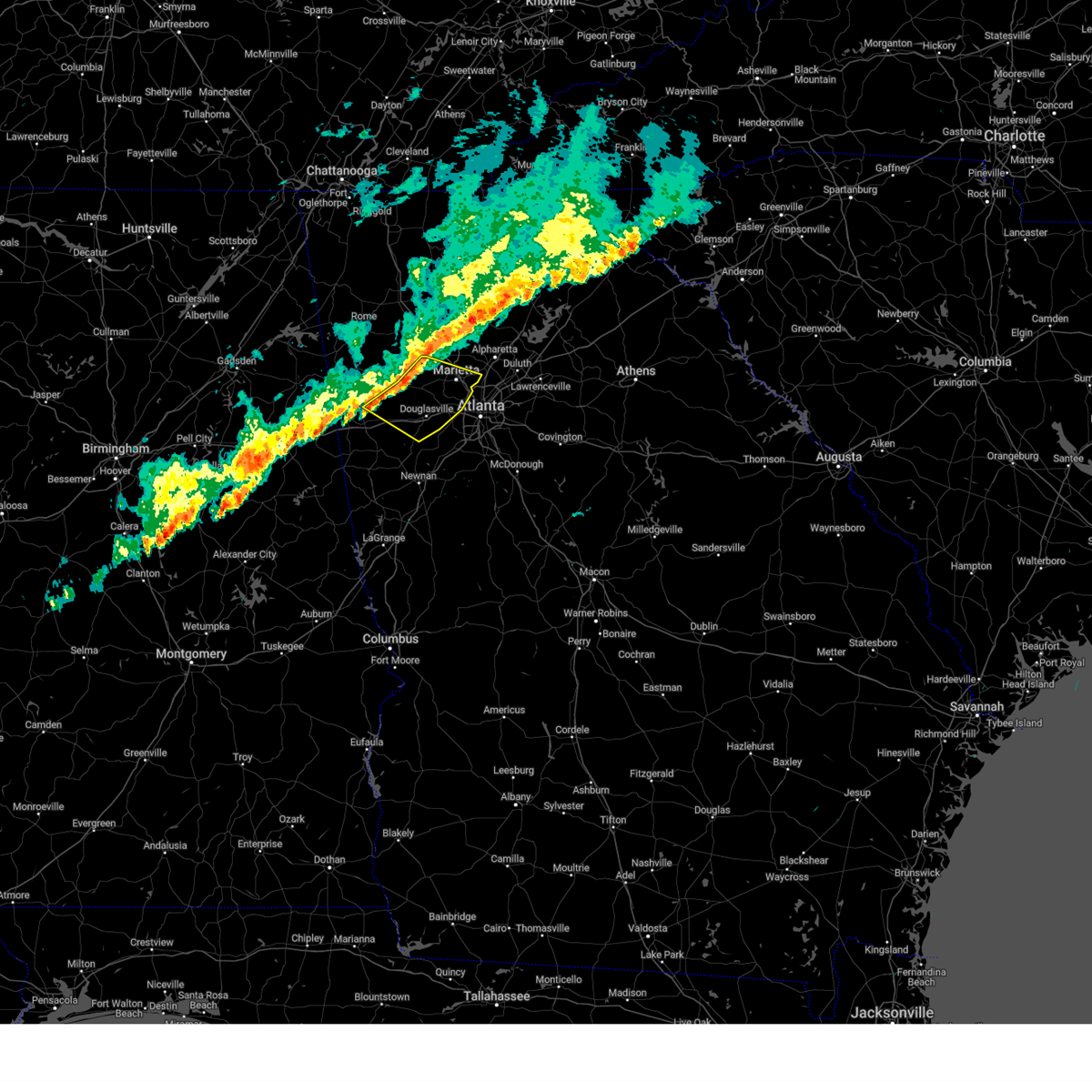 Svrffc the national weather service in peachtree city has issued a * severe thunderstorm warning for, paulding county in northwestern georgia, east central haralson county in northwestern georgia, northeastern carroll county in northwestern georgia, cobb county in north central georgia, douglas county in north central georgia, * until 300 pm est. * at 235 pm est, severe thunderstorms were located along a line extending from near acworth to dallas to near draketown, moving east at 35 mph (radar indicated). Hazards include 60 mph wind gusts and penny size hail. expect damage to roofs, siding, and trees Svrffc the national weather service in peachtree city has issued a * severe thunderstorm warning for, paulding county in northwestern georgia, east central haralson county in northwestern georgia, northeastern carroll county in northwestern georgia, cobb county in north central georgia, douglas county in north central georgia, * until 300 pm est. * at 235 pm est, severe thunderstorms were located along a line extending from near acworth to dallas to near draketown, moving east at 35 mph (radar indicated). Hazards include 60 mph wind gusts and penny size hail. expect damage to roofs, siding, and trees
|
| 1/9/2024 8:40 AM EST | Powerlines downed along citadel dr near briarcliff roa in dekalb county GA, 5.9 miles SW of Atlanta, GA |
| 1/9/2024 8:40 AM EST | Tree downed along oxford road ne near the by way n in dekalb county GA, 4.5 miles WSW of Atlanta, GA |
| 1/9/2024 8:19 AM EST |
 At 819 am est, severe thunderstorms were located along a line extending from near city of south fulton to union city to sandy creek, moving northeast at 65 mph (radar indicated). Hazards include 60 mph wind gusts. expect damage to roofs, siding, and trees At 819 am est, severe thunderstorms were located along a line extending from near city of south fulton to union city to sandy creek, moving northeast at 65 mph (radar indicated). Hazards include 60 mph wind gusts. expect damage to roofs, siding, and trees
|
| 1/9/2024 8:12 AM EST |
 At 811 am est, a severe thunderstorm capable of producing a brief tornado was located over palmetto, or 8 miles south of city of south fulton, moving northeast at 65 mph (radar indicated rotation). Hazards include tornado. Flying debris will be dangerous to those caught without shelter. mobile homes will be damaged or destroyed. damage to roofs, windows, and vehicles will occur. Tree damage is likely. At 811 am est, a severe thunderstorm capable of producing a brief tornado was located over palmetto, or 8 miles south of city of south fulton, moving northeast at 65 mph (radar indicated rotation). Hazards include tornado. Flying debris will be dangerous to those caught without shelter. mobile homes will be damaged or destroyed. damage to roofs, windows, and vehicles will occur. Tree damage is likely.
|
| 9/14/2023 2:37 PM EDT |
 The severe thunderstorm warning for southwestern dekalb, south central fulton and north central clayton counties will expire at 245 pm edt, the storm which prompted the warning has weakened below severe limits, and no longer poses an immediate threat to life or property. therefore, the warning will be allowed to expire. however, heavy rain is still possible with this thunderstorm. The severe thunderstorm warning for southwestern dekalb, south central fulton and north central clayton counties will expire at 245 pm edt, the storm which prompted the warning has weakened below severe limits, and no longer poses an immediate threat to life or property. therefore, the warning will be allowed to expire. however, heavy rain is still possible with this thunderstorm.
|
| 9/14/2023 1:55 PM EDT |
 At 154 pm edt, a severe thunderstorm was located over grant park-zoo atlanta, or near atlanta, moving southeast at 5 mph (radar indicated). Hazards include 60 mph wind gusts. expect damage to roofs, siding, and trees At 154 pm edt, a severe thunderstorm was located over grant park-zoo atlanta, or near atlanta, moving southeast at 5 mph (radar indicated). Hazards include 60 mph wind gusts. expect damage to roofs, siding, and trees
|
| 9/14/2023 1:43 PM EDT | Large tree uprooted at se corner of broyles st se and sydney st s in fulton county GA, 2.5 miles NW of Atlanta, GA |
| 8/28/2023 7:07 PM EDT |
 The severe thunderstorm warning for southern cherokee, northwestern dekalb, southwestern forsyth, cobb, southwestern gwinnett and northeastern fulton counties will expire at 715 pm edt, the storm which prompted the warning has weakened below severe limits, and no longer poses an immediate threat to life or property. therefore, the warning will be allowed to expire. however, heavy rain is still possible with this thunderstorm. The severe thunderstorm warning for southern cherokee, northwestern dekalb, southwestern forsyth, cobb, southwestern gwinnett and northeastern fulton counties will expire at 715 pm edt, the storm which prompted the warning has weakened below severe limits, and no longer poses an immediate threat to life or property. therefore, the warning will be allowed to expire. however, heavy rain is still possible with this thunderstorm.
|
| 8/28/2023 6:50 PM EDT | Tree dow in fulton county GA, 6.1 miles S of Atlanta, GA |
| 8/28/2023 6:34 PM EDT |
 At 633 pm edt, a severe thunderstorm was located over dobbins air reserve base, or near marietta, moving northeast at 15 mph (radar indicated). Hazards include 60 mph wind gusts and nickel size hail. expect damage to roofs, siding, and trees At 633 pm edt, a severe thunderstorm was located over dobbins air reserve base, or near marietta, moving northeast at 15 mph (radar indicated). Hazards include 60 mph wind gusts and nickel size hail. expect damage to roofs, siding, and trees
|
| 8/28/2023 5:53 PM EDT |
 The severe thunderstorm warning for southern cherokee, northwestern dekalb, eastern cobb and north central fulton counties will expire at 600 pm edt, the storm which prompted the warning has weakened below severe limits, and no longer poses an immediate threat to life or property. therefore, the warning will be allowed to expire. however, heavy rain is still possible with this thunderstorm. The severe thunderstorm warning for southern cherokee, northwestern dekalb, eastern cobb and north central fulton counties will expire at 600 pm edt, the storm which prompted the warning has weakened below severe limits, and no longer poses an immediate threat to life or property. therefore, the warning will be allowed to expire. however, heavy rain is still possible with this thunderstorm.
|
| 8/28/2023 5:50 PM EDT |
 At 550 pm edt, severe thunderstorms were located along a line extending from near campbellton to hannah, moving north at 20 mph (radar indicated). Hazards include 60 mph wind gusts and nickel size hail. expect damage to roofs, siding, and trees At 550 pm edt, severe thunderstorms were located along a line extending from near campbellton to hannah, moving north at 20 mph (radar indicated). Hazards include 60 mph wind gusts and nickel size hail. expect damage to roofs, siding, and trees
|
| 8/28/2023 5:12 PM EDT |
 At 512 pm edt, a severe thunderstorm was located over vinings, or near marietta, moving north at 30 mph (radar indicated). Hazards include 60 mph wind gusts and nickel size hail. expect damage to roofs, siding, and trees At 512 pm edt, a severe thunderstorm was located over vinings, or near marietta, moving north at 30 mph (radar indicated). Hazards include 60 mph wind gusts and nickel size hail. expect damage to roofs, siding, and trees
|
| 8/12/2023 5:21 PM EDT |
 At 520 pm edt, severe thunderstorms were located along a line extending from near hidden valley park to sunny side, moving east at 20 mph (radar indicated). Hazards include 60 mph wind gusts. Expect damage to roofs, siding, and trees. locations impacted include, griffin, mcdonough, decatur, jonesboro, stockbridge, forest park, hampton, morrow, lovejoy, locust grove, avondale estates, lake city, lithonia, orchard hill, woolsey, sunny side, east griffin, candler-mcafee, belvedere park, and lakeview estates. hail threat, radar indicated max hail size, <. 75 in wind threat, radar indicated max wind gust, 60 mph. At 520 pm edt, severe thunderstorms were located along a line extending from near hidden valley park to sunny side, moving east at 20 mph (radar indicated). Hazards include 60 mph wind gusts. Expect damage to roofs, siding, and trees. locations impacted include, griffin, mcdonough, decatur, jonesboro, stockbridge, forest park, hampton, morrow, lovejoy, locust grove, avondale estates, lake city, lithonia, orchard hill, woolsey, sunny side, east griffin, candler-mcafee, belvedere park, and lakeview estates. hail threat, radar indicated max hail size, <. 75 in wind threat, radar indicated max wind gust, 60 mph.
|
| 8/12/2023 5:05 PM EDT |
 At 505 pm edt, severe thunderstorms were located along a line extending from forest park to inman, moving east at 20 mph (radar indicated). Hazards include 60 mph wind gusts. Expect damage to roofs, siding, and trees. locations impacted include, atlanta, fayetteville, jonesboro, city of south fulton, peachtree city, east point, union city, forest park, riverdale, college park, morrow, hapeville, lake city, brooks, woolsey, belvedere park, hartsfield-jackson airport, grant park-zoo atlanta, candler-mcafee, and starrs mill. hail threat, radar indicated max hail size, <. 75 in wind threat, radar indicated max wind gust, 60 mph. At 505 pm edt, severe thunderstorms were located along a line extending from forest park to inman, moving east at 20 mph (radar indicated). Hazards include 60 mph wind gusts. Expect damage to roofs, siding, and trees. locations impacted include, atlanta, fayetteville, jonesboro, city of south fulton, peachtree city, east point, union city, forest park, riverdale, college park, morrow, hapeville, lake city, brooks, woolsey, belvedere park, hartsfield-jackson airport, grant park-zoo atlanta, candler-mcafee, and starrs mill. hail threat, radar indicated max hail size, <. 75 in wind threat, radar indicated max wind gust, 60 mph.
|
| 8/12/2023 4:55 PM EDT | Awning at exxon station along virginia ave damaged and hanging down over gas pump in fulton county GA, 7.2 miles NNE of Atlanta, GA |
| 8/12/2023 4:55 PM EDT | Numerous power outages reported around the atlanta airport. marta rail service is suspended as a result in the are in clayton county GA, 8.5 miles N of Atlanta, GA |
| 8/12/2023 4:55 PM EDT | Numerous trees down in south atlanta... east point... hapeville... and surrounding communities. locations include grant st and nolan st... 7th st and 3rd ave... memoria in fulton county GA, 5.7 miles N of Atlanta, GA |
| 8/12/2023 4:55 PM EDT | Measured at asos station katl atlant in clayton county GA, 9.3 miles NNE of Atlanta, GA |
| 8/12/2023 4:52 PM EDT | Measured at asos station katl atlant in clayton county GA, 9.3 miles NNE of Atlanta, GA |
| 8/12/2023 4:52 PM EDT | Tree down near intersection of flat shoals ave se and ormewood ave s in dekalb county GA, 4.9 miles WNW of Atlanta, GA |
| 8/12/2023 4:52 PM EDT |
 At 451 pm edt, severe thunderstorms were located along a line extending from near gresham park to near woolsey, moving east at 20 mph (radar indicated). Hazards include 60 mph wind gusts. expect damage to roofs, siding, and trees At 451 pm edt, severe thunderstorms were located along a line extending from near gresham park to near woolsey, moving east at 20 mph (radar indicated). Hazards include 60 mph wind gusts. expect damage to roofs, siding, and trees
|
| 8/12/2023 4:50 PM EDT | Tree down in rideshare lot at hartsfield-jackson... near terminal pkwy before it crosses under airport blvd to enter north termina in fulton county GA, 8.7 miles NNE of Atlanta, GA |
| 8/12/2023 4:50 PM EDT | Tree down along connell ave s in fulton county GA, 5.7 miles N of Atlanta, GA |
| 8/12/2023 4:50 PM EDT | Tree blocking i-85 sb just before riverdale r in clayton county GA, 9.5 miles NNE of Atlanta, GA |
| 8/12/2023 4:47 PM EDT |
 At 447 pm edt, severe thunderstorms were located along a line extending from college park to peachtree city, moving east at 20 mph (radar indicated). Hazards include 60 mph wind gusts. Expect damage to roofs, siding, and trees. locations impacted include, atlanta, fayetteville, jonesboro, city of south fulton, peachtree city, east point, union city, forest park, riverdale, college park, fairburn, tyrone, morrow, hapeville, senoia, lake city, brooks, woolsey, belvedere park, and hartsfield-jackson airport. hail threat, radar indicated max hail size, <. 75 in wind threat, radar indicated max wind gust, 60 mph. At 447 pm edt, severe thunderstorms were located along a line extending from college park to peachtree city, moving east at 20 mph (radar indicated). Hazards include 60 mph wind gusts. Expect damage to roofs, siding, and trees. locations impacted include, atlanta, fayetteville, jonesboro, city of south fulton, peachtree city, east point, union city, forest park, riverdale, college park, fairburn, tyrone, morrow, hapeville, senoia, lake city, brooks, woolsey, belvedere park, and hartsfield-jackson airport. hail threat, radar indicated max hail size, <. 75 in wind threat, radar indicated max wind gust, 60 mph.
|
| 8/12/2023 4:38 PM EDT | Tree down at butner rd and camp creek pkwy s in fulton county GA, 10 miles NE of Atlanta, GA |
| 8/12/2023 4:27 PM EDT |
 At 427 pm edt, severe thunderstorms were located along a line extending from near sandtown to thomas crossroads, moving east at 20 mph (radar indicated). Hazards include 60 mph wind gusts. expect damage to roofs, siding, and trees At 427 pm edt, severe thunderstorms were located along a line extending from near sandtown to thomas crossroads, moving east at 20 mph (radar indicated). Hazards include 60 mph wind gusts. expect damage to roofs, siding, and trees
|
| 8/7/2023 6:27 PM EDT |
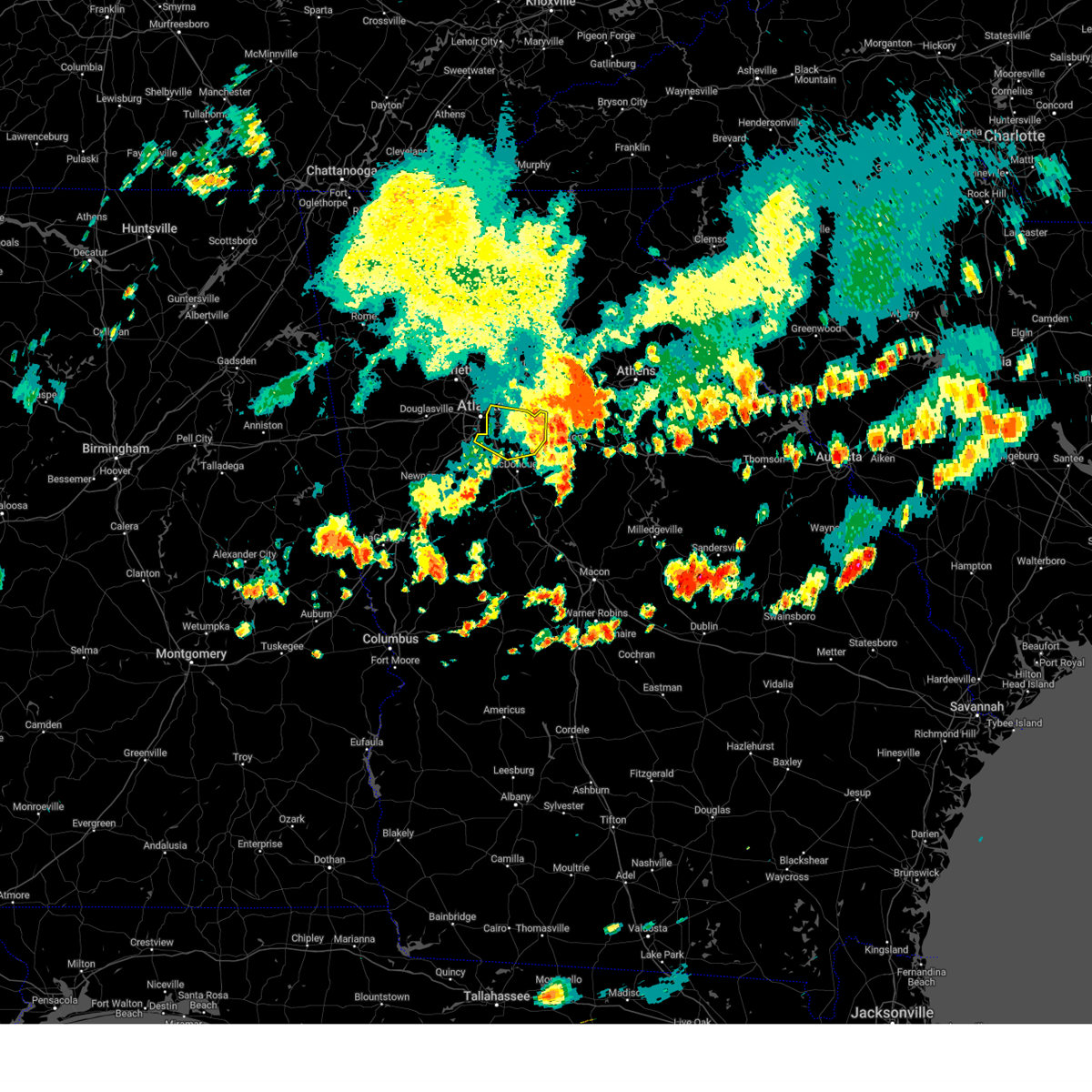 The severe thunderstorm warning for rockdale, dekalb, northwestern henry and northeastern clayton counties will expire at 630 pm edt, the storm which prompted the warning has moved out of the area. therefore, the warning will be allowed to expire. a severe thunderstorm watch remains in effect until 800 pm edt for north central georgia. The severe thunderstorm warning for rockdale, dekalb, northwestern henry and northeastern clayton counties will expire at 630 pm edt, the storm which prompted the warning has moved out of the area. therefore, the warning will be allowed to expire. a severe thunderstorm watch remains in effect until 800 pm edt for north central georgia.
|
| 8/7/2023 6:12 PM EDT |
 The severe thunderstorm warning for southwestern dekalb, south central fulton and northwestern clayton counties will expire at 615 pm edt, the storm which prompted the warning has moved out of the area. therefore, the warning will be allowed to expire. a severe thunderstorm watch remains in effect until 800 pm edt for north central georgia. The severe thunderstorm warning for southwestern dekalb, south central fulton and northwestern clayton counties will expire at 615 pm edt, the storm which prompted the warning has moved out of the area. therefore, the warning will be allowed to expire. a severe thunderstorm watch remains in effect until 800 pm edt for north central georgia.
|
| 8/7/2023 6:11 PM EDT |
 The severe thunderstorm warning for dekalb, south central forsyth, cobb, douglas, western gwinnett, fulton and northwestern clayton counties will expire at 615 pm edt, the storms which prompted the warning have moved out of the area. therefore, the warning will be allowed to expire. a severe thunderstorm watch remains in effect until 800 pm edt for north central and northwestern georgia. The severe thunderstorm warning for dekalb, south central forsyth, cobb, douglas, western gwinnett, fulton and northwestern clayton counties will expire at 615 pm edt, the storms which prompted the warning have moved out of the area. therefore, the warning will be allowed to expire. a severe thunderstorm watch remains in effect until 800 pm edt for north central and northwestern georgia.
|
| 8/7/2023 5:55 PM EDT |
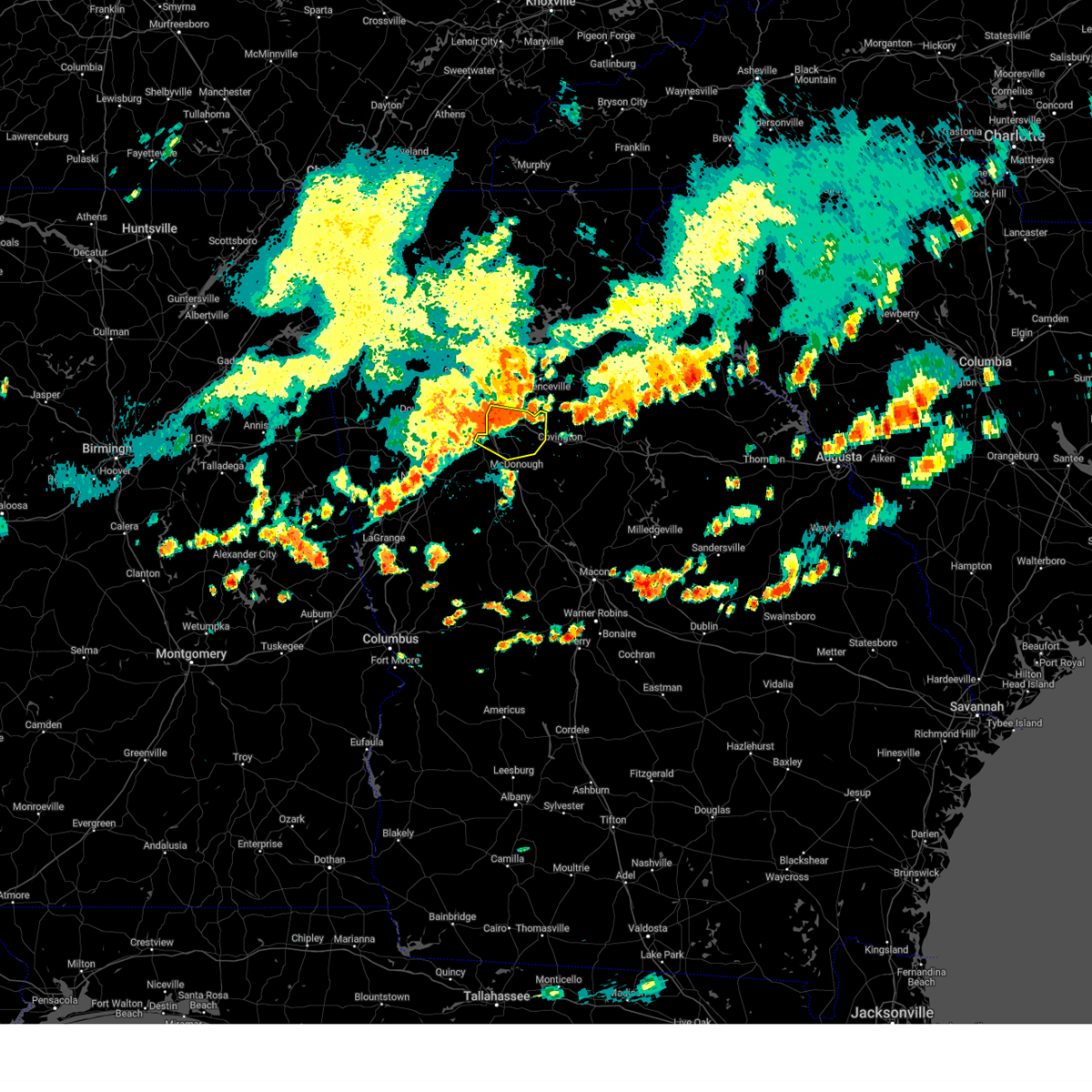 At 555 pm edt, a severe thunderstorm was located over gresham park, or 7 miles south of decatur, moving southeast at 45 mph (radar indicated). Hazards include golf ball size hail and 70 mph wind gusts. People and animals outdoors will be injured. expect hail damage to roofs, siding, windows, and vehicles. expect considerable tree damage. Wind damage is also likely to mobile homes, roofs, and outbuildings. At 555 pm edt, a severe thunderstorm was located over gresham park, or 7 miles south of decatur, moving southeast at 45 mph (radar indicated). Hazards include golf ball size hail and 70 mph wind gusts. People and animals outdoors will be injured. expect hail damage to roofs, siding, windows, and vehicles. expect considerable tree damage. Wind damage is also likely to mobile homes, roofs, and outbuildings.
|
| 8/7/2023 5:51 PM EDT | A tree was downed at the intersection of lyle ave and college s in fulton county GA, 6.7 miles NNE of Atlanta, GA |
| 8/7/2023 5:50 PM EDT | A large tree was uprooted at the corner of elvira st se and eric st s in fulton county GA, 3.9 miles NW of Atlanta, GA |
| 8/7/2023 5:45 PM EDT | A tree was downed on utility lines on genessee ave s in fulton county GA, 2.9 miles N of Atlanta, GA |
| 8/7/2023 5:38 PM EDT |
 At 538 pm edt, a severe thunderstorm was located over east point, or near atlanta, moving east at 30 mph (radar indicated). Hazards include golf ball size hail and 70 mph wind gusts. People and animals outdoors will be injured. expect hail damage to roofs, siding, windows, and vehicles. expect considerable tree damage. Wind damage is also likely to mobile homes, roofs, and outbuildings. At 538 pm edt, a severe thunderstorm was located over east point, or near atlanta, moving east at 30 mph (radar indicated). Hazards include golf ball size hail and 70 mph wind gusts. People and animals outdoors will be injured. expect hail damage to roofs, siding, windows, and vehicles. expect considerable tree damage. Wind damage is also likely to mobile homes, roofs, and outbuildings.
|
| 8/7/2023 5:27 PM EDT |
 At 527 pm edt, severe thunderstorms were located along a line extending from near sandy plains to treasure lake, moving east at 50 mph (radar indicated). Hazards include 60 mph wind gusts and quarter size hail. Hail damage to vehicles is expected. Expect wind damage to roofs, siding, and trees. At 527 pm edt, severe thunderstorms were located along a line extending from near sandy plains to treasure lake, moving east at 50 mph (radar indicated). Hazards include 60 mph wind gusts and quarter size hail. Hail damage to vehicles is expected. Expect wind damage to roofs, siding, and trees.
|
| 8/7/2023 4:58 PM EDT |
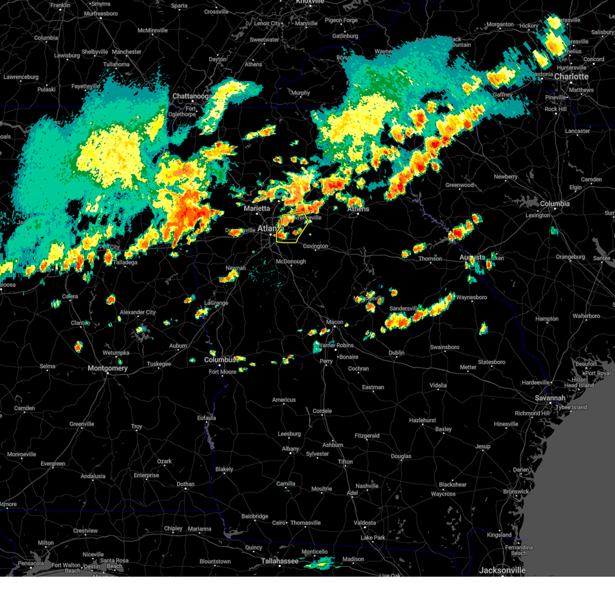 At 458 pm edt, a severe thunderstorm was located over belvedere park, or near decatur, moving east at 35 mph (radar indicated). Hazards include 60 mph wind gusts and quarter size hail. Hail damage to vehicles is expected. expect wind damage to roofs, siding, and trees. locations impacted include, atlanta, lawrenceville, decatur, peachtree corners, snellville, lilburn, norcross, doraville, clarkston, stone mountain, avondale estates, grayson, lithonia, pine lake, tucker, belvedere park, north decatur, candler-mcafee, druid hills, and mountain park. hail threat, radar indicated max hail size, 1. 00 in wind threat, radar indicated max wind gust, 60 mph. At 458 pm edt, a severe thunderstorm was located over belvedere park, or near decatur, moving east at 35 mph (radar indicated). Hazards include 60 mph wind gusts and quarter size hail. Hail damage to vehicles is expected. expect wind damage to roofs, siding, and trees. locations impacted include, atlanta, lawrenceville, decatur, peachtree corners, snellville, lilburn, norcross, doraville, clarkston, stone mountain, avondale estates, grayson, lithonia, pine lake, tucker, belvedere park, north decatur, candler-mcafee, druid hills, and mountain park. hail threat, radar indicated max hail size, 1. 00 in wind threat, radar indicated max wind gust, 60 mph.
|
| 8/7/2023 4:53 PM EDT | Asos station kpdk peachtree dekal in dekalb county GA, 10.5 miles SW of Atlanta, GA |
| 8/7/2023 4:50 PM EDT | A tree was reported down on terry mill rd s in dekalb county GA, 5.7 miles WNW of Atlanta, GA |
| 8/7/2023 4:48 PM EDT | Asos station kpdk peachtree dekal in dekalb county GA, 10.5 miles SW of Atlanta, GA |
| 8/7/2023 4:45 PM EDT | Asos station kpdk peachtree dekal in dekalb county GA, 10.5 miles SW of Atlanta, GA |
| 8/7/2023 4:40 PM EDT | A tree was reported down at carroll dr nw at marietta blvd n in fulton county GA, 3 miles SSE of Atlanta, GA |
| 8/7/2023 4:38 PM EDT | A tree was reported down on fairfield rd n in fulton county GA, 6.7 miles S of Atlanta, GA |
| 8/7/2023 4:36 PM EDT |
 At 435 pm edt, a severe thunderstorm was located over chastain memorial park, or near vinings. another severe storm was located over cascade heights or near west atlatna. both storms were moving east at 30 mph (radar indicated). Hazards include 60 mph wind gusts and quarter size hail. Hail damage to vehicles is expected. Expect wind damage to roofs, siding, and trees. At 435 pm edt, a severe thunderstorm was located over chastain memorial park, or near vinings. another severe storm was located over cascade heights or near west atlatna. both storms were moving east at 30 mph (radar indicated). Hazards include 60 mph wind gusts and quarter size hail. Hail damage to vehicles is expected. Expect wind damage to roofs, siding, and trees.
|
| 8/6/2023 3:02 PM EDT |
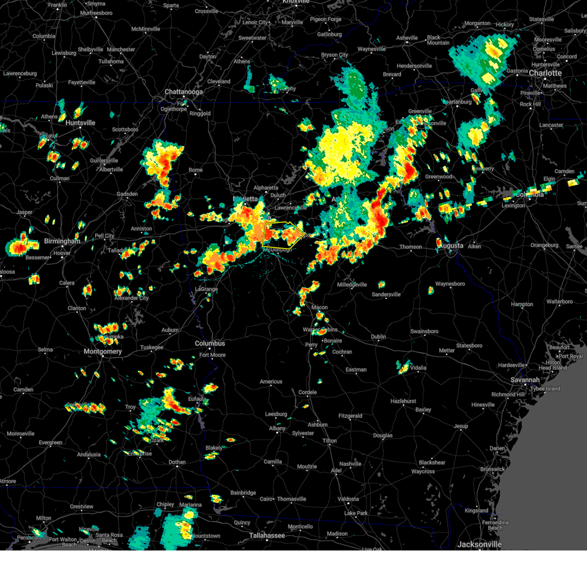 At 301 pm edt, a severe thunderstorm was located over panola mountain state park, or 9 miles west of conyers, moving east at 35 mph (radar indicated). Hazards include 60 mph wind gusts. expect damage to roofs, siding, and trees At 301 pm edt, a severe thunderstorm was located over panola mountain state park, or 9 miles west of conyers, moving east at 35 mph (radar indicated). Hazards include 60 mph wind gusts. expect damage to roofs, siding, and trees
|
| 8/6/2023 2:27 PM EDT | A tree fell onto a vehicle on i-285 between langford pkwy and camp creek pkwy. no injuries reporte in fulton county GA, 7.5 miles NE of Atlanta, GA |
| 8/3/2023 5:19 PM EDT |
 At 519 pm edt, a severe thunderstorm was located over forest park, or near jonesboro, moving southeast at 30 mph (radar indicated). Hazards include 60 mph wind gusts. Expect damage to roofs, siding, and trees. locations impacted include, atlanta, decatur, city of south fulton, east point, union city, forest park, riverdale, college park, fairburn, hapeville, avondale estates, lake city, belvedere park, hartsfield-jackson airport, candler-mcafee, fort gillem, lakewood park, panthersville, conley, and gresham park. hail threat, radar indicated max hail size, <. 75 in wind threat, radar indicated max wind gust, 60 mph. At 519 pm edt, a severe thunderstorm was located over forest park, or near jonesboro, moving southeast at 30 mph (radar indicated). Hazards include 60 mph wind gusts. Expect damage to roofs, siding, and trees. locations impacted include, atlanta, decatur, city of south fulton, east point, union city, forest park, riverdale, college park, fairburn, hapeville, avondale estates, lake city, belvedere park, hartsfield-jackson airport, candler-mcafee, fort gillem, lakewood park, panthersville, conley, and gresham park. hail threat, radar indicated max hail size, <. 75 in wind threat, radar indicated max wind gust, 60 mph.
|
| 8/3/2023 4:40 PM EDT |
 At 440 pm edt, a severe thunderstorm was located near sweetwater creek state park, or near city of south fulton, moving southeast at 35 mph (radar indicated). Hazards include 60 mph wind gusts. expect damage to roofs, siding, and trees At 440 pm edt, a severe thunderstorm was located near sweetwater creek state park, or near city of south fulton, moving southeast at 35 mph (radar indicated). Hazards include 60 mph wind gusts. expect damage to roofs, siding, and trees
|
| 8/3/2023 4:30 PM EDT |
 At 430 pm edt, a severe thunderstorm was located over brownsville, or near douglasville, moving southeast at 25 mph (radar indicated). Hazards include 60 mph wind gusts. expect damage to roofs, siding, and trees At 430 pm edt, a severe thunderstorm was located over brownsville, or near douglasville, moving southeast at 25 mph (radar indicated). Hazards include 60 mph wind gusts. expect damage to roofs, siding, and trees
|
| 7/29/2023 11:55 PM EDT |
 At 1155 pm edt, a severe thunderstorm was located over panthersville, or near decatur, moving southeast at 20 mph (radar indicated). Hazards include 60 mph wind gusts and penny size hail. Expect damage to roofs, siding, and trees. locations impacted include, atlanta, decatur, stone mountain, avondale estates, lithonia, pine lake, belvedere park, candler-mcafee, druid hills, north decatur, north druid hills, belmont, arabia mountain, redan, scottdale, kirkwood, panthersville, east lake, gresham park, and snapfinger. hail threat, radar indicated max hail size, 0. 75 in wind threat, radar indicated max wind gust, 60 mph. At 1155 pm edt, a severe thunderstorm was located over panthersville, or near decatur, moving southeast at 20 mph (radar indicated). Hazards include 60 mph wind gusts and penny size hail. Expect damage to roofs, siding, and trees. locations impacted include, atlanta, decatur, stone mountain, avondale estates, lithonia, pine lake, belvedere park, candler-mcafee, druid hills, north decatur, north druid hills, belmont, arabia mountain, redan, scottdale, kirkwood, panthersville, east lake, gresham park, and snapfinger. hail threat, radar indicated max hail size, 0. 75 in wind threat, radar indicated max wind gust, 60 mph.
|
| 7/29/2023 11:46 PM EDT |
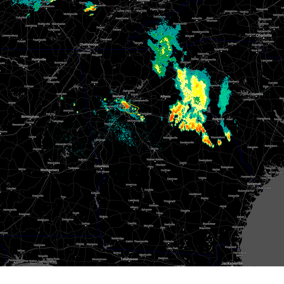 At 1146 pm edt, a severe thunderstorm was located over decatur, moving southeast at 15 mph (radar indicated). Hazards include 60 mph wind gusts. Expect damage to roofs, siding, and trees. locations impacted include, atlanta, decatur, clarkston, stone mountain, avondale estates, lithonia, pine lake, belvedere park, north decatur, north druid hills, midtown, grant park-zoo atlanta, candler-mcafee, druid hills, north atlanta, tucker, belmont, sweet auburn, arabia mountain, and piedmont park. hail threat, radar indicated max hail size, <. 75 in wind threat, radar indicated max wind gust, 60 mph. At 1146 pm edt, a severe thunderstorm was located over decatur, moving southeast at 15 mph (radar indicated). Hazards include 60 mph wind gusts. Expect damage to roofs, siding, and trees. locations impacted include, atlanta, decatur, clarkston, stone mountain, avondale estates, lithonia, pine lake, belvedere park, north decatur, north druid hills, midtown, grant park-zoo atlanta, candler-mcafee, druid hills, north atlanta, tucker, belmont, sweet auburn, arabia mountain, and piedmont park. hail threat, radar indicated max hail size, <. 75 in wind threat, radar indicated max wind gust, 60 mph.
|
| 7/29/2023 11:45 PM EDT | Tree down on a car at intersection of parker ave se and glenwood ave s in dekalb county GA, 6.8 miles WNW of Atlanta, GA |
| 7/29/2023 11:25 PM EDT |
 At 1125 pm edt, a severe thunderstorm was located over chastain memorial park, or near atlanta, moving southeast at 25 mph (radar indicated). Hazards include 60 mph wind gusts. expect damage to roofs, siding, and trees At 1125 pm edt, a severe thunderstorm was located over chastain memorial park, or near atlanta, moving southeast at 25 mph (radar indicated). Hazards include 60 mph wind gusts. expect damage to roofs, siding, and trees
|
| 7/28/2023 7:26 PM EDT |
 The severe thunderstorm warning for northwestern dekalb, southwestern gwinnett and east central fulton counties will expire at 730 pm edt, the storm which prompted the warning has moved out of the area. therefore, the warning will be allowed to expire. The severe thunderstorm warning for northwestern dekalb, southwestern gwinnett and east central fulton counties will expire at 730 pm edt, the storm which prompted the warning has moved out of the area. therefore, the warning will be allowed to expire.
|
| 7/28/2023 7:05 PM EDT |
 At 705 pm edt, a severe thunderstorm was located over doraville, or near peachtree corners, and is nearly stationary (radar indicated). Hazards include 60 mph wind gusts. Expect damage to roofs, siding, and trees. locations impacted include, atlanta, peachtree corners, sandy springs, roswell, dunwoody, lilburn, chamblee, norcross, doraville, tucker, north atlanta, north decatur, north druid hills, mountain park, mechanicsville, and brookhaven. hail threat, radar indicated max hail size, <. 75 in wind threat, radar indicated max wind gust, 60 mph. At 705 pm edt, a severe thunderstorm was located over doraville, or near peachtree corners, and is nearly stationary (radar indicated). Hazards include 60 mph wind gusts. Expect damage to roofs, siding, and trees. locations impacted include, atlanta, peachtree corners, sandy springs, roswell, dunwoody, lilburn, chamblee, norcross, doraville, tucker, north atlanta, north decatur, north druid hills, mountain park, mechanicsville, and brookhaven. hail threat, radar indicated max hail size, <. 75 in wind threat, radar indicated max wind gust, 60 mph.
|
| 7/28/2023 6:56 PM EDT |
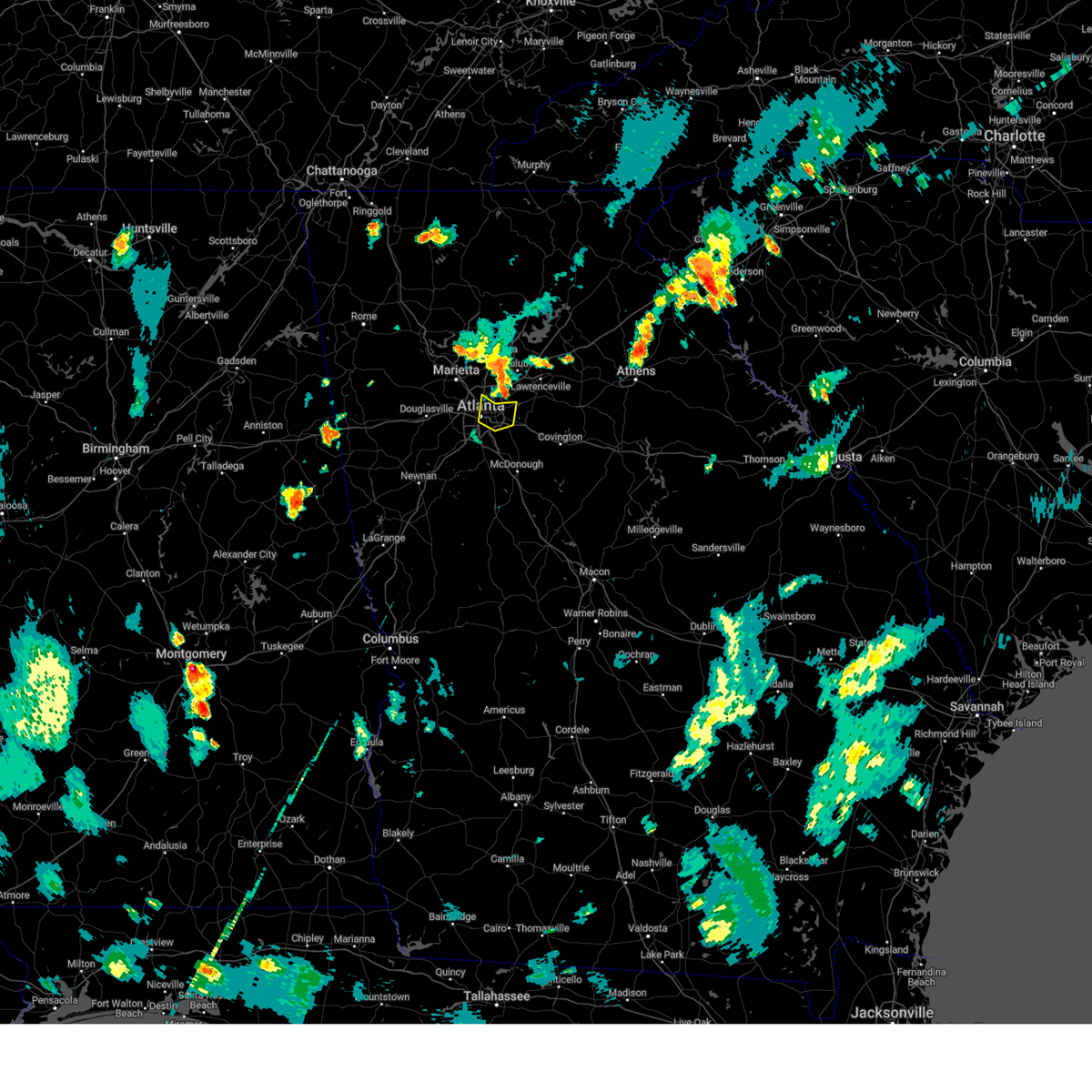 At 656 pm edt, a severe thunderstorm was located over clarkston, or near decatur, moving south at 20 mph (radar indicated). Hazards include 60 mph wind gusts. expect damage to roofs, siding, and trees At 656 pm edt, a severe thunderstorm was located over clarkston, or near decatur, moving south at 20 mph (radar indicated). Hazards include 60 mph wind gusts. expect damage to roofs, siding, and trees
|
| 7/28/2023 6:42 PM EDT |
 At 641 pm edt, a severe thunderstorm was located over mechanicsville, or near peachtree corners, and is nearly stationary (radar indicated). Hazards include 60 mph wind gusts. expect damage to roofs, siding, and trees At 641 pm edt, a severe thunderstorm was located over mechanicsville, or near peachtree corners, and is nearly stationary (radar indicated). Hazards include 60 mph wind gusts. expect damage to roofs, siding, and trees
|
| 7/21/2023 6:58 PM EDT | Corrects previous flash flood report from 1 w atlantic station. cars stalled from high waters along huff rd n in fulton county GA, 1.9 miles S of Atlanta, GA |
| 7/21/2023 6:29 PM EDT | Tree down at the intersection of briarcliff rd and old briarcliff r in dekalb county GA, 5.1 miles WSW of Atlanta, GA |
| 7/21/2023 6:26 PM EDT | A tree was reported down on a house near the intersection of burton dr ne and stephens dr n in dekalb county GA, 5.9 miles SW of Atlanta, GA |
| 7/21/2023 6:25 PM EDT | Large oak tree down near the intersection of mentelle dr ne and 7th st n in fulton county GA, 2.9 miles WSW of Atlanta, GA |
| 7/21/2023 6:19 PM EDT |
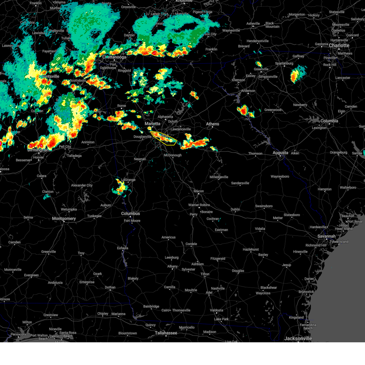 At 619 pm edt, severe thunderstorms were located along a line extending from smyrna to candler-mcafee, moving southeast at 20 mph (radar indicated). Hazards include 60 mph wind gusts and penny size hail. expect damage to roofs, siding, and trees At 619 pm edt, severe thunderstorms were located along a line extending from smyrna to candler-mcafee, moving southeast at 20 mph (radar indicated). Hazards include 60 mph wind gusts and penny size hail. expect damage to roofs, siding, and trees
|
| 7/21/2023 5:21 PM EDT |
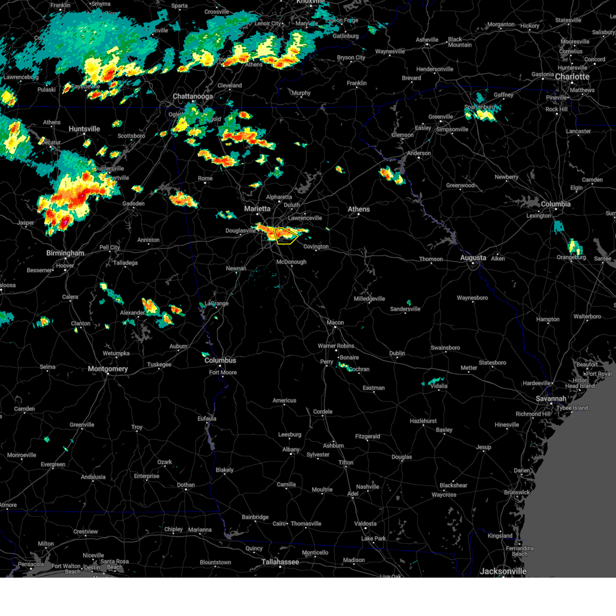 At 520 pm edt, a severe thunderstorm was located over decatur, moving southeast at 15 mph (radar indicated). Hazards include 60 mph wind gusts and penny size hail. expect damage to roofs, siding, and trees At 520 pm edt, a severe thunderstorm was located over decatur, moving southeast at 15 mph (radar indicated). Hazards include 60 mph wind gusts and penny size hail. expect damage to roofs, siding, and trees
|
| 7/20/2023 6:56 PM EDT |
 The severe thunderstorm warning for southern rockdale, southern dekalb, northern henry, south central fulton, northern clayton and central newton counties will expire at 700 pm edt, the storm which prompted the warning has weakened below severe limits, and has exited the warned area. therefore, the warning will be allowed to expire. however gusty winds and heavy rain are still possible with this thunderstorm. a severe thunderstorm watch remains in effect until 1000 pm edt for north central georgia. a severe thunderstorm watch also remains in effect until 100 am edt for north central georgia. The severe thunderstorm warning for southern rockdale, southern dekalb, northern henry, south central fulton, northern clayton and central newton counties will expire at 700 pm edt, the storm which prompted the warning has weakened below severe limits, and has exited the warned area. therefore, the warning will be allowed to expire. however gusty winds and heavy rain are still possible with this thunderstorm. a severe thunderstorm watch remains in effect until 1000 pm edt for north central georgia. a severe thunderstorm watch also remains in effect until 100 am edt for north central georgia.
|
| 7/20/2023 6:49 PM EDT |
 At 649 pm edt, a severe thunderstorm was located over redan, or 7 miles east of decatur, moving east at 50 mph (radar indicated). Hazards include 60 mph wind gusts and penny size hail. Expect damage to roofs, siding, and trees. locations impacted include, atlanta, mcdonough, decatur, conyers, covington, east point, stockbridge, forest park, college park, morrow, hapeville, lake city, oxford, porterdale, mansfield, hartsfield-jackson airport, midtown, grant park-zoo atlanta, candler-mcafee and belvedere park. hail threat, radar indicated max hail size, 0. 75 in wind threat, radar indicated max wind gust, 60 mph. At 649 pm edt, a severe thunderstorm was located over redan, or 7 miles east of decatur, moving east at 50 mph (radar indicated). Hazards include 60 mph wind gusts and penny size hail. Expect damage to roofs, siding, and trees. locations impacted include, atlanta, mcdonough, decatur, conyers, covington, east point, stockbridge, forest park, college park, morrow, hapeville, lake city, oxford, porterdale, mansfield, hartsfield-jackson airport, midtown, grant park-zoo atlanta, candler-mcafee and belvedere park. hail threat, radar indicated max hail size, 0. 75 in wind threat, radar indicated max wind gust, 60 mph.
|
| 7/20/2023 6:35 PM EDT |
 At 634 pm edt, a severe thunderstorm was located over la vista, or near atlanta, moving southeast at 50 mph (radar indicated). Hazards include 60 mph wind gusts and penny size hail. expect damage to roofs, siding, and trees At 634 pm edt, a severe thunderstorm was located over la vista, or near atlanta, moving southeast at 50 mph (radar indicated). Hazards include 60 mph wind gusts and penny size hail. expect damage to roofs, siding, and trees
|
| 7/20/2023 6:13 PM EDT |
 At 612 pm edt, severe thunderstorms were located along a line extending from near clermont to suwanee, moving southeast at 50 mph (radar indicated). Hazards include 70 mph wind gusts and penny size hail. Expect considerable tree damage. Damage is likely to mobile homes, roofs, and outbuildings. At 612 pm edt, severe thunderstorms were located along a line extending from near clermont to suwanee, moving southeast at 50 mph (radar indicated). Hazards include 70 mph wind gusts and penny size hail. Expect considerable tree damage. Damage is likely to mobile homes, roofs, and outbuildings.
|
| 7/20/2023 5:57 PM EDT |
 At 557 pm edt, severe thunderstorms were located along a line extending from duluth to chattoogaville, moving southeast at 50 mph (radar indicated). Hazards include 70 mph wind gusts and penny size hail. Expect considerable tree damage. Damage is likely to mobile homes, roofs, and outbuildings. At 557 pm edt, severe thunderstorms were located along a line extending from duluth to chattoogaville, moving southeast at 50 mph (radar indicated). Hazards include 70 mph wind gusts and penny size hail. Expect considerable tree damage. Damage is likely to mobile homes, roofs, and outbuildings.
|
| 7/2/2023 5:11 PM EDT | Trees down along monterey pkwy and cimarron pkw in fulton county GA, 13.9 miles S of Atlanta, GA |
| 7/2/2023 5:06 PM EDT |
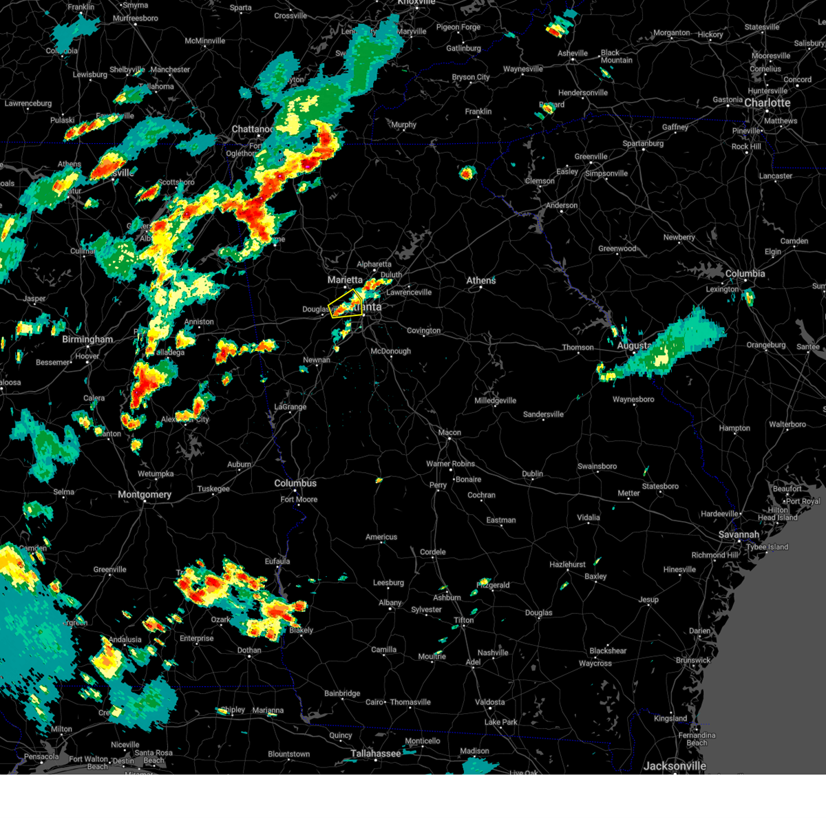 The severe thunderstorm warning for southern cobb, northeastern douglas and central fulton counties will expire at 515 pm edt, the storm which prompted the warning has weakened below severe limits, and no longer poses an immediate threat to life or property. therefore, the warning will be allowed to expire. however gusty winds are still possible with this thunderstorm. The severe thunderstorm warning for southern cobb, northeastern douglas and central fulton counties will expire at 515 pm edt, the storm which prompted the warning has weakened below severe limits, and no longer poses an immediate threat to life or property. therefore, the warning will be allowed to expire. however gusty winds are still possible with this thunderstorm.
|
| 7/2/2023 4:34 PM EDT |
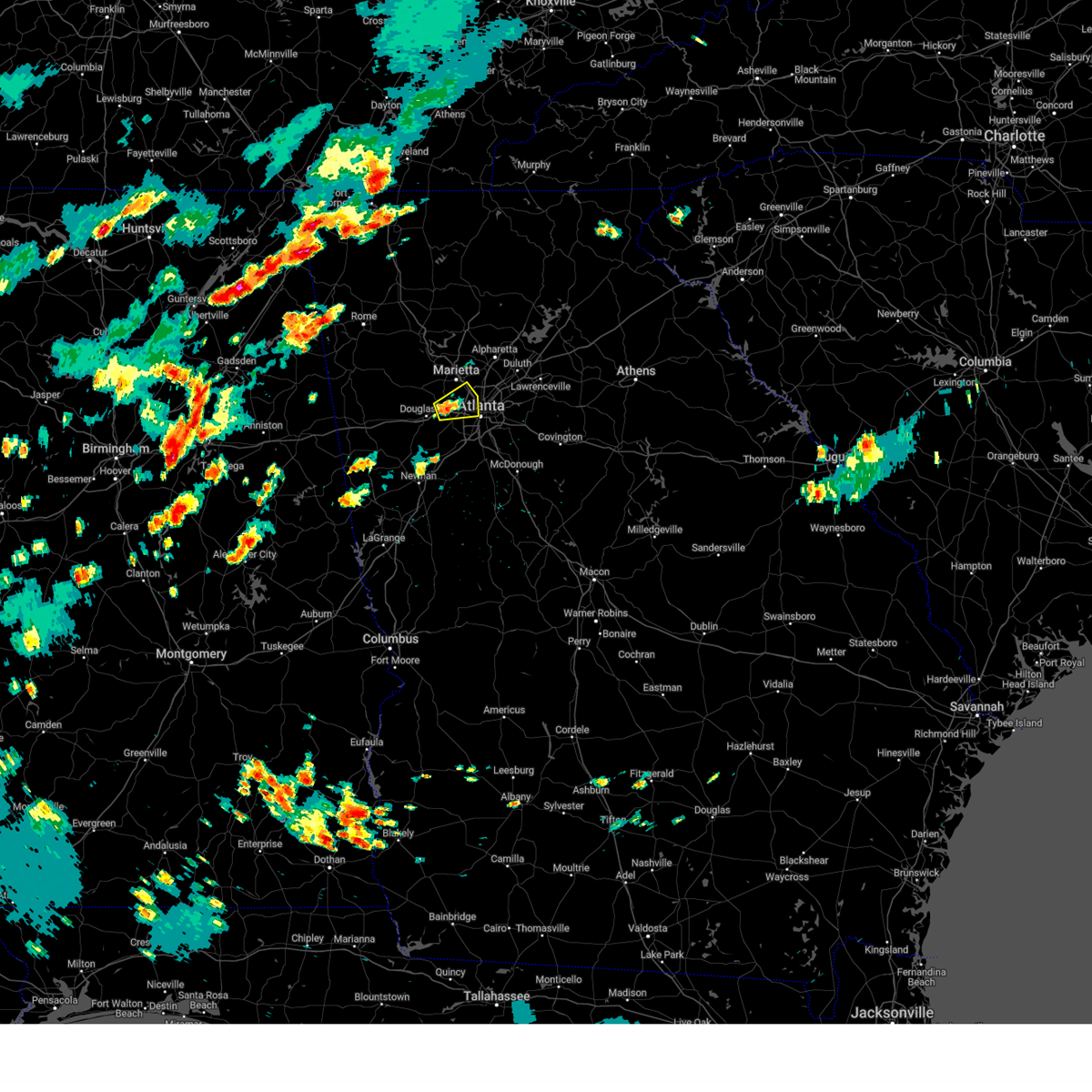 At 434 pm edt, a severe thunderstorm was located over mableton, or 8 miles west of atlanta, moving east at 10 mph (radar indicated). Hazards include 60 mph wind gusts and penny size hail. expect damage to roofs, siding, and trees At 434 pm edt, a severe thunderstorm was located over mableton, or 8 miles west of atlanta, moving east at 10 mph (radar indicated). Hazards include 60 mph wind gusts and penny size hail. expect damage to roofs, siding, and trees
|
| 6/25/2023 6:56 PM EDT |
 At 655 pm edt, a severe thunderstorm was located over the area (radar indicated). Hazards include 60 mph wind gusts. expect damage to roofs, siding, and trees At 655 pm edt, a severe thunderstorm was located over the area (radar indicated). Hazards include 60 mph wind gusts. expect damage to roofs, siding, and trees
|
| 6/25/2023 6:24 PM EDT | *** 1 fatal *** tree fell on individual outdoor in fulton county GA, 5.1 miles SSW of Atlanta, GA |
| 6/25/2023 6:24 PM EDT |
 At 623 pm edt, severe thunderstorms were located along a line extending from near lilburn to hiram to winston to near arnco-sargent, moving southeast at 45 mph (radar indicated). Hazards include 60 mph wind gusts and penny size hail. Expect damage to roofs, siding, and trees. locations impacted include, atlanta, marietta, douglasville, lawrenceville, decatur, fayetteville, conyers, covington, dallas, jonesboro, peachtree corners, city of south fulton, sandy springs, roswell, smyrna, dunwoody, east point, kennesaw, duluth and stockbridge. hail threat, radar indicated max hail size, 0. 75 in wind threat, radar indicated max wind gust, 60 mph. At 623 pm edt, severe thunderstorms were located along a line extending from near lilburn to hiram to winston to near arnco-sargent, moving southeast at 45 mph (radar indicated). Hazards include 60 mph wind gusts and penny size hail. Expect damage to roofs, siding, and trees. locations impacted include, atlanta, marietta, douglasville, lawrenceville, decatur, fayetteville, conyers, covington, dallas, jonesboro, peachtree corners, city of south fulton, sandy springs, roswell, smyrna, dunwoody, east point, kennesaw, duluth and stockbridge. hail threat, radar indicated max hail size, 0. 75 in wind threat, radar indicated max wind gust, 60 mph.
|
| 6/25/2023 6:20 PM EDT | Large oak tree fell at pennington pl se and lomita rd s in dekalb county GA, 5.7 miles WNW of Atlanta, GA |
| 6/25/2023 6:00 PM EDT |
 At 600 pm edt, severe thunderstorms were located along a line extending from near alpharetta to near taylorsville to near yorkville to near clem, moving southeast at 45 mph (radar indicated). Hazards include 60 mph wind gusts and penny size hail. expect damage to roofs, siding, and trees At 600 pm edt, severe thunderstorms were located along a line extending from near alpharetta to near taylorsville to near yorkville to near clem, moving southeast at 45 mph (radar indicated). Hazards include 60 mph wind gusts and penny size hail. expect damage to roofs, siding, and trees
|
| 6/25/2023 5:43 PM EDT |
 At 543 pm edt, severe thunderstorms were located along a line extending from banks crossing to milton, moving southeast at 45 mph (radar indicated). Hazards include 60 mph wind gusts and penny size hail. expect damage to roofs, siding, and trees At 543 pm edt, severe thunderstorms were located along a line extending from banks crossing to milton, moving southeast at 45 mph (radar indicated). Hazards include 60 mph wind gusts and penny size hail. expect damage to roofs, siding, and trees
|
| 5/16/2023 5:41 PM EDT |
 At 540 pm edt, a severe thunderstorm was located over brownsville, or near douglasville, moving east at 15 mph (radar indicated). Hazards include 60 mph wind gusts and quarter size hail. Hail damage to vehicles is expected. expect wind damage to roofs, siding, and trees. locations impacted include, atlanta, douglasville, city of south fulton, smyrna, powder springs, austell, lithia springs, sweetwater creek state park, brownsville, chapel hill, six flags over georgia, campbellton, sandtown and mableton. hail threat, radar indicated max hail size, 1. 00 in wind threat, radar indicated max wind gust, 60 mph. At 540 pm edt, a severe thunderstorm was located over brownsville, or near douglasville, moving east at 15 mph (radar indicated). Hazards include 60 mph wind gusts and quarter size hail. Hail damage to vehicles is expected. expect wind damage to roofs, siding, and trees. locations impacted include, atlanta, douglasville, city of south fulton, smyrna, powder springs, austell, lithia springs, sweetwater creek state park, brownsville, chapel hill, six flags over georgia, campbellton, sandtown and mableton. hail threat, radar indicated max hail size, 1. 00 in wind threat, radar indicated max wind gust, 60 mph.
|
| 5/16/2023 5:26 PM EDT |
 At 526 pm edt, a severe thunderstorm was located over brownsville, or near douglasville, moving east at 15 mph (radar indicated). Hazards include 60 mph wind gusts and quarter size hail. Hail damage to vehicles is expected. Expect wind damage to roofs, siding, and trees. At 526 pm edt, a severe thunderstorm was located over brownsville, or near douglasville, moving east at 15 mph (radar indicated). Hazards include 60 mph wind gusts and quarter size hail. Hail damage to vehicles is expected. Expect wind damage to roofs, siding, and trees.
|
| 3/26/2023 11:58 PM EDT |
 At 1158 pm edt, a severe thunderstorm was located over lake spivey, or over jonesboro, moving northeast at 50 mph (radar indicated). Hazards include 60 mph wind gusts. Expect damage to roofs, siding, and trees. locations impacted include, jonesboro, stockbridge, forest park, riverdale, hampton, morrow, lovejoy, lake city, lake spivey, rex, fort gillem, bonanza, atlanta motor speedway, jw smith reservoir, conley, eagles landing and irondale. hail threat, radar indicated max hail size, <. 75 in wind threat, radar indicated max wind gust, 60 mph. At 1158 pm edt, a severe thunderstorm was located over lake spivey, or over jonesboro, moving northeast at 50 mph (radar indicated). Hazards include 60 mph wind gusts. Expect damage to roofs, siding, and trees. locations impacted include, jonesboro, stockbridge, forest park, riverdale, hampton, morrow, lovejoy, lake city, lake spivey, rex, fort gillem, bonanza, atlanta motor speedway, jw smith reservoir, conley, eagles landing and irondale. hail threat, radar indicated max hail size, <. 75 in wind threat, radar indicated max wind gust, 60 mph.
|
| 3/26/2023 11:43 PM EDT |
 At 1143 pm edt, a severe thunderstorm was located near fayetteville, moving northeast at 50 mph (radar indicated). Hazards include 60 mph wind gusts. Expect damage to roofs, siding, and trees. locations impacted include, fayetteville, jonesboro, peachtree city, stockbridge, forest park, riverdale, hampton, tyrone, morrow, lovejoy, lake city, woolsey, lake spivey, rex, starrs mill, inman, fort gillem, bonanza, atlanta motor speedway and jw smith reservoir. hail threat, radar indicated max hail size, <. 75 in wind threat, radar indicated max wind gust, 60 mph. At 1143 pm edt, a severe thunderstorm was located near fayetteville, moving northeast at 50 mph (radar indicated). Hazards include 60 mph wind gusts. Expect damage to roofs, siding, and trees. locations impacted include, fayetteville, jonesboro, peachtree city, stockbridge, forest park, riverdale, hampton, tyrone, morrow, lovejoy, lake city, woolsey, lake spivey, rex, starrs mill, inman, fort gillem, bonanza, atlanta motor speedway and jw smith reservoir. hail threat, radar indicated max hail size, <. 75 in wind threat, radar indicated max wind gust, 60 mph.
|
| 3/26/2023 11:27 PM EDT |
 At 1127 pm edt, a severe thunderstorm was located near sharpsburg, or near newnan, moving northeast at 50 mph (radar indicated). Hazards include 60 mph wind gusts. expect damage to roofs, siding, and trees At 1127 pm edt, a severe thunderstorm was located near sharpsburg, or near newnan, moving northeast at 50 mph (radar indicated). Hazards include 60 mph wind gusts. expect damage to roofs, siding, and trees
|
| 3/26/2023 9:55 PM EDT |
 At 955 pm edt, severe thunderstorms were located along a line extending from brookhaven to tucker to redan, moving northeast at 35 mph (radar indicated). Hazards include 60 mph wind gusts and quarter size hail. Hail damage to vehicles is expected. Expect wind damage to roofs, siding, and trees. At 955 pm edt, severe thunderstorms were located along a line extending from brookhaven to tucker to redan, moving northeast at 35 mph (radar indicated). Hazards include 60 mph wind gusts and quarter size hail. Hail damage to vehicles is expected. Expect wind damage to roofs, siding, and trees.
|
| 3/26/2023 9:47 PM EDT |
 At 947 pm edt, a severe thunderstorm was located over little five points, or near decatur, moving northeast at 25 mph (radar indicated). Hazards include ping pong ball size hail and 60 mph wind gusts. People and animals outdoors will be injured. expect hail damage to roofs, siding, windows, and vehicles. expect wind damage to roofs, siding, and trees. locations impacted include, atlanta, decatur, city of south fulton, east point, chamblee, clarkston, avondale estates, pine lake, belvedere park, north decatur, north atlanta, north druid hills, midtown, grant park-zoo atlanta, candler-mcafee, druid hills, tucker, belmont, sweet auburn and piedmont park. hail threat, radar indicated max hail size, 1. 50 in wind threat, radar indicated max wind gust, 60 mph. At 947 pm edt, a severe thunderstorm was located over little five points, or near decatur, moving northeast at 25 mph (radar indicated). Hazards include ping pong ball size hail and 60 mph wind gusts. People and animals outdoors will be injured. expect hail damage to roofs, siding, windows, and vehicles. expect wind damage to roofs, siding, and trees. locations impacted include, atlanta, decatur, city of south fulton, east point, chamblee, clarkston, avondale estates, pine lake, belvedere park, north decatur, north atlanta, north druid hills, midtown, grant park-zoo atlanta, candler-mcafee, druid hills, tucker, belmont, sweet auburn and piedmont park. hail threat, radar indicated max hail size, 1. 50 in wind threat, radar indicated max wind gust, 60 mph.
|
| 3/26/2023 9:45 PM EDT | Quarter sized hail reported 1.3 miles SSW of Atlanta, GA, 1 inch hail reported at ga tech. |
| 3/26/2023 9:45 PM EDT | Golf Ball sized hail reported 0.9 miles W of Atlanta, GA, 1.75 hail near mercedes benz stadium. |
| 3/26/2023 9:40 PM EDT | Quarter sized hail reported 3 miles WNW of Atlanta, GA, 1 inch hail reported at grant park. |
| 3/26/2023 9:40 PM EDT | Golf Ball sized hail reported 2.2 miles N of Atlanta, GA, 1.75 hail reported at lee and white complex. |
| 3/26/2023 9:37 PM EDT | Golf Ball sized hail reported 6.7 miles NNE of Atlanta, GA, 1.75 hail reported at e point st and vesta ave. |
| 3/26/2023 9:35 PM EDT | Golf Ball sized hail reported 3.2 miles NNE of Atlanta, GA, 1.75 hail at lockhaven cir sw and wichita dr sw. |
| 3/26/2023 9:31 PM EDT |
 At 930 pm edt, a severe thunderstorm was located over east point, or near atlanta, moving northeast at 25 mph (radar indicated). Hazards include golf ball size hail and 60 mph wind gusts. People and animals outdoors will be injured. expect hail damage to roofs, siding, windows, and vehicles. Expect wind damage to roofs, siding, and trees. At 930 pm edt, a severe thunderstorm was located over east point, or near atlanta, moving northeast at 25 mph (radar indicated). Hazards include golf ball size hail and 60 mph wind gusts. People and animals outdoors will be injured. expect hail damage to roofs, siding, windows, and vehicles. Expect wind damage to roofs, siding, and trees.
|
| 3/26/2023 9:28 PM EDT | Golf Ball sized hail reported 2.9 miles N of Atlanta, GA, 1.75 hail reported at dill ave sw and sylvan rd sw. |
| 3/26/2023 9:25 PM EDT | Multiple trees down on camp creek pkw in fulton county GA, 8.9 miles NNE of Atlanta, GA |
| 3/26/2023 9:25 PM EDT | Tree down on car on stone r in fulton county GA, 7.4 miles NNE of Atlanta, GA |
| 3/26/2023 9:21 PM EDT |
 At 921 pm edt, a severe thunderstorm was located over union city, or 8 miles southeast of city of south fulton, moving northeast at 40 mph (radar indicated). Hazards include tennis ball size hail and 60 mph wind gusts. People and animals outdoors will be injured. expect hail damage to roofs, siding, windows, and vehicles. expect wind damage to roofs, siding, and trees. locations impacted include, atlanta, jonesboro, city of south fulton, east point, union city, forest park, riverdale, college park, fairburn, tyrone, morrow, hapeville, palmetto, lake city, hartsfield-jackson airport, cascade heights, lakewood park, sandy creek, conley and sandtown. thunderstorm damage threat, considerable hail threat, observed max hail size, 2. 50 in wind threat, radar indicated max wind gust, 60 mph. At 921 pm edt, a severe thunderstorm was located over union city, or 8 miles southeast of city of south fulton, moving northeast at 40 mph (radar indicated). Hazards include tennis ball size hail and 60 mph wind gusts. People and animals outdoors will be injured. expect hail damage to roofs, siding, windows, and vehicles. expect wind damage to roofs, siding, and trees. locations impacted include, atlanta, jonesboro, city of south fulton, east point, union city, forest park, riverdale, college park, fairburn, tyrone, morrow, hapeville, palmetto, lake city, hartsfield-jackson airport, cascade heights, lakewood park, sandy creek, conley and sandtown. thunderstorm damage threat, considerable hail threat, observed max hail size, 2. 50 in wind threat, radar indicated max wind gust, 60 mph.
|
| 3/26/2023 9:10 PM EDT |
 At 910 pm edt, a severe thunderstorm was located over palmetto, or 9 miles south of city of south fulton, moving northeast at 35 mph (radar indicated). Hazards include golf ball size hail and 60 mph wind gusts. People and animals outdoors will be injured. expect hail damage to roofs, siding, windows, and vehicles. expect wind damage to roofs, siding, and trees. locations impacted include, atlanta, newnan, fayetteville, jonesboro, city of south fulton, peachtree city, east point, union city, forest park, riverdale, college park, fairburn, tyrone, morrow, hapeville, palmetto, lake city, chattahoochee hills, hartsfield-jackson airport and cascade heights. thunderstorm damage threat, considerable hail threat, observed max hail size, 1. 75 in wind threat, radar indicated max wind gust, 60 mph. At 910 pm edt, a severe thunderstorm was located over palmetto, or 9 miles south of city of south fulton, moving northeast at 35 mph (radar indicated). Hazards include golf ball size hail and 60 mph wind gusts. People and animals outdoors will be injured. expect hail damage to roofs, siding, windows, and vehicles. expect wind damage to roofs, siding, and trees. locations impacted include, atlanta, newnan, fayetteville, jonesboro, city of south fulton, peachtree city, east point, union city, forest park, riverdale, college park, fairburn, tyrone, morrow, hapeville, palmetto, lake city, chattahoochee hills, hartsfield-jackson airport and cascade heights. thunderstorm damage threat, considerable hail threat, observed max hail size, 1. 75 in wind threat, radar indicated max wind gust, 60 mph.
|
| 3/26/2023 9:03 PM EDT |
 At 903 pm edt, a severe thunderstorm was located over cannongate, or 9 miles northeast of newnan, moving northeast at 35 mph (radar indicated). Hazards include 60 mph wind gusts and quarter size hail. Hail damage to vehicles is expected. Expect wind damage to roofs, siding, and trees. At 903 pm edt, a severe thunderstorm was located over cannongate, or 9 miles northeast of newnan, moving northeast at 35 mph (radar indicated). Hazards include 60 mph wind gusts and quarter size hail. Hail damage to vehicles is expected. Expect wind damage to roofs, siding, and trees.
|
| 3/3/2023 4:31 PM EST |
 At 431 pm est, severe thunderstorms were located along a line extending from kennesaw to abilene, moving east at 40 mph (radar indicated). Hazards include 60 mph wind gusts. expect damage to roofs, siding, and trees At 431 pm est, severe thunderstorms were located along a line extending from kennesaw to abilene, moving east at 40 mph (radar indicated). Hazards include 60 mph wind gusts. expect damage to roofs, siding, and trees
|
| 1/12/2023 3:53 PM EST | Pdk recorded a wind gust of 60mp in dekalb county GA, 10.5 miles SW of Atlanta, GA |
| 1/12/2023 3:49 PM EST |
 At 348 pm est, severe thunderstorms were located along a line extending from near chattahoochee hills to near grantville, moving northeast at 80 mph (radar indicated). Hazards include 60 mph wind gusts and quarter size hail. Hail damage to vehicles is expected. Expect wind damage to roofs, siding, and trees. At 348 pm est, severe thunderstorms were located along a line extending from near chattahoochee hills to near grantville, moving northeast at 80 mph (radar indicated). Hazards include 60 mph wind gusts and quarter size hail. Hail damage to vehicles is expected. Expect wind damage to roofs, siding, and trees.
|
| 1/12/2023 3:46 PM EST |
 At 346 pm est, a tornado producing storm was located over east point, or 7 miles southwest of atlanta, moving east at 45 mph (radar confirmed tornado). Hazards include damaging tornado. Flying debris will be dangerous to those caught without shelter. mobile homes will be damaged or destroyed. damage to roofs, windows, and vehicles will occur. Tree damage is likely. At 346 pm est, a tornado producing storm was located over east point, or 7 miles southwest of atlanta, moving east at 45 mph (radar confirmed tornado). Hazards include damaging tornado. Flying debris will be dangerous to those caught without shelter. mobile homes will be damaged or destroyed. damage to roofs, windows, and vehicles will occur. Tree damage is likely.
|
| 1/12/2023 3:31 PM EST |
 At 331 pm est, severe thunderstorms were located along a line extending from sandy plains to near mableton to chattahoochee hills, moving northeast at 55 mph (radar indicated). Hazards include 60 mph wind gusts. expect damage to roofs, siding, and trees At 331 pm est, severe thunderstorms were located along a line extending from sandy plains to near mableton to chattahoochee hills, moving northeast at 55 mph (radar indicated). Hazards include 60 mph wind gusts. expect damage to roofs, siding, and trees
|
| 1/4/2023 5:48 AM EST |
 At 548 am est, severe thunderstorms were located along a line extending from cascade heights to near gresham park to near irondale to vaughn to near hilltop, moving northeast at 60 mph (radar indicated). Hazards include 60 mph wind gusts. Expect damage to roofs, siding, and trees. Locations impacted include, atlanta, griffin, mcdonough, decatur, jonesboro, east point, stockbridge, forest park, college park, clarkston, hampton, morrow, lovejoy, hapeville, stone mountain, locust grove, avondale estates, lake city, lithonia and pine lake. At 548 am est, severe thunderstorms were located along a line extending from cascade heights to near gresham park to near irondale to vaughn to near hilltop, moving northeast at 60 mph (radar indicated). Hazards include 60 mph wind gusts. Expect damage to roofs, siding, and trees. Locations impacted include, atlanta, griffin, mcdonough, decatur, jonesboro, east point, stockbridge, forest park, college park, clarkston, hampton, morrow, lovejoy, hapeville, stone mountain, locust grove, avondale estates, lake city, lithonia and pine lake.
|
| 1/4/2023 5:37 AM EST |
 At 536 am est, severe thunderstorms were located along a line extending from near campbellton to near union city to near fayetteville to near haralson to near greenville, moving northeast at 60 mph (radar indicated). Hazards include 60 mph wind gusts. expect damage to roofs, siding, and trees At 536 am est, severe thunderstorms were located along a line extending from near campbellton to near union city to near fayetteville to near haralson to near greenville, moving northeast at 60 mph (radar indicated). Hazards include 60 mph wind gusts. expect damage to roofs, siding, and trees
|
| 1/3/2023 6:03 PM EST |
 At 603 pm est, severe thunderstorms were located along a line extending from bolton to atlanta to lakewood park to conley to riverdale, moving east at 50 mph (radar indicated). Hazards include 60 mph wind gusts. Expect damage to roofs, siding, and trees. Locations impacted include, atlanta, city of south fulton, smyrna, east point, forest park, riverdale, college park, morrow, hapeville, lake city, hartsfield-jackson airport, midtown, grant park-zoo atlanta, druid hills, candler-mcafee, sweet auburn, piedmont park, cascade heights, lakewood park and conley. At 603 pm est, severe thunderstorms were located along a line extending from bolton to atlanta to lakewood park to conley to riverdale, moving east at 50 mph (radar indicated). Hazards include 60 mph wind gusts. Expect damage to roofs, siding, and trees. Locations impacted include, atlanta, city of south fulton, smyrna, east point, forest park, riverdale, college park, morrow, hapeville, lake city, hartsfield-jackson airport, midtown, grant park-zoo atlanta, druid hills, candler-mcafee, sweet auburn, piedmont park, cascade heights, lakewood park and conley.
|
| 1/3/2023 5:51 PM EST |
 At 550 pm est, severe thunderstorms were located along a line extending from lithia springs to sweetwater creek state park to city of south fulton to union city to near sandy creek, moving east at 40 mph (radar indicated). Hazards include 60 mph wind gusts. Expect damage to roofs, siding, and trees. Locations impacted include, atlanta, douglasville, city of south fulton, smyrna, east point, union city, forest park, riverdale, college park, powder springs, fairburn, austell, morrow, hapeville, lake city, lithia springs, hartsfield-jackson airport, midtown, grant park-zoo atlanta and druid hills. At 550 pm est, severe thunderstorms were located along a line extending from lithia springs to sweetwater creek state park to city of south fulton to union city to near sandy creek, moving east at 40 mph (radar indicated). Hazards include 60 mph wind gusts. Expect damage to roofs, siding, and trees. Locations impacted include, atlanta, douglasville, city of south fulton, smyrna, east point, union city, forest park, riverdale, college park, powder springs, fairburn, austell, morrow, hapeville, lake city, lithia springs, hartsfield-jackson airport, midtown, grant park-zoo atlanta and druid hills.
|
| 1/3/2023 5:39 PM EST |
 At 539 pm est, severe thunderstorms were located along a line extending from near winston to chapel hill to campbellton to near palmetto to near cannongate, moving east at 45 mph (radar indicated). Hazards include 60 mph wind gusts. expect damage to roofs, siding, and trees At 539 pm est, severe thunderstorms were located along a line extending from near winston to chapel hill to campbellton to near palmetto to near cannongate, moving east at 45 mph (radar indicated). Hazards include 60 mph wind gusts. expect damage to roofs, siding, and trees
|
| 8/5/2022 6:38 PM EDT |
 The severe thunderstorm warning for southern cherokee, southwestern forsyth, northeastern cobb and northeastern fulton counties will expire at 645 pm edt, the storm which prompted the warning has weakened below severe limits, and no longer poses an immediate threat to life or property. therefore, the warning will be allowed to expire. however small hail, gusty winds and heavy rain are still possible with this thunderstorm. The severe thunderstorm warning for southern cherokee, southwestern forsyth, northeastern cobb and northeastern fulton counties will expire at 645 pm edt, the storm which prompted the warning has weakened below severe limits, and no longer poses an immediate threat to life or property. therefore, the warning will be allowed to expire. however small hail, gusty winds and heavy rain are still possible with this thunderstorm.
|
| 8/5/2022 6:12 PM EDT |
 At 612 pm edt, a severe thunderstorm was located over sweat mountain, or over mountain park, moving north at 30 mph (radar indicated). Hazards include ping pong ball size hail. People and animals outdoors will be injured. Expect damage to roofs, siding, windows, and vehicles. At 612 pm edt, a severe thunderstorm was located over sweat mountain, or over mountain park, moving north at 30 mph (radar indicated). Hazards include ping pong ball size hail. People and animals outdoors will be injured. Expect damage to roofs, siding, windows, and vehicles.
|
| 7/29/2022 5:40 PM EDT |
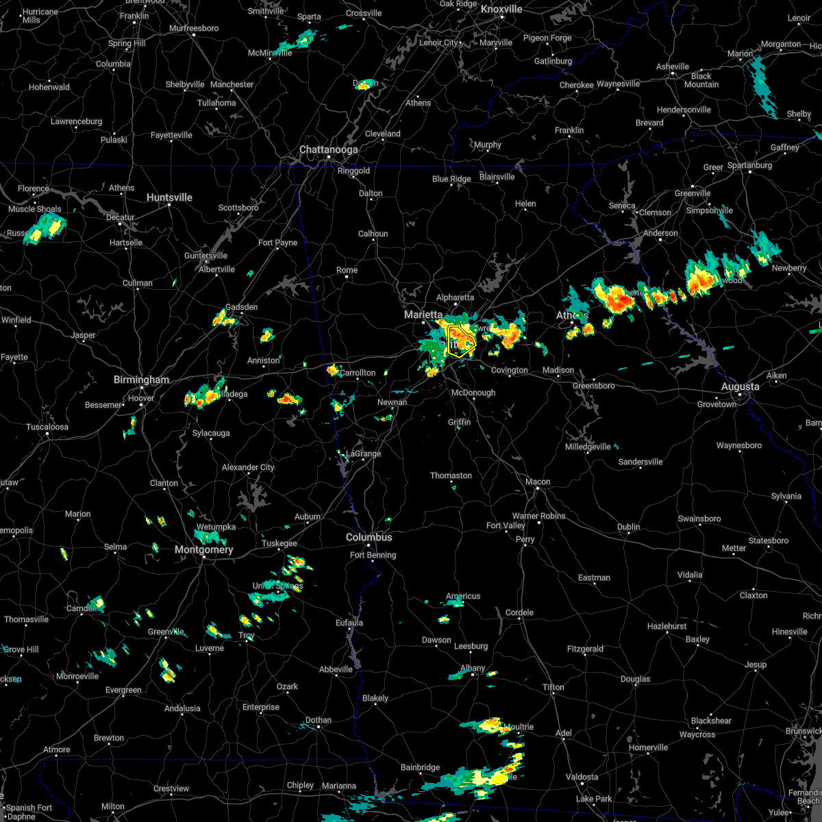 The severe thunderstorm warning for northwestern dekalb county will expire at 545 pm edt, the storm which prompted the warning has weakened below severe limits, and no longer poses an immediate threat to life or property. therefore, the warning will be allowed to expire. to report severe weather, contact your nearest law enforcement agency. they will relay your report to the national weather service peachtree city. The severe thunderstorm warning for northwestern dekalb county will expire at 545 pm edt, the storm which prompted the warning has weakened below severe limits, and no longer poses an immediate threat to life or property. therefore, the warning will be allowed to expire. to report severe weather, contact your nearest law enforcement agency. they will relay your report to the national weather service peachtree city.
|
| 7/29/2022 5:34 PM EDT |
 At 533 pm edt, a severe thunderstorm was located over clarkston, or near decatur, moving east at 20 mph (radar indicated). Hazards include 60 mph wind gusts and quarter size hail. Hail damage to vehicles is expected. expect wind damage to roofs, siding, and trees. locations impacted include, atlanta, decatur, dunwoody, chamblee, doraville, clarkston, stone mountain, avondale estates, pine lake, tucker, belvedere park, north decatur, north atlanta, north druid hills, candler-mcafee, druid hills, mountain park, scottdale, kirkwood and brookhaven. hail threat, radar indicated max hail size, 1. 00 in wind threat, radar indicated max wind gust, 60 mph. At 533 pm edt, a severe thunderstorm was located over clarkston, or near decatur, moving east at 20 mph (radar indicated). Hazards include 60 mph wind gusts and quarter size hail. Hail damage to vehicles is expected. expect wind damage to roofs, siding, and trees. locations impacted include, atlanta, decatur, dunwoody, chamblee, doraville, clarkston, stone mountain, avondale estates, pine lake, tucker, belvedere park, north decatur, north atlanta, north druid hills, candler-mcafee, druid hills, mountain park, scottdale, kirkwood and brookhaven. hail threat, radar indicated max hail size, 1. 00 in wind threat, radar indicated max wind gust, 60 mph.
|
| 7/29/2022 5:11 PM EDT |
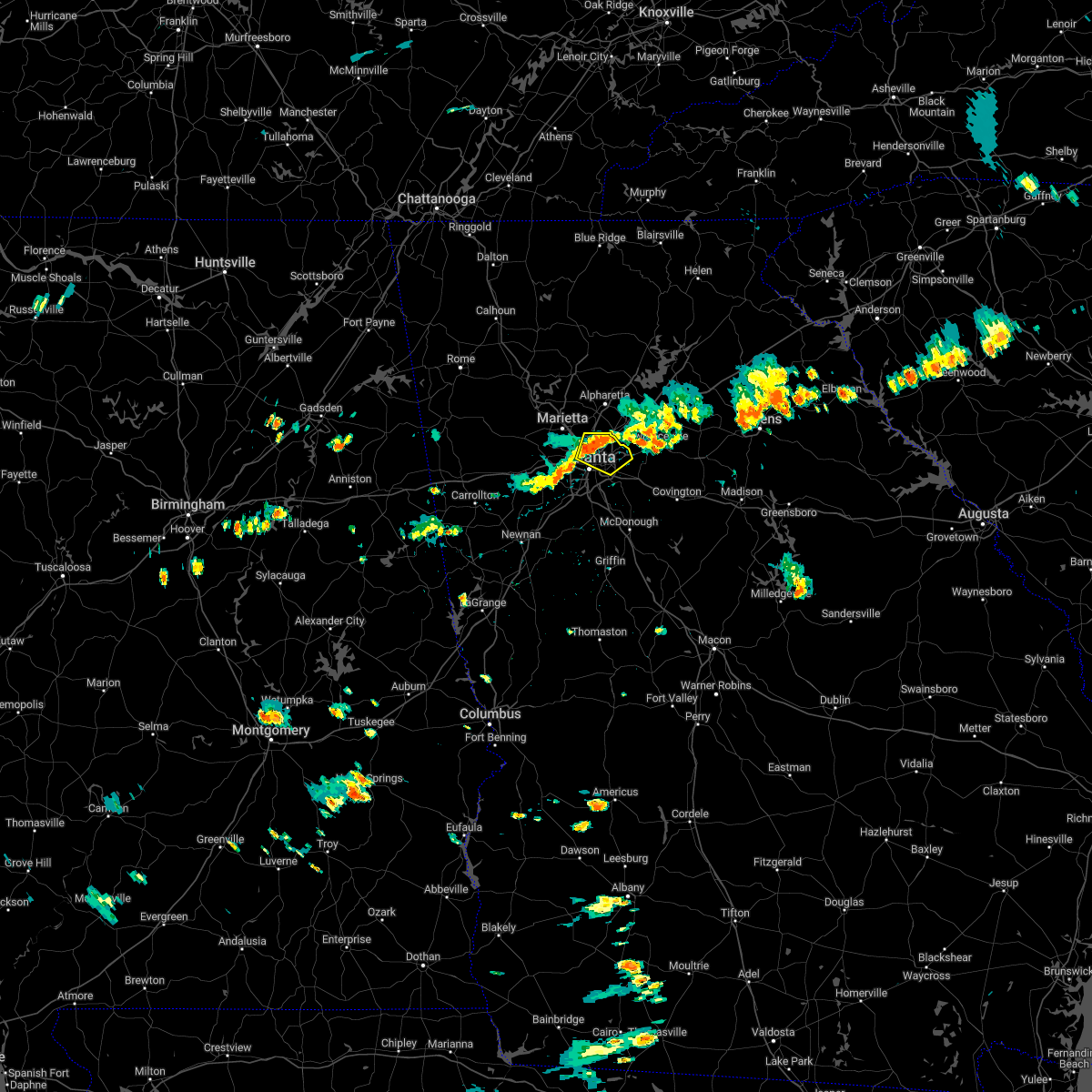 At 511 pm edt, a severe thunderstorm was located over brookhaven, or near decatur, moving east at 20 mph (radar indicated). Hazards include 60 mph wind gusts and quarter size hail. Hail damage to vehicles is expected. Expect wind damage to roofs, siding, and trees. At 511 pm edt, a severe thunderstorm was located over brookhaven, or near decatur, moving east at 20 mph (radar indicated). Hazards include 60 mph wind gusts and quarter size hail. Hail damage to vehicles is expected. Expect wind damage to roofs, siding, and trees.
|
| 7/21/2022 9:56 AM EDT | Trees and powerlines down near intersection of buford hwy ne and laventure d in dekalb county GA, 10.9 miles SW of Atlanta, GA |
| 7/19/2022 4:56 PM EDT | Tree down on house on drewery st n in fulton county GA, 3.4 miles WSW of Atlanta, GA |
| 7/19/2022 4:44 PM EDT | Tree down on house at intersection of lavender dr nw and chappell rd n in fulton county GA, 0.9 miles E of Atlanta, GA |
| 7/19/2022 4:12 PM EDT |
 At 411 pm edt, severe thunderstorms were located along a line extending from near new hope to near douglasville to near fairplay, moving east at 20 mph (radar indicated). Hazards include 60 mph wind gusts and penny size hail. expect damage to roofs, siding, and trees At 411 pm edt, severe thunderstorms were located along a line extending from near new hope to near douglasville to near fairplay, moving east at 20 mph (radar indicated). Hazards include 60 mph wind gusts and penny size hail. expect damage to roofs, siding, and trees
|
| 7/19/2022 8:57 AM EDT | *** 1 inj *** tree down on car at eleanor terrace nw and eleanor ct nw in fulton county GA, 3.9 miles ESE of Atlanta, GA |
| 7/8/2022 10:04 PM EDT |
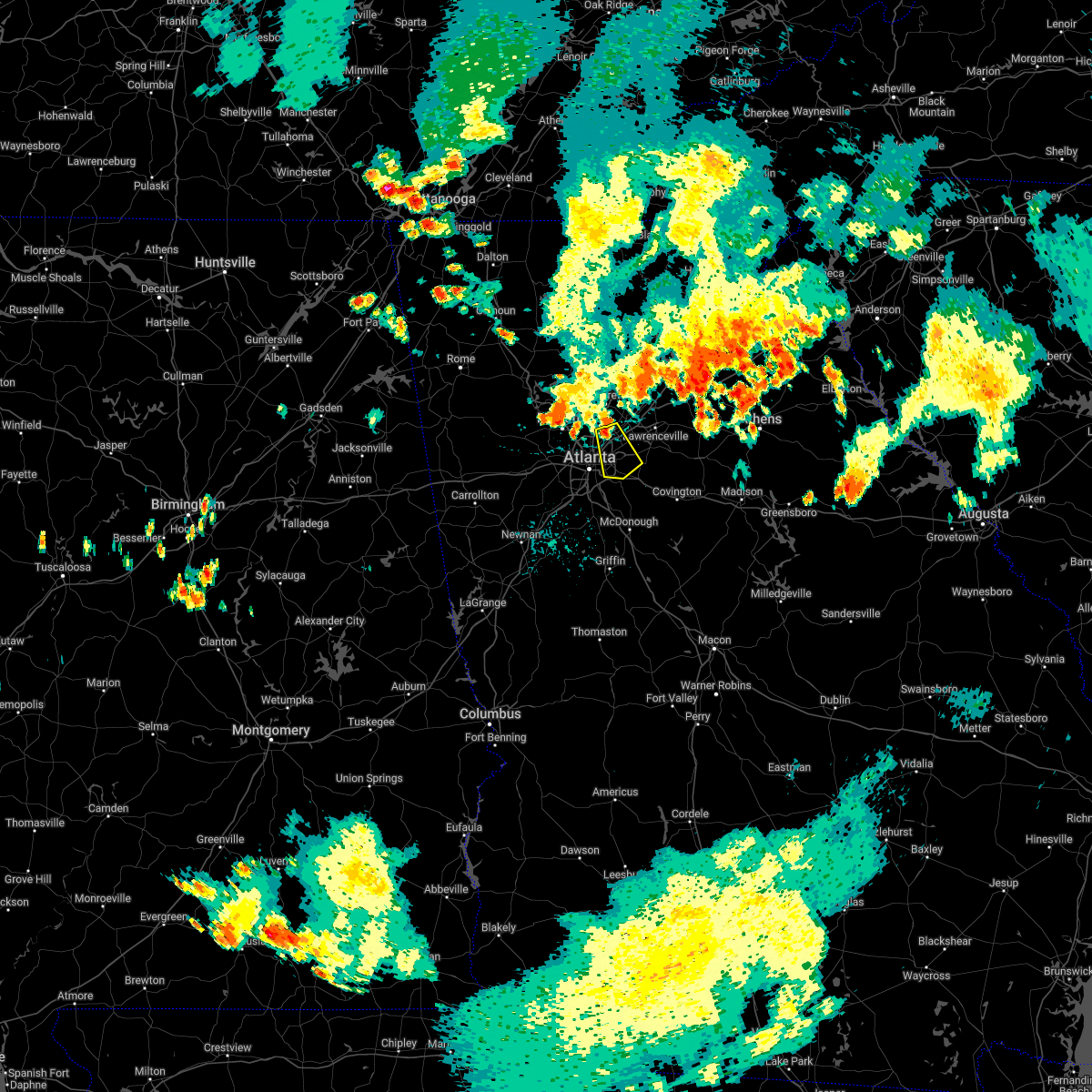 At 1004 pm edt, a severe thunderstorm was located over doraville, or 8 miles north of decatur, moving southeast at 20 mph (radar indicated). Hazards include 60 mph wind gusts and quarter size hail. Hail damage to vehicles is expected. Expect wind damage to roofs, siding, and trees. At 1004 pm edt, a severe thunderstorm was located over doraville, or 8 miles north of decatur, moving southeast at 20 mph (radar indicated). Hazards include 60 mph wind gusts and quarter size hail. Hail damage to vehicles is expected. Expect wind damage to roofs, siding, and trees.
|
| 7/3/2022 4:20 PM EDT |
 At 420 pm edt, a severe thunderstorm was located over jonesboro, moving southeast at 10 mph (radar indicated). Hazards include 60 mph wind gusts and quarter size hail. Hail damage to vehicles is expected. Expect wind damage to roofs, siding, and trees. At 420 pm edt, a severe thunderstorm was located over jonesboro, moving southeast at 10 mph (radar indicated). Hazards include 60 mph wind gusts and quarter size hail. Hail damage to vehicles is expected. Expect wind damage to roofs, siding, and trees.
|
| 6/27/2022 4:05 PM EDT |
 At 405 pm edt, a severe thunderstorm was located over gresham park, or near atlanta, moving southeast at 20 mph (radar indicated). Hazards include 60 mph wind gusts and quarter size hail. Hail damage to vehicles is expected. Expect wind damage to roofs, siding, and trees. At 405 pm edt, a severe thunderstorm was located over gresham park, or near atlanta, moving southeast at 20 mph (radar indicated). Hazards include 60 mph wind gusts and quarter size hail. Hail damage to vehicles is expected. Expect wind damage to roofs, siding, and trees.
|
| 6/25/2022 12:03 AM EDT |
 At 1202 am edt, a severe thunderstorm was located over bankhead, or near atlanta, and is nearly stationary (radar indicated). Hazards include 60 mph wind gusts and penny size hail. Expect damage to roofs, siding, and trees. locations impacted include, atlanta, smyrna, east point, six flags over georgia, cascade heights and mableton. hail threat, radar indicated max hail size, 0. 75 in wind threat, radar indicated max wind gust, 60 mph. At 1202 am edt, a severe thunderstorm was located over bankhead, or near atlanta, and is nearly stationary (radar indicated). Hazards include 60 mph wind gusts and penny size hail. Expect damage to roofs, siding, and trees. locations impacted include, atlanta, smyrna, east point, six flags over georgia, cascade heights and mableton. hail threat, radar indicated max hail size, 0. 75 in wind threat, radar indicated max wind gust, 60 mph.
|
| 6/24/2022 11:40 PM EDT |
 At 1140 pm edt, a severe thunderstorm was located over six flags over georgia, or 7 miles west of atlanta, and is nearly stationary (radar indicated). Hazards include 60 mph wind gusts and penny size hail. expect damage to roofs, siding, and trees At 1140 pm edt, a severe thunderstorm was located over six flags over georgia, or 7 miles west of atlanta, and is nearly stationary (radar indicated). Hazards include 60 mph wind gusts and penny size hail. expect damage to roofs, siding, and trees
|
| 6/17/2022 5:55 PM EDT |
 At 555 pm edt, a severe thunderstorm was located over lilburn, or 9 miles west of lawrenceville, moving east at 20 mph (radar indicated). Hazards include 60 mph wind gusts and quarter size hail. Hail damage to vehicles is expected. Expect wind damage to roofs, siding, and trees. At 555 pm edt, a severe thunderstorm was located over lilburn, or 9 miles west of lawrenceville, moving east at 20 mph (radar indicated). Hazards include 60 mph wind gusts and quarter size hail. Hail damage to vehicles is expected. Expect wind damage to roofs, siding, and trees.
|
| 6/17/2022 5:40 PM EDT | A tree was downed onto a structure on chappell circle n in gwinnett county GA, 15.2 miles SW of Atlanta, GA |
| 6/17/2022 5:28 PM EDT |
 At 528 pm edt, a severe thunderstorm was located over roswell, or 11 miles east of marietta, moving southeast at 25 mph (radar indicated). Hazards include 60 mph wind gusts and quarter size hail. Hail damage to vehicles is expected. Expect wind damage to roofs, siding, and trees. At 528 pm edt, a severe thunderstorm was located over roswell, or 11 miles east of marietta, moving southeast at 25 mph (radar indicated). Hazards include 60 mph wind gusts and quarter size hail. Hail damage to vehicles is expected. Expect wind damage to roofs, siding, and trees.
|
| 6/16/2022 10:17 PM EDT |
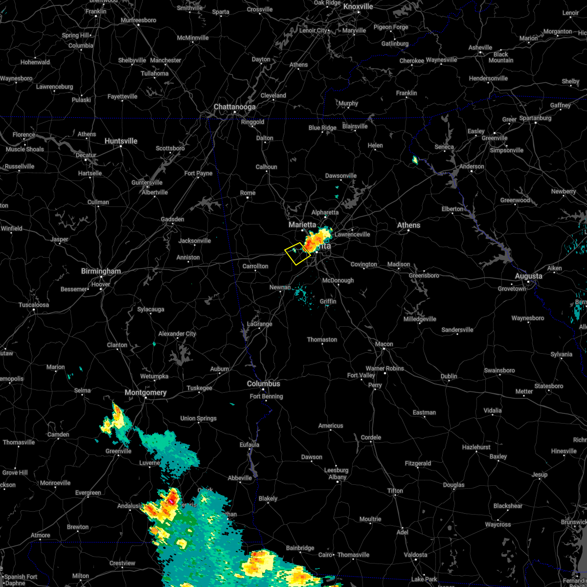 At 1017 pm edt, a severe thunderstorm was located over six flags over georgia, or 9 miles west of atlanta, moving southwest at 5 mph (radar indicated). Hazards include 60 mph wind gusts and quarter size hail. Hail damage to vehicles is expected. Expect wind damage to roofs, siding, and trees. At 1017 pm edt, a severe thunderstorm was located over six flags over georgia, or 9 miles west of atlanta, moving southwest at 5 mph (radar indicated). Hazards include 60 mph wind gusts and quarter size hail. Hail damage to vehicles is expected. Expect wind damage to roofs, siding, and trees.
|
| 6/16/2022 10:08 PM EDT |
 At 1007 pm edt, a severe thunderstorm was located near bolton, or 7 miles northwest of atlanta, moving southwest at 5 mph (radar indicated). Hazards include 60 mph wind gusts and quarter size hail. Hail damage to vehicles is expected. expect wind damage to roofs, siding, and trees. locations impacted include, atlanta, marietta, sandy springs, smyrna, vinings, bolton, atlantic station, mableton, bankhead and chastain memorial park. hail threat, radar indicated max hail size, 1. 00 in wind threat, radar indicated max wind gust, 60 mph. At 1007 pm edt, a severe thunderstorm was located near bolton, or 7 miles northwest of atlanta, moving southwest at 5 mph (radar indicated). Hazards include 60 mph wind gusts and quarter size hail. Hail damage to vehicles is expected. expect wind damage to roofs, siding, and trees. locations impacted include, atlanta, marietta, sandy springs, smyrna, vinings, bolton, atlantic station, mableton, bankhead and chastain memorial park. hail threat, radar indicated max hail size, 1. 00 in wind threat, radar indicated max wind gust, 60 mph.
|
| 6/16/2022 9:53 PM EDT | Quarter sized hail reported 11.7 miles S of Atlanta, GA, quarter sized hail reported via social media in sandy springs near roswell rd |
| 6/16/2022 9:46 PM EDT |
 At 946 pm edt, a severe thunderstorm was located over chastain memorial park, or 9 miles southeast of marietta, moving southwest at 5 mph (radar indicated). Hazards include 60 mph wind gusts and quarter size hail. Hail damage to vehicles is expected. Expect wind damage to roofs, siding, and trees. At 946 pm edt, a severe thunderstorm was located over chastain memorial park, or 9 miles southeast of marietta, moving southwest at 5 mph (radar indicated). Hazards include 60 mph wind gusts and quarter size hail. Hail damage to vehicles is expected. Expect wind damage to roofs, siding, and trees.
|
| 6/16/2022 9:38 PM EDT | Ping Pong Ball sized hail reported 12.5 miles SSW of Atlanta, GA, walnut sized hail observed at abernathy and glenridge rd |
| 4/6/2022 10:51 PM EDT |
 At 1051 pm edt, a severe thunderstorm was located over sweetwater creek state park, or 8 miles east of douglasville, moving east at 40 mph (radar indicated). Hazards include 60 mph wind gusts and quarter size hail. Hail damage to vehicles is expected. Expect wind damage to roofs, siding, and trees. At 1051 pm edt, a severe thunderstorm was located over sweetwater creek state park, or 8 miles east of douglasville, moving east at 40 mph (radar indicated). Hazards include 60 mph wind gusts and quarter size hail. Hail damage to vehicles is expected. Expect wind damage to roofs, siding, and trees.
|
| 2/17/2022 11:08 PM EST |
 At 1108 pm est, severe thunderstorms were located along a line extending from north druid hills to grant park-zoo atlanta to near college park, moving east at 50 mph (radar indicated). Hazards include 60 mph wind gusts. Expect damage to roofs, siding, and trees. Locations impacted include, atlanta, decatur, east point, union city, forest park, college park, fairburn, chamblee, doraville, hapeville, north decatur, hartsfield-jackson airport, north druid hills, grant park-zoo atlanta, druid hills, north atlanta, candler-mcafee, sweet auburn, piedmont park and lakewood park. At 1108 pm est, severe thunderstorms were located along a line extending from north druid hills to grant park-zoo atlanta to near college park, moving east at 50 mph (radar indicated). Hazards include 60 mph wind gusts. Expect damage to roofs, siding, and trees. Locations impacted include, atlanta, decatur, east point, union city, forest park, college park, fairburn, chamblee, doraville, hapeville, north decatur, hartsfield-jackson airport, north druid hills, grant park-zoo atlanta, druid hills, north atlanta, candler-mcafee, sweet auburn, piedmont park and lakewood park.
|
| 2/17/2022 10:59 PM EST |
 At 1059 pm est, severe thunderstorms were located along a line extending from bolton to cascade heights to near fairburn, moving east at 50 mph (radar indicated). Hazards include 60 mph wind gusts. Expect damage to roofs, siding, and trees. Locations impacted include, atlanta, decatur, east point, union city, forest park, college park, fairburn, chamblee, doraville, hapeville, north decatur, north atlanta, hartsfield-jackson airport, north druid hills, midtown, grant park-zoo atlanta, druid hills, candler-mcafee, sweet auburn and piedmont park. At 1059 pm est, severe thunderstorms were located along a line extending from bolton to cascade heights to near fairburn, moving east at 50 mph (radar indicated). Hazards include 60 mph wind gusts. Expect damage to roofs, siding, and trees. Locations impacted include, atlanta, decatur, east point, union city, forest park, college park, fairburn, chamblee, doraville, hapeville, north decatur, north atlanta, hartsfield-jackson airport, north druid hills, midtown, grant park-zoo atlanta, druid hills, candler-mcafee, sweet auburn and piedmont park.
|
| 2/17/2022 10:47 PM EST |
 At 1047 pm est, severe thunderstorms were located along a line extending from near sweetwater creek state park to campbellton to chattahoochee hills, moving east at 50 mph (radar indicated). Hazards include 60 mph wind gusts. expect damage to roofs, siding, and trees At 1047 pm est, severe thunderstorms were located along a line extending from near sweetwater creek state park to campbellton to chattahoochee hills, moving east at 50 mph (radar indicated). Hazards include 60 mph wind gusts. expect damage to roofs, siding, and trees
|
| 12/29/2021 11:51 PM EST |
 The severe thunderstorm warning for southern paulding, central haralson, central cobb, northern carroll and douglas counties will expire at midnight est, the storms which prompted the warning have weakened below severe limits, and no longer pose an immediate threat to life or property. therefore, the warning will be allowed to expire. however lightning and very heavy rain are still possible with these thunderstorms. a tornado watch remains in effect until 500 am est for north central and northwestern georgia. The severe thunderstorm warning for southern paulding, central haralson, central cobb, northern carroll and douglas counties will expire at midnight est, the storms which prompted the warning have weakened below severe limits, and no longer pose an immediate threat to life or property. therefore, the warning will be allowed to expire. however lightning and very heavy rain are still possible with these thunderstorms. a tornado watch remains in effect until 500 am est for north central and northwestern georgia.
|
| 12/29/2021 11:31 PM EST |
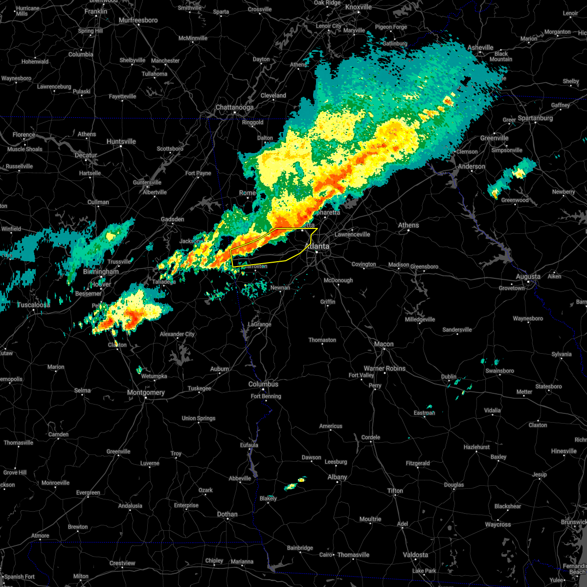 At 1131 pm est, severe thunderstorms were located along a line extending from near due west to near draketown to near i 20 welcome center, moving south at 25 mph (radar indicated). Hazards include 60 mph wind gusts. Expect damage to roofs, siding, and trees. locations impacted include, marietta, douglasville, dallas, buchanan, smyrna, villa rica, powder springs, austell, bremen, temple, hiram, tallapoosa, mount zion, waco, lithia springs, fair oaks, mount bethel, lost mountain park, vinings and brownsville. hail threat, radar indicated max hail size, <. 75 in wind threat, radar indicated max wind gust, 60 mph. At 1131 pm est, severe thunderstorms were located along a line extending from near due west to near draketown to near i 20 welcome center, moving south at 25 mph (radar indicated). Hazards include 60 mph wind gusts. Expect damage to roofs, siding, and trees. locations impacted include, marietta, douglasville, dallas, buchanan, smyrna, villa rica, powder springs, austell, bremen, temple, hiram, tallapoosa, mount zion, waco, lithia springs, fair oaks, mount bethel, lost mountain park, vinings and brownsville. hail threat, radar indicated max hail size, <. 75 in wind threat, radar indicated max wind gust, 60 mph.
|
| 12/29/2021 11:12 PM EST |
 At 1112 pm est, severe thunderstorms were located along a line extending from near braswell to yorkville to near eubank lake to near tallapoosa, moving east at 50 mph (radar indicated). Hazards include 60 mph wind gusts. expect damage to roofs, siding, and trees At 1112 pm est, severe thunderstorms were located along a line extending from near braswell to yorkville to near eubank lake to near tallapoosa, moving east at 50 mph (radar indicated). Hazards include 60 mph wind gusts. expect damage to roofs, siding, and trees
|
| 9/7/2021 11:34 PM EDT |
 At 1134 pm edt, a severe thunderstorm was located near mount bethel, or near marietta, moving northeast at 10 mph (radar indicated). Hazards include 60 mph wind gusts and nickel size hail. expect damage to roofs, siding, and trees At 1134 pm edt, a severe thunderstorm was located near mount bethel, or near marietta, moving northeast at 10 mph (radar indicated). Hazards include 60 mph wind gusts and nickel size hail. expect damage to roofs, siding, and trees
|
| 9/7/2021 11:06 PM EDT |
 At 1106 pm edt, a severe thunderstorm was located over union city, moving north at 25 mph (radar indicated). Hazards include 60 mph wind gusts. expect damage to roofs, siding, and trees At 1106 pm edt, a severe thunderstorm was located over union city, moving north at 25 mph (radar indicated). Hazards include 60 mph wind gusts. expect damage to roofs, siding, and trees
|
| 7/27/2021 6:13 PM EDT |
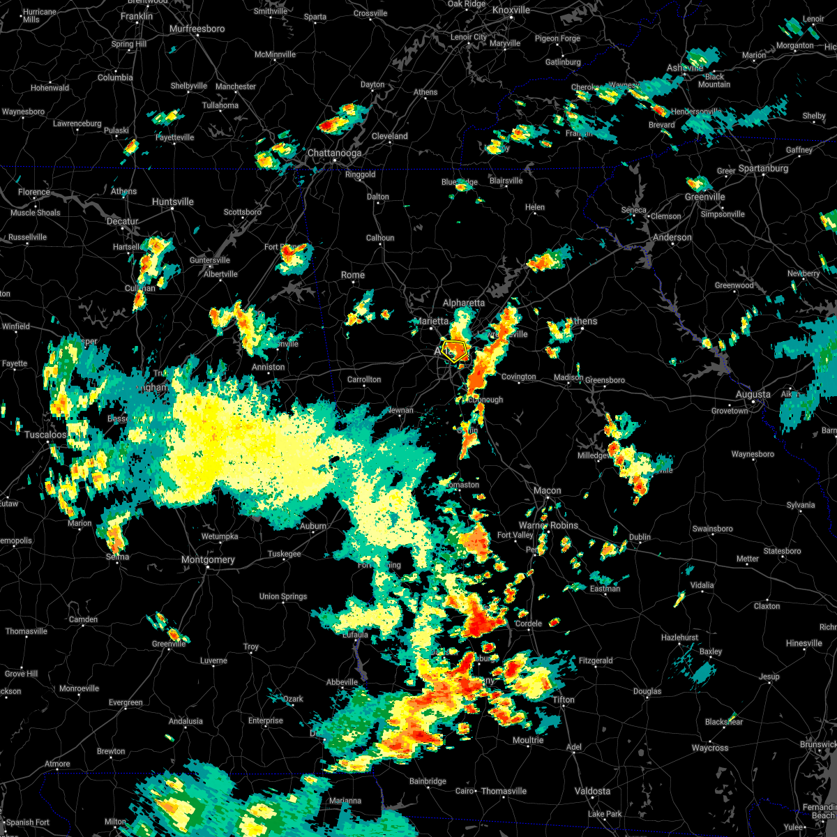 At 613 pm edt, a severe thunderstorm was located over la vista, or near atlanta, moving south at 10 mph (radar indicated). Hazards include 60 mph wind gusts and quarter size hail. Hail damage to vehicles is expected. expect wind damage to roofs, siding, and trees. Locations impacted include, atlanta, decatur, grant park-zoo atlanta, north decatur, north atlanta, north druid hills, druid hills, midtown, virginia highland, sweet auburn, piedmont park, brookhaven, bolton, la vista, little five points, atlantic station and scottdale. At 613 pm edt, a severe thunderstorm was located over la vista, or near atlanta, moving south at 10 mph (radar indicated). Hazards include 60 mph wind gusts and quarter size hail. Hail damage to vehicles is expected. expect wind damage to roofs, siding, and trees. Locations impacted include, atlanta, decatur, grant park-zoo atlanta, north decatur, north atlanta, north druid hills, druid hills, midtown, virginia highland, sweet auburn, piedmont park, brookhaven, bolton, la vista, little five points, atlantic station and scottdale.
|
| 7/27/2021 6:10 PM EDT | Tree down on a car in buckhead. no injuries reporte in fulton county GA, 5.4 miles S of Atlanta, GA |
| 7/27/2021 6:00 PM EDT | Multiple trees reported down along broadland rd nw... between andover rd and w conway dr n in fulton county GA, 6.7 miles S of Atlanta, GA |
| 7/27/2021 5:58 PM EDT |
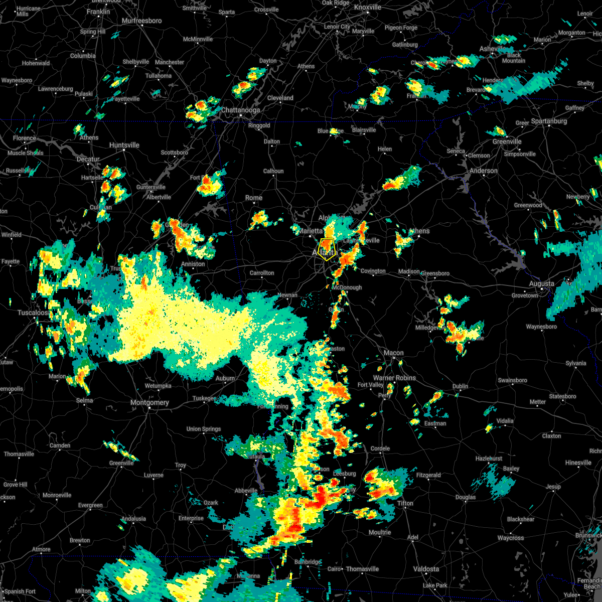 At 558 pm edt, a severe thunderstorm was located over chastain memorial park, or 7 miles northwest of decatur, moving south at 10 mph (radar indicated). Hazards include 60 mph wind gusts and quarter size hail. Hail damage to vehicles is expected. Expect wind damage to roofs, siding, and trees. At 558 pm edt, a severe thunderstorm was located over chastain memorial park, or 7 miles northwest of decatur, moving south at 10 mph (radar indicated). Hazards include 60 mph wind gusts and quarter size hail. Hail damage to vehicles is expected. Expect wind damage to roofs, siding, and trees.
|
| 7/23/2021 5:56 PM EDT |
 The severe thunderstorm warning for southwestern dekalb and central fulton counties will expire at 600 pm edt, the storm which prompted the warning has weakened below severe limits, and no longer poses an immediate threat to life or property. therefore, the warning will be allowed to expire. to report severe weather, contact your nearest law enforcement agency. they will relay your report to the national weather service peachtree city. The severe thunderstorm warning for southwestern dekalb and central fulton counties will expire at 600 pm edt, the storm which prompted the warning has weakened below severe limits, and no longer poses an immediate threat to life or property. therefore, the warning will be allowed to expire. to report severe weather, contact your nearest law enforcement agency. they will relay your report to the national weather service peachtree city.
|
| 7/23/2021 5:39 PM EDT |
 At 539 pm edt, a severe thunderstorm was located over grant park-zoo atlanta, or over atlanta, and is nearly stationary (radar indicated). Hazards include 60 mph wind gusts and quarter size hail. Hail damage to vehicles is expected. expect wind damage to roofs, siding, and trees. Locations impacted include, atlanta, decatur, grant park-zoo atlanta, candler-mcafee, druid hills, belvedere park, west end, sweet auburn, turner field, kirkwood, lakewood park, panthersville, east lake, gresham park and little five points. At 539 pm edt, a severe thunderstorm was located over grant park-zoo atlanta, or over atlanta, and is nearly stationary (radar indicated). Hazards include 60 mph wind gusts and quarter size hail. Hail damage to vehicles is expected. expect wind damage to roofs, siding, and trees. Locations impacted include, atlanta, decatur, grant park-zoo atlanta, candler-mcafee, druid hills, belvedere park, west end, sweet auburn, turner field, kirkwood, lakewood park, panthersville, east lake, gresham park and little five points.
|
| 7/23/2021 5:30 PM EDT | Numerous trees reported down within the grant park/glenwood park/ormewood park/east atlanta villiage neighborhoods in east atlant in fulton county GA, 3.5 miles WNW of Atlanta, GA |
| 7/23/2021 5:26 PM EDT |
 At 526 pm edt, a severe thunderstorm was located over grant park-zoo atlanta, or near atlanta, moving southeast at 5 mph (radar indicated). Hazards include 60 mph wind gusts. expect damage to roofs, siding, and trees At 526 pm edt, a severe thunderstorm was located over grant park-zoo atlanta, or near atlanta, moving southeast at 5 mph (radar indicated). Hazards include 60 mph wind gusts. expect damage to roofs, siding, and trees
|
| 7/9/2021 3:00 PM EDT |
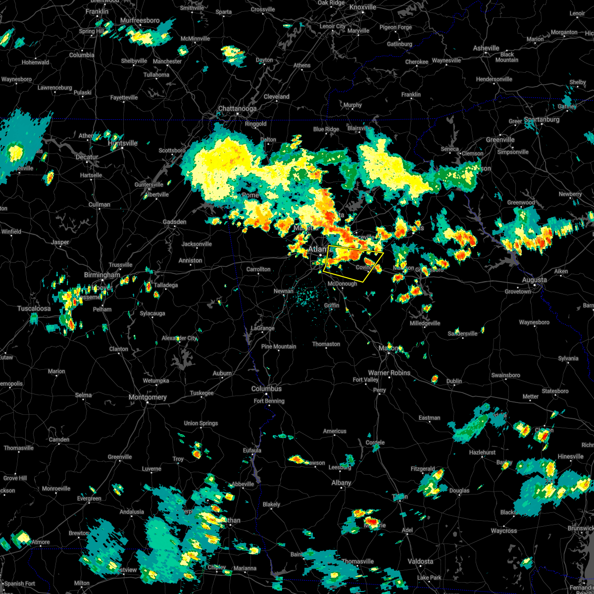 At 259 pm edt, severe thunderstorms were located along a line extending from near milstead to ellenwood, moving east at 30 mph (radar indicated). Hazards include 60 mph wind gusts and penny size hail. Expect damage to roofs, siding, and trees. Locations impacted include, decatur, conyers, monroe, covington, forest park, clarkston, morrow, stone mountain, avondale estates, lake city, oxford, lithonia, porterdale, walnut grove, pine lake, jersey, belvedere park, north decatur, lakeview estates and candler-mcafee. At 259 pm edt, severe thunderstorms were located along a line extending from near milstead to ellenwood, moving east at 30 mph (radar indicated). Hazards include 60 mph wind gusts and penny size hail. Expect damage to roofs, siding, and trees. Locations impacted include, decatur, conyers, monroe, covington, forest park, clarkston, morrow, stone mountain, avondale estates, lake city, oxford, lithonia, porterdale, walnut grove, pine lake, jersey, belvedere park, north decatur, lakeview estates and candler-mcafee.
|
| 7/9/2021 2:45 PM EDT | A tree was blown down onto a power line on wee kirk rd s in dekalb county GA, 7.4 miles NW of Atlanta, GA |
| 7/9/2021 2:40 PM EDT |
 At 240 pm edt, severe thunderstorms were located along a line extending from redan to college park, moving east at 30 mph (radar indicated). Hazards include 60 mph wind gusts and penny size hail. expect damage to roofs, siding, and trees At 240 pm edt, severe thunderstorms were located along a line extending from redan to college park, moving east at 30 mph (radar indicated). Hazards include 60 mph wind gusts and penny size hail. expect damage to roofs, siding, and trees
|
| 5/4/2021 2:57 PM EDT |
 The national weather service in peachtree city has issued a * severe thunderstorm warning for. paulding county in northwestern georgia. southwestern cherokee county in north central georgia. haralson county in northwestern georgia. Cobb county in north central georgia. The national weather service in peachtree city has issued a * severe thunderstorm warning for. paulding county in northwestern georgia. southwestern cherokee county in north central georgia. haralson county in northwestern georgia. Cobb county in north central georgia.
|
| 5/4/2021 1:52 PM EDT |
 At 152 pm edt, severe thunderstorms were located along a line extending from near mount bethel to near lithia springs, moving east at 50 mph (trained weather spotters). Hazards include 60 mph wind gusts. Expect damage to roofs, siding, and trees. Locations impacted include, marietta, douglasville, smyrna, kennesaw, villa rica, powder springs, austell, hiram, lithia springs, fair oaks, mount bethel, sweetwater creek state park, white water park, vinings, brownsville, jim r miller park, winston, lake val-do-mar, sandy plains and dobbins air reserve base. At 152 pm edt, severe thunderstorms were located along a line extending from near mount bethel to near lithia springs, moving east at 50 mph (trained weather spotters). Hazards include 60 mph wind gusts. Expect damage to roofs, siding, and trees. Locations impacted include, marietta, douglasville, smyrna, kennesaw, villa rica, powder springs, austell, hiram, lithia springs, fair oaks, mount bethel, sweetwater creek state park, white water park, vinings, brownsville, jim r miller park, winston, lake val-do-mar, sandy plains and dobbins air reserve base.
|
| 5/4/2021 1:28 PM EDT |
 At 128 pm edt, severe thunderstorms were located along a line extending from new hope to temple, moving east at 50 mph (trained weather spotters). Hazards include 60 mph wind gusts. expect damage to roofs, siding, and trees At 128 pm edt, severe thunderstorms were located along a line extending from new hope to temple, moving east at 50 mph (trained weather spotters). Hazards include 60 mph wind gusts. expect damage to roofs, siding, and trees
|
| 5/3/2021 10:55 AM EDT |
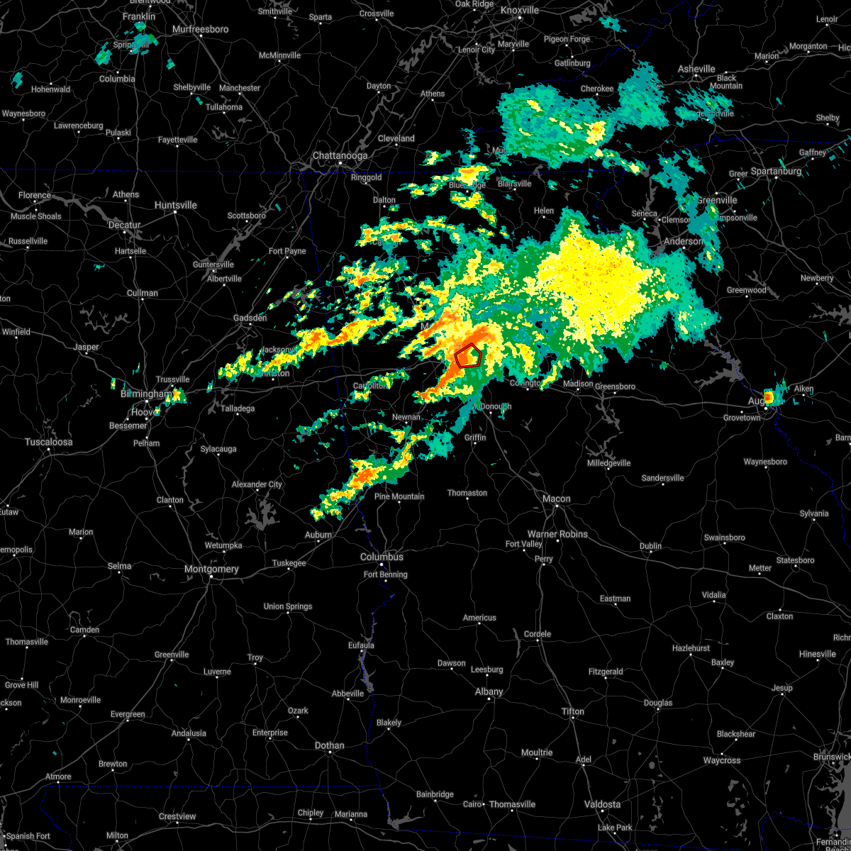 At 1054 am edt, a severe thunderstorm capable of producing a tornado was located over virginia highland, or over atlanta, moving east at 35 mph (radar indicated rotation). Hazards include tornado. Flying debris will be dangerous to those caught without shelter. mobile homes will be damaged or destroyed. damage to roofs, windows, and vehicles will occur. tree damage is likely. Locations impacted include, atlanta, decatur, chamblee, clarkston, avondale estates, belvedere park, north decatur, north atlanta, north druid hills, druid hills, midtown, tucker, virginia highland, sweet auburn, piedmont park, scottdale, kirkwood, brookhaven, east lake and la vista. At 1054 am edt, a severe thunderstorm capable of producing a tornado was located over virginia highland, or over atlanta, moving east at 35 mph (radar indicated rotation). Hazards include tornado. Flying debris will be dangerous to those caught without shelter. mobile homes will be damaged or destroyed. damage to roofs, windows, and vehicles will occur. tree damage is likely. Locations impacted include, atlanta, decatur, chamblee, clarkston, avondale estates, belvedere park, north decatur, north atlanta, north druid hills, druid hills, midtown, tucker, virginia highland, sweet auburn, piedmont park, scottdale, kirkwood, brookhaven, east lake and la vista.
|
| 5/3/2021 10:44 AM EDT |
 At 1044 am edt, a tornado producing storm was located over bankhead, or near atlanta, moving east at 35 mph (radar confirmed tornado). Hazards include damaging tornado. Flying debris will be dangerous to those caught without shelter. mobile homes will be damaged or destroyed. damage to roofs, windows, and vehicles will occur. Tree damage is likely. At 1044 am edt, a tornado producing storm was located over bankhead, or near atlanta, moving east at 35 mph (radar confirmed tornado). Hazards include damaging tornado. Flying debris will be dangerous to those caught without shelter. mobile homes will be damaged or destroyed. damage to roofs, windows, and vehicles will occur. Tree damage is likely.
|
| 5/3/2021 10:33 AM EDT |
 At 1032 am edt, a severe thunderstorm was located over sandtown, or near atlanta, moving east at 35 mph (radar indicated). Hazards include 60 mph wind gusts and penny size hail. Expect damage to roofs, siding, and trees. Locations impacted include, atlanta, douglasville, smyrna, east point, hapeville, sweetwater creek state park, west end, bankhead, six flags over georgia, cascade heights, bolton, sandtown, vinings and mableton. At 1032 am edt, a severe thunderstorm was located over sandtown, or near atlanta, moving east at 35 mph (radar indicated). Hazards include 60 mph wind gusts and penny size hail. Expect damage to roofs, siding, and trees. Locations impacted include, atlanta, douglasville, smyrna, east point, hapeville, sweetwater creek state park, west end, bankhead, six flags over georgia, cascade heights, bolton, sandtown, vinings and mableton.
|
| 5/3/2021 10:26 AM EDT |
 At 1026 am edt, a tornado producing storm was located over sandtown, or 9 miles east of douglasville, moving east at 35 mph (radar confirmed tornado). Hazards include damaging tornado. Flying debris will be dangerous to those caught without shelter. mobile homes will be damaged or destroyed. damage to roofs, windows, and vehicles will occur. Tree damage is likely. At 1026 am edt, a tornado producing storm was located over sandtown, or 9 miles east of douglasville, moving east at 35 mph (radar confirmed tornado). Hazards include damaging tornado. Flying debris will be dangerous to those caught without shelter. mobile homes will be damaged or destroyed. damage to roofs, windows, and vehicles will occur. Tree damage is likely.
|
| 5/3/2021 10:21 AM EDT |
 At 1021 am edt, a severe thunderstorm capable of producing a tornado was located near sandtown, or 8 miles southeast of douglasville, moving east at 35 mph (radar indicated rotation). Hazards include tornado. Flying debris will be dangerous to those caught without shelter. mobile homes will be damaged or destroyed. damage to roofs, windows, and vehicles will occur. Tree damage is likely. At 1021 am edt, a severe thunderstorm capable of producing a tornado was located near sandtown, or 8 miles southeast of douglasville, moving east at 35 mph (radar indicated rotation). Hazards include tornado. Flying debris will be dangerous to those caught without shelter. mobile homes will be damaged or destroyed. damage to roofs, windows, and vehicles will occur. Tree damage is likely.
|
| 5/3/2021 10:14 AM EDT |
 At 1014 am edt, a severe thunderstorm was located over chapel hill, or near douglasville, moving east at 40 mph (radar indicated). Hazards include 60 mph wind gusts and quarter size hail. Hail damage to vehicles is expected. Expect wind damage to roofs, siding, and trees. At 1014 am edt, a severe thunderstorm was located over chapel hill, or near douglasville, moving east at 40 mph (radar indicated). Hazards include 60 mph wind gusts and quarter size hail. Hail damage to vehicles is expected. Expect wind damage to roofs, siding, and trees.
|
| 4/24/2021 8:52 PM EDT |
 The severe thunderstorm warning for southeastern paulding, northwestern dekalb, northwestern fayette, cobb, douglas, west central gwinnett, northern heard, northern coweta, fulton and northwestern clayton counties will expire at 900 pm edt, the storms which prompted the warning have moved out of the area. therefore, the warning will be allowed to expire. a severe thunderstorm watch remains in effect until 1000 pm edt for north central, northwestern and west central georgia. The severe thunderstorm warning for southeastern paulding, northwestern dekalb, northwestern fayette, cobb, douglas, west central gwinnett, northern heard, northern coweta, fulton and northwestern clayton counties will expire at 900 pm edt, the storms which prompted the warning have moved out of the area. therefore, the warning will be allowed to expire. a severe thunderstorm watch remains in effect until 1000 pm edt for north central, northwestern and west central georgia.
|
| 4/24/2021 8:41 PM EDT | Asos station katl atlant in clayton county GA, 9.3 miles NNE of Atlanta, GA |
| 4/24/2021 8:36 PM EDT |
 At 835 pm edt, severe thunderstorms were located along a line extending from mountain park to near thomas crossroads, moving east at 50 mph (radar indicated). Hazards include 70 mph wind gusts and quarter size hail. Hail damage to vehicles is expected. expect considerable tree damage. Wind damage is also likely to mobile homes, roofs, and outbuildings. At 835 pm edt, severe thunderstorms were located along a line extending from mountain park to near thomas crossroads, moving east at 50 mph (radar indicated). Hazards include 70 mph wind gusts and quarter size hail. Hail damage to vehicles is expected. expect considerable tree damage. Wind damage is also likely to mobile homes, roofs, and outbuildings.
|
| 4/24/2021 8:19 PM EDT |
 At 818 pm edt, severe thunderstorms were located along a line extending from due west to near lithia springs to plant wansley, moving northeast at 70 mph (radar indicated). Hazards include 70 mph wind gusts and quarter size hail. Hail damage to vehicles is expected. expect considerable tree damage. wind damage is also likely to mobile homes, roofs, and outbuildings. Locations impacted include, atlanta, marietta, newnan, douglasville, decatur, fayetteville, dallas, sandy springs, roswell, johns creek, alpharetta, smyrna, dunwoody, peachtree city, east point, kennesaw, duluth, union city, forest park and riverdale. At 818 pm edt, severe thunderstorms were located along a line extending from due west to near lithia springs to plant wansley, moving northeast at 70 mph (radar indicated). Hazards include 70 mph wind gusts and quarter size hail. Hail damage to vehicles is expected. expect considerable tree damage. wind damage is also likely to mobile homes, roofs, and outbuildings. Locations impacted include, atlanta, marietta, newnan, douglasville, decatur, fayetteville, dallas, sandy springs, roswell, johns creek, alpharetta, smyrna, dunwoody, peachtree city, east point, kennesaw, duluth, union city, forest park and riverdale.
|
| 4/24/2021 8:07 PM EDT |
 At 807 pm edt, severe thunderstorms were located along a line extending from near new hope to near douglasville to centralhatchee, moving east at 70 mph (radar indicated). Hazards include 60 mph wind gusts and quarter size hail. Hail damage to vehicles is expected. Expect wind damage to roofs, siding, and trees. At 807 pm edt, severe thunderstorms were located along a line extending from near new hope to near douglasville to centralhatchee, moving east at 70 mph (radar indicated). Hazards include 60 mph wind gusts and quarter size hail. Hail damage to vehicles is expected. Expect wind damage to roofs, siding, and trees.
|
| 4/24/2021 5:24 PM EDT |
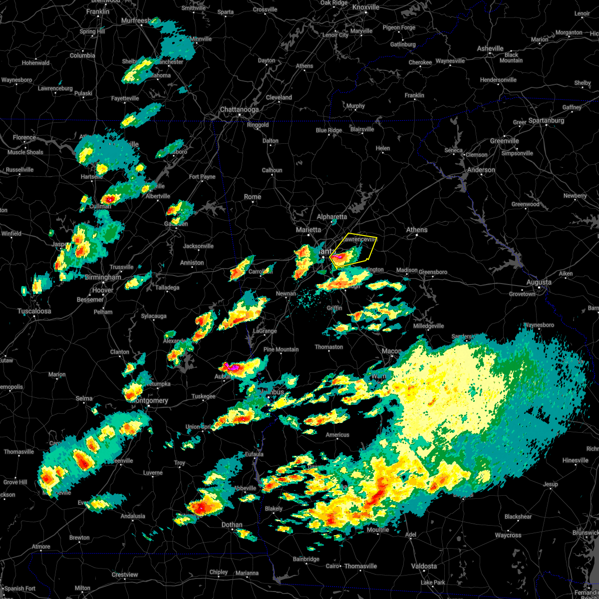 At 524 pm edt, a severe thunderstorm was located over redan, or 7 miles east of decatur, moving northeast at 55 mph (radar indicated). Hazards include 60 mph wind gusts and quarter size hail. Hail damage to vehicles is expected. expect wind damage to roofs, siding, and trees. Locations impacted include, lawrenceville, decatur, snellville, lilburn, loganville, clarkston, stone mountain, avondale estates, grayson, lithonia, pine lake, tucker, belvedere park, lakeview estates, candler-mcafee, north decatur, mountain park, windsor, belmont and big haynes creek park. At 524 pm edt, a severe thunderstorm was located over redan, or 7 miles east of decatur, moving northeast at 55 mph (radar indicated). Hazards include 60 mph wind gusts and quarter size hail. Hail damage to vehicles is expected. expect wind damage to roofs, siding, and trees. Locations impacted include, lawrenceville, decatur, snellville, lilburn, loganville, clarkston, stone mountain, avondale estates, grayson, lithonia, pine lake, tucker, belvedere park, lakeview estates, candler-mcafee, north decatur, mountain park, windsor, belmont and big haynes creek park.
|
| 4/24/2021 5:18 PM EDT | Quarter sized hail reported 5.7 miles WNW of Atlanta, GA, multiple pictures and videos of hail up to quarter size were received from the east atlanta area. |
| 4/24/2021 5:09 PM EDT |
 At 508 pm edt, a severe thunderstorm was located over hapeville, or near atlanta, moving northeast at 55 mph (radar indicated). Hazards include 60 mph wind gusts and quarter size hail. Hail damage to vehicles is expected. Expect wind damage to roofs, siding, and trees. At 508 pm edt, a severe thunderstorm was located over hapeville, or near atlanta, moving northeast at 55 mph (radar indicated). Hazards include 60 mph wind gusts and quarter size hail. Hail damage to vehicles is expected. Expect wind damage to roofs, siding, and trees.
|
| 3/26/2021 3:11 AM EDT |
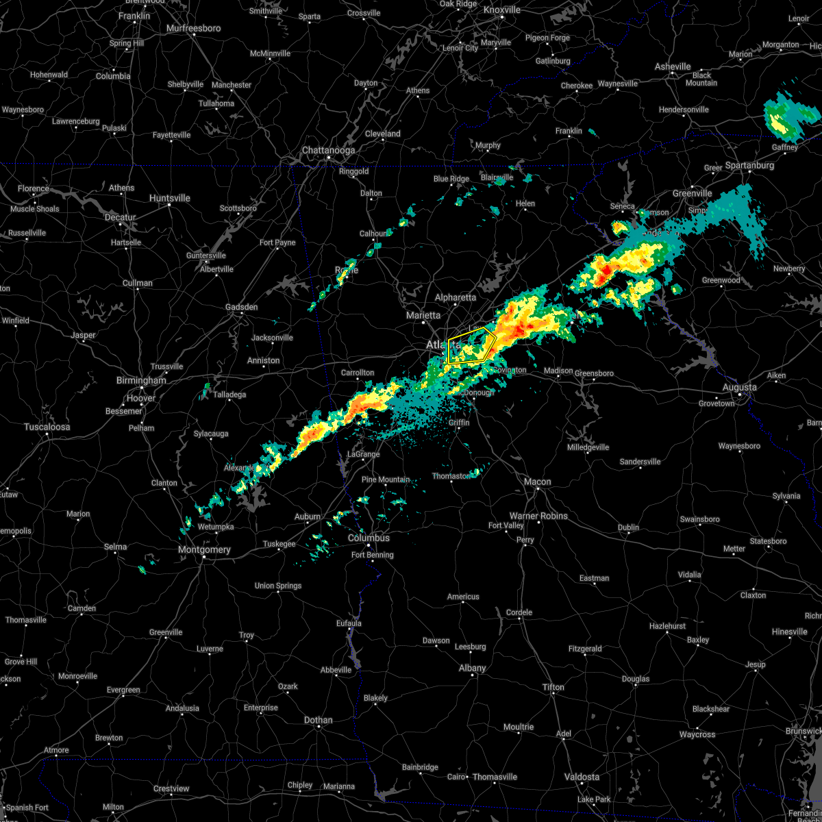 The severe thunderstorm warning for dekalb and southwestern gwinnett counties will expire at 315 am edt, the storm which prompted the warning has moved out of the area. therefore, the warning will be allowed to expire. however heavy rain is still possible with this thunderstorm. a tornado watch remains in effect until 700 am edt for north central georgia. a tornado watch also remains in effect until 700 am edt for north central georgia. to report severe weather, contact your nearest law enforcement agency. they will relay your report to the national weather service peachtree city. The severe thunderstorm warning for dekalb and southwestern gwinnett counties will expire at 315 am edt, the storm which prompted the warning has moved out of the area. therefore, the warning will be allowed to expire. however heavy rain is still possible with this thunderstorm. a tornado watch remains in effect until 700 am edt for north central georgia. a tornado watch also remains in effect until 700 am edt for north central georgia. to report severe weather, contact your nearest law enforcement agency. they will relay your report to the national weather service peachtree city.
|
| 3/26/2021 2:47 AM EDT |
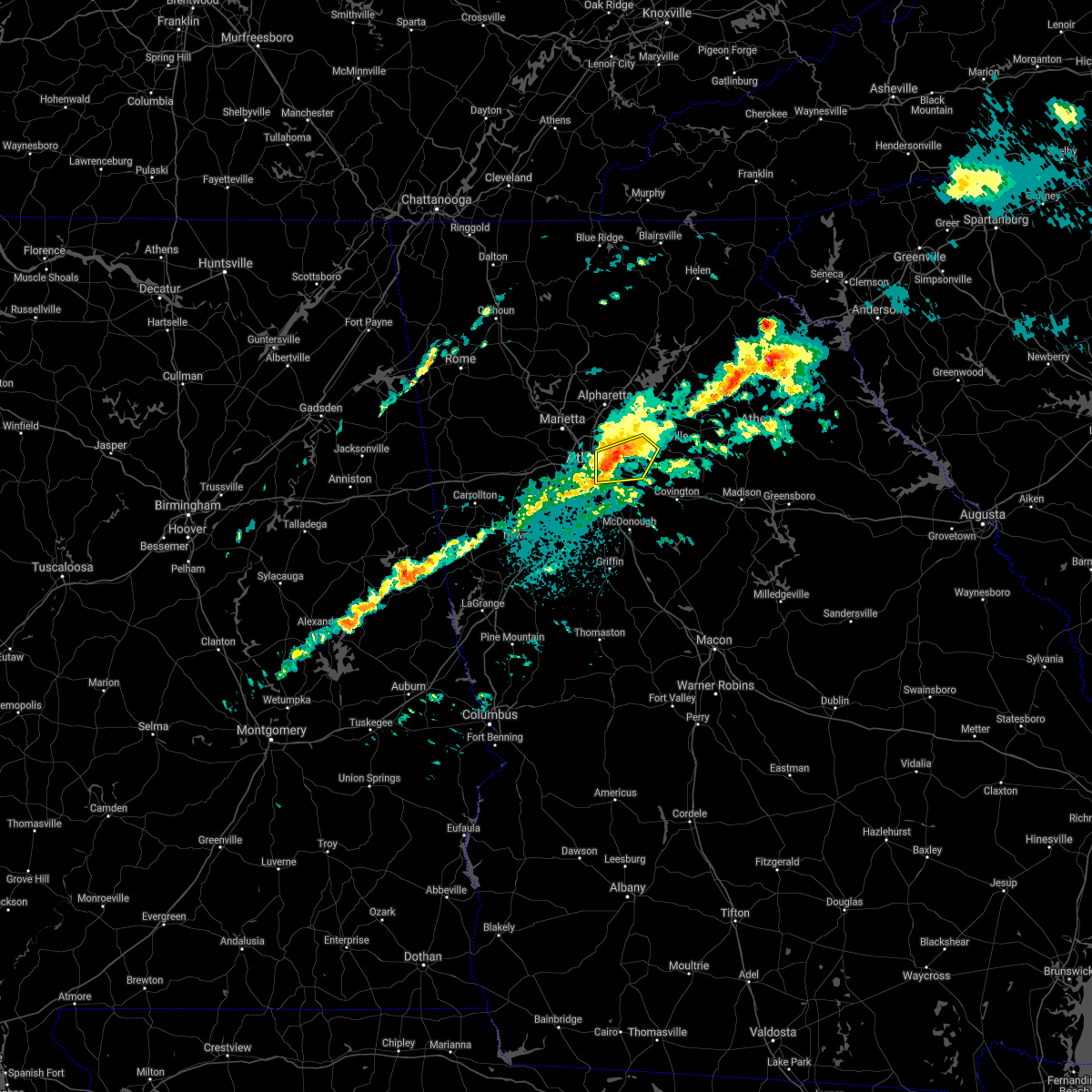 At 247 am edt, a severe thunderstorm was located over scottdale, or over decatur, moving east at 55 mph (radar indicated). Hazards include 60 mph wind gusts and nickel size hail. Expect damage to roofs, siding, and trees. Locations impacted include, atlanta, decatur, snellville, lilburn, clarkston, stone mountain, avondale estates, lithonia, pine lake, tucker, belvedere park, north decatur, north druid hills, candler-mcafee, druid hills, north atlanta, mountain park, belmont, east lake and little five points. At 247 am edt, a severe thunderstorm was located over scottdale, or over decatur, moving east at 55 mph (radar indicated). Hazards include 60 mph wind gusts and nickel size hail. Expect damage to roofs, siding, and trees. Locations impacted include, atlanta, decatur, snellville, lilburn, clarkston, stone mountain, avondale estates, lithonia, pine lake, tucker, belvedere park, north decatur, north druid hills, candler-mcafee, druid hills, north atlanta, mountain park, belmont, east lake and little five points.
|
| 3/26/2021 2:38 AM EDT |
 At 238 am edt, a severe thunderstorm was located over atlanta, moving east at 55 mph (radar indicated). Hazards include 60 mph wind gusts. expect damage to roofs, siding, and trees At 238 am edt, a severe thunderstorm was located over atlanta, moving east at 55 mph (radar indicated). Hazards include 60 mph wind gusts. expect damage to roofs, siding, and trees
|
| 10/10/2020 8:28 PM EDT |
 The tornado warning for central dekalb county will expire at 830 pm edt, the storm which prompted the warning has weakened below severe limits, and no longer appears capable of producing a tornado. therefore, the warning will be allowed to expire. a tornado watch remains in effect until 900 pm edt for north central georgia. to report any damage from severe weather, contact your nearest law enforcement agency. they will relay your report to the national weather service peachtree city. The tornado warning for central dekalb county will expire at 830 pm edt, the storm which prompted the warning has weakened below severe limits, and no longer appears capable of producing a tornado. therefore, the warning will be allowed to expire. a tornado watch remains in effect until 900 pm edt for north central georgia. to report any damage from severe weather, contact your nearest law enforcement agency. they will relay your report to the national weather service peachtree city.
|
| 10/10/2020 8:20 PM EDT |
 At 820 pm edt, a severe thunderstorm capable of producing a tornado was located over pine lake, or near decatur, moving north at 35 mph (radar indicated rotation). Hazards include tornado. Flying debris will be dangerous to those caught without shelter. mobile homes will be damaged or destroyed. damage to roofs, windows, and vehicles will occur. tree damage is likely. Locations impacted include, decatur, clarkston, stone mountain, avondale estates, pine lake, tucker, north decatur, belvedere park, candler-mcafee, belmont, redan and scottdale. At 820 pm edt, a severe thunderstorm capable of producing a tornado was located over pine lake, or near decatur, moving north at 35 mph (radar indicated rotation). Hazards include tornado. Flying debris will be dangerous to those caught without shelter. mobile homes will be damaged or destroyed. damage to roofs, windows, and vehicles will occur. tree damage is likely. Locations impacted include, decatur, clarkston, stone mountain, avondale estates, pine lake, tucker, north decatur, belvedere park, candler-mcafee, belmont, redan and scottdale.
|
| 10/10/2020 8:06 PM EDT |
 At 806 pm edt, a severe thunderstorm capable of producing a tornado was located over snapfinger, or 8 miles southeast of decatur, moving north at 20 mph (radar indicated rotation). Hazards include tornado. Flying debris will be dangerous to those caught without shelter. mobile homes will be damaged or destroyed. damage to roofs, windows, and vehicles will occur. Tree damage is likely. At 806 pm edt, a severe thunderstorm capable of producing a tornado was located over snapfinger, or 8 miles southeast of decatur, moving north at 20 mph (radar indicated rotation). Hazards include tornado. Flying debris will be dangerous to those caught without shelter. mobile homes will be damaged or destroyed. damage to roofs, windows, and vehicles will occur. Tree damage is likely.
|
| 10/10/2020 8:02 PM EDT |
 At 802 pm edt, a severe thunderstorm capable of producing a tornado was located near snapfinger, or 8 miles south of decatur, moving north at 20 mph (radar indicated rotation). Hazards include tornado. Flying debris will be dangerous to those caught without shelter. mobile homes will be damaged or destroyed. damage to roofs, windows, and vehicles will occur. tree damage is likely. Locations impacted include, forest park, candler-mcafee, hidden valley park, panthersville, ellenwood, conley, gresham park and snapfinger. At 802 pm edt, a severe thunderstorm capable of producing a tornado was located near snapfinger, or 8 miles south of decatur, moving north at 20 mph (radar indicated rotation). Hazards include tornado. Flying debris will be dangerous to those caught without shelter. mobile homes will be damaged or destroyed. damage to roofs, windows, and vehicles will occur. tree damage is likely. Locations impacted include, forest park, candler-mcafee, hidden valley park, panthersville, ellenwood, conley, gresham park and snapfinger.
|
| 10/10/2020 7:47 PM EDT |
 At 747 pm edt, a severe thunderstorm capable of producing a tornado was located over morrow, or near jonesboro, moving north at 20 mph (radar indicated rotation). Hazards include tornado. Flying debris will be dangerous to those caught without shelter. mobile homes will be damaged or destroyed. damage to roofs, windows, and vehicles will occur. Tree damage is likely. At 747 pm edt, a severe thunderstorm capable of producing a tornado was located over morrow, or near jonesboro, moving north at 20 mph (radar indicated rotation). Hazards include tornado. Flying debris will be dangerous to those caught without shelter. mobile homes will be damaged or destroyed. damage to roofs, windows, and vehicles will occur. Tree damage is likely.
|
| 8/30/2020 6:36 PM EDT |
 At 635 pm edt, a severe thunderstorm was located over college park, or 8 miles southwest of atlanta, moving north at 5 mph (radar indicated). Hazards include 60 mph wind gusts and quarter size hail. Hail damage to vehicles is expected. Expect wind damage to roofs, siding, and trees. At 635 pm edt, a severe thunderstorm was located over college park, or 8 miles southwest of atlanta, moving north at 5 mph (radar indicated). Hazards include 60 mph wind gusts and quarter size hail. Hail damage to vehicles is expected. Expect wind damage to roofs, siding, and trees.
|
| 8/18/2020 9:42 PM EDT |
 At 942 pm edt, a severe thunderstorm was located near sandtown, or 12 miles southeast of douglasville, moving south at 5 mph (radar indicated). Hazards include 60 mph wind gusts and quarter size hail. Hail damage to vehicles is expected. Expect wind damage to roofs, siding, and trees. At 942 pm edt, a severe thunderstorm was located near sandtown, or 12 miles southeast of douglasville, moving south at 5 mph (radar indicated). Hazards include 60 mph wind gusts and quarter size hail. Hail damage to vehicles is expected. Expect wind damage to roofs, siding, and trees.
|
| 8/10/2020 3:35 PM EDT |
 At 335 pm edt, severe thunderstorms were located along a line extending from bold springs to near mountain park to near vinings, moving southeast at 45 mph (radar indicated). Hazards include 60 mph wind gusts and penny size hail. Expect damage to roofs, siding, and trees. Locations impacted include, atlanta, lawrenceville, decatur, sandy springs, roswell, alpharetta, dunwoody, duluth, snellville, suwanee, lilburn, chamblee, norcross, doraville, clarkston, stone mountain, dacula, avondale estates, grayson and berkeley lake. At 335 pm edt, severe thunderstorms were located along a line extending from bold springs to near mountain park to near vinings, moving southeast at 45 mph (radar indicated). Hazards include 60 mph wind gusts and penny size hail. Expect damage to roofs, siding, and trees. Locations impacted include, atlanta, lawrenceville, decatur, sandy springs, roswell, alpharetta, dunwoody, duluth, snellville, suwanee, lilburn, chamblee, norcross, doraville, clarkston, stone mountain, dacula, avondale estates, grayson and berkeley lake.
|
| 8/10/2020 3:27 PM EDT |
 At 327 pm edt, severe thunderstorms were located along a line extending from dacula to lilburn to near sandy plains, moving southeast at 40 mph (radar indicated). Hazards include 60 mph wind gusts and nickel size hail. Expect damage to roofs, siding, and trees. Locations impacted include, atlanta, marietta, lawrenceville, decatur, sandy springs, roswell, johns creek, alpharetta, smyrna, dunwoody, milton, kennesaw, duluth, acworth, sugar hill, snellville, suwanee, buford, lilburn and chamblee. At 327 pm edt, severe thunderstorms were located along a line extending from dacula to lilburn to near sandy plains, moving southeast at 40 mph (radar indicated). Hazards include 60 mph wind gusts and nickel size hail. Expect damage to roofs, siding, and trees. Locations impacted include, atlanta, marietta, lawrenceville, decatur, sandy springs, roswell, johns creek, alpharetta, smyrna, dunwoody, milton, kennesaw, duluth, acworth, sugar hill, snellville, suwanee, buford, lilburn and chamblee.
|
| 8/10/2020 3:22 PM EDT |
 At 322 pm edt, a severe thunderstorm was located over gresham park, or near decatur, moving southeast at 20 mph (radar indicated). Hazards include 60 mph wind gusts and quarter size hail. Hail damage to vehicles is expected. Expect wind damage to roofs, siding, and trees. At 322 pm edt, a severe thunderstorm was located over gresham park, or near decatur, moving southeast at 20 mph (radar indicated). Hazards include 60 mph wind gusts and quarter size hail. Hail damage to vehicles is expected. Expect wind damage to roofs, siding, and trees.
|
| 8/10/2020 2:54 PM EDT |
 At 253 pm edt, severe thunderstorms were located along a line extending from woodstock to cumming and chestatee, moving southeast at 40 mph (radar indicated). Hazards include 60 mph wind gusts and nickel size hail. expect damage to roofs, siding, and trees At 253 pm edt, severe thunderstorms were located along a line extending from woodstock to cumming and chestatee, moving southeast at 40 mph (radar indicated). Hazards include 60 mph wind gusts and nickel size hail. expect damage to roofs, siding, and trees
|
| 8/9/2020 7:10 PM EDT |
 The severe thunderstorm warning for southwestern dekalb, northwestern henry, southeastern fulton and clayton counties will expire at 715 pm edt, the storm which prompted the warning is weakening below severe limits, and no longer poses an immediate threat to life or property. therefore, the warning will be allowed to expire at 715 pm edt. however, gusty winds and heavy rain are still possible with this thunderstorm. The severe thunderstorm warning for southwestern dekalb, northwestern henry, southeastern fulton and clayton counties will expire at 715 pm edt, the storm which prompted the warning is weakening below severe limits, and no longer poses an immediate threat to life or property. therefore, the warning will be allowed to expire at 715 pm edt. however, gusty winds and heavy rain are still possible with this thunderstorm.
|
| 8/9/2020 6:48 PM EDT |
 At 647 pm edt, a severe thunderstorm was located over ellenwood, and is nearly stationary (radar indicated). Hazards include 60 mph wind gusts and nickel size hail. expect damage to roofs, siding, and trees At 647 pm edt, a severe thunderstorm was located over ellenwood, and is nearly stationary (radar indicated). Hazards include 60 mph wind gusts and nickel size hail. expect damage to roofs, siding, and trees
|
| 8/3/2020 2:52 PM EDT | Tree downed onto the road at spalding drive and old dominion drive in fulton county GA, 15.8 miles SSW of Atlanta, GA |
| 8/3/2020 2:50 PM EDT | Tree blocking all lanes at cannady court and treadwick driv in fulton county GA, 15.4 miles SSW of Atlanta, GA |
| 8/3/2020 2:45 PM EDT | Tree down on powerlines along kayron drive and reed lane causing road closur in fulton county GA, 11.2 miles SSW of Atlanta, GA |
| 8/3/2020 2:42 PM EDT | Tree downed over the road on donaldson drive near blairsville circle in dekalb county GA, 10.1 miles SSW of Atlanta, GA |
| 8/3/2020 2:40 PM EDT |
 The severe thunderstorm warning for southwestern cobb, northeastern douglas and southwestern fulton counties will expire at 245 pm edt, the storm which prompted the warning has weakened below severe limits, and has exited the warned area. therefore, the warning will be allowed to expire. The severe thunderstorm warning for southwestern cobb, northeastern douglas and southwestern fulton counties will expire at 245 pm edt, the storm which prompted the warning has weakened below severe limits, and has exited the warned area. therefore, the warning will be allowed to expire.
|
| 8/3/2020 2:19 PM EDT |
 At 219 pm edt, a severe thunderstorm was located near union city, or 12 miles southeast of douglasville, moving northeast at 15 mph (radar indicated). Hazards include ping pong ball size hail and 60 mph wind gusts. People and animals outdoors will be injured. expect hail damage to roofs, siding, windows, and vehicles. expect wind damage to roofs, siding, and trees. Locations impacted include, atlanta, douglasville, east point, union city, fairburn, austell, palmetto, lithia springs, sweetwater creek state park, chapel hill, six flags over georgia, cascade heights, campbellton, sandtown and mableton. At 219 pm edt, a severe thunderstorm was located near union city, or 12 miles southeast of douglasville, moving northeast at 15 mph (radar indicated). Hazards include ping pong ball size hail and 60 mph wind gusts. People and animals outdoors will be injured. expect hail damage to roofs, siding, windows, and vehicles. expect wind damage to roofs, siding, and trees. Locations impacted include, atlanta, douglasville, east point, union city, fairburn, austell, palmetto, lithia springs, sweetwater creek state park, chapel hill, six flags over georgia, cascade heights, campbellton, sandtown and mableton.
|
| 8/3/2020 2:10 PM EDT | Several trees downed in south fulton. old fairburn road and lakeside blv in fulton county GA, 9.7 miles NE of Atlanta, GA |
| 8/3/2020 2:01 PM EDT |
 At 201 pm edt, a severe thunderstorm was located near campbellton, or 12 miles southeast of douglasville, moving northeast at 15 mph (radar indicated). Hazards include 60 mph wind gusts and quarter size hail. Hail damage to vehicles is expected. Expect wind damage to roofs, siding, and trees. At 201 pm edt, a severe thunderstorm was located near campbellton, or 12 miles southeast of douglasville, moving northeast at 15 mph (radar indicated). Hazards include 60 mph wind gusts and quarter size hail. Hail damage to vehicles is expected. Expect wind damage to roofs, siding, and trees.
|
| 7/21/2020 4:15 PM EDT | 3 trees dow in fulton county GA, 7.1 miles N of Atlanta, GA |
| 7/21/2020 4:10 PM EDT |
 At 410 pm edt, a severe thunderstorm was located over hapeville, or 7 miles south of atlanta, and is nearly stationary (radar indicated). Hazards include 60 mph wind gusts and quarter size hail. Hail damage to vehicles is expected. Expect wind damage to roofs, siding, and trees. At 410 pm edt, a severe thunderstorm was located over hapeville, or 7 miles south of atlanta, and is nearly stationary (radar indicated). Hazards include 60 mph wind gusts and quarter size hail. Hail damage to vehicles is expected. Expect wind damage to roofs, siding, and trees.
|
| 7/21/2020 4:02 PM EDT | Several small trees down north of sandy springs... blocking the roadway near spalding dr and preachtree dunwoody rd in fulton county GA, 14.1 miles SSW of Atlanta, GA |
| 7/18/2020 5:08 PM EDT |
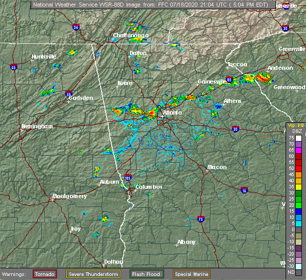 At 508 pm edt, severe thunderstorms were located along a line extending from near mableton to austell to brownsville, and are nearly stationary (radar indicated). Hazards include 60 mph wind gusts and quarter size hail. Hail damage to vehicles is expected. Expect wind damage to roofs, siding, and trees. At 508 pm edt, severe thunderstorms were located along a line extending from near mableton to austell to brownsville, and are nearly stationary (radar indicated). Hazards include 60 mph wind gusts and quarter size hail. Hail damage to vehicles is expected. Expect wind damage to roofs, siding, and trees.
|
| 7/15/2020 5:42 PM EDT |
 The severe thunderstorm warning for southeastern cobb and central fulton counties will expire at 545 pm edt, the storm which prompted the warning has weakened below severe limits, and no longer poses an immediate threat to life or property. therefore, the warning will be allowed to expire. to report severe weather, contact your nearest law enforcement agency. they will relay your report to the national weather service peachtree city. The severe thunderstorm warning for southeastern cobb and central fulton counties will expire at 545 pm edt, the storm which prompted the warning has weakened below severe limits, and no longer poses an immediate threat to life or property. therefore, the warning will be allowed to expire. to report severe weather, contact your nearest law enforcement agency. they will relay your report to the national weather service peachtree city.
|
| 7/15/2020 5:14 PM EDT |
 At 513 pm edt, a severe thunderstorm was located over chastain memorial park, or 8 miles north of atlanta, moving northwest at 10 mph (radar indicated). Hazards include 60 mph wind gusts and quarter size hail. Hail damage to vehicles is expected. Expect wind damage to roofs, siding, and trees. At 513 pm edt, a severe thunderstorm was located over chastain memorial park, or 8 miles north of atlanta, moving northwest at 10 mph (radar indicated). Hazards include 60 mph wind gusts and quarter size hail. Hail damage to vehicles is expected. Expect wind damage to roofs, siding, and trees.
|
| 7/9/2020 7:51 PM EDT |
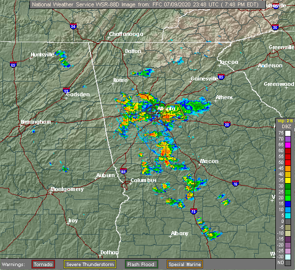 At 750 pm edt, a severe thunderstorm was located over snapfinger, or 7 miles southeast of decatur, moving south at 15 mph (radar indicated). Hazards include 60 mph wind gusts. Expect damage to roofs, siding, and trees. Locations impacted include, decatur, conyers, avondale estates, lithonia, pine lake, lakeview estates, belvedere park, candler-mcafee, milstead, belmont, arabia mountain, redan, scottdale, panthersville, gresham park and snapfinger. At 750 pm edt, a severe thunderstorm was located over snapfinger, or 7 miles southeast of decatur, moving south at 15 mph (radar indicated). Hazards include 60 mph wind gusts. Expect damage to roofs, siding, and trees. Locations impacted include, decatur, conyers, avondale estates, lithonia, pine lake, lakeview estates, belvedere park, candler-mcafee, milstead, belmont, arabia mountain, redan, scottdale, panthersville, gresham park and snapfinger.
|
| 7/9/2020 7:30 PM EDT |
 At 730 pm edt, a severe thunderstorm was located over mountain park, or 10 miles east of decatur, moving south at 25 mph (radar indicated). Hazards include 60 mph wind gusts. expect damage to roofs, siding, and trees At 730 pm edt, a severe thunderstorm was located over mountain park, or 10 miles east of decatur, moving south at 25 mph (radar indicated). Hazards include 60 mph wind gusts. expect damage to roofs, siding, and trees
|
| 6/14/2020 8:06 PM EDT |
 At 806 pm edt, a severe thunderstorm was located over riverdale, or near jonesboro, moving south at 10 mph (radar indicated). Hazards include 60 mph wind gusts and quarter size hail. Hail damage to vehicles is expected. Expect wind damage to roofs, siding, and trees. At 806 pm edt, a severe thunderstorm was located over riverdale, or near jonesboro, moving south at 10 mph (radar indicated). Hazards include 60 mph wind gusts and quarter size hail. Hail damage to vehicles is expected. Expect wind damage to roofs, siding, and trees.
|
| 4/13/2020 2:53 AM EDT |
 At 253 am edt, a severe thunderstorm was located over panola mountain state park, or 10 miles west of conyers, moving east at 60 mph (radar indicated). Hazards include 60 mph wind gusts. expect damage to roofs, siding, and trees At 253 am edt, a severe thunderstorm was located over panola mountain state park, or 10 miles west of conyers, moving east at 60 mph (radar indicated). Hazards include 60 mph wind gusts. expect damage to roofs, siding, and trees
|
| 4/13/2020 2:53 AM EDT |
 The severe thunderstorm warning for northern fayette, south central fulton and clayton counties will expire at 300 am edt, the storm which prompted the warning has moved out of the area. therefore, the warning will be allowed to expire. however gusty winds are still possible with this thunderstorm. a tornado watch remains in effect until 700 am edt for north central and west central georgia. The severe thunderstorm warning for northern fayette, south central fulton and clayton counties will expire at 300 am edt, the storm which prompted the warning has moved out of the area. therefore, the warning will be allowed to expire. however gusty winds are still possible with this thunderstorm. a tornado watch remains in effect until 700 am edt for north central and west central georgia.
|
| 4/13/2020 2:51 AM EDT |
 The tornado warning for southwestern dekalb and south central fulton counties will expire at 300 am edt, the storm which prompted the warning has weakened below severe limits, and no longer appears capable of producing a tornado. therefore, the warning will be allowed to expire. however gusty winds are still possible with this thunderstorm. a tornado watch remains in effect until 700 am edt for north central georgia. The tornado warning for southwestern dekalb and south central fulton counties will expire at 300 am edt, the storm which prompted the warning has weakened below severe limits, and no longer appears capable of producing a tornado. therefore, the warning will be allowed to expire. however gusty winds are still possible with this thunderstorm. a tornado watch remains in effect until 700 am edt for north central georgia.
|
| 4/13/2020 2:48 AM EDT |
 At 247 am edt, a severe thunderstorm capable of producing a tornado was located over lakewood park, or near atlanta, moving northeast at 45 mph (radar indicated rotation. this storm has a history of producing a tornado). Hazards include tornado. Flying debris will be dangerous to those caught without shelter. mobile homes will be damaged or destroyed. damage to roofs, windows, and vehicles will occur. tree damage is likely. Locations impacted include, atlanta, decatur, east point, hapeville, grant park-zoo atlanta, belvedere park, candler-mcafee, druid hills, turner field, kirkwood, lakewood park, panthersville, east lake, gresham park and little five points. At 247 am edt, a severe thunderstorm capable of producing a tornado was located over lakewood park, or near atlanta, moving northeast at 45 mph (radar indicated rotation. this storm has a history of producing a tornado). Hazards include tornado. Flying debris will be dangerous to those caught without shelter. mobile homes will be damaged or destroyed. damage to roofs, windows, and vehicles will occur. tree damage is likely. Locations impacted include, atlanta, decatur, east point, hapeville, grant park-zoo atlanta, belvedere park, candler-mcafee, druid hills, turner field, kirkwood, lakewood park, panthersville, east lake, gresham park and little five points.
|
| 4/13/2020 2:46 AM EDT |
 At 246 am edt, a severe thunderstorm capable of producing a tornado was located over lakewood park, or near atlanta, moving northeast at 45 mph (radar indicated rotation). Hazards include tornado. Flying debris will be dangerous to those caught without shelter. mobile homes will be damaged or destroyed. damage to roofs, windows, and vehicles will occur. Tree damage is likely. At 246 am edt, a severe thunderstorm capable of producing a tornado was located over lakewood park, or near atlanta, moving northeast at 45 mph (radar indicated rotation). Hazards include tornado. Flying debris will be dangerous to those caught without shelter. mobile homes will be damaged or destroyed. damage to roofs, windows, and vehicles will occur. Tree damage is likely.
|
| 4/13/2020 2:38 AM EDT |
 At 238 am edt, a confirmed tornado was located over college park, or 8 miles southwest of atlanta, moving northeast at 45 mph (radar confirmed tornado). Hazards include damaging tornado. Flying debris will be dangerous to those caught without shelter. mobile homes will be damaged or destroyed. damage to roofs, windows, and vehicles will occur. tree damage is likely. Locations impacted include, atlanta, east point, forest park, college park, hapeville and hartsfield-jackson airport. At 238 am edt, a confirmed tornado was located over college park, or 8 miles southwest of atlanta, moving northeast at 45 mph (radar confirmed tornado). Hazards include damaging tornado. Flying debris will be dangerous to those caught without shelter. mobile homes will be damaged or destroyed. damage to roofs, windows, and vehicles will occur. tree damage is likely. Locations impacted include, atlanta, east point, forest park, college park, hapeville and hartsfield-jackson airport.
|
| 4/13/2020 2:36 AM EDT |
 At 235 am edt, a severe thunderstorm was located near union city, or 8 miles northwest of jonesboro, moving east at 60 mph (radar indicated). Hazards include 70 mph wind gusts. Expect considerable tree damage. damage is likely to mobile homes, roofs, and outbuildings. Locations impacted include, atlanta, fayetteville, jonesboro, east point, union city, forest park, riverdale, college park, fairburn, tyrone, morrow, hapeville, palmetto, lake city, hartsfield-jackson airport, grant park-zoo atlanta, lake spivey, fort gillem, lakewood park and sandy creek. At 235 am edt, a severe thunderstorm was located near union city, or 8 miles northwest of jonesboro, moving east at 60 mph (radar indicated). Hazards include 70 mph wind gusts. Expect considerable tree damage. damage is likely to mobile homes, roofs, and outbuildings. Locations impacted include, atlanta, fayetteville, jonesboro, east point, union city, forest park, riverdale, college park, fairburn, tyrone, morrow, hapeville, palmetto, lake city, hartsfield-jackson airport, grant park-zoo atlanta, lake spivey, fort gillem, lakewood park and sandy creek.
|
| 4/13/2020 2:33 AM EDT |
 At 233 am edt, a severe thunderstorm capable of producing a tornado was located near union city, or 12 miles southwest of atlanta, moving northeast at 45 mph (radar indicated rotation). Hazards include tornado. Flying debris will be dangerous to those caught without shelter. mobile homes will be damaged or destroyed. damage to roofs, windows, and vehicles will occur. Tree damage is likely. At 233 am edt, a severe thunderstorm capable of producing a tornado was located near union city, or 12 miles southwest of atlanta, moving northeast at 45 mph (radar indicated rotation). Hazards include tornado. Flying debris will be dangerous to those caught without shelter. mobile homes will be damaged or destroyed. damage to roofs, windows, and vehicles will occur. Tree damage is likely.
|
| 4/13/2020 2:24 AM EDT |
 At 224 am edt, a severe thunderstorm was located over palmetto, or 12 miles northeast of newnan, moving east at 60 mph (radar indicated). Hazards include 60 mph wind gusts. expect damage to roofs, siding, and trees At 224 am edt, a severe thunderstorm was located over palmetto, or 12 miles northeast of newnan, moving east at 60 mph (radar indicated). Hazards include 60 mph wind gusts. expect damage to roofs, siding, and trees
|
| 4/9/2020 5:07 AM EDT |
 The severe thunderstorm warning for southeastern paulding, southern cobb, northeastern carroll and douglas counties will expire at 515 am edt, the storms which prompted the warning have weakened below severe limits, and no longer pose an immediate threat to life or property. therefore, the warning will be allowed to expire. however gusty winds are still possible with these thunderstorms. The severe thunderstorm warning for southeastern paulding, southern cobb, northeastern carroll and douglas counties will expire at 515 am edt, the storms which prompted the warning have weakened below severe limits, and no longer pose an immediate threat to life or property. therefore, the warning will be allowed to expire. however gusty winds are still possible with these thunderstorms.
|
| 4/9/2020 4:54 AM EDT |
 At 454 am edt, severe thunderstorms were located along a line extending from near dallas to near new georgia to near temple, moving east at 50 mph (radar indicated). Hazards include 60 mph wind gusts and penny size hail. Expect damage to roofs, siding, and trees. Locations impacted include, douglasville, dallas, smyrna, villa rica, powder springs, austell, temple, hiram, lithia springs, sweetwater creek state park, vinings, brownsville, chapel hill, bill arp, six flags over georgia, winston, lake val-do-mar, new georgia and mableton. At 454 am edt, severe thunderstorms were located along a line extending from near dallas to near new georgia to near temple, moving east at 50 mph (radar indicated). Hazards include 60 mph wind gusts and penny size hail. Expect damage to roofs, siding, and trees. Locations impacted include, douglasville, dallas, smyrna, villa rica, powder springs, austell, temple, hiram, lithia springs, sweetwater creek state park, vinings, brownsville, chapel hill, bill arp, six flags over georgia, winston, lake val-do-mar, new georgia and mableton.
|
| 4/9/2020 4:40 AM EDT |
 At 440 am edt, severe thunderstorms were located along a line extending from eubank lake to near draketown to buchanan, moving east at 50 mph (radar indicated). Hazards include 60 mph wind gusts and penny size hail. expect damage to roofs, siding, and trees At 440 am edt, severe thunderstorms were located along a line extending from eubank lake to near draketown to buchanan, moving east at 50 mph (radar indicated). Hazards include 60 mph wind gusts and penny size hail. expect damage to roofs, siding, and trees
|
| 3/31/2020 11:43 AM EDT |
 At 1143 am edt, a severe thunderstorm was located over eagles landing, or near mcdonough, moving east at 60 mph (radar indicated). Hazards include 70 mph wind gusts. Expect considerable tree damage. damage is likely to mobile homes, roofs, and outbuildings. Locations impacted include, atlanta, griffin, mcdonough, fayetteville, jackson, jonesboro, peachtree city, stockbridge, forest park, riverdale, hampton, morrow, lovejoy, hapeville, locust grove, senoia, lake city, lithonia, brooks and jenkinsburg. At 1143 am edt, a severe thunderstorm was located over eagles landing, or near mcdonough, moving east at 60 mph (radar indicated). Hazards include 70 mph wind gusts. Expect considerable tree damage. damage is likely to mobile homes, roofs, and outbuildings. Locations impacted include, atlanta, griffin, mcdonough, fayetteville, jackson, jonesboro, peachtree city, stockbridge, forest park, riverdale, hampton, morrow, lovejoy, hapeville, locust grove, senoia, lake city, lithonia, brooks and jenkinsburg.
|
| 3/31/2020 11:38 AM EDT | Report of a large tree downed on top of a ca in dekalb county GA, 4.6 miles WNW of Atlanta, GA |
| 3/31/2020 11:16 AM EDT |
 At 1115 am edt, a severe thunderstorm was located over thomas crossroads, or near newnan, moving east at 60 mph (radar indicated). Hazards include 70 mph wind gusts. Expect considerable tree damage. Damage is likely to mobile homes, roofs, and outbuildings. At 1115 am edt, a severe thunderstorm was located over thomas crossroads, or near newnan, moving east at 60 mph (radar indicated). Hazards include 70 mph wind gusts. Expect considerable tree damage. Damage is likely to mobile homes, roofs, and outbuildings.
|
| 3/24/2020 11:36 PM EDT |
 At 1135 pm edt, a severe thunderstorm was located over kennesaw, or 7 miles northwest of marietta, moving east at 40 mph (radar indicated). Hazards include 60 mph wind gusts and penny size hail. expect damage to roofs, siding, and trees At 1135 pm edt, a severe thunderstorm was located over kennesaw, or 7 miles northwest of marietta, moving east at 40 mph (radar indicated). Hazards include 60 mph wind gusts and penny size hail. expect damage to roofs, siding, and trees
|
| 2/6/2020 8:07 AM EST | *** 1 inj *** a tree fell on a car heading westbound near the intersction of i-285 and ashford dunwoody roa in dekalb county GA, 11.7 miles SSW of Atlanta, GA |
| 2/6/2020 7:42 AM EST |
 At 742 am est, a severe thunderstorm was located over chamblee, or 8 miles north of decatur, moving northeast at 70 mph (radar indicated). Hazards include 60 mph wind gusts. expect damage to roofs, siding, and trees At 742 am est, a severe thunderstorm was located over chamblee, or 8 miles north of decatur, moving northeast at 70 mph (radar indicated). Hazards include 60 mph wind gusts. expect damage to roofs, siding, and trees
|
| 1/11/2020 5:24 PM EST |
 At 523 pm est, severe thunderstorms were located along a line extending from near hollis lathem reservoir to near palmetto, moving east at 40 mph (radar indicated). Hazards include 60 mph wind gusts. expect damage to roofs, siding, and trees At 523 pm est, severe thunderstorms were located along a line extending from near hollis lathem reservoir to near palmetto, moving east at 40 mph (radar indicated). Hazards include 60 mph wind gusts. expect damage to roofs, siding, and trees
|
| 1/11/2020 4:51 PM EST |
 At 450 pm est, severe thunderstorms were located along a line extending from salacoa valley to whitesburg, moving east at 45 mph (radar indicated). Hazards include 60 mph wind gusts. expect damage to roofs, siding, and trees At 450 pm est, severe thunderstorms were located along a line extending from salacoa valley to whitesburg, moving east at 45 mph (radar indicated). Hazards include 60 mph wind gusts. expect damage to roofs, siding, and trees
|
| 10/31/2019 1:19 PM EDT |
 At 119 pm edt, a severe thunderstorm was located over fayetteville, moving northeast at 60 mph (radar indicated). Hazards include 60 mph wind gusts. Expect damage to roofs, siding, and trees. Locations impacted include, atlanta, griffin, mcdonough, fayetteville, jonesboro, peachtree city, stockbridge, union city, forest park, riverdale, college park, fairburn, hampton, tyrone, morrow, lovejoy, hapeville, locust grove, senoia and lake city. At 119 pm edt, a severe thunderstorm was located over fayetteville, moving northeast at 60 mph (radar indicated). Hazards include 60 mph wind gusts. Expect damage to roofs, siding, and trees. Locations impacted include, atlanta, griffin, mcdonough, fayetteville, jonesboro, peachtree city, stockbridge, union city, forest park, riverdale, college park, fairburn, hampton, tyrone, morrow, lovejoy, hapeville, locust grove, senoia and lake city.
|
| 10/31/2019 1:07 PM EDT |
 At 106 pm edt, a severe thunderstorm was located over sharpsburg, or 10 miles east of newnan, moving northeast at 55 mph (radar indicated). Hazards include 60 mph wind gusts. expect damage to roofs, siding, and trees At 106 pm edt, a severe thunderstorm was located over sharpsburg, or 10 miles east of newnan, moving northeast at 55 mph (radar indicated). Hazards include 60 mph wind gusts. expect damage to roofs, siding, and trees
|
| 9/10/2019 5:30 PM EDT | Tree down on vehicles near the intersection of mcmillan st. nw and 8th st n in fulton county GA, 1.5 miles SW of Atlanta, GA |
| 9/10/2019 5:29 PM EDT |
 At 528 pm edt, a severe thunderstorm was located over sandy springs, or 9 miles east of marietta, moving west at 5 mph (radar indicated). Hazards include 60 mph wind gusts. Expect damage to roofs, siding, and trees. Locations impacted include, atlanta, marietta, sandy springs, smyrna, dunwoody, chamblee, doraville, tucker, fair oaks, north atlanta, north druid hills, vinings, brookhaven, bolton, dobbins air reserve base and chastain memorial park. At 528 pm edt, a severe thunderstorm was located over sandy springs, or 9 miles east of marietta, moving west at 5 mph (radar indicated). Hazards include 60 mph wind gusts. Expect damage to roofs, siding, and trees. Locations impacted include, atlanta, marietta, sandy springs, smyrna, dunwoody, chamblee, doraville, tucker, fair oaks, north atlanta, north druid hills, vinings, brookhaven, bolton, dobbins air reserve base and chastain memorial park.
|
| 9/10/2019 5:18 PM EDT | Recieved a report of damage along club dr ne including trees down and roof damage. time is estimated from rada in fulton county GA, 7.7 miles SSW of Atlanta, GA |
| 9/10/2019 5:00 PM EDT |
 The national weather service in peachtree city has issued a * severe thunderstorm warning for. northwestern dekalb county in north central georgia. southeastern cobb county in north central georgia. central fulton county in north central georgia. Until 545 pm edt. The national weather service in peachtree city has issued a * severe thunderstorm warning for. northwestern dekalb county in north central georgia. southeastern cobb county in north central georgia. central fulton county in north central georgia. Until 545 pm edt.
|
| 8/14/2019 6:06 PM EDT |
 At 606 pm edt, a severe thunderstorm was located over oak grove, or 9 miles northwest of marietta, moving southeast at 30 mph (radar indicated). Hazards include 60 mph wind gusts and quarter size hail. Hail damage to vehicles is expected. expect wind damage to roofs, siding, and trees. Locations impacted include, atlanta, marietta, canton, sandy springs, roswell, alpharetta, smyrna, kennesaw, woodstock, acworth, holly springs, emerson, fair oaks, mount bethel, hickory flat, kellogg creek, red top mountain state park, cross roads, due west and sandy plains. At 606 pm edt, a severe thunderstorm was located over oak grove, or 9 miles northwest of marietta, moving southeast at 30 mph (radar indicated). Hazards include 60 mph wind gusts and quarter size hail. Hail damage to vehicles is expected. expect wind damage to roofs, siding, and trees. Locations impacted include, atlanta, marietta, canton, sandy springs, roswell, alpharetta, smyrna, kennesaw, woodstock, acworth, holly springs, emerson, fair oaks, mount bethel, hickory flat, kellogg creek, red top mountain state park, cross roads, due west and sandy plains.
|
| 8/14/2019 5:51 PM EDT |
 At 550 pm edt, a severe thunderstorm was located over emerson, or near cartersville, moving southeast at 30 mph (radar indicated). Hazards include 60 mph wind gusts and quarter size hail. Hail damage to vehicles is expected. Expect wind damage to roofs, siding, and trees. At 550 pm edt, a severe thunderstorm was located over emerson, or near cartersville, moving southeast at 30 mph (radar indicated). Hazards include 60 mph wind gusts and quarter size hail. Hail damage to vehicles is expected. Expect wind damage to roofs, siding, and trees.
|
| 8/14/2019 12:20 AM EDT | Tree down blocking traffic at moreland ave se and lyndale dr. se. reported by local media and social medi in fulton county GA, 3.5 miles WNW of Atlanta, GA |
| 8/1/2019 5:36 PM EDT |
 At 536 pm edt, a severe thunderstorm was located over mechanicsville, or 10 miles north of decatur, moving northeast at 15 mph (radar indicated). Hazards include 60 mph wind gusts and penny size hail. Expect damage to roofs, siding, and trees. Locations impacted include, sandy springs, roswell, dunwoody, duluth, chamblee, norcross, doraville, clarkston, berkeley lake, tucker, north atlanta, north decatur, mechanicsville, brookhaven and scottdale. At 536 pm edt, a severe thunderstorm was located over mechanicsville, or 10 miles north of decatur, moving northeast at 15 mph (radar indicated). Hazards include 60 mph wind gusts and penny size hail. Expect damage to roofs, siding, and trees. Locations impacted include, sandy springs, roswell, dunwoody, duluth, chamblee, norcross, doraville, clarkston, berkeley lake, tucker, north atlanta, north decatur, mechanicsville, brookhaven and scottdale.
|
| 8/1/2019 5:30 PM EDT | A large tree was downed onto the onramp from i-285 to i-8 in dekalb county GA, 12.5 miles SW of Atlanta, GA |
| 8/1/2019 5:30 PM EDT | Dozens of trees were blown down in the area of embry hills drive. some were downed onto homes and power line in dekalb county GA, 12.5 miles SW of Atlanta, GA |
| 8/1/2019 5:30 PM EDT | Quarter sized hail reported 12.5 miles SW of Atlanta, GA, quarter-sized hail fell at the i-85/i-285 interchange along with estimated 40-50 mph wind gusts. |
| 8/1/2019 5:21 PM EDT |
 At 521 pm edt, a severe thunderstorm was located over doraville, or 8 miles north of decatur, moving northeast at 15 mph (radar indicated). Hazards include 60 mph wind gusts and quarter size hail. Hail damage to vehicles is expected. Expect wind damage to roofs, siding, and trees. At 521 pm edt, a severe thunderstorm was located over doraville, or 8 miles north of decatur, moving northeast at 15 mph (radar indicated). Hazards include 60 mph wind gusts and quarter size hail. Hail damage to vehicles is expected. Expect wind damage to roofs, siding, and trees.
|
| 8/1/2019 5:10 PM EDT | A tree fell across elkmont rd n in fulton county GA, 3.4 miles WSW of Atlanta, GA |
| 8/1/2019 4:54 PM EDT |
 At 454 pm edt, a severe thunderstorm was located over piedmont park, or over atlanta, moving north at 10 mph (radar indicated). Hazards include 60 mph wind gusts and quarter size hail. Hail damage to vehicles is expected. Expect wind damage to roofs, siding, and trees. At 454 pm edt, a severe thunderstorm was located over piedmont park, or over atlanta, moving north at 10 mph (radar indicated). Hazards include 60 mph wind gusts and quarter size hail. Hail damage to vehicles is expected. Expect wind damage to roofs, siding, and trees.
|
| 7/30/2019 5:37 PM EDT |
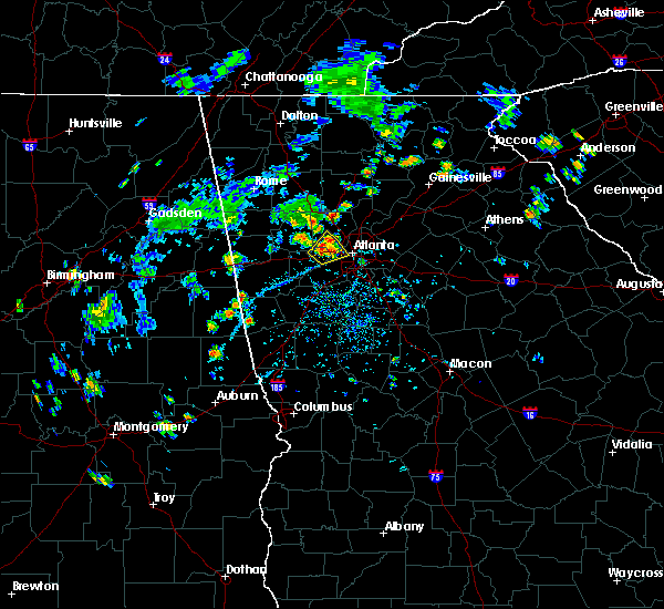 At 536 pm edt, a severe thunderstorm was located over lithia springs, or near douglasville, and is nearly stationary (radar indicated). Hazards include 60 mph wind gusts and quarter size hail. Hail damage to vehicles is expected. expect wind damage to roofs, siding, and trees. Locations impacted include, atlanta, douglasville, smyrna, powder springs, austell, lithia springs, sweetwater creek state park, six flags over georgia, jim r miller park and mableton. At 536 pm edt, a severe thunderstorm was located over lithia springs, or near douglasville, and is nearly stationary (radar indicated). Hazards include 60 mph wind gusts and quarter size hail. Hail damage to vehicles is expected. expect wind damage to roofs, siding, and trees. Locations impacted include, atlanta, douglasville, smyrna, powder springs, austell, lithia springs, sweetwater creek state park, six flags over georgia, jim r miller park and mableton.
|
| 7/30/2019 5:26 PM EDT |
 At 525 pm edt, a severe thunderstorm was located over lithia springs, or near douglasville, and is nearly stationary (radar indicated). Hazards include 60 mph wind gusts and quarter size hail. Hail damage to vehicles is expected. Expect wind damage to roofs, siding, and trees. At 525 pm edt, a severe thunderstorm was located over lithia springs, or near douglasville, and is nearly stationary (radar indicated). Hazards include 60 mph wind gusts and quarter size hail. Hail damage to vehicles is expected. Expect wind damage to roofs, siding, and trees.
|
| 6/24/2019 7:24 PM EDT |
 At 724 pm edt, severe thunderstorms were located along a line extending from redan to near inman, moving east at 35 mph (radar indicated). Hazards include 60 mph wind gusts. Expect damage to roofs, siding, and trees. Locations impacted include, atlanta, newnan, mcdonough, decatur, fayetteville, conyers, jonesboro, peachtree city, east point, stockbridge, union city, forest park, riverdale, college park, fairburn, hampton, tyrone, morrow, lovejoy and hapeville. At 724 pm edt, severe thunderstorms were located along a line extending from redan to near inman, moving east at 35 mph (radar indicated). Hazards include 60 mph wind gusts. Expect damage to roofs, siding, and trees. Locations impacted include, atlanta, newnan, mcdonough, decatur, fayetteville, conyers, jonesboro, peachtree city, east point, stockbridge, union city, forest park, riverdale, college park, fairburn, hampton, tyrone, morrow, lovejoy and hapeville.
|
| 6/24/2019 7:07 PM EDT |
 At 707 pm edt, a severe thunderstorm was located near duluth, or near lawrenceville, moving east at 35 mph (radar indicated). Hazards include 60 mph wind gusts. Expect damage to roofs, siding, and trees. Locations impacted include, atlanta, lawrenceville, sandy springs, roswell, johns creek, alpharetta, dunwoody, duluth, sugar hill, snellville, suwanee, buford, lilburn, chamblee, norcross, doraville, clarkston, braselton, stone mountain and flowery branch. At 707 pm edt, a severe thunderstorm was located near duluth, or near lawrenceville, moving east at 35 mph (radar indicated). Hazards include 60 mph wind gusts. Expect damage to roofs, siding, and trees. Locations impacted include, atlanta, lawrenceville, sandy springs, roswell, johns creek, alpharetta, dunwoody, duluth, sugar hill, snellville, suwanee, buford, lilburn, chamblee, norcross, doraville, clarkston, braselton, stone mountain and flowery branch.
|
| 6/24/2019 7:05 PM EDT | A tree and power lines were reported down in the 2700 block of kimmeridge drive near thompson avenu in fulton county GA, 6 miles NNE of Atlanta, GA |
| 6/24/2019 6:52 PM EDT |
 At 634 pm edt, a severe thunderstorm was located over hannah, or 10 miles east of carrollton, moving east at 35 mph (radar indicated). Hazards include 60 mph wind gusts and penny size hail. expect damage to roofs, siding, and trees At 634 pm edt, a severe thunderstorm was located over hannah, or 10 miles east of carrollton, moving east at 35 mph (radar indicated). Hazards include 60 mph wind gusts and penny size hail. expect damage to roofs, siding, and trees
|
| 6/24/2019 6:51 PM EDT |
 At 651 pm edt, severe thunderstorms were located along a line extending from bankhead to madras, moving east at 35 mph (radar indicated). Hazards include 60 mph wind gusts. expect damage to roofs, siding, and trees At 651 pm edt, severe thunderstorms were located along a line extending from bankhead to madras, moving east at 35 mph (radar indicated). Hazards include 60 mph wind gusts. expect damage to roofs, siding, and trees
|
| 6/24/2019 6:39 PM EDT |
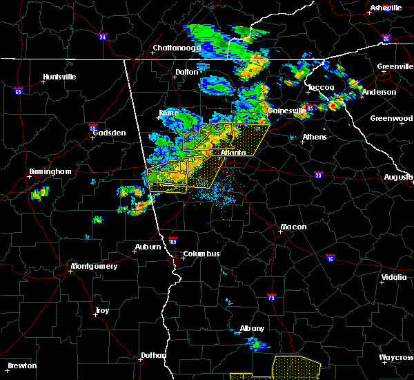 At 638 pm edt, a severe thunderstorm was located over mount bethel, or 7 miles east of marietta, moving east at 35 mph (radar indicated). Hazards include 60 mph wind gusts and penny size hail. expect damage to roofs, siding, and trees At 638 pm edt, a severe thunderstorm was located over mount bethel, or 7 miles east of marietta, moving east at 35 mph (radar indicated). Hazards include 60 mph wind gusts and penny size hail. expect damage to roofs, siding, and trees
|
| 6/24/2019 6:35 PM EDT |
 At 634 pm edt, a severe thunderstorm was located over hannah, or 10 miles east of carrollton, moving east at 35 mph (radar indicated). Hazards include 60 mph wind gusts and penny size hail. expect damage to roofs, siding, and trees At 634 pm edt, a severe thunderstorm was located over hannah, or 10 miles east of carrollton, moving east at 35 mph (radar indicated). Hazards include 60 mph wind gusts and penny size hail. expect damage to roofs, siding, and trees
|
| 6/24/2019 6:15 PM EDT |
 At 615 pm edt, a severe thunderstorm was located over due west, or 8 miles northeast of dallas, moving east at 30 mph (radar indicated). Hazards include 60 mph wind gusts and quarter size hail. Hail damage to vehicles is expected. Expect wind damage to roofs, siding, and trees. At 615 pm edt, a severe thunderstorm was located over due west, or 8 miles northeast of dallas, moving east at 30 mph (radar indicated). Hazards include 60 mph wind gusts and quarter size hail. Hail damage to vehicles is expected. Expect wind damage to roofs, siding, and trees.
|
| 6/23/2019 3:34 PM EDT |
 At 334 pm edt, a severe thunderstorm was located over belvedere park, or over decatur, moving east at 10 mph (radar indicated). Hazards include 60 mph wind gusts and quarter size hail. Hail damage to vehicles is expected. expect wind damage to roofs, siding, and trees. Locations impacted include, atlanta, east point, hapeville, candler-mcafee, cascade heights, lakewood park, panthersville, turner field and gresham park. At 334 pm edt, a severe thunderstorm was located over belvedere park, or over decatur, moving east at 10 mph (radar indicated). Hazards include 60 mph wind gusts and quarter size hail. Hail damage to vehicles is expected. expect wind damage to roofs, siding, and trees. Locations impacted include, atlanta, east point, hapeville, candler-mcafee, cascade heights, lakewood park, panthersville, turner field and gresham park.
|
| 6/23/2019 3:25 PM EDT |
 At 325 pm edt, a severe thunderstorm was located over sandtown, or 10 miles southwest of atlanta, moving southeast at 15 mph (radar indicated). Hazards include ping pong ball size hail and 60 mph wind gusts. People and animals outdoors will be injured. expect hail damage to roofs, siding, windows, and vehicles. Expect wind damage to roofs, siding, and trees. At 325 pm edt, a severe thunderstorm was located over sandtown, or 10 miles southwest of atlanta, moving southeast at 15 mph (radar indicated). Hazards include ping pong ball size hail and 60 mph wind gusts. People and animals outdoors will be injured. expect hail damage to roofs, siding, windows, and vehicles. Expect wind damage to roofs, siding, and trees.
|
| 6/23/2019 3:19 PM EDT | Atl asos measured a wind gust at 50 kt in clayton county GA, 8.5 miles N of Atlanta, GA |
| 6/23/2019 3:00 PM EDT | Tree down in midtown atlanta near the intersection of juniper st ne and 11th st. ne in fulton county GA, 2.4 miles WSW of Atlanta, GA |
| 6/23/2019 2:55 PM EDT |
 At 255 pm edt, a severe thunderstorm was located over midtown, or over atlanta, moving east at 10 mph (radar indicated). Hazards include 60 mph wind gusts and quarter size hail. Hail damage to vehicles is expected. Expect wind damage to roofs, siding, and trees. At 255 pm edt, a severe thunderstorm was located over midtown, or over atlanta, moving east at 10 mph (radar indicated). Hazards include 60 mph wind gusts and quarter size hail. Hail damage to vehicles is expected. Expect wind damage to roofs, siding, and trees.
|
| 6/22/2019 8:00 PM EDT |
 A severe thunderstorm warning remains in effect until 830 pm edt for southwestern dekalb. northwestern henry. southeastern fulton and northeastern clayton counties. at 800 pm edt, a severe thunderstorm was located over forest park, or near jonesboro, moving east at 15 mph. hazard. 60 mph wind gusts. A severe thunderstorm warning remains in effect until 830 pm edt for southwestern dekalb. northwestern henry. southeastern fulton and northeastern clayton counties. at 800 pm edt, a severe thunderstorm was located over forest park, or near jonesboro, moving east at 15 mph. hazard. 60 mph wind gusts.
|
| 6/22/2019 7:37 PM EDT |
 At 737 pm edt, a severe thunderstorm was located over college park, or 9 miles southwest of atlanta, moving east at 15 mph (radar indicated). Hazards include 60 mph wind gusts and quarter size hail. Hail damage to vehicles is expected. Expect wind damage to roofs, siding, and trees. At 737 pm edt, a severe thunderstorm was located over college park, or 9 miles southwest of atlanta, moving east at 15 mph (radar indicated). Hazards include 60 mph wind gusts and quarter size hail. Hail damage to vehicles is expected. Expect wind damage to roofs, siding, and trees.
|
| 6/22/2019 7:37 PM EDT |
 The national weather service in peachtree city has issued a * severe thunderstorm warning for. southwestern dekalb county in north central georgia. northeastern fayette county in north central georgia. northwestern henry county in north central georgia. South central fulton county in north central georgia. The national weather service in peachtree city has issued a * severe thunderstorm warning for. southwestern dekalb county in north central georgia. northeastern fayette county in north central georgia. northwestern henry county in north central georgia. South central fulton county in north central georgia.
|
| 6/22/2019 7:37 PM EDT |
 At 737 pm edt, a severe thunderstorm was located over college park, or 9 miles southwest of atlanta, moving east at 15 mph (radar indicated). Hazards include 60 mph wind gusts and quarter size hail. Hail damage to vehicles is expected. Expect wind damage to roofs, siding, and trees. At 737 pm edt, a severe thunderstorm was located over college park, or 9 miles southwest of atlanta, moving east at 15 mph (radar indicated). Hazards include 60 mph wind gusts and quarter size hail. Hail damage to vehicles is expected. Expect wind damage to roofs, siding, and trees.
|
| 6/22/2019 4:08 PM EDT |
 At 407 pm edt, a severe thunderstorm was located over lakewood park, or near atlanta, moving east at 15 mph (radar indicated. at 345 pm, quarter-sized hail was reported sweetwater state park). Hazards include 60 mph wind gusts and quarter size hail. Hail damage to vehicles is expected. expect wind damage to roofs, siding, and trees. Locations impacted include, atlanta, decatur, east point, forest park, college park, morrow, hapeville, avondale estates, lake city, belvedere park, hartsfield-jackson airport, grant park-zoo atlanta, candler-mcafee, rex, sweet auburn, lakewood park, conley, east lake, snapfinger and ellenwood. At 407 pm edt, a severe thunderstorm was located over lakewood park, or near atlanta, moving east at 15 mph (radar indicated. at 345 pm, quarter-sized hail was reported sweetwater state park). Hazards include 60 mph wind gusts and quarter size hail. Hail damage to vehicles is expected. expect wind damage to roofs, siding, and trees. Locations impacted include, atlanta, decatur, east point, forest park, college park, morrow, hapeville, avondale estates, lake city, belvedere park, hartsfield-jackson airport, grant park-zoo atlanta, candler-mcafee, rex, sweet auburn, lakewood park, conley, east lake, snapfinger and ellenwood.
|
| 6/22/2019 4:04 PM EDT |
 At 403 pm edt, a severe thunderstorm was located near sandtown, or 10 miles southwest of atlanta, moving southeast at 15 mph (trained weather spotters. at sweetwater state park reported quarter sized hail). Hazards include 60 mph wind gusts and quarter size hail. Hail damage to vehicles is expected. expect wind damage to roofs, siding, and trees. Locations impacted include, atlanta, east point, cascade heights and sandtown. At 403 pm edt, a severe thunderstorm was located near sandtown, or 10 miles southwest of atlanta, moving southeast at 15 mph (trained weather spotters. at sweetwater state park reported quarter sized hail). Hazards include 60 mph wind gusts and quarter size hail. Hail damage to vehicles is expected. expect wind damage to roofs, siding, and trees. Locations impacted include, atlanta, east point, cascade heights and sandtown.
|
| 6/22/2019 3:59 PM EDT |
 At 359 pm edt, a severe thunderstorm was located over lakewood park, or over atlanta, moving east at 15 mph (radar indicated). Hazards include 60 mph wind gusts and quarter size hail. Hail damage to vehicles is expected. Expect wind damage to roofs, siding, and trees. At 359 pm edt, a severe thunderstorm was located over lakewood park, or over atlanta, moving east at 15 mph (radar indicated). Hazards include 60 mph wind gusts and quarter size hail. Hail damage to vehicles is expected. Expect wind damage to roofs, siding, and trees.
|
| 6/22/2019 3:44 PM EDT |
 At 344 pm edt, a severe thunderstorm was located over sandtown, or 9 miles east of douglasville, moving southeast at 15 mph (radar indicated). Hazards include 60 mph wind gusts and quarter size hail. Hail damage to vehicles is expected. expect wind damage to roofs, siding, and trees. Locations impacted include, atlanta, douglasville, east point, lithia springs, sweetwater creek state park, six flags over georgia, cascade heights, sandtown and mableton. At 344 pm edt, a severe thunderstorm was located over sandtown, or 9 miles east of douglasville, moving southeast at 15 mph (radar indicated). Hazards include 60 mph wind gusts and quarter size hail. Hail damage to vehicles is expected. expect wind damage to roofs, siding, and trees. Locations impacted include, atlanta, douglasville, east point, lithia springs, sweetwater creek state park, six flags over georgia, cascade heights, sandtown and mableton.
|
| 6/22/2019 3:31 PM EDT |
 At 331 pm edt, a severe thunderstorm was located over sweetwater creek state park, or 7 miles east of douglasville, moving southeast at 15 mph (radar indicated). Hazards include 60 mph wind gusts and quarter size hail. Hail damage to vehicles is expected. Expect wind damage to roofs, siding, and trees. At 331 pm edt, a severe thunderstorm was located over sweetwater creek state park, or 7 miles east of douglasville, moving southeast at 15 mph (radar indicated). Hazards include 60 mph wind gusts and quarter size hail. Hail damage to vehicles is expected. Expect wind damage to roofs, siding, and trees.
|
| 6/7/2019 3:42 PM EDT | A tree and power lines were reported down on long island drive near burdette roa in fulton county GA, 9.5 miles S of Atlanta, GA |
| 4/14/2019 7:34 PM EDT |
 At 734 pm edt, a severe thunderstorm was located over avondale estates, or over decatur, moving northeast at 45 mph (radar indicated). Hazards include 60 mph wind gusts and penny size hail. Expect damage to roofs, siding, and trees. Locations impacted include, atlanta, lawrenceville, decatur, dunwoody, duluth, snellville, suwanee, lilburn, chamblee, norcross, doraville, clarkston, stone mountain, dacula, avondale estates, grayson, berkeley lake, pine lake, tucker and belvedere park. At 734 pm edt, a severe thunderstorm was located over avondale estates, or over decatur, moving northeast at 45 mph (radar indicated). Hazards include 60 mph wind gusts and penny size hail. Expect damage to roofs, siding, and trees. Locations impacted include, atlanta, lawrenceville, decatur, dunwoody, duluth, snellville, suwanee, lilburn, chamblee, norcross, doraville, clarkston, stone mountain, dacula, avondale estates, grayson, berkeley lake, pine lake, tucker and belvedere park.
|
| 4/14/2019 7:31 PM EDT |
 At 731 pm edt, a severe thunderstorm was located over candler-mcafee, or over decatur, moving northeast at 45 mph (radar indicated). Hazards include 60 mph wind gusts and penny size hail. expect damage to roofs, siding, and trees At 731 pm edt, a severe thunderstorm was located over candler-mcafee, or over decatur, moving northeast at 45 mph (radar indicated). Hazards include 60 mph wind gusts and penny size hail. expect damage to roofs, siding, and trees
|
| 4/9/2019 5:55 PM EDT | Public reported a tree down on marietta rd nw near dupont commons lan in fulton county GA, 3.8 miles SSE of Atlanta, GA |
| 4/9/2019 5:55 PM EDT | Public reported a tree was downed on brantley street n in fulton county GA, 4.6 miles SE of Atlanta, GA |
| 2/12/2019 1:35 PM EST | Clayton county emergency services reported several trees and power lines blown down around the laurel park apartments along georgia highway 85 on the north side of rive in clayton county GA, 11.2 miles N of Atlanta, GA |
| 10/10/2018 6:55 PM EDT |
 The tornado warning for south central cobb, northeastern douglas and central fulton counties will expire at 700 pm edt, the tornadic storm which prompted the warning has weakened. therefore, the warning will be allowed to expire at 7 pm. The tornado warning for south central cobb, northeastern douglas and central fulton counties will expire at 700 pm edt, the tornadic storm which prompted the warning has weakened. therefore, the warning will be allowed to expire at 7 pm.
|
| 10/10/2018 6:37 PM EDT |
 At 637 pm edt, a severe thunderstorm capable of producing a tornado was located over cascade heights, or near atlanta, moving west at 20 mph (radar indicated rotation). Hazards include tornado. Flying debris will be dangerous to those caught without shelter. mobile homes will be damaged or destroyed. damage to roofs, windows, and vehicles will occur. Tree damage is likely. At 637 pm edt, a severe thunderstorm capable of producing a tornado was located over cascade heights, or near atlanta, moving west at 20 mph (radar indicated rotation). Hazards include tornado. Flying debris will be dangerous to those caught without shelter. mobile homes will be damaged or destroyed. damage to roofs, windows, and vehicles will occur. Tree damage is likely.
|
| 8/9/2018 4:55 PM EDT | Tree down on the entrance ramp from riverdale rd onto i-85 n in clayton county GA, 9.5 miles NNE of Atlanta, GA |
| 8/9/2018 4:51 PM EDT |
 The severe thunderstorm warning for southwestern cobb, northeastern douglas and south central fulton counties will expire at 500 pm edt, the storm which prompted the warning has weakened below severe limits, and no longer poses an immediate threat to life or property. therefore, the warning will be allowed to expire. however gusty winds and heavy rain are still possible with this thunderstorm. The severe thunderstorm warning for southwestern cobb, northeastern douglas and south central fulton counties will expire at 500 pm edt, the storm which prompted the warning has weakened below severe limits, and no longer poses an immediate threat to life or property. therefore, the warning will be allowed to expire. however gusty winds and heavy rain are still possible with this thunderstorm.
|
| 8/9/2018 4:44 PM EDT | Via twitter... at least 3 trees down in the vacinity of mt paran rd nw and w conway dr nw in buckhead in fulton county GA, 7.5 miles S of Atlanta, GA |
| 8/9/2018 4:23 PM EDT |
 At 422 pm edt, a severe thunderstorm was located over sweetwater creek state park, or near douglasville, moving east at 45 mph (radar indicated). Hazards include 60 mph wind gusts. expect damage to roofs, siding, and trees At 422 pm edt, a severe thunderstorm was located over sweetwater creek state park, or near douglasville, moving east at 45 mph (radar indicated). Hazards include 60 mph wind gusts. expect damage to roofs, siding, and trees
|
| 8/9/2018 3:40 PM EDT | Tree down at the intersection of i-285 onramp from i-85 and u.s. hwy 29/roosevelt hwy in fulton county GA, 10.7 miles NNE of Atlanta, GA |
| 7/21/2018 7:16 PM EDT |
 At 715 pm edt, a severe thunderstorm was located over gresham park, or near decatur, moving east at 30 mph (radar indicated). Hazards include 60 mph wind gusts and quarter size hail. Hail damage to vehicles is expected. expect wind damage to roofs, siding, and trees. Locations impacted include, atlanta, decatur, avondale estates, candler-mcafee, belvedere park, druid hills, panthersville, east lake, gresham park, little five points and kirkwood. At 715 pm edt, a severe thunderstorm was located over gresham park, or near decatur, moving east at 30 mph (radar indicated). Hazards include 60 mph wind gusts and quarter size hail. Hail damage to vehicles is expected. expect wind damage to roofs, siding, and trees. Locations impacted include, atlanta, decatur, avondale estates, candler-mcafee, belvedere park, druid hills, panthersville, east lake, gresham park, little five points and kirkwood.
|
| 7/21/2018 7:11 PM EDT | Tree down on a house and a tree down on powerline in fulton county GA, 3.9 miles NW of Atlanta, GA |
| 7/21/2018 7:10 PM EDT | Quarter sized hail reported 7.4 miles NW of Atlanta, GA, hail report on social media. size estimated from photo. |
| 7/21/2018 7:00 PM EDT | Quarter sized hail reported 6.7 miles NNE of Atlanta, GA, public report of quarter sized hail |
| 7/21/2018 6:45 PM EDT |
 At 645 pm edt, a severe thunderstorm was located near sandtown, or 11 miles southeast of douglasville, moving east at 25 mph (radar indicated). Hazards include 60 mph wind gusts and quarter size hail. Hail damage to vehicles is expected. Expect wind damage to roofs, siding, and trees. At 645 pm edt, a severe thunderstorm was located near sandtown, or 11 miles southeast of douglasville, moving east at 25 mph (radar indicated). Hazards include 60 mph wind gusts and quarter size hail. Hail damage to vehicles is expected. Expect wind damage to roofs, siding, and trees.
|
| 7/21/2018 6:51 AM EDT |
 The severe thunderstorm warning for northwestern dekalb, southeastern cobb and central fulton counties will expire at 700 am edt, the storms which prompted the warning have weakened or moved out of the warned area. therefore, the warning will be allowed to expire. however gusty winds are still possible with these thunderstorms. a severe thunderstorm watch remains in effect until 1000 am edt for north central georgia. The severe thunderstorm warning for northwestern dekalb, southeastern cobb and central fulton counties will expire at 700 am edt, the storms which prompted the warning have weakened or moved out of the warned area. therefore, the warning will be allowed to expire. however gusty winds are still possible with these thunderstorms. a severe thunderstorm watch remains in effect until 1000 am edt for north central georgia.
|
| 7/21/2018 6:27 AM EDT |
 At 627 am edt, severe thunderstorms were located along a line extending from doraville to chastain memorial park to smyrna, moving southeast at 40 mph (radar indicated). Hazards include 60 mph wind gusts and quarter size hail. Hail damage to vehicles is expected. expect wind damage to roofs, siding, and trees. Locations impacted include, atlanta, marietta, decatur, sandy springs, roswell, smyrna, dunwoody, chamblee, doraville, north decatur, fair oaks, north atlanta, north druid hills, midtown, druid hills, tucker, mount bethel, vinings, piedmont park and brookhaven. At 627 am edt, severe thunderstorms were located along a line extending from doraville to chastain memorial park to smyrna, moving southeast at 40 mph (radar indicated). Hazards include 60 mph wind gusts and quarter size hail. Hail damage to vehicles is expected. expect wind damage to roofs, siding, and trees. Locations impacted include, atlanta, marietta, decatur, sandy springs, roswell, smyrna, dunwoody, chamblee, doraville, north decatur, fair oaks, north atlanta, north druid hills, midtown, druid hills, tucker, mount bethel, vinings, piedmont park and brookhaven.
|
| 7/21/2018 6:10 AM EDT |
 At 610 am edt, a severe thunderstorm was located over woodstock, or 9 miles north of marietta, moving southeast at 35 mph (radar indicated). Hazards include 60 mph wind gusts and quarter size hail. Hail damage to vehicles is expected. Expect wind damage to roofs, siding, and trees. At 610 am edt, a severe thunderstorm was located over woodstock, or 9 miles north of marietta, moving southeast at 35 mph (radar indicated). Hazards include 60 mph wind gusts and quarter size hail. Hail damage to vehicles is expected. Expect wind damage to roofs, siding, and trees.
|
| 7/6/2018 5:12 PM EDT |
 The severe thunderstorm warning for southern cobb, northeastern douglas and southwestern fulton counties will expire at 515 pm edt, the storm which prompted the warning has weakened below severe limits, and no longer poses an immediate threat to life or property. therefore, the warning will be allowed to expire. however gusty winds and heavy rain are still possible with this thunderstorm. additional storms will affect much of metro atlanta through 7 pm. to report severe weather, contact your nearest law enforcement agency. they will relay your report to the national weather service peachtree city. The severe thunderstorm warning for southern cobb, northeastern douglas and southwestern fulton counties will expire at 515 pm edt, the storm which prompted the warning has weakened below severe limits, and no longer poses an immediate threat to life or property. therefore, the warning will be allowed to expire. however gusty winds and heavy rain are still possible with this thunderstorm. additional storms will affect much of metro atlanta through 7 pm. to report severe weather, contact your nearest law enforcement agency. they will relay your report to the national weather service peachtree city.
|
| 7/6/2018 4:49 PM EDT | Quarter sized hail reported 5 miles ESE of Atlanta, GA, 1 inch hail reported briefly just west of i-285... west of atlanta. |
| 7/6/2018 4:39 PM EDT |
 At 439 pm edt, a severe thunderstorm was located over bankhead, or near atlanta, moving west at 10 mph (radar indicated). Hazards include 60 mph wind gusts and nickel size hail. expect damage to roofs, siding, and trees At 439 pm edt, a severe thunderstorm was located over bankhead, or near atlanta, moving west at 10 mph (radar indicated). Hazards include 60 mph wind gusts and nickel size hail. expect damage to roofs, siding, and trees
|
| 6/25/2018 6:21 PM EDT |
 The severe thunderstorm warning for northeastern fayette, northwestern henry, clayton and south central fulton counties will expire at 630 pm edt, the storm which prompted the warning has weakened below severe limits, and no longer poses an immediate threat to life or property. therefore, the warning will be allowed to expire. however gusty winds are still possible with this thunderstorm. The severe thunderstorm warning for northeastern fayette, northwestern henry, clayton and south central fulton counties will expire at 630 pm edt, the storm which prompted the warning has weakened below severe limits, and no longer poses an immediate threat to life or property. therefore, the warning will be allowed to expire. however gusty winds are still possible with this thunderstorm.
|
| 6/25/2018 5:50 PM EDT |
 At 549 pm edt, a severe thunderstorm was located over riverdale, or near jonesboro, moving east at 30 mph (radar indicated). Hazards include 60 mph wind gusts and quarter size hail. Hail damage to vehicles is expected. Expect wind damage to roofs, siding, and trees. At 549 pm edt, a severe thunderstorm was located over riverdale, or near jonesboro, moving east at 30 mph (radar indicated). Hazards include 60 mph wind gusts and quarter size hail. Hail damage to vehicles is expected. Expect wind damage to roofs, siding, and trees.
|
| 6/22/2018 5:56 PM EDT |
 At 556 pm edt, a severe thunderstorm was located near chapel hill, or 7 miles south of douglasville, moving east at 40 mph (radar indicated). Hazards include 60 mph wind gusts. expect damage to roofs, siding, and trees At 556 pm edt, a severe thunderstorm was located near chapel hill, or 7 miles south of douglasville, moving east at 40 mph (radar indicated). Hazards include 60 mph wind gusts. expect damage to roofs, siding, and trees
|
| 6/22/2018 5:36 PM EDT |
 At 535 pm edt, a severe thunderstorm was located over sweetwater creek state park, or near douglasville, moving east at 25 mph (radar indicated). Hazards include 60 mph wind gusts. expect damage to roofs, siding, and trees At 535 pm edt, a severe thunderstorm was located over sweetwater creek state park, or near douglasville, moving east at 25 mph (radar indicated). Hazards include 60 mph wind gusts. expect damage to roofs, siding, and trees
|
| 6/15/2018 5:49 PM EDT |
 At 549 pm edt, a severe thunderstorm was located over college park, or 8 miles southwest of atlanta, moving southwest at 20 mph (radar indicated). Hazards include 60 mph wind gusts and quarter size hail. Hail damage to vehicles is expected. Expect wind damage to roofs, siding, and trees. At 549 pm edt, a severe thunderstorm was located over college park, or 8 miles southwest of atlanta, moving southwest at 20 mph (radar indicated). Hazards include 60 mph wind gusts and quarter size hail. Hail damage to vehicles is expected. Expect wind damage to roofs, siding, and trees.
|
| 6/11/2018 5:06 PM EDT | *** 1 inj *** a tree was blown onto a residence in decatur on sycamore st... one person was trappen in the home and injure in dekalb county GA, 9.5 miles SW of Atlanta, GA |
| 6/11/2018 5:05 PM EDT |
 At 505 pm edt, a severe thunderstorm was located over decatur, moving southeast at 10 mph (radar indicated). Hazards include 60 mph wind gusts and quarter size hail. Hail damage to vehicles is expected. Expect wind damage to roofs, siding, and trees. At 505 pm edt, a severe thunderstorm was located over decatur, moving southeast at 10 mph (radar indicated). Hazards include 60 mph wind gusts and quarter size hail. Hail damage to vehicles is expected. Expect wind damage to roofs, siding, and trees.
|
| 6/11/2018 4:45 PM EDT | A large tree fell onto a home on w. wieuca rd with no injuries reporte in fulton county GA, 8.2 miles S of Atlanta, GA |
| 6/11/2018 4:42 PM EDT |
 At 441 pm edt, a severe thunderstorm was located over sandy springs, or 7 miles east of marietta, and is nearly stationary (radar indicated). Hazards include golf ball size hail and 60 mph wind gusts. People and animals outdoors will be injured. expect hail damage to roofs, siding, windows, and vehicles. Expect wind damage to roofs, siding, and trees. At 441 pm edt, a severe thunderstorm was located over sandy springs, or 7 miles east of marietta, and is nearly stationary (radar indicated). Hazards include golf ball size hail and 60 mph wind gusts. People and animals outdoors will be injured. expect hail damage to roofs, siding, windows, and vehicles. Expect wind damage to roofs, siding, and trees.
|
| 6/11/2018 4:35 PM EDT | A large tree fell onto a home on w. wieuca rd with no injuries reporte in fulton county GA, 8.2 miles S of Atlanta, GA |
| 6/10/2018 3:00 PM EDT | One tree fell down and blocked several lanes on i-20 eb... sr 70/fulton in fulton count in fulton county GA, 6.6 miles E of Atlanta, GA |
| 6/9/2018 7:07 PM EDT | Picture via twitter of a tree down over a roadway over powerline in dekalb county GA, 14.1 miles SSW of Atlanta, GA |
| 6/1/2018 4:20 PM EDT | Social media report of very large tree falling through a house in the 700 block of woodley dr. major damage to home occure in fulton county GA, 4 miles S of Atlanta, GA |
| 6/1/2018 3:51 PM EDT |
 At 351 pm edt, severe thunderstorms were located along a line extending from near sandy plains to douglasville to near clem, moving east at 45 mph (radar indicated). Hazards include 60 mph wind gusts and quarter size hail. Hail damage to vehicles is expected. Expect wind damage to roofs, siding, and trees. At 351 pm edt, severe thunderstorms were located along a line extending from near sandy plains to douglasville to near clem, moving east at 45 mph (radar indicated). Hazards include 60 mph wind gusts and quarter size hail. Hail damage to vehicles is expected. Expect wind damage to roofs, siding, and trees.
|
| 6/1/2018 2:24 PM EDT |
 At 223 pm edt, severe thunderstorms were located along a line extending from norcross to atlantic station, moving east at 25 mph (radar indicated). Hazards include 60 mph wind gusts and nickel size hail. expect damage to roofs, siding, and trees At 223 pm edt, severe thunderstorms were located along a line extending from norcross to atlantic station, moving east at 25 mph (radar indicated). Hazards include 60 mph wind gusts and nickel size hail. expect damage to roofs, siding, and trees
|
| 3/19/2018 11:26 PM EDT |
 At 1118 pm edt, a confirmed tornado was located near campbellton, or 11 miles southeast of douglasville, moving east at 40 mph (radar confirmed tornado). Hazards include damaging tornado. Flying debris will be dangerous to those caught without shelter. mobile homes will be damaged or destroyed. damage to roofs, windows, and vehicles will occur. tree damage is likely. Locations impacted include, atlanta, east point, union city, college park, fairburn and campbellton. At 1118 pm edt, a confirmed tornado was located near campbellton, or 11 miles southeast of douglasville, moving east at 40 mph (radar confirmed tornado). Hazards include damaging tornado. Flying debris will be dangerous to those caught without shelter. mobile homes will be damaged or destroyed. damage to roofs, windows, and vehicles will occur. tree damage is likely. Locations impacted include, atlanta, east point, union city, college park, fairburn and campbellton.
|
| 3/19/2018 11:18 PM EDT |
 At 1118 pm edt, a confirmed tornado was located near campbellton, or 11 miles southeast of douglasville, moving east at 40 mph (radar confirmed tornado). Hazards include damaging tornado. Flying debris will be dangerous to those caught without shelter. mobile homes will be damaged or destroyed. damage to roofs, windows, and vehicles will occur. tree damage is likely. Locations impacted include, atlanta, east point, union city, college park, fairburn and campbellton. At 1118 pm edt, a confirmed tornado was located near campbellton, or 11 miles southeast of douglasville, moving east at 40 mph (radar confirmed tornado). Hazards include damaging tornado. Flying debris will be dangerous to those caught without shelter. mobile homes will be damaged or destroyed. damage to roofs, windows, and vehicles will occur. tree damage is likely. Locations impacted include, atlanta, east point, union city, college park, fairburn and campbellton.
|
| 3/19/2018 11:15 PM EDT | Quarter sized hail reported 12.7 miles NE of Atlanta, GA, web report of quarter-sized hail along stonewall tell rd |
| 3/19/2018 11:15 PM EDT |
 At 1115 pm edt, a severe thunderstorm was located over sweet auburn, or over atlanta, moving southeast at 35 mph (radar indicated). Hazards include 60 mph wind gusts and penny size hail. expect damage to roofs, siding, and trees At 1115 pm edt, a severe thunderstorm was located over sweet auburn, or over atlanta, moving southeast at 35 mph (radar indicated). Hazards include 60 mph wind gusts and penny size hail. expect damage to roofs, siding, and trees
|
| 3/19/2018 11:11 PM EDT |
 At 1110 pm edt, a severe thunderstorm was located over chattahoochee hill country, or 13 miles south of douglasville, moving southeast at 40 mph (radar indicated). Hazards include golf ball size hail and 70 mph wind gusts. People and animals outdoors will be injured. expect hail damage to roofs, siding, windows, and vehicles. expect considerable tree damage. wind damage is also likely to mobile homes, roofs, and outbuildings. locations impacted include, atlanta, douglasville, fayetteville, jonesboro, east point, union city, forest park, riverdale, college park, fairburn, tyrone, morrow, hapeville, palmetto, lake city, lithia springs, hartsfield-jackson airport, chattahoochee hill country, bill arp and fairplay. A tornado watch remains in effect until 400 am edt for north central, northwestern and west central georgia. At 1110 pm edt, a severe thunderstorm was located over chattahoochee hill country, or 13 miles south of douglasville, moving southeast at 40 mph (radar indicated). Hazards include golf ball size hail and 70 mph wind gusts. People and animals outdoors will be injured. expect hail damage to roofs, siding, windows, and vehicles. expect considerable tree damage. wind damage is also likely to mobile homes, roofs, and outbuildings. locations impacted include, atlanta, douglasville, fayetteville, jonesboro, east point, union city, forest park, riverdale, college park, fairburn, tyrone, morrow, hapeville, palmetto, lake city, lithia springs, hartsfield-jackson airport, chattahoochee hill country, bill arp and fairplay. A tornado watch remains in effect until 400 am edt for north central, northwestern and west central georgia.
|
| 3/19/2018 11:10 PM EDT | Golf Ball sized hail reported 12.3 miles ENE of Atlanta, GA, golf ball sized hail was reported near the intersection of campbellton road and fulton industrial boulevard. |
| 3/19/2018 11:10 PM EDT | A tree was reported down in the roadway on highway 285 just past cobb parkwa in cobb county GA, 8.7 miles SSE of Atlanta, GA |
| 3/19/2018 11:02 PM EDT | A large tree was blown down onto power lines and a vehicle on mary george avenue n in fulton county GA, 3.7 miles SE of Atlanta, GA |
| 3/19/2018 11:00 PM EDT | A tree was blown onto i-285 southbound about a half mile north of paces ferry r in cobb county GA, 8.7 miles SSE of Atlanta, GA |
| 3/19/2018 10:59 PM EDT |
 At 1059 pm edt, a severe thunderstorm capable of producing a tornado was located over bill arp, or near douglasville, moving east at 45 mph (radar indicated rotation). Hazards include tornado and quarter size hail. Flying debris will be dangerous to those caught without shelter. mobile homes will be damaged or destroyed. damage to roofs, windows, and vehicles will occur. Tree damage is likely. At 1059 pm edt, a severe thunderstorm capable of producing a tornado was located over bill arp, or near douglasville, moving east at 45 mph (radar indicated rotation). Hazards include tornado and quarter size hail. Flying debris will be dangerous to those caught without shelter. mobile homes will be damaged or destroyed. damage to roofs, windows, and vehicles will occur. Tree damage is likely.
|
| 3/19/2018 10:53 PM EDT |
 At 1053 pm edt, a severe thunderstorm was located over treasure lake, or 10 miles southwest of douglasville, moving east at 55 mph (radar indicated). Hazards include 70 mph wind gusts and quarter size hail. Hail damage to vehicles is expected. expect considerable tree damage. Wind damage is also likely to mobile homes, roofs, and outbuildings. At 1053 pm edt, a severe thunderstorm was located over treasure lake, or 10 miles southwest of douglasville, moving east at 55 mph (radar indicated). Hazards include 70 mph wind gusts and quarter size hail. Hail damage to vehicles is expected. expect considerable tree damage. Wind damage is also likely to mobile homes, roofs, and outbuildings.
|
| 3/19/2018 10:51 PM EDT |
 At 1050 pm edt, a severe thunderstorm was located over powder springs, or 8 miles southwest of marietta, moving southeast at 35 mph (radar indicated). Hazards include 60 mph wind gusts and penny size hail. expect damage to roofs, siding, and trees At 1050 pm edt, a severe thunderstorm was located over powder springs, or 8 miles southwest of marietta, moving southeast at 35 mph (radar indicated). Hazards include 60 mph wind gusts and penny size hail. expect damage to roofs, siding, and trees
|
| 3/1/2018 11:41 AM EST |
 The severe thunderstorm warning for northwestern dekalb, southwestern forsyth, northern cobb, northwestern gwinnett and northeastern fulton counties will expire at 1145 am est, the storm which prompted the warning has weakened below severe limits, and no longer poses an immediate threat to life or property. therefore the warning will be allowed to expire. however gusty winds are still possible with this thunderstorm. The severe thunderstorm warning for northwestern dekalb, southwestern forsyth, northern cobb, northwestern gwinnett and northeastern fulton counties will expire at 1145 am est, the storm which prompted the warning has weakened below severe limits, and no longer poses an immediate threat to life or property. therefore the warning will be allowed to expire. however gusty winds are still possible with this thunderstorm.
|
| 3/1/2018 11:17 AM EST |
 At 1116 am est, a severe thunderstorm was located over due west, or near marietta, moving east at 55 mph (radar indicated). Hazards include 60 mph wind gusts. expect damage to roofs, siding, and trees At 1116 am est, a severe thunderstorm was located over due west, or near marietta, moving east at 55 mph (radar indicated). Hazards include 60 mph wind gusts. expect damage to roofs, siding, and trees
|
| 11/18/2017 10:07 PM EST |
 At 1006 pm est, severe thunderstorms were located along a line extending from lake val-do-mar to tyus, moving east at 40 mph (radar indicated). Hazards include 60 mph wind gusts. expect damage to roofs, siding, and trees At 1006 pm est, severe thunderstorms were located along a line extending from lake val-do-mar to tyus, moving east at 40 mph (radar indicated). Hazards include 60 mph wind gusts. expect damage to roofs, siding, and trees
|
| 7/25/2017 5:20 PM EDT | A tree blown down was reported on mason rd north of union city in fulton county GA, 13.1 miles NE of Atlanta, GA |
| 7/25/2017 5:08 PM EDT |
 At 508 pm edt, a severe thunderstorm was located over riverdale, moving southwest at 15 mph (radar indicated). Hazards include 60 mph wind gusts and penny size hail. expect damage to roofs, siding, and trees At 508 pm edt, a severe thunderstorm was located over riverdale, moving southwest at 15 mph (radar indicated). Hazards include 60 mph wind gusts and penny size hail. expect damage to roofs, siding, and trees
|
| 7/25/2017 3:54 PM EDT |
 At 353 pm edt, a severe thunderstorm was located over north decatur, or near decatur, moving southwest at 10 mph (radar indicated). Hazards include 60 mph wind gusts and nickel size hail. expect damage to roofs, siding, and trees At 353 pm edt, a severe thunderstorm was located over north decatur, or near decatur, moving southwest at 10 mph (radar indicated). Hazards include 60 mph wind gusts and nickel size hail. expect damage to roofs, siding, and trees
|
| 7/17/2017 7:20 PM EDT | Powerlines down on steve dr at buford hwy in gwinnett county GA, 14.1 miles SW of Atlanta, GA |
| 7/4/2017 5:22 PM EDT |
 The severe thunderstorm warning for southeastern paulding, southern cobb, douglas and south central fulton counties will expire at 530 pm edt, the storms that prompted the warning have weakened below severe limits, and no longer poses an immediate threat to life or property. therefore the warning will be allowed to expire. however small hail, gusty winds over 40 mph and heavy rain are still likely with these thunderstorms. to report severe weather, contact your nearest law enforcement agency. they will relay your report to the national weather service peachtree city. The severe thunderstorm warning for southeastern paulding, southern cobb, douglas and south central fulton counties will expire at 530 pm edt, the storms that prompted the warning have weakened below severe limits, and no longer poses an immediate threat to life or property. therefore the warning will be allowed to expire. however small hail, gusty winds over 40 mph and heavy rain are still likely with these thunderstorms. to report severe weather, contact your nearest law enforcement agency. they will relay your report to the national weather service peachtree city.
|
| 7/4/2017 5:18 PM EDT | A tree was reported down near the intersection of cascade palmetto highway and rataree roa in fulton county GA, 15.2 miles ENE of Atlanta, GA |
| 7/4/2017 5:18 PM EDT | A tree was reported down near the intersection of west stubbs road and cascade palmetto highwa in fulton county GA, 14.4 miles ENE of Atlanta, GA |
| 7/4/2017 4:52 PM EDT |
 At 451 pm edt, a severe thunderstorm was located near douglasville, moving east at 35 mph (radar indicated). Hazards include 60 mph wind gusts and penny size hail. expect damage to roofs, siding, and trees At 451 pm edt, a severe thunderstorm was located near douglasville, moving east at 35 mph (radar indicated). Hazards include 60 mph wind gusts and penny size hail. expect damage to roofs, siding, and trees
|
| 6/23/2017 9:13 PM EDT |
 At 913 pm edt, severe thunderstorms were located along a line extending from near lakewood park to morrow, moving east at 35 mph (radar indicated). Hazards include 60 mph wind gusts. expect damage to roofs, siding, and trees At 913 pm edt, severe thunderstorms were located along a line extending from near lakewood park to morrow, moving east at 35 mph (radar indicated). Hazards include 60 mph wind gusts. expect damage to roofs, siding, and trees
|
| 6/15/2017 6:23 PM EDT |
 At 623 pm edt, severe thunderstorms were located along a line extending from near college park to near arnco-sargent to texas, moving southeast at 35 mph (radar indicated). Hazards include 60 mph wind gusts. Expect damage to roofs, siding, and trees. Locations impacted include, atlanta, newnan, franklin, peachtree city, east point, union city, forest park, riverdale, college park, fairburn, tyrone, hapeville, palmetto, hogansville, grantville, ephesus, centralhatchee, moreland, sharpsburg and turin. At 623 pm edt, severe thunderstorms were located along a line extending from near college park to near arnco-sargent to texas, moving southeast at 35 mph (radar indicated). Hazards include 60 mph wind gusts. Expect damage to roofs, siding, and trees. Locations impacted include, atlanta, newnan, franklin, peachtree city, east point, union city, forest park, riverdale, college park, fairburn, tyrone, hapeville, palmetto, hogansville, grantville, ephesus, centralhatchee, moreland, sharpsburg and turin.
|
| 6/15/2017 6:12 PM EDT | A large tree was reported down in the road on lenox road in morningsid in fulton county GA, 4.6 miles SW of Atlanta, GA |
| 6/15/2017 6:12 PM EDT | Three trees were down... multiple tree branches were snapped... and a power line was reported down in the riverside neighborhoo in fulton county GA, 5 miles SE of Atlanta, GA |
| 6/15/2017 6:09 PM EDT | Tree and powerlines downed on lynhurst drive in sw atlanta in fulton county GA, 5.2 miles NE of Atlanta, GA |
| 6/15/2017 5:52 PM EDT |
 At 552 pm edt, a severe thunderstorm was located over panthersville, or 7 miles south of decatur, moving northeast at 10 mph (radar indicated). Hazards include 60 mph wind gusts. expect damage to roofs, siding, and trees At 552 pm edt, a severe thunderstorm was located over panthersville, or 7 miles south of decatur, moving northeast at 10 mph (radar indicated). Hazards include 60 mph wind gusts. expect damage to roofs, siding, and trees
|
| 6/15/2017 5:50 PM EDT |
 At 549 pm edt, severe thunderstorms were located along a line extending from near powder springs to near treasure lake to graham, moving southeast at 35 mph (radar indicated). Hazards include 60 mph wind gusts. expect damage to roofs, siding, and trees At 549 pm edt, severe thunderstorms were located along a line extending from near powder springs to near treasure lake to graham, moving southeast at 35 mph (radar indicated). Hazards include 60 mph wind gusts. expect damage to roofs, siding, and trees
|
| 6/14/2017 7:48 PM EDT |
 At 748 pm edt, a severe thunderstorm was located over jim r miller park, or near marietta, and is nearly stationary (radar indicated). Hazards include 60 mph wind gusts. expect damage to roofs, siding, and trees At 748 pm edt, a severe thunderstorm was located over jim r miller park, or near marietta, and is nearly stationary (radar indicated). Hazards include 60 mph wind gusts. expect damage to roofs, siding, and trees
|
| 5/29/2017 3:05 PM EDT | Report via twitter of a tree blown down on redwine rd near princeton lakes parkway in fulton county GA, 8.9 miles NE of Atlanta, GA |
| 5/29/2017 2:56 PM EDT |
 At 256 pm edt, a severe thunderstorm was located near union city, or 12 miles southeast of douglasville, moving northeast at 30 mph (radar indicated). Hazards include 60 mph wind gusts and penny size hail. expect damage to roofs, siding, and trees At 256 pm edt, a severe thunderstorm was located near union city, or 12 miles southeast of douglasville, moving northeast at 30 mph (radar indicated). Hazards include 60 mph wind gusts and penny size hail. expect damage to roofs, siding, and trees
|
| 5/28/2017 6:08 AM EDT |
 The severe thunderstorm warning for southeastern paulding, carroll, cobb and douglas counties will expire at 615 am edt, the storms which prompted the warning have moved out of the area. therefore the warning will be allowed to expire. a severe thunderstorm watch remains in effect until 1100 am edt for north central and west central georgia. The severe thunderstorm warning for southeastern paulding, carroll, cobb and douglas counties will expire at 615 am edt, the storms which prompted the warning have moved out of the area. therefore the warning will be allowed to expire. a severe thunderstorm watch remains in effect until 1100 am edt for north central and west central georgia.
|
| 5/28/2017 5:48 AM EDT |
 At 548 am edt, severe thunderstorms were located along a line extending from near mableton to hannah to near lowell, moving east at 45 mph (radar indicated). Hazards include 60 mph wind gusts. Expect damage to roofs, siding, and trees. Locations impacted include, marietta, douglasville, carrollton, dallas, smyrna, kennesaw, acworth, villa rica, powder springs, austell, hiram, bowdon, whitesburg, roopville, lithia springs, fair oaks, lost mountain park, vinings, brownsville and bill arp. At 548 am edt, severe thunderstorms were located along a line extending from near mableton to hannah to near lowell, moving east at 45 mph (radar indicated). Hazards include 60 mph wind gusts. Expect damage to roofs, siding, and trees. Locations impacted include, marietta, douglasville, carrollton, dallas, smyrna, kennesaw, acworth, villa rica, powder springs, austell, hiram, bowdon, whitesburg, roopville, lithia springs, fair oaks, lost mountain park, vinings, brownsville and bill arp.
|
| 5/28/2017 5:24 AM EDT |
 At 524 am edt, severe thunderstorms were located along a line extending from draketown to near ranburne to micaville, moving east at 50 mph (radar indicated). Hazards include 60 mph wind gusts. expect damage to roofs, siding, and trees At 524 am edt, severe thunderstorms were located along a line extending from draketown to near ranburne to micaville, moving east at 50 mph (radar indicated). Hazards include 60 mph wind gusts. expect damage to roofs, siding, and trees
|
| 5/4/2017 9:14 PM EDT | Reports of mostly minor damage on north side of atlanta hartsfield airfield. damage reports received thus far are to cargo buildings and cars on ram in fulton county GA, 7.1 miles N of Atlanta, GA |
| 4/18/2017 3:05 PM EDT | Quarter sized hail reported 13 miles SW of Atlanta, GA, the public reported quarter sized hail near the intersection of stonecrest court and chamblee tucker road. |
| 4/5/2017 8:11 AM EDT |
 At 811 am edt, a severe thunderstorm was located over lowell, or 7 miles south of carrollton, moving east at 45 mph (radar indicated). Hazards include 60 mph wind gusts and half dollar size hail. Hail damage to vehicles is expected. Expect wind damage to roofs, siding, and trees. At 811 am edt, a severe thunderstorm was located over lowell, or 7 miles south of carrollton, moving east at 45 mph (radar indicated). Hazards include 60 mph wind gusts and half dollar size hail. Hail damage to vehicles is expected. Expect wind damage to roofs, siding, and trees.
|
| 4/3/2017 12:04 PM EDT |
 At 1203 pm edt, a severe thunderstorm was located over la vista, or near decatur, moving northeast at 50 mph (radar indicated). Hazards include 60 mph wind gusts. Expect damage to roofs, siding, and trees. Locations impacted include, atlanta, decatur, sandy springs, dunwoody, east point, forest park, college park, chamblee, doraville, clarkston, hapeville, avondale estates, belvedere park, north decatur, north atlanta, hartsfield-jackson airport, north druid hills, midtown, grant park-zoo atlanta and candler-mcafee. At 1203 pm edt, a severe thunderstorm was located over la vista, or near decatur, moving northeast at 50 mph (radar indicated). Hazards include 60 mph wind gusts. Expect damage to roofs, siding, and trees. Locations impacted include, atlanta, decatur, sandy springs, dunwoody, east point, forest park, college park, chamblee, doraville, clarkston, hapeville, avondale estates, belvedere park, north decatur, north atlanta, hartsfield-jackson airport, north druid hills, midtown, grant park-zoo atlanta and candler-mcafee.
|
| 4/3/2017 11:52 AM EDT |
 The severe thunderstorm warning for northwestern dekalb, central cobb, northeastern douglas and central fulton counties will expire at noon edt, the storm which prompted the warning has moved out of the area. therefore the warning will be allowed to expire. however gusty winds and heavy rain are still possible with this thunderstorm. a severe thunderstorm watch remains in effect until 500 pm edt for north central georgia. The severe thunderstorm warning for northwestern dekalb, central cobb, northeastern douglas and central fulton counties will expire at noon edt, the storm which prompted the warning has moved out of the area. therefore the warning will be allowed to expire. however gusty winds and heavy rain are still possible with this thunderstorm. a severe thunderstorm watch remains in effect until 500 pm edt for north central georgia.
|
| 4/3/2017 11:51 AM EDT |
 The tornado warning for southwestern fulton county will expire at noon edt, the storm which prompted the tornado warning has weakened and pushed away from southwest fulton county. therefore, the warning will be allowed to expire. a severe thunderstorm warning is now in effect for portions of fulton county. a severe thunderstorm watch remains in effect until 500 pm edt for north central georgia. The tornado warning for southwestern fulton county will expire at noon edt, the storm which prompted the tornado warning has weakened and pushed away from southwest fulton county. therefore, the warning will be allowed to expire. a severe thunderstorm warning is now in effect for portions of fulton county. a severe thunderstorm watch remains in effect until 500 pm edt for north central georgia.
|
| 4/3/2017 11:50 AM EDT |
 At 1149 am edt, a severe thunderstorm was located over sandtown, or 7 miles west of atlanta, moving northeast at 50 mph (radar indicated). Hazards include 60 mph wind gusts. expect damage to roofs, siding, and trees At 1149 am edt, a severe thunderstorm was located over sandtown, or 7 miles west of atlanta, moving northeast at 50 mph (radar indicated). Hazards include 60 mph wind gusts. expect damage to roofs, siding, and trees
|
| 4/3/2017 11:35 AM EDT |
 At 1135 am edt, a severe thunderstorm capable of producing a tornado was located near chattahoochee hill country, or 11 miles south of douglasville, moving northeast at 40 mph (radar indicated rotation). Hazards include tornado. Flying debris will be dangerous to those caught without shelter. mobile homes will be damaged or destroyed. damage to roofs, windows, and vehicles will occur. Tree damage is likely. At 1135 am edt, a severe thunderstorm capable of producing a tornado was located near chattahoochee hill country, or 11 miles south of douglasville, moving northeast at 40 mph (radar indicated rotation). Hazards include tornado. Flying debris will be dangerous to those caught without shelter. mobile homes will be damaged or destroyed. damage to roofs, windows, and vehicles will occur. Tree damage is likely.
|
| 4/3/2017 11:32 AM EDT |
 At 1131 am edt, a severe thunderstorm was located over austell, or 8 miles northeast of douglasville, moving northeast at 55 mph (radar indicated). Hazards include 60 mph wind gusts. expect damage to roofs, siding, and trees At 1131 am edt, a severe thunderstorm was located over austell, or 8 miles northeast of douglasville, moving northeast at 55 mph (radar indicated). Hazards include 60 mph wind gusts. expect damage to roofs, siding, and trees
|
| 4/3/2017 11:27 AM EDT |
 At 1127 am edt, a severe thunderstorm was located over chattahoochee hill country, or 12 miles south of douglasville, moving northeast at 55 mph (radar indicated). Hazards include 60 mph wind gusts. expect damage to roofs, siding, and trees At 1127 am edt, a severe thunderstorm was located over chattahoochee hill country, or 12 miles south of douglasville, moving northeast at 55 mph (radar indicated). Hazards include 60 mph wind gusts. expect damage to roofs, siding, and trees
|
| 3/21/2017 8:40 PM EDT |
 At 838 pm edt, severe thunderstorms were located extending from near milton to sandy plains to near eubank lake to near piedmont, moving southeast at 40 mph (radar indicated, plus multiple reports of downed trees and powerlines due to the very strong winds). Hazards include 60 mph wind gusts and penny size hail. expect damage to roofs, siding, and trees At 838 pm edt, severe thunderstorms were located extending from near milton to sandy plains to near eubank lake to near piedmont, moving southeast at 40 mph (radar indicated, plus multiple reports of downed trees and powerlines due to the very strong winds). Hazards include 60 mph wind gusts and penny size hail. expect damage to roofs, siding, and trees
|
| 11/30/2016 1:51 PM EST |
 At 150 pm est, a confirmed tornado was located over vinings, or 7 miles north of atlanta, moving northeast at 40 mph (radar confirmed tornado). Hazards include damaging tornado. Flying debris will be dangerous to those caught without shelter. mobile homes will be damaged or destroyed. damage to roofs, windows, and vehicles will occur. tree damage is likely. Locations impacted include, atlanta, sandy springs, dunwoody, chamblee, doraville, north atlanta, tucker, chastain memorial park and brookhaven. At 150 pm est, a confirmed tornado was located over vinings, or 7 miles north of atlanta, moving northeast at 40 mph (radar confirmed tornado). Hazards include damaging tornado. Flying debris will be dangerous to those caught without shelter. mobile homes will be damaged or destroyed. damage to roofs, windows, and vehicles will occur. tree damage is likely. Locations impacted include, atlanta, sandy springs, dunwoody, chamblee, doraville, north atlanta, tucker, chastain memorial park and brookhaven.
|
| 11/30/2016 1:44 PM EST |
 At 143 pm est, a confirmed tornado was located over bolton, or near atlanta, moving northeast at 45 mph (radar confirmed tornado). Hazards include damaging tornado. Flying debris will be dangerous to those caught without shelter. mobile homes will be damaged or destroyed. damage to roofs, windows, and vehicles will occur. tree damage is likely. Locations impacted include, atlanta, decatur, sandy springs, dunwoody, chamblee, doraville, clarkston, pine lake, north atlanta, midtown, tucker, druid hills, north decatur, north druid hills, chastain memorial park, piedmont park, bolton, brookhaven, la vista and scottdale. At 143 pm est, a confirmed tornado was located over bolton, or near atlanta, moving northeast at 45 mph (radar confirmed tornado). Hazards include damaging tornado. Flying debris will be dangerous to those caught without shelter. mobile homes will be damaged or destroyed. damage to roofs, windows, and vehicles will occur. tree damage is likely. Locations impacted include, atlanta, decatur, sandy springs, dunwoody, chamblee, doraville, clarkston, pine lake, north atlanta, midtown, tucker, druid hills, north decatur, north druid hills, chastain memorial park, piedmont park, bolton, brookhaven, la vista and scottdale.
|
| 11/30/2016 1:39 PM EST |
 At 138 pm est, severe thunderstorms were located along a line extending from kennesaw state university to smyrna to near six flags over georgia, moving northeast at 45 mph (radar indicated). Hazards include 60 mph wind gusts. Expect damage to roofs. siding. and trees. locations impacted include, atlanta, marietta, sandy springs, smyrna, kennesaw, austell, fair oaks, white water park, mount bethel, vinings, kennesaw state university, jim r miller park, six flags over georgia, chastain memorial park, sandy plains, bolton, dobbins air reserve base, bankhead, mableton and atlantic station. A tornado watch remains in effect until 600 pm est for north central georgia. At 138 pm est, severe thunderstorms were located along a line extending from kennesaw state university to smyrna to near six flags over georgia, moving northeast at 45 mph (radar indicated). Hazards include 60 mph wind gusts. Expect damage to roofs. siding. and trees. locations impacted include, atlanta, marietta, sandy springs, smyrna, kennesaw, austell, fair oaks, white water park, mount bethel, vinings, kennesaw state university, jim r miller park, six flags over georgia, chastain memorial park, sandy plains, bolton, dobbins air reserve base, bankhead, mableton and atlantic station. A tornado watch remains in effect until 600 pm est for north central georgia.
|
| 11/30/2016 1:38 PM EST |
 At 138 pm est, a severe thunderstorm capable of producing a tornado was located over six flags over georgia, or 9 miles west of atlanta, moving east at 45 mph (radar indicated rotation). Hazards include tornado. Flying debris will be dangerous to those caught without shelter. mobile homes will be damaged or destroyed. damage to roofs, windows, and vehicles will occur. Tree damage is likely. At 138 pm est, a severe thunderstorm capable of producing a tornado was located over six flags over georgia, or 9 miles west of atlanta, moving east at 45 mph (radar indicated rotation). Hazards include tornado. Flying debris will be dangerous to those caught without shelter. mobile homes will be damaged or destroyed. damage to roofs, windows, and vehicles will occur. Tree damage is likely.
|
| 11/30/2016 1:15 PM EST |
 At 115 pm est, severe thunderstorms were located along a line extending from new georgia to near douglasville to hannah, moving northeast at 60 mph (radar indicated). Hazards include 60 mph wind gusts. Expect damage to roofs. siding. And trees. At 115 pm est, severe thunderstorms were located along a line extending from new georgia to near douglasville to hannah, moving northeast at 60 mph (radar indicated). Hazards include 60 mph wind gusts. Expect damage to roofs. siding. And trees.
|
| 7/21/2016 4:41 PM EDT |
 At 440 pm edt, a severe thunderstorm was located over north atlanta, or near decatur, moving south at 10 mph (radar indicated). Hazards include 60 mph wind gusts and penny size hail. Expect damage to roofs. siding. and trees. Other locations in the warning include but are not limited to atlanta, decatur, east point, chamblee, clarkston, stone mountain, avondale estates, pine lake, north atlanta, midtown, druid hills, north decatur, candler- mcafee, belvedere park, grant park-zoo atlanta, tucker, north druid hills, belmont, turner field and lakewood park. At 440 pm edt, a severe thunderstorm was located over north atlanta, or near decatur, moving south at 10 mph (radar indicated). Hazards include 60 mph wind gusts and penny size hail. Expect damage to roofs. siding. and trees. Other locations in the warning include but are not limited to atlanta, decatur, east point, chamblee, clarkston, stone mountain, avondale estates, pine lake, north atlanta, midtown, druid hills, north decatur, candler- mcafee, belvedere park, grant park-zoo atlanta, tucker, north druid hills, belmont, turner field and lakewood park.
|
| 7/21/2016 4:40 PM EDT | Several trees were downed at sporadic locations in northern dekalb count in dekalb county GA, 13.8 miles SSW of Atlanta, GA |
| 7/21/2016 4:40 PM EDT | A large tree was blown down at the intersection of chamblee dunwoody rd and nerine ci in dekalb county GA, 13.2 miles SSW of Atlanta, GA |
| 7/21/2016 4:28 PM EDT |
 At 427 pm edt, a severe thunderstorm was located near berkeley lake, or 14 miles southwest of cumming, and is nearly stationary (radar indicated). Hazards include 60 mph wind gusts and penny size hail. Expect damage to roofs. siding. and trees. Other locations in the warning include but are not limited to sandy springs, roswell, johns creek, alpharetta, dunwoody, duluth, lilburn, chamblee, norcross, doraville, berkeley lake, north atlanta, tucker and mechanicsville. At 427 pm edt, a severe thunderstorm was located near berkeley lake, or 14 miles southwest of cumming, and is nearly stationary (radar indicated). Hazards include 60 mph wind gusts and penny size hail. Expect damage to roofs. siding. and trees. Other locations in the warning include but are not limited to sandy springs, roswell, johns creek, alpharetta, dunwoody, duluth, lilburn, chamblee, norcross, doraville, berkeley lake, north atlanta, tucker and mechanicsville.
|
| 7/19/2016 6:32 PM EDT |
 At 632 pm edt, a severe thunderstorm was located near fairburn, or 11 miles southeast of douglasville, moving southwest at 15 mph (radar indicated). Hazards include 60 mph wind gusts and quarter size hail. Hail damage to vehicles is expected. expect wind damage to roofs, siding, and trees. Other locations in the warning include but are not limited to east point, union city, fairburn, tyrone, palmetto, chattahoochee hill country, sandy creek and campbellton. At 632 pm edt, a severe thunderstorm was located near fairburn, or 11 miles southeast of douglasville, moving southwest at 15 mph (radar indicated). Hazards include 60 mph wind gusts and quarter size hail. Hail damage to vehicles is expected. expect wind damage to roofs, siding, and trees. Other locations in the warning include but are not limited to east point, union city, fairburn, tyrone, palmetto, chattahoochee hill country, sandy creek and campbellton.
|
| 7/11/2016 6:36 PM EDT |
 At 635 pm edt, a severe thunderstorm was located near lake city, or 7 miles northeast of jonesboro, moving northeast at 25 mph (radar indicated). Hazards include 60 mph wind gusts and penny size hail. Expect damage to roofs. siding. and trees. multiple reports of trees down and damage have been received. Other locations in the warning include but are not limited to jonesboro, forest park, riverdale, college park, morrow, lake city, conley, fort gillem, rex, lake spivey, ellenwood and irondale. At 635 pm edt, a severe thunderstorm was located near lake city, or 7 miles northeast of jonesboro, moving northeast at 25 mph (radar indicated). Hazards include 60 mph wind gusts and penny size hail. Expect damage to roofs. siding. and trees. multiple reports of trees down and damage have been received. Other locations in the warning include but are not limited to jonesboro, forest park, riverdale, college park, morrow, lake city, conley, fort gillem, rex, lake spivey, ellenwood and irondale.
|
| 7/11/2016 6:31 PM EDT |
 At 631 pm edt, severe thunderstorms were located along a line extending from lake city to near mcdonough to near locust grove, moving northeast at 45 mph (radar indicated). Hazards include 60 mph wind gusts. Expect damage to roofs. siding. and trees. Other locations in the warning include but are not limited to atlanta, decatur, conyers, monroe, covington, snellville, loganville, clarkston, stone mountain, social circle, avondale estates, oxford, lithonia, porterdale, walnut grove, pine lake, between, jersey, candler-mcafee and belvedere park. At 631 pm edt, severe thunderstorms were located along a line extending from lake city to near mcdonough to near locust grove, moving northeast at 45 mph (radar indicated). Hazards include 60 mph wind gusts. Expect damage to roofs. siding. and trees. Other locations in the warning include but are not limited to atlanta, decatur, conyers, monroe, covington, snellville, loganville, clarkston, stone mountain, social circle, avondale estates, oxford, lithonia, porterdale, walnut grove, pine lake, between, jersey, candler-mcafee and belvedere park.
|
| 7/11/2016 6:13 PM EDT |
 At 613 pm edt, a severe thunderstorm was located over jonesboro, moving northeast at 25 mph (radar indicated). Hazards include 60 mph wind gusts and penny size hail. Expect damage to roofs. siding. and trees. Other locations in the warning include but are not limited to fayetteville, jonesboro, forest park, riverdale, college park, tyrone, morrow, lovejoy, hapeville, lake city, hartsfield-jackson airport, irondale, conley, bonanza, jw smith reservoir, fort gillem, rex, sandy creek, lake spivey and ellenwood. At 613 pm edt, a severe thunderstorm was located over jonesboro, moving northeast at 25 mph (radar indicated). Hazards include 60 mph wind gusts and penny size hail. Expect damage to roofs. siding. and trees. Other locations in the warning include but are not limited to fayetteville, jonesboro, forest park, riverdale, college park, tyrone, morrow, lovejoy, hapeville, lake city, hartsfield-jackson airport, irondale, conley, bonanza, jw smith reservoir, fort gillem, rex, sandy creek, lake spivey and ellenwood.
|
| 7/6/2016 12:50 PM EDT | Tree and powerline down across conferate ave se in fulton county GA, 3.9 miles NW of Atlanta, GA |
| 7/6/2016 12:48 PM EDT | Tree down on ga tech campus...knocked out power. over 10000 power outages reported in fulton in fulton county GA, 1.9 miles SW of Atlanta, GA |
| 7/6/2016 12:47 PM EDT |
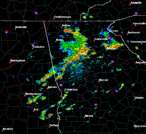 At 1247 pm edt, a severe thunderstorm was located over tucker, or 8 miles northeast of decatur, moving east at 40 mph (radar indicated). Hazards include 60 mph wind gusts. Expect damage to roofs. siding. and trees. other locations in the warning include but are not limited to atlanta, lawrenceville, sandy springs, roswell, dunwoody, duluth, snellville, lilburn, loganville, chamblee, norcross, doraville. Clarkston, stone mountain, dacula, grayson, berkeley lake, pine lake, north atlanta and north decatur. At 1247 pm edt, a severe thunderstorm was located over tucker, or 8 miles northeast of decatur, moving east at 40 mph (radar indicated). Hazards include 60 mph wind gusts. Expect damage to roofs. siding. and trees. other locations in the warning include but are not limited to atlanta, lawrenceville, sandy springs, roswell, dunwoody, duluth, snellville, lilburn, loganville, chamblee, norcross, doraville. Clarkston, stone mountain, dacula, grayson, berkeley lake, pine lake, north atlanta and north decatur.
|
| 7/6/2016 12:46 PM EDT |
 At 1246 pm edt, a severe thunderstorm was located near college park, or 9 miles southwest of atlanta, moving southeast at 30 mph (radar indicated). Hazards include 60 mph wind gusts. Expect damage to roofs. siding. and trees. Other locations in the warning include but are not limited to atlanta, east point, college park, hapeville, grant park-zoo atlanta, midtown, west end, cascade heights, turner field, piedmont park, bolton, lakewood park, sweet auburn, sandtown, bankhead, virginia highland, atlantic station, little five points, six flags over georgia and mableton. At 1246 pm edt, a severe thunderstorm was located near college park, or 9 miles southwest of atlanta, moving southeast at 30 mph (radar indicated). Hazards include 60 mph wind gusts. Expect damage to roofs. siding. and trees. Other locations in the warning include but are not limited to atlanta, east point, college park, hapeville, grant park-zoo atlanta, midtown, west end, cascade heights, turner field, piedmont park, bolton, lakewood park, sweet auburn, sandtown, bankhead, virginia highland, atlantic station, little five points, six flags over georgia and mableton.
|
| 7/6/2016 12:45 PM EDT | Large tree down along weatherstone way in the woodland hills area. time estimated from rada in dekalb county GA, 5.4 miles SW of Atlanta, GA |
| 7/6/2016 12:42 PM EDT | Tree down on west paces ferry road...near governors mansion in fulton county GA, 5.6 miles SSW of Atlanta, GA |
| 7/6/2016 12:35 PM EDT |
 At 1235 pm edt, a severe thunderstorm was located over north atlanta, or 8 miles northwest of decatur, moving east at 40 mph (radar indicated). Hazards include 60 mph wind gusts. Expect damage to roofs. siding. and trees. Other locations in the warning include but are not limited to atlanta, lawrenceville, sandy springs, roswell, dunwoody, duluth, snellville, lilburn, loganville, chamblee, norcross, doraville , clarkston, stone mountain, dacula, grayson, berkeley lake, pine lake, north atlanta and tucker. At 1235 pm edt, a severe thunderstorm was located over north atlanta, or 8 miles northwest of decatur, moving east at 40 mph (radar indicated). Hazards include 60 mph wind gusts. Expect damage to roofs. siding. and trees. Other locations in the warning include but are not limited to atlanta, lawrenceville, sandy springs, roswell, dunwoody, duluth, snellville, lilburn, loganville, chamblee, norcross, doraville , clarkston, stone mountain, dacula, grayson, berkeley lake, pine lake, north atlanta and tucker.
|
| 7/6/2016 12:20 PM EDT |
 At 1220 pm edt, a severe thunderstorm was located near lithia springs, or 7 miles east of douglasville, moving east at 40 mph (radar indicated). Hazards include 60 mph wind gusts. Expect damage to roofs. siding. and trees. Other locations in the warning include but are not limited to atlanta, douglasville, smyrna, east point, college park, powder springs, austell, hapeville, midtown, grant park-zoo atlanta, lithia springs, sweetwater creek state park, turner field, lakewood park, sweet auburn, atlantic station, west end, six flags over georgia, cascade heights and piedmont park. At 1220 pm edt, a severe thunderstorm was located near lithia springs, or 7 miles east of douglasville, moving east at 40 mph (radar indicated). Hazards include 60 mph wind gusts. Expect damage to roofs. siding. and trees. Other locations in the warning include but are not limited to atlanta, douglasville, smyrna, east point, college park, powder springs, austell, hapeville, midtown, grant park-zoo atlanta, lithia springs, sweetwater creek state park, turner field, lakewood park, sweet auburn, atlantic station, west end, six flags over georgia, cascade heights and piedmont park.
|
| 7/6/2016 12:11 PM EDT |
 At 1211 pm edt, a severe thunderstorm was located over douglasville, moving east at 40 mph (radar indicated). Hazards include 60 mph wind gusts. Expect damage to roofs. siding. and trees. Other locations in the warning include but are not limited to atlanta, douglasville, smyrna, east point, college park, powder springs, austell, hapeville, hiram, midtown, grant park-zoo atlanta, lithia springs, sweetwater creek state park, turner field, lakewood park, sweet auburn, atlantic station, west end, six flags over georgia and cascade heights. At 1211 pm edt, a severe thunderstorm was located over douglasville, moving east at 40 mph (radar indicated). Hazards include 60 mph wind gusts. Expect damage to roofs. siding. and trees. Other locations in the warning include but are not limited to atlanta, douglasville, smyrna, east point, college park, powder springs, austell, hapeville, hiram, midtown, grant park-zoo atlanta, lithia springs, sweetwater creek state park, turner field, lakewood park, sweet auburn, atlantic station, west end, six flags over georgia and cascade heights.
|
| 6/17/2016 3:00 PM EDT | Emergency manager has received reports of several trees down across southern fulton count in fulton county GA, 1.5 miles W of Atlanta, GA |
| 6/14/2016 2:57 PM EDT |
 At 257 pm edt, a severe thunderstorm was located over forest park, or 7 miles north of jonesboro, moving northeast at 15 mph (radar indicated). Hazards include 60 mph wind gusts and quarter size hail. Hail damage to vehicles is expected. expect wind damage to roofs, siding, and trees. Other locations in the warning include but are not limited to atlanta, decatur, jonesboro, east point, forest park, riverdale, college park, morrow, hapeville, avondale estates, lake city, hartsfield-jackson airport, candler- mcafee, belvedere park, conley, lakewood park, gresham park, east lake, fort gillem and rex. At 257 pm edt, a severe thunderstorm was located over forest park, or 7 miles north of jonesboro, moving northeast at 15 mph (radar indicated). Hazards include 60 mph wind gusts and quarter size hail. Hail damage to vehicles is expected. expect wind damage to roofs, siding, and trees. Other locations in the warning include but are not limited to atlanta, decatur, jonesboro, east point, forest park, riverdale, college park, morrow, hapeville, avondale estates, lake city, hartsfield-jackson airport, candler- mcafee, belvedere park, conley, lakewood park, gresham park, east lake, fort gillem and rex.
|
| 4/30/2016 6:45 PM EDT | Numerous trees and powerlines reported down by atlanta fire at intersection of w. wesley rd and moores mill r in fulton county GA, 4.7 miles S of Atlanta, GA |
| 4/30/2016 6:31 PM EDT |
 At 631 pm edt, a severe thunderstorm was located near atlanta, moving north at 25 mph (radar indicated). Hazards include 60 mph wind gusts and quarter size hail. Hail damage to vehicles is expected. expect wind damage to roofs, siding, and trees. Other locations in the warning include but are not limited to atlanta, marietta, sandy springs, smyrna, chamblee, north atlanta, midtown, fair oaks, grant park-zoo atlanta, north druid hills, druid hills, vinings, turner field, dobbins air reserve base, sweet auburn, brookhaven, la vista, atlantic station, west end and cascade heights. At 631 pm edt, a severe thunderstorm was located near atlanta, moving north at 25 mph (radar indicated). Hazards include 60 mph wind gusts and quarter size hail. Hail damage to vehicles is expected. expect wind damage to roofs, siding, and trees. Other locations in the warning include but are not limited to atlanta, marietta, sandy springs, smyrna, chamblee, north atlanta, midtown, fair oaks, grant park-zoo atlanta, north druid hills, druid hills, vinings, turner field, dobbins air reserve base, sweet auburn, brookhaven, la vista, atlantic station, west end and cascade heights.
|
| 4/7/2016 12:11 AM EDT |
 At 1211 am edt, severe thunderstorms were located along a line extending from doraville to near candler-mcafee to near peachtree city, moving east at 50 mph (radar indicated). Hazards include 60 mph wind gusts. Expect damage to roofs. siding. and trees. Other locations in the warning include but are not limited to atlanta, newnan, decatur, fayetteville, jonesboro, sandy springs, dunwoody, peachtree city, east point, stockbridge, union city, forest park, snellville, riverdale, college park, fairburn, lilburn, chamblee, norcross and doraville. At 1211 am edt, severe thunderstorms were located along a line extending from doraville to near candler-mcafee to near peachtree city, moving east at 50 mph (radar indicated). Hazards include 60 mph wind gusts. Expect damage to roofs. siding. and trees. Other locations in the warning include but are not limited to atlanta, newnan, decatur, fayetteville, jonesboro, sandy springs, dunwoody, peachtree city, east point, stockbridge, union city, forest park, snellville, riverdale, college park, fairburn, lilburn, chamblee, norcross and doraville.
|
| 4/7/2016 12:07 AM EDT | A large tree was blown across memorial drive se near east lake par in dekalb county GA, 6.7 miles W of Atlanta, GA |
| 4/7/2016 12:05 AM EDT | A large tree fell onto a home on westminster way ne causing extensive roof damag in dekalb county GA, 6.4 miles WSW of Atlanta, GA |
| 4/7/2016 12:02 AM EDT | A tree fell onto power lines on windsor parkway near osbourne r in dekalb county GA, 9.2 miles SSW of Atlanta, GA |
| 4/6/2016 11:55 PM EDT | A tree was downed on riverview rd near northside d in fulton county GA, 9.5 miles S of Atlanta, GA |
| 4/6/2016 11:41 PM EDT |
 At 1141 pm edt, severe thunderstorms were located along a line extending from near marietta to near lithia springs to near newnan, moving east at 50 mph (radar indicated). Hazards include 60 mph wind gusts and quarter size hail. Hail damage to vehicles is expected. expect wind damage to roofs, siding, and trees. Other locations in the warning include but are not limited to atlanta, marietta, newnan, douglasville, decatur, fayetteville, jonesboro, sandy springs, smyrna, dunwoody, peachtree city, east point, stockbridge, union city, forest park, snellville, riverdale, college park, powder springs and fairburn. At 1141 pm edt, severe thunderstorms were located along a line extending from near marietta to near lithia springs to near newnan, moving east at 50 mph (radar indicated). Hazards include 60 mph wind gusts and quarter size hail. Hail damage to vehicles is expected. expect wind damage to roofs, siding, and trees. Other locations in the warning include but are not limited to atlanta, marietta, newnan, douglasville, decatur, fayetteville, jonesboro, sandy springs, smyrna, dunwoody, peachtree city, east point, stockbridge, union city, forest park, snellville, riverdale, college park, powder springs and fairburn.
|
| 8/10/2015 5:50 PM EDT |
 At 549 pm edt, a severe thunderstorm was located near atlanta, moving east at 20 mph (radar indicated). Hazards include 60 mph wind gusts and nickel size hail. Expect damage to roofs. siding and trees. Other locations in the warning include but are not limited to atlanta, smyrna, east point, college park, hapeville, grant park-zoo atlanta, midtown, west end, six flags over georgia, cascade heights, turner field, piedmont park, lakewood park, bolton, sweet auburn, sandtown, bankhead, mableton, virginia highland and atlantic station. At 549 pm edt, a severe thunderstorm was located near atlanta, moving east at 20 mph (radar indicated). Hazards include 60 mph wind gusts and nickel size hail. Expect damage to roofs. siding and trees. Other locations in the warning include but are not limited to atlanta, smyrna, east point, college park, hapeville, grant park-zoo atlanta, midtown, west end, six flags over georgia, cascade heights, turner field, piedmont park, lakewood park, bolton, sweet auburn, sandtown, bankhead, mableton, virginia highland and atlantic station.
|
| 7/30/2015 6:27 PM EDT |
 At 627 pm edt, a severe thunderstorm was located near college park, or 10 miles southwest of atlanta, moving southwest at 10 mph (radar indicated). Hazards include 60 mph wind gusts and quarter size hail. Hail damage to vehicles is expected. expect wind damage to roofs, siding and trees. Other locations in the warning include but are not limited to atlanta, peachtree city, east point, union city, college park, fairburn, tyrone, palmetto, chattahoochee hill country, sandtown, sandy creek and campbellton. At 627 pm edt, a severe thunderstorm was located near college park, or 10 miles southwest of atlanta, moving southwest at 10 mph (radar indicated). Hazards include 60 mph wind gusts and quarter size hail. Hail damage to vehicles is expected. expect wind damage to roofs, siding and trees. Other locations in the warning include but are not limited to atlanta, peachtree city, east point, union city, college park, fairburn, tyrone, palmetto, chattahoochee hill country, sandtown, sandy creek and campbellton.
|
| 7/23/2015 2:18 PM EDT | A tree down on home on margaret plac in fulton county GA, 2.3 miles ESE of Atlanta, GA |
| 7/21/2015 3:31 PM EDT |
 At 330 pm edt, severe thunderstorms were located extending from near smyrna to near union city to near chattahoochee hills, moving southeast at 30 mph (radar indicated). Hazards include 60 mph wind gusts and penny size hail. Expect damage to roofs. siding and trees. Other locations in the warning include but are not limited to atlanta, douglasville, smyrna, east point, union city, college park, fairburn, austell, palmetto, chattahoochee hills, lithia springs, west end, sweetwater creek state park, six flags over georgia, cascade heights, turner field, campbellton, chapel hill, sandtown and bill arp. At 330 pm edt, severe thunderstorms were located extending from near smyrna to near union city to near chattahoochee hills, moving southeast at 30 mph (radar indicated). Hazards include 60 mph wind gusts and penny size hail. Expect damage to roofs. siding and trees. Other locations in the warning include but are not limited to atlanta, douglasville, smyrna, east point, union city, college park, fairburn, austell, palmetto, chattahoochee hills, lithia springs, west end, sweetwater creek state park, six flags over georgia, cascade heights, turner field, campbellton, chapel hill, sandtown and bill arp.
|
| 7/21/2015 3:13 PM EDT |
 At 312 pm edt, severe thunderstorms were located extending from near lithia springs to near douglasville to near villa rica, moving southeast at 25 mph (radar indicated). Hazards include 60 mph wind gusts and penny size hail. Expect damage to roofs. siding and trees. Other locations in the warning include but are not limited to atlanta, douglasville, smyrna, east point, union city, villa rica, college park, powder springs, fairburn, austell, palmetto, hiram, chattahoochee hills, lithia springs, sweetwater creek state park, turner field, new georgia, campbellton, lake val-do-mar and hannah. At 312 pm edt, severe thunderstorms were located extending from near lithia springs to near douglasville to near villa rica, moving southeast at 25 mph (radar indicated). Hazards include 60 mph wind gusts and penny size hail. Expect damage to roofs. siding and trees. Other locations in the warning include but are not limited to atlanta, douglasville, smyrna, east point, union city, villa rica, college park, powder springs, fairburn, austell, palmetto, hiram, chattahoochee hills, lithia springs, sweetwater creek state park, turner field, new georgia, campbellton, lake val-do-mar and hannah.
|
| 7/19/2015 3:38 PM EDT | Trees and powerlines down at harbin dr. and landrum dr. many residents without powe in fulton county GA, 5.2 miles NE of Atlanta, GA |
| 7/18/2015 5:25 PM EDT |
 The severe thunderstorm warning for southwestern dekalb county will expire at 530 pm edt, the storms which prompted the warning have weakened below severe limits, and exited the warned area. therefore the warning will be allowed to expire. The severe thunderstorm warning for southwestern dekalb county will expire at 530 pm edt, the storms which prompted the warning have weakened below severe limits, and exited the warned area. therefore the warning will be allowed to expire.
|
| 7/18/2015 5:16 PM EDT |
 At 515 pm edt, severe thunderstorms were located extending from candler-mcafee to lake city, moving southeast at 10 mph (radar indicated). Hazards include 60 mph wind gusts. Expect damage to roofs. siding and trees. Other locations in the warning include but are not limited to atlanta, decatur, clarkston, avondale estates, pine lake, druid hills, north decatur, candler-mcafee, north druid hills, belvedere park, kirkwood, little five points, gresham park, east lake, la vista, scottdale and panthersville. At 515 pm edt, severe thunderstorms were located extending from candler-mcafee to lake city, moving southeast at 10 mph (radar indicated). Hazards include 60 mph wind gusts. Expect damage to roofs. siding and trees. Other locations in the warning include but are not limited to atlanta, decatur, clarkston, avondale estates, pine lake, druid hills, north decatur, candler-mcafee, north druid hills, belvedere park, kirkwood, little five points, gresham park, east lake, la vista, scottdale and panthersville.
|
| 7/18/2015 4:55 PM EDT |
 At 454 pm edt, severe thunderstorms were located extending from near decatur to forest park, moving southeast at 10 mph (radar indicated). Hazards include 60 mph wind gusts. Expect damage to roofs. siding and trees. Other locations in the warning include but are not limited to atlanta, decatur, east point, forest park, riverdale, college park, clarkston, morrow, hapeville, avondale estates, lake city, pine lake, midtown, druid hills, north decatur, candler-mcafee, belvedere park, grant park-zoo atlanta, hartsfield-jackson airport and north druid hills. At 454 pm edt, severe thunderstorms were located extending from near decatur to forest park, moving southeast at 10 mph (radar indicated). Hazards include 60 mph wind gusts. Expect damage to roofs. siding and trees. Other locations in the warning include but are not limited to atlanta, decatur, east point, forest park, riverdale, college park, clarkston, morrow, hapeville, avondale estates, lake city, pine lake, midtown, druid hills, north decatur, candler-mcafee, belvedere park, grant park-zoo atlanta, hartsfield-jackson airport and north druid hills.
|
| 7/14/2015 9:24 PM EDT | A tree was blown onto a house on argonne avenu in fulton county GA, 2.4 miles WSW of Atlanta, GA |
| 7/14/2015 9:22 PM EDT |
 At 921 pm edt, severe thunderstorms were located extending from near suwanee to lilburn to pine lake to near hapeville to near college park to near fairburn to near chattahoochee hills, moving southeast at 45 mph (radar indicated). Hazards include 60 mph wind gusts and nickel size hail. Expect damage to roofs. siding and trees. Other locations in the warning include but are not limited to atlanta, newnan, lawrenceville, mcdonough, decatur, fayetteville, conyers, winder, monroe, covington, jonesboro, peachtree city, east point, duluth, stockbridge, union city, sugar hill, forest park, snellville and suwanee. At 921 pm edt, severe thunderstorms were located extending from near suwanee to lilburn to pine lake to near hapeville to near college park to near fairburn to near chattahoochee hills, moving southeast at 45 mph (radar indicated). Hazards include 60 mph wind gusts and nickel size hail. Expect damage to roofs. siding and trees. Other locations in the warning include but are not limited to atlanta, newnan, lawrenceville, mcdonough, decatur, fayetteville, conyers, winder, monroe, covington, jonesboro, peachtree city, east point, duluth, stockbridge, union city, sugar hill, forest park, snellville and suwanee.
|
| 7/14/2015 9:20 PM EDT | Tree down on car with person trapped...montgomery ferry and monroe d in fulton county GA, 3.7 miles SW of Atlanta, GA |
| 7/14/2015 9:18 PM EDT | Trees and powerlines down on west conway drive northwest in fulton county GA, 6.7 miles S of Atlanta, GA |
| 7/14/2015 9:06 PM EDT |
 At 905 pm edt, severe thunderstorms were located extending from near milton to sandy springs, austell, douglasville and dallas, moving southeast at 45 mph (radar indicated). Hazards include 60 mph wind gusts and quarter size hail. Hail damage to vehicles is expected. expect wind damage to roofs, siding and trees. Other locations in the warning include but are not limited to atlanta, marietta, douglasville, lawrenceville, canton, cartersville, decatur, dallas, sandy springs, roswell, johns creek, alpharetta, smyrna, dunwoody, east point, milton, kennesaw, duluth, woodstock and acworth. At 905 pm edt, severe thunderstorms were located extending from near milton to sandy springs, austell, douglasville and dallas, moving southeast at 45 mph (radar indicated). Hazards include 60 mph wind gusts and quarter size hail. Hail damage to vehicles is expected. expect wind damage to roofs, siding and trees. Other locations in the warning include but are not limited to atlanta, marietta, douglasville, lawrenceville, canton, cartersville, decatur, dallas, sandy springs, roswell, johns creek, alpharetta, smyrna, dunwoody, east point, milton, kennesaw, duluth, woodstock and acworth.
|
| 7/14/2015 8:44 PM EDT |
 At 843 pm edt, severe thunderstorms were located extending from near waleska to woodstock to southwest of kennesaw to near dallas to aragon, moving southeast at 55 mph (radar indicated). Hazards include 70 mph wind gusts and quarter size hail. Hail damage to vehicles is expected. expect considerable tree damage. wind damage is also likely to mobile homes, roofs and outbuildings. Other locations in the warning include but are not limited to atlanta, marietta, douglasville, lawrenceville, canton, cartersville, decatur, dallas, buchanan, sandy springs, roswell, johns creek, alpharetta, smyrna, dunwoody, east point, milton, kennesaw, duluth and woodstock. At 843 pm edt, severe thunderstorms were located extending from near waleska to woodstock to southwest of kennesaw to near dallas to aragon, moving southeast at 55 mph (radar indicated). Hazards include 70 mph wind gusts and quarter size hail. Hail damage to vehicles is expected. expect considerable tree damage. wind damage is also likely to mobile homes, roofs and outbuildings. Other locations in the warning include but are not limited to atlanta, marietta, douglasville, lawrenceville, canton, cartersville, decatur, dallas, buchanan, sandy springs, roswell, johns creek, alpharetta, smyrna, dunwoody, east point, milton, kennesaw, duluth and woodstock.
|
| 6/30/2015 1:06 PM EDT |
 The severe thunderstorm warning for southern dekalb county will expire at 115 pm edt, the storm which prompted the warning has weakened below severe limits, and no longer pose an immediate threat to life or property. therefore the warning will be allowed to expire. however gusty winds are still possible with this thunderstorm. The severe thunderstorm warning for southern dekalb county will expire at 115 pm edt, the storm which prompted the warning has weakened below severe limits, and no longer pose an immediate threat to life or property. therefore the warning will be allowed to expire. however gusty winds are still possible with this thunderstorm.
|
| 6/30/2015 12:47 PM EDT |
 At 1246 pm edt, a severe thunderstorm was located over candler-mcafee, or near decatur, and is moving east at 30 mph (radar indicated). Hazards include 60 mph wind gusts and penny size hail. Expect damage to roofs. siding and trees. Other locations in the warning include but are not limited to atlanta, decatur, stone mountain, avondale estates, lithonia, pine lake, candler-mcafee, belvedere park, druid hills, north decatur, kirkwood, snapfinger, arabia mountain, belmont, gresham park, east lake, redan, panthersville and scottdale. At 1246 pm edt, a severe thunderstorm was located over candler-mcafee, or near decatur, and is moving east at 30 mph (radar indicated). Hazards include 60 mph wind gusts and penny size hail. Expect damage to roofs. siding and trees. Other locations in the warning include but are not limited to atlanta, decatur, stone mountain, avondale estates, lithonia, pine lake, candler-mcafee, belvedere park, druid hills, north decatur, kirkwood, snapfinger, arabia mountain, belmont, gresham park, east lake, redan, panthersville and scottdale.
|
| 6/30/2015 12:45 PM EDT | Powerlines were reported down on atlanta street between magnolia street and oak street causing a road closur in fulton county GA, 0.3 miles ENE of Atlanta, GA |
| 6/30/2015 12:35 PM EDT |
 At 1235 pm edt, a severe thunderstorm was located over grant park-zoo atlanta, or near atlanta, moving east at 20 mph (radar indicated). Hazards include 60 mph wind gusts and penny size hail. Expect damage to roofs. siding and trees. Other locations in the warning include but are not limited to atlanta, decatur, east point, hapeville, stone mountain, avondale estates, lithonia, pine lake, midtown, candler-mcafee, belvedere park, grant park-zoo atlanta, druid hills, north decatur, snapfinger, arabia mountain, belmont, turner field, lakewood park and sweet auburn. At 1235 pm edt, a severe thunderstorm was located over grant park-zoo atlanta, or near atlanta, moving east at 20 mph (radar indicated). Hazards include 60 mph wind gusts and penny size hail. Expect damage to roofs. siding and trees. Other locations in the warning include but are not limited to atlanta, decatur, east point, hapeville, stone mountain, avondale estates, lithonia, pine lake, midtown, candler-mcafee, belvedere park, grant park-zoo atlanta, druid hills, north decatur, snapfinger, arabia mountain, belmont, turner field, lakewood park and sweet auburn.
|
| 6/24/2015 5:05 PM EDT |
 At 504 pm edt, a severe thunderstorm was located near college park, or 8 miles southwest of atlanta, moving southwest at 10 mph (radar indicated). Hazards include 60 mph wind gusts and quarter size hail. Hail damage to vehicles is expected. expect wind damage to roofs, siding and trees. Other locations in the warning include but are not limited to atlanta, east point, union city, riverdale, college park, fairburn, hapeville, hartsfield-jackson airport and sandtown. At 504 pm edt, a severe thunderstorm was located near college park, or 8 miles southwest of atlanta, moving southwest at 10 mph (radar indicated). Hazards include 60 mph wind gusts and quarter size hail. Hail damage to vehicles is expected. expect wind damage to roofs, siding and trees. Other locations in the warning include but are not limited to atlanta, east point, union city, riverdale, college park, fairburn, hapeville, hartsfield-jackson airport and sandtown.
|
| 6/24/2015 4:30 PM EDT |
 At 429 pm edt, a severe thunderstorm was located near union city, or 8 miles northwest of jonesboro, moving south at 15 mph (radar indicated). Hazards include 60 mph wind gusts and penny size hail. Expect damage to roofs. siding and trees. Other locations in the warning include but are not limited to atlanta, east point, union city, riverdale, college park, hapeville and hartsfield-jackson airport. At 429 pm edt, a severe thunderstorm was located near union city, or 8 miles northwest of jonesboro, moving south at 15 mph (radar indicated). Hazards include 60 mph wind gusts and penny size hail. Expect damage to roofs. siding and trees. Other locations in the warning include but are not limited to atlanta, east point, union city, riverdale, college park, hapeville and hartsfield-jackson airport.
|
| 6/24/2015 4:03 PM EDT |
 At 403 pm edt, a severe thunderstorm was located over lake city, or 7 miles northeast of jonesboro, moving southeast at 15 mph (radar indicated). Hazards include 60 mph wind gusts and quarter size hail. Hail damage to vehicles is expected. expect wind damage to roofs, siding and trees. Other locations in the warning include but are not limited to jonesboro, stockbridge, forest park, riverdale, college park, morrow, hapeville, lake city, hartsfield-jackson airport, irondale, conley, eagles landing, bonanza, hidden valley park, fort gillem, rex, kelleytown, lake spivey and ellenwood. At 403 pm edt, a severe thunderstorm was located over lake city, or 7 miles northeast of jonesboro, moving southeast at 15 mph (radar indicated). Hazards include 60 mph wind gusts and quarter size hail. Hail damage to vehicles is expected. expect wind damage to roofs, siding and trees. Other locations in the warning include but are not limited to jonesboro, stockbridge, forest park, riverdale, college park, morrow, hapeville, lake city, hartsfield-jackson airport, irondale, conley, eagles landing, bonanza, hidden valley park, fort gillem, rex, kelleytown, lake spivey and ellenwood.
|
| 6/24/2015 4:00 PM EDT | Golf Ball sized hail reported 5.8 miles NNE of Atlanta, GA, emergency manager received report of hail of varying size...up to golf balls in the laurels subdivision off of highway 20 in the vicinity of east point |
| 6/24/2015 3:40 PM EDT |
 At 340 pm edt, a severe thunderstorm was located over east point, or near atlanta, moving southeast at 15 mph (radar indicated). Hazards include 60 mph wind gusts and quarter size hail. Hail damage to vehicles is expected. expect wind damage to roofs, siding and trees. Other locations in the warning include but are not limited to atlanta, east point, union city, forest park, riverdale, college park, morrow, hapeville, lake city, hartsfield-jackson airport, west end, cascade heights, turner field, lakewood park, fort gillem and conley. At 340 pm edt, a severe thunderstorm was located over east point, or near atlanta, moving southeast at 15 mph (radar indicated). Hazards include 60 mph wind gusts and quarter size hail. Hail damage to vehicles is expected. expect wind damage to roofs, siding and trees. Other locations in the warning include but are not limited to atlanta, east point, union city, forest park, riverdale, college park, morrow, hapeville, lake city, hartsfield-jackson airport, west end, cascade heights, turner field, lakewood park, fort gillem and conley.
|
| 6/24/2015 2:34 PM EDT |
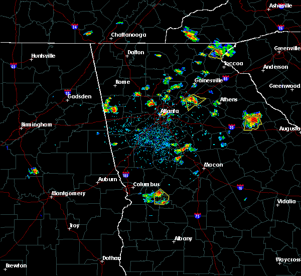 At 234 pm edt, a severe thunderstorm was located over fair oaks, or near marietta, moving south at 10 mph (radar indicated). Hazards include 60 mph wind gusts and penny size hail. Expect damage to roofs. siding and trees. Other locations in the warning include but are not limited to marietta, smyrna, powder springs, austell, fair oaks, lithia springs, dobbins air reserve base, white water park, vinings, jim r miller park, six flags over georgia and mableton. At 234 pm edt, a severe thunderstorm was located over fair oaks, or near marietta, moving south at 10 mph (radar indicated). Hazards include 60 mph wind gusts and penny size hail. Expect damage to roofs. siding and trees. Other locations in the warning include but are not limited to marietta, smyrna, powder springs, austell, fair oaks, lithia springs, dobbins air reserve base, white water park, vinings, jim r miller park, six flags over georgia and mableton.
|
| 6/18/2015 5:24 PM EDT | At 523 pm edt, a severe thunderstorm was located over hartsfield-jackson airport, or 8 miles northwest of jonesboro, moving northeast at 40 mph (radar indicated). Hazards include 60 mph wind gusts. Expect downed trees and powerlines as well as minor damage to roofs and siding. Other locations in the warning include but are not limited to atlanta, east point, forest park, riverdale, college park, morrow, hapeville, lake city, grant park-zoo atlanta, hartsfield-jackson airport, conley, lakewood park, sweet auburn, gresham park, fort gillem, ellenwood and panthersville. |
| 6/9/2015 4:37 PM EDT |
 At 437 pm edt, a severe thunderstorm continues to be located near stockbridge, or near mcdonough, moving east at 20 mph (radar indicated). Hazards include 60 mph wind gusts and quarter size hail. Hail damage to vehicles is expected. expect wind damage to roofs, siding and trees. Other locations in the warning include but are not limited to mcdonough, jonesboro, stockbridge, forest park, riverdale, college park, morrow, lovejoy, hapeville, lake city, hartsfield-jackson airport, magnet, flippen, richardson park, rex, lake spivey, irondale, conley, eagles landing and bonanza. At 437 pm edt, a severe thunderstorm continues to be located near stockbridge, or near mcdonough, moving east at 20 mph (radar indicated). Hazards include 60 mph wind gusts and quarter size hail. Hail damage to vehicles is expected. expect wind damage to roofs, siding and trees. Other locations in the warning include but are not limited to mcdonough, jonesboro, stockbridge, forest park, riverdale, college park, morrow, lovejoy, hapeville, lake city, hartsfield-jackson airport, magnet, flippen, richardson park, rex, lake spivey, irondale, conley, eagles landing and bonanza.
|
| 6/9/2015 3:52 PM EDT |
 The national weather service in peachtree city has issued a * severe thunderstorm warning for. southwestern rockdale county in north central georgia. clayton county in north central georgia. central henry county in north central georgia. Until 445 pm edt. The national weather service in peachtree city has issued a * severe thunderstorm warning for. southwestern rockdale county in north central georgia. clayton county in north central georgia. central henry county in north central georgia. Until 445 pm edt.
|
| 6/9/2015 3:45 PM EDT |
 At 344 pm edt, a cluster of several severe thunderstorms were located over lithonia, or 7 miles west of conyers, moving east at 20 mph (radar indicated). Hazards include 60 mph wind gusts and quarter size hail. Hail damage to vehicles is expected. expect wind damage to roofs, siding and trees. Other locations in the warning include but are not limited to decatur, conyers, stockbridge, forest park, clarkston, morrow, stone mountain, avondale estates, lake city, lithonia, pine lake, candler-mcafee, belvedere park, georgia international horse park, lakeview estates, snapfinger, arabia mountain, belmont, panola mountain state park and richardson park. At 344 pm edt, a cluster of several severe thunderstorms were located over lithonia, or 7 miles west of conyers, moving east at 20 mph (radar indicated). Hazards include 60 mph wind gusts and quarter size hail. Hail damage to vehicles is expected. expect wind damage to roofs, siding and trees. Other locations in the warning include but are not limited to decatur, conyers, stockbridge, forest park, clarkston, morrow, stone mountain, avondale estates, lake city, lithonia, pine lake, candler-mcafee, belvedere park, georgia international horse park, lakeview estates, snapfinger, arabia mountain, belmont, panola mountain state park and richardson park.
|
| 6/9/2015 3:34 PM EDT |
 A severe thunderstorm warning remains in effect until 400 pm edt for south central gwinnett. rockdale. dekalb. northeastern clayton and northwestern henry counties. at 333 pm edt. a severe thunderstorm was located near candler-mcafee. or near decatur. moving east at 20 mph. hazard. 60 mph wind gusts and quarter size hail. A severe thunderstorm warning remains in effect until 400 pm edt for south central gwinnett. rockdale. dekalb. northeastern clayton and northwestern henry counties. at 333 pm edt. a severe thunderstorm was located near candler-mcafee. or near decatur. moving east at 20 mph. hazard. 60 mph wind gusts and quarter size hail.
|
| 6/9/2015 3:29 PM EDT | Tree down on a car in buckhead in fulton county GA, 5.3 miles SSW of Atlanta, GA |
| 6/9/2015 3:18 PM EDT | Tree down along interstate 20 near glenwood road in fulton county GA, 3 miles WNW of Atlanta, GA |
| 6/9/2015 3:10 PM EDT |
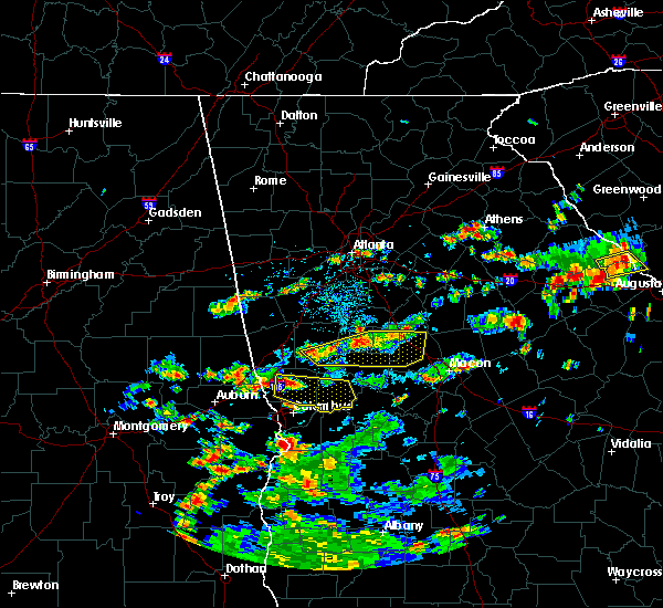 At 310 pm edt, a severe thunderstorm was located over grant park-zoo atlanta, or over atlanta, moving east at 20 mph (radar indicated). Hazards include 60 mph wind gusts and quarter size hail. Hail damage to vehicles is expected. expect wind damage to roofs, siding and trees. Other locations in the warning include but are not limited to atlanta, decatur, conyers, east point, stockbridge, forest park, college park, clarkston, morrow, hapeville, stone mountain, avondale estates, lake city, lithonia, pine lake, north decatur, candler-mcafee, georgia international horse park, north druid hills and midtown. At 310 pm edt, a severe thunderstorm was located over grant park-zoo atlanta, or over atlanta, moving east at 20 mph (radar indicated). Hazards include 60 mph wind gusts and quarter size hail. Hail damage to vehicles is expected. expect wind damage to roofs, siding and trees. Other locations in the warning include but are not limited to atlanta, decatur, conyers, east point, stockbridge, forest park, college park, clarkston, morrow, hapeville, stone mountain, avondale estates, lake city, lithonia, pine lake, north decatur, candler-mcafee, georgia international horse park, north druid hills and midtown.
|
| 6/3/2015 4:02 PM EDT | At 401 pm edt, a severe thunderstorm was located near chattahoochee hill country, or 12 miles south of douglasville. another strong storm was located chapel hill. both storms were moving southeast at 20 mph (radar indicated). Hazards include 60 mph wind gusts and quarter size hail. Hail damage to vehicles is expected. expect wind damage to roofs, siding and trees. Other locations in the warning include but are not limited to east point, union city, fairburn, palmetto, chattahoochee hill country, madras, roscoe, campbellton and cannongate. |
| 5/26/2015 5:06 PM EDT | At 506 pm edt, severe thunderstorms were located along a line extending from doraville to near lakeview estates, moving northeast at 65 mph (radar indicated). Hazards include 60 mph wind gusts and quarter size hail. Hail damage to vehicles is expected. expect wind damage to roofs, siding and trees. Other locations in the warning include but are not limited to atlanta, decatur, conyers, snellville, lilburn, chamblee, doraville, clarkston, stone mountain, avondale estates, lithonia, pine lake, north decatur, candler-mcafee, belvedere park, georgia international horse park, lakeview estates, tucker, druid hills and north druid hills. |
| 5/26/2015 4:49 PM EDT | At 449 pm edt, severe thunderstorms were located along a line extending from near east point to near mcdonough, moving northeast at 45 mph (radar indicated). Hazards include 60 mph wind gusts and quarter size hail. Hail damage to vehicles is expected. expect wind damage to roofs, siding and trees. Other locations in the warning include but are not limited to atlanta, mcdonough, decatur, conyers, jonesboro, east point, stockbridge, union city, forest park, snellville, riverdale, college park, lilburn, chamblee, doraville, clarkston, hampton, morrow, lovejoy and hapeville. |
| 5/26/2015 4:25 PM EDT | At 424 pm edt, severe thunderstorms were located along a line extending from near tyrone to near woolsey, moving northeast at 65 mph (radar indicated). Hazards include 60 mph wind gusts and quarter size hail. Hail damage to vehicles is expected. expect wind damage to roofs, siding and trees. Other locations in the warning include but are not limited to atlanta, griffin, mcdonough, decatur, fayetteville, conyers, jonesboro, peachtree city, east point, stockbridge, union city, forest park, snellville, riverdale, college park, fairburn, lilburn, chamblee, doraville and clarkston. |
| 5/18/2015 5:04 PM EDT | At 503 pm edt, a severe thunderstorm was located near north atlanta, or 7 miles north of atlanta, moving east at 15 mph (radar indicated). Hazards include 60 mph wind gusts and quarter size hail. Hail damage to vehicles is expected. expect wind damage to roofs, siding and trees. other locations in the warning include but are not limited to atlanta, marietta, sandy springs, smyrna, dunwoody, grant park-zoo atlanta, midtown, west end, vinings, six flags over georgia, cascade heights, chastain memorial park, turner field, piedmont park, bolton, dobbins air reserve base, sweet auburn, bankhead, virginia highland and atlantic station. 1. 00in. |
| 5/18/2015 4:38 PM EDT | At 437 pm edt, a severe thunderstorm was located over smyrna, or near marietta, moving east at 15 mph (radar indicated). Hazards include 60 mph wind gusts and quarter size hail. Hail damage to vehicles is expected. expect wind damage to roofs, siding and trees. other locations in the warning include but are not limited to atlanta, marietta, sandy springs, smyrna, dunwoody, midtown, fair oaks, grant park-zoo atlanta, vinings, jim r miller park, turner field, dobbins air reserve base, sweet auburn, atlantic station, west end, white water park, mount bethel, six flags over georgia, cascade heights and chastain memorial park. 1. 00in. |
| 4/19/2015 9:39 AM EDT | At 938 am edt, a severe thunderstorm was located near smyrna, or 9 miles northwest of atlanta, moving northeast at 25 mph (radar indicated). Hazards include 60 mph wind gusts. Expect damage to roofs. siding and trees. other locations in the warning include but are not limited to atlanta, marietta, sandy springs, smyrna, austell, fair oaks, dobbins air reserve base, vinings, six flags over georgia, chastain memorial park, mableton and bolton. a tornado watch remains in effect until 300 pm edt for north central georgia. Possible. |
| 4/19/2015 9:21 AM EDT | At 921 am edt, a severe thunderstorm was located near lithia springs, or 7 miles east of douglasville, moving northeast at 25 mph (radar indicated). Hazards include 60 mph wind gusts. Expect damage to roofs. siding and trees. other locations in the warning include but are not limited to atlanta, marietta, douglasville, sandy springs, smyrna, austell, fair oaks, lithia springs, sweetwater creek state park, vinings, six flags over georgia, chastain memorial park, bolton, dobbins air reserve base, bankhead, mableton and atlantic station. a tornado watch remains in effect until 300 pm edt for north central georgia. Possible. |
| 4/10/2015 6:10 PM EDT | Emergency manager reports a tree down on powerline at monroe and 10th stree in fulton county GA, 3.2 miles SW of Atlanta, GA |
| 4/10/2015 6:10 PM EDT | Emergency manager reports trees down on emory university campus..one leaning against a fraternity house on eaglerow road. powerlines are also down with power outages. s in fulton county GA, 1.7 miles WNW of Atlanta, GA |
| 4/10/2015 6:07 PM EDT | The national weather service in peachtree city has issued a * severe thunderstorm warning for. southern gwinnett county in north central georgia. dekalb county in north central georgia. central fulton county in north central georgia. Until 645 pm edt. |
| 10/14/2014 5:23 AM EDT | There were multiple trees down on ben hill road and stone road. wires were reported down on fairburn roa in fulton county GA, 1.7 miles WNW of Atlanta, GA |
| 9/3/2014 5:25 PM EDT | Powerlines were reported down at the corner of wildwood road and merton road as well as mercer street northeas in fulton county GA, 4.6 miles SW of Atlanta, GA |
| 9/3/2014 5:00 PM EDT | Popwerlines were reported down near peeples street southwes in fulton county GA, 2.2 miles N of Atlanta, GA |
| 9/3/2014 5:00 PM EDT | Powerlines were reported down near peeples street southwes in fulton county GA, 2.9 miles N of Atlanta, GA |
| 8/9/2014 7:30 PM EDT | Fulton county ema relayed a report of trees down in fulton county. trees were down at 3470 and 3505 riverly rd nw...1307 beecher st sw and 501 connell ave s in fulton county GA, 1.7 miles WNW of Atlanta, GA |
| 8/8/2014 2:55 PM EDT | Roof collapse along empire blvd in fulton county GA, 7.2 miles NNW of Atlanta, GA |
| 8/8/2014 2:53 PM EDT | Multiple trees down across fulton county - bluefield road sw and wyland dr sw... donald lee hollowell pkwy... w wesley road nw and northside dr nw... paces ferry road n in fulton county GA, 1.7 miles WNW of Atlanta, GA |
| 8/7/2014 7:50 PM EDT | Reports of several trees down in fulton county GA, 3 miles WNW of Atlanta, GA |
| 6/21/2014 3:20 PM EDT | Large tree fell on two car in fulton county GA, 3.4 miles SSW of Atlanta, GA |
| 7/17/2013 6:15 PM EDT | County 911 center reported about 5 trees down in the chamblee area. one tree on a car and several powerlines dow in dekalb county GA, 11 miles SW of Atlanta, GA |
| 7/17/2013 5:30 PM EDT | Philips arena event employee reported a portion of the arena roof sustained damage and a section of the seating space was evacuated as a result. roof debris was reporte in fulton county GA, 1.7 miles WNW of Atlanta, GA |
| 7/12/2013 5:05 PM EDT | A tree was blown down on presidential driv in dekalb county GA, 12.5 miles SW of Atlanta, GA |
| 6/13/2013 8:00 PM EDT | Trees snapped and uprooted across bolton road between marietta blvd and road. power lines and lines down als in fulton county GA, 5.1 miles SE of Atlanta, GA |
| 6/5/2013 7:05 PM EDT | A tree fell on a truck off gaston street. trees across powerlines off newport street in nw atlant in fulton county GA, 2.6 miles NNE of Atlanta, GA |
| 3/18/2013 6:10 PM EDT | Golf Ball sized hail reported 8.5 miles N of Atlanta, GA, golf ball hail at the airport. numerous windshields brokin on i85 south. |
| 3/18/2013 6:02 PM EDT | Quarter sized hail reported 8.5 miles N of Atlanta, GA |
| 8/2/2012 6:30 PM EDT | Media relayed reports of several trees down across northeast atlanta including iverson avenue...hardee street and sinclair avenu in dekalb county GA, 4.4 miles W of Atlanta, GA |
| 8/2/2012 6:30 PM EDT | A tree was reported down on a business at fox brothers barbeque in northeast atlant in dekalb county GA, 3.8 miles W of Atlanta, GA |
| 7/10/2012 6:20 PM EDT | Quarter sized hail reported 11.6 miles S of Atlanta, GA |
| 7/10/2012 6:00 PM EDT | Quarter sized hail reported 11.6 miles S of Atlanta, GA |
| 7/9/2012 11:00 PM EDT | 6 to 8 trees down in fulton county GA, 1.7 miles WNW of Atlanta, GA |
| 7/3/2012 5:56 PM EDT | Fulton county ema relayed a report of powerlines down in the lakewood park are in fulton county GA, 4.5 miles NNW of Atlanta, GA |
| 5/20/2012 7:20 PM EDT | Quarter sized hail reported 5.1 miles N of Atlanta, GA, marble to quarter size hail was reported by the media on langford parkway south of downtown atlanta |
| 1/1/0001 12:00 AM | Golf Ball sized hail reported 9.4 miles ENE of Atlanta, GA |
| 1/1/0001 12:00 AM | Quarter sized hail reported 3.3 miles S of Atlanta, GA, public reports quarter sized hail and intense lightning near howell mill road and interstate 75. |
| 1/1/0001 12:00 AM | Storm damage reported in dekalb county GA, 6.3 miles WNW of Atlanta, GA |
| 1/1/0001 12:00 AM | Fulton county emergency management reports several power lines down around the count in fulton county GA, 6.9 miles NNW of Atlanta, GA |
| 1/1/0001 12:00 AM | *** 2 fatal *** one tree fell on a car and killed two female in fulton county GA, 6.9 miles SSE of Atlanta, GA |
| 1/1/0001 12:00 AM | Marta reports a downed tree on cascade road in atlant in fulton county GA, 3 miles NE of Atlanta, GA |
| 1/1/0001 12:00 AM | Marta reports a downed tree on cascade road in atlant in fulton county GA, 3 miles NE of Atlanta, GA |
| 1/1/0001 12:00 AM | Dispatch center reported 5 trees and 5 powerlines down throughout the count in dekalb county GA, 6.7 miles W of Atlanta, GA |
| 4/15/2011 8:14 PM EDT | Quarter sized hail reported 11.1 miles S of Atlanta, GA, near riverwood high school |
| 4/15/2011 8:05 PM EDT | Golf Ball sized hail reported 9.6 miles S of Atlanta, GA, at johnson ferry rd. near fulton-cobb county line. |
Hail Maps for Atlanta, GA


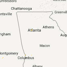


Connect with Interactive Hail Maps